Day nine, Coopracambra National Park VKFF-0113

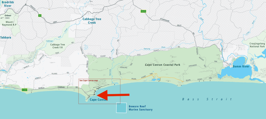
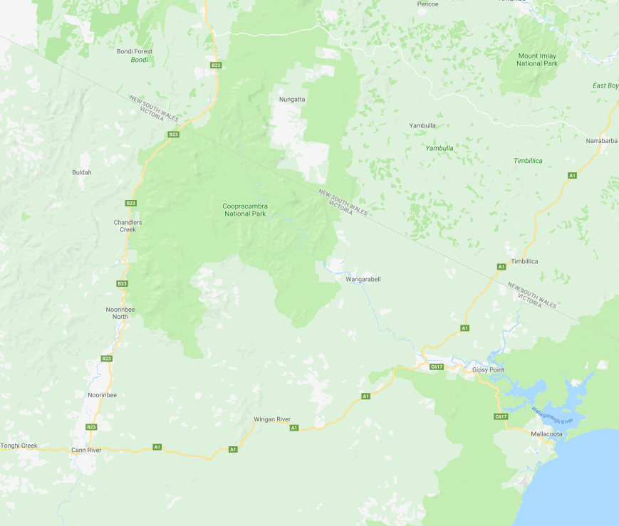
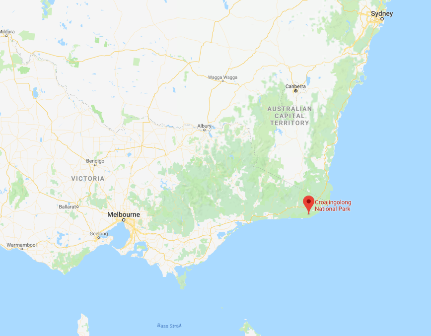
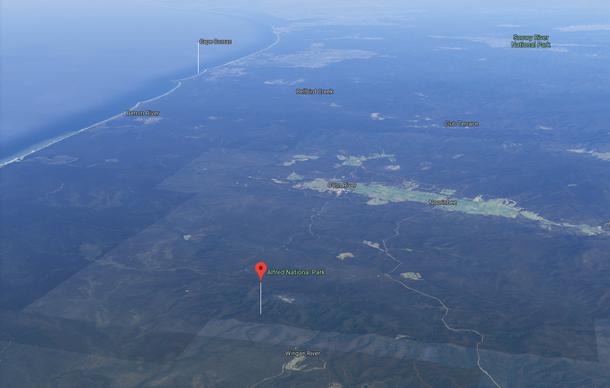
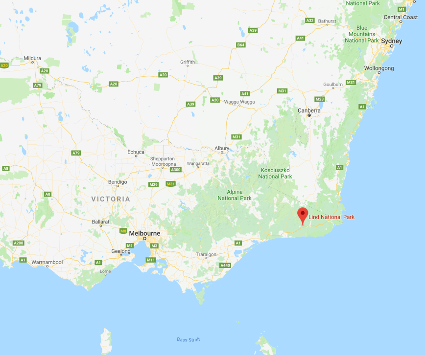
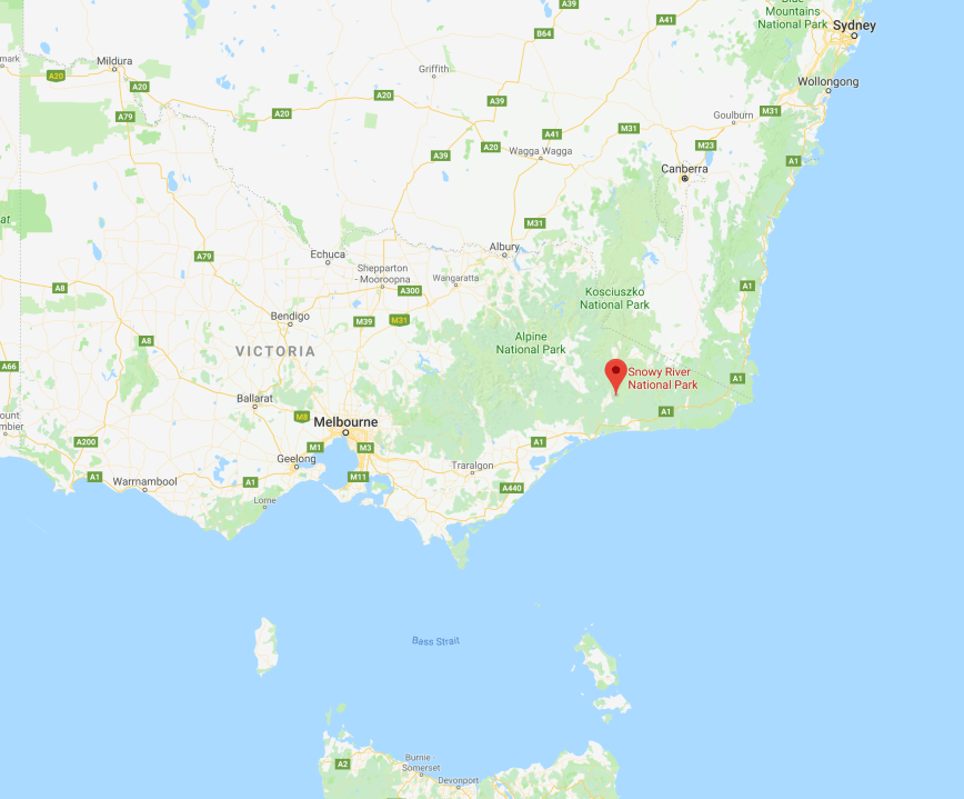
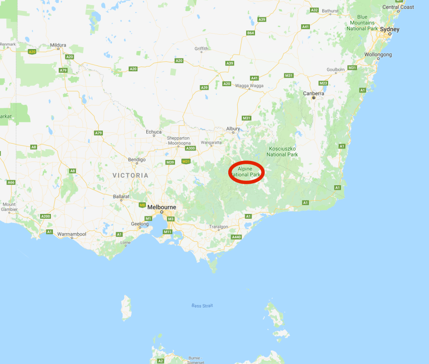
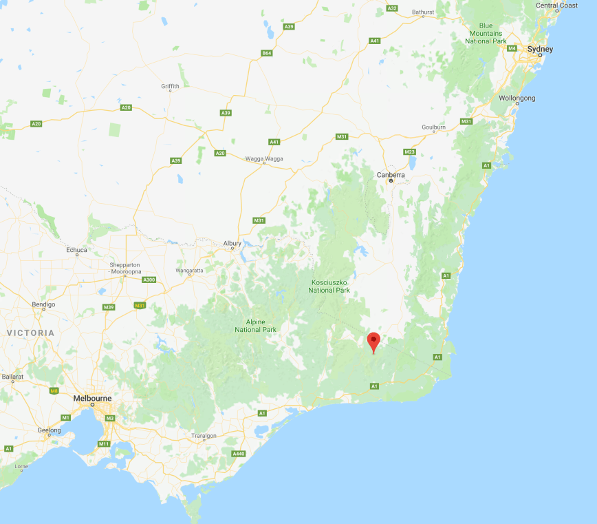
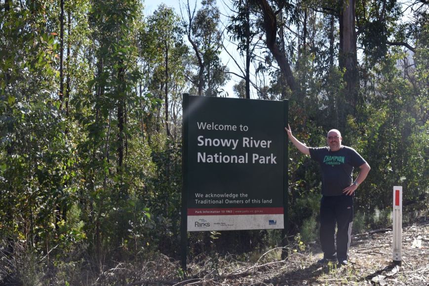
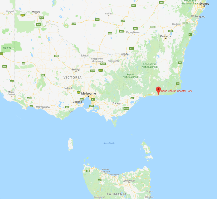
Day nine (Sunday 12th November 2017) had crept up very quickly on us.  We had two activations planned today for the 2017 Keith Roget Memorial National Parks Award Weekend.  The first being the Coopracambra National Park VKFF-0113, which is located about 473 km east of Melbourne and about 29 km north of Cann River.

Screen Shot 2017-11-30 at 3.09.20 pm.png

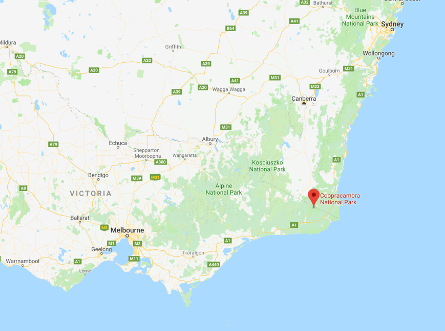
Above:- Map showing the location of the Coopracambra National Park.  Map courtesy of google maps.

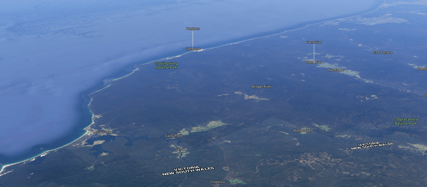
The Coopracambra National Park is another large park, comprising some 38,800-hectares (96,000-acres), and was established in 1988.  The northern boundary of the park is defined by the Black-Allan Line that marks part of the border between Victoria and New South Wales.  The Monaro Highway defines the park’s western boundary. Within the confines of the park, the Genoa River flows eastwards to the Tasman Sea. T he highest peak in the park is Mount Coopracambra, with an elevation of 1,103 metres (3,619 ft).

Screen Shot 2017-11-30 at 3.16.28 pm.png

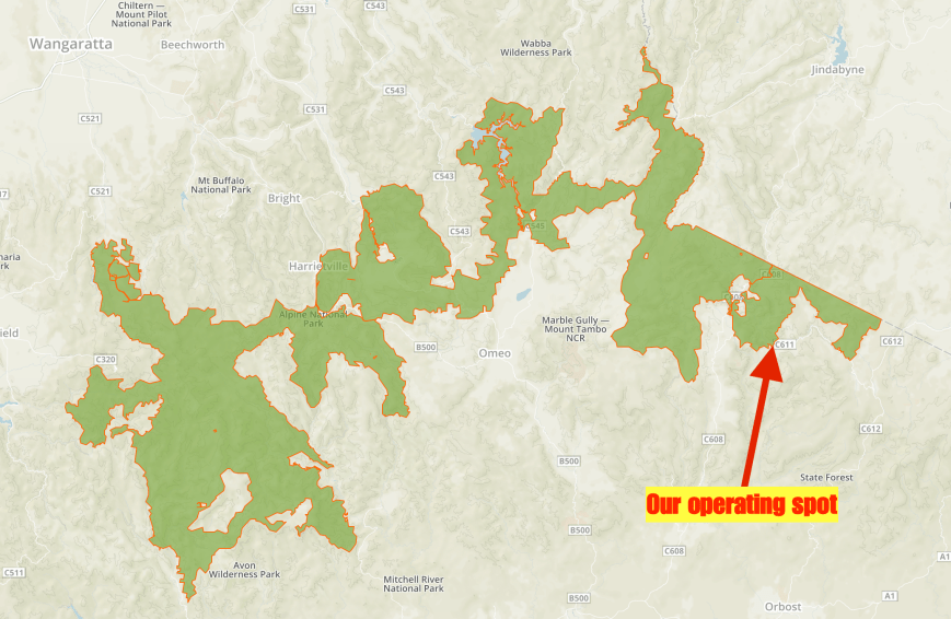
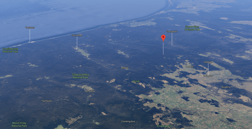
Above:- Map showing the location of the park on the Victorian/New South Wales State border.  Map courtesy of google maps

Combined with the adjoining South East Forests National Park located in New South Wales, the Coopracambra National Park forms one of the largest contiguous areas of high quality wilderness in south-eastern Australia that spans from Bombala in New South Wales to the town of Cann River in Victoria.

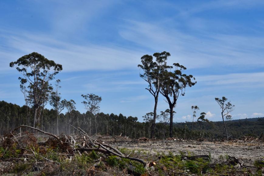
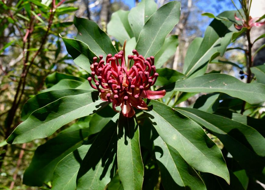
Vegetation varies from warm temperate rainforest in the sheltered gullies to open forests of White and Red Stringybark on the ridges, while the riparian zone is dominated by Kanooka and Peppermint. The massive Gippsland Grey Box is particularly striking, with its rough grey trunks contrasting dramatically with snowy white branches. Wildflowers are plentiful in the park, some of which are classified as very significant.

Screen Shot 2017-11-30 at 3.17.31 pm.png

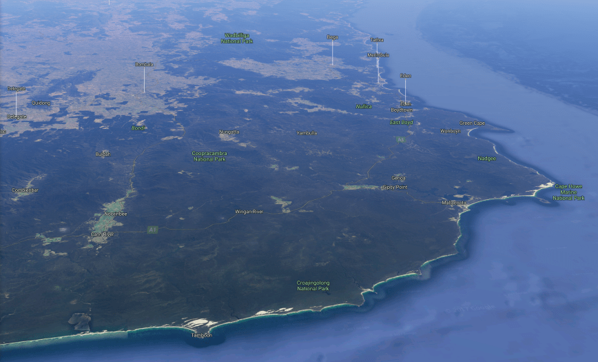
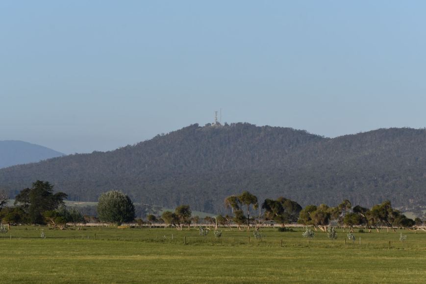
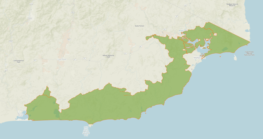
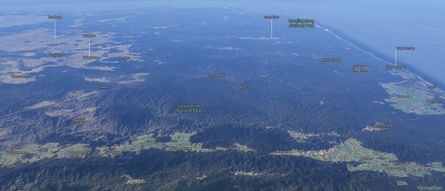
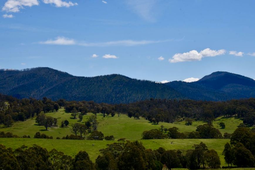
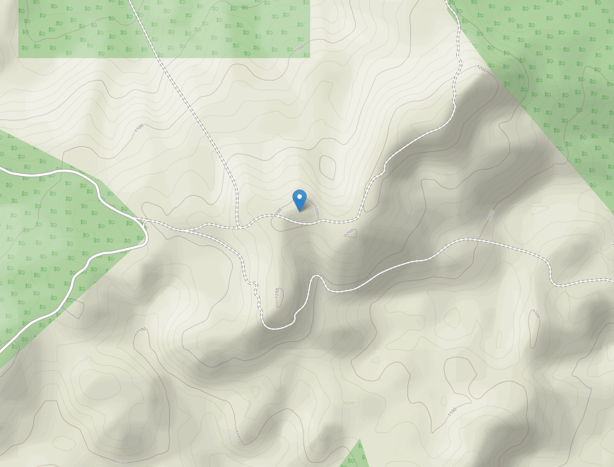
Above:- Aerial shot showing the Coopracambra National Park.  Image courtesy of google maps

Norman Wakefield (1918-1972), a naturalist, walked the Genoa Gorge and noted the qualities and diversities of native species in the area.  In 1972 he reported the discovery of the oldest known fossill footprints (355 million years old) near the Genoa River.  He made recommendations for the creation of a park, which was to become Coopracambra.

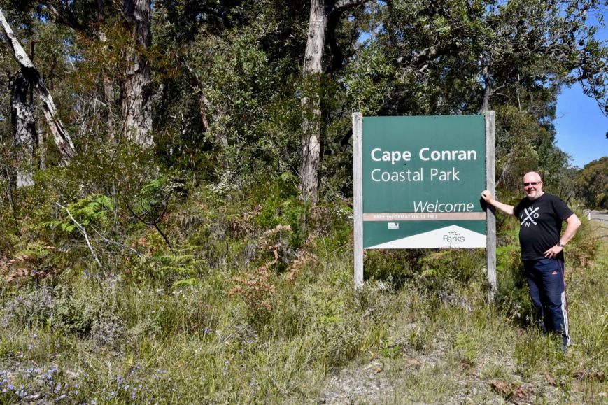
As we had done the morning before, Marija and I headed over to Relics Cafe for a coffee and some breakfast.  We then headed north out of Cann River on the Monaro Highway.  We stopped off briefly to have a look at the old Noorinbee school, which was the first public building for the Cann River residents, built by the local community with voluntary labour and materials in 1898.

We continued north on the Monaro Highway and along the way I spoke with Jim VK2QA, Ron VK3JP and COlin VK3ZZS/7.

We soon reached the south western corner of the Coopracambra National Park.

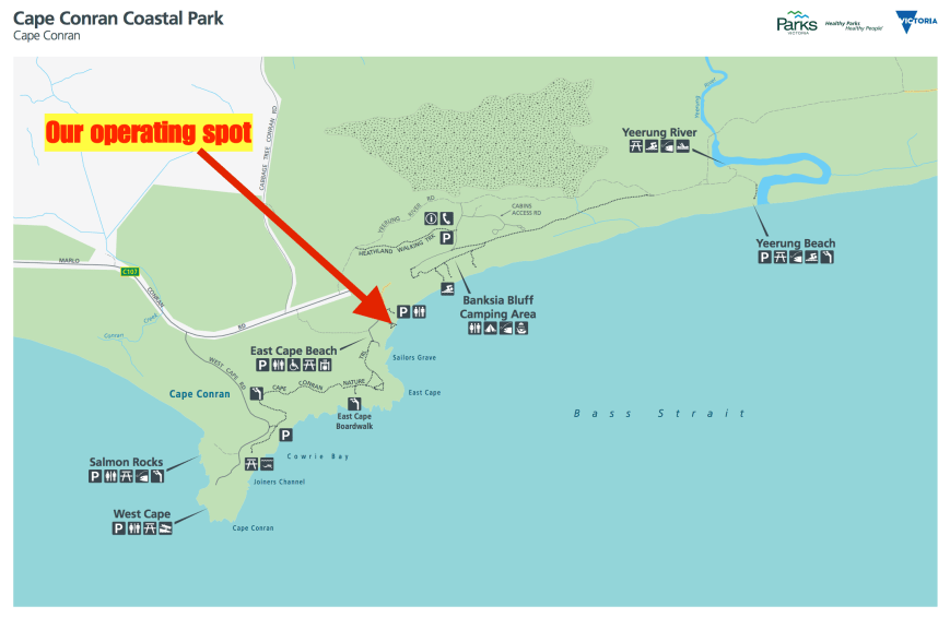
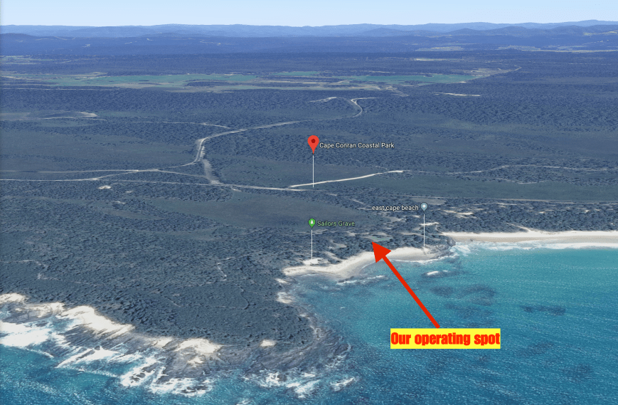
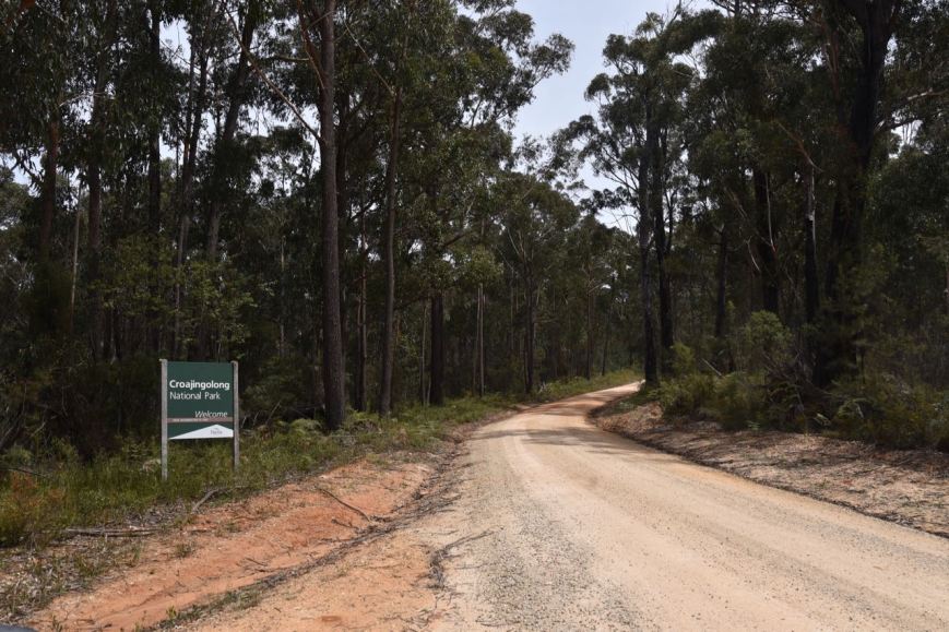
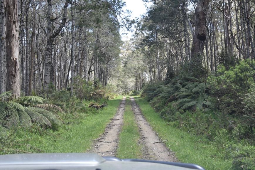
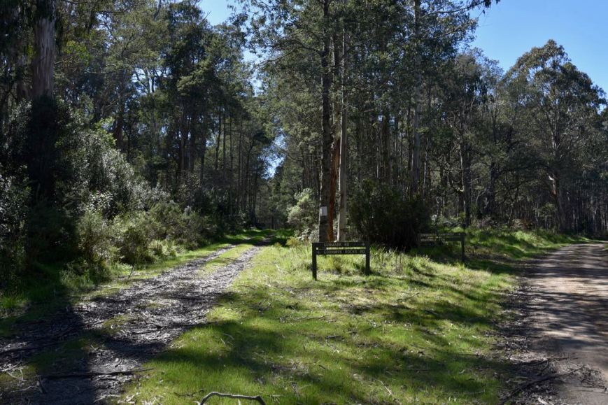
Although it is possible to access Cooopracambra National Park from any direction using a network of roads, sections of these roads are only suitable for 4WD vehicles.  We accessed the park via WB Line, the main park track.

As we drove along the track we both logged Ian VK1DI/p from the mobile.  Ian being in the Dunlop Grasslands Nature Reserve VKFF-0839.

WB Line has steep grades and is not recommended for conventional vehicles.  We drove a few kms along the track until we reached Yambulla Track.

Screen Shot 2017-11-30 at 3.14.22 pm.png

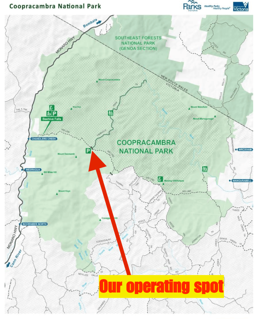
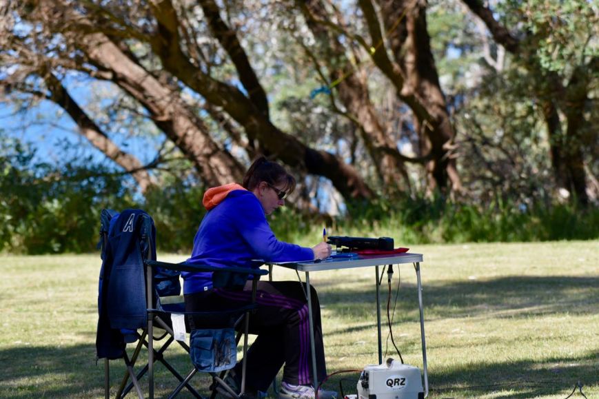
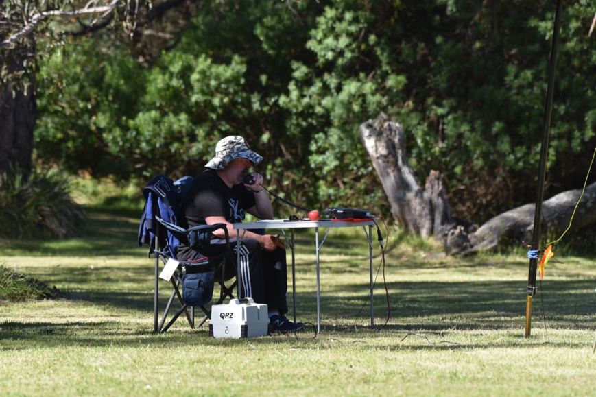
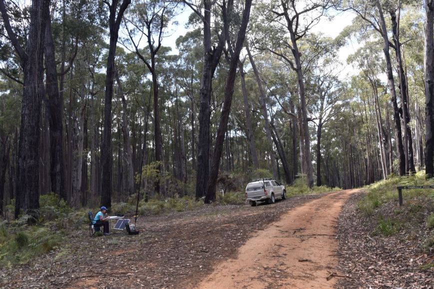
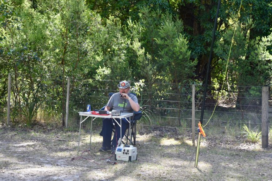
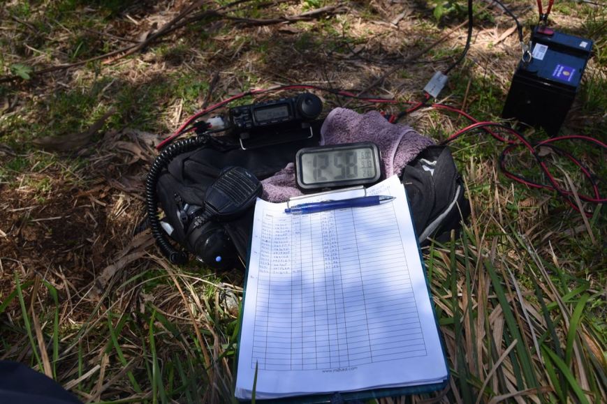
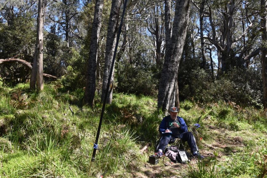
There was a nice area here off WB Track where we could park the vehicle and string out the dipole.  Surrounding us was the beautiful forest that is the Coopracambra National Park.

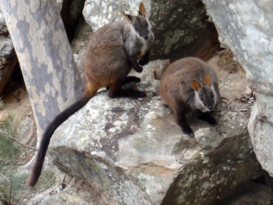
Once we were out of the car we immediately noticed an abundance of native flowers, many of which were very very tiny, but quite spectacular.

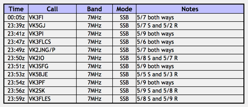
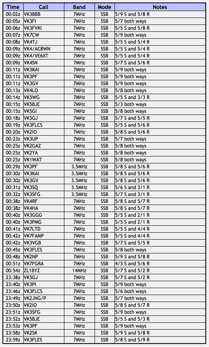
We were all set up and ready to go by around 2345 UTC (10.45 a.m. Victorian local time).  As it was before the UTC rollover, we could work stations before and after the UTC rollover, and these would count towards our 44 QSO required for the global World Wide Flora Fauna (WWFF) program.  We immediately headed to 7.144 once set up and found John VK2AWJ/3 calling CQ from the Errinunda National Park VKFF-0158.  John was quite low to us (4/2), as Errinundra is quite close.  But we were able to successfully log John.  It was a nice way to start the activation with a Park to Park contact.

We then found Joe VK3YSP/p and Julie VK3FOWL/p, operating as VK3SRC/p in the Churchill National Park VKFF-0621, calling CQ on 7.100.  Joe and Julie had a very strong 5/9 signal to Coopracambra.  Next in our log was David VK3IL/p on 7.090, who was activating SOTA summit Mount Stirling VK3/ VE-011.

Marija and I then moved up to 7.095 and started calling CQ.  This was answered by Dennis VK2HHA, followed by Adam VK2YK, and then Roscoe VK3KRH with a booming signal on his beam.  Next in the log was another Park to Park, this time with Rex VK3OF/p who was activating the Lower Goulburn National Park VKFF-0741.  Our 10th contact, qualifying the park for us for VKFF, was Roald VK1RZ.

As Marija now had 10 contacts and had qualified the park for VKFF, she was happy to hand the mic to me.  I continued to call CQ and was pleased to hear that the 40m band was in quite good condition, with stations logged from VK1, VK2, VK3, VK4, and VK7.  The South Australian stations (VK5) were noticeably absent.  Obviously propagation back over the border on 40m was not working.

A number of Park to Park contacts were logged by both myself and Marija.  They included:-

  • Malcolm VK3OAK/p in the Lower Glenelg National Park VKFF-0296
  • Brett VK3FLCS/p in the Kinglake National Park VKFF-0264
  • Dave VK2ZK/p (VK2JDC/p) in the Turon National Park VKFF-0501
  • Helen VK7FOLK/p in the St Helens Point Conservation Area VKFF-1153
  • David VK3TUN/p in the Heathcote Graytown National Park VKFF-0624
  • Gerard VK2IO/p in the Wambina Nature Reserve VKFF-2014.

I now had 39 stations in the log before the UTC rollover, whilst Marija had 17.

After the UTC rollover I worked a further 16 stations including the following Park to Park contacts:-

  • Gerard VK2IO/p in the Wambina Nature Reserve VKFF-2014.
  • Mark VK4SMA/p in the Morgan Park Conservation Park VKFF-1597
  • Gerard VK2JNG/p in the Tooloom National Park VKFF-0491
  • Nick VK3ANL/p in the Gresswell Hill Nature Conservation Reserve VKFF-2104

I now had 55 contacts in the log and had qualified the park for the global WWFF program.

Marija then got back on air and started calling CQ, also hoping to get 44 contacts.  Greg VK7FGRA was first in the log, followed by Lee VK2LEE, and then Michael VK3FCMC.  A few QSOs later Marija was called by Phil VK7FILL/p was activating SOTA summit Mount Roland VK7/ NC-003 in Tasmania with a good 5/5 signal.  About 6 QSOs later Marija was called by Brett VK3FLCS/p for another Park to Park after the rollover from the Kinglake National Park VKFF-0264.

But callers soon dried up, so we decided to try the 80m band.  Unfortunately we only made one contact on 80, but it was a Park to Park, with Brett VK3FLCS in the Kinglake National Park VKFF-0264.

We headed back to 40m where we logged Tony VK3VX in the Wyperfeld National Park VKFF-0549 on 7.139.  Marija then propped on 7.150 and logged 8 stations, passing the required 44 QSOs to qualify the park for WWFF.  Marija’s 44th contact was a QSO with Rick VK4RF.

I then decided to have a go on the 20m band.  My first contact there was with Gerard VK2IO/p in the Wambina Nature Reserve VKFF-2014 on 14.310.  I then moved up the band to 14.315 and called CQ.  This was answered by Colin VK4PDX, followed by Rick VK4RF/VK4HA, and then John VK4TJ.  My 5th and final station logged was Nigel VK6NI in Western Australia.

We had a little bit of time up our sleeve so I decided to try propagation on the 15m band.  I called CQ on 21.244 and this was answered by Colin VK4PDX who had followed me from 20m.  Rick VK4RF/VK4HA then called, followed by Tony VK7LTD and finally John VK4TJ.

To complete the activation we had a final tune across the 40m band, logging 3 more Park to Park contacts: Jonathan VK7JON and Helen VK7FOLK in the Bay of Fires Conservation Area VKFF-1133, and VK3SRC/p in the Churchill National Park VKFF-0621.  Joe and Julie put one of their young students Ethan on the mic and we had a quick chat to him.

DSC_0082

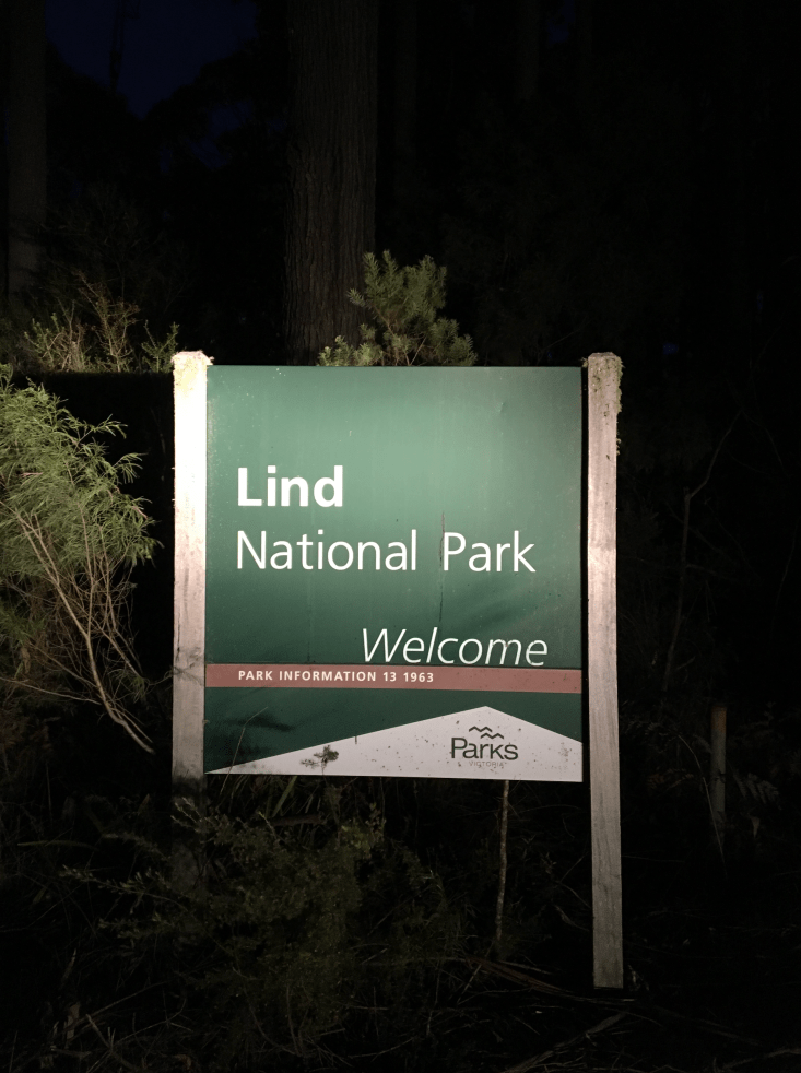
It was time to head off to our next activation of the day, the Lind National Park.  Marija and I had a total of 120 stations in the log between the two of us, including 43 Park to Park QSOs.  It had been a very successful activation.

Marija worked the following stations on 40m SSB before the UTC rollover:-

  1. VK2AWJ/p (Errinundra National Park VKFF-0158)
  2. VK3SRC/p (Churchill National Park VKFF-0621)
  3. VK3FOWL/p (Churchill National Park VKFF-0621)
  4. VK3YSP/p (Churchill National Park VKFF-0621)
  5. VK3IL/p (SOTA Mount Stirling VK3/ VE-011)
  6. VK2HHA
  7. VK2YK
  8. VK3KRH
  9. VK3OF/p (Lower Goulburn National Park VKFF-0741)
  10. VK1RZ
  11. VK3OAK/p (Lower Glenelg National Park VKFF-0296)
  12. VK3FLCS/p (Kinglake National Park VKFF-0264)
  13. VK2ZK/p (Turon National Park VKFF-0501)
  14. VK2JDC/p (Turon National Park VKFF-0501)
  15. VK7FOLK/p (St Helens Point Conservation Area VKFF-1153)
  16. VK3TUN/p (Heathcote Graytown National Park VKFF-0624)
  17. VK2IO/p (Wambina Nature Reserve VKFF-2014)

Marija worked the following stations on 40m SSB after the UTC rollover:-

  1. VK2IO/p (Wambina Nature Reserve VKFF-2014)
  2. VK4SMA/p (Morgan Park Conservation Park VKFF-1597)
  3. VK2JNG/p (Tooloom National Park VKFF-0491)
  4. VK3ANL/p (Gresswell Hill Nature Conservation Reserve VKFF-2104)
  5. VK2YK
  6. VK7FGRA
  7. VK2LEE
  8. VK3FCMC
  9. VK3SFG
  10. VK3UH
  11. VK7FILL/p (SOTA Mount Roland VK7/ NC-003)
  12. VK3ARH
  13. VK2BTC
  14. VK3PYE
  15. VK3OHM
  16. VK2XXM
  17. VK3FLCS/p (Kinglake National Park VKFF-0264)
  18. VK7QP
  19. VK3BHR
  20. VK3XV/p (Wyperfeld National Park VKFF-0549)
  21. VK2QA
  22. VK3MRH
  23. VK2PKT
  24. VK7DW
  25. VK3BNJ
  26. VK4RF
  27. VK4HA
  28. VK3TKK/m
  29. VK7FOLK/p (Bay of Fires Conservation Area VKFF-1133)

Marija worked the following stations on 80m SSB:-

  1. VK3FLCS/p (Kinglake National Park VKFF-0264)

I worked the following stations on 40m SSB before the UTC rollover:-

  1. VK2AWJ/p (Errinundra National Park VKFF-0158)
  2. VK3SRC/p (Churchill National Park VKFF-0621)
  3. VK3YSP/p (Churchill National Park VKFF-0621)
  4. VK3FOWL/p (Churchill National Park VKFF-0621)
  5. VK3IL/p (SOTA Mount Stirling VK3/ VE-011)
  6. VK2HHA
  7. VK2YK
  8. VK3KRH
  9. VK3OF/p (Lower Goulburn National Park VKFF-0741)
  10. VK1RZ
  11. VK3OAK/p (Lower Glenelg National Park VKFF-0296)
  12. VK3OHM
  13. VK3SQ
  14. VK3FLCS/p (Kinglake National Park VKFF-0264)
  15. VK1MA
  16. VK3GGG
  17. VK3PMG
  18. VK4RF
  19. VK4HA
  20. VK2XXM
  21. VK1AT
  22. VK2MOR
  23. VK2UH
  24. VK1HW
  25. VK3MAB
  26. VK7FRJG
  27. VK2PKT
  28. VK4SJD
  29. VK2ZK/p (Turon National Park VKFF-0501)
  30. VK2JDC/p (Turon National Park VKFF-0501)
  31. VK1DI
  32. VK7FOLK/p (St Helens Point Conservation Area VKFF-1153)
  33. VK2NP
  34. VK2KJJ
  35. VK2YW
  36. VK7KT
  37. VK3TUN/p (Heathcote Graytown National Park VKFF-0624)
  38. VK2IO/p (Wambina Nature Reserve VKFF-2014)

I worked the following stations on 40M after the UTC rollover:-

  1. VK2IO/p (Wambina Nature Reserve VKFF-2014)
  2. VK4SMA/p (Morgan Park Conservation Park VKFF-1597)
  3. VK2ALF/m
  4. VK3FCMC
  5. VK3UH
  6. VK2GAZ
  7. VK2YA
  8. VK1WAT
  9. VK2JNG/p (Tooloom National Park VKFF-0491)
  10. VK2JNG/p (Tooloom National Park VKFF-0491)
  11. VK4TJ
  12. VK7PAL
  13. VK2LEE
  14. VK7RN
  15. VK3ANL/p (Gresswell Hill Nature Conservation Reserve VKFF-2104)
  16. VK2FADV
  17. VK2YK
  18. VK7FILL/p (SOTA Mount Roland VK7/ NC-003)
  19. VK3FLCS/p (Kinglake National Park VKFF-0264)
  20. VK3XV/p (Wyperfeld National Park VKFF-0549)
  21. VK7JON/p (Bay of Fires Conservation Area VKFF-1133)
  22. VK7FOLK/p (Bay of Fires Conservation Area VKFF-1133)
  23. VK3SRC/p (Churchill National Park VKFF-0621)

I worked the following stations on 20m SSB:-

  1. VK2IO/p (Wambina Nature Reserve VKFF-2014)
  2. VK4PDX
  3. VK4RF
  4. VK4HA
  5. VK4TJ
  6. VK6NO

I worked the following stations on 15m SSB:-

  1. VK4PDX
  2. VK4RF
  3. VK4HA
  4. VK7LTD
  5. VK4TJ

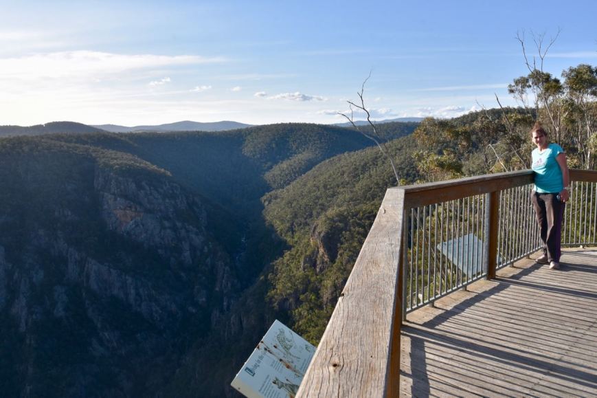
At the end of the activation we drove back down WB Line to Beehive Falls.  We parked in the carpark and took the walk through the scrub, but were very disappointed with the view of the falls.  The track falls well short of the falls, unless you are prepared to chance your luck and scramble over rocks, which we were not.  There is a better view to be had from the roadway of WB Line.

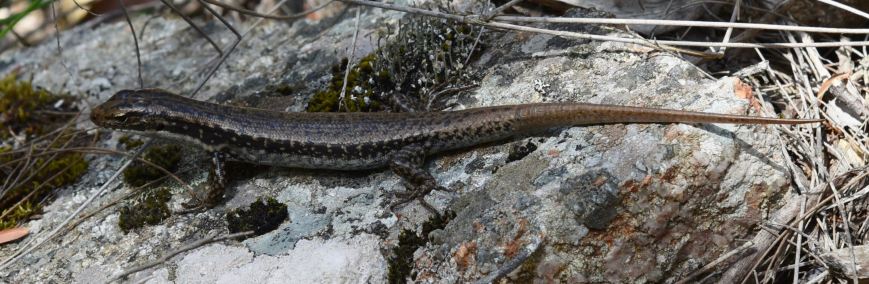
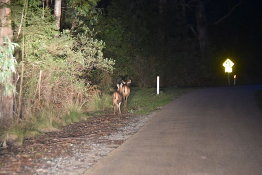
It was another warm day, but fortunately the only reptile we came across during the day was a small lizard.  No snakes fortunately.

DSC_0112


References.

Australian Dictionary of Biography, 2017, <http://adb.anu.edu.au/biography/wakefield-norman-arthur-11933>, viewed 30th November 2017

Wikipedia, 2017, <https://en.wikipedia.org/wiki/Coopracambra_National_Park>, viewed 30th November 2017

Croajingolong National Park VKFF-0119

Our second activation for day eight (Saturday 11th November 2017) was the Croajingolong National Park VKFF-0119, which is located about 495 km east of Melbourne, and about 20 km from Cann River.  This was to be a new park for Marija and I for the Keith Roget Memorial National Parks Award (KRMNPA) and the World Wide Flora Fauna (WWFF) program.

Screen Shot 2017-11-30 at 11.41.51 am.png

Above:- Map showing the location of the Croajingolong National Park.  Map courtesy of google maps

After packing up at the Alfred National Park, Marija and I headed south on West Wingan Road towards the coast.  We soon reached the boundary of the Croajingolong National Park.  Marija had checked out the possibility of activating SOTA peak Mount Everard VK3/ VG-151 which is in the park.  But when we reached the track which lead to the summit, there was a locked gate.  The sign on the gate read ‘Seasonal Closure.  Open from 31 Oct’, and it was certainly passed the 31st October, but none the less the gate was locked.  This meant a significant hike along the track to reach the summit, and we decided to leave it for another day.

Croajingolong National Park is a large park, comprising 88,355-hectares (218,330-acre).  The park is about 80 km by 20 km and is linear in shape.  It was established on the 26th April 1979.  The park is bordered on the southern side by the Tasman Sea of the South Pacific Ocean, the western side by Bemm River and the eastern side by the town of Mallacoota.  The park’s northern boundary comprises dense bushland and low hills.

Screen Shot 2017-11-30 at 2.01.24 pm.png

Above:- Aerial view of the park.  Courtesy of google maps

Together with the adjoining Nadgee Nature Reserve in New South Wales, the park forms one of only 12 Wold Biosphere areas in Australia.  It was nominated in 1977 by UNESCO as a World Biosphere Reserve due to Croajingolong’s spectacular landscapes and environmental significance.

Screen Shot 2017-11-30 at 12.42.52 pm.png

Above:- Map showing the Croajingolong National Park.  Map courtesy of Protected Planet.

The name Croajingolong derives from the Aboriginal Krauatungalung words galung, meaning “belonging to” and kraua, meaning “east”.  In 1870, Captain James Cook’s first sighting of Australia’s east coast occurred at Point Hicks in what is now the National Park.  By the 1830’s European settlers had commenced to arrive in area and by the 1850’s pastoralists occupied most of the better land in the area.

In the early 1900s two national parks were set aside around Mallacoota and Wingan Inlet, and in 1970 Captain Cook National Park was established at Point Hicks.  These parks combined to form Croajingolong National Park in 1979.

The park is home to nearly 1,000 native plant species including around 90 species of orchids.  A total of native mammal species, 26 reptile species and 306 species of birds have been recorded in the park.  The birds represent about half of Victoria’s and a third of Australia’s total bird species.  Threatened species found in the park include the Ground Parrot, Eastern Bristlebird, Smoky Mouse, Grey‐headed Flying Fox and Australian Fur Seal.

On our way through the park we logged Tony VK3XV/p who was in the Kara Kara National Park VKFF-0629.

We continued along West Wingan Road until we reached the Wingan Inlet campground which is located in tall Bloodwood forest on the western shore of Wingan Inlet.  The Wingan River rises below Mount Future, near the Wingan Swamp, north of the Alfred National Park between Cann River and Genoa, and flows generally south through the Croajingolong National Park joined by eight minor tributaries before reaching its mouth with Bass Strait, at the Wingan Inlet.

There was a nice cleared area here in amongst the forest, which allowed us to stretch out the 80/40/20m linked dipole.

Screen Shot 2017-11-30 at 2.00.01 pm.png

Above:- Our operating spot at Wingan Inlet campground.  Image courtesy of google maps

As we were unsure on what band conditions were going to be like, Marija and I again decided to share the mic until Marija had 10 contacts in the log, qualifying the park for VKFF.  We headed to 7.144 and called CQ which was answered by Rex VK3OF/p in the Barmah National Park VKFF-0739.  Rex was quite weak (5/3), as we were to him, but as we both had no man made noise in our parks, we were able to work each other very comfortably.  Next up was Scott VK7NWT, followed by Gerard VK2JNG/p.  Gerard advised us that he was at a park, but was just outside the park boundary as he had encountered a locked gate.  This was a shame as we would have loved to have logged Gerard Park to Park from Croajingolong.

A few QSOs later we had another Park Park in the log, a contact with Gerard VK2IO/p who was in the Prospect Nature Reserve VKFF-1986.  Marija’s 10th contact came in the form of another Park to Park, this time with Mark VK4SMA/p who was activating the Denmark Hill Conservation Reserve VKFF-1529.

Marija took a break from the radio, with 10 contacts in the log, and I perservered under some pretty trying band conditions.  I logged Jonathan VK7JON, followed by Jim VK2FADV, and then a Park to Park with Neil VK4HNS/p who was activating the Springbrook National Park VKFF-0463.  But that was when things really dried up on 40m with callers, so I headed to the 80m band.

When I tuned to 3.610 I found Peter VK3ZPF/p there, calling CQ from SOTA summit Mount Donna Buang VK3/ VC-002 in the Yarra Ranges National Park VKFF-0556.  Peter had a strong 5/8 signal.  Each time a Park to Park appeared, Marija also logged the station.  As we had no internet coverage, Peter kindly spotted us on parksnpeaks on 3.605.  We there logged two further Park to Park contacts, with Peter VK3PF/p in the Tarra Bulga National Park VKFF-0480 and Allen VK3ARH who was in the Chiltern Mount Pilot National Park VKFF-0620.  Both Peter and Allen were quite low down (5/3) but perfectly readable.

DSC_9962

I then headed to 14.310 on the 20m band where I called CQ on 14.310.  My only taker there was John VK4TJ, who kindly gave me his two other calls of VK4/AC8WN and VK4/VE6XT.  I was very appreciative of this, as the quest to getting 44 contacts during this activation was very hard.

I moved back to 40m where Marija and I logged two further Park to Park contacts, before propping on a frequency and calling CQ.  Those contacts were with Malcolm VK3OAK/p who was in the Mount Richmond National Park VKFF-0361 and Mark VK3OHM/p who was activating the Dandenong Ranges National Park VKFF-0630.

I then moved down to 7.150 and called CQ, which was answered by David VK3TUN/p who was activating the Terrick Terrick National Park VKFF-0630.  I kept calling CQ, with often many minutes of no callers.  But I perservered, having learnt from previous activations, that sometimes you just have to keep calling and calling, and you will eventually fill up your log.

DSC_9964

Above:- Conditions were quite frustrating at times

Two hours into the activation I had contact number 44 in the log, that being a QSO with Doug VK3FJAE.  After Doug, I logged a further 5 stations before deciding to call it a day.  Marija had qualified the park for the KRMNPA and VKFF, while I had also qualifed the park under very difficult conditions for WWFF.

During our activation we had a number of visitors, both human, reptile, and some of our feathered friends.  I had a good chat to a couple of boaties who were about to head out for an afternoon of fishing.  They were very interested in what we were doing and had a listen to some of our contacts.  Birds spotted during our activation included a number of Australian King Parrots who are very identifiable by their bright red head and body.  We also had numerous Superb Fairy Wrens dancing around us during the activation.

We also observed a Lace Monitor.  These reptiles are the second largest monitor in Australia after the Perentie.  They can reach as long as 2.1 metres, and the one we observed was certainly quite large.  There were a number of people camping in the area and it made Marija and I wonder how you would feel if you encountered a Monitor in your tent.

Marija worked the following stations on 40m SSB:-

  1. VK3OF/p (Barmah National Park VKFF-0739)
  2. VK7NWT
  3. VK2JNG/p
  4. VK2WWV
  5. VK3JP
  6. VK3CA
  7. VK3NSC
  8. VK2IO/p (Prospect Nature Reserve VKFF-1986)
  9. VK4FFAB
  10. VK4SMA/p (Denmark Hill Nature Reserve VKFF-1529)
  11. VK4HNS/p (Springbrook National Park VKFF-0463)
  12. VK3OAK/p (Mount Richmond National Park VKFF-0361)
  13. VK3OHM/p (Dandenong Ranges National Park VKFF-0132)
  14. VK3TUN/p (Terrick Terrick National Park VKFF-0630)

Marija worked the following stations on 80m SSB:-

  1. VK3ZPF/p (SOTA VK3/ VC-002 & Yarra Ranges National Park VKFF-0556)
  2. VK3PF/p (Tarra Bulga National Park VKFF-0480)
  3. VK3ARH/p (Chiltern Mount Pilot National Park VKFF-0620)

I worked the following stations on 40m SSB:-

  1. VK3OF/p (Barmah National Park VKFF-0739)
  2. VK7NWT
  3. VK2JNG/p
  4. VK2WWV
  5. VK3JP
  6. VK3CA
  7. VK3NSC
  8. VK2IO/p (Prospect Nature Reserve VKFF-1986)
  9. VK4SMA/p (Denmark Hill Nature Reserve VKFF-1529)
  10. VK7JON/m
  11. VK2FADV
  12. VK4HNS/p (Springbrook National Park VKFF-0463)
  13. VK3OAK/p (Mount Richmond National Park VKFF-0361)
  14. VK3OHM/p (Dandenong Ranges National Park VKFF-0132)
  15. VK3TUN/p (Terrick Terrick National Park VKFF-0630)
  16. VK7DW
  17. VK3PWG
  18. VK7QP
  19. VK2YK
  20. VK3DHI
  21. VK3LDB
  22. VK5KLV
  23. VK3NLK
  24. VK4PDX
  25. VK3NBL/p
  26. VK2LEE
  27. VK3KRH
  28. VK7WH
  29. VK3ELH
  30. VK3PAT
  31. VK4RF
  32. VK4HA
  33. VK3FSPG
  34. VK3MPR
  35. VK3KTO
  36. VK3CWF
  37. VK2FDRN
  38. VK3FJAE
  39. VK3FLMJ
  40. VK5NRG
  41. VK2SK
  42. VK7AN
  43. VK5GJ

I worked the following stations on 80m SSB:-

  1. VK3ZPF/p (SOTA VK3/ VC-002 & Yarra Ranges National Park VKFF-0556)
  2. VK3PF/p (Tarra Bulga National Park VKFF-0480)
  3. VK3ARH/p (Chiltern Mount Pilot National Park VKFF-0620)

I worked the following stations on 20m SSB:-

  1. VK4TJ
  2. VK4/VE6XT
  3. VK4/AC8WN

After packing up Marija and I headed back along West Wingan Road through the Croajingolong National Park.  We logged Jonathan VK7JON/p and Helen VK7FOLK/p, who were activating St Helens Point Conservation Area VKFF-1153.  They both had a beautiful strong 5/8 signal into the mobile.  I decided to put out a few calls from the mobile and called CQ on 7.095.  I ended up logging 8 stations: VK2NP, VK2ZK, VK2JDC, VK3STU, VK3VIN, VK3FMKE, VK3FLCS, and VK3PI.

We then drove out of the park and along the Princes Highway.  As we travelled towards Cann River we logged Rex VK3OF/p who was activating the Lower Goulburn National Park VKFF-0741.

Marija and I then stopped off at the Drummer Rainforest Walk, which is about 11 km east of Cann River.  Two hundred million years ago, when the climate was much wetter and warmer, dinosaurs roamed through flourishing rainforests.  Only a small percentage of Australia’s original rainforest areas remain, including Drummer.  The walk is around 1 km and takes you through the warm temperate rainforest adjacent to the Thurra River.

During our walk we were lucky enough to spot a few Gippsland Water Dragons, a large lizard, measuring up to 80 cm.  They are good swimmers and often dive into the water when disturbed.  They can remain submerged for around 30 minutes.

We then headed back into Cann River and again went to the Cann River Hotel for dinner, and then enjoyed a quite night back in the motel room.


References.

Oz Animals, 2017, <http://www.ozanimals.com/Reptile/Gippsland-Water-Dragon/Physignathus/lesueurii%20howittii.html>, viewed 30th November 2017

Parks Victoria, ‘Croajingolong National Park Visitor Guide’.

Parks Victoria, 2017, <http://parkweb.vic.gov.au/explore/parks/croajingolong-national-park>, viewed 30th November 2017

State of Victoria, Department of Sustainability and Environment, 2005, ‘Drummer Rainforest Walk, Forest Notes’

Wikipedia, 2017, <https://en.wikipedia.org/wiki/Croajingolong_National_Park>, viewed 30th November 2017

Wikipedia, 2017, <https://en.wikipedia.org/wiki/Wingan_River>, viewed 30th November 2017

Day eight and Alfred National Park VKFF-0618, the first activation for the 2017 KRMNPA Weekend.

It was now day eight (Saturday 11th November 2017) of our trip, and the first day of our 4 planned park activations for the 2017 Keith Roget Memorial National Parks Award Weekend.  Our first park of the day was to be the Alfred National Park VKFF-0618 which is located about 466 km east of Melbourne, and about 20 km east of Cann River.

Screen Shot 2017-11-29 at 7.17.27 pm.png

Above:- Map showing the location of the Alfred National Park.  Map courtesy of google maps

Before heading to the park Marija and I enjoyed a very nice breakfast and a coffee at Relics Cafe at Cann River.  The egg and bacon roll was a great start to the day.  We then headed out of Cann River, east on the Princes Highway.

DSC_9887

Research the night before showed that there were no tracks as such in the Alfred National Park, so we turned right onto West Wingan Road following the western boundary of the park.  We then turned left onto Soda Creek Track.  We drove down Soda Creek Track and set up in amongst the scrub near Allen Creek Track.  The Alfred National Park Visitor Guide actually states:

“there is little opportunity for visitors to stop and enjoy the park due to the risk posed by high speed traffic” (referring to the Princes Highway).

Apparently 30 years ago, the Princes Highway was windy and gravel and allowed for easy stopping and a view of the park.  However, the highway is now sealed and the high speed of vehicles on the highway, no longer allows people to stop to admire the park.

Alfred National Park is 3,050-hectare (7,500-acre) in size and was established back on 23rd December 1925, prior to a National Parks Act or any ranger service.  The park preserves examples of warm temperate rainforest, particularly the jungle of Mount Drummer.  The park is of national significance, and many of the vegetation communities within the park contain species of flora and fauna that are uncommon or rare in Victoria.  It was named after the then Minister for Lands and Water Supply, Alfred Downard.

Screen Shot 2017-11-30 at 12.35.13 am.png

Above:- Aerial View of the Alfred National Park.  The cleared green area is Cann River.  Image courtesy of google maps

The rainforest community consists of a closed canopy of Lilly Pilly with numerous lianas, ferns and epiphytes. The wet sclerophyll forest of Alfred National Park is dominated by Messmate, Mountain Grey Gum and Blue Gum. The understorey features Soft Tree-fern, Austral Mulberry, Hazel Pomaderris and Gippsland Waratah and many species of fern.  The park is particularly known for occurrence of four varieties of tree ferns and of epiphytic orchids such as the Orange-blossom orchid and the Rock orchid.  There are 16 flora species in the park that are considered threatened in Victoria.

Much of the park was devastated as a result of the 1983 Ash Wednesday bushfires.  It had a dramatic effect on much of the vegetation and landscape, but the park has certainly recovered well.

A large amount of native flora can be found in the park including Spot-tailed Quoll, Common Bent-wing Bat, Powerful Owl and Sooty Owl.  A total of 36 species of mammals, 167 of birds, 22 of reptiles and 14 of amphibians have been recorded.  The park is home to an amazing bird, the Lyrebird.  The video below shows some of the amazing sounds that this bird replicates.

On our way to the park we booked in to the Riverland Radio Club Net on 7.115 on the 40m band and logged Ron VK5BRL.  The 40m band appeared to have stabilised a bit over the past few days, with signals being quite good.  It was a promising sign that today’s activation would be fruitful.

After we set up Marija and I again booked in to the Riverland Net where we logged a total of 6 stations from VK2 and VK5.  We then tuned across the band to see if we could find any other park activators and it wasn’t long before we did.  We found Peter VK3ZPF/p on 7.139 calling CQ from the Lake Eildon National Park VKFF-0625.  We then worked Matt VK4FMHT/p who was activating the King Island Conservation Park VKFF-1573.

We then headed to 7.150 and started calling CQ.  This was answered by Ian VK5IS in the Mid North of South Australia, followed by Adam VK2YK, and then Garry VK2GAZ.  Signals from New South Wales were very strong.  Adam was our contact number 1o, thus qualifying the park for the VKFF program.  Marija then decided to take a breather and have a walk around the park.

I continued on, calling CQ on 7.150 and logging a total of 45 stations before the UTC rollover (11.00 a.m. Victorian local time).  Contact number 44, qualifying the park for me for the global WWFF program, was a QSO with Rod VK7FRJG in Hobart who was 5/9.  Rod uses a home brew Moxon rectangle as an antenna, and always has a brilliant signal.  Contact number 45 was another Park to Park contact, this time with Rex VK3OF/p who was in the Barmah National Park VKFF-0739.  Marija was quick to log Rex as well.

Once I had my 44 contacts in the log I convinced Marija to get back on the mic.  It was now just after the UTC rollover.  Marija called CQ and that was answered by Cliff VK2NP, followed by Nan VK2KRN who was running QRP, and then Mark VK4SMA/p who was activating the Denmark Hill Conservation Reserve VKFF-1529.  A few QSOs later we had another Park to Park in the log, Malcolm VK3OAK/p who was in the Mount Eccles National Park VKFF-0345.

Marija logged a further 5 stations and callers started to slow down.  So we took the opportunity of tuning across the band in the hope that we would pick up some more Park to Park contacts.  It wasn’t long and we found Tony VK3XV/p on 7.144 who was activating the Kara Kara National Park VKFF-0629.

Marija and I then decided to check out the 80m band.   We headed to 3.605 and started calling CQ and we soon had another Park to Park in the log, with a contact with Peter VK3ZPF/p who was in the Lake Eildon National Park VKFF-0625.  This was followed by Peter VK3PF/p who was activating the Morwell National Park VKFF-0626.  Two further stations were logged, Geoff VK3SQ at Beechworth and Ian VK1DI in Canberra.

DSC_9898.jpg

I then moved to the 20m band and called CQ on 14.310.  This was answered by Lee VK2LEE, John VK5BJE, and then Peter VK5KX.  I logged a further 3 stations on 20m from VK2, VK4, and VK5.

We then moved back to 40m.  Marija needed a further 16 contacts to qualify the park for 44, so she commenced calling CQ which was answered by Michael VK3FCMC, followed by Gerard VK2IO/p who was activating the Prospect Nature Reserve VKFF-1986, and then Lee VK2LEE.  Marija was then called by Mick VK3GGG/VK3PMG who was activating the Budj Bim National Park VKFF-0345.

Marija soon had her 44 in the log, a contact with Les VK3FLES.  Our final contact at Alfred was another Park to Park, this time with Marc VK3OHM/p who was in the Dandenong Ranges National Park VKFF-0132.  Marija had qualified the park, with 46 contacts, and I had also qualified the park with 64 contacts.  It was time to pack up and head off to our next park, the Croajinolong National Park.

DSC_9894

Marija worked the following stations on 40m SSB:-

  1. VK5BRL
  2. VK5MJ
  3. VK2PKT
  4. VK5DW
  5. VK5MRE
  6. VK2SK
  7. VK3ZPF/p (Lake Eildon National Park VKFF-0625)
  8. VK4FMHT/p (King Island Conservation Park VKFF-1573)
  9. VK5IS
  10. VK2YK
  11. VK3OF/p (Barmah National Park VKFF-0739)
  12. VK2NP
  13. VK2KRN
  14. VK4SMA/p (Denmark Hill Conservation Reserve VKFF-1529)
  15. VK7JON/m
  16. VK7FOLK/m
  17. VK2FRKO/p
  18. VK2SLB
  19. VK3OAK/p (Mount Eccles National Park VKFF-0345)
  20. VK2BTC
  21. VK2IO/m
  22. VK7FRJG
  23. VK7EI
  24. VK7DX
  25. VK3XV/p (Kara Kara National Park VKFF-0629)
  26. VK3FCMC
  27. VK2IO/p (Prospect Nature Reserve VKFF-1986)
  28. VK2LEE
  29. VK3PMG/p (Budj Bim National Park VKFF-0345)
  30. VK3GGG/p (Budj Bim National Park VKFF-0345)
  31. VK3FHCT
  32. VK3MRG/p
  33. VK4TJ
  34. VK4/AC8WN
  35. VK4/VE6XT
  36. VK5KLV
  37. VK3HKV
  38. VK3EJS
  39. VK3JDA
  40. VK2MOR
  41. VK3FLES
  42. VK3UH
  43. VK3OHM/p (Dandenong Ranges National Park VKFF-0132)

Marija worked the following stations on 80m SSB:-

  1. VK3ZPF/p (Lake Eildon National Park VKFF-0625)
  2. VK3PF/p (Morwell National Park VKFF-0626)
  3. VK1DI

I worked the following stations on 40m SSB:-

  1. VK5BRL
  2. VK5MJ
  3. VK2PKT
  4. VK5DW
  5. VK5MRE
  6. VK2SK
  7. VK3ZPF/p (Lake Eildon National Park VKFF-0625)
  8. VK4FMHT/p (King Island Conservation Park VKFF-1573)
  9. VK5IS
  10. VK2YK
  11. VK2GAZ
  12. VK2YA
  13. VK1WAT
  14. VK4RF
  15. VK4HA
  16. VK3TUN
  17. VK2VW
  18. VK2FOUZ
  19. VK2IPK
  20. VK2FXRR
  21. VK2FADV
  22. VK4TJ
  23. VK4/VE6XT
  24. VK4/AC8WN
  25. VK7FGRA
  26. VK4FDJL
  27. VK3NSC
  28. VK2WWV
  29. VK2JNG/m
  30. VK3PWG
  31. VK5KLV
  32. VK2GIB
  33. VK7ZGK
  34. VK3FAHS/p
  35. VK2KT
  36. VK7FOLK/m
  37. VK2QA
  38. VK7MPR
  39. VK1AT
  40. VK1DI
  41. VK2AJG
  42. VK2ZGH
  43. VK2FHIT
  44. VK7FRJG
  45. VK3OF/p (Barmah National Park VKFF-0739)
  46. VK4SMA/p (Denmark Hill Conservation Reserve VKFF-1529)
  47. VK7JON/m
  48. VK3OAK/p (Mount Eccles National Park VKFF-0345)
  49. VK3XV/p (Kara Kara National Park VKFF-0629)
  50. VK2IO/p (Prospect Nature Reserve VKFF-1986)
  51. VK3FHCT
  52. VK3PMG/p (Budj Bim National Park VKFF-0345)
  53. VK3GGG/p (Budj Bim National Park VKFF-0345)
  54. VK3OHM/p (Dandenong Ranges National Park VKFF-0132)

I worked the following stations on 80m SSB:-

  1. VK3ZPF/p (Lake Eildon National Park VKFF-0625)
  2. VK3PF/p (Morwell National Park VKFF-0626)
  3. VK3SQ
  4. VK1DI

I worked the following stations on 20m SSB:-

  1. VK2LEE
  2. VK5BKE
  3. VK5KX
  4. VK4ANI/p
  5. VK4LMB
  6. VK5WG


References.

Parks Victoria, 2012, ‘Alfred National Park Visitor Guide’.

Parks Victoria, 1998, ‘Lind and Alfred National Parks Management Plan’.

Wikipedia, 2017, <https://en.wikipedia.org/wiki/Alfred_National_Park>, viewed 30th November 2017

An evening at Lind National Park VKFF-0287

After tea at the Cann River Hotel I decided to head down the road to do a quick activation of the Lind National Park VKFF-0287.  Marija and I were intending to activate Lind on Sunday, but I was a little concerned about the way band conditions had been on our trip, and thought I would add a few contacts for this park.   It was also Friday night, and of course the 7130 DX Net and I knew that Bill W1OW, who books in to the net, is a very keen park hunter.

Screen Shot 2017-11-30 at 9.41.58 am.png

Above:- Map showing the location of the Lind National Park.  Map courtesy of google maps

It was a short 15 km drive down the Princes Highway from Cann River, and I reached the south eastern corner of the park.  I travelled a short distance down Lind Park Road and pulled the vehicle into a clearing in amongst the scrub.  I decided not to worry about stringing out the dipole for this activation, but rather operate from the vehicle using the Icom IC-7000 and the Codan 9350 self tuning antenna.

Screen Shot 2017-11-30 at 11.08.00 am.png

I booked in to the 7130 DX Net, but there so much interference from an Indonesian station on the same frequency, that I booked out 15 minutes after checking in, with just 2 contacts in the log, Mal VK5MJ and Peter VK2STO in Lightning Ridge.

I then put out a few CQ calls on 7.144, but my only taker there was Mark VK5QI, so I moved down to 3.605 on the 80m band.  There I logged Nik VK3NLK, followed by Mick VK3GGG/VK3PMG, and finally Peter VK3PF/VK3KAI.  I had 8 contacts in the log.  I then headed back to the motel room at Cann River.

I worked the following stations on 40m SSB:-

  1. VK5MJ
  2. VK2STO
  3. VK5QI

I worked the following stations on 80m SSB:-

  1. VK3NLK
  2. VK3GGG
  3. VK3PMG
  4. VK3PF
  5. VK3KAI

Day seven and the Point Hicks Marine National Park VKFF-0953

Marija and I only one had one planned park activation for day seven (Friday 10th November 2017), that being the Point Hicks Marine National Park VKFF-0953, which is located about 490 km (by road) east of Melbourne.  So we had a little bit of a sleep in and after breakfast in the motel room at Orbost we hit the road.  It was a little sad to leave Orbost as it is a beautiful little town, and the accomodation at the Orbost Motel had certainly been very impressive.  Our next three nights were to be spent at Cann River.

Screen Shot 2017-11-29 at 4.01.47 pm.png

Above:- Map showing the location of the Point Hicks Marine National Park.  Map courtesy of google maps

Our first stop of the morning was the visitor centre in Orbost.  We wanted to check to make sure we hadn’t missed any of the attractions in the town.  And also to have a look at the old settlers slab hut which contains the visitor centre.  The hut was built in 1872 by John Moore, a Scottish settler, with the assistance of his neighbours Harry Dargan and the McCole brothers.  The hut was wire together, with no nails being used in the structure.  In 1966 the hut was dedicated to the Orbost Historical Society.  In 1970 the hut was removed and stored.  In 1984, the current side was made available and the hut was rebuilt.

DSC_9786

We then headed east out of Orbost on the Princes Highway, passing the Mount Raymond Regional Park.  As we had only one activation for the day Marija and I decided to do the Murrungowar Forest Drive which meanders through the great forests of East Gippsland, showcasing a range of forest types and sceneries.  It commences at the Murrungowar Picnic Ground on the Princes Highway, about 17 km east of Orbost, and finished back on the Princes Highway about 14 km east of the picnic ground.  The drive covers about 34 km and takes around 2 hours, depending on how long you stop to explore.

The forest drive includes the Little Cabbage Tree Falls.  There is a short, very enjoyable, 800 metre walk to the falls from the picnic area.  It is well worth a look.

We also stopped to have a walk along the Falls Creek Memorial Trail which is dedicated to Peter Geary, a young forester who tragically lost his life.  The walk takes you through Stringybark Forest and fern gullies, to the waterfalls on Falls Creek.

The drive not only takes you through spectacular countryside, but also through land which has been logged.  It is certainly a stark and barren countryside compared to the lush forest, once the vegetation has been cleared.

DSC_9808

We then decided to detour off the Highway down to Bemm River, a small township which is surrounded by Sydenham Inlet and State Forest.  The area is renowned for its bream fishing, giving the town its second name, ‘The Bream Capital’.  There were certainly a lot of people out fishing during our visit to the little town.  This is a place which we will have to return to.  The little hotel looked very inviting.

The Bemm River is formed by the confluence of the Errinundra and Combienbar rivers, and rises below near Boulder Flat, northwest of the town of Cann River. The river descends 165 metres over its 58 kilometres course.  The name of the river is derived from the Aboriginal words binn or birn of the Gunai people, meaning “fish hawk”.

Whilst at Bemm River Marija and I worked Tony VK3XV/p from the mobile.  Tony was activating the Great Otway National Park VKFF-0066.  Although low down, at 5/3, Tony was very workable.

We then drove back to the Princes Highway and our next stop was the McKenzie River Rainforest Walk, about 45 km east of Orbost and around 30 km west of Cann River.  There is a picnic area here, and a very enjoyable 1 km loop walk on sealed pathways, boardwalks and swing bridges through the rainforest.  The McKenzie River is a perennial river of the Bemm River.

We then continued east along the Princes Highway, passing the Lind National Park, which we planned to activate on Sunday as part of the Keith Roget Memorial National Parks Award Weekend.  We then reached Cann River and picked up our key for the motel room, situated right next door to the Cann River Hotel (very convenient).

Cann River is a little town located on the Cann River at the junction of the Princes Highway and the Monaro Highway.  It has a population of a few hundred people and contains a hotel, a couple of motels, a bakery, a small supermarket, and some cafes.

Cann River’s history dates back to around 1879 when the Morgan family took up the Cann River Station.  By 1890, the Cann River Post Office had opened, on the Morgan property.  By 1921 there were 163 people living in the district and by 1938 Cann River comprised a Post and Telegraph Office, police station, school, church, hotel, boarding house and garage.

We then headed south out of Cann River on the Tamboon Road, heading to Point Hicks.  This is a dirt road, but is in good condition.  It is very windy and passes through some spectacular country.  It wasn’t long before we had reached the Croajinolong National Park, another park which we planned to activate over the weekend.

DSC_9843

As we approached the coastline we crossed over the Thurra River which rises below Mealing Hill in remote country northeast of Cann River and flows over a 71 km course before reaching its mouth with Bass Strait, east of Point Hicks.

We then followed the Point Hicks Road, through the Thurra River campground.  The road follows the coastline and Honeymoon Bay.

The Point Hicks lighthouse soon came into view in the distance.  The lighthouse was built between 1887 to 1888, and commenced operation in 1890.  The lighthouse is 37 metres (121 feet) tall, making it the tallest lighthouse on the Australian mainland.  It is 56 metres above sea level.

Point Hicks is a place of immense historic importance as it was the first point on the east coast of Australia where Europeans sighted land.  As such it can be seen as the beginning of modern European society in Australia.  Captain Cook first sighted Point Hicks in 1770.  In his journal on the Endeavour he described the landscape thus:

“With the first daylight this morn the land was seen, it made in sloping hill covered in part with trees and bushes, but interspersed with large tracts of sand… I have named it Point Hicks because Lieutenant (Zachariah) Hicks was the first to discover this land…”.


The Point Hicks Marine National Park is 4,000 hectares in size and is located adjacent to Point Hicks in the Craojinolong National Park.  From the water, the eastern and western boundaries are indicated by yellow triangular shore markers.  Whereas the western boundary extends to shore (east of Clifton Rocks) the eastern boundary stops 2 km from shore and heads west for approx 1 km just north Whaleback Rock.  The boundary then extends north, meeting the short at the eastern side of Stable Bay.

DSC_9850

The reefs in the Marine National Park are among Victoria’s most interesting and beautiful.  I quote from the Point Hicks Visitor Guide:-

“Diving around Whaleback Rock or Sensation Reef is a truly amazing experience. The water is often very clear with sunlight glinting off schools of silver fish. As you drift down you feel dwarfed by massive granite boulders. A forest of gently swaying brown seaweeds covers the seafloor. If you move the seaweed fronds aside, a remarkable mat of colourful sponges, sea-squirts, sea-moss and sea-fans of all shapes and sizes appear before you. Orange, red, purple, white and brown, the sponges intertwine in intricate and beautiful patterns. Many other creatures are visible between the sponges, under rocks and poking out of the seaweed holdfasts. They include brightly coloured Sea-stars, Brittle Stars, Abalone, Fan Worms, large sea shells, Hermit Crabs and delicate nudibranchs (Sea Slugs). Fish comprise of schools of Butterfly Perch, Silver Sweep and Long-finned Pike, with Banded Morwongs common amongst the deeper boulders. “

The park’s seafloor drops rapidly from shore, descending to 90 metres depth, which is one of the deepest marine areas within Victoria.  The park represents Victoria’s warmer eastern marine environment, with many animals here being unable to survive in the cooler waters further to the west.

Marija and I had been following two 4WD’s all the way down the Tamboon and Point Hicks Road ahead of us.  After passing through the Thurra River campground and then travelling a further 1km or so metres we reached a locked gate.  The occupants of one of the 4WD’s got out and unlocked the gate and then started locking it again.  Marija asked what was happening, only to be told that vehicular access to the lighthouse was prohibited unless you were staying there.  Bugger!  We hadn’t seen any mention of that anywhere.

So we parked the vehicle and then walked down the beach and set up.

Screen Shot 2017-11-29 at 4.03.41 pm.png

We followed our previous MO of swapping the mic until Marija had 10 contacts in the log, thus qualifying the park for the VKFF program.  Our first contact was with Brett VK3FLCS who was portable in the Heathcote-Graytown National Park VKFF-0624, with a strong 5/8 signal.  We then logged Michael VK3FCMC, followed by Mick VK3GGG/VK3PMG, and then Rick VK4RF/VK4HA.  Contact number ten came 15 minutes into the activation, a QSO with Brett VK2VW.  We were then called by Andrew VK7DW/p who was in the Mount Barrow Falls State Reserve VKFF-1819 in Tasmania.  It was nice to have two Park to Park contacts in the log.

Marija took a break from the radio after logging 11 stations and went for a walk to the lighthouse.  I continued on, logging a steady flow of callers on 40m from VK2, VK3, VK4, VK5 and VK7.  This included another Park to Park, this time with Peter VK3TKK/p who was in the Shallow Inlet Marine Coastal Park VKFF-0749.  It was also nice to speak with Julie VK3FOWL/VK3SRC who was operating from one of her schools.  Julie and her husband Joe VK3YSP run an excellent schools program called the School Amateur Radio Club Network.

Contact number 44, thus qualifying the park for me for the global WWFF program came 1 hour & 15 minutes into the activation.  That was a QSO with Steve VK5ST in the famous Barossa Valley wine growing region of South Australia.

I logged 49 stations on 40m before heading to 3.610 on the 80m band where I logged 4 stations: Peter VK3PF, Winston VK7WH, Ken VK3UH, and Al VK7AN.  Conditions on 80m around Victoria and Tasmania were excellent, but sadly there were not many callers.  To complete the activation I called CQ on 14.310 where I logged just one station, John VK4TJ in Queensland.  I think there may have been a German station calling, but the signal was so low that I was unable to get the call sign.

DSC_9877

It was time to pack up, with 54 contacts in the log for me, and 11 for Marija.  We headed back into Cann River on the Point Hicks/Tamboon Road.  It was now very late afternoon and there were plenty of kangaroos out and about, so it was a slow drive back.

As we drove back out of Croajingolong National Park I decided to put out a few CQ calls from the mobile on 40m.  I logged Mike VK5FMWW and also Roy VK5NRG.  It was very hard keeping the VSWR down on the Codan 9350, I suspect because of all the thick forest we were travelling through.

DSC_9885.jpg

Once we got back into Cann River we freshened up and then headed to the hotel, where we enjoyed a very nice meal and a few cold beverages.

IMG_0703

Marija worked the following stations on 40m SSB:-

  1. VK3FLCS/p (Heathcote Graytown National Park VKFF-0624)
  2. VK3FCMC
  3. VK3PMG
  4. VK3GGG
  5. VK4RF
  6. VK4HA
  7. VK3RU
  8. VK7LTD
  9. VK2IO/m
  10. VK2VW
  11. VK7DW/p (Mount Barrow Falls State Reserve VKFF-1819)

I worked the following stations on 40m SSB:-

  1. VK3FLCS/p (Heathcote Graytown National Park VKFF-0624)
  2. VK3FCMC
  3. VK3GGG
  4. VK3PMG
  5. VK4RF
  6. VK4HA
  7. VK3RU
  8. VK7LTD
  9. VK2IO/m
  10. VK2VW
  11. VK7DW (Mount Barrow Falls State Reserve VKFF-1819)
  12. VK7JON
  13. VK5NRG
  14. VK5TBC
  15. VK7FOWL/p
  16. VK3SRC
  17. VK2JAZ
  18. VK4VXX/2
  19. VK2LEE
  20. VK3LDB
  21. VK3TKK/p (Shallow Inlet Marine Coastal Park VKFF-0749)


References.

Aussie Towns, 2017, <http://www.aussietowns.com.au/town/orbost-vic>, viewed 29th November 2017

Aussie Towns, 2017, <http://www.aussietowns.com.au/town/cann-river-vic>, viewed 29th November 2017

Parks Victoria, 2013, ‘Point Hicks Marine National Park Visitor Guide’.

Point Hicks lighthouse, 2017, <http://pointhicks.com.au/>, viewed 29th November 2017

Wikipedia, 2017, <https://en.wikipedia.org/wiki/Bemm_River,_Victoria>, viewed 29th November 2017

Wikipedia, 2017, <https://en.wikipedia.org/wiki/Bemm_River>, viewed 29th November 2017

Wikipedia, 2017, <https://en.wikipedia.org/wiki/Thurra_River>, viewed 29th November 2017

Wikipedia, 2017, <https://en.wikipedia.org/wiki/Point_Hicks_Lighthouse>, viewed 29th November 2017

Our final activation for day six, the Snowy River National Park VKFF-0455

After packing up at the Alpine National Park, Marija and I drove a short distance further along McKillops Road and soon reached our final activation for the day, the Snowy River National Park VKFF-0455.

Screen Shot 2017-11-28 at 10.20.14 pm.png

Above:- Map showing the location of the Snowy River National Park.  Map courtesy of google maps.

The Snowy River National Park is 98,700-hectare (244,000-acre) in size and was established on the 26th April 1979.  Much of the park is classified as wilderness area, where vehicles are unable to visit.

Screen Shot 2017-08-17 at 8.02.39 pm.png

Above:- Aerial shot of the Snowy River National Park.  Image courtesy of google maps

Over 250 species of native animal have been recorded in the Snowy River National Park.  Twenty nine of these are considered rare or threatened in Victoria.  The park provides one of the last natural habitats at the Little River Gorge for the endangered brush-tailed rock wallaby. Numbers for this species are estimated as extremely small.

Petrogale_penicillata_6.jpg

Above:- Brush-tailed Rock Wallabies.  Image courtesy of wikipedia.

We crossed over McKillops Bridge and the Snowy River.  The bridge was built by the Victorian Country Roads Board in two stages, between 1931-1936, during which the height of the bridge was raised, following the orginal bridge superstructure being washed away during the record floods of January 1934.  The deck of the bridge is 255 metres long and spans the famous Snowy River.  When originally planned and constructed, the bridge was regarded as being a world leader in the application of welding techniques to the construction of substantial steel-truss river bridges.

The bridge is sighted at McKillops Crossing, named after pioneer overlanding squatter George McKillop who crossed the Snowy River here in 1835.

We drove over the bridge and into the McKillops Bridge camping and picnic ground.  There were only two other vehicles in the campground, so we had the area pretty much to ourselves.  McKillops Bridge is one of the few places in the park with access to the Snowy River by conventional vehicles.

You can walk right down to the water’s edge of the Snowy River here, which is what we did.  It was such a hot day that I was tempted to strip down to my jocks and go for a swim, but this was soon ruled out by Marija.  I guess she didn’t want me scaring any of the wildlife.

As we had done in previous actions, Marija and swapped the mic, until Marija had 10 contacts in the log, thus qualifying the park for the VKFF program.  We called CQ on 7.144 and this was answered by John VK5BJE with a good 5/7 signal.  Rob VK2FROB then called in, followed by John VK4TJ and then Rick VK4RF.

But it was really slow going, and signals were way down compared to usual.  There was huge fading (QSB) on almost all signals, and for a while I thought there might have been a problem with the transceiver or the antenna.  But no, it was just very poor band conditions.  In fact, so bad, I would say it was the worst condition I had seen the bands in during my 4 years of operating portable.

It took us around 16 minutes to reach contact number ten, that being a QSO with Peter VK5KX in Adelaide.  Despite numerous CQ calls, Marija and I logged just 2 further stations on 40m.  We then lowered the squid pole and inserted the links in the dipole for the 80m band and headed to 3.610 where I started calling CQ.

My call was answered by Peter VK3PF with a beautiful 5/9 signal and he reciprocated with a 5/9 for me.  This was followed by Ken VK3UH who was also 5/9, and then Andrew VK1DA/2 who was activating SOTA summit Baldy Range VK2/ ST-008 in the Brindabella National Park VKFF-0054.  Andrew also had a strong 5/9 signal.

But sadly, despite the 80m band being in quite good condition, I only logged a further 5 stations, all Victorian (VK3) amateurs.  I then put out 5 minutes of CQ calls on 14.310 on 20m but had no takers at all.  So I headed back to 40m where 5 minutes of CQ calls yielded just one station, Roy VK5NRG in Adelaide who was 5/9.

So feeling a little dejected, and not having qualified the park for the global WWFF program, Marija and I packed up.  It was now 4.30 p.m. and we still had a 2 hour drive to get back to Orbost.  But, we had qualified the park for the VKFF program and the Keith Roget Memorial National Parks Award.

Marija worked the following stations on 40m SSB:-

I worked the following stations on 40m SSB:-

  1. VK5BJE
  2. VK2FROB
  3. VK4TJ
  4. VK4/AC8WN
  5. VK4/VE6XT
  6. VK4RF
  7. VK4HA
  8. VK5KLV
  9. VK5KBJ
  10. VK5KX
  11. VK4NH
  12. VK4DXA

I worked the following stations on 80m SSB:-

  1. VK3PF
  2. VK3UH
  3. VK1DA/p (SOTA Baldy Range VK2/ ST-008 & Brindabella National Park VKFF-0054)
  4. VK3MRH
  5. VK3NLK
  6. VK3SFG
  7. VK3GGG
  8. VK3PMG

After packing up we headed west on McKillops Road, enjoying some majestic views of the Snowy River National Park.

We then stopped at Little River Gorge, which is located in the park.  The gorge is the deepest gorge in Victoria.  It has taken millions of years for the Little River to create the gorge by eroding away hundreds of metres of rock.  The gorge is 4 km long and up to 500 metres deep.  It is truly a spectacular sight.  Wulgulmerang Creek plunges 300 metres from its partially hidden chasm in the gorge wall opposite the lookout.

DSC_9752

Our next stop was the Little River Falls which are in the Snowy River National Park.  It is just a short walk to the falls from the carpark and certainly well worth the walk.  Along the way we encountered a number of the locals (see photos below).

The Little River is a perennial river of the Snowy River catchment, which rises below Mount Stradbroke in a remote alpine wilderness area within the Alpine National Park.  The river descends 842 metres (2,762 ft) over its 27-kilometre course.

We then travelled south on the Gelantipy Road towards Orbost.  It was now getting late and the sun was starting to set.  Sadly, we had seen a number of dead wombats on our trip.  But on our journey back home we were to encounter a live wombat, who quickly scurried across the road in front of us and into his burrow, before I could stop the vehicle and get the camera out.

Once we got to the town of Buchan, we took the Buchan-Orbost Road.  It was now dark, and it was very slow going, as the road is very windy and state forest exists on either side of the road.  We encountered numerous kangaroos on this section of road, and also some wild deer.

DSC_9783

Above:- Wild deer on the Buchan-Orbost Road.

We didn’t get back into Orbost until quite late, and by that time all of the pubs and take aways had shut.  So it was baked beans on toast for us for dinner.  Both Marija and I slept very well that night.  It had been a very long day.


References.

Victorian Heritage Council, 2017, <http://vhd.heritagecouncil.vic.gov.au/places/5986/download-report>, viewed 28th November 2017

Wikipedia, 2017, <https://en.wikipedia.org/wiki/Little_River_(Snowy_River_National_Park)>, viewed 28th November 2017

Wikipedia, 2017, <https://en.wikipedia.org/wiki/Snowy_River_National_Park>, viewed 28th November 2017

Alpine National Park VKFF-0619

After packing up at Goonmirk Rocks, Marija and I headed for our next planned activation, Mount Tower VK3/ VG-032 in the Alpine National Park VKFF-0619.  We initially had not planned on activating the SOTA summit, but looking at maps it appeared as though it was going to be a relatively easy summit to access.  How wrong we were to be!

We left the Errinundra National Park and travelled north along the Bonang Road, with the iphone pointing us (hopefully) in the correct direction of the summit.  Unfortunately we encountered a very arrogant truck driver, who was doing a U turn on the very windy dirt road, and despite seeing us coming, continued his manouevre and pulled out in front of us, rather than letting us through.  This resulted in a very very low journey with huge clouds of dust in front of us.

Despite having numerous spots to pull over, he chose not to, and there was no opportunity for oveertaking.  So in the end I pulled over and gave him a few km headstart before heading off again.  Not quite a scene out of the 1971 movie Duel, but none the less, very frustrating.

There were some very nice views to be had on the Bonang Road of the surrounding countryside and the Snowy River National Park.

DSC_9673

There was also lots of native fauna to be observed, including lizards, a few snakes on the road, and very noisy Sulphur Crested Cockatoos.

At the little town of Bonang, we turned onto McKillops Road.  On some maps this is referred to as the Bonang-Gelantipy Road.  The GPS told us to turn off onto Warm Corner Track.  According to the GPS this would take us into the Snowy River National Park and on to the Bowen Track and the summit.  WRONG!  We soon encountered a sign which read private property and a locked gate.  Peter VK3PF had given us some directions to get to the summit whilst we were in Errinundra, but unfortunately our note taking wasn’t up to scratch.  So this was a summit that was going to have to wait for another day.

Feeling quite frustrated we continued to travel along McKillops Road with a view to getting to the camping area at McKillops Bridge.  Our next stop was the Ambyne bridge at the Deddick River Crossing.  The Ambyne bridge was designed and built by Victoria’s Country Roads Board was was opened in 1935.  The structure enabled farm trucks with a gross weight of three tons to cross the river, thus linking settlers with the new road between Bonang and McKillops Bridge over the Snowy River.  Life was extremely tough for the Ambyne pioneers and most of the original settlers walked off their land.  The bridge was built in an area when the Country Roads Board was strongly committted to providing a basic traffic connection for settlers produce to reach distant ports and markets, thus keeping the survivors on their bush blocks.  The bridge served from 1935 until it was closed to traffic in 1970.  It is one of only two surviving Victorian examples of suspension bridges constructed for this purpose.

We continued our journey on McKillops Road, which follows the Deddick River, which is a perennial river of the Snowy River catchment.  The Deddick River rises below Mount Little Bill in a remote alpine wilderness area within the Snowy River National Park, and flows generally north leaving the national park, then northwest through the locality of Tubbut, and then west southwest.  The river is joined by the Bonang River and sixteen minor tributaries, before reaching its confluence with the Snowy River in the Snowy River National Park below Mount Bulla Bulla, a few hundred metres north of the McKillops Bridge.  The river descends 693 metres (2,274 ft) over its 60-kilometre course.

Much to ur surprise we soon encountered an Alpine National Park sign.  I didn’t realise that the Alpine National Park came this far to the east.  We were conscious of the time, it was now mid afternoon, but we decided to detour into the park for a very quick activation.  This would be a new park for Marija and I as activators for both the World Wide Flora Fauna (WWFF) program, and the Keith Roget Memorial National Parks Award.

DSC_9694

The Alpine National Park is 6,474 km2 in size and stretches from central Gippsland all the way to the New South Wales border where it adjoins Kosciuszko National Park.  The park was established in 1989 and contains some of Australia’s most stunning alpine landscapes, including mountain peaks, escarpments and grassy high plains.  It is the largest National Park in Victoria and contain’s Victoria’s highest peak, Mount Bogong at 1,9867 metres.

Screen Shot 2017-11-28 at 5.43.35 pm.png

Above:- Map showing the location of the Alpine National Park.  Map courtesy of google maps.

The national park protects many threatened species, including the spotted tree frog, she-oak skink, smoky mouse, broad-toothed mouse and mountain pygmy possum.

We travelled a short distance down a dirt track and found a camping type area, where there was plenty of room to string out the 80/40/20m linked dipole.

Screen Shot 2017-11-28 at 8.44.37 pm.png

Above:- Map of the Alpine National Park, showing our operating spot.  Map courtesy of protected planet.

There were some very nice views to be had of the surrounding countryside and the Deddick River from our operating spot.

We very quickly set up the station, and as we had no internet coverage, we were just hoping that some of the park & SOTA regulars would hear us calling CQ and kindly spot us.  We called CQ on 7.144 and this was answered by Greg VK5GJ in the Adelaide Hills with a strong 5/8 signal, with a 5/7 being returned to us.  We were happy with that as we were operating with just 10 watts, due to Marija’s restrictions with the Foundation licence.

This was followed by Gerard VK2IO who kindly spotted us on parksnpeaks, and then John VK4TJ.  John holds two other calls, one in VE6 in Canada, and the other in the USA, and he kindly supplied us with those 2 calls, so we could reach our 10 quicker.

Contact number 10, qualifying the park for us for VKFF, was with Brett VK2VW, and came about 20 minutes into the activation.  After logging 10 stations I quickly lowered the squid pole and inserted the links for 80m.  I then called CQ on 3.610 and this was answered by Peter VK3PF, followed by Sergio VK3SFG.

Marija and I apologise to others who may have been looking for us and would have liked to have logged us in the Alpine National Park, but this was a very quick impromptu activation.

Marija worked the following stations on 40m SSB:-

  1. VK5GJ
  2. VK2IO
  3. VK4TJ
  4. VK4/VE6XT
  5. VK4/AC8WN
  6. VK5GI
  7. VK5DW/m
  8. VK3GGG
  9. VK3PMG
  10. VK2VW

I worked the following stations on 40m SSB:-

  1. VK5GJ
  2. VK2IO
  3. VK4TJ
  4. VK4/VE6XT
  5. VK4/AC8WN
  6. VK5GI
  7. VK5DW/m
  8. VK3GGG
  9. VK3PMG
  10. VK2VW

I worked the following stations on 80m SSB:-

  1. VK3PF
  2. VK3SFG


References.

Parks Victoria, 2017, <http://parkweb.vic.gov.au/explore/parks/alpine-national-park>, viewed 28th November 2017

Wikipedia, 2017, <https://en.wikipedia.org/wiki/Deddick_River>, viewed 28th November 2017

Wikipedia, 2017, <https://en.wikipedia.org/wiki/Alpine_National_Park>, viewed 28th November 2017

Day six and Goonmirk Rocks VK3/ VG-048 in the Errinundra National Park VKFF-0158

Day six had rolled around (Thursday 9th November 2017) and Marija and I had enjoyed a very comfortable night’s sleep at thee motel at Orbost.  We had a big day planned, with one summit for the Summits on the Air (SOTA) program in the Errinundra National Park, and also the Snowy River National Park.  We had a lot km’s to cover, so we made a bright and early start from Orbost.

Our first activation for the day was to be Goonmirk Rocks VK3/ VG-048 which is within the Errinundra National Park VKFF-0158 about 373 km east of Melbourne.

Screen Shot 2017-11-27 at 7.45.41 pm.png

Above:- Map showing the location of Goonmirk Rocks in the Errinundra National Park.  Map courtesy of google maps.

Goonmirk Rocks is 1,208 metres above sea level and is worth 8 points for the Summits on the Air program.  The summit was last activated by Peter VK3PF on the 2nd October 2016, and has been activated a total of 11 times.

Screen Shot 2017-11-27 at 7.48.38 pm

Above:- Aerial view of the Errinundra National Park, also indicating the location of the summit.  Image courtesy of google maps.

The summit is a short 100 metre walk through the scrub, from Goonmirk Rocks Road, a dirt track, which runs off Gunmark Road.

Screen Shot 2017-11-27 at 7.46.57 pm.png

Above:- Goonmirk Rocks VK3/ VG-048.  Courtesy of Open Street Map.

We drove out of Orbost north along Bonang Road to the summit.  This is a very windy road through absolutely beautiful country.  Due to the nature of the road, the 100 km drive took us around 2 hours and 15 minutes to reach our destination.

About 75-80 km out of Orbost we reached the western boundary of the Errinundra National Park.  Errinundra is 39,870 hectares in size and was established on the 15th July 1988.  The park is centred on the Errinundra Plateau, a southwards extension of the Monaro Tablelands of New South Wales which rises to more than 1,000 metres above sea level.  The Errinundra National Park preserves the largest remaining cool temperate rainforest in Victoria and supports some of South Eastern Australia’s most spectacular old growth forests.

DSC_9615

Errinundra is unique in that it offers both ancient cool temperate and warm temperate rainforest. It is dominated by Southern Sassafras and Black Olive Berry and features Mountain Plum Pines, some specimens of which are over 400 years old.   The Plateau’s tall, wet eucalypt forests of shining gum and Cut-tail include some giants many hundreds of years old. The park was recently expanded by 12,340 hectares due to the Victorian State Government’s committment to preserving old growth forest for future generations.

The park is the source of seven rivers flowing north, south and east, providing a water source for many of the surrounding communities, before flowing into Bass Strait or becoming part of the Snowy River system.  The Errinundra Plateau contains three granite outcops – Mount Ellery, Mount Morris, and Cobbs Hill, which extend into the rain clouds, causing much of the rain which falls in the catchment areas.

Screen Shot 2017-11-27 at 9.35.35 pm.jpg

The park is home to many rare and threatened species of flora and fauna, including Powerful Owls, Tiger Quolls, and Long-footed Potoroos.

We travelled a little further up the Bonang Road and reached the eastern boundary of the Snowy River National Park, which was to be our activation in the afternoon.  We hadn’t quite made up our mind on where to operate from, but it was clear there were no real activation opportunities on the Bonang Road.

DSC_9618

This really is spectacular country.  Forest as far as the eye can see with beautiful ferns as an understorey.

We then turned right onto the Bendoc-Orbost Road and travelled through the Errinundra National Park for around 6 km until we reached Gunmark Road.  We continued along Gunmark Road for around 11 km until we reached Goonmirk Rocks Road.

DSC_9651

About 1 km down Goonmirk Rocks Road, just after the Aspen Battery Track we reached a small sign which read ‘Goonmirk Rocks 100M’.  It’s not entirely easy to spot, but our GPS directed us to the location.

DSC_9624

We pulled the Toyota Hi Lux as far off the track as possible and then started packing the gear into our backpacks.  It was around 10.30 a.m. Victorian local time.  We then commenced the short walk along the track to the summit.

The path is quite defined and takes you through spectacular forest.  Marija and I both commented that it was something like out of Jurasic Park.  We expected to see a T-Rex or a Brontosaurus enjoying breakfast.  It was a warm morning so we were ever vigilant and kept an eye out for snakes.  Neither of us are fond of ‘Joe Blakes’.

As we walked along the track to the summit we saw a number of Victorian Waratah Telopea oreades in flower.  The Victorian Waratah is a large shrub which produces an abundance of small red flowers during Spring.  And we happened to be in the park just at the right time.

DSC_9630

We had walked around 100 metres along the track when it came to a rather abrupt end with nothing but forest ahead.  In amongst the scrub we located a number of large rocks, Goonmirk Rocks.  Many were completely overgrown by vegetation.  We started to wonder for a while if we were in the right spot, because they are really not that impressive.

It was quite difficult stretching out the 80/40/20m linked dipole, but we did it, just! We ran the Yaesu FT-857d for this activation and set the power output at 10 watts, allowing for Marija’s Foundation licence.  We again decided to share the mic, and get 4 contacts in the log, thus qualifying the SOTA summit, and then 10 contacts, qualifying the park for the VKFF program.  And then all things going well, I would box on and try to get my 44 to qualify the park for the global WWFF program.

We had very minimal phone coverage and it was difficult to place a self spot.  We called CQ on 7.144 and this was answered by Greg VK5GJ in the Adelaide Hills with a good 5/7 signal.  This was followed by Mark VK3PI, Brett VK3FLCS, and then Gerard VK2JNG/p.  We breathed a sigh of relief as we had qualified the summit.

Contact number ten came 20 minutes into the activation, with a QSO with Les VK3FLES.  We breathed another sigh of relief, with the park now qualified for VKFF.

DSC_9642

Marija then took a break whilst I continued to call CQ, logging stations on 40m from VK1,VK2, VK3, VK4, VK5, and VK7.  Band conditions were not bad, which was very pleasing, as previous days we had experienced quite a bit of fading on signals.  I logged 32 stations on 40m and then lowered the squid pole and inserted the links for 80m, and called CQ on 3.610.  This was answered by Peter VK3PF, followed by Geoff VK3SQ, and Sergio VK3SFG.

I now had 37 contacts in the log and needed a further 7 to qualify the park, so I moved back to 7.144 on 40m.  Rick VK4RF/VK4HA was the first in the log with a strong 5/8 signal, followed by Mick VK3GGG/VK3PMG, and then husband and wife team Tony VK7LTD and Angela VK7FAMP.  Contact number 44 was a QSO with Colin VK3VGB.  I was really pleased once I had got over the line.  It had been a long drive out to the summit/park, and I really wanted to qualify.

DSC_9640

I logged a handful more stations on 40m and then QSY’d to 14.310 on the 20m where I spoke with John ZL1BYZ in New Zealand.

It was time for us to head off to the Snowy River National Park.  Marija and I had both qualified the summit for SOTA, and the park for VKFF and WWFF.

DSC_9635

Marija worked the following stations:-

Screen Shot 2017-11-27 at 7.42.24 pm.png

I worked the following stations:-

Screen Shot 2017-11-27 at 7.37.47 pm.png

Just as we were getting back into the vehicle I caught a glimpse out of the corner of my eye of what I thought was a fox on the road.  It turned out to be a young wild dog.  I was not quick enough with the camera to catch a shot sadly.  I have since found out that wild dogs are common throughout this area.

Before heading to the Snowy River National Park we took a short drive to one of the rainforest walks in the Errinundra National Park, the Errinundra Saddle Rainforest Walk.  If you are visiting Errinundra, this is a must!

This slideshow requires JavaScript.

It is an easy 30 minute walk through the rainforest, with interpretive boards along the way.  We saw many Victorian Warratah in flower.

A number of the signs explain Australia’s ancient forests.  Australia’s geographic isolation has meant that much of its flora and fauna is very different from species in other parts of the world.  Most are found nowhere else.  However, some closely related species are found on the continents which once made up the ancient southern supercontinent Gondwana.  About 50 million years ago Australia was the last continent to leave Gondwana when it broke free from Antarctica and commenced its drift northwards.

Most of the Gondwana forests were replaced by tough leafed open forests of eucalypts and acacias.  Some isolated remnants of the ancient Gondwanan forests remain.  These include the cool and warm temperate rainforests of Tasmania and eastern Australia, and the dry rainforests or scrub forests of northern Australia.  These forests have high conservation values.  Segments of these cool and warm temperate rainforest are found within the Errinundra National Park.

519px-Laurasia-Gondwana.svg.png

Above:- Gondwana.  Courtesy of wikipedia.


References.

Parks Victoria, ‘Errinundra National Park Visitor Guide’.

Wikipedia, 2017, <https://en.wikipedia.org/wiki/Errinundra_National_Park>, viewed 27th November 2017

Mount Raymond Regional Park VKFF-0975, take two

After having tea on Wednesday night at the Orbost Hotel, I decided to head back out to the Mount Raymond Regional Park VKFF-0975 to see if I could pick up my remaining 16 contacts, to qualify the park for the global WWFF program.

It was just a short 15 minute drive down the Princes Highway from Orbost to the park.  I didn’t bother driving to the top this time.  I pulled into a little track just off Tower Road.  I also didn’t bother running out the dipole for this activation, but rather ran my mobile set up in the Toyota Hi Lux, which consisted of an Icom IC-7000, 100 watts output, and the Codan self tuning 9350 antenna.

I booked in to the 7130 DX Net and was very pleased to hear that conditions on the 40m band were quite good.  I logged a handful of VK’s and two New Zealand stations.   This included Gary ZL3SV, who had a huge signal.  Gary runs a 2,000 foot log, 640 metre centre feed sloper antenna on top of a hill.

I then moved up the band and called CQ and I soon had my 16 required contacts in the log, with a QSO with Lawrence KN7D in Utah, USA (5/5 both ways).

Banner_Design.png

At the end of the net I headed back into Orbost, where I retired to the motel room for a well earnt rest.  It had been another very enjoyable, but long day.

I worked the following stations on 40m SSB:-

  1. VK7ROY
  2. VK5MJ
  3. ZL2ASH
  4. VK7FRJG
  5. VK2HJW
  6. VK7RN
  7. ZL3SV
  8. VK5JDS
  9. VK2SK
  10. VK7VAZ
  11. VK3FMKE
  12. VK2VE
  13. VK4ZD
  14. VK4DI
  15. VK2XXM
  16. KN7D
  17. VK2VOM
  18. VK2NEO
  19. VK5FTCT
  20. VK5VBR

Cape Conran Coastal Park VKFF-0744

After packing up at Mount Raymond, Marija and I headed to our second planned activation for the day, the Cape Conran Coastal Park VKFF-0744.  The park is located about 400 km east of Melbourne, and is not far from the Victoria/New South Wales State border.

Screen Shot 2017-11-27 at 5.32.13 pm.png

Above:- Map showing the location of the Cape Conran Coastal Park.  Map courtesy of google maps

We travelled east along the Princes Highway and then turned right onto the Cabbage Tree-Conran Road and travelled south towards the park.  We soon passed the Cabbage Tree Nature Conservation Reserve and considered popping in there for a quick activation, as it also qualified for the World Wide Flora Fauna (WWFF) program.  But we were running short of time, and there were that many parks that we couldn’t activate everything.

We soon reached the park which abuts the Cabbage Tree-Conran Road.  We turned left onto Cape Conran Road and then East Cape Road.

DSC_9483

The Cape Conran Coastal Park is a coastal reserve and protects 11,700 hectares of East Gippland’s Wilderness Coast.  It was declared in 1997.  Much of the park is covered by heathland and banksia woodland.  Cape Conran Coastal Park, together with Croajinolong National Park and the Nadgee Nature Reserve in New South Wales, and other reserves, form a part of the largest contiguous protected area on the south-east Australia coast.  The park is a popular coastal holiday destination.

During May to October whales may be sighted off the coast and dolphins are often seen surfing the waves.  Over 40 native mammals have been recorded in the park including Long-nose Bandicoots, Long-nose Potoroos, Wombats and Sugar Gliders.  Over 1770 species of native bird can be found in the park including the White-bellied sea eagle, Powerful Owl, and Eastern Ground Parrot.  Below are some of the birds I observed during our activation.  The kookaburra were particularly tame.  I suspect because they are fed, despite the warning signs stating not to do so.

About 14 years ago Cape Conran was chosen as a site to trial a wildlife protection and monitoring program run by the Department of ENvironment Land Water & Planning, with the results being astounding.  By reducing the numbers of introduced foxes, to virtually none, a resurgance of small marsupials and other native naimals commenced.  The program has been so successful that it has been rolled out throughout all of East Gippsland, and is now the largest wildlife management program on the East Coast of Australia.

We set up in the picnic/camping area at East Cape.  It was very quiet, so we had the area almost entirely to ourselves.  There was a nice lawned area here, with wooden tables and benches, making it an ideal spot to operate from.

Screen Shot 2017-11-27 at 5.49.59 pm.png

Screen Shot 2017-11-27 at 5.50.44 pm.png

Above:- Map showing our operating spot.  Map courtesy of Parks Victoria

Screen Shot 2017-11-27 at 5.39.14 pm.png

Above:- Aerial shot of East Cape showing our operating spot.  Image courtesy of google maps

As we had done in previous activations, Marija and I decided to share the mic.  Marija was just keen to get her 10 contacts to qualify the park for VKFF.  I was very keen to get 44 contacts to qualify the park for the global WWFF program, but after the band conditions at Mount Raymond, we were not entirely sure that would happen.

First in the log was Owen VK4FADW with a strong 5/9 signal, followed by John VK5BJE, Mark VK7MPR, and then Gerard VK2IO.  John’s signal was fair (5/5), while Mark was moderately strong (5/7), and Gerard was weak (5/3).  This was not a great sign that we were going to have a rewarding activation.

The ever reliable Rick VK4RF/VK4HA was our tenth contact, after 25 minutes.  It was very slow going.

DSC_9493

I kicked on, and slowly started filling up the log.  But the 40m band was in poor condition with lots of fading (QSB) on most signals.  I logged 17 stations on 40m from VK2, VK3, VK4, VK5 and VK7, before QSYing to the 80m band where I put out a CQ call on 3.610.  That was answered by Paul VK3SS with a strong 5/9 signal, followed by Peter VK3PF (also 5/9) and then Ken VK3UH (again 5/9).  Despite conditions being good on 80m around Victoria, I logged just 2 more VK3 stations.

I then headed to 14.310 on the 20m band, where 5 minutes of CQ calls went unanswered.  I had just 23 stations in the log, and was a long way off the required 44, so I headed back to 7.144 on the 40m band.  The band conditions slowly started to pick up and after a further 40 minutes I had contact number 44 in the log, a QSO with Bill VK5MBD in the Mid North of South Australia.  Tony VK5MRT was contact number 45 and my last for Cape Conran.

It was now 5.30 p.m. Victorian local time and we were getting a bit peckish and were keen to head off for some dinner.

DSC_9544

After packing up we enjoyed a short walk along the beach at East Cape.  It was a beautiful warm late afternoon and the coastline was certainly very picturesque.

On the way back to Orbost we stopped for a little bit of sightseeing.  This included Salmon Rocks.

The photos below show the typical coastline and the park on the road into the town of Marlo.

Our next stop was just outside of Marlo, where we enjoyed a great view of the coast and the mouth of the famous Snowy River.

Marlo is a beautiful little town with a population of around 700 people.  The name “Marlo” is generally accepted to have roots in tribal aboriginal language. “Marloo” meaning white clay is suggestive of the Marlo Bluff, whilst “Murloo” meaning “muddy banks” was reportedly used by the local indigenous people.

After having a bit of a quick look around Marlo, we headed north out of town on the Marlo Road towards Orbost.  We stopped briefly for some photographs of water birds in a wetlands area north of Marlo.

We continued along the Marlo Road, which hugs the Snowy River all the way to Orbost.  There were some nice views of Mount Raymond to be had.  And all the way along the river were people camping and caravaning.

DSC_9604

Once we got back into Orbost, Marija and I headed to the Orbost Club Hotel for a meal and a few ales.  After tea I decided to head back out to the Mount Raymond Regional Park VKFF-0975 to pick up my remaining 16 contacts to qualify the park.

DSC_9605


References.

Cape Conran Coastal Park, 2017, <http://www.conran.net.au/>, viewed 27th November 2017

Parks Victoria, ‘Cape Conran Coastal Park Visitor Guide’.

Parks Victoria, 2013, ‘Cape Conran Coastal Park Master Plan’

Wikipedia, 2017, <https://en.wikipedia.org/wiki/Cape_Conran_Coastal_Park>, viewed 27th November 2017.

Wikipedia, 2017, <https://en.wikipedia.org/wiki/Marlo,_Victoria>, viewed 27th November 2017