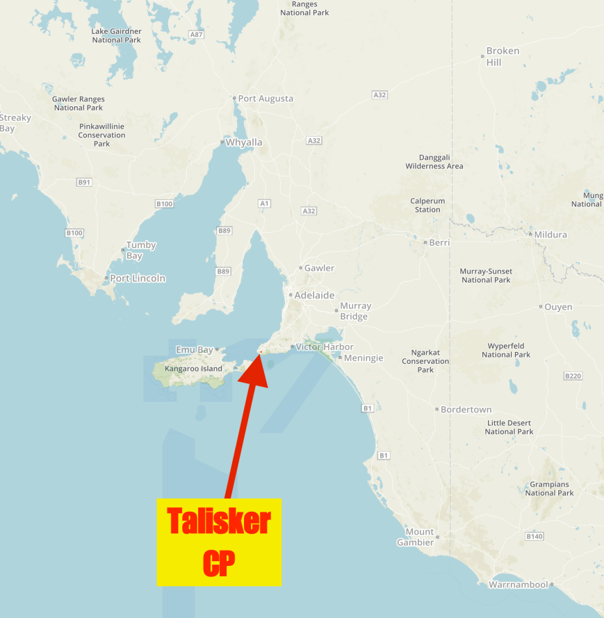
Our first activation for Saturday 1st April 2017 for the 4th Anniversary of the VK5 National & Conservation Parks Award, was Talisker Conservation Park 5CP-223 & VKFF-0790. I have activated and qualified this park previously on a number of occasions, but it was to be a unique park for my wife Marija VK5FMAZ for both the VK5 Parks Award and World Wide Flora Fauna (WWFF).
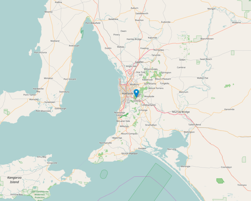
Talisker is located about 100 km south of Adelaide on the Fleurieu Peninsula. It was just a short drive from our accomodation at Deep Creek.
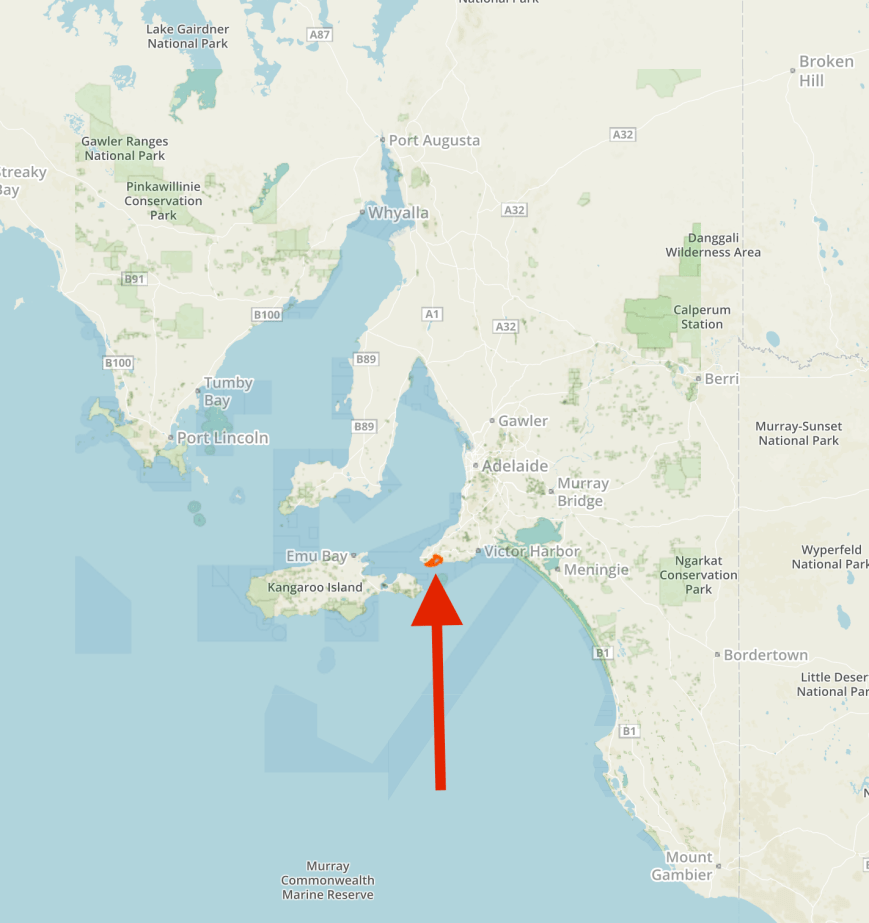
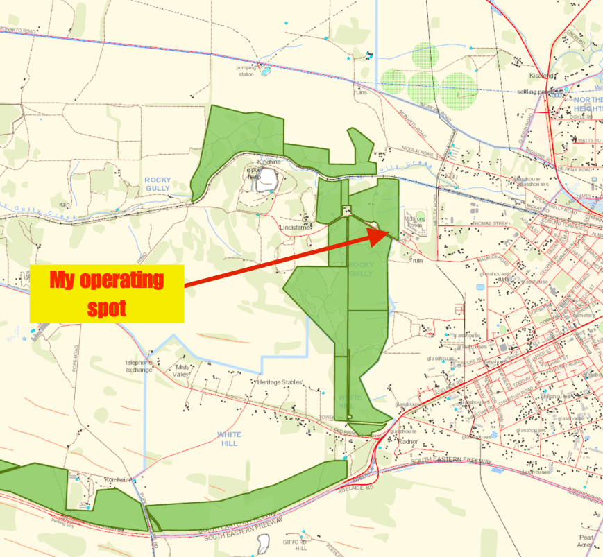
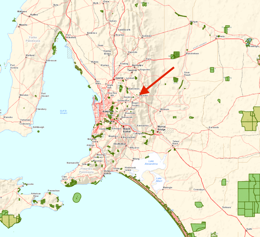
Above:- Map showing the location of the Talisker Conservation Park, south of Adelaide. Map courtesy of Protected Planet.
After breakfast we packed the 4WD and headed off to Talisker. It was quite an overcast morning with some dark clouds in the sky. We certainly had our fingers crossed that the weather would hold off.
Talisker Conservation Park was established in 1976 and consists of 211 hectares of native scrub set in very hilly terrain. The park incorporates the old Talisker silver-lead mine, which was discovered by John McLeod in 1862. It was named after a locality on the Isle of Skye in Scotland. Talisker employed Cornish miners and supported a nearby township called Silverton. The population of Silverton grew to 3000 at its peak in 1870. The Talisker Mining Company worked the mine until falling ore grades and a lack of finance, forced the mine’s closure in 1872. Between 1917 to 1920, the mine was worked again, mainly for arsenic.
More information on the park and its fascinating history can be found at my previous posts at…..
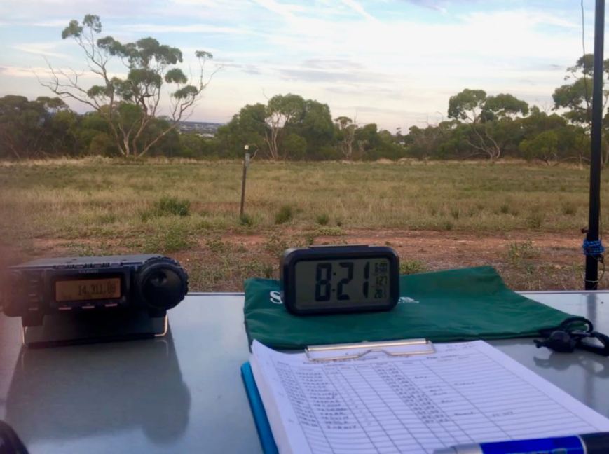
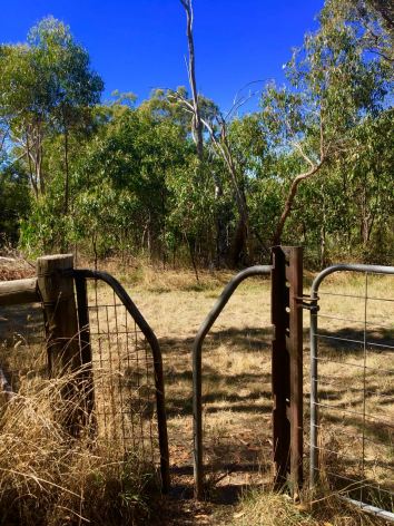
We set up in our normal spot, a clearing in the scrub near the old camp ground, off Talisker Road. There is plenty of room here to stretch out the 80/40/20, linked dipole. We were all set up and ready to go by just after 2300 UTC (9.30 a.m. South Australian local time). The sun was occasionally popping its head out from the clouds, so we set up the solar panels to top up the power pack.
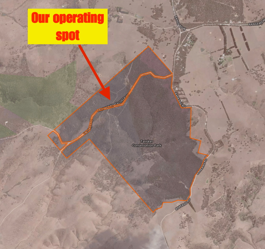
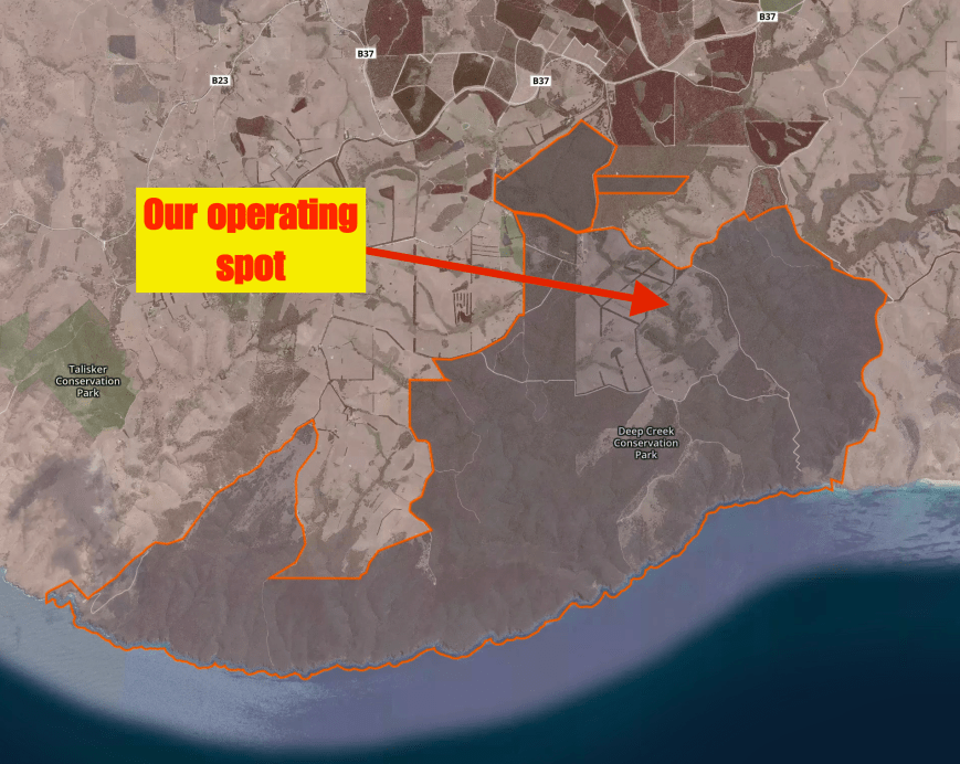
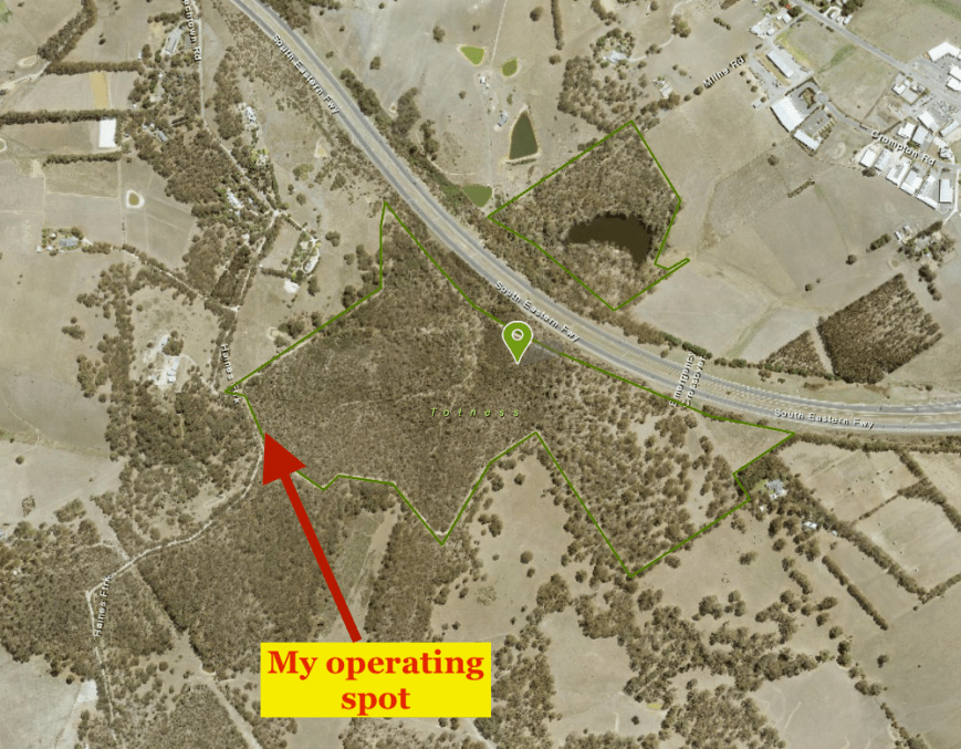
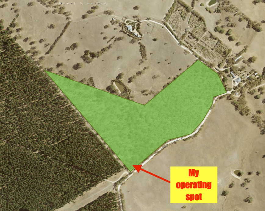
Above:- Aerial shot of the Talisker Conservation Park showing our operating spot in the northern section of the park. Image courtesy of Protected Planet.
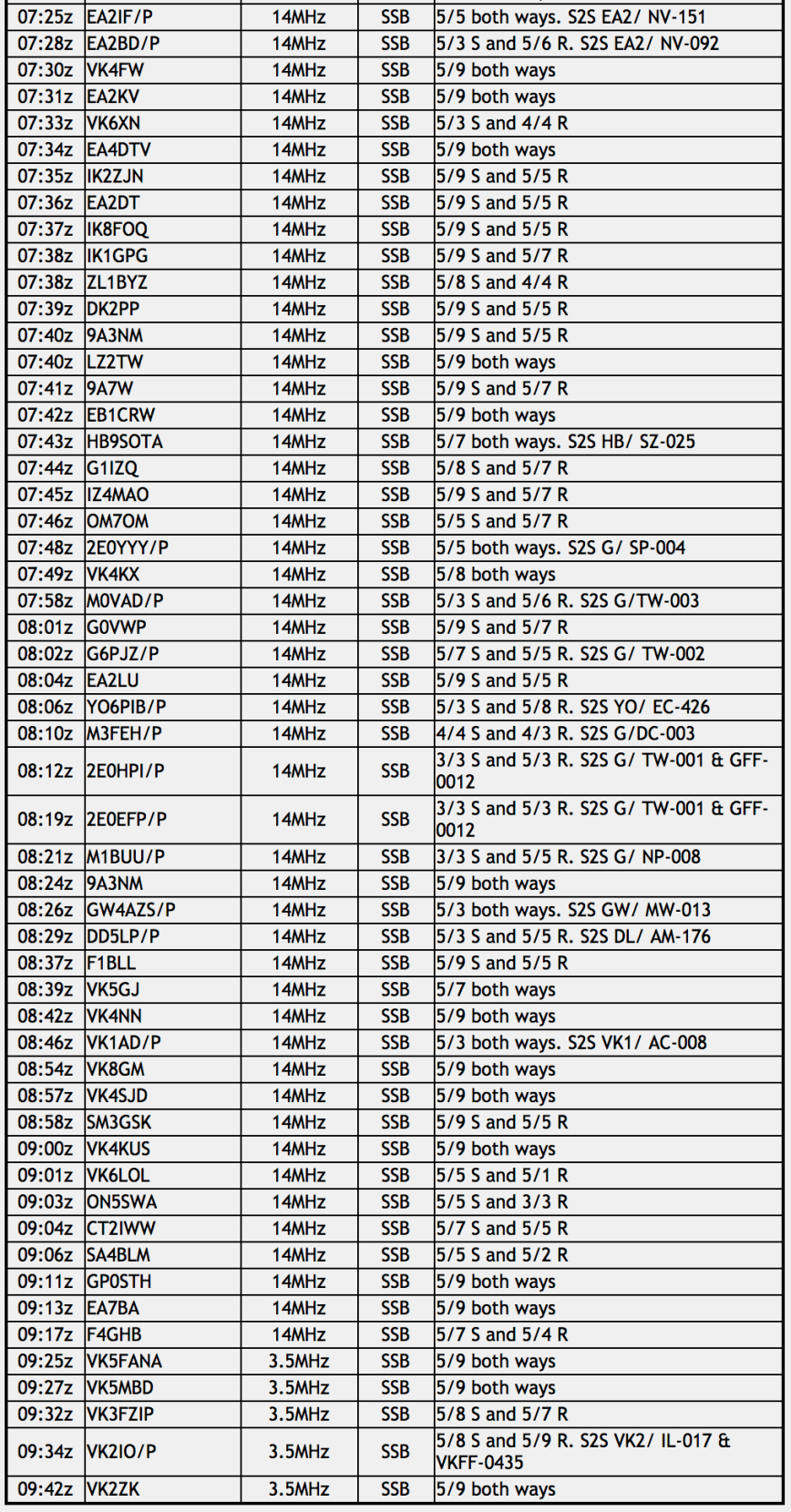
As I had activated and qualified the park previously, Marija started off on air first. Prior to calling CQ we had a quick tune across the 40m band to see if we could find any other VK5 park activators. It didn’t take us long. We soon found Tony VK3XV/5 calling CQ on 7.144 from the Lower Glenelg River Conservation Park 5CP-122 & VKFF-0905. Tony was very low down (5/1), but as there was no man made noise on the band from the park, Tony was easily worked (5/1 received). It was clear that close in propagation was going to be a challenge during the activation which was a real pity, as we were both hoping for some Park to Park action.
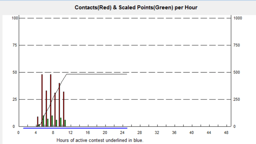
After speaking with Tony, Marija then headed to 7.150 where she commenced calling CQ. This was answered by Roald VK1MTS with a strong 5/8 signal, followed by Steve VK3FSPG/VK3MPR, and then Geoff VK3SQ. It didn’t take long for a mini pile up to ensue, and considering Marija has only been licenced for 12 months, she did a very admirable job managing the pile up. Marija logged a total of 34 stations on 40m from VK1, VK2, VK3, VK4, VK5, and VK7. But at that stage, Tony was our only VK5 Parks activator. It appeared that Tony, Marija and I were the only early starters for the anniversary weekend.
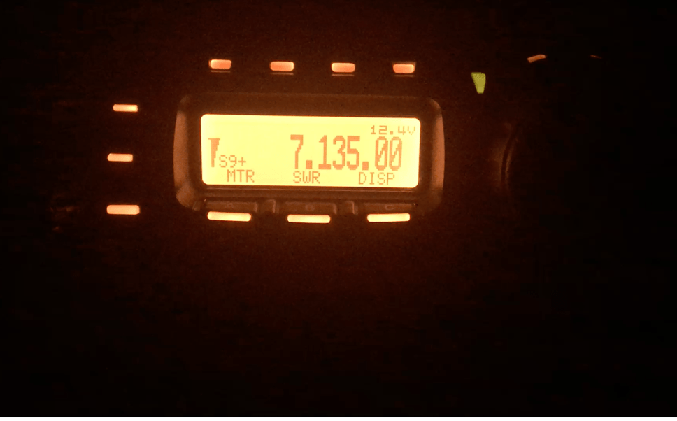
After a good run on 40m, we then lowered the squid pole and inserted the links for the 80m band and headed to 3.610. I spotted Marija on parksnpeaks and Marija called CQ. This was answered by the ever reliable Mick VK3GGG/VK3PMG, with a strong 5/8 signal from western Victoria. Adrian VK5FANA who was portable in the Clements Gap Conservation Park 5CP-043 & VKFF-0812 in the Mid North of South Australia then called us. Sadly, due to a high noise floor on 80m we were just not quite able to pull Adrian through. We weren’t really sure where the noise was coming from, as we were certainly not near any known interference sources. Marija then spoke with Col VK5HCF in Mount Gambier, Ivan VK5HS in the Riverland, and then John VK5DJ at Millicent in the South East. Adrian then called in again, and thanks to his patience and persistence, we were able to make a valid contact just as out noise floor dropped for us. I also logged Adrian Park to Park.


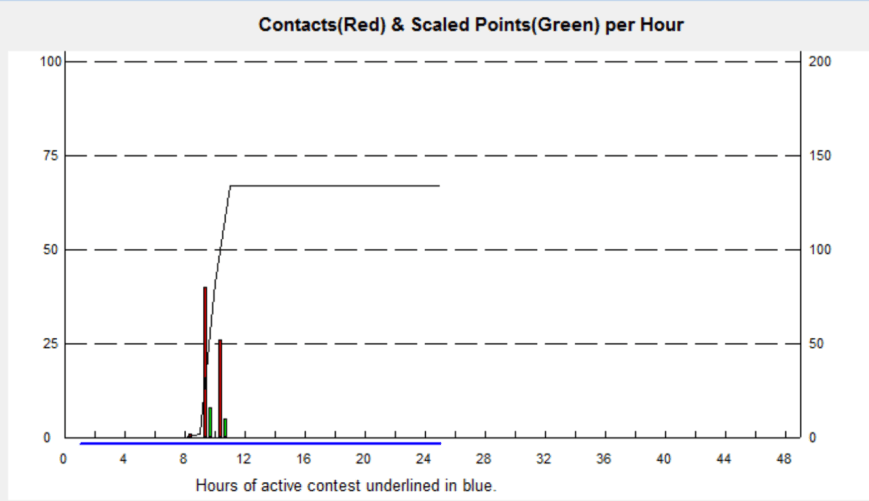
Marija and I then decided to try the 15m band. We had seen a few comments on one of the Facebook sites from some USA stations asking us to try 15m. So it was down with the 80/40/20m linked dipole, and up with the 15m 1/2 wave dipole. Sadly, about five minutes of Marija’s CQ calls went unanswered, so I jumped into the operator’s seat and called CQ. After about 5 minutes of CQ calls, Hans VK6XN from Western Australia came back to my CQ call. Unfortunately Hans was our only contact on 15m. Marija was now just 1 contact short of qualifying the park for WWFF, with 43 contacts in the log.
We headed back to the 40m band where we both worked Wade VK1FWBD who was portable on a SOTA peak, Tuggeranong Hill VK1/ AC-038. Wade was Marija’s 44th contact, and a successful park activation in the log.
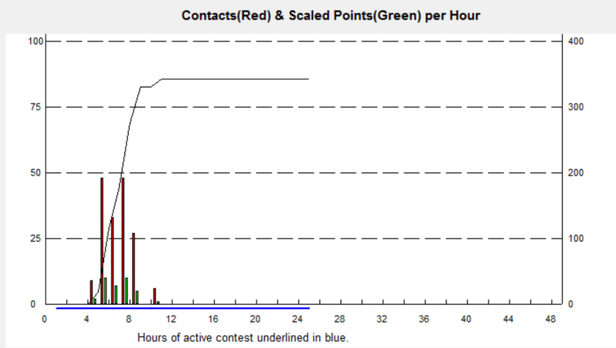
I then took control of the mic and called CQ on 7.144. My first taker there was Fred VK3DAC, followed by Les VK2DSG and then regular park hunter Rick VK4RF/VK4HA. A few of the VK5 Park activators now started to appear, and Marija and I swapped the mic each time to log them Park to Park.

The trig point in the park, opposite our operating position
South Australian park activators logged on 7.144 on 40m were:
- Mark VK5QI/p – Warren Conservation Park 5CP-247 & VKFF-0941
- Adrian VK5FANA/p – Clements Gap Conservation Park 5CP-043 & VKFF-0812
- Greg VK5ZGY/p – Lake Frome Conservation Park 5CP-108 & VKFF-0900
- Greg VK5GJ/p, Hesperilla Conservation Park 5CP-090 & VKFF-1038
- Norm VK5GI/p, Hesperilla Conservation Park 5CP-090 & VKFF-1038
- Gary VK5FGRY/p – Morialta Conservation Park 5CP-142 & VKFF-0783
- Ray VK5RR – Hogwash Bend Conservation Park 5CP-092 & VKFF-0892
- Tony VK5MRT/p, Bullock Hill Conservation Park 5CP-265 & VKFF-0873
- Peter VK5PET/p – Cleland Conservation Park 5CP-042 & VKFF-0778 & SOTA Mount Lofty VK5/ SE-005
- Mark VK5QI/p – Cromer Conservation Park 5CP-049 & VKFF-0779
Interstate park activators logged on 40m were:
- Peter VK3PF/p, Mount Eccles National Park VKFF-0345
- Neil VK4HNS/p -Dthinnwan National Park VKFF-0587
- Mark VK4SMA/p – White Rock Conservation Park VKFF-1676
- Rob VK4AAC/p – Goomboorian National Park VKFF-0722
- Mick VK3PMG/VK3GGG/p – Kara Kara National Park VKFF-0629
Interstate SOTA activators logged on 40m were:
- Gerard VK2IO – VK2/ HU-080
- Peter VK3PF/p, Mount Rouse VK3/ VS-048
- Mick VK3PMG/VK3GGG/p – West of England Range VK3/ VW-013
Some other interesting contacts included Steve VK5SFA who was using a 1.2 m diameter loop antenna, and Craig VK3CRG who was streaming my QSOs on VK3RTV Digital Amateur Television.


After logging a total of 79 stations on 7.144, traffic started to slow down. So we took the opportunity of tuning across the 40m band and picking up a few more South Australian & interstate park activators.
- Tony VK3XV/5 – Penambol Conservation Park 5CP-175 & VKFF-0802
- Andrew VK5MR/p – Lake Torrens National Park 5NP-013 & VKFF-0278
- Greg VK5ZGY/p – Beachport Conservation Park 5CP-014 & VKFF-0791
- Keith VK5OQ/3 – Lower Glenelg National Park VKFF-0296
We were now 5 hours into our activation and I had not yet got up to 20m. So it was time to try that band. I self spotted on parksnpeaks and then called CQ on 14.310 and this was answered by Hans VK6XN in Western Australia, who I had worked a little earlier on the 15m band. Hans was a good 5/8, considerably stronger than his earlier signal on 15m. I worked a further 8 stations on 20m including:
- Mark VK4SMA/p -White Rock Conservation Park VKFF-1676
- Neil VK4HNS/p – Goomboorian National Park VKFF-0587
It was now approaching 0500 UTC (3.30 p.m. local time), and we decided to have one last listen on 40m before calling it a day at Talisker. We were pleased we did, as we logged David VK5HYZ in the Mount Remarkable National Park 5NP-015 & VKFF-0360.


Marija and I ended up with a total of 158 QSOs for this activation, including a total of 42 Park to Park contacts.
Thankyou to everyone who called, and thanks to those who took the time to spot us.
I worked the following stations on 40m SSB:-
- VK3XV/5 (Lower Glenelg River Conservation Park 5CP-122 & VKFF-0905)
- VK1FWBD/p (Tuggeranong Hill SOTA VK1/ AC-038)
- VK3DAC
- VK2DSG
- VK4RF
- VK4HA
- VK5QI/p (Warren Conservation Park 5CP-247 & VKFF-0941)
- VK5FANA/p (Clements Gap Conservation Park 5CP-043 & VKFF-0812)
- VK3SQ
- VK3PF/p (Mount Eccles National Park VKFF-0345)
- VK3TKK
- VK3FRAB
- VK3PAT
- VK3GGG
- VK3PMG
- VK3SFG
- VK3FCMC
- VK5JW
- VK1DI
- VK3MRH
- VK3TJK
- VK3GTS
- VK3FLCS
- VK2IO/p (SOTA VK2/ HU-080)
- VK5ZGY/p (Lake Frome Conservation Park 5CP-108 & VKFF-0900)
- VK5GJ/p (Hesperilla Conservation Park 5CP-090 & VKFF-1038)
- VK5GI/p (Hesperilla Conservation Park 5CP-090 & VKFF-1038)
- VK5IS/p
- VK3UCD
- VK3ANL
- VK3SB
- VK7JON/m
- VK7FOLK/m
- VK5AW
- VK3GWS
- VK3RV
- VK4HNS/p (Dthinnwan National Park VKFF-0587)
- VK5FGRY/p (Morialta Conservation Park 5CP-142 & VKFF-0783)
- VK7PRN
- VK3BNJ
- VK3MAB
- VK5FAKV
- VK3CBP
- VK5RR/p (Hogwash Bend Conservation Park 5CP-092 & VKFF-0892)
- VK5KB
- VK5EMI
- VK4SMA/p (White Rock Conservation Park VKFF-1676)
- VK3ARH
- VK4AAC/p (Goomboorian National Park VKFF-0722)
- VK5MRT/p (Bullock Hill Conservation Park 5CP-265 & VKFF-0873)
- VK5PET/p (Cleland Conservation Park 5CP-042 & VKFF-0778 & Mt Lofty summit VK5/ SE-005)
- VK2YW
- VK5HCF/m
- VK5FCDL
- VK3PF/p (SOTA Mount Rouse VK3/ VS-048)
- VK5KLV
- VK3VLA
- VK5FMWW
- VK5SFA
- VK3GGG/p (Kara Kara National Park VKFF-0629 & SOTA VK3/ VW-013)
- VK3PMG/p (Kara Kara National Park VKFF-0629 & SOTA VK3/ VW-013)
- VK3CRG
- VK5HS
- VK5QI/p (Cromer Conservation Park 5CP-049 & VKFF-0779)
- VK3ALA/7
- VK2LX
- VK3FLJD
- VK4GSF
- VK2HHA
- VK2FENG
- VK5MLB
- VK3ATC
- VK2VW
- VK3KMA
- VK5NMG
- VK5KSW
- VK3KMH
- VK3BBB
- VK3FSPG
- VK3MPR
- VK5ZRY/m
- VK3FEVT
- VK3XV/5 (Penambol Conservation Park 5CP-175 & VKFF-0802)
- VK5MR/p (Lake Torrens National Park 5NP-013 & VKFF-0278)
- VK5ZGY/p (Beachport Conservation Park 5CP-014 & VKFF-0791)
- VK5OQ/3 (Lower Glenelg River National Park)
- VK5HYZ/p (Mount Remarkable National Park 5NP-015 and VKFF-0360)
I worked the following stations on 80m SSB:-
- VK5FANA/p (Clements Gap Conservation Park 5CP-043)
I worked the following station on 15m SSB:-
- VK6XN
I worked the following stations on 20m SSB:-
- VK6XN
- VK2HOT
- VK4DA
- VK4QQ
- VK2XXM
- VK6AHR
- VK4SMA/p (White Rock Conservation Park VKFF-1676)
- VK4HNS/p (Goomboorian National Park VKFF-0587)
- VK4YLH
Marija worked the following stations on 40m SSB:-
- VK3XV/5 (Lower Glenelg River Conservation Park 5CP-122 & VKFF-0905)
- VK1MTS
- VK3FSPG
- VK3MPR
- VK3SQ
- VK7JON
- VK3SFG
- VK4FW
- VK4RZ
- VK2AMF
- VK3ARH
- VK7NOH
- VK2WG
- VK2YW/p
- VK3FSLG
- VK3KMA
- VK3FCMC
- VK4RF
- VK4HA
- VK4HNS/p
- VK7PRN
- VK3OHM
- VK3QA
- VK3VIN
- VK2XXM
- VK3PAT
- VK3FRAB
- VK5FMWW/m
- VK3YE
- VK3FHCT
- VK7FOLK/m
- VK2FADV
- VK2VAA
- VK3GGG
- VK3PMG
- VK3TKK/m
- VK3SQ
- VK1FWBD/p (Tuggeranong Hill SOTA VK1/ AC-038)
- VK3PF/p (Mount Eccles National Park VKFF-0345)
- VK5ZGY/p (Lake Frome Conservation Park5CP-108 & VKFF-0900)
- VK5GI/p (Hesperilla Conservation Park 5CP-090 & VKFF-1038)
- VK5GJ/p (Hesperilla Conservation Park 5CP-090 & VKFF-1038)
- VK4HNS/p (Dthinnwan National Park VKFF-0587)
- VK5FANA/p (Clements Gap Conservation Park 5CP-043 & VKFF-0812)
- VK5FGRY/p (Morialta Conservation Park 5CP-142 & VKFF-0783)
- VK5RR/p (Hogwash Bend Conservation Park 5CP-092 & VKFF-0892)
- VK4AAC/p (Goomboorian National Park VKFF-0722)
- VK5MRT/p (Bullock Hill Conservation Park 5CP-265 & VKFF-0873)
- VK3PF/p (SOTA Mount Rouse VK3/ VS-048)
- VK5QI/p (Cromer Conservation Park 5CP-049 & VKFF-0779)
- VK3XV/5 (Penambol Conservation Park 5CP-175 & VKFF-0802)
- VK5MR/p (Lake Torrens National Park 5NP-013 & VKFF-0278)
- VK5ZGY/p (Beachport Conservation Park 5CP-014 & VKFF-0791)
- VK5HYZ/p (Mount Remarkable National Park 5NP-015 & VKFF-0360)
Marija worked the following stations on 15m SSB:-
- VK6XN
Marija worked the following stations on 80m SSB:-
- VK3GGG
- VK3PMG
- VK5HCF
- VK5HS
- VK5DJ
- VK5FANA/p (Clements Gap Conservation Park 5CP-043 & VKFF-0812)
At the end of the activation we drove down to Blowhole Beach. The track down to the beach is definitely only 4WD. It is very rocky and steep, and has numerous washaways. It is clearly marked 4WD ONLY.


As we grew closer to the bottom car parking area we saw that there were a number of surfers enjoying the waves.


There are some very nice views here, out across the Southern Ocean and out to Kangaroo Island.


We then drove down to the bottom of Tapanappa Road and along the dirt track to the camping area. We enjoyed some sensational views of the coastline from here.


References.
Wikipedia, 2017, <https://en.wikipedia.org/wiki/Talisker_Conservation_Park>, viewed 3rd April 2017