Ettrick Conservation Park 5CP-267 and VKFF-1029

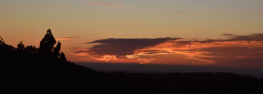
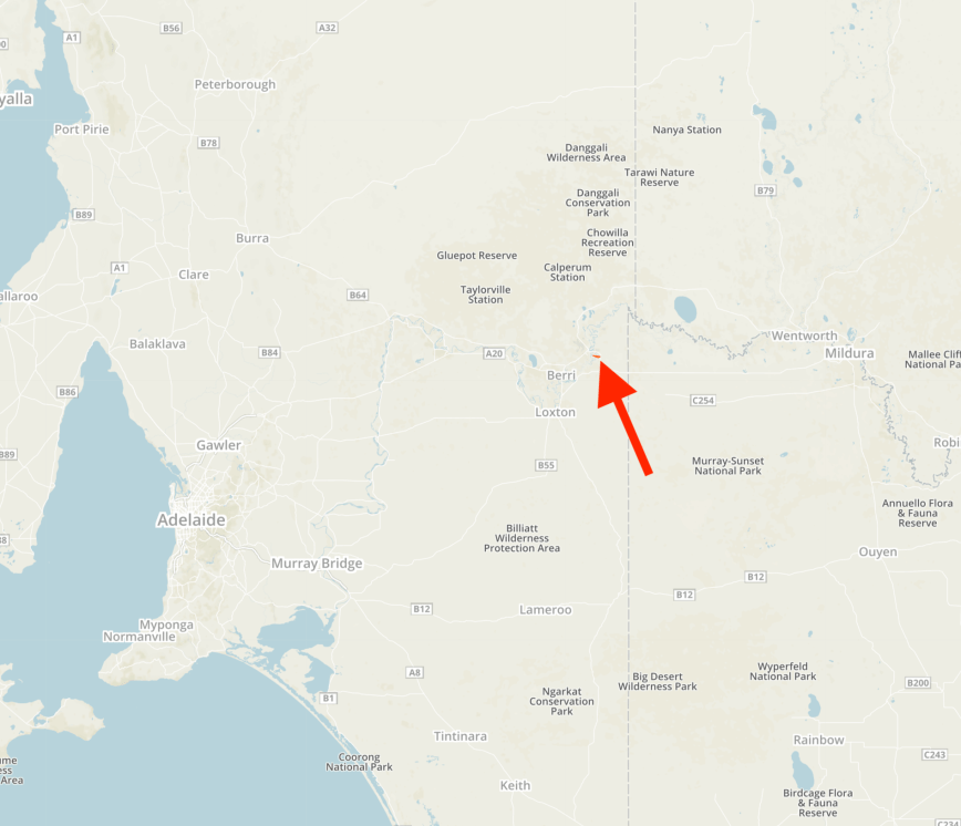
Today (Saturday 6th July 2019) was a beautiful sunny day ahead of some wet weather coming in from the west.  So I took the opportunity of heading east to activate some Murray Mallee parks.  The first park was to be the Ettrick Conservation Park 5CP-267 & VKFF-1029.  I have activated and qualified this park previously so today’s activation would go towards the Boomerang Award.

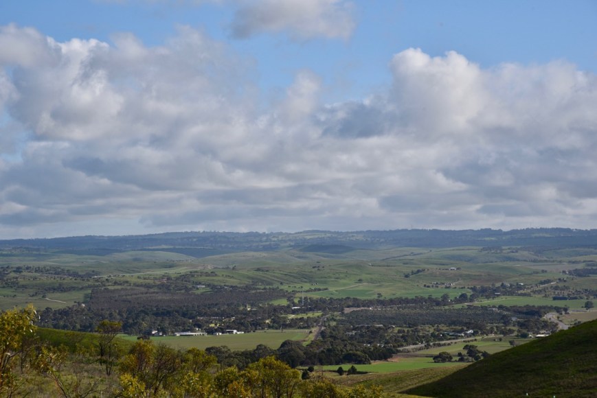
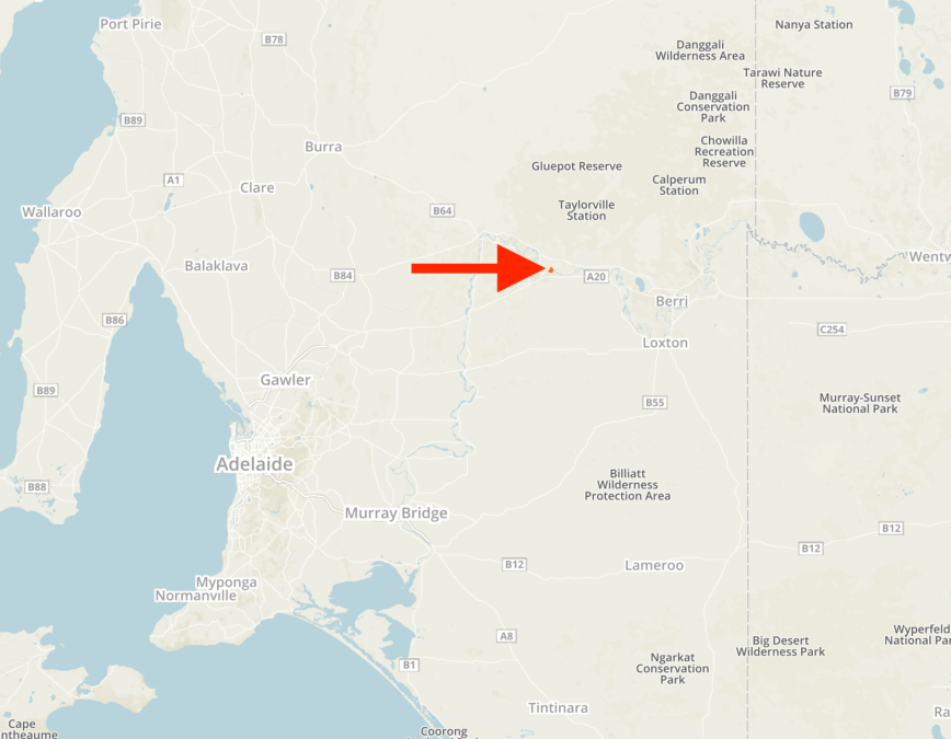
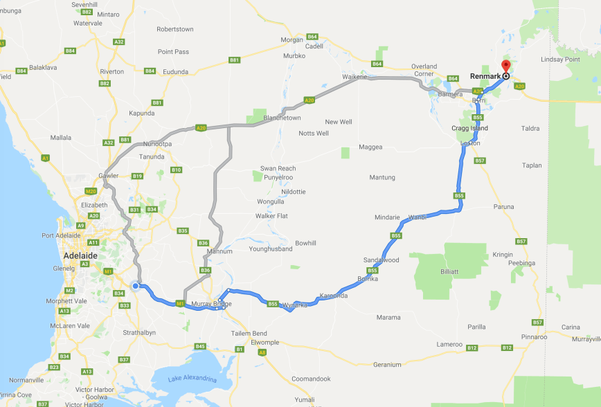
The park is located about 110 km east of Adelaide and about 33 km north east of the town of Murray Bridge.

Screen Shot 2019-07-06 at 7.22.25 pm.png

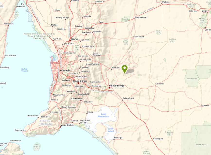
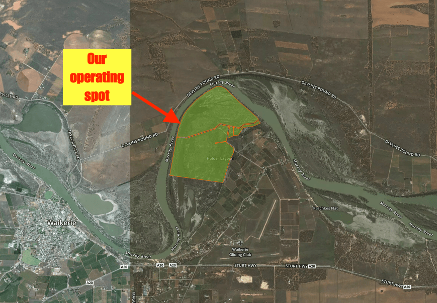
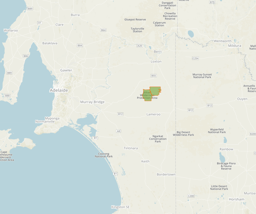
Above:- Map showing the location of the Ettrick Conservation Park in the Murray Mallee.  Map courtesy of Location SA Map Viewer.

I left home at around 9.30 a.m. and headed east along the South Eastern Freeway to Murray Bridge.  I then headed north on Burdett Road and stopped briefly to admire some of the views of the Murray River.

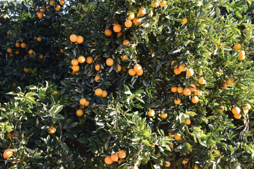
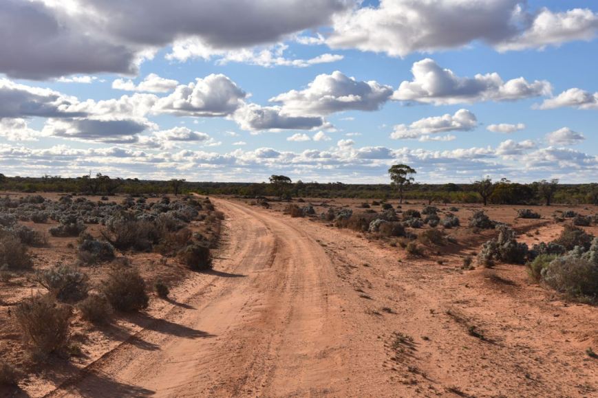
I then turned right onto Glenburr Road.  This took me past a number of cropping properties and some old abandoned stone farm buildings.

About 4-5 km along Glenburr Road I reached the junction with Boundary Road.  This is the northwestern corner of the park which is not signposted.  I have mentioned this in previous posts, but do not get some of the surrounding scrub confused with the park and end up on private property.  There is a lot of native vegetation around the park which is not part of the Ettrick Conservation Park.

The Ettrick Conservation Park was established on the 31st day of October 2013 and is about 479 hectares in size.

Screen Shot 2019-07-06 at 7.29.03 pm

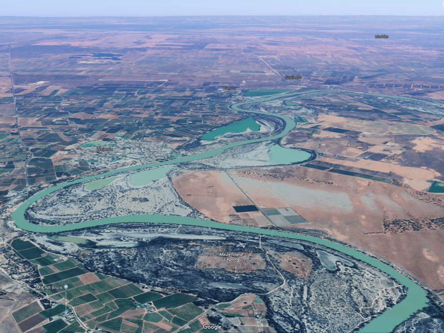
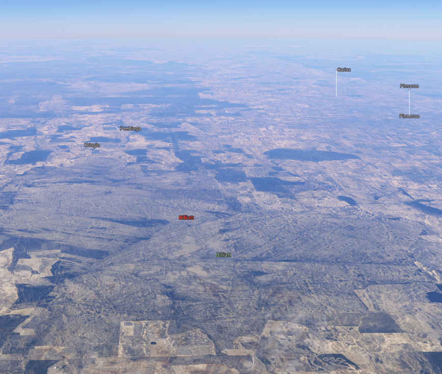
Above:- An aerial view of the Ettrick Conservation Park looking north.  The Murray River can be seen to the north of the park.  Image courtesy of Google Maps.

The park takes its name after the Hundred of Ettrick which was proclaimed on 4th May 1893. It was named by Governor Kintore who hailed from Scotland where there is a ‘Parish of Ettrick’ in Selkirk, derived from the Gaelic eadar-dha-eas – ‘between two waterfalls’.

b5986

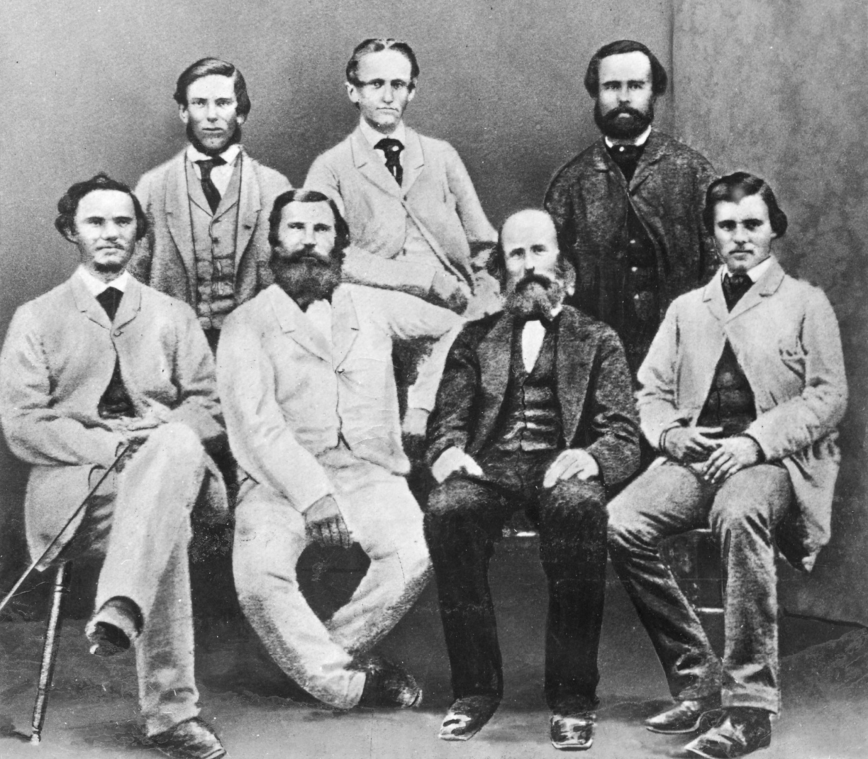
ABove:- Ninth Earl of Kintore, Governor Kintore.  Image courtesy of adb.anu.edu.au

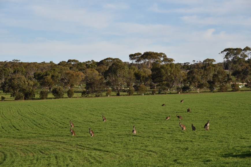
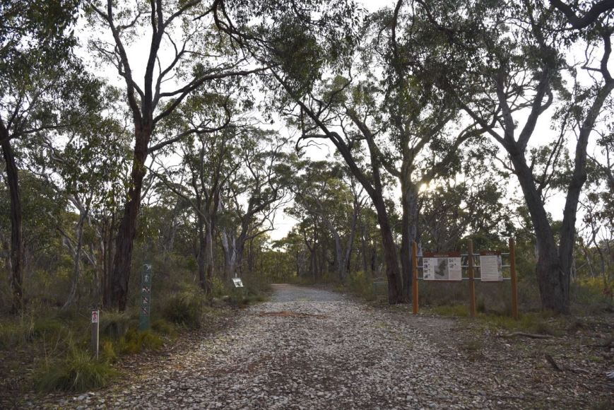
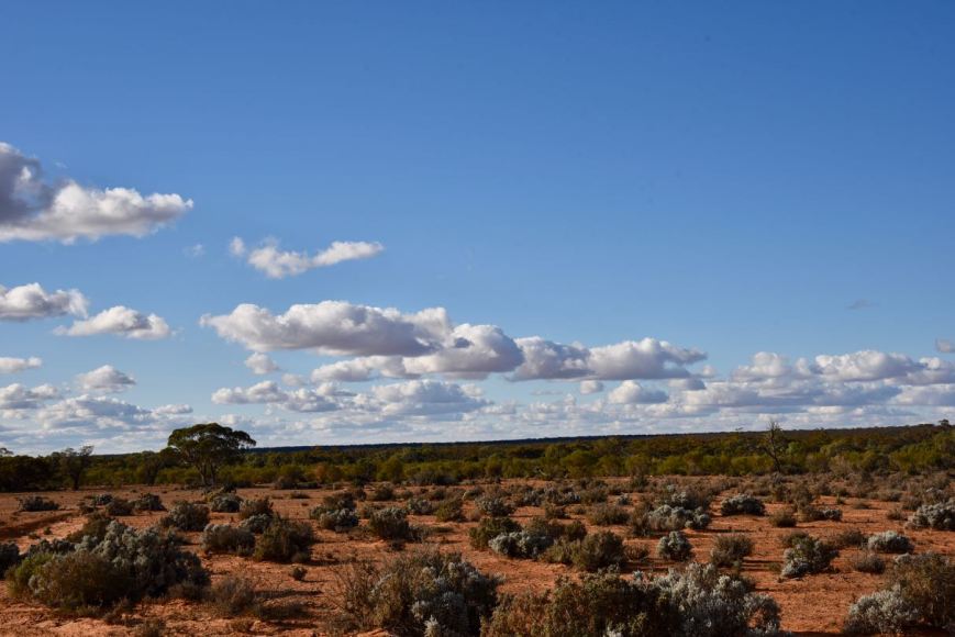
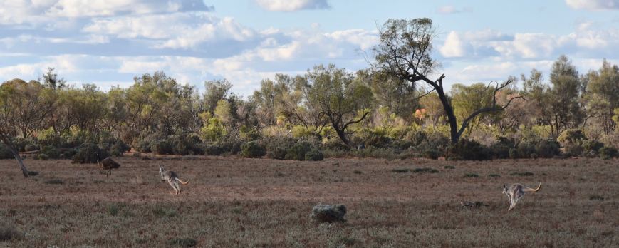
The park is made up of open mallee with several species of Eucalpyt.  It is also home to one of the few remaining examples of tussock grassland in this part of the Murray Darling Basin.  The park is an important refuge for species such as the Malleefowl and Regent Parrot.

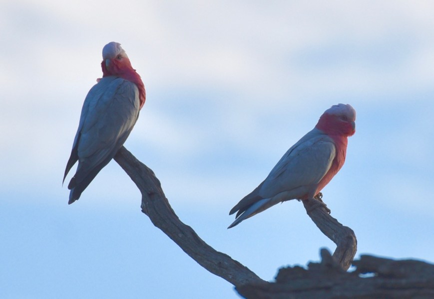
Birds SA have recorded about 65 species of bird in the park including Mallee Ringneck, Galah, Spiny-cheeked Honeyeater, Spotted Pardalote, White-browed Babbler, White-winged Chough, Peaceful Dove, Purple-backed Fairywren, Splendid Fairywren, Grey Butcherbird, Black-faced Cuckoo-shrike, and Gilbert’s Whistler.

If you follow the main track through the park it will bring you to an old abandoned farmhouse which I suspect was the original homestead on the property before it was acquired by the South Australian Government as a park.

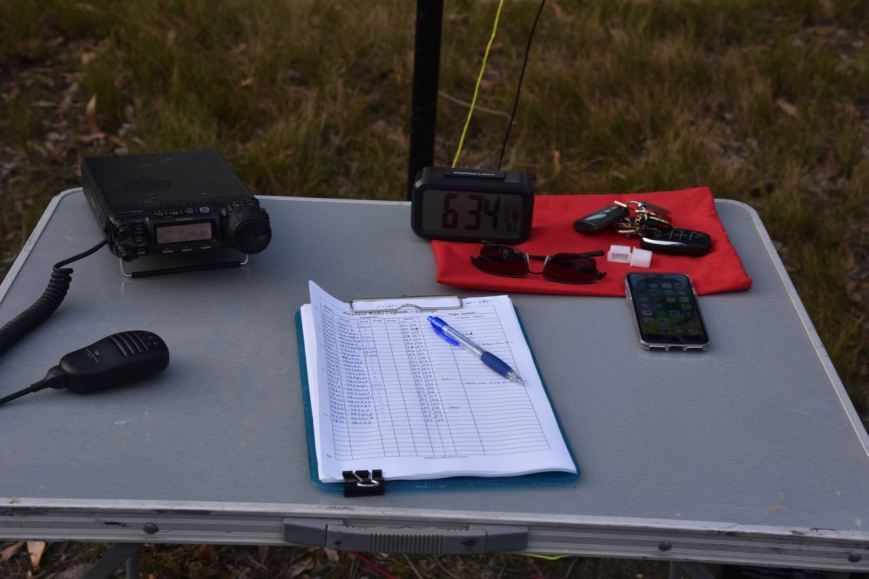
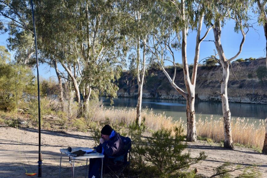
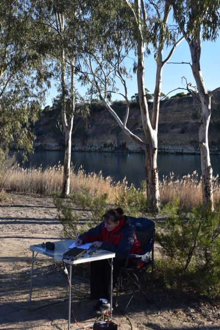
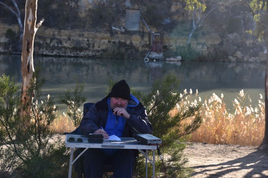
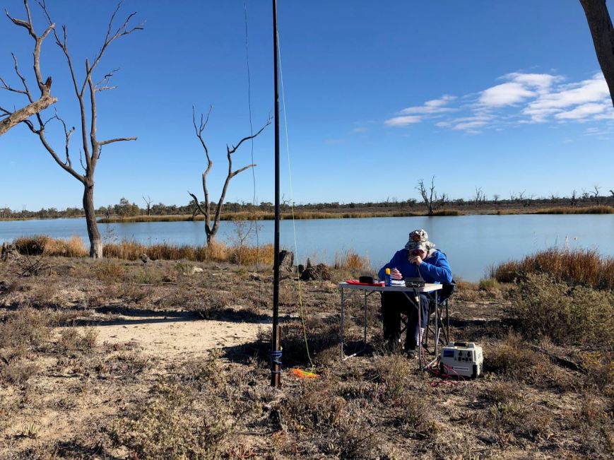
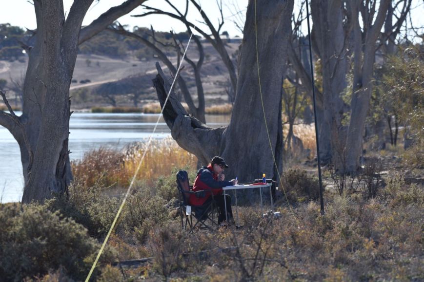
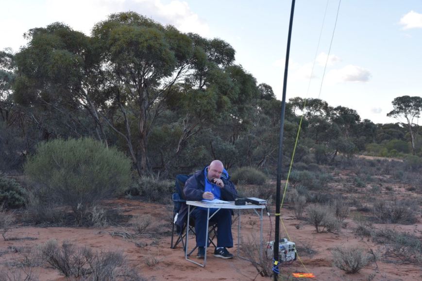
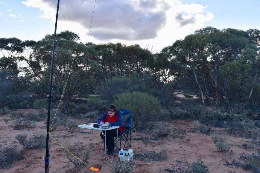
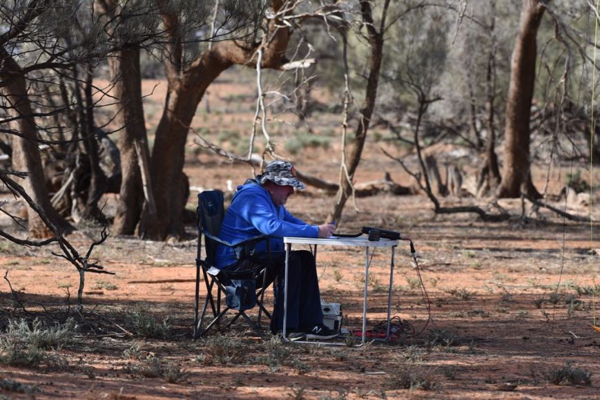
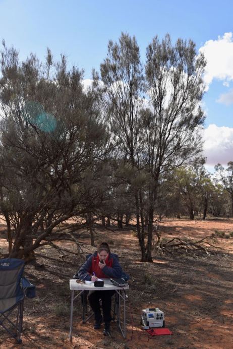
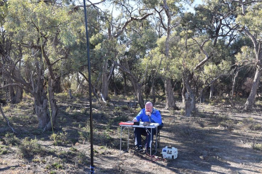
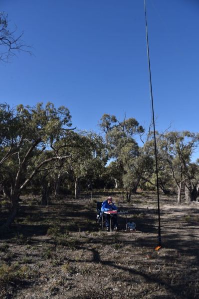
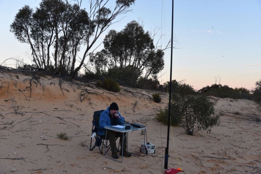
I travelled along a 4WD track which led into the park via a gateway (minus the gate) on Glenburr Road.  I found a clearing in amongst the scrub and set up my station comprising the Yaesu FT-857d and the 20/40/80m linked dipole.  I ran about 30 watts for this activation.

Screen Shot 2019-07-06 at 7.22.08 pm.png

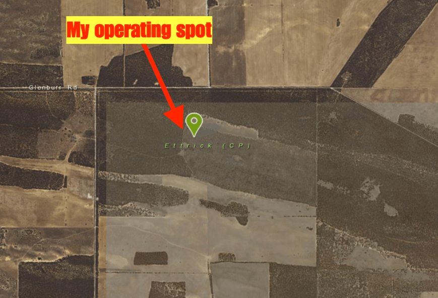
Above:- Aerial shot of the park showing my operating spot. Image courtesy of Location SA Map Viewer.

I had very little phone coverage in the park so had a lot of difficulty in trying to self-post on parksnpeaks.  I called CQ on 7.144 and this was almost immediately answered by Hans VK5YX with a big signal from the southern suburbs of Adelaide.  I had forgotten to write down the park reference so Hans kindly looked it up for me.  Geoff VK3SQ and Brett VK2VW followed and I was informed that Rob VK4AAC/3 was down on 80m in a park.  So it was down with the squid pole and in with the 80m sections of the antenna and off to 3.640.  I logged Rob who was activating the Tocumwal Regional Park VKFF-0978.

I then headed back to 7.144 on 40m and found that there was quite a pile up waiting for me.  I logged Lee VK2LEE, followed by Mike VK6MB/2 in the Kemendok National Park VKFF-1174.  About 8 QSOs later Rob VK4AAC/3 gave me a shout for a Park to Park on a different band.

DSC_8467

Within an hour I had 44 contacts in the log, with QSO number 44 being with Peter VK2FPAR.  A few QSOs after Pete I had my fifth Park to Park QSO in the log with a contact with Peter VK3PF/p who was activating the Rokeby Flora Reserve VKFF-2428.

I logged a total of 49 stations on 40m before heading over to the 20m band.  I called CQ and this was answered by Scott VK4CZ with a lovely 5/9 signal, although the pesky Over the Horizon Radar was present on 20m once again.  Hans VK6XN then gave me a shout followed by Ian VK6EA who has become a regular park hunter of late.

I logged 12 stations on 20m and then headed down to 3.610 on 80m.  As I had no internet coverage I was hoping there may be someone on that frequency monitoring.  And fortunately, there was.  John VK5BJE was first in the log, followed by Peter VK3PF/p in the Rokeby Flora Reserve VKFF-2428, and finally Gerard VK2IO/5.

DSC_8481

I had 64 contacts in the log in a little under 90 minutes and it was time to pack up and head off to my next park the Lowan Conservation Park.

A BIG THANKS to those who took the time to spot me during this activation.

I worked the following stations on 40m SSB:-

  1. VK5YX
  2. VK3SQ
  3. VK2VW
  4. VK2LEE
  5. VK6MB/2 (Kemendok National Park VKFF-1174)
  6. VK4RF
  7. VK4HA
  8. VK1MA
  9. VK3MCK
  10. VK2HHA
  11. VK2PKT
  12. VK5BJE
  13. VK4AAC/3 (Tocumwal Regional Park VKFF-0978)
  14. VK2VH/3 (Tocumwal Regional Park VKFF-0978)
  15. VK2NP
  16. VK2YK
  17. VK4NH
  18. VK4DXA
  19. ZL4TY/VK4
  20. VK4CZ
  21. VK4FARR
  22. VK2FADV
  23. VK4HNS
  24. VK4TJ
  25. VK4/AC8WN
  26. VK4/VE6XT
  27. VK3MPR
  28. VK2MJW
  29. VK4HAT
  30. VK1AT
  31. VK2CTG
  32. VK7FJFD
  33. VK6EA
  34. VK3XPT
  35. VK3CM
  36. VK3AHR
  37. VK7FEAT/m
  38. VK4MWB
  39. VK2XXM
  40. VK7NSS
  41. VK2MOR
  42. VK3ZNK
  43. VK2FPAR
  44. VK4FDJL
  45. VK3PF/p (Rokeby Flora Reserve VKFF-2428)
  46. VK7FRJG
  47. VK3LTL
  48. VK7VZ

I worked the following stations on 80m SSB:-

  1. VK4AAC/3 (Tocumwal Regional Park VKFF-0978)
  2. VK5BJE
  3. VK3PF/p (Rokeby Flora Reserve VKFF-2428)
  4. VK2IO/5

I worked the following stations on 20m SSB:-

  1. VK4CZ
  2. VK6XN
  3. VK6EA
  4. VK2LEE
  5. VK2NP
  6. VK4NH
  7. VK4DXA
  8. ZL4TY/VK4
  9. ZL1TM
  10. VK4TJ
  11. VK4/AC8WN
  12. VK4/VE6XT


References.

Birds SA, 2019, <https://birdssa.asn.au/location/ettrick-conservation-park/>, viewed 6th July 2019

State Library of South Australia, 2019, <http://www.slsa.sa.gov.au/digitalpubs/placenamesofsouthaustralia/>, viewed 6th July 2019

Wikipedia, 2019, <https://en.wikipedia.org/wiki/Ettrick_Conservation_Park>, viewed 6th July 2019

Kinchina Conservation Park 5CP-277 and VKFF-1764

Today (Friday 5th July 2019) after work I headed to the Kinchina Conservation Park 5CP-277 & VKFF-1764 for a quick late afternoon activation.  I have activated and qualified Kinchina a number of times previously, so today’s activation for me would count towards the Boomerang Award.

The Kinchina Conservation Park is located just to the west of the town of Murray Bridge, about 75 km east of the city of Adelaide.

Screen Shot 2019-07-05 at 8.26.44 pm.png

Above:- Map showing the location of the Kinchina Conservation Park.  Map courtesy of Location SA Map Viewer.

I drove east along the South Eastern Freeway and took the Monarto exit.  I then travelled east on the Old Princes Highway and then turned left onto Maurice Road.  This is good cropping land, and many of the crops were full of kangaroos.  Much to the farmer’s disgust, I suspect.

DSC_8406

I soon reached the western section of the Kinchina Conservation Park which is very well signposted.

DSC_8405

The Kinchina Conservation Park was established on the 22nd day of September 2016 and is 414 hectares in size.  It is located in the north of the Gifford Hill Range on the eastern flanks of Rocky Gully and White Hill, west of the town of Murray Bridge.  The Gifford Hill Range was named after South Australian pioneer John Gifford.

Screen Shot 2019-07-05 at 8.24.48 pm.png

Above:- An aerial shot of the Kinchina Conservation Park looking east.  The town of Murray Bridge and the mighty Murray River are located nearby.  Image courtesy of Google maps

During my visit to the park, it was alive with Western Grey Kangaroos.  The beautiful Diamond Firetail finch can be found in the park.  However, it wasn’t spotted by me during this visit.  I did, however, see a number of other bird species including Red Wattlebirds and Mulga parrots.

Walking SA has a number of great walks in this park listed on their website.

I parked my vehicle in the second carpark along Maurice Road, just above the Mobilong Prison.  I walked a short distance inside the park gate and set up my station consisting of the Yaesu FT-857d and the 20/40/80m linked dipole.  I ran about 30 watts for this activation.

I placed a self spot on parksnpeaks and started calling CQ on 7.144.  First in the log was Brett VK2VW with a big 5/9 plus signal, followed by John VK4TJ, Deryck VK4FDJL, and then Rick VK4RF.

I logged a total of 18 stations on 40m from VK1, VK2, VK4, VK7 and New Zealand.  Not a single station from Victoria or South Australia was logged.  It appeared that the close in propagation was not working resulting in no VK5’s.  I’ve also noted of recent times that the 40m band often shuts down into Victoria.  And today was no exception.

It was getting a bit late, about 0715 UTC, but I then headed off to the 20m band.  I called CQ on 14.310 and logged a total of 5 stations, all from Queensland.

IMG_2221

I then tried my luck on 80m.  For whatever reason, I had strength 7 noise on that band, which resulted in me missing a few callers.  However, I did log a total of 22 stations from VK2, VK3, VK4, VK5 and VK7.  This included a number of stations from Victoria and South Australia, but also as far afield as Queensland.

To complete the activation I went back to 40m hoping to log Stuie VK8NSB in Darwin who had posted on Facebook that he was keen for a contact and unable to hear me on 20m.  However, it was not to be.  I logged 5 stations from VK2, VK4, VK6, and Vanuatu.  It was a real pleasure to be called by Mike YJ0MB in Vanuatu who had a bit 5/9 signal.

IMG_2223.JPG

I was being eaten alive by the mosquitoes and it was time for me to pack up and head for home.  I had a total of 50 stations in the log.

I worked the following stations on 40m SSB:-

  1. VK2VW
  2. VK4TJ
  3. VK4/AC8WN
  4. VK4/VE6XT
  5. VK4FDJL
  6. VK4RF
  7. VK4HA
  8. VK4CZ
  9. VK4FARR
  10. VK1DI
  11. ZL1TM
  12. VK2MG
  13. VK2FSAV
  14. VK2NP
  15. VK2YK
  16. VK2DJP
  17. VK2JON
  18. VK7AN
  19. VK4HDY
  20. VK4SMA
  21. VK2MOR
  22. YJ0MB
  23. VK6EA

I worked the following stations on 20m SSB:-

  1. VK4NH
  2. VK4DXA
  3. ZL4TY/VK4
  4. VK4CZ
  5. VK4FE

I worked the following stations on 80m SSB:-

  1. VK5BJE
  2. VK3PF
  3. VK2NP
  4. VK3ARH
  5. VK5AYL
  6. VK5FANA
  7. VK4HNS
  8. VK5YX
  9. VK5CZ
  10. VK5LA
  11. VK7AN
  12. VK3FORD
  13. VK2YK
  14. VK5PTL
  15. VK3MCK
  16. VK3LAJ
  17. VK5JDS
  18. VK3AJA
  19. VK3MPR
  20. VK5SF
  21. VK3ZPF
  22. VK4JK


References.

Wikipedia, 2019, <https://en.wikipedia.org/wiki/Kinchina_Conservation_Park>, viewed 5th July 2019

Monarto Woodlands Conservation Park 5CP-276 and VKFF-1763

This afternoon (Tuesday 2nd July 2019) I headed out to the Monarto Woodlands Conservation Park 5CP-276 & VKFF-1763.  I have activated and qualified this park previously, so today’s activation was to go towards the VKFF Boomerang Award.  Another reason for heading out into the field today was to film a short introduction to another video for the VKFF YouTube channel.  I also intended taking a few photos to enter into the Birdlife Australia photographic competition.

Screen Shot 2019-07-02 at 8.24.38 pm.png

Above:- Map showing the location of the Monarto Woodlands Conservation Park east of Adelaide.  Map courtesy of Location SA Map Viewer.

I headed out to Callington and headed up the hill out of Callington on the old Princes Highway.  There are some great views to be had here of the Bremer Valley.

DSC_8291

During the 1970s, plans were implemented by the Labor State Government under the leadership of Don Dunstan to establish a satellite city at Monarto, about 70 km east of Adelaide.  Concerns were held that the city of Adelaide would become overpopulated following rapid population growth.  Originally named ‘Murray New Town’, the proposed city was subsequently known as the ‘City of Monarto’.  Dunstan’s vision did not succeed.  In 1975 the Australian Federal Whitlam government was controversially dismissed which resulted in the “new cities programme” programme being shut down.

1920px-Don_Dunstan_1968_crop.jpg

ABove;- Don Dunstan.  Image courtesy of Wikipedia

The video below was produced by the South Australian Film Corporation in 1975.  It gives an interesting insight into the farmers of the area at the time, many of whom sold their land believing that the satellite city would go ahead.

As part of the Monarto development, substantial areas of cleared farming land were revegetated.  This was in an effort to beautify the environment, reduce dust and make the area more attractive for human habitation.  This has been the largest revegetation program conducted in South Australia, with some 600,000 plants established on 1850 ha of land.  A total of  250 species of trees and large shrubs were planted.

Screen Shot 2019-07-02 at 8.33.05 pm.png

Above:- Aerial shot of the Monarto Woodlands Conservation Park, looking west back towards Adelaide.  The blue marker is my home location.

The Monarto Woodlands Conservation Park is a relatively new park.  It was gazetted on the 22nd day of September 2016 and is 426 hectares in size.  Monarto takes its name from the Hundred of Monarto which was gazetted in 1847.  It was named after ‘Queen Monarto’ an aboriginal woman who lived in the area at the time.  In 1908 the town of Monarto was laid out.

During my visit to the park, I saw numerous Western Grey kangaroos, a number of whom had joeys in their pouches.

About 92 species of native birds have been recorded in the Monarto area including 40 species which are considered to be declining.  During my visit, I was hoping to spot a Diamond Firetail finch, but I wasn’t that lucky.  But I did spot many other birds, some of which feature in my photos below.

I ran the Yaesu FT-857d, 40 watts, and the 20/40/80m linked dipole for this activation.  The dipole is supported on a 7-metre telescopic squid pole and is inverted vee configuration.

After turning the transceiver on, I asked if the frequency was in use on 7.144.  Geoff VK3SQ and Peter VK3PF both came back to let me know it was clear.  Amazing how popular the WWFF program has become in Australia in recent years.  This happens regularly, in that, I don’t even need to call CQ.

After logging Geoff and Peter, Dennis VK2HHA then called, followed by Brett VK2VW, Peter VK2KNV mobile, and then Glenn VK4FARR.  Brett and Glenn kindly spotted me on parksnpeaks which resulted in a mini pile up, despite it being a weekday.

I logged 44 contacts in around 60 minutes with contacts into VK2, VK3, VK4, VK6, VK7 and New Zealand.  This included a Park to Park with Peter VK3TKK/p who was activating the Sydney Harbour National Park VKFF-0473.  I was also called by Tony VK7LTD/p and Angela VK7FAMP/p who were operating from SOTA summit VK7/ NE-034.

DSC_8293

I then headed to 14.310 on the 20m band and started calling CQ after putting up a self spot on parksnpeaks.  Rick VK4RF was first in the log on 20m, followed by Cliff VK2NP and then Ray VK4NH.  I logged a total of 9 stations on 20m including another Park to Park with Peter VK3TKK/2 on a second band from Sydney Harbour.

When callers slowed down I tuned across the band and heard a few North American stations at around strength 7-8.  The ANZA DX Net was running on 14.183 and was about to close, so I quickly booked in and was lucky enough to work Stan KE5EE with a strong 5/8 signal.  He gave me a 5/7 signal report.

I then moved down to 80m where I was hoping to log some of the local South Australian stations, as I had not logged a single VK5 on 40m.  I logged a total of 6 stations on 3.610.  Four of those were from VK5, while two were from VK3.

To conclude the activation I had one last go on 40m calling CQ on 7.144.  I logged a further 9 stations.

DSC_8298

It was now just before 4.30 p.m. local time and it was time for me to pack up and go for a walk through the park.  I had a total of 69 stations in the log.

I worked the following stations on 40m SSB:-

  1. VK3SQ
  2. VK3PF
  3. VK2HHA
  4. VK3AHR
  5. VK2VW
  6. VK2KNV/m
  7. VK4FARR
  8. VK4FDJL
  9. VK4NH
  10. VK4DXA
  11. ZL4TY/VK4
  12. VK4RF
  13. VK4HA
  14. VK4CPS
  15. VK4AAC/2
  16. VK2VH
  17. VK2FGJO
  18. VK7QP
  19. VK2NP
  20. VK2JON
  21. VK2HRX
  22. VK3DBP/2
  23. ZL1TM
  24. VK3LAJ
  25. VK2YMU
  26. VK4HNS
  27. VK3TKK/2 (Sydney Harbour National Park VKFF-0472)
  28. VK4TJ
  29. VK4/AC8WN
  30. VK4/VE6XT
  31. VK6EA
  32. VK3MCK
  33. VK4VXX/m
  34. VK3ZNK/m
  35. VK2UXO
  36. VK3ZMD
  37. VK3BBB/p
  38. VK7LTD/p (SOTA VK7/ NE-034)
  39. VK7FAMP/p (SOTA VK7/ NE-034)
  40. VK3UH
  41. VK4/AG7WB
  42. VK2KJJ
  43. VK3FMPC
  44. VK3CU
  45. VK7ROY
  46. VK1MA
  47. VK7FJFD
  48. VK3MPR
  49. VK3MKE
  50. VK2XSE
  51. VK1DI
  52. VK2HBO
  53. VK2LEE

I worked the following stations on 20m SSB:-

  1. VK4RF
  2. VK4HA
  3. VK2NP
  4. VK4NH
  5. VK4DXA
  6. ZL4TY/VK4
  7. VK4MWB
  8. VK6EA
  9. VK3TKK/2 (Sydney Harbour National Park VKFF-0472)
  10. KE5EE

I worked the following stations on 80m SSB:-

  1. VK5BJE
  2. VK3PF
  3. VK5FANA
  4. VK2IO/5
  5. VK3BBB
  6. VK5AYL


References.

Birds Australia, 2019, ‘The State of Australia’s Birds 2019’

Wikipedia, 2019, <https://en.wikipedia.org/wiki/Monarto,_South_Australia>, viewed 2nd July 2019

Morialta Conservation Park 5CP-142 and VKFF-0783

Today (Monday 1st July 2019) was the first of my 2 days off after working 7 shifts straight.  And as it was a fine day I packed the 4WD and headed to the Morialta Conservation Park 5CP-142 & VKFF-0783.  I have activated and qualified Morialta previously, so today’s activation was to go towards the Boomerang Award.  Morialta CP is located about 12 km east of the city of Adelaide.

Screen Shot 2019-07-01 at 8.08.52 pm.png

Above:- Map showing the location of the Morialta Conservation Park in the Adelaide Hills.  Map courtesy of Protected Planet.

To get to the park I headed west on the South Eastern Freeway and took the Bridgewater exit and into the town of Uraidla.  I then took the Lobethal Road into the town of Norton Summit and then travelled north on Colonial Drive.

This took me passed the Morialta Barns which were built in the late 1840s by John Baker who arrived in the colony of South Australia in 1838.  Baker built the mansion Morialta at Magill in 1847.

John_Baker_SA

Above:- John Baker.  Image courtesy of Wikipedia

The barns were part of the Morialta House Estate where a farm and orchard was established.  The stone buildings of Morialta Barns included two barns, a well house, a bakehouse, a dairy, stables, a stoned walled enclosure around the barns, the original stables and coach house, poultry shed, an old piggery, and a number of other small farm buildings.

DSC_8212

I continued along Colonial Drive and soon reached Morialta cottage.  This is often confused for the Morialta Homestead built by John Baker in 1847.

DSC_8214

I turned up Moores Road and soon reached the eastern side of the park.  I continued along Moores Road and parked at the carpark at the end of Moores Road.  Although some maps may show that Moores Road continues, it does not.  There is a locked gate here and only foot traffic is allowed from this point on.

The Morialta Conservation Park is about in size and was established on the 15th day of July 1915.  The park consists of a narrow gorge with three waterfalls, bounded by steep ridges and cliffs.  Morialta is believed to be an aboriginal Karuna word moriatta meaning “ever flowing” or “running water”,

The park is bounded by Black Hill Conservation Park on the north, Norton Summit road on the south, the suburb of Rostrevor on the west, and by agricultural land on the east.  The park caters for a variety of activities, including bushwalking, picnics, rock climbing and bird watching

Screen Shot 2019-07-01 at 8.17.11 pm

Above:- An aerial view of the Morialta Conservation Park looking west back towards the city of Adelaide.  Image courtesy of Google Maps.

John Smith Reid was a major landholder in the area.  In 1911, he offered to donate part of his land as a national reserve.  In 1913 Reid donated 218 hectares (540 acres), and in 1915 the area was declared a National Pleasure Resort.

Screen Shot 2019-07-01 at 9.08.09 pm.png

Above:- Newspaper article from the Adelaide Register, Fri 18th April 1913

Much of the construction work in the park was commenced in the 1920s and 1930s, although floods and bushfires have destroyed much of this original work.  In 1966 additional property to the east was added, and the park was declared a National park.  In 1972 the park was re-proclaimed as Morialta Conservation Park.

There are a number of walks in the park with all tracks being well signposted.  There are also a number of information boards.

Birds SA have recorded about 92 species of native bird in the park including Yellow-tailed Black Cockatoo, Adelaide Rosella, Rainbow Lorikeet, Superb Fairywren, New Holland Honeyeater, Striated Pardalote, Black-winged Currawong, Australian Magpie, Magpie-lark, Little Raven, Little Buttonquail, Shining Bronze-Cuckoo, Chestnut-rumped Heathwren, Yellow-rumped Thornbill, and Restless Flycatcher.

DSC_8250

The video below will give you a good idea on the beauty of this park.

I set up on the edge of Third Falls Track.  It was just a short walk from the vehicle and there was plenty of room to string out the 20/40/80m linked dipole.

Screen Shot 2019-07-01 at 8.04.40 pm.png

Above:- Aerial shot of the Morialta Conservation Park showing my operating spot.  Image courtesy of Protected Planet.

I called CQ on 7.144 with Peter VK3PF being first in the log, followed by Deryck VK4FDJL, and then a Park to Park with Nik VK3ZNK/p who was in the Yarrawonga Regional Park VKFF-0981.  Despite it being a weekday, there was a steady flow of callers.  It is a testament as to how popular the WWFF program has become in Australia nowadays.  Within half an hour I had 33 stations in the log.

I moved down to the 80m band to 3.610 and asked if the frequency was in use.  John VK5BJE came back to advise he and others had been waiting for me.  I was then called by Hans VK5YX, Ian VK5CZ in the Clare Valley, and Tony VK5FBIC.

I then saw a spot pop up on parksnpeaks on 40m for Mike VK6MB/3 who was activating a park.  So I quickly lowered the squid pole and took out the links and headed to 7.144.  I logged Mike who was in the Tragowel Swamp Nature Conservation Reserve VKFF-2216.

After logging Mike I moved back down to 80m where I logged two stations, Keith VK3MKE and Nik VK3ZNK/p in the Yarrawonga Regional Park VKFF-0981 for a second band.

I then saw another spot pop up for Angela VK7FAMP.  So it was back to 40m where I spoke with Angela who was in the St Helens Conservation Area VKFF-1153.  This was my fourth Park to Park for the activation.

I then tried my luck on the 20m band but was to be sadly disappointed.  The 20m band has been incredibly poor of late and today was no exception.  I tried 14.310 the normal WWFF calling frequency in Australia, but I was being drowned out by the Over the Horizon Radar.  So I moved down to 20m and called CQ which was answered by Matt VK1MA.  Matt was 5/5 and gave me a 3/3.  About 5 minutes more of CQ calls yielded no callers on that band.

So it was back to 40m where I called CQ on 7.140.  Peter VK2UXO was the first to call with his normal big signal.  Next was Andrei ZL1TM in New Zealand who is a regular park hunter.  I logged a further 6 stations and whilst monitoring parksnpeaks I saw a spot for Gerard VK2IO/5 just below me.  I moved down to 7.135 and logged Gerard, Park to Park from the Granite Island Recreation Park VKFF-1711.

To conclude the activation I moved back up to 7.140 where I logged a further 9 stations.

DSC_8222

I had 60 contacts in the log and the temperature had now dropped to 9 deg C.  It was time for me to pack up and head off for a bush walk through the park.

I worked the following stations on 40m SSB:-

  1. VK3PF
  2. VK4FDJL
  3. VK3ZNK/p (Yarrawonga Regional Park VKFF-0981)
  4. VK5CZ
  5. VK5BJE
  6. VK3SQ
  7. VK3MPR
  8. VK2NP
  9. VK2VW
  10. VK3DBP/2
  11. VK4NH
  12. VK4DXA
  13. ZL4TY/VK4
  14. VK3ALA
  15. VK4MWB
  16. VK3PAT
  17. VK4RF
  18. VK4HA
  19. VK2DWP/m
  20. VK4HNS
  21. VK4FOMP
  22. VK4TJ
  23. VK4/AC8WN
  24. VK4/VE6XT
  25. VK5YX
  26. VK6KJ
  27. VK6EA
  28. VK5FBIC
  29. VK5SF
  30. VK2AD
  31. VK2YK
  32. VK7LG
  33. VK2MGM
  34. VK6MB/3 (Tragowel Swamp Nature Conservation Reserve VKFF-2216)
  35. VK7FAMP/p (St Helens Conservation Area VKFF-1153)
  36. VK2UXO
  37. ZL1TM
  38. VK4FARR
  39. VK1MA
  40. VK3ARH
  41. VK2LEE
  42. VK5KLD
  43. VK4FAJP
  44. VK2IO/5 (Granite Island Recreation Park VKFF-1711)
  45. VK7ALH
  46. VK7XDM
  47. VK3XDM/7
  48. VK7FRJG
  49. VK2PKT
  50. VK5HV
  51. VK2OQ/m
  52. VK3MCK
  53. VK3IO

I logged the following stations on 80m SSB:-

  1. VK5BJE
  2. VK5YX
  3. VK5CZ
  4. VK5FBIC
  5. VK3ZNK/p (Yarrawonga Regional Park VKFF-0981)
  6. VK3MKE

I worked the following station on 20m SSB:-

  1. VK1MA

I went for a stroll along Moores Track which is well signposted.

DSC_8227

Along the way, I enjoyed some fine views through the trees.

A bit further along the track, I came to a cleared area for power lines which assisted in a less obstructed view of the surrounding countryside.

I then walked back to the car and took a drive along Montacute Road, stopping every now and again to admire the views and take a few photographs.

I also stopped off to have a look at the historic St Pauls Church at Montacute which was consecrated on the 9th day of March 1886.

The church sits on the top of an impressive hill with some terrific views of the surrounding countryside.

I was getting hungry and headed for home, enjoying a quite spectacular sunset.

DSC_8289


References.

Birds SA, 2019, <https://birdssa.asn.au/location/morialta-conservation-park/>, viewed 1st July 2019

The Heysen Trail, 2019, <https://heysentrail.asn.au/trailwalker/article/the-morialta-barns/>, viewed 1st July 2019

Wikipedia, 2019, <https://en.wikipedia.org/wiki/Morialta_Conservation_Park>, viewed 1st July 2019

Maize Island Lagoon Conservation Park 5CP-123 and VKFF-0827

Our final planned activation for the trip was the Maize Island Lagoon Conservation Park 5CP-123 & VKFF-0827.  Both Marija and I have qualified this park previously, so this activation was to go towards our 2019 activators stats and the Boomerang Award.

The park is located about 186 km Adelaide and about 8 km northeast of the town of Waikerie in the Riverland region of South Australia.

Screen Shot 2019-06-25 at 5.43.31 pm.png

Above:- Map showing the location of the Maize Island Lagoon Conservation Park.  Map courtesy of Protected Planet.

But before going to the park Marija and I stopped off at one of our favourites, the Chocolates & More store at Monash.  We left with a bag of goodies sure to do great harm to our waistline.

DSC_8152

We then continued west on the Sturt Highway and called into the Banrock Station winery for some lunch.  The winery includes a cellar door, wetland centre, gallery and restaurant.  I enjoyed a Baked Riverland Murray Cod with lime and almond butter, roasted vegetables and pearl couscous salad.  Marija enjoyed Pan Fried prawns with crab and Barramundi cakes, crisp salad and aioli.  And a few glasses of red.

This slideshow requires JavaScript.

After leaving Banrock we continued along the Sturt Highway, turning right onto Barratt Road and then on to Hawkes Hill Road, passing a number of orange orchards.

DSC_8177

We soon entered into the Maize Island Lagoon Conservation Park.  The park is located on the southern side of the mighty Murray River and covers an area of about 214 hectares.  Most of the park comprises low lying, seasonally inundated River Redgum flats.

Screen Shot 2019-06-25 at 6.27.09 pm.png

Above:- An aerial shot of the Maize Island Lagoon Conservation Park (located in the foreground) with the town of Waikierie in the centre left of the image.  Image courtesy of Google Maps. 

The park includes Holder Lagoon.  The park was so named because early pioneers had grown crops of maize as fodder for cattle and horses on the drying lagoon bed following high rivers.

During our visit to the park, there were about 6 or so Pelicans enjoying the sun on the Murray, directly opposite where we set up.

DSC_8188

We drove down the 4WD track running through the park and set up right on the banks of the Murray.

Screen Shot 2019-06-25 at 5.43.17 pm.png

Above:- An aerial shot showing the park and our operating spot.  Image courtesy of Protected Planet.

To kick off the activation Marija and I logged Mike VK6MB/3 who was on 7.160 activating the Tenneriffe Flora Reserve VKFF-2448.  Mike was about to go QRT and kindly gave us the frequency.  After Mike, Peter VK3PF was next in the log, followed by Scott VK4CZ and then Ray VK4NH.  The familiar mini pile up soon developed and I had soon qualified the park for VKFF.

I logged a total of 28 stations on 40m before swapping the microphone with Marija so that she could qualify the park for VKFF.

DSC_8193

Marija’s first contact after calling CQ was with Bill VK3CWF, followed by Mark VK4SMA, and then Angela VK7FAMP.  Within 7 minutes Marija had qualified the park for VKFF, with contact number ten being with regular park hunter Cliff VK2NP.

Marija logged a total of 17 stations on 40m from VK2, VK3, VK4, and VK7.

DSC_8196

I then jumped back into the operator’s chair and unfortunately 42 minutes into the activation, W6KH came onto the frequency with a strength 9 plus signal.  Wow, was he strong!  He was taking part in the Field Day and sadly was not able to hear me.  Some of the guys running big antennas and 400 watts came up to let him know that the frequency was in use, but that didn’t work.

I decided it wasn’t worth competing with him so I moved down the band slightly to 7.157.  I worked just 1 station, and then much to my surprise, W6KH came up on this frequency as well.  I worked just 5 more stations and gave it away as most of the stations calling me were getting drowned out.

It was the perfect time to head down to 80m, where I logged a total of 18 stations from VK2, VK3, VK4, VK5, and VK7.  The 80m band was in great shape, but it was getting late and we needed to pack up and hit the road.

DSC_8192.jpg

Marija worked the following stations on 40m SSB:-

  1. VK6MB/3 (Tenneriffe Flora Reserve VKFF-2448)
  2. VK3CWF
  3. VK4SMA
  4. VK7FAMP
  5. Vk2PKT
  6. VK4AAC/3
  7. VK2VH/3
  8. VK3MPR
  9. VK4FDJL
  10. VK2NP
  11. VK4MGL
  12. VK4NH
  13. VK4DXA
  14. ZL4TY/VK4
  15. VK3PF
  16. VK7LTD
  17. VK3GB

Marija worked the following station on 80m SSB:-

  1. VK2IO/5 (SOTA Mount Lofty VK5/ SE-005 & Cleland Conservation Park VKFF-0778)

I worked the following stations on 40m SSB:-

  1. VK6MB/3 (Tenneriffe Flora ReserveVKFF-2448)
  2. VK3PF
  3. VK4CZ
  4. VK4NH
  5. VK4DXA
  6. ZL4TY/VK4
  7. VK3ANL
  8. VK3ZPF
  9. VK3SQ
  10. VK2KJJ
  11. VK4SMA
  12. VK4RF
  13. VK4HA
  14. VK2QK
  15. VK4FDJL
  16. VK3MPR
  17. VK2VW
  18. VK2TM
  19. VK2JXA
  20. VK5NJ
  21. VK2PKT
  22. VK2FMEM
  23. VK2LAD
  24. VK1MIC
  25. VK2NP
  26. VK7KW
  27. VK3CWF
  28. VK2YK
  29. VK3FT
  30. VK4AAC/2
  31. VK2VH
  32. VK4TJ
  33. VK4/AC8WN
  34. VK4/VE6XT
  35. VK3XPT/p
  36. VK4MGL
  37. VK3ARH
  38. VK2WGW
  39. VK7HCK
  40. VK5FANA
  41. VK7LTD

I worked the following stations on 80m SSB:-

  1. VK5FANA
  2. VK3SQ
  3. VK4AAC/2
  4. VK2VH
  5. VK3ZPF
  6. VK5AYL
  7. VK3FT
  8. VK5BJE
  9. VK4TJ
  10. VK4/AC8WN
  11. VK4/VE6XT
  12. VK2NP
  13. VK3MCK
  14. VK2IO/5 (SOTA Mount Lofty VK5/ SE-005 & Cleland Conservation Park VKFF-0778)
  15. VK7LTD
  16. VK7FAMP
  17. VK2LEE
  18. VK4CZ

On the way home, we stopped off briefly to buy some local Riverland oranges and apples.

DSC_8205

We then stopped in Waikerie to have a look at the Waikerie Silo Art.  The silos at Waikerie were the fifth silo artwork in South Australia and the 25th in Australia.  They are the work of artists Garry DUNCAN and Jimmy DVATE.

It was time to hit the road again and head for home.  We stopped off at one of the hotels in Mount Pleasant for a meal and arrived home at around 8.30 p.m.

On the way home I had some very nice contacts from the mobile.  This included a contact with Matt VK0HZ on 40m.  Matt was at Davis Station, Antartica.  Marija also made contact with Matt and received a 5/1 signal report.  This was a memorable QSO for both Marija and me.


References.

National Parks and Wildlife, 1994, ‘Maize Island Lagoon Management Plan’

Pike River Conservation Park 5CP-180 and VKFF-0831

I had a bit of a sleep in on Sunday morning (23rd June 2019), not getting out of bed at the motel until around 8.00 a.m.  Marija had been up bright and early at around 6.30 a.m.  We headed to the Motel’s breakfast bar and had some cereal, toast, coffee and orange juice.  It was a slightly warmer morning than Saturday, with the temperature around 2 deg C.

Following breakfast, we checked out at the motel and headed to the Renmark Hotel.  We wanted to have a look at the hotel’s museum.  We were a little early so we took a brief stroll along the Renmark riverfront.

The local birds, of the feathered variety, were out for the breakfast.

We then headed across the road to the Renmark Hotel, a very impressive building which dates back to 1897.  In November 1957 the hotel opened a bar which at the time was the longest bar in the Southern Hemisphere.  The bar was 205 feet or 62.4 metres long, circled the entire room and had 20 taps.

DSC_7957

On the first floor of the hotel, you can find the museum which features a number of displays and historical artefacts linked to the hotel.  It is very interesting and is well worth a visit.

This slideshow requires JavaScript.

Marija and I then headed for the Pike River Conservation Park 5CP-180 & VKFF-0831.  We have both activated and qualified the park previously, so this activation was to go towards our 2019 activation stats and the Boomerang Award.

Screen Shot 2019-06-24 at 8.26.55 pm.png

Above:- Map showing the location of the Pike River Conservation Park.  Map courtesy of Protected Planet.

We headed out of Renmark, east on the Sturt Highway, crossing over the historic Paringa Bridge on the Murray River.  The Paringa bridge was opened in 1927 and is a vertical lift bridge.  It is listed as a State Heritage Place on the South Australian Heritage Register.  The vertical lift span is opened twice daily for river traffic.

Just outside of Paringa, on the other side of the River to Renmark, we stopped briefly to have a look at an old timber jinker which was used in the 1930s at the Renmark Irrigation Trust’s No. 1 pumping station to haul red dum logs into the irrigations settlement for various purposes including pylons in culverts over the irrigation channels.  It was hauled by a crawler tractor.

DSC_8010

We soon reached the park entrance off the Sturt Highway.  The park is well signposted, although the sign itself has seen better days.

The Pike River Conservation Park was established on the 1st day of February 1979 and is  2.88 km2 in size.  It was dedicated as a Conservation Park as it protects a permanent wetland area and adjacent land on the River Murray flood plain, and is a valuable feeding and breeding habitat for water birds.

Marija and I drove down the dirt track and set up on the banks of Pike Lagoon.  We were a short distance from the water’s edge.  We ran the Yaesu FT-857d and the 20/40/80m linked dipole for this activation.

Screen Shot 2019-06-24 at 8.27.16 pm.png

Above:- An aerial shot of the Pike River Conservation Park, showing our operating spot.  Image courtesy of Protected Planet.

Our first contact was with Peter VK5KPR/p who was activating The Dutchman’s Stern Conservation Park 5CP-228 & VKFF-0817 in the Flinders Ranges.  Peter was quite low down, but due to the lack of man-made noise in the park, we were able to comfortably copy Peter’s signal.

After logging Peter I moved down the band to 7.130 and while Marija placed a spot for me on parksnpeaks, I started calling CQ.  Anthony VK3LAJ came back to my call, followed by Rick VK4RF and then Rod VK7FRJG.

I logged a total of 28 stations on 40m, before handing the microphone over to Marija.

IMG_2197

While Marija was on air I wandered around the park taking a few bird photographs.  Most didn’t turn out, but the ones below are the best from a bad bunch.

DSC_8127

Marija called CQ on 7.144 and logged Rob VK4AAC/3 who was activating the Yabba South Nature Conservation Reserve VKFF-2239.  Next was Ken Vk2KYO, Peter VK3PF, and then Steve VK3MPR.

Marija logged a total of 15 stations and had qualified the park for VKFF.  I got back into the operator’s chair and logged a further 15 stations on 7.130.  I was now just 1 short of the 44 QSO mark.

I headed to 80m but was saddened to find that there was strength 7 of noise on that band.  I logged 6 stations, some of those with difficulty.  This included Rob VK4AAC/3 in VKFF-2239.  Marija also logged Rob on 80m for the Park to Park contact.

DSC_8065

We packed up at around midday as we were keen to go to the Banrock Station winery for some lunch.  Marija received a message from Adrian after we had packed up.  We tried Adrian without success.

As we were driving through the park we logged Tony VK7LTD/p and Angela VK7FAMP/p who were activating the East Risdon State Reserve VKFF-1798.  Also, Alan VK2MG who was activating the Gir-um-bit National Park VKFF-0589.

Marija received another message from Adrian, so we headed back to 80m and called Adrian.  Again no response, so we thought we had missed him.  But just in time, when we were just 10 metres from the park gate, Adrian called and made the log.

Marija worked the following stations on 40m SSB:-

  1. VK5KPR/p (The Dutchman’s Stern Conservation Park 5CP-228 & VKFF-0817)
  2. VK4AAC/3 (Yabba South Nature Conservation Reserve VKFF-2239)
  3. VK2VH/3 (Yabba South Nature Conservation Reserve VKFF-2239)
  4. VK2KYO
  5. VK3PF
  6. VK3MPR
  7. VK2VW
  8. VK3EIR
  9. VK4RF
  10. VK4HA
  11. VK4CZ/m
  12. VK1DI
  13. VK4SYD
  14. VK5PE
  15. VK2YK
  16. VK7LTD/p (East Risdon State Reserve VKFF-1798)
  17. VK7FAMP/p (East Risdon State Reserve VKFF-1798)
  18. VK2MG/p (Gir-um-bit National Park VKFF-0589)

Marija worked the following stations on 80m SSB:-

  1. VK4AAC/3 (Yabba South Nature Conservation Reserve VKFF-2239)
  2. VK2VH/3 (Yabba South Nature Conservation Reserve VKFF-2239)

I worked the following stations on 40m SSB:-

  1. VK5KPR/p (The Dutchman’s Stern Conservation Park 5CP-228 & VKFF-0817)
  2. VK3LAJ
  3. VK4RF
  4. VK4HA
  5. VK7FRJG
  6. VK2NP
  7. VK3SIM
  8. VK3SQ
  9. VK3ZPF
  10. VK3MCK
  11. VK4TJ
  12. VK4/AC8WN
  13. VK4/VE6XT
  14. VK3GL
  15. VK3MPR
  16. VK4NH
  17. VK4DXA
  18. ZL4TY/VK4
  19. VK3PF
  20. VK5PE
  21. VK4CZ/m
  22. VK4FDJL
  23. VK6MB/3
  24. VK5IS/p
  25. VK3DOU
  26. VK5TRM
  27. VK4AAC/3 (Yabba South Nature Conservation Reserve VKFF-2239)
  28. VK2VH/3 (Yabba South Nature Conservation Reserve VKFF-2239)
  29. VK7AN
  30. VK3IC
  31. VK4MWB
  32. VK2PKT
  33. VK2FAD
  34. VK2KYO
  35. VK2YK
  36. VK2UXO
  37. VK5LA
  38. VK4SMA
  39. VK2HBO
  40. VK2ADB
  41. VK2HHA
  42. VK3MAB
  43. VK3MB
  44. VK7LTD/p (East Risdon State Reserve VKFF-1798)
  45. VK7FAMP/p (East Risdon State Reserve VKFF-1798)
  46. VK2MG/p (Gir-um-bit National Park VKFF-0589)

I worked the following stations on 80m SSB:-

  1. VK5CZ
  2. VK5BJE
  3. VK4AAC/3 (Yabba South Nature Conservation Reserve VKFF-2239)
  4. VK2VH/3 (Yabba South Nature Conservation Reserve VKFF-2239)
  5. VK5LA
  6. VK2IO/5
  7. VK5FANA

I worked the following stations on 20m SSB:-

  1. VK4NH
  2. VK4DXA
  3. ZL4TY/VK4


References.

Renmark Hotel, 2019, <http://www.renmarkhotel.com.au/page.php?id=10>, viewed 24th June 2019

Wikipedia, 2019, <https://en.wikipedia.org/wiki/Paringa_Bridge>, viewed 24th June 2019

Wikipedia, 2019, <https://en.wikipedia.org/wiki/Pike_River_Conservation_Park>, viewed 24th June 2019

Danggali Conservation Park 5CP-052 and VKFF-0825

After packing up Marija and I decided to head north and activate the Danggali Conservation Park 5CP-052 & VKFF-0825.  This was to be a first-time activation for both Marija and me.

The park is located about 350 km north east of Adelaide and about 90 km north of Renmark.

Screen Shot 2019-06-24 at 7.22.41 pm.png

Above:- Map showing the location of the Danggali Conservation Park.  Map courtesy of Protected Planet.

As we had never been out to the park previously, we were unsure what the condition of Chowilla Track was beyond out spot in the Chowilla Regional Reserve.  We had hoped that if it was as good as it had been, then we would have sufficient time to get out to Billiatt, make some contacts, and get back before it was dark, thus avoiding the kangaroos and emus.

We found the track to be in generally good condition with some very rough corrugations in parts.

DSC_7924

Above:- Chowilla Track.

The countryside out here is brilliant, consisting of mallee scrub.  It was a beautiful sunny afternoon with blue skies and some puffy white clouds.  This is certainly very remote country.

DSC_7923

It was slow going along the track as there were dozens of kangaroos and emus.

DSC_7926

Above:- Kangaroos and emus scurrying for cover.

The track was well signposted with signs indicating that we were heading in the correct direction to Danggali.

DSC_7928

After about 30 km drive on the dirt, we reached the Danggali Conservation Park.

Danggali Conservation Park was established on the 4th day of November 1976 and is 28,417 hectares in size.  Located to the north of the conservation park is the Danggali Wilderness Protection Area which is 202,815 hectares in size.  The Danggali Conservation Park and Wilderness Protection Area was classified as Australia’s first Biosphere Reserve in 1977.  This was in an effort to conserve the area’s dense mallee scrubland.  Together they protect over 250,000 hectares of high-quality mallee vegetation.

The park comprises the former pastoral runs of ‘Morganvale’, ‘Canopus’, ‘Hypurna’ and ‘Postmark’.  It was named after the aboriginal people that inhabited the area.

DSC_7942

The park consists of undulating plains and dunes with the vegetation being dominated by Eucalyptus Mallee woodland and forest with a Triodia understorey.  In the south-east of the park, you can also find extensive Casuarina woodland.  The park forms a core component of the larger Riverland Biosphere Reserve, formerly known as the Bookmark Biosphere.

The park contains numerous native birds including the threatened and declining species of the Black-eared Miner and Malleefowl.

Screen Shot 2019-06-24 at 8.06.33 pm.png

Above:- An aerial view of Danggali looking north.  The town of Renmark and the Murray are towards the bottom of the image.  Courtesy of Google Maps.

We set up near the information board at the southern boundary of the park.  Again for this activation, we ran the Yaesu FT-857d and the 20/40/80m linked dipole.


Screen Shot 2019-06-24 at 7.44.36 pm.png

Above:- The Danggali Conservation Park showing our operating spot.  Map courtesy of Protected Planet.

We had absolutely no phone coverage here in Danggali as it was too remote.  As a result, we were unable to self spot on parksnpeaks.  After setting up I started calling CQ on 7.144 hoping that some of the park regulars would find me.  First in the log was Stu VK2FMEM/p, followed by Andrei ZL1TM, and then Deryck VK4FDJL.  Thank you to Deryck for spotting me.

We had about 50 minutes in the park, so I whizzed through the contacts as quickly as possible.  Within 9 minutes I had qualified the park for VKFF, with contact number ten being with Adam VK2YK.  I then worked Ken VK3UH and decided to swap the mic with Marija so that she could qualify the park.

DSC_7933

After I had reached my 10 QSOs for VKFF I handed the microphone over to Marija.  She called CQ on 7.144 and was answered by Ken VK3UH, followed by Geoff VK3SQ, and then Cliff VK2NP.  It took Marija just 5 minutes to get her 10 QSOs.  Contact number ten was with Murray VK4MWB.

I then jumped into the operator’s chair once again and called CQ.  I logged a total of 31 stations on 40m and was now just 13 contacts short of the magical 44 QSOs.  But callers had dried up on 40m so I headed down to 80m.  I was a bit worried as I was unable to spot myself.  But my fears were soon allayed when Joe VK3EIR came back to my CQ call.  This was followed by Andy VK5LA who kindly spotted me on parksnpeaks.

Much to my surprise, I ended up logging a total of 21 stations on 80m from VK1, VK2, VK3, VK4, and VK5.  Contact number 44 was with Yern VK2KJJ.  Conditions around VK5 were exceptional, with 5/9 plus 20 reports received from Hans VK5YX in the southern suburbs of Adelaide, and Adrian VK5FANA on the Yorke Peninsula.

DSC_7939

I had qualified the park for VKFF & WWFF and had 52 contacts in the log.  Marija had qualified the park for VKFF.  It was now 4.30 p.m. and time to pack up and head back along the Chowilla Track.

Marija worked the following stations on 40m SSB:-

  1. VK3UH
  2. VK3SQ
  3. VK2NP
  4. VK4NH
  5. VK4DXA
  6. ZL4TY/VK4
  7. VK2LX
  8. VK4FDJL
  9. VK3TKK/p (VKFF-2374)
  10. VK4MWB

I worked the following stations on 40m SSB:-

  1. VK2FMEM/p
  2. ZL1TM
  3. VK4FDJL
  4. VK3ANX
  5. VK3MPR
  6. VK1CT/p (VKFF-0844)
  7. VK3SQ
  8. VK3PF
  9. VK1DI
  10. VK2YK
  11. VK3UH
  12. VK3ZNK
  13. VK2LX
  14. VK4NH
  15. VK4DXA
  16. ZL4TY/VK4
  17. VK4MWB
  18. VK2FROX
  19. VK3EIR
  20. VK2HHA
  21. VK4AS
  22. VK2NP
  23. VK3FRC
  24. VK2YE
  25. VK4TI
  26. VK3ZPF
  27. VK3MKE
  28. VK3AZN
  29. VK4CZ
  30. VK4QQ
  31. VK2UPR/m

I worked the following stations on 80m SSB:-

  1. VK3EIR
  2. VK5LA
  3. VK2AD
  4. VK3ZPF
  5. VK5YX
  6. VK1DI
  7. VK4TJ
  8. VK4/AC8WN
  9. VK4/VE6XT
  10. VK3PF
  11. VK3KAI
  12. VK3GV
  13. VK2KJJ
  14. VK3SQ
  15. VK2NP
  16. VK2YK
  17. VK3MCK
  18. VK3MKE
  19. VK5FANA
  20. VK3ZOT
  21. VK3FPSR

We made the slow trip back along the Chowilla Track and the Renmark-Wentworth Road, enjoying a magnificent sunset.  It was slow going due to other road users, namely kangaroos and emus.

DSC_7948

After getting back into Renmark we headed to the Renmark Club for a meal.  It is always a nice meal at the club.

IMG_2193

It was then back to the motel room to watch a bit of footy on the television and then off to bed in preparation for another long day on Sunday.


References.

Department of Environment and Natural Resources, 2011, ‘Danggali Wilderness Protection Area and Conservation Park Management Plan’.

National Parks South Australia, 2019, <https://www.parks.sa.gov.au/find-a-park/Browse_by_region/Murray_River/danggali-conservation-park-and-wilderness-protection-area>, viewed 24th June 2019

State Library South Australia, 2019, <http://www.slsa.ha.sa.gov.au/digitalpubs/placenamesofsouthaustralia/>, viewed 24th June 2019

Wikipedia, 2019, <https://en.wikipedia.org/wiki/Danggali_Conservation_Park>, viewed 24th June 2019

Chowilla Regional Reserve VKFF-1698

After leaving the Chowilla Game Reserve we headed to the Chowilla Regional Reserve VKFF-1698.  This was to be the first time that Marija and I had activated the park.

Screen Shot 2019-06-24 at 5.00.41 pm.png

Above:- Map showing the location of the Chowilla Regional Reserve near the VK2/VK5 STate border.  Map courtesy of Protected Planet.

We drove northeast on the Renmark-Wentworth Road and soon reached another sign for the Chowilla Game Reserve and Regional Reserve.

DSC_7896

We travelled past Coombool Swamp and Lake Limbra which are located in the Game Reserve on the southern side of the road.  When there is water in the swamp and the lake, a large number of waterbirds can be found including Red-necked Stints which are a small migratory bird which makes an annual journey north to breed in Siberia and western Alaska and visit Australia during the warmer months.

DSC_7898

It was slow going as there were many kangaroos and emus on the road.  The Renmark-Wentworth Road speed limit is 80kph due to the wildlife and road conditions.

DSC_7904

We then turned left into the Chowilla Track.  There is a sign at this location for the Danggali Conservation Park, which is located 31 km down the track.

DSC_7952

Chowilla Track is very sandy and rocky in places.  I would not try it in a conventional vehicle.  And I suspect it might be a bit tricky after rain.

DSC_7911

The Chowilla Regional Reserve was established on the 8th April 1993 after a prolonged period of community consultation.  It consists of 20,075 hectares of floodplain and wetland.

Prior to European settlement in the Chowilla area, the aboriginal Maraura and Ngintait tribes occupied the area.  They were skilled craftsmen making reed baskets, & reed and grass nets which were used to catch fish and ducks.  Possum skins were sewn with tendons from kangaroo tails and used as clothing.  Tortoise shells were used to carry water.

The Adelaide Chronicle, 8th August 1921 reports the following:-

“There were, about half a century ago, when the present head station at Chowilla was built, many hundreds of aborigines in the neighbourhood.  There was a big camp near the Murray between the Woolshed, half a mile away, and the station, which is about 12 miles from the New South Wales border.  Today, there are no blacks near the place, although there are plenty of vestiges of their occupation.  On the sandhills back from the river, many skeletons and primitive implements have been found.  In the centre of the Chowilla orangery, which covers about 25 acres of the plain adjacent to the homestead and the river, there is a plot of ground which is sacredly preserved.  This was for hundreds of years an aboriginal cemetery.  The last king of the Murray blacks in the Chowilla district (known as Tommy Dodd) is buried there.  He died 30 or 40 years ago”.

Screen Shot 2019-06-24 at 5.50.13 pm.png

Above:- part of the newspaper article from the Adelaide Chronicle, Sat 13th August 1921.  Courtesy of Trove.

The first European pastoralists settled at Chowilla in about 1846 with Crown land being occupied by squatters who had been granted an annual occupation licence. The first Chowilla lease was held by Albermarle Bertie CATOR.  Between 1851 and 1864 the lease changed hands several times and it was during this period that the downstream portion of Chowilla became known as Bookmark.   Three brothers, John, William and Robert ROBERTSON took control of Chowilla-Bookmark and the nearby Boundary Run during the 1870s.  Stone homesteads were built at Bookmark and Chowilla between 1876-77.  It was not long after this that the historic wooldshed and shearers quarters were built at Chowilla.

Chowilla is home to numerous native mammals including both Red and Grey Kangaroos.  Many native birds can be found in the park including the endangered Black-eared Miner and Malleefowl.

Marija and I set up on the eastern side of the Chowilla Track.  We placed the deck chair and fold up table underneath the shade of a tree, as although it was a little chilly, the sun had some considerable bite.  We ran the Yaesu FT-857d and the 20/40/80m linked dipole for this activation.

Screen Shot 2019-06-24 at 5.00.32 pm.png

Above:- The Chowilla Regional Reserve showing our operating spot.  Map courtesy of Protected Planet.

We had no internet coverage from the park so we were unable to self spot on parksnpeaks.  I called CQ on 7.144 and it didn’t take long for my first caller, Keith VK2PKT.  This was followed by Kieran VK2QK, Anthony VK3LAJ and then Ray VK3NBL.

Contact number ten, qualifying the park for VKFF, was with Andy VK2JXA.  This was followed by a Park to Park with Mike VK6MB/3 who was activating the Cobram Regional Park VKFF-0961.  A steady flow of callers followed, and about 14 contacts later I worked another park activator, Rob VK4AAC/3 in the Warby Ovens National Park VKFF-0742.  This was followed by Peter VK3TKK/p who was activating the Mount Charlie Flora Reserve VKFF-2396.

DSC_7909

I logged 27 stations and then swapped the mic with Marija whose first contact was with Rob VK4AAC/3 in the Warby Ovens National Park VKFF-0742, followed by Peter VK3TKK/p in the Mount Charlie Flora Reserve VKFF-2396.

It took Marija just ten minutes to get her 10 QSOs, qualifying the park for VKFF.  Contact number ten was with Ken VK7DY mobile.  Marija logged a further 4 stations, and happy with qualifying the park for VKFF, handed the microphone back to me.

I logged a further 13 stations including Neil VK4HNS/p who was activating the Lamington National Park VKFF-0280.  With 40 contacts in the log, and callers having dried up on 40m I headed down to the 80m band.  First, in the log there was Andy VK5LA, then Geoff Vk3SQ, Gerard VK2IO/5 and then a Park to Park with Mike VK6MB/3 in the Warby Ovens National Park VKFF-0742.

To finish off the activation I called CQ on 14.310 for about 5 minutes but had no takers.  Unfortunately, as there was no internet coverage we were unable to spot on parksnpeaks.

DSC_7913

Marija worked the following stations on 40m SSB:-

  1. VK4AAC/p (Warby Ovens National Park VKFF-0742)
  2. VK2VH (Warby Ovens National Park VKFF-0742)
  3. VK3TKK/p (Mount Charlie Flora Reserve VKFF-2396)
  4. VK2LX
  5. VK3PF
  6. VK1DI
  7. VK3PAT
  8. VK2HHA
  9. VK4CZ
  10. VK7DY/m
  11. VK4NH
  12. VK4DXA
  13. ZL4TY/VK4
  14. VK4FARR
  15. VK3ZNK

Marija worked the following station on 80m SSB:-

  1. VK6MB/3 (VKFF-0961)

I worked the following stations on 40m SSB:-

  1. VK2PKT
  2. VK2QK
  3. VK3LAJ
  4. VK3NBL
  5. VK1AT
  6. VK2KJJ
  7. VK3CM
  8. VK2ADB
  9. VK2FPAR
  10. VK2JXA
  11. VK6MB/3 (Cobram Regional Park VKFF-0961)
  12. VK7DY
  13. VK3DBP
  14. VK2LEE
  15. VK2NP
  16. VK4FDJL
  17. VK3SQ
  18. VK4TJ
  19. VK4/AC8WN
  20. VK4/VE6XT
  21. VK3ZMD
  22. VK2TMO
  23. VK3LK
  24. VK2VW
  25. VK4AAC/3 (Warby Ovens National Park VKFF-0742)
  26. VK2VH/3 (Warby Ovens National Park VKFF-0742)
  27. VK3TKK/p (Mount Charlie Flora Reserve VKFF-2396)
  28. VK3PF
  29. VK4NH
  30. VK4DXA
  31. ZL4TY/VK4
  32. VK2LX
  33. VK5IS
  34. VK3MKE
  35. VK3FRC
  36. VK3GER
  37. VK1DI
  38. VK3ANL
  39. VK4HNS/p (Lamington National Park VKFF-0280)
  40. VK7ME

I worked the following stations on 80m SSB:-

  1. VK5LA
  2. VK3SQ
  3. VK2IO/5
  4. VK6MB/3 (Cobram Regional Park VKFF-0961)


References.

Department for Environment and Water, 2019, <https://www.environment.sa.gov.au/Home/Full_newsevents_listing/News_Events_Listing/170830-chowilla-floodplain-bird-survey>, viewed 24th June 2019

Department of Environment and Natural Resources, 1995, ‘Chowilla Regional Reserve abd Chowilla Game Reserve Management Plan’

Wikipedia, 2019, <https://en.wikipedia.org/wiki/Chowilla_Regional_Reserve>, viewed 24th June 2019


Chowilla Game Reserve VKFF-1697

On Saturday morning (22nd June 2019) Marija and I made an early start.  And it was a very chilly morning with a temperature of around minus 4 deg C.  We had breakfast at the motel and were on the road to Ivan VK5HS’s house by just before 8.00 a.m. local time.  Ivan had kindly volunteered to look at my mobile setup in the Toyota Hi-Lux.  Fortunately, it was a quick job, and the issues were minimal.

We then headed off to activate the Chowilla Game Reserve VKFF-1697 which is located about 312 km north east of Adelaide and about 54 km northeast of Renmark.  This was to be the first time that Marija and I had activated this park.

Screen Shot 2019-06-24 at 2.16.32 pm.png

Above:- Map showing the location of the Chowilla Game Reserve on the VK2/VK3/VK5 State border.  Map courtesy of Protected Planet.

Marija and I headed north out of Renmark on the Renmark-Wentworth Road and after approximately 10 km we reached a sign for Calperum Station.  Calperum Station is sometimes referred to as Calperum Reserve.   The Calperum property is a de-stocked pastoral (sheep) station which is owned and managed by the Australian Landscape Trust.

Calperum was purchased by the Chicago Zoological Society in 1993 and is managed for public benefit as a site for habitat and species conservation, scientific research and education.  The majority of Calperum is listed as “critical habitat” for the threatened Black-eared Miner.  It also includes internationally significant wetlands that are a major part of the Riverland Ramsar Site and is part of a larger reserve system known as the Riverland Biosphere Reserve which was previously known as the Bookmark Biosphere Reserve.

DSC_7791

At the end of the bitumen section of the Renmark-Wentworth Road, we stopped off at the ‘Bookmark’ information bay.  There are a number of information boards here with some very interesting information pertaining to Calperum and Taylorville Stations.

A little further down the road, about 1 km, we stopped briefly for a photograph at the Calperum Station sign.  Don’t turn right here as it will take you to the Calperum Station information centre.  To get to Chowilla you need to continue on the dirt on the Renmark-Wentworth Road.

DSC_7792

We continued along the dirt on the Renmark-Wentworth Road.  This is dry harsh countryside but has a real appeal to me.  There is something about the remoteness of the Australian bush.

DSC_7795

The Renmark-Wentworth Road is a dirt road but it is in good condition and 4WD is not at all essential.  However, be aware that at many times of the day you will encounter emus and kangaroos, as we did.  It is due to this reason and the dirt, that the speed limit is 80 kph.

DSC_7796

We soon reached a sign for the Chowilla Game Reserve and Regional Reserve.

We turned right onto the road taking you to Chowilla Homestead.  Again it was slow going as there were many big Red Kangaroos and emus who were very keen to run in front of the 4WD.

We soon reached Woolshed Creek where there are some information boards and toilets.  Unfortunately, we could not get any further as the tracks were closed.  Woolshed Creek is a 3.5 km long anabranch of the Murray River which leaves the bottom end of Chowilla Creek and rejoins the Murray River downstream of the Chowilla Creek junction.  Woolshed Creek has more than 450 mature River Red Gums along its banks and supports a diverse range of flora and fauna.

The Chowilla Game Reserve was established on the 4th day of April 1993 and is about 17,000 hectares in size.  The Reserve consists of majestic River Red Gums and hardy Black Box trees.  The park contains the mighty Murray River and a number of its anabranches.

The game reserve is an integral part of the Riverland Biosphere Reserve, comprising 18,000 hectares of floodplains and wetlands.  Chowilla is an important refuge for waterbird populations. It is recognised as a Riverland Wetland of International Importance declared under the Ramsar convention, and one of the six The Living Murray icon sites in the Murray-Darling Basin.

The exact origins of the name Chowilla are not known.  Mr N.B. Tindale, an anthropologist, was quoted in 1965 as saying ‘the word tjowila was the manner in which an early explorer described the spot near the present Chowilla homestead.’  The Aboriginal word meant a ‘place of spirits or ghosts’ and inferred that the spot was a burial place.  Other sources say it is derived from tuawila (or tjauwili) – ‘place of the spiny lizard’.

The short video below gives a snapshot of Chowilla.

We set up near the information board at Woolshed Creek.  For this activation, we ran the Yaesu FT-857d and the 20/40/80 m linked dipole, inverted vee, 7 m at the apex.  I ran 40 watts output and Marija ran her 10 watts PEP abiding by her Foundation class licence conditions.

Screen Shot 2019-06-24 at 3.09.52 pm.png

Above:- Map showing the location of the Chowilla Game Reserve and our operating spot.  Image courtesy of Protected Planet.

Marija spotted me on parksnpeaks and I called CQ on 7.144.  Peter VK3PF was first in the log, followed by Geoff VK3SQ, Peter VK3ZPF, and then Bob VK6POP.  It did not take long for a mini pile up to develop.  Within 6 minutes I had qualified the park for VKFF, with contact number ten being a QSO with Don VK3MCK.

DSC_7820

After logging 44 stations and qualifying the park for WWFF, Marija jumped into the operator’s chair and started calling CQ on 7.144.  First in the log was Peter VK3PF, followed by Deryck VK4FDJL, Geoff VK3SQ, and then Ross VK3WAC mobile.

After just 10 minutes Marija had contact number ten in the log, with the park qualified for VKFF.  Contact number 10 was with Mark VK7ME.  Marija logged a total of 17 stations from VK2, VK3, VK4 and VK7.

DSC_7825

While Marija was on air I was off taking some photographs.  Birdlife Australia is currently running its Photography Awards competition, and I was hoping to get some snaps to submit.

Once I returned from my walk, I jumped back into the operator’s chair and logged a further 4 stations including Fred VK4FE/p who was activating the Mowbray National Park VKFF-0367.  Marija also logged Fred for a Park to Park contact, along with another 3 stations from VK2, before we decided to give the 80m band a go.

It was down with the squid pole and in with the links for the 80m section of the antenna.  I called CQ on 3.610 and this was answered by Perrin VK3XPT/p who was operating portable using his Clansman military transceiver and a random length of wire just 1 metre off the ground.  Although Perrin’s signal was quite low, he was very readable due to the lack of man-made noise in Chowilla.

Below is a video of my contact with Perrin (taken by Perrin).

After speaking with Perrin I then logged Ian VK5CZ, followed by Peter VK3ZPF and then Gerard VK2IO mobile 5 who was nearly in a park.  I then spoke with Greg VK5GJ who was running just 4 watts and was a good 5/7 signal.  I lowered my power down to 5 watts and Greg gave me a 5/9 to the Adelaide Hills.

Gerard VK2IO/5 had now made it into his park, and gave us a call from the O’Halloran Hill Recreation Park VKFF-1737.  Marija then logged Adrian and Ian VK5CZ.

To conclude the activation I called CQ on 14.310 where I logged a total of 7 stations from VK2, VK4, VK7 and New Zealand.

DSC_7819.jpg

Marija worked the following stations on 40m SSB:-

  1. VK3PF
  2. VK4FDJL
  3. VK3SQ
  4. VK3WAC/m
  5. VK2MT/p
  6. VK3MKE
  7. VK3DOU
  8. VK3UH
  9. VK3XPT/p
  10. VK7ME
  11. VK4TJ
  12. VK4/AC8WN
  13. VK4/VE6XT
  14. VK7QP/3
  15. VK7EE
  16. VK3ANL
  17. VK2PKT
  18. VK4FE/p (Mowbray National Park VKFF-0367)
  19. VK2HMV
  20. VK2STO
  21. VK2YK

Marija worked the following stations on 80m SSB:-

  1. VK2IO/p (O’Halloran Hill Recreation Park VKFF-1737)
  2. VK5FANA
  3. VK5CZ

I worked the following stations on 40m SSB:-

  1. VK3PF
  2. VK3SQ
  3. VK3ZPF
  4. VK6POP
  5. VK4FDJL
  6. VK2WG
  7. VK2LX
  8. VK2HHA
  9. VK2YK
  10. VK3MCK
  11. VK6MAC
  12. VK4NH
  13. VK4DXA
  14. ZL4TY/VK3
  15. VK2VW
  16. VK3MPR
  17. VK2PKT
  18. VK2KYO
  19. VK4HNS
  20. VK4CZ
  21. VK3YSA
  22. VK4MGL
  23. VK3WAC/m
  24. VK4MWB
  25. VK1VIC
  26. VK2VIC
  27. VK3DOU
  28. VK6TU
  29. VK4TJ
  30. VK4/AC8WN
  31. VK4/VE6XT
  32. VK2VIN
  33. VK3CCW
  34. VK6KRC
  35. VK3XPT/p
  36. VK4AAC/2
  37. VK2VH
  38. VK3DBP
  39. VK1DI
  40. VK3MKE
  41. VK4FARR
  42. VK2HL/4
  43. VVK2GKA
  44. VK3UH
  45. VK2MT
  46. VK3ANL
  47. VK4GSF
  48. VK3TKK/m
  49. VK4FE/p (Mowbray National Park VKFF-0367)

I worked the following stations on 80m SSB:-

  1. VK3XPT/p
  2. VK5CZ
  3. VK3ZPF
  4. VK2IO/m
  5. VK5GJ
  6. VK2IO/p (O’Halloran Hill Recreation Park VKFF-1737)
  7. VK5FANA

I worked the following stations on 20m SSB:-

  1. VK4TJ
  2. VK4/AC8WN
  3. VK4/VE6XT
  4. VK6XN
  5. ZL1TM
  6. VK7HCK
  7. VK2LEE

At the end of the activation, we had a look at the old Chowilla shearing shed and shearer’s quarters.  The history here is fascinating.  Way back in 1864, Richard HOLLAND took possession of the Bookmark Station lease for his stepsons: John, William and Robert ROBERTSON.  The shearing shed was constructed in the 1870s of local pine timber and iron.  In 1881, a total of 70,250 sheep were shorn in the shed.

This slideshow requires JavaScript.

There are some terrific historic photographs inside the shearing shed which show the people and history of Chowilla.

We then had a look at the old shearer’s quarters which can now be booked for accommodation.  Marija and I both agreed that we will be back here to stay.

The shearers quarters and the shearing shed are situated right on the banks of the mighty Murray River.

We then headed off for our next park activation, the Chowilla Regional Reserve.


References.

Chowilla Station, 2019, <http://www.chowilla.com.au/History.php>, viewed 24th June 2019

Department of the Environment and Energy, 2019, <https://www.environment.gov.au/topics/national-parks/associated-programs/australias-biosphere-reserves/calperum-tayorville-stations>, viewed 24th June 2019

National Parks South Australia, 2019, <https://www.parks.sa.gov.au/find-a-park/Browse_by_region/Murray_River/chowilla-game-reserve>, viewed 24th June 2019

State Library South Australia, 2019, <http://www.slsa.ha.sa.gov.au/digitalpubs/placenamesofsouthaustralia/C.pdf>, viewed 24th June 2019

Wikipedia, 2019, <https://en.wikipedia.org/wiki/Calperum_Station_(reserve)>, viewed 24th June 2019

Wikipedia, 2019, <https://en.wikipedia.org/wiki/Chowilla_Game_Reserve>, viewed 24th June 2019

Billiatt Wilderness Protection Area VKFF-1685

Recently I purchased a new Toyota Hi-Lux and had my old mobile gear removed from my old 4WD into the new vehicle.  Unfortunately, I started experiencing some issues with my Codan 9350 antenna not tuning correctly.  So Marija and I decided to head to Renmark to see our good friend Ivan VK5HS who had offered to help us.

We left home late Friday afternoon (21st June 2019) and headed to Renmark.  It is about a 263 km drive through Karoonda and Loxton.

Screen Shot 2019-06-24 at 11.42.59 am.png

Above:- Map showing our travel route to Renmark.  Map courtesy of Google Maps.

Our first stop for the afternoon was at the town of Karoonda to have a look at the silos which are currently being painted as part of the latest silo art project in Australia.  Karoonda is an aboriginal word meaning ‘winter camp’.  The renowned street artist Heesco Khosnaran has commenced painting the silos which are expected to be completed by the end of June.  More information can be found on the Karoonda Silo Art website.

In April this year during a visit to the Riverland, Marija and I activated the Billiatt Wilderness Protection Area VKFF-1685.  Although Marija and I had both logged 10 contacts from Billiatt and qualified the park for VKFF, we had not attained 44 contacts and thus qualifying the park for the global WWFF program.  So we decided to stop at Billiatt to hopefully pick up a few extra contacts.

Billiatt is located about 200 km east of Adelaide, about 18 km south of the town of Alawoona, and about 37 km north of the town of Lameroo.

Screen Shot 2019-06-24 at 11.30.04 am.png

Above:- Map showing the location of the Billiatt Wilderness Protection Area.  Map courtesy of Protected Planet.

The Billiatt Wilderness Protection Area is not to be confused with the Billiatt Conservation Park (CP).  The CP is a small parcel of scrub located near the northwestern corner of the much larger Wilderness Protection Area.

The Billiatt Wilderness Protection area was declared on the 24th day if July 2008 and is 59,125 hectares in size.  The park preserves some of the largest remnant stands of pristine mallee heath and shrubland habitat in South Australia.  Much of the land which surrounds the park has been cleared for farming purposes.  Attempts were made to clear and farm the land within Billiatt between the 1870s and 1930s, however, the land ultimately proved unsuitable for conventional farming methods.

The Pankina Well and ruins in the Billiatt Wilderness Protection Area are remnants of Pankina Station, which was a pastoral lease which existed over the land right up until 1979.

DSC_7782

Billiatt was named after John William BILLIATT, who was a member of John McDOUALL STUART’s expedition in 1861-62.  He was born in Lincolnshire, UK, in 1842, and arrived in Adelaide in 1861.

Screen Shot 2019-06-24 at 12.27.25 pm.png

Above:- Explorers of the South Australian Great Northern Exploring Expedition, 1861-1862.  J.W. BILLIATT is in the middle in the back row.  Image courtesy of State Library SA

The Wilderness Area provides habitat for a number of species of conservation significance including the nationally endangered Mallee Emu-wren and the nationally endangered Malleefowl and Western Whip Bird.   Flora species of conservation significance include the nationally endangered Inland Green-comb Spider Orchid.  There are several significant butterfly species located in the park including the nationally vulnerable Small Bronze Azure and state vulnerable Fiery Jewel.

In early 2014, South Australia and Victoria experienced devastating bushfires.  Billiatt felt the full force of one such fire.  Just after 6.00 p.m. on the 14th January, fires ignited in the Margaret Dowling campsite in the park.  The park was completely engulfed and the fire wiped out entire populations of threatened native birds.  Over 67,000 hectares were burnt.  It wasn’t until 9 days later, on 23rd January, that the fire was declared safe.

Screen Shot 2019-06-24 at 12.11.22 pm.png

Above:- An aerial shot of Billiatt looking east.  A very remote location.  Image courtesy of Google Maps.

We travelled into the small town of Alawoona on the Karoonda Highway.  The town takes its name from an aboriginal word meaning  place of hot winds.  We then headed south on Billiatt Road towards Lameroo.  We had internet coverage here so Marija thre up a quick spot on parksnpeaks to advise that we would be on air in around 15 minutes.

dsc_0009.jpg

Above:- The Karoona Highway at Alawoona (the main street).

We soon reached the park on the eastern side of Billiatt Road.  It is signposted at this location.  We set up just off the road on a sand dune.  We ran the Yaesu FT-857d and the 20/40/80m linked dipole for this activation.

Screen Shot 2019-06-24 at 11.33.23 am.png

Above:- The Billiatt Wilderness Protection Area showing our operating spot.  Map courtesy of Protected Planet.

Although it had been a fine and sunny day the temperature had dropped dramatically to around 4 deg C.  It was around 5.00 p.m. local time before we were set up and ready to go.  We had no internet coverage in the park so were unable to throw up a spot on parksnpeaks.  I called CQ on 7.144 with regular park hunter Peter VK3PF being first in the log.  This was followed by another park regular Andrei ZL1TM, and then Ray VK4NH.

Many thanks to Deryck VK4FDJL, Glenn VK4FARR and Adam VK2YK who spotted me on parksnpeaks on 40m.

I needed 24 contacts to add to my previous 20 when I was last in the park in April.  I logged 23 stations on 40m before callers dried up.  I need just 1 more contact.  I moved down to the 80m band and called CQ.  This was answered by Adrian VK5FANA on the Yorke Peninsula.  Adrian gave me a 20/9 signal report which I was really pleased with.  I then logged Adam VK2YK, followed by Andy VK4KY and then Mike VK6MB/2 who was activating the Murray Valley Regional Park VKFF-1785.  Marija also logged Mike for the Park to Park contact.

I logged a total of 13 stations on 80m before Marija and I decided it was just too cold to stick around.  We also still had quite a drive ahead of us before reaching Renmark.

DSC_7781

Above:- My shack in Billiatt.

I had 36 contacts in the log and with my last activation at Billiatt, I had now qualified the park for WWFF.

I worked the following stations on 40m SSB:-

  1. VK3PF
  2. Zl1TM
  3. VK4NH
  4. VK4DXA
  5. ZL4TY/VK4
  6. VK4FDJL
  7. VK2NP
  8. VK1AT
  9. VK4TJ
  10. VK4/AC8WN
  11. VK4/VE6XT
  12. VK2VW
  13. VK6XN
  14. VK4FARR
  15. VK2MG
  16. VK7MD/m
  17. VK2YK
  18. VK1DI
  19. VK4PDX
  20. VK4HAT
  21. VK4SMA
  22. VK4CZ
  23. VK4FEEL

I worked the following stations on 80m SSB:-

  1. VK5FANA
  2. VK2YK
  3. VK4KY/p
  4. VK6MB/2 (Murray Valley Regional Park VKFF-1785)
  5. VK7NET
  6. VK5CZ
  7. VK4CZ
  8. VK5WG
  9. VK1DI
  10. VK3MCK
  11. VK3ZNK
  12. VK2NP
  13. VK2VU

We headed off to Renmark, and after booking into our motel we headed to the Renmark Hotel for some dinner.

IMG_2184.jpg

After dinner, we headed back to the motel to watch a bit of the football and then had an early night.


References.

Department of Environment and Natural Resources, 2011, ‘Reserves of the Billiatt District Management Plan 2011’.

State Library South Australia, 2019, <http://www.slsa.ha.sa.gov.au/digitalpubs/placenamesofsouthaustralia/>, viewed 24th June 2019

Wikipedia, 2019, <https://en.wikipedia.org/wiki/Billiatt_Wilderness_Protection_Area>, viewed 24th June 2019

Wikipedia, 2019, <https://en.wikipedia.org/wiki/Alawoona>, viewed 24th June 2019