
Today (Monday 1st July 2019) was the first of my 2 days off after working 7 shifts straight. And as it was a fine day I packed the 4WD and headed to the Morialta Conservation Park 5CP-142 & VKFF-0783. I have activated and qualified Morialta previously, so today’s activation was to go towards the Boomerang Award. Morialta CP is located about 12 km east of the city of Adelaide.

Above:- Map showing the location of the Morialta Conservation Park in the Adelaide Hills. Map courtesy of Protected Planet.
To get to the park I headed west on the South Eastern Freeway and took the Bridgewater exit and into the town of Uraidla. I then took the Lobethal Road into the town of Norton Summit and then travelled north on Colonial Drive.
This took me passed the Morialta Barns which were built in the late 1840s by John Baker who arrived in the colony of South Australia in 1838. Baker built the mansion Morialta at Magill in 1847.

Above:- John Baker. Image courtesy of Wikipedia
The barns were part of the Morialta House Estate where a farm and orchard was established. The stone buildings of Morialta Barns included two barns, a well house, a bakehouse, a dairy, stables, a stoned walled enclosure around the barns, the original stables and coach house, poultry shed, an old piggery, and a number of other small farm buildings.

I continued along Colonial Drive and soon reached Morialta cottage. This is often confused for the Morialta Homestead built by John Baker in 1847.

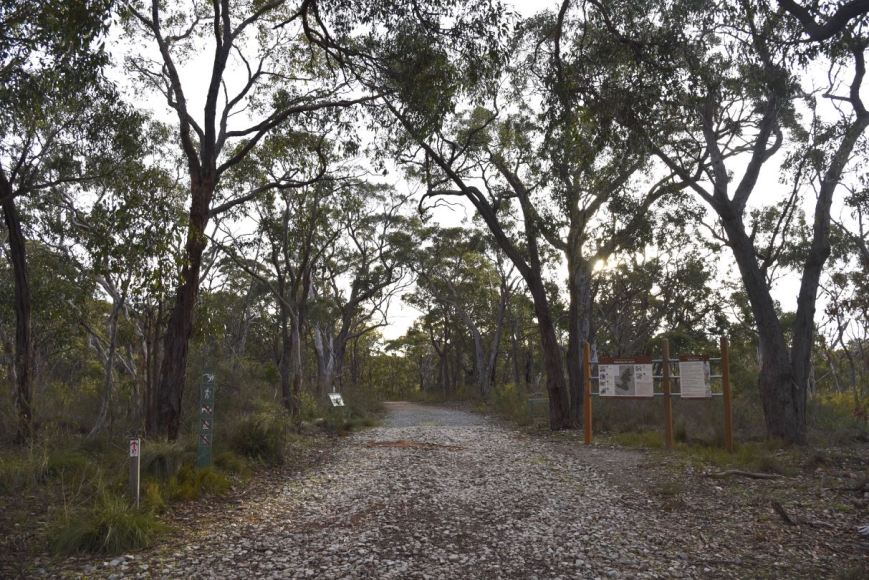
I turned up Moores Road and soon reached the eastern side of the park. I continued along Moores Road and parked at the carpark at the end of Moores Road. Although some maps may show that Moores Road continues, it does not. There is a locked gate here and only foot traffic is allowed from this point on.
The Morialta Conservation Park is about in size and was established on the 15th day of July 1915. The park consists of a narrow gorge with three waterfalls, bounded by steep ridges and cliffs. Morialta is believed to be an aboriginal Karuna word moriatta meaning “ever flowing” or “running water”,


The park is bounded by Black Hill Conservation Park on the north, Norton Summit road on the south, the suburb of Rostrevor on the west, and by agricultural land on the east. The park caters for a variety of activities, including bushwalking, picnics, rock climbing and bird watching

Above:- An aerial view of the Morialta Conservation Park looking west back towards the city of Adelaide. Image courtesy of Google Maps.
John Smith Reid was a major landholder in the area. In 1911, he offered to donate part of his land as a national reserve. In 1913 Reid donated 218 hectares (540 acres), and in 1915 the area was declared a National Pleasure Resort.

Above:- Newspaper article from the Adelaide Register, Fri 18th April 1913
Much of the construction work in the park was commenced in the 1920s and 1930s, although floods and bushfires have destroyed much of this original work. In 1966 additional property to the east was added, and the park was declared a National park. In 1972 the park was re-proclaimed as Morialta Conservation Park.


There are a number of walks in the park with all tracks being well signposted. There are also a number of information boards.


Birds SA have recorded about 92 species of native bird in the park including Yellow-tailed Black Cockatoo, Adelaide Rosella, Rainbow Lorikeet, Superb Fairywren, New Holland Honeyeater, Striated Pardalote, Black-winged Currawong, Australian Magpie, Magpie-lark, Little Raven, Little Buttonquail, Shining Bronze-Cuckoo, Chestnut-rumped Heathwren, Yellow-rumped Thornbill, and Restless Flycatcher.

The video below will give you a good idea on the beauty of this park.
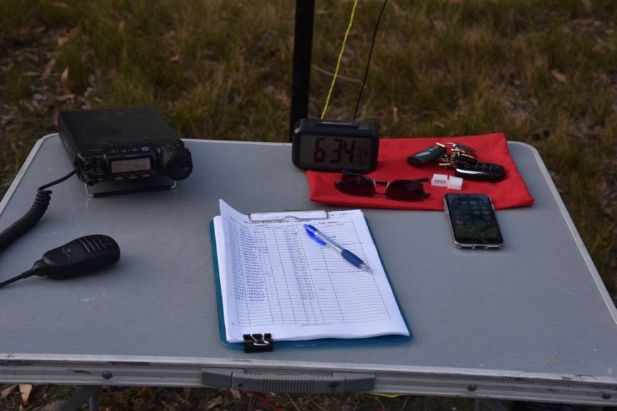
I set up on the edge of Third Falls Track. It was just a short walk from the vehicle and there was plenty of room to string out the 20/40/80m linked dipole.

Above:- Aerial shot of the Morialta Conservation Park showing my operating spot. Image courtesy of Protected Planet.
I called CQ on 7.144 with Peter VK3PF being first in the log, followed by Deryck VK4FDJL, and then a Park to Park with Nik VK3ZNK/p who was in the Yarrawonga Regional Park VKFF-0981. Despite it being a weekday, there was a steady flow of callers. It is a testament as to how popular the WWFF program has become in Australia nowadays. Within half an hour I had 33 stations in the log.
I moved down to the 80m band to 3.610 and asked if the frequency was in use. John VK5BJE came back to advise he and others had been waiting for me. I was then called by Hans VK5YX, Ian VK5CZ in the Clare Valley, and Tony VK5FBIC.
I then saw a spot pop up on parksnpeaks on 40m for Mike VK6MB/3 who was activating a park. So I quickly lowered the squid pole and took out the links and headed to 7.144. I logged Mike who was in the Tragowel Swamp Nature Conservation Reserve VKFF-2216.
After logging Mike I moved back down to 80m where I logged two stations, Keith VK3MKE and Nik VK3ZNK/p in the Yarrawonga Regional Park VKFF-0981 for a second band.


I then saw another spot pop up for Angela VK7FAMP. So it was back to 40m where I spoke with Angela who was in the St Helens Conservation Area VKFF-1153. This was my fourth Park to Park for the activation.
I then tried my luck on the 20m band but was to be sadly disappointed. The 20m band has been incredibly poor of late and today was no exception. I tried 14.310 the normal WWFF calling frequency in Australia, but I was being drowned out by the Over the Horizon Radar. So I moved down to 20m and called CQ which was answered by Matt VK1MA. Matt was 5/5 and gave me a 3/3. About 5 minutes more of CQ calls yielded no callers on that band.
So it was back to 40m where I called CQ on 7.140. Peter VK2UXO was the first to call with his normal big signal. Next was Andrei ZL1TM in New Zealand who is a regular park hunter. I logged a further 6 stations and whilst monitoring parksnpeaks I saw a spot for Gerard VK2IO/5 just below me. I moved down to 7.135 and logged Gerard, Park to Park from the Granite Island Recreation Park VKFF-1711.
To conclude the activation I moved back up to 7.140 where I logged a further 9 stations.
I had 60 contacts in the log and the temperature had now dropped to 9 deg C. It was time for me to pack up and head off for a bush walk through the park.
I worked the following stations on 40m SSB:-
- VK3PF
- VK4FDJL
- VK3ZNK/p (Yarrawonga Regional Park VKFF-0981)
- VK5CZ
- VK5BJE
- VK3SQ
- VK3MPR
- VK2NP
- VK2VW
- VK3DBP/2
- VK4NH
- VK4DXA
- ZL4TY/VK4
- VK3ALA
- VK4MWB
- VK3PAT
- VK4RF
- VK4HA
- VK2DWP/m
- VK4HNS
- VK4FOMP
- VK4TJ
- VK4/AC8WN
- VK4/VE6XT
- VK5YX
- VK6KJ
- VK6EA
- VK5FBIC
- VK5SF
- VK2AD
- VK2YK
- VK7LG
- VK2MGM
- VK6MB/3 (Tragowel Swamp Nature Conservation Reserve VKFF-2216)
- VK7FAMP/p (St Helens Conservation Area VKFF-1153)
- VK2UXO
- ZL1TM
- VK4FARR
- VK1MA
- VK3ARH
- VK2LEE
- VK5KLD
- VK4FAJP
- VK2IO/5 (Granite Island Recreation Park VKFF-1711)
- VK7ALH
- VK7XDM
- VK3XDM/7
- VK7FRJG
- VK2PKT
- VK5HV
- VK2OQ/m
- VK3MCK
- VK3IO
I logged the following stations on 80m SSB:-
- VK5BJE
- VK5YX
- VK5CZ
- VK5FBIC
- VK3ZNK/p (Yarrawonga Regional Park VKFF-0981)
- VK3MKE
I worked the following station on 20m SSB:-
- VK1MA
I went for a stroll along Moores Track which is well signposted.
Along the way, I enjoyed some fine views through the trees.


A bit further along the track, I came to a cleared area for power lines which assisted in a less obstructed view of the surrounding countryside.


I then walked back to the car and took a drive along Montacute Road, stopping every now and again to admire the views and take a few photographs.


I also stopped off to have a look at the historic St Pauls Church at Montacute which was consecrated on the 9th day of March 1886.


The church sits on the top of an impressive hill with some terrific views of the surrounding countryside.


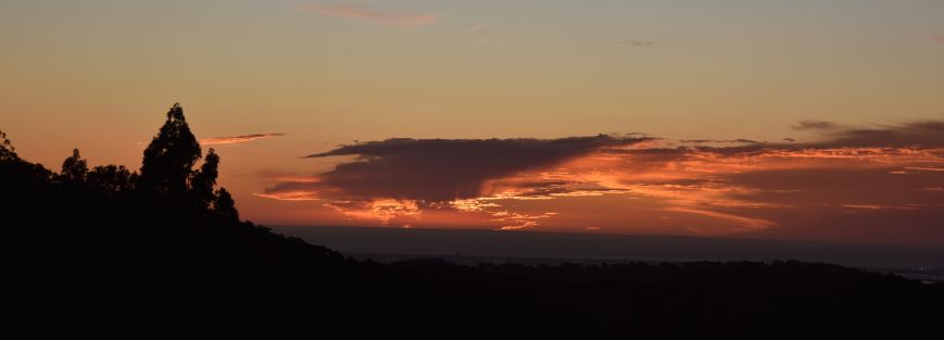
I was getting hungry and headed for home, enjoying a quite spectacular sunset.
References.
Birds SA, 2019, <https://birdssa.asn.au/location/morialta-conservation-park/>, viewed 1st July 2019
The Heysen Trail, 2019, <https://heysentrail.asn.au/trailwalker/article/the-morialta-barns/>, viewed 1st July 2019
Wikipedia, 2019, <https://en.wikipedia.org/wiki/Morialta_Conservation_Park>, viewed 1st July 2019
