Bandon Conservation Park 5CP-263 and VKFF-0999

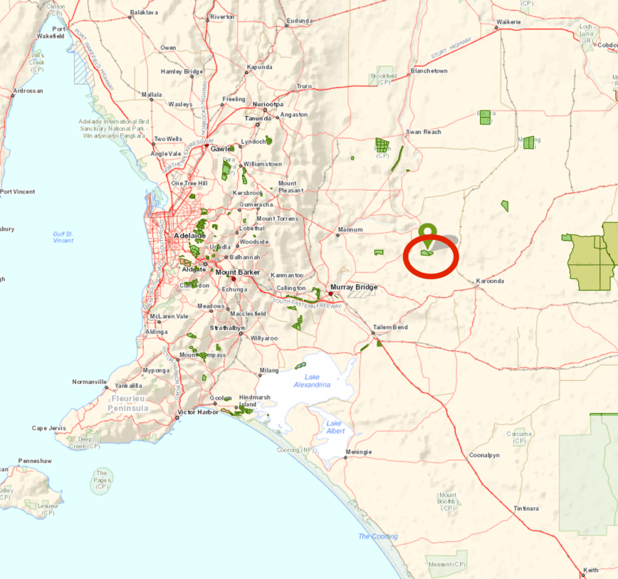
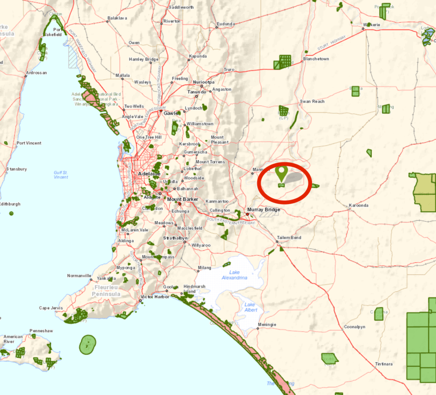
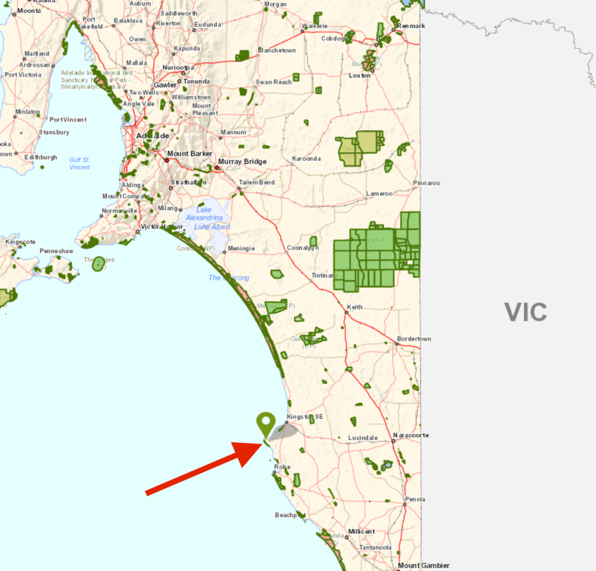
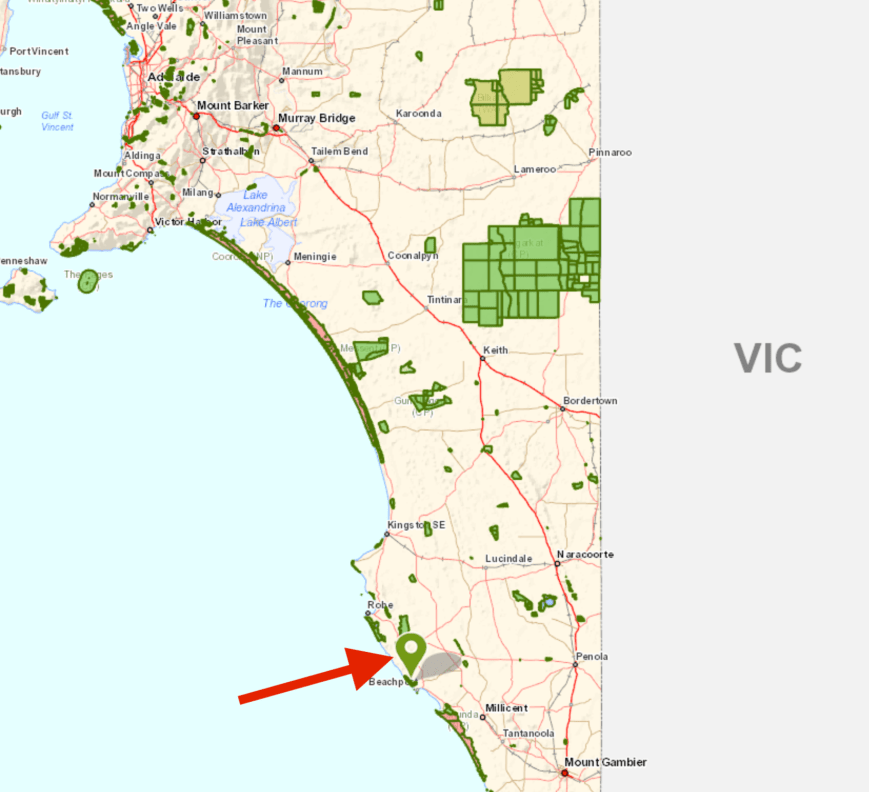
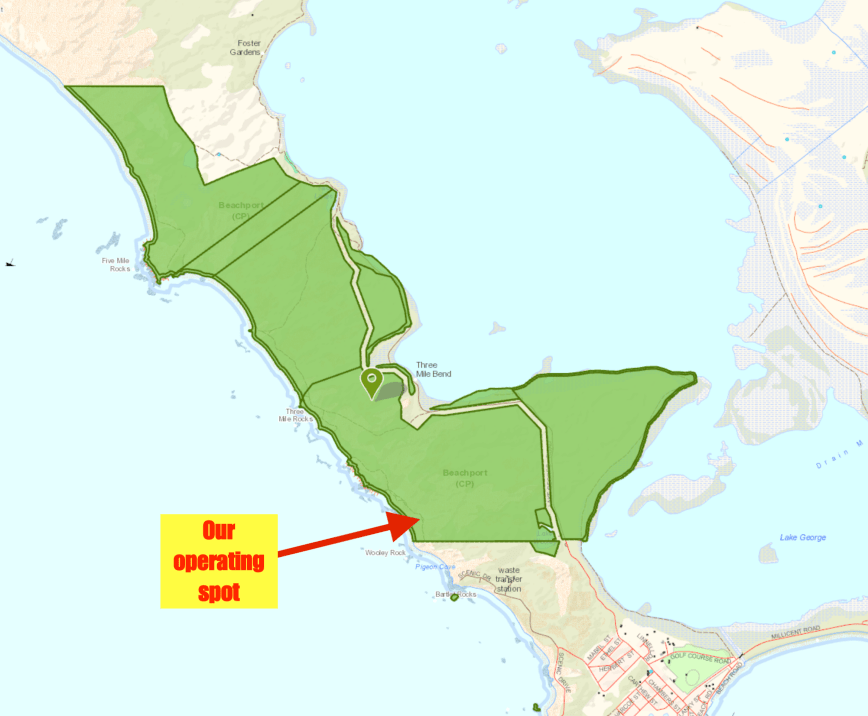
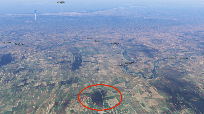
My third and final planned park activation for the day was the Bandon Conservation Park 5CP-263 & VKFF-099  which is located about 16 km east of the town of Copeville and about 130 km east of the city of Adelaide. 

Screen Shot 2018-04-03 at 11.51.28 am.png

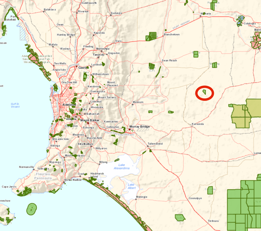
Above:- Map showing the location of the Bandon Conservation Park.  Map courtesy of Location SA Map Viewer.

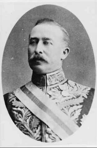
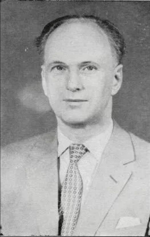
The park is about 700 hectares in size and was proclaimed on the 22nd August 2013.  It is named after the The Hundred of Bandon in which it is located.  The Hundred of Bandon was named after the birthplace in Ireland of Sir George Strickland Kingston (1807-1880), engineer and politician who emigrated to Australia in the 1830’s.

B5030

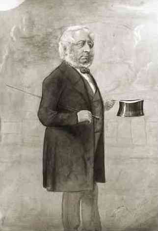
Above:- Sir George Strickland Kingston.  Image courtesy of wikipedia.

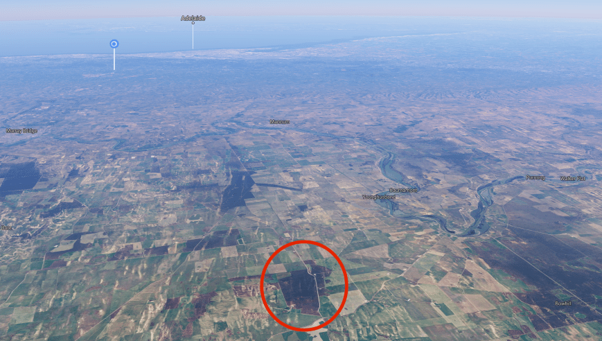
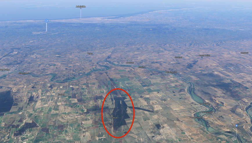
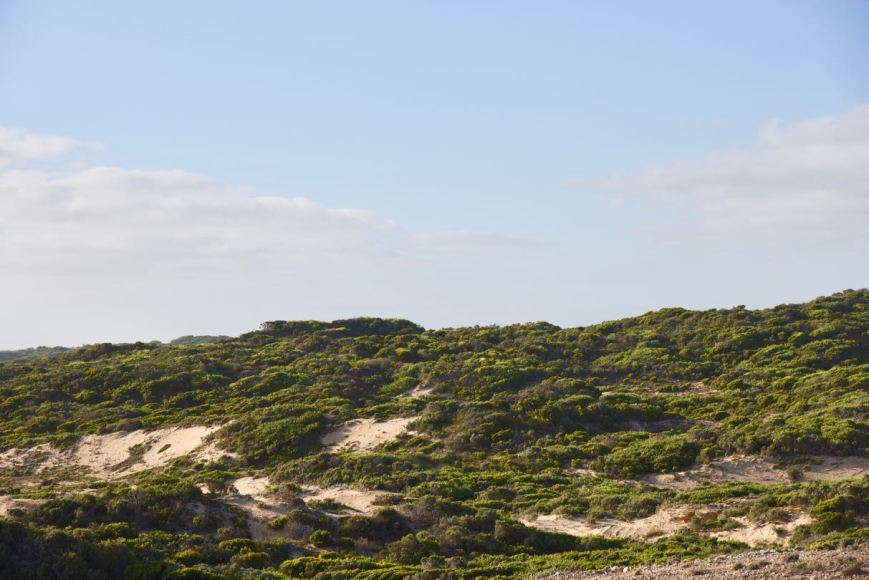
The park comprises of typical mallee country and is surrounded by cleared land for farming.

Screen Shot 2018-04-01 at 8.27.04 pm

Above:- Aerial shot showing the Bandon Conservation Park and the surrounding countryside.  Image courtesy of google maps

I found the mallee vegetation in Bandon to be a little lower in height compared to Ettrick and Lowan.  The soil here was very sandy, which made it a lot easier for me to drive the squid pole holder into the ground.

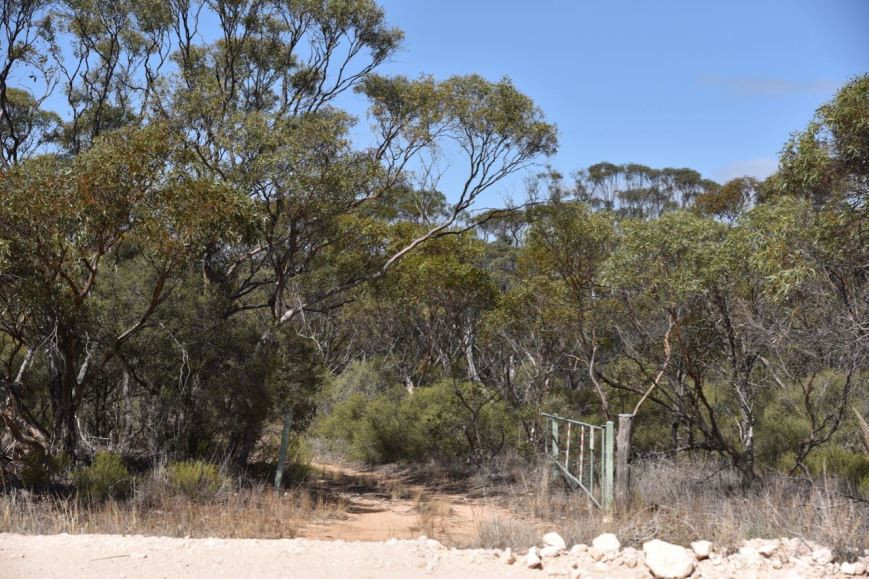
The park is a little piece of remnant mallee in the area which otherwise has been cleared for farming.  The photo below shows the park boundary, with the scrub to the right, and the stark contrast of the cleared cropping land to the left.

DSC_0696

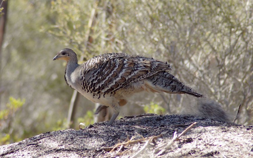
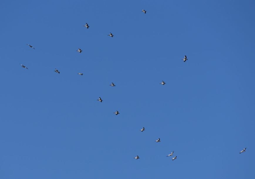
It was still pretty warm so most of the birds in the park were no doubt seeking the shade.  But I did spot these Crested Pigeons.

DSC_0705

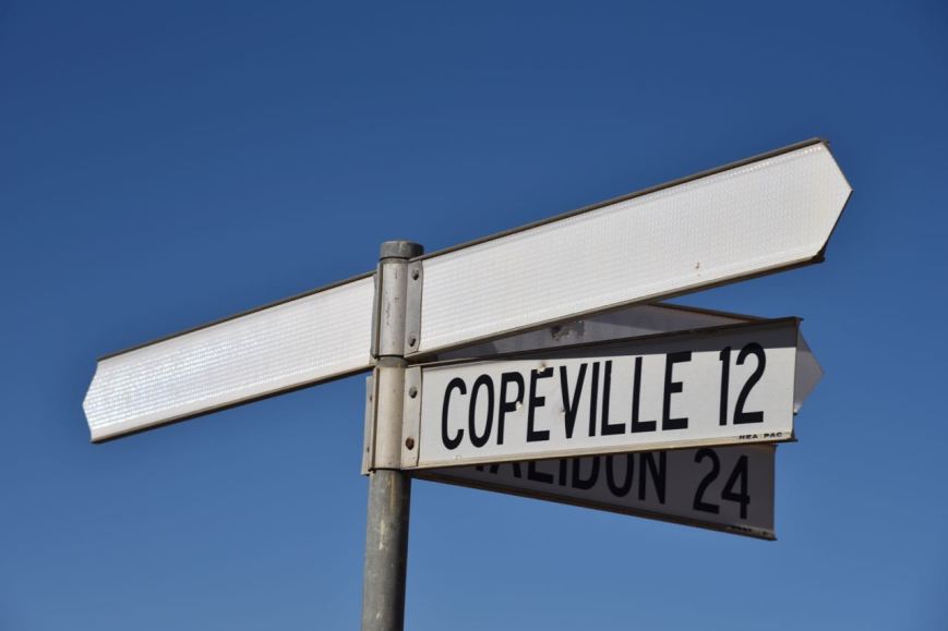
To get to the park from Lowan I travelled east on Gribble Bore Road onto Rosenzweig Road and then turned left onto Perponda Road.  I stopped briefly in Perponda.  Don’t blink as you will miss Perponda, which consists of just a house or two and an old hall.  Perponda was proclaimed on 1st May 1919, and is a corruption of the Aboriginal word  ‘peraparna’ meaning  ‘rain water’.  There is a small memorial plaque here for the Perponda School which opened in 1924 and closed in 1942.

My next brief stop was a little further up the road at Kalyan, which was proclaimed on the 10th August 1933.  Kalyan is anAboriginal word meaning ‘you stop here’.  The Kalyan School opened in 1922 and closed in 1952.  There is a small memorial plaque here for the old school.

As it was a warm day there were quite a few Sleepy Lizards out on the road enjoying the sunshine.  Fortunately I did not see any snakes.

DSC_0687

Signage out here I found to be very poor.  Many of the signs had faded and the place names and road names were very hard to see.

I turned right onto Walshs Bore Road from the Perponda Road and then continued east on Kadie Bore Road.

DSC_0690

Above: an example of the faded signs

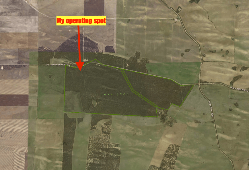
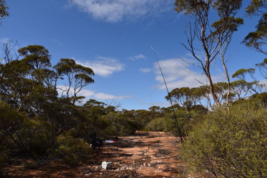
I soon reached the north western corner of the park.  The park is not signposted.  Well I certainly could not find a park name signpost.  There was a sandy 4WD track following the western boundary of the park but I continued along Kadie Bore Road and followed a sandy track on the eastern side of the park for a few hundred metres off the road.  I set up underneath the shade of a tree.  

Screen Shot 2018-04-03 at 11.50.54 am.png

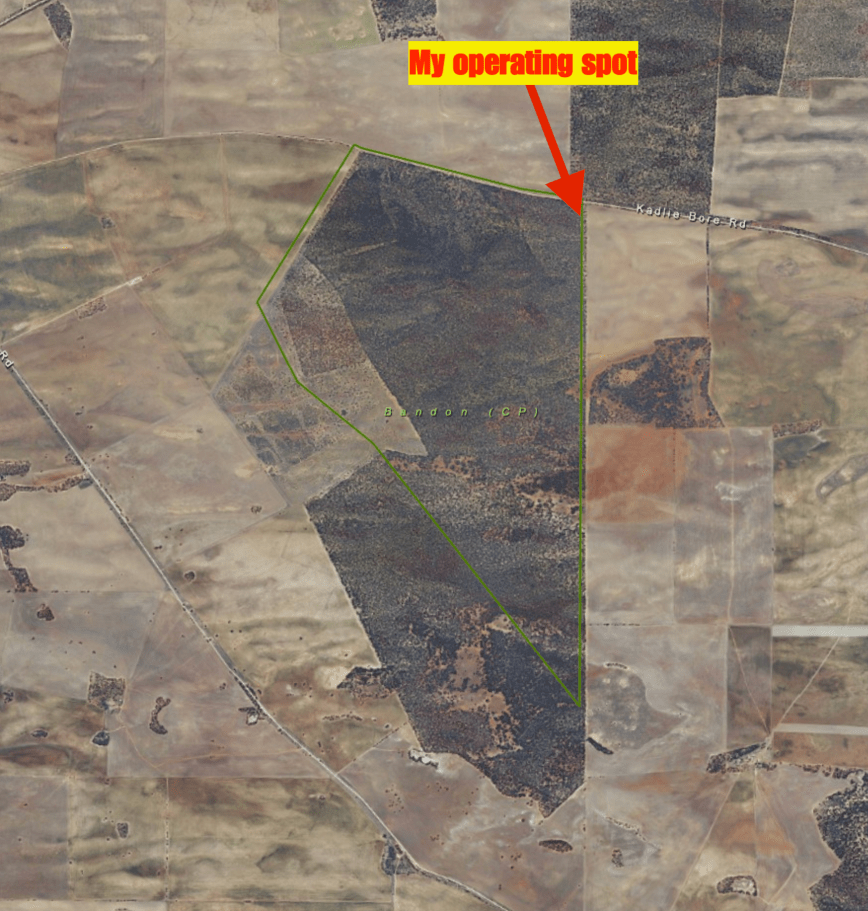
Above:- Aerial shot of the Bandon Conservation Park showing my operating spot in the north eastern corner.  Image courtesy of Location SA Map Viewer.

I headed to 7.144 on the 40m band and called CQ.  Geoff VK3SQ in Beechworth answered my call, followed by Peter VK3PF, Dennis VK2HHA, and then Jim VK1AT.  The 40m band had really opened up nicely, with no fading detected and most signals being nice and strong.  Within 6 minutes I had qualifed the park for VKFF, with 10 contacts in the log.  Contact number ten being a QSO with Cliff VK2NP.

The band was quite busy, and was just opening up to Europe, so I experienced quite a bit of interference.  I was hoping to hear Yves ON8ON in Belgium who was activating a park, but sadly this was not to be.

I logged 40 stations on 40m before heading off to 20m hoping to get some European long path action.  I ended up logging a total of 11 stations on 20m including two DX contacts: Gianluca IK4LZH in Italy, and Max IK1GPG in Italy.

To finish off the activation I put out a few CQ calls on 3.160 on the 80m band.  I logged 5 stations there, from VK3 and VK5.  Again, despite band conditions on 80m being quite good, there were not a lot of callers there.

It was now just after 4.00 p.m. local time and I decided to pack up and head home.  I had a total of 56 contacts in the log at Bandon, and a unique park for me under my belt as an activator for WWFF/VKFF and the VK5 Parks Award.

I worked the following stations on 40m SSB:-

  1. VK3SQ
  2. VK3PF
  3. VK2HHA
  4. VK1AT
  5. VK2EXA
  6. VK3AHR
  7. VK3FRAB
  8. VK4TJ
  9. VK3ZPF
  10. VK2NP
  11. VK3ZMD
  12. VK3RW
  13. VK2PKT
  14. VK3TKK/m
  15. VK3BBB
  16. VK4NH
  17. VK4DXA
  18. ZL4TY/VK4
  19. VK3YB
  20. VK3KMH
  21. VK2LEE
  22. VK3UP
  23. VK5KLV
  24. VK4FDJL
  25. VK3KTO
  26. VK4HNS
  27. VK3KKP/2
  28. VK2FF
  29. VK1DI
  30. VK2KYO
  31. VK2YW
  32. VK4AAC/2
  33. VK3VVC
  34. VK7JON
  35. VK7FOLK
  36. VK3FMKE
  37. VK2NEO
  38. VK3FLES
  39. VK4SMA
  40. VK3KMA

I worked the following stations on 20m SSB:-

  1. VK4SMA
  2. VK4TJ
  3. VK4/AC8WN
  4. VK4/VE6XT
  5. VK4NH
  6. VK4DXA
  7. ZL4TY/VK4
  8. VK6GLX
  9. IK4LZH
  10. VK3SX
  11. IK1GPG

I worked the following stations on 80m SSB:-

  1. VK5FMAZ
  2. VK3ZPF
  3. VK3SQ
  4. VK5FANA
  5. VK5BJE

Following the activation I decided to take a different route home, along the Karoonda Highway.  I stopped briefly in Karoonda, which is an aboriginal word meaning ‘winter camp.  The town is located in the centre of the Murray Mallee region of South Australia.  The town has a population of around 600 people and was founded on wheat growing in the early 1900’s but is also well known for Merino sheep production.

There is a memorial in town for Constable Harold Pannell who was shot and killed on duty back in March 1957.  Pannell had attended a property to serve a warrant on John Fischer for the seizure of property after Fischer had failed to pay damages awarded against him in a court case.

I also had a brief look at Karoonda Pioneer park which has a very interesting collection of old buidlings, railcars, and other memorabillia.

After leaving Karoonda I worked Brett VK3FLCS/p on 40m.  Brett was activating the Tooborac Nature Conservation Reserve VKFF-2212, and had a good signal into the mobile.

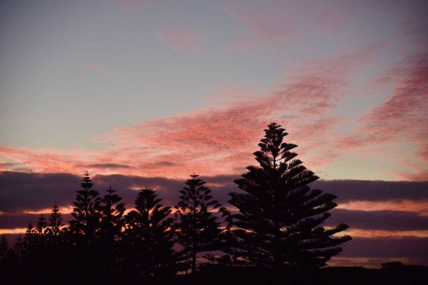
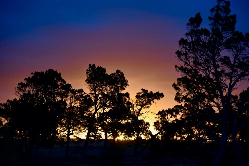
I continued on my journey back home, arriving home just after tea.  Along the way I enjoyed a magnificent sunset.  I had a terrific day, with three parks activated and a total of 178 QSOs.  THANKS to everyone who called, and a big THANKS to those who took the time to spot me on parksnpeaks, Facebook, etc, as I had virtually no internet coverage all day.

DSC_0720


References.

Cockburn; R, 2002, ‘South Australia.  What’s in a Name?”

Monument Australia, 2018, <https://monumentaustralia.org.au/themes/people/crime/display/50966-senior-constable-harold-rae-pannell> viewed 3rd April 2018

State Library South Australia, 2018, <http://www.slsa.sa.gov.au/digitalpubs/placenamesofsouthaustralia/>, viewed 3rd April 2018

Wikipedia, 2018, <https://en.wikipedia.org/wiki/Bandon_Conservation_Park>, viewed 3rd April 2018

Wikipedia, 2018, <https://en.wikipedia.org/wiki/Karoonda,_South_Australia>, viewed 3rd April 2018

Lowan Conservation Park 5CP-121 and VKFF-1052

My second park of the day was the Lowan Conservation Park 5CP-121 & VKFF-1052 which is located about 20 km north west of the town of Karoonda and about 151 km from Adelaide.

Screen Shot 2018-04-03 at 10.48.10 am.png

Above:- Map showing the location of the Lowan Conservation Park in the Murray Mallee region of South Australia.  Map courtesy of Location SA Map Viewer.

Lowan’s total area is about 675 hectares and consists of Hundred of Bowhill – Sections 71 and 73.  The park was purchased on the recommendation of the Land Board and National Parks Council recommendation.  The then private owners of the land were anxious to see scrub remain on the block.  Section 71 was proclaimed on 9th September 1971 as Lowan National Park.  It became Lowan Conservation Park on 27th April 1972.  Section 73 was added on 2nd August 1973.

Screen Shot 2018-04-01 at 8.32.12 pm.png

ABove:- Aerial shot of the Lowan Conservation Park (in the foreground) and the surrounding countryside.  Image courtesy of google maps.

Vegetation habitats within the park include

  • Tall open scrubland with Mallee Honey-myrtle (Melaleuca acuminata), Dryland Tea-tree (M. lanceolata), Red Mallee (Eucalyptus socialis) and Narrow-leaved Mallee (E. leptophylla)
  • Very open mallee with Ridge-fruited Mallee (Eucalyptus incrassata) and Dune Tea-tree (Leptospermum coriaceum)

There have been a total of 88 species of native bird recorded in the park by Birds SA.  This includes Common Bronzewing, Spiny-cheeked Honeyeater, White-eared Honeyeater, Yellow-rumped Thornbill, Weebill, White-winged Chough, Striped Honeyeater, Yellow Thornbill, Chestnut Quailthrush, Gilbert’s Whistler, Magpielark, andSouthern Scrub Robin.

Also located in the park is the Malleefowl, also known as Lowan.  It is from this bird that the park takes its name.

Leipoa_ocellata_-Ongerup,_Western_Australia,_Australia-8.jpg

It only took me a short time to get to Lowan from Ettrick.  I travelled along Glenbur Road and turned right onto Piggy Flat Road and then left onto the Bowhill Road.  I then turned right onto Gribble Bore Road.   There is an old windmill and stone water tank on the corner, so it’s not hard to miss this corner.  There is also a plaque here to commemorate the sealing of the Bowhill Road.

I soon reached the north western corner of the park.   A little further along Gribble Bore Road there is an unlocked gate and a 4WD track which takes you into the park.

DSC_0672

Above:- the gate and track leading into the park.

I drove a few hundred metres down the track and found a clearing in the scrub.  The day had really warmed up and it was now approaching 30 deg C, so I chose the shade of some trees for my operating spot.  I ran the Yaesu FT-857d, at 40 watts, and the 20/40/80m linked dipole for this activation.

Screen Shot 2018-04-03 at 11.47.23 am.png

Above:- Aerial shot of the Lowan Conservation Park, showing my operating spot.  Image courtesy of Location SA Map Viewer.

First in the log again was Peter VK3PF with a strong 5/9 signal, followed by Dave VK2RP/m with a great signal coming out of his mobile station.  I had ten contacts in the log within 9 minutes, that being a QSO with regular park hunter Keith VK2PKT who was roaring in with a 5/9 plus from Parkes in New South Wales.

The 40m band was still a little unstable, with considerable amounts of fading (QSB) on most signals.  But there were still plenty of park hunters lining up to get Lowan in their logs.

Park to Park activity had been scarce during the day, despite it being a public holiday.  This was in contrast with Easter Sunday, when there had been a huge amount of park activity.  Sadly I was working that day.  But 17 contacts into the activation, and I had a few Park to Park contacts.  These being with John VK3CU/p and Victoria VK3LO/p who were in the Jilpanger Nature Conservation Reserve VKFF-2118 in western Victoria.  I’m glad I worked them when I did, with 5/9 plus signals, as 10 minutes later when I had a listen their signals had dropped right down.

About two dozen QSOs later I was called by Peter VK2KNV/p who was in the Lachlan Valley Regional Park VKFF-1784.

I logged a total of 52 stations on 40m before things slowed down a little, which was fortuative, as I had been told Sue VK5AYL was up on 7.155 in a park.  So I headed there and logged Sue who was activating the Clements Gap Conservation Park VKFF-0812.  Sue was roaring in with a 5/9 plus signal.  This was Sue’s first ‘solo’ park activation.  And while on the topic of Sue, can I remind everyone of Sue’s excellent parksnpeaks app.  The ParksnPeaks app allows (Australian & NZ) amateur radio operators to alert, spot and chase portable radio activity.

1200x630bb.jpg

I then moved back to 7.144 and called CQ again.  This was answered by Les VK3FLES, followed by Mark VK3FBOM.  This was Mark’s first every contact on HF.  I explained to Mark all about the park’s programs, and he seemed very keen.  Hopefully we will hear Mark out and about one day soon.

I logged a further 4 stations on 40m from VK3 and VK5, before lowering the squid pole and removing the links in the linked dipole.  I headed to 14.310 on the 20 band and found Rob VK4SYD/p in the Hays Inlet Conservation Park VKFF-1555.  Rob had a strong 5/9 signal from Queensland.

I then moved up to 14.315 and was called by Peter VK3PF who kindly spotted me on parksnpeaks, as I had no internet coverage from the park.  I logged a further 4 calls on 20m, before heading off to 3.610 on the 80m band where I logged just the one station, Wolf VK5WF in Adelaide who was 5/9.

It was now a little after 1.30 p.m., so I packed up and headed off to my third and final park of the day, the Bandon Conservation Park.  I had a total of 66 contacts in the log at Lowan.

I worked the following stations on 40m SSB:-

  1. VK3PF
  2. VK2RP/m
  3. VK2BDR/m
  4. VK3SQ
  5. VK3AHR
  6. VK3BBB
  7. VK2LEE
  8. VK4HNS
  9. VK3FRAB
  10. VK2PKT
  11. VK2HHA
  12. VK3FLES/m
  13. VK2NP
  14. VK2FADV/4
  15. VK3FMKE
  16. VK2IO
  17. VK3CU/p (Jilpanger Nature Conservation Reserve VKFF-2118)
  18. VK3LT/p (Jilpanger Nature Conservation Reserve VKFF-2118)
  19. VK4NH
  20. VK4DXA
  21. ZL4TY/VK4
  22. VK1AT
  23. VK3UCD
  24. VK4TJ
  25. VK4/AC8WN
  26. VK4/VE6XT
  27. VK3LBT
  28. VK3BCM
  29. VK3FIAN
  30. VK3ARH
  31. VK3ZGC
  32. VK4AAC/2
  33. VK5KLV
  34. VK2NEO
  35. VK3TKK/m
  36. VK3YSA
  37. VK3HOT
  38. VK7JPN
  39. VK3WAR
  40. VK4FDJL
  41. VK2KNV/p (Lachlan Valley Regional Park VKFF-1784)
  42. VK2EXA
  43. VK7AN
  44. VK3YB
  45. VK5FMAZ
  46. VK2KYO
  47. VK3TP
  48. VK7RN
  49. VK5BJE
  50. VK5HS
  51. VK3CWF
  52. VK2SR
  53. VK5AYL/p (Clements Gap Conservation Park VKFF-0812)
  54. VK3FLES
  55. VK3FBOM
  56. VK5WF
  57. VK5PL
  58. VK5KLD
  59. VK3VIN

I worked the following stations on 20m SSB:-

  1. VK4SYD/p (Hays Inlet Conservation Park VKFF-1555)
  2. VK3PF
  3. VK4TJ
  4. VK4NH
  5. VK4DXA
  6. ZL4TY/VK4

I worked the following stations on 80m SSB:-

  1. VK5WF


References.

Birds SA, 2018, <https://birdssa.asn.au/location/lowan-conservation-park/>, viewed 3rd April 2018

Foulkes, J.N. & Gillen, J.S. 2000, ‘A Biological Survey of the Murray Mallee South Australia’.

Wikipedia, 2018, <https://en.wikipedia.org/wiki/Lowan_Conservation_Park>, viewed 3rd April 2018

Ettrick Conservation Park 5CP-267 and VKFF-1029

Yesterday, Easter Monday (2nd April 2018), Marija went out for lunch with a girlfriend, so I headed out into the field to activate three Mallee parks.  Two of these, Ettrick & Lowan, I had activated before for both WWFF and the VK5 Parks Award.  But Bandon Conservation Park was to be a first for me.  I had a bit of a drive ahead.  In fact during the day I covered a distance of around 286 km.

Screen Shot 2018-04-02 at 7.40.47 pm.png

Above:- Map showing my route for the day.  Map courtesy of plotaroute.com

My first park for the day was the Ettrick Conservation Park 5CP-267 & VKFF-1029 which is located about 35 km north east of the town of Murray Bridge and about 112 km east of the city of Adelaide.

Screen Shot 2018-04-03 at 9.41.03 am.png

Above:- Map showing the location of the Ettrick Conservation Park.  Map courtest of Location SA Map Viewer.

The park is 479 hectares in size and was gazetted on the 31st October 2013.  It is named after the Hundred of Ettrick, which was proclaimed on 4th May 1893.  It was named by Governor Kintore who hailed from Scotland where there is a ‘Parish of Ettrick’ in Selkirk, derived from the Gaelic eadar-dha-eas – ‘between two waterfalls’.  There are certainly no waterfalls out here at Ettrick.  It is typical harsh mallee country.  There is also a place called Ettrick in the Mid North of South Australia, near Riverton.

B5986.jpg

Ninth Earl of Kintore, Governor Kintore.  Image courtesy of adb.anu.edu.au

The park is a piece of remnant mallee which is surrounded by cleared farming land.  The park is located in relatively close proximity to the mighty Murray River (which can be seen in the image below, to the right of the picture).

Screen Shot 2018-04-01 at 8.28.37 pm.png

Above:- Aerial shot showing the Ettrick Conservation Park in the foreground.  Image courtesy of google maps.

The park consists mostly of Low Very Open Woodland with Mallee Box with Dryland Tea-treeIt is also home to one of the few remaining examples of tussock grassland in this particular part of the Murray-Darling Basin.

More than 65 species of bird have been recorded in the park by Birds SA.  This includes Mallee Ringneck, Galah, Spiny-cheeked Honeyeater, Spotted Pardalote, White-browed Babbler, White-winged Chough, Peaceful Dove, Purple-backed Fairywren, Splendid Fairywren, Grey Butcherbird, Black-faced Cuckooshrike, and Gilbert’s Whistler.

During my visit to the park I took the photos below of a Whistling Kite and also a Brown Falcon.  The Falcon, he/she was kind enough to sit up in the tree long enough for me to take a few shots.

After leaving Murray Bridge I took the Burdett Road and then turned right onto the Bowhill Road.  About 4 km up the road I turned left onto Boundary Road.   The western boundary of the park soon came into view.  There is a lot of other scrub surrounding and adjacent to the park.  I wonder whether one day this will be incorporated into Ettrick.

I headed to Glenburr Road and found an entry into the park.  I drove a short distance along the track and found a clearing in the scrub and set up.

Screen Shot 2018-04-03 at 10.10.06 am.png

Above:- Aerial shot of the Ettrick Conservation Park.  Image courtesy of Location SA Map Viewer.

After setting up I put our a call on 7.144 to see if the frequency was in use.  A few voices came back to me to advise the frequency was clear.  One of the those was Peter VK3PF with a strong 5/9 signal.  I then logged Ron VK3AHR, followed by Geoff VK3SQ and then Neil VK4HNS.  Contact number 10, qualifying the park for me for the VKFF program, was a a QSO with Hans VK6XN in Western Australia.  This came ten minutes into the activation.

I was then called by VK3VG who asked if I wouldn’t mind moving frequency as the Old Timers broadcast was about to commence on 7.146.  So I moved down to 7.140 where I logged Jern VK2KJJ, Graeme VK3PGK, John VK4TJ, and then Keith VK2PKT.

Band conditions on 40m were average, with quite a bit of fading (QSB) on most signals.  However it was pleasing to have a steady flow of callers from all across Australia.  My 44th contact, qualifying the park for the global WWFF program, came with a QSO with Jarrad VK3BL, about 50 minutes into the activation.

DSC_0612

I logged a total of 47 stations on 40m, before lowering the squid pole and removing the links and then heading to 14.310 on the 20m band.  Unfortunately I had no internet coverage so I was unable to self spot on parksnpeaks.  I called CQ and this was answered by Russell VK4ARW, followed by Stuie VK8NSB in Darwin who had a strong 5/9 signal, and then Mark VK4SMA.  John VK4TJ followed, and then Snow VK4ME.  But despite 5 minutes more of CQ calls, I had no further takers.

John VK4TJ told me that Liz VK2XSE was in a park and was on 7.170.  So it was down with the squid pole and back in with the links, and off to 40m.  I logged Liz VK2XSE/p who was in the Lachlan Valley Regional Park VKFF-1784.  Liz had a strong 5/8 signal and reciprocated with a 5/8 for me.

I then lowered the squid pole again and inserted the links for the 80m band.  I had just enough coverage on the mobile to give Marija a quick call, and she became contact number 1 on 80m.  David VK5HYZ then called in, followed by John VK5BJE.  Despite band conditions being very good on 80m around South Australia, I had no further callers.

To complete the activation I put up the 1/2 wave 15m dipole and put out a few calls on 21.244, but had no takers.

It was time to pack up and head off to my second park, the Lowan Conservation Park.  I had a total of 56 contacts in the log.

I worked the following stations on 40m SSB before the UTC rollover:-

  1. VK3PF
  2. VK3AHR
  3. VK3SQ
  4. VK4HNS
  5. VK2NEO
  6. VK3UCD
  7. VK4FDJL
  8. VK3NBL
  9. VK1TX
  10. VK6XN
  11. VK3VG
  12. VK2KJJ
  13. VK3PGK
  14. VK4TJ
  15. VK2PKT
  16. VK4AAC/2
  17. VK2IO
  18. VK2HHA
  19. VK7AN
  20. VK5FMAZ

I worked the following stations on 40m after the UTC rollover:-

  1. VK2FAD
  2. VK3FSPG
  3. VK3MPR
  4. VK2NP
  5. VK5BJE
  6. VK3SQ
  7. VK5IS
  8. VK3ARH
  9. VK4HNS
  10. VK1HW
  11. VK2KYO
  12. VK3TKK/m
  13. VK4NH
  14. VK4DXA
  15. ZL4TY/VK4
  16. VK5KLV
  17. VK4AAC/2
  18. VK4AAV
  19. VK2KNV/m
  20. VK2XSE/m
  21. VK3NLK/2
  22. VK2IO
  23. VK3AOF
  24. VK3BL
  25. VK2EJW
  26. VK3PF
  27. VK3KMA
  28. VK2XSE/p (Lachlan Valley Regional Park VKFF-1784)

I worked the following stations on 20m SSB:-

  1. VK4ARW
  2. VK8NSB
  3. VK4SMA
  4. VK4TJ
  5. VK4ME

I worked the following stations on 80m SSB:-

  1. VK5FMAZ
  2. VK5HYZ
  3. VK5BJE


References.

Birds SA, 2018, <https://birdssa.asn.au/location/ettrick-conservation-park/>, viewed 3rd April 2018

Murray Valley Standard newspaper, 2018, <http://www.murrayvalleystandard.com.au/story/1966160/ettrick-conservation-park-proclaimed/>, viewed 3rd April 2018

State Library of South Australia, 2018, <http://www.slsa.sa.gov.au/digitalpubs/placenamesofsouthaustralia/>, viewed 3rd April 2018

2018 CQ World Wide WPX Contest

Last weekend (Saturday 24th & Sunday 25th March 2018) I took part in the CQ World Wide WPX Contest.  The WPX Contest is based on an award offered by CQ Magazine for working all prefixes. Held on the last weekend of March (SSB) and May (CW), the contest draws thousands of entries from around the world.

wpx contest

My equipment was a Yaesu FT-2000, 100 watts and a TET Emtron TE-53 tri bander on 10, 15, & 20m, and my home brew 40m 1/2 wave dipole for 40m.

I found band conditions to be very poor.  Long path propagation to Europe on 20m was very poor.  The majority of my contacts were made on the 15m band.

  • 10m – 7 QSOs
  • 15m – 106 QSOs
  • 20m – 79 QSOs
  • 40m – 60 QSOs

I did not hear many South American stations, and those that I did, I was unable to get through to.  This included a Peruvian station on 40m.  That would have been a new country for me.  Nor did I hear many African stations.

But admittedly I did not make it an all nighter on either night during the contest.  So I probably missed the best time for the Africans on the short path to Australia.

My final tally was a total of 252 contacts on 10, 15, 20 & 40m SSB, with a claimed score of 152,663 points.

I picked up a few new countries on 40m.  But I missed out on many other new ones, with my 100 watts and dipole just not making it.

Below is a map showing my contacts during the contest.

Screen Shot 2018-03-28 at 6.42.53 pm.png

Below are my contacts in the Asian region.  The majority of these were made on 15m SSB.

Screen Shot 2018-03-28 at 6.44.29 pm.png

Below are my contacts in Europe and northern Africa.  The European contacts were made on 20m long path and 15m short path.  The two Moroccan stations (CN2AA & CN3A) had huge signals on 40m

Screen Shot 2018-03-28 at 6.46.15 pm.png

And finally here are my contacts in North America.  Most of these were made on 40m SSB during ‘our’ evening.  Some of the signals from the USA were huge.

Screen Shot 2018-03-28 at 6.46.41 pm

So it was only a meager effort on my part compared to the big gun stations.  Those in Australia who I heard active and doing very well included VK4KW, VK2AU, and VK4QH.

Good luck to all in the 2018 CQ WW WPX Contest

John Moyle Memorial Field Day 2018

The John Moyle Memorial Field Day (JMMFD) is held annually in March in memory of the late John Moyle, VK2JU.   The aim of the JMMFD is…..

“The aim is to encourage and provide familiarisation with portable and field operation, and provide training for emergency situations. The rules are therefore specifically designed and focussed to encourage field operations.”

For those who might be interested to read some history behind the man, in whose name the field day is named, you might find one of my previous posts interesting.  It can be found at…..

https://vk5pas.org/2016/03/20/john-moyle-memorial-field-day-2016/

There are a number of photographs there of John Moyle and lots of interesting history on this gentleman.

Screen Shot 2018-03-28 at 5.21.31 pm.png

I normally head out into the field to a park and operate portable for the JMMFD, but unfortunately this year I had to work dayshift on the weekend.  I was hoping to get out into the field on Saturday afternoon, but Saturday was rated as extreme for the potential of bushfires, so I decided to stay home.

I handed out a few numbers from home, going between the shack and the living room to get an update on the South Australian State election which was held that weekend.  I made a total of 78 contacts, all on 40m, with a claimed score of 108 points.

As of today (28th March 2018), a total of 124 logs have been received.  This includes fifteen (15) logs from South Australia (VK5).

Good luck to everyone who took part in the 2018 JMMFD.

The trip home and the Bernouilli Conservation Reserve VKFF-1684

After leaving the Little Dip Conservation Park and reinflating our tyres, we headed back towards Robe to refuel, before continuing on our way home.

As we travelled north on the Nora Creina Road we stopped briefly to have a look at ‘Dingley Dell’, a little freestone cottage which was built by George Kendle in 1861.  It was named after Mr. Wardle’s home in Charles Dickens’ novel, ‘The Pickwick Papers’.  Alexander Tolmer, previously Robe’s Superintendent of Police, moved here in 1865 when he became Crown Lands Ranger for the Guichen Bay district.  The poet Adam Lindsay Gordon, was a frequent visitor.  From the mid 1870’s Dingley Dell was the home of William and Anna Maria Dawson and their eleven children.  Their great grand daughter Helen, and her husbamd Ray Fulbohm have restored the old homestead.

DSC_0516

A little further up the road we stopped to have a look at the old CSIRO Field Station and Research Farm which operated between 1935 and 1976, was the site of research on pasture trace minerals deficiency in the diet of local sheep.

DSC_0519

We headed back into Robe and refuelled.  As we left Rove we stopped to have a look at the old Bush Inn, which was built in 1852 and licensed in 1855.  It was also known as Mac’s Hotel and Carrier’s Arms to 1871.

DSC_0521

We left Robe, travelling north on the Southern Ports Highway, and took a detour to Cape Jaffa to have a look at the new marina which is in development.  Whilst there we decided to do a quick activation of the Bernouilli Conservation Reserve VKFF-1684, from the vehicle.

Screen Shot 2018-03-16 at 7.52.09 pm.png

Above:- Map showing the location of the Bernouilli Conservation Park.  Map courtesy of Location SA Map Viewer.

Bernouilli Conservation Park is located just south of Cape Jaffa and extends south and south-east for just over 7km.  The park is about 266 hectares in size and was proclaimed on the 11th November 1993.  The park consists of a coastal dune system.  It is dominated by Tall Shrubland with Coast Beard-heath), Coast Wattle and Coast Daisy-bush.

The name of the park is derived from Cape Bernouilli, the former name of the headland of Cape Jaffa.

Over 40 species of bird have been recorded in the park including Musk Duck, Hooded Plover, Superb Fairywren, Singing Honeyeater, Rufous Bristlebird, Orange-bellied Parrot, Red-capped Plover,  Spiny-cheeked Honeyeater, Striated Fieldwren, and White-browed Babbler.

Screen Shot 2018-03-16 at 7.55.08 pm.png

Above:- Aerial shot of the Bernouilli Conservation Park.  Image courtesy of google maps.

We travelled to the end of Rothalls Road and soon found a park sign at the north eastern corner of the park.

Depending on what maps you look at, you may or may not see a road which follows the eastern boundary of the park.  We followed that road until we found a gap in the scrub and pulled the vehicle into the clearing.  We operated from the vehicle using the Icom IC-7000 and the Codan 9350 self tuning antenna mounted on the rear of the Toyota Hi Lux.

Screen Shot 2018-03-16 at 7.42.48 pm.png

Above:- Map of the park showing our operating spot.  Map courtesy of Location SA Map Viewer.

Upon turning on the transceiver we found Liz VK2XSE/p on 7.144 calling CQ from Barren Grounds Nature Reserve VKFF-1885.  Both Marija and I logged Liz, Park to Park.

We then moved down to 7.139 and I started calling CQ whilst Marija spotted me on parksnpeaks.  My first caller was Ron VK3AHR, followed by Peter VK3PF, and then Brian VK3BBB.  Contact number 10, qualifying the park for VKFF, was with Allen VK3ARH, about 10 minutes into the activation.  I logged just one more station, Geoff VK3SQ, before we decided we had better pack up and hit the road again.

DSC_0523

This is a park that Marija and I will need to go back to, so that Marija can qualify the park, and I can get my remaining contacts towards the 44 required to qualify the park for the WWFF global award.

Marija worked the following station on 40m SSB:-

  1. VK2XSE/p (Barren Grounds Nature Reserve VKFF-1885)

I worked the following stations on 40m SSB:-

  1. VK2XSE/p (Barren Grounds Nature Reserve VKFF-1885)
  2. VK3AHR
  3. VK3PF
  4. VK3BBB
  5. VK3OAK
  6. VK2QR
  7. VK3FT
  8. VK3UH
  9. VK2IO
  10. VK3ARH
  11. VK3SQ

After leaving the park we drove down to the foreshore area of Cape Jaffa.  We stopped briefly to have a look at the seafarers memorial.  This recognises lighthouse keepers, seafarers, and fisherman who have lost their lives in the Cape Jaffa area.

We took the Cape Jaffa Road out of town and soon reached the Southern Ports Highway and headed north.  At Reedy Creek we stopped to have a look at the police memorial re the murder of Trooper Harry Edmonds Pearce way back in 1881.

In 1881 Trooper Pearce  who was stationed at Kingston was ordered to escort a Robert Johnson alias William Nugent to court to appear on charges of having sold liquor to aborigines, and also for having been in possession of a stolen horse.   Trooper Pearce had escorted his prisoner for about 2 miles when Johnson dismounted from his horse and refused to go any further.  Johnson then tackled the trooper with a long knife and during the struggle Pearce’s hands were cut and he was unable to use his revolver.  Johnson proceeded to strike Pearce a number of times and attempted to cut his throat as the two wrestled together.  Upon being slashed to the abodomen Pearce became faint and then collapsed.  Johnson then turned the trooper’s horse adrift and left him to die. Pearce was found the next morning but died from his wounds on the 18th May 1881.  Many years ago I worked in the Police Force with the gt gt gt grand daughter of Pearce.

DSC_0532

We continued on to Kingston, where we stopped for a bite to eat and then continued on the Princes Highway, passing the Coorong.  Our next stop was at Jack Point where there is a Pelican Observatory Walk.  The bird hide overlooks a cluster of small islands where pelicans, terns, seagulls have established large permanent breeding colonies.  Sadly we didn’t see any pelicans.  We did observe some other waterbirds.

We had noticed during our trip that the Coorong was incredibly dry.  We have only had 10mm of rain this Summer and no doubt that has had a big impact.

But we did see dozens of Singing Honeyeaters.  And they were not easy to photograph.  They were very quick and just as I was about to take a shot, they would dart off to another shrub.  But I did manage to capture a few shots.

Once we got back onto the Princes Highway we did see a large flock of pelicans soaring in the breeze.  Perhaps they were heading to Jack Point?

DSC_0605.jpg

We arrived home around tea time on Monday night and commenced unpacking.  It had been a terrific 4 days away.  We had activated 8 South Australian parks and had made 531 contacts, which included about 124 Park to Park contacts.

THANKYOU to everyone who called us during our activations.


References.

Birds SA, 2018, <https://birdssa.asn.au/location/bernouilli-conservation-reserve/>, viewed 16th March 2018

Coorong Country, 2018, <https://coorongcountry.com.au/coorong-walking-trails/>, viewed 16th March 2018

National Trust, 2018, <https://www.nationaltrust.org.au/places/robe-csiro-research-station/>, viewed 16th March 2018

Wikipedia, 2018, <https://en.wikipedia.org/wiki/Bernouilli_Conservation_Reserve>, viewed 16th March 2018

4WDing in the Little Dip Conservation Park VKFF-0904

It was now Monday 12th March 2018 and time for us to head home.  After a relatively early start Marija and I headed down to the main street of Robe for a bite to eat.  We went to the Union Cafe and enjoyed a very nice cooked breakfast.  We then decided to head back to the Little Dip Conservation Park to do some 4WDing.  We had toyed with the idea of getting down onto the beach in the Coorong National Park, but decided on Little Dip instead.  And I’m pleased we did.  We were to have a great time.

We accessed the park via the Douglas Dawson Track which is at the end of Beacon Hill Road.  We took the short detour first to the top of Beacon Hill where there is a lookout which offers some great views of Robe and the surrounding countryside.

It was then into Little Dip.  We deflated the tyre pressure down to about 15 psi and headed off down the track, which initially started off quite rocky, but soon became sandy.

We decided whilst we were travelling through the park that Marija would put out a few calls on 40m to log a few stations from the mobile.  Marija was only on air for a short time, as the track became very bumpy and we decided 4 eyes on the track were better than 2.

Marija worked the following stations on 40m SSB:-

  1. VK3UH
  2. VK5ZPG
  3. VK3RW
  4. VK3SQ
  5. VK2JNG

A short distance along the track we came to a junction and sat there for a while pondering on which direction to go.  It was at that time that another 4WD pulled up.  It was a couple from Victoria, Phil and Bianca, and their son Mitchell.  They told us they had got bogged the day before, and we decided to team up and do the track together.

This slideshow requires JavaScript.

The track from Robe to Nora Creina is about 21 km.  We found it a little challenging in 2 parts, both of these being dune climbs.  The beach is also quite soft and boggy in parts.  The track takes you through sand dunes, rocky trails, and down onto the beach on a number of occasions.

We would highly recommend this 4WD trip if you are in the Robe area.  If you do decide to do the trip, remember:-

  • lower your tyre pressure down to 15-20 psi
  • If you become bogged it is very difficult to find someone to come and pull you out. It is therefore safer to travel with at least one other vehicle.
  • Phone coverage is often poor so you need to climb to the nearest high point to phone for help.

Screen Shot 2018-03-16 at 6.23.44 pm.png


Beachport Conservation Park 5CP-014 and VKFF-0791

After leaving the Lake Hawdon South Conservation Park, Marija and I headed down to the town of Beachport, about 47 km south of Robe.  As we travelled along Clay Wells Road on our way to the Southern Ports Highway we spoke to Ian VK1DI/p from the mobile.  Ian was activating the Cuumbeun Nature Reserve VKFF-1920 and had a strong 5/8 signal into the mobile.

We travelled south on the Southern Ports Highway and then took a short detour off the highway to have a look at the Woakwine Cutting.  This said to be Australia’s largest one man engineering feat.  The cutting was excavated to drain land behind the Woakwine Range.  During the 1880’s the McCourt family moved into the Woakwine area.  It was soon realised that without richer land to compliment the rocky high country, making a living on the land would be difficult.  In 1957 Murray McCourt commenced the construction of a channel from the swamp through the range to Lake George with a view fo draining a large swamp on his property.

There is a display of machines used to make the cutting and a viewing platform, but this was closed.  I had to drive down the road and then make my way through the scrub to get a view of the cutting.  It is an amazing piece of engineering.

Below is a video which gives you a good idea of this amazing feat.

We soon reached Beachport, a small town of around 880 people.  The town was named on 23 May 1878 for the then British Secretary of State for the Colonies, Michael Hicks Beach, 1st Earl St Aldwyn.  Beachport has a large crayfishing fleet, and is known for its 772-metre (2,533 ft)-long jetty.

We stopped off first to have a look at the Beachport Customs House which was used between 1879-1900.  It was originally located at the railway yards and was used to record incoming and outgoing goods.  Following Federation, the buidling was used as a railway office for goods and for men who travelled down in front of the train on a trolley to ensure that the tracks were clear.  Men would sleep overnight in the buidling and return back ahead of the train the following day.

We then drove along the Scenic Road in Beachport taking in some of the great views of the lighthouse, the town itself and the surrounding coastline.

There was plenty of activity down on the beach by 4WD enthusiasts.

DSC_0462

We decided to do a very quick activation of the Beachport Conservation Park 5CP-014 & VKFF-0791, but from the vehicle.

Screen Shot 2018-03-15 at 1.02.24 pm.png

Above:- Map showing the location of the Beachport Conservation Park.  Map courtesy of Location SA Map Viewer.

Beachport Conservation park is about  875 hectares (1.160 acres) in size and was established on 1st January 1959.  The conservation park was originally created as a reserve in 1959, declared as a National Park in 1959 and was re-proclaimed as a conservation park under the National Parks and Wildlife Act 1972 for the purpose of setting ‘aside to preserve and protect a representative sample of the coastal environment of south east South Australia.’

DSC_0465

We travelled along a sandy track at the end of Scenic Way and found a small clearing off the side of the track.  We didn’t want to venture too far, as the sand was very boggy and I didn’t plan on spending an hour or two digging our way out.

Screen Shot 2018-03-15 at 1.02.12 pm.png

Above:- Map of the Beachport Conservation Park showing our operating spot.  Map courtesy of Location SA Map Viewer.

I called CQ on 7.135 and this was answered by Hans VK5YX/2 who was in the Kosciuszko National Park VKFF-0269.  It was relatively slow going from the vehicle, with signals being a bit down with my mobile antenna compared to the linked dipole.  But within about 13 minutes I had contact number 10 in the log, with a QSO with Bill VK4FW/p who was activating the Reinke Scrub Conservation Park VKFF-1634.  Marija also logged Bill.

I worked a further 4 stations before heading down to 80m very quickly where I logged my good mate Ivan VK5HS, who was booming in from the Riverland region of South Australia.  Marija also logged Ivan.

Marija worked the following station on 40m SSB:-

  1. VK4FW/p (Reinke Scrub Conservation Park VKFF-1634)

Marija worked the following station on 80m SSB:-

  1. VK5HS

I worked the following stations on 40m SSB:-

  1. VK5YX/2 (Kosciuszko National Park VKFF-0269)
  2. VK3PF
  3. VK5KLV
  4. VK4TJ
  5. VK4/AC8WN
  6. VK4/VE6XT
  7. VK4FDJL
  8. VK2IO
  9. VK1DI
  10. VK4FW/p (Reinke Scrub Conservation Park VKFF-1634)
  11. VK4PDX
  12. VK2LEE
  13. VK2GPT
  14. VK2VX

I worked the following station on 80m SSB:-

  1. VK5HS

We then drove back into Robe and out along the Lake George Road and back into the Beachport Conservation Park.  This part of the park is suitable for conventional vehicles.

We stopped briefly to have a look at Wooley Waterhole.  Native birds including Superb Fairy Wrens, Red-browned finches and Yellow-rumped Thornbills depend on this waterhole for fresh water.  It is beieved the waterhole was dug during the late 1800’s.  I captured a shot of a Grey Fantail at the waterhole.

I also caught these two Silvereyes heading down for a drink.

DSC_0474


We then stopped to have a look at the memorial plaque in the park which recognises the old Robe to Beachport track, which was once used by mail coaches and travelleres passing through what is now known as Wooley Lake.  The waters of the lake often quenched the thirst of horses and travelleres, but today only the waterhole remains fresh.

We then took a short detour off road to have a look at Lake George.  It was bone dry during our visit, but each year high tides and fresh water run off into drains that fill the lake.  During these periods you can often see windsurfers on the lake and people swimming.  But not during our visit.

DSC_0489

We headed back in to Beachport and headed to the local hotel for a feed and a few cold beverages.  It was a great meal.

Screen Shot 2018-03-15 at 12.10.30 pm.png

On our way back to Robe we stopped off to have a look at the memorial for two Able Seaman, W.L.E. Danswan and T.W. Todd who lost their lives on the beach at Beachport when a German mine they were destroying exploded on 14th July 1941.  These men were the first casualties due to enemy action on Australian soil during World War Two.  There is also a memorial here to all fishermen who have died in the Beachport area.

It was the end of another great day, with an amazing sunset.  This is certainly a very beautiful part of South Australia.

DSC_0490


References.

Wattle Range Council, 2018, <http://www.wattlerange.sa.gov.au/page.aspx?u=2341>, viewed 15th March 2018

Wikipedia, 2018, <https://en.wikipedia.org/wiki/Beachport>, viewed 15th March 2018

Wikipedia, 2018, <https://en.wikipedia.org/wiki/Beachport_Conservation_Park>, viewed 15th March 2018