2017 VK Shires Contest

I have finalised my log for the 2017 VK Shires Contest.  I entered into the Single Op All Band Rover section.  I activated the following shires during the contest:-

  • Grant District Council – GD5 (Telford Scrub Conservation Park & Lower Glenelg River Conservation Park)
  • City of Mount Gambier Council – MG5 (in Mount Gambier)
  • Glenelg Shire Council – GL3 (Lower Glenelg National Park, VICTORIA)

I ended up with a total of 193 QSOs.  I worked a total of 151 different Shires and two Zones.  My claimed score is 29,529 points.

ConTest_Logo

The band conditions were quite challenging at times during the contest, with close in propagation being non existant at times.

I ran my normal portable station for the contest, consisting of Yaesu FT-857d, 40 watts, and a 20/40/80m linked dipole, inverted vee, supported on a 7m telescopic heavy duty squid pole.

I was active from around 0714 UTC on Saturday 10h June in the Telford Scrub Conservation Park, just north of Mount Gambier.  This is located in the Grant District Council area.  I activated the park for around 2 hours & 15 minutes, making a total of 79 contacts on 40m SSB & 80m SSB.  Marija VK5FMAZ was also with me and spent a little bit of time on air making some contacts for the contest.  In the end it got just too cold for us in the park, so we headed into Mount Gambier to buy some tea.  I made a handful (6) of contacts whilst in Mount Gambier.

Then on Sunday morning, 11th June, Marija and I headed to the Lower Glenelg River Conservation Park situated right on the VK5/VK3 border.  This is also located in the Grant District Council area.  I was on air from around 0016 UTC until 0151 UTC and made a total of 44 contacts for the Contest.  Plus a few double ups for those I had worked the day before, but who wanted to log the park.   Marija also qualified the park and made a number of contacts for the contest.

We then crossed the border into Victoria and activated the Lower Glenelg National Park which was located in Glenelg Shire Council (GL3).  I made a total of 65 contacts on 40m SSB & 20m SSB.  Marija also qualified the park for both the WWFF global program and also VKFF, and also the Keith Roget Memorial National Parks Award.

Below is a graph (from VK Contest Logger) which shows my activity.  From around 0714 UTC on Saturday for a bit over 2 hours.  And then again on Sunday morning and Sunday afternoon.

Screen Shot 2017-06-21 at 5.24.53 pm

The vast majority of my contacts were made on SSB on the 40m band – a total of 155 QSOs.

Screen Shot 2017-06-21 at 6.15.27 pm.png

The graph below shows my activity on the 40m band where I made a total of 155 QSOs.

Screen Shot 2017-06-21 at 5.26.15 pm.png

The graph below shows my activity on the 80m band where I made a total of 35 QSOs.

Screen Shot 2017-06-21 at 5.26.23 pm.png

And just 3 QSOs on the 20m band on SSB.  Conditions on 20m were extremely poor.

Screen Shot 2017-06-21 at 5.26.27 pm.png

Last year I made a total of 156 QSOs with 16,704 points and came first in the Rover section.  This year I made an additional 33 contacts on top of last year.  I’ll be keen to see the results for this year’s contest.

I will tally up Marija’s contest QSOs and place another post once I have completed her log.

YOFF Diploma

This morning I received a very nice certificate from Romania.  It is issued for having worked 10 different WWFF reference areas, and making 200 QSOs or more in each of those reference areas.

Thanks to Pit YO3JW, the YOFF Awards Manager.

200 VK5PAS 10 004 2017

Padthaway Conservation Park 5CP-169 and VKFF-0924

Our final trip for our trip away, on Monday 12th June 2017 was the Padthaway Conservation Park 5CP-169 & VKFF-0924.  The park is located about 287 km south east of Adelaide.

Screen Shot 2017-06-15 at 10.13.32 am.png

Map showing the location of the Padthaway Conservation Park.  Map courtesy of Protected Planet.

We travelled through the little town of Padthaway which is at the centre of the Padthaway wine growing region which is 62 km long and 8 km wide, with the Riddoch Highway running through the middle.  The park is well signposted from the Highway.

DSC_7308

The park is situated just 2 km north east of the town of Padthaway.  We accessed the park via Vogelsang Road.

Screen Shot 2017-06-15 at 9.57.51 am.png

Aerial view of the park.  Image courtesy of Google maps

The park which preserves a remnant block of native vegetation, was first proclaimed as the Padthaway National Park on 18th Match 1971.  It became the Padthaway Conservation Park on 27th April 1972.  The park consists of South Australian Blue Gum and Rough barked Manna Gum woodland, and Brown Stringybark low open forest.

More than 95 species of bird have been recorded in the park including Rainbow Lorikeet, White-throated Treecreeper, Superb Fairywren, Brown Thornbill, New Holland Honeyeater, Red Wattlebird, Mallee Ringneck, Blue-winged Parrot, Fuscous Honeyeater, Black-capped Sittella, Restless Flycatcher, & Eastern Yellow Robin.

Padthaway was the name of the original pastoral station which was established near the town in 1847 by a successful Scottish businessman, Robert Lawson.  In 1882 the Padthaway Estate Homestead was built by Eliza and Robert Lawson.  In 1952 Padthaway became the centre of a soldier settlement scheme.   The first vineyards were planted in the region in 1968 and today Padthaway is a top wine-producing region.

pad1355

This was to be another unique park for both Marija and I, for the World Wide Flora Fauna (WWFF) program.  I had activated the park back in 2014 as part of the VK5 National & Conservation Parks Award.

We set up in a clearing just off a track which ran from Vogelsang Road.  We ran our normal operating equipment for this activation: the Yaesu Ft-857d (on 10w for Marija and 40w for me), and the 80/40/20m linked dipole.

Screen Shot 2017-06-15 at 10.13.18 am.png

As is normally the case when Marija and I activate parks together, Marija started off on the mic first.  Marija called CQ on 7.135 and this was answered by Jonathan VK7JON, followed by Dennis VK2HHA, Geoff VK3SQ, and Rick VK4RF/VK4HA.  It took Marija just 9 minutes to reach contact number 10, qualifying the park for VKFF.  Contact number 10 was with Bill VK2KT.  When Marija had 15 contacts in the log, we swapped the mic.

First taker for me was Gerard VK2NP, followed by Geoff VK3SQ, Lee VK2LEE, and then Mark VK3FOTO mobile.  The 40m band was in excellent condition and had certainly improved since our activation at Glen Roy.  A mini pile up soon ensued.  I had contact number 10 in the log after 9 minutes, with contact number 44 after being on air for 45 minutes.  I worked a total of 69 stations on 40m, until things started to slow down.  This included Park to Park contacts with Rob VK4AAC/2 in Sea Acres National Park VKFF-0606, Stef VK5HSX/2 in the Paroo Darling National Park VKFF-0410, David VK2JDR/p in the Royal National Park VKFF-0435, and Gerard VK2IO/p in the Limeburners Creek National Park VKFF-0597.

I then headed over to 14.310 on the 20m band where I worked a total of 5 stations from VK2 and VK4.  Sadly, no DX.  To complete the activation, I called CQ on 3.610 on the 80m band.  This was answered by John Vk5BJE, then Mick VK3GGG/VK3PMG, and then Geoff VK3SQ.  I logged a total of 10 stations on 80m.

Whilst activating, this little fella, a Black-faced Cuckoo Shrike, showed continual interest in our activation.  He continually flew from tree to tree above our operating spot.  The Black-faced Cuckoo Shrike has a very distinctive flight pattern.  It gives a few flaps of its wings, then glides with them by its side for a second or two.  During this glide, the bird loses elevation until it flaps again, giving the flight is characteristic undulating pattern.

DSC_7332

The Black-faced Cuckoo Shrike who showed great interest in us.

This was another successful activation.  Marija had 19 contacts in the log, while I had 84.  This included 10 Park to Park contacts between the two of us.

Marija worked the following stations on 40m SSB:-

  1. VK7JON
  2. VK2HHA
  3. VK3SQ
  4. VK4RF
  5. VK4HA
  6. VK5FANA
  7. VK2LEE
  8. VK3PF
  9. VK2GAZ
  10. VK2KT
  11. VK3ZPF
  12. VK3PNG
  13. VK2VW
  14. VK3CWF
  15. VK2NP
  16. VK4AAC/2 (Sea Acres National Park VKFF-0606)
  17. VK5HSX/2 (Paroo Darling National Park VKFF-0410)
  18. VK2JDR/p (Royal National Park VKFF-0435)
  19. VK2IO/p (Limeburners Creek National Park VKFF-0597)

I worked the following stations on 40m SSB:-

  1. VK2NP
  2. VK3SQ
  3. VK2LEE
  4. VK3FOTO
  5. VK2YK
  6. VK4AAC/2 (Sea Acres National Park VKFF-0606)
  7. VK2CTB/p
  8. VK7FOLK/m
  9. VK7NWT
  10. VK2HHA
  11. VK2KT
  12. VK4RF
  13. VK4HA
  14. VK2KYO
  15. VK5KLV
  16. VK3CM
  17. VK2KDP
  18. VK1AD
  19. VK3PF
  20. VK3MVP
  21. VK4HNS
  22. VK5HSX/2 (Paroo Darling National Park VKFF-0410)
  23. VK3MCK
  24. VK3ZPF
  25. VK3NCR
  26. VK3EF
  27. VK2YX
  28. VKa1AT
  29. VK2LAX
  30. VK3ELH
  31. VK5ZEA
  32. VK3FPSR
  33. VK3TQ
  34. VK7QP
  35. VK3ANL
  36. VK5ATN
  37. VK5APV/p
  38. VK2FBJM
  39. VK4ZL
  40. VK2ALF/m
  41. VK2NEO
  42. VK4PDX
  43. VK3SFG
  44. VK3NGD/m
  45. VK3FSPG
  46. VK3MPR
  47. VK3PAT
  48. VK7FRJG
  49. VK2LX
  50. VK7ZGK
  51. VK3ZMD
  52. VK2JDR/p (Royal National Park VKFF-0435)
  53. VK2SVN
  54. VK4FADW
  55. VK4FE
  56. VK2GPT
  57. VK7ALB
  58. VK3KMH
  59. VK2MMM
  60. VK3GTS
  61. VK7VZ
  62. VK2QK
  63. VK4TJ
  64. VK3MRH
  65. VK3HN
  66. ZL1TM
  67. VK2IO/p (Limeburners Creek National Park VKFF-0597)
  68. VK3FORD
  69. VK5MA/m

I worked the following stations on 20m SSB:-

  1. VK4BX
  2. VK2LEE
  3. VK4AAC/2 (Sea Acres National Park VKFF-0606)
  4. VK2NP
  5. VK2IO/p (Limeburners Creek National Park VKFF-0597)

I worked the following stations on 80m SSB:-

  1. VK5BJE
  2. VK3GGG
  3. VK3PMG
  4. VK3SQ
  5. VK5FANA
  6. VK3DMD
  7. VK2NP
  8. VK2LEE
  9. VK5QI
  10. VK5KDK

After packing up, we continued on our journey home, stopping off at the Riverside Hotel at Tailem Bend for tea.  Marija enjoyed a nice curry, while I had a beautiful steak and a bundy & coke or two.  It was the end of a great few days away.

IMG_0273


References.

Birds SA, 2017, <http://www.birdssa.asn.au/location/padthaway-conservation-park/&gt;, viewed 15th June 2017

Birdlife, 2017, <http://www.birdlife.org.au/bird-profile/black-faced-cuckoo-shrike&gt;, viewed 15th June 2017

Padthaway Wine Region, 2017, <http://www.padthawaywineregion.com/&gt;, viewed 15th June 2017

Glen Roy Conservation Park 5CP-077 and VKFF-0797

Our first planned park activation for Monday 12th June 2017 was the Glen Roy Conservation Park 5CP-077 & VKFF-0797, which is located about 75 km north of Mount Gambier, and about 363 km south east of Adelaide.

Screen Shot 2017-06-15 at 9.59.41 am.png

Map showing the location of the Glen Roy Conservation Park.  Map courtesy of Protected Planet.

Marija and I were up early again and on the road by 7.30 a.m.  Again we headed to Subway for some breakfast and to pick up some lunch.   We then had a quick look at the Umpherston Sinkhole, a typical limestone cave that was formed by the corrosion of limestone rocks by seawater waves.  The sinkhole was naturally created when the chamber’s roof collapsed.  The Umpherston Sinkhole was made into a garden by James Umpherston in 1886.   As it was winter, many of the plants were not in flower and we were a little disapointed with the amount of rubbish that was strewn around.

We then headed out for a quick look at the Blue Lake, an extinct volcanic crater which boasts a vibrant cobalt blue colour during the months of December to March each year.  As we were in the South East in winter, the lake did not have the distinct blue colour.

We then started heading north out of Mount Gambier along the Riddoch Highway towards Glen Roy.  Just north of the Mount Gambier airport we saw a large flock of Yellow-tailed Black cockatoos.  I stopped for a bit of a photo opportunity.  The Yellow tailed Black cockatoo is a large cockatoo which is easily identifiable by its mostly black plumage, with most body feathers edged with yellow.  It has a yellow cheek patch and yellow panels on the tail.  They are listed as vulnerable in South Australia, so it was great to see so many of these amazing birds.

We then detoured into the Telford Scrub Conservation Park and took a walk along the 100 metre long boardwalk which is 4 metres above the ground in the forest.  This is definitely worth having a look at.

We then continued north on the Riddoch Highway and stopped briefly at Penola.  Penola is a beautiful little town located in the Coonawarra wine growing region.  It is known as the central location in the life of Mary MacKillop, St Mary of the Cross, the first Australian to gain Roman Catholic sainthood.  Together with the Reverend Julian Tenison Woods, she founded the Sisters of St Joseph of the Sacred Heart (the Josephites), a congregation of religious sisters, that established a number of schools and welfare institutions throughout Australasia with an emphasis on education for the rural poor.

We had a look at Saint Mary of the Cross MacKillop, a purpose built school building which was constructed when Mary MacKillop and Rev Woods classeses outgrew a small cottage.  Work commenced in October 1866 and was completed in May 1867.

We continued along the Riddoch Highway and then turned right onto the Edenhope Road.  Soon after we took a forestry road on our left and this took us to the southern boundary of the Glen Roy Conservation Park.

The park was first proclaimed on 12 November 1970 as the Glen Roy National Park.  It was re-proclaimed as Glen Roy Conservation Park on 27 April 1972.  The park is 544 hectares in size and comprised open forests of Brown Stringybark and Pink Gum.  In the west of the park there are low lying River Red Gum woodlands.

More than 90 species of birds have been recorded in the park including Crimson Rosella, Laughing Kookaburra, Superb Fairywren, Yellow-faced honeyeater, Eastern Yellow Robin, and Grey Fantail.  The park was certainly alive with Superb Fairywrens.  They were everywhere.

The park is home to a large amount of native wildlife including Western Grey Kangaroos, Common wombat, and the Yellow footed antichinus.

The park is named after the former Glen Roy station which was established by Scottish settlers in the area in the 1800’s.

Screen Shot 2017-06-15 at 9.53.26 am.png

Aerial shot of the park, looking east back towards Penola.  Image courtesy of Goodle maps

Although it was overcast, the showers had held off, so we did not initially worry about rolling out the awning/annexe for the Toyota Hi Lux.  We stretched out the 80/40/20m linked dipole, and put up the fold up table and deck chair.

Screen Shot 2017-06-15 at 9.59.26 am.png

Aerial shot of the Glen Roy Conservation Park.  Image courtesy of Protected Planet.

This was to be another unique park for both Marija and I, for the World Wide Flora Fauna (WWFF) program.  I had activated the park back in 2014 as part of the VK5 National & Conservation Parks Award.  Marija kicked off the activation, tracking down Stef VK5HSX/2 on 7.140 who was activating the Paroo Darling National Park VKFF-0410.  I also logged Stef.  We then found Tony VK3XV/p on 7.135 who was activating the Broken-Boosey State Park VKFF-0752.  It was a nice way to start the activation with two Park to Park contacts.

Marija then headed down to 7.135 where she called CQ.  Rod VK7FRJG was the first taker, followed by Sergio VK3SFG and then Les VK5KLV.  It wasn’t long and Marija had her 10 contacts in the log, qualifying the park for VKFF.

After logging 13 stations, including a further Park to Park with Gerard VK2IO/p who was in the Goolawah National Park VKFF-1170, Marija and I swapped the mic.  Within 5 minutes I had my 10 contacts, qualifying the park for VKFF.  But from there on, it was very slow going on 40m.

I QSYd to 3.610 on the 80m band where I worked John VK5BJE, followed by Hans VK5YX and then Adrian VK5FANA.  There was good propagation back to Adelaide and across the Yorke Penminsula, with strong signals from John, Hans and Adrian.  I then spoke with two South East locals, Ron VK5AKJ and Col VK5HCF.

I then headed off to 20m where I called CQ on 14.310 for around 5 minutes, with absolutely no takers.  So I ventured back to 40m where I called CQ again on 7.135.  It was around this time that the rain came down, so it was a mad dash to roll out the awning on the Hi Lux.  The rain was so heavy that a number of callers mentioned they could hear the rain in the background.

I logged a further 36 stations on 40m, reaching contact number 44, two hours into the activation.  Peter VK2NEO at Leeton was my 44th contact.  Two further Park to Park contacts were logged: Ian VK1DI/2 in the Eurobodalla National Park VKFF-0164, and Mark VK5QI in the Hogwash Bend Conservation Park 5CP-092 & VKFF-0892.  Another notable contact was with Colin VK2CTB/p who was portable at Oberon, running QRP 1 watt.  Colin was an excellent 55 signal into Glen Roy.

Marija and I had both qualified the park and it was time to pack up and head off to our next activation for the day, the Padthaway Conservation Park.  Marija had15 contacts in the log, while I had 53 contacts.

Marija worked the following stations on 40m SSB:-

  1. VK5HSX/2 (Paroo Darling National Park VKFF-0410)
  2. VK3XV/p (Broken-Boosey State Park VKFF-0752)
  3. VK7FRJG
  4. VK3SFG
  5. VK5KLV
  6. VK2VW
  7. VK5NJ
  8. VK7JON
  9. VK7FOLK
  10. VK2IO/p (Goolawah National Park VKFF-1170)
  11. VK5ZEA
  12. VK4RF
  13. VK4HA
  14. VK1DI/2 (Eurobodalla National Park VKFF-0164)
  15. VK5QI/p (Hogwash Bend Conservation Park 5CP-092 & VKFF-0892)

I worked the following stations on 40m SSB:-

  1. VK5HSX/2 (Paroo Darling National Park VKFF-0410)
  2. VK3XV/p (Broken-Boosey State Park VKFF-0752)
  3. VK2IO/p (Goolawah National Park VKFF-1170)
  4. VK3SQ
  5. VK4RF
  6. VK4HA
  7. VK2KYO
  8. VK5KLV
  9. VK4TJ
  10. VK3PF
  11. VK2NP
  12. VK3NXT
  13. VK2YK
  14. VK2HHA
  15. VK1DI/2 (Eurobodalla National Park VKFF-0164)
  16. VK5FBJC
  17. VK3ZPF
  18. VK5QI/p (Hogwash Bend Conservation Park 5CP-092 & VKFF-0892)
  19. VK3FOTO/m
  20. VK7BC
  21. VK2LX
  22. VK3DBP
  23. VK3SFG
  24. VK3MCK
  25. VK3VKT/m
  26. VK5FANA
  27. VK3NCR
  28. VK3GGG
  29. VK3PMG
  30. VK3KRH
  31. VK7FRJG
  32. VK7JON/m
  33. VK7FOLK/m
  34. VK2HPN
  35. VK1AT
  36. VK2CTB/p
  37. VK3MAB
  38. VK5MRE
  39. VK2NEO
  40. VK5ATN
  41. VK3KMH
  42. VK3CWF
  43. VK7QP
  44. VK5NJ
  45. VK7EE
  46. VK7PRN
  47. VK7JON
  48. VK5FGFK

I worked the following stations on 80m SSB:-

  1. VK5BJE
  2. VK5YX
  3. VK5FANA
  4. VK5AKJ
  5. VK5HCF

After leaving the park we continued along the Riddoch Highway and stopped in briefly to Father Woods Park.  The park was established on land donated to the Archdiocese of Adelaide by Mr Jack Gartner as a memorial in recognition of the work done by Father Julian Edmund Tenison Woods.  Chainsaw sculptor Kevin Gilders transformed pine tree trunks into a series of sculptures depicting Woods as a bush priest, good citizen, scientist and explorer, founder and educator. On 23 May Archbishop Philip Wilson blessed the sculptures and re-dedicated the park as a place of pilgrimage, prayer and contemplation.


References

Birdlife Australia, 2017, <http://birdlife.org.au/bird-profile/Yellow-tailed-Black-Cockatoo&gt;, viewed 15th June 2017

Birds SA, 2017, <http://www.birdssa.asn.au/location/glen-roy-conservation-park/&gt;, viewed 15th June 2017

Mary MacKillop Penola Centre, 2017, <http://www.mackilloppenola.org.au/memorialpark/dsp-default.cfm?loadref=147&gt;, viewed 15th June 2017

Mount Gambier Point, 2017, <http://www.mountgambierpoint.com.au/attractions/caves/umpherston-sinkhole/&gt;, viewed 15th June 2017

Wikipedia, 2017, <https://en.wikipedia.org/wiki/Mary_MacKillop&gt;, viewed 15th June 2017

Lower Glenelg National Park VKFF-0296

After packing up at the Lower Glenelg Conservation Park, Marija and I drove around 600 metres back down Moores Track and across the State border into Victoria.  Our next activation was to be the Lower Glenelg National Park VKFF-0296.  We had not initially planned to activate this park, but rather the Piccaninnie Ponds Conservation park.  But we decided to activate Lower Glenelg National Park instead, as it was a new Shire for the Hunters for the VK Shires Contest.

The park is located about 420 km from Melbourne and about 490 km from Adelaide.

Screen Shot 2017-06-13 at 9.35.39 pm.png

Map showing the location of the Lower Glenelg National Park.  Map courtesy of Protected Planet.

Lower Glenelg National Park is a large park.  It is 27,300 hectares (67,000 acres) in size.  The central feature of the park is the Glenelg River.  A spectacular gorge has been carved by the river along the last part of its winding 400 km path to the Southern Ocean.  Stretching 15km along the lower reaches of the river, the Glenelg River limestone Gorge has cliffs up to 50m in places.  The Princess Margaret Rose Cave is also located within the park.  It is often referred to as the ‘jewell in the crown’ of the park.

The park protects over 700 species of native plants.  The heath and fringing forest areas have over 50 species of orchids, while the tributaries of Moleside Creek support the most westerly tree-fern gullies in Australia.

Lower Glenelg National Park abuts the Cobboboonee National Park in the east and the South Australian border in the west.  To the south lies the Discovery Bay Coastal Park which is adjacent to the Southern Ocean.

Numerous native animals can be found in the park including Eastern Grey kangaroos, Red-necked wallabies, Brush-tail possums, koalas and echidnas.  In the more remote and undisturbed areas, rare animals such as Heath Rats, Swamp Antechinus and Potoroos can be found. Small colonies of Wombats inhabit the park, the only remnants of a once widespread population in the south west region of Victoria.

We set up in a clearing just off Moores Track.  As the weather had cleared a little, we initially didn’t roll out the awning.  But we had allowed for sufficient room to the side of the Toyota Hi Lux should the need arise.

Screen Shot 2017-06-13 at 9.35.19 pm.png

Map of the park, showing our operating spot at the western end of the park.  Map courtesy of Protected Planet.

Once again Marija kicked off the activation, calling CQ on 7.095.  This was to be a unique park as an activator for Marija for both the World Wide Flora Fauna (WWFF) program and the Keith Roget Memorial National Parks Award.  First in the log was Matt VK1MA, followed by Al VK7AN, and then VK3WMM/p.  Callers were a combinations of participants for the VK Shires Contest and the WWFF program and KRMNPA.  In just over 10 minutes Marija had 10 contacts in the log, thus qualifying the park for both VKFF & KRMNPA.  We then swapped the mic.

I logged a total of 25 stations on 40m from VK1, VK2, VK3, VK4, VK5, and VK7.  This included a Park to Park contact with Tony VK3XV/p who was activating the Barmah National Park VKFF-0739.  Marija also logged Tony.

Marija then jumped back on air again, logging a further 34 stations from VK2, VK3, VK5, VK6, and VK7.  This included 3 Park to Park contacts: Gordon VK5GY/p who was in the Pandappa Conservation Park 5CP-170 & VKFF-1131, Gerard VK2JNG/3 in Gunbower National Park VKFF-0740, and Stef VK5HSX/2 in the Paroo Darling National Park VKFF-0410.  I also logged these stations Park to Park.

Just before 2.00 p.m. Victorian local time I picked up the mic again and logged a total of 30 stations.  This included Park to Park contacts with John VK3CU/p and VK3LT who were portable in the Yarra Ranges National Park VKFF-0556, and Peter VK3ZPF/p who was activated the Werribee Gorge State Park VKFF-0774.

DSC_7212

Sadly the sun didn’t stay out for long and we were forced to put out the annexe on the Hi Lux, as the showers became quite persistent and heavy.

To complete the activation we had a quick scan around the 40m band, picking up a few more contacts for the VK Shires Contest, and a few more Park to Park contacts including Ian VK1DI/p who was activating the Batemans Marine Park VKFF-1406, and Adam VK2YK/p who was portable in the Sea Acres National Park VKFF-0606.

It was now approaching 3.30 p.m. local time and we decided we had played radio for long enough during the day.  It was time to head back to Mount Gambier and freshen up before the evening dinner as part of the South East Radio Group (SERG) Convention.

Marija worked the following stations on 40m SSB:-

  1. VK1MA
  2. VK7AN
  3. VK3WMM/p
  4. VK2HHA
  5. VK5FANA
  6. VK3GC
  7. VK3BBB
  8. VK3SQ
  9. VK3HAK
  10. VK3TNL
  11. VK3XV/p (Barmah National Park VKFF-0739)
  12. VK3NLK
  13. VK7TW
  14. VK5HSX/m
  15. VK3MRG/p
  16. VK7PRN
  17. VK2SOL
  18. VK5GY/p (Pandappa Conservation Park 5CP-170 & VKFF-1131)
  19. VK2JNG/3 (Gunbower National Park VKFF-0740)
  20. VK3MRH
  21. VK2MT/p
  22. VK5PL
  23. VK3ZO
  24. VK3SIM
  25. VK2TCL
  26. VK2NSW
  27. VK5UE
  28. VK5HSX/2 (Darling National Park VKFF-0410)
  29. VK5FBJC
  30. VK3FRAB
  31. VK3FRAD
  32. VK3VH
  33. VK5AFZ
  34. VK3OHM
  35. VK5BJE
  36. VK2VVV
  37. VK3LED
  38. VK2UH
  39. VK3PTE
  40. VK5MBD
  41. VK5KLV
  42. VK2MTM
  43. VK6MN
  44. VK5DP
  45. VK4TJ
  46. VK3CU/p (Yarra Ranges National Park VKFF-0556)
  47. VK3LT/p (Yarra Ranges National Park VKFF-0556)
  48. VK3ZPF/p (Werribee Gorge State Park VKFF-0774)
  49. VK4RF
  50. VK4HA
  51. VK1DI/p (Batemans Marine Park VKFF-1406)
  52. VK2YK/p (Sea Acres National Park VKFF-0606)

I worked the following stations on 40m SSB:-

  1. VK3FDAP/p
  2. VK2VVV
  3. VK7PRN
  4. VK4RF
  5. VK4HA
  6. VK1MA
  7. VK2PAW
  8. VK2BFC
  9. VK3PF
  10. VK2SK
  11. VK7EK
  12. VK2NEO
  13. VK2VU
  14. VK5FMWW
  15. VK7JGD
  16. VK3GC
  17. VK3HAK
  18. VK3VIN
  19. VK3SQ
  20. VK3XV/p (Barmah National Park VKFF-0739)
  21. VK3MRG/p
  22. VK3CWF
  23. VK2HHA
  24. VK3NLK
  25. VK2MMM
  26. VK5GY/p (Pandappa Conservation Park 5CP-170 & VKFF-1131)
  27. VK2JNG/3 (Gunbower National Park VKFF-0740)
  28. VK5HSX/2 (Paroo Darling National Park VKFF-0410)
  29. VK5MBD
  30. VK2HRX
  31. VK7FRJG
  32. VK1AT
  33. VK7JON
  34. VK5KLV
  35. VK7MPR
  36. ZL2AYZ
  37. VK4TJ
  38. VK4AAC/2
  39. VK3ZO
  40. VK7DW
  41. VK3GGG/p
  42. VK3PMG/p
  43. VK2VAE
  44. VK3CU/p (Yarra Ranges National Park VKFF-0556)
  45. VK3LT/p (Yarra Ranges National Park VKFF-0556)
  46. VK3ZPF/p (Werribee Gorge State Park VKFF-0774)
  47. VK3NXT
  48. VK2LEE
  49. VK2KYO
  50. VK5ATN
  51. VK2NP
  52. VK5FAKV
  53. VK7FOLK
  54. VK2WFT
  55. VK3ZZS/p
  56. VK2IB
  57. VK5KKT
  58. VK1AL
  59. VK2KDP
  60. VK1DI/p (Batemans Marine Park VKFF-1406)
  61. VK2YK/p (Sea Acres National Park VKFF-0606)
  62. VK2TTL

I worked the following stations on 20m SSB:-

  1. VK4RF
  2. VK4HA
  3. VK4AS

After packing up we headed back into Mount Gambier where we picked up a bottle of red and then headed back to the motel to freshen up.

SERG_LOGO_sml_shad

We enjoyed a fantastic night at the SERG Convention dinner.  We shared a table with my good mate John VK5NJ and his wife Tanina, and Tony VK5ZAI and his wife Jill.  Marija and I even drew the first winning raffle ticket, winning a little BaoFeng hand helf tx.  I can highly recommend the SERG Convention to anyone who has not been before.


References

Parks Victoria, 2017, <http://parkweb.vic.gov.au/explore/parks/lower-glenelg-national-park&gt;, viewed 14th June 2017

Wikipedia, 2017, <https://en.wikipedia.org/wiki/Lower_Glenelg_National_Park&gt;, viewed 14th June 2017

Lower Glenelg River Conservation Park 5CP-122 and VKFF-0905

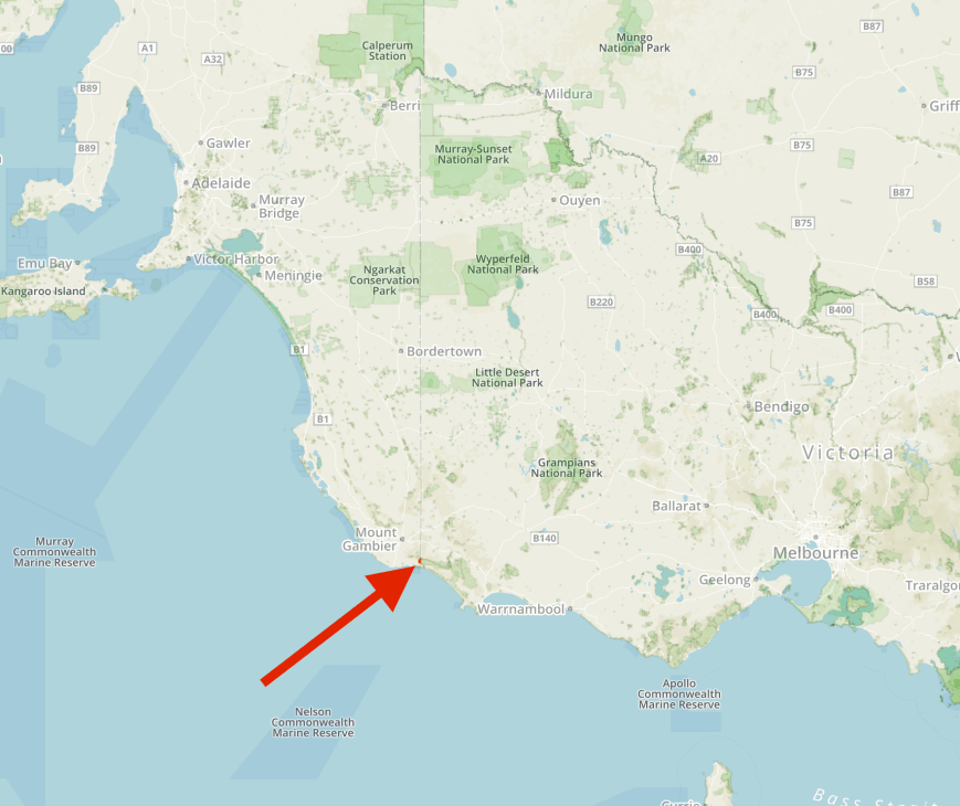
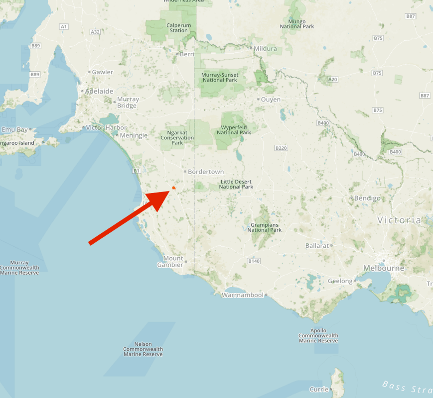
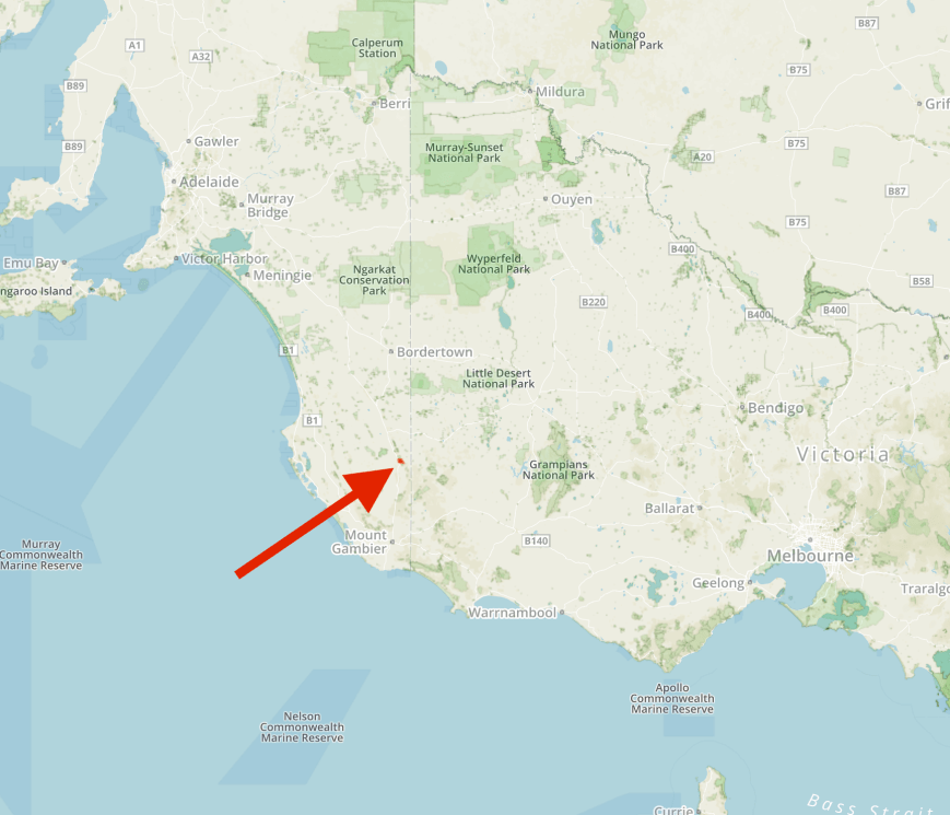
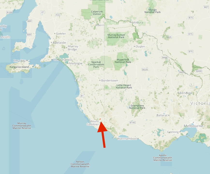
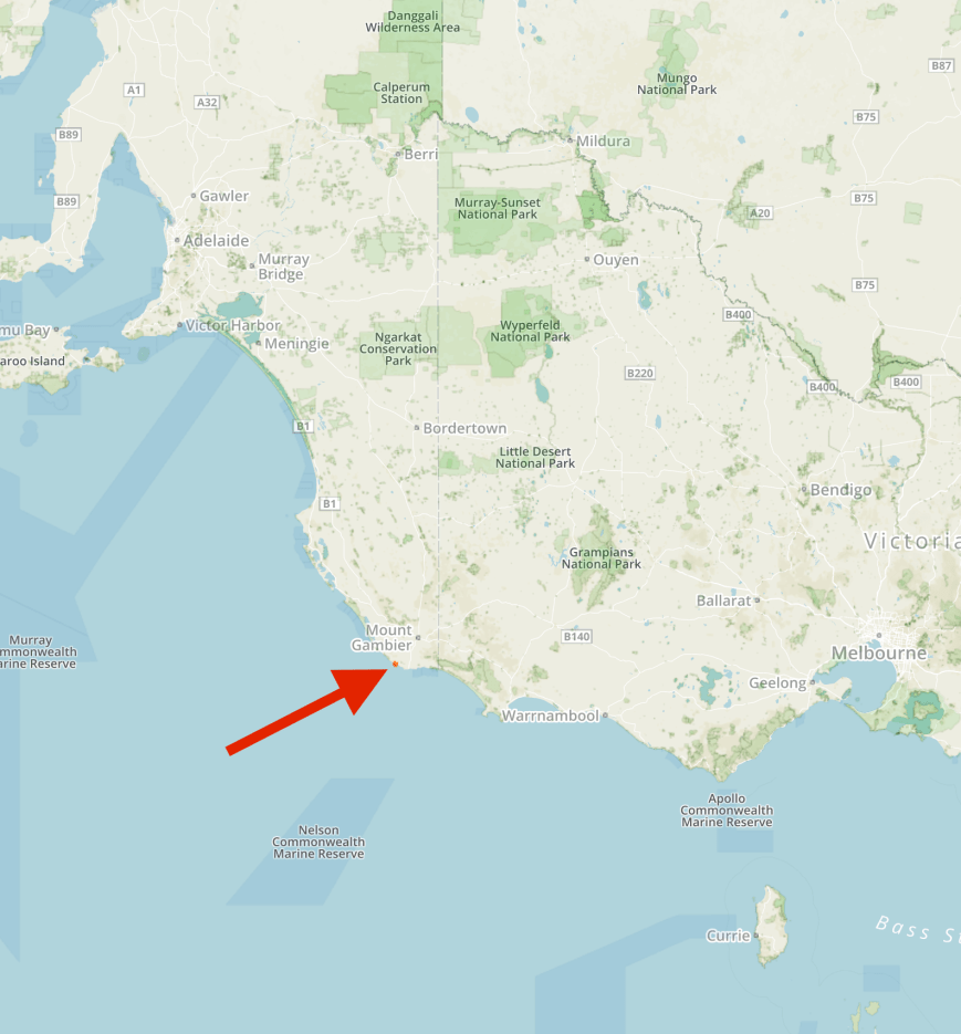
Our first planned activation for Sunday 11th June 2017 was the Lower Glenelg River Conservation Park 5CP-122 & VKFF-0905.  The park is located about 31 km south east of Mount Gambier, and about 465 km south east of Adelaide, in the south east corner of South Australia.

Screen Shot 2017-06-13 at 9.27.45 pm.png

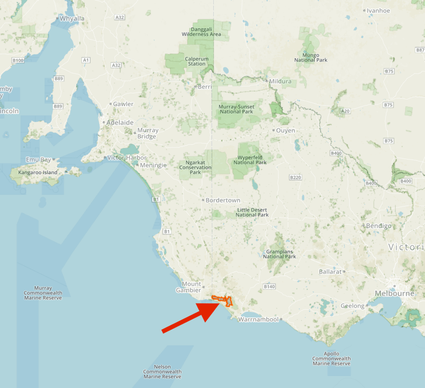
Map showing the location of the Lower Glenelg River Conservation Park.  Map courtesy of Protected Planet.

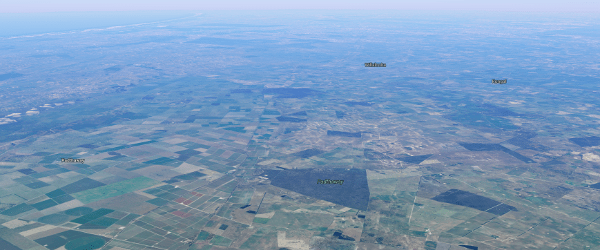
The park is located right on the South Australian/Victorian State border.  Access to the park from the South Australian side can only be made via boat.  Or you can access the park via a a 4WD track from the Victorian side which is what Marija and I did.

Screen Shot 2017-06-14 at 4.58.41 pm.png

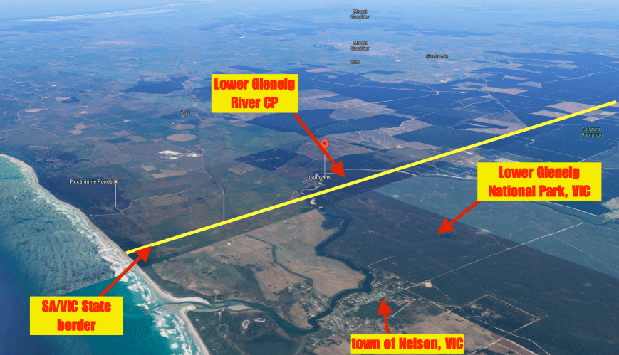
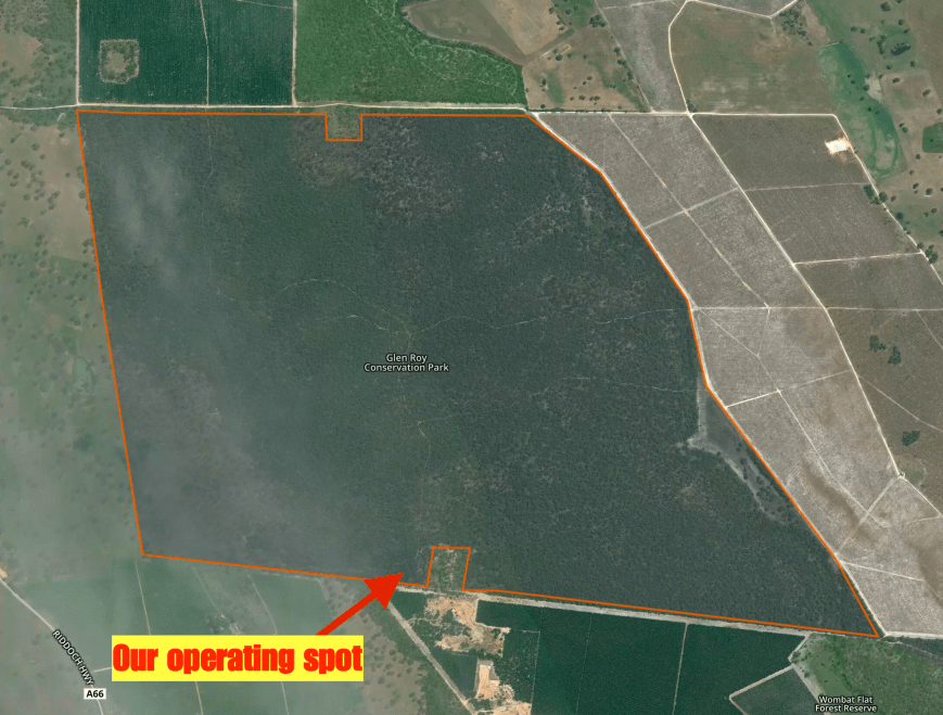
Aerial shot showing the Lower Glenelg River Conservation Park on the SA/VIC border, and the adjacent Lower Glenelg National Park in Victoria.  Image courtesy of Google maps.

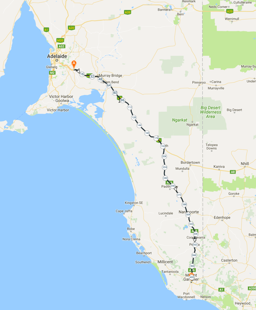
The map below shows our route.  We travelled south east out of Mount Gambier down towards the South Australian/Victorian border.  It was a cold morning with quite a bit of drizzle.  It wasn’t looking good for the activation.

Screen Shot 2017-06-14 at 5.29.06 pm.png

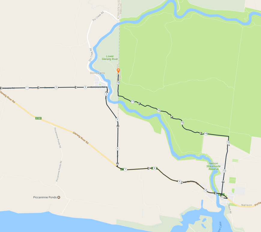
Our route to the park.  Map courtesy of plotaroute.com

Marija and I made a quick detour off the Glenelg River Road, down Donovans Road, into the little town of Donovans which is situated on the banks of the beautiful Glenelg River.  The area was originally known as Donovans Landing, and was owned by, and named after Thomas John Donovan.   He was famous due to him shooting the Tantanoola Tiger, a ‘phantom cat’, which is now preserved in the Tantanoola Hotel.

In 1884 a Bengal Tiger is purported to have escaped from a travelling circus in the South East.  A search was mounted, however the tiger was never located.  There were however, over the next few years, numerous reports of missing sheep in the area, with many suggesting that the tiger was responsible.  Eleven years later, Donovan saw what he thought was the tiger in a paddock, with a sheep in its jaws.  Donovan subsequently shot and killed the animal which turned out to be a Eurasian Wolf.  It is believed that the wolf was a stowaway on board a boat shipwrecked off the coast and somehow made it to shore.  A very interesting tale indeed.

There are some nice views here to be had of the Glenelg River.  The river rises in the Grampian Ranges in western Victoria and flows generally north, then west, then south, for over 350 km.  This makes it the longest river in south west Victoria and the third longest river overall.  A short stretch of the lower end of the river winds through South Eastern South Australia before returning to Victoria to enter Discovery Bay at Nelson.

The river was named after Colonial Secretary Baron Glenelg, Charles Grant (1778-1866), by Major Thomas Mitchell in August 1836.  Grant was a Scottish politician and colonial administrator.

Lord-glenelg

Charles Grant, 1st Baron Glenelg

From Donovans we made the short trip to the South Australian/Victorian State border.  There is an information board here marking the survey of the border.  The boundary between South Australia and Victoria, formerly the Port Phillip District of New South Wales, was marked from the shores of the Southern Ocean to the south bank of the River Murray between 1847 and 1850.

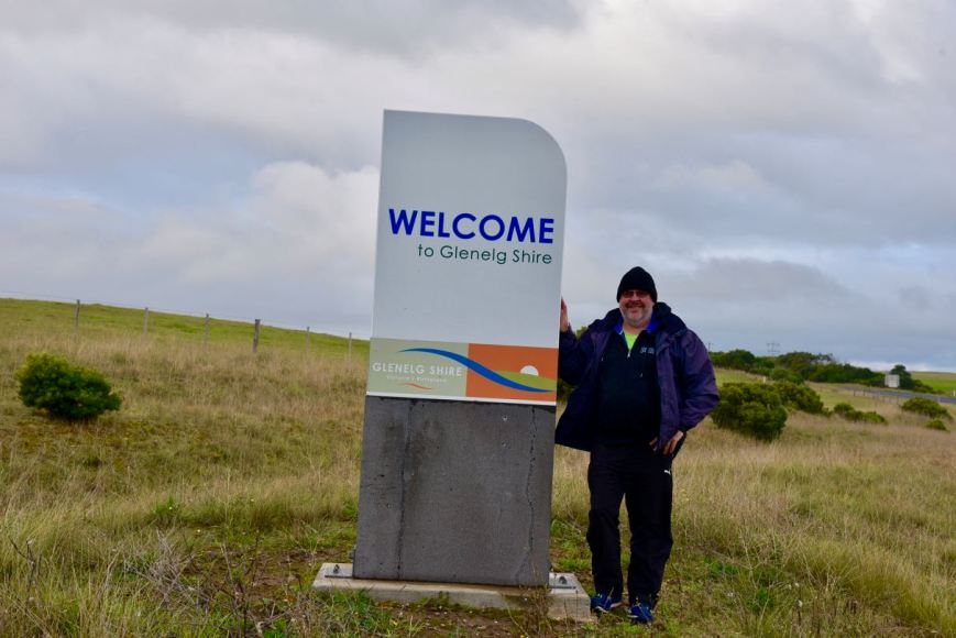
There was also a sign here indicating that we were entering into the Glenelg Shire.  A new shire for us to activate for the VK Shires Contest.

DSC_7229.jpg

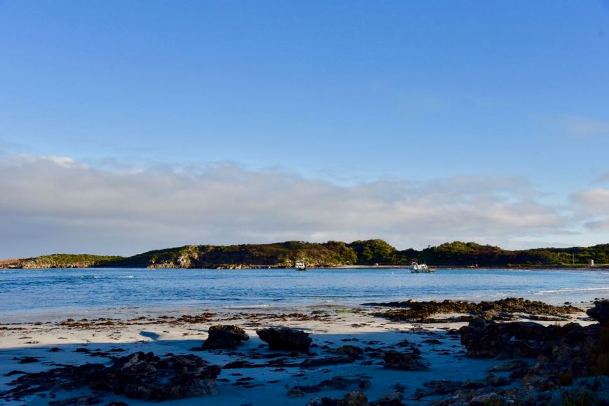
We then drove into the little town of Nelson.  This is a small fishing village with a population of around 250 people.  It is located at the mouth of the Glenelg River.  In January 1852 the name of Nelson was adopted for the settlement, after the ship Lady Nelson, which was used by Lieutenant James Grant in explorations of the area in the early 1800’s.

We drove north out of Nelson on the North Nelson Road.  We soon reached the junction with Forest Road and the start of the Lower Glenelg National Park.  We then turned left onto Moores Track and travelled west through the Lower Glenelg National Park in Victoria.

Just after we turned into Moores Track we could see a tree down across the track ahead of us.  Fortunately someone had cut most of it up with a chainsaw, and there was sufficient room for us to pass.

DSC_7220

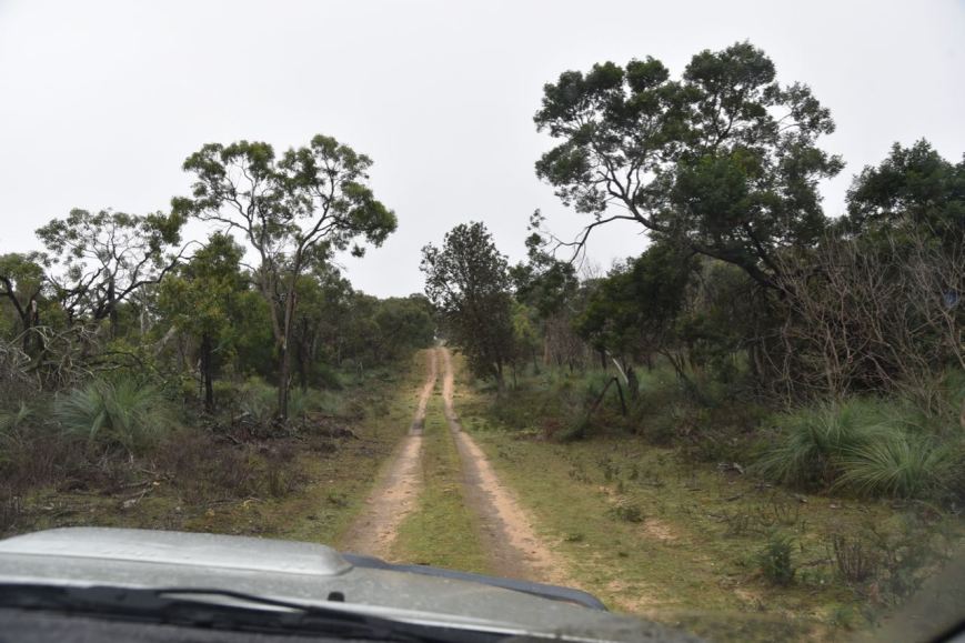
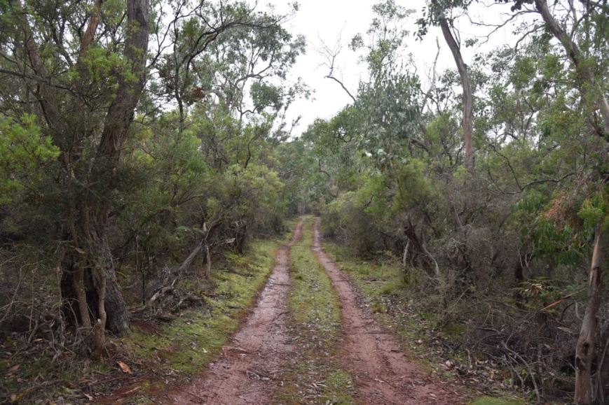
Morres Track was generally in good condition except for one spot which is shown in the photo below.  It didn’t look much, but the puddle was about 1.5 feet deep and very boggy, but we made it through in the Toyoa Hi Lux without any issues.

DSC_7189

For the remainder of the trip along Moores Track it was clear driving, but slow.  The park was absolutely alive with kangaroos who often darted out in front of us.

DSC_7190

When we reached the right hand turn dog leg on Moores Track, we had reached the State border.

DSC_7208

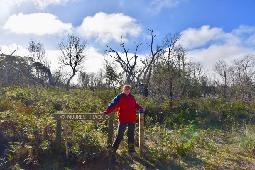
Marija at the dog leg and the State border

We travelled a little further up Moores Track until we reached the junction with McHughs Track.  There was a Lower Glenelg River Conservation Park sign here.

We decided to travel west down McHughs Track to see if it would take us down to the river.  It was slow going as it was quite overgrown.  Take note, there are no turn around areas, or places to pull off, until you get to the very end of the track.

DSC_7194

Unfortunately there were no places to set up once we got to the end of the track, as the scrub is just too thick.  However, it was worth the drive down, as we were rewarded with some nice views of the Glenelg River, despite the fog.

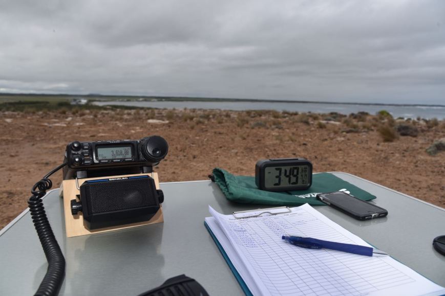
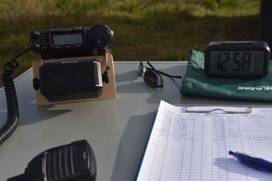
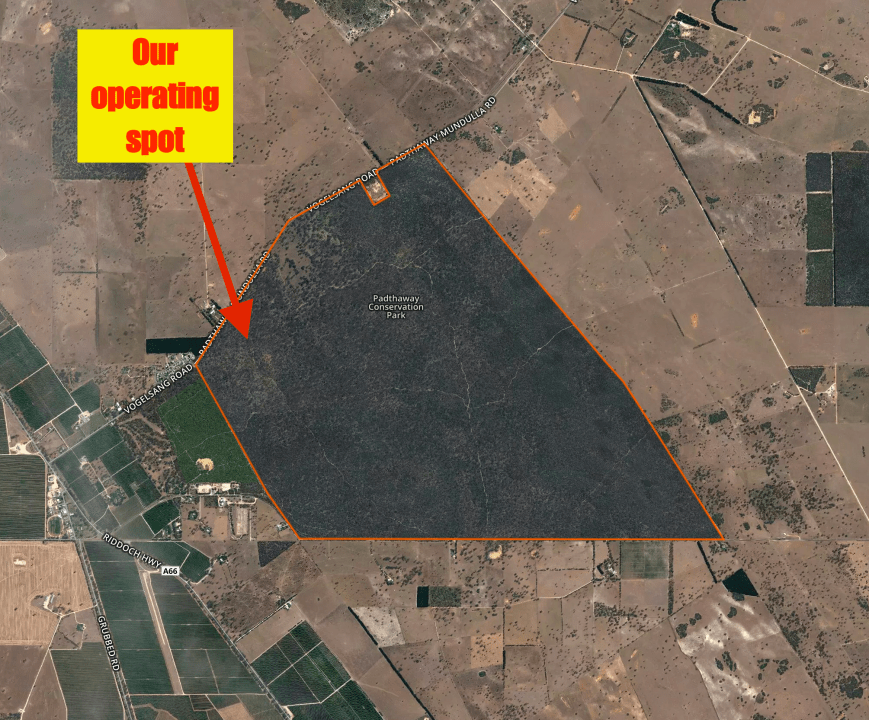
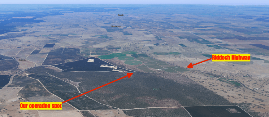
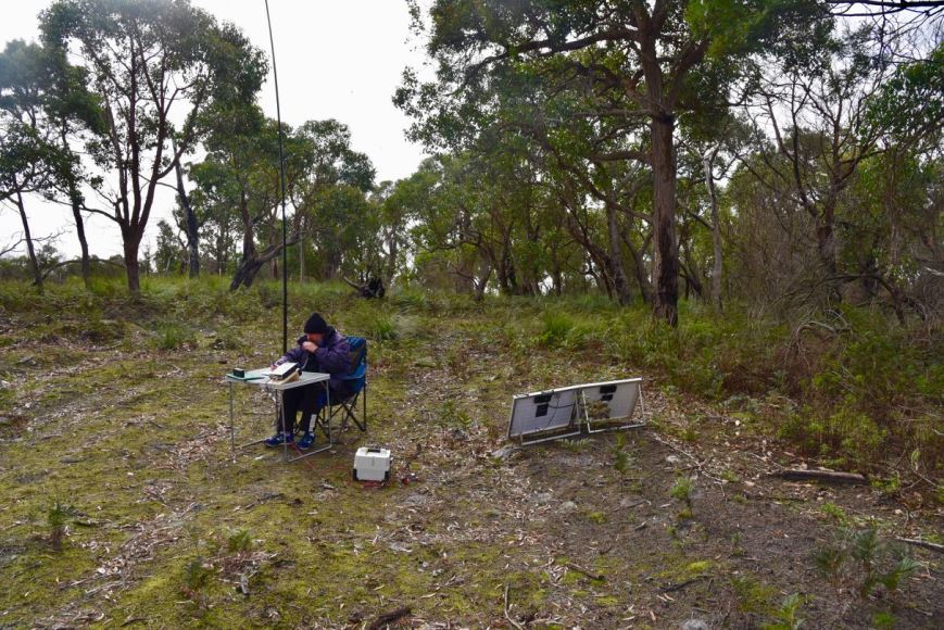
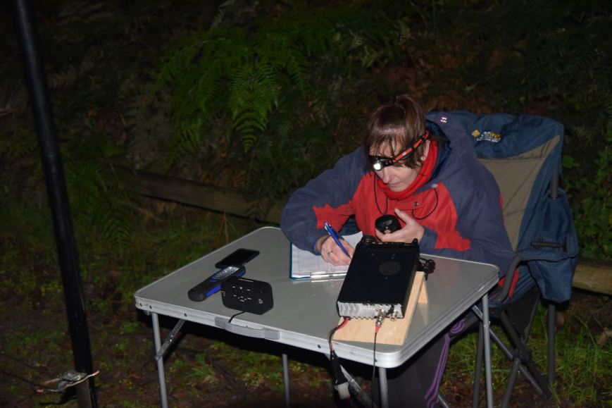
We returned to the junction of Moores Track and McHughs Track and set up.  As it was still drizzling with rain, Marija and I set up underneath the annexe of the Toyota Hi Lux.  We ran the Yaesu FT-857d for this activation, along with the 80/40/20m linked dipole.

Screen Shot 2017-06-14 at 7.30.03 pm.png

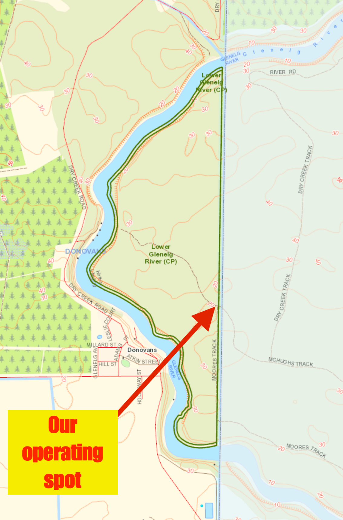
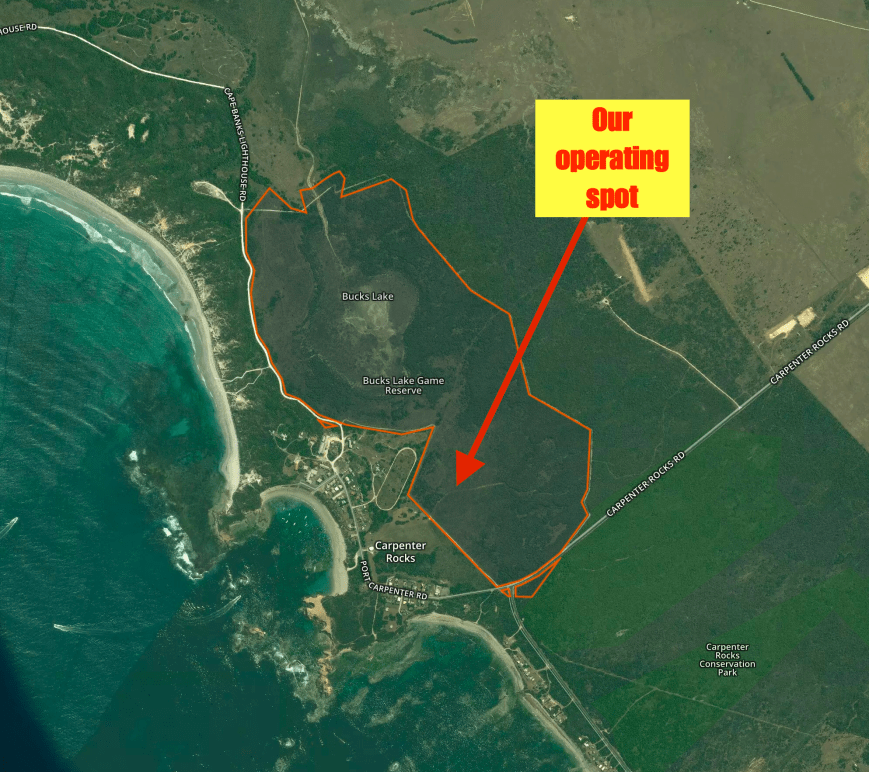
Map of the park showing our operating spot.  Map courtesy of Location SA Viewer.


The Lower Glenelg Conservation Park is 127 hectares in size, and was dedicated in 1993 for the conservation of important vegetation associations and species.  It is an extension of Victoria’s Lower Glenelg National Park, which adjoins it on the eastern boundary.  The Glenelg River forms the western boundary of the park.  The Park contains an endangered vegetation association (Swamp Gum woodland) and several endangered plant species.  Two of the endangered species include the Slender Greenhood and Shining Buttercup.

The Great South West Walk (250 kilometres of walking trail) passes through the Lower Glenelg River Conservation Park.

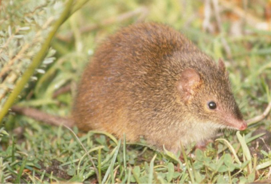
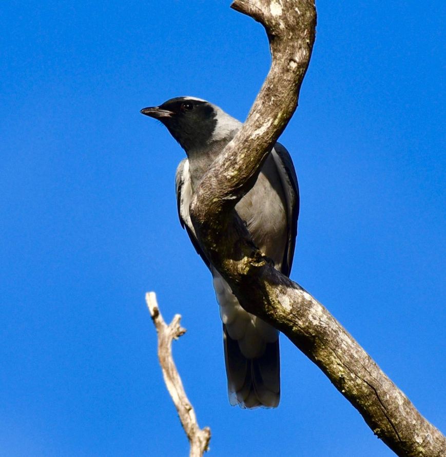
The Park provides habitat for a variety of threatened fauna species including the Rufous Bristlebird, Yellow-tailed Black Cockatoo, Peregrine Falcon, Azure Kingfisher, Heath Mouse, and Red-necked Wallaby.

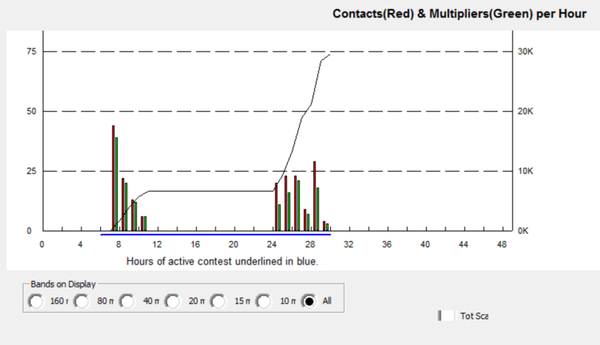
This was to be a unique park for both Marija and I, for both the World Wide Flora Fauna (WWFF) program and the VK5 National & Conservation Parks Award.  Marija kicked off the activation, calling CQ on 7.144.  It was a slow start, with around 3 minutes of calls going unanswered.  I had spotty phone coverage but was eventually able to spot Marija, with her first caller following very soon after.  Peter VK3PTE was first in the log, followed by Glen VK2VVV, and then Rick VK4RF/VK4HA.

The WIA broadcast kicked off soon after on 7.146, so we QSY’d down the band to 7.095.  Marija soon had 10 contacts in the log, qualifying the park for her for VKFF.  After logging 12 contacts, Marija was happy to hand the mic to me.  Included in her 12 contacts was a Park to Park QSO with Tony VK3XV/p who was activating the Barmah National Park VKFF-0739.

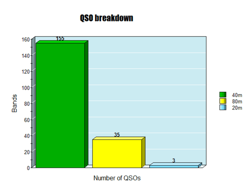
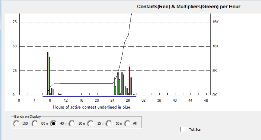
I then jumped on the mic and called CQ on 7.095.  My CQ call was answered by Peter VK3PF, followed by Geoff VK3SQ, Greg VK2EXA, and then Adrian VK5FANA.  Within 10 minutes I had contact number 10, with VK4AAC/2, in the log, and the park qualified for VKFF.  I logged 21 stations on 40m from VK1, VK2, VK3, VK4, and VK5, before heading over to 3.610 on the 80m band.

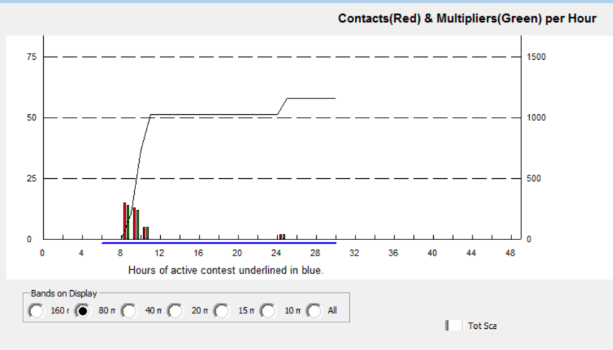
I there logged John VK5BJE from the Adelaide Hills with a good 5/5 signal.  Sadly, John was my only contact on 80m.  I then QSYd back to 7.095 hoping to pick up a few more contacts on my quest to 44 contacts to qualify the park for WWFF.  Within another 40 minutes, I had contact number 44 in the log.  It was Graham VK7ZGK with a thumping 5/9 plus signal from Tasmania.

All up I made a total of 51 contacts on 40m and 80m, with a number of contacts made for the VK Shires Contest.  I had one Park to Park contact, that being with Tony VK3XV/p in the Barmah National Park VKFF-0739.

Marija worked the following stations on 40m SSB:-

  1. VK3PTE
  2. VK2VVV
  3. VK4RF
  4. VK4HA
  5. VK2AB
  6. VK4AAC/2
  7. VK5KLV
  8. VK4RF (after the UTC rollover)
  9. VK4HA (after the UTC rollover)
  10. VK1AT
  11. VK2VW
  12. VK3SQ
  13. VK3WMM/p
  14. VK3XV/p (Barmah National ParkVKFF-0739)

I worked the following stations on 40m SSB:-

  1. VK3PF
  2. VK3SQ
  3. VK2EXA
  4. VK5FANA
  5. VK2AB
  6. VK4RF
  7. VK4HA
  8. VK3HBG
  9. VK4TAA
  10. VK4AAC/2
  11. VK2EMI
  12. VK1MA
  13. VK1AT
  14. VK5KLV
  15. VK2KYO
  16. VK2OA
  17. VK5LOL
  18. VK1HW
  19. VK2NP
  20. VK3MCK
  21. VK5HSX/2
  22. VK2ESG
  23. VK3LM
  24. VK5MBD
  25. VK3KAI
  26. VK3GV
  27. VK4TJ
  28. VK4/AC8WN
  29. VK4/VE6XT
  30. VK2HHA
  31. VK7JGD
  32. VK5NJ
  33. VK3CM
  34. VK3MRG/p
  35. VK2TCL
  36. VK3XV/p (Barmah National Park VKFF-0739)
  37. VK5MA/p
  38. VK2XXM
  39. VK7EE
  40. VK2UH
  41. VK5PL
  42. VK5BJE
  43. VK7ZGK
  44. VK6MN
  45. VK5DT
  46. VK3CBP
  47. VK7PAL
  48. VK3ZLD
  49. VK3BBB
  50. VK3MAB

I worked the following station on 80m SSB:-

  1. VK5BJE


References.

Government of South Australia, 2000, Lower Glenelg River Conservation Park Management Plan.

State Library South Australia, 2017, <http://www.samemory.sa.gov.au/site/page.cfm?u=276&gt;, viewed 14th June 2017

Wikipedia, 2017, <https://en.wikipedia.org/wiki/Glenelg_River_(Victoria)&gt;, viewed 14th June 2017

Wikipedia, 2017, <https://en.wikipedia.org/wiki/Charles_Grant,_1st_Baron_Glenelg&gt;, viewed 14th June 2017

Wikipedia, 2017, <https://en.wikipedia.org/wiki/Nelson,_Victoria&gt;, viewed 14th June 2017

Telford Scrub Conservation Park 5CP-226 and VKFF-0805 and the VK Shires Contest

After leaving the SERG Convention, Marija and I decided to head out to the Telford Scrub Conservation Park 5CP-226 & VKFF-0805 for a few hours for the VK Shires Contest which had commenced at 0600 UTC that day (3.30 p.m. South Australian local time).  Telford Scrub is just 15 km north of Mount Gambier, just off the Riddoch Highway.

Screen Shot 2017-06-13 at 7.30.33 pm.png

Map showing the location of the Telford Scrub Conservation Park.  Map courtesy of Protected Planet.

Telford Scrub is 175 hectares in size and was first proclaimed on 12th March 1987.  The park features a 100 metre long boardwalk which takes you along the forest canopy about 4 metres off the ground.  There are various interpretive signs along the way.

Screen Shot 2017-06-13 at 7.26.03 pm.png

Aerial shot, showing the park, with Mount Gambier in the background.  Image courtesy of Google maps

The park supports four major vegetation types:  Brown Stringybark open woodland, Brown Stringybark/Rough-barked Manna Gum open woodland, Swamp Gum open woodland; and low open shrubland.  More than 20 species of native orchid can be found in the park.

DSC_7175 (1).jpg

About 117 species of bird have been recorded in the park including the Crimson Rosella, Laughing Kookaburra, White-throated Treecreeper, Superb Fairywren, White-browned Scrubwomen, Red-tailed Black Cockatoo, Satin Flycatcher, and Southern Boobook.  During our visit, a vehicle arrived in the carpark.  It was a gentleman about to head off on a night walk through the park to photograph owls and Tawny Fromouths.  It is truly amazing who you meet when you visit these parks.

A large amount of native wildlife can be found in the park including Western Grey kangaroos and koalas.The vulnerable Southern Brown Bandicoot and the endangered Sugar Glider can also be found.

Below is a great video of a Sugar Glider in flight.

Marija and I set up in the carpark off Grundys Lane.  We were all set up and ready to go by around 0710 UTC (4.40 p.m. South Australian local time).

Screen Shot 2017-06-13 at 7.30.08 pm.png

Aerial shot of the park showing our operating spot in the southern section of the park.  Image courtesy of Protected Planet.

There was plenty of room here to string out the 80/40/20m linked dipole.

DSC_7170

Telford Scrub is located in the District Council of Grant (GD5 for the VK Shires Contest).  It is quite strange how it works down in the South East.  The town of Mount Gambier comes under the City of Mount Gambier Council, whilst the land around it is the District Council of Grant.

Screen Shot 2017-06-13 at 8.28.00 pm.png

Map showing the Grant Council area surrounding the town of Mount Gambier, and our operating spot at Telford Scrub.

I started off on 7.115 on the 40m band.  The band was quite busy with stations calling ‘CQ Contest’.  My first station worked was Andrew VK2UH, followed by Geoff VK3SQ, and then Hans VK6XN who was operating portable in the Shoalwater Islands Marine Park VKFF-1454.  I logged a total of 52 stations including another Park to Park contact, this time with Phil VK6ADF/p who was in Lesueur National Park VKFF-0285.

DSC_7172

The 40m band had slowed a little, so I headed to the 80m band.  We found Tony VK3XV/p calling CQ on 3.610 from the Terrick Terrick National Park VKFF-0630.  We both logged Tony, and I then moved down to 3.605 and started calling ‘CQ Contest’.  I logged 12 stations before swapping the mic with Marija.

Marija wasn’t real keen on the contesting, but wanted to qualify the park with 10 QSOs for the VKFF program.  She soon reached that total in around 10 minutes, with contact number 10 being Michael VK3LM.

DSC_7178

I then took charge of the mic again and logged an additional 15 stations on 80m including Bill ZL2AYZ in Blenhiem in New Zealand.  Marija and I swapped the mic so she could log our good friend Ivan VK5HS when he called in, and also Bill in New Zealand.  To finish off the activation, Marija logged a handful of stations after tuning across the 80m band.

Marija had a total of 15 stations in the log from VK2, VK3, VK5, and New Zealand, all on the 80m band.  I had a total of 80 stations in the log on the 40m and 80m bands.  It was time to head back into Mount Gambier for some dinner, with the local time being just after 7.00 p.m. local time.

I had logged 61 different shires for the contest:

  1. AC2
  2. AC5
  3. BB3
  4. BC3
  5. BL2
  6. BN4
  7. BU7
  8. CB2
  9. CK2
  10. CN2
  11. CO6
  12. CS3
  13. CW6
  14. DG4
  15. DN6
  16. FC3
  17. FC4
  18. GB3
  19. GD5
  20. GG3
  21. GS7
  22. HC7
  23. HI2
  24. IP4
  25. IS3
  26. KH7
  27. KY2
  28. LC3
  29. LE2
  30. LS3
  31. LV4
  32. MD5
  33. MG3
  34. MM3
  35. MO3
  36. MP3
  37. MZ3
  38. NA2
  39. NC2
  40. NS3
  41. OC5
  42. QP2
  43. RP5
  44. RM6
  45. RX5
  46. SB4
  47. SG3
  48. UA2
  49. UH2
  50. UL2
  51. WD2
  52. WH3
  53. WO2
  54. WR3
  55. WV2
  56. WW2
  57. WW7
  58. WY3
  59. YP5
  60. YV2
  61. YV3

We headed to Fasta Pasta, and while Marija was inside ordering, I made a total of 6 contacts on 40m and 80m from the vehicle.  This time in the Mount Gambier Council area (MG5 for the VK Shires Contest).

We then headed back to the motel room for dinner.

Marija worked the following stations on 80m SSB:-

  1. VK3XV/p (Terrick Terrick National Park VKFF-0630)
  2. VK3GH
  3. VK3FSLG
  4. VK5FANA
  5. VK3FAAJ
  6. VK3SQ
  7. VK3ER
  8. VK3WMM/p
  9. VK3PF
  10. VK3LM
  11. VK5HS
  12. ZL2AYZ
  13. VK3C
  14. VK5KBJ
  15. VK2YW/p

I worked the following stations on 40m SSB:-

  1. VK2UH
  2. VK3SQ
  3. VK6XN/p (Shoalwater Islands Marine Park VKFF-1454)
  4. VK2NEO
  5. VK2KDP
  6. VK4QQ
  7. VK2BBQ/p
  8. VK2KJJ
  9. VK2KT
  10. VK5FANA
  11. ZL2AYZ
  12. VK2TCL
  13. VK4NH
  14. VK3OHM
  15. VK2LEE
  16. VK2YW/p
  17. VK7JGD
  18. VK4FMAX
  19. VK3PI
  20. VK2SR
  21. VK5KPR
  22. VK5NJ
  23. VK2MTM
  24. VK2VVV
  25. VK2NSS
  26. VK3GYH/p
  27. VK7ZGK
  28. VK3NLK
  29. VK3ARH
  30. VK3MRG
  31. VK3TNL
  32. VK2PHL
  33. VK2PAW
  34. VK3GC
  35. VK4FE
  36. VK7JON
  37. VK3FPSR
  38. VK2ND
  39. VK3JP
  40. VK2NSW
  41. VK2MT/p
  42. VK6ADF/p (Lesueur National Park VKFF-0285)
  43. VK7DW
  44. VK3GTS
  45. VK2QH
  46. VK3WMM/p
  47. VK2QK
  48. VK6FBOS
  49. VK2VOL
  50. VK4SMA
  51. VK5MR
  52. VK2GGA

I worked the following stations on 80m SSB:-

  1. VK3XV/p (Terrick Terrick National Park VKFF-0630)
  2. VK3SQ
  3. VK5KBJ
  4. VK2YW/p
  5. VK2BFC
  6. VK3LDB
  7. VK3VKT
  8. VK5FANA
  9. VK3WMM/p
  10. VK3LM/p
  11. VK2ARL
  12. VK7GG
  13. VK2GGA
  14. VK3PF
  15. VK3GH
  16. VK5PO
  17. VK5HS
  18. VK3OHM
  19. VK3LM/p
  20. VK3CWF
  21. VK3FSPG
  22. VK3NXT
  23. VK3GC
  24. VK6VCK/p
  25. VK3CWM
  26. ZL2AYZ
  27. VK3ER
  28. VK4QH


References.

Birds SA, 2017, <http://www.birdssa.asn.au/location/telford-scrub-conservation-park/&gt;, viewed 13th June 2017

National Parks South Australia, 2017, <https://www.environment.sa.gov.au/parks/Find_a_Park/Browse_by_region/Limestone_Coast/telford-scrub-conservation-park&gt;, viewed 13th June 2017

Douglas Point Conservation Park 5CP-057 and VKFF-0795

Our second activation for Saturday 10th June 2017 was the Douglas Point Conservation Park 5CP-057 and VKFF-0795.  The park is situated and about 42 km south (by road) of Mount Gambier and about 470 km south east of Adelaide.

Screen Shot 2017-06-13 at 1.44.56 pm.png

Map showing the location of the Douglas Point Conservation Park.  Map courtesy of Protected Planet.

The Douglas Point Conservation Park is 31 hectares in size and was proclaimed on 8th May 1997 to protect the state endangered and nationally vulnerable plant species, Sand Ixodia.  Douglas Point is the only reserve in Australia containing this plant.  In addition to this, the Park is a significant refuge for two plant species of conservation significance.

The habitats of the Douglas Point Conservation Park vary from exposed cliff top to coastal heath, principally Coastal Wattle / Coastal Beard-heath scrubland.

The Park is located within the traditional lands of the Boandik people.  The remains of scattered middens are evidence of Aboriginal habitation in the past.

The exact origins of the name, Cape Douglas, are unknown.  Lieutenant James Grant sailed through the area on the Lady Nelson in December 1800 and named several features including Cape Northumberland.  On the 5th of April 1802, the French navigator Nicholas Baudin passed Cape Northumberland in his ship the ‘Geographe’ whilst travelling west along the coast.  Baudin subsequently met Matthew Flinders, who was travelling from the west to east, in Encounter Bay.  Later in 1802 Matthew Flinders charted the area on the Investigator, with crew including boatswain Charles Douglas. Captain William Bloomfield Douglas helped Captain Benjamin Germain chart the waters around Cape Northumberland and Port MacDonnell in 1860.  It is possible that Cape Douglas was named during one of these exercises.

William_Bloomfield_Douglas.jpg

William Bloomfield Douglas.  Image courtesy of wikipedia

The park is home to over 60 species of bird.  A total of those are of conservation significance including the Rufous Bristlebird and the Beautiful Firetail, and also the nationally endangered Orange-bellied Parrot.

During our visit to the park we spotted a Crested Tern and a Nakeen kestrel (I think).

Recreational activities undertaken in the Park include bush-walking, surfing, diving, fishing and 4WDriving.

Just outside of the park on the Cape Douglas Road, you can view an interpretive sign regarding the Admella, a passenger steamship which was shipwrecked on a submerged reef off the coast of nearby Carpenter Rocks.

DSC_7164

It was during the early hours of Saturday 6 August 1859 that the ship struck the reef, resulting in survivors clinging to the wreck for over a week.  Many took days to die as they glimpsed the land from the sea and watched as one rescue attempt after another failed.  With the loss of 89 lives, mostly due to cold and exposure, it is one of the worst maritime disasters in Australian history.   It remains the greatest loss of life in the history of European settlement in South Australia.  Of the 113 on board 24 survived, including only one woman, Bridget Ledwith.  Of the 89 dead, 14 were children.

Admella_painting.jpg

SS Admella.  Image courtesy of Wikipedia

The GPS showed that we had a short 20 minute drive to get to the park.  WRONG!.  It took us to a carpark at the end of Pelican Point Road at Blackfellows Caves.  There was no access to the park via the coastal road as the GPS indicated.  So we headed inland and eventually reached the park via Cape Douglas Road.

DSC_7135

There weren’t too many operating options here.  It is very exposed to the ocean as you are above some clifftops overlooking the ocean.

Screen Shot 2017-06-13 at 1.44.28 pm.png

Aerial view of the park showing our operating spot.  Image courtesy of Protected Planet.

There is a 4WD track leading further into the park.  And it is definitely 4WD.  It is extremely rocky and then sandy.

Screen Shot 2017-06-13 at 1.46.35 pm

Aerial shot of Douglas Point Conservation Park.  Image courtesy of Google maps 

For this activation we ran the Yaesu FT-857d and the 80/40/20 m linked dipole, supported on the 7m heavy duty squid pole.  It took some belts of the hammer to drive the squid pole holder into the ground, as the ground was very rocky.

DSC_7160

The rugged coastline of Douglas Point provided some great views along the coast and out across the Southern Ocean.  Fortunately there was only a gentle breeze blowing and the rain was holding off.

There were also some nice views back out to Umpherstone Bay and back to Mount Gambier.  Centennary Tower in Mount Gambier and Mount Schank were clearly visible in the distance.

This was to be another unique park for both Marija and I, for both the World Wide Flora Fauna (WWFF) program and the VK5 National & Conservation Parks Award.  Marija started off the activation calling CQ on 7.144.  It didn’t take long and Marija had her first caller in the log, Geoff VK3SQ in norther eastern Victoria.  This was followed by Greg VK2EXA, Andy VK3AJA, and then Paul VK3AFB.  Marija had qualified the park for VKFF, with 10 contacts in the log within 10 minutes.  After logging 11 stations, Marija was happy to hand over the mic.

I then called CQ on 7.144 which was answered by Peter VK3PF, followed by Don VK3MCK, and then Craig VK3NCR.  Mike VK5FMWW then called in and although being quite low was readable in the park.  Sadly Mike was struggling with noise at his end and we couldn’t quite complete the contact with a valid signal report exchange.  Contact number 10 for me, qualifying the park for VKFF, was with Greg VK2MTC in Cooma.

I had reached contact number 40 on 40m within one hour.  I still needed another 4 contacts to qualify the park for the global WWFF program.  As things had slowed a little on 40m I headed off to 14.310 on the 20m band where I logged 4 stations from VK2, VK4 and VK4.  Contact number 44 was with Allen VK3ARH whose signal was very low.  But as there was no noise in the park, and Allen was suffering from a low noise floor at his end, we were able to comfortably log the QSO.

To finish the activation I headed off to 3.610 on the 80m band.  Allen VK3ARH (signing as VK3HRA) had followed me down and was first in the log.  I logged only one further contact, that being with Ken VK2KYO.  Cliff VK2NP also tried, but although readable in the park, Cliff was unable to hear me above his noise floor.

With 11 contacts in the log for Marija, and 46 for me, it was time to pack up and head back into Mount Gambier.

Marija worked the following stations on 40m SSB:-

  1. VK3SQ
  2. VK2EXA
  3. VK3AJA
  4. VK3AFG
  5. VK7DW
  6. VK3ELH
  7. VK4TJ
  8. VK4/AC8WN
  9. VK4/VE6XT
  10. VK5FMWW
  11. VK7FOLK

I worked the following stations on 40m SSB:-

  1. VK3PF
  2. VK3MCK
  3. VK3NCR
  4. VK2EXA
  5. VK3SFG
  6. VK3OHM
  7. VK3AFB
  8. VK3AWG
  9. VK2YS/4
  10. VK2MTC
  11. VK3SQ
  12. VK2NP
  13. VK2HHA
  14. VK7DW
  15. VK3BBB
  16. VK4TJ
  17. VK4/AC8WN
  18. VK4/VE6XT
  19. VK3FRC
  20. VK5IS
  21. VK7GG
  22. VK7AN
  23. VK3ELH
  24. VK2KYO
  25. VK2TCL
  26. VK3PTE
  27. VK2VW
  28. VK3FDAP/p
  29. VK5HSX/2
  30. VK7JON
  31. VK5MBD
  32. VK7FOLK
  33. VK4RF
  34. VK4HA
  35. VK7EE
  36. VK3ZZS/p
  37. VK2UH
  38. VK2FRJH/m
  39. VK6VRO

I worked the following stations on 20m SSB:-

  1. VK4FI
  2. VK2NP
  3. VK2IO/m
  4. VK4AAC/2
  5. VK3ARH

I worked the following stations on 80m SSB:-

  1. VK3HRA
  2. VK2KYO

At the end of the activation Marija and I headed in to Mount Gambier and the Scout Hall for the SERG Convention.  It was great to catch up with a lot of familiar faces.  I also had a browse through the buy and sell.  My only purchase for the day, much to Marija’s pleasure, was a cup of coffee.


References.

Department for Environment and Heritage, May 2003, Douglas Point Conservation Park Management Plan.

Wikipedia, 2017, <https://en.wikipedia.org/wiki/SS_Admella&gt;, viewed 13th June 2017

Bucks Lake Game Reserve VKFF-1690

Marija and I both finished work early on Friday 9th June 2017 and then packed the Hi Lux and headed south east for Mount Gambier.  We had planned to stay at Mount Gambier for 3 nights, and attend the annual convention/buy and sell/fox hunting championships hosted by the South East Radio Group (SERG).

This was a 400 km journey for us from our home in the Adelaide Hills.

Screen Shot 2017-06-13 at 12.28.08 pm.png

Map showing our route down to Mount Gambier from the Adelaide Hills.

Along the way we stopped briefly for a bite to eat and a drink at Coonalpyn.  The silos there have recently been the subject of some great artwork by Guido van Helten.  I had viewed this during a recent interstate trip, but this was the first time Marija had viewed this very impressive artwork.

We also had a quick look at Coonalyn Tunnel Vision, which was originally developed in 1995 to brighten up the railway pedestrian underpass with local art.

We then continued on to Mount Gambier, arriving just after 6.00 p.m. local time.  After booking in to our motel, the Tower Motor Inn, we headed out for tea at Jens Hotel at Mount Gambier, where we enjoyed a very nice meal.  It was then back to the motel room to watch a very nice win by the Adelaide Crows football team.

Our first activation for the trip away was on Saturday 10th June 2017 and was at the Bucks Lake Game Reserve VKFF-1690 which is located about 40 km south west of Mount Gambier, and about 440 km south east of Adelaide.

Screen Shot 2017-06-13 at 10.18.10 am.png

Map showing the location of the Bucks Lake Game Reserve in the South East region of South Australia.  Map courtesy of Protected Planet.

Bucks Lake Game Reserve is 138 hectares in size and consists of near pristine seasonally-inundated coastal wetland.  It is located at the southern end of Lake Bonney which was the primary source of water to  Bucks Lake.  Due to influences by man, the water level of Lake Bonney has descreased, resulting in Bucks Lake and other wetlands near Lake Bonney, becoming degraded from the lack of water supply.

The reserve was originally created as a National Park in 1968 under the National Parks Act 1966 and was re-proclaimed as a game reserve under the National Parks and Wildlife Act 1972 for the purpose of the conservation of wildlife and management of game.

Hunting is allowed in the Reserve during a proclaimed open season with hunters requiring to have an ‘endorsed hunting permit’ and only to harvest maximum numbers of specific species.

Screen Shot 2017-06-13 at 10.37.39 am.png

Aerial shot showing the Bucks Lake Game Reserve with Carpenter Rocks Conservation Park in the foreground.  Image courtesy of Google maps.

The reserve protects habitat for important fauna species such as the state endangered Swamp Antechinus and the Southern Bush Rat.  The Swamp Antechinus is a small carnivorous marsupial which has a very scattered distribution on the Australian mainland, limited to small pockets in South Eastern South Australia and south western Victoria.  It is also found in Tasmania.

Screen Shot 2017-06-13 at 11.31.20 am.png

Swamp Antechinus.  Image courtesy of Nature Glenelg Trust

Screen Shot 2017-06-13 at 11.31.25 am.png

Map showing the habitat of Swamp Antechinus.  Image courtesy of Nature Glenelg Trust

Marija and I were on the road by 7.30 a.m.  We made a quick detour to the local Subway where we purchased some lunch and also a bacon & egg roll for breakfast.  We then headed south west out of Mount Gambier on the Carpenter Rocks Road.  This is kangaroo and wombat country as was evident by the signs.

Prior to activating the reserve, we had a quick look around the little town of Carpenter Rocks which is renmowned for its rugged coastline which provides exceptional fishing and diving locations.

DSC_7110

The coastline at Carpenter Rocks.

We then travelled out along the Cape Banks Lighthouse Road until we reached the northern section of the reserve.  We found a 4WD drive which followed the northern boundary of the park, but could not find anywhere really suitable to set up.  We followed this track all the way around the boundary of the park until we reached the Carpenter Rocks Road again.

We then saw a sign on the northern side of the road which said ‘Fire Water’, so we decided to take this track, heading north, following the western boundary of the reserve.  We then came to a track on the right which took us into the park, and we soon found a sign marking the reserve.

DSC_7111

There was an open gate here and a 4WD heading further east into the park.  We set up just off this track.

Screen Shot 2017-06-13 at 10.17.49 am.png

Aerial shot of the Bucks Lake Game Reserve, showing our operating spot.  Image courtesy of Protected Planet.

For this activation we ran the Yaesu FT-857d and the 80/40/20m linked dipole, inverted vee, supported on the 7m heavy duty telescopic squid pole.  Power output was 10 watts PEP for Marija and 40 watts for myself.

During the week, Al VK2OK, who had been part of the my team out into the field on the Sunday at the 2017 WIA AGM/Convention, sent me a wooden stand for the transceiver which had a Benelec speaker mounted at the front.  It was a great set up, and one which I will continue to use.  Many thanks Al.

DSC_7124

The shack, showing the stand & speaker for the Yaesu FT-857d.

This was to be a unique park for both Marija and I for the World Wide Flora Fauna (WWFF) program.  And hopefully a new park for the hunters.

Marija started off first, working Gerard VK2IO who was on SOTA peak Middle Brother VK2/ MN-066.  Marija and I swapped the mic, so we both could log Gerard.  We then tuned across the 40m band and found Mick VK3PMG/p calling CQ from the Crawford River Regional Park VKFF-0963.  Although Mick’s signal was quite low, we both logged Mick comfortably as there was no noise in Bucks Lake.

Marija then propped on 7.132 and called CQ.  Her first taker was Peter VK3PF, who had activated Bucks Lake a few weeks earlier during his visit to VK5.  This was followed by Les VK5KLV, Jonathan VK7JON, and then Rob VK4AAC/2.

Marija soon had her 10 contacts in the log, qualifying Bucks Lagoon for VKFF.  Contact number 10 was with Rod VK7FRJG in Tasmania with a strong signal.

Marija was happy to qualify the park for VKFF.  I then jumped on the mic and called CQ on 7.132.  This was answered by Rod VK7FRJG, followed by Geoff VK3SQ, Les VK7OT, and then Helen VK7FOLK.  Signals out of Tasmania were exceptionally strong.

Contact number 10, qualifying the park for me for VKFF, was with Bruce VK3SOL/p, operating the club call of the Shepparton & District ARC, who was portable at the Echuca Steam Rally.

Whilst I was operating Marija went off for a walk to try to locate the actual lake in the park.  Sadly, all tracks leading to the lake were completely overgrown.

There was a steady flow of callers and despite a rather slow start, it looked like I was probably going to reach the 44 to qualify the park for WWFF.  I run a paper log out in the field, which contains 35 contacts on each page.  It is always a nice feeling when I reach page number 2, as that always means I only need another 10 contacts to qualify.

I worked a total of 44 stations on 40m within an hour, with contact number 44 being a SOTA contact with Ian VK5CZ/p who was activating Lagoon Hill VK5/ SE-008.  Marija also logged Ian.  Whilst Marija still had the mic she was called by Hans VK6XN who had a strong 58 signal from some 3,000 km to the west.  Not bad at all considering the time of the day.

I then headed off to 20m where I called CQ on 14.310.  This was answered by Hans VK6XN who had followed me up from 40m, and then Phil VK6ADF.  Sadly, they were my only 2 contacts on 20m, despite 5 minutes of CQ calls.

To finish off the activation I headed to 3.610 on the 80m band where I worked 4 stations from VK3, VK5, and VK7.  This included a contact with Mike VK3ZMD who advised that I was his 200th Australian park worked.  Congratulations Mike.

It was now just after 10.30 a.m. and it was time for Marija and I to pack up and head off to our next park, the Douglas Point Conservation Park.  Marija had qualified the park for VKFF, with a total of 12 contacts in the log, whilst I had qualified the park for VKFF & WWFF, with a total of 50 contacts in the log.  Thanks t everyone who called, and many thanks to those who took the time to spot Marija and I, either on parksnpeaks and/or Facebook.

Marija worked the following stations on 40m SSB:-

  1. VK2IO/p (SOTA Middle Brother VK2/ MN-066)
  2. VK3PMG/p (Crawford River Regional Park VKFF-0963)
  3. VK3PF
  4. VK5KLV
  5. VK7JON
  6. VK4AAC/2
  7. VK7FOLK
  8. VK2KYO
  9. VK2NP
  10. VK7FRJG
  11. VK5CZ/p (SOTA Lagoon Hill VK5/ SE-008)
  12. VK6XN

I worked the following stations on 40m SSB:-

  1. VK2IO/p (SOTA Middle Brother VK2/ MN-066)
  2. VK3PMG/p (Crawford River Regional Park VKFF-0963)
  3. VK7FRJG
  4. VK3SQ
  5. VK7OT
  6. VK7FOLK
  7. VK5KLV
  8. VK1HW
  9. VK7JON
  10. VK3SOL/p
  11. VK5FANA
  12. VK7AN
  13. VK4AAC/2
  14. VK5MBD
  15. VK3PF
  16. VK7FGRA
  17. VK7WH
  18. VK3ARH
  19. VK2NP
  20. VK4WC/2
  21. VK4ICE/2
  22. VK5ZGY/m
  23. VK3WAC/m
  24. VK2LX
  25. VK6XN
  26. VK6FSEA
  27. VK2VW
  28. VK3ZPF
  29. VK2VAA
  30. VK3AJA/p
  31. VK4TJ
  32. VK4/AC8WN
  33. VK4/VE6XT
  34. VK2TDB
  35. VK3HKK
  36. VK6BEC
  37. VK3MCK
  38. VK7JON/m
  39. VK7FOLK/m
  40. VK5MA/m
  41. VK3JP
  42. VK7PSJ
  43. VK2JNG/3
  44. VK5CZ/p (SOTA Lagoon Hill VK5/ SE-008)

I worked the following stations on 20m SSB:-

  1. VK6XN
  2. VK6ADF

I worked the following stations on 80m SSB:-

  1. VK5FANA
  2. VK7CW
  3. VK3ZIE/p
  4. VK3ZMD


References.

Department for Environment and Heritage,  2007, Management Plan Carpenter Rocks Conservation Park and Bucks Lake Game Reserve.

Wikipedia, 2017, <https://en.wikipedia.org/wiki/Bucks_Lake_Game_Reserve&gt;, viewed 13th June 2017

South East trip

Marija VK5FMAZ and I are home from our trip to the South East region of South Australia.  We attended the South East Radio Group (SERG) Convention and had a great time.

Whilst away we activated a total of seven parks.  Six of those parks were in South Australia, whilst one was in Victoria.  We made a total of 567 QSOs with 44 of those being Park to Park.  We also competed a bit in the VK Shires Contest.

Bucks Lake Game Reserve VKFF-1690

  • Marija – 12 QSOs (1 Park to Park)
  • Paul -50 QSOs (1 Park to Park)

Douglas Point Conservation Park 5CP-057 & VKFF-0795

  • Marija – 11 QSOs
  • Paul – 46 QSOs

Telford Scrub Conservation Park 5CP-226 & VKFF-0805

  • Marija – 15 QSOs (1 Park to Park)
  • Paul – 80 QSOs (3 Park to Park

Lower Glenelg River Conservation Park 5CP-122 & VKFF-0905

  • Marija – 14 QSOs (1 Park to Park)
  • Paul – 51 QSOs (1 Park to Park)

Lower Glenelg National Park, Victoria VKFF-0296

  • Marija – 52 QSOs (7 Park to Park)
  • Paul – 65 QSOs (9 Park to Park)

Glen Roy Conservation Park 5CP-077 & VKFF-0797

  • Marija – 15 QSOs (5 Park to Park)
  • Paul – 53 QSOs (5 Park to Park

Padthaway Conservation Park 5CP-169 & VKFF-0924

  • Marija – 19 QSOs (4 Park to Park)
  • Paul – 84 QSOs (5 Park to Park)