Wagant Bushland Reserve VKFF-4249

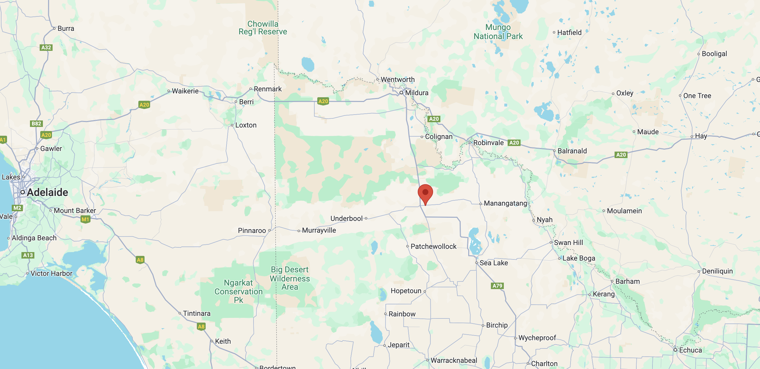
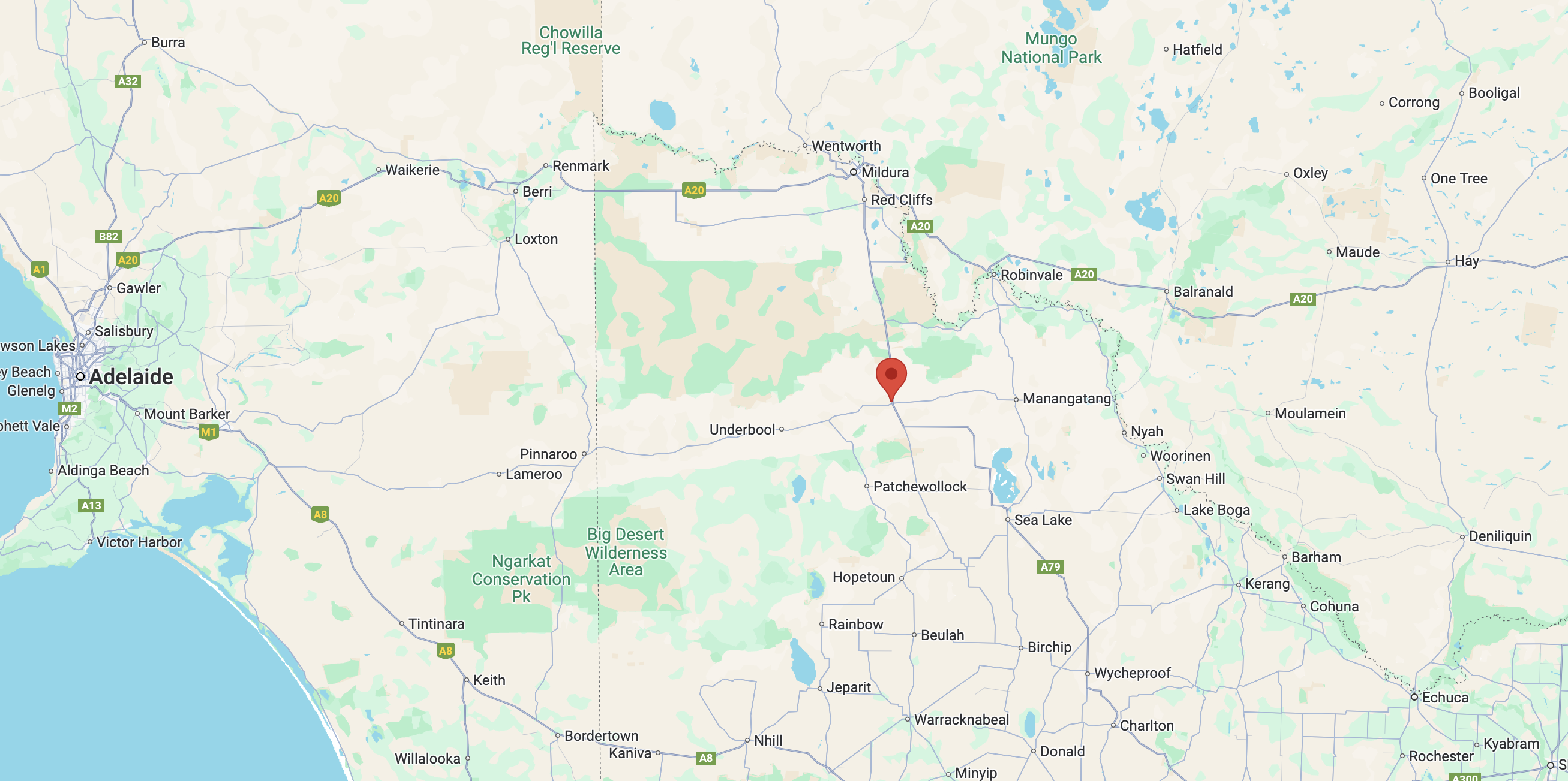
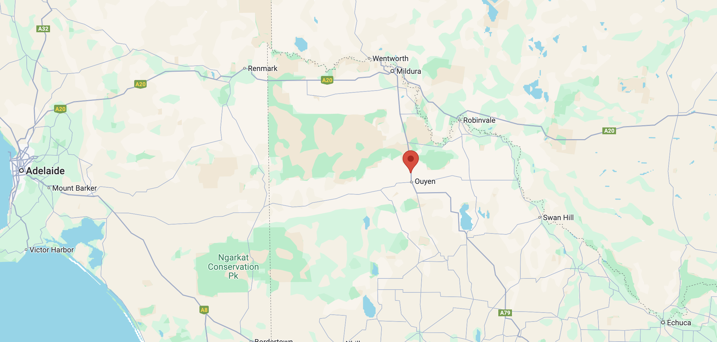
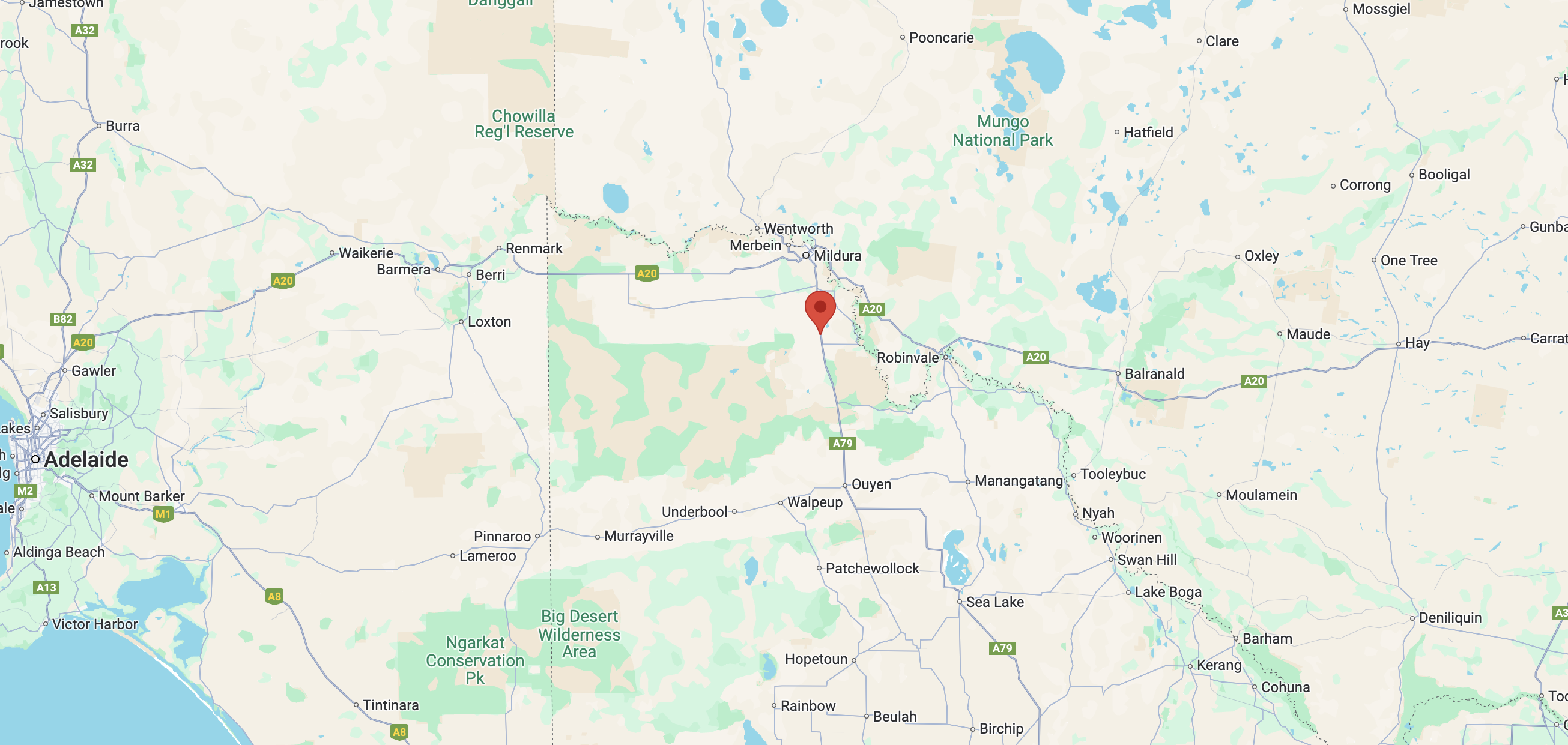
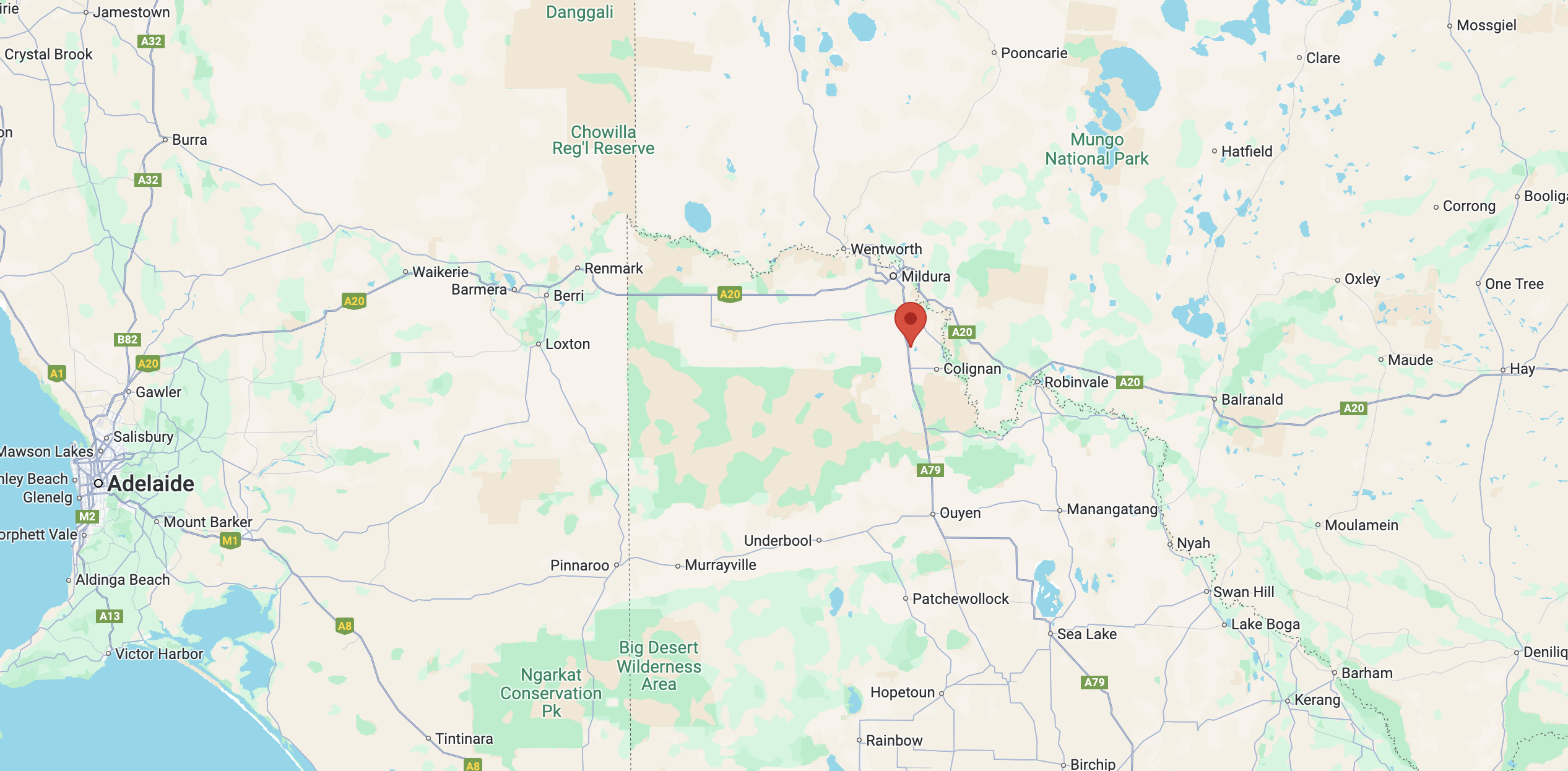
My next activation for Tuesday 20th August 2024 is the Wagant Bushland Reserve VKFF-4249. The park is located about 25 km northeast of Ouyen in northwest Victoria.

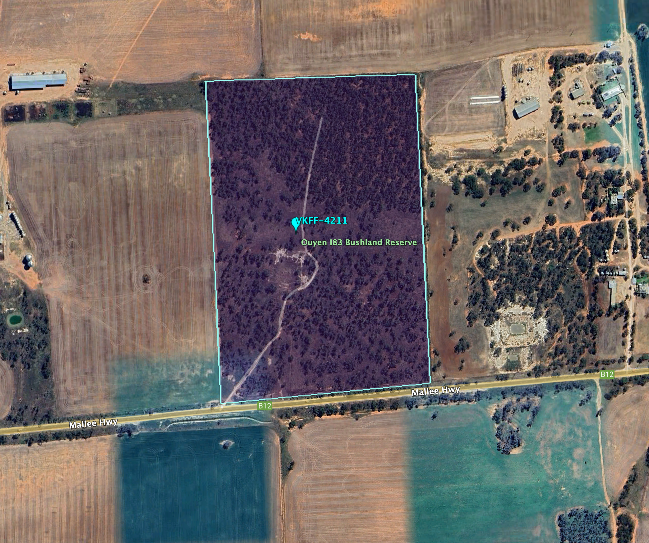
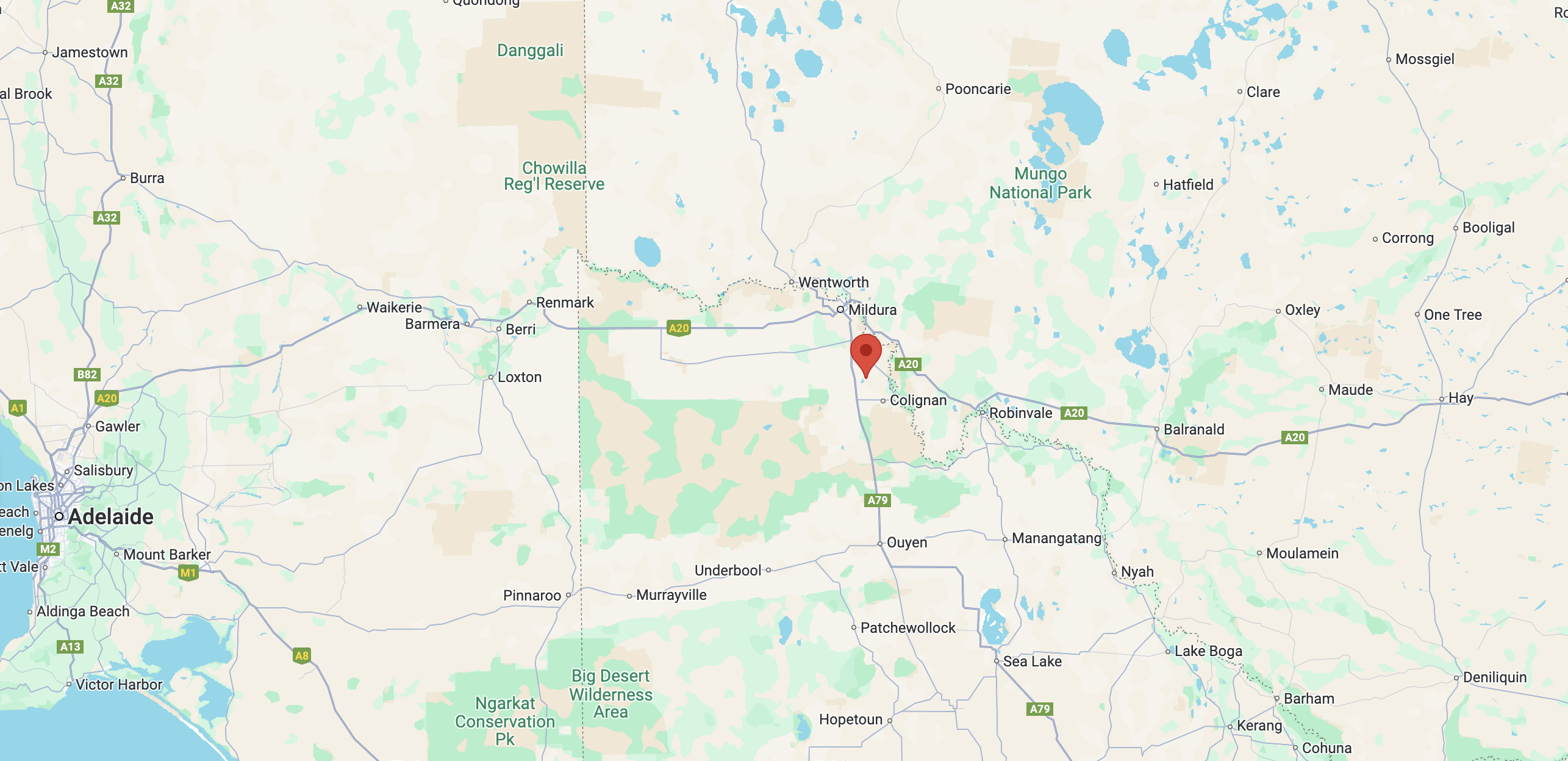
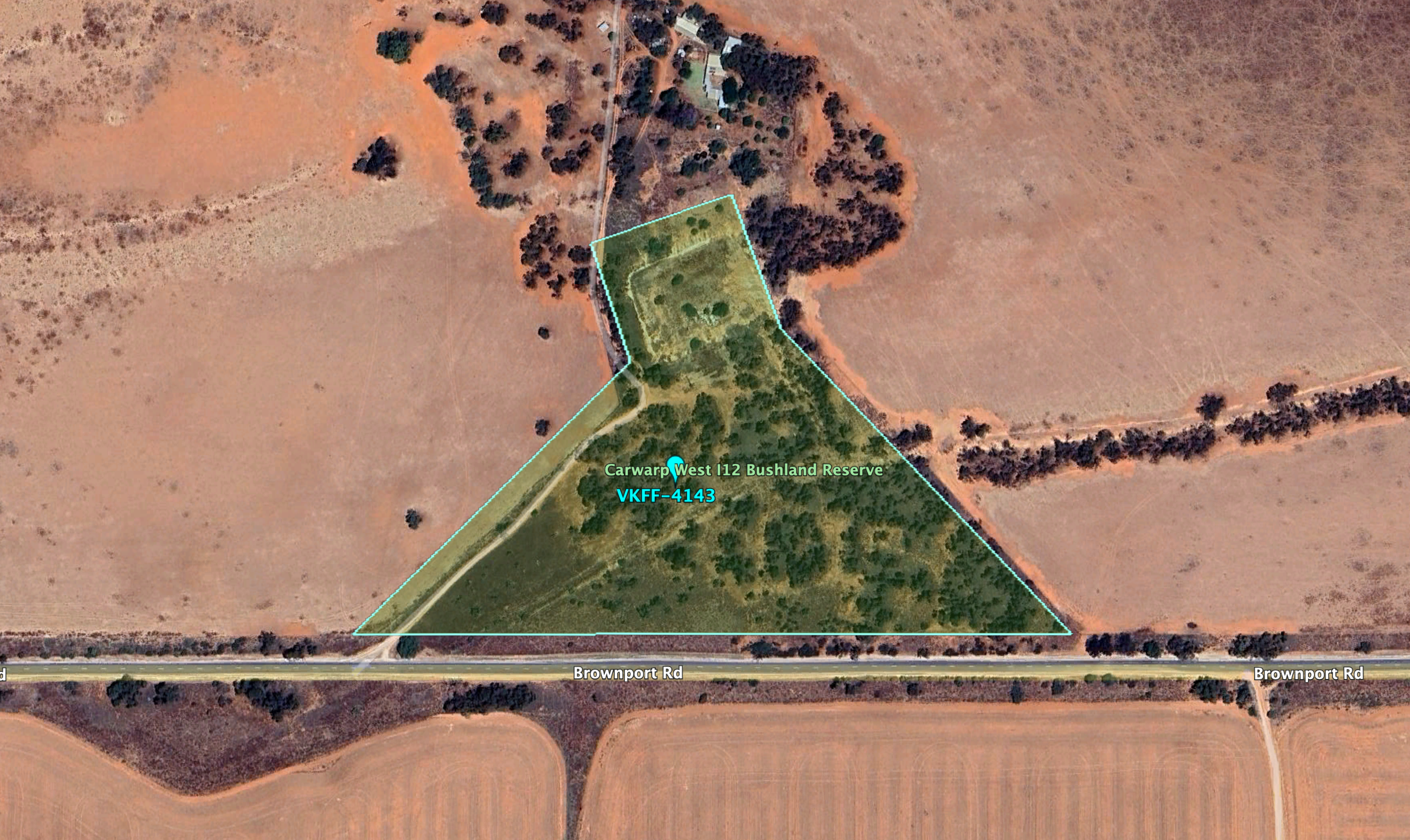
Above:- Map showing the location of the Wagant Bushland Reserve. Map c/o Google Maps.

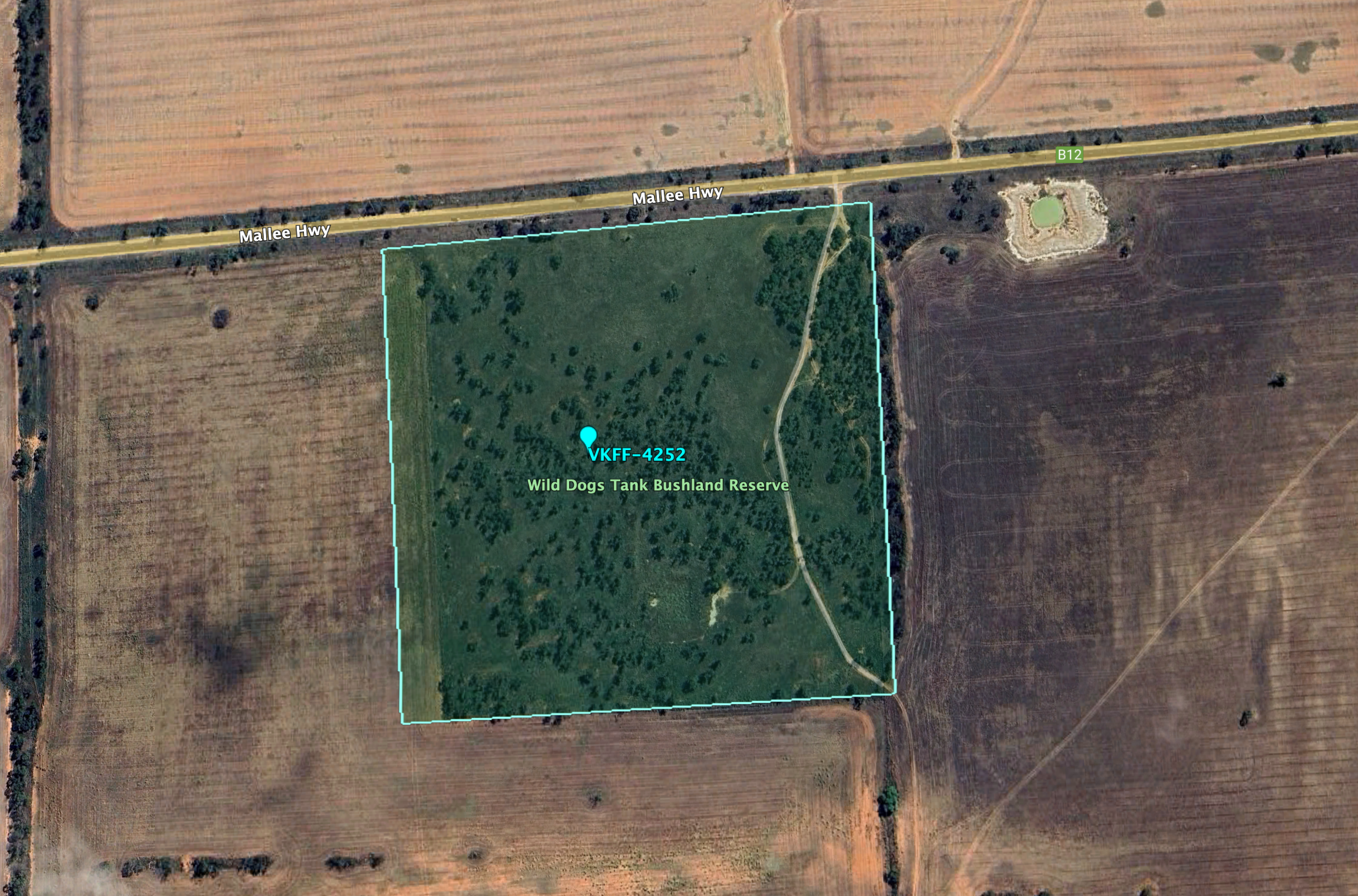
The reserve is located on the northern and southern side of Edwards Road.

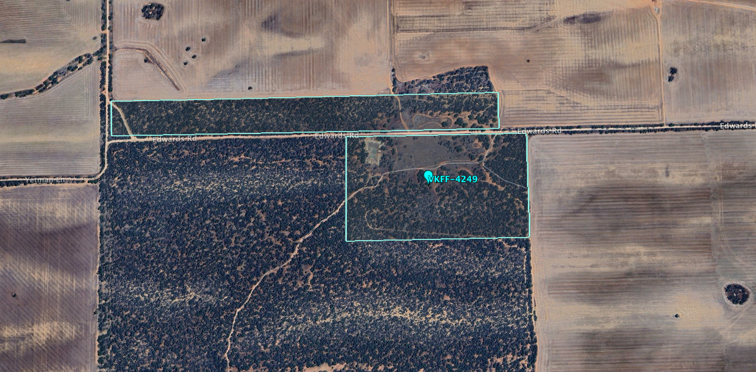
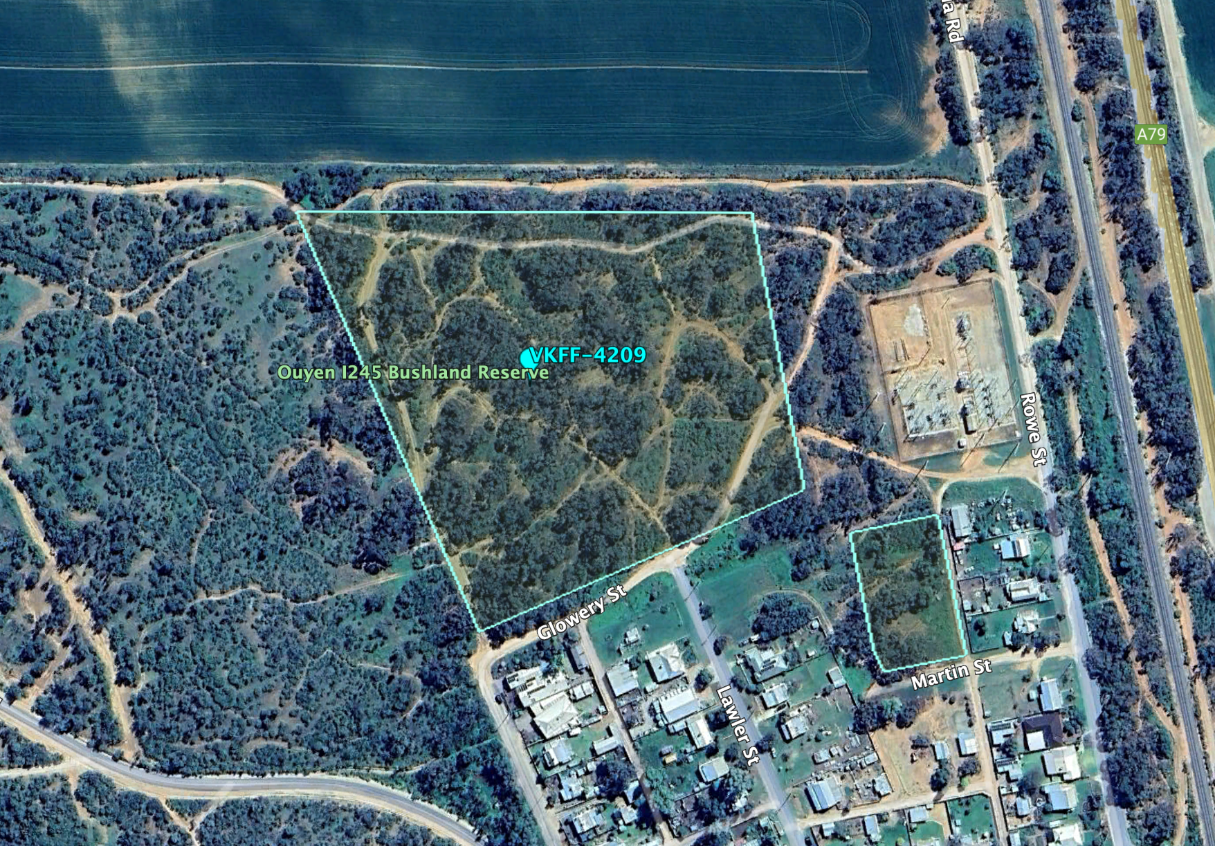
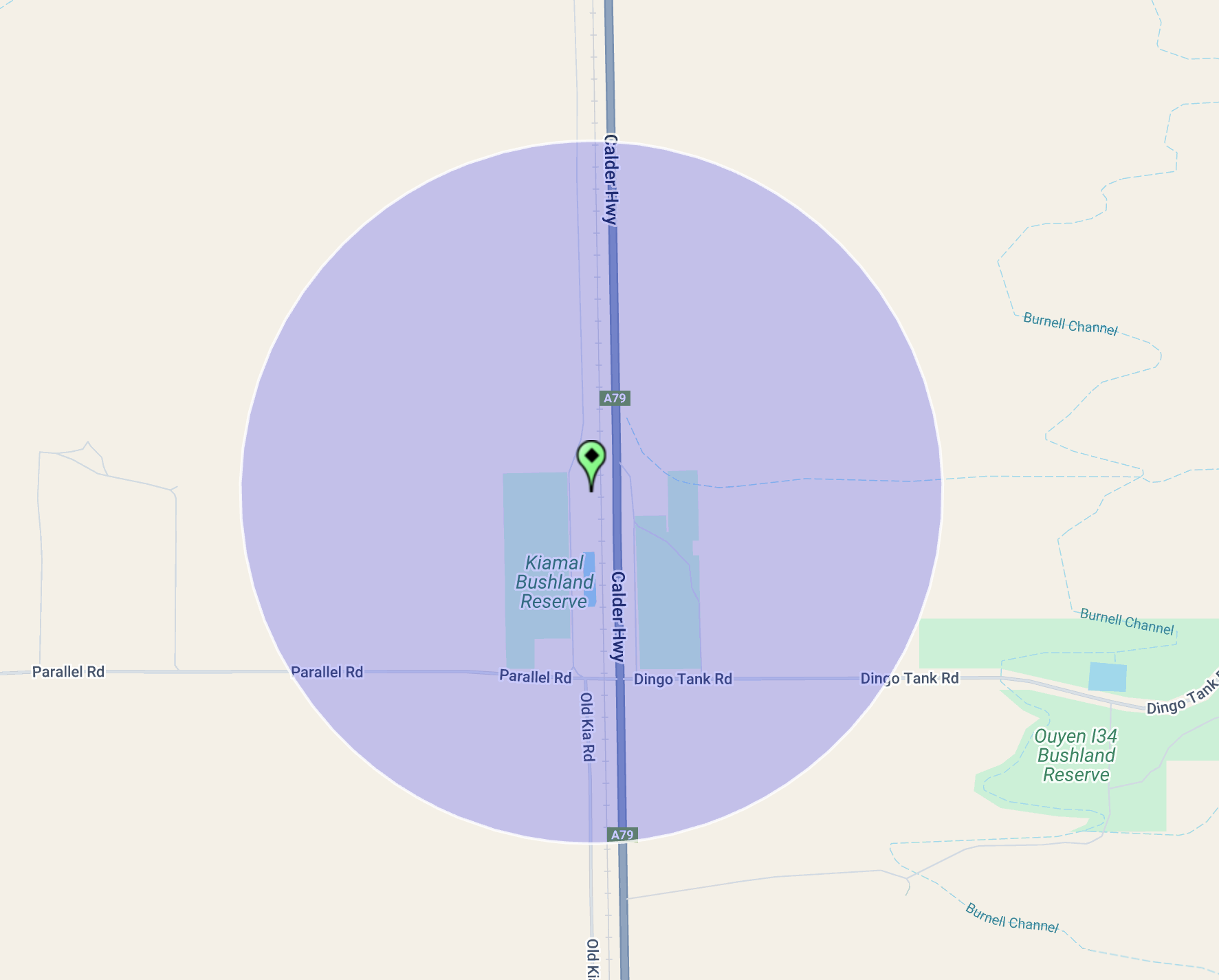
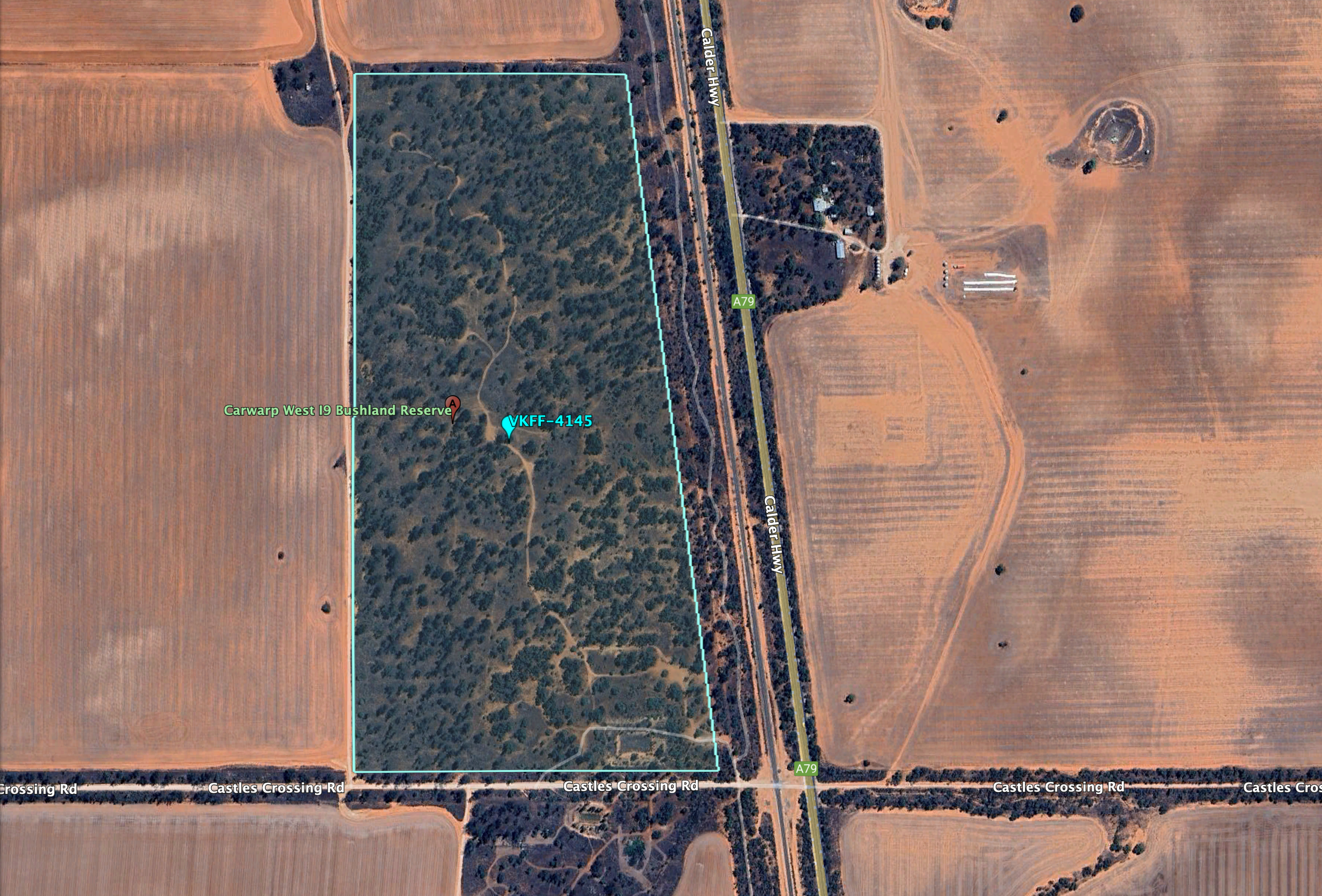
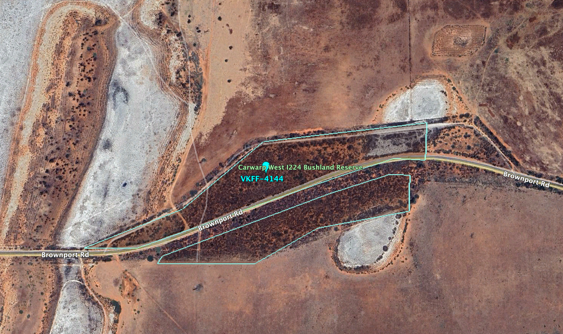
Above:- An aerial view of the Wagant Bushland Reserve. Image c/o Google Earth.

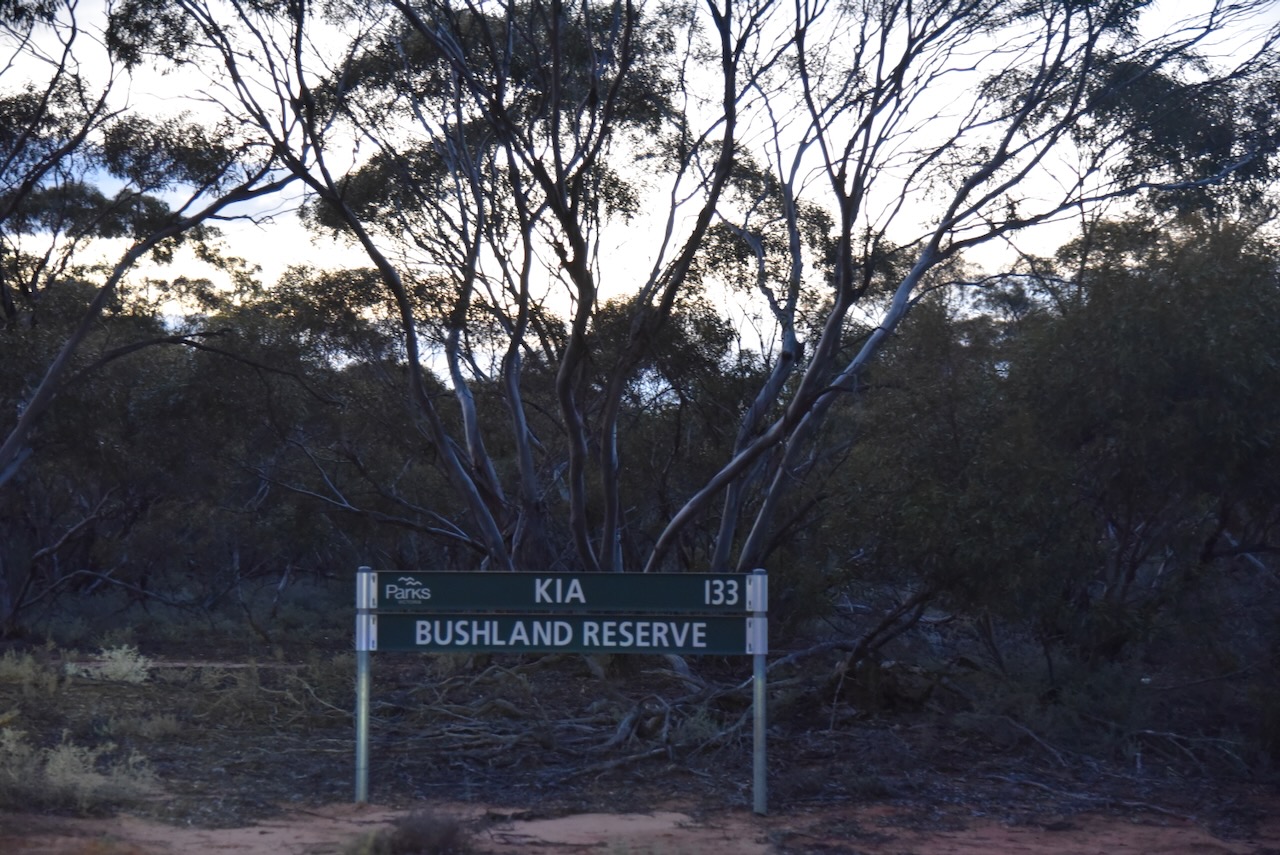
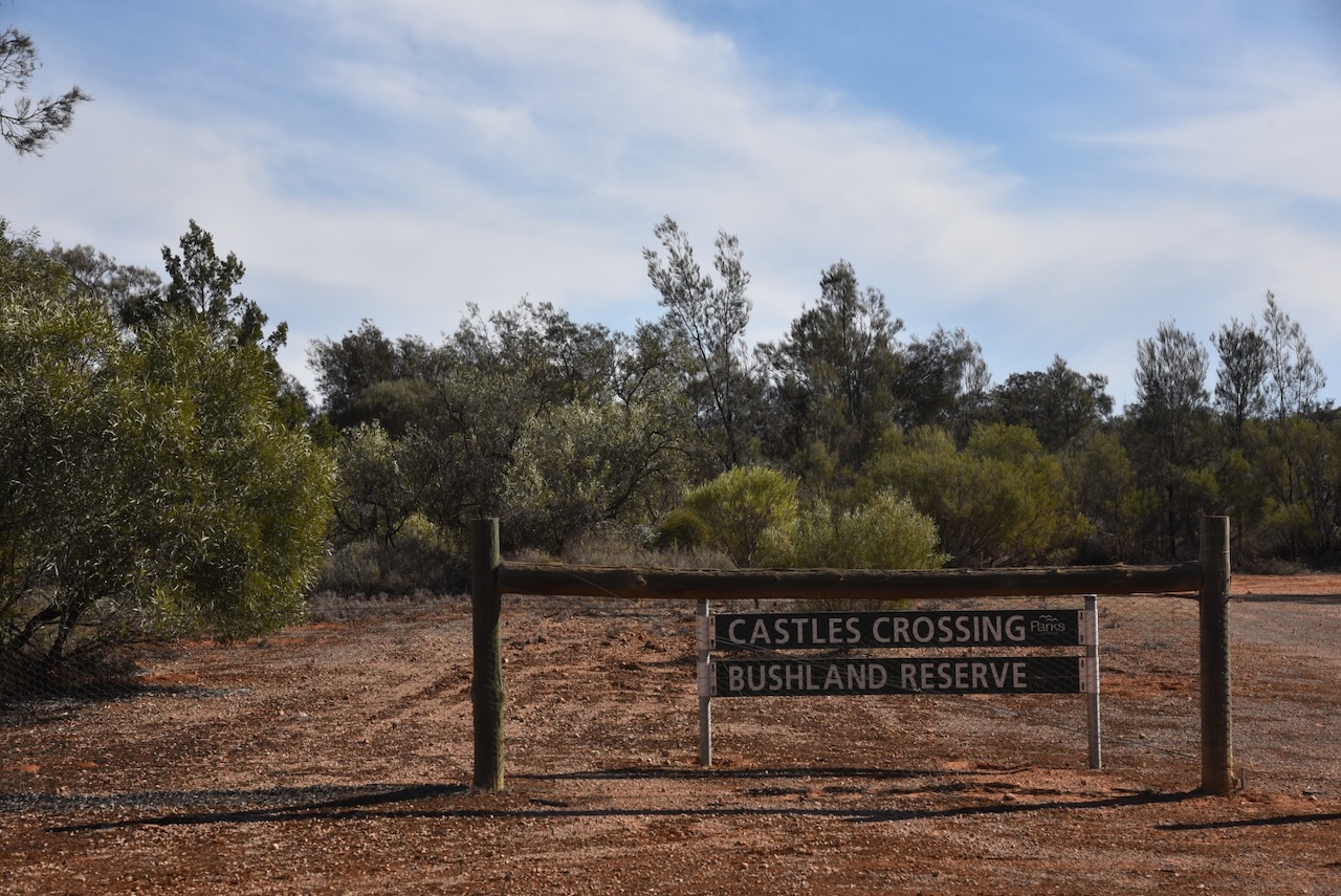
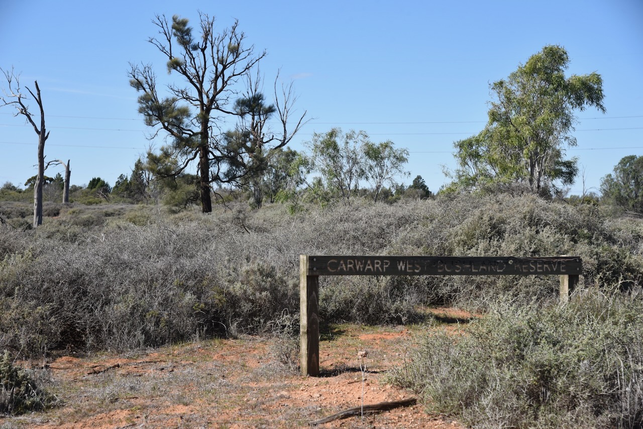
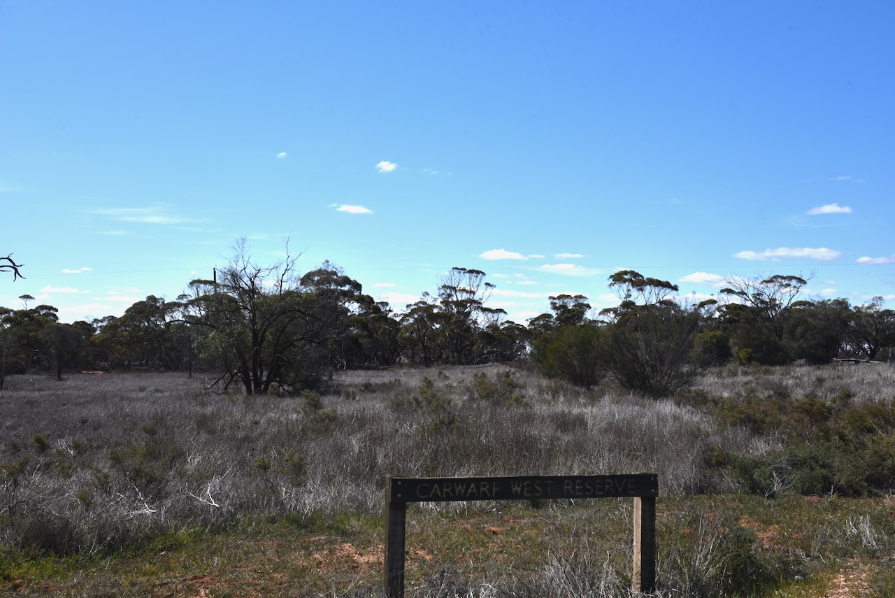
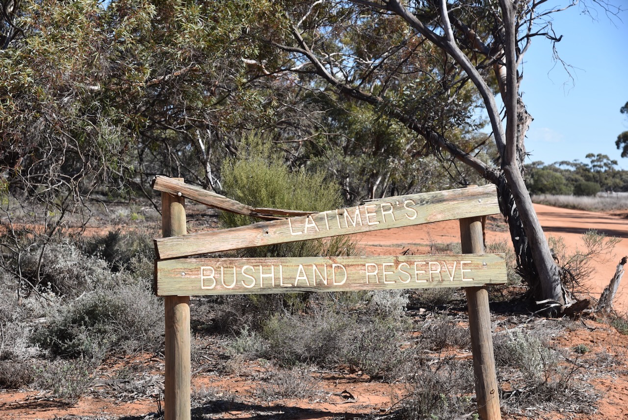
The park is about 48 hectares in size and was established on the 1st day of May 1979. The park was also signposted as Latimer’s Bushland Reserve. The sign was broken and it was clear that authorities had not been to the park for years. I am not sure when the name of the park was changed. Wagant is an aboriginal word meaning ‘hail’. (Blake 1978) (CAPAD 2022)

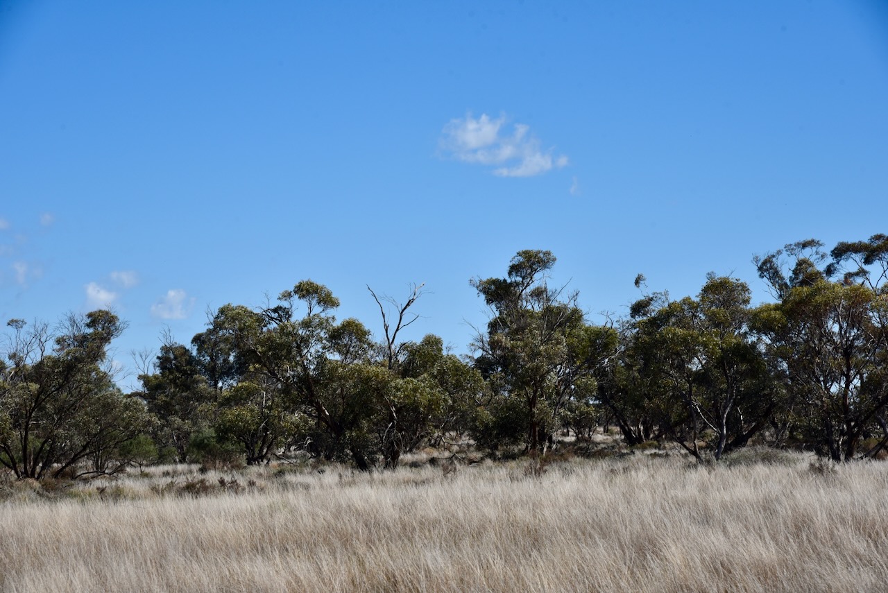
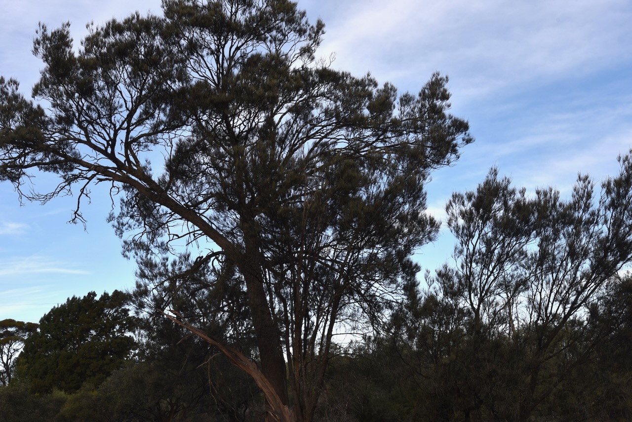
As I arrived at the park there was a Wedge Tailed eagle soaring way above me in the thermals. Unfortunately, he/she was too high up for a good photograph.

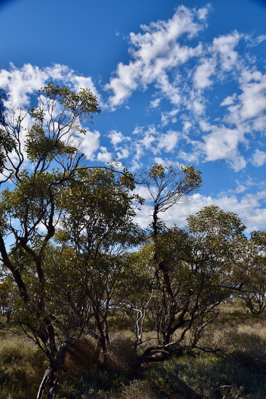
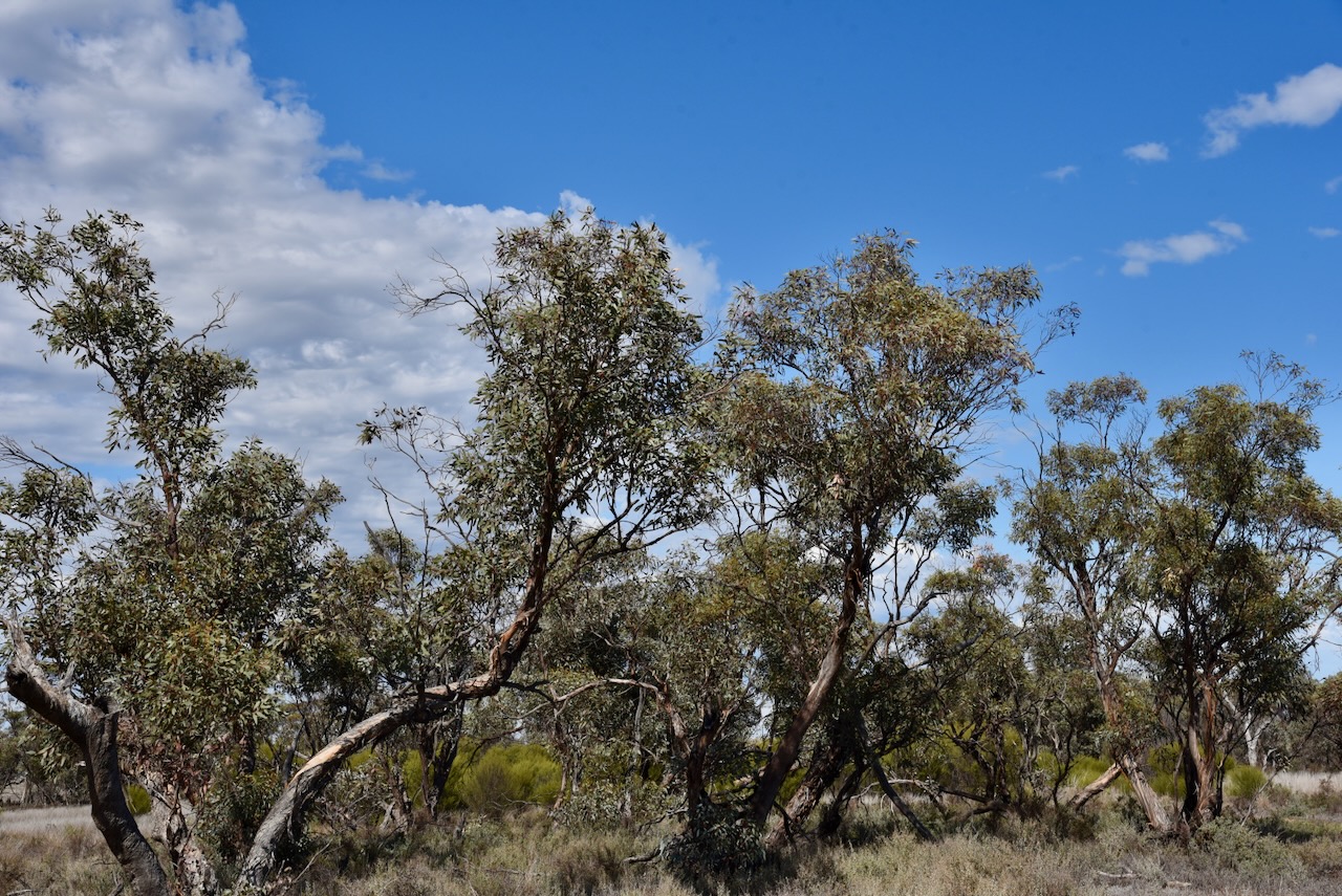
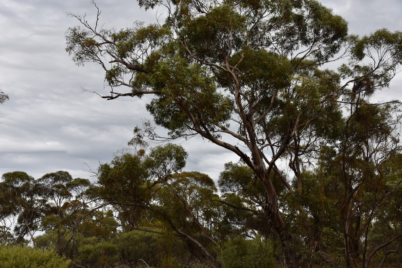
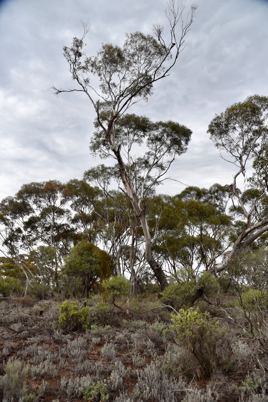
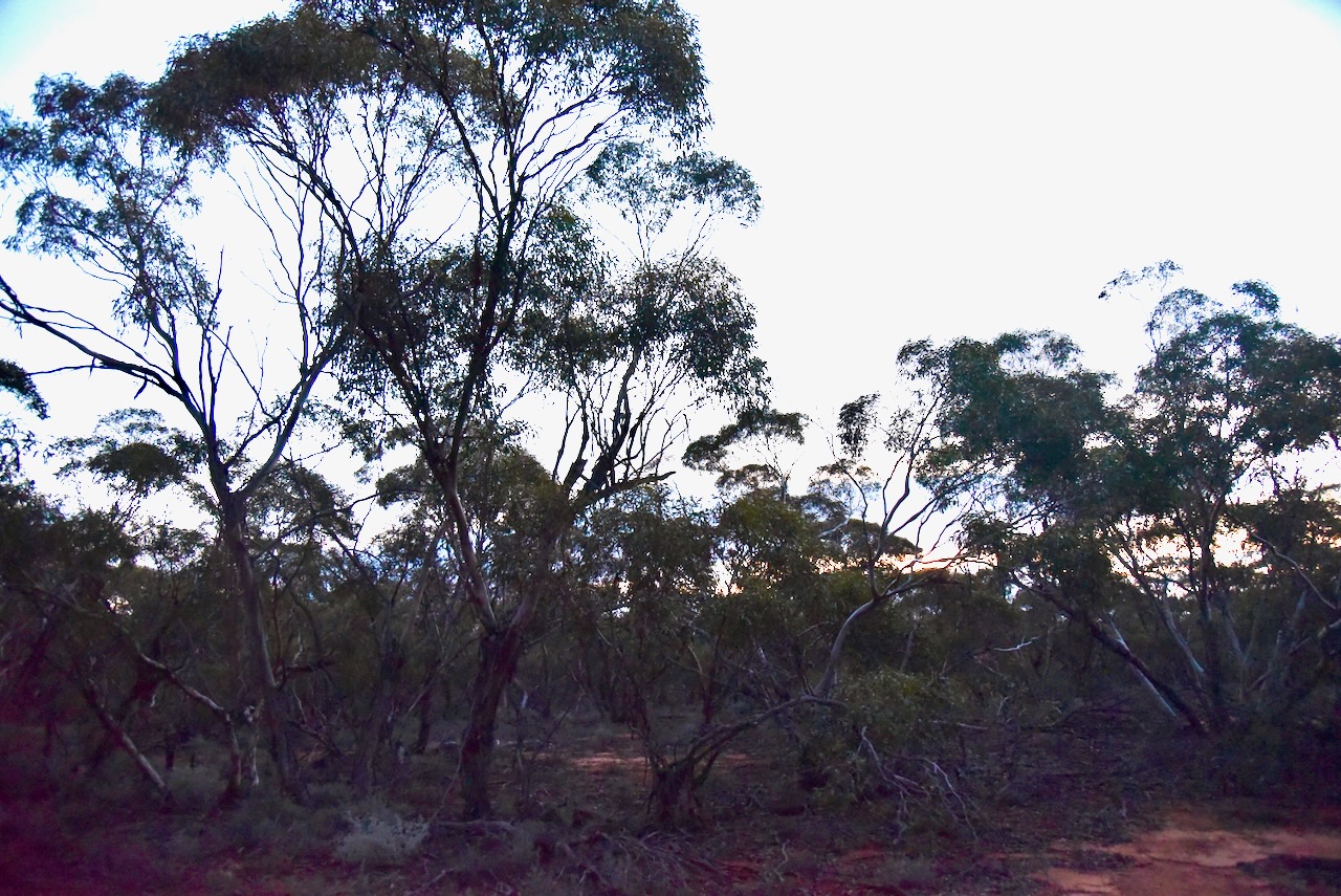
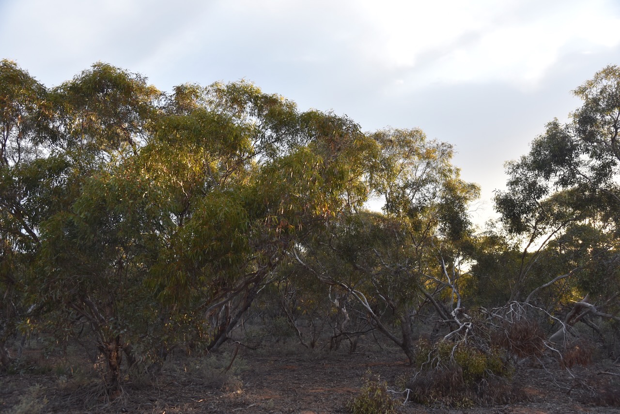
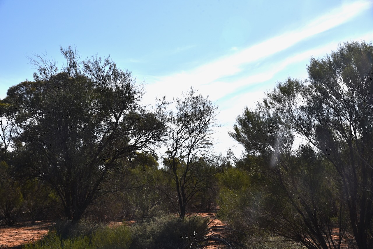
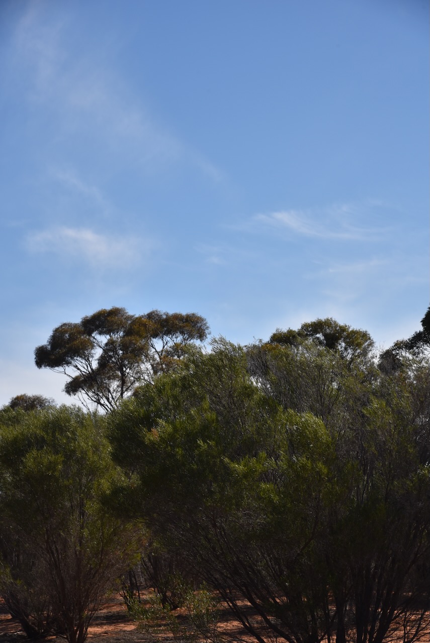
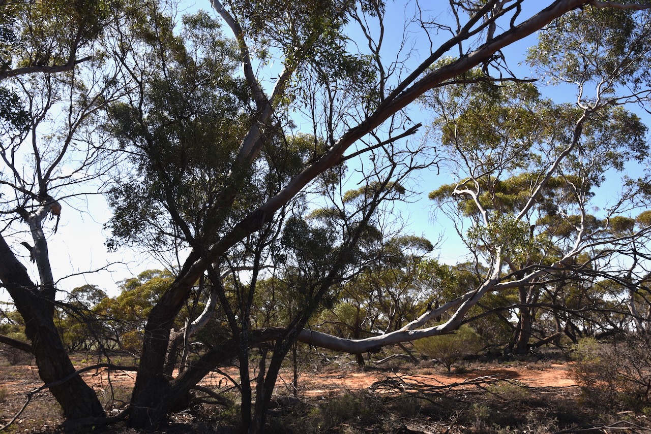
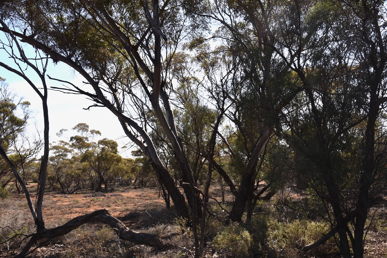
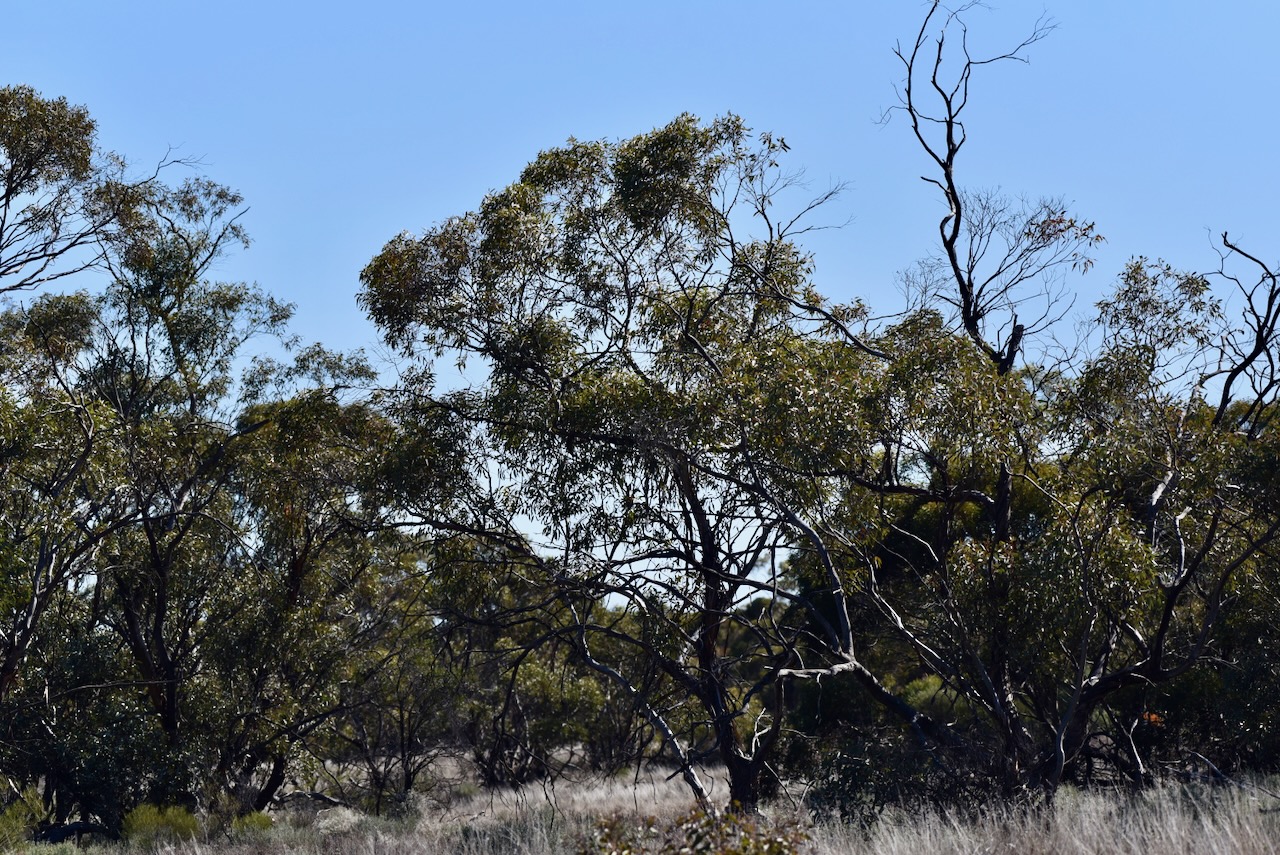
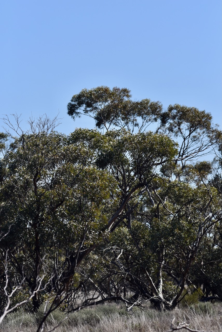
I drove into the park and set up in a clearing amongst the mallee scrub. I ran the Yaesu FT857, 40 watts, and the 20/40/80m linked dipole.

I worked the following stations on 40m SSB:-

  1. VK3BEL
  2. VK3HJW
  3. VK3ZDK
  4. VK1AD
  5. VK1NAM
  6. VK2VW
  7. VK2HFI
  8. VK2AKA
  9. VK2BUG
  10. VK2IO
  11. VK2GEZ
  12. VK3VIN
  13. VK2SLB
  14. VK2BRN
  15. VK2KBT
  16. VK3STV
  17. VK3CEO
  18. VK3ZPF
  19. VK3JW
  20. VK3APJ
  21. VK3SO
  22. Vk3SFG
  23. VK5AAF
  24. VK2EXA
  25. VK5WU
  26. VK3PF/m
  27. VK2YW
  28. VK5VK
  29. VK5FANA
  30. VK2EG/p (SOTA VK2/ MN-103 & Ngambaa Nature Reserve VKFF-1981)
  31. VK5KVA
  32. VK3CA
  33. VK1ARQ
  34. VK3WRD
  35. VK3UAO

I worked the following stations on 40m AM:-

  1. VK3CA
  2. VK3HM

I worked the following stations on 40m FM:-

  1. VK3CA
  2. VK3HM

I worked the following stations on 20m SSB:-

  1. VK2EG (SOTA VK2/ MN-103 & Ngambaa Nature Reserve VKFF-1981)
  2. VK7XX
  3. VK2VW
  4. VK2HFI
  5. VK2AKA
  6. VK2BUG
  7. VK2IO
  8. VK2GEZ
  9. VK2TM
  10. VK4EMP
  11. VK4TI
  12. VK4GKO
  13. VK4HNS
  14. VK6DS/p (Westralia Conservation Park VKFF-1442)

References.

  1. Leslie James Blake, 1978, Place Names of Victoria.
  2. Dcceew.gov.au. (2023). Collaborative Australian Protected Areas Database (CAPAD) 2022 – DCCEEW. [online] Available at: https://www.dcceew.gov.au/environment/land/nrs/science/capad/2022 [Accessed 7 Nov. 2024].‌

Wild Dog Tank Bushland Reserve VKFF-4252

After leaving the Ouyen I83 Bushland Reserve on 20th August 2024, I headed to the Wild Dog Tank Bushland Reserve VKFF-4252. The park is located about 7 km east of Ouyen in northwest Victoria.

Above:- Map showing the location of the Wild Dog Tank Bushland Reserve. Map c/o Google Maps.

The reserve is located on the southern side of the Mallee Highway.

Above:- An aerial view of the Wild Dog Tank Bushland Reserve. Image c/o Google Earth.

The reserve is about 16 hectares in size and was established on the 1st day of May 1979. (CAPAD 2022)

This is another park that was easy to access. I drove in along a 4WD track. I ran the Yaesu FT857, 40 watts, and the 20/40/80m linked dipole.

I worked the following stations on 20m SSB:-

  1. VK2VW
  2. VK2HFI
  3. VK2AKA
  4. VK2BUG
  5. VK5QA/4
  6. VK3CLD/4
  7. VK2SLB
  8. VK2BRN
  9. VK2KBT
  10. VK3PF
  11. VK6JK
  12. VK6DS/p (Westralia Conservation Park VKFF-1442)
  13. ZL/VE6TC
  14. VK4EMP
  15. VK4TI
  16. VK4GKO
  17. ZL1TM
  18. VK4JJ
  19. VK1ARQ

I worked the following stations on 40m SSB:-

  1. VK2SLB
  2. VK2BRN
  3. VK2KBT
  4. VK3PF/m
  5. VK5AAF
  6. VK3APJ
  7. VK2IO
  8. VK2GEZ
  9. VK3HJW
  10. VK3ANL
  11. VK3AXH
  12. VK5WU
  13. VK2VW
  14. VK2HFI
  15. VK2AKA
  16. VK2BUG
  17. VK2EXA
  18. VK3CA
  19. VK3BEL
  20. VK1DI
  21. VK5FANA
  22. VK3CEO
  23. Vk5CZ
  24. VK7XX
  25. VK3UAO
  26. VK5PL
  27. VK2VAR
  28. VK2GOM

I worked the following stations on 40m AM:-

  1. VK3CA
  2. VK3HM

I worked the following stations on 40m FM:-

  1. VK3CA
  2. VK3HM
  3. VK3CEO

References.

  1. Dcceew.gov.au. (2023). Collaborative Australian Protected Areas Database (CAPAD) 2022 – DCCEEW. [online] Available at: https://www.dcceew.gov.au/environment/land/nrs/science/capad/2022 [Accessed 6 Nov. 2024].‌

Ouyen I83 Bushland Reserve VKFF-4211

My next activation for Tuesday 20th August 2024 was the Ouyen I83 Bushland Reserve VKFF-4211. The park is located about 4.5 km east of Ouyen in northwest Victoria.

Above:- Map showing the location of the Ouyen I83 Bushland Reserve. Map c/o Google Maps.

The Ouyen I83 Bushland Reserve is located on the northern side of the Mallee Highway.

Above:- An aerial view of the Ouyen I83 Bushland Reserve. Image c/o Google Earth.

The reserve is about 24 hectares in size and was established on the 1st day of May 1979. (CAPAD 2022)

This was an easy park to access. I was able to drive in along a 4WD track. I ran the Yaesu FT857, 40 watts, and the 20/40/80m linked dipole for this activation.

I worked the following stations on 40m SSB:-

  1. VK3PF
  2. VK5AYL
  3. VK3CEO
  4. VK3SQ
  5. VK2BD
  6. VK2SLB
  7. VK2BRN
  8. VK2KBT
  9. VK3BEL
  10. VK2EXA
  11. VK2MZ
  12. VK7XX
  13. VK1AAF
  14. VK3APJ
  15. VK2KYP
  16. VK2IO
  17. VK2GEZ
  18. VK5GVV
  19. VK4HNS
  20. VK5DC
  21. VK3CJN
  22. VK3QHU
  23. VK2DWP
  24. VK5FD
  25. VK3ANL
  26. VK2JDD
  27. VK2VAR
  28. VK2GOM
  29. VK2KA
  30. VK3SO
  31. VK3SFG
  32. VK3PWG
  33. VK3TTK
  34. VK3MDC
  35. VK7WN
  36. VK3UAO
  37. VK5CFW
  38. VK3VIN
  39. VK2VW
  40. VK2HFI
  41. VK2AKA
  42. VK2BUG
  43. VK1ARQ

I worked the following station on 40m AM:-

  1. VK3UAO

I worked the following stations on 20m SSB:-

  1. VK7XX
  2. VK2VAR
  3. VK2GOM
  4. VK2SLB
  5. VK2BRN
  6. VK2KBT
  7. VK2VW
  8. VK2HFI
  9. VK2AKA
  10. VK2BUG
  11. VK6DS/p (Westralia Conservation Park VKFF-1442)
  12. VK5QA/4
  13. VK3CLD/4
  14. VK3PF
  15. VK1ARQ
  16. VK4ALA

References.

  1. Dcceew.gov.au. (2023). Collaborative Australian Protected Areas Database (CAPAD) 2022 – DCCEEW. [online] Available at: https://www.dcceew.gov.au/environment/land/nrs/science/capad/2022 [Accessed 6 Nov. 2024].‌

Ouyen I245 Bushland Reserve VKFF-4209 and Ouyen silo VK-OYN3

My first park for Tuesday 20th August 2024 was the Ouyen I245 Bushland Reserve VKFF-4209 and the Ouyen silo VK-OYN3.

The reserve is just on the north edge of the town of Ouyen in northwest Victoria.

Above:- Map showing the location of the Ouyen I245 Bushland Reserve. Map c/o Google Maps.

The Ouyen area was first inhabited by the Wegaia aboriginal people. Ouyen, which is pronounced ‘Oh-Yen’, is believed to be derived from the Wegaia word ‘wuya wuya’ which is believed to mean ‘pink-eared duck’. Others claim that is means ‘ghost waterhole’. (Aussie Towns 2024) (Victorian Places 2024) (Wikipedia 2024)

In 1903 the railway line was extended from Woomelang (80km south of Ouyen) to Mildura. The town of Ouyen was established around the Ouyen railway station that was constructed in 1906 on the Midura railway line. The Ouyen Post Office opened on the 22nd day of October 1907. In 1909 the township was formally proclaimed. By 1911 Ouyen had become a transport and service centre for the surrounding land that was occupied by agricultural and pastoral properties. Ouyen’s population was 766 people. (Aussie Towns 2024) (Victorian Places 2024) (Wikipedia 2024)

Above:- An early view of Oke Street Ouyen. Image c/o Walking Ouyen Facebook page.

Today Ouyen is the commercial centre for the surrounding grain farming region. (Wikipedia 2024)

The Ouyen silos are located on Rowe Street. There are two steel silos a few hundred metres apart from the concrete silos and the older steel silos.

Above:- An aerial view of Ouyen showing the location of the Ouyen silos. Image c/o Google Maps.

The concrete silos at Ouyen were constructed in 1939. (The Argus)

Above:- Article from The Argus, Thu 25 May 1939. Image c/o Trove.

The two steel Jumbo silos were constructed in 1986. Five railway departmental residences were demolished to make way for their construction. Work commenced in July 1986 and they were completed by November 1986. (Mildura Railway History 2024)

The Ouyen I245 Bushland Reserve is located on the northern side of Glowery Street, Ouyen.

Above:- An aerial view of the Ouyen I245 Bushland Reserve. Image c/o Google Earth.

The reserve is only small, about 5 hectares in size, and was established on the 8th day of May 1990. (CAPAD 2022)

The reserve was easily accessible and I set up in a clearing amongst the mallee scrub. ran the Yaesu FT857, 40 watts, and the 20/40/80m linked dipole. I was set up within the activation zone of the Ouyen silo.

Above:- Map showing the activation zone of the Ouyen silo. Image c/o SiOTA website.

I worked the following stations on 40m SSB:-

  1. VK3CA
  2. VK3HM
  3. VK2VW
  4. VK2HFI
  5. VK2AKA
  6. VK2BUG
  7. VK2IO
  8. VK2GEZ
  9. VK7PJM
  10. VK3ZPF
  11. Vk3JW
  12. VK3ZDK
  13. VK3HJW
  14. VK3CEO
  15. VK7XX
  16. VK3AMO
  17. VK4HNS
  18. VK3CJN
  19. VK3QHU
  20. VK3VIN
  21. VK2SLB
  22. VK2BRN
  23. VK2KBT
  24. VK3UAO
  25. VK3APJ
  26. VK5AAF
  27. VK5GY
  28. VK3PF
  29. VK3SO
  30. Vk3SFG
  31. VK2KYO
  32. VK3TBS
  33. VK5IS
  34. VK2EXA

I worked the following stations on 40m AM:-

  1. VK3CA
  2. VK3HM
  3. VK3UAO

I worked the following stations on 40m FM:-

  1. VK3CA
  2. VK3HM

I worked the following stations on 20m SSB:-

  1. VK7XX
  2. VK5QA/4
  3. VK3CLD/4
  4. VK2SLB
  5. VK2BRN
  6. VK2KBT
  7. VK7WN
  8. VK2VW
  9. VK2HFI
  10. VK2AKA
  11. VK2BUG
  12. VK4HNS
  13. VK4JJ
  14. VK4EMP
  15. VK4TI
  16. VK4GKO
  17. VK2MES

References.

  1. Aussie Towns. (2022). Ouyen, VIC – Aussie Towns. [online] Available at: https://www.aussietowns.com.au/town/ouyen-vic [Accessed 3 Nov. 2024].
  2. ‌Dcceew.gov.au. (2023). Collaborative Australian Protected Areas Database (CAPAD) 2022 – DCCEEW. [online] Available at: https://www.dcceew.gov.au/environment/land/nrs/science/capad/2022 [Accessed 3 Nov. 2024].‌
  3. Victorianplaces.com.au. (2014). Ouyen | Victorian Places. [online] Available at: https://www.victorianplaces.com.au/ouyen [Accessed 3 Nov. 2024].
  4. ‌vmrs.net. (n.d.). Mildura Railway History. [online] Available at: https://vmrs.net/mildura/sitemap.htm. [Accessed 3 Nov. 2024].
  5. ‌Wikipedia Contributors (2024). Ouyen. Wikipedia.‌

Kia I33 Bushland Reserve VKFF-4231

After leaving the Kiamal Bushland Reserve I headed out to activate the Kia I33 Bushland Reserve VKFF-4231.

The reserve is located about 12 km north of Ouyen in northwest Victoria.

Above:- Map showing the location of the Kia I33 Bushland Reserve. Map c/o Google Maps.

The Kia district is now known as Kiamal. It is an aboriginal word with various meanings, including squat, emu, war spear, and fibrous tree. (Blake 1978)

Above:- An aerial view looking north towards the park from Ouyen. Image c/o Google Maps.

The reserve is located on the western side of Calder Highway and on the northern side of Lonergan Road.

Above:- An aerial view of the Kia I33 Bushland Reserve. Image c/o Google Earth.

The Kia I33 Bushland Reserve is about 51 hectares in size and was established on the 1st day of May 1979. (CAPAD 2022)

I ran the Yaesu FT857, 40 watts, and the 20/40/80m linked dipole for this activation.

I worked the following stations on 40m SSB:-

  1. VK3PF/p (Yea River, Yea Streamside Reserve VKFF-3928)
  2. VK4SMA
  3. VK3EJ
  4. VK5WU
  5. VK3CEO
  6. VK5AYL
  7. VK3CA
  8. VK3HM
  9. VK7PJM
  10. VK5PL
  11. VK4FDJL
  12. VK4WAB
  13. ZL3MR
  14. VK4EMP
  15. VK4TI
  16. VK4GKO
  17. VK5LA
  18. VK5KAW
  19. Vk5FANA
  20. VK5WA/m
  21. VK3UAO
  22. KG5CIK
  23. VK3PAJ
  24. VK1ARQ
  25. VK3VIN
  26. VK4AGE
  27. VK7MAT
  28. VK7MAD
  29. VK4HMI
  30. VK6JK
  31. VK3MIJ
  32. VK3ZK

I worked the following stations on 40m AM:-

  1. VK3ZK
  2. VK3CEO
  3. VK4SMA
  4. VK4AGE
  5. VK3UAO
  6. VK5WU
  7. VK3CA
  8. VK3HM
  9. VK5FB
  10. VK5LA
  11. VK5KAW

I worked the following stations on 40m FM:-

  1. VK3UAO
  2. VK3CA
  3. VK3HM
  4. VK5LA
  5. VK5KAW
  6. VK5FB

After leaving the park I headed back into Ouyen and went out for dinner at the Ouyen Club where I enjoyed a very nice meal and a few cold Bundy and cokes.

References.

  1. Dcceew.gov.au. (2023). Collaborative Australian Protected Areas Database (CAPAD) 2022 – DCCEEW. [online] Available at: https://www.dcceew.gov.au/environment/land/nrs/science/capad/2022 [Accessed 3 Nov. 2024].‌
  2. Leslie James Blake, 1978, Place Names of Victoria.

Kiamal Bushland Reserve VKFF-4232 and Kiamal silo VK-KML3

After packing up at Carwarp West I9 Bushland Reserve on Monday 19th August 2024, I headed south on Calder Highway for 65 km until I reached the town of Ouyen. I had booked accommodation here for a few nights. I booked into my motel room, offloaded some of my gear, and then headed out to activate another park.

I drove to Kiamal Bushland Reserve VKFF-4232, just 8 km north of Ouyen. The park is also within the activation zone of the Kiamal silo VK-KML3.

Above:- Map showing the location of the Kiamal Bushland Reserve. Map c/o Google Maps.

Kiamal was formerly known as Kia. It is an aboriginal word with various meanings including to squat, emu, war spear, and fibrous tree). (Victorian Places)

In its day Kiamal was a thriving town with dances and other social events being held at the local hall. Kiamal also had its own cricket club.

Above:- Article from the Ouyen Mail, Wed 15 Nov 1939. Image c/o Trove.

The Kiamal railway station opened on the 6th day of May 1913 and was originally known as Kia Siding. It was renamed Kiamal on the 19th day of February 1917. The siding consisted of a goods loop siding that was completed in late April 1913. By January 1919 a passenger platform had been constructed. There were no goods platform or shed on the siding. Kiamal was closed to passenger traffic on the 14th day of April 1970. In January 1992 the Kiamal platform was removed. (Mildura Railway History)

The Kiamal Bushland Reserve is located on both the eastern and western side of Calder Highway at the intersection with Parallel Road and Dingo Tank Road.

Above:- An aerial view of the Kiamal Bushland Reserve. Image c/o Google Earth.

The reserve is about 18 hectares in size and was established on the 8th day of May 1990. (CAPAD 2022)

I accessed the reserve via Old Kia Road. I ran the Yaesu FT857, 40 watts, and the 20/40/80m linked dipole for this activation.

Above:- the activation zone at the Kiamal silo. Image co SiOTA website.

I worked the following stations on 20m SSB:-

  1. ZL3MR
  2. VK2VW
  3. VK2HFI
  4. VK2AKA
  5. VK2BUG
  6. VK2IO
  7. VK2GEZ
  8. KG5CIK
  9. VK2EG/p
  10. VK5QA/4
  11. VK3CLD/4
  12. OH1XT
  13. ON4BB
  14. VK5PL
  15. SP7MW
  16. VK4SMA
  17. F5NZO
  18. IK1GPG
  19. OH1MM
  20. SP9RXP
  21. EW6MP
  22. ON4ON
  23. GI0BDX
  24. ZL1TM
  25. OH5EP
  26. M6KFI/p
  27. PA5WK
  28. UT5PI
  29. OM5TX
  30. VK6NU
  31. EA3MP
  32. IS0CZG
  33. M1TES/m
  34. G4AKC/p (bicycle mobile)
  35. DL2ND
  36. VK4HNS
  37. F4HZR
  38. VK4TJ
  39. OM3CND
  40. VK4EMP
  41. VK4TI
  42. VK4GKO
  43. S58AL
  44. RX9WN
  45. SP5HRX
  46. IK4JPK
  47. VK5AYL
  48. LA7TN

I worked the following stations on 40m SSB:-

  1. VK5LA
  2. VK5KAW
  3. VK3APJ
  4. VK2EXA
  5. VK7PSJ
  6. VK5FB
  7. VK7PJM
  8. VK1DI
  9. VK3CEO
  10. VK4FSC
  11. VK3ADS
  12. KG5CIK
  13. VK3ALF
  14. VK7JU
  15. VK5AC
  16. VK3PF/p (Yea Streamside Reserve VKFF-3928)
  17. VK5WU
  18. VK4FDJL
  19. VK4WAB
  20. VK4EMP
  21. VK4TI
  22. VK4GKO
  23. VK3SQ
  24. VK2BD
  25. VK2KEV/3
  26. VK4XRC
  27. VK3ZK
  28. VK2TGH
  29. VK5GY
  30. VK5FANA
  31. VK4DTS
  32. VK2IO
  33. VK2GEZ

References.

  1. Dcceew.gov.au. (2023). Collaborative Australian Protected Areas Database (CAPAD) 2022 – DCCEEW. [online] Available at: https://www.dcceew.gov.au/environment/land/nrs/science/capad/2022 [Accessed 17 Oct. 2024].‌
  2. Leslie James Blake, 1978, Place Names of Victoria.
  3. Vmrs.net. (2024). Kiamal. [online] Available at: https://vmrs.net/mildura/section1/Kiamal.htm [Accessed 17 Oct. 2024].‌

Carwarp West I9 (Castle Crossing) Bushland Reserve VKFF-4145

My next activation for Monday 19th August 2024 was the Carwarp West I9 (Castle Crossing) Bushland Reserve VKFF-4145. This was the first time that I had activated the park.

The reserve is located about 36 km south of Mildura in northwest Victoria.

Above:- Map showing the location of the Carwarp West I9 Bushland Reserve. Map c/o Google Maps.

The park is located on the western side of Calder Highway at the intersection with Castles Crossing Road.

Above:- An aerial view of the Carwarp West I9 Bushland Reserve. Image c/o Google Earth.

The reserve is about 39 hectares in size and was established on the 1st day of May 1979. (CAPAD 2022)

I drove into the park and set up in the carpark area. There was plenty of room to string out the 20/40/80m linked dipole. I ran the Yaesu FT857 and 40 watts. I worked the following stations on 40m SSB:-

  1. VK3PF/m
  2. VK3CEO
  3. VK3CJN
  4. VK3QHU
  5. VK3ACZ
  6. VK3MIJ
  7. VK3EJ
  8. VK2SLB
  9. VK2BRN
  10. VK2KBT
  11. VK3PWG
  12. VK3TTK
  13. VK5WU
  14. VK2IO
  15. VK2GEZ
  16. VK3CA
  17. VK3BEL
  18. VK3QH
  19. VK1AD
  20. VK1NAM
  21. VK3YE/p (Mt Martha Nature Conservation Reserve VKFF-2152)
  22. VK3APJ
  23. VK3HJW
  24. VK2VW
  25. VK2HFI
  26. VK2AKA
  27. VK2BUG
  28. VK4FDJL
  29. VK3MKE
  30. VK2EXA
  31. VK7ALB

I worked the following stations on 40m AM:-

  1. VK3CA
  2. VK3QH
  3. VK3BEL
  4. VK3APJ

I worked the following stations on 40m FM:-

  1. VK3CA
  2. VK3QH
  3. VK3BEL
  4. VK3APJ

I worked the following stations on 20m SSB:-

  1. VK2USH/p (Lake Broadwater Resources Reserve VKFF-3539)
  2. VK6AB
  3. KG5CIK
  4. VK2VW
  5. VK2HFI
  6. VK2AKA
  7. VK2BUG
  8. VK4EMP
  9. VK4TI
  10. VK4GKO
  11. VK2IO
  12. VK2GEZ
  13. VK6JK
  14. VK2MJW
  15. OM5TX
  16. DL2ND
  17. DL1EBR
  18. VK4SMA
  19. VK5QA/4
  20. VK3CLD/4
  21. OH1XT
  22. F5PYI
  23. OH1MM

References.

  1. Dcceew.gov.au. (2023). Collaborative Australian Protected Areas Database (CAPAD) 2022 – DCCEEW. [online] Available at: https://www.dcceew.gov.au/environment/land/nrs/science/capad/2022 [Accessed 14 Oct. 2024].‌

Carwarp West I224 Bushland Reserve VKFF-4144

After leaving Carwarp West I12 Bushland Reserve on Monday 19th August 2024, I drove a little further along Bronwport Road until I reached my next park activation, the Carwarp West I224 Bushland Reserve VKFF-4144.

The reserve is about 35 km south of Mildura in northwest Victoria.

Above:- Map showing the location of the Carwarp West I224 Bushland Reserve. Map c/o Google Maps.

The reserve is located on the northern side of Brownport Road and is about 5 km east of Calder Highway.

Above:- An aerial view of the Carwarp West I224 Bushland Reserve. Image c/o Google Earth.

The reserve is about 13.5 hectares in size and was established on the 8th day of May 1990. (CAPAD 2022)

I ran the Yaesu FT857, 40 watts, and the 20/40/80m linked dipole for this activation.

I worked the following stations on 40m SSB:-

  1. VK2USH/p (Lake Broadwater Resources Reserve VKFF-3539)
  2. VK3APJ
  3. VK3MTT
  4. VK2TER/p (SOTA VK1/ AC-042 & Black Mountain Nature Reserve VKFF-0834)
  5. VK3CA
  6. VK3CEO
  7. VK3ZGA
  8. VK3SX
  9. VK2EXA
  10. VK2KYO
  11. VK5PL
  12. VK3HJW
  13. VK2VW
  14. VK2HFI
  15. VK2AKA
  16. VK2BUG
  17. VK3IK/m
  18. VK2IO
  19. VK2GEZ
  20. VK2HAK
  21. VK3EJ
  22. VK5FTOM
  23. VK3YE/p (Mount Martha Nature Conservation Reserve VKFF-2152)
  24. VK2SLB
  25. VK2BRN
  26. VK2KBT
  27. VK3SO
  28. VK3SFG
  29. VK3KYF

I worked the following stations on 40m AM:-

  1. VK3CA
  2. VK3CEO
  3. VK3ZGA
  4. VK2KYO
  5. VK3PF/p (Tooborac Nature Conservation Reserve VKFF-2212)

I worked the following stations on 40m FM:-

  1. VK3CA
  2. VK3HM
  3. VK3ZGA
  4. VK3CEO
  5. VK3APJ
  6. VK3AMO
  7. VK3PF/p (Tooborac Nature Conservation Reserve VKFF-2212)

I worked the following stations on 20m SSB:-

  1. VK4HNS
  2. VK6DS
  3. VK2VW
  4. VK2HFI
  5. VK2AKA
  6. VK2BUG
  7. VK2SLB
  8. VK2BRN
  9. VK2KBT
  10. VK7EE
  11. VK5CZ
  12. VK4SMA
  13. VK4EMP
  14. VK4TI
  15. VK4GKO
  16. KG5CIK
  17. VK2IO
  18. VK2GEZ
  19. VK7JFD
  20. ZL3MR
  21. VK6JK
  22. DL2ND
  23. OH1XT
  24. VK2ZRD
  25. F5PYI
  26. VK2EG
  27. VK2SOL
  28. SQ9CWO

Reference.

  1. Dcceew.gov.au. (2023). Collaborative Australian Protected Areas Database (CAPAD) 2022 – DCCEEW. [online] Available at: https://www.dcceew.gov.au/environment/land/nrs/science/capad/2022 [Accessed 14 Oct. 2024].‌

Carwarp West I12 Bushland Reserve VKFF-4143

My next park for Monday 19th August 2024 was the Carwarp West I12 Bushland Reserve VKFF-4143. This was to be the first time I had activated the park for the World Wide Flora Fauna (WWFF) program, and only the third time that the park had been activated.

The reserve is about 32 km south of Mildura in northwest Victoria.

Above:- Map showing the location of the Carwarp West I12 Bushland Reserve. Map c/o Google Maps.

The reserve is located on the northern side of Brownport Road, just 1 km east of Calder Highway.

Above:- An aerial view of the Carwarp West I12 Bushland Reserve. Image c/o Google Earth.

The reserve is quite small at just 5.5 hectares. It was established on the 1st day of May 1979. (CAPAD 2022)

I ran the Yaesu FT857, 40 watts, and the 20/40/80m linked dipole for this activation. There was plenty of cleared area to string out the linked dipole.

I worked the following stations on 40m SSB:-

  1. VK3OB/2
  2. VK3PF/m
  3. VK2SLB
  4. VIK2BRN
  5. VK2KBT
  6. VK5DC
  7. VK3CWF
  8. VK1AD
  9. VK1NAM
  10. VK3CA
  11. VK3APJ
  12. Vk3EJ
  13. VK3QH
  14. VK3MTT
  15. VK3GJG
  16. VK3HJW
  17. VK4HNS
  18. VK5GY
  19. VK3PWG
  20. VK3TTK
  21. Vk3CEO
  22. VK3ZPF
  23. VK3JW
  24. VK2VW
  25. VK2HFI
  26. VK2AKA
  27. VK2BUG
  28. VK5KVA
  29. VK3PF/p (Tooborac Nature Conservation Reserve VKFF-2212)
  30. Vk5FB
  31. VK5PL
  32. VK3PXS

I worked the following stations on 40m AM:-

  1. VK3CA
  2. VK3APJ
  3. VK3GJG
  4. VK5GY
  5. VK3PWG
  6. VK3TTK
  7. VK3CEO

I worked the following station on 40m FM:-

  1. VK3GJG

I worked the following stations on 20m SSB:-

  1. VK2IO
  2. VK2GEZ
  3. VK4HNS
  4. VK2VW
  5. VK2HFI
  6. VK2AKA
  7. VK2BUG
  8. VK7WN
  9. VK5QA/4
  10. VK3CLD/4
  11. ZL4LC

References.

  1. Dcceew.gov.au. (2023). Collaborative Australian Protected Areas Database (CAPAD) 2022 – DCCEEW. [online] Available at: https://www.dcceew.gov.au/environment/land/nrs/science/capad/2022 [Accessed 14 Oct. 2024].‌