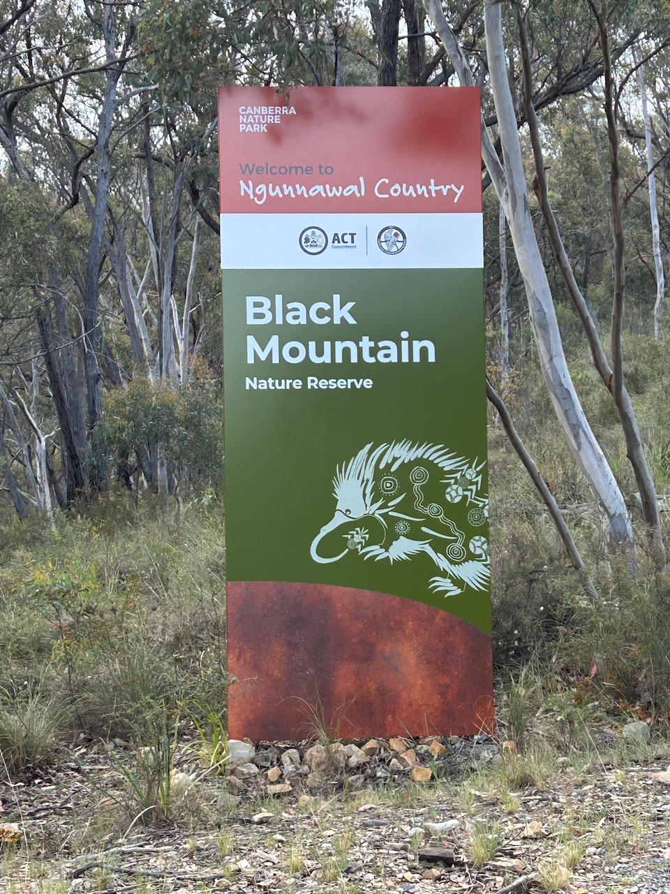
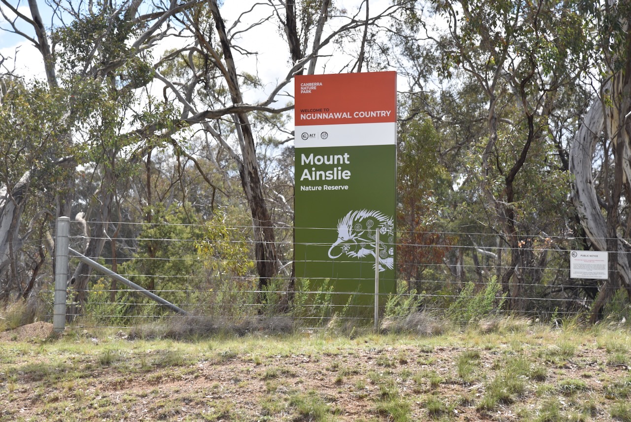
Our first activation for Monday, the 27th day of October 2025, was Mount Ainslie VK1/ AC-040 for the Summits On The Air (SOTA) program, and Mount Ainslie Nature Reserve VKFF-0850 for the World Wide Flora Fauna (WWFF) program.
Mount Ainslie has an extremely interesting history, and I found it fascinating to research. I wonder how many people in Canberra are aware of the origins of the names Mount Ainslie and Mount Tennent?
Mount Ainslie was named after James Ainslie, who was the first overseer of Duntroon Station. Ainslie was born in 1797 in Roxburghshire, Scotland. In 1818, he married Betty Catteral in Lancashire, England. In 1820, they had a son called James Ainslie. Sadly, in that same year, Betty died. James Ainslie Sr emigrated to Australia in 1825 aboard the Admiral Cockburn. Upon his arrival in Australia, he was employed by Robert Campbell to establish a sheep station on the Limestone Plains in the colony of New South Wales. (Wikipedia 2025)
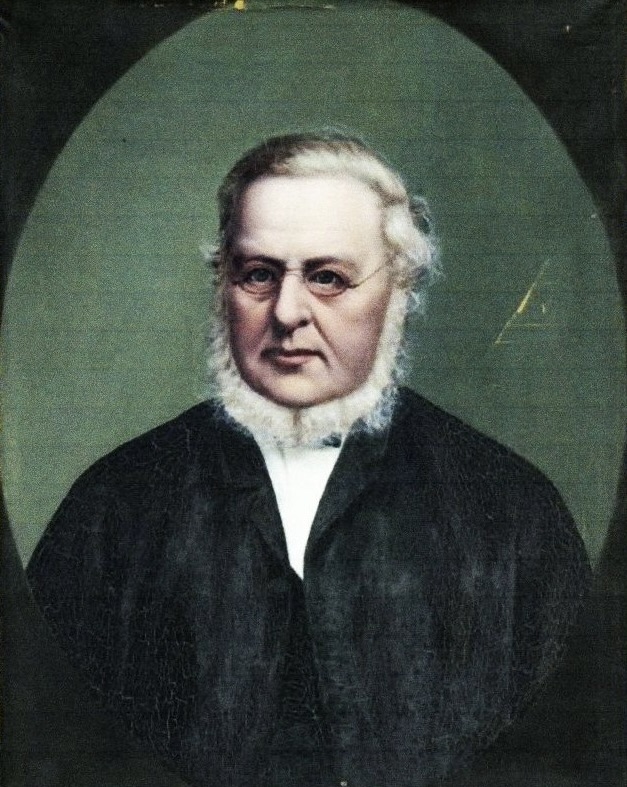
Robert Campbell was a merchant and politician. He was a member of the first Legislative Council in New South Wales. The suburb of Campbell in Canberra, and Campbell Islands in the subantarctic islands of New Zealand, are named in his honour. (Wikipedia 2025)
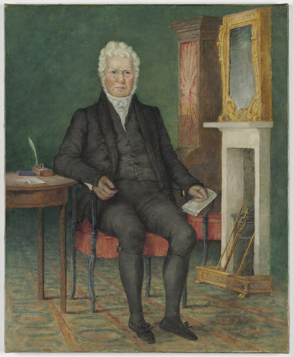
Above: Robert Campbell, c. 1835. Image c/o Wikipedia
Campbell was awarded compensation for the loss of his ship, Sydney, whilst it was under Government contract. He was also allowed to select some land in the newly discovered Limestone Plains area in Argyle County, in what is current day Canberra. (Steven 1966)
In January 1825, James Ainslie and several convict labourers were making their way from Bathurst with 700 of Campbell’s sheep to find a suitable site for the sheep station. When they were near Booroowa (east of Young), they encountered a group of Aboriginal people who were reportedly terrified as they had never seen white people or sheep before. They believed that Ainslie was a dead spirit, and as a result, they ‘sacrificed’ an Aboriginal woman to Ainslie. Her name was Ija Ngambri. (Wikipedia 2025) (Wright 2012)
Ngambri subsequently guided Ainslie and his party to the southeast, where Ainslie established Pialligo Station in the area that is present-day Canberra. Pialligo is believed to derive from an Aboriginal language. The Pialligo area forms part of the traditional lands of the Ngunnawal Aboriginal people. Pialligo is now a semi-rural suburb of Canberra, located adjacent to the Canberra Airport. Pialligo Station was later renamed by Campbell in 1833 as Duntroon, after the family’s ancestral home of Duntrune Castle in Argyll, Scotland in 1833. The original homestead was built at this time, with a two-storey extension added in 1862. (Grokipedia 1970) (Wikipedia 2025)
In c. 1826/1827, Ainslie and Ngambri had a daughter called Ju Nin Mingo, also known as Nanny. She married Onyong @ Hong-kong and had several children who all used the family name of Duncan. She died in 1873 from measles and is buried at the McCarthy property on Ginninderra Estate. (Ngambri 2014) (Wikipedia 2025)
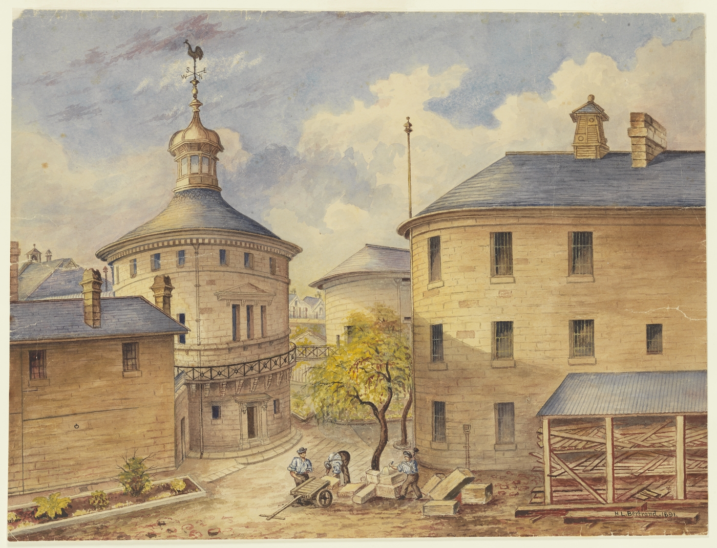
In 1911, the Australian Federal Government acquired the Duntroon homestead and the surrounding land. The former Duntroon homestead now serves as the Officers’ Mess for the Royal Military College in the suburb of Campbell.
Initially, the run comprised 4,000 acres and had a flock of 700 sheep. Within about 10 years, this had increased to 20,000 sheep. It was at this time that Mount Ainslie was named in his honour. (Grokipedia 1970) (Wikipedia 2025)
Every good Australian story has a convict or a bushranger. For James Ainslie, some infamous Australian bushrangers would enter his life.
John Tennant was born c. 1794 in Belfast, Northern Ireland. In 1823, he was sentenced to transportation for life. He arrived in Sydney in July 1824 aboard the Prince Regent. He was described as a ploughman, thatcher, and fencer. Upon arrival, he was assigned to Joshua John Moore on Moore’s property called Canberry, the first European property on the Limestone Plains. (ancestry 2016) (Convictrecords.com.au 2026) (Wikipedia 2025)
In September 1826, Tennant was sentenced to six months’ hard labour in Irons for “making away with his master’s money.” He has stolen £6 from Moore. (ancestry 2016)

Above: A chain gang, c. 1833. Image c/o Wikipedia
Tennant subsequently absconded from the chain gang in October 1826 and commenced a series of crimes. He formed a gang consisting of John Ricks, James Murphy, and Thomas Keane. The gang became known as the Terror of Argyle. (Convictrecords.com.au 2026)
John Raikes, alias John Ricks, John Rix, Dublin Jack, was born in 1807. He was transported to Australia in 1825 aboard the Norfolk, having been sentenced on the 24th day of April 1824, at the Sussex Court of Sessions, to 7 years for a felony. (ancestry 2016) (Convictrecords.com.au 2026)

Above: Convict details for John Raikes. Image c/o ancestry.com.au
James Murphy was born in c. 1808 in Dublin. He was convicted in Dublin City of robbery and was sentenced to 7 years’ transportation. He departed England on the Prince Regent, the same ship as John Tennant. James was just 16 years old. He was assigned to a property near the current city of Canberra and fled. He subsequently joined the Tennant gang. (Convictrecords.com.au 2026)
Thomas Keane, alias Kain, Cane, was born c. 1804 in Meath, Ireland. He was convicted of cow stealing in November 1824 and sentenced to 7 years’ transportation. He was transported to Australia aboard the Sir Godfrey Webster. (ancestry 2016) (Convictrecords.com.au 2026)
In July 1827, Tennant, Ricks, Cane and Murphy robbed Roses Outstation at the Yass River. Tennant was shot in the back by James Farrell during this incident, but survived.
In 1827, it is believed that Tennant was in the company with Mary Elizabeth Winter, nee Herd, a convict who had arrived in Australia in 1820 aboard the Morley. She had been convicted in the Old Bailey for possessing a forged note. In 1821, she married her master, Robert Winter, who was himself a convict and had earned a Ticket of Leave. In 1826, Mary, her husband and John Handcock were involved in a burglary plot that led to the death penalty being imposed on her husband. Mary was acquitted. Soon after, she teamed up with Tennant. (Convictrecords.com.au 2026) (Grokipedia 1970)
In September 1827, a twenty-pound reward and a Ticket of Leave were offered to “any Person or Persons who may apprehend, and lodge the said John Tennant in any of His Majesty’s Gaols; and if the Person is a Prisoner, he will also be allowed a Ticket of Leave.” (Convictrecords.com.au 2026) (Trove 2026)
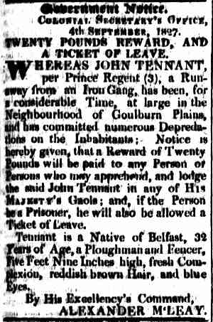
Above: article from The Sydney Gazette, Fri 7 Sept 1827. Image c/o Trove
In October 1827, Constable John Jones reportedly sighted Tennant and Winter fishing on the Yass River near Gundaroo. Interestingly, Constable Jones only had one eye. Tennant allegedly armed himself with a loaded musket and threatened to shoot out the other eye of the Constable. The Constable laid down his arms, which led to the pair fleeing into the bush and escaping. What ultimately happened to Mary Winter is unclear. She is only one of three documented female bushrangers active in Australia during the 1800s. (Convictrecords.com.au 2026) (Grokipedia 1970)
On the 21st day of November 1827, Tennant and Ricks robbed Pialligo Station. Ainslie had taken all but one of Campbell’s men from the station to wash sheep. He left a man named Charles Bowman, who was a servant of Campbell and also an invalid. Tennant produced a pistol and threatened to blow Bowman’s brains out. They then bound Bowman’s hands and feet and tied a handkerchief over his eyes. Tennant and Ricks then stole a variety of property from the storeroom including 29lb of Brazil tobacco, vests, jackets, handkerchiefs, shirts, trousers, 150 lb of flour, tea and sugar, 3 gallons of spirits, powder and shot, boots, four holey dollars, three Spanish dollars, two rupees, a night cap, and a small horse pistol. Tennant then threatened to kill Bowman, who prayed for mercy, as he had a small family…’. Tennant then tied a blanket over Bowman’s head and left. (Trove 2026)
The following day, Ainslie and Cowan went in search of the bushrangers. They located the tea and sugar in a sack in a hollow tree. Cowan was then joined by Duncan McFarlane from Ginninderra Station, and they commenced another search. They located Tennant hiding under a fallen tree near where the tea and sugar had been secreted. Tennant then threatened to ‘blow their brains out’ if they came closer. Cowan and MacFarlane were unarmed and retreated. (Trove 2026) (Wikipedia 2025)
Following the 1827 robbery at Pialligo, the gang committed further robberies and serious assaults. (Wikipedia 2025)
On the 21st day of December 1827, Tennant, Ricks, Cane, and Murphy committed a robbery in the dwelling house of Thomas Rose. The four men, all armed with pistols, confronted the hut keeper, James Farrell. The gang had previously committed a robbery here back in July when Tennant was shot. Tennant threatened to blow his brains out. They also demanded property from Thomas Simpson, the overseer. They tied Farrell to a post, and Ricks gave him 50 lashes with his belt. (Ancestry 2016)
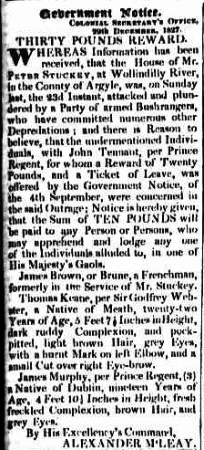
On the evening of Sunday, the 23rd day of December 1827, Tennant’s gang committed a robbery at the home of Peter Stuckey at Wollindilly River. Stuckey’s wife, Ann, was home alone at the time with her four children. She saw the four men approaching the house, all armed. They demanded money from her and then stole property from the hut. (Trove 2026)
A reward appeared in The Sydney Gazette on the 31st day of December 1827, for the apprehension of Keane and Murphy regarding the robbery at Wollindilly River.
Above: article from the Sydney Gazette & NSW advertiser, Mon 31 Dec 1827. Image c/o Trove
During the early hours of the 8th day of January 1828, Tennant and Ricks robbed J.J. Moore’s station, Canberry and placed all of the men on the station under guard. James Cowan, the overseer, was awoken by the noise and armed himself with a musket. Tennant and Ricks demanded that he should come out of his hut. Cowan replied that he would defend his hut to the last. Tennant threatened to set fire to the hut, but Cowan would not come outside. (Trove 2026) (Wikipedia 2025)
Tennant set fire to the roof of the hut, but due to the bark being wet, the fire did not take hold. Thomas Leahy, a servant of Moore, appealed to Tennant and Ricks not to harm Cowan. Tennant replied that he would not burn the hut, but if anyone, Scotch, Irish, or English, came after them, he would have their lives. After demanding some food, the bushrangers decamped. (Trove 2026) (Wikipedia 2025)
At sunrise, Cowan attended Campbell’s station, Pialligo and informed him of the robbery. Ainslie is reported to have said, “It was time something was done……I will go out and take them, dead or alive.” Cowan informed Ainslie that he would accompany him. Ainslie was aware that two Constables were at a nearby station and sent for them to accompany them on their search for Tennant and Ricks. Ainslie also acquired the use of four Aboriginal men to be used as trackers. District Constable John Jones joined the men at Pialligo before making their way to Canberry, where Constable Fenton, Cowan, Duncan Macfarlane, and others joined the party. (Trove 2026) (Wikipedia 2025)
Soon after leaving Canberry, the Aboriginal trackers picked up the track of Tennant and Ricks, leading to the Murrumbidgee River. After five miles of tracking, one of the Aboriginal trackers, called ‘Make-a-cake’, called out ‘Make a light’, which means that he had seen the bushrangers’ encampment. The group paused to discuss a strategy, but while doing so, Ainslie rushed into the bushranger’s tent alone. (Trove 2026) (Wikipedia 2025)
Ainslie placed his musket to Tennant’s chest and threatened to shoot him if he moved. Not knowing that Ainslie was in the tent, the group opened fire on the tent with three shots. Amazingly, Ainslie was not struck. However, Tennant was wounded in the neck, face, and hands, while Rix suffered a wound to his knee. (Trove 2026) (Wikipedia 2025)
Cain and Murphy had been apprehended previously by District Constable Daniel Geary from Goulburn Plains, Aboriginal trackers, and others. At the time, Caine was in possession of a musket, while Murphy had a pistol. (Trove 2026)
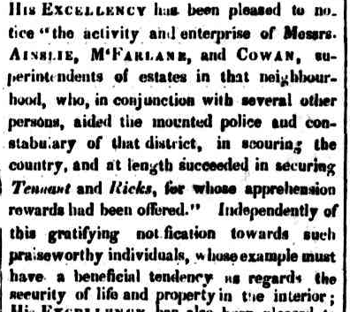
The Sydney Gazette, dated Monday 4th February 1828, reported:
“His Excellency has been pleased to notice the activity and enterprise of Messrs. Ainslie, McFarlane and Cowan……who in conjunction with several other persons, aided the mounted police and constabulary of that district, in scouring the country, and at length succeeded in securing Tennant, and Ricks…” (Trove 2026)
Above: article from The Sydney Gazette & NSW Advertiser, Mon 4 Feb 1828. Image c/o Trove
Tickets of Leave were granted to five prisoners of the Crown who assisted in the capture of Tennant and Ricks. The newspaper also reported:
“His Excellency, expressing a determination to reward the aboriginal natives…” (Trove 2026)
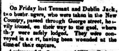
Following their capture, Tennant and Ricks were conveyed in a cart to the Sydney Gaol, ‘heavily ironed.’ (Trove 2026)
Above: article from The Sydney Gazette & NSW Advertiser, Mon 28 Jan 1828. Image c/o Trove
On Thursday, the 14th day of February 1828, Tennant and Ricks attempted to escape from the Sydney Gaol. However, their efforts were unsuccessful, and they were located by authorities in the loft. (Trove 2026)
Above: the Darlinghurst (Sydney) Gaol. Image c/o Mitchell Library, State Library of NSW
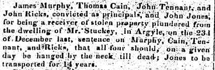
On Friday, the 29th day of February 1828, John Tennant, John Ricks, James Murphy, & Thomas Cain were convicted in the Criminal Court of Sydney, for stealing in the dwelling house of Peter Stuckey and putting his wife Ann in bodily fear. Tennant, Ricks, Murphy, & Cain were sentenced to death by hanging. John Jones was convicted of receiving stolen property and was transported for 14 years. (Trove 2026) (Wikipedia 2025)
Above: article from The Australian, Wed 5 Mar 1828. Image c/o Trove
The men were then imprisoned in the hulk Phoenix. The Phoenix was a 3-decker merchant ship that was built on the Thames in 1798. She was damaged in 1824 on a voyage with convicts to Van Diemen’s Land. The Phoenix was then condemned and used as a prison hulk for convicts who were awaiting transportation to Norfolk Island and Moreton Bay. (Wikipedia 2025)
On the 30th day of May 1828, Tennant, Ricks, Cain, and Murphy appeared before Justice Dowling in the Supreme Criminal Court, Sydney, indicted for stealing in the dwelling house of Thomas Rose and placing John Farrell and Thomas Simpson in bodily fear. That same morning, Tennant attempted to escape from the lock-up house prior to the trial. Upon being brought into the court, Tennant complained to Justice Dowling that the Constable had placed his handcuffs too tightly. Upon inspection, it was found that the marks were caused by Tennant himself, “….”caused by his own exertions to force his hands from the shackles, in which he succeeded, and had very nearly effected his escape when he was detected.” The jury found the men not guilty of stealing from the dwelling house, but they were remanded on the assault charges. (Trove 2026)
In June 1818, Tennant, Ricks, Cain, & Murphy were convicted of the violent assault on Farrell and were sentenced to 5 months’ imprisonment. Upon hearing their sentence, the men shouted out “God save the King, the Judge, and Jury.” (Trove 2026)
The men were then placed in the Phoenix prison hulk. In July 1829, Tennant, Ricks, James, & Murphy were released from the hulk and imprisoned at Sydney Gaol. (ancestry 2016)
In September 1829, Tennant, Ricks, Murphy, and Caine were indicted for the robbery at Pialligo Station in November 1827 and for putting Charles Bowman in fear. Mr Justice Dowling ruled that it was proper to dismiss the capital charge and find on the minor one. After retiring for about 10 minutes, Tennant and Murphy were found guilty of Larceny. Caine and Ricks were found not guilty. (Trove 2026)
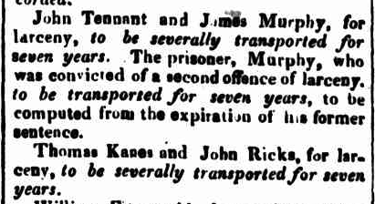
On Saturday, the 19th day of September 1829, Mr Justice Stephen and Mr Justice Dowling sat for the purpose of passing sentence on several prisoners, including Tennant, Ricks, Caine, and Murphy. John Tennant and James Murphy were sentenced for larceny offences and received 7 years’ transportation to Norfolk Island. Thomas Kane and John Ricks were sentenced for larceny and received seven years’ transportation. (Trove 2026)
Above: article from the Sydney Gazette & NSW Advertiser, Tue 22 Sept 1892. Image c/o Trove
Their death sentence had been commuted due to a discovery by the Judge that the men had been tried under Statutes that had been repealed by Mr Peel’s Acts, which had not then been brought into operation in the Colony. The sentence, therefore, could not be carried into effect, and they were “discharged from the consequences of their conviction.” Some articles and websites state that Tennant was executed, but this is incorrect. (Trove 2026)
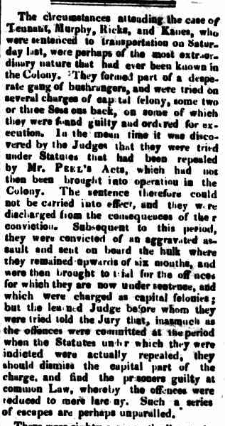
Above: article from The Sydney Gazette & NSW Advertiser, Tue 22 Sept 1829. Image c/o Trove
The Colonial Secretary warned the Commandant of Norfolk Island, stating:
“The six men named…long the terror of Argyle and the surrounding country, are now forwarded and I am directed to point out to you for your information their extreme desperation in order that you may be aware of their characters.”

Above: Norfolk Island penal settlement. Photo c/o VK5PAS.
On the 16th day of September 1836, Tennant was freed from the hulk. (ancestry 2016)
In 1831, Governor Darling promised free grants of land consisting of 100 acres each to Ainslie and Cowan, in acknowledgement of their services in the capture of the bushrangers Tennand and Rix. Ainslie had decided to return to Scotland and gave his promised grant of land to John Lupton jun, the son of John Lupton snr, who was the innkeeper of Lupton’s Inn at Bargo, New South Wales. Ainslie would often stop here on his way to and from Sydney. (Trove 2026) (Wikipedia 2025)
After serving time on Norfolk Island, Tennant wastransferred to Sydney in September 1836 and was moved to Hyde Park Barracks. He died the following year, on the 29th day of August 1837, in Windsor Gaol, New South Wales. (ancestry 2016) (Convictrecords.com.au 2026) (Wikipedia 2025)
Above: Windsor Gaol, late 1800s. Image c/o Old Sydney Album Facebook page
Mount Tennent in Namadgi National Park in the ACT is named after John Tennant. A Canberra legend has Tennant’s loot still hidden somewhere on Mount Tennent.
John Raikes was issued a Certificate of Freedom in April 1838. In March 1845, it was reported that he was before the court at Bathurst for robbery and horse stealing. (Convictrecords.com.au 2026) (Trove 2026)
In 1839, Thomas Keane was issued a Certificate of Freedom. (ancestry 2016)
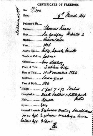
Above: Certificate of Freedom of Thomas Keane. Image c/o http://www.ancestry.com.au
Below is a video on the Terror of Argyle.
In January 1835, Robert Campbell placed an advertisement in The Sydney Gazette that he would pay no more orders drawn by Ainslie ‘in consequence of the recent irregularities and insubordination at my Establishment Limestone Plains, occasioned by a Store being set up some months ago, for the sale of spirituous and other fermented Liquors, on a neighbouring farm…” (Wikipedia 2025)
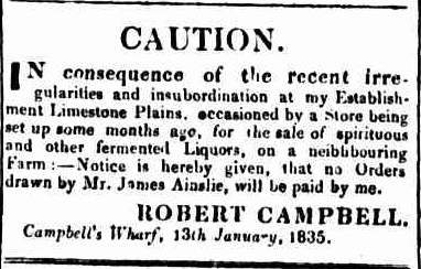
Above: article from The Sydney Gazette, Thu 22 Jan 1835. Image c/o Trove
Within two months of this announcement, Ainslie also advertised in the Sydney Herald that he was about to ‘quit the Colony.’ On the 16th day of March 1835, he sailed aboard the Edinburgh for Liverpool, England, leaving behind his wife and daughter. After arriving in England, he made his way back to Scotland. (Wikipedia 2025)
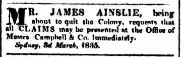
Above: advertisement from The Sydney Herald, Thu 5 Mar 1835. Image c/o Trove
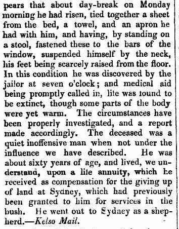
Following his arrival back in Scotland, Ainslie found himself in trouble with the police, being arrested frequently for public nuisance and assaults. In 1844, Ainslie was charged with assault. He was tried at the Circuit Court and committed to Jedburgh Castle Jail in Scotland. (Trove 2026) (Wikipedia 2025)
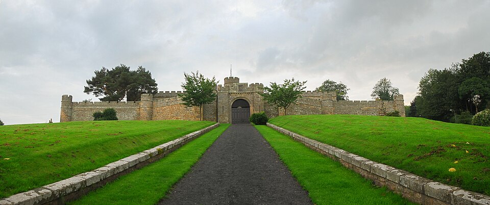
Above: Jedburgh Castle Jail. Image c/o Mihael Grmek Wikipedia
On the 11th day of April 1844, Ainslie committed suicide by hanging himself in Jedburgh Castle. He was 60 years old. (Wikipedia 2025) (Trove 2026)
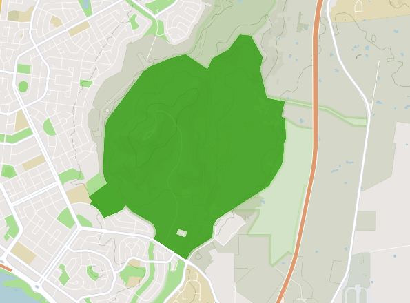
The Mount Ainslie Nature Reserve is 637 hectares in size and adjoins Mount Majura Nature Reserve. It is also in close proximity to Mount Pleasant Nature Reserve. (and 2023)
The Mount Ainslie Nature Reserve contains a large area of critically endangered Yellow Box-Blakely’s Red Gum Grassy Woodland. It also contains stands of Drooping She-oak, which is an important foraging resource for the Glossy Black Cockatoo, which is listed as vulnerable. The park also contains the critically endangered Canberra Spider Orchid and the endangered Hoary Sunaray. The frare Rosenberg’s Goanna can also be found in the park. (and 2023)
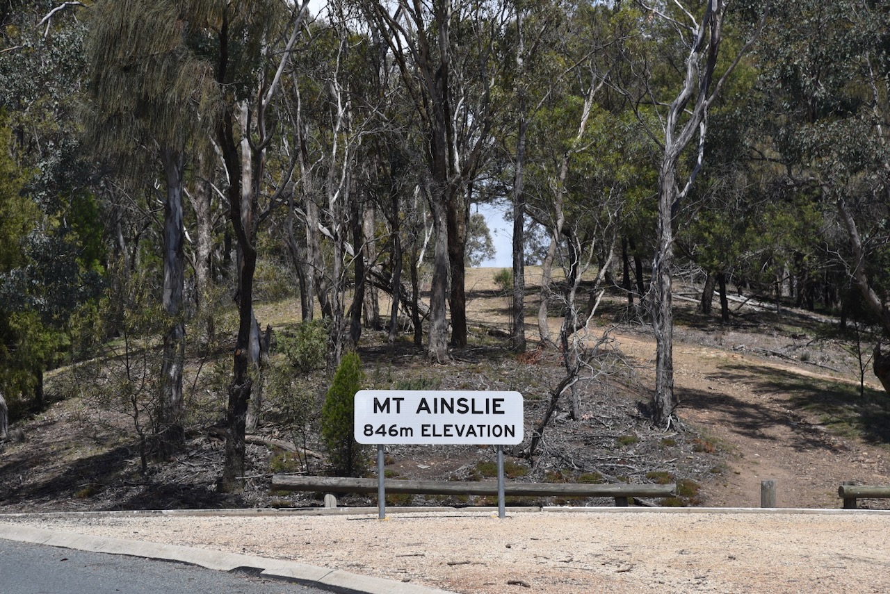
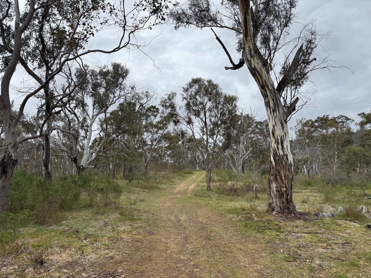
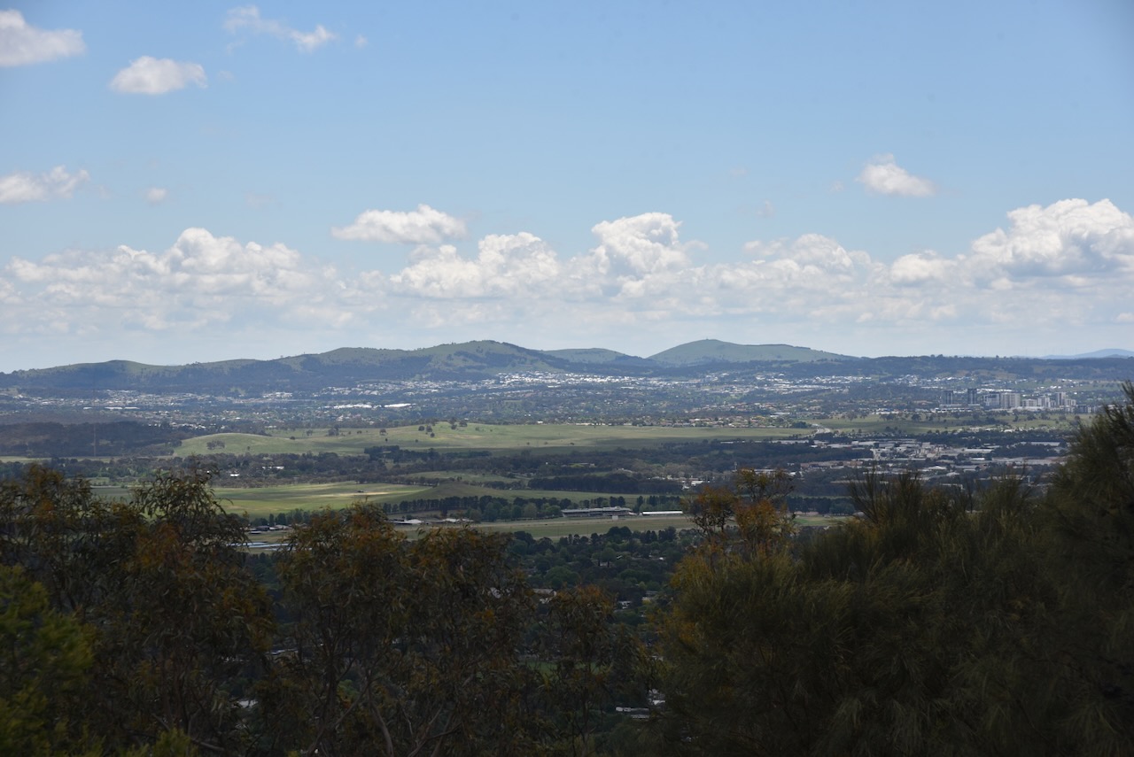
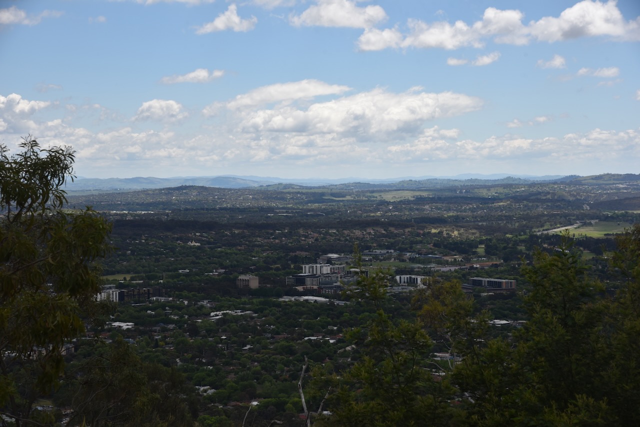
Mount Ainslie is 843 metres above sea level and qualifies with 1 point for the Summits On The Air (SOTA) program. It has been activated 378 times. Not surprising, as it is on Canberra’s doorstep and is a nice, easy drive up summit. It was first activated in February 2013 by Ian VK1DI.
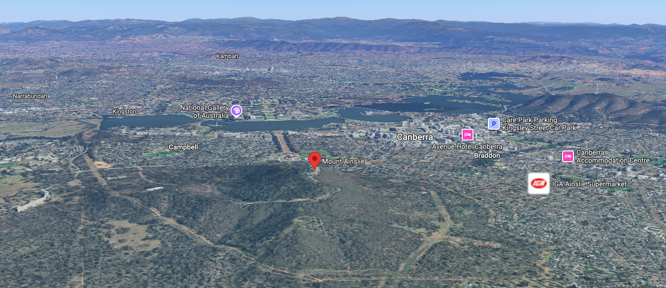
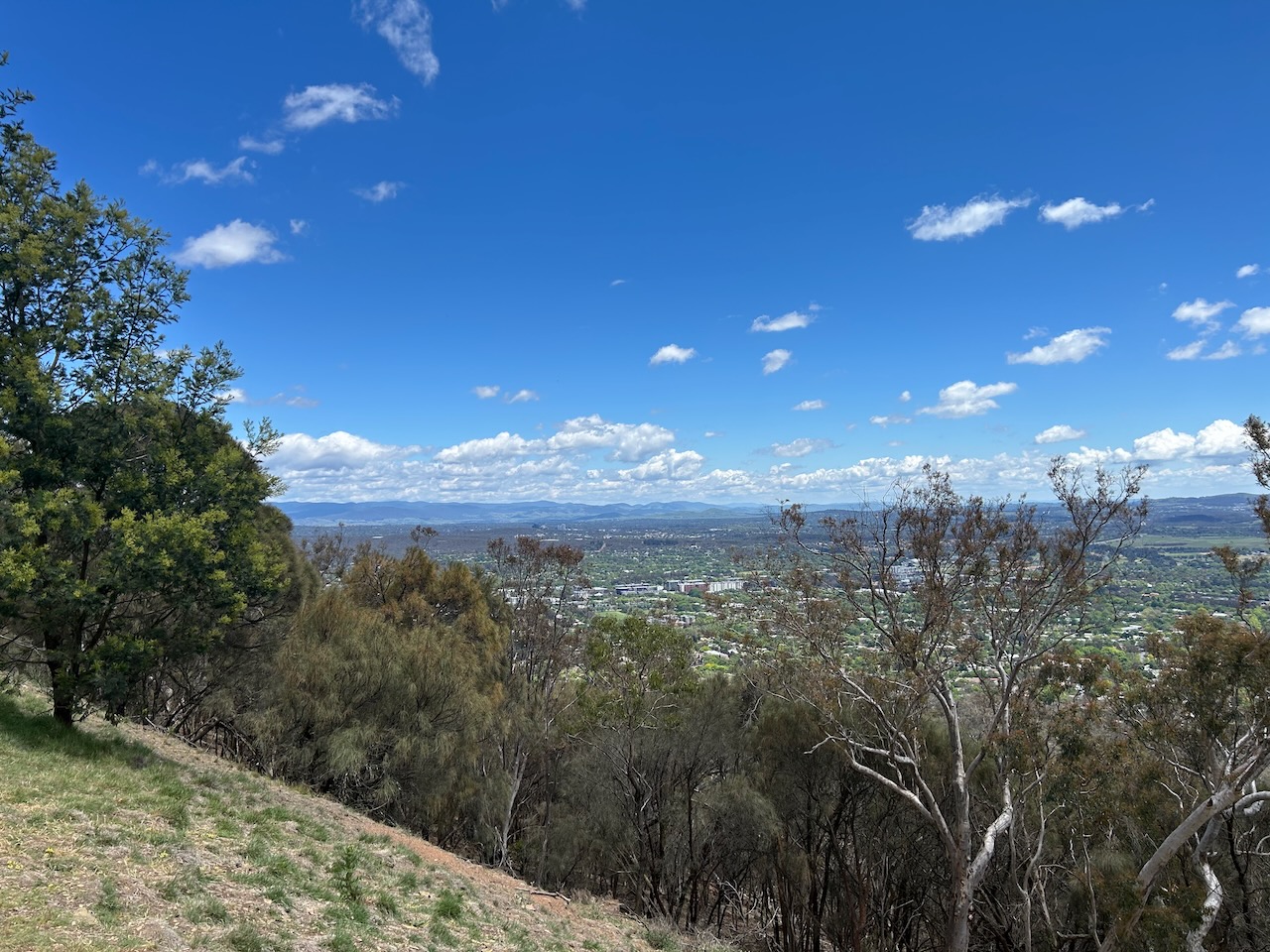
Above: an aerial view of Mount Ainslie. Image c/o Google Maps
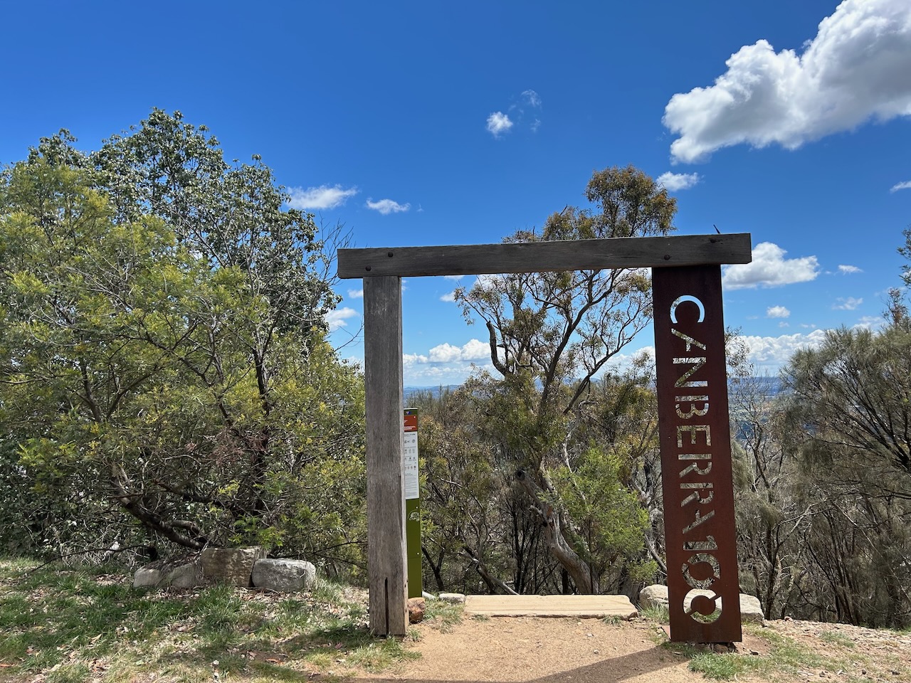
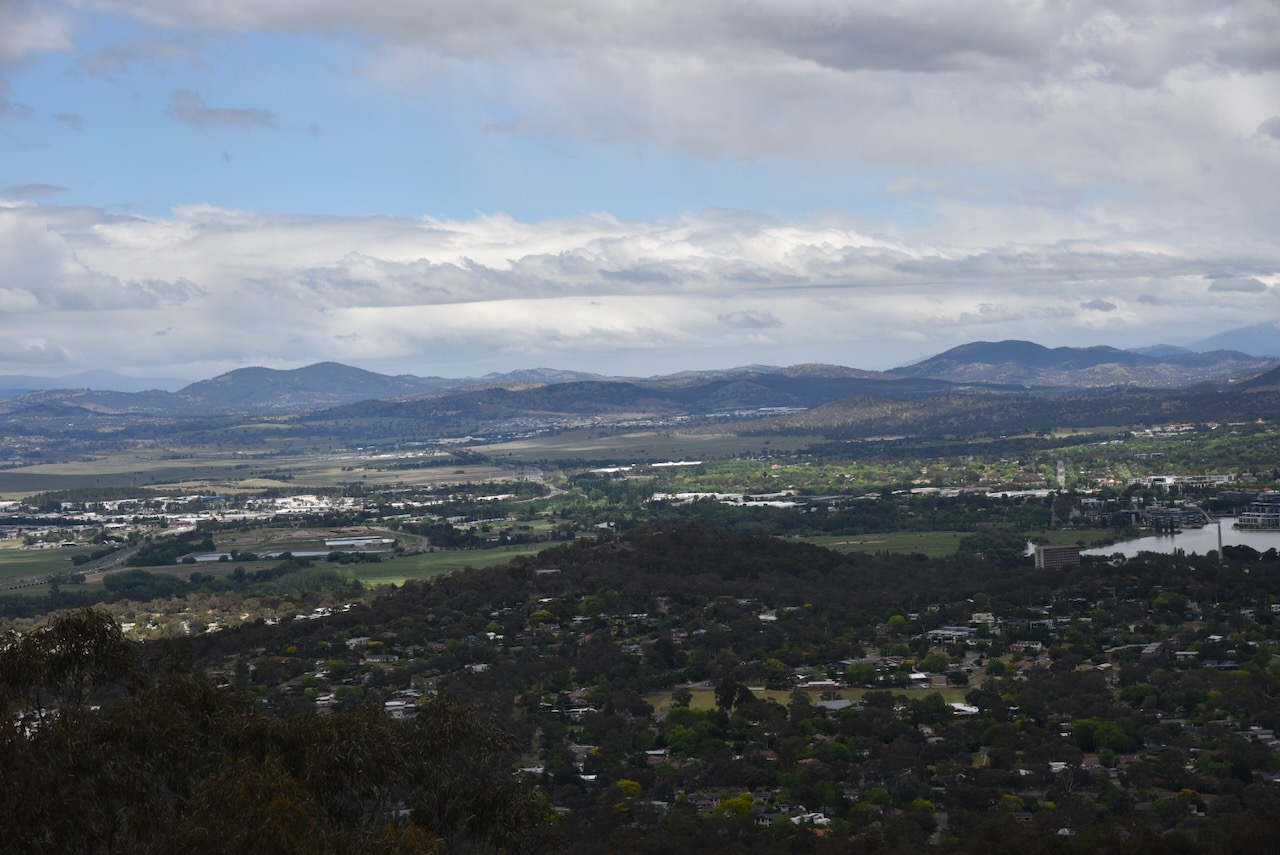
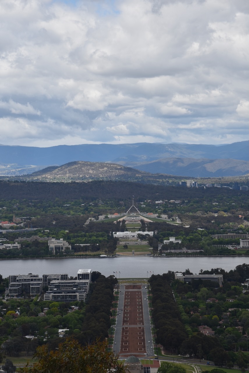
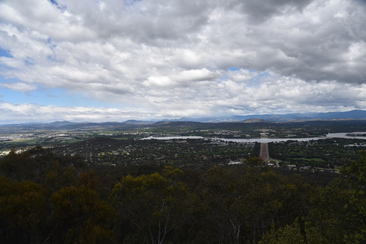
There are excellent views of Canberra from Mount Ainslie. Some of the prominent Canberra landmarks visible include the Australian War Memorial, Parliament House and Lake Burley Griffin.


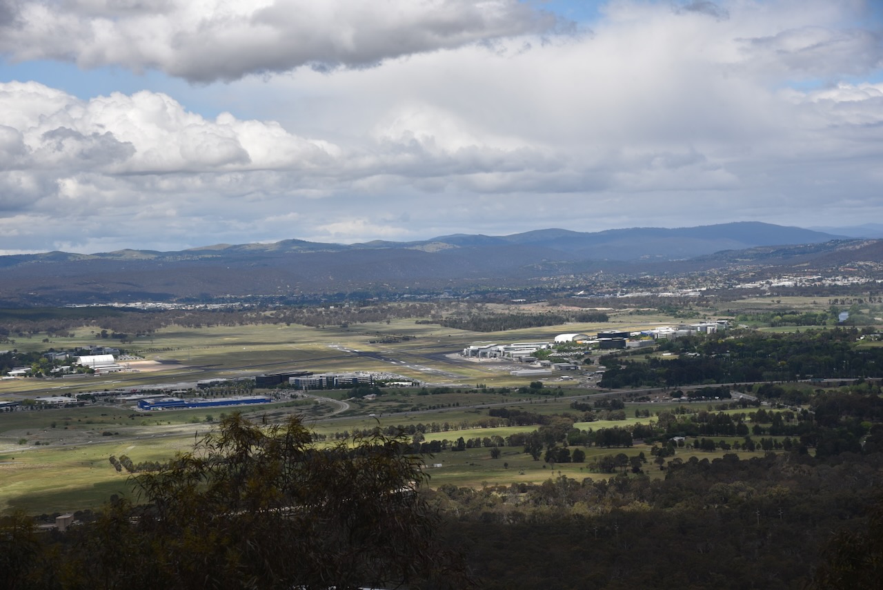

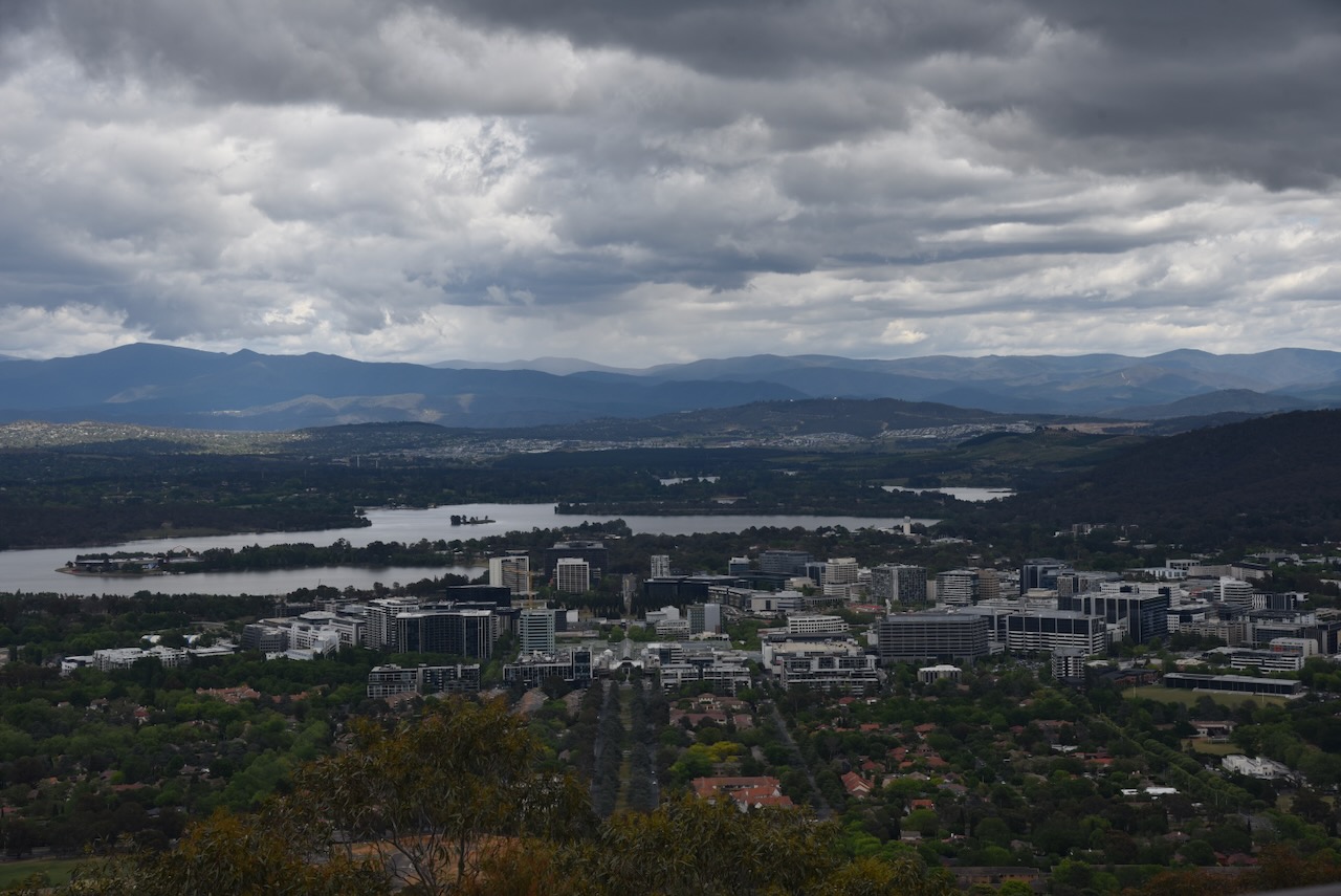
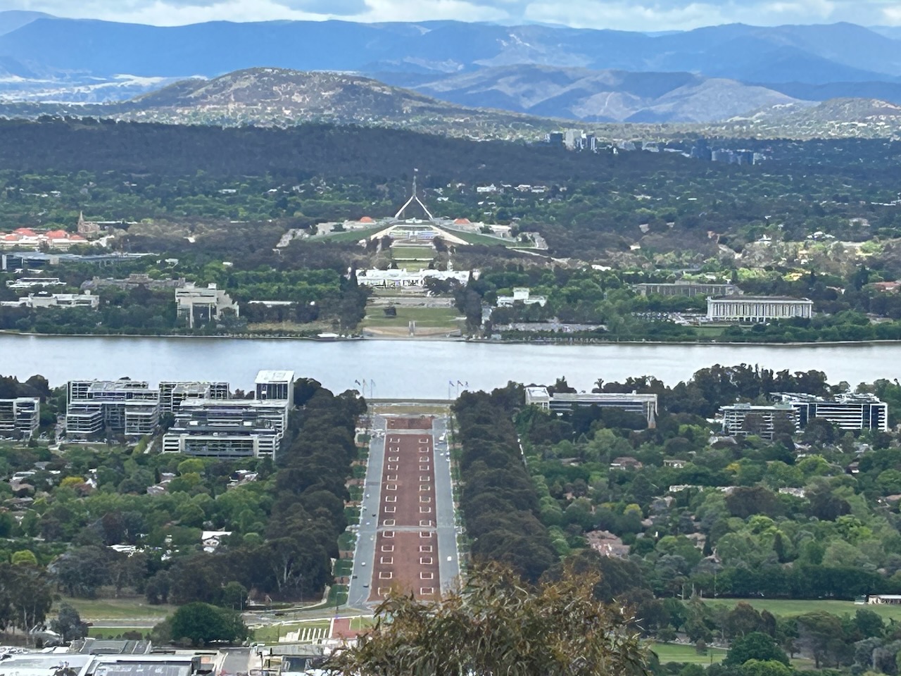
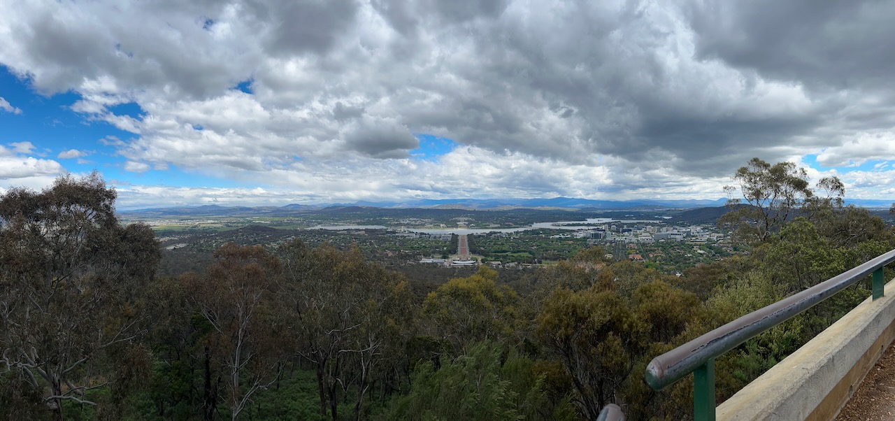
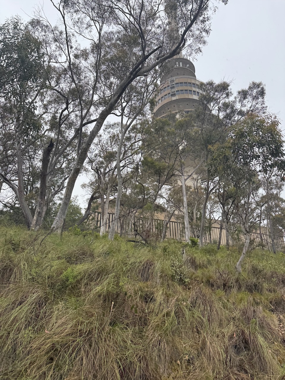
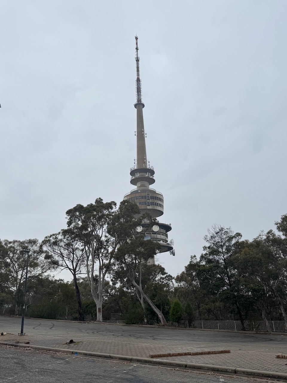
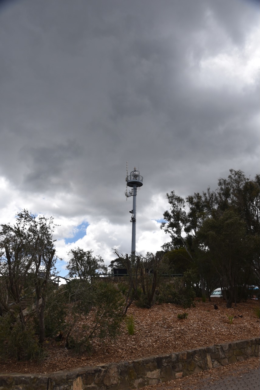
Mount Ainslie has a lookout and a small communications tower.

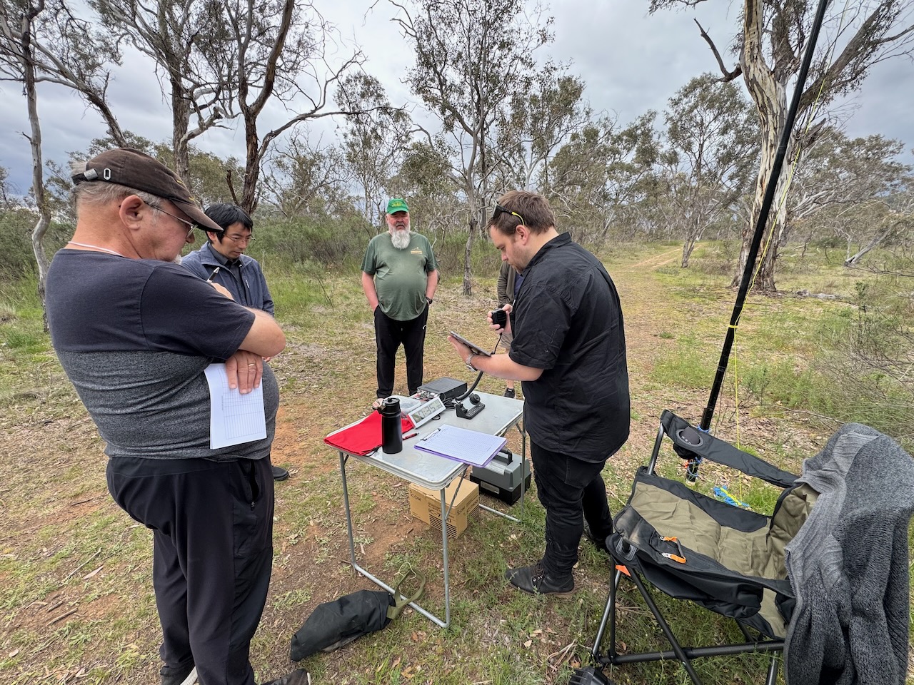
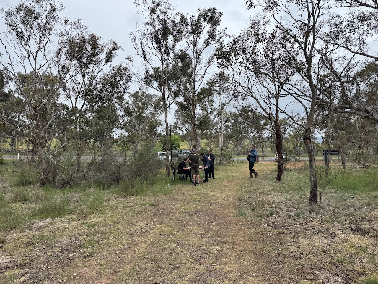
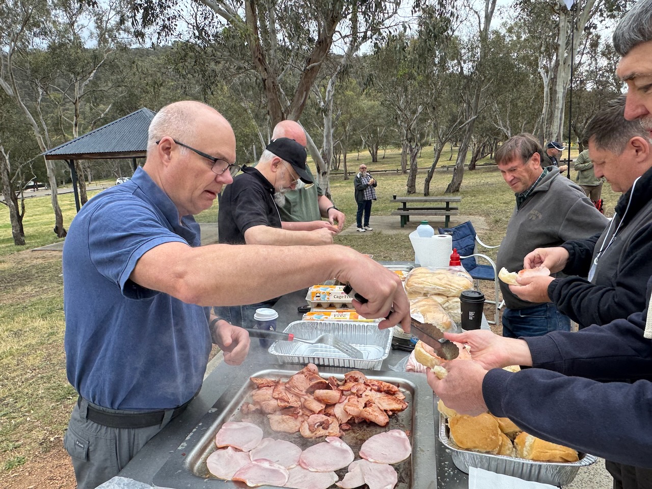
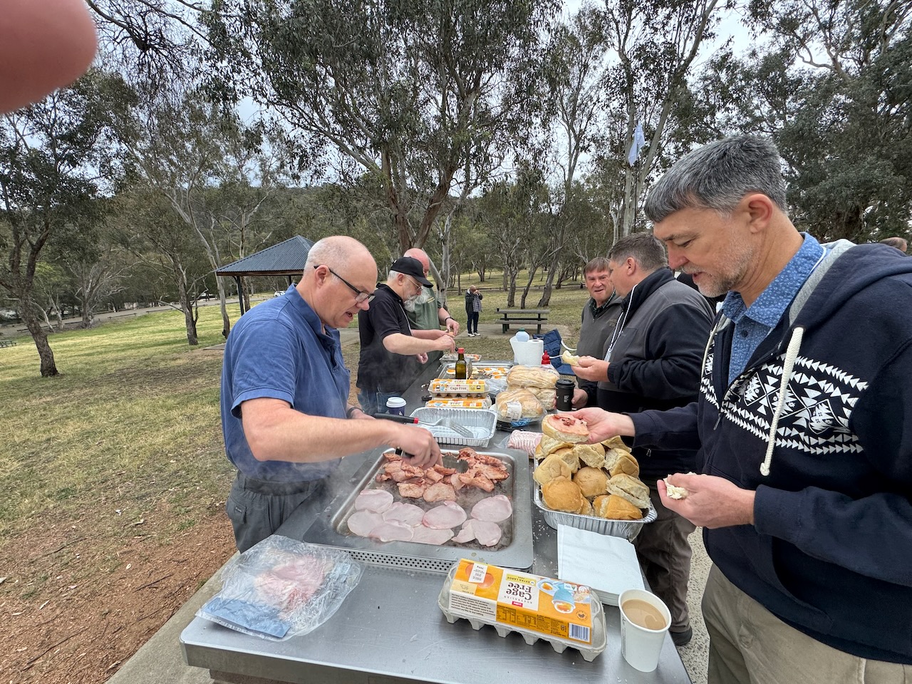
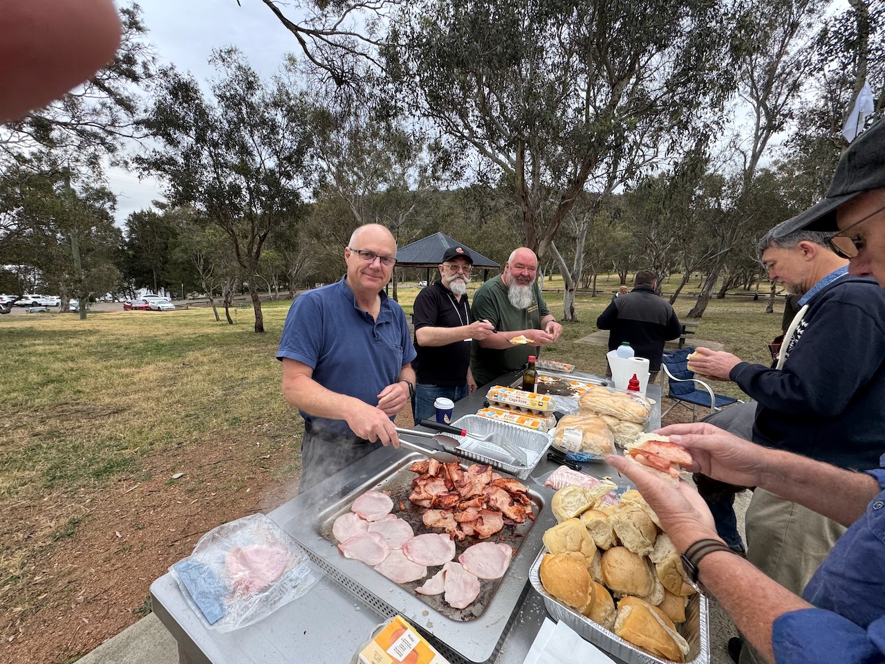
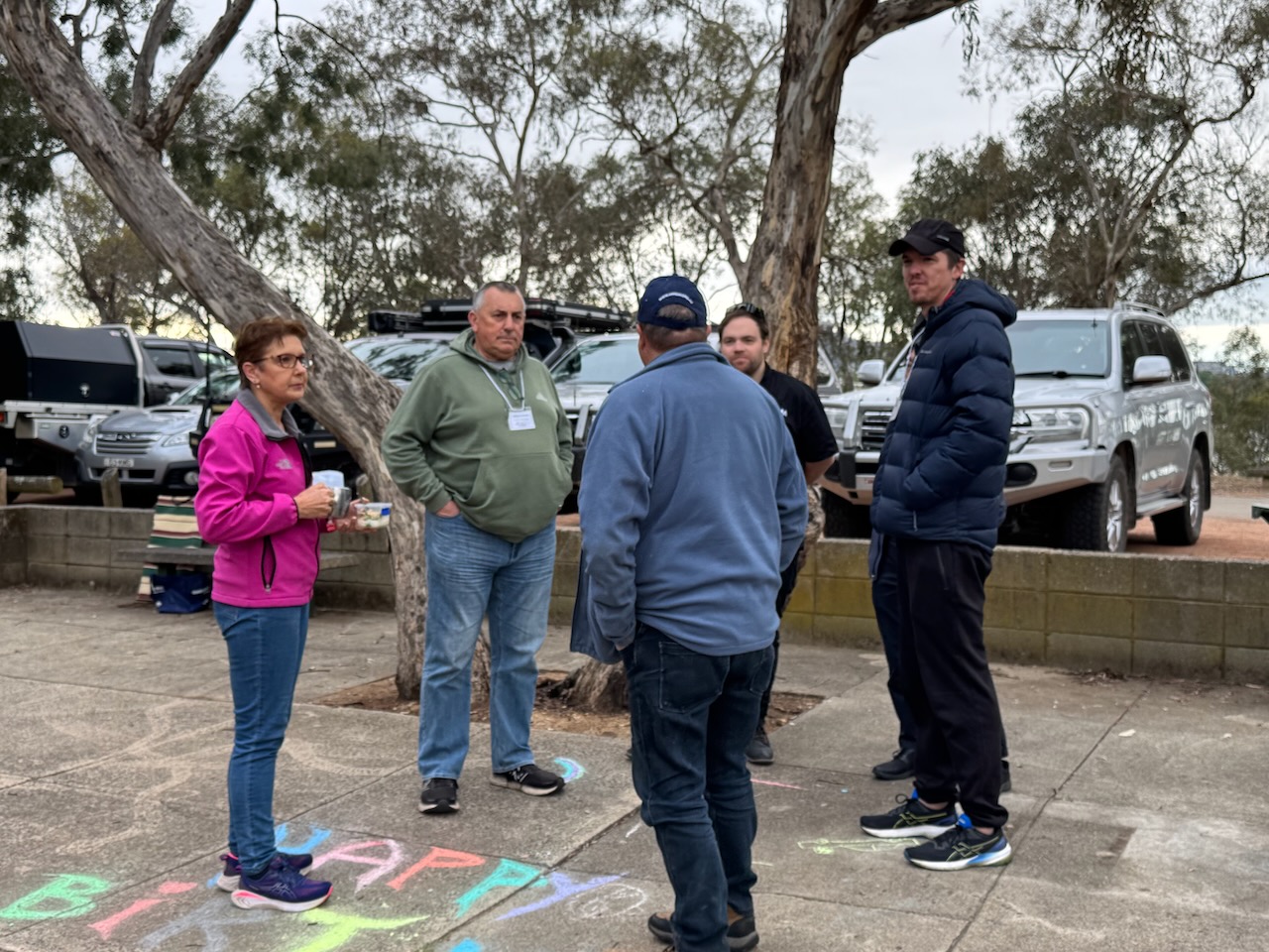
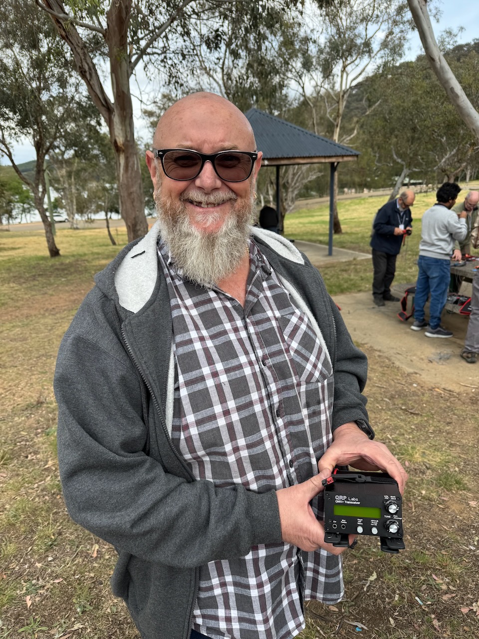
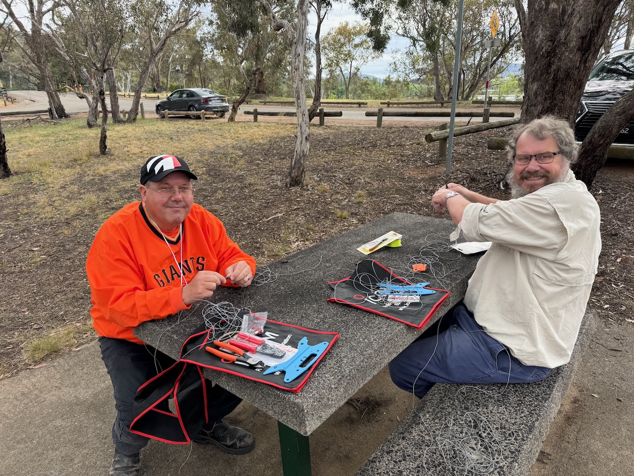
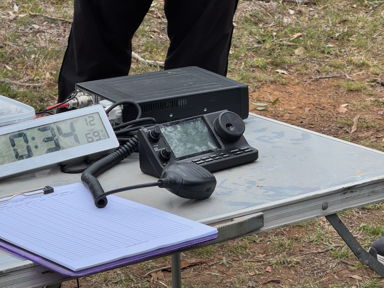
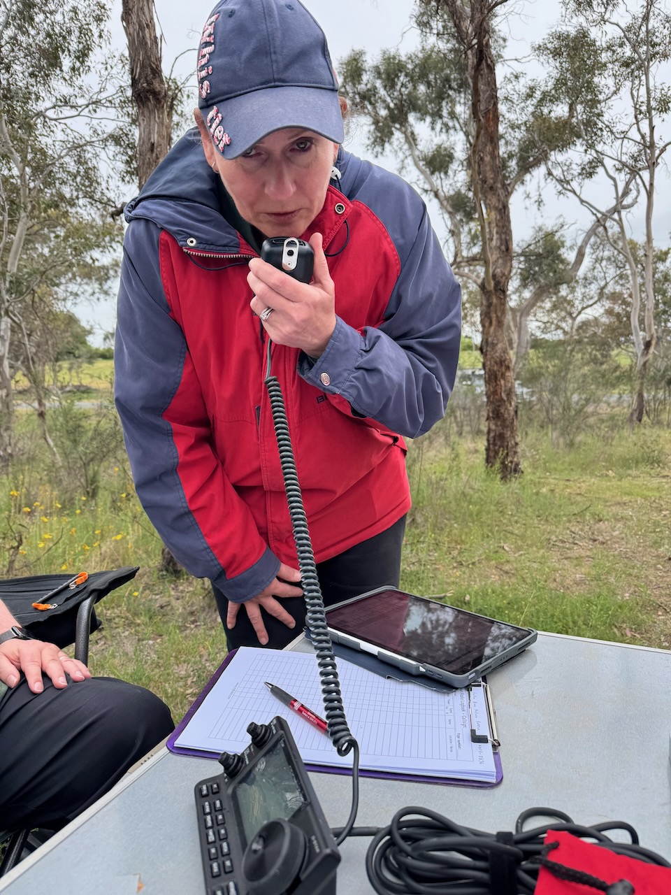
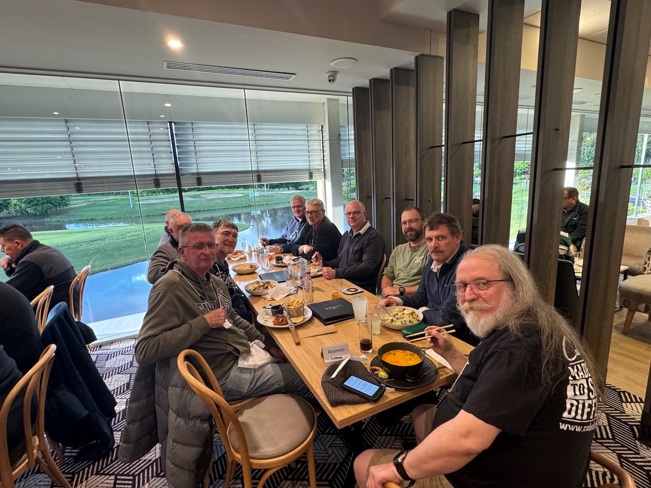
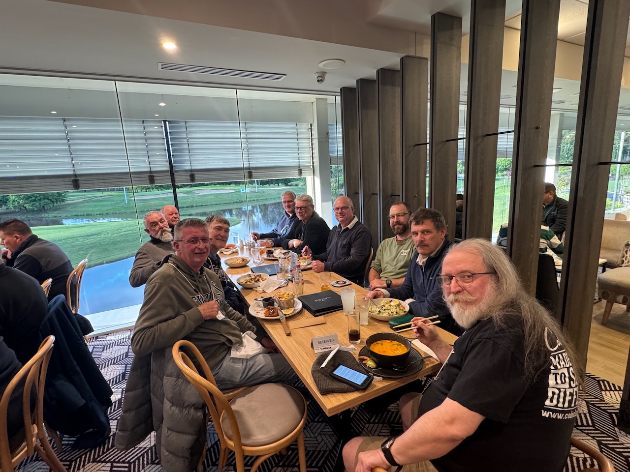
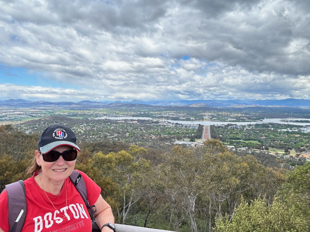
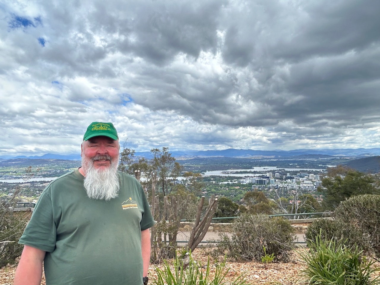
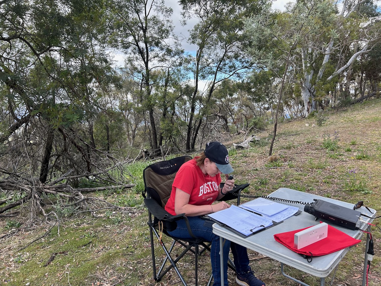
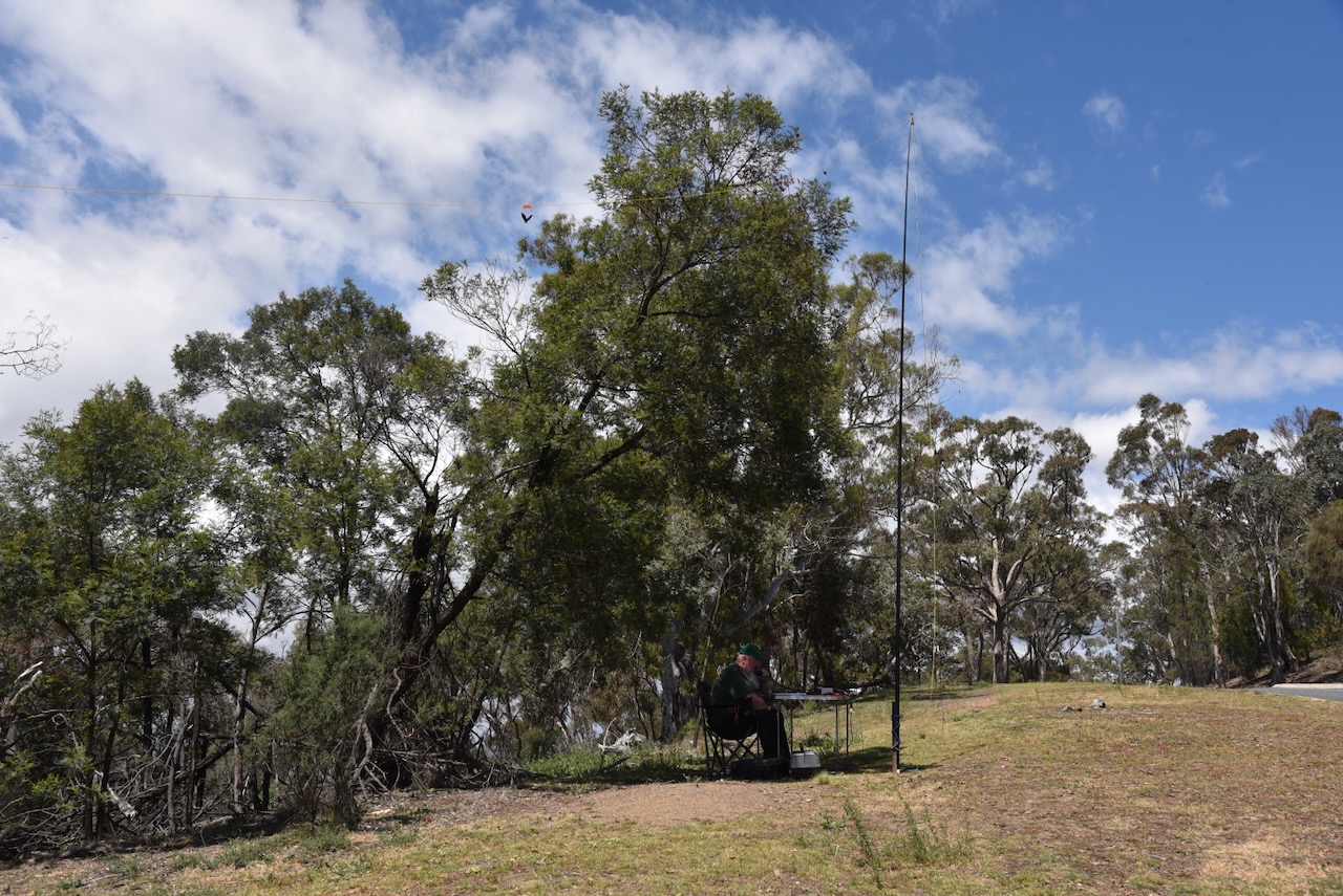
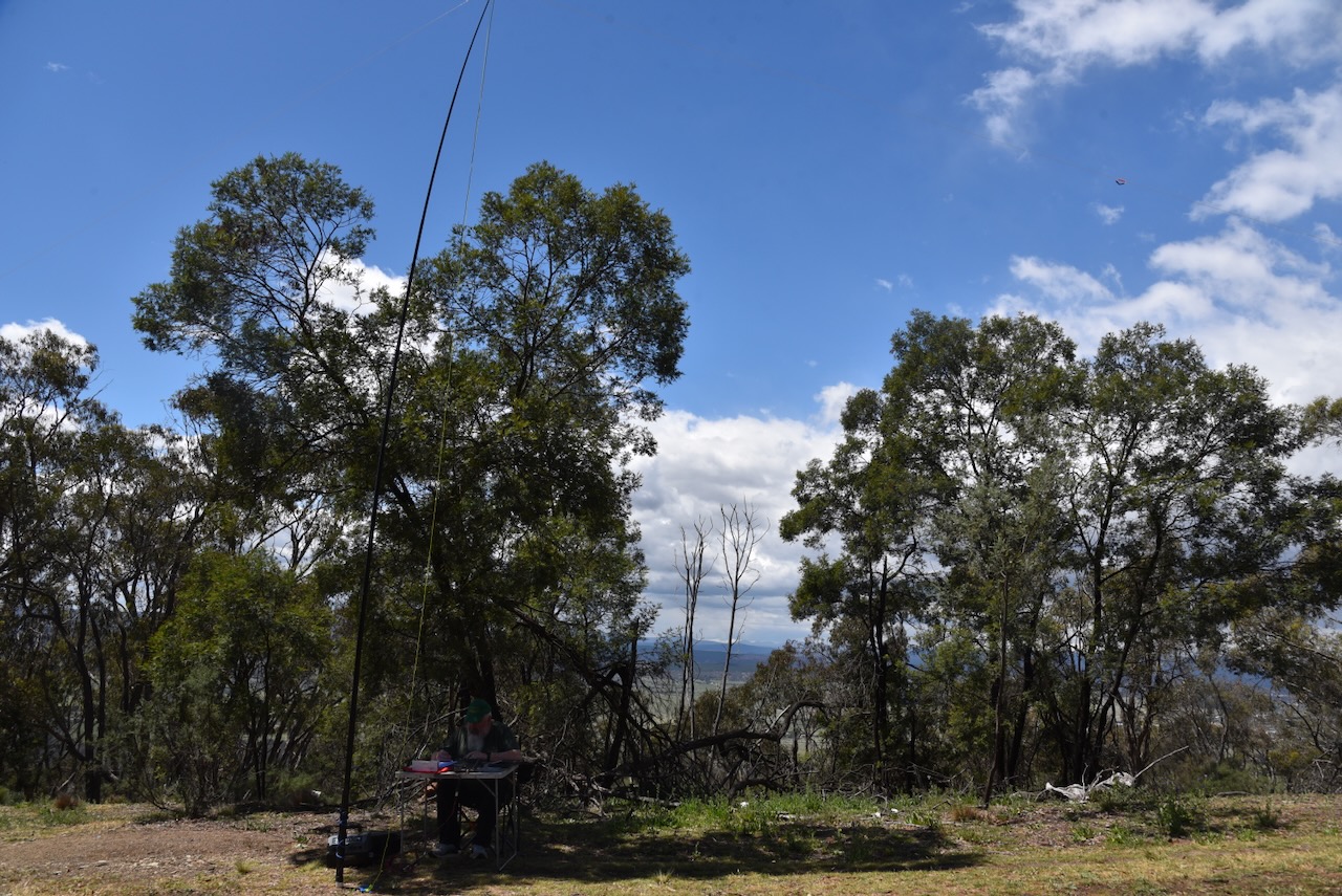
Marija and I operated from the side of the road just down from the car park. We ran the Yaesu FT857, 40 watts, and the 20/40/80m linked dipole.
Marija worked the following stations on 40m SSB:
- VK1CHW/p (VKFF-0033)
- VK2CHW/p (VKFF-0033)
- VK3YV/p (VKFF-0847)
- VK3TNL/p (VKFF-0847)
- VK3FCC/p (VKFF-0847)
- VK3CIA/p (VKFF-0847)
- VK3DCQ/p (VKFF-4959)
- VK1DI/p (VKFF-0842)
- VK3ZPF/p (VKFF-0618)
- VK3JW/p (VKFF-0618)
- VK3PJF/p (VKFF-0618)
- VK2YK/p (VKFF-0851)
- VK5GA/p (VKFF-0851)
- VK2USH
- VK2PET
- VK3PF/p (VKFF-1890 & VK1/ AC-008)
- VK3KAI/p (VKFF-1890 & VK1/ AC-008)
- VK3SMW
- VK2VW
- VK2HFI
- VK2AKA
- VK2BUG
- VK2HBR
- VK3TDK/p (VKFF-3076)
- VK3NYC/p (VKFF-3076)
- VK3GJG/p (VKFF-3076)
- VK2VAR
- VK2GOM
- VK2VIC
- VK1VIC
- VK2GOY
- VK3FTOM
- VK2NP
- VK3ZSC
- VK2IO/p (VKFF-0860)
- VK2GEZ/p VKFF-0860)
- VK3BDW
- VK2AHP
- VK2ETI
- VK2AIT
- VK2AIQ
- VK2AIZ
- VK2AIX
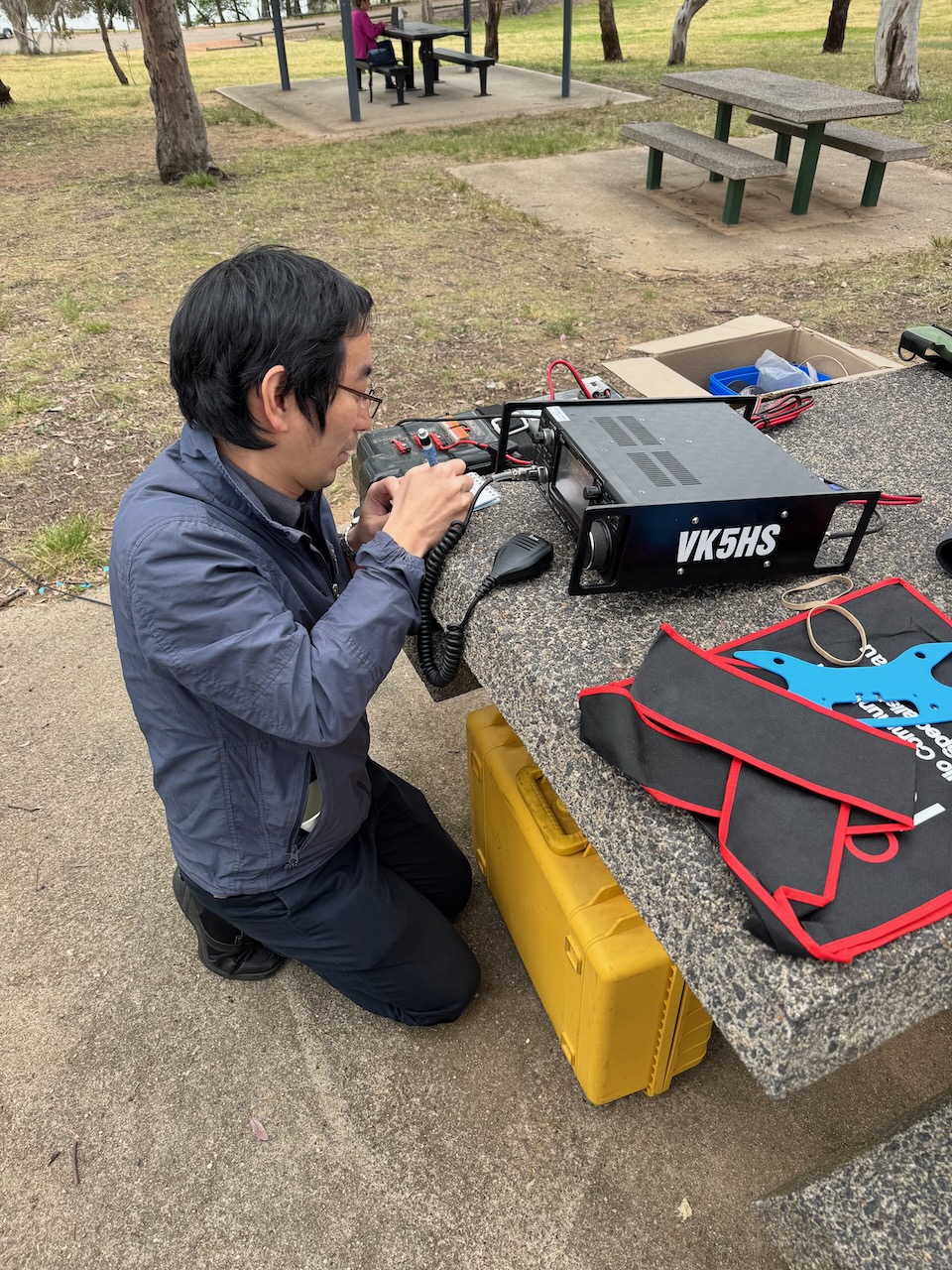
- VK5HS/p (VKFF-2383)
- VK3UH
Marija worked the following stations on 20m SSB:-
- VK3ZPF/p (VKFF-0618)
- VK2IO/p (VKFF-0860)
- VK2GEZ/p VKFF-0860)
- VK3PF/p (VKFF-1890 & VK1/ AC-008)
- VK3KAI/p (VKFF-1890 & VK1/ AC-008)
- ZL1IM
- ZL2ATH
- VK1AD
- ZL2WE
I worked the following stations on 40m SSB:
- VK1CHW/p (VKFF-0033)
- VK2CHW/p (VKFF-0033)
- VK3YV/p (VKFF-0847)
- VK3TNL/p (VKFF-0847)
- VK3FCC/p (VKFF-0847)
- VK3CIA/p (VKFF-0847)
- VK3DCQ/p (VKFF-4959)
- VK1DI/p (VKFF-0842)
- VK3ZPF/p (VKFF-0618)
- VK3JW/p (VKFF-0618)
- VK3PJF/p (VKFF-0618)
- VK1AD
- VK3APJ
- VK3CLD
- VK2DBF
- VK5QA
- VK3HJW
- VK1AO
- VK2MET
- VK2IO/p (VKFF-0860)
- VK2GEZ/p VKFF-0860)
- VK2YK/p (VKFF-0851)
- VK5GA/p (VKFF-0851)
- VK3GJG/p (VKFF-3076)
- VK3CEO
- VK3ZSC
- VK3KRL
- VK2NP
- VK1AC
- VK3BDW
- VK2HRX
- VK5AYL
- VK2AHP
- VK2USH/p (VKFF-1783)
- VK2PET
- VK3PF/p (VKFF-1890 & VK1/ AC-008)
- VK3KAI/p (VKFF-1890 & VK1/ AC-008)
- VK3SMW
- VK2VW
- VK2HFI
- VK2AKA
- VK2BUG
- VK2HBR
- VK3TDK/p (VKFF-3076)
- VK3NYC/p (VKFF-3076)
- VK2VAR
- VK2GOM
- VK5HS/p (VKFF-2383)
I worked the following stations on 20m SSB:-
- VK3ZPF/p (VKFF-0618)
- VK2IO/p (VKFF-0860)
- VK2GEZ/p VKFF-0860)
- VK3PF/p (VKFF-1890 & VK1/ AC-008)
- VK3KAI/p (VKFF-1890 & VK1/ AC-008)
- ZL1IM
References.
- ancestry (2016). Ancestry® | Genealogy, Family Trees & Family History Records. [online] Ancestry.com.au. Available at: https://www.ancestry.com.au/. [Accessed 22 Jan. 2026].
- and, P. (2023). Mount Ainslie Nature Reserve. [online] Act.gov.au. Available at: https://www.parks.act.gov.au/find-a-nature-park/canberra-nature-park/mount-ainslie-nature-reserve. [Accessed 23 Jan. 2026].
- Convictrecords.com.au. (2026). Available at: https://convictrecords.com.au/convicts/ricks/john/107811 [Accessed 23 Jan. 2026].
- Convictrecords.com.au. (2026). Available at: https://convictrecords.com.au/convicts/heard/mary/80093 [Accessed 23 Jan. 2026].
- Grokipedia (1970). Pialligo, Australian Capital Territory. [online] Grokipedia. Available at: https://grokipedia.com/page/pialligo_australian_capital_territory [Accessed 23 Jan. 2026].
- Grokipedia (1970). Mrs Winter. [online] Grokipedia. Available at: https://grokipedia.com/page/mrs_winter [Accessed 23 Jan. 2026].
- Ngambri Local Aboriginal Land Council, 2014, Aboriginal Heritage Stories Queanbeyan and surrounds
- Steven, M. (1966). Campbell, Robert (1769–1846). [online] Anu.edu.au. Available at: https://adb.anu.edu.au/biography/campbell-robert-1876. [Accessed 22 Jan. 2026].
- Trove. (2026). The Bee of Australia (Sydney, NSW : 1844) – 23 Nov 1844 – p3. [online] Available at: https://trove.nla.gov.au/newspaper/page/22331387?searchTerm=james%20ainslie [Accessed 22 Jan. 2026].
- Trove. (2026). No title – The Australian (Sydney, NSW : 1824 – 1848) – 25 Jan 1828. [online] Available at: https://trove.nla.gov.au/newspaper/article/37073047/4249489 [Accessed 23 Jan. 2026].
- Trove. (2026). JAMES AINSLIE. – No. 3. – Federal Capital Pioneer (Canberra, ACT : 1924 – 1926) – 24 Jul 1926. [online] Available at: https://trove.nla.gov.au/newspaper/article/36247677 [Accessed 23 Jan. 2026].
- Trove. (2026). The Sydney Gazette and New South Wales Advertiser (NSW : 1803 – 1842) – 7 Sep 1827 – p1. [online] Available at: https://trove.nla.gov.au/newspaper/page/496114?searchTerm=john%20tennant [Accessed 23 Jan. 2026].
- Trove. (2026). INCIDENTS IN THE LIFE OF TROOPER AINSLIE. – Federal Capital Pioneer (Canberra, ACT : 1924 – 1926) – 25 Jun 1926. [online] Available at: https://trove.nla.gov.au/newspaper/article/36247642?searchTerm=pialligo%20%2B%20tennant [Accessed 23 Jan. 2026].
- Trove. (2026). Police Reports. – SYDN[?]Y. – The Sydney Gazette and New South Wales Advertiser (NSW : 1803 – 1842) – 18 Feb 1828. [online] Available at: https://trove.nla.gov.au/newspaper/article/2189930?searchTerm=john%20tennant [Accessed 23 Jan. 2026].
- Trove. (2026). HIGHWAY ROBBERY. – The Sydney Gazette and New South Wales Advertiser (NSW : 1803 – 1842) – 22 Sep 1829. [online] Available at: https://trove.nla.gov.au/newspaper/article/2193464?searchTerm=bushranger%20%2B%20tennant [Accessed 24 Jan. 2026].
- Trove. (2026). SYDNEY NEWS. – The Maitland Mercury and Hunter River General Advertiser (NSW : 1843 – 1893) – 22 Mar 1845. [online] Available at: https://trove.nla.gov.au/newspaper/article/672561 [Accessed 24 Jan. 2026].
- Trove. (2026). CRIMINAL COURT. – WEDNESDAY. – The Australian (Sydney, NSW : 1824 – 1848) – 11 Sep 1829. [online] Available at: https://trove.nla.gov.au/newspaper/article/36866939?searchTerm=tennant [Accessed 24 Jan. 2026].
- Trove. (2026). CRIMINAL COURT.—(Tuesday.) – TRIAL. – The Australian (Sydney, NSW : 1824 – 1848) – 6 Jun 1828. [online] Available at: https://trove.nla.gov.au/newspaper/article/36864340?searchTerm=john%20tennant [Accessed 24 Jan. 2026].
- Trove. (2026). The Sydney Gazette and New South Wales Advertiser (NSW : 1803 – 1842) – 4 Feb 1828 – p2. [online] Available at: https://trove.nla.gov.au/newspaper/page/496529?searchTerm=john%20tennant [Accessed 24 Jan. 2026].
- Trove. (2026). Supreme Criminal Court. – TUESDAY, JUNE 3, 1828. (Before Mr. JUSTICE DOWLING.) – The Sydney Gazette and New South Wales Advertiser (NSW : 1803 – 1842) – 6 Jun 1828. [online] Available at: https://trove.nla.gov.au/newspaper/article/2190517?searchTerm=john%20tennant%20%2B%20death%20sentence [Accessed 24 Jan. 2026].
- Wikipedia Contributors (2025). James Ainslie (pastoralist). Wikipedia.
- Wikipedia Contributors (2025). John Tennant (bushranger). Wikipedia.
- Wright, T. (2012). Cleavage gives Canberra allure. [online] The Sydney Morning Herald. Available at: https://www.smh.com.au/politics/federal/cleavage-gives-canberra-allure-20121116-29hgk.html [Accessed 23 Jan. 2026].