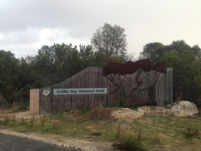
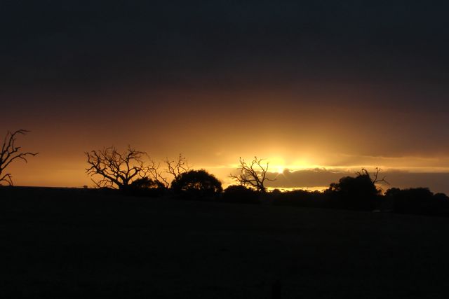
My last activation for the Friday, 14th June, 2013, was the Coffin Bay National Park. I was a bit puffed out after 2 SOTA activations during the day, so I thought a quick activation of the park would be good before heading back to Port Lincoln, for a feed and a beer or two.
Coffin Bay National Park is situated about 46 kms west of Port Lincoln on the Eyre Peninsula, and about 703 kms west of Adelaide. The park consists of about 31,000 hectares. The beautiful town of Coffin Bay is located near the entrance to the National Park. Coffin Bay is renowned for its oyster farming, and I couldn’t resist buying a few dozen fresh oysters. Coffin Bay was named by explorer Matthew Flinders after his friend the naval officer, Isaac Coffin.
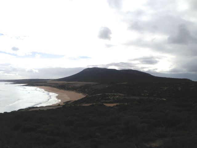
The Coffin Bay NP features a long peninsula with a sheltered bay, coastal dunes, swamps and a spectacular coastline of islands, reefs, limestone cliffs and white surf beaches.
To the east of Point Avoid are Almonta and Gunyah Beaches, used for surfing. Reefs extend out to sea from Point Avoid to Golden Island with Price Island further out.
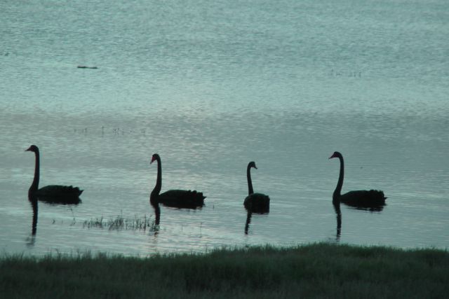
There is a great variety of wildlife in the national park. Numerous seabirds can be seen including White-bellied Sea Eagles and Ospreys was well as various albatross and petrels.
The area covered by the national park is also classified by BirdLife International as an Important Bird Area. It supports over 1% of the world populations of Pied and Sooty Oystercatchers, as well as significant numbers of Fairy Terns, Hooded Plovers, Western Whipbirds, Rock Parrots, and Blue breasted Fairy wrens.
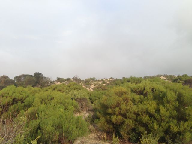
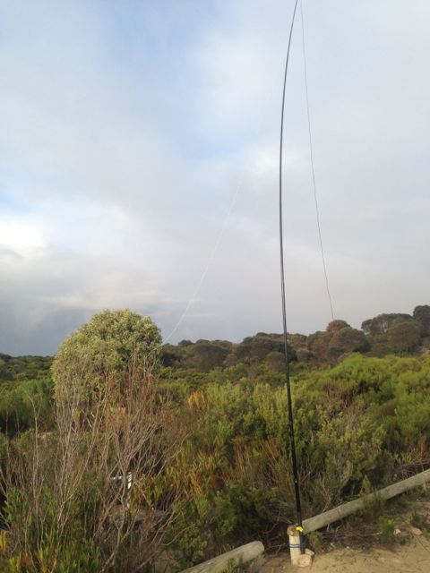
I pulled into an area of the park called Middle Well and started setting up the equipment. I almost had to move because of a rather inquisitive emu. The weather was holding up okay, but there was the threat of rain out to the east.
I ended up working a total of 9 stations on 40m SSB, before having to pack up due to the weather.
The following stations were worked:- Col VK5HCF; Nev VK5WG; Peter VK3PF; Brian VK5FMID; David VK5KC; Larry VK5LY; John VK5BJE; David VK5UG; and John VK5FTCT.
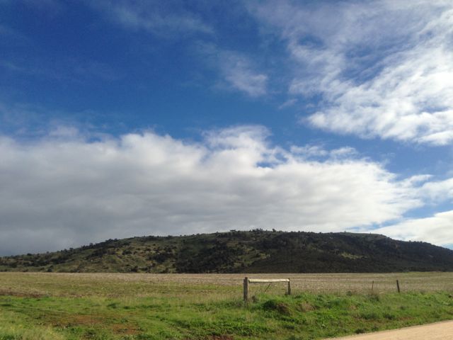
Mount Greenly, VK5/ SW-033, was my 2nd summit for Friday 14th June, 2013.
Mt Greenly is 305 metres above sea level and is worth 1 point. It is located about 5 kms north west of the little town of Coulta on the lower Eyre Peninsula, and about 705 kms from Adelaide. The summit overlooks the large salt lake, Lake Greenly to the east and the Great Australian Bight to the west, and is surrounded on 3 sides by picturesque sheep and cereal farming country.
I brought forward the activation time of this summit by one hour, simply because of the weather which was pretty lousy. Rain and showers had been hanging around all day, and I was quite keen to get the summit under my belt and head back to the motel room.
Mount Greenly was named by Captain Matthew Flinders on the 16th February, 1802, after the fiancee of Sir Isaac Coffin who aided Flinders in the selection and fitting out of the Investigator.
The summit itself is located on private property owned by Peter & Louise PUCKRIDGE. I contacted them prior to climbing the hill, and they were very friendly and helpful.
There is a hill, located 4 km to the south of Mount Greenly, which can be confused for Mount Dutton. The hill is named Frenchman, and is 168 metres high. It takes its name from the French whalers who used it as a lookout during the early 1800’s. Although imposing in itself, it does not qualify for SOTA as it does not have sufficient prominence.
Access to the Mount Greenly summit is via Coles Point Road, which runs off the Flinders Highway,about 3 kms before the town of Coulta. You can’t miss seeing the summit, as it is an imposing figure in a relatively flat lanscape. The name ‘Coulta’ is derived from the local Aboriginal people who called a nearby spring ‘Koolta’. Travel west along Coles Point Road for a distance of about 10 kms, and then turn right into Greenly Beach Road. Almost immediately after turning right you will find another dirt road on your right which leads you to a parking area. I parked the car at the end of that dirt road, and walked the rest of the way to the summit, which was about 3 kms to the top.
Prior to climbing the hill I drove down to Coles Point to look at the rugged coastline and the Great Australian Bight. There is a monument here to a young gentleman who drowned here back in 1941. There are also terrific view back to the western side of Mount Greenly. It is well worth a drive down to the coastline to have a look. The beach is often frequented by surfers, although the area also has a reputation for its man eating Great White sharks. Greenly Beach made it into the top 101 beaches of Australia.
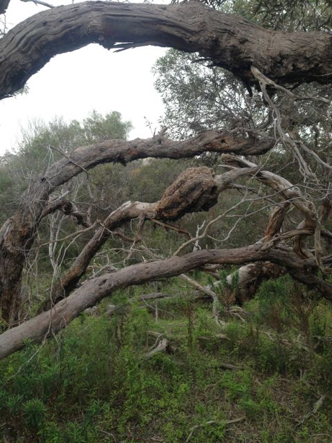
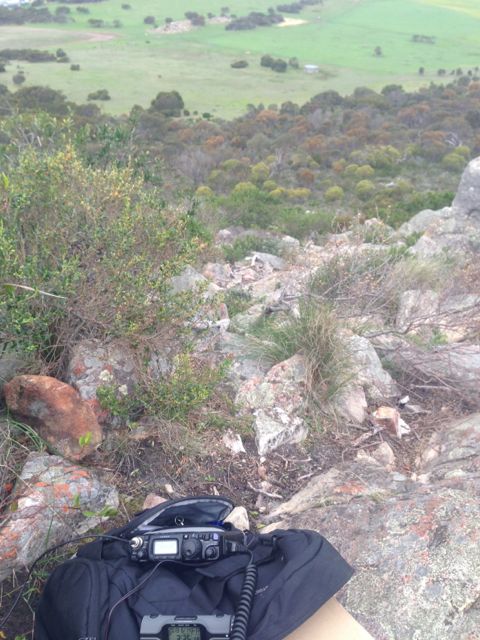
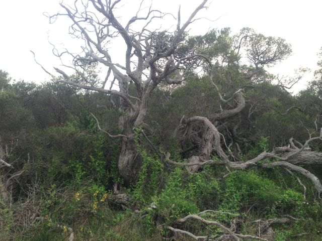
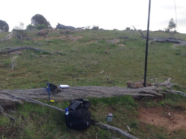
The first part of the walk to the summit is certainly not easy. There is no track. You need to make your way through some pretty thick scrub to the low ridgeline on the southern side of the summit. This was certainly the hardest part of the walk.
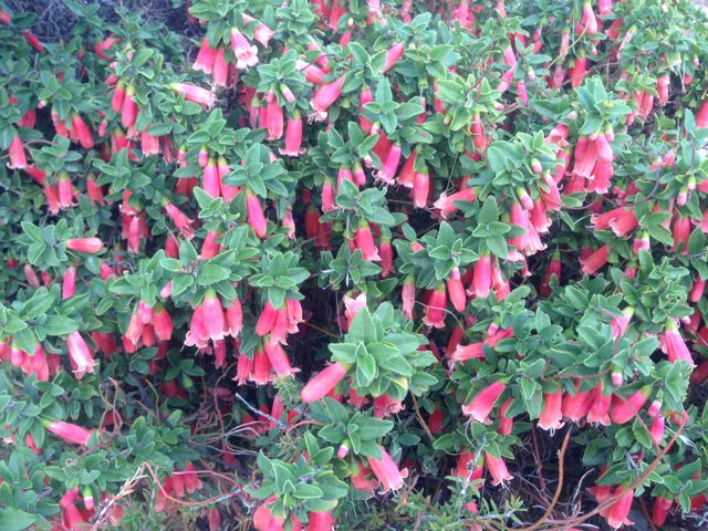
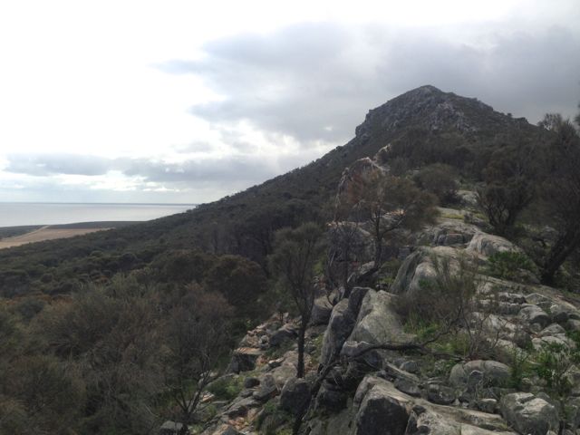
Once I reached the ridgeline it was much easier going from there, but still a challenge. The ridegline is very rocky and has quite a bit of thick vegetation in parts. But it is a slow and steady incline up to the actual peak of Mount Greenly. There were quite a few plants that were in flower on the summit. They included correas, grevillias, wattles, flame heath, and gums. And the rock formations are truly quite amazing.
Once you reach the actual summit, there is no trig point. There is a pile of rocks which has gradually been growing, as more and more people climb this hill. There was very little room to move right up the top, so I climbed back down a little bit and set up on the southern side of the summit.
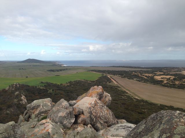
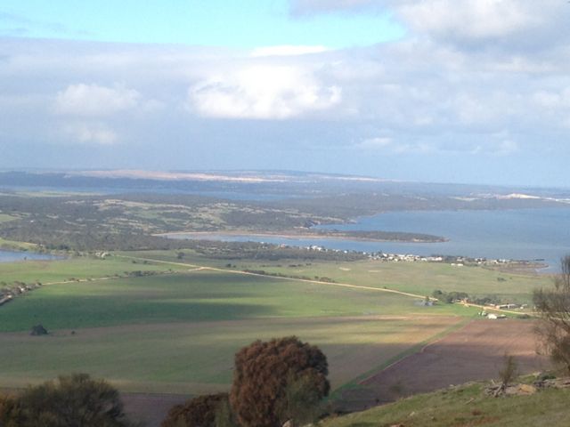
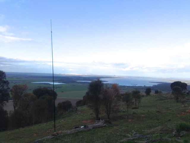
The view on the top is quite impressive. To the south you can see Mount Dutton and the nearby Frenchman & Mena Hill, and beautiful lush green crops in between. To the north are also lush green crops. To the east you can see North & South Block and Lake Greenly, lying just below the summit. And to the west you have the wilds of the Great Australian Bight and Greenly Beach.
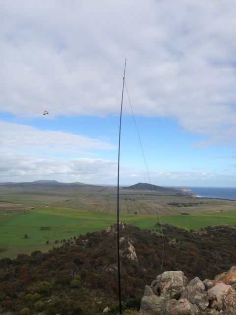
The weather on the top of the hill was pretty wild and woolly. I guess that’s what you would expect when it is the middle of winter, and you have the Great Australian Bight just over your shoulder. I managed to secure the squid pole to a bush using 2 octopus straps, but the wind was so strong that at one stage it collapsed on itself. Apparently they hang glide from this hill.
Sadly I didn’t get any summit to summit QSO’s. I was carefully watching SotaWatch hoping that Ian VK1DI was going come up. Ian had planned to activate The Dutchman’s Stern in the Flinders Ranges, whilst over here on holidays in South Australia. Ian did give me a call but advised that he had not reached the actual summit of The Dutchmans Stern, so no s2s.
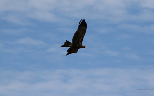
During my time on the hill I had a friendly Wedge Tailed eagle constantly soaring in the wind above the summit.
I managed a total of 19 QSO’s on 40m SSB.
The following stations were worked:- Col VK5HCF; Brian VK5FMID; Paul VK5FUZZ; Tony VK3CAT/m; Andrew VK2UH; Ernie VK3DET; John VK2YW; VK3JP; Rik VK3KAN/m; Bernard VK3AMB; Glenn VK3YY; John VK5FTCT; Ron VK3AFW/m; Ian VK1DI/5; Peter VK3PF; Rhett VK3GHZ; Jim VK5JW; Bill VK5MBD; and Mark VK7FMPR.
On Friday morning, 14th June, 2013, I got up bright and early and headed for Mount Dutton, VK5/ SW-035, which is situated about 48 kms north west of Port Lincoln on the lower Eyre Peninsula.
Mount Dutton was named after Charles Christian DUTTON, an explorer, who in 1839, led a small expedition from Port Lincoln to Coffin Bay. DUTTON was an early Sheriff of the Province and then settled in the Port Lincoln district. He died at age 32 in 1842.
I travelled out along the Flinders Highway towards the town of Wangary, and watched the spectacular sunrise. And at the same time keeping a close watch for kangaroos. There are plenty of roos over here on the Eyre Peninsula.
At Wangary, turn left into Farm Beach Road and travel west towards the ocean.
It is worth a quick detour down to Farm Beach and Gallipoli Beach, which featured in Peter WEIR’s Australian movie ‘Gallipoli’.
After travelling down Farm Beach Road for about 5 kms turn right into Broccabruna Drive. There is a brown sign here saying ‘Frenchman 14’. Travel about 1 km along Broccabruna Dr and then veer left onto Mena Road. There is a brown sign here saying ‘Frenchman 13’. About 3 kms up Mena Road, you will see an old derelict cottage just set off the road amongst trees and shrubs. There is a large tall palm tree here as well to keep an eye out for.
Directly opposite this, you will see a large cocky’s gate. I travelled from here through the paddock to the base of the hill. It is about a 3 km walk from there to the summit. The first part of this walk is a bit of a challenge. There is no track and the scrub is quite thick in parts. It is pretty easy to get disorientated.
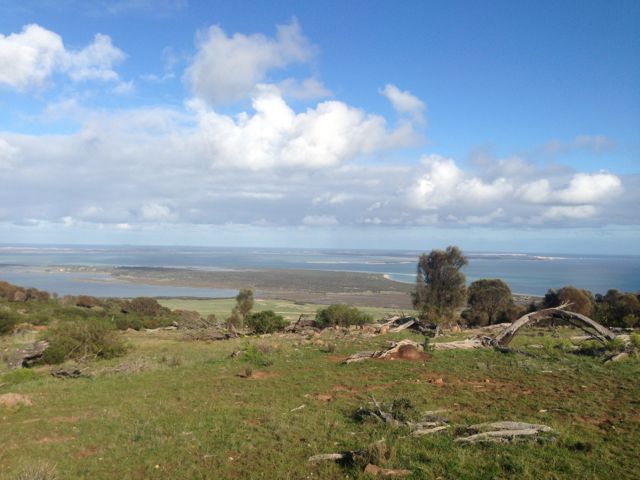
Once you do reach the top there are spectacular views out in all directions. Particularly to the south. The views of Mount Dutton Bay, Coffin Bay, and the Coffin Bay National Park are truly amazing. The hill is surrounded by lush sheep and cereal farming land. The walk along the ridgeline on the top of the hill is quite easy, and there are plenty of spots to explore.
During the late 1800’s, nearby Dutton Bay was a valuable ‘land-sea link’, as a jetty was built adjacent to the large Dutton Bay woolshed. At its peak, over 20,000 sheep were shorn within the woolshed. Up to 100,000 fleeces were baled and loaded onto ketches from the adjoining jetty, for overseas markets.
There are quite a few trees and shrubs and rocks on the top, so plenty of options in securing the ends of the dipole. I set up the 40m/20m linked dipole on the 7m squid pole, using a fallen tree and some rocks to secure it into place. The tree made a good bench.
I put a CQ call out, and worked a total of 15 stations before the UTC rollover, and a total of 24 stations after the UTC rollover.
Stations worked before the UTC rollover were:- Ian VK5CZ; Roger VK5NWE; Peter VK3PF; Glenn VK3YY; Rik VK3KAN/m; David VK3VDL/m; Ron VK3AFW/m; Tony VK3CAT; David VK5UG; Nev VK5WG; David VK5LSB; Ernie VK3DET; Urey VK3ATA; Dennis VK5LDM; and Mike VK5MCB.
Stations worked after the UTC roll over were:- Rik VK3KAN/m; David VK5UG; Nev VK5WG; Ron VK3AFW/m; Peter VK3PF; Col VK5HCF; David VK5LSB; Les VK5KLD; Mike VK5MCB; Tony VK3CAT/m; Ernie VK3DET; Rhett VK3GHZ; VK3JP; Ian VK5CZ; David VK3VDL; VK3JM; Glenn VK3YY; Dennis VK5LDM; Jim VK5JW; Colin VK3NCC/2; Urey VK3ATA; Brian VK5FMID; John VK5FTCT, and Mark VK7FMPR.