Coorong National Park

My last activation for Sunday was the Coorong National Park.  After packing up at the Mowantjie Willauwar CP, I drove down the Princes Highway and into the town of Meningie, which sits on the shores of Lake Alexandrina, which is Australia’s largest frehwater lake.

I stopped in at the Meningie bakery for lunch, which I can highly recommend.  After devouring a locally made pie and cream bun, whilst enjoying the view of the lake, I journeyed on down the road to the Coorong.

The Coorong National Park, which was established in 1966, stretches for a distance of about 130 kms.  The western end of the Coorong is located at the mouth of the Murray River near Hindmarsh Island, whilst the eastern end is located near Kingston.  The Coorong is approximately 142,500 hectares in size.  You may remember this National Park from the 1977 movie called ‘Storm Boy’.

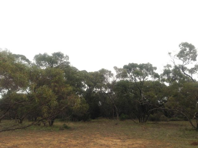
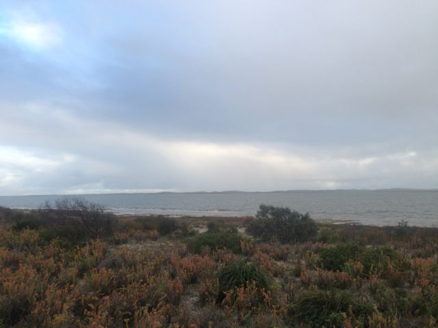
The Coorong consists of a string of lagoons which are protected from the Southern Ocean by the sweeping sand dunes of the Younghusband Peninsula.  The area supports a huge array of bird and wild life. In fact some of the birds here are migratory and come from as far away as Siberia.

coorong1

The exact meaning of the name ‘Coorong’ is open to discussion.  It is thought to be a corruption of the local Aboriginal people’s word kurangh, meaning “long neck”; which is a reference to the shape of the lagoon system. The name is also thought to be from the Aboriginal word Coorang, meaning “sand dune”, a reference to the sand dunes that can be seen between the park and the Southern Ocean.

IMGA0040          IMGA0033

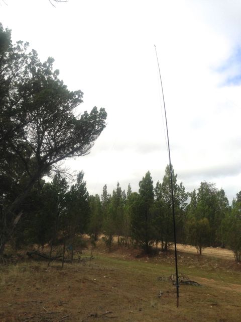
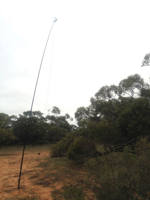
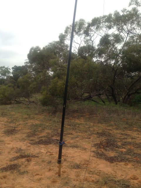
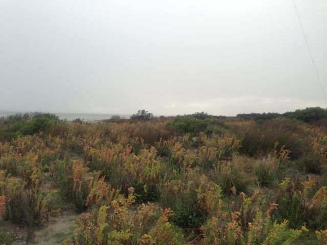
About 5 kms out of Meningie, I turned down Seven Mile Road, and travelled 2kms down to the waterfront, and then headed south along a dirt track through the scrub.  It was a little bit boggy and sandy in parts but the Falcon XR6 handled it just fine.  The photos below show the operating spot, amongst the low lying coastal vegetation.

IMG_2579          IMG_2576

Because the area was so sandy & soft I used the squid pole holder to drive into the sand to hold the squid pole in place.  No trees here, so the ends of the legs of the dipole were pretty close to the ground.  I was set up only about 30 feet from the water.

IMG_2578          IMG_2577

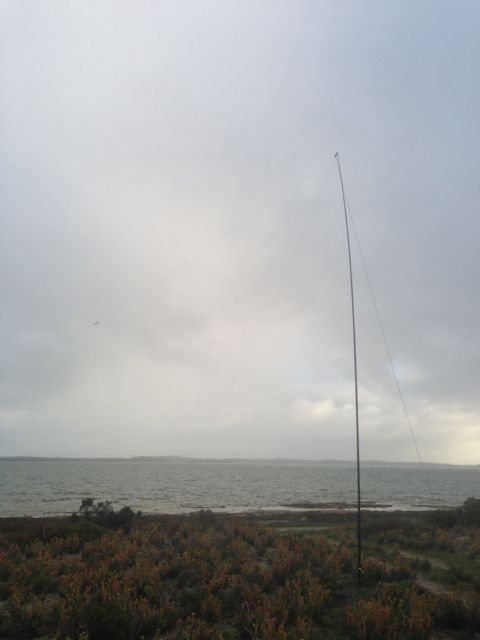
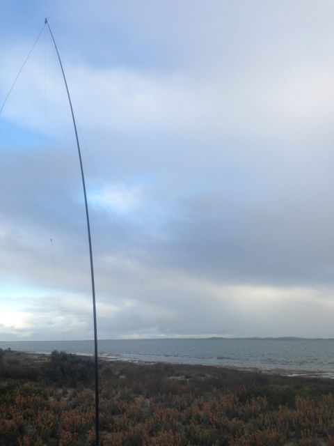
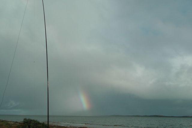
Compared to the 2 previous activations further inland, the weather was very different here.  I was just 30 feet from the freshwater of the Coorong, and the sand dunes and the Southern Ocean were not that far away.  I could actually hear clearly the pounding of the waves.  So the weather off the ocean was pretty fresh and quite windy.  And there was also annoying drizzly rain whilst I set up the antenna.

IMGA0035

But for the most part I stayed dry, and had some good contacts on 40m.  I managed 2 more SOTA contacts, with Mark VK3PI/p on VK3/VS-033; and then Kevin VK3KAB/p on the top of Gentle Annie VK3/ VT-078.

I also spoke with John VK5BJE/p who was operating from the Onkaparinga River National Park.  I had spoken to John earlier from Mowantjie, so obviously John got itchy feet and went out to activate a park, which was great.

After a bit of a run on 40m, I decided to try 20m to see if I could work any DX, but I was a little disapointed.  There didn’t seem to be too much activity on 20m.  But I did manage to have a very enjoyable QSO with Paul EA5/GM0OPK in Spain, who was romping in, and also my good mate Phil ZL2TZE in New Zealand.

The waters of the Coorong are popular for fishermen, and indeed while I was there I saw about 3 boats heading off, and then returning with their catch.  There was a large group of Pelicans waiting to be fed.  Over the years I’ve had a good feed of fish that have come from the Coorong area, which is renowned for its Coorong Mullet and Mulloway.

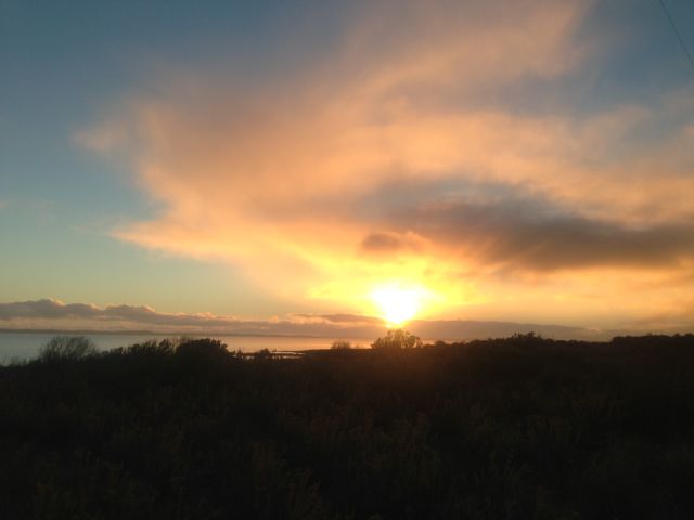
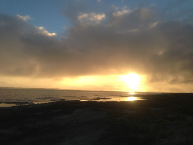
After packing up the gear, I sat back and enjoyed the sunset and then headed home to the Adelaide Hills.

IMG_2584   IMG_2581

I had a total of 19 QSO’s.  Most of those were on 40m.  I did manage 3 on 20m into NSW, Spain, and NZ.

The following stations were worked:- Mark VK3PI/p (SOTA); John VK5BJE/p; Ron VK3AFW; Nick VK3ANL; Allen VK3HRA; Brian VK5FMID; Peter VK3PAH; Andy VK5LA; Peter VK3ZPF/m; David VK5KC; Scott VK7NWT; Kevin VK3KAB/p (SOTA); Gerard VK2JNG; Shaun VK5FAKV; Dave VK3VCE; Roy VK5NRG; Adam VK2YK; Paul EA5/GM0OPK; and Phil ZL2TZE.

A really beautiful spot and a good fun afternoon.

Mowantjie Willauwar Conservation Park

Following the activation at the Poonthie Ruwe CP, I drove a few kms away to the Mowantjie Willauwar Conservation Park.  The park is situated about 100 kms east of Adelaide, and about 5 kms south west of Tailem Bend.  Access is via Placid Estate Road, which runs off the Princes Highway.  This park is much better signposted that Poonthie Ruwe.  Although, there are no signs on the Princes Highway to indicate its existence.

Parks map

The park was proclaimed under its current name in June, 2005 and conserves about 143 hectares of Southern Cypress Pine forest, that includes two nationally threatened orchid species…the Sandhill Greenhood Orchid, and the Metallic Sun Orchid.  It is one of just nine areas left in South Australia where the Sandhill Greenhood Orchid can be found.  The park was originally constituted as the Tailem Bend Forest Reserve back in 1950.

IMG_2572

The nearby Princes Highway originally cut through the park, but was rerouted in the 19990’s to bypass the park.

The name of the park is aboriginal in the native Ngarrindjeri language.  ‘Mowantjie’ is the name for the native pine found in the park, while ‘Willauwar’ is a plural word meaning ‘forest of species’.  Therefore ‘Mowantjie Willauwar’ means ‘Native Pine Forest’.

Over 40 different varieties of birds have been documented in the park.

IMG_2575          IMG_2574

Again I set up the dipole on the 7m squid pole and used the 817nd.  There are obviously plenty of trees here to string up the ends of the dipole.  This time, there was a bit more activity on 40m which was good.

My first QSO was with Glen VK3YY who was on top of Mount Dandenong VK3/ VC-025.  I had 2 other SOTA contacts during the afternoon.  The next was with Kevin VK3KAB on VK3/ VT-040, and then Peter VK3ZPF who was on top of VK3/ VT-026.

I also spoke with Andy VK5LA/p, who was operating portable as part of the VK5 Parks Award, up in the River Murray National Park.  I think this was Andy’s first parks activation, so congratulations Andy, and thanks for supporting the program/award.

IMG_2573

I made a total of 14 QSO’s, all on 40m.

The following stations were worked:- Glen VK3YY/p (SOTA), Andy VK5LA/p (Murray River NP), Ron VK3AFW, John VK5BJE, Rod VK2ZRD, Col VK5HCF, Andrew VK2UH, Bernard VK3AMB, Brian VK5FMID, Kevin VK3KAB/p (SOTA), Peter VK3ZPF/p (SOTA), David VK5KC, Allen VK3HRA, and Peter VK2NEO.

Poonthie Ruwe Conservation Park

On Sunday morning, 2nd June 2013, I activated the Poonthie Ruwe Conservation Park, which is located about 100 kms east of Adelaide.  It is situated about 5 kms south east of the town of Tailem Bend, near the Murray River.  The park was originally called Poonthie Ruwi-Riverdale CP and was proclaimed back in 2003, but the name was changed in May, 2008.  The park’s name means ‘Hopping Mouse Country’ in the traditional Ngarrindjeri aboriginal language.  Unfortunately, there is no Hopping Mouse population in the area today, due to European settlement.

Poonthie Ruwe consists of mallee and Scented Irongrass tussock grassland and covers an area of about 241 hectares.  It is the largest area of this type of vegetation in South Australia, and the temperate grasslands that are found in the park are classified as critically endangered.  This type of vegetation has been poorly conserved due to clearing for farming.

IMG_2569

Access to the park is via Blackets Road, which runs off the Princes Highway, just out of Tailem Bend.  There are no signs indicating the park is there, so before leaving home make sure you know exactly where it is located.

Parks map

The area is quite sandy, and there is a resident ant population as I found out.  Their nests almost looked like the lunar landscape.

IMG_2568

I set up my gear and called CQ on 7.100 on 40m, but things were incredibly slow.  First cab off the rank was Bob VK2OD.  This was followed by a few of the regular Hunters in Andy VK5LA, Brian VK5FMID, and Allen VK3HRA.

IMG_2566  IMG_2570

Because things were s slow, I decided to pack up the gear and i headed ‘around the corner’ to the Mowantjie Willauwar Conservation Park.

I made a total of just 6 QSO’s, all on 40m.

The following stations were worked:- Bob VK2OD, Andy VK5LA, Brian VK5FMID, Allen VK3HRA, Roy VK5NRG, and Ian VK3FIAN.