Ngarkat Conservation Park

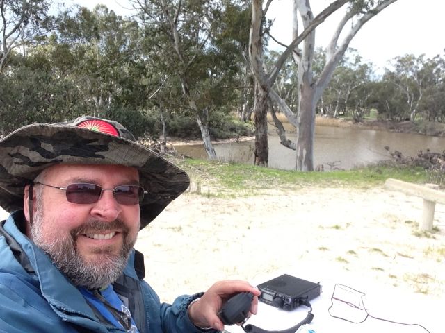
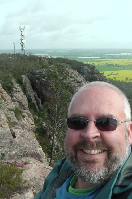
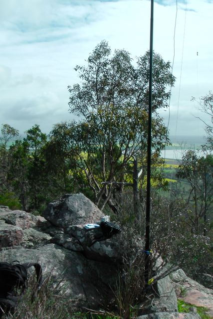
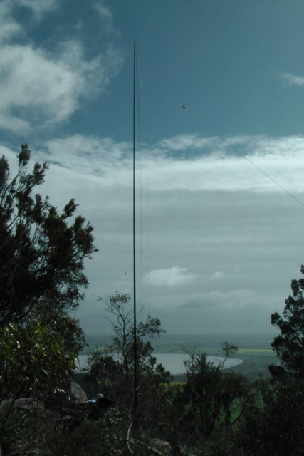
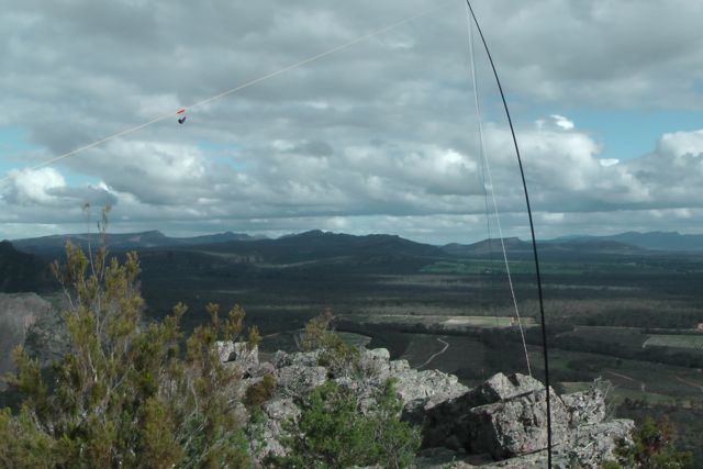
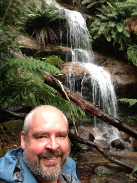
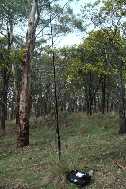
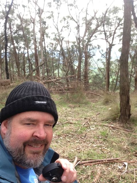
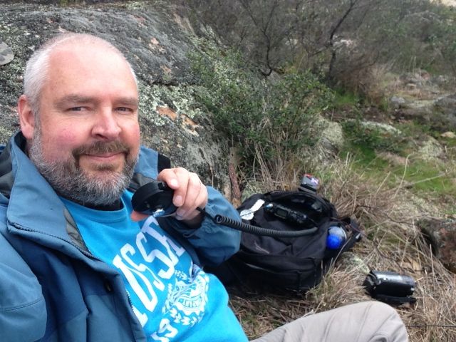
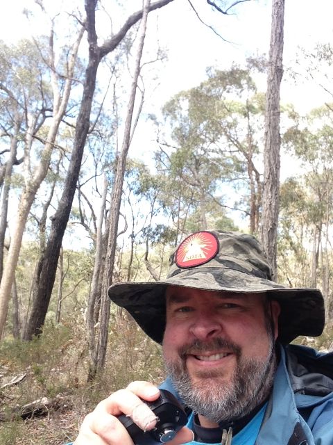
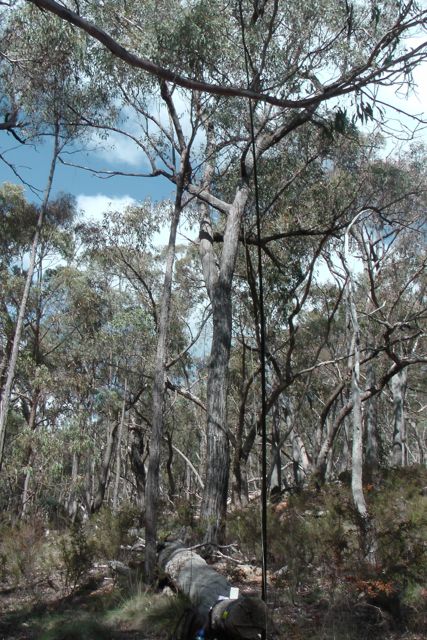
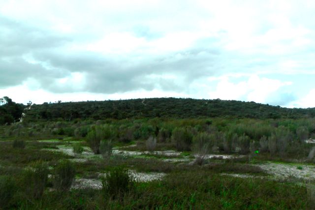
My last planned activation for Wednesday 11th September, 2013, was the Ngarkat Conservation Park, just over the border in South Australia.  So after activating Little Desert National Park I drove west towards S.A. and into the town of Keith.  Just north west of Keith I turned off the Dukes Highway onto Snoswells Road and followed this for a few km north until I reached the park, and an area called Tyms Lookout.  There is a carpark at the end of Snoswells Road, and this is where I set up my gear.

ngarkat-map-large

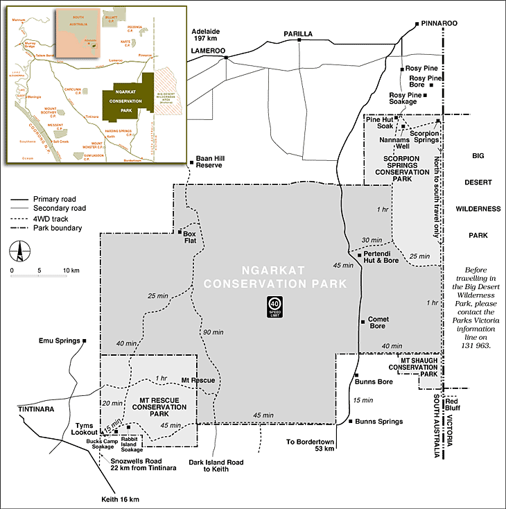
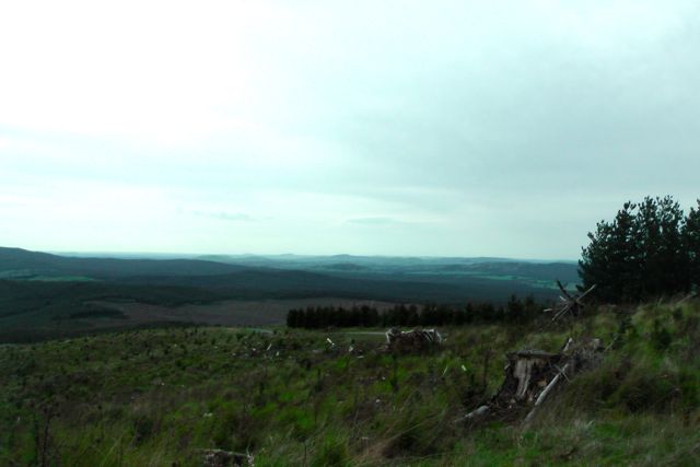
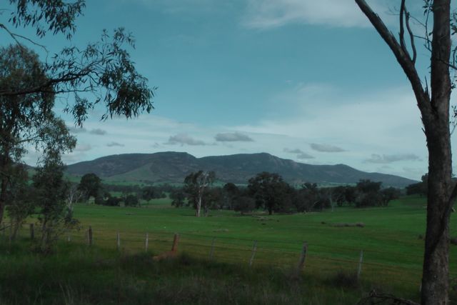
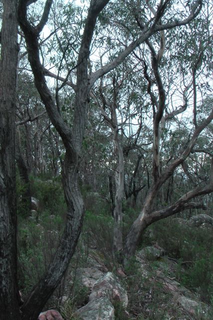
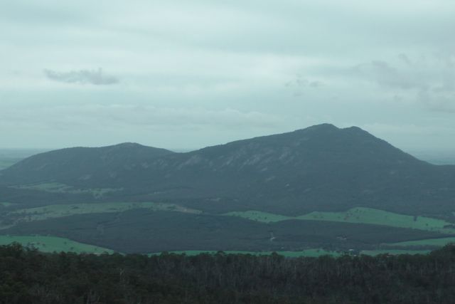
Ngarkat Conservation Park is large park.  In fact it is one of the largest mallee parks in South Australia.  Its total area is 270,000 hectares which consists of vegetated sand dunes, mallee and heath.  It is located about 209 km south east of Adelaide, 34 km south of Pinaroo, and 5 km north of Keith.  It was named after a tribe of Aboriginals who previously inhabited the area.  The park abounds with wildlife including Western Grey kangaroos and emus.  Over 120 species of birds including the rare Malleefowl have been recorded. There are a number of walking trails and it is home to the legendary Border Track.  The the park has a popular 4WD track.

IMGA0105_5     IMGA0109_4

I started off on 40m and my first contact was with John VK5BJE who had a very strong 5/9 signal.  This was followed by Larry VK5LY who was patiently waiting in the Murray River National Park.  Signal reports of 5/9 both ways were exchanged with Larry.  Another Park to Park contact for the log !  Another Park to Park contact was made with Tony VK3VTH/5 who was portable in the Karte Conservation Park (5/9 both ways).  When things got a little quiet I decided to tune around the band & I heard 2 gentlemen on Lord Howe Island talking to each other.  After about 5 minutes they were signing off, so I decided to give them a call, and much to my surprise they replied. Dick VK9LH, and Des VK9FLHI were both 5/8 signals and I received a 5/1 signal report back from both of them.  I could also hear some European signals coming through, including Jose EA2KC, who had a good strong signal.  I tried calling him but unfortunately I could not get through.

IMGA0116_4

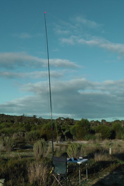
Time was starting to get away from me, but I decided to go to 20m and have a quick listen.  I am glad that I did because I made 2 DX contacts and 1 contact over to my good mate Jess VK6JES in Western Australia.  The 2 DX contacts were with Jose EA2KC (5/9 sent and 5/6 received), and then Jara DL1YD (5/9 sent and 5/5 received).  I was really pleased to have 2 good DX contacts with just 5 watts, and it was now time to pack up and head home.  After all I still had a 2 hour drive to get back to the home qth.

The following stations were worked:-

John VK5BJE; Larry VK5LY/p; Ron VK3AFW; Tony VK3CAT; Dale Vk5FSCK; Brian VK5FMID; Graham VK5KGP; Nick VK3NAL; Tony VK5ZAI; Tony VK3VTH/5; David VK3MIJ; Colin VK3UBY/m; Charles VK5FBAC; Paul VK4CPS; Paul VK4PAR; Dick VK9LH; Des VK9FLHI; David VK5KC; Peter VK3PF; Peter VK3TKK/m; Jose EA2KC; Jara DL1YD; & Jess, VK6JES.

I have placed a video of this activation on You Tube…..

Little Desert National Park, Victoria

Little Desert National Park in Victoria, was my last intended activation for Tuesday 10th September, but unfortunately I ran out of time, as I had spent longer on Mount Langi Ghiran than expected.  Ed VK2JI had told me that Andrew VK2ONZ was going to be up on air on a summit shortly.  Sure enough I checked SOTA Goat and saw that they had posted an alert.  So I patiently waited for an hour but sadly they did not appear.  So off the summit I headed, a little later than planned.

So after activating Mount Arapiles, I drove back along the Western Highway into Horsham, and after picking up some Subway for lunch, I continued back along the Highway to Dimboola.  From there I headed out along Horeshoe Bend Road, south of Dimboola.

The Little Desert NP which covers an area of about 32,000 hectares, is renowned for its unmodified ‘desert’ landscapes and its conservation values.  Features of special note in the park include the presence of endangered Mallefowl, the Wimmera River, and colourful wildflower displays during spring.

The park’s beginnings started in 1955 when 217 hectares were reserved as the Kiata Lowan Sanctuary, primarily for the protection of Malleefowl.  In 1968, plans were announced to develop the area for agriculture.  There was enormous public outcry over this, and as a result the area was increased to 945 hectares.  By 1969 the Park was expanded to 35,300 hectares with the addition of the majority of the block between the Wimmera River and the Nhill Harrow Road.  In 1991, further land was added to the park.

There are numerous native animals to be found in the park including Western Grey Kangaroos, Western Pygmy-possum, Swamp wallaby, & Silky mouse.  There have also been some sightings of the platypus in the Wimmera River.  A total of 229 native bird species have been recorded in the park.  Of these, five are endangered, three vulnerable, and nine rare.

I entered into the Little Desert National Park and set up at Horeshoe Bend near the banks of the Wimmera River.  This was a really idealic setting.  The weather was beautiful and the view from my fold up table & deck chair was fantastic.  I had noted when I arrived that there was a school bus parked nearby, and sure enough, after about 10 minutes on air, the silence was broken by a group of high school kids walking along the banks of the Wimmera, returning to the bus.  I certainly got a few strange looks from the children and their teacher as they walked by.

IMGA0094_6

I operated for about 30 minutes and then decided that it was time to head off over the border into South Australia.  I still had a 2 hour drive ahead of me before reaching my final activation, the Ngarkat Conservation Park.  But I was happy.  The park was activated, and 11 stations were in the log on 40m SSB from VK3, VK5 & VK7.

IMG_3497      IMGA0098_6

The following stations were worked:-

Tony VK5ZAI; Ron VK3AFW; John VK5BJE; Dale VK5FSCK; Albert VK3KLB; Ivan VK5HS; Col VK5HCF/qrp; Brian VK5FMID; Larry VK5LY/m; Greg VK3UT; and Eric VK7EK.

Mount Arapiles, VK3/ VW-022

Mount Arapiles, VK3/ VW-022 was my first activation for Wednesday 11th September, 2013.  It was also to be my last SOTA activation on my 6 day trip.  I had stayed overnight at the Victoria Hotel at Dimboola, so it was a 57 km drive out to Mt Arapiles, firstly along the Western Highway, and then across the Wimmera plain.

Mt Arapiles is 369 metres above sea level and is worth 1 SOTA point.  The summit is known by the local aboriginals as Dyurrait.  It is situated about 10 km west of  the little town of Natimuk, and is located within the Mount Arapiles-Tooan State Park, known by the aborigines as Dalkaiana warty Dyurrait.  The Park consists of 7,475 hectares and was created in 1987.  About 14 % of Victoria’s flora species are represented in the Mt Arapiles section of the Park.  Mt Arapiles is one of Australia’s best rock climbing areas.  In fact it is widely regarded as the top rock climbing area in Australia and is world renowned.  Over 2,000 routes have been developed on the numerous cliffs, crags, and pinnacles.  There are also numerous walking tracks throughout the park catering for all levels of fitness.

img003

The area is known to be frequented by the endangered Peregrine Falcon.  They return to the area each year during the spring nesting season.  The birds are in low numbers and are under threat in Victoria.   Numerous other bird species can be found including Crimson Rosellas, New Holand honeyeaters, Bronzewing Pigeons, Brown Treecreepers, and also the threatened Malleefowl.  Mt Arapiles is also home to various other wildlife including Western Grey Kangaroos and echidnas.

I had viewed Mount Arapiles, dozens and dozens of times, as my father’s family comes from the Wimmera region, and my Nana spent her final years at nearby Natimuk, but I had never climbed the summit.  As I drove south west from the Western Highway, you could clearly see the spectacular feature of Mt Arapiles rising sharply from the Wimmera Plains, west of Horsham.

IMGA0021_7      IMGA0022_7

I drove through historic little town of Natimuk, and admired all the historic buildings.  Natimuk is a beautiful little town with a population of about 450 people.  Natimuk has traditionally survived as a rural service centre for the surrounding grain and sheep farming community.  In more recent times it has diversified into tourism and staved off the decline unfortunately common in some other Wimmera towns.  There is a memorial cairn here for Major Thomas Mitchell, who discovered and climbed Mt Arapiles on the 22nd and 23rd July, 1836.

Fortunately there is a road all the way to the top of Mt Natimuk.  From the carpark, it is a short 50 metre walk up some stairs to the lookout.  Again, all of the native plants were out in spectacular flower.  About 500 species of native plants occur in the park.  Some of which such as the Rock Wattle and Skeleton Fork (a type of fern) are rare or endangered.  The views from the top are also very good in all directions.  Out to the east is Horsham; to the north east is Lake Wyn Wyn, Olivers Lake, and Lake Natimuk; to the north is Mitre Lake; out to the west is more of the State Park and a large number of small lakes; and to the south is Toolondo Reservoir.

IMGA0037_7     IMGA0041_7

IMGA0060_7      IMGA0075_7

I set up just to the north of the trig point and used a small shrub to secure the 7m squid pole, with the use of some octopus straps.  Take care when setting up as there are some very low power lines running into the fire spotting tower.  I secured the legs of the dipole to the branches of nearby trees.

IMGA0050_7     IMGA0051_7

After finishing setting up the gear, I had about 9 minutes to play with before the UTC rollover.  So I quickly jumped onto 7.090 and put out a call and worked a total of 12 stations in VK2, VK3, & VK5 before the new UTC day.  I then worked a further 21 stations in VK2, VK3, & VK5 after the UTC rollover.

There were a few of the regular QRP callers which was good to see.  They included Col VK5HCF, Andrew VK2ONZ, and Andrew VK3ARR.  I also managed a VK5 Parks contact with Johnny VK7ZJJ/5, who was portable at Wilpena Pound in the Flinders Ranges National Park.

After an hour on the summit is was time to pack up and head off to Little Desert National Park.  I had planned to activate this park the day before, but unfortunately I had run out of time.  But before I left I did go for a walk and look at Melville Cave.  The Park contains significant Aboriginal cultural sites including rock shelters, rock art, and quarries.  The traditional owners are the Wotjobaluk, Wergaia, Jadawadjali, Jaadwa and Jupagalk people.  One can only image what significance this place must have had to the local Aboriginals.  For thousands of years Mount Arapiles and its surrounding plains had provided the local aboriginal tribes with food, water, tools and shelter.  By the 1800’s, they were surrounded by squatters who had selected runs on the surrounding fertile Wimmera plains to graze stock and grow grain.

The following stations were worked before the UTC rollover:-

Brian VK5FMID; Col VK5HCF; Bernard VK3AMB; Fred VK3JM; Peter VK3FPSR; Mitch VK3FMDV/qrp; Andrew VK3ARR/qrp; Brian VK3MCD; Ron VK3AFW; Ed VK2JI; Peter VK3PF/m; and Ivan VK5HS.

The following stations were worked after the UTC rollover:-

John VK5BJE; Fred VK3JM; Ron VK3AFW; Brian VK3MCD; Ed VK2JI; Tony VK3CAT/m; Peter VK3PF/m; Col VK5HCF/qrp; Andrew VK2ONZ/qrp; Bernard VK3AMB; Andrew VK3ARR; Mike VK5MCB/qrp; Brian VK5FMID; Peter VK3FPSR; Mitch VK3FMDV; Charles VK5FBAC; Larry VK5LY; Johnny VK7ZJJ/5; Ron VK5AKR; Colin VK3UBY; and Jerry VK5NMG.

I have posted a video on You Tube of the activation…..

Mt Zero, VK3/ VW-020 & Grampians National Park

Mount Zero, VK3/ VW-020 was my 2nd summit activation for Tuesday 10th September, 2013.  Mount Zero is 391 metres above sea level, and is worth 1 SOTA point.  It is also located within the Grampians National Park, so it qualifies for the Keith Roget Memorial National Parks Award (KRMNPA).

I accessed the summit after turning left from the Western Highway onto the Wonwondah-Dadswell Bridge Road, and then left into Winfields Road.  I then turned left into the Halls Gap-Mount Zero Road.  There is a carpark on the eastern side of the road.  I parked the car there and then commenced the 2.8 km walk to the Mt Zero summit, which requires you to cross back over the Halls Gap-Mt Zero Road.  The information board shows the walk to be 2.8 km, but the sign shows it to be 1 km.  After doing the walk, it is definitely 2.8 km and not 1 km !

IMGA0084_5     IMGA0088_5

There is an excellent track leading all the way to the summit which is clearly marked with yellow arrows.  A little bit of rock climbing is required, but nothing too taxing.  This was a really enjoyable walk.  The native plants were all out in flower including grevillias & other native flowers.

  IMGA0101_4      IMGA0102_4

I kept up the pace during the hike to the summit, following an Irish tourist & her English companion.  Once we got to the summit we had a good chat, only to find that they were in training for a trip to the Himalayas.  They were curious as to why I was carrying a squid pole, so I explained to them my reason for being on the summit, and they were very interested.

There is a trig point on the summit, along with a memorial cairn to the explorer, Major Thomas Mitchell who discovered and climbed the summit on the 20th July, 1836.  The cairn also shows directions & distances for various other peaks in the area.  The views from the top are spectacular in all directions with the Victoria Range & The Asses Ears to the south, Black Range & Mount Bepture to the SW, Mt Difficult to the SE, the Pyrenees Range to the east, and Mount Jeffcott to the NE.

There wasn’t a huge amount of room to move up the top, so I used a small shrub to secure the squid pole, utilising 2 octopus straps.  And I then ran the legs of the dipoles out, wedging the wire winders between rocks.  Although it was overcast, there was no rain in sight, and even better, there was no wind on the top of the summit.  You need to be a bit careful on the summit as there are sheer cliff faces and gaps between the rocks on the summit which you can fall between.

IMG_3484      IMGA0129

I remained on 40m SSB for the entire activation working a total of 23 stations in VK2, VK3, VK4, & VK5.

The following stations were worked:-

Larry VK5LY; Peter VK3FPSR; Brian VK3MCD; Alex VK3AMX; Mark VK3YN; Peter VK3PF/m; Col VK5HCF; Barry VK5BW; Ed VK2JI; Tony VK3CAT/m; Ron VK3AFW; Colin VK3UBY; Roy VK5NRG/qrp; Brian VK5FMID; Glen VK4FSCC; Bernard VK3AMB/m; John VK2FALL; Andt VK5LA/p; Charles VK5FBAC; Ivan VK5HS; Laurie VK3AW; Colin VK3LO; & Wolf VK5WF.

I have added a video to You Tube of the activation…..

Mt Langi Ghiran, VK3/ VS-004

Mount Langi Ghiran, VK3/ VS-004 was my first summit activation for Tuesday 10th September, 2013.  Mt Langi Ghiran is 950 metres ASL and is worth 6 SOTA points.  It is situated within the Langi Ghiran State Park, about 15 km east of Ararat, and about 220 km west of Melbourne.

The Langi Ghiran State Park is 2,695 hectares in size and takes in Mount Langi Ghiran in the north, Mount Gorrin in the south, and a River Red Gum-Yellow Box open woodland in the west.  The park, which was proclaimed in June 1987, has a rich Aboriginal cultural heritage and contains a wide range of significant Aboriginal archaelogical sites.  Within the park is the historic Langi Ghiran Reservoir, which is still used as a supplementary water supply for Ararat.  The park contains a variety of vegetation once typical of the area, including a number of significant species.  The park has rugged granite peaks and attractive landscapes.

img003

The park supports a large amount of wildlife, including the rare Squirrel Glider, and Brush-tailed Phascogale.   The introduced Sambar deer are also found in the park.  Over 105 species of birds have been recorded in the park, including the rare species Painted Honeyeater, Powerful Owl, and Black Falcon.  There are also numerous reptiles including the Marbled Gecko, Large Striped Skink, Bougainville’s Skink, and Shingeback.

I entered the park via the Western Highway and drove along  Kartuk Road, which is on the western border of the park.  I had only driven a very short distance and I saw the first group of Western Grey kangaroos.  Travelling down the track took a bit of time because there were kangaroos everywhere, and they were not adverse to jumping out in front of the car.

IMGA0004_6      IMGA0010_6

Kartuk Road leads to the Langi Ghiran camping & picnic ground.  Just before you enter the picnic ground area, there is a track running off to the right called Reservoir Track, which is a dirt track that leads to the Langi Ghiran Reservoir.  I drove out along Reservoir Track and stopped at the historic reservoir for a quick look.  I then continued on towards the summit, driving along Easter Track.  After a short distance I reached a locked gate with two signs which read ‘Management Vehicles Only” and “And Walkers only”.  I parked the car here and commenced walking up Easter Track towards the summit.  It is about a 3km walk from here.

IMGA0038_6      IMGA0049_5

Easter Track starts off with a gentle gradient and good surface.  But as you get closer to the summit, the track roughens up and the gradient gets much steeper.  Eventually I reached a small cairn built of moss rocks on the left hand side of the track.  From here I saw a small track on the right, which was quite grown over.  It led off into the scrub on the western side of the track and heads off to the summit.

IMGA0053_6

The track soon disappeared amongst the scrub and I had to trek through thick scrub and scramble over large moss rocks, until I reached the summit.  I set up my 40m/20m linked pole in an inverted vee configuration, using my 7 m squid pole, which I secured with octopus straps to a small shrub growing amongst the rocks.

IMGA0071_6      IMGA0075_6

I tuned to 40m and put out a call.  Things started off extremely slow.  My first 4 qualifying QSO’s with Peter VK3PF, Charles VK5FBAC, Brian VK5FMID, and Peter VK3FPSR mobile, took a long time to achieve.  But following that, things really picked up, and conditions seemed very good on 40m.

After about half an hour on the summit, I spoke with Ed VK2JI who advised that Andrew VK2ONZ was due to come up on a summit within the next 30 minutes.  Sure enough I checked the iphone and the SOTA Goat application, and I saw that Andrew was due to be on a VK2 summit by 0100 UTC.  So I decided to stay on the summit longer than planned, hoping that I could get a ‘Summit to Summit’ into New South Wales.  But unfortunately Andrew didn’t come up, so I decided it was time to head down.  I had a 3km walk back to the car and I still had another SOTA activation planned, along with a National Park.

After a very slow start I had 42 QSO’s in the notebook on 40m SSB.

The following stations were worked prior to the UTC rollover:-

Peter VK3PF; Charles VK5FBAC; Brian VK5FMID; Peter VK3FPSR/m; Jim VK5JW; Ed VK2JI; Rhett VK3GHZ/m; Ivan VK5HS; John VK5BJE/p; Larry VK5LY; Bruce VK3FBNG; John VK5PO; Colin VK3UBY; Ron VK3AFW; Peter VK1XP; Andrew VK3ARR/qrp; Brian VK3MCD/qrp; John VK5SIX; and VK3EMU.

The following stations were worked after the UTC rollover:-

VK3EMU; Peter VK3PF/qrp; Fred VK3JM/qrp; Brian VK3MCD/qrp; Andrew VK3ARR/qrp; Dale VK5FSCK; Peter VK3FPSR; Brian VK5FMID; Larry VK5LY; Peter VK1XP; Colin VK3UBY; Ed VK2JI; John VK5BJE/p; Phil VK2CPO/qrp; Ron VK3AFW/m; Tony VK3CAT; Bernard VK3AMB; Ron VK3MRH; John VK5BJE/p; Tony VK5ZAI; Graham VK5KGP; Michelle VK3FEAT/p; and David VK5KC.

I have posted a video of the activation on You Tube…..

One Tree Hill, VK3/ VS-036 night time activation

On Monday night, 9th September, 2013, I decided to head back up to One Tree Hill, VK3/ VS-036, just out of Ararat, and book into the 7130 DX Net.  Why I decided to do this in reflection, I do not know.  It was absolutely blowing a gale outside and it was freezing cold.

IMG_3477

And setting up the equipment was certainly very interesting.  It took a long time to erect the antenna in the dark.  The only aid being my head lamp.  I used a fencepost to secure the squid pole and stretched out the legs of the dipole.  How the squid pole did not snap in the very blustery wind, I do not know. The wind was gusting up to 80 kph.

The net was being held on 7.135 due to the Over The Horizon Radar, but I could still hear the OTHR choofing away on 7.135.  I could only just hear Roy VK7ROY who was Net Control, and unfortunately he had no copy on me at all.  So with the assistance of Rick VK2HFP I booked into the net.  Other than poor propagation to Tasmania, conditions appeared to be very good on 40m.  I was able to work into New South Wales and Queensland with good 5/8-9 signal reports being given for my little 5 watt signal.  I even worked into New Zealand with no problems at all receiving 5/5 & 5/6 signal reports from Caleb ZL2TCR and Brian ZL2ASH.

But sadly, there were very few checkins on the net.  The only DX was William FO5JV.  William gave me a call, but we were just not quite able to make the QSO.

Considering the lack of checkins and the attrocious weather conditions, I decided that the warmth of the motel room was a bit more appealing to the cold and windy summit.  So I packed up and headed back to the motel in Ararat.

My 2nd night time activation had not really gone to plan.  I only managed to work 5 stations as follows:-

Rick VK2HFP; Caleb ZL2TCR; Brian ZL2ASH; Brian VK4FXAC; & John VK2FALL/qrp (8 watts).

Mount Buangor, VK3/ VS-003

Mount Buangor, VK3/ VS-003 was my second summit for Monday.  And I am very pleased to say that it was my last, as I certainly found this the most difficult and challenging summit.

Mount Buangor is 987 metres above sea level and is worth 6 SOTA points.  It was formally known as Flagstaff Hill which originated from a rock cairn and flagpole that is reported to have been erected by Major Thomas Mitchell during his exploration of the area in the 1830’s.

The summit is situated within the 2,4000 hectare Mount Buangor State Park.  There are a variety of landscapes within the park including eucalypt forest, creek flats, waterfalls and steep escarpments.  Within the park there is a 15 km network of walking tracks.  The park contains a variety of eucalypts including Yarra Gums and Manna Gums, which grow along the creek flats and Blue Gums and Messmates, which prefer the south-facing escarpment or the elevated plateau.  Narrow-leaf Peppermint can be found on the dry ridges. Snow Gums grow on the higher peaks and Red Stringybarks colour the western area of the park.  Magnificent tree ferns grow in wet gullies where the lush vegetation creates a cool retreat in summer.  Mount Cole Grevillea and Shiny Tea-tree are found on the elevated slopes.

IMGA0069_5      IMGA0071_5

More than 130 species of birds have been recorded in the park and adjoining Mount Cole State Forest.  Echidnas, Eastern Grey Kangaroos, Swamp Wallabies and Red-necked Wallabies, possums, gliders, bats, are all resident within the park.

The local Aboriginal people who frequented the Mount Buangor area were the Beeripmo Balug clan of the Dwab Wurrung tribe.  There were a number of 19th century sawmills in the park.  Kosminski’s and Emery’s mills feature sawpits and a log chute for sliding sawlogs downhill from the plateau.

I entered the Mount Buangor State Park via the Western Highway and Ferntree Gully Road, and then Ferntree Waterfalls Road.  I parked the car at the Ferntree camping area, and walked to the summit from there which took me two hours.  I think I made a rod for my own back.  In reflection I have looked at a map of the park, and it looks like the much shorter route is via Wallaby Caves Road.  Nethermind, too late now.

Buangor map

I found the walk very taxing, although very scenic.  I followed the track uphill, which follows Middle Creek, to a firebreak track, and then back into the scrub again to the summit.  There are no views from the summit due to the trees.  However there is a lookout on the way to the summit.  There is a small rock cairn at the summit.

I set up the 40m/20m linked dipole, supporting it on the 7m squid pole.  I used a fallen log to secure the squid pole to, with the aid of some octopus straps.  The log also served as a backrest.  The weather was slowly coming in from the west, and sure enough after only 10 minutes on air, I was forced to get out the bothy bag.  I spent the remainder of the activation, both in and out of the bohty bag to stay out of the showers.

IMGA0101_3      IMGA0102_3

IMGA0106_3     IMGA0104_3

My first four contacts were with Albert VK3KLB, Peter VK3FPSR, Ivan VK5HS, and Colin VK3UBY.  This was followed by a steady flow of Chasers.

Again I had a handful of stations call me using just qrp.  They included Philip VK2CPO who was portable on a cattle station near Cobar in NSW.  He was using just 10 watts.  I also spoke with Gary VK5PCM who was using just 1.5 watts and a squid pole from the Belair National Park.  And also Perrin who was running 5 watts from his little Yaesu FT-817 and a magnetic loop antenna.

Another good contact was with Tony VK3VTH, who was portable in the Big Desert National Park in Victoria, as part of the Keith Roget Memorial National Parks Award.

I also tried 20m for the benefit of Ed VK2JI, who was struggling with me on 40m SSB, but to no avail.  I did not hear Ed.  In fact I didn’t hear any VK’s.  After about 20 CQ calls I decided to pull stumps, and head back down the hill to the car.  After nearly one hour on the summit I had worked 28 stations in VK1, VK2, VK3, & VK5 on 40m SSB.

By the time I got down the bottom, I stopped off at waterfalls.  I was so hot and worn out, that I felt like jumping into the beautiful flowing water.  Good thing I didn’t, because after about 5 minutes of admiring the falls, along came 2 young girls in their 20’s walking through the park.

IMG_3474

The following stations were worked:-

Albert VK3KLB; Peter VK3FPSR; Ivan VK5HS; Colin VK3UBY; Graeme VK3PGK; Bernard VK3AMB; Larry VK5LY; Peter VK3PF/m; Rhett VK3GHZ; John VK5DJ; Tony VK3CAT/m; Andrew VK2UH; Phillip VK2CPO/qrp; Brian VK5FMID; Terry VK5ATN; Gary VK5PCM/qrp; Glen VK3GMC; Ed VK2JI; Charles VK5FBAC; Paul VK5FUZZ; Geoff VK3AHT; Dallas VK3EB; Marshall VK3MRG; Greg VK3UT; Barry VK5CB; Tony VK3VTH/p; Perrin VK3XPT/qrp; and Rod VK5FTTC.

I have added a video to You Tube of the activation…..

Mount Lonarch, VK3/ VS-013

I had planned to activate two summits on Monday, 9th September, 2013.  The first was Mount Lonarch, VK3/ VS-013 which is 788 metres above sea level and is worth 4 SOTA points.  It is located in the Mt Cole State Forest (for more info, please see the blog re Ben Nevis).

Mount Lonarch is very easy to access, as there is a road straight to the top.  I travelled out of Ararat, heading east along the Western Highway.  As I did I drove passed both Mount Buangor and Mount Langi Ghiran.  Mount Buangor was my afternoon climb, and Mt Lang Ghiran was my first climb tomorrow morning.

I stopped off for a quick look at a few sights near the little town of Buangor.  Located on the bank of Billy Billy Creek, Buangor is nestled between Mount Buangor, Mount Cole and Mount Langi Ghiran.   The area is the location of the Challicum Hills Wind Farm, Australia’s largest windfarm at time of completion in August 2003. The focal point in the township of Buangor is the heritage-listed Cobb & Co building formerly used as staging stables.

IMGA0012_5

I turned left off the Highway onto Eurambeen-Raglan Road, and into the little township of Raglan, which was named after FitzRoy Somerset, 1st Baron Reaglan, who was a Field Marshal during the Crimean War.  Many of the residents of Raglan are descendants of the first European settlers of the area, with various roads and lanes bearing the family names of those settlers.   The main industry of Raglan is sheep grazing with sundry support business such as live stock transport also exist in the town.

After travelling through Raglan, I continued north on the Raglan-Elmhurst Road, and then turned right onto the Mount Lonarch Road, and up through the Mount Lonarch Forest.  I then turned left onto Tower Road and headed north to the summit.

To your east at this point there are magnificent views out towards Ben Major, VK3/ VS-028 and Ben More, VK3/ VS-027, the surrounding valley and the town of Lexton.

IMGA0030_5      IMGA0032_5

After travelling about 3 km along Tower Road, I encountered trouble !  There in front of me completely blocking the dirt road was a tip truck and trailer, and no one at all in sight.  I still had at least 4 km to go to the summit.  Fortunately I was able to navigate the Ford Falcon around the truck and back onto the dirt road.  As I drove further down the road I saw a guy working on a Bobcat and apparently cutting some fire breaks in the scrub and the forest.

IMGA0035_5

I continued on up Tower Road and parked about 1 km from the actual summit, and walked the remainder of the way.  On the way up I bumped into a worker who apologised for the road being blocked.  He and another guy were up on the summit clearing fire breaks.

Once you reach the summit, there is a little bit of disapointment, as the view is obscured by all the trees.  There is a fire spotting tower at the summit and I would imagine that the view from there above the tree canopy would be extra special.

IMGA0046_5      IMGA0047_5

IMGA0037_5

I found a stump of a dead sapling and this looked like the perfect thing to strap my 7m squid pole to, which is exactly what I did.  I then stretched out the legs of the dipole and tied them off to nearby trees.  There are no shortage of options up here when it comes to trees.

IMGA0045_5     IMG_3469

I only had about 8 minutes before the UTC rollover, so I immediately went to 7.090 and put a call out, and was greeted by all the regular SOTA chasers.  The 4 qualifying contacts being with Tony VK3CAT who was mobile, Peter Vk3FPSR, Bernard VK3AMB, and Peter VK3PF who was operating QRP.  I managed 9 QSO’s before the UTC rollover.

After the new day I worked a further 23 stations on 40m SSB.

I worked quite a few QRP stations which was good to see as always.  They included Peter VK3PF, Andrew VK3ARR, Andrew VK2ONZ, Warren VK3BYD who was portable near Violet Town, and George VK4GSF who was using just 12 watts.  It was great to get a QRP to QRP contact all the way to Queensland.

I was also lucky enough to work John VK5BJE who was portable in the Wyperfield National Park in Victoria, as part of the Keith Roget Memorial National Parks Award.

After an hour on the summit, I had 32 contacts in the log and it was time to head off to Mount Buangor, which I knew was going to be much more challenging to get to the top that here at Mount Lonarch.

The following stations were worked before the UTC rollover:-

Tony VK3CAT/m; Peter VK3FPSR; Bernard VK3AMB; Peter VK3PF/qrp; Andrew VK3ARR/qrp; Larry VK5LY; Brian VK3MCD; Andrew VK2ONZ/qrp; & Brian VK5FMID.

The following stations were worked after the UTC rollover:-

Ron VK3AFW; Larry VK5LY; Tony VK3CAT/m; Peter VK3FPSR; Warren VK3BYD/p; Bernard VK3AMB; Andrew VK3ARR/qrp; Peter VK3PF; Fred Vk3JM; Brian VK3MCD; Ron VK3JP; Terry VK5ATN; Brian VK5FMID; John VK5BJE/p; Andrew VK2ONZ/qrp; Vin VK3FMOL; Bill VK5MBD; John VK5FMJC; George VK4GSF; Dale VK5FSCK; Tony VK5ZAI; Ivan VK5HS; and Colin VK3UBY.

I have posted a video on You Tube of this activation…..

Ben Nevis, VK3/ VS-009

My third and final summit of the Sunday was Ben Nevis, VK3/ VS-009, which is about 193 km west of Melbourne, and about 25 km from the township of Beaufort.

After activating Point 756 in the Pyrenees I travelled back down the Landsborough-Elmhurst Road and then turned right onto the Pyrenees Highway and travelled west.  I then turned left onto the Buangor-Ben Nevis Road and travelled south.  I then turned left onto Mount Cole Road, and then left onto Ben Nevis Road, which takes you straight up to the Ben Nevis summit.  Ben Nevis Road is a dirt road but is in very good condition and is easily passable in a 2wd vehicle.

Ben Nevis map

Ben Nevis is 870 metres above sea level, and is worth 4 SOTA points.  It is located within the Mount Cole State Forest, and marks the gateway to the Grampians and the Pyrenees wine district.  Ben Nevis is popular with rock climbers and offers three distinct cliff faces: Red Rocks, North Cliff, & Centre Cliff.  It is also used by hang glider pilots.

Mount Cole State Forest consists of large native trees including Messmate, Manna Gum, and Blue Gums on the wetter southern half, while on the northern side woodland species such as Yellow box and Red Stringybark grow.   The rare Mt Cole Grevillia can also be found in the park, along with native orchids and a large number of wildflower species.

More than 130 species of birds have been sighted in the forest, along with kangaroos, wallabies, echidna, koalas, and possums.

IMGA0058_4     IMGA0067_4

The area was originally home to the Beeripmo balug aboriginal tribe, who formed part of the larger Djab Wurrung language speaking people.  They called the area ‘Bereep-bereep’ meaning ‘wild’  Beeripmo translates to ‘wild mount’.  Following the 1836 expedition of Major Thomas Mitchell, settlers soon moved into the area.  During the 1840’s timber harvesting with axe and cross cut saw commenced.  By 1856, steam powered mills commenced in the area.  By 1889, the demand from the towns on the Victorian goldfields fr building materials, firewood, and railway sleepers led to over thirty mills operating within the region, right up until 1904.  In 1981, the Victorian Forests Commission was established, and soon after Mt Cole State Forest was closed for timber harvesting.  By 1947, timber harvesting was reopened.

I parked the car just down from the carpark, packed up the gear into the back pack, and walked a short distance up to the summit.  There are two large communication towers on the summit, but as I was to find out they did not cause too many problems with the noise floor.

      IMGA0100_2      IMGA0101_2

There are fantastic views on the top of the summit.  Out to the south is the imposing feature of Mount Buangor, which I was to climb the following day.  Out to the east you can see Mount Lonarch which was also on my list to climb.

IMGA0085_3     IMGA0086_3

I set up the equipment on the eastern side of the summit, not far from the main communications tower.  I sheltered behind a large moss rock which acted as a back rest.  There were no problems with securing the ends of the dipole, as there are lots of trees and shrubs on the top of Ben Nevis.

IMGA0080_3     IMG_3462

My first contact was with Andrew VK1NAM who was portable on Mt Tennant, VK1/ AC-026.  My 2nd QSO was with Andrew VK1DA who was also portable on VK1/ AC-026.  This was followed by the regular crowd of SOTA Chasers.

QRP stations to call in were Andrew VK2ONZ, Andrew VK3ARR, and Brent VK2MEV.  All of whom had very nice signals.

I also spoke with Tony VK3VTH who was portable in the Little Desert National Park as part of the Keith Roget Memorial National Parks Award.

Another interesting contact was with Freddo VK3FDI/mm who called in again from his maritime mobile set up on board his sloop ‘Four Winds’ on the Port Phillip Bay.  It was quite a nice day on top of the summit weather wise, and it was

From about 0615 UTC, the Over The Horizon Radar on 40m kicked in and was very strong, and despite the noise floor being low, it was proving difficult to work any weak stations.

After 37 QSO’s on 40m SSB, I decided to have a listen on 20m to see whether I could work some DX with my QRP set up.  The band was very busy with the All Asian Contest.  In particular I heard about half a dozen Hawaiin stations calling CQ Contest.  They were very strong, but unfortunately were participating in the contest, so sadly they weren’t looking to work VK stations.

After 2 hours, I ended up with 43 QSO’s on 40m SSB & 20m SSB, and it was time to pack up and head back to Ararat.

The following stations were worked:-

Andrew VK1NAM/p; Andrew VK1DA/p; Matt VK1MA; Tony VK3CAT; Brian VK3MCD; Mark VK3DEE; Ron VK3AFW; Fred VK3JM; Bernard VK3AMB; Mark VK1MDC; Tim VK5AV; Andrew VK2ONZ/qrp; Andrew VK3ARR/qrp; Peter VK3PF/p; Andy VK5LA; Nick VK3ANL; Warren VK3BYD; Roy VK5NRG; Dale VK5FSCK; Gavin VK3HY; Peter VK3FPSR; Greg VK3HBM; Rhett VK4GHZ; Brent VK2MEV/qrp; Ed VK2JI; Dean VK1DW; Brad VK3LOX; Graham VK7ZGK; Colin VK3UBY; Ian VK3TCX/m; John VK2YW; Glen VK3YY; Tony VK3VTH/p; Freddo VK3FDI/mm; Darrel VK5JDS; Don VK3HDX; Rod VK5FTTC; Roger DL5RBW; 5Q1A/p; Phil ZL2RVW; Peter VK4AAV; EA2KC; Ian VK3FD/4.

I have posted a video of the activation on You Tube.

Point 756/Pyrenees, VK3/ VS-018

After my activation at Blue Mountain, I drove a few km to my next activation which was Point 756 / Pyrenees, VK3/ VS-018.  This was the second planned summit for Sunday 8th September, 2013.  It is 756 metres above sea level and is worth 4 points.

I exited Blue Mountain Track, and drove a short distance south east on the Glenlofty-Warrenmang Road, and then turned right onto Main Break Track and travelled south until I reached the summit point, which is just on the north eastern side of the track.  There was quite a bit of debris on the road and there was quite a bit of tree felling in progress.

Again I found a nice fallen log and used this as a seat, bench, and securing point for the 7m squid pole.  Because the area is heavily forested, there were plenty of options with regards to securing the legs of the 20m/40m linked dipole.

IMG_3460       IMGA0046_4

The summit is located within the Pyrenees Range.  For more information on the Pyrenees Range, have a look at my previous post for Blue Mountain summit.  This is certainly a very attractive part of Victoria.  All of the native plants were out in flower including the wattle and some of the small native orchids.

IMGA0044_4     IMGA0049_3

IMGA0053_4     IMGA0054_4

My first contact was with Ernie VK3DET who was portable on Stokes Hill VK5/ NE-050 on his Flinders Ranges holiday.  It was great to work Ernie, as we had been corresponding via e-mail before Ernie’s trip, sharing our experiences between Vk3 summits I could activate & VK5 summits that Ernie could activate whilst in the Flinders Ranges.  Ernie was not all that strong (5/5) but he was still very readable, as the noise floor was virtually non existant.

I then moved to 7.095 and called CQ SOTA and was soon swamped by many of the regular SOTA Chasers.  My fifth contact on the summit was with Ian VK1DI who was portable in New South Wales on Mt Lowden, VK2/ ST-002. A few guys called in whilst operating QRp again.  They included Brent VK2MEV, and Andrew VK3ARR.  Another interesting contact was with Freddo VK3FDI who was maritime mobile on Port Phillip Bay.

After an hour of operating it was time to pack up and head off to Ben Nevis.  I had worked 29 stations on 40m SSB.

The following stations were worked:-

Ernie VK3DET/p; Matt Vk1MA; Tim VK5AV; Terry VK5ATN; Brent VK2MEV/qrp; Ian VK1DI/2; Andrew VK3ARR; Dale VK5FSCK; Nick VK3ANL; Glen VK3YY; Tony VK3CAT; Brian VK3MCD/m; Bernard VK3AMB; Terry VK3YX; Mark VK1MDC; Mark VK3DEE; Ron VK3AFW; Grant VK3HP; Paul VK5FUZZ; Rod VK5FTTC; Paul VK3DAI; David VK5KC; John VK2YW; Andy VK5LA; Mark VK3PI; Freddo VK3FDI/mm; Peter VK2XP/p; Peter VK3PF/m; and Andy VK3FCOE.

I have posted a video on You Tube of the activation….