Nene Valley Conservation Park

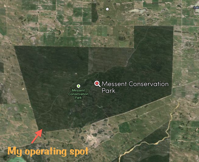
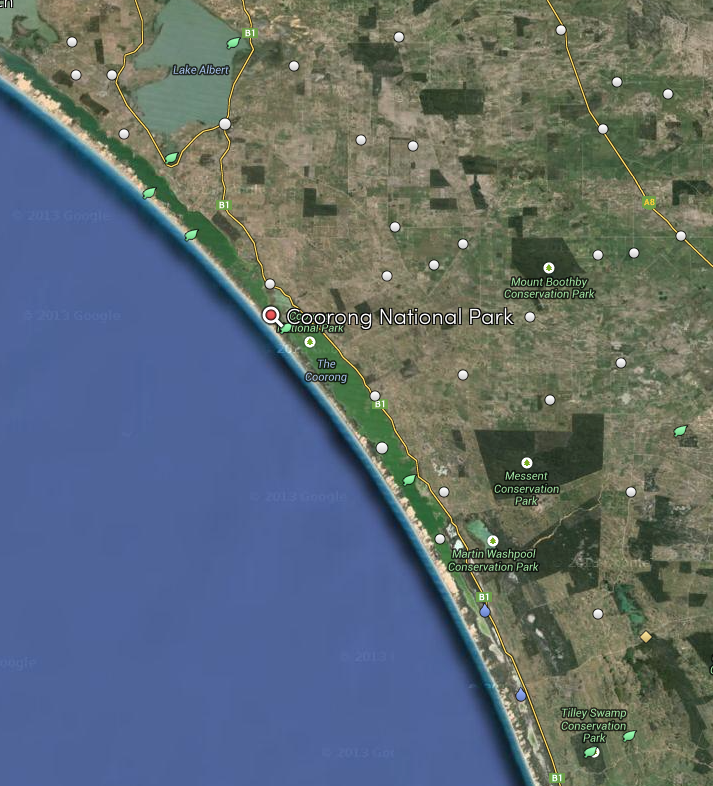
My second activation for Saturday was the Nene Valley Conservation Park, which is located  The park is located in close proximity to the little township of Nene Valley, and about 35 km south west of Mount Gambier.  Although Nene Valley was not a port, many ships were lost in this vicinity.  The town itself was was named in 1962 after the wrecking of the Nene Valley.

The Nene Valley was a 333 ton wooden barque, launched in England in 1852.   Built for the colonial trade to India and Australia it was on its second voyage to the southern hemisphere in 1854, bound for Portland Bay and Port Fairy in Victoria, from Gravesend in England.  During this period, international sailing ships travelled on Great Circle Routes: south down the mid-Atlantic and then east across the Southern Ocean.  Navigation was still uncertain and the first approach to land was always a risky business.  In October 1854, the lookout on the Nene Valley saw breaking surf in the darkness and reported land ahead.  The Captain decided it was only low cloud and sailed on.

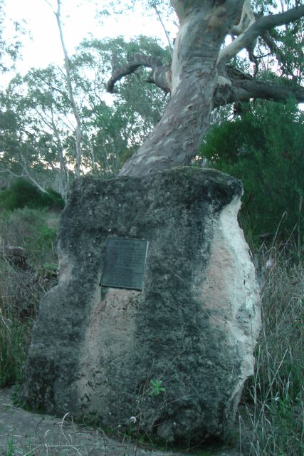
The Nene Valley went aground soon afterwards immediately in front of what is now the town of Nene Valley.  The stranded vessel was driven ashore and broke up.  The crew and nine passengers all survived, but four sailors drowned the following day during a salvage attempt.  The shipwreck was a local landmark on the beach until the 1930s.  I have not been able to find a picture of the Nene Valley.

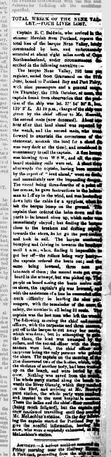
Below is an article from the South Australian Register, Adelaide, Monday 30th October, 1854, regarding the wreck of the Nene Valley.

Screenshot 2014-06-12 09.41.54

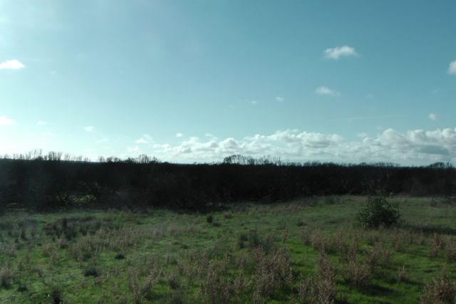
The Nene Valley Conservation Park was constituted in 1972 and covers an area of about 373 hectares.  The majority of the park consists of unstructured skeletal sand dunes dominated by a costal wattle and coastal beard-heath.

Prior to setting up I went for a drive through the town of Nene Valley and went down to the beach to have a look at the roaring waves of the Southern Ocean.  Nene Valley  contains some very impressive holiday homes.  I found it very interesting how the little town got its name.

During the 1940s the small town of Maggoty Point came into existence.  It consisted of just a few shacks primarily for the local fishermen.  A narrow dirt track led into the area.  The name Maggoty Point was derived from the fact that seaweed which collected on the beach, became a very good breeding ground for maggots.  In 1960, further shacks were built and a much improved road was planned.

IMGA0016

In 1961, the Livingstone brothers, who were well known graziers in the area, agreed to surrender a piece of land at Nene Valley Rock to the local Council.  However this was done on the proviso that the Council alter the name of the area from Maggoty Point to Nene Valley to perpetuate the memory of the wreck of the Nene Valley.  Interestinly an early survey of the area which was completed in 1885, shows a creek nearby called Nyn Valley Creek.

During the 1980s, the Council developed an area west of the town, providing further blocks for sale.  The shacks had been freeholder and additional interest was shown by people wanting to purchase a quiet block close to the Southern Ocean.  All blocks were sold, and new buildings continue to appear in Nene Valley which currently has a population of about 50 people.  I am sure all the locals agree, that Nene Valley is far more pleasing to the ear, than Maggoty Point!

IMGA0018

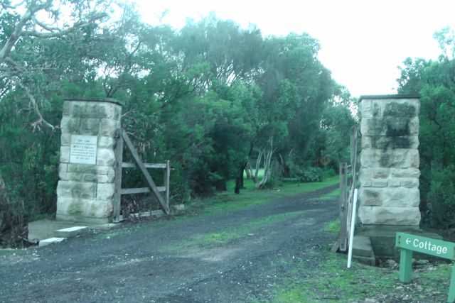
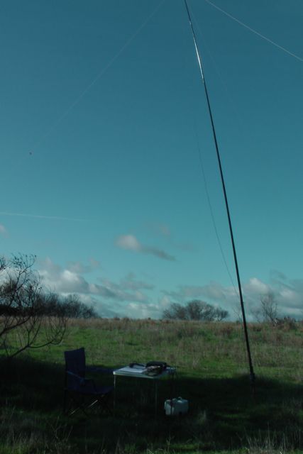
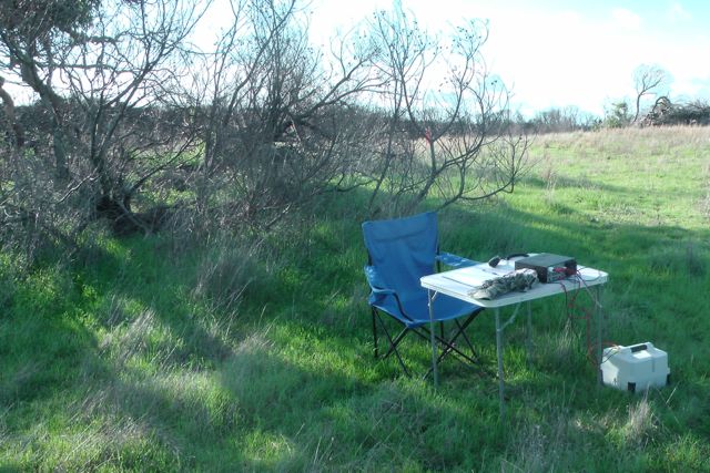
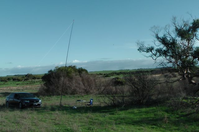
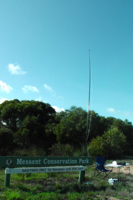
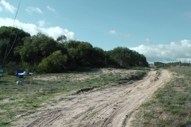
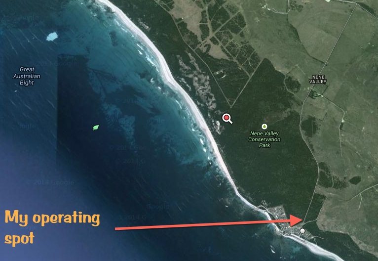
I set up close to the town of Nene Valley.  I did try some other locations, but the tracks were only suitable for 4WD.  My operating spot was not ideal as I had some power lines running overhead nearby.  However, the weather was not ideal with drizzling rain, and my head cold wasn’t getting any better, so I wanted to get the activation done and dusted and head off to the South East Radio Group (SERG) convention.  I just had to put up with the frying pan noise with the moisture on the power lines.

Screenshot 2014-06-10 14.54.04

Again I ran the Yaesu FT-450 and 40 watts into the linked dipole.  I am a keen QRP operator, and normally use my Yaesu FT-817nd and just 5 watts.  But of recent times I’ve decided to run just that little bit extra power from the parks, so my signal can be heard a little better for the further afield VKs.  And it seems to be paying off, with lots of contacts and good signal reports.

IMGA0022

My first four contacts were with regular park hunters: John VK5BJE, Brian VK5FMID, Arno VK5ZAR, and Amanda VK3FQSO.  All four had good strong 5/9 signals.  The 40 m band was still in very good condition with some excellent signals coming into Nene Valley.  A steady flow of callers followed from VK2, VK3, VK5, VK6, and VK7.

Some of the highlights of this activation was a park to park contact with Stuart VK5STU who was operating portable from the Morialta Conservation Park in the foothills of the Adelaide Hills.  Stuart was running QRP and had a very nice 5/8 signal down to the South East.

I also worked a number of portable or mobile stations including David VK5KC/p who was on holidays and was operating from the Tailem Bend caravan park overlooking the Murray River.  Mike VK3XL/m who was mobile on his way home after activating a SOTA summit called in to say hi and had a very strong 5/9 signal.  Active park hunter Greg VK5ZGY who was mobile also called in with a strong 5/9 signal from Mount Gambier.  Matt VK3MAT who was mobile and QRP had a good 5/7 signal.  I spoke again with Hauke VK1HW who was mobile at Wangaratta.  Hauke had a very strong 5/9 signal coming out of his mobile.  And my last 2 mobile contacts were with Peter VK3PAH mobile, and Gary VK5ZK who was mobile at Penola in the South East of South Australia.  Gary was in the South East for the SERG convention.

But the most satisfying QSO was with Mike VK6MB over in Western Australia.  I was very surprised when Mike called in towards the end of my activation.  In fact Mike was number 25 in my log.  Mike had a good strong 5/6 signal and he repaid the favour with a 5/5 for me.  I was quite surprised to be getting over to Western Australia so well.  That is a distance of about 3,000 km.

Prior to packing up the goat bleated on my mobile phone, so I tuned to 7.085 and worked Justin VK2CU who was portable on SOTA peak, Mount Ulandra, VK2/ RI-011 (5/9 both ways).

IMGA0021  IMGA0024

It was starting to get a bit wet, so it was time to pack up and head off to the SERG convention.  I had a total of 29 QSOs in the log.

Looking at a map, it appears that access to Nene Valley CP is limited.  However, when I come back to Nene Valley I hope to have a 4WD, and I think I will try to activate the park a little further to the north, along the 4QD track that follows the coast.   It was a little noisy where I was with the power lines.

The following stations were worked on 40m SSB:

John VK5BJE; Brian VK5FMID; Arno VK5ZAR; Amanda VK3FQSO; Larry VK5LY; Nigel VK5NIG; Greg VK5GJ; David VK5KC/p; Mal VK3AZZ; Peter VK3PF; Andrew VK2UH; Bernard VK3AMB; David VK5HCJ; Mike VK3XL/m; Stuart VK5STU/p; Andrew VK3ARR; John VK5NJ; Greg VK5ZGY/m; Graham VK7NGA; Matt VK3MAT/m; Hauke VK1HW/3; Greg VK7FGGT; Rod VK2LAX; VK3PAH/p; Mike VK6MB; Paul VK7CC; Ray VK3FQ; Gary VK5ZK/m; David VK5NQP;Phil VK3BHR; and Justin VK2CU/p.


References.

Department of Environment and Natural Resources, ‘Small Coastal Parks of the South East Management Plan’ 1994.

District Council of Grant, https://www.dcgrant.sa.gov.au/page.aspx?u=663

Dingley Dell Conservation Park

My first park for Saturday 7th June, 2014, was the Dingley Dell Conservation Park, which is located about 30 km south of Mount Gambier, and 407 km south east of Adelaide.  It was another bright and early start for me.  The alarm went off at 6.15 a.m. and after a coffee and a nice hot shower I was on the road.  The temperature was about 2 degrees C.  I headed out of Mount Gambier towards Port MacDonnell along the Riddoch Highway, and accessed the park via Dingley Dell Road.  I did encounter some road obstructions along the way as you can see below.

IMGA0013

On the way to the summit I passed Mount Schank, which sadly does not qualify for the Summits on the Air program.  Below is a zoomed in photo of Mount Schank as seen from Dingley Dell.

IMGA0011

Dingley Dell Conservation Park covers an area of six hectares and was constituted as a conservation park in 1972 due to its historic significance.  The park comprises gently undulating consolidated dunes with an open woodland of South Australian blue gum, with isolated blackwood, golden wattle, coastal bearded-heath, and native box.  Grazing land abuts the northern and western boundaries of the park.

The park contains the former home of the famous Australian poet, Adam Lindsay Gordon.  This eccentric and talented poet lived at Dingley Dell between 1864 to 1867.  Gordon purchased the cottage in 1864 for 150 pounds.  It was during his stay here that his first poem was published outside of a newspaper or magazine.

gordona(an5487725)

Image courtesy of brightoncemetery.com

The cottage was given to the local council by his wife Maggie, in about 1873.  In 1922 at the request of the Dingley Dell Restoration Committee, the South Australian Government purchased the cottage.  The cottage has been restored and is open to the public.  Gordon’s personal belongings and other moments of this ear form part of the period collection within the cottage.

IMGA0001

 IMGA0003

So how did Dingley Dell get its name?  It is certainly an interesting name.  The following account comes from an old resident of the Port MacDonnell district who had an intimate acquaintance with Adam Lindsay Gordon.  He said:

“The country surrounding the cottage was then, even more so than now, a sylvan paradise, in which gums and wattles ran riot and it was from the music of the birds in the trees, mingled with the tinkling of the bells of the hobbled stock, that the name ‘Dingley Dell’ was derived”.

B54883

Above: Dingley Dell, c. 1907.  Photo courtesy of images.slsa.sa.gov.au

Access to the park is off Springs Road which runs off the Dingley Dell Road.  There is an entrance gate with two old stone pillars.  This will take you passed the caretakers property on your right and the picnic area on your left.  There is ample car parking facilities.

IMGA0014

I set up my gear off a little track on the northern side of the cottage.  The scrub is quite thick, but I managed to find enough of a clearing to stretch out the legs of the dipole.

Screenshot 2014-06-10 14.56.27

Image courtesy of Mapcarta.

My first contact in the park was with Rod VK2LAX (5/7 both ways).  This was followed by regular park hunters Col VK5HCF and John VK5BJE.  Nick VK3ANL was kind enough to call in whilst he was on the top of SOTA peak, Mount William, VK3/ VS-001, which is located in the Grampians National Park, VKFF-213.  Again I worked Greg who was sounding great on his little home new QRP rig.  Richard VK5ZRY also called in to say hello and was running 10 watts from over on the Yorke Peninsula.  Greg has the Ramsay-Way Conservation Park named after him, and is quite active in the VK5 parks award.

After working a total of 11 stations, the caretaker came over to say hi.  He was accompanied by his sheepdog.  The gentleman was very interested in my operation, and had a background in marine radio.  His dog however, only wanted to chase sticks, and would not leave me alone.  That is what all the barking was about for those that heard it.  I had to keep a careful watch to make sure the dog didn’t run through the legs of the dipole.

IMGA0008

After 40 minutes in the park I had a total of 18 QSOs in the log from this rather unique little park.  Band conditions were very good, but conditions on the ground were very trying with the caretaker’s sheep dog.

The following stations were worked on 40m SSB:

Rod VK2LAX; Col VK5HCF; John VK5BJE; Leon VK3VGA; Brian VK5FMID; Nick VK3ANL/p; Phil VK3BHR; Greg VK5GJ; Kev BK3NKC; Richard VK5ZRY; Lloyd VK5BR; Larry VK5LY; Peter VK3PF; Amanda VK3FQSO; Bernard VK3AMB; Terry VK3UP/m; Hans VK5YX; and Nigel VK5NIG.


References.

Cockburn; R, ‘South Australia.  What’s in a Name”, 2002.

National Parks South Australia, Dingley Dell Conservation Park, http://www.environment.sa.gov.au/parks/Find_a_park/Browse_by_region/Limestone_Coast/Dingley_Dell_Conservation_Park

Government of South Australia, ‘Dingley Dell Conservation Park’ brochure, 2010


Mount Scott Conservation Park

My final park for Friday 6th June 2014 was the Mount Scott Conservation Park, which is located about 22 km east of Kingston in the South East of South Australia.  The park was constituted in 1972 and covers an area of about 1,238 hectares.

Screenshot 2014-06-10 14.58.54

The park is located on part of the South East relict beach dunes which run north west and south east.  These ranges are generally less than 30 metres in height and are roughly parallel to the present coastline.

A variety of different native animals can be found in the park including the Red necked wallaby, Western Grey kangaroo, Silky mouse, and Common Wombat.  Numerous bird species are also located within the park including the endangered Mallee Fowl.

IMGA0218

The park and the nearby small summit of Mount Scott are named after John and Charles Scott, pioneers of South Australia.  The summit is located just to the east of the park and is just 67 metres ASL.  So it is a long way from qualifying for the Summits on the Air program.

I accessed the park via Mount Scott Road, a dirt road off the Desert Camp – Kingston Road.

Reedy Creek abuts the south western boundary of the park.  Where the road crosses the Reedy Creek you can view the remains of a 90 feet long bridge that was built in the 1850’s to span the Reedy Creek.  The bridge served as the main outlet for heavily laden bullock wagons between the Tatiara district and Port Caroline at Kingston between 1856 and 1910.  The remaining logs are approximately 160 years old.  There is a plaque at this location.

IMGA0219     IMGA0221

IMGA0220

I set up in a little cleared area off Mount Scott Road, and erected the 40m/20m linked dipole supported by the 7 m squid pole.  Again I used the Yaesu FT-450, and 40 watts. The transceiver was powered by my 44 amp hour power pack.

IMGA0216

My first contact was with Matt VK1MA who had a very strong 5/9 plus signal.  This was followed by active park hunter Brian VK5FMID, and then Stan VK3BNJ who had become a regular in my log during the day.

I worked three VK4s during this activation which was very pleasing.  My first Queensland contact was with Owen VK4FADW who was 5/5 and gave me a 5/7-8 signal report.  Next up was Bruce VK4MQ who was running a Codan transceiver and just 20 watts (5/7 both ways).  And the third contact was with Glenn VK4FSCC (5/5 sent and 5/7 received).

IMGA0215

I also had two QRP contacts.  The first was with Greg VK5GJ using his home brew QRP transceiver and next was Peter VK3PF.

The noise floor within the park was non existent.  The only annoyance on the 40m band was the Over the Horizon Radar (OTHR) which was quite strong.  There are lots of anecdotal stories of where the OTHR originates from, but I would love to truly know one day.

After operating in the park for about 40 minutes I had a total of 20 QSOs in the log.  The sun was setting and I still had a good drive to get to Mount Gambier.  I also wanted to avoid as many kangaroos as possible.

IMGA0222

The following stations were worked on 40m SSB:

Matt VK1MA; Brian VK5FMID; Stan VK3BNJ’ Col VK5HCF; Scott VK7NWT; Owen VK4FADW; Max VK3MCX; Greg VK5GJ; Nev VK5GW; Nigel VK5NIG; Bruce VK4MQ; Arno VK5ZAR; Glenn VK4FSCC; Allen VK5FD; Greg VK5ZGY; Ike VK3CVD; Michael VK3HAU; Ron VK5VH; Ray VK3NBL; and Peter VK3PF.


References.

Department of Environment and Natural Resources South Australia, ‘Small Inland Parks of the South East Management Plan’, 1994.

Cockburn, R, ‘South Australia.  What’s in a name?’, 2002.

Tilley Swamp Conservation Park

My fourth park activation for Friday 6th June 2014, was the Tilley Swamp Conservation Park, which is located north of Kingston in the Upper South East of South Australia.  The park conserves an area of about 1,525 hectares and was proclaimed and gazetted in 1993.

Moves to establish Tilley Swamp commenced in the late 1980’s following an application of vegetation clearance through the Native Vegetation Management Branch by the owner.  The Native Vegetation Management Authority refused the application and subsequently the allotment was registered as a Heritage Agreement and eventually sold to National Parks and Wildlife South Australia.

The park forms an integral part of the significant Tilley Swamp watercourse which moves surface waters northerly through the park.  During summer, the park is an important refuge for thousands of water birds, and for at least 20 other species throughout the year.  This includes the vulnerable Rufous Bristlebird.

The park is also home to a number of native mammals including the rare (SA) Common Wombat and rare (SA) Red-necked Wallaby.

The park is considered to be one of the most significant scrub blocks in the area and contains a number of rare plants including the Metallic Sun-orchid.

Tilley Swamp was named after Thomas Tilley, who succeeded John MacIntyre as manager for the Leake Brothers at Glencoe in the South East.  Tilley later joined pioneer pastoralist George Ormerod in a pastoral partnership, which included a lease of the Avenue Range run and other properties.

Screenshot 2014-06-10 15.01.44

I accessed the park via Petherick Road, which runs off the eastern side of the Princes Highway.  Petherick Road runs along the southern boundary of the park.  I found an unlocked access gate and drove my car in a very short distance.  There are no formal tracks.

IMGA0209

My first impressions of this park were that it was probably one of the least attractive that I had ever visited.  The park was severely impacted by a bushfire in February 2013 and there was still lots of evidence that the park was recovering.  However, I only saw a very small portion of the park, and never got the opportunity of exploring it in detail, so I will reserve my judgement until another visit.

I set up underneath a small cluster of ‘dead’ trees and shrubs, which provided a bit of shade from the sun.  There was plenty of room here to run out the legs of the dipole which I held down with some dead tree branches.

 IMGA0210

My first contact was with Hauke VK1HW who was mobile in the Selwyn Snowfields in the Snowy Mountains in New South Wales.  This was followed by Greg VK5GJ at Meadows in the Adelaide Hills, Arno VK5ZAR in Adelaide, and then Col VK5HCF at Mount Gambier in the South East.  All had beautiful 5/9 signals.

IMGA0211

A steady flow of callers followed from VK2, VK3, and VK5.  Nigel VK5NIG was kind enough to give me a call whilst he was operating from the top of Mount Gawler VK5/ SE-013.  Although Nigel was running QRP 5 watts, his signal was a very good 5/9.  It is very refreshing to see a number of SOTA operators now chasing park activators, and vice versa of course.

IMGA0212

Another good contact from this park was with Ken VK3FKNZ at Belmont, a southern suburb of Geelong.  Ken advised me that he had only been on air for one week.  Welcome aboard Ken.  Ken had a very nice 5/9 signal coming into Tilley Swamp with his IC-751A and wire antenna.

My last contact in the park was with Greg VK5GJ who called in for the second time, but this time using his ‘just completed’ home brew QRP rig.  Greg had a solid 5/9 signal with very nice audio.  Congratulations Greg on your home brew construction.

IMGA0213

After operating for one hour at Tilley Swamp I had a total of 26 QSOs in the log.  It was time to move on to my final activation of the day, the Mount Scott Conservation Park.

The following stations were worked:

Haucke VK1HW/m; Greg VK5GJ; Arno VK5ZAR; Col VK5HCF; Nev VK5WG; Norm VK5GI; Tibor VK3MRO; Bob VK5FPAC; John VK2AWJ; Darren VK2NNN; John VK5BJE; Greg VK5ZGY; Gary VK5ZK/m; Amanda VK3FQSO; Rod VK2LAX; Rod VK5VRB; Nigel VK5NIG; Allen VK3HRA; Hans VK5YX; Jim VK2FADV; Don VK5NFB; Peter VK2NEO; Ken VK3FKNZ; Brian VK5FMID; Stan VK3BNJ; and Greg VK5GJ.

References.

Government of South Australia, Tilley Swamp Conservation Park Managemnt Plan, 2000.

Cockburn, R, ‘South Australia.  What’s in a Name?’, 2002

Pastoral Pioneers of South Australia, Vol II, 1927

Messent Conservation Park

It is just a short drive from Martin Washpool Conservation Park to the Messent Conservation Park, which was my third activation for Friday 6th June 2014.There is a sandy track that leads from Martin Washpool to Messent.  The track dissects two pieces of farming land.  Although the track is sandy, it can be passed in dry weather in a conventional vehicle.  I stuck to the high points of the track and had no issues.  I certainly wouldn’t try it in wet weather without a 4WD.

Screenshot 2014-06-10 15.04.05


Messent conserves a large area of open scrub, open heath and tussock sedge land and includes a number of rare plant species.  The park contains brown stringy barks, white and ridge-fruited mallee, deret banksias, fringed myrtle and yaccas.  It is home to numerous native animals and birds including western grey kangaroos, wombats, echidnas, ashey-grey mice,  emus, mallee fowl, and a variety of waterbirds.

I still have not been able to find anything on the internet to tell me how this park was named.  However, I did find people of the name MESSENT in South Australia, so I presume the park was named in honour of one of them?

I last activated this park on the 5th September 2013.  Details on that activation and a video can be found at…..

https://vk5pas.wordpress.com/2013/09/12/messent-conservation-park/

I set up in exactly the same location as last year, in the south eastern corner of the park.  Although I wanted to explore more of this park, it was just too risky in a conventional vehicle.  There are 2 tracks going off to the north and to the east, but as per last year, they were very sandy and not suitable for anything but a 4WD.  So out came the little fold up table and deck chair, and after erecting the antenna I went to 7.095 on 40m.  Again for this activation, I ran the Yaesu FT450, 40 watts and the linked dipole.

IMGA0204

I didn’t even get a chance to call CQ.  I asked if the frequency was in use and Brian VK5FMID came back to say it was all mine.  Brian had a beautiful strong 5/9 signal coming in from Mount Gambier.  This was followed by ever reliable John VK5BJE and then Norm VK5GI.  One of the regular New South Wales parks chasers, John VK2AWJ then called in with a strong 5/9 signal.

IMGA0205

A steady flow of callers followed including Gary VK5ZK who was mobile at the Wellington ferry, on his way down to the South East Radio Group convention at Mount Gambier.

I had one QRP contact whilst in the park, and that was with Simon VK3SMC who was portable.  Simon was running QRP 2.5 watts and had a very nice 57 signal.

IMGA0208

After 35 minutes of operating in the park I and a total of 21 QSOs in the log from VK2, VK3, and VK5.  Time to move off to the Tilley Swamp Conservation Park.

The following stations were worked:

Brian VK5FMID; John VK5BJE; Norm VK5GI; John VK2AWJ; John VK5DJ; Amanda VK3FQSO; Greg VK5GJ; Gary VK5ZK/m; Tony VK5FTVR; Nigel VK5NIG; John VK5ET; Greg VK5ZGY; Stan VK3BNJ; Ormond VK3HAT; Simon VK3SMC/p; Charles VK5FBAC; Col VK5HCF; Tibor VK3MRO/m; Larry VK5LY; Greg VK7FGGT; and Haucke VK1HW/m.


References.

Australian Government, Department of the Emvironment, http://www.environment.gov.au/cgi-bin/ahdb/search.pl?mode=place_detail;place_id=7958

Limestone Coast Tintinara Heart of the Parks brochure, 2010

Martin Washpool Conservation Park

After packing up at the Coorong National Park, I continued south east on the Princes Highway heading towards my next park, which was the Martin Washpool Conservation Park.

In September last year I had activated this park, which has a rather macabre history.  The park was named after Malachi Martin, who was a convicted murderer.  It was so named after the pool in which he washed the blood from himself after committing murder.  For more information on the park and my previous activation, have a look at …..

https://vk5pas.wordpress.com/2013/09/12/martin-washpool-conservation-park/

Screenshot 2014-06-10 15.04.20

 Map courtesy of Mapcarta

I set up in exactly the same spot as last year which was at the end of Salt Creek Road.  Access to the park is via a closed but unlocked gate at this location.  And as per last year, this park was absolutely alive with honeyeaters and wattlebirds, as many of the native trees and shrubs were in flower.

IMGA0195

I used the park sign to attach my squid pole to, with the assistance of some octopus straps.  There is a track heading off to the south along the eastern boundary of the park, but I have never ventured up there, as the track is very sandy and boggy.  It would certainly not be passable in a conventional vehicle.  From looking at maps, this track takes you right down to the water in the park, which is fed by the Tilley Swamp Drain.

IMGA0202

My first contact was with Greg VK5ZGY, who I was looking forward to meeting at Mount Gambier.  Greg and his wife Gabbie are very keen park activators and hunters.  Next up was Nev VK5WG from Crystal Brook with his normal enormous signal, and then Greg VK5GJ who has become a regular park hunter.  This was followed by Nigel VK5NIG and John VK5BJE.  A steady flow of callers followed from VK2, VK3 and VK5.

 IMGA0197   IMGA0203

Peter VK3PAH called in again, from his mobile, making this his 2nd park contact for the day.  Peter was using an Alinco DX70 and a whip and had a beautiful 5/8 signal.  I managed to get Col in the log again, using the special call of VI50CONV.  My only QRP contact was with Simon VK3SMC who was running his FT-817 and 5 watts into an end fed antenna at Bonnydoon near Lake Eildon.  Another mobile station that called in was Rod VK5KFB who was mobile on his way down to the SERG convention.

IMGA0199

After 45 minutes in the park, it was time to pull stumps again and head off to the Messent Conservation Park, just a few km away.  I had a total of 20 contacts in the log.

The following stations were worked:

Greg VK5ZGY; Nev VK5WG; Greg VK5GJ; Nigel VK5NIG; John VK5BJE; Tony VK5FTVR; Dennis VK5HH; Peter VK3PAH/mobile; Amanda VK3FQSO; Col VI50CONV; Simon VK3SMC/p; Tom VK2KF; Norm VK5GI; Hans VK5YX; Larry VK5LY; Albert VK3KLB; John VK2AWJ; Rod VK5KFB/mobile; Brian VK5FMID; and Col VK5HCF.

Coorong National Park VKFF-115

The weekend of Saturday 7th June 2014 and Sunday 8th June 2014 was the 50 year celebration of the South East Radio Group in Mount Gambier.  They were holding their annual convention and had kindly asked me to attend to deliver a presentation on the VK5 National and Conservation Parks Award.  So bright and early on Friday morning (6th June 2014) I headed off from home in the Adelaide Hills towards Mount Gambier in the south east of South Australia.  This being a journey of around 400 km.  I decided to head to Tailem Bend and then travel south east along the Princes Highway.

My plans were to activate 5 parks along the way.  Some of which I had activated previously, but there were two new ones on my activation list: Tilley Swamp, and Mount Scott.  My first stop was the Coorong National Park.  This park qualifies for both the VK5 Parks Award and also the World Wide Flora and Fauna (WWFF) program.  The Coorong is VKFF-115

Screenshot 2014-06-10 15.07.59

Map courtesy of mapcarta

It was a very crisp morning.  When I left home the temperature was only about 2 degrees C.  However I was greeted by a spectacular sunrise as I travelled towards the Coorong.

IMGA0169

I had previously activated the Coorong National Park, however I needed to accrue some more QSOs to get me over the 44 QSO mark to qualify the park for the WWFF global award.  Previously I had operated from Seven Mile.  This time I decided to operate from Parnka Point.

Information about my previous activation can be located at…..

https://vk5pas.wordpress.com/2013/06/03/coorong-national-park/

Parnka Point is located at the end of a narrow strip of land.  This is the narrowest part of The Coorong as the water is less than 100 metres wide.  Parnka Point is where the northern and southern lagoons of The Coorong meet each other.  The water at this point is often referred to as Hells Gate.

The northern lagoon is partly fed by the waters of the River Murray, and varies in salinity from brackish to hyper saline.  In contrast the southern lagoon is always hyper saline.  While this narrow channel often appears calm, a change in wind direction or water levels can create treacherous currents through this narrow but deep channel.

Screenshot 2014-06-10 15.15.56

Map courtesy of mapcarta

Parnka Point was a significant meeting site for the five aboriginal tribes that formed the Ngarrindjeri clan.  Parnka is a Ngarrindjeri word meaning ‘sandy beach’.  As you look out across the lagoon, you can see wooden poles in the seater.  These are the remains of a ferry built last century to access the Younghusband Peninsula.  I ha previously camped here at Parnka Point, many years ago with my children when they were young.

IMGA0175

The Coorong is located about 160 km south east of Adelaide.  Its name is thought to be a corruption of the local aboriginal word kurangh, meaning ‘long neck’, which is a reference to the shape of the lagoon system.  The name is also thought to be from the Aboriginal word Coorang, “sand dune”, a reference to the sand dunes that can be seen between the park and the Southern OceanMore information on the Coorong National Park can be found at…..

http://www.environment.sa.gov.au/parks/Find_a_park/Browse_by_region/Limestone_Coast/Coorong_National_Park

IMGA0170     IMGA0174

I drove down to end of Parnka Point and set up my little fold up table and deck chair, looking out towards the southern lagoon.  It was a spectacular morning, with some fog over Younghusband Peninsula and the water.  And it was cold!  In fact, it was 2 degrees C.  The same temperature as when I had left home.

This morning I used my Yaesu FT-450, running 40 watts into the 40 m / 20 m linked dipole supported on the 7 metre telescopic squid pole.  I powered the radio with my 44 amp hour power pack.

IMGA0188

There was lots of bird activity, of the feathered kind.  This included black swans and cormorants (see photos below), and various other water and wading birds.

IMGA0179      IMGA0181

There were lots of very strong Europeans coming in on 40m so it was a bit difficult to find a clear frequency.  Finally I found that 7.105 was clear and I put out a CQ call to be answered by parks stalwart, John VK5BJE.  This was followed by Larry VK5LY in the Riverland and Brian VK5FMID down in Mount Gambier.  Greg VK5GJ then called in from Meadows.  Greg attended the SOTA & Parks symposium and since that time has been a regular parks hunter.

My first interstate caller was Paul VK7CC who I regularly talk to on the 7.130 DX Net.  Paul always calls in to say hi when he hears me in a park.  He had a beautiful 5/9 plus signal into The Coorong.  Then to my surprise, a few QSOs later I was called by Barry VK6WF who was a genuine 5/9 signal.  Barry gave me a 5/5 signal report from Kellerberrin, about 200 km east of Perth.  Next up was Col VK5HCF from Mount Gambier.  I also worked Col under the special call of VI50CONV for the SERG 50th year anniversary.

Some stations came up very close to me after operating for about 40 minutes, and one in particular was extremely wide and splattering badly.  This made things a little difficult at times.  However I did manage to work Craig VK3NCR/2 who was portable in the Warrumbungle National Park.  The QRM was so bad I QSYd up to 7.110 but was still being clobbered.  So it is with thanks to Ken VK3YXC, who was my final contact.  Ken was mobile and was very low down and was being killed off by the splatter.  But we perservered and I was finally able to get his call in totality.  Thanks Ken.  They were very trying conditions.

I read a blog tonight put out by Marshall VK3MRG who experienced the same over the weekend, with wide and over driving stations.  It makes it very difficult for everyone else.

http://vk3mrg.weebly.com

After an hour of operating at this beautiful location, it was time to pack up.  I was already behind schedule.  But it was very hard to go QRT as I sat back in the deck chair and looked across the beautiful Coorong.  It is certainly a treasure of South Australia.

The following stations were worked:-

John VK5BJE; Larry VK5LY; Brian VK5FMID; Greg VK5GJ; Paul VK7CC; Tony VK5ZAI; Greg VK5ZGY; Craig VK5LI; Greg VK7FGGT; Charles VK5FBAC; Dave VK3DSB; Barry VK6WF; Col VK5HCF; Col VI5CONV; Nick VK3FNCE; Craig VK3NCR/2; Keith VK5ND; Nigel VK5NIG; Dennis VK5LDM; Don VK5NFB; and Ken VK3YXC mobile.

VK5 SOTA and Parks activation day

Early this morning I headed off to Crafers and met up with John VK5BJE.  John and I had organised an introduction day to SOTA & the Parks awards, with a planned SOTA activation at Mount Lofty, followed by a parks activation at Belair National Park.  The day was targeting those amateurs who had an interest in SOTA & parks activations, but for whatever reason had not previously completed an activation, or for those that wanted to pick up a few more operating tips.

We met at the Crafers bus interchange just before 8.00 a.m. and we were soon joined by a group of keen amateurs.  It was a very chilly morning, but the weather gods were smiling down on us, as the heavy rain from Saturday had disappeared and although the sky was grey and overcast, the weather was generally fine.  (As I type this, it has recommenced raining here at Mount Barker, so we were very lucky!).  I was also moving a bit slow after my neighbour’s 50th birthday party last night and the consumption of a little too much red wine.

John and I spoke briefly to the group about our respective introductions to SOTA and parks activities, and this was followed by some tips on portable operation.  Of the group, about 50 % had never conducted a SOTA or parks activation, so John and I warned them about pile up management and general operating tips.

At 8.30 a.m. we headed off in convoy, just up the road, to Mount Lofty summit, VK5/ SE-005 which is also located within the Cleland Conservation Park.  So apart from being a SOTA peak, it also qualifies for the VK5 Parks award.  We parked our cars just inside the main gate to the Mount Lofty summit, and then walked a few hundred metres down a track through the scrub, which leads out to the east.  This track leads to the spot where John and I have operated from previously.  It is away from the crowds at the obelisk and the restaurant, but is well within the activation zone.  So for those that showed a willingness to get on air, we did the ‘walk out, walk back in method’.   We walked out of the activation zone and then back in, after walking downhill for about 600 metres.

Because we had a number of willing hams, lugging gear was not a problem.  So we decided to share the load, and to take a few of the comforts from home, including a small fold up table and chair.  Our operating equipment was a Yaesu FT817nd, 5 watts output and a 40m / 20 m linked dipole, supported on a 7 metre squid pole.  The transceiver was powered by small SLAB batteries.

First in the ‘hot seat’ was Patrick VK5MPJ, who is one of the younger members of the Adelaide Hills Amateur Radio Society.  Well, Patrick didn’t really volunteer….it was more a case of Patrick being pushed into the operators chair.  Conditions appeared to be very good, and as we warned, Patrick was soon greeted with a pile up and had his first SOTA activation under his belt.

Tony VK5FTVR was next up.  Tony is recently licenced and is enjoying retirement.  This was Tony’s first ever SOTA and parks activation, and he performed admirably and also qualified the summit.  Next up was David VK5NQP with his mascot, a little goat, which can be seen in the photographs below.  David has activated parks previously, but I believe this was his first ever SOTA activation.  Well done David.

Mark VK5FMRK then followed.  Again, Mark is just recently licenced, and considering he had the preying eyes of all his peers on his on air performance, Mark did a great job and qualified the summit.  Chris VK4FR/5 then hopped in the driver’s seat, followed by Graham VK5GW.  This was the first SOTA activation for both Chris and Graham.  I think they may have been bitten by the bug.  Keith VK5OQ then qualified the summit.  You may recall Keith’s recent article in AR magazine re activating SOTA peaks in the Falls Creek area.

Not sure how it happened, but the boys encouraged me to warm up the operator’s chair for a short time, as did John VK5BJE, and Nigel VK5NIG.  And our final SOTA activator was Steve VK5AIM.  Again, this was Steve’s very first SOTA activation, although he has been active in the VK5 Parks Award.  Steve won the ‘biggest mascot of the day’ award with his kangaroo which can also be seen in the photographs below.

This slideshow requires JavaScript.

After completing our activation of Mount Lofty just after 11.00 a.m. local time we headed over to the Belair National Park, which was just a short 10 minute drive to the south.  We entered the park via Sheaok Road, and set up in a little clearing, about 500 metres down the track off Sheaok Road.  Belair National Park qualifies for both the VK5 National & Conservation Parks award, and the World Wide Flora Fauna (WWFF) program.

Again we set up the 40 m / 20 m linked dipole and initially used John’s Yaesu FT857 on the 10 watt setting.  John displayed to the guys his LIFePO4 battery with powered the radio, and passed on some tips re the various batteries.  We then moved to the Yaesu FT-450 and 40-50 watts, with the transceiver being powered by a 44 amp hour power pack.  The extra power made our signal just that little bit more readable considering that it was now lunch time, and the 40 m band was going to sleep.

Again Patrick was first up in the ‘hot seat’, followed by Mark VK5FMRK, then Tony VK5FTVR, Keith VK5OQ, and Steve VK5AIM.  A few of the guys managed park to park contacts with Bob VK5FO who was activating Morialta Conservation Park, and David VK5NQP who was activating Charleston Conservation Park.  As Bob and David had activated parks before, they decided after Mount Lofty, to head of to Montacute and Charleston to give the new guys an opportunity of having a ‘park to park’ contact for the VK5 Parks award.


This slideshow requires JavaScript.

The following amateurs took part…..

  1. Tony VK5FTVR
  2. Mark VK5FMRK
  3. Victor VK5KAB
  4. Chris VK4FR/5
  5. Graham VK5GW
  6. David VK5NQP
  7. Patrick VK5MPJ and his Dad
  8. Bob VK5FO
  9. Ray VK5RR
  10. Steve VK5AIM
  11. Keith VK5OQ
  12. Nigel VK5NIG

Many thanks to John VK5BJE for helping me out with the day.  And also thanks to Nigel VK5NIG @ Mr Mount Gawler, for helping out at Mount Lofty.  A lot of the guys walked away from the day, amazed with what 5 watts and a simple little antenna can achieve.

I would also like to say thank you to the many patient SOTA chasers and park hunters that called the activators today.  It was a big learning curve for many of the activators, and I would imagine it would not be easy performing to a crowd behind the mic.

Also thanks to the fellas who turned up this morning to brave the elements.  It was a pretty chilly day, but fortunately we dodged the rain which is the most important thing.  From feedback provided, I think everyone enjoyed themselves.

We are planning on running a similar day in Spring later in the year, so we hope to see some new faces at the next activation day.  I think we all learned today, that there are never ‘silly questions’ and it is all about giving it a go and learning from each other.