
My second planned activation of Saturday 12th November 2016 was the Terrick Terrick National Park VKFF-0630, which is located about 230 km north of Melbourne. It is about 40 km by road from Bob VK3SX’s home at Gunbower. This was to be another unique park for me as an activator for the World Wide Flora Fauna (WWFF) program and the Keith Roget Memorial National Parks Award (KRMNPA).

Above:- Map showing the location of the Terrick Terrick National Park. Map courtesy of protected planet.
I headed back out along the Murray Valley Highway and then along the Kow Swamp Road and onto the Leitchville-Pyramid Road. As I travelled south the Mount Hope Nature Conservation Reserve came into view. Currently this does not qualify for WWFF. Mount Hope is a granite outcrop located within the 126 hectare Nature Conservation Reserve. The mountain was first sighted in 1836 by Scottish born explorer Major Sir Thomas Mitchell who climbed Mount Hope 4 days later. A sign of how far we have come with regards to conservation in this country are the comments of Joseph Hawdon in 1838. Hawdon was droving cattle between Howlong in New South Wales and Adelaide when he decided to climb Mount Hope. Hawdon stated:
“This hill appears to be inhabited by a small kangaroo of fawn colour, with a most beautiful head, and about the size of an English hare. I shot one, and preserved its skin”.
The kangaroo he was referring to was an eastern hare-wallaby, which sadly became extinct a few years after the arrival of the European settlers.
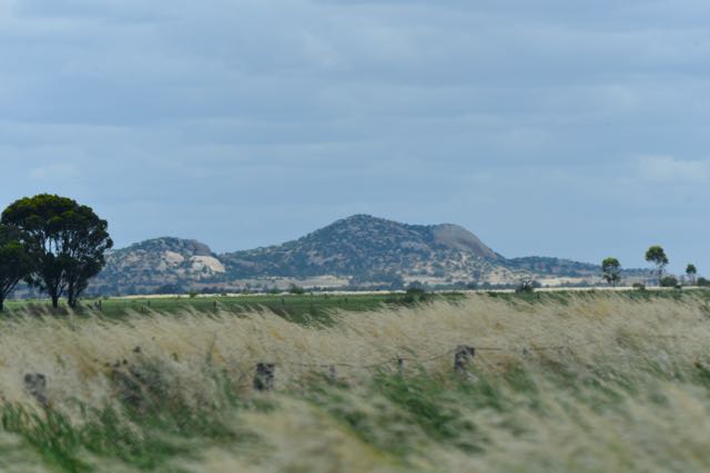
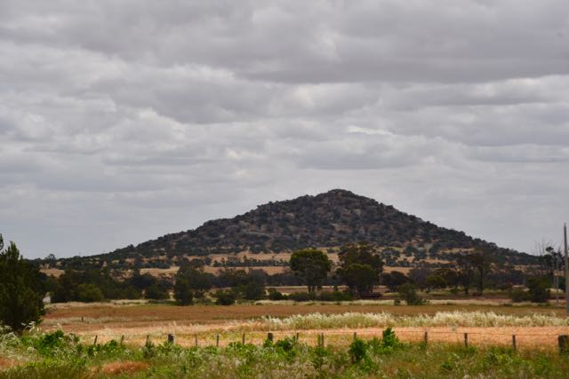
Pyramid Hill then came into view. This is located near the town of Pyramid Hill which was named after the summit which rises to a height of 180 metres above sea level. Not enough prominence for a peak for the Summits on the Air (SOTA) program. It was around this time that I made contact in the mobile with Lesley VK5LOL/3 who was portable in the Murray Sunset National Park, VKFF-0373.
The GPS in the vehicle had its own idea on how it wanted to take me into the park, but I saw a park sign and followed that road which took me into the north western section of the park via Sylvaterre-Timms Lake Road.
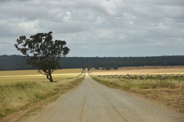
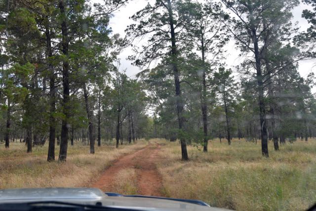
It wasn’t long before I reached a sign for the park and a 4WD track leading into the park (Squire Track).


Terrick Terrick National Park is 5,925 hectares in size and was gazetted as a National Park in November 1998 after celebrating 10 years as a State Park. This was a direct result of the acquisition of the 1,277 hectare Davies sheep grazing property. The park was further expanded in 2009 as a result of the River Red Gums Forests Investigation to include all of the nearby 12 Grassland Conservation Reserves. The highest point in the park is Mount Terrick Terrick, also known as Mitiamo Rock.
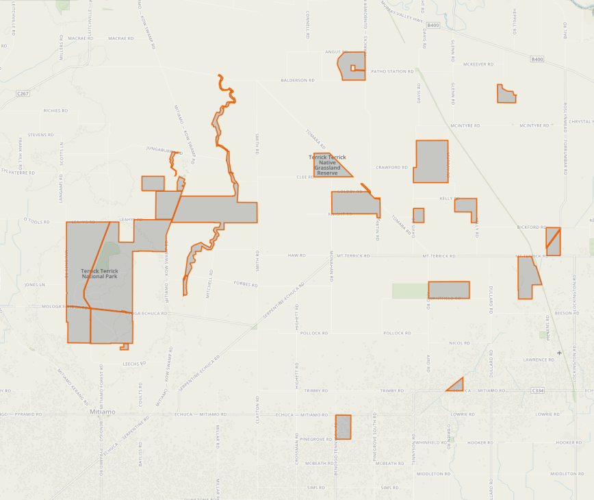
Above:- Map showing the Terrick Terrick National Park, including the former 12 Grassland Conservation Reserves. Map courtesy of Protected Planet.
Tree species located within the park include Grey Box, Yellow Box and White Cypress Pine. In fact Victoria’s most significant stand of White Cypress Pine can be found within Terrick Terrick, with many of the trees being over 100 years old. On and around the granite outcrops within the forest, various shrubs such as Deane’s Wattle, Snowy Mint-bush and Nodding Blue-lily can be found. A total of 26 rare or threatened plants species can be found in the park. Annual Buttons and Pepper Grass are endangered species that are only found in Terrick Terrick. The park also contains the largest Victorian population of the threatened species of Bottle Bluebush, Fragrant Leek-orchid and Murray Swainson-pea.
The wooden and open grasslands of Terrick Terrick are home to over 100 species of birds, including the nationally vulnerable Plains-wanderer, Grey-crowned Babbler, Bush Stone-curlew, Mallee Ringneck Parrot, Barking Owl, and Brolga.
Various native mammals and reptiles call the park home, including the Black Wallaby, Fait-tailed Dunnart, Striped Legless Lizard, Hooded Scaly-foot, and Tree Goanna. The Hooded Scaly-foot, a legless lizard is considered critically endangered in Victoria, and Terrick Terrick is one of only three conservation reserves where it is known to occur in Victoria.


Major Sir Thomas Mitchell climbed nearby Pyramid Hill in 1836 and was suitably impressed by the surrounding countryside. His favourable reports encouraged squatters with large numbers of sheep to the area. Sadly, farming practices dramatically changed the dynamics of the pre European grassland community.
For years the area had been inhabitated by the Dja Dja Wurrung aboriginal people. The cool granite outcrops had provided them with shelter and the plants and animals of the area had provided food. The rock wells in the low granitic outcrops increased the water supply during the dry summers in the area. Curving scars can be located on a number of the old Grey Box trees where they were cut to make canoes, shields, carrying bowls and material to provide shelter. During gravel extraction operations in the park, an aboriginal skeleton was located which has been dated at 5,500 years old.
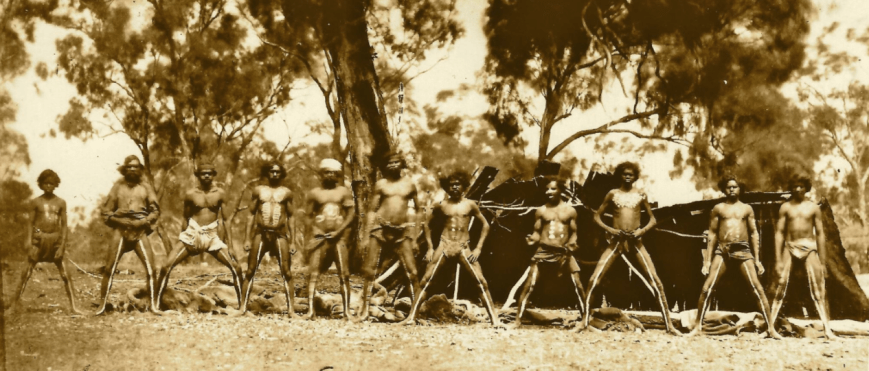
Above:- Dja Dja Wurrung men around the time of Australian colonisation. Image courtesy of Today Media Network.
Here is a link to an excellent site with a large amount of information about Terrick Terrick National Park.
http://users.mcmedia.com.au/~stocky/terrick_terrick.html
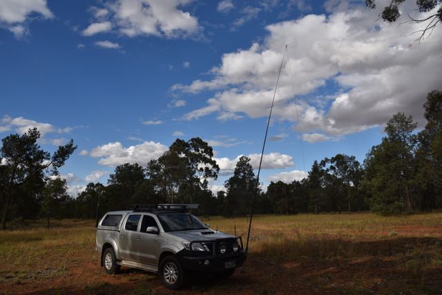
I set up just off Squire Track. There was a nice clearing here which allowed me to pull just off the track and stretch out the 80/40/20m linked dipole. The ground cover here was also quite low, and as it was a warm day (26 degrees C) this suited me fine as it gave me a little warning of snakes. As it turns out I was to later have a close encounter with a goanna.
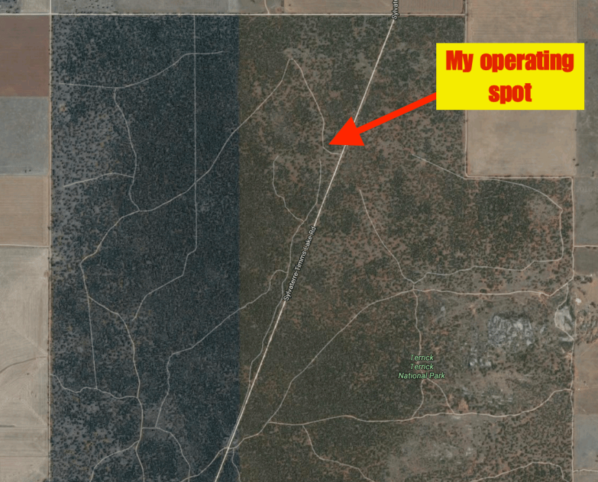
Above:- Aerial showing my operating spot in the north western section of the park. Image courtesy of Google maps.
The mosquitos were also vicious in this park and they, along with the very strong winds and heat, prevented me from operating outside of the vehicle. I ran the coax from the linked dipole in through the passenger side window
The 40m band was very busy with all the KRMNPA activity and it took me a little while to find a clear spot to start calling CQ. My first contact was a Park to Park (P2P) contact with Peter VK3PF who was portable in the Baw Baw National Park VKFF-0020. A nice way to start the activation with a Park to Park. This was followed by another P2P contact, this time with Bernard VK3AV who was activating the Organ Pipes National Park VKFF-0627. About five QSOs later I made a few more P2P contacts.
Band conditions on 40m were quite good, despite the rather loud static crashes from the electrical storm activity around Australia. I went on to work a total of 46 stations on 40m which included the following further P2P contacts:
- Joe VK3SRC/p, Point Nepean National Park VKFF-0628
- Tim VK3MTB/p, The Lakes National Park VKFF-0484
- Gerard VK2IO/p, Budderoo National Park VKFF-0062
- Norm VK3XCI/p, Little Desert National Park VKFF-0291
- Peter VK3ZPF/p, Snowy River National Park VKFF-0455
- Lesley VK2FLEZ/p, Brisbane Water National Park VKFF-0056
- John VK2AWJ/3, Wilsons Promontory National Park VKFF-0539
- David VK3III/p, Little Desert National Park VKFF-0291
- Rob VK4AAC/3, Mount Arapiles-Tooan State Park VKFF-0765
- Mike VK6MB/p, Walpole-Normalup Inlets Marine Park VKFF-1456
- Allen VK3ARH/p, Lind National Park VKFF-0287
I was very pleased to work Lesley VK2FLEZ on his very first park activation. Well done Lesley and welcome to the world of park activating.
I also worked a number of QRP stations (all running 5 watts) including Roy VK3FRC (5/9 both ways), David VK2JDR (5/7 sent & 5/6 received), Nev VK5WG (5/8 sent and 5/9 received), Ian VK3AXF (5/7 both ways), and Greg VK5GJ (5/7 both ways).
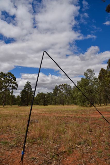
I had just finished working Allen VK3ARH when I heard a crack and proceeded to see my squid pole fall to the ground. It had snapped in the high winds. Not surprising really, because this was one of my original squid poles and was around 4 years old. I apologise to the VK2 that was calling as this happened. By the time I had retrieved my spare squid pole and returned to 7.135, they were gone.
I then headed to 14.310 and started calling CQ. This was answered by John VK6NU who was on SOTA peak Mount Randall VK6/ SW-039, which is located within the Monadnocks Conservation Park VKFF-1459. This was followed by Mike VK6MB in the Walpole-Normalup Inlets Marine Park VKFF-1456 and also Hans VK6XN who was in the Kalamunda National Park VKFF-0253. Mike VK6MB had the strongest signal of the three, with a very nice 5/7. Both John and Hans were 5/3 and perfectly readable as there was no man made noise on the bands. Despite a number of further CQ calls, my only other taker on 20m was Kio JA8RJE.
I had a quick tune around the 20m band and the only activity I found was the ANZA DX Net, which I decided to book in to. I there worked Maurice ZL1ANF in New Zealand, and Jim E51JD in the Cook Islands. At the conclusion of the net I tuned across the band again and found Phil VK6ADF on 14.310 in the Alexander Morrison National Park VKFF-0002.
I then headed back to 40m where I spoke with Jarrad VK6FFAR in the Tuart Forest National Park VKFF-0498, followed by Neil VK4HNS who was activating the Crowsnest National Park VKFF-0121.
I then decided to try 80m. So it was down with the squid pole and in with the links for the 80 m section of the linked dipole. I headed to 3.610 and started calling CQ and this was answered by Len VK3DCF in Wodonga with a good 5/8 signal. Len gave me 5/9. It was 5.20 p.m. local time and still bright daylight and the 80m band was performing beautifully. Sadly I had no phone coverage so I was unable to spot myself on parksnpeaks, and as a result despite numerous CQ calls, Len was my only taker on 80m.
To complete the activation I went back to 14.310 and put out a number of CQ calls. However my only taker was Alan VK6XL.
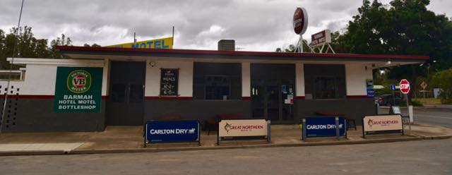
It was time to pack up and head off to Barmah. I still had about one hour drive ahead of me. I was very happy as I had qualified the park for WWFF, with a total of 58 contacts in the log, including 18 Park to Park contacts.
The following stations were worked on 40m SSB:-
- VK3PF/p (Baw Baw National Park VKFF-0020)
- VK3AV/p (Organ Pipes National Park VKFF-0627)
- VK3BL
- VK5BJE
- VK2KYO
- VK3SFG
- VK3SRC/p (Point Nepean National Park VKFF-0628)
- VK3MTB/p (The Lakes National Park VKFF-0484)
- VK2IO/p (Budderoo National Park VKFF-0062)
- VK3FRC
- VK2JDR
- VK5WG
- VK3SX
- VK5FANA
- VK3SQ
- VK1AT
- VK3AXF
- VK7DW
- VK2YW
- VK3XCI/p (Little Desert National Park VKFF-0291)
- VK5CP
- VK3ZPF/p (Snowy River National Park VKFF-0455)
- VK5GK
- VK2FLEZ/p (Brisbane Water National Park VKFF-0056)
- VK3GGG
- VK3PMG
- VK2QH
- VK2AWJ/3 (Wilsons Promontory National Park VKFF-0539)
- VK3III/p (Little Desert National Park VKFF-0291)
- VK4AAC/3 (Mount Arapiles-Tooan State Park VKFF-0765)
- VK3FPSR
- VK5TW
- VK5FGRY
- VK7JON/m
- VK5CM
- VK6MB/p (Walpole-Normalup Inlets Marine Park VKFF-1456)
- VK5TR
- VK5FCLK
- VK5PL
- VK2SX
- VK3FJCQ
- VK5PCM
- VK3ARH/p (Lind National Park VKFF-0287)
- VK5KLV
- VK5LSB
- VK6FFAR/p (Tuart Forest National Park VKFF-0498)
- VK4HNS/p (Crowsnest National Park VKFF-0121)
- VK6FGGT
The following stations were worked on 20m SSB:-
- VK6NU/p (Monadnocks Conservation Park VKFF-1459)
- VK6MB/p (Walpole-Normalup Inlets Marine Park VKFF-1456)
- JA8RJE
- VK6XN/p (Kalamunda National Park VKFF-0253)
- ZL1ANF
- E51JD
- VK6XL
The following stations were worked on 80m SSB:-
- VK3DCF
At the conclusion of the activation I had a quick 15 minute exploratory drive through the park on Squire Track. I intend to come back here to Terrick Terrick to do some further exploring in the 4WD, including a look at Mount Terrick Terrick.
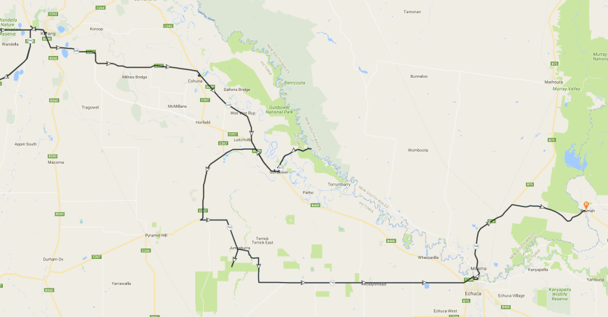
Below shows a map of my travels on Saturday.
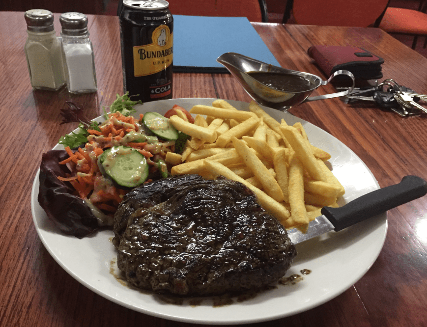
After booking in to the Barmah caravan park, I made the short walk down to the Barmah Hotel where I enjoyed a few Bundy and Cokes and a nice steak.
References.
Parks Victoria, 2013, “Terrick Terrick Visitor Guide’.
Wikipedia, 2016, <https://en.wikipedia.org/wiki/Mount_Hope_(Victoria)>, viewed 20th November 2016
Wikipedia, 2016, <https://en.wikipedia.org/wiki/Pyramid_Hill>, viewed 20th November 2016
