It was a bright and early start for me on Friday morning (11th November 2016). I was up at 6.00 a.m. and after breakfast and loading of the Toyota HiLux, I was on the road, heading towards Victoria. My first planned overnight stop was the little town of Kerang in Victoria, and this was a journey of about 550 km through the Mallee region of South Australia and into North East Victoria.
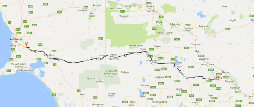
Above:- Map showing my travelling route from Mount Barker in South Australia to Kerang in Victoria. Map courtesy of plotaroute
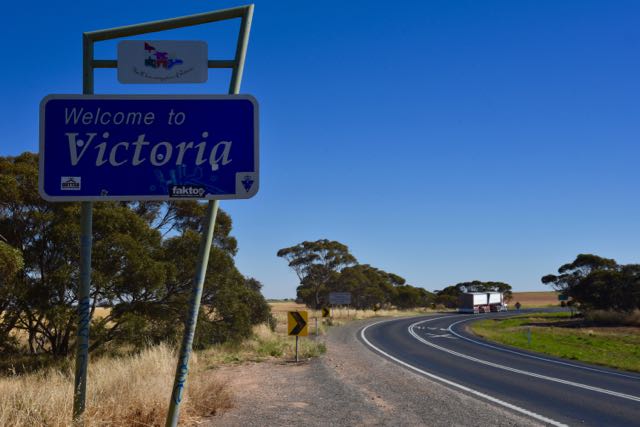
I travelled south east along the South Eastern Freeway until I reached the intersection of the Mallee Highway and the Dukes Highway just outside of Tailem Bend. It was here that I turned off to travel east along the Mallee Highway through the little towns of Jabuk, Parrakie, Lameroo and Pinnaroo until I reached the State border of South Australia and Victoria.
Along the way I booked in to the Mid South Coast Amateur Radio Club Net on 40m being run by John VK2NJP.
I then stopped briefly for a coffee at Murrayville, a little town about 22 km east of the border. The town is located in an agricultural corridor which is bounded on the north by the Murray Sunset National Park and to the south by the Big Desert Wilderness Park. The little Cobb and Co Cafe dates back to 1911 when it was first used as the local Fruit and Veg shop.
The shop takes its name from the Cobb & Co coaches which passed through the area back in the mid 1850’s. Gold was discovered in Victoria during the 1850’s and as a result people from all over the world rushed to the diggings in Victoria. Four young Americans, Freeman Cobb, John Murray Peck, James Swanton and John Lambert commenced a stagecoach company to fulfil the need for transport. On the 30th January 1854 the very first Cobb & Co coach ran from Melbourne to the Forest Creek diggings at Castlemaine.


I continued east heading towards Ouyen, passing through the little towns of Cowangie, Boinka, Linga, Underbool and Walpeup. Along the way I spoke with John VK2AWJ/3 who was activating the French Island National Park VKFF-0622. I then booked in to the 7105 Net being run by Ron VK3MRH.


Google maps at home had indicated that after leaving Ouyen I would then travel through Mittyack and Gerahmim and on to Nyah. But the GPS in the vehicle had some different ideas. At Walpeup the GPS guided me down to Patchewollock and then on to Sea Lake. Along the way I stopped off briefly to have a look at Lake Tyrell which is Victoria’s largest salt lake covering 20,860 hectares.


I then continued on to Culgoa and Lalbert until I reached Kerang. Along the way had a chat to Julie VK3SRC who was operating portable at a school in Melbourne, and also spoke with some of her students. I have since spoken with Julie and she has told me that the students were amazed that they were speaking with someone driving along in their car. I also spoke with Peter VK3TKK who was portable in the Reef Hills State Park VKFF-0773, and Brett VK3FLCS who was portable in the Heathcote-Graytown National Park VKFF-0624. A little while later I spoke again with VK3TKK who was this time operating portable from the Warby Ovens National Park VKFF-0742.
I booked in to the caravan park and then had a quick look around the town. Kerang is a rural town situated on the Loddon River, with a population of about 4,000 people. The word Kerang is aboriginal for cockatoo. Major Thomas Mitchell was the first European to visit the area in 1836. In 1860 the Burke and Wills expedition also passed through Kerang on their journey to cross Australia from Melbourne to the Gulf of Carpentaria.


I then headed out to Leaghur State Park VKFF-0762 which is located about 32 km south of Kerang on the Boort-Kerang Road. The park is about 280 km from Melbourne. This was to be a unique park for me as an activator in the World Wide Flora Fauna (WWFF) program.
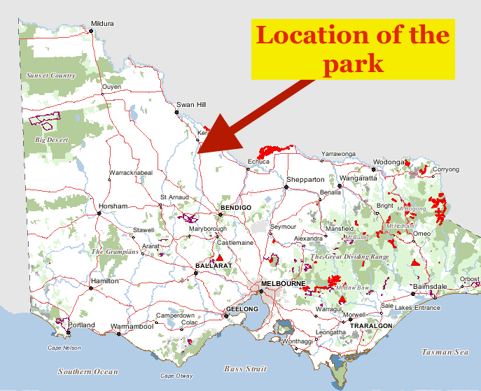
Above:- Map showing the location of the Leaghur State Park. Map courtesy of Forest Explorer
There were no issues in locating the park as it was very well signposted on the Boort-Kerang Road. Just inside the park entrance is an information board with a map of the park and various other information. However it was only a very quick read of the board for me, as the minute I jumped out of the vehicle, the mosquitos were all over me. They were absolutely relentless.


Leaghur State Park which is 2,022 hectares in size, is located on the Loddon River floodplain in Victoria;s north west. Leaghur protects some of the most significant Black Box wetland and woodland communities in Victoria. Flooding can occur in winter and spring, replenishing the park with rich, stunning wetlands and vigorous growth. This flooding is essential for the health of Black Box communities.
The park was originally managed by the Forests Commission of Victoria as Leaghur Forest Reserve and, from 1970, as Leaghur Forest Park. The Land Conservation Council in its Final Recommendations for the Mallee Area Review in 1989, proposed the park be renamed as Leaghur State Park. The park was proclaimed as a State Park on the 23rd September 1992. The Victorian Government increased the size of the Leaghur State Park by including the Appin State Forest and Leaghur Wildlife Reserve into the State Park, in June 2010 to protect and enhance the River Red Gum forests in Victoria.
The park supports a large variety of birdlife including Whistling Kites, Brown Falcons, and Superb Fairy-wrens. The Grey-crowned Babbler which is listed as being of State significance can also be found in the park. Other threatened birds include the Great Egret which breeds within Leaghur. In fact a total of almost 100 species of bird have been recorded in Leaghur.
The park is also home to wallabies and kangaroos which can often be seen grazing on the open plains at dawn and dusk.
Nearly 140 native flora species have been recorded within the park. Of those, 14 species are listed as rare or threatened. A further 24 species are considered to be of regional significance.
Early settlers found the Black Box had limited value as sawn timber and harvesting was limited. Today, fine old trees survive, with much of the habitat still intact. Scar trees and oven mounds, reminders of the Aboriginal people who hunted in the area, and of settlers seeking materials for shelter. Dairy Track is a reminder of the farmers who travelled this track to deliver fresh cream to the Appin dairies, while wild oats and other weeds suggest that the Red Plain was once used for cropping. The park has a rich history of stock grazing and scattered settlement, although little evidence remains of three early homesteads built in the park.


After entering the park I drove down Chamberlain Track which joins Lake Merran Track. I was hoping to get down to the picnic area at Lake Merran. But despite the dry appearance of the park there was a huge amount of water lying around. Chamberlain Track was passable but even in 4WD I found Lake Merran Track far to wet and boggy. I didn’t fancy on getting myself bogged in the first park for the trip.


So I turned back around and headed to the picnic area I had seen when I first entered the park off Main Track. Fortunately there was a wooden bench and table at this spot so there was no need for my deck chair and fold up table. I used the Yaesu FT-857d set at 40 watts output for this activation, along with my 80/40/20m linked dipole supported on the 7 metre squid pole.
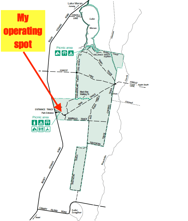
Above:- Map of the Leaghur State Park showing my operating spot in the park. Map courtesy of Parks Victoria
First in the log was John VK5BJE with a great 5/9 signal, followed by park regular Mick VK3GGG/VK3PMG, and then Brett VK3FLCS who was portable in the Heathcote-Graytown National Park VKFF-0624. Two more Park to Park contacts immediately followed. The first being with Norm VK3XCI who was portable in the Wyperfeld National Park VKFF-0549, and then Joe VK3SRC who was portable at Arthurs Seat State Park VKFF-0750. A handful of contacts later I then logged Rob VK4AAC/3 who was activating the Little Desert National Park VKFF-0291.
The 40m band was working nicely other than the very loud static crashes at times. Signals were very good from VK1, VK2, VK3, VK5 and VK7. Contact number 30 during this activation was quite special in that it was with Terry VK2/G4UUQ who was on his second to last day of holidays in Australia. Terry was a retired National Parks Ranger in the United Kingdom and was interested to hear about the various parks programs, particularly the upcoming Keith Roget Memorial National Parks Award weekend.
I logged three further Park to Park contacts during this activation, making seven P2P QSOs in total. Those were with Peter VK3TKK/p in the Mount Buffalo National Park VKFF-0287, Neil VK4HNS/p in the Ravensbourne National Park VKFF-0427, and Gerard VK2IO/p in the Illawarra State Conservation Area VKFF-1329.
Other interesting contacts including logging Gerald VK2IO who was using the special call of VI2HQ40 to celebrate the 40th anniversary of the Mid South Coast Amateur Radio Club. Greg VK5GJ who often runs QRP was logged using just 500 milliwatts (5/3 from the Adelaide Hills). And it was also very pleasing to be able to log Colin VK4PDX who has just upgraded from VK4FAAS. I was Colin’s first ever contact with his brand new call.


So after 1 and 3/4 hours in the park I had qualified Leaghur State Park for WWFF with a total of 55 contacts.
I worked the following stations on 40m SSB:-
- VK5BJE
- VK3GGG
- VK3PMG
- VK3FLCS/p (Heathcote-Graytown National Park VKFF-0624)
- VK3XCI/p (Wyperfeld National Park VKFF-0549)
- VK3SRC/p (Arthurs Seat State Park VKFF-0750)
- VK3SQ
- VK3SFG
- VK2KYO
- VK4AAC/3 (Little Desert National Park VKFF-0291)
- VK7DW
- VK5RM
- VK5GJ
- VK5EE
- VK3PF
- VK5FD/p
- VK3ZPF
- VK4FDJL/2
- VK7FRJG
- VK3MCX
- VK2VW
- VK2HHA
- VK2EJW
- VK7DON
- VK3JP
- VK7CC
- VK5GI
- VK2JAZ
- VK2FDAV
- VK2/G4UUQ
- VK2QK
- VK5FANA
- VK1AT
- VI2HQ40
- VK5WG
- VK5KLV
- VK3TKK/p (Mount Buffalo National Park VKFF-0287)
- VK4HNS/p (Ravensbourne National Park VKFF-0427)
- VK5IS
- VK2YW
- VK5FMJC
- VK5CZ
- VK5NEX
- VK5VRB
- VK5GJ (QRP 500 milliwatts)
- VK2IO/p (Illawarra State Conservation Area VKFF-1329)
- VK4PDX
- VK7JON
I worked the following stations on 20m SSB:-
- VK6XN
- VK6NU
- VK6EA
- VK5MBD
- VK4KUS
- VK3SX
- VK6MB
References.
Parks Victoria, 2010, ‘Leaghur State Park Visitor Guide’
Parks Victoria, 1998, ‘Leaghur State Park Management Plan’.
Sea Lake Tourism, 2016, <http://sealake.vic.au/about/lake-tyrrell/>, viewed 19th November 2016
Wikipedia, 2016, <https://en.wikipedia.org/wiki/Kerang>, viewed 19th November 2016
Cobb & Co Museum, 2016, <http://www.cobbandco.qm.qld.gov.au/About+Us/History/Legend+of+Cobb+Co#.WC-MpeF97u4>, viewed 19th November 2016