
After leaving the Coopracambra National Park Marija and I decided to go for a drive to the Victorian/New South Wales State border. It was just a short 15 km drive up the Monaro Highway. Along the way we decided to do a very quick activation, from the vehicle, of the South East Forests National Park VKFF-0458, which was just over the border in New South Wales.
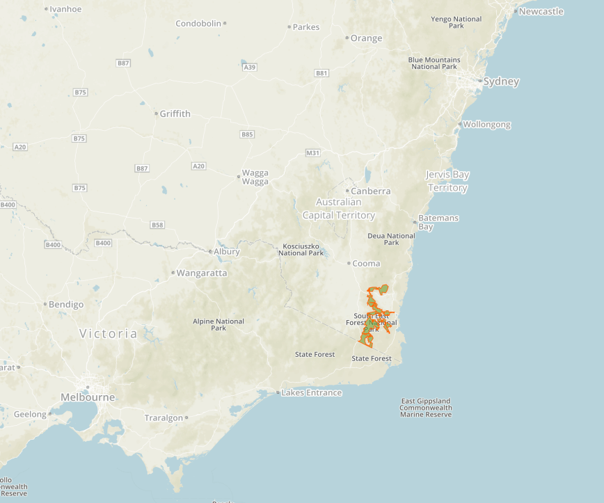
Above:- Map showing the location of the South East Forests National Park. Map courtesy of Protected Planet.
The South East Forests National Park is a large park, comprising some 115,177-hectares (284,610-acres). It was created in 1997 by the amalgamation of Genoa, Tantawangalo, Bemboka, Yowaka and Coolangubra National Parks, all of which had been gazetted in 1994.
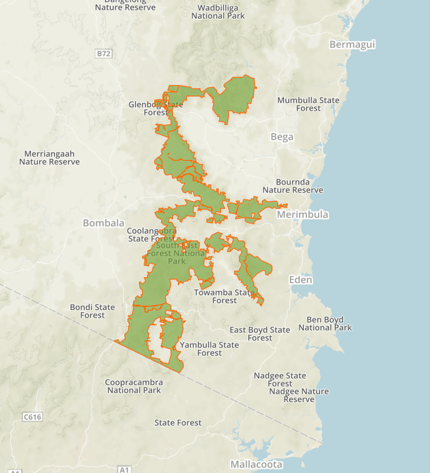
Above:- Map showing the area of the South East Forests National Park in the south eastern corner of New South Wales. Map courtesy of Protected Planet.
Until around 1968 much of the south eastern corner of New South Wales was vacant crown land consisting of rugged forest known as the Wallagaraugh Wilderness. At this time a scientific committee which had been appointed by the New South Wales State Government, recommended the area of about 100,00 hectares be protected as a National Park. However, the Japanese company Harris-Daishowa sought to log the area for woodchips, with most of the land been categorised as State Forest. Only the Nalbaugh and Nungatta National Parks were declared in what is now South East Forests National Park.
In October 1969 logging commenced, and despite increasing opposition, continued for about 25 years. During the 1988 election, the Labor State government proposed an 80,000 hectare park as a re-election promise, however they were not re-elected. A number of protests were held in the area. It was not until 1994, that under the Fahey Liberal State NSW Government that the Genoa, Tantawangalo, Bemboka Yowaka and Coolangubra national parks came into existence.


Above:- Various newspaper clippings relating to the protests. Courtesy of Trove.
Combined with the adjoining Coopracambra National Park located in Victoria across the Black-Allan Line, the South East Forests National Park forms one of the largest contiguous areas of high quality wilderness in south-eastern Australia that spans from Bombala in New South Wales to the town of Cann River in Victoria.
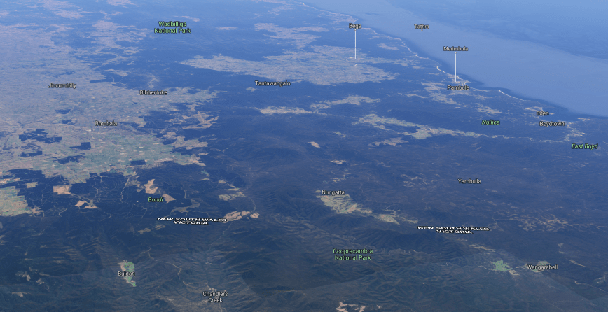
Above:- Aerial view showing the South East Forests National Park. Image courtesy of google maps
A large amount of native animals can be found in the park including threatened species such as the Smoky Mouse. The park forms part of the Ulladlla to Merimbula Important Bird Area, identified as such by BirdLife International due to its importance for Swift Parrots.
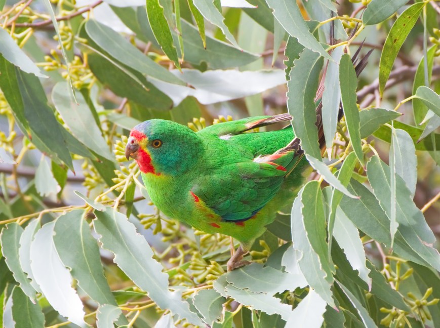
Above:- Swift Parrot. Image courtesy of Wikipedia.
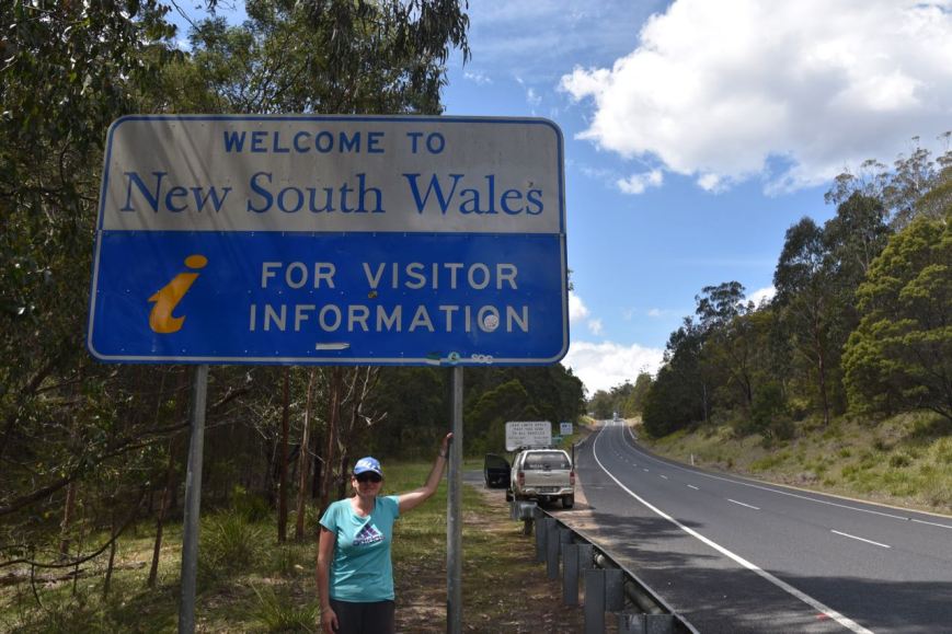
We soon reached the New South Wales border and stopped briefly for a photograph at the State border sign.
We continued a very short distance up the Monaro Highway and soon reached the park on our right, and a park sign of South East Forests.


This is truly magnificent country with scrub and forest as far as the eye can see.


Sadly there is still logging in the area. The photos below show the stark contrast of the logged countryside compared to the lush forest.


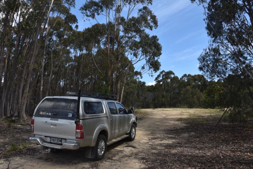
Marija and I drove a short distance down Saddle Flaps Road and found a small dirt track which lead to a clearing. We operated from the vehicle for this activation, running the Icom IC-7000 and the Codan 9350 self tuning antenna mounted on the rear of the Toyota Hi Lux.
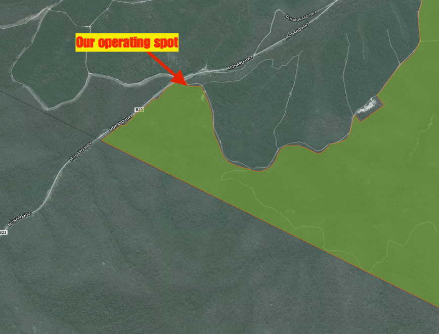
Above:- Aerial shot showing our operating spot in the South East Forests National Park. Map courtesy of Protected Planet.
We had no internet coverage and were unable to self spot on parksnpeaks or Facebook. We had a quick tune across the 40m band and found Jonathan VK7JON/p and Helen VK7FOLK/p calling CQ from the Bay of Fires Conservation Area VKFF-1133, with a good 5/7 signal. We logged Jonathan and Helen and then headed up the band to 7.144 where we started calling CQ.
Our CQ call was answered by Gerard VK2JNG/p who was in the Tooloom National Park VKFF-0491. It was terrific to get 3 Park to Park contacts in the log. This was followed by Adam VK2YK, Winston VK7WH, and then another Park to Park, with Peter VK3PF/p who was activating the Mornington Peninsula National Park VKFF-0333.
Ben VK7BEN/p then gave us a call from the Mount Field National Park VKFF-0347 in Tasmania, and then Colin VK3ZZS/7, and then Neil VK4HNS/p who was in the Knapp Creek Conservation Park VKFF-1574. Not bad, our 6th Park to Park contact from South East Forests. Our final caller on 40m was Marc VK3OHM with a strong 5/8 signal.
To complete the activation I moved up to 14.310 on the 20m band and called CQ. But with no internet coverage and without the ability to spot, I had no callers.
Marija and I then drove back over the State border, heading to our next activation, the Lind National Park.
Marija and I worked the following stations on 40m SSB:-
- VK7JON/p (Bay of Fires Conservation Area VKFF-1133)
- VK7FOLK/p (Bay of Fires Conservation Area VKFF-1133)
- VK2JNG/p (Tooloom National Park VKFF-0491)
- VK2YK
- VK7WH
- VK3PF/p (Mornington Peninsula National Park VKFF-0333)
- VK7BEN/p (Mount Field National Park VKFF-0347)
- VK3ZZS/7
- VK4HNS/p (Knapp Creek Conservation Park VKFF-1574)
- VK3OHM
References.
Wikipedia, 2017, <https://en.wikipedia.org/wiki/South_East_Forests_National_Park>, viewed 30th November 2017
