Our second park for the day was the Mantung Conservation Park 5CP-269 & VKFF-1055. The park is located about 228 km north east of the city of Adelaide and about 45 km west of Loxton. Again, this was to be a unique park for both Marija and I as activators, for both WWFF and the VK5 Parks Award.
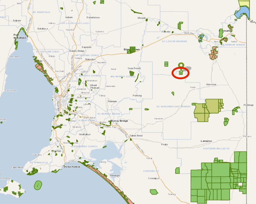
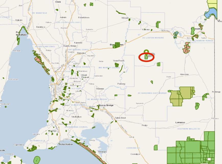
Above:- Map showing the location of the Mantung Conservation Park. Map courtesy of Location SA Map Viewer
The Mantung Conservation Park is about 1,696 hectares (4,190 acres) in size and was proclaimed on the 16th October 2014. So in the scheme of things, Mantung is a relatively new park.
At the opening of the park, Natural Resources South Australian Murray-Darling Basin District Manager, Mallee and Coorong, Paul Gillen stated:
“Proclaiming the Mantung area as a Conservation Park complements a large network of adjoining Vegetation Heritage Agreements in the area which are well-managed by local farmers and the Mantung-Maggea Land Management Group with support from the Murray Mallee Local Action Planning group and Natural Resources SA Murray-Darling Basin…….The local community has really taken Mantung under its wing, taking part in extensive native habitat restoration work in recent years.”
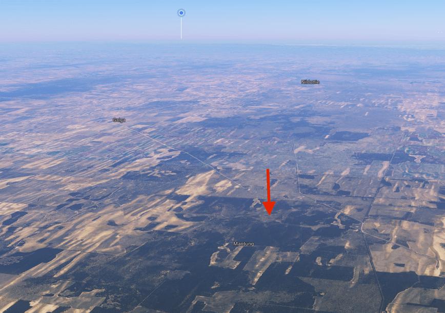
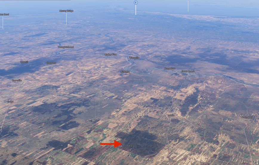
Above:- Aerial shot showing the Mantung Conservation Park and the surrounding countryside. Image courtesy of Google maps
Mantung is a local aboriginal word literally meaning ‘water on a native road’. Aborigines traversing through the area, followed sandhills from Jadko about 6·5 km north of Swan Reach, via Bakara eastward to Loxton. They obtained water from mallee trees, while sandhills contained root foods. Needle bush roots also yielded water for indigenous travellers.
The Hundred of Mantung, County of Albert, was proclaimed on 15th June 1893. The name was shown as an Aboriginal waterhole on an 1864 land tenure plan. The town of Mantung, was proclaimed on 8th July 1915.
The conservation park is important for the conservation of the following bird species: Malleefowl, Southern Scrub Robin, Shy Heathwren, Inland Thornbill, White-browned Babbler, and Purple-gaped honeyeater.


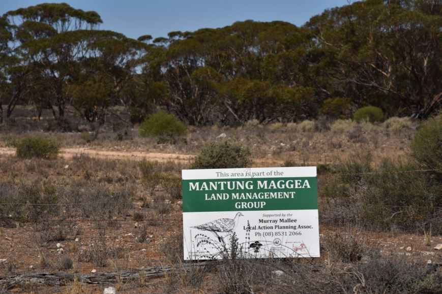
After leaving Bakara, we travelled south on Start Road until we reached Bakara Well Road where we turned left and travelled east. We continued east on Carnell Road and then Evans Road, and upon reaching the junction of Evans Road and Farr Road, we took Farr Road. We soon reached the north western corner of the park. There was an open gate at this location, with a Mantung Maggea Land Management Group sign.
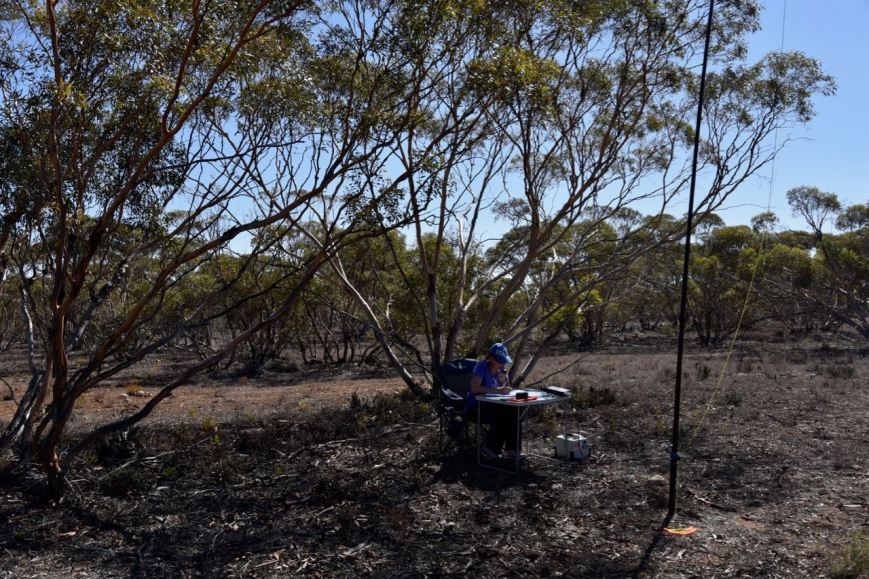
We continued along Farr Road and found another open gate and a 4WD track leading into the park. We travelled along the track for about 500 metres and set up underneath the shade of some trees. It was a warm afternoon, with the temperature approaching 35 deg C.
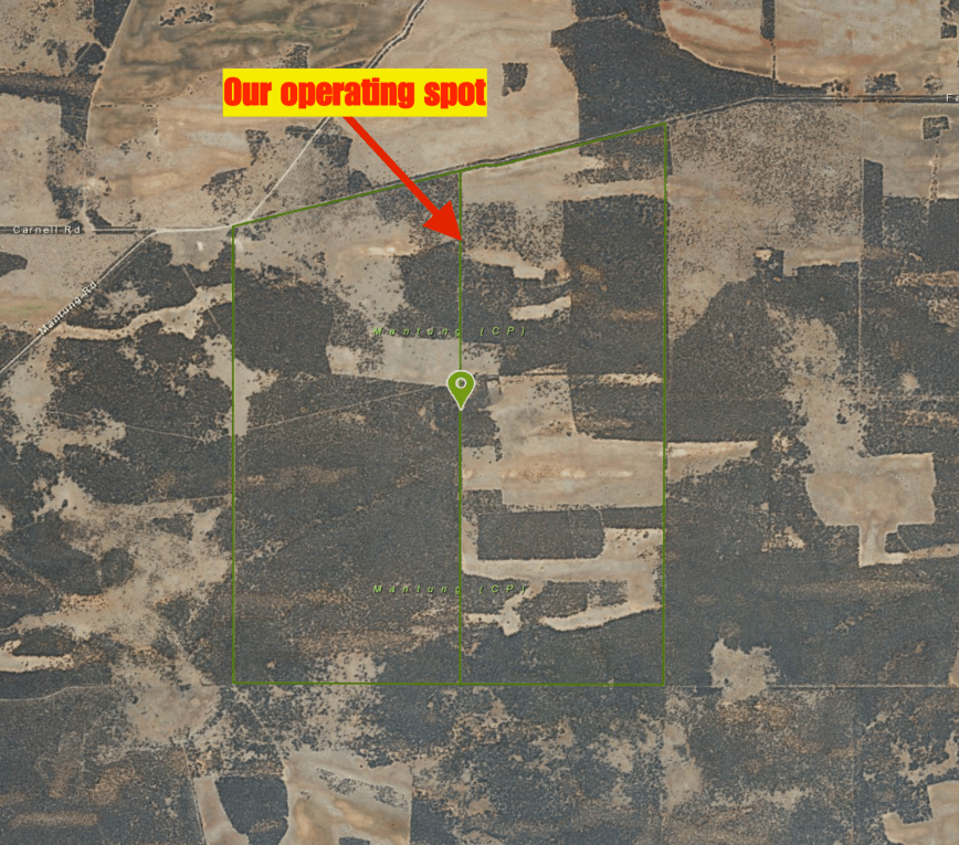
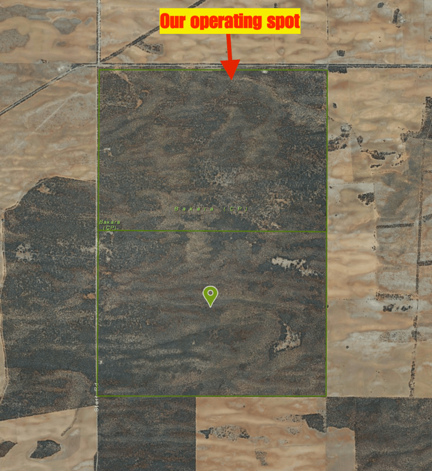
Above:- Aerial shot of the Mantung Conservation Park, showing our operating spot in the northern section of the park. Image courtesy of Location SA Map Viewer
I kicked off the activation, calling CQ on 7.144. This was answered by Mike VK5FMWW who had a big 5/9 plus signal. It was great to see the 40m band open around South Australia. Next in the log was Gerard VK2IO/p who was activating the Dharawal National Park VKFF-1167. Marija and I swapped the mic so she could log Gerard Park to Park. She then decided to stay in the operators chair and within7 minutes had logged 10 stations, qualifying the park for the VKFF program. Contact number 10 for Marija was a QSO with Bill VK4FW/p who was activating the Baywulla Creek Conservation Park VKFF-1470. I also logged Bill Park to Park.


I then jumped into the operators chair and called CQ. Deryck VK4FDJL was the first taker, followed by Helen VK7FOLK and then Linda VK7QP. The 40m band had improved quite dramatically compared to conditions during our first park activation at Bakara. There was a steady flow of callers, with mini pile ups at times. Contact number 44 was a QSO with Mike VK3FCMC.
I also logged the following Park to Park contacts (Marija also logged these):
- Liz VK2XSE/p -Jerrawangala National Park VKFF-0248VKFF-0248
- Nik VK3NLK/p – Gippsland Lakes Conservation Park VKFF-0747
- Peter VK3ZPF/p – Cathedral Range State Park VKFF-0755
- VK4SMA/p – Maryland National Park VKFF-0309
- VK2IO/p – Dharawal State Conservation Area VKFF-1313
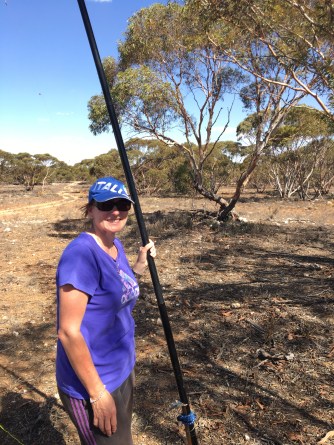
During the activation the wind really picked up and the squid pole came crashing down. As we had so many callers we didn’t get the opportunity of hammering the squid pole holder back into the dry and rocky ground. So Marija and I took turns holding the squid pole upright. Apparently our signal was still strong, even when the squid pole was lying on the ground.
After logging a total of 46 stations on 40m I headed off to 14.310 on the 20m band where I spoke with Peter VK2NEO and Rob VK7VZ.
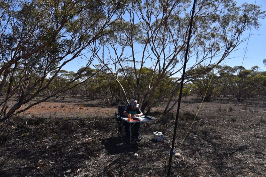
It was now really hot and there wasn’t a huge amount of shade under the mallee shrubs, so Marija and I decided to call it a day. Sorry, we didn’t try 80m during this activation. It was just too hot and we wanted to get back into the air conditioned comfort of the Hi Lux.
Marija had qualified the park for VKFF with 16 contacts in the log, and I had qualified for the park for VKFF & WWFF with 48 QSOs. We also had 14 Park to Park contacts in the log from Mantung.
Marija worked the following stations on 40m SSB:-
- VK2IO/p (Dharawal National Park VKFF-1167)
- VK3QB
- VK5FMWW
- VK7QP
- VK3CWF
- VK3PGK
- VK3FSPG
- VK3MPR
- VK7FOLK
- VK4FW/p (Baywulla Creek Conservation Park VKFF-1470)
- VK2XSE/p (Jerrawangala National Park VKFF-0248)
- VK3NLK/p (Gippsland Lakes Conservation Park VKFF-0747)
- VK5FANA
- VK3ZPF/p (Cathedral Range State Park VKFF-0755)
- VK4SMA/p (Maryland National Park VKFF-0309)
- VK2IO/p (Dharawal State Conservation Area VKFF-1313)
I worked the following stations on 40m SSB:-
- VK5FMWW
- VK2IO/p (Dharawal National Park VKFF-1167)
- VK4FW/p (Baywulla Creek Conservation Park VKFF-1470)
- VK4FDJL
- VK7FOLK
- VK7QP
- VK3FSPG
- VK3MPR
- VK2LEE
- VK2USH
- VK3ZD
- VK7VZ
- VK5VBR
- VK7JON
- VK2NP
- VK3BBB
- VK3UH
- VK3PF
- VK2PKT
- VK3FRAB
- VK3UCD
- VK5HS
- VK7DW/p
- VK4HNS
- VK5FMLO
- VK2XSE/p (Jerrawangala National Park VKFF-0248)
- VK3ARH
- VK5DW
- VK3NLK/p (Gippsland Lakes Conservation Park VKFF-0747)
- VK5KLV
- VK5FANA
- VK3ZPF/p (Cathedral Range State Park VKFF-0755)
- VK7EK
- VK4TJ
- VK4/AC8WN
- VK4/VE6XT
- VK2NEO
- VK5PL
- VK2YE
- VK4SMA/p (Maryland National Park VKFF-0309)
- VK2IO/p (Dharawal State Conservation Area VKFF-1313)
- VK3ANL
- VK3HY
- VK3FCMC
- VK3SQ
- VK3KMA
I worked the following stations on 20m SSB:-
- VK2NEO
- VK7VZ
After packing up we drove into the little town of Mantung. There isn’t a huge amount here nowadays. It is another town which has suffered at the hands of the closure of the railway line. But there are a number of interpretive signs pointing out historic sites in the town, courtesy of the Mantung Centenary Committee. At the old hall there are 2 brochures which detail the historic railway towns of Mantung, Mercunda, Maggea, Galga and Eastern Well, and also the Mantung Centenary Walk.
In 1893 the Hundred of Mantung was surveyed into 14 large sections, however virtually no interest was shown. In 1910 the Hundred of Mantung was surveyed into 46 smaller sections and these were all taken up and new pioneer families moved onto their land.


We then travelled south west on the Galga Road, and we worked Gerard VK2IO/p from the mobile. Gerard was in the Dharawal State Conservation Area VKFF-1313 and was a strong 5/8 into the mobile.
We stopped briefly to have a look at the old settlement of Mercunda, originally known as Mattala. Again, there is not a lot here, as the town collapsed following the closure of the railway. However there is an interpretive sign at the old Mercunda hall and school. Mercunda once boasted a railway siding with goods platform, passengers platform, stock loading yards, wheat shed and wheat stacking area, cottages for railway workers, several saw benches set up by wood merchants in the 1920’s and 30’s, a general store, blacksmith, post office, twon hall, school, football and tennis teams and also a golf club (1965-1974).


Our next stop was the town of Galga which was surveyed in October 1915 by Mr. A. Thomas, after the Waikerie railway line from Karoonda to Waikerie was opened in 1914. The town was gazetted on 10th February 1916 and in its heyday consisted of a post office (opened in September 1915), a telephone exchange, a general store (opened in 1921), the Galga hall used for dances, two churches, and a school. In 1920 the Galga Football Club was formed and originally played in a paddock until recreational land was surveyed in the town in 1922.


Perhaps Galga’s most famous former resident is singer, Julie Anthony (1951-). She was born in Galga and was raised on the family farm.
On the way home we spoke with Ian VK1DI/2 on 40m from the mobile. Ian was in the Tallaganda State State Conservation Area VKFF-1375 and was a good 5/8 signal. I also worked Bernie on 20m who was using the special call of VI4GAMES for the 2018 Commonwealth Games.
We arrived home in the late afternoon. We had a terrific time away. Again, thanks to all of the organisers of the BRL Gathering, and thanks to those who called Marija and I during our park activations.
References.
All Music, 2018, <https://www.allmusic.com/artist/julie-anthony-mn0000840426>, viewed 9th April 2018
Natural Resources SA Murray Darling Basin, 2018, <http://www.naturalresources.sa.gov.au/samurraydarlingbasin/news/141125-mantung-cp>, viewed 9th April 2018
State Library South Australia, 2018, <http://www.slsa.sa.gov.au/digitalpubs/placenamesofsouthaustralia/>, viewed 9th April 2018
Wikipedia, 2018, <https://en.wikipedia.org/wiki/Mantung_Conservation_Park>, viewed 9th April 2018
Wikipedia, 2018, <https://en.wikipedia.org/wiki/Galga,_South_Australia>, viewed 9th April 2018