It was now Monday 11th June 2018, and time for Marija and I to head back home after 3 very enjoyable nights in Mount Gambier. We had hoped to activate a park or two on the way home, but hadn’t really decided on which one, as the weather was looking quite threatening. So after another stop at Subway for breakfast we hit the road and headed north along the Riddoch Highway out of Mount Gambier.
As we approached Penola we decided upon turning off at Narracoorte and activating some parks between there and Bordertown, on the South Australian/Victorian border. But as we continued northwards, the weather became more threatening and we decided to activate a closer park, the Bool Lagoon Game Reserve VKFF-1687.
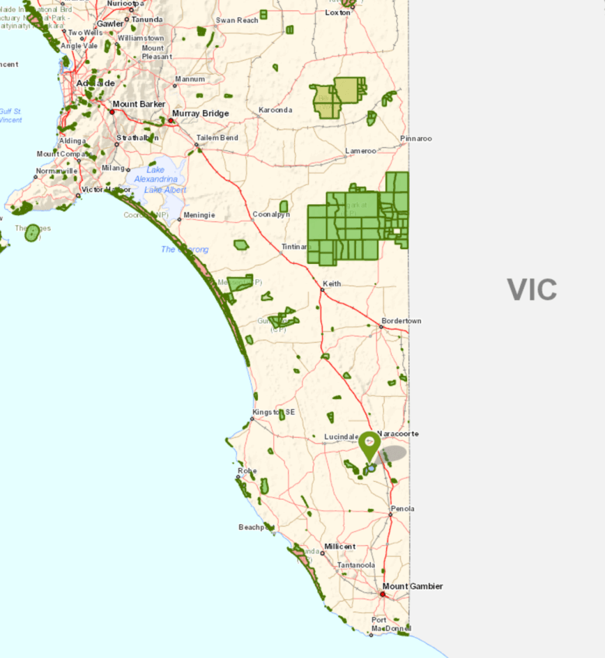
Bool Lagoon is located about 26 km (by road) south of Narracoorte and about 359 km south east of Adelaide.
Above:- Map showing the location of the Bool Lagoon Game Reserve. Map courtesy of Location SA Map Viewer.
This was to be another unique park for both Marija and I in the World Wide Flora Fauna (WWFF) program.
The Bool Lagoon Game Reserve is about 3,103 hectaresin size and was established on 8th June 1967. It is one of the largest and most diverse freshwater lagoon systems in southern Australia. In 1985, the area covered by both the game reserve and the Hacks Lagoon Conservation Park was added under the name “Bool and Hacks Lagoons” to the List of Wetlands of International Importance maintained by the Ramsar Convention.
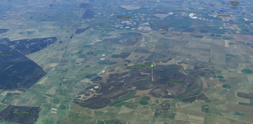
Above:- Aerial view of the Bool Lagoon Game Reserve. Image courtesy of google maps
Prior to its proclamation, Bool and Hacks Lagoons were subject to private pastoral leases. In 1940 the Flora and Fauna Committee and the South Australian Ornithological Association (now Birds SA) proposed that all or part of the wetland be declared a Bird Sanctuary. On the 8th June 1967, Sections 223 and 224 were proclaimed as a Game Reserve. On Section 323 was added on the 29th August 1974, with Section 380 being added on 27th August 1992. Section 330 and other land was added on 4th November 1993.
At certain times of the year there is no water at Bool Lagoon. The park contains various habitat types including Tall Shrubland, Sedgeland, Grassland, Floating waterplants Herbland, and Open Water.
Bool Lagoon provides critical habitat for the nationally vulnerable Southern Bell Frog. Several hundred, perhaps thousands of these frogs live at Bool Lagoon. The endangered Striped Legless Lizard also calls the park home.
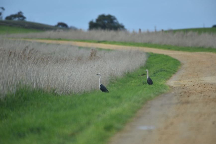
Birds SA have recorded 183 native species of bird at Bool Lagoon. This includes Black Swan, Australian Shelduck, Pacific Black Duck, Grey Teal, Australian White Ibis, Straw-necked Ibis, Eastern Great Egret, Swamp Harrier, Plumed Whistling Duck, Glossy Ibis, Black-backed Bittern, Cattle Egret, Spotted Harrier, Australian Pratincole, and Sacred Kingfisher.
Below are some photos of some of the birds we observed during our visit to Bool Lagoon.
Yellow Billed Spoonbill
Black shouldered Kite
Australian Shelduck
Whistling Kite
Black shouldered kite
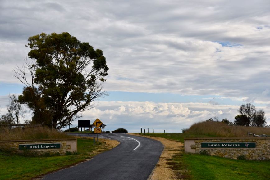
We entered the park via the main entrance which runs off Bool Lagoon Road. The reserve is well signposted.
There is an information board as you enter the park, with lots of interesting information about the reserve and its inhabitants.
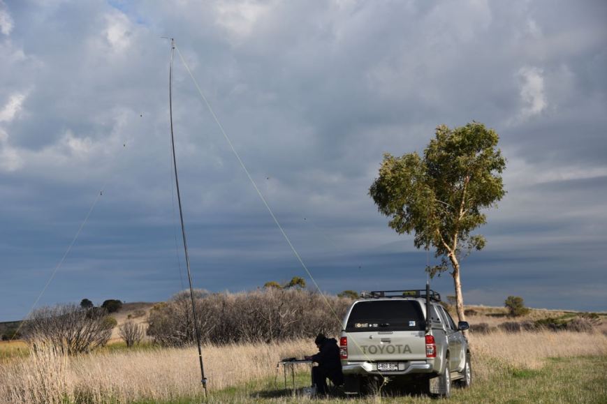
We followed the track on the southern side of the lagoon and travelled to an area which is called Big Hill. It was slow going along the track as there was lots of birdlife.
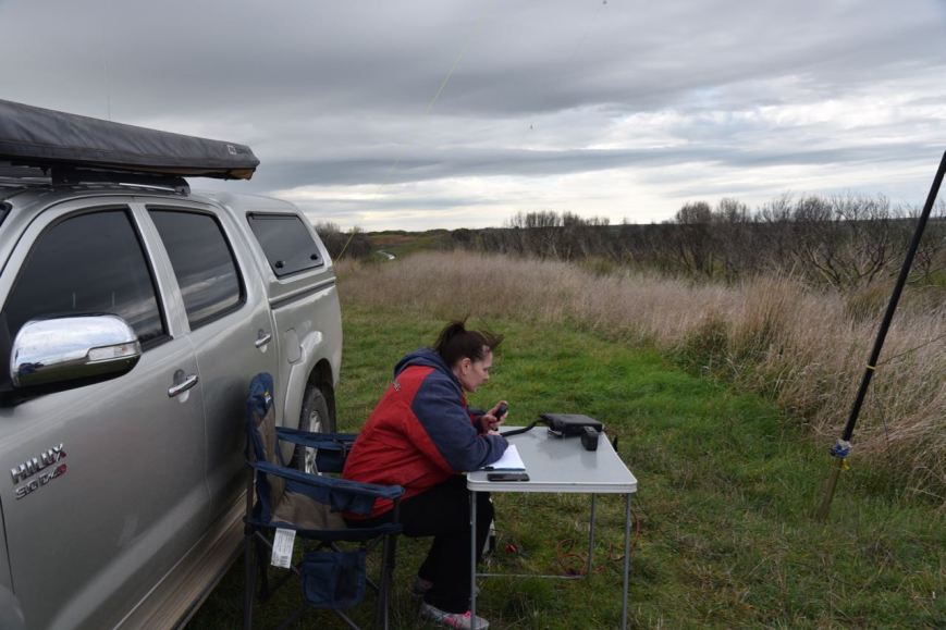
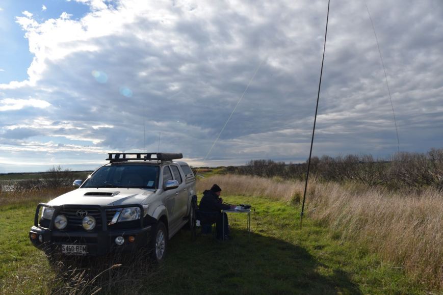
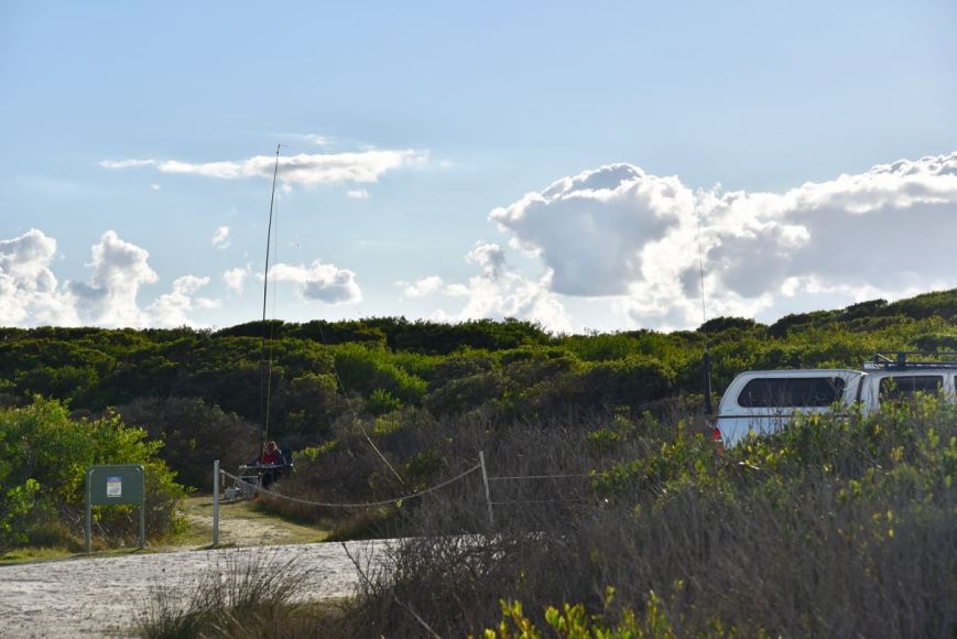
We set up in a clearing near Big Hill. There was plenty of room to stretch out the dipole and not interfere with other users of the reserve. We initially set up outside of the vehicle, but the rain struck during our activation so we retreated inside the vehicle for the remainder of the activation.
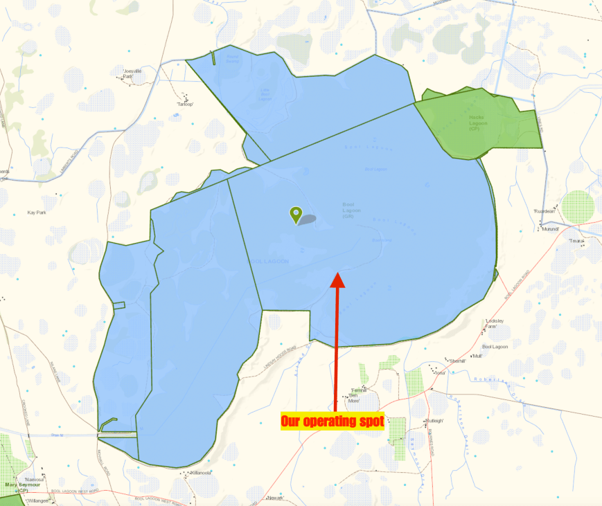
Above:- Our operating spot in the Bool Lagoon Game Reserve. Map courtesy of Location SA Map Viewer.
I kicked off the activation, using the special call of VI50IARU3. I had been allocated the call for a week, to help celebrate the 50th anniversary of the International Amateur Radio Union in Region 3.
So what is the call about?
On the 12th April 1968, 50 years ago, a regional arm of the International Amateur Radio Union, IARU Region 3, was established in Sydney. The IARU had been established a number of years earlier, in Paris, in 1925. is an international confederation of national amateur radio organisations that allows a forum for common matters of concern and collectively represents matters to the International Telecommunication Union (ITU).
First in the log from Bool Lagoon was Rob VK4AAC/5 at the Dingley Dell Conservation Park VKFF-1025, followed by Andrew VK7DW, and then Gerard VK2JNG. Despite this being a rarely activated park and a special call, the number of callers was far less than expected. And after 15 minutes, callers had completely dried up on 40m. I had 17 QSOs in the log, including another Park to Park contact, with Gerard VK2IO/p in the Macquarie Nature Reserve VKFF-1958.
I headed off to the 80m band where I called CQ on 3.610. This was answered by Peter VK3PF, followed by Geoff VK3SQ, and then Peter VK3ZPF. I logged a further 5 stations, including another Park to Park, with Rob VK4AAC/5 at Dingley Dell.
Marija then called CQ on 80m and logged 5 contacts from VK3 and VK5. This included a Park to Park with Rob VK4AAC/5 at Dingley Dell. Despite band conditions being quite good on the 80m band, callers soon stalled, so we headed back to 40m. We put a call out on 7.144 to see if the frequency was in use and didn’t hear anything. Ivan VK5HS/m then responded to our CQ call with a strong 5/9 signal. But we then heard people tell us that the frequency was in use by a QRP station. Rob VK4AAC then came up to let us know he was on the frequency but had been stomped on by VK5HS. So after logging Rob, we moved down the band to 7.139.
I logged a total of 20 stations on 7.139, swapping the mic every now and again with Marija so she could log particular stations. Marija’s 10th contact, qualifying the park for VKFF, was a QSO with Rob VK4AAC/5 at Dingley Dell. Contact number 44 for me was with Kevin VK7KEV in Tasmania. We also logged some more Park to Park contacts, with Alan VK2MG/p in the Wyrrabalong National Park VKFF-0550, and Gerard VK2IO/p in the Lake Innes Nature Reserve VKFF-1955. Other good contacts were with Bob VK6POP over in Western Australia, Andrei ZL1TM in New Zealand, and Ivan VK5HS maritime mobile on the Cadell ferry.
To complete the activation I called CQ on 14.310 on the 20m where I logged 3 stations; Andrei ZL1TM in New Zealand, Cliff VK2NP in Sydney, and Alan VK2MG/p in the Wyrrabalong National Park VKFF-0550 VKFF-0550.
Marija and I packed up, with another park under our belt, and took a walk along the boardwalk in the park. Whilst doing so Marija put a call into Bournes Birds, a nearby tourist attracation, which we hoped to visit. Unfortunately we reached their answering machine. But 15 minutes later we received a call to advise they would open up for us, so it was off to Bournes Birds for us. Just a short drive from the park.
Marija worked the following stations on 40m SSB:-
VK5HS/m
VK2MG/p (Wyrrabalong National Park VKFF-0550)
VK5FANA
VK5UV
VK4AAC/5 (Dingley Dell Conservation Park VKFF-1025)
VK2IO/p (Lake Innes Nature Reserve VKFF-1955)
Marija worked the following stations on 80m SSB:-
VK5BJE
VK5FANA
VK5UV
VK3ZPF
VK4AAC/5 (Dingley Dell Conservation Park VKFF-1025)
I worked the following stations on 40m SSB:-
VK4AAC/5 (Dingley Dell Conservation Park VKFF-1025)
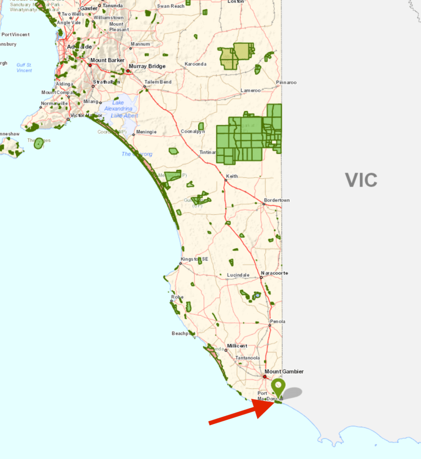
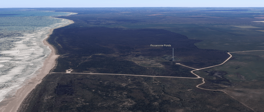
After packing up at Mumbunnar Conservation Park, Marija and I headed to our second park activation for the day, the Piccanninie Ponds Conservation Park 5CP-178 & VKFF-0927. The park is located about 30 km south east of Mount Gambier.
Above:- Map showing the location of the Piccanninie Ponds Conservation Park in the lower south east of South Australia. Map courtesy of Location SA Map Viewer.
The Piccanninie Ponds Conservation Park is 862 hectares (2,130 acres) in size and was established on the 16th October 1969. It is located in the locality of Wye and overlooks Discovery Bay, which was named by explorer Thomas Mitchell in August 1836.
The park is located in close proximity to the State border with Victoria and is part of the Discovery Bay to Piccaninnie Ponds Important Bird Area, identified by BirdLife International as being of global significance for several bird species. It is a listed Ramsar site. The Ramsar Convention on Wetlands of International Importance especially as Waterfowl Habitat is an international treaty for the conservation and sustainable use of wetlands.
Above:- An aerial view of the Piccanninie Ponds Conservation Park. Image courtesy of google maps.
Piccanninie Ponds is a very popular site for snorkelling and cave diving. In 1964–1965, prior to its proclamation as a conservation park, underwater explorer Valerie Taylor described the ponds as “one of the most beautiful sights in Australia”.
The park contains three main features of interest to cave divers. The ‘First Pond’ is an open depression about 10 metres (33 ft) deep with a silt floor and vegetated fringe supporting much aquatic life. The ‘Chasm’ is a sinkhole with a depth of over 100 metres (330 ft), and the ‘Cathedral’ is an enclosed area with limestone formations and a depth of about 35 metres (115 ft). Underwater visibility is excellent and may exceed 40 metres (130 ft). Snorkelling and cave diving at Piccaninnie Ponds is by permit only. Several divers have died whilst exploring the caves.
After leaving Mumbannar we travelled back into South Australia via the Princes Highway and then travelled south along Dry Creek Road following the State border. We soon reached the town of Donovans, where there are some nice views (through the trees) of the Glenelg River.
The Glenelg River at Donovans
Donovans landing, Glenelg River
Looking across the river to the Lower Glenelg Conservation Park
We then crossed the State border and continued along the Glenelg River Road and then on to the Piccanninie Ponds Road.
It wasn’t long before we reached the park, which is clearly signposted, and has a number of information boards.
Before setting up, Marija and I stopped off to have a look at the ponds themselves. They were absolutely crystal clear and were very inviting. There was a young couple in the carpark putting on their wetsuits, getting ready for a dive.
We drove further along Piccanninie Ponds Road until we reached the section which takes you down onto the beach. As we were running short a little of time, we decided not to lower our tyre pressure and drive down onto the sand.
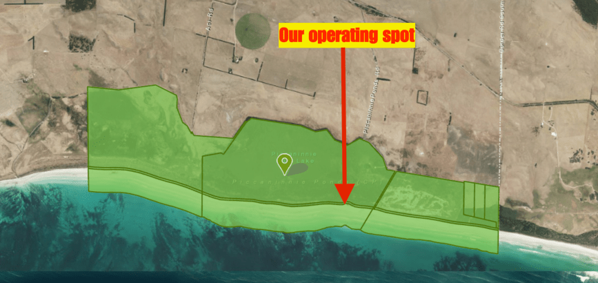
Instead, we parked the vehicle and set up along a walking trail which cut its way through the scrub. There was plenty of room to string out the 20/40/80m linked dipole.
Above:- Aerial view of the Piccanninie Ponds Conservation Park, showing our operating spot. Image courtesy of Location SA Map Viewer.
We were set up a little after 0500 UTC and had around 1 hour of the VK Shires Contest remaining. I kicked off the activation, calling CQ on 7.133. This was answered by Ian VK5IS in the Mid North of South Australia, followed by Andrew VK3AB/p, and then Andrew VK3MUD/p. Contact number ten, qualifying the park for me for VKFF, was with Sam VK5ASK/m.
Above:- Our operating spot down along the walking track.
After I had qualified the park for VKFF, Marija jumped on the mic and called CQ on 7.133. This was answered by Adrian VK5FANA, followed by Cliff VK2NP, and then Adam VK2YK. Marija’s 10th contact was with Geoff VK3SQ in Beechworth. Marija was very pleased to log Greg VK8GM in Alice Springs, and Greg VK4VXX/8 near the South Australian/Northern Territory border.
With Marija having qualified the park for VKFF, I jumped back on the mic. I logged a total of 34 stations before the VK Shires Contest concluded at 0600 UTC, and a further 11 stations after the contest. This included a Park to Park contact with Marc VK3OHM/p in the Greater Bendigo National Park VKFF-0623.
I then moved to 3.610 on the 80m band where I logged 6 stations from VK3, VK5, and VK7. This included a Park to Park with Duncan VK3XBC/p in the Wyperfeld National Park VKFF-0549. Whilst I was on 80m two park rangers arrived on the scene. One of the rangers I had met earlier in the year during an activation at the Little Dip Conservation Park.
Time was marching on and Marija and I needed to pack up and head back into Mount Gambier. That evening we were to attend the SERG Convention dinner. Between us we had 63 contacts in the log.
Marija worked the following stations on 40m SSB:-
VK1DI/2 (Livingstone National Park VKFF-0292)
VK5FANA
VK2NO
VK2YK
VK3VCE/4
VK2LEE
VK4VXX/8
VK8GM/p
VK2VW
VK3SQ
VK3ABP
VK4TJ
I worked the following stations on 40m SSB:-
VK5IS
VK3AB/p
VK3MUD/p
VK7QP
VK4VXX/8
VK6QM
VK2HPN
VK2DEK
VK1DI/2 (Livingstone National Park VKFF-0292)
VK5ASK/m
VK5FANA
VK4TJ
VK4/AC8WN
VK4/VE6XT
VK2NP
ZL2AYZ
VK3SQ
VK2VW
VK8GM/p
VK3GK
ZL1TM
VK2YK
VK7KR
VK3PF
VK2HHA
VK5KLV
VK2NEO
VK2TTL
VK2KTG
VK2JDR
VK3ELH
VK7FMAC
VK4FDJL
VK2WA
VK2ZVG
VK2FJMM
VK7AN
VK2QM
VK5NAW
VK5MK
VK2QK
VK2QE
VK6MN
VK5PL
VK3OHM/p (Greater Bendigo National Park VKFF-0623)
I worked the following stations on 80m SSB:-
VK7AN
VK3XBC/p (Wyperfeld National Park VKFF-0549)
VK5BJE
VK3AWG
VK3PF
VK5RM
We returned to Mount Gambier and freshened up and headed to the Scout Hall where we listened to Joe VK3YSP and Julie VK3FOWL deliver a presentation on youth in our hobby. This was followed by a presentation on aerial photography and drones.
We then enjoyed a great evening at the SERG Dinner.
Marija with Tanina (John VK5NJ’s wife)
with John VK5NJ, Brian VK3BBBm Joe VK3YSP, Greg VK5ZGY, Rob VK4AAC and Andrew VK5MAS
Joe VK3YSP and Brian VK3BBB
Rob VK4AAC delivering a presentation on his travels around Australia.
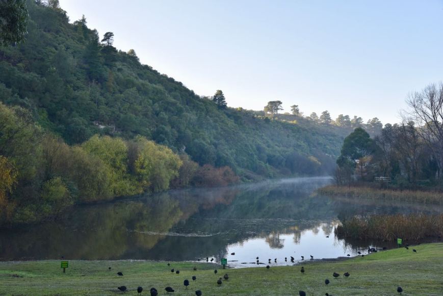
It was now day three (Sunday 10th June 2018) of our trip. We had one planned park activation for the day, over the border in Victoria. After a warm shower Marija and I headed to Subway again for breakfast, comprising a coffee and an egg & bacon roll. We then drove around the Valley Lake in Mount Gambier. It was a sunny but very chilly morning, with lots of mist still hovering around the surface of the lake.
Above:- Valley Lake
We then decided to take a walk up to the top of the Centennary Tower which commemorates the naming and the European discovery of Mount Gambier by Lieutenant James Grant in December 1800. The tower sits 190 metres above sea level.
This is not an easy walk. It is a very steep walk. However, I need the exercise, and the walk would burn off some of the red wine consumed the night before. Along the way, the track was alive with Superb Fairy Wrens.
And once you have got to the top, and have taken a number of breaths and regained your composure, you are rewarded with the best views of Mount Gambier and the surrounding countryside.
We had read on the internet that the tower was open at times, selling refreshments and souvenirs. However it was not open during our visit.
We then walked back to the vehicle and took a drive around the famous Blue Lake at Mount Gambier. The Blue Lake is a crater lake which between December to March turns to a vibrant cobalt blue colour.
Marija and I then attended the scout hall in Mount Gambier, the venue for the South East Radio Group’s annual convention. We caught up with Col VK5HCF and a number of other SERG members. We also said g’day to Joe VK3YSP and Julie VK3FOWL who were busy with some students , undertaking some activities including soldering. Joe and Julie do magnificent work with children through the School Amateur Radio Club Network.
Marija and I then headed to our first park activation for the day, the Mumbannar Nature Conservation Reserve VKFF-2161. The park is located about 40 km east of Mount Gambier, and 12 km (by road) west of the town of Mumbannar in south western Victoria.
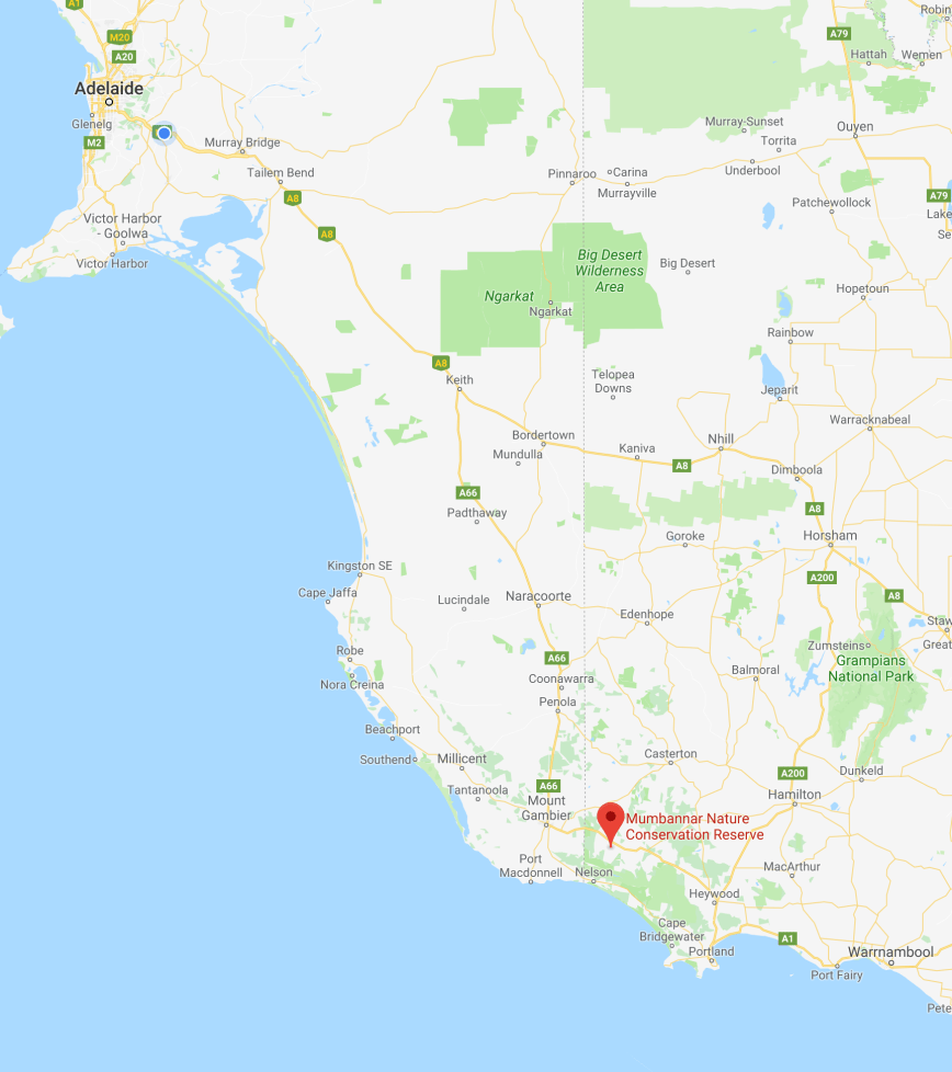
Above:- Map showing the location of Mumbannar Nature Conservation Reserve. Map courtesy of google maps
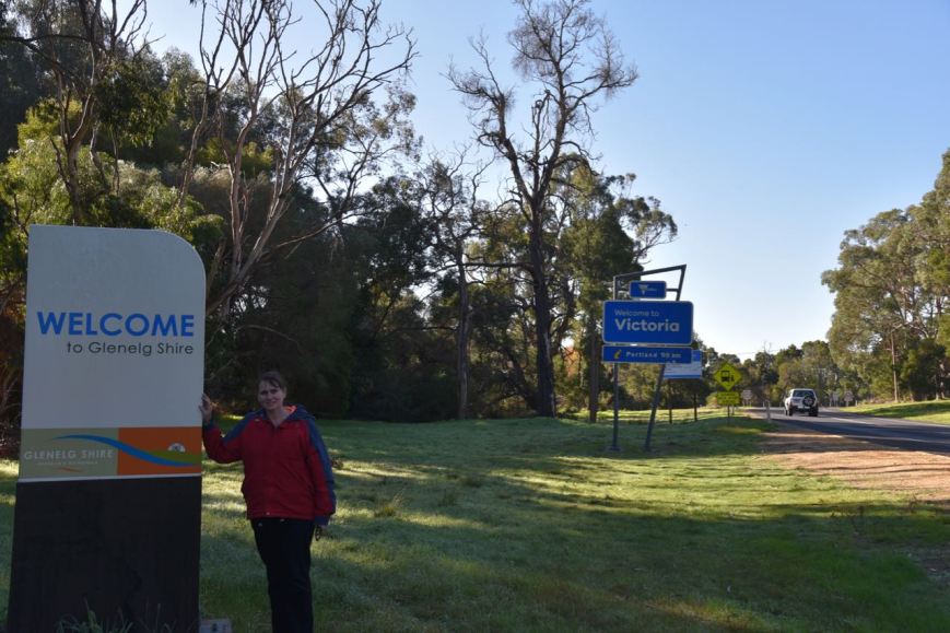
We headed out of Mount Gambier on the Princes Highway and soon reached the State border of South Australia and Victoria. We stopped briefly for a photograph and then continued on to the park.
Above:- Marija at the State border.
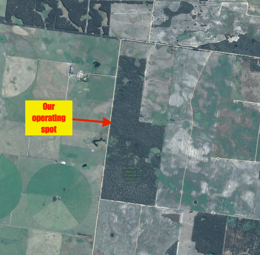
We turned off the Princes Highway onto Faheys Settlement Road. We soon reached the park on the eastern side of the road. The park was well signposted. There were no gates into the park, so we pulled over to the side of the road and then climbed the fence with our gear and set up.
Above:- Aerial view of the park showing our operating spot. Image courtesy of google maps
I have not been able to find out information on this park on the internet. It is recorded on the Parks Victoria website, but there is no associated information.
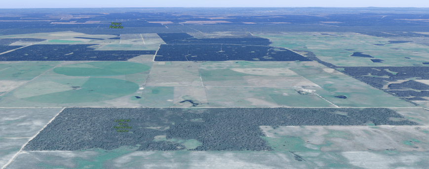
The park is a piece of remnant scrub which is surrounded by cleared land for farming, and also pine plantations.
Above:- Aerial shot of the Mumbannar NRC, looking west back towards the SA/Vic border. Image courtesy of google maps
This was the weekend of the VK Shires Contest, so Marija and I intended on handing out some exchanges for the contest, as well as activating the park. The objectives of this contest are for amateurs around the world to contact as many VK shires as possible in the contest period. Our shire for this park was Glenelg Shire (GL3).
Mumbannar was to be a unique park for both Marija and I in the World Wide Flora Fauna (WWFF) program.
After setting up we headed to 7.144 and found Tony VK3XV/p activating the Kara Kara National Park VKFF-0629 in western Victoria. After logging Tony we tuned across the band and found Marc VK3OHM/p in the Terrrick Terrick National Park VKFF-0630. Next was another Park to Park contact, this time with Gerard VK2JNG/p in the Beni State Conservation Area VKFF-1277.
I then propped on 7.160 and called CQ. First in the log following my CQ call was Les VK5KLV, followed by Garry VK7JGD and then Mark VK7ME. I logged a total of 33 stations on 40m including some more Park to Park contacts as follows….
Ian VK1DI/2 – The Rock Nature Reserve VKFF-2002
Rob VK4AAC/5 – Telford Scrub Conservation Park VKFF-0805
VK4HNS/p – Archer National Park VKFF-0336
Brian VK3BCM/p – Alpine National Park VKFF-0619
With 33 contacts in the log I headed off to 3.610 on the 80m band. John VK5BJE was first in the log, followed by Rob VK4AAC/5, and then Sue, both in the Telford Scrub Conservation Park. Adrian VK5FANA then gave me a shout, followed by Peter VK3PF. Despite band conditions on 80m being quite good, they were my only 5 contacts on that band.
I then moved back to 40m and called CQ on 7.140. This was answered by Ivan VK5HS mobile. My 44th contact, qualifying the log for the global WWFF program was with Nick VK3ANL/p in the Gresswell Forest part b Nature Conservation Reserve VKFF-2103. I logged a further 2 stations, and with 46 contacts in the log, it was time to swap the mic with Marija.
Marija then called CQ on 7.140 and logged Nick VK3ANL/p in the Gresswell Forest part b Nature Conservation Reserve VKFF-2103, followed by John VK2YW/p, and then Greg VK4VXX/8. Marija’s 10th contact, qualifying the park for VKFF was a QSO with Bill ZL2AYZ in New Zealand. Bill was a strong 5/8 and gave Marija a 5/6 signal report.
Marija logged a further 6 stations on 40m from VK2, VK3, VK4, VK5, & VK8. This included a contact with our friend Greg VK8GM in Alice Springs. Marija and I decided to give 80m a go again. Marija called CQ on 3.610 and logged Ivan VK5HS/m, Adrian VK5FANA, and then Nick VK3ANL/p in the Gresswell Forest part b Nature Conservation Reserve.
To complete the activation we moved back to 40m where we logged another Park to Park contact, with Gerard VK2JNG/p in the Sappa Bulga National Park VKFF-1180.
Marija had qualified the park, with a total of 19 contacts. I had qualified the park for both VKFF and WWFF with 48 conatcts. Between us we had 16 Park to Park contacts.
Marija worked the following stations on 40m SSB:-
VK3XV/p (Kara Kara National Park VKFF-0629)
VK3OHM/p (Terrrick Terrick National Park VKFF-0630)
VK2JNG/p (Beni State Conservation Area VKFF-1277)
VK3ANL/p (Gresswell Forest part b Nature Conservation Reserve VKFF-2103)
VK2YW/p
VK4VXX/8
VK5LA/m
VK7QP/p
VK5HS
ZL2AYZ
VK5KLV
VK3AHR
VK2KJJ
VK2MT
VK8GM/p
VK4FDJL
Marija worked the following stations on 80m SSB:-
VK5HS/m
VK5FANA
VK3ANL
I worked the following stations on 40m SSB:-
VK3XV/p (Kara Kara National Park VKFF-0629)
VK3OHM/p (Terrick Terrick National Park VKFF-0630)
VK2JNG/p (Beni State Conservation Area VKFF-1277)
VK5KLV
VK7JGD
VK7ME
VK1DI/2 (The Rock Nature Reserve VKFF-2002)
ZL2AYZ
VK3AHR
VK2AB
VK5LA/p
VK5FANA/m
VK2VEX
VK2MTM
VK4AAC/5 (Telford Scrub Conservation Park VKFF-0805)
VK3ZD/p
VK2FSAV
VK4HNS/p (Archer National Park VKFF-0336)
VK3BCM/p (Alpine National Park VKFF-0619)
VK6MN
VK2LKW
VK3FXBR
VK2KJJ
VK2YE
VK2VW
VK5FANA
VK2NP
VK4TJ
VK4/AC8WN
VK4/VE6XT
VK2AZ
VK3SG
VK5KFB
VK5HS/m
VK2BBQ
VK2MT
VK7EK
VK8GM
VK3ANL/p (Gresswell Forest part b Nature Conservation Reserve VKFF-2103)
VK2YW/p
VK4VXX/8
VK2JNG/p (Sappa Bulga National Park VKFF-1180)
I worked the following stations on 80m SSB:-
VK5BJE
VK4AAC/5 (Telford Scrub Conservation Park VKFF-0805)
VK5AYL/p (Telford Scrub Conservation Park VKFF-0805)
VK5FANA
VK3PF
VK3ANL/p (Gresswell Forest part b Nature Conservation Reserve VKFF-2103)
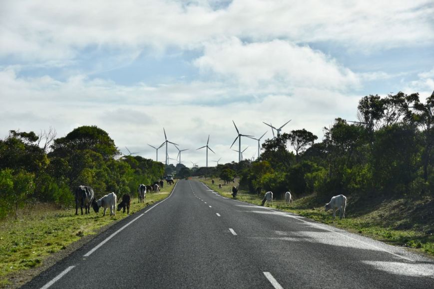
After leaving the Tantanoola Caves Conservation Park we headed to the nearby town of Tantanoola, intending to visit the historic Tantanoola Pub. But we were a little too early for lunch as it was only 11.30 a.m. In fact as we pulled up in Tantanoola, they were only just opening up the hotel. So we decided to do the Woakwine Range WInd Farm tourist drive.
We travelled out of town along the Poonada Road and then onto the Canunda Frontage Road. We were soon amongst the wind turbines in the largest wind farm in the Southern Hemisphere. When fully operational, the 123 spectacular turbines at Canunda and Lake Bonney wind farm development will generate almost 300 megawatts which represents the equivalent of one eighth of South Australia’s energy needs. The turbines are about 100 metres tall.
Above:- Marija standing in front of the wind turbines, giving you a good idea of just how big they are.
As we headed out along the Canunda Frontage Road we encountered some other road users (see below).
Above:- Some of the other road users
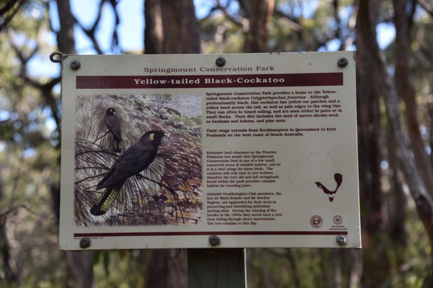
A little further along we spotted a flock of Yellow Tailed Black Cockatoos. They are a large cockatoo which has a yellow cheek patch and yellow panels on the tail. In South Australia they are listed as being vulnerable.
As we drove along Canunda Frontage Road we enjoyed some great views of Lake Bonney S.E. This is not to be confused with Lake Bonney in the Riverland region of South Australia. Lake Bonney S.E. is a coastal freshwater lake. With a surface area of 5,056 square kilometres, Lake Bonney S.E. is one of the largest freshwater lakes in Australia.
As we drove along the Canunda Frontage Road we decided to activate the Canunda National Park 5NP-002 & VKFF-0075. I had activated and qualified this park previously, so our intention was to get the park qualified for Marija and then head back into Tantanoola to the hotel.
Above:- Map showing the location of the Canunda National Park. Map courtesy of Location SA Map Viewer.
We turned off the Canunda Frontage Road and onto the Canunda Causeway and soon reached the park boundary. We continued through the park along the Oil Rig Square Road. A short distance later we reached the coastline.
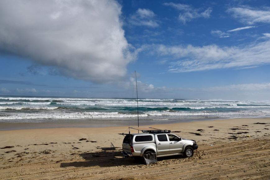
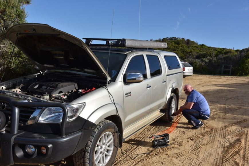
It was here that we made the decision to head down onto the beach as it was quite a nice afternoon. We lowered the tyre pressure down to around 12 psi and then drove through the dunes down onto the beach.
We drove about 1km along the beach and pulled off the trail made by other 4WDers and rolled out the awning of the Toyota Hi Lux. Once down on the beach I realised that we were also within the Lower South East Marine Park.
Above:- Our operating spot. A beautiful view.
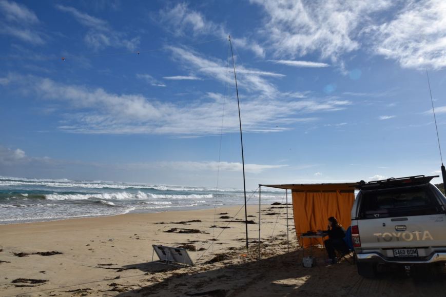
Unfortunately I had no internet coverage so I was unable to self spot on parksnpeaks and/or Facebook, and I was unable to look up the VKFF number for the Marine Park. So Marija put out some CQ calls on 7.135 and these were answered by Adrian VK5FANA. Adrian kindly looked up the VKFF reference for us for the Marine Park and also spotted us. I cannot encourage enough, that hunters spot activators. Not only does it greatly assist the activators, but it also helps your fellow park hunters.
As a result of Adrian’s spot, Marija soon had a number of amateurs giving her a shout. Within 9 minutes Marija had qualified the park for the VKFF program, with 10 contacts in the log. QSO number 10 was with Charlie VK3FCIA.
Marija logged a total of 23 stations including three Park to Park QSOS:
Stef VK5HSX/3 – Croajingolong National Park VKFF-0119
Andrew VK7DW/p – Trevallyn Nature Recreation Area VKFF-1156
Mark Vk4SMA/p – Samford Conservation Park VKFF-1639
It was an amazing day for this time of the year down in the South East. It is normally cold and raining. But today we were blessed with quite a bit of sunshine. It was a beautiful spot, with the sound of the waves rolling in. Occasionally we had some trailbikes and other 4WDers travelling passed us.
Other than that the only onlookers were some of the local birds (of the feathered variety).
Marija worked the following stations on 40m SSB:-
VK5FANA
VK3AZN
VK4VXX/5
VK3HOT
VK2HHA
VK3MIJ
VK3SQ
VK3ER
VK5HSX/3 (Croajingolong National Park VKFF-0119)
VK7FCIA
Vk2RP/m
VK2BDR/m
VK5TT
VK3ELH
VK2NP
VK3UH
VK3ANL
VK2VW
VK3PF
VK3IRS
VK2LEE
VK7DW/p (Trevallyn Nature Recreation Area VKFF-1156)
VK4SMA/p (Samford Conservation Park VKFF-1639)
After Marija had qualified Canunda for the VKFF program, I jumped on the mic to activate the Lower South East Marine Park VKFF-1725. The Lower South East Marine Park is divided into two sections: the first adjacent to Canunda National Park and the second from MacDonnell Bay just west of French Point to the Victorian border. At 360 km2, it represents 1% of South Australia’s marine parks network.
Above:- Map showing the two sections of the Lower South East Marine Park. Image courtesy of DEWNR.
First in the log for me were two Park to Park contacts, with Mark VK4SMA/p and Ade VK4SOE/p who were activating the Samford Conservation Park VKFF-1639. As this was a new park there was quite a flurry of activity at the commencement of the activation. But this slowed down quite quickly, and with 37 contacts in the log on 40m, callers dried up. I was 7 short of qualifying the park for the global WWFF program.
The 37 contacts were spread across VK2, VK3, VK4, VK5 and VK7. Other than the Park to Park contacts with Mark and Ade, I had made the following Park to Park QSOS.
Alan VK2MG/p -Wyrrabalong National Park VKFF-0550
Andrew VK7DW/p – Trevallyn Nature Recreation Area VKFF-1156
I also logged Graham VK3SOL/p operating portable at the Echuca Moama Steam Rally.
I then headed to 3.610 on the 80m band where I called CQ. This was answered by Adrian VK5FANA, followed by Ivan VK5HS/mobile and then Andy VK5LA/mobile. I logged a further 5 stations, all from Victoria. Peter VK3ZPF was contact number 44.
To complete the activation I QSY’d to the 20m band where I found Mike VK6MB/8 in the Uluru-Kata Tjuta National Park VKFF-0505. Mike had a brilliant 5/9 signal down to the beach from his iconic location in the Northern Territory. I then moved up to 14.315 and worked Hans VK6XN. Sadly Hans was my only caller.
I worked the following stations on 40m SSB:-
VK4SMA/p (Samford Conservation Park VKFF-1639)
VK4SOE/p (Samford Conservation Park VKFF-1639)
VK5FANA
VK2RP/m
VK2BDR/m
VK5LA/m
VK5HS/m
VK2HPN/1
VK3ELH
VK2MG/p (Wyrrabalong National Park VKFF-0550)
VK3SOL/p
VK2LEE
VK3NXT
VK2NP
VK2HHA
VK3SQ
VK3PF
VK3ZPF
VK4TJ
VK4CPS
VK2IO/m
VK3TKK/m
VK7DW/p (Trevallyn Nature Recreation Area VKFF-1156)
VK7FGRA
VK3MAB
VK5TT
VK4VXX/5
VK3ER
VK2QK
VK5PL
VK3ARH
VK3AHR
VK7CC
VK3ANL
VK2VW
VK7ME
VK3KAI
I worked the following stations on 80m SSB:-
VK5FANA
VK5HS/m
VK5LA/m
VK3PF
VK3KAI
VK3ARH
VK3ZPF
VK3SQ
I worked the following stations on 20m SSB:-
VK6MB/8 (Uluru-Kata Tjuta National Park VKFF-0505)
VK6XN
It was now coming up to 2.15 p.m. and time for us to pack up. Marija had qualified Canunda for VKFF and I had qualified the Marine park for VKFF and WWFF. We drove back down the beach and up the sand dunes, where we got the air pressure generator out and put the tyres back up to their correct psi.
We drove back into Tantanoola and called into the Tantanoola Pub for a few drinks. The hotel is well known for having the ‘Tantanoola Tiger’ on display. During the late 1800’s it is reported that a Bengal tiger escaped from a travelling circus. Soon after, locals started reporting missing sheep and cattle, but despite extensive searches, no animal was found. And then in August 1895, a local man, Thomas Donovan shot an animal believed to the the tiger. However it appears that it was not the tiger, but most likely a Eurasian wolf.
We drove back to Mount Gambier and had a shower and then headed to Jens Hotel for dinner. We had an arranged dinner with a group incuding Rob VK4AAC and his wife Doris, John VK5NJ and his wife Tanina, Joe VK3YSP and his wife Julie VK3FOWL, Ross from Strictly Ham and his son. This was a great night with lots of laughs.
It was now day two (Saturday 9th June 2018) of our trip to the south east of South Australia. Despite it being a very chilly morning, Marija and I were very pleased to see some blue sky outside. The weather forecasters had predicted some wet weather, but there appeared to be no sign of that at Mount Gambier.
We hit the road quite early and headed Subway in Mount Gambier for a coffee and an egg and bacon roll. We then headed out to the historic Glencoe Woolshed, about 25 km north west of Mount Gambier.
We picked up the key and paid a small fee at the local Glencoe General Store.
The Glencoe district was first settled in 1844, just 8 years after the colonisation of South Australia. Edward and Robert Leake established a sheep shearing station and had named the property after Glen Coe in Scotland. The Leake holdings comprised about 90,000 acres stretching from Mount Muirhead near Millicent encompassing the Mount Gambier region to the Penola Road.
The Leake brothers were originally from Rosedale in Tasmania and then moved to South Australia, bringing with them Saxon Merino sheep. In around 1857 they built a two storey home, calling it Frontier House. Sadly this building has now been demolished. However the two storied coach house, stables, and groom’s quarters are still standing.
One of the brothers, Robert, died in 1860. This left Edward to manage the property on his own. When his flock of sheep reached 50,000, he decided that a good shearing shed was required. In 1863 the Glencoe Woolshed was constructed.
The shearing shed has hand adzed, cathedral like arched blackwood beams with supporting posts of pit sawn blackwood. The roof timbers were laid on the ground and marked with Roman numerals to assist in their assembly. The roman numerals are still clearly visible today.
Glencoe is unique in that it was never converted to a mechanised shearing. At its peak there were about 38 shearers at Glencoe, as well as roust-a-bouts, wool classers and shed hands. The most sheep shorn in one year at Glencoe is 53,000. A total of 2,000 sheep were shorn in that year, with an extra 100 men employed.
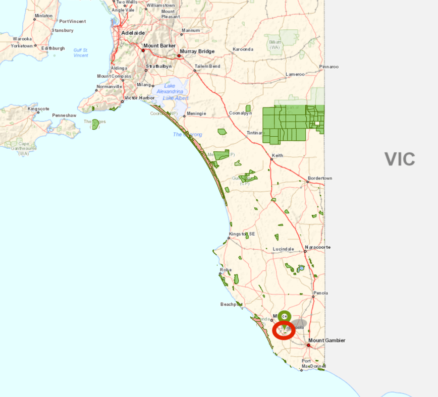
We then left Glencoe and headed to the Tantanoola Caves Conservation Park 5CP-225 & VKFF-0804. The park is situated about 36 km north west of Mount Gambier and about 434 km south east of Adelaide.
Above:- Map showing the location of the Tantanoola Caves Conservation Park. Image courtesy of Location SA Map Viewer.
The Tantanoola Caves Conservation Park is about 14 hectares in size and features the Tantanoola Cave, a dolomite cavern which contains spectacular stalactites and helictites. The park is one of South Australia’s oldest reserves. It was first dedicated in 1930 and was the first in Australia to provide wheelchair access to a show cave. The park also contains the Up-and-Down Rocks, a stranded marine cliff which towers over the Princes Highway which runs passed the park.
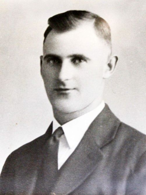
The park was discovered in 1930 by Boyce Lane, a 16 year old boy who was out rabbit hunting with his pet ferret in an area known as Hanging Rocks. Boyce’s ferret disappeared down a small hole in the cliffs whilst chasing a rabbit and would not come back out of the hole. Boyce returned to his nearby home to collect a torch and notify his brother. They returned and climbed through the small hole and then shined their torches around to discover the cave.
Above:- Boyce Lane, aged 21. Image courtesy of ABC
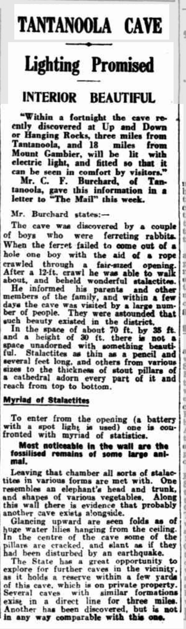
The two boys shared their discovery with their father George Lane, and later that day a group of men returned later that day to investigate. It did not take long for news of the discovery of the cabe to spread throughout the local community. The Lane family then opened up the cave to the public. The entrance to the cave was only. The Lane family later increased the size of the opening and hand rails and electric lighting were used to make the cave more accessible for visitors.
Above:- Article from The Mail, Adelaide, Sat 12 April 1930. Courtesy of Trove
Sadly, by the 1980’s, Occupational Health and Safety had taken hold and due to safety issues the cave was declared as unsafe and was closed. The cave was subsequently taken over by Parks Australia and was reopened in 1983.
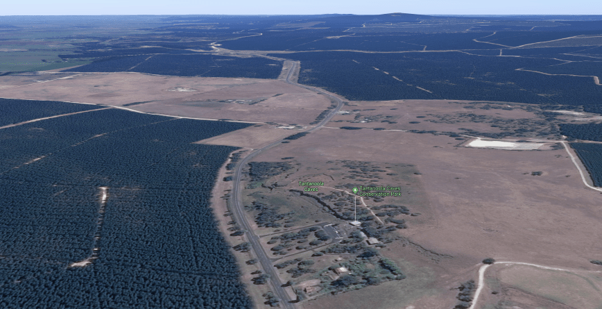
Above:- Aerial view of the Tantanoola Caves Conservation Park and the surrounding countryside. Image courtesy of google maps
The name Tantanoola is derived from the aboriginal word ‘tentunola’ which means boxwood/brushwood hill of camp. The town of Tantanoola is situated a few kms to the north west of the park. Tantanoola was originally named ‘Lucieton’ by Governor Jervois after his daughter Lucy Caroline, on 10th July 1879. It was changed by Governor Robinson to ‘Tantanoola’ on 4th October 1888.
Above:- Aerial view showing the location of the park to the east of the town of Tantanoola. Image courtesy of Location SA Map Viewer.
We had arrived at the caves just at the start of a tour, so we had a look through the small but very interesting visitor centre.
We then did the Clifftop Look walk which offers some terrific views of the surrounding countryside, including the nearby Lake Bonney and Woakwine Range wind farms.
The original entrance to cave is visible above the current day entrance.
After our walk we joined the tour guide who explained the history of the park and then took us inside the cave which is truly quite spectacular. The cave measures 25 metres by 18 metres and is 8 metres in height. It is believed the age of the cave is more than 300,000 years.
Numerous fossil remains have been located in the park including bryozoa, brachopods, molluscs, shark teeth and extinct megafauna Zygomaturus trilobus and sthenurine kangaroos, and fossils of an unidentified seal.
Moisture in the cave.
Once we completed the tour we returned back to the vehicle where Marija quickly activated the park for the World Wide Flora Fauna (WWFF) program. As we were activating from the car, the activation would not count for the VK5 National & Conservation Parks Award.
I spotted Marija on parksnpeaks whilst she called CQ on 7.139. First in the log was Adrian VK5FANA on the Yorke Peninsula. Within 10 minutes Marija had contact number 10 in the log, with a QSO with Rod VK7FRJG in Tasmania. Marija had qualified the park for VKFF and it was time for us to hit the road for our next stop for the day.
After packing up at the Aberdour Conservation Park, Marija and I continued south on the Riddoch Highway. As it was only just after lunch, and the weather was holding up nicely, we decided to activate the Desert Camp Conservation Reserve VKFF-1705. The park is located about 235 km south east of Adelaide and about 17 km north west of the town of Padthaway.
This was to be a unique park for both Marija and I as activators in the WWFF program.
Above:- Map showing the location of the Desert Camp Conservation Reserve in the south east region of South Australia. Map courtesy of Location SA Map Viewer.
The Desert Camp Conservation Reserve is not to be confused the with Desert Camp Conservation Park. The reserve is the much larger piece of scrub located on the eastern side of the Riddoch Highway. The Desert Camp Conservation Park is a small section of Scrub to the east of the Riddoch Highway, on the Rowney Road West.
Desert Camp Conservation Reserve is 882 hectares in size and was proclaimed on the 11th November 1993. I have not been able to find out the origin of the park name, as there is certainly no desert here.
Above:- Aerial view of the Desert Camp Conservation Reserve. Image courtesy of google maps
About 248 species of native plants have been recorded in the park. Of these, 17 are considered rare or threatened in the south east, and 10 are either threatened or rare in South Australia. One species, the Metalic sun-orchid is considered endangered nationally.
The park comprises Brown stringybark Low Woodland; Pink gum Woodland over a Mixed Heath; Pink gum Low Woodland over a desert banksia, heath yacca and heath tree; Open South Australian Blue Gum; Dwarf hakea, dwarf sheoak, honey myrtle; Coastal white mallee; Broombush, silver broombush Open Heath; and Mixed Herbland.
The reserve is recorded as being “the largest block of remnant vegetation in the Hundred of Marcollat” and which “accounts for over half of the remaining native vegetation in blocks greater than 25 hectares in that Hundred.” It is surrounded by cleared farming land.
Above:- Cleared farming land to the east of the park.
Birds SA have recorded a total of 93 native birds in the park including Peaceful Dove, Galah, Australian Magpie, Superb Fairywren, New Holland Honeyeater, Red Wattlebird, Buff-rumped Thornbill, Southern Emuwren, Grey Butcherbird, White-winged Triller, and Eastern Yellow Robin.
I snapped the photo below of a Whistling Kite, which was perched up high in a tree in the park. He/she kindly sat there allowing me to snap off some shots.
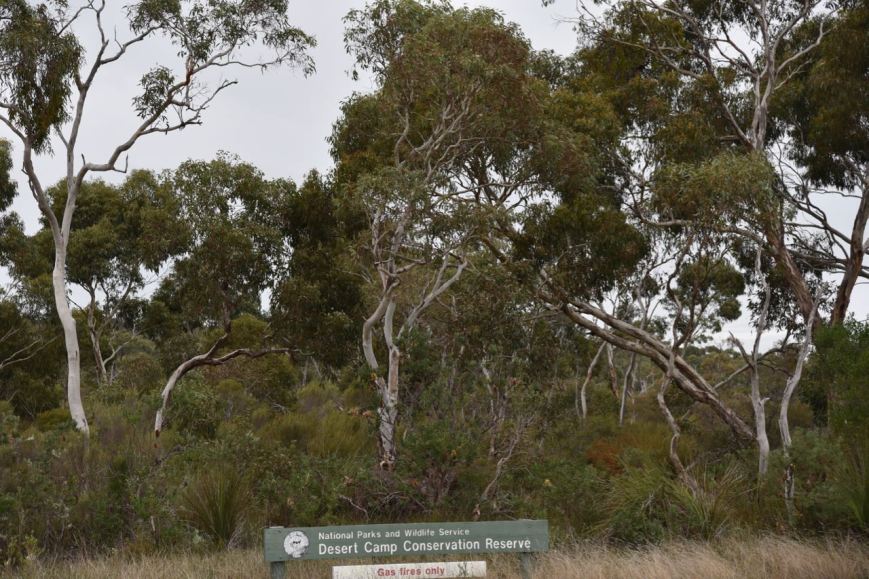
The park is easily located, just to the south of the intersection of the Riddoch Highway and Rowney Road. The park is well signposted.
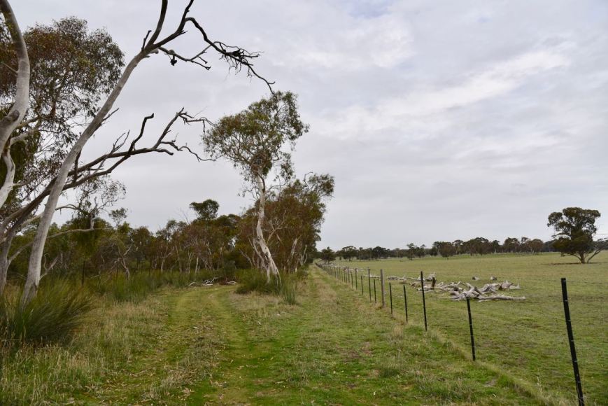
We continued south on Riddoch Highway, passing Rowney Road and followed a 4WD track into the park, which followed a fenceline.
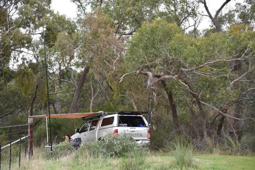
We drove a few hundred metres along the track and found a clearing which allowed us to set up the 20/40/80m linked dipole. As the weather was a little inclement, we rolled out the awning on the Toyota Hi Lux and sat underneath that in the deck chairs.
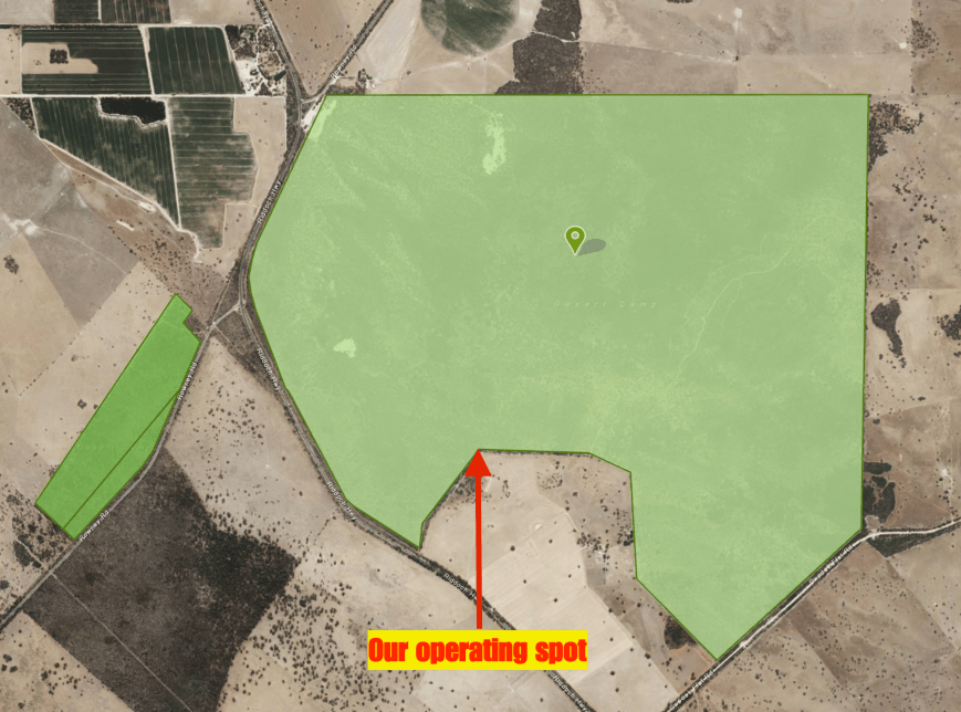
Above:- Aerial view showing the Desert Camp Conservaiton Reserve, showing our operating spot. The dark green area is the adjacent Desert Camp Conservation Park. Image courtesy of Location SA Map Viewer.
Marija started off the activation, calling CQ on 7.139 after I had placed a spot up on the WWFF Australia Facebook page and on parksnpeaks. Gerard VK2IO/p was first in the log, with a Park to Park contact into the Booti Booti National Park VKFF-0046. Next in the log was Brett VK2VW, followed by John VK4TJ. Within 10 minutes Marija had qualified the park for VKFF, with 10 contacts in the log. Contact number 10 was with Greg VK4VXX/5.
We then swapped the mic and I called CQ on 7.139. Peter VK3PF was first in the log, followed by Cliff VK2NP and then Andrew VK7DW. Six minutes later I had contact number 10 in the log, with a QSO with Glenn VK4FARR. After working Glenn, both Marija and I logged Neil VK4HNS/p who was activating the Conway National Park VKFF-0110. This was followed by another Park to Park contact, this time with David VK5HYZ/p in the Ikara-Flinders Ranges National Park VKFF-0176.
I kept calling CQ on 7.139 and had a steady flow of callers from all across Australia. This included another Park to Park, this time with Bill VK4FW/p in the Goat Island Conservation Park VKFF-1549. I ended up logging a total of 52 stations on 40m from VK1, VK2, VK3, VK4, VK5, VK7 and New Zealand. It was nice as always to log Andre ZL1TM who has become a regular VKFF Hunter. I was also pleased to work Geoff VK3MCM who had only been on air for around 2 weeks and I was his 4th contact. Welcome to the hobby Geoff.
We then lowered the squid pole and inserted the 80m links and headed to 3.610. I called CQ and this was answered by Rob VK3FKL who had followed me down from 40m. Conditions on 80m were brilliant, with absolutely no noise. I logged 11 stations on 80m from VK2, VK3, VK5 and VK7.
To complete the activation I called CQ on 14.310 on the 20m band, but sadly only logged 1 station there, Cliff VK2NP.
It was time to pack up and head off to Mount Gambier. Desert Camp was another successful activation, with a total of 76 contacts between the 2 of us, including 7 Park to Park contacts.
Marija worked the following stations on 40m SSB:-
VK2IO/p (Booti Booti National Park VKFF-0046)
VK2VW
VK4TJ
VK3SQ
VK3HOT
VK4CZ
VK3PF
VK7DW
VK2KYO
VK4VXX/5
VK4HNS/p (Conway National Park VKFF-0110)
VK5HYZ/p (VKFF-0176)
I worked the following stations on 40m SSB:-
VK2IO/p (Booti Booti National Park VKFF-0046)
VK3PF
VK2NP
VK7DW
VK4CZ
VK2KYO
VK4VXX/5
VK7ME
VK3SQ
VK4FARR
VK4HNS/p (Conway National Park VKFF-0110)
VK5HYZ/p (Ikara-Flinders Ranges National Park VKFF-0176)
VK2FOUZ
VK3GGG/p
VK3PMG/p
VK3ANL
VK2HHA
VK2STO/p
VK2SMS/p
VK3OHM
VK2GKA
VK3FKAR
VK3FNQS
VK3VHF
VK3VFO
VK4FE
VK3MCM
VK3ZZS/7
VK2QK
VK4FW/p (Goat Island Conservation Park VKFF-1549)
VK4FDJL
VK2ARL
VK2VOO
VK5WG
VK2WE
VK3ANP
VK3ATO
VK5KLV
VK1AT
VK3ZIG/m
VK7FRJG
VK3FLJD
VK2LEE
VK3ZMD
VK5CZ
VK4TJ
VK2WR
VK2KDP/m
VK3FKL
VK7TZ
ZL1TM
I worked the following stations on 80m SSB:-
VK3FKL
VK5MRE
VK5PL
VK4AAC/5
VK3SQ
VK3PF
VK5CZ
VK7TZ
VK3PAT
VK2HHA
VK5BJE
I worked the following station on 20m SSB:-
VK2NP
We had missed the predicted wet weather, but that did not last. We had timed our activations well, as not long after getting mobile, the heavens really opened up. We arrived at Mount Gambier at around 5.00 p.m. and booked into our accomodation, the Motel Mount Gambier. After freshening up we headed out for tea at the Mount Gambier Hotel.
Last Friday (8th June 2018) Marija VK5FMAZ and I had an early start from home, heading to the south east of South Australia. Our intended destination was Mount Gambier, to attend the South East Radio Group’s annual convention.
Marija and I had hoped to activate some parks over the weekend, but had not made any firm plans and had not added any alerts on parksnpeaks, as we were not sure what the weather was going to do.
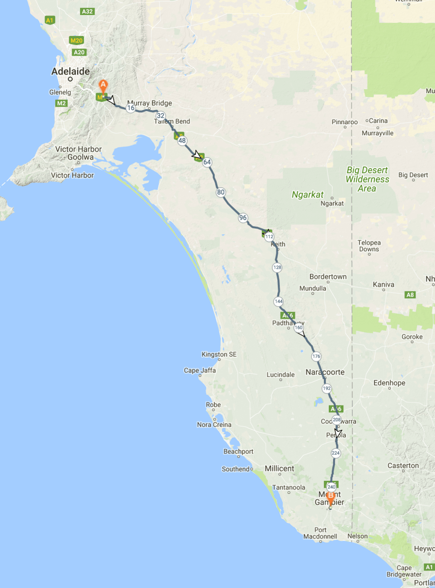
We left home at around 8.30 a.m. and had a 400 km drive ahead of us, taking us through the Murray Mallee and on to the beautiful Coonawarra wine growing region.
Above:- Map showing our route to Mount Gambier. Map courtesy of Plot a route.
Our first stop was the little town of Cookes Plains. Don’t blink as you will miss it. There isn’t much here, but I had never detoured off the highway into Cookes Plains previously, so we decided to have a sneak peak. It was named after pastoralists James and Archie Cooke and was originally a private subdivision. Cooke Plains boundaries now also include the former government town of Bedford which was surveyed in August 1871 and declared ceased to exist on 28 April 1960.
There is a beautiful old hall in Cookes Plains, along with a monument to commemorate the construction of the first patented concrete filled railway wheel stone roller, used to break down rough limestone ground into arable cropping land.
We then stopped off at our usual coffee stop, the Coonalpyn Silo Cafe. I enjoyed a hot cup of coffee and an egg and bacon roll. We were soon on the road again, travelling through Culburra, Tintinara and on to Keith. We then turned off the Dukes Highway, onto the Riddoch Highway. The highway is named after John Riddoch, the first white settler landholder and vigneron in Coonawarra.
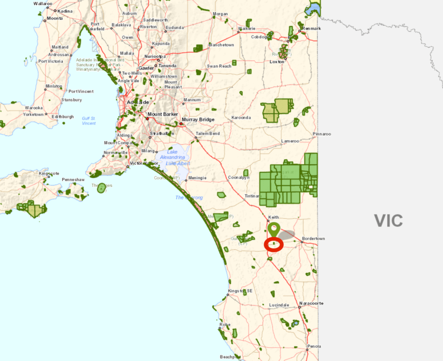
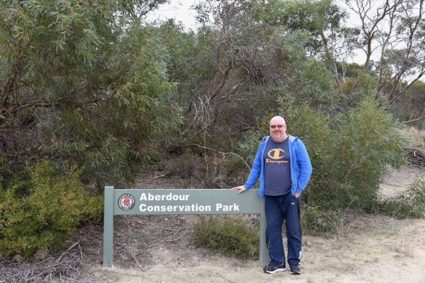
As we drove south we decided to activate the Aberdour Conservation Park VKFF-0994 which is situated about 35 km south of Keith, on the corner of Cannawigara Road and Nankivell Road.
Above:- Map showing the location of the Aberdour Conservation Park. Map courtesy of Location SA Map Viewer.
I had activated the Aberdour Conservation Park back in June 2016 but had to cut the activation short because of poor weather, and had only got 28 contacts in the log. So although having qualified the park for VKFF, I was 16 QSOs short of the required 44 to qualify the park for the global WWFF program. So I was hoping to pick up those during this activation to qualify the park.
Aberdour Conservation Park is about 145 hectares in size and comprised Hundred of Willalooka, Sections 7 and 80. Section 7 comprises 131 hectares of native bush. While the southern section of the park, Section 80 comprises 14 hectares of native bush.
The park name is derived from Aberdour Homestead which is located to the west of the conservation park on the east side of the Riddoch Highway.
The park is dominated by three main landforms: Coastal Mallee; Yellow Mallee; and Pink Gum. The endangered Jumping Jack Wattle can be found in the park.
The Nankivell family made a gift of 131 hectares and this was proclaimed as a park on the 28th February 1991. The remaining 14 hectares was added on 16th February 2006. This smaller section was previously a Stone Reserve under the control of the Tatiara District Council.
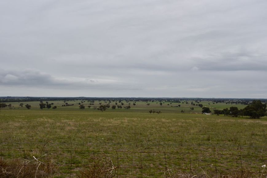
There has been extensive clearing of the land surrounding the park for farming purposes. The park preserves an area of remnant vegetation typical of undulating dune and limestone country.
Above:- Cleared farming land on the western side of the park.
Birds SA have recorded a total of 7 native species of bird in the park including Galah, Red-rumped Parrot, Superb Fairywren, New Holland Honeyeater, Red Wattlebird, Purple-gaped Honeyeater, Cockatiel, Purple-backed Fairywren, Yellow-faced Honeyeater, Striated Thornbill, and Black-faced Cuckooshrike.
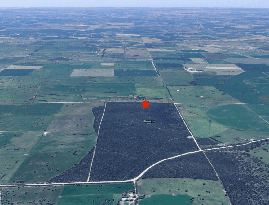
Above:- Aerial shot showing the Aberdour Conservation Park. The red star indicates our operating spot. Image courtesy of google maps
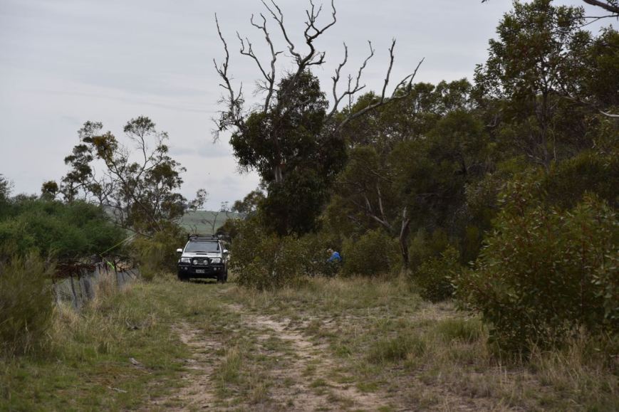
Marija and I drove down Cannawigara Road from the Riddoch Highway and we soon reached the south western corner of the park. There is a park sign at this location and a 4WD track which travels south-north, following the western boundary of the park.
Above:- at the south western corner of the park.
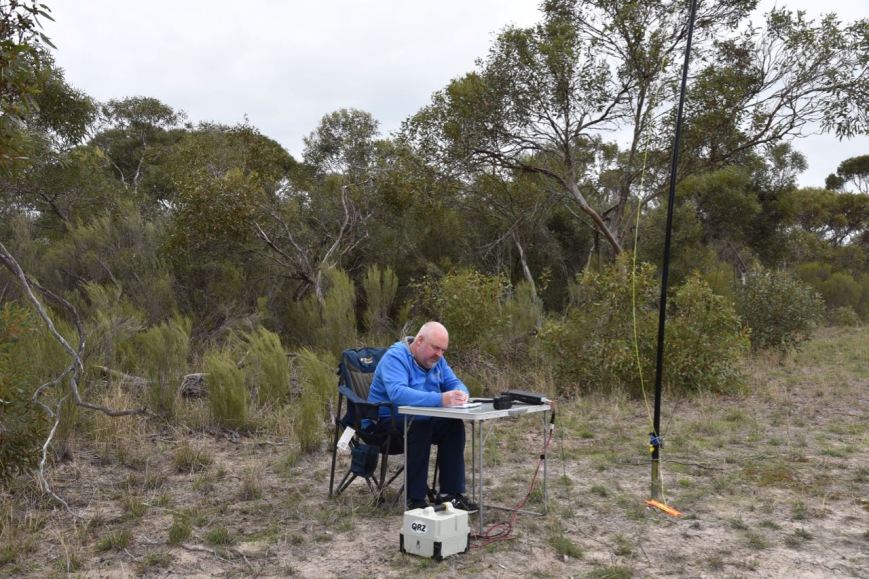
We continued along Cannawigara Road and then turned left onto Nankivell Road following the eastern boundary of the park. We then turned left onto the 4WD track which follows the northern boundary of the park, and found a clearing and set up there. We ran the Yaesu FT-857d and the 20/40/80m linked dipole for this activation.
Above:- Aerial shot of the park showing our operating spot in the northern section of the park. Image courtesy of Location SA Map Viewer.
I kicked off the activation by calling CQ on 7.144 which was answered by Brett VK2VW who kindly spotted me on parksnpeaks. Within 13 minutes I had 10 contacts in the log, with contact number 10 being Peter VK3PF.
I logged a total of 28 contacts on 40m before Marija and I decided to try 80m. Band conditions on 40m had been quite good, with contacts logged from VK1, VK2, VK3, VK4, and VK7. Clearly there was no close in propagation, with no South Australian stations logged.
I logged 4 stations on 3.610 on 80m, from VK2 and VK3. This included a Park to Park contact with Gerard VK2IO/p on SOTA peak VK2/ MN-216 in the Booti Booti National Park VKFF-0046.
Marija then jumped into the operators seat and logged 5 stations on 80m including a Park to Park with Gerard VK2IO/p. Despite conditions being quite good on 80m and some self spots on parksnpeaks we had no further callers on 80m.
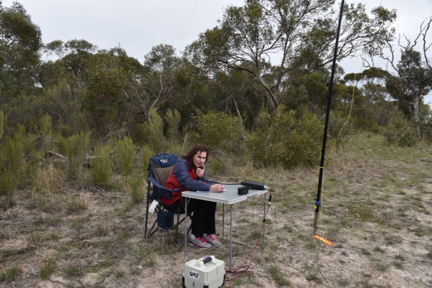
We then headed back to 40m where Marija called CQ on 7.144, logging 5 stations from VK2, VK3, VK5 & VK7. Marija had now qualified the park for the VKFF program, with contact number 10 being with Jonathan VK7JON.
I then put out some calls on 14.310 on the 20m band, which was answered by Scott VK4CZ, and then Gerard VK2IO/p for another Park to Park. But they were my only 2 callers.
It was now approaching 12.15 p.m. and we still had a way to go to get to Mount Gambier, so we packed up and hit the road once again.
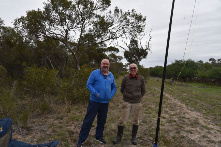
We had a little surprise during the activation, with a visit from Alan VK5ZLT, who it turns out owns the land on the northern side of the park. Alan had said he had heard someone calling CQ and had followed our voices from his property to our operating spot.
Above:- with Alan VK5ZLT
Marija worked the following stations on 40m SSB:-
VK3UH
VK2VW
VK5FANA
VK2HHA
VK7JON
Marija worked the following stations on 80m SSB:-
VK2IO/p (SOTA VK2/ MN-216 & Booti Booti National Park VKFF-0046)
VK3GGG/p
VK3PMG/p
VK5GJ
VK3SQ
I worked the following stations on 40m SSB:-
VK2VW
VK4CZ
VK2XSE/m
VK2KNV/m
VK7JON
VK2LEE
VK2HHA
VK7OT
VK1AT
VK3PF
VK2PKT
VK3ANL
VK1FTRK
VK4TJ
VK4/AC8WN
VK4/VE6XT
VK3ARH
VK7FGRA
VK4FE
Vk2VK
VK2ZVG
VK4KX
VK4UMS
VK3SQ
VK2MTC
VK3CM
VK2RP/m
VK2BDR/m
I worked the following stations on 80m SSB:-
VK3GGG/p
VK3PMG/p
VK3SQ
VK2IO/p (SOTA VK2/ MN-216 & Booti Booti National Park VKFF-0046)
I worked the following stations on 20m SSB:-
VK4CZ
VK2IO/p (SOTA VK2/ MN-216 & Booti Booti National Park VKFF-0046)
Saturday just gone (2nd June 2018) was another lovely day for this time of the year. So I packed the 4WD and headed down to the Fleurieu Peninsula south of Adelaide, hoping to activate the Gum Tree Gully Conservation Park. I have never activated this park previously and have tried to access it previously without success. And I was to be disappointed again this time around. I drove down Hammond Road and spoke with one of the land owners and I found that access gates to the park from this road was now locked. I obtained the actual farmers name and tried to make contact them without success. So there is more work to be done before I can get into this park.
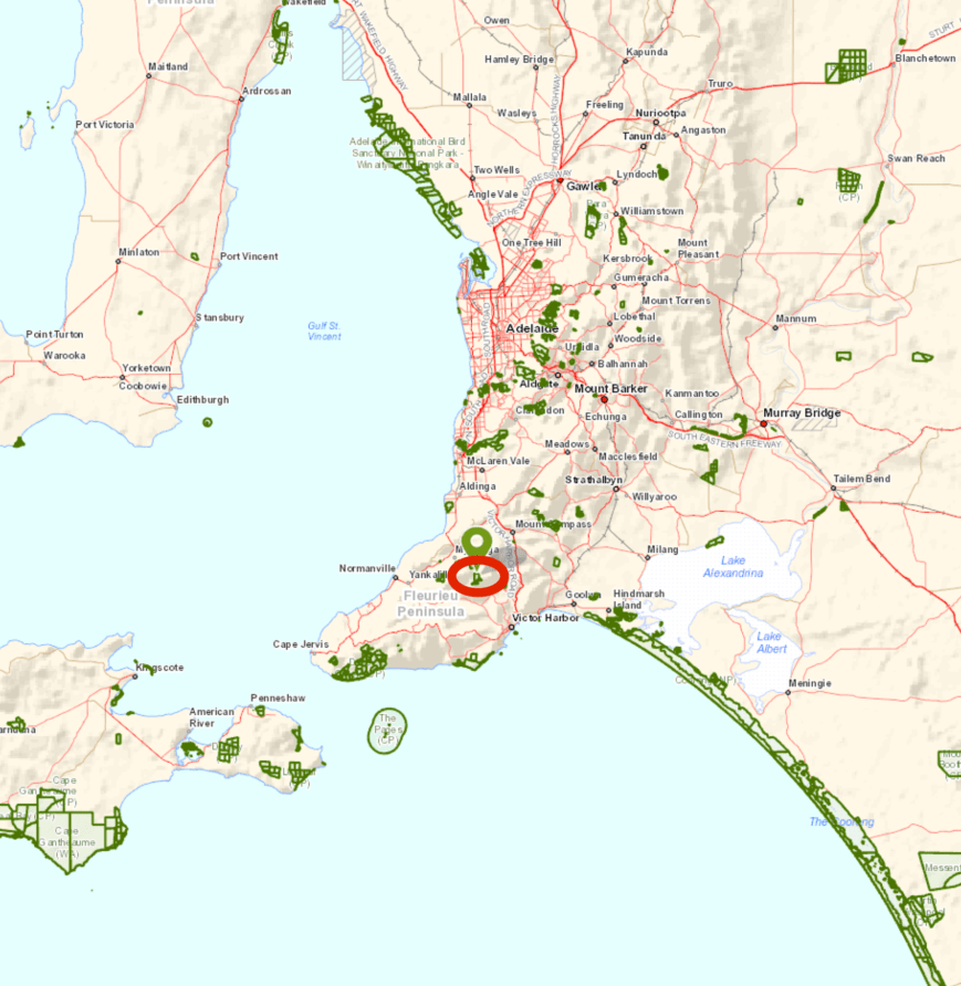
So option number two was the Spring Mount Conservation Park 5CP-219 & VKFF-0789. I have activated this park previously, but it is such a beautiful park I decided to head back there.
Above:- Map showing the location of the Spring Mount Conservation Park. Map courtesy of Location SA Map Viewer.
The Spring Mount Conservation Park is 279 hectares in size and is located about 15 km south east of the town of Myponga. Sections 633 and 715 of the park were first proclaimed on the 3rd February 1966 as Spring Mount Wild-Life Reserve. The reserve was re-proclaimed on 27th April 1972 as Spring Mount Conservation Park. Additions were made to the park on 13th September 1973 and 17th October 2013.
The park is mostly Open Forest of Brown Stringybark and Messmate Stringybark with understorey plants including Myrtle Wattle, Beaked Hakea, and Yacca.
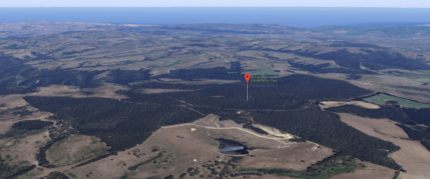
Above:- Aerial view of the Spring Mount Conservation Park, looking west. Image courtesy of google maps.
Birds SA have recorded a total of 90 species of native bird in the park including Adelaide Rosella, White-throated Treecreeper, Yellow-tailed Black cockatoo, Superb Fairywren, Crescent Honeyeater, Grey Shrikethrush, Grey Fantail, Scarlet Robin, Brush Bronzewing, Sacred Kingfisher, Yellow-faced Honeyeater, Buff-rumped Thornbill, Bassian Thrush, and Beautiful Firetail.
Each time I visit the park I always see a lot of Western Grey kangaroos. And I wasn’t disappointed on this visit. They were in abundance.
I drove along Mount Alma Road and enjoyed some great views of the surrounding countryside.
Above:- Typical Fleurieu Peninsula countryside.
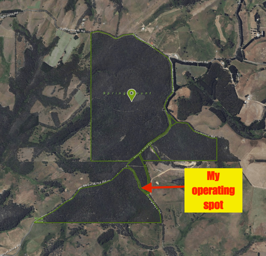
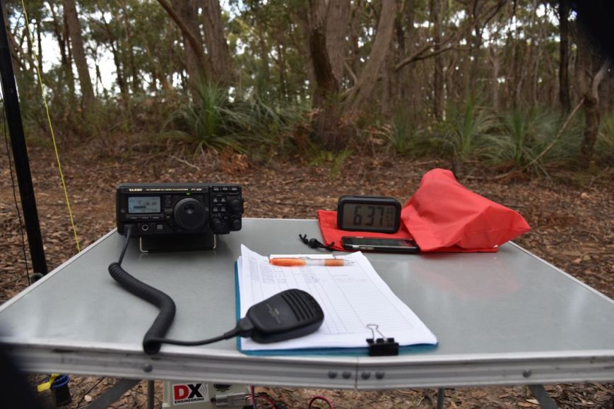
I then along Strangways Road and set up along a walking track at gate 10. I ran the Yaesu FT-897, 40 watts, and the 20/40/80m linked dipole and the 1/2 wave 15m dipole for this activation.
Above:- Aerial view of the park showing my operating spot. Image courtesy of Location SA Map Viewer.
My first contact was a Park to Park contact, with a QSO with Rob VK4AAC/3 in the Buckley Nature Conservation Reserve VKFF-2054. Rob was calling CQ on 7.144. I then moved down the band to 7130 and started calling CQ. Phil VK3MB came back to my CQ call, followed by Shaun VK3VLY/p and then Gerard VK2IO. The 40m band was in quite good condition and I had a steady flow of callers. Contact number 12 was Peter VK3PF/p who was activating SOTA summit VK3/ VE-168. Contact number 32 was with Mike VK4DX/p activating IOTA OC-137.
I logged a total of 36 stations before I headed to the 80m band, hoping to get some of the local South Australian amateurs in the log. My wife Marija VK5FMAZ had sent me an SMS message telling me she was listening on 40m but was unable to hear me.
First in the log on 80m was Adrian VK5FANA who was 5/9 plus. Adrian gave me a 5/9 plus 30 signal report. Next up was Marija VK5FMAZ and then Greg VK5GJ who was running QRP. Rob VK4AAC/3 then called in for another Park to Park from the Buckley Nature Conservation Reserve. My fifth and final caller on 80m was Peter VK3ZPF.
Above:- my shack for the afternoon
I then headed to the 20m band and found John VK6NU/p calling CQ from SOTA peak VK6/ SW-042. John was a strong 5/8 signal and he reciprocated with a 5/8 for me. I headed up to 14.315 and called CQ, and called CQ, and called CQ. But sadly no takers. This was a little disappointing as the band was definitely open to Western Australia.
I then lowered down the squid pole and put up the 1/2 wave 15m dipole and started calling CQ on 21.245, but sadly I had no takers. So I tuned across the band and found Ken JA2GPR calling CQ. Ken was 5/8 and gave me a 5/6 signal report.
I then headed back to 40m and logged a further 10 stations from VK2, VK3, VK4, VK7 and New Zealand. Regular park hunter Andrei ZL1TM made it into my log once again. I was also called by Gar ZL3SV who was a super strong signal. Gary advised I was peaking 20/9 to Nelson on the top of the South Island of New Zealand. But, that was all due to Gary’s antenna, a 2,000 foot long (640 metre) centre feed sloper.
Above:- View of my operating position on the edge of the walking track
To finish off the activation I headed back to 80m as I had seen a spot pop up for Peter VK3PF/p who was on 3.615 activating SOTA peak VK3/ VE-163. After logging Peter I moved down to 3.610 and logged a further 6 stations from VK2, VK3, and VK5.
It was time to pack up and make the 1 hour journey back home. I had a total of 60 contacts in the log. It was slow going on the way home as the sun was just starting to set and as a result the roos were out in great numbers.
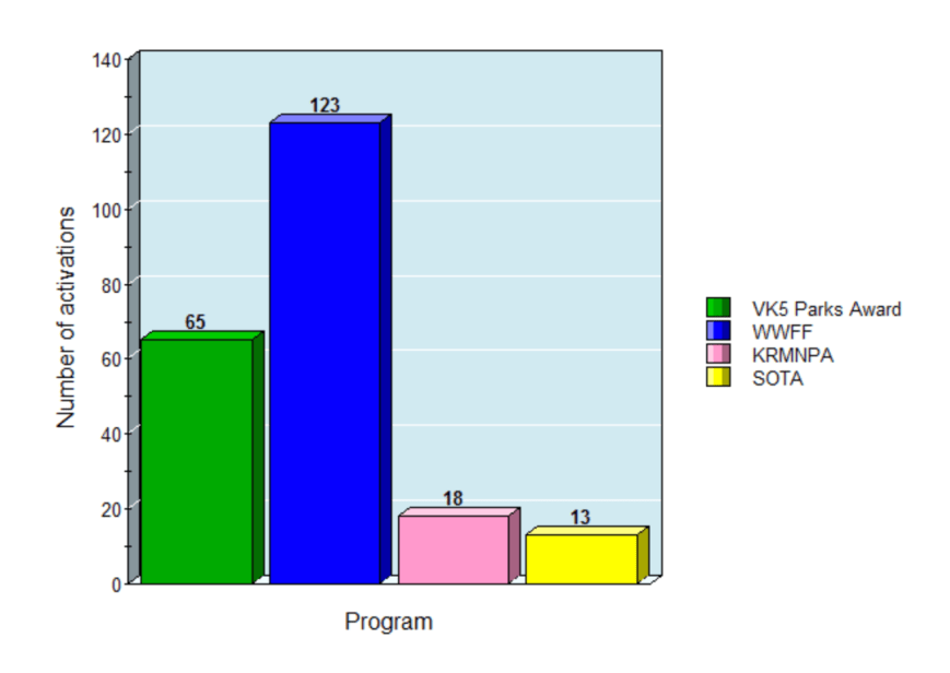
During 2017 I conducted 65 park activations for the VK5 National & Conservation Parks Award, and a total of 123 for the World Wide Flora Fauna program. This was a mixture of parks in South Australia, Victoria, and New South Wales, with 18 of those activations counting towards the Keith Roget Memorial National Parks Award. Marija and I continued to activate a number of parks together.
The Friday afternoon/evening activation event for the VK5 Parks Awards continued to be very popular. I activated a number of unique parks in 2017 including the Blackwood Forest Recreation Park, the Adelaide Dolphin Sanctuary, the Lawari Conservation Park, and the Nurragi Conservation Reserve.
On the beach at the Moana Sands Conservation Park
At the Douglas Point Conservation Park
Marija on air at Sturt Gorge Recreation Park
I conducted 13 activations for the Summits on the Air (SOTA) program during 2017. Four of those summits were in South Australia, while the remaining nine were in Victoria.
The year 2017 kicked off for Marija and I with a SOTA activation of Mount Bryan VK5/ SE-001 on New Years Day. This was as part of the regular VK New Years Day SOTA event. Marija and I spent New Years Eve in Burra at one of the local pubs, and on NY Day we headed out to the summit. After 2 hours on Mount Bryan I had a total of 76 QSOs in the log including 41 S2S contacts. Marija had a total of 39 QSOs in the log including 37 S2S contacts. It had been an amazing activation.
Marija and I then did the Dare Hill Drive. This was a very enjoyable and scenic drive through spectacular countryside in the north of South Australia. The drive took us to the homestead of Sir George Hubert Wilkins, and through the historic Collinsville Station property. On the drive we stopped off to activate two rarely activated parks, the Caroona Creek Conservation Park and the Pandappa Conservation Park.
a creek crossing on the Dare Hill drive
Marija on air at the Caroona Creek Conservation Park
On air in the Pandappa Conservation Park
old Ketchowla Station shearing shed
Marija at the Wilkins homestead
In mid January I had a fun afternoon out with Chris VK5FR and David VK5KC, at the Encounter Marine Park VKFF-1707. We drove down along Goolwa Beach to the mouth of the mighty Murray River and set up on the sand. We had a number of interested onlookers, one lady being game enough to pick up the mic. The video below is a little bit of footage of the activation.
In February Marija and our daughter Olivia headed to Victoria. Our main reason for travelling there was to go to Sovereign Hill at Ballarat as Olivia has an interest in Australian history. Whilst away on the trip I activated SOTA peak Mount Warrenheip VK3/ VC-019, the Creswick Regional Park VKFF-0964, and Mount Buninyong VK3/ VC-018. Whilst at Mount Buninyong, Allen VK3ARH paid us a visit.
with Allen VK3ARH
On air at Mt Warrenheip
Marija on air at Mt Buninyong being watched on by Olivia
Enjoying a Mountain Goat beer at the hotel in Buninyong
Marija and Olivia at Sovereign Hill
March 4th to March 12th 2017 was Parks Week. I had a little bit of free time from work and undertook 2 activations during the event.
On Friday 10th March I headed out to activate the Lowan Conservation Park 5CP-121 & VKFF-1052. This was another successful activation, with a total of 87 contacts in the log including a number of Park to Park contacts, including Ken ZL4KD and his wife Margaret ZL4YS who were in ZLFF-0026.
And then on Saturday 11th March Marija and I activated Mount Lofty VK5/ SE-005 which is located within the Cleland Conservation Park 5CP-042 & VKFF-0778. This was as part of an afternoon/morning of VK/Europe/UK SOTA activations, in which it was hoped that a number of Summit to Summit contacts would be obtained between VK & Europe/UK. Band conditions on 20m had been quite ordinary in preceding weeks, so I didn’t expect to work much DX during this activation, yet alone any of the DX SOTA activators. I ended up with 113 contacts in the log, included twenty (20) Summit to Summit contacts and six (6) Park to Park contacts. This included numerous DX S2S contacts into Spain, Switzerland, England, Romania, Wales, and Germany.
Above:- racking up the QSOs at Mt Lofty/Cleland CP
Later in March I headed out to the Totness Recreation Park for the John Moyle Memorial Field Day. I entered in the Six Hour Portable Operation category. Specifically the Single Operator, Phone Only, HF Bands section. Within my 6 hour block of operating I made a total of 241 contacts with a score of 482 points. I came in 1st place in the 6 hour portable section, running the Yaesu FT-857d, 40 watts and the linked dipole.
In April the special activation weekend was held for the 4th year anniversary of the VK5 National & Conservation Parks Award. Marija and I headed down the Fleurieu Peninsula, south of Adelaide. We activated 4 different parks and made a total of 532 QSOs.
Operating from the homestead in the Deep Creek Conservation Park
Marija on air in the Eric Bonython Conservation Park
Marija in the Talisker Conservation Park
A total of 20 amateurs took part in the weekend, activating 29 different parks across Australia. A total of 1,311 QSOs were made over the weekend, including 410 Park to Park contacts. Each activator who took part in the weekend received a special participation certificate.
Above:- participation certificate for the 4th year anniversary of the VK5 Parks Award.
A few weeks later I headed to Victoria to Foster to attend Antennapalooza run by the Gippsland Gate Radio & Electronics Club. The them for the 2017 event was operating portable, and I was asked to deliver a presentation on the parks awards. Whilst away I activated a number of parks and SOTA summits.
with Tony VK3XV, Joee VK3YSP & Marshall VK3MRG
My display table
One of my activations whilst away was a joint activation with Chris VK3QB and Chris VK3PAT at the Shallow Inlet Marine Coastal Park VKFF-0749. This was a really enjoyable morning on the beach under the shade of the awning of the Toyota Hi Lux.
On air with Chris VK3QB
Chris VK3PAT on air, with Chris Vk3QB
Our operating spot at Shallow Inlet
On Easter Sunday Marija and I activated the Scott Creek Conservation Park in the Adelaide Hills. After Marija had qualified the park I jumped on the mic using the special call of VK5WOW, issued for the 2017 WIA AGM at Hahndorf. I ended up with a total of 157 contacts as VK5WOW, on the 20, 40 and 80m bands, including 11 Park to Park contacts. A small amount of DX was logged from New Zealand, Croatia, Finland, Italy, France, Germany, Japan, and Belgium. Below is a short video of the activation.
Later in April Marija and I drove to the Riverland and attended the BRL Gathering. Whilst away we activated a number of parks. Once again I set up a small display at the event, showing various portable transceivers, antennas, power sources, and awards. I also delivered a presentation on operating portable.
Marija on air at Ramco Point Conservation Park
Delivering a presentation at the BRL Gathering
My display table at the BRL Gathering
A highlight of this year’s BRL Gathering was a high altitude balloon launch by the Amateur Radio Experimenters Group.
Getting ready to launch
Ivan VK5HS making contacts via the balloon
One of my activations whilst in the Riverland was at the Cooltong Conservation Park. Marija activated & qualified the park first and I then operated as VK5WOW, making a total of 161 contacts. Whilst activating the park Shaun VK5FAKV came out to pay us a visit.
On Anzac Day Marija and I activated the Tolderol Game Reserve VKFF-1752, using the special AX prefix. We made a total of 176 contacts between the two of us.
In late April I activated the Monarto Conservation Park using the special call of VK5WOW. I made a total of 113 QSOs.
In early May I activated the Totness Recreation Park, again using the special call of VK5WOW. I made a total of 130 contacts.
On 6th May I activated the Ferries McDonald Conservation Park for the Harry Angel Memorial 80m Sprint. I worked a total of 63 stations during the Sprint from VK2, VK3, VK4, VK5, VK6, VK7, and VK8.
The weekend of 13th & 14th May was the Mills on the Air Weekend. On Saturday I activated Nixon’s Mill at Hahndorf using the special VK5WOW call. I made a total of 89 QSOs, including making contact with hams at the Dunn Mill at Mount Barker, and Andersons Mill at Smeaton in Victoria. Later that day I also activated the Kenneth Stirling Conservation Park as VK5WOW and made a total of 107 contacts. On Sunday I activated the old Laucke Flour Mill at Strathalbyn and made a total of 87 QSOs. I was joined briefly by Tony VK5MRT.
On 17th May I activated the Mount George Conservation Park with the special VI5WOW call. I made a total of 84 contacts.
This was my 6th activation using VK5WOW or VI5WOW. During April & May under these calls I made a total of 872 contacts. Sadly, propagation was not great when it came to DX.
During May the Annual General Meeting & Convention of the Wireless Institute of Australia was held at Hahndorf, just down the road from my home. Andrew VK6AS, and Heath VK3TWO & his wife Monique stayed with us. The theme of the convention was ‘Radio is Magic’.
The event kicked off on the Friday evening with drinks and gourmet pizza at the Hahndorf Convention Centre. Saturday saw the AGM and presentations. I delivered a presentation on ‘Operating field portable in the great outdoors’. The Saturday night formal dinner was at the convention centre.
On Sunday morning, myself and 4 other team leaders (John VK5BJE, Peter VK5PET, Les VK5KLV, & Chris VK5FR) took a number of amateurs out into the field to activate parks. For many it was their first park activation. One of my team was Gerard VK2JNG, who has taken to park activating like a duck to water. Later that day there was a Come and Try event at the Hahndorf Oval. Chris VK5FR and I set up a parks display table.
With some of the crew on the Friday night
Delivering my presentation at the Convention on Saturday
Out in the field on Sunday morning
With Chris VK5FR and an interesting onlooker at our display table
I received a Certificate of Appreciation at the Convention for delivering my parks presentation. I would like to express my sincere thanks to the Organising Committee for the 2017 WIA AGM & Convention: David VK5KC, John VK5BJE, Jim VK5TR, Shirley VK5YL, Stuart VK5STU, Roy VK5NRG, Grant VK5GR, Matt VK5ZM, David VK5KK, Ian VK5ZD, Joy Robbins, & Daniel VK5DF.
There was also a special 2017 WIA AGM & Convention award on offer, which both Marija and I qualified for. The certificate was actually designed by myself.
On the Sunday afternoon of the Convention I headed out to the Mylor Conservation Park for one final run of the special call of VI5WOW. I logged a total of 56 stations and hopefully gave a few more people a chance to get the special call in their log. So all up I ended up with 928 QSOS whilst using VK5WOW and VI5WOW.
In June Marija and I headed down to the South East for the annual convention and National Fox Hunting Championships held by the South East Radio Group. Whilst down that neck of the woods we activated 7 parks in South Australia and Victoria, and made a total of 567 contacts, with 44 of those being Park to Park contacts.
The SERG event coincided with the VK Shires Contest. Marija and I activated three shires – GD5, MG5, & GL3. I made 193 QSOs. Marija made 78 QSOs in her very first contest. Congratulations to Tony VK3XV who came in at number one in this category with 173 QSOs and 182 Shires and a score of 31,486 points. I managed to get position number 2 with a total of 167 QSOs and 180 Shires and a score of 30,060 points. And well done to Marija who came in at number 3, with 70 QSOs and and a score of 5,180 points.
We enjoyed a fantastic night at the SERG Convention dinner on the Sunday evening. We shared a table with my good mate John VK5NJ and his wife Tanina, and Tony VK5ZAI and his wife Jill. Marija even drew the first winning raffle ticket, winning a little BaoFeng hand held tx. I can highly recommend the SERG Convention to anyone who has not been before.
with Tony VK5ZAI and John VK5NJ
Marija in the Lower Glenelg National Park
On air at Telford Scrub for the VK Shires Contest
Marija with the handheld won in the raffle
In July I activated the Totness Recreation Park for the Trans Tasman Low Band Contest. The aim of the contest is to encourage Low Band activity Trans-Tasman, that is between VK and ZL. The contest is divided into three 2 hour periods. I remained out in the field until just after the commencement of the third period which was at 1200 UTC (9.30 p.m. local time). The cold weather got the better of me (got down to 4 deg C) and I packed up and headed home with a total of 171 contacts in the log.
Above:- ‘the shack’ at Totness for the Trans Tasman.
In August for the 2017 International Lighthouse & Lightship Weekend, Marija and I activated the Marino Rocks lighthouse AU-0018 located within the Marino Conservation Park 5CP-126 & VKFF-1056. We made a a total of 210 contacts, including 22 different Australian lighthouses and one NZ lighthouse. Amongst that were 10 Park to Park contacts. Ian VK5MA visited us during the activation.
With Ian VK5MA
Below is a short video of our activation at Marino lighthouse.
On October 22nd the 2nd VKFF Team Championship was held. Six teams took part in the event. Marija and I entered the event as ‘The Walkie Talkies’ and activated the Monarto Woodlands Conservation Park. The weather was less than ideal, and Marija and I huddled underneath the awning of the 4WD during the activation. We made a total of 197 QSOs, which included 32 Park to Park (P2P) contacts under some very trying band conditions. Marija and I took 1st place this year, pipping last years winners Team Kookaburra.
On air for the VKFF Team Championship
Our certificate for the 40m section
Our Overall Winner certificate
In late October between 23rd-29th October, National Bird Week was held. I headed down to the Coorong National Park for an activation and some bird photography.
I managed to get some good photographs during my visit to the Coorong. However, not everything went to plan. I blew up my Yaesu FT-857d. Fortunately it has been fixed.
My operating spot in the Coorong National Parka
In early November I activated the Scott Creek Conservation Park with my good mate John VK5BJE. During the activation I tested my newly acquired Yaesu FT-897 which I had obtained through a deceased estate auction with my local radio club. We had a great afternoon out in the park and ended up with 102 stations in the log between us, including some nice Pacific DX contacts on 20m, and five Park to Park contacts.
My newly acquired Yaesu FT-897
With John VK5BJE
In November Marija and I enjoyed 2 great weeks away in Victoria and New South Wales. Whilst away from home we activated a total of six (6) summits for the Summits on the Air (SOTA) program, and a total of twenty seven (27) parks for the World Wide Flora Fauna (WWFF) program and the Keith Roget Memorial National Parks Award. We made a total of 1,680 QSOs under some pretty trying band conditions at times. This included x 2 Summit to Summit contacts, and 138 x Park to Park contacts. We travelled a distance of 4,450 km.
‘the shack’ at the Ninety Mile Beach Marine Park
At Alfred National Park
At Nadgee Nature Reserve
On the beach at Point Hicks Marine National Park
Marija at VK3/ VG-048 in Errinundra National Pakr
Both Marija and I received an activator certificate for taking part in the KRMNPA Weekend. Many thanks to Tony VK3XV, the KRMNPA Awards Manager.
Radio wasn’t the only thing on the agenda during the trip away. We did a lot of sightseeing including a really enjoyable cruise in the Croajingolong National Park viewing the majestic White Bellied Sea Eagles.
A great food at Mallacoota
4WDing in the Nadgee Nature Reserve
White bellied sea eagle in the Croajingolong National Park
And whilst away we met up with a number of amateurs. We called in to see Paul VK3SS at Stratford, and enjoyed a nice evening out with some of the local hams at Traralgon. Whilst at Malacoota we bumped in to John VK2AWJ. And on the way home we caught up with Kev VK3VEK and Peter VK3TKK.
Out for tea with Sergio VK3SFG, Brian VK3BBB, Peter VK3PF and Ken VK3UH
In the shack of Paul VK3SS
With John VK2AWJ
With Kev VK3VEK
With Peter VK3TKK
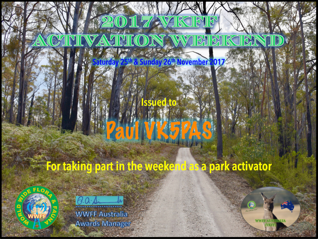
Later in November the 2017 VKFF Activation Weekend was held. Marija and I stayed at Morgan for a few nights and activated 6 parks whilst we were away. We made a total of 490 QSOs including 138 Park to Park QSOs.
Taking some time out at one of the local wineries
Marija on air at the Brookfield Conservation Park
On air at the Hogwash Bend Conservation Park
On air at the Morgan Conservation Park
Each activator who took place in the 2017 VKFF Activation Weekend received a special participation certificate.
During November the VKFF Annual Photographic Competition was held. There were a total of 31 entries. Thankyou to everyone who submitted photos (VK3FLCS, VK3GGG, VK3PF, VK3ZPF, VK4HNS, VK4JAZ, VK4SMA, VK4SOE, VK5FMAZ, VK5PAS, VK7JON). A total of 17 amateurs took the time to cast their vote/s. First place was shared by myself and Neil VK4HNS. Second place was shared by Grant VK4JAZ, Marija VK5FMAZ & Paul VK5PAS. Third place was shared by Jonathan VK7JON, Peter VK3ZPF, Peter VK3PF, & Paul VK5PAS.
During 2017 I was issued with a number of awards including the following:-
WWFF Park to Park 264
WWFF Park to Park 308
WWFF Park to Park 352
WWFF Park to Park 396
WWFF Park to Park 444
WWFF Park to Park 544
DXFF 40
YOFF Diploma 10 x 200 QSOs
WWFF Activator 154
WWFF Activator 165
WWFF Activator 176
WWFF Activator 187
WWFF Hunter 944
WWFF Hunter 1044
Murray River Parks Activator 20
NSW National Parks 50 year
VKFF Activator Honour Roll 175
VKFF Activator 200
VKFF Hunter Honour Roll 600
VKFF Hunter Honour Roll 625
VKFF Hunter Honour Roll 650
VKFF Hunter Honour Roll 675
VKFF Hunter Honour Roll 700
VKFF Hunter Honour Roll 725
VKFF Hunter Honour Roll 750
VKFF Hunter Honour Roll 775
VKFF Hunter Honour Roll 800
VKFF Hunter Honour Roll 825
This slideshow requires JavaScript.
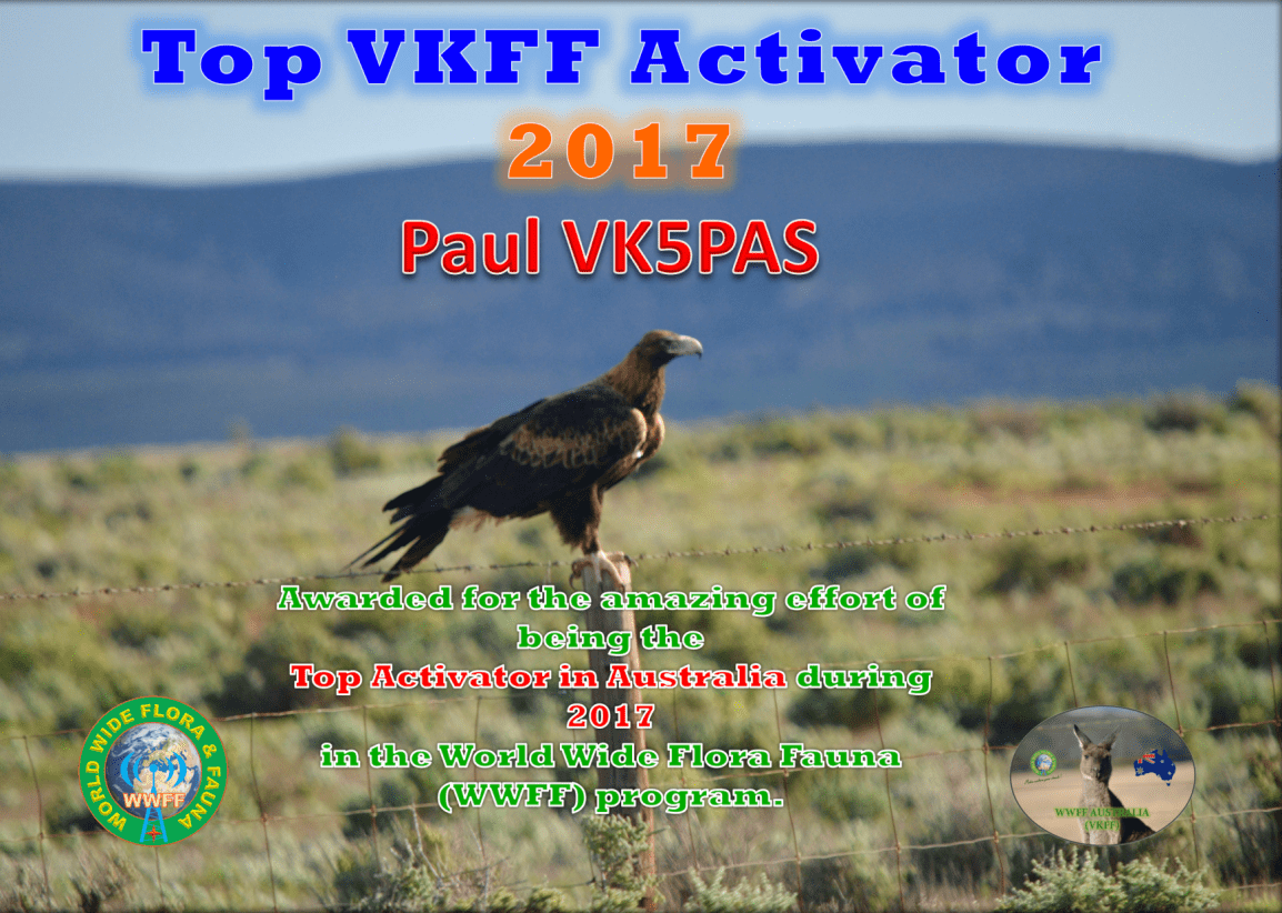
Each year the VKFF program issues certificates to the Top VKFF Hunter and the Top VKFF Activator. This year the Top VKFF Hunter with a total of 548 different VKFF references during 2017 was Peter VK3PF. An amazing effort. Coming in at 2nd place was Gerard VK2IO with 547 different VKFF references, just 1 behind Peter.
The Top VKFF Activator turned out to be myself with 102 different VKFF references activated during 2017. This was very closely followed by Gerard VK2JNG with 99 different VKFF references activated. Gerard has certainly taken to park activating.
And each year the global WWFF program issued Top 44 certificates. The first Top 44 certificate is issued each year for the Top 44 activators in the world, and is based on activations where 44 QSOs are achieved. I came 13th in the world with 90 activations. The top activator in the world was SP5UUD with 505 activations. Now that is an achievement.
The other Top 44 certificate is issued to activators who have made it into the Top 44, with respect to the number of QSOs made during activations. In 2017 I came in at position number 27 with a total of 7,037 QSOs from 102 different references. That works out to around 69 contacts per activation.
Some of my best DX contacts whilst out portable in 2017 was with Grant E6AG on Nieue, A25BE in Botswana.