
Our third and final park for Sunday (10th November 2019) was the Wyperfeld National Park VKFF-0549. This would be our second Victorian National Park for the 2019 Keith Roget Memorial National Parks Award (KRMNPA) Activation Weekend.
The park is located about 450 km north-west of Melbourne and is located in the Mallee district of north-western Victoria.
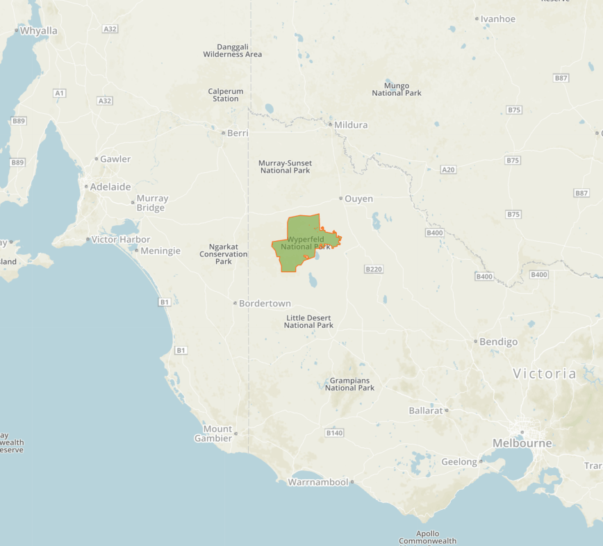
Above:- Map showing the location of the Wyperfeld National Park in western Victoria. Map courtesy of Protected Planet.
We stopped briefly in the town of Patchewollock which is believed to take its name from the corruption of two aboriginal words ‘putje’ meaning ‘plenty’ and ‘wallah’ meaning ‘porcupine grass’. Thus ‘the place of plenty porcupine grass’.


The town contains some large Mallee Fowl sculptures which are made of corrugated iron.


Patchewollock is also part of the Silo Art Trail. Brisbane artist Fintan Magee completed the work in 2016. The work portrays an image of the archetypal Aussie farmer.


You can also view some railway buildings from a bygone era. The line to Patchewollock was officially opened on the 4th day of May 1925. Patchewollock Railway Station’s last wheat train departed on the 3rd day of July 1986 and the line closed on the 8th day of December 1986.


The Wyperfeld National Park is the third largest National Park in Victoria. It is about 357,017 hectares (882,210 acres) in size. It was declared in 1921 to protect this large piece of mallee, woodland and heathland.
The park’s name comes from the Parish of Wyperfeld. There have been numerous attempts to discover the origin of the word ‘Wyperfeld’. It is believed to come from the German ‘Wyper’, a tributary of the Rhine, and ‘Feld’, a field.
The park can be reached:
- via Patchewollock off the Sunraysia Highway
- via Hopetoun on the Henty Highway
- via Underbool on the Mallee Highway
- via Rainbow from the Western Highway at Dimboola.
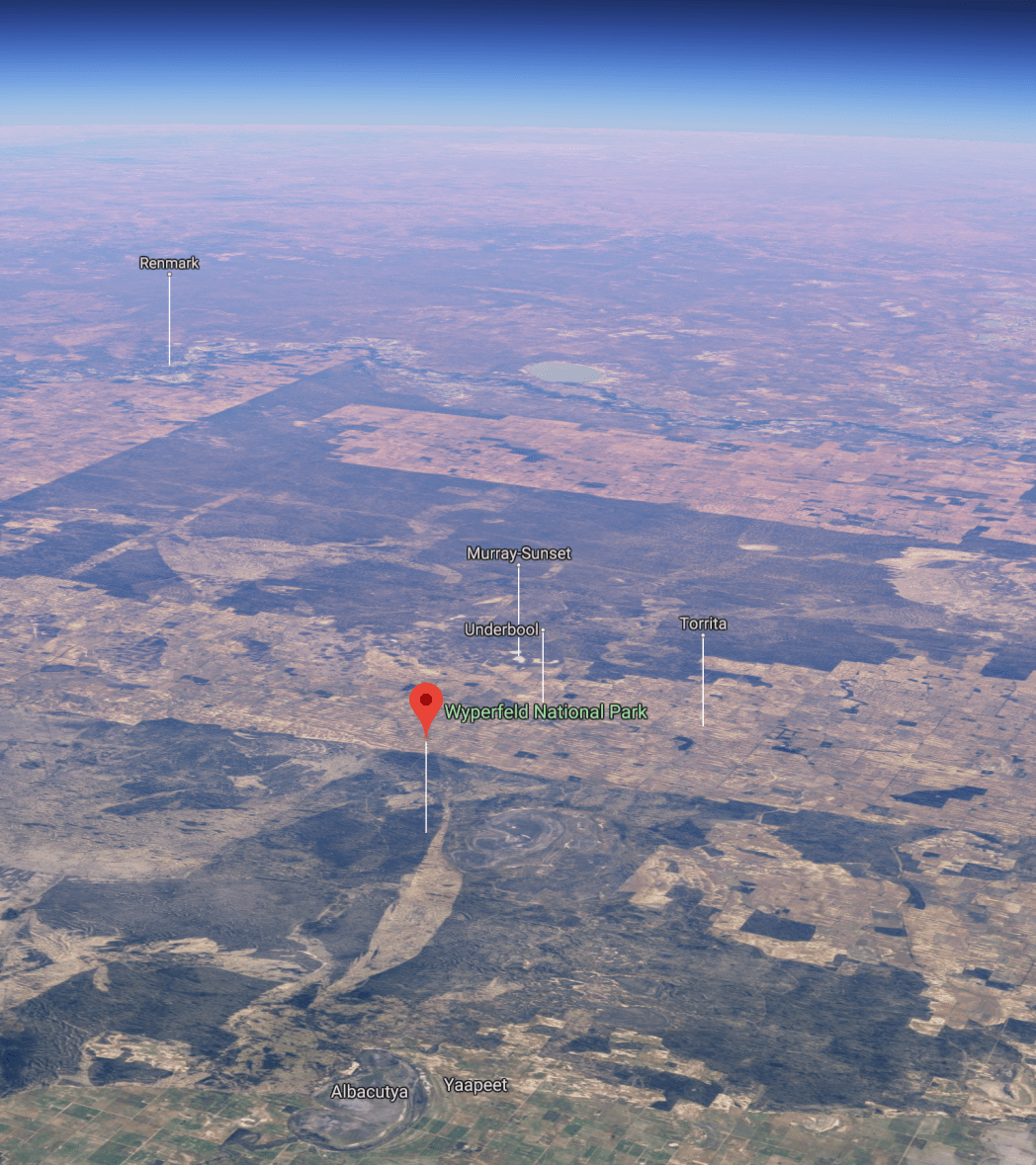
Above:- An aerial view of the Wyperfeld National Park looking north. Image courtesy of Google maps
Prior to European settlement in the area, the Wotjobaluk aboriginal people regularly travelled along Outlet Creek which snakes its way through the centre of the park, visiting the lakes and swamps. From the 1860s European settlers followed the same route to establish pastoral runs.
In 1909 a total of 3,900 hectares were reserved by the Victorian State Government following pressure from naturalists. In 1921 Wyperfeld National Park was proclaimed. Wyperfeld was Australia’s first Mallee National Park.
About 450 species of native plants can be found in the park. River Red Gum and Black Box woodlands cover the floodplains of Outlet Creek and its lakes. Pine-Buloke grows on nearby dunes. Mallee eucalypts cover most of the eastern section of the park.


Over 200 species of bird have been recorded in the park. Wyperfeld National Park is nationally recognised as an Important Bird Area. This is due to the area’s threatened population of Malleefowl and other species of birds including the Mallee Emu-wren.


After leaving Patchewoolock we headed west on Baring Road and then Pine Plains Road. We soon reached the eastern boundary of the park.


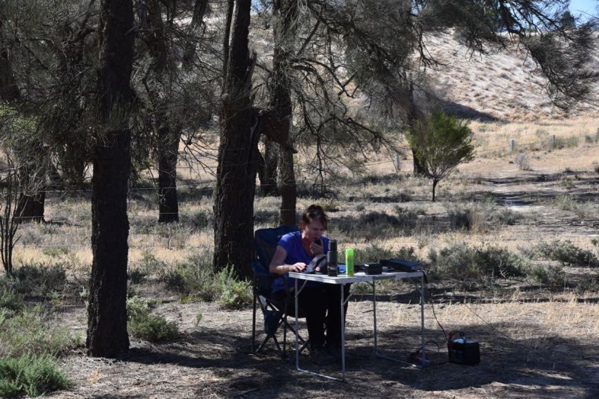
Last year we activated the park from the Casuarina campground. This year we decided to head to the Snowdrift campground.
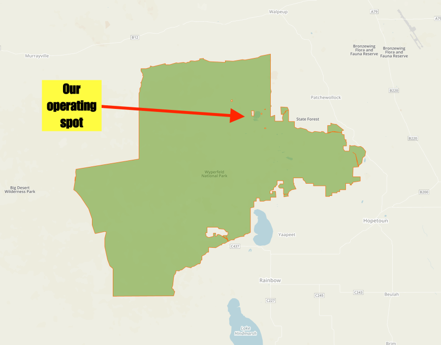
Above:- The Wyperfeld National Park showing our operating spot. Map courtesy of Protected Planet.
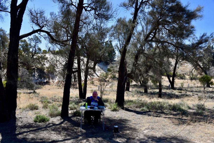
Snowdrift contains magnificent white sand dunes in a normally flat park.


Marija was keen enough to climb the sand dunes. There are some great views to be had of the surrounding area from the top.


After setting up Marija and I tuned across the band to see if we could hear any other park activators, but sadly we did not. In fact, the band was very quiet with very few operators. But there was a very low down station on 7.145 so I was unable to get onto 7.144. I found 7.141 clear and started to call CQ. We were unable to self spot on parksnpeaks as there was absolutely no internet coverage from within the park at our location.
It took around 3 or 4 minutes of CQ calls before the first station came back to my CQ call. It was Grant VK2LX with a big 5/9 signal. Grant kindly spotted us on parksnpeaks which resulted in a lot more traffic. Second in the log was Kieran VK2QK, followed by Graham VK7ZGK, and then a Park to Park with Gerard VK2IO/p who was activating the Dural Nature Reserve VKFF-1926. Marija also logged Gerard.
I logged a total of 12 stations on 40m before swapping the mic with Marija.
Marija called CQ on 7.141 and this was answered by Linda VK7QP, followed by Mark VK4SMA, and Scott VK4CZ. Just 5 minutes later and Marija had contact number ten in the log, with a contact with Dave VK2RP.
Marija went on to work a total of 21 stations on 40m from VK2, VK3, VK4, and VK7. This included a further Park to Park, with Peter Vk3ZPF/p who was in the Churchill National Park VKFF-0621.
Although we have both previously activated and qualified Wyperfeld, it is always nice to get your 10 or 44 contacts during an activation. Despite the band being in rather a poor shape, I was hoping to get my 44, so I hopped back into the operator’s chair.
I logged a further 33 stations including Park to Park contacts with Alan VK2MG/4 in the Samford Conservation Park VKFF-1639, Peter VK3ZPF/p in the Churchill National Park VKFF-0621, and David VK5DG/3 in the Alfred National Park VKFF-0618. Contact number 44 was with Andrew VK7DW and came in an hour and twenty minutes into the activation. Not bad considering the band conditions were poor.
I then moved up to the 20m band where I logged three stations, Mark VK3BSA mobile 6, Jonathan VK7JON and Murray VK4MWB.
Marija worked the following stations on 40m SSB:-
- VK2IO/p (Dural Nature Reserve VKFF-1926)
- VK7QP
- VK4SMA
- VK4CZ
- VK4NH
- VK4DXA
- ZL4TY/VK4
- VK3HAY
- VK2YK
- VK2RP
- VK2BDR
- VK7JON
- VK4MWB
- VK4TJ
- VK4/AC8WN
- VK4/VE6XT
- VK4SSN
- VK3ZPF/p (Churchill National Park VKFF-0621)
- VK2EZT
- VK7FOLK
- VK3PF/m
- VK5DG/3 (Alfred National Park VKFF-0618)
I worked the following stations on 40m SSB:-
- VK2LX
- VK2QK
- VK7ZGK
- VK2IO/p (Dural Nature Reserve VKFF-1926)
- VK1AT
- VK3BSA/5
- VK4NH
- VK4DXA
- ZL4TY/VK4
- VK7QP
- VK4CZ
- VKSMA
- VK2MG/4 (Samford Conservation Park VKFF-1639)
- VK2PKT
- VK7HCK
- VK3MPR
- VK7JON
- VK4FARR
- VK5NAW
- VK7FJFD
- VK2JES
- VK2PGB
- VK3FADM/1
- VK3ZPF/p (Churchill National ParkVKFF-0621)
- VK2AD
- VK4GSF
- VK4MWB
- VK3ANL
- VK4TJ
- VK4/AC8WN
- VK4/VE6XT
- VK4SSN
- VK3BSA/6
- VK2LEE
- VK2UH
- VK2SK
- VK7ROY
- VK7ME
- VK1JH
- VK7VZ
- VK5DG/3 (Alfred National Park VKFF-0618)
- VK4HNS
- VK2PAA
- VK7DW
- VK4PDX
I worked the following stations on 20m SSB:-
- VK3BSA/6
- VK7JON
- VK4MWB
x
x
References.
Parks Victoria, 2006, Wyperfeld National Park Visitor Guide
Wikipedia, 2019, <https://en.wikipedia.org/wiki/Wyperfeld_National_Park>, viewed 13th November 2019
