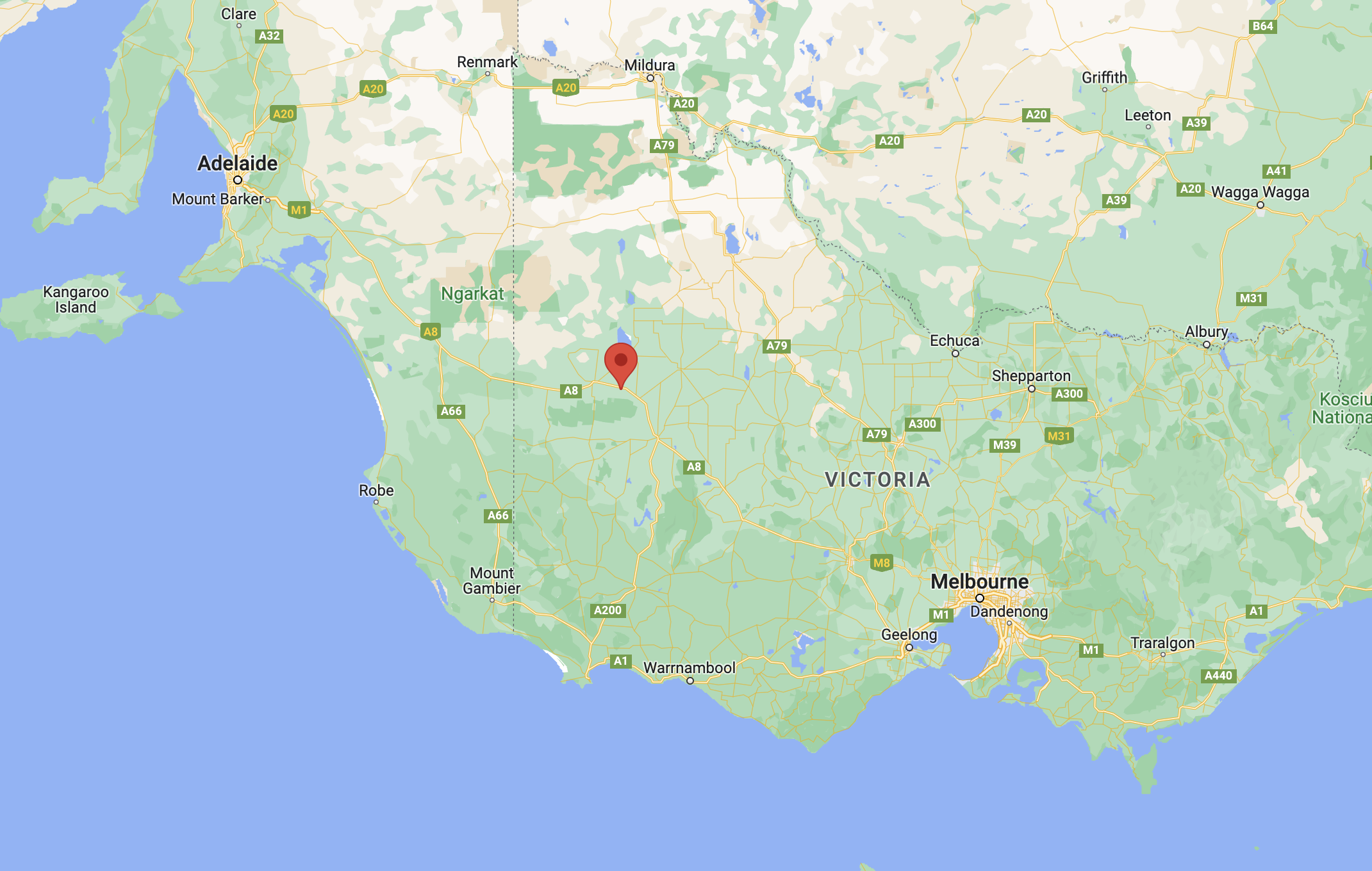
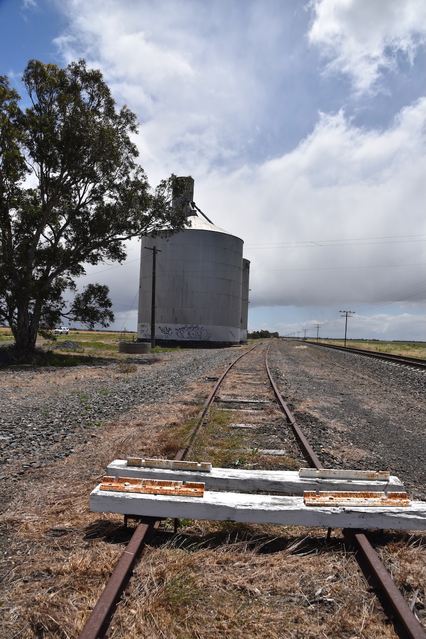
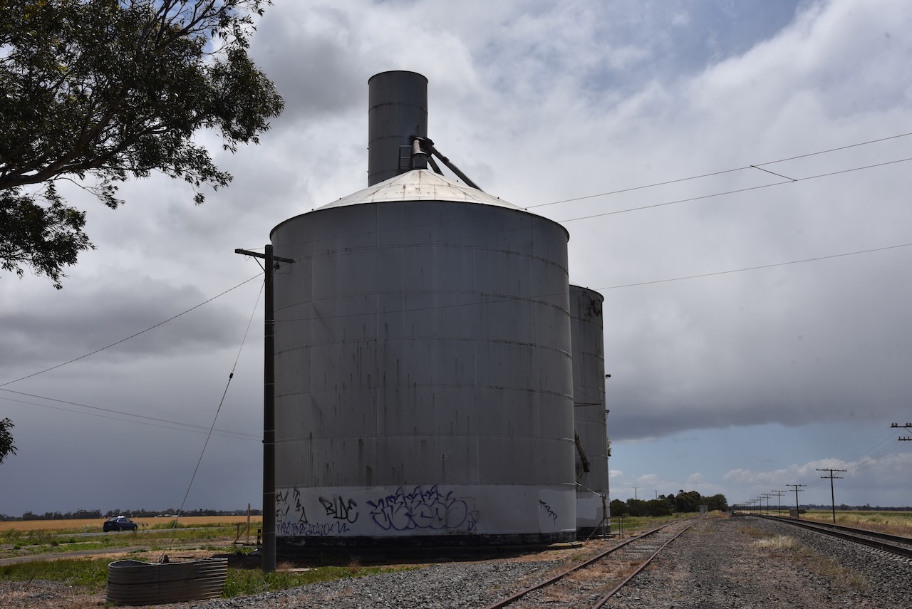
Our seventh silo for Monday 21st November 2022 was the Gerang Gurung silo VK-GRU3, located about 351 km north west of the city of Melbourne.
Above:- Map showing the location of Gerang Gerung. Map c/o Google maps
Gerang Gerung comes from an aboriginal word jerung meaning a leaf or branch. European pastoralists settled in the area commenced in 1846. During the early 1880s the Junction Hotel was opened. In September 1884 the Gerang State School No 2618 was opened. Following the opening of the railway line in 1887 from Dimboola to Serviceton, a general store, Bible Christian church and a public hall were built.
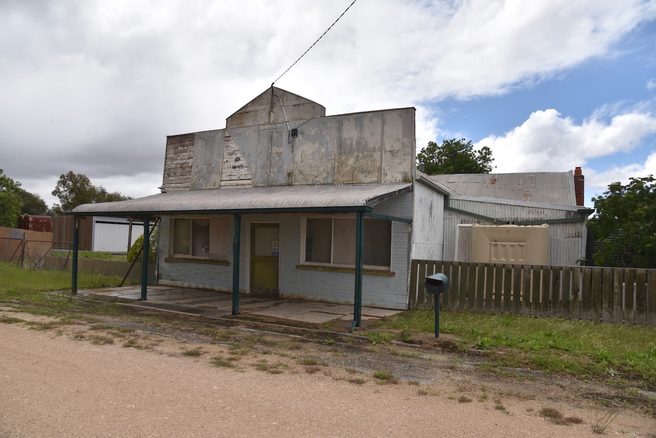
Nowadays very little remains in Gerang Gerung.
The silo is located in Railway Street.
We operated from directly alongside of the silo and ran the Icom IC-7000, 100 watts, and the Codan 9350 self tuning antenna.
Above:- Map showing the location of Gerang Gerung and the activation zone. Image c/o SiOTA website.
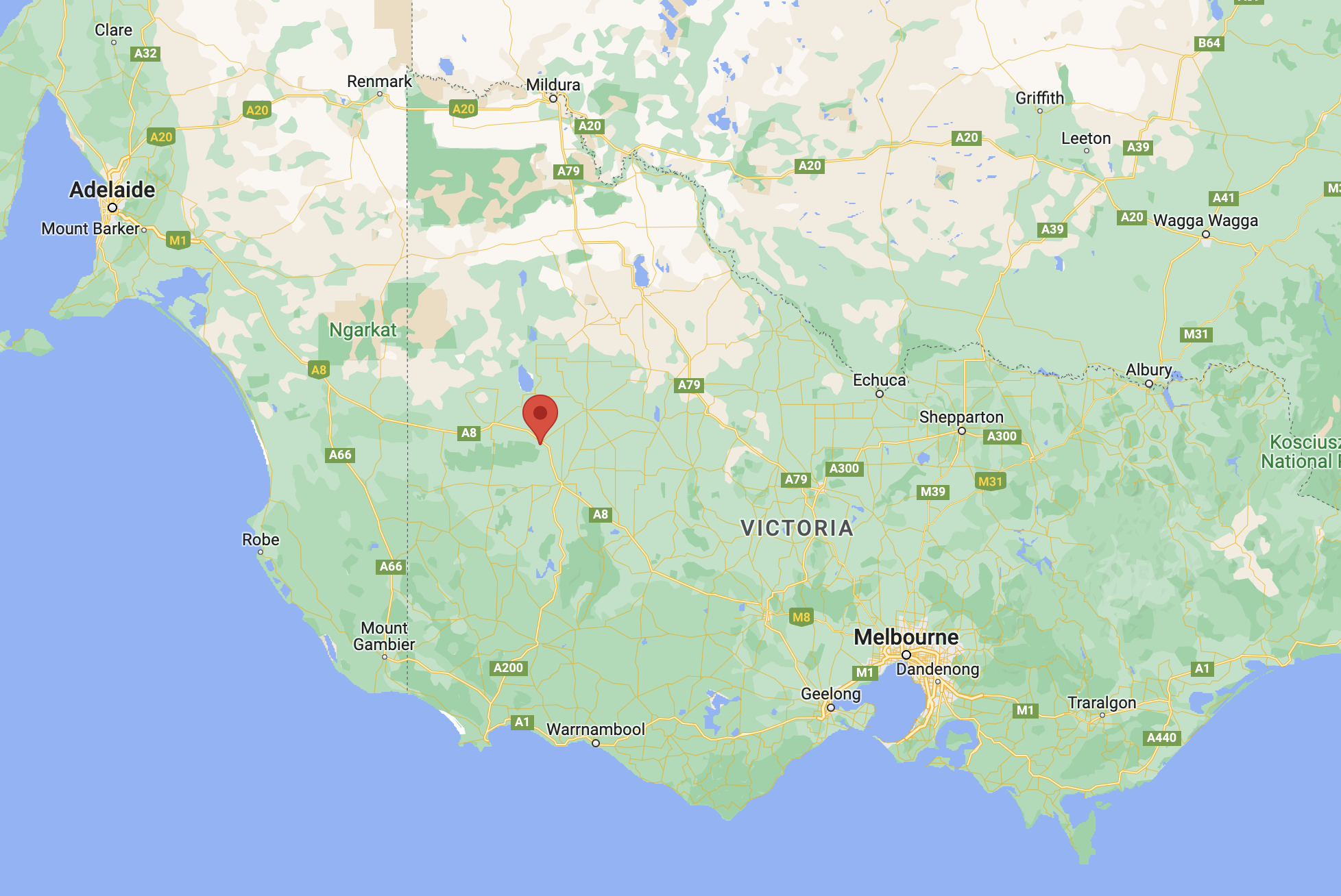
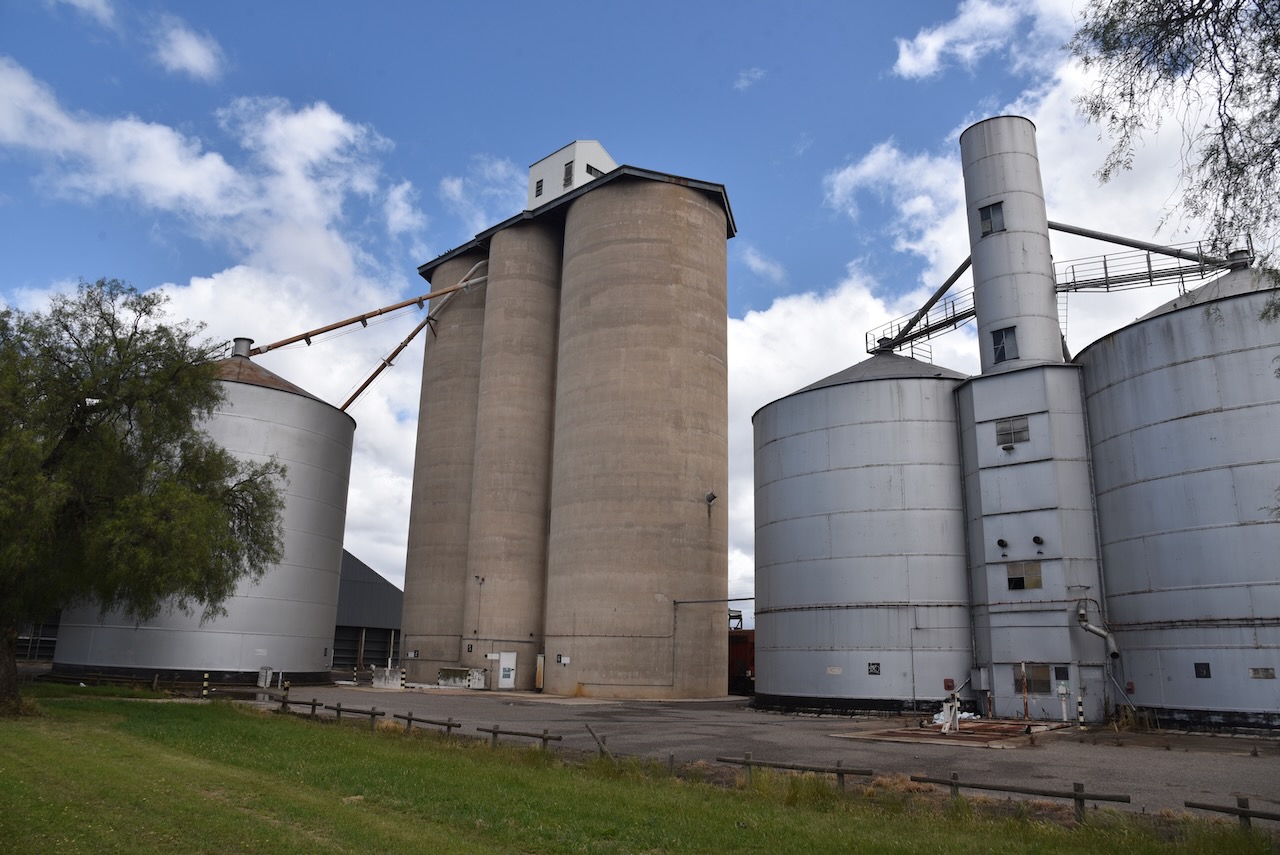
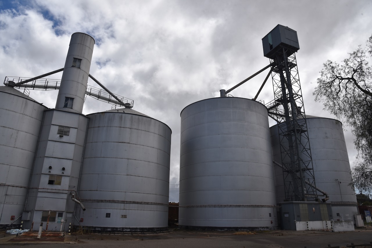
Our sixth silo for Monday 21st November 2022 was the Dimboola silo VK-DMA3. Dimboola is located in western Victoria about 337 km north west of the city of Melbourne.
Above:- Map showing the location of Dimboola in western Victoria. Map c/o Google maps.
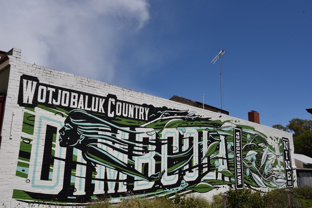
Prior to the arrival of European settlers the Dimboola area was occupied by the Wotjobaluk aboriginal people. In 1852 it is believed there were about 1,200 Wotjobaluk people living in the area.
In 1846 the first station in the district was established by Horatio Ellerman and George Shaw. By 1859 the area was known as ‘Nine Creeks’ due to the numerous nearby branches of the Wimmera River. In 1862 a town site was surveyed. Dimboola was gazetted and proclaimed in 1863. The Post office still called Nine Creeks at this time.
Dimboola is a Singhalese word (‘Dimbula’) meaning ‘land of figs’. This was because the surveyor of Dimboola was John George Winchester Wilmot (b. 1830. d. 1895) who had been a pioneering coffee planter in Sri Lanka (then known as Ceylon).
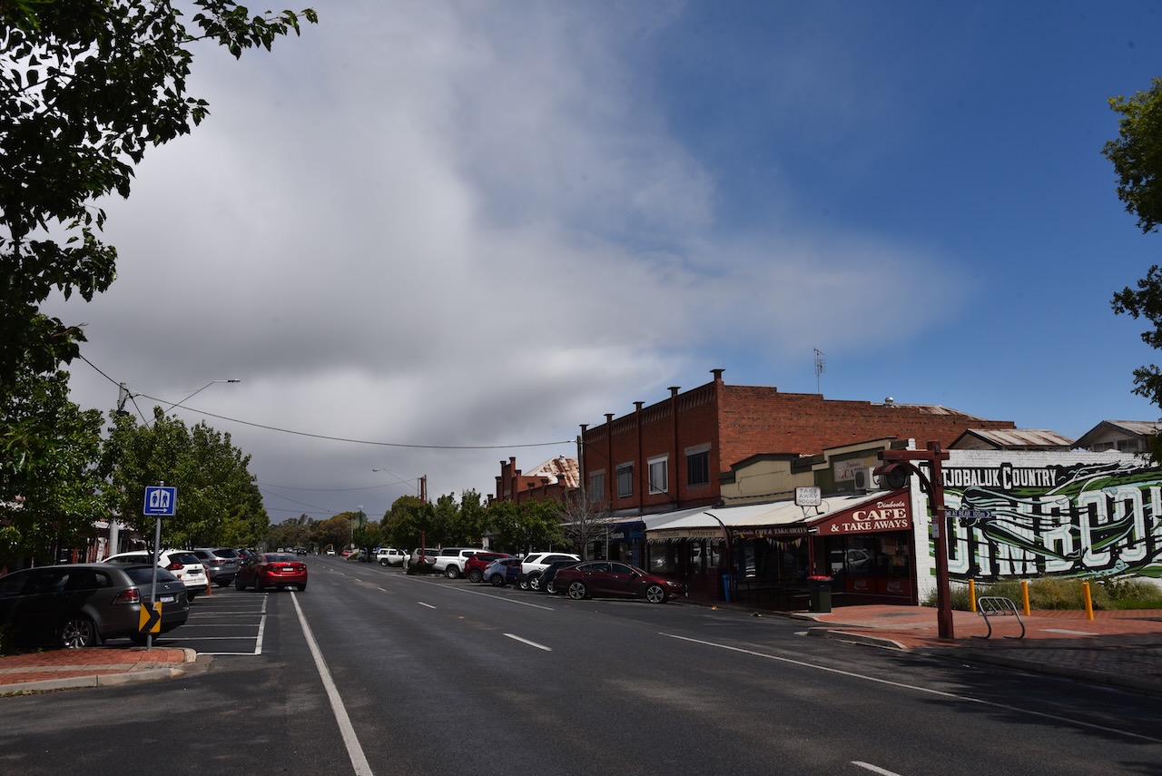
The Dimboola silo is a large complex and is located between Upper Region Street and Hindmarsh Street in the heart of Dimboola.
We operated from Upper Region Street directly opposite the silo. It was a little noisy on the 40m band due to us being in the heart of town. We ran the Icom IC-7000, 100 watts, and the Codan 9350 self tuning antenna for this activation.
Above:- Map showing the location of the Dimboola silo and the activation zone. Image c/o SiOTA website.
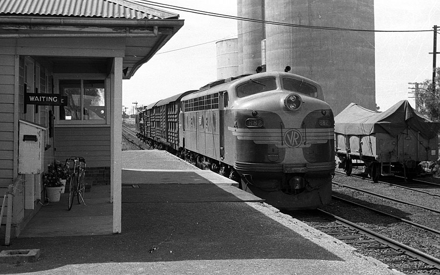
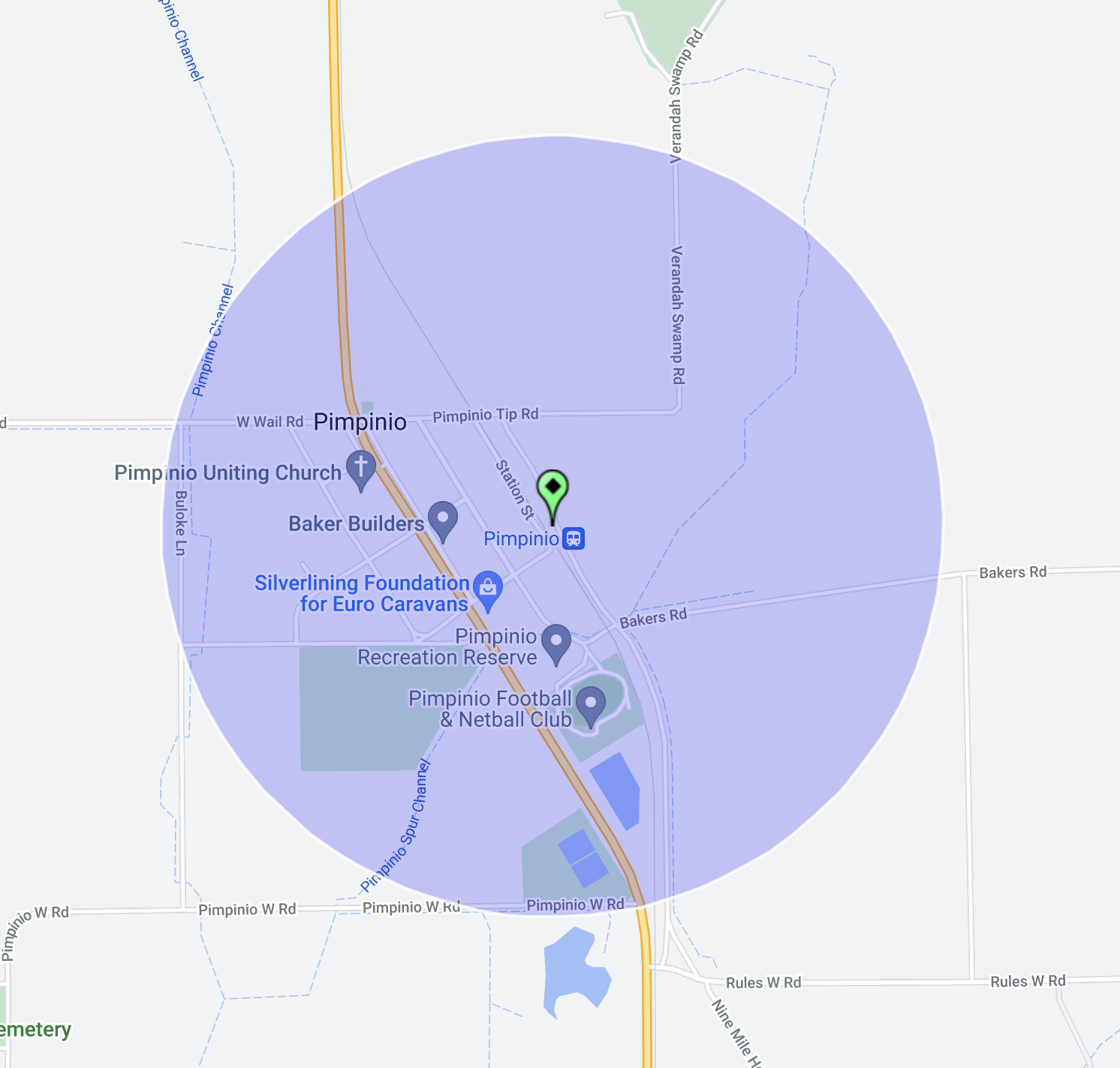
Our next silo for Monday 21st November 2022 was the Pimpinio silo VK-PMO3. Pimpinio is located about 15km west of Horsham and about 317 km north west of Melbourne.
Above:- Map showing the location of Pimipinio. Map c/o Google maps.
Pimpinio is believed to have derived from an Aboriginal word describing a man squatting on his heels, or children. In around 1870 a hotel and blacskmith’s forge was established in the Pimpinio area. The township of Pimpinio was gazetted on the 28th day of July 1873. In 1874 the Pimpinio school was opened in a Union Church hall. Following the extension of the railway from Horsham to Dimboola, a store was opened in the town.
The Pimpinio railway station was built in 1882 and disestablished 100 years later in 1982.
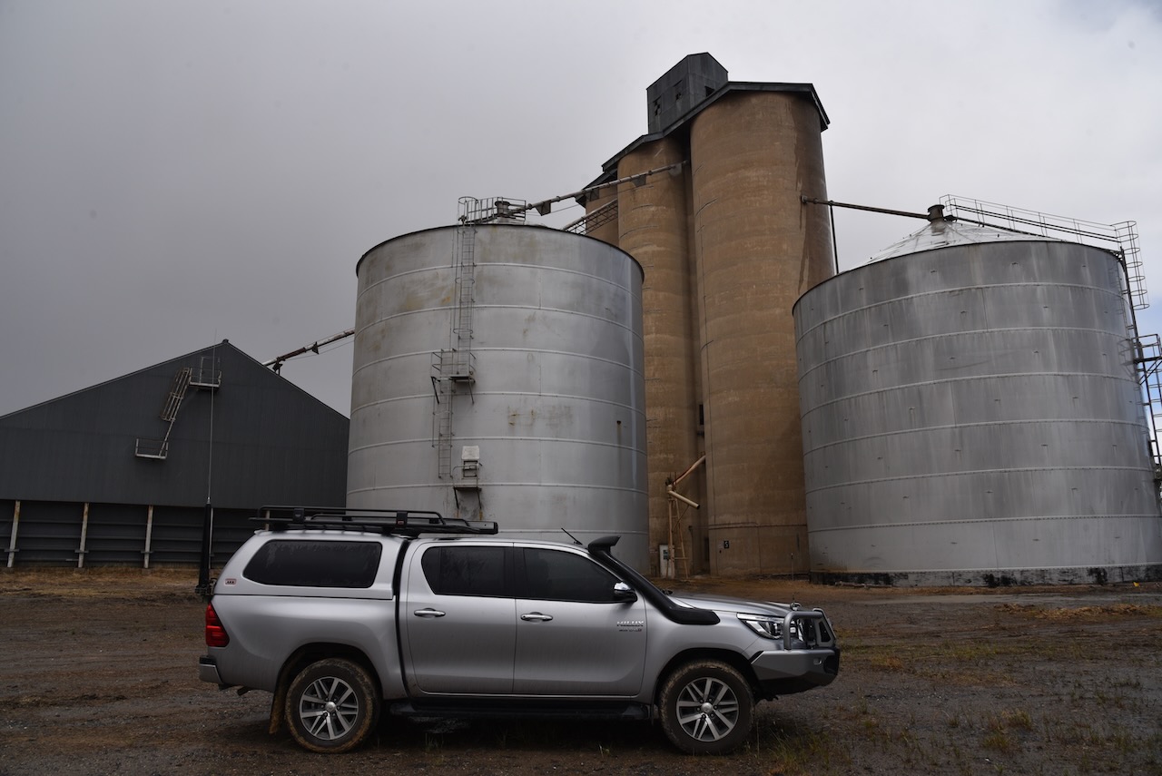
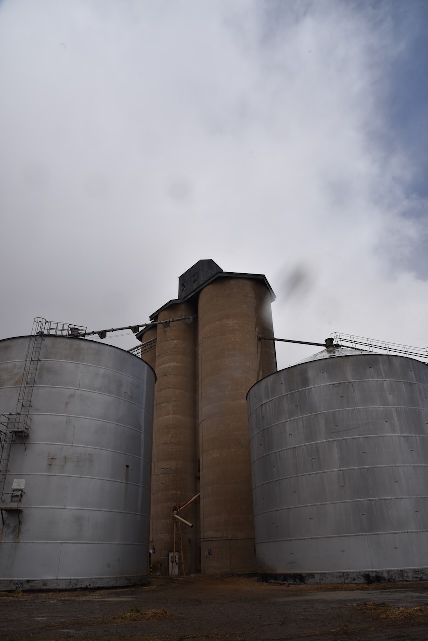
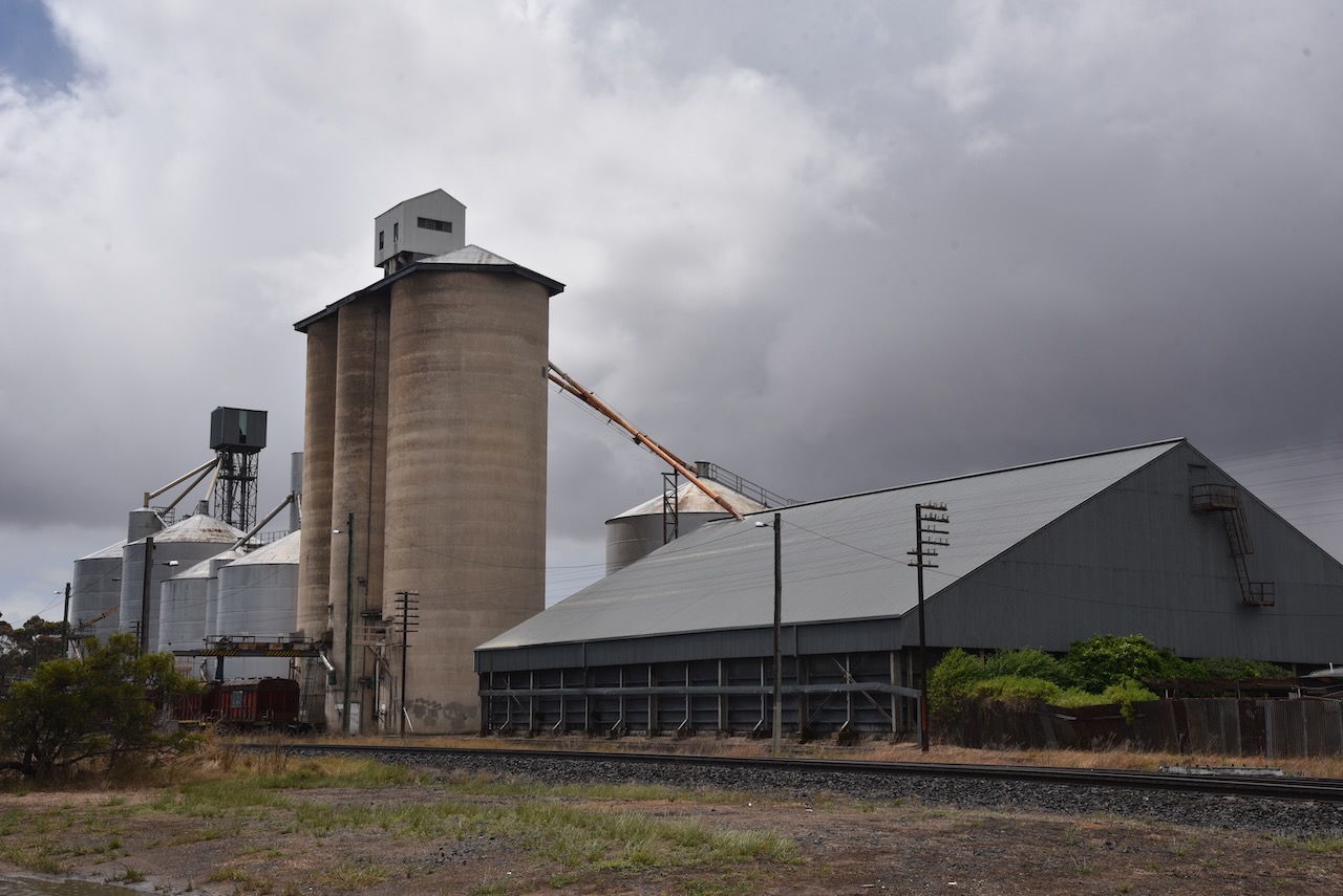
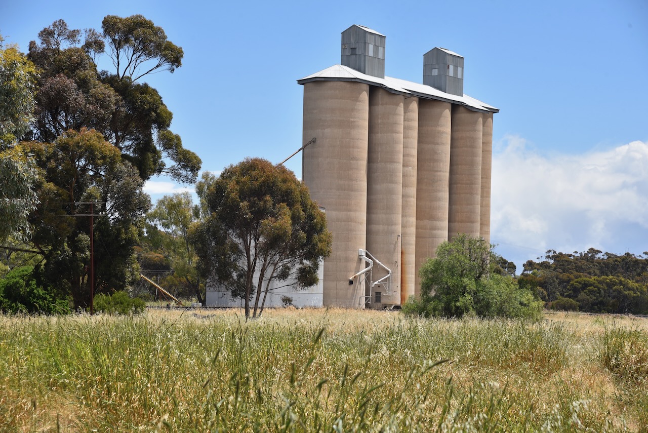
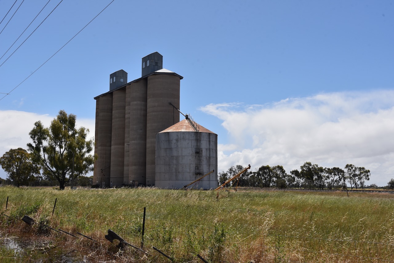
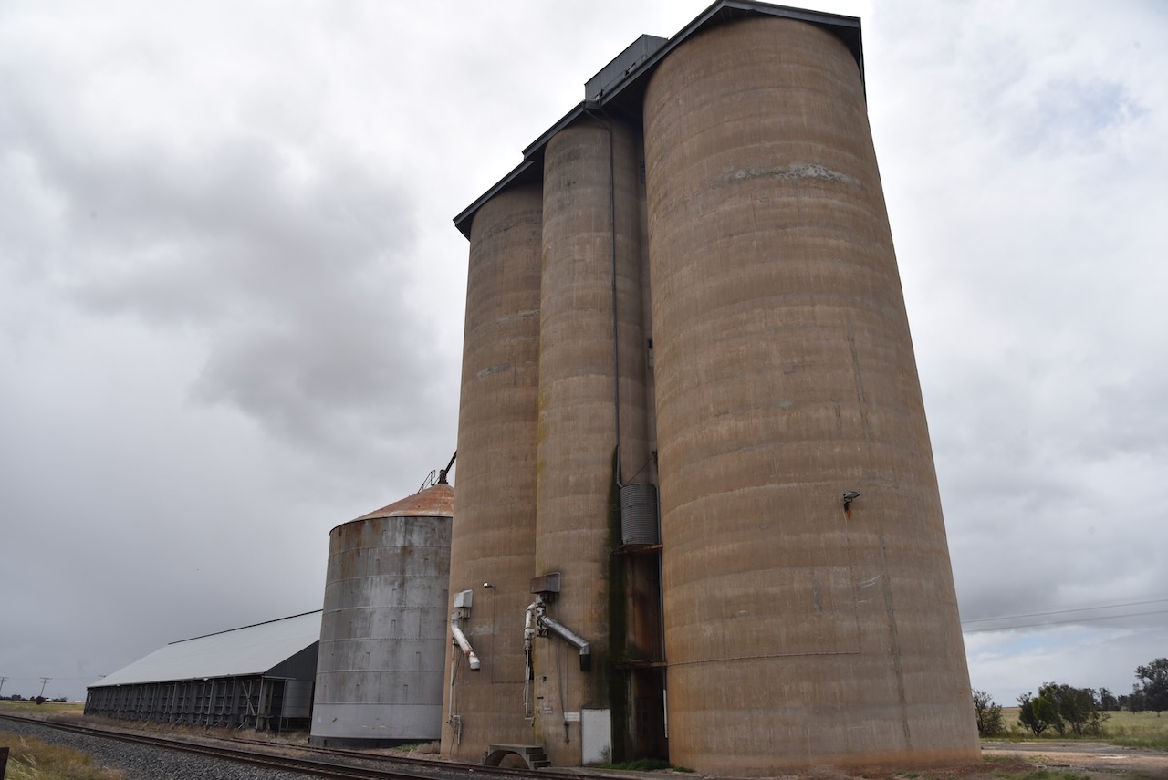
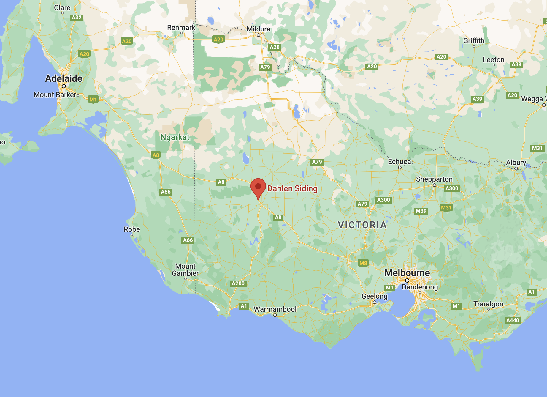
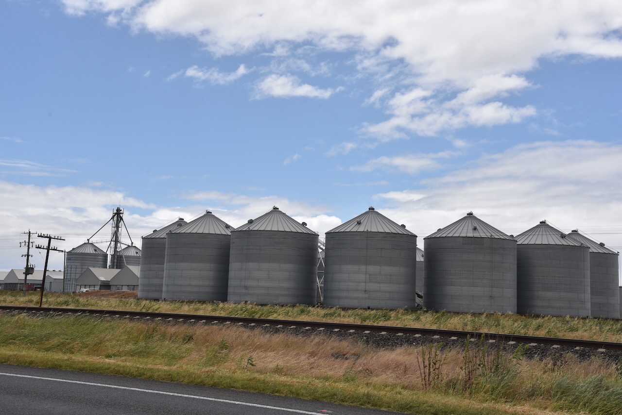
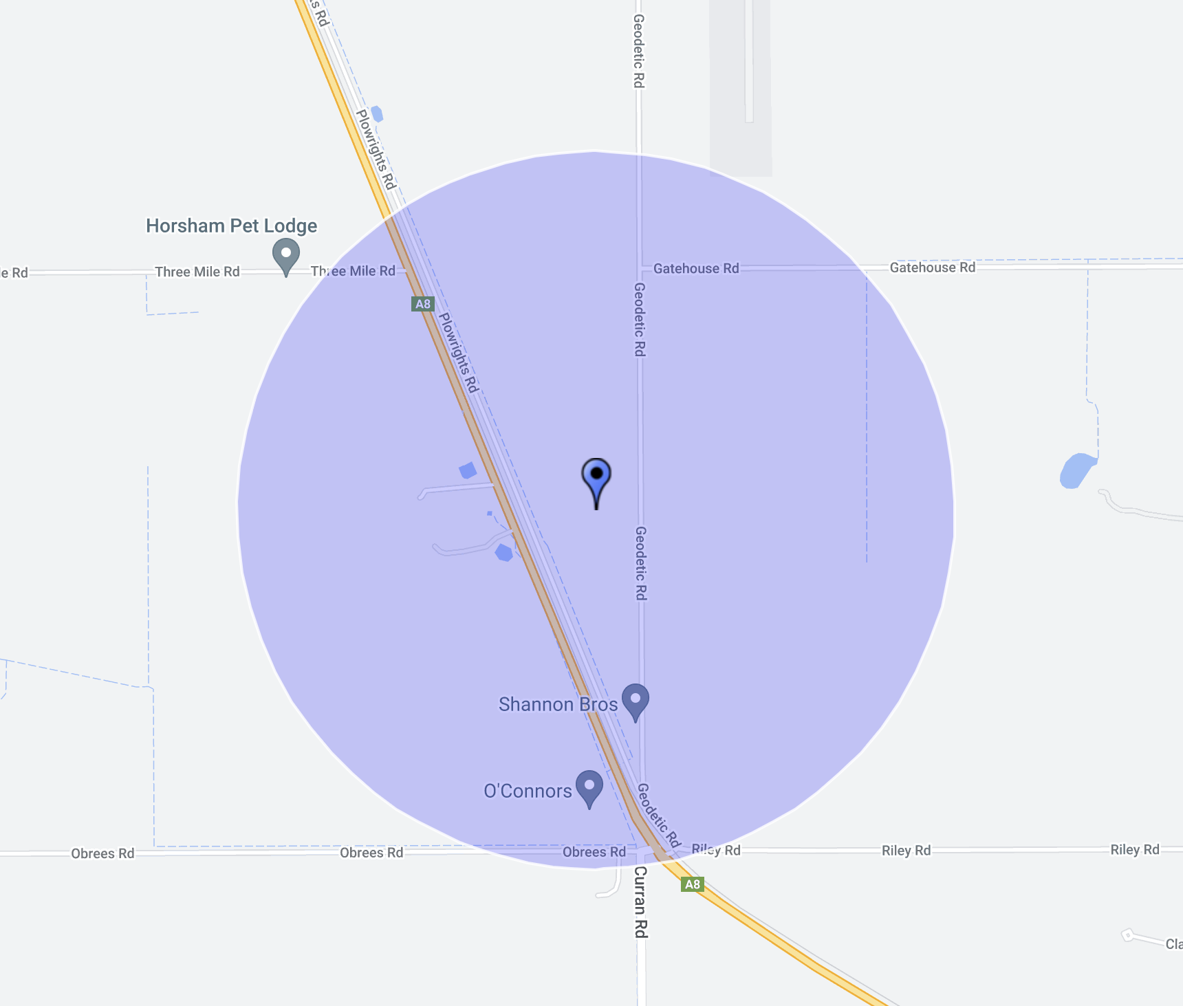
Our third silo for Monday 21st November 2022 was the Dahlen Siding silo VK-DHG3. It is located on the Western Highway about 10km north west of Horsham.
Above:- Map showing the location of Dahlen Siding. Map c/o Google maps.
Dahlen Siding is a railway siding, with the silos being located between the Western Highway and Plowrights Road.
The Dahlen silos were built in 1951.
Above:- Article from The Horsham Times, Tues 17 July 1951. Image c/o Trove.
We operated from right alongside of the silos, running the Icom IC-7000, 100 watts, and the Codan 9350 self tuning antenna.
During our activation we were hit by heavy rain and hail. As the rain band approached the rain static on the 20m band went up to strength 9.
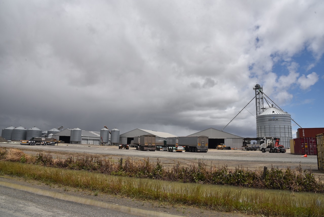
Our second silo for Monday 21st November 2022 was the Vectis silo VK-VCS3, located just off the Wimmera Highway in western Victoria, about 15 km west of Horsham.
Above:- Map showing the location of Vectis, Victoria. Map c/o Google maps.
The rural locality of Vectis was named after the Vectis pastoral run which was taken up in 1844 by James and Alexander Wilson. By the early 1870’s a number of Prussian Lutheran settlers took up farm selections in the area. In 1875 the Zion Lutheran church was erected. Schools were also established between 1876 to 1878. In 1887, the railway line between Horsham and Noradjuha was opened and a railway station existed at Vectis.
The Vectis silos are working silos, operated by Shannon Bros, a family owned and operated commercial grain storage, export packing and logistics company. They have two grain receival and export packing sites, one of which is Vectis.
We operated from the 4WD for this activation on Geodetic Road, adjacent to the silo. We used the Icom IC-7000, 100 watts, and the Codan 9350 self tuning antenna.
Above:- Map showing the location of the silo and the activation zone. Image c/o SiOTA website.
On our way home (Monday 21st November 2022) we had planned on trying to activate as many silos as possible for the Silos On The Air (SiOTA) program. We had a 410 km drive ahead of us and it was already late in the morning, so each activation was going to be quick.
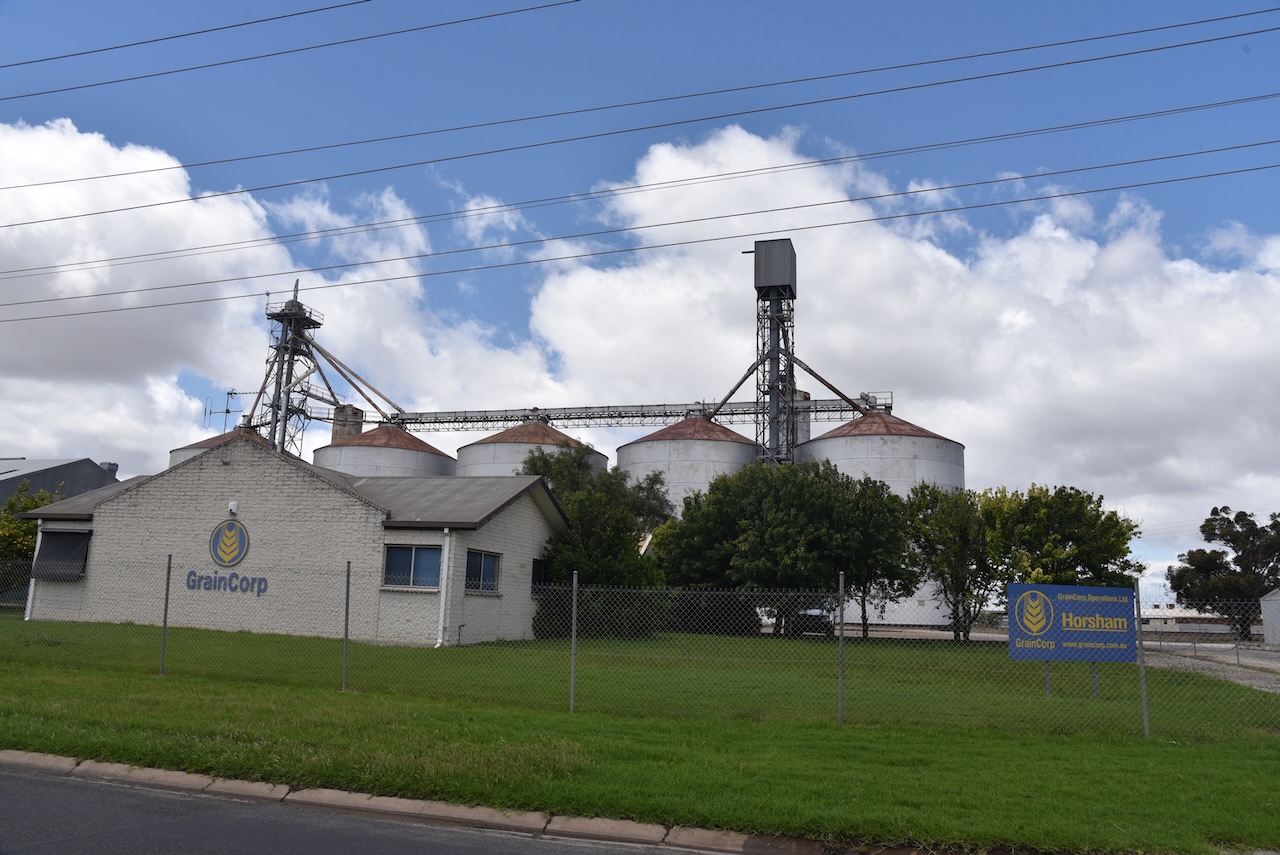
Our first silo was the Horsham silo VK-HRM3, in western Victoria.
Above:- Map showing the location of Horsham. Map c/o Google maps.
Horsham is a regional city in western Victoria about 300 km northwest of Melbourne. It has a population of about 20,429 people (2021 census). It is the 11th largest city in Victoria.
It was named Horsham by James Monckton Darlot (b. 1811. d. 1903), an early settler in the area, after his native town of Horsham in the United Kingdom.
Above:- Article from The Blayney Advocate and Carcoar Herald, Sat 20 Jul 1901. Image c/o Trove
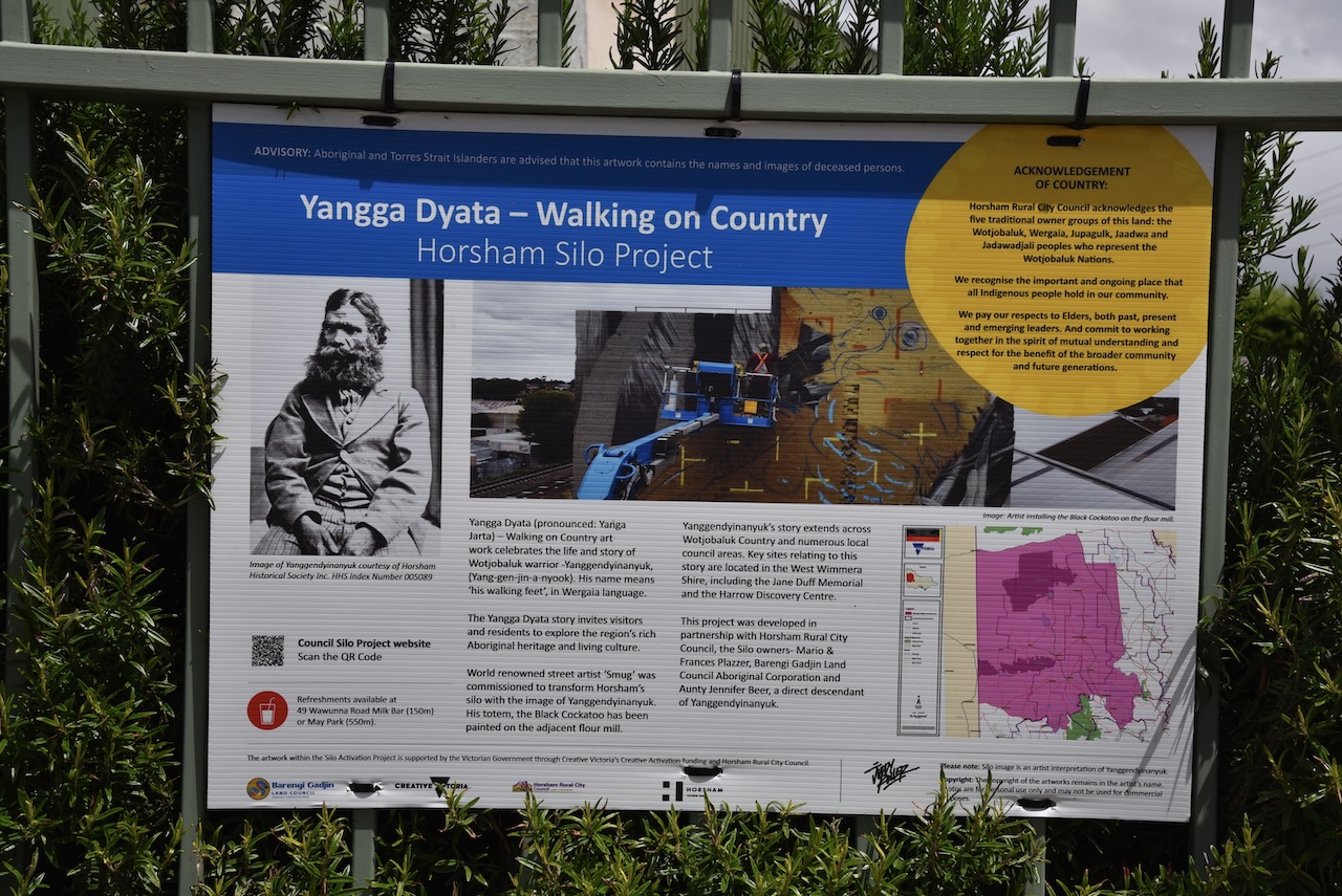
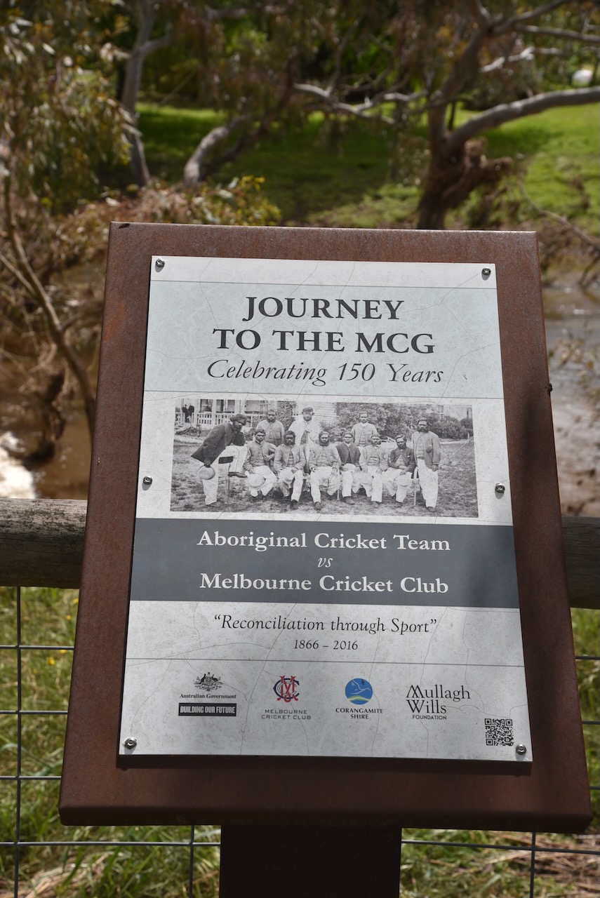
The Horsham silo features silo art. The silo itself has a painting of Yanggendyiaanyuk, an aboriginal man whose tracking skills were used. On the old flour mill next to the silo is a painting of a Red-tailed Black Cockatoo.
The murals were painted by artist Sam Bates @ Smug and were completed in May 2022. The mural is titled The Yangga Dyata which means ‘Walking on Country’.
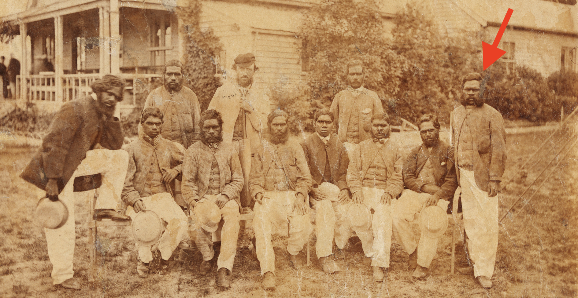
Yanggendyinanyuk (b. c. 1834d. 1866), also known as ‘Dick-a-Dick’, Dicky Dick, King Richard, Richard Kennedy, and Richard Barney, was a tracker and cricketer. He was a member of the first Australian cricket team to tour England in 1868, composed of aboriginal Australians.
Above:- The aboriginal cricket team, c. 1867 at the Melbourne Cricket Team. Image c/o State Library NSW
The story of this cricket team is little known by many Australians I have found. There is a brilliant museum at Harrow, the Harrow Discovery Centre, which we have visited and tells the story of the team.
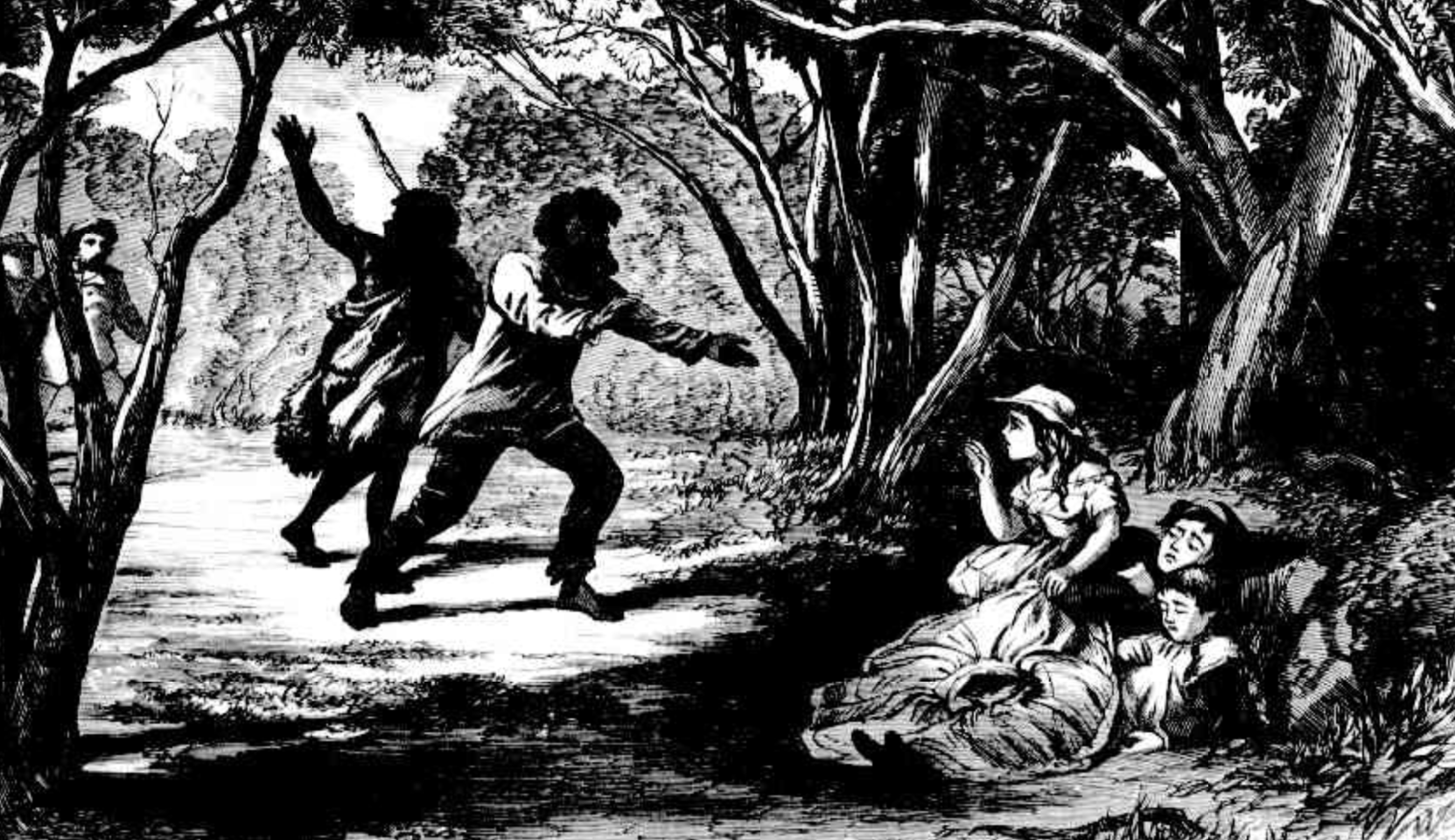
On Friday the 12th day of August 1864, in the mallee scrub near Natimuk, three white children, Isaac Cooper, Jane Cooper and Frank Duff, went missing. Their tracks were found the following day, however a thunderstorm developed and this resulted in the tracks being destroyed. The official search for the children was subsequently cancelled and the children were reported as being dead.
Six days later on the 18th day of August 1864, a neighbour of the Duff family suggested that Dick-a-Dick and other Wotjobaluk aboriginal trackers be used. The Duff family agreed and as a result, Dick-a-Dick took two other Wotjobaluk men, Jerry and Fred, with him and recommenced a search. Within hours they located the children.
As a result Dick-a-Dick became a hero and was called King Richard. He and the other two aboriginal trackers received a reward of £15 between them. They were permitted to spend £5 in whatever fashion they chose, while the remaining amount ws given to their white employer.
Above:- from an article in The Australian News for Home Readers, Sat 24 Sep 1864. Image c/o Trove.
We operated from the 4WD directly alongside of the silo on Wawunna Road, Horsham. We used the Icom IC-7000, 100 watts, and the Codan 9350 self tuning antenna for this activation.
Above:- The location of the silo and the activation zone. Image c/o SiOTA website.
It was day 27 (Monday 21st November 2022) and the final day of our amazing trip. After breakfast and booking our of our motel we decided to do one more final park activation. We did plan on a number of silos on our way home.
We headed to the JJ Kingston Wildflower Sanctuary VKFF-2337, just on the edge of the town of Stawell.
Above:- Map showing the location of the JJ Kingston Wildfloweer Sanctuary. Map c/o google maps
The park is a tiny piece of remnant scrub on the northern side of Crowlands Road between Barbara Street and Oliver Road.
Above:- An aerial view of the park. Image c/o Google Earth.
The park is named in honour of Mr. J.J. Kingston, the Stawell Mayor 1951-1952.
Unfortunately there were no wildflowers in the park during our visit.
We operated from the 4WD for this activation, running the Icom IC-7000, 100 watts, and the Codan 9350 self tuning antenna.
Marija made the following QSOs on 40m SSB:-
VK2IO
VK2MET
VK1AO
VK2PKT
VK5HAA
VK5FANA
VK5BJF
VK5BJE
VK3PF
VK3AHR
Marija made the following QSOs on 20m SSB:-
VK2MET
VK1AO
I made the following QSOs on 40m SSB:-
VK2IO
VK2MET
VK1AO
VK2PKT
VK5HAA
VK5FANA
VK5BJF
VK5BJE
VK3PF
VK3AHR
I made the following QSOs on 20m SSB:-
VK2MET
VK1AO
VK4MUD
ZL1TM
VK4EMP
VK4TI
We headed back into Stawell and despite having visited the town many times previously, we took the time to have a look at some of the historic buildings located in the town.
St Matthews Uniting Church was completed in 1868 and was opened on the 11th day of April 1869 with a special dedication service. The church was built at a cost of about £2000. The tower and spire was paid for by anonymous donor at a cost of £1352. The 40,000 bricks required were purchased for 35 shillings per 1000.
Oban was built in 1898 as a private home for Mr & Mrs. Edward Simmons (no known relation). He and his brother Walter were the main shareholders in Stawell’s Oriental gold mine.
The town of Stawell holds the annual Stawell Gift, a foot race which has been held since 1878. It is held at Central Park in Stawell.
No visit to Stawell can pass without a visit to the local bakery which has regularly been the winner of Australia’s best vanilla slice.
We then stopped at the site of the old Pleasant Creek Hospital. It was opened on the 21st day of June 1861 and replaced the tent hospital of the goldfields. It was the only hospital between Ballarat and the Murray at that time. In 1882 a Benevolent ward was opened which gave shelter to many miners and others who had come from overseas int he gold rush days and had no families in Australia to assist them.
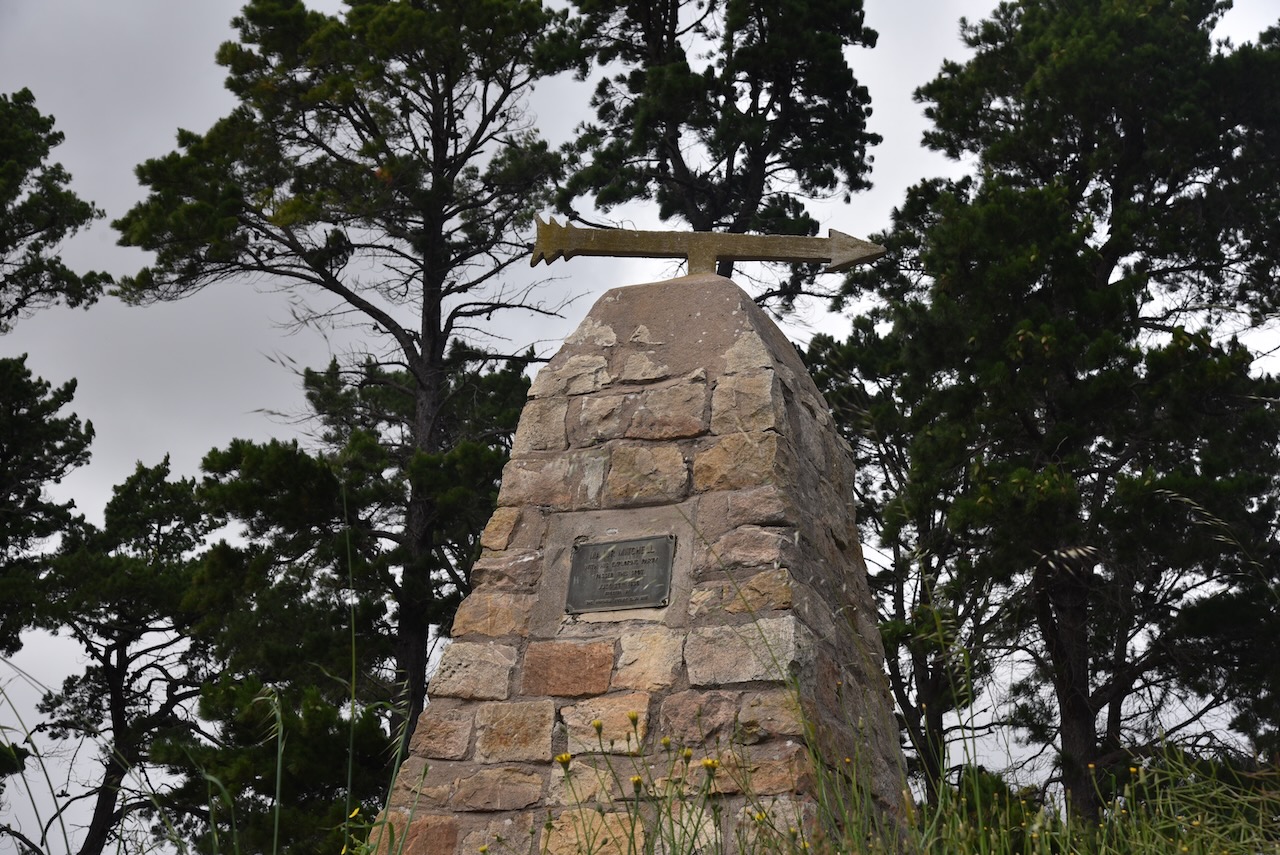
A little further along the Western Highway at Stawell is the memorial cairn for explorer Major Mitchell who passed by the location in July 1836.
A little further down the road, not far from Deep Lead is the Doctors Hill Monument. It commemorates the establishment and erection in 1859 of the first Pleasant Creek Hospital, which served the needs of the gold miners and the rural community of western Victoria.
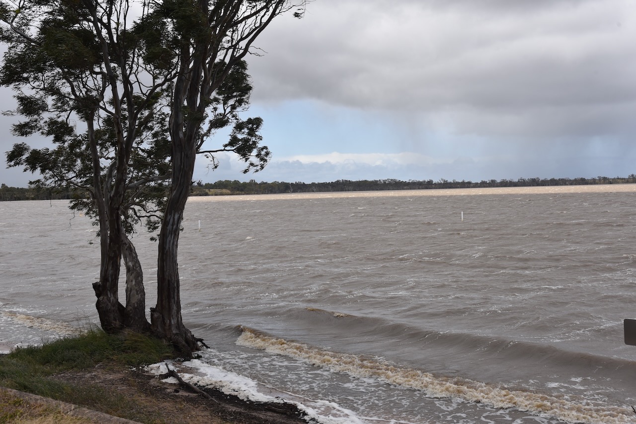
Just before getting into Horsham we stopped sat Green Lake where I previously went swimming as a child during my visits to Horsham to with my parents to visit relatives. Due to all of the recent rain the lake was full. Marija and I have previously seen it bone dry.
We then called in to see my Aunty Dawn and Uncle Jack at Horsham, and spent a few very enjoyable hours with them.
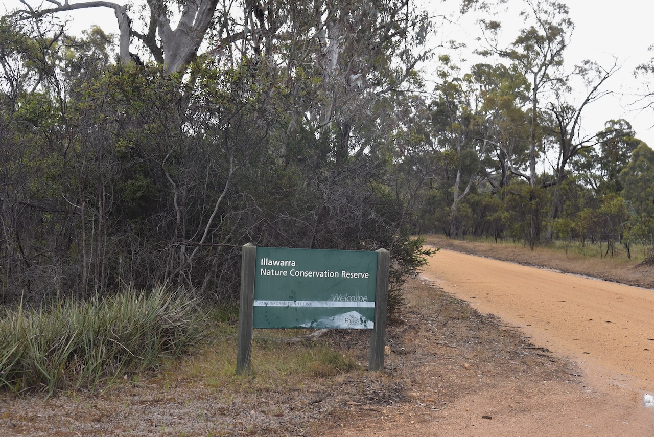
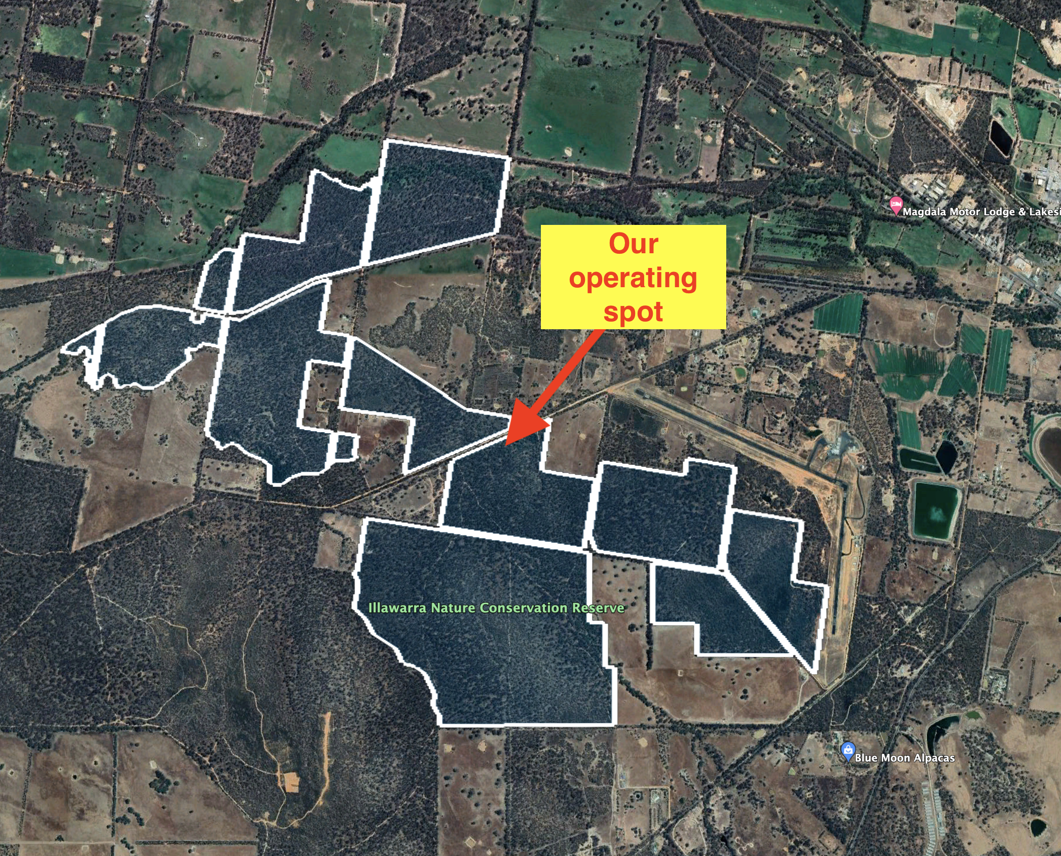
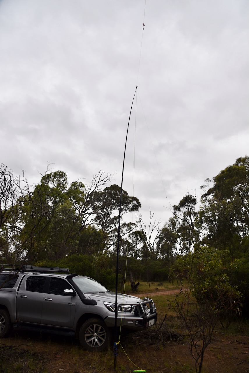
Our final park for 20th November 2022 was the Illawarra Nature Conservation Reserve VKFF-2111. The park is located in western Victoria near Stawell, about 243 km northwest of Melbourne.
Above:- Map showing the location of the Illawarra Nature Conservation Reserve. Map c/o google maps.
Prior to heading to the park we booked in to our accomodation in Stawell.
We then drove the short distance out to the park. The Illawarra Nature Conservation Reserve covers an area of about 600 hectares.
The critically endangered Swift parrot can be located in the park.
We set up in a clearing amongst the scrub off Commercial Road. As it was raining on and off, we operated from the 4WD for this activation, running the Yaesu FT857, 40 watts, and the 20/40/80m linked dipole.
Above:- An aerial view of the park showing our operating spot. Image c/o Google Earth.
Marija made the following QSOs on 20m SSB:-
VK4HAT
VK4SMA
VK4TJ
VK6AB
VK4NH
VK4DXA
ZL4NVW
VK6NU
VK6JK
VK3VEK
VK4MUD
VK4FW
VK8MM
VK2IO/p (Windsor Downs Nature Reserve VKFF-2020)
I made the following QSOs on 20m SSB:-
VK4HAT
VK4SMA
IK4IDF
HA4FB
VK4TJ
VK6AB
VK4NH
VK4DXA
ZL4NVW
SP5INQ
VK6NU
IW2NXI
UT5ZC
VK6JK
ZL3MR
VK3VEK
VK4MUD
VK4FW
VK8MM
I made the following QSOs on 40m SSB:-
VK3AHR
VK3ZPF
VK7XX
VK5BJE
VK3SQ
VK3DL
VK3PF/m
VK5MSA
KG5CIK
VK4FW
VK8MM
VK2YAK
VK4YAK
VK2IO/p (Windsor Downs Nature Reserve VKFF-2020)
VK3VIN
VK3GJG
VK5FANA
VK5KLV
VK4NH
VK4DXA
VK2GMC
VK2MET
VK1AO
VK5AYL
VK3ZK
VK3CWF
VK3UAO
VK2YK
VK5GA
VK3ACZ
VK7PSJ
VK3ANL
VK3UH
VK1DI
VK4HMI
VK4EW
VK4HAT
VK4MUD
VK4TVR/m
VK1HF
We packed up and headed back to Stawell and purchased Fish N Chips and went back to our motel room for the evening.
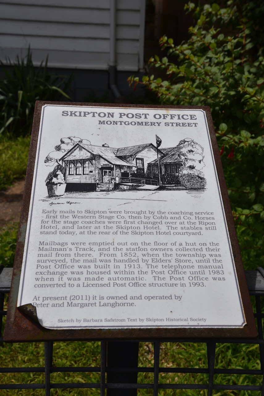
After packing up at Rokewood (20th November 2022) we headed northwest along the Rokewood-Skipton Road and we soon reached the little town of Skipton.
Skipton takes its name from Skipton in Yorkshire in the United Kingdom. It comes from Old English – ‘Scip-tun’ meaning ‘sheep town’. The area was first established as a pastoral run in 1839. By 1852 the town site had been surveyed. A Post office was opened on the 6th day of March 1858. In 1859, Skipton held the first agricultural show in the western district of Victoria.
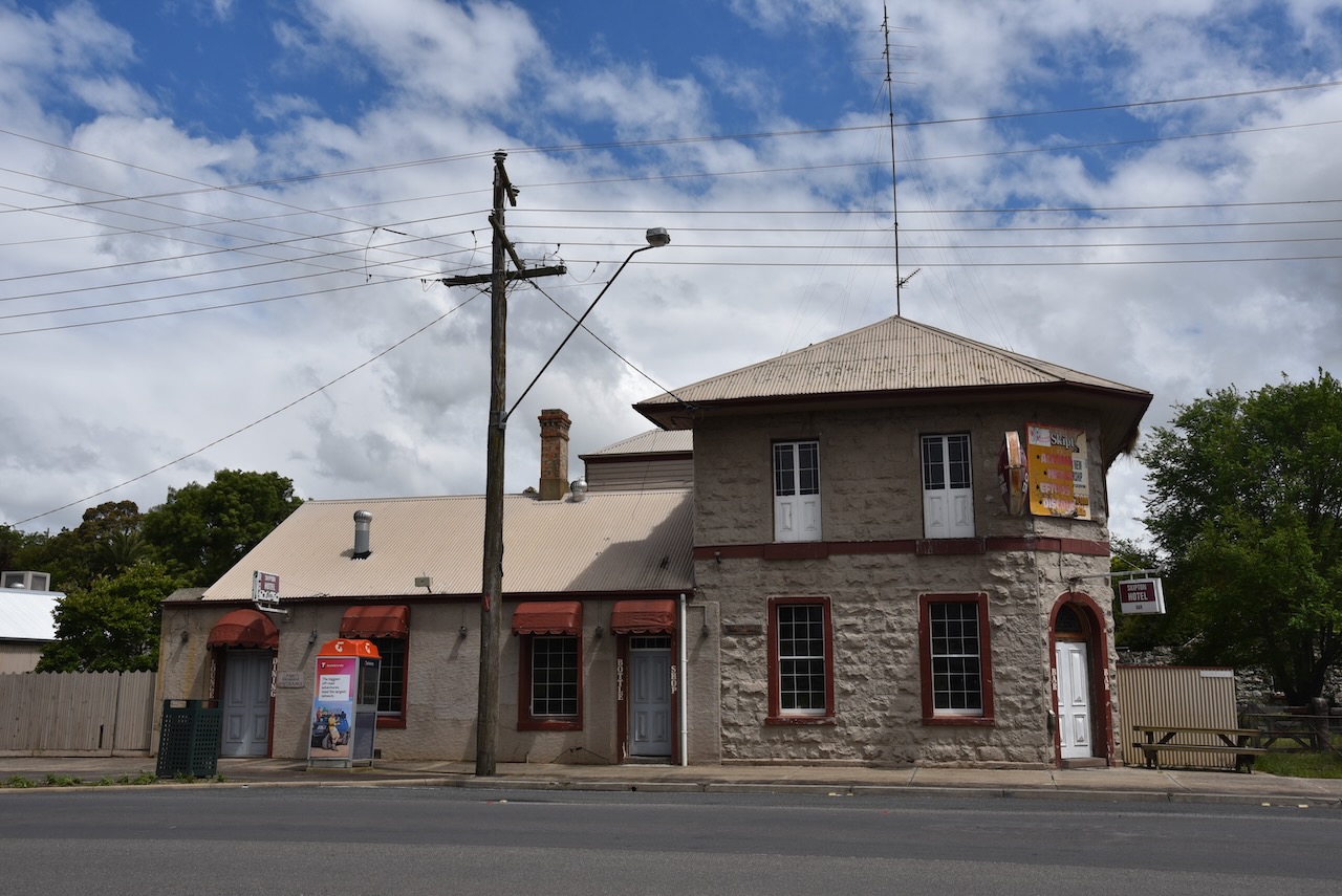
Skipton was the home to a number of notable people including Henry Bolte, the longest serving Premier of Victoria. There are also a number of historic buildings including the old Skipton Hotel which waas built in 1859.
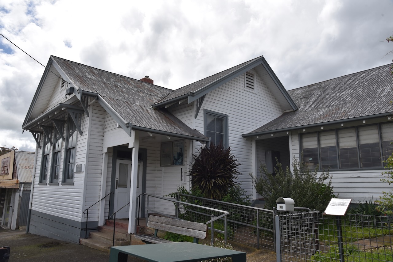
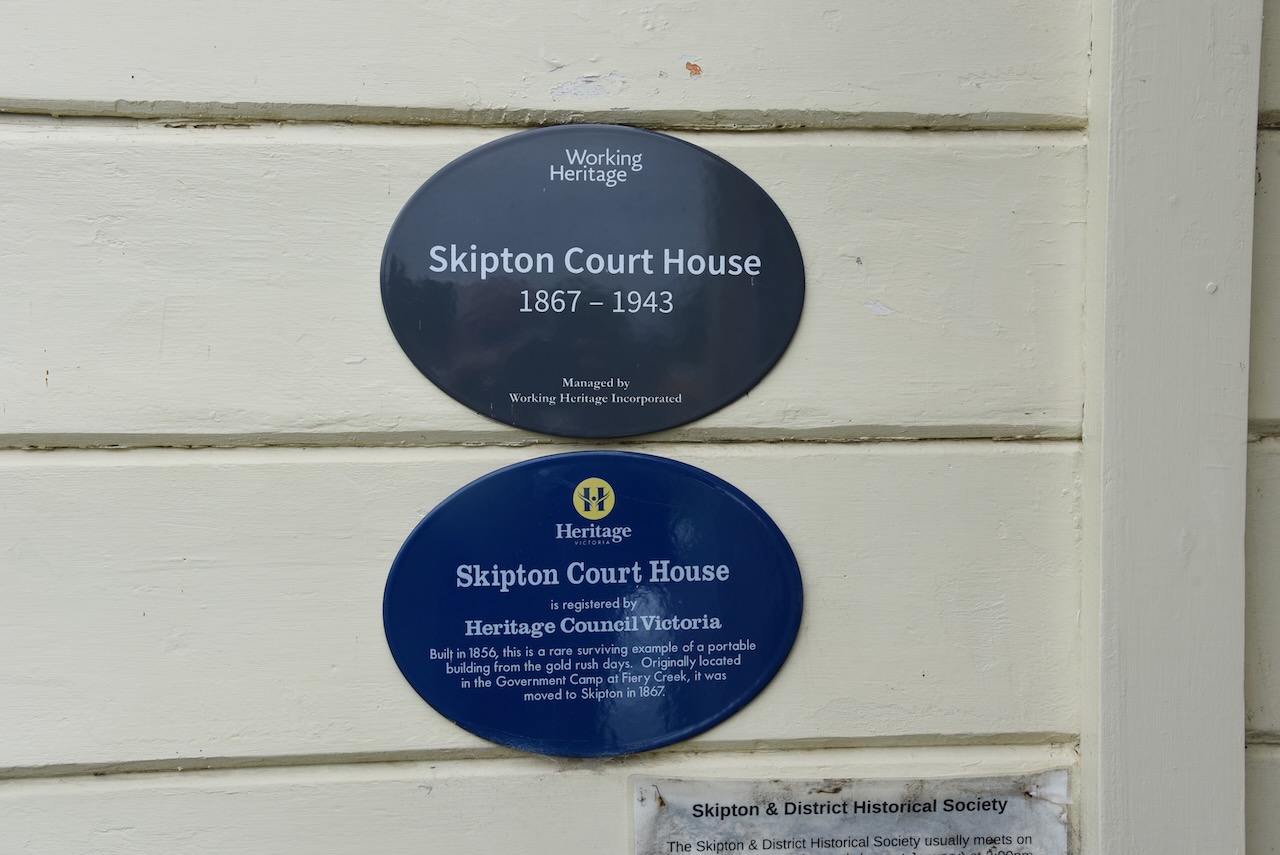
Marija and I then visited the old Skipton Court House which is now used by the Skipton Historical Society.
The old court house building was built at the government camp at Fiery Creek in 1856 and was moved to Skipton in 1867. We were lucky in that there were volunteers present and we were able to go inside the courthouse. The volunteer that we spoke to advised that the court house was flooded in recent weeks due to the heavy rain and that water was quite a few inches deep inside.
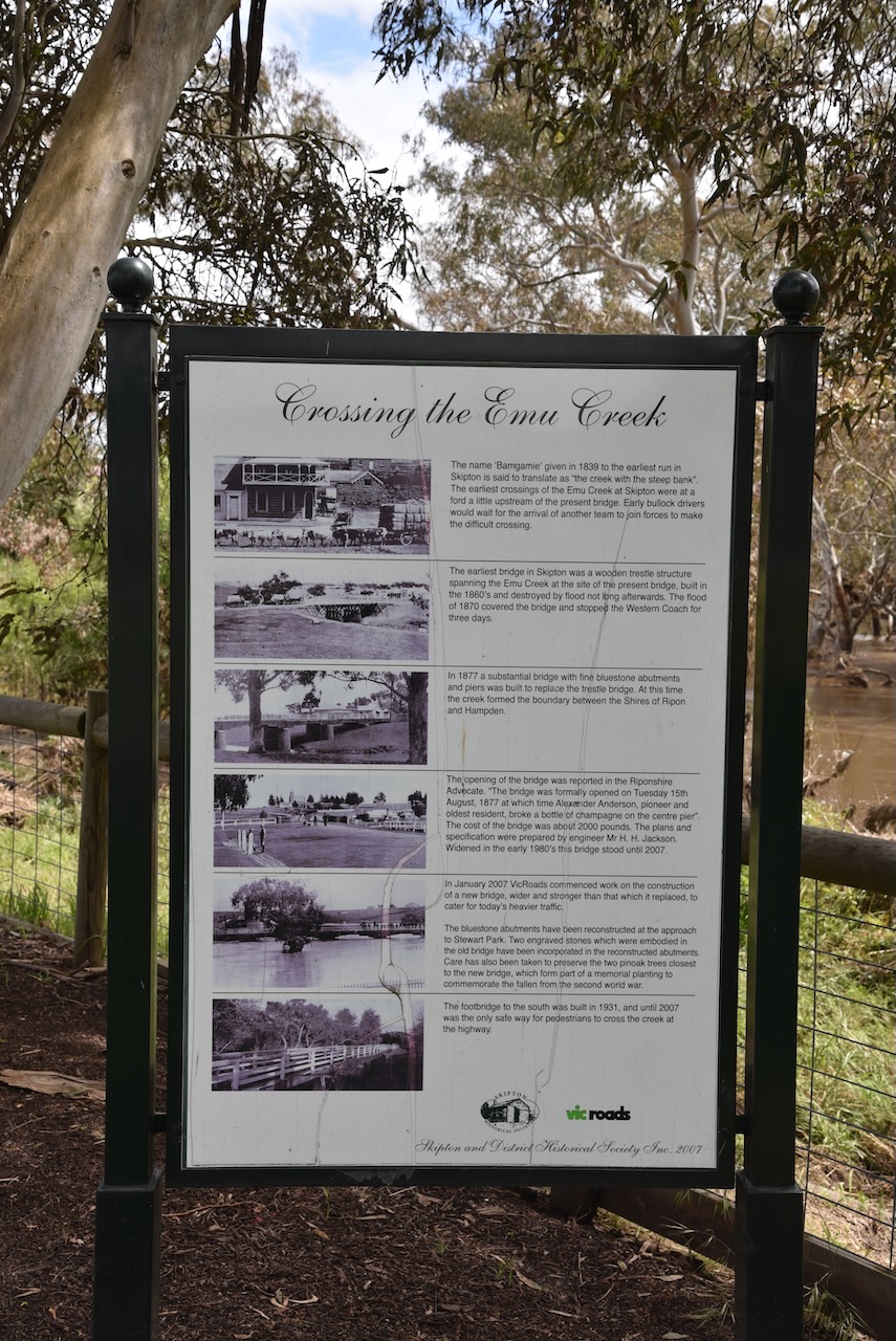
Adjacent to the old court house is Stewart Park on the banks of the Mount Emu Creek. There is a viewing platform in the park to view platypus which can be found in the creek. There are also a number of information boards with history of Skipton, and a memorial cairn to the Skipton pioneers. There was quite a bit of water flowing along the creek after the recent floods.
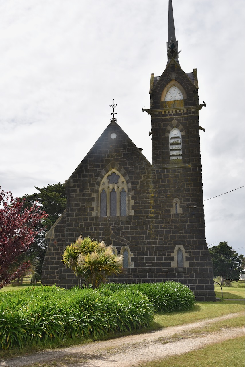
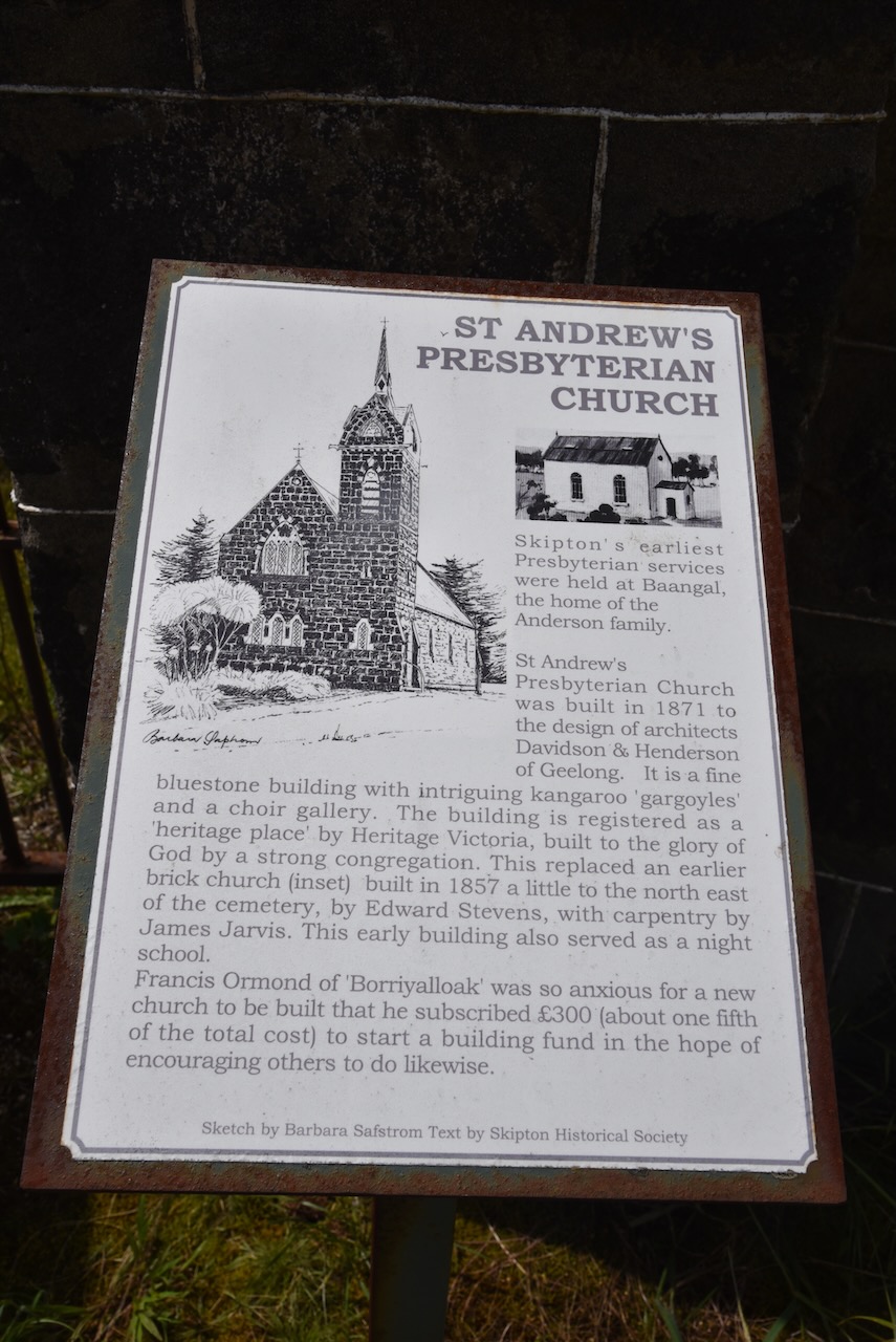
We then had a look at St Andrews Presbyterian Church, a beautiful tuck-pointed bluestone Gothic Revival church which was built between 1871-1872.
We then drove north out of Skipton on the Skipton Road towards Beaufort. Marija saw on the map that the Blacks Creek Nature Conservation Reserve VKFF-2049 was just up the road, so we decided to call in there for a quick park activation.
Above:- Map showing the location of the Blacks Creek NCR. Map c/o Google maps.
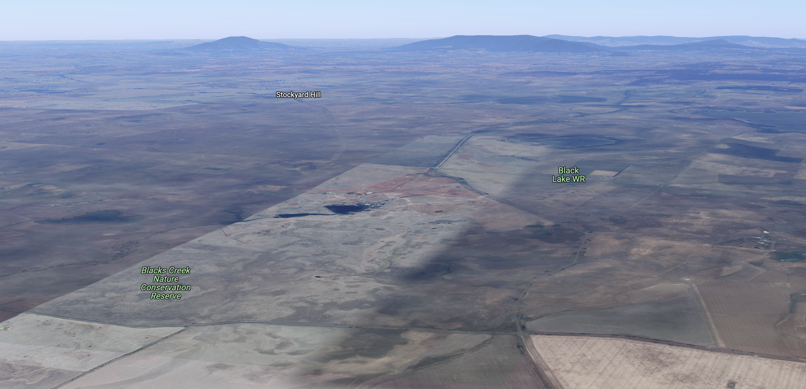
The Blacks Creek Nature Conservation Reserve is 233.95 hectares in size and is located on the northern side of the Carngham-Streatham Road. It was gazetted in 2002.
Above:- An aerial view of the Blacks Creek NCR. Image c/o Google maps.
The park preserves Plains Grassland which is considered endangered in the Victorian Volcanic Plain bioregion. Patches of grassland the size of Blacks Creek are very rare. The park contains a number of significant plant species, including at least two which are of national significance.
Marija and I set up near the corner of the Carngham-Streatham Road and Stockyard Hill Road.
Above: Aerial view of the park showing our operating spot. Image c/o Google Earth.
Marija worked the following stations on 40m SSB:-
VK7XX
VK2HHA
VK3SQ
VK2MET
VK1AO
VK2VH
VK4AAC
VK3VB
VK7AN
VK5PL
VK2IO/p (Pitt Town Nature Reserve VKFF-1984)
VK3BEZ/p (Alpine National Park VKFF-0619)
VK3NRB/p (Alpine National Park VKFF-0619)
I worked the following stations on 40m SSB:-
VK7XX
VK2HHA
VK3SQ
VK2MET
VK1AO
VK2VH
VK4AAC
VK3VB
VK7AN
VK2PKT
VK5PL
VK3VIN
VK5AYL
VK3BBB
VK2CCP
VK3DL
VK3GRX
VK2IO/p (Pitt Town Nature Reserve VKFF-1984)
VK4FW
VK8MM
VK4TJ
VK3UH
VK4KLA
VK3YV
VK3ZK
VK4NH
VK4DXA
VK3GJG
VK3BEZ/p (Alpine National Park VKFF-0619)
VK5KVA
VK3NRB/p (Alpine National Park VKFF-0619)
VK3DXJ
VK5BJE
VK1AAF
I worked the following stations on 20m SSB:-
VK4NH
VK4DXA
VK4FW
VK8MM
VK4EW
VK4SMA
I worked the following stations on 20m AM:-
VK4EW
VK4NH
VK4DXA
VK4SMA
It had started to rain so we packed up, with 57 contacts in the log, including 6 Park to Park contacts.
We drove north on the Skipton Road towards Beaufort and the heavens really opened up and we experienced very heavy rain was we drove passed Lake Goldsmith.