Black Dog Natural Features Reserve VKFF-3599

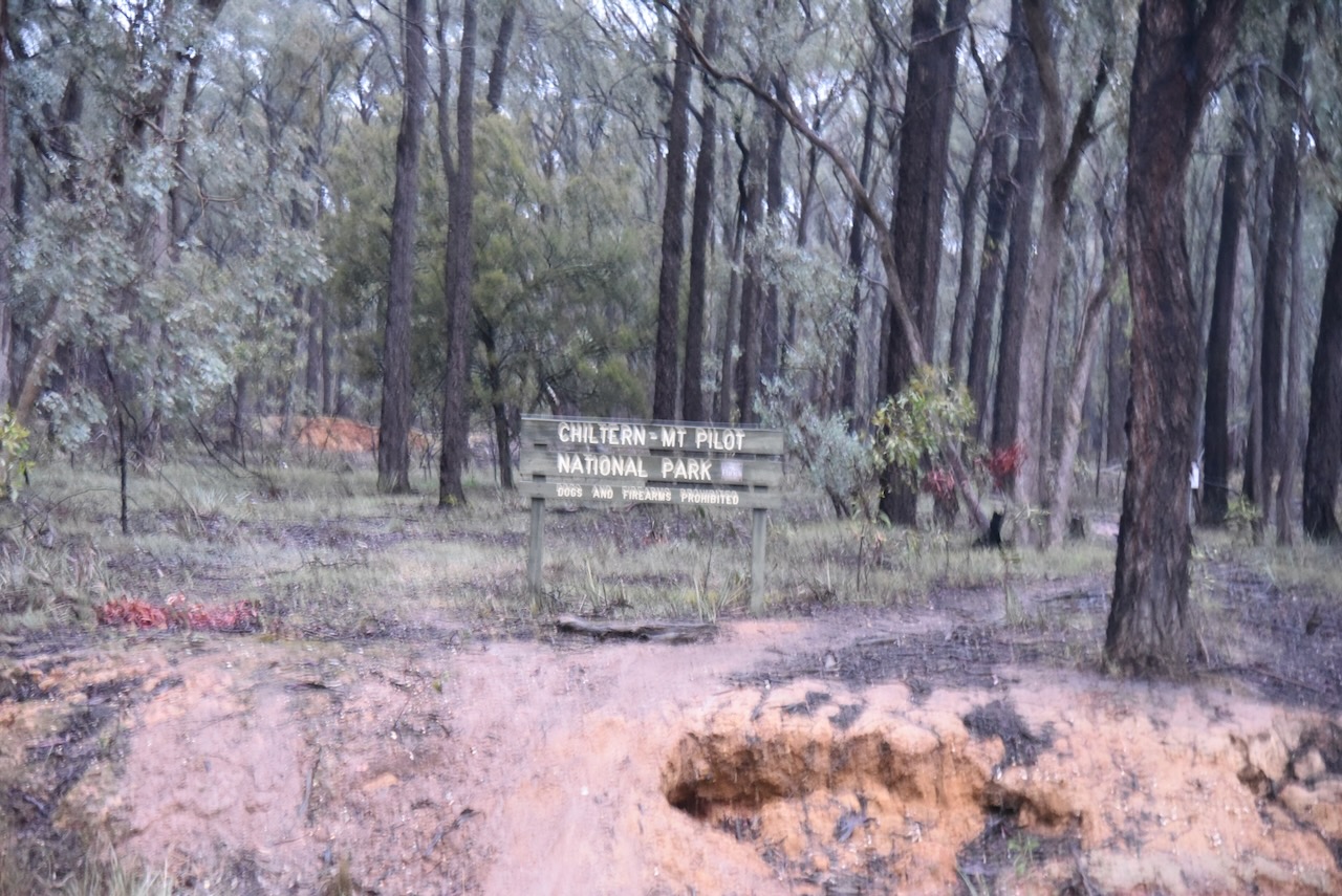
Our first VKFF park activation for Monday, the 4th day of May 2026, was the Black Dog Natural Features Reserve VKFF-3599. The reserve is located southeast of Chiltern.

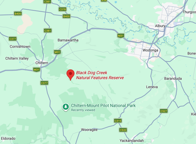
Above: Map showing the location of Black Dog Natural Features Reserve. Map c/o Google Maps

The reserve stretches from near the junction of Beechworth-Chiltern Road and Black Dog Creek Road in the west, to near the junction of Black Dog Creek Road and Jessies Lane to the east.

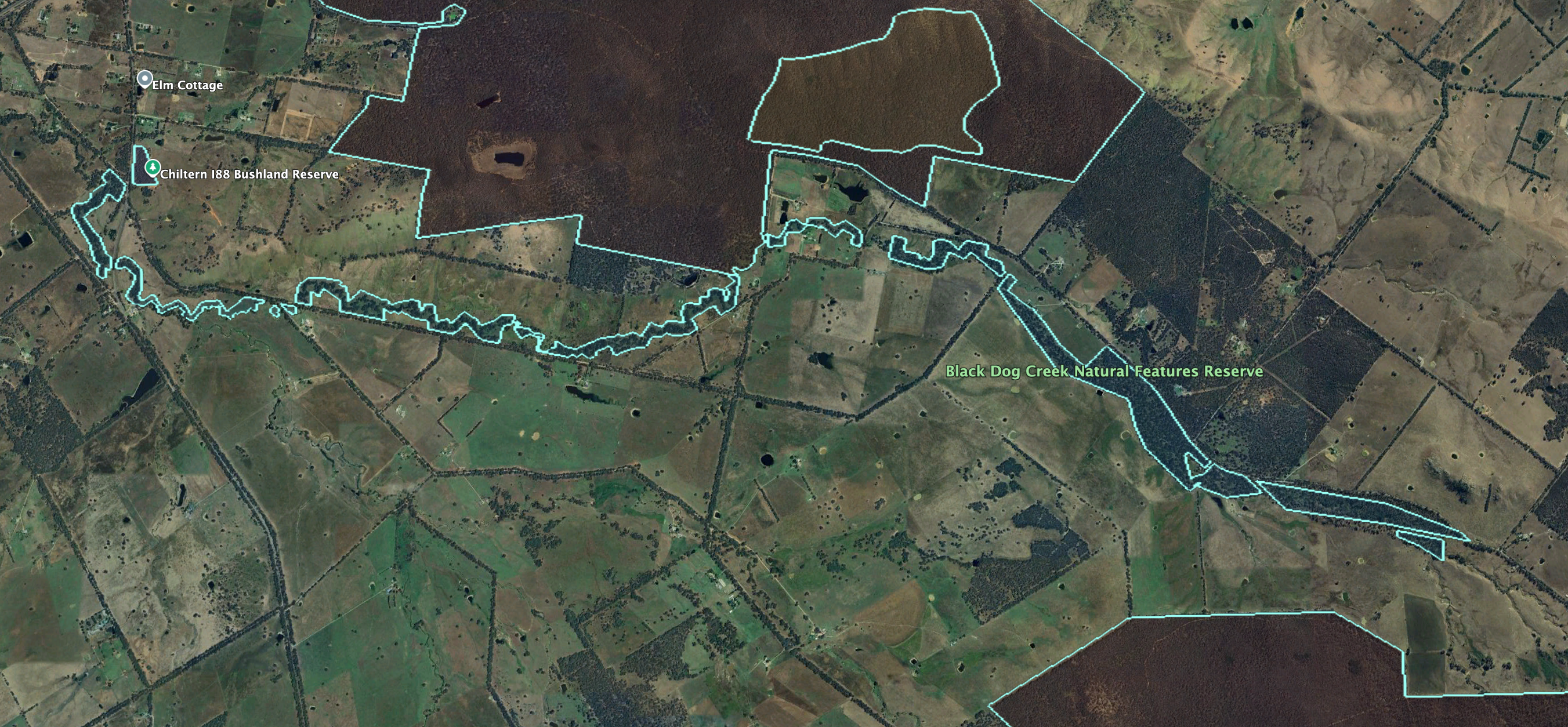
Above: the boundaries of Black Dog NFR. Image c/o Google Earth

The nearby town of Chiltern, situated on the Black Dog Creek, was originally known as the Black Dog township. The Black Dog Inn was opened in 1845, where the creek crossed the Melbourne-Sydney Road. The township was surveyed in 1851-1852 along the creek. Only a few years later, the name was changed to Chiltern (Victorianplaces.com.au 2026)

We operated off Black Dog Creek Road near Jessies Land. We ran the Yaesu FT857, 40 watts, and the 20/40/80m linked dipole.

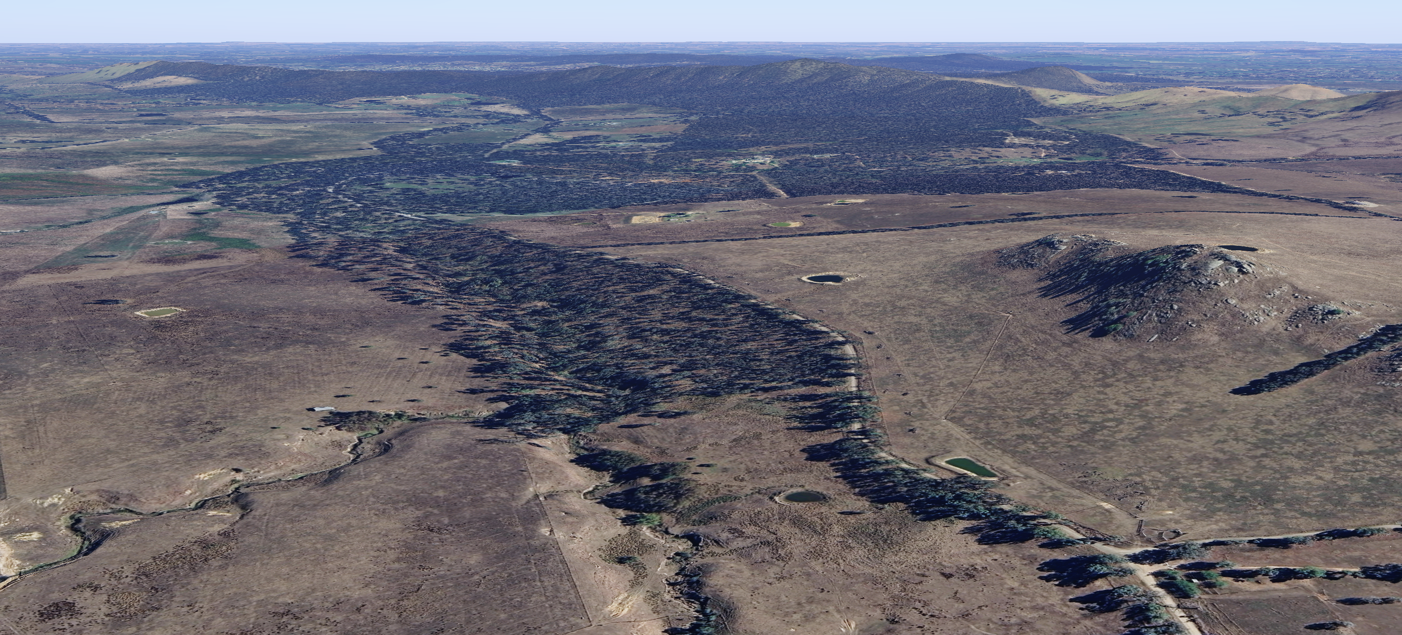
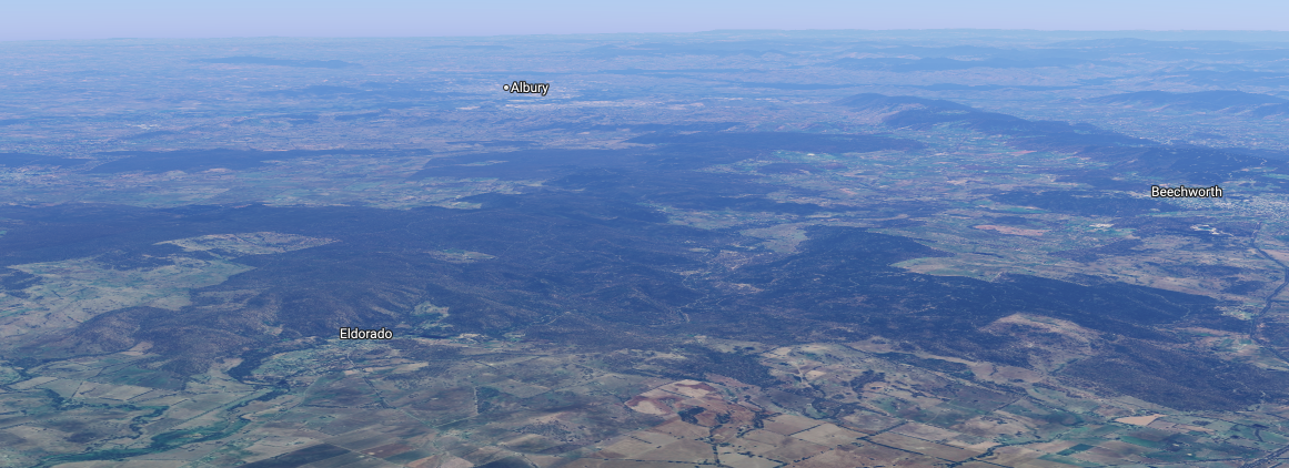
Above: An aerial view of the park. Image c/o Google Maps

I worked the following stations on 40m SSB:-

  1. VK5AOK
  2. VK3VIN
  3. VK3KRL
  4. VK4NH
  5. VK4DXA
  6. VK3GJG
  7. VK3TAZ
  8. VK3CEO
  9. VK7PJM
  10. VK1CHW
  11. VK2CHW
  12. VK2LAX
  13. VK2COS
  14. VK3FB
  15. VK2EXA
  16. VK2IO/M
  17. VK2GEZ/M
  18. VK1AO
  19. VK2MET
  20. VK3CJN
  21. VK3QHU
  22. VK4EMP
  23. VK4TI
  24. VK4GKO
  25. VK3SQ
  26. VK2BD
  27. VK3JT
  28. VK4CZ
  29. VK3FS
  30. VK3ATT
  31. VK3ETT
  32. VK3APJ
  33. VK3SO
  34. VK3SFG
  35. VK3WMF
  36. VK5LRB
  37. VK1XP
  38. VK2MW
  39. VKWHSV
  40. VK3ZAQ
  41. VK4BWL
  42. VK3PF/M
  43. VK3MCK
  44. VK3BEL
  45. VK3BEB
  46. VK4FNQ

I worked the following stations on 40m AM:-

  1. VK3SQ
  2. VK3JT
  3. VK2BD
  4. VK3GJG
  5. VK3TAZ
  6. VK2IO/M
  7. VK2GEZ/M
  8. VK2EXA
  9. VK3CLD
  10. VK5QA
  11. VK2DBF
  12. VK3AMO
  13. VKECEO
  14. VK3GAZ
  15. VK2MW
  16. VK3APJ

I worked the following stations on 20m SSB:-

  1. VK2VW
  2. VK2HFI
  3. VK2AKA
  4. VK2BUG
  5. VK4CZ
  6. VK4NH
  7. VK4DXA
  8. VK2IO/M
  9. VK2GEZ/M

I worked the following stations on 20m AM:-

  1. VK2VW
  2. VK2HFI
  3. VK2AKA
  4. VK2BUG
  5. VK4CZ

References.

  1. Victorianplaces.com.au. (2026). Chiltern and Chiltern Shire | Victorian Places. [online] Available at: https://www.victorianplaces.com.au/chiltern-and-chiltern-shire [Accessed 12 May 2026].‌

Chiltern Mount Pilot National Park VKFF-0620

My final park for Sunday, the 3rd day of May 2026, was the Chiltern-Mount Pilot National Park VKFF-0620. The park is located southwest of Albury, and south of Chiltern in northeast Victoria.

Above: Map showing the location of Chiltern-Mount Pilot National Park. Map c/o Google Maps

The Chiltern-Mt Pilot National Park is about 21,650-hectares (53,500-acres) in size and extends west from Beechworth across the busy Hume Freeway to the west of Chiltern. (Wikipedia 2026)

Above: the various boundaries of the Chiltern-Mount Pilot National Park. Image c/o Google Earth

When the Europeans settled in Australia, box-ironbark forests covered about 7.4 million hectares or 13% of Victoria. Nearly 80% of these forests were cleared by European settlers, while the remaining 20% was severely degraded due to grazing. Chiltern-Mount Pilot National Park was declared to protect the remaining box-ironbark forest. (Wikipedia 2026)

Above: an aerial view of the Chiltern-Mount Pilot National Park. Image c/o Google Maps

The Chiltern Regional Park, first known as the Chiltern State Park, was a 4,520-hectare (10,500-acre) box-ironbark forest that was gazetted in 1980. The Mount Pilot Multipurpose Park was also established. In 1997, the park became the Chiltern Box-ironbark National Park. In 2002, the Chiltern Box-ironbark National Park and the Mt Pilot Multipurpose Park, in addition to other sections of land, were incorporated to form the Chiltern-Mt Pilot National Park. (Wikipedia 2026)

The park is home to more than 600 native species of flora, including 42 threatened species. This includes the crimson spider orchid, yellow hyacinth orchid, Warby swamp gum, and mountain swainson pea. (Wikipedia 2026)

A total of 276 different native mammals, birds, and reptiles have been recorded in the park. This includes 43 fauna species that are recorded as threatened. This includes the squirrel glider, Brush-tailed phascogale, Barking Owl, and Regent honeyeater. (Wikipedia 2026)

I did not intend to activate this park, and was on my way to another park, when I noticed the park sign after passing underneath the Hume Freeway on McHugh Road. The photo above featuring the park sign is blurred because it was taken in heavy rain.

The rain was so heavy that I could not string out the dipole. I had to operate from the vehicle for this activation, running the Icom IC-7000, 100 watts, and the Codan 9350 antenna with the 1.5 metre stainless steel whip.

The rain was so heavy at times that I could not hear the stations that were calling. In the end, the lightning rolled in and decided to call it a day. I headed back into Albury and went out for dinner with Heath VK3TWO, Chris VK5FR, Gerard VK2IO, Peter VK3PF, and his brother.

I worked the following stations on 40m SSB:-

  1. VK7EV
  2. VK2VW
  3. VK2HFI
  4. VK2AKA
  5. VK2BUG
  6. VK5KPR
  7. VK5MAZ
  8. VK4HMI
  9. VK3CJN
  10. VK3QHU
  11. VK2NNN
  12. VK3BEL
  13. VK3BEB
  14. VK3SMW
  15. VK3CLD
  16. VK5QA
  17. VK2DBF
  18. VK2IO/P (VKFF-2186)
  19. VK2GEZ/P (VKFF-2186)
  20. VK3AMO
  21. VK3EJ
  22. VK1CHW
  23. VK2CHW
  24. VK4KTW
  25. VK5FL
  26. VK5HS
  27. VK2OKR
  28. VK2BXB
  29. VK2AUS
  30. VK2AUR
  31. VK2AUK
  32. VK3UH
  33. VK3CEO
  34. VK4SMA
  35. VK2KEV
  36. VK7AAE
  37. VK5DIK
  38. VK2FDSD
  39. VK3APJ
  40. VK5AOK
  41. VK3KRL
  42. VK5FANA
  43. VK2OM
  44. VK5DW
  45. VK7AJP
  46. VK7PJM
  47. VK5AYL
  48. VK2PKT
  49. VK2KFT
  50. VK3MXW
  51. VK3PE
  52. VK4CZ

References.

  1. Wikipedia Contributors (2026). Chiltern-Mt Pilot National Park. Wikipedia.‌