Fryingpan Creek Streamskide Reserve VKFF-3692

My second activation for Sunday, the 3rd day of May 2026, was the Fryingpan Creek Streamside Reserve VKFF-3692.

Above: Map showing the location of Fryingpan Creek SSR. Map c/o Google Maps

The reserve is located on the southeast corner of High Street and Cemetery Road at Barnawartha.

Above: the boundaries at the reserve. Image c/o Google Earth

The reserve is about 5.5 hectares in size and was established on the 1st day of May 1979. As the name implies, Fryingpan Creek passes through the reserve. The creek commences near the Chiltern Mount Pilot National Park and flows into Indigo Creek to the north. (Dcceew.gov.au, 2023)

I ran the Yaesu FT857, 40 watts, and the 20/40/80m linked dipole for this activation.

I worked the following stations on 40m SSB:-

  1. VK3IFT
  2. VK3TKU
  3. VK3WRD
  4. VK2VW
  5. VK2HFI
  6. VK2AKA
  7. VK2BUG
  8. VK4BWL
  9. VK3VIN
  10. VK3CEO
  11. VK5AYL
  12. VK3MDC
  13. VK4FNQ
  14. VK3MB
  15. VK3KRL
  16. VK5MAZ
  17. VK3SQ
  18. VK2BD
  19. VK3JT
  20. VK3UH
  21. VK5DW
  22. VK3CLD
  23. VK2DBF
  24. VK5QA
  25. VK2EXA
  26. VK5PL
  27. VK5AV
  28. VK5FANA
  29. VK4MRH/P (VKFF-3992)
  30. VK4EAH
  31. VK2KJH
  32. VK5AMH
  33. VK3FB
  34. VK7PJM
  35. VK2IO/P (VKFF-2186)
  36. VK2GEZ/P (VKFF-2186)
  37. VK3APJ
  38. VK3FS
  39. VK3ATT
  40. VK3ETT
  41. VK5HS
  42. VK3ACZ
  43. VK5BJE
  44. VK3GRK
  45. VK2MAB
  46. VK2LUE
  47. VK3CJN
  48. VK3QHU
  49. VK3FB
  50. VK3BDW
  51. VK1ACE
  52. VK5NJ

References.

  1. Dcceew.gov.au. (2023). Collaborative Australian Protected Areas Database (CAPAD) 2022 – DCCEEW. [online] Available at: https://www.dcceew.gov.au/environment/land/nrs/science/capad/2022.

Barnawartha Scenic Reserve VKFF-3588

On Sunday afternoon, the 3rd day of May 2026, at the conclusion of the VK Summit event, I headed out to activate some parks. My first park was the Barnawartha Scenic Reserve VKFF-3588.

Above: Map showing the location of the Barnawartha Scenic Reserve. Map c/o Google Maps

The reserve is located on the eastern side of the Hume Freeway, between Plunketts Road and Oates Gap Road.

Above: the boundaries at the Barnawartha Scenic Reserve. Image c/o Google Earth

The reserve is about 131 hectares in size and was established on the 1st day of May 1979. (Dcceew.gov.au, 2023)

I accessed the park via Oates Gap Road and then a 4WD track that led into the park. It was quite a wet afternoon and the track was steep and slippery and only accessible via 4WD.

Above: an aerial view of the Barnawartha Scenic Reserve. Image c/o Google Maps

I ran the Yaesu FT857, 40 watts, and the 20/40/80m linked dipole for this activation.

Unfortunately, 10 minutes into the activation, I had LZ5R come onto my frequency, calling CQ contest. Fortunately those that were calling me were much stronger so I remained on the frequency.

There was a very nice opening on the long path 20m into Europe. I logged a total of 130 stations for this activation.

I worked the following stations on 40m SSB:-

  1. VK7PJM
  2. VK2IO/M
  3. VK2GEZ/M
  4. VK3ZSC
  5. VK3TKU
  6. VK2AIH
  7. VK4VHW
  8. VK2VH
  9. VK4AAC
  10. VK2VW
  11. VK2HFI
  12. VK2AKA
  13. VK2BUG
  14. VK3FB
  15. VK4NH
  16. VK4DXA
  17. VK2MW
  18. VK2HSV
  19. VK2OM
  20. VK2XWB/P
  21. VK3PF (VKFF-5788)
  22. VK3KAI (VKFF-5788)
  23. VK3VBA (VKFF-5788)
  24. VK2EXA
  25. VK3CEO
  26. VK1AO
  27. VK2MET
  28. VK5DM
  29. EI6KV
  30. VK3CWF
  31. VK2JHJ
  32. VK5FANA
  33. VK3WRD
  34. VK3TVG
  35. VK3HHE
  36. VK2AXV
  37. VK2IO/P (VKFF-4631)
  38. VK2GEZ/P (VKFF-4631)
  39. VK3AMO
  40. VK5KVA
  41. VK3CJN
  42. VK3QHU
  43. VK3VIN
  44. VK3UP
  45. VK1CHW
  46. VK2CHW
  47. VK5FL
  48. VK3MB
  49. VK2NWT
  50. VK3UH
  51. VK3MAY
  52. VK2ICW
  53. VK3PJT
  54. VK2LEE
  55. VK2DG
  56. VK2YW
  57. VK2MAB
  58. VK2LUE
  59. VK5HS
  60. VK2MOE
  61. VK1MO
  62. VK4SYD
  63. VK1KEP
  64. VK3TUN/P (VKFF-5798)
  65. VK5DG/P (VKFF-5798)
  66. VK5ANB/P (VKFF-5798)

I worked the following stations on 20m SSB:-

  1. KG5CIK
  2. VK3AP
  3. YO3AEK
  4. 9A8DX
  5. IC8CUQ
  6. IU0PXO
  7. KE3GR
  8. F5NZO
  9. UT5PI
  10. F4ISZ
  11. OZ6CM
  12. OK2ZV
  13. F5PYI
  14. NU6C
  15. OH1MM
  16. UY7VV
  17. IU6JMK
  18. SQ7KM
  19. ES6RW
  20. DL8UP
  21. SP5HRX
  22. E75RN
  23. SV5ADM
  24. OE3MGS
  25. K7DHX
  26. R3G
  27. VK4EW
  28. VK5HS
  29. VK3PF (VKFF-5788)
  30. VK3KAI (VKFF-5788)
  31. VK3VBA (VKFF-5788)
  32. EA5IPC
  33. VK5WU
  34. IW2MJQ
  35. VK3SX
  36. VK4NH
  37. VK4DXA
  38. VK5PL
  39. VK7AAE
  40. PD5S
  41. PD1AT
  42. DG0OBU
  43. LZ3TY
  44. IK3PCZ
  45. EA3MP
  46. IZ5JMZ
  47. OK7WA
  48. EA5GVV
  49. S54X
  50. VK5DDD
  51. SQ9CWO
  52. IK1GCB
  53. VK4ERC
  54. F1EMX
  55. F4GYE
  56. F6KBK
  57. IZ5ILF
  58. SM1ALH
  59. F4GYM
  60. VK3IFR
  61. VK3TKU
  62. TA4YMA
  63. DK3TG
  64. DJ1SD

References.

  1. Dcceew.gov.au. (2023). Collaborative Australian Protected Areas Database (CAPAD) 2022 – DCCEEW. [online] Available at: https://www.dcceew.gov.au/environment/land/nrs/science/capad/2022.

2026 VK Summit & WIA AGM

On Saturday, the 2nd day of May and Sunday, the 3rd day of May 2026, I attended the 2026 VK Summit event in Albury, which coincided with the AGM of the Wireless Institute of Australia.

On both days, we had a WWFF/VKFF display table which I manned with Chris VK5FR, Garrick VK3GJG, Malcolm VK3OAK, and Peter VK3PWG. Thank you very much to Chris, Garrick, Malcolm, and Peter. We had a lot of visitors to the table and a significant amount of attention to the WWFF program.

I also checked several QSL cards for the ARRL DXCC program and checked identification for the Logbook Of The World (LOTA) program.

On Saturday night, I attended the dinner at the Commercial Club. Albury. The guest speaker was Adrian KO8SCA, the Co-leader of the 2026 3Y0K Bouvet Island Dxpedition. There was also an ISS hookup.

On Sunday, myself, Chris and Garrick delivered a presentation on the WWFF/VKFF program.

Barnawartha South I16 Bushland Reserve VKFF-4551

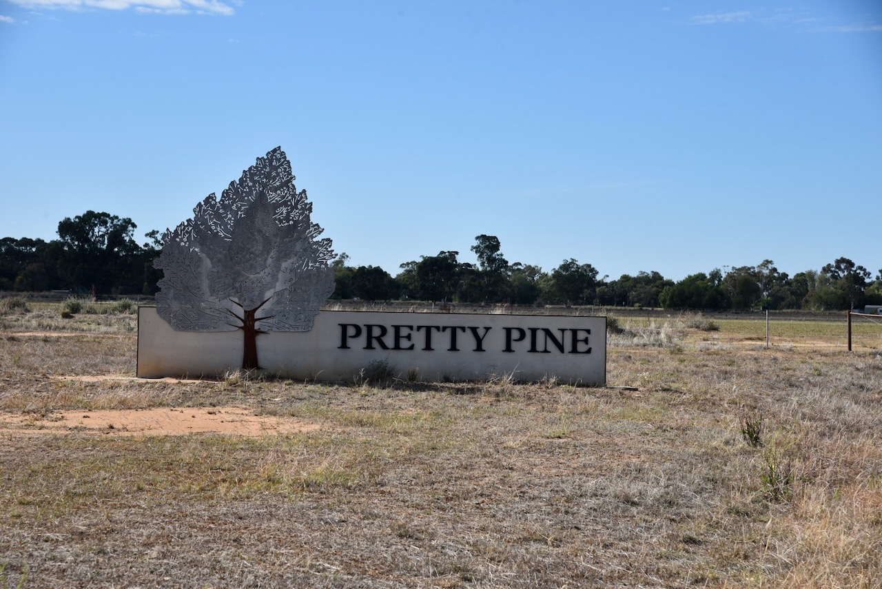
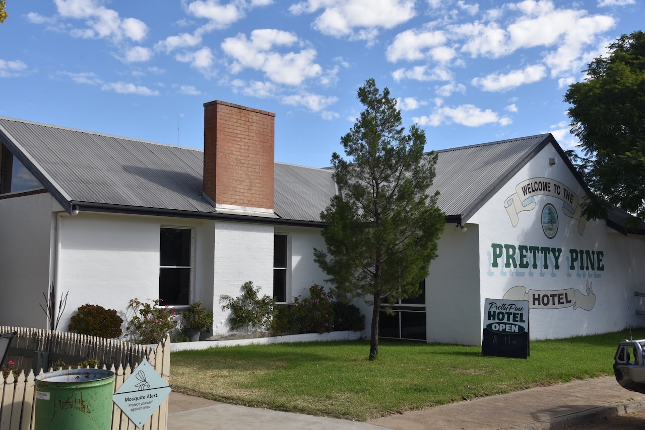
After leaving Moulamein on Friday, the 1st day of May 2026, Chris VK5FR and I continued west towards Albury. Although I had been there in November last year with my wife Marija, I decided to call into the hotel at Pretty Pine with Chris.

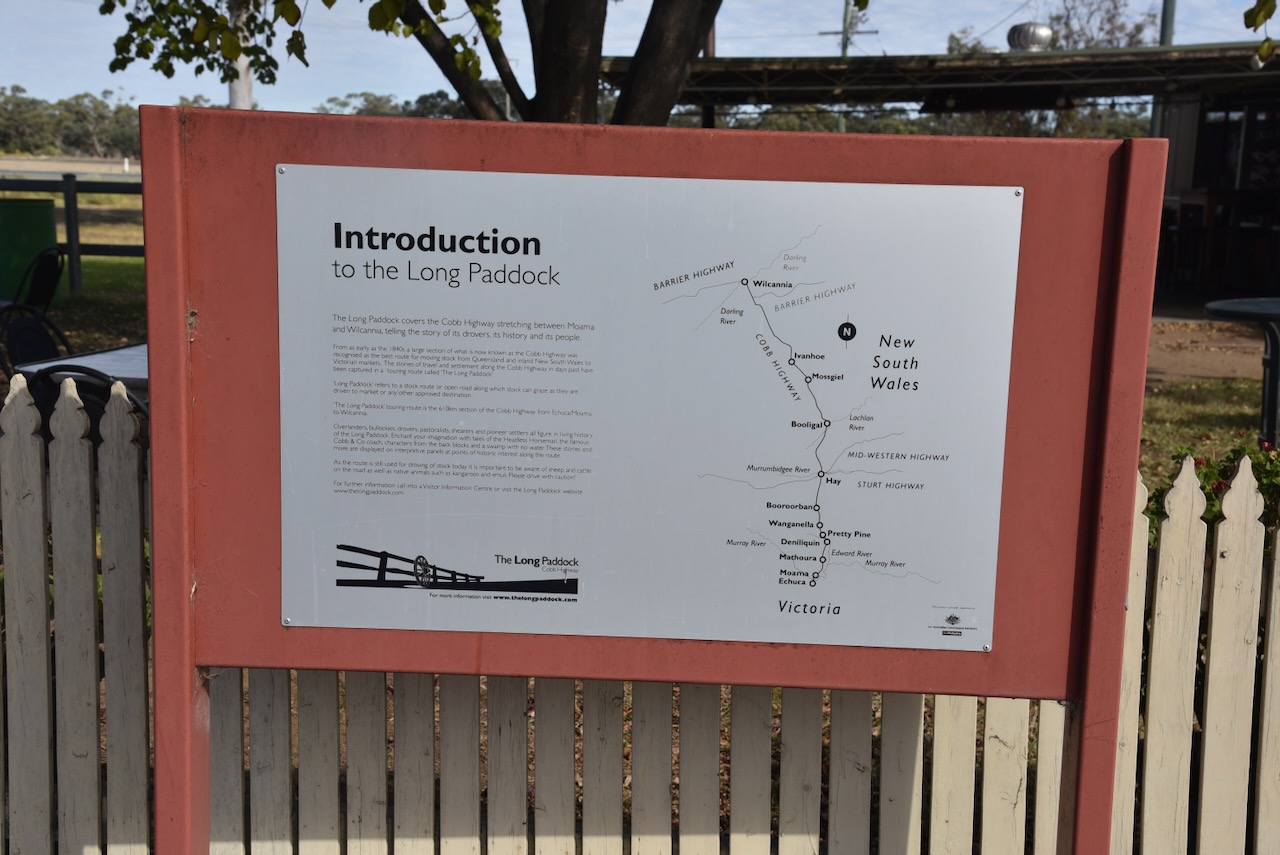
Prett Pine is located about 19 km northwest of Deniliquin, and about 716 km southwest of Sydney.

Early official government documentation often referred to the district as Dahwilly, while other documents referred to both Dahwilly and Pretty Pine. Pretty Pine remained as the preferred name for the district. (Wikipedia 2025)

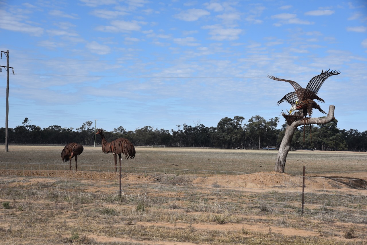
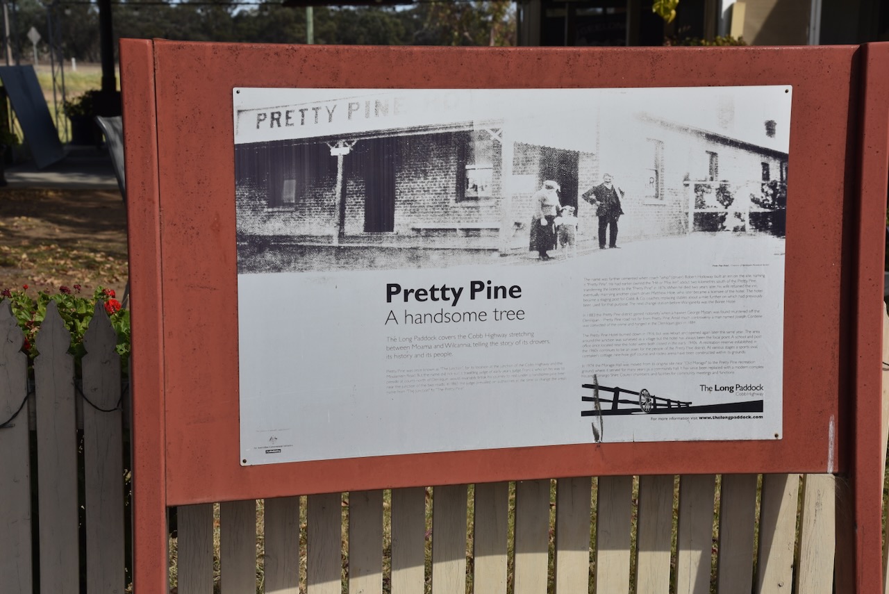
On Pretty Pine Road, as you enter the town, you can view some sculptures of a Wedge-tailed Eagle and Emus.

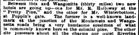
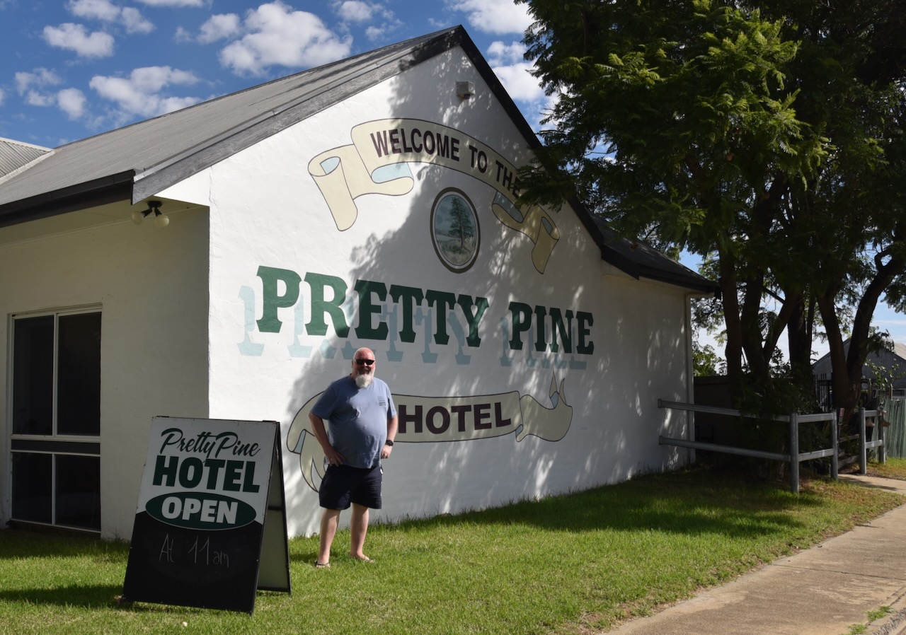
In late September 1875, it was reported that a new hotel was being built at Pretty Pine for Mr. R. Holloway, at the junction of the Moulamein and Wangonetta Roads. (Trove 2026) (Wikipedia 2025) 

Above: part of an article from Australian Town and Country Journal, Sat 4 Sept 1875. Image c/o Trove

Robert Holloway was well known in the Riverina district of New South Wales. He was the publican of the Carriers’ Arms Hotel at Deniliquin. He had also previously been a Cobb and Co. coach-driver. In December 1875, his license had been transferred to his new public house, the Pretty Pine Hotel. (Wikipedia 2025)

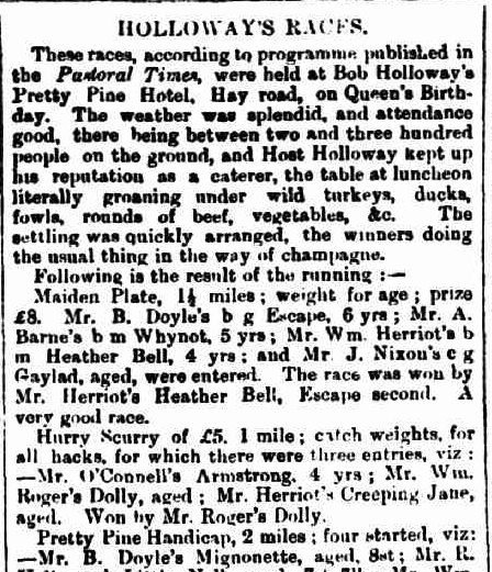
In May 1876, Holloway hosted a horse-racing meeting at Pretty Pine celebrating the Queen’s Birthday. (Wikipedia 2025)

Above: part of an article from The Pastioral Times, Sat 27 May 1876. Image c/o Trove

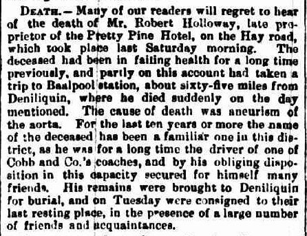
In late July 1878, Holloway died during a visit to ‘Baalpool’ station near Moulamein. The cause of his death was recorded as “aneurism of the aorta”. It was reported that he had been in failing health “for a long time previously”. (Nla.gov.au 2026)

Above: article from The Pastoral Times, Sat 3 Aug 1878. Image c/o Trove

Following Holloway’s death, his wife, Anastasia, took over the hotel’s license. In November 1879, a total of 213 acres of Crown land surrounding the Pretty Pine Hotel was dedicated as a site for the village of Dahwilly. The name originated from the Parish of Dahwilly, where the hotel was located. (Wikipedia 2025)

In 1880, Anastasia Holloway married Matthew Hole. He was a former Cobb and Co. coach-driver. The following year, in 1881, the publican’s license for the hotel was transferred to Hole. (Wikipedia 2025)

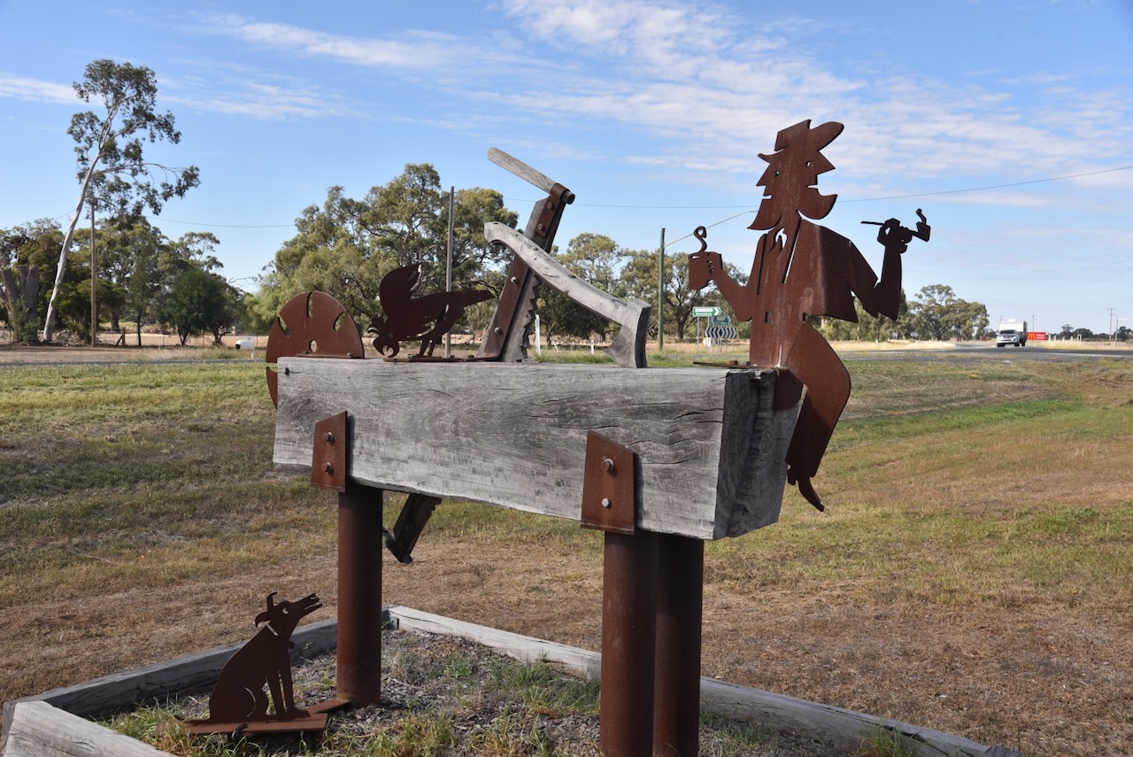
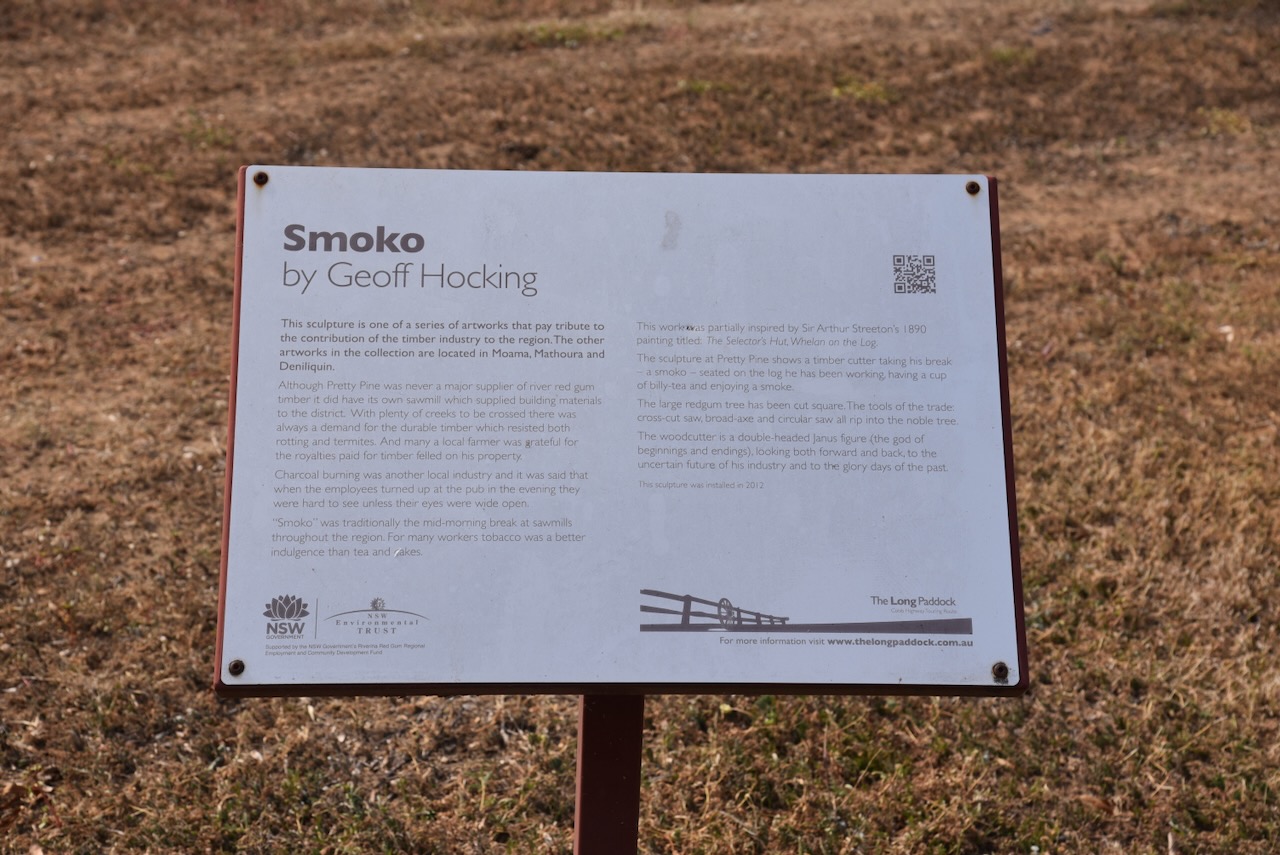
Opposite the hotel is the ‘Smoko’ sculpture, the work of Geoff Hocking.

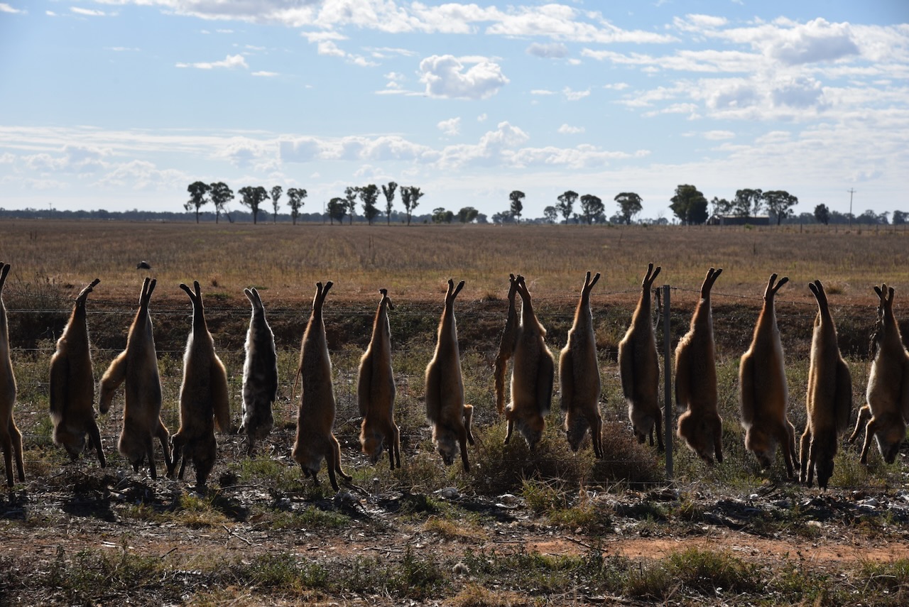
After a quick drink at the Pretty Pine Hotel, Chris and I continued east towards Albury. We came across the scene below, dozens of foxes and feral cats hanging from a farmer’s front fence.

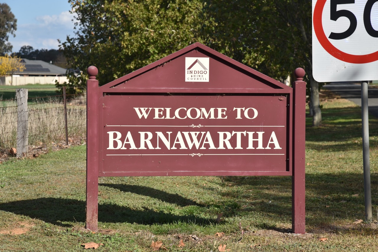
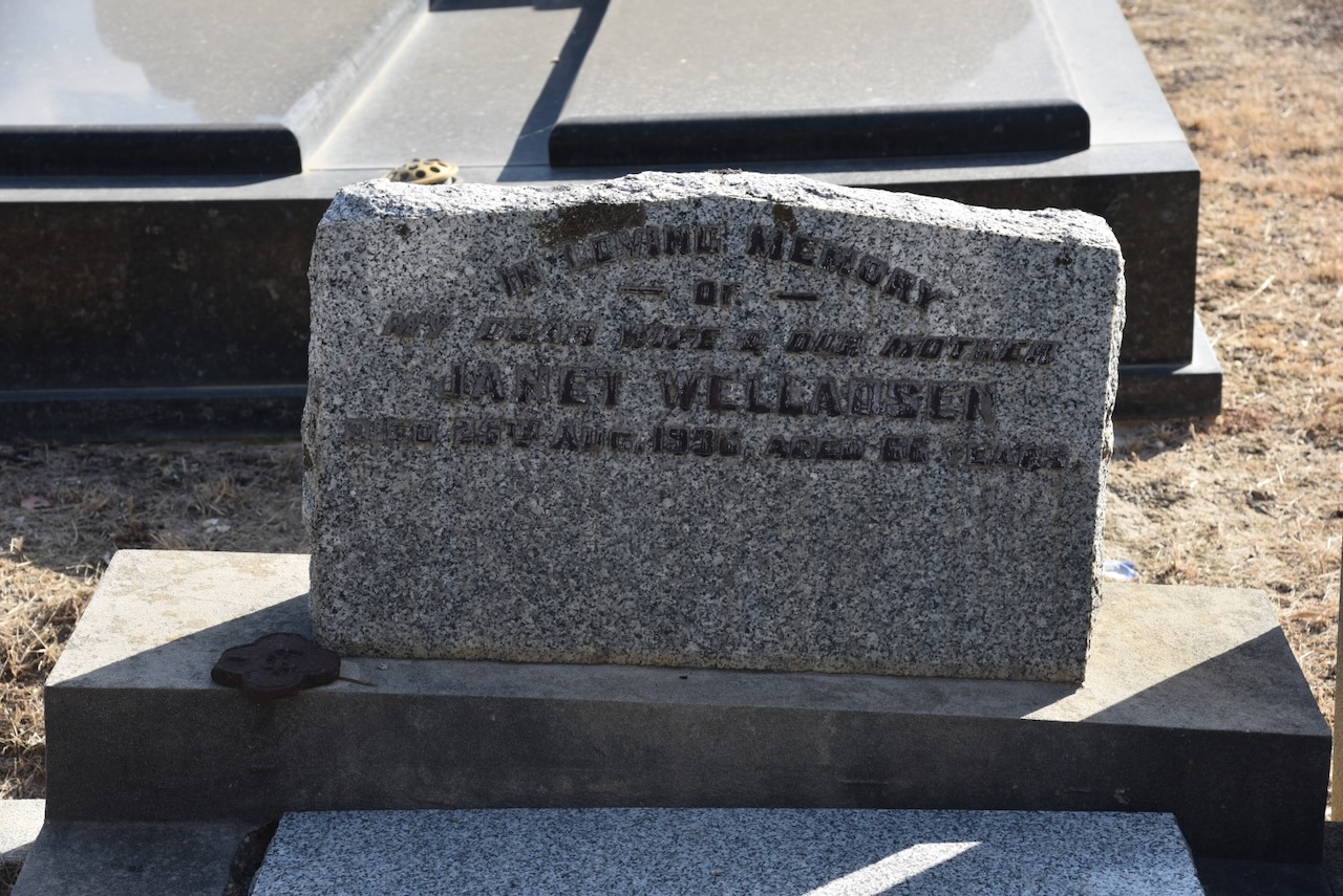
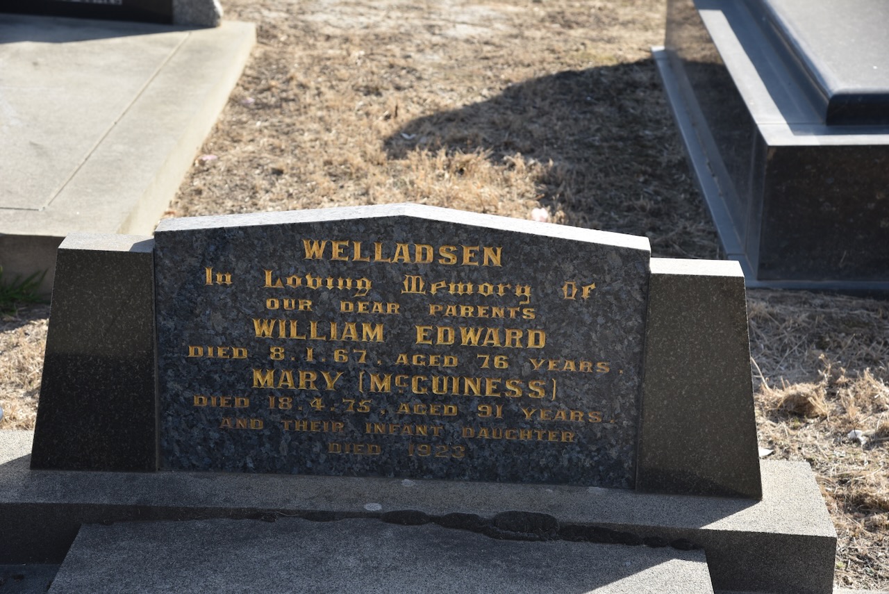
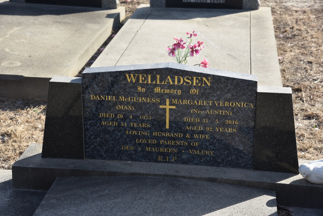
We detoured into the town of Barnawartha as I wanted to quickly visit the Barnawartha Cemetery. Family history is one of my other hobbies and some of my family members are buried at Barnawartha.

Barnawartha was previously known as Indigo Crossing. The name Barnawartha was introduced during the 1840s. It is believed to derive from an Aboriginal word with various meanings, including ‘tall rushes’, ‘parting of the storms’, and ‘deaf and dumb’. The township was surveyed in 1857. The Post Office opened on the 1st day of August 1860. (Wikipedia 2026)

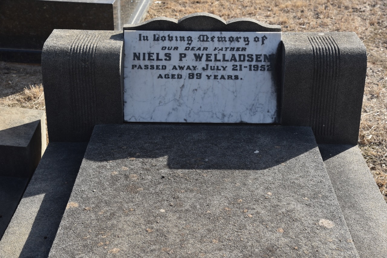
We made a quick visit to the cemetery, where I found several headstones of family members.

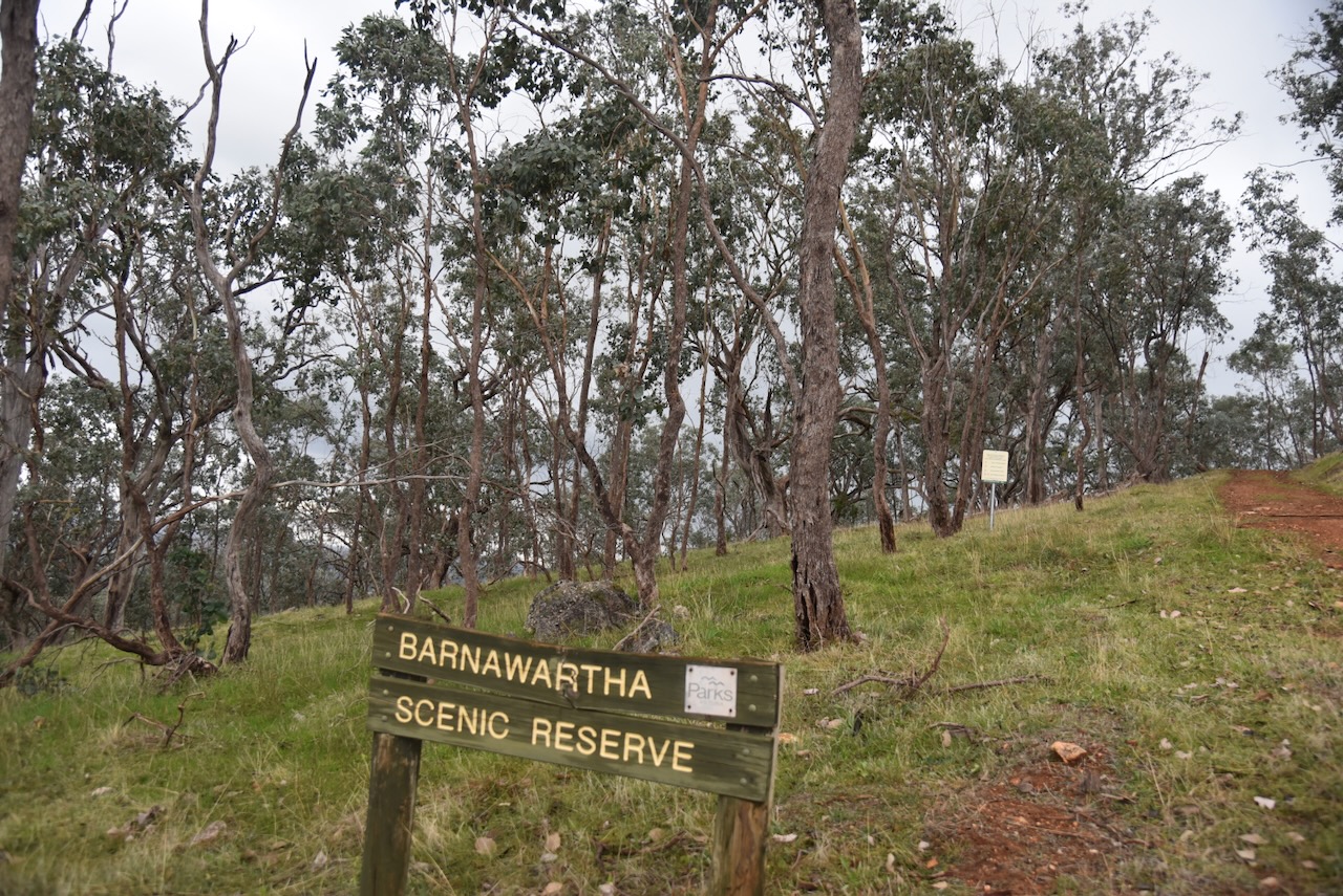
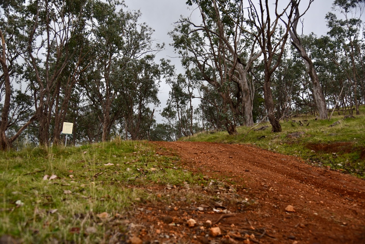
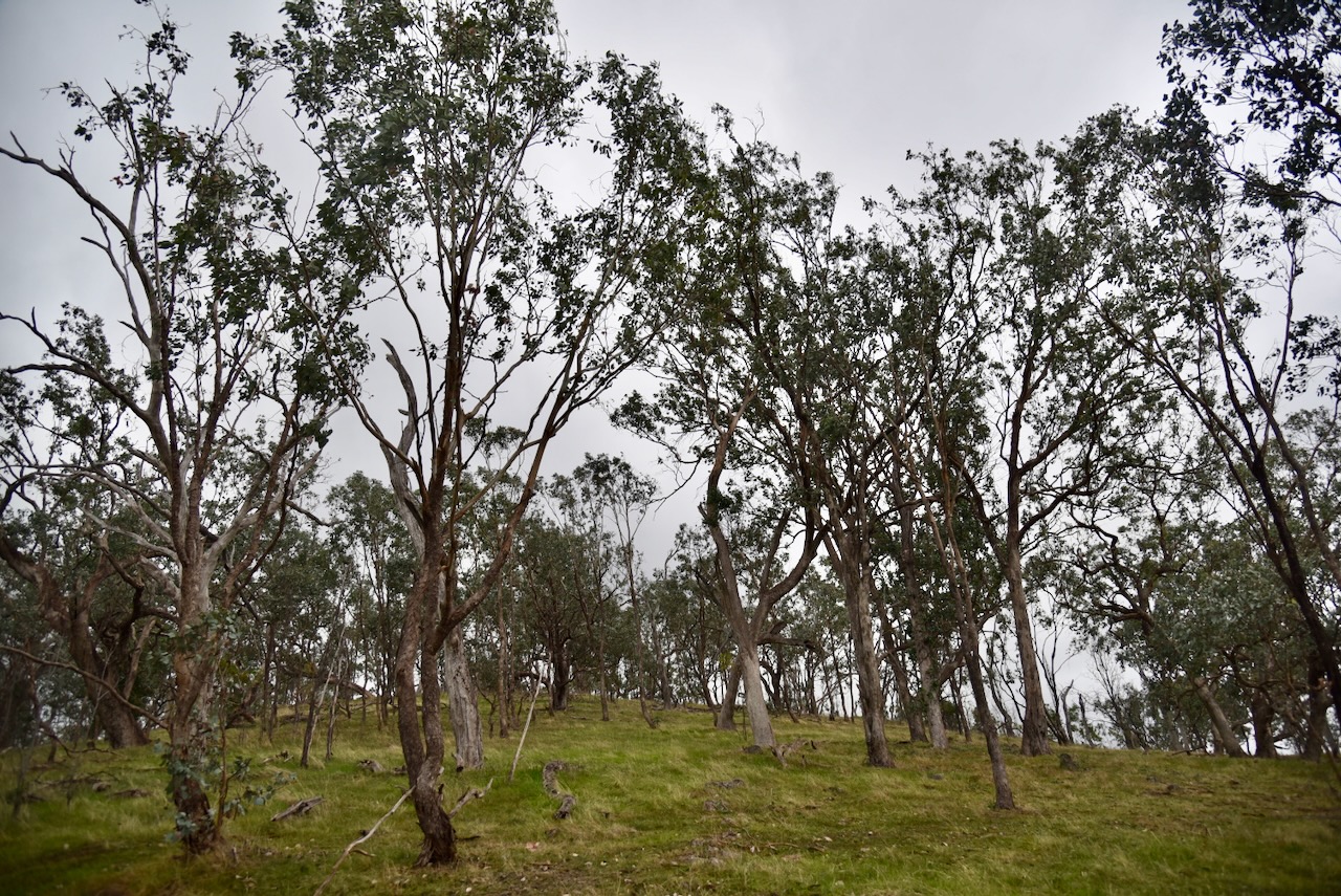
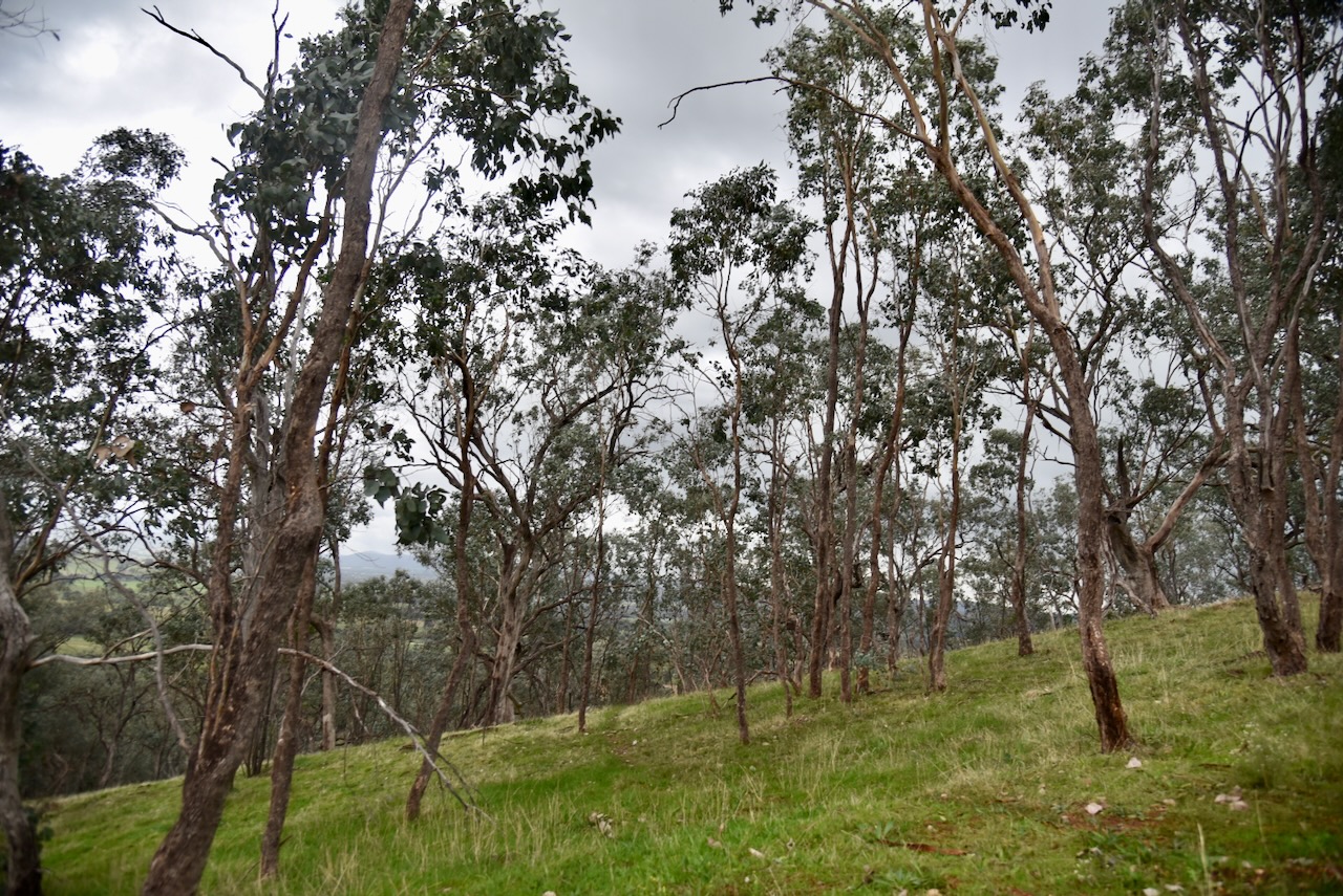
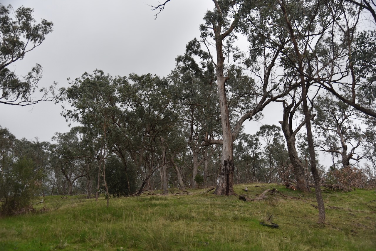
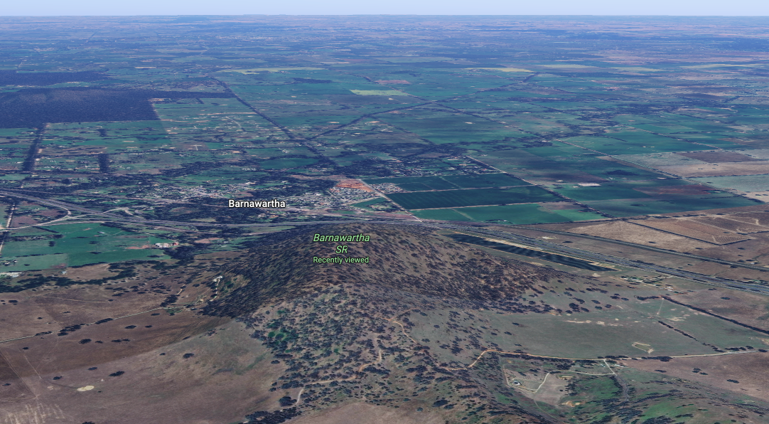
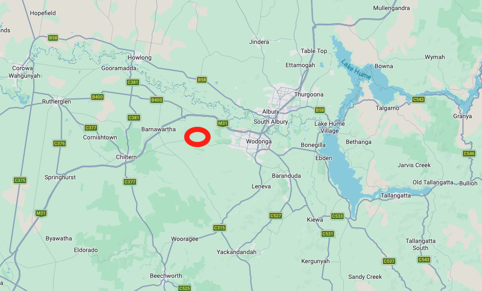
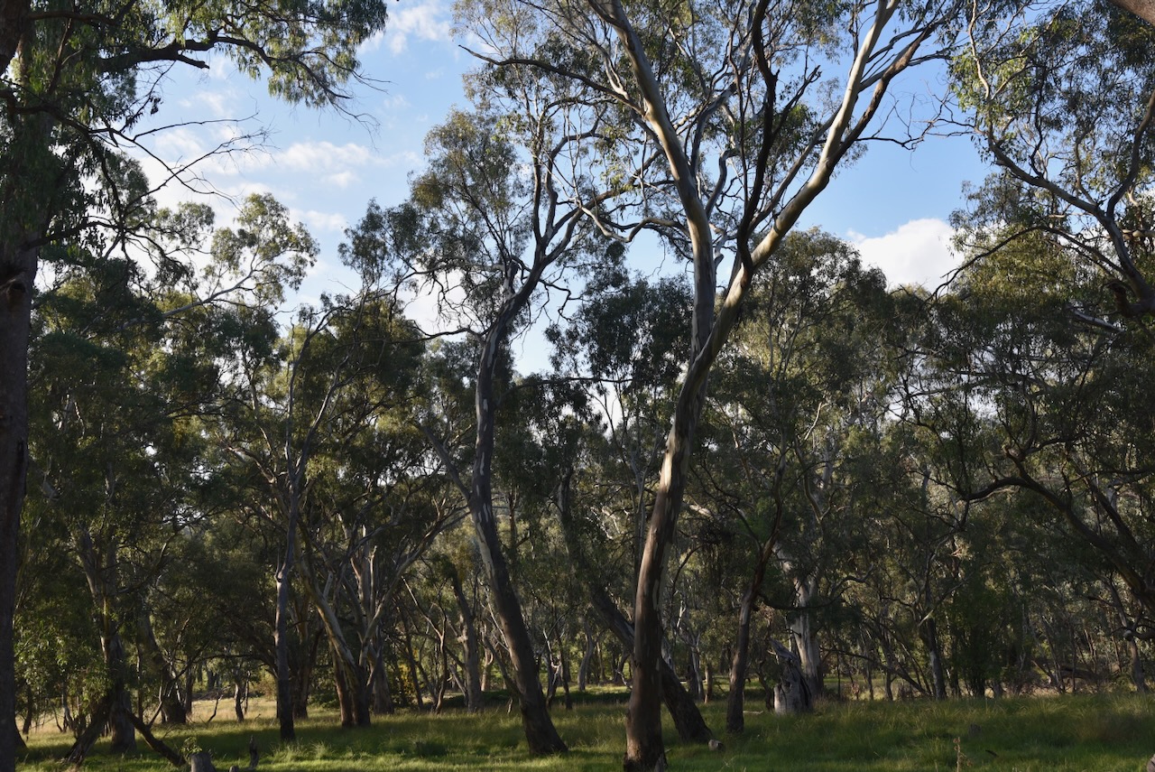
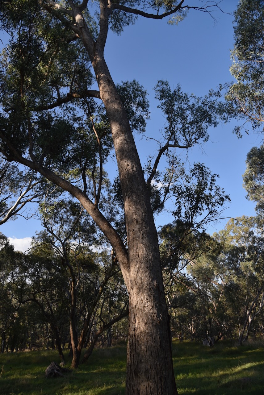
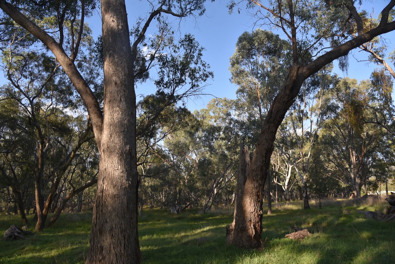
Chris and I then headed to the Barnawartha I16 Bushland Reserve VKFF-4551.

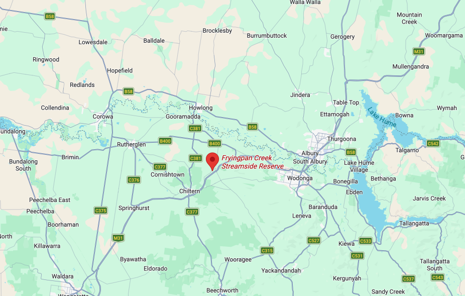
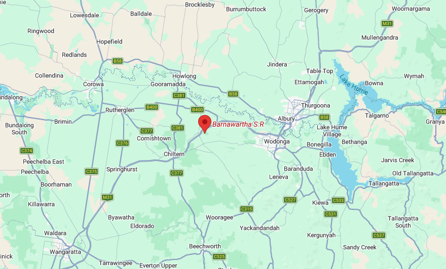
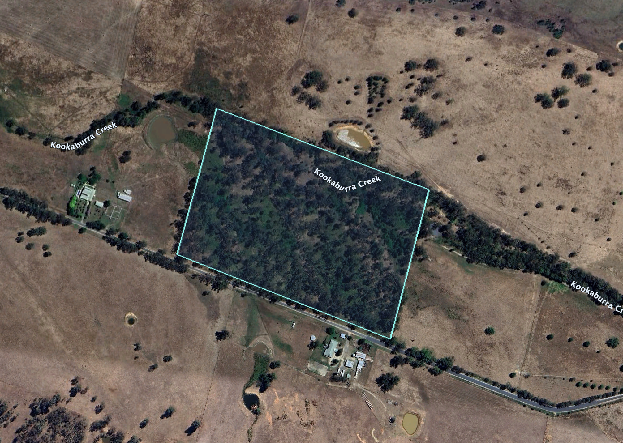
Above: Map showing the location of the Barnawartha I16 Bushland Reserve. Map c/o Google Maps

The reserve is located on the northern side of Cookinburra Road.

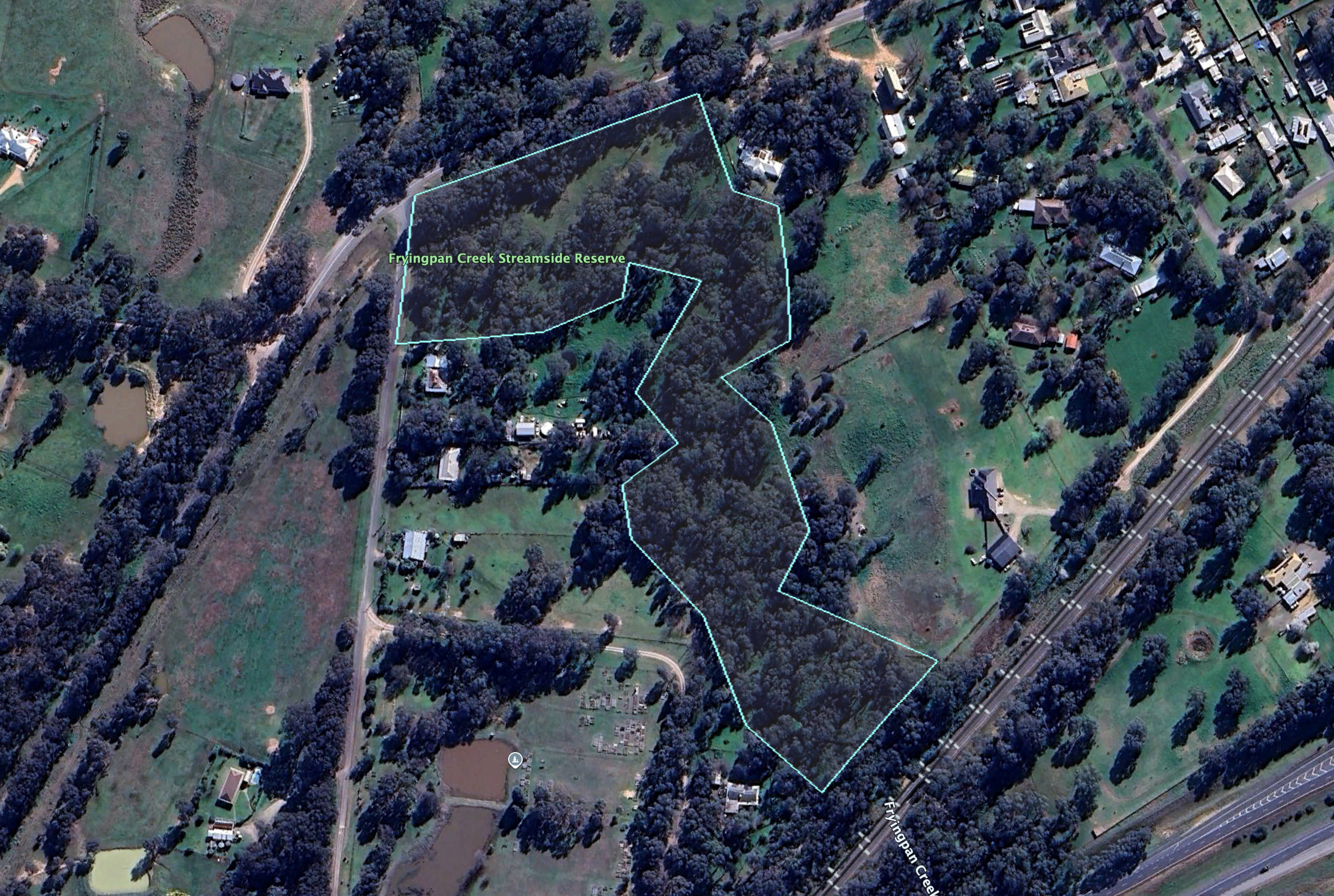
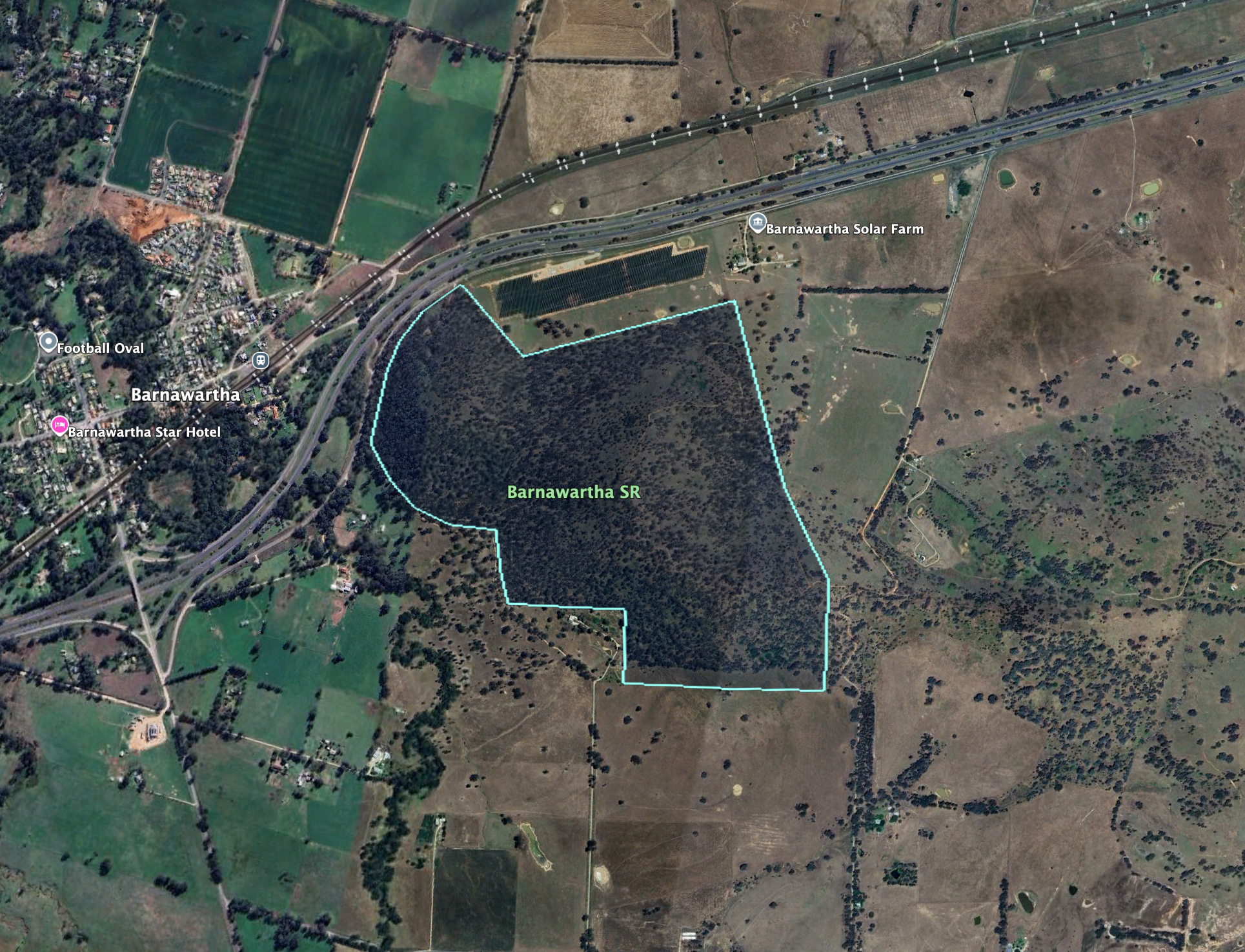
Above: the boundaries of the Barnawartha I16 Bushland Reserve. Image c/o Google Earth

The reserve is about 11 hectares in size and was established on the 1st day of May 1979. (Dcceew.gov.au, 2023)

This was an easy park to access. We ran the Yaesu FT857, 40 watts output, and the 20/40/80m linked dipole.

I worked the following stations on 40m SSB:-

  1. VK1CHW
  2. VK2CHW
  3. VK2PKT
  4. VK2KFT
  5. VK2IO/P (VKFF-1925)
  6. VK2GEZ/P (VKFF-1925)
  7. VK1MAZ
  8. VK1AO
  9. VK2MET
  10. VK2NP
  11. VK3IH
  12. VK8VK
  13. VK3PF (VKFF-4611)
  14. VK3UP
  15. VK7AN
  16. VK2VW
  17. VK2HFI
  18. VK2AKA
  19. VK2BUG
  20. VK2VIC
  21. VK1VIC
  22. VK2GOY
  23. VK5WU
  24. VK1ACE
  25. VK2EXA
  26. VK2XGB/M
  27. F5PYI
  28. VK4NH
  29. VK4DXA
  30. VK7MAT
  31. VK3CEO
  32. VK7AAE
  33. VK3AMO
  34. VK1KEP
  35. VK2RO
  36. VK5ACK
  37. VK3MCA
  38. VK3JBA/M
  39. VK3TDK
  40. VK3NYC
  41. VK2MAB
  42. VK2LUE
  43. VK3BCM
  44. VK5BM

I worked the following stations on 20m SSB:-

  1. VK4SMA
  2. VK5MAZ
  3. VK4NH
  4. VK4DXA
  5. EA3MP
  6. OH1MM
  7. VK6NU
  8. F5NZO
  9. VK7AAE
  10. KG5CIK
  11. SP2XF
  12. DA2MM
  13. VK5AYL
  14. VK6XL
  15. VK4AS
  16. UT5ZC
  17. UT5PI
  18. F4GYM
  19. F6KBK
  20. F4WBN
  21. IU5LBQ
  22. IK8RIH
  23. DA1AM
  24. HB9TUS
  25. VK7NRT
  26. SQ9CQO
  27. HA0IS

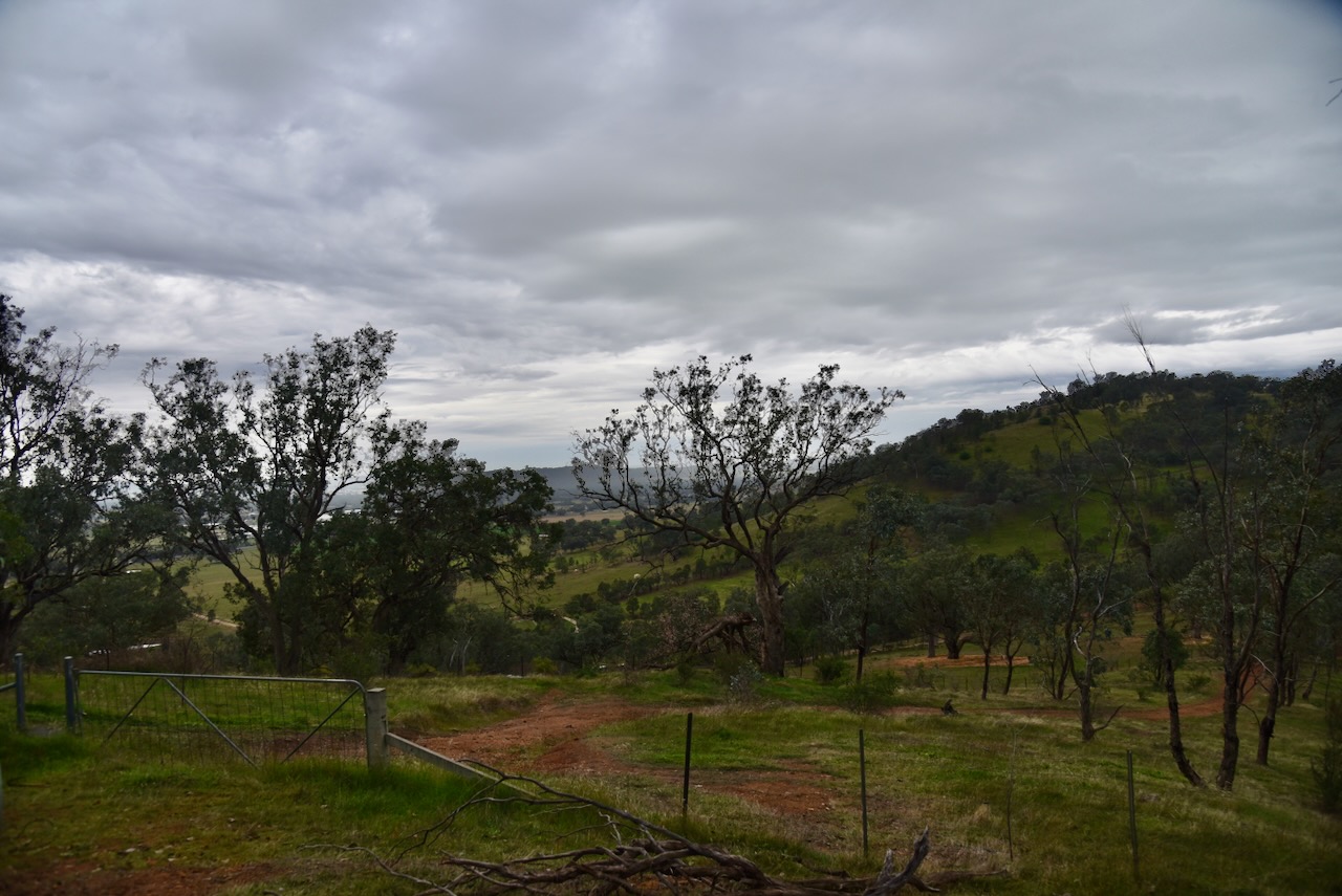
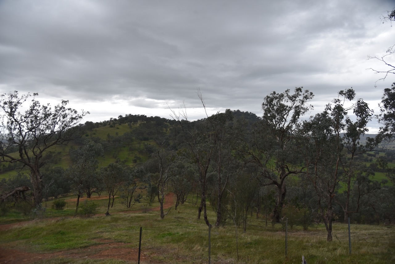
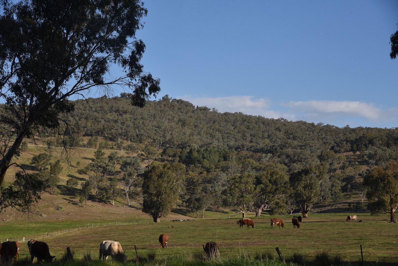
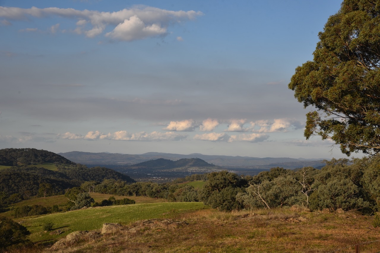
After a successful activation, we packed up and headed to Albury. As we travelled along Cookinburra Road, we enjoyed some very scenic views.

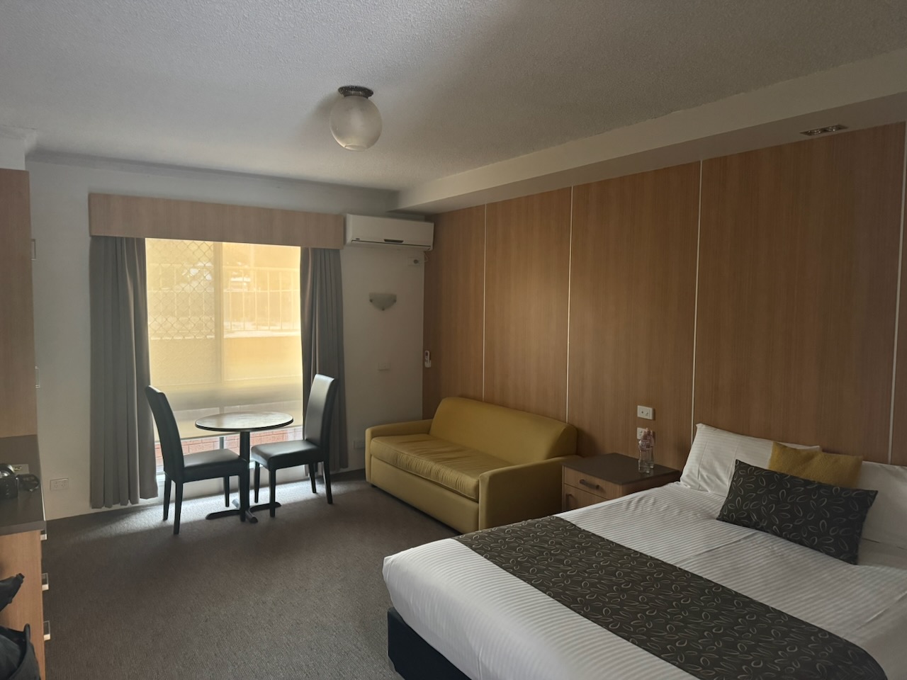
We booked into our accommodation at Albury, the Regent Motel.

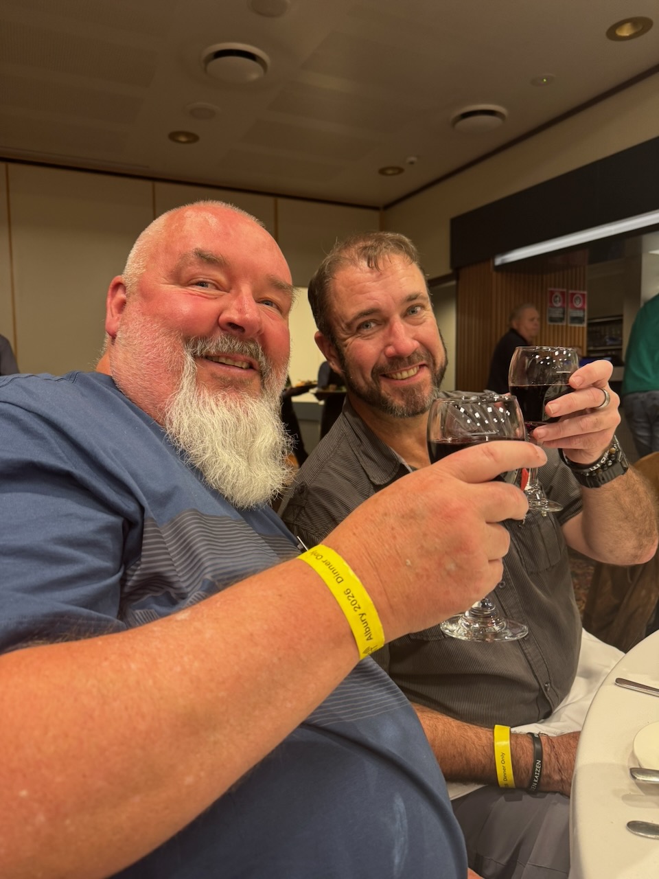
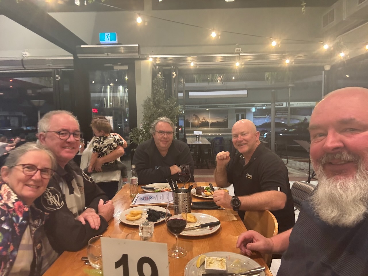
We then headed to the Albury Brew House for a meal and a few drinks with Craig VK3CLD and his wife Leonnie, and Grant VK5GR. We were also joined by Malcolm VK3OAK and Peter VK3PWG

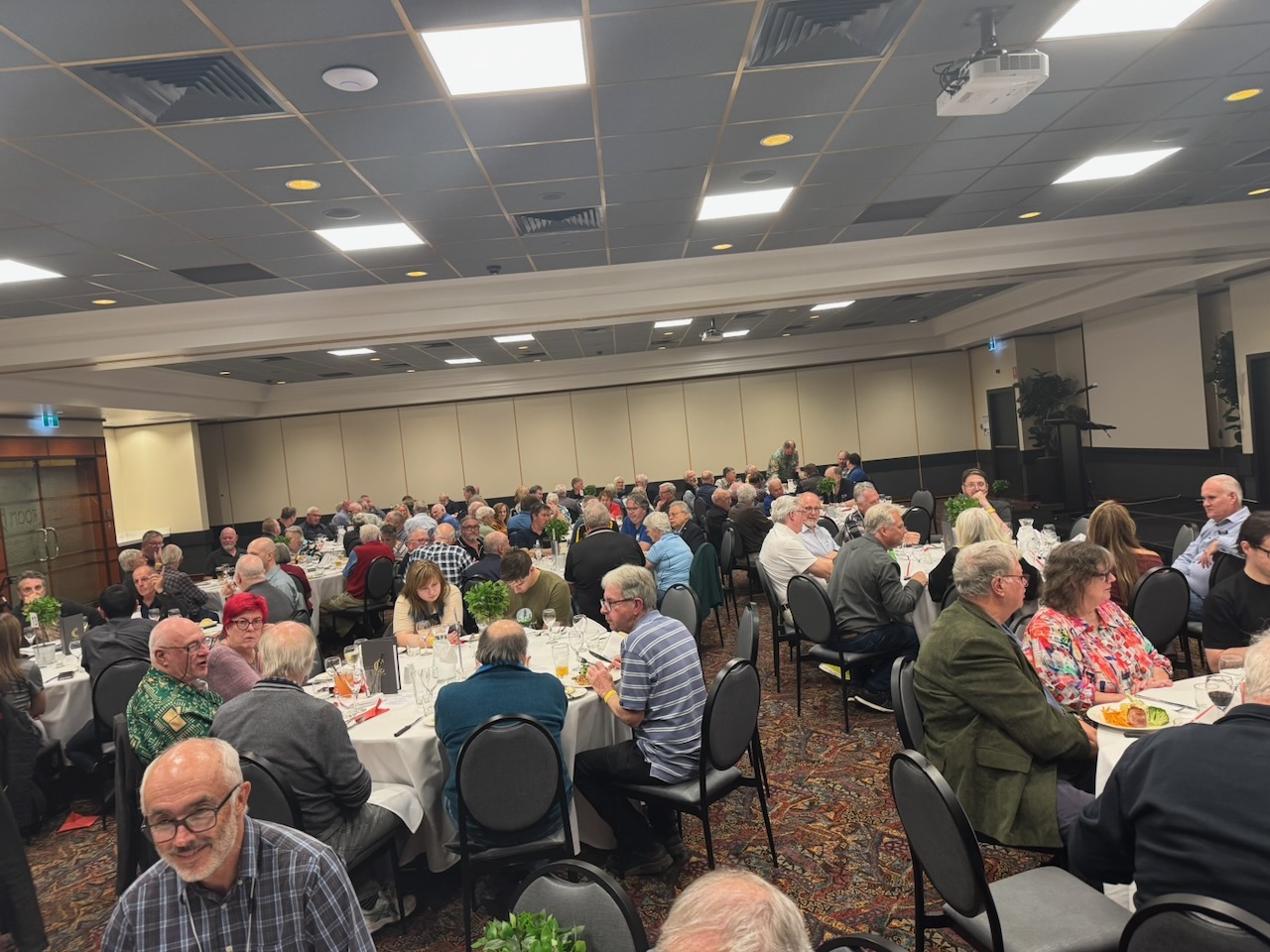
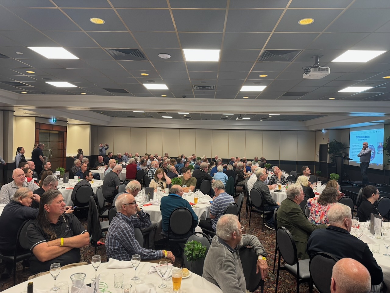
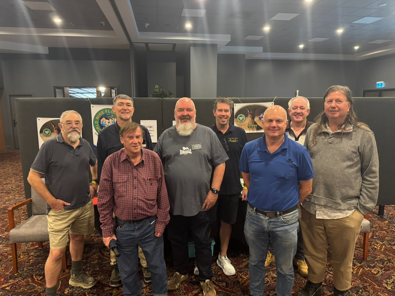
We then ventured up the road to the Commercial Club for a few drinks with some other amateurs who were attending the VK Summit event.

References.

  1. Dcceew.gov.au. (2023). Collaborative Australian Protected Areas Database (CAPAD) 2022 – DCCEEW. [online] Available at: https://www.dcceew.gov.au/environment/land/nrs/science/capad/2022.
  2. ‌Nla.gov.au. (2026). Making sure you’re not a bot! [online] Available at: https://trove.nla.gov.au/newspaper/article/268018492 [Accessed 10 May 2026].
  3. ‌Trove. (2026). DENILIQUIN. – August 26. – Australian Town and Country Journal (Sydney, NSW : 1870 – 1919) – 4 Sep 1875. [online] Available at: https://trove.nla.gov.au/newspaper/article/70585087. [Accessed 10 May 2026]
  4. ‌Wikipedia Contributors (2026). Barnawartha. Wikipedia.
  5. ‌Wikipedia Contributors (2025). Pretty Pine, New South Wales. Wikipedia.‌