Jabuk silo VK-JBK5, Silos On The Air

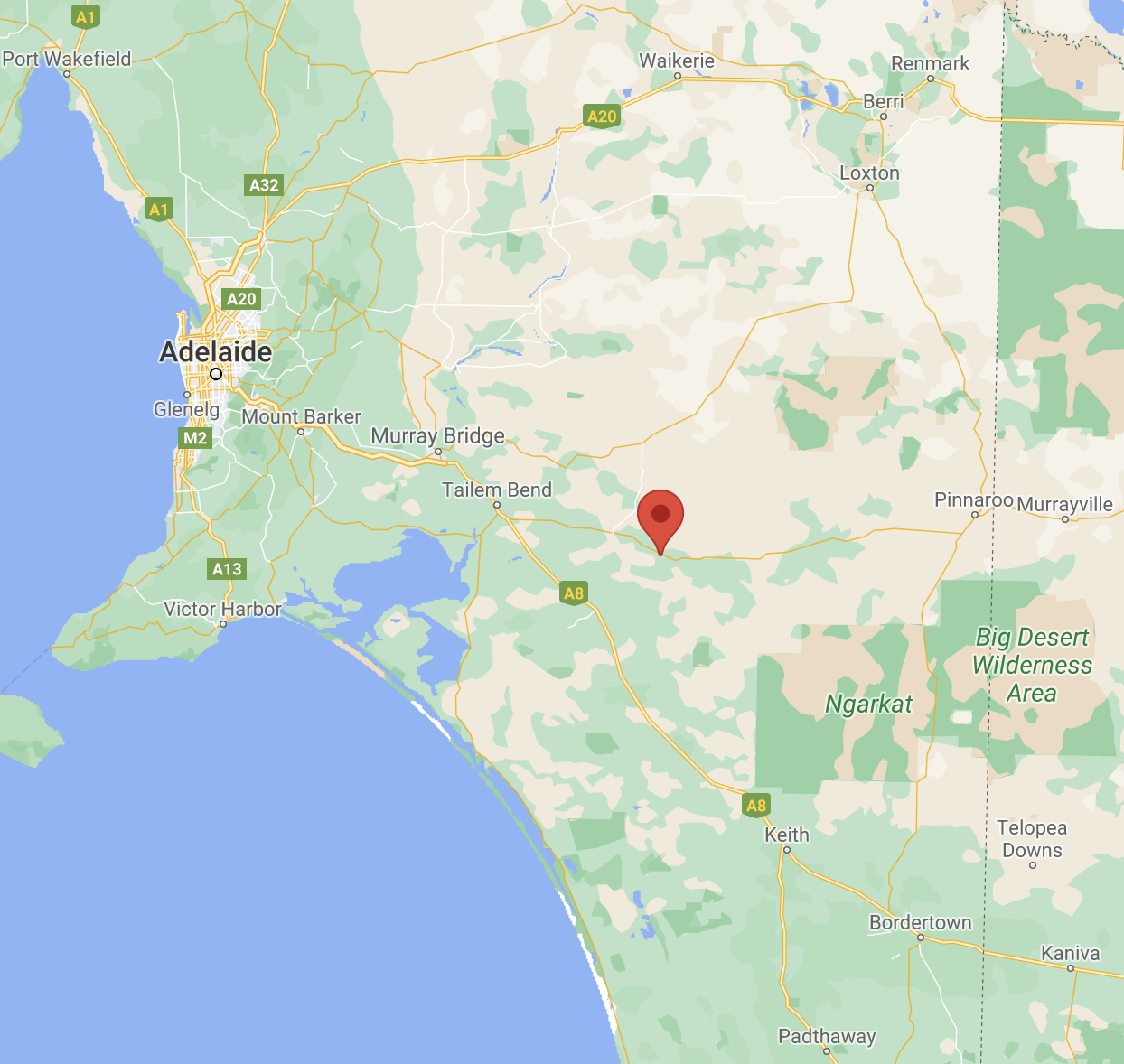
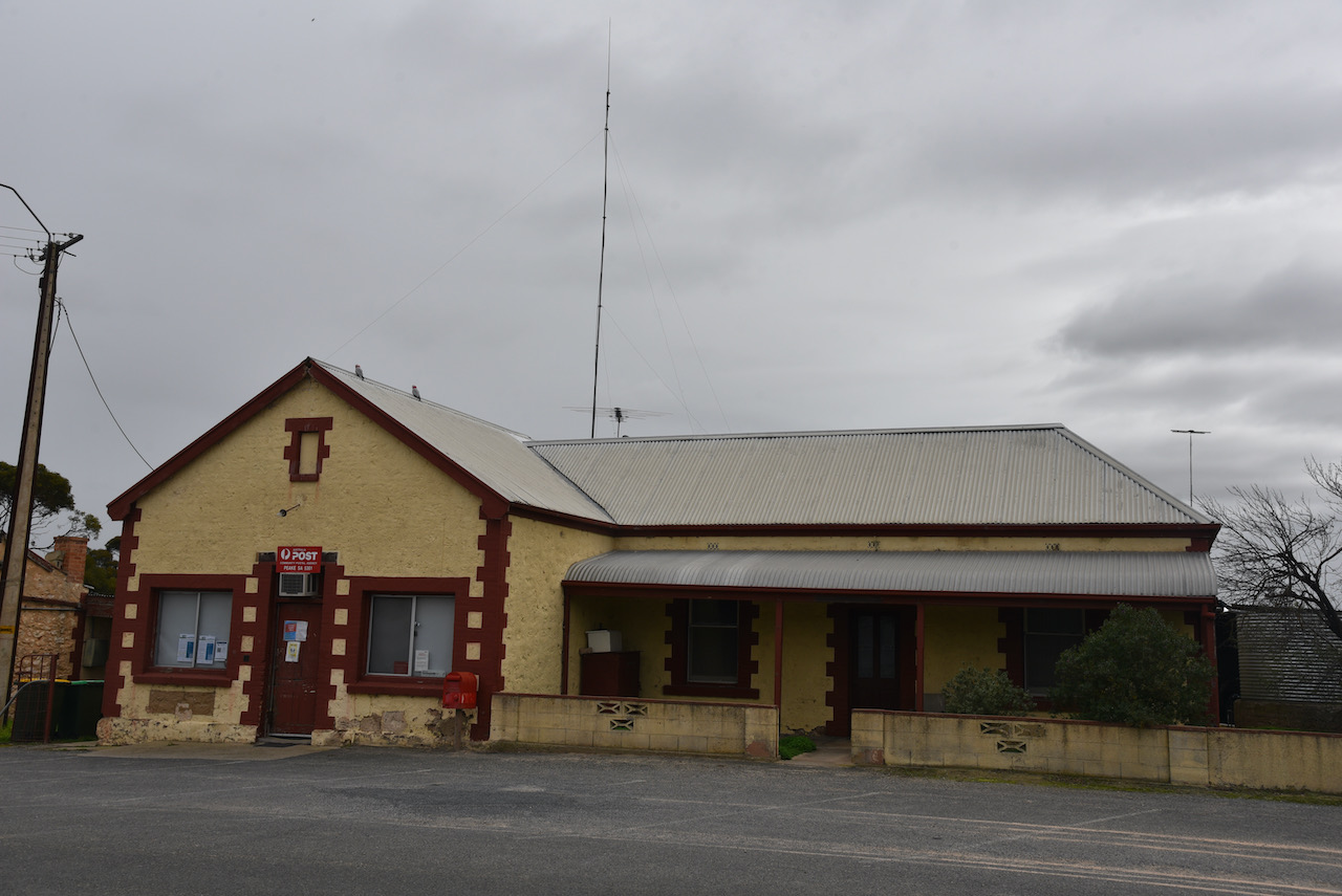
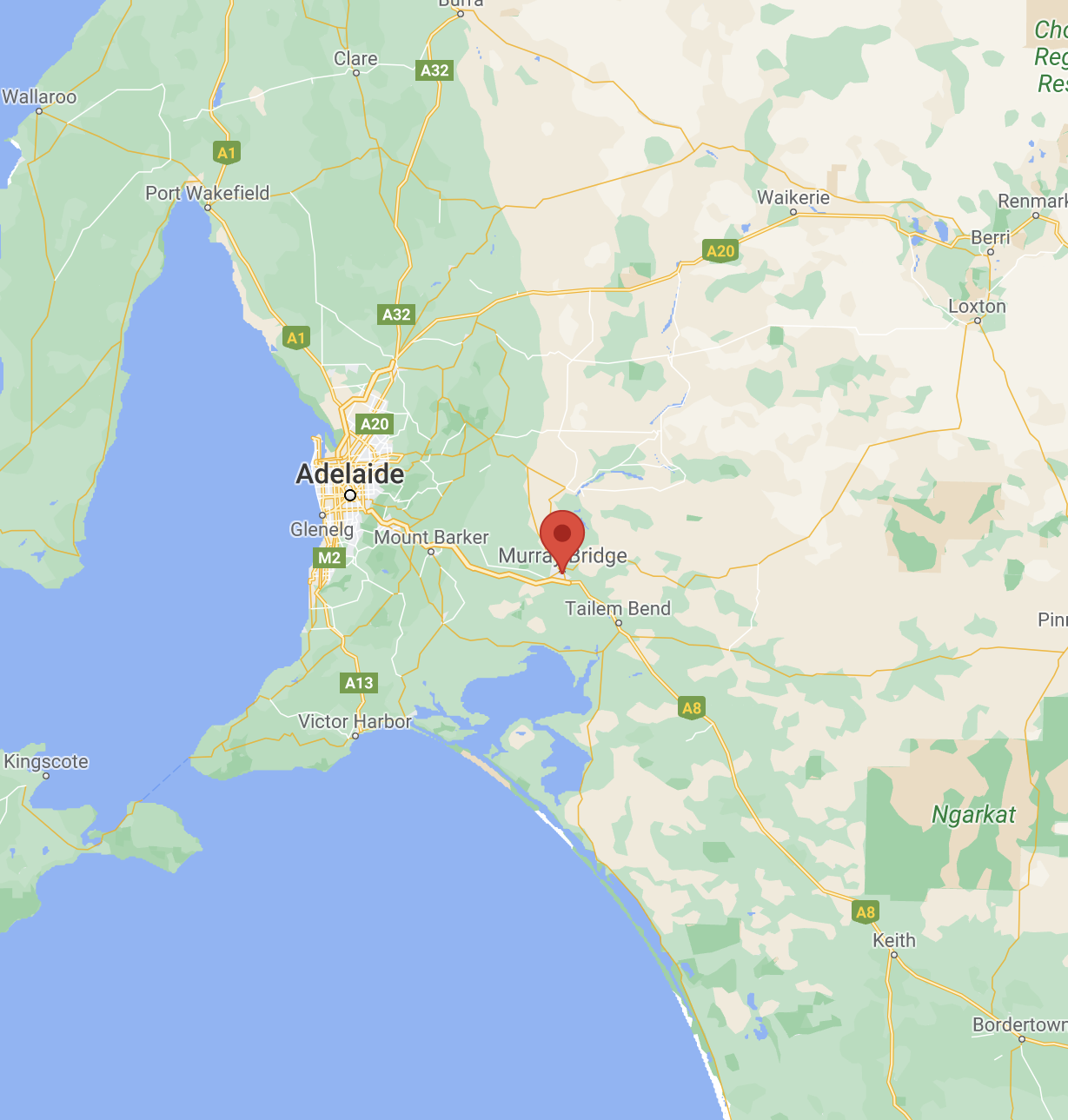
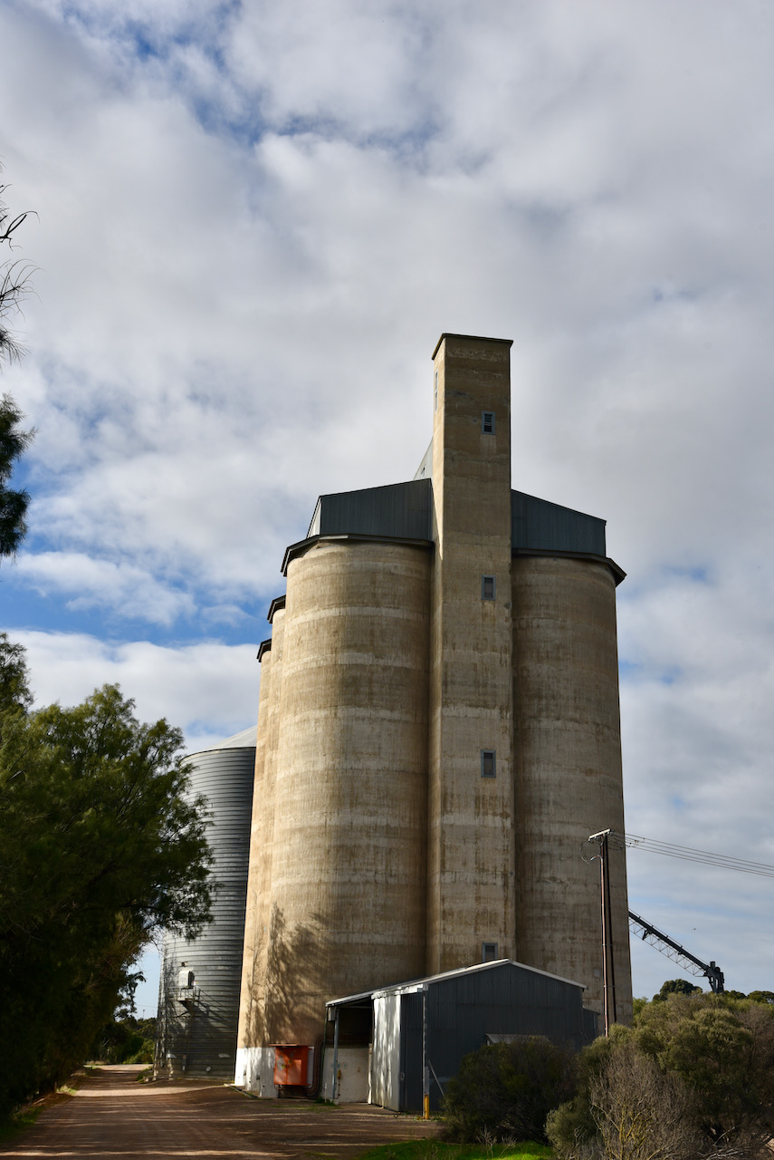
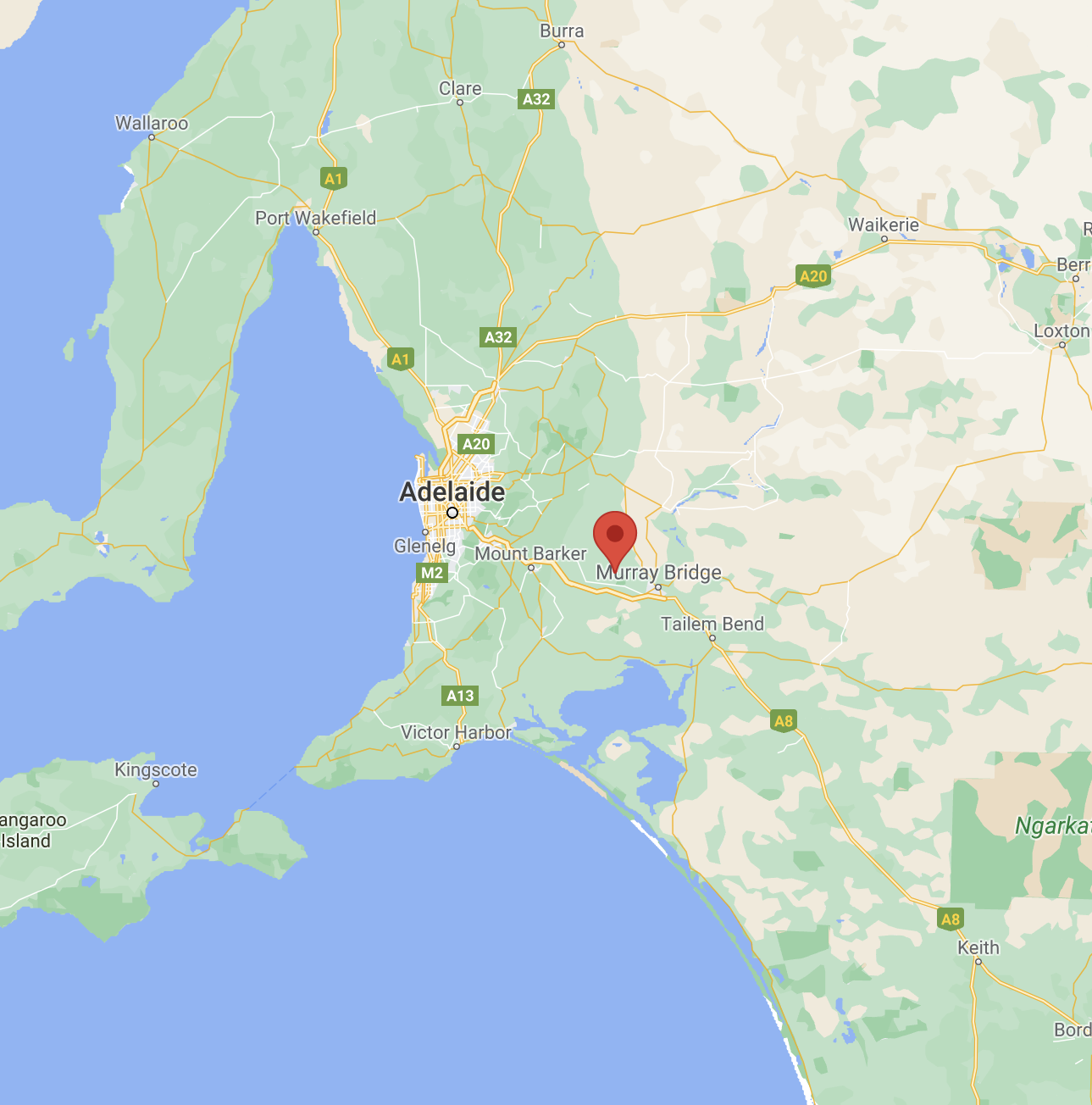
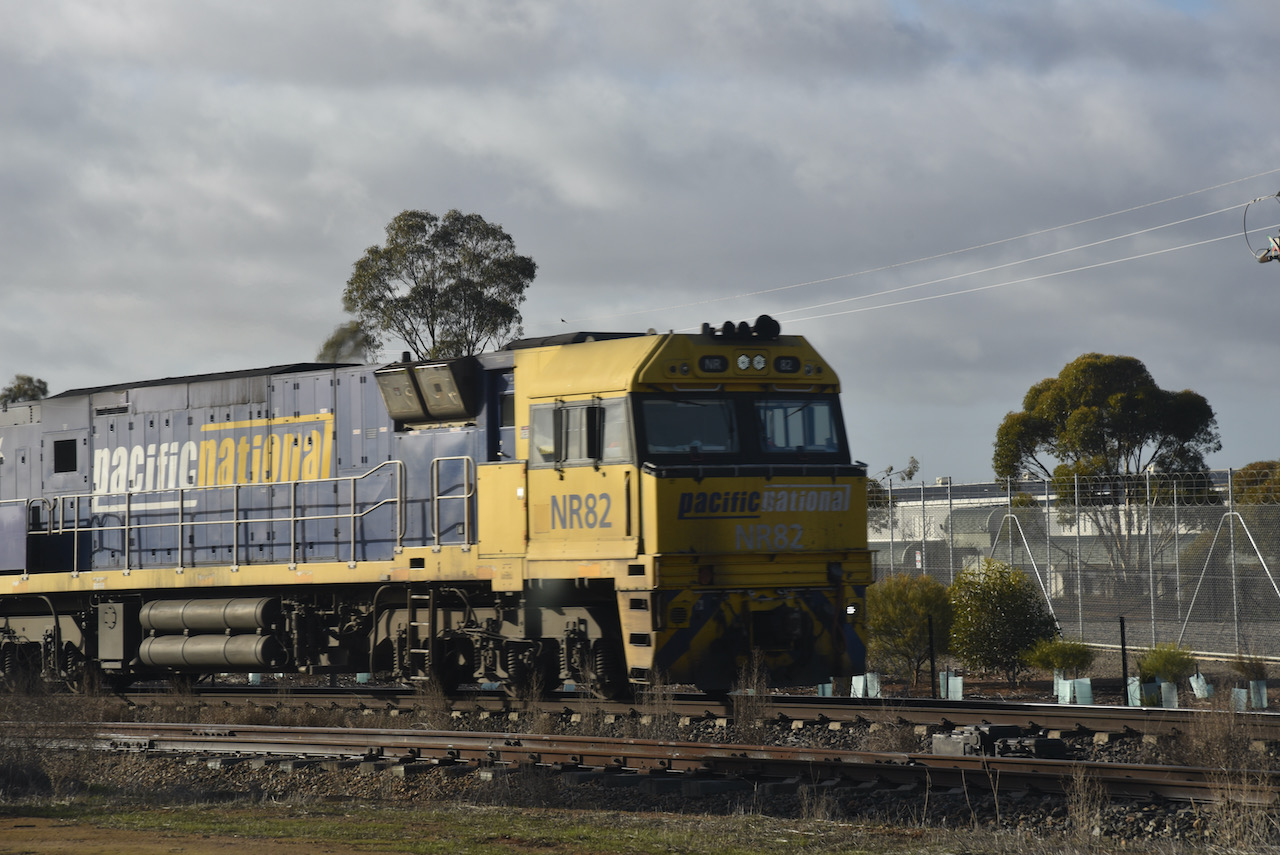
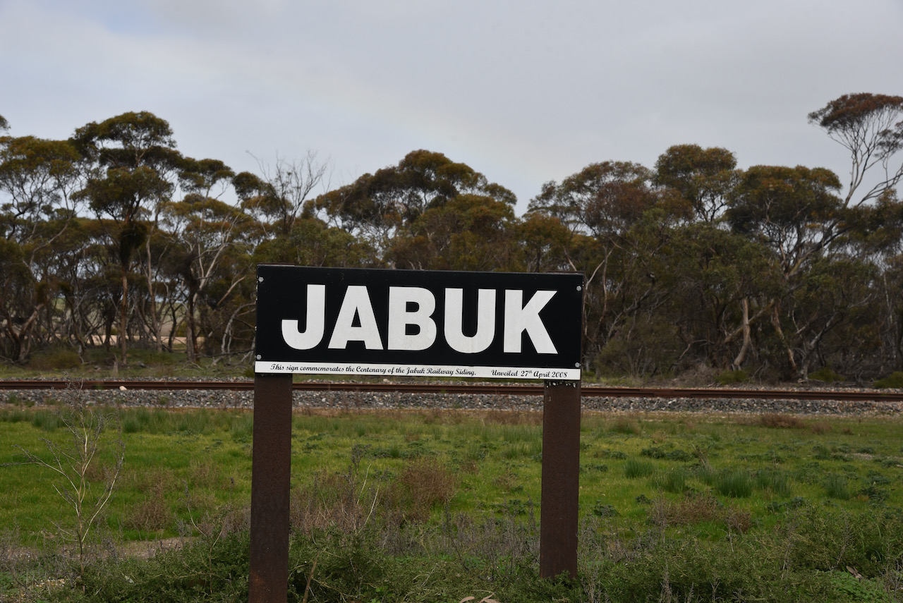
My sixth silo for the day was the Jabuk silo VK-JBK5. Jabuk is a tiny town situated about 157km south-east of the city of Adelaide.

Above:- Map showing the location of Jabuk. Map c/o Google maps

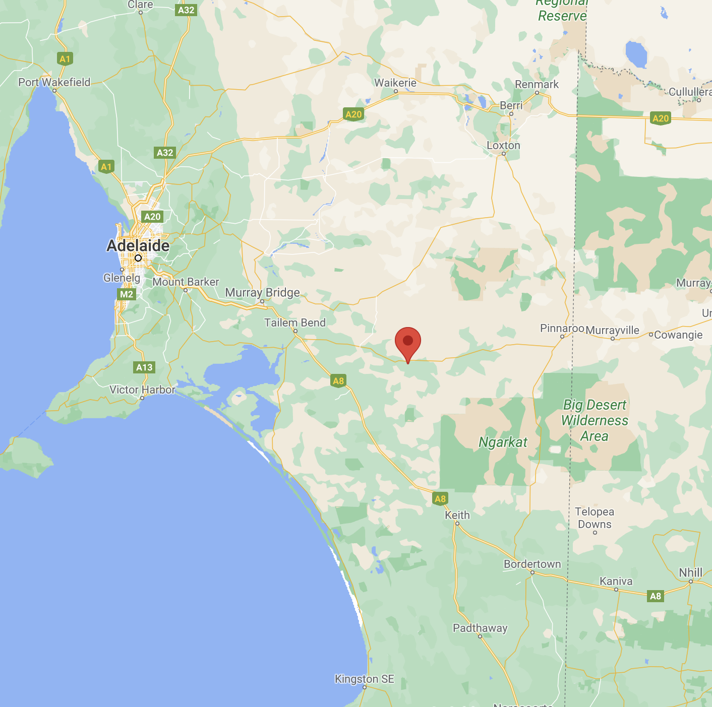
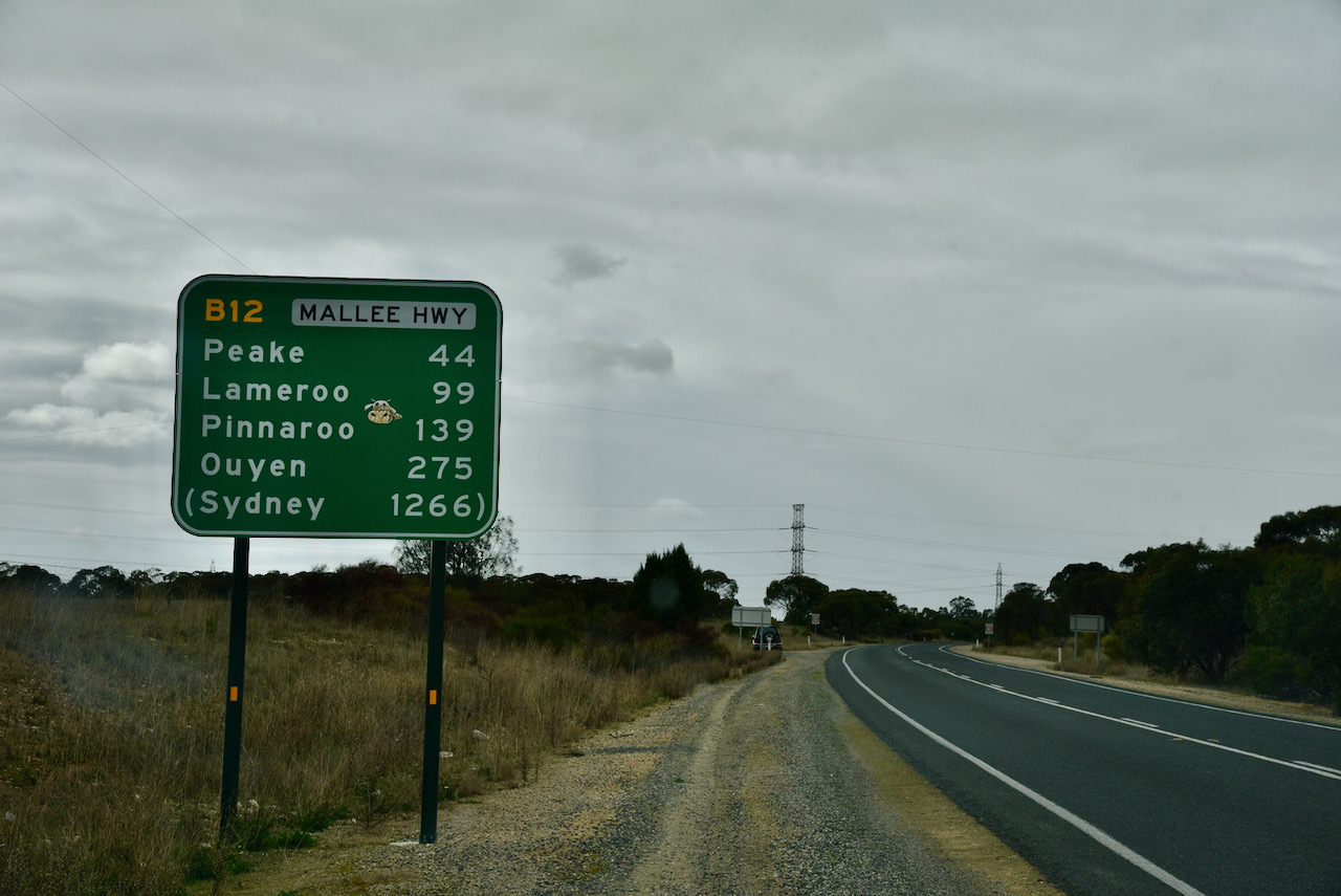
After leaving Peake I continued east on the Mallee Highway for about 12km and soon reached the little town of Jabuk which is located just south of the Highway.

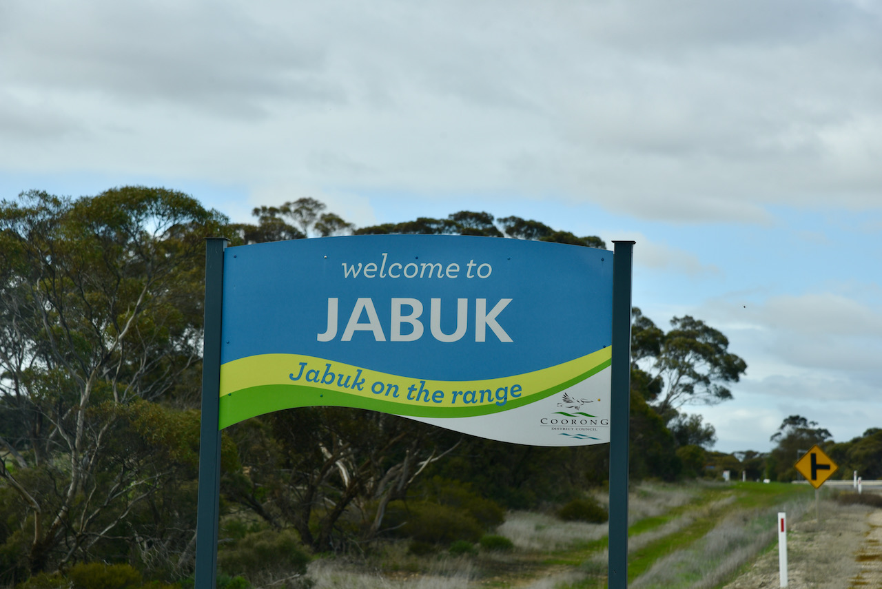
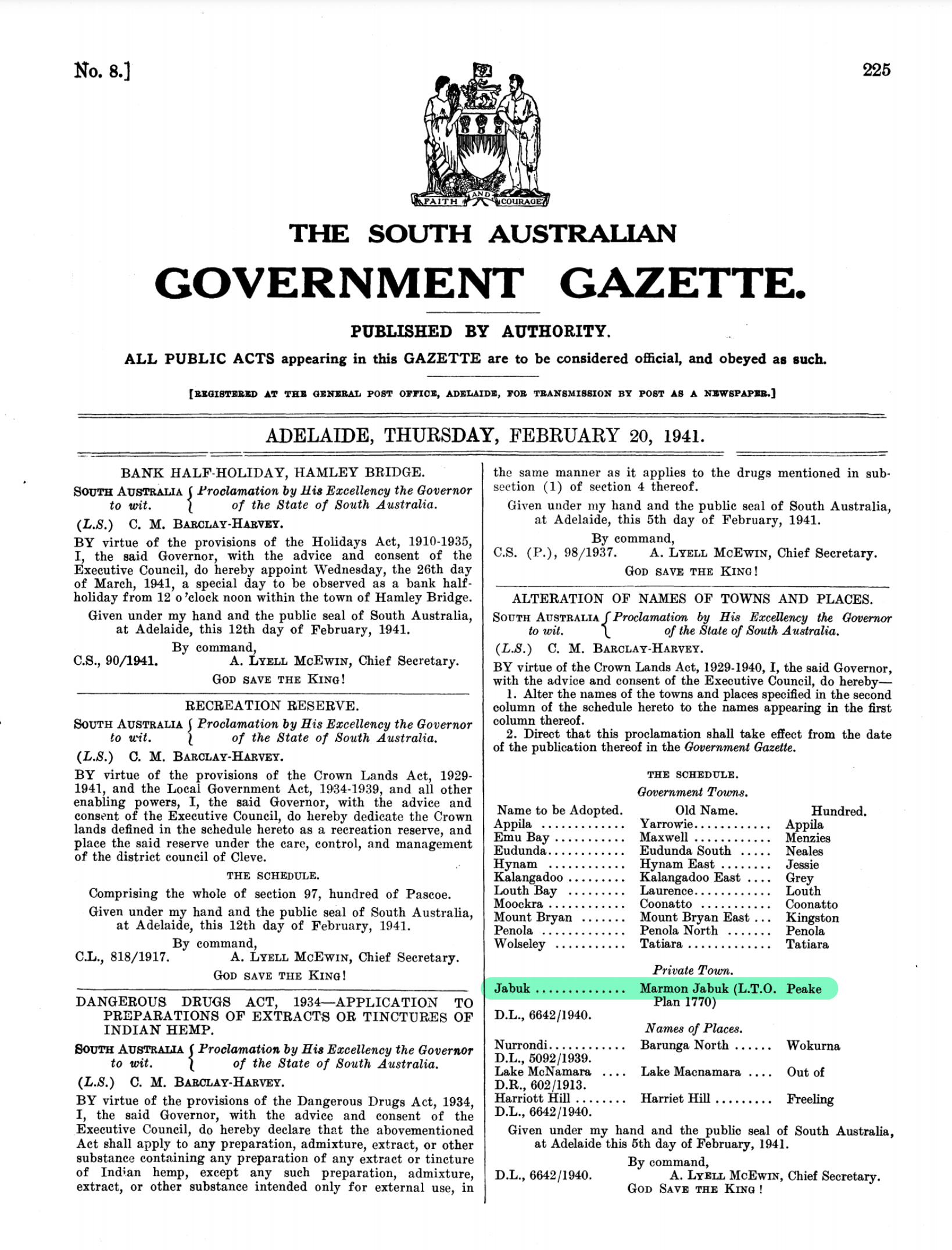
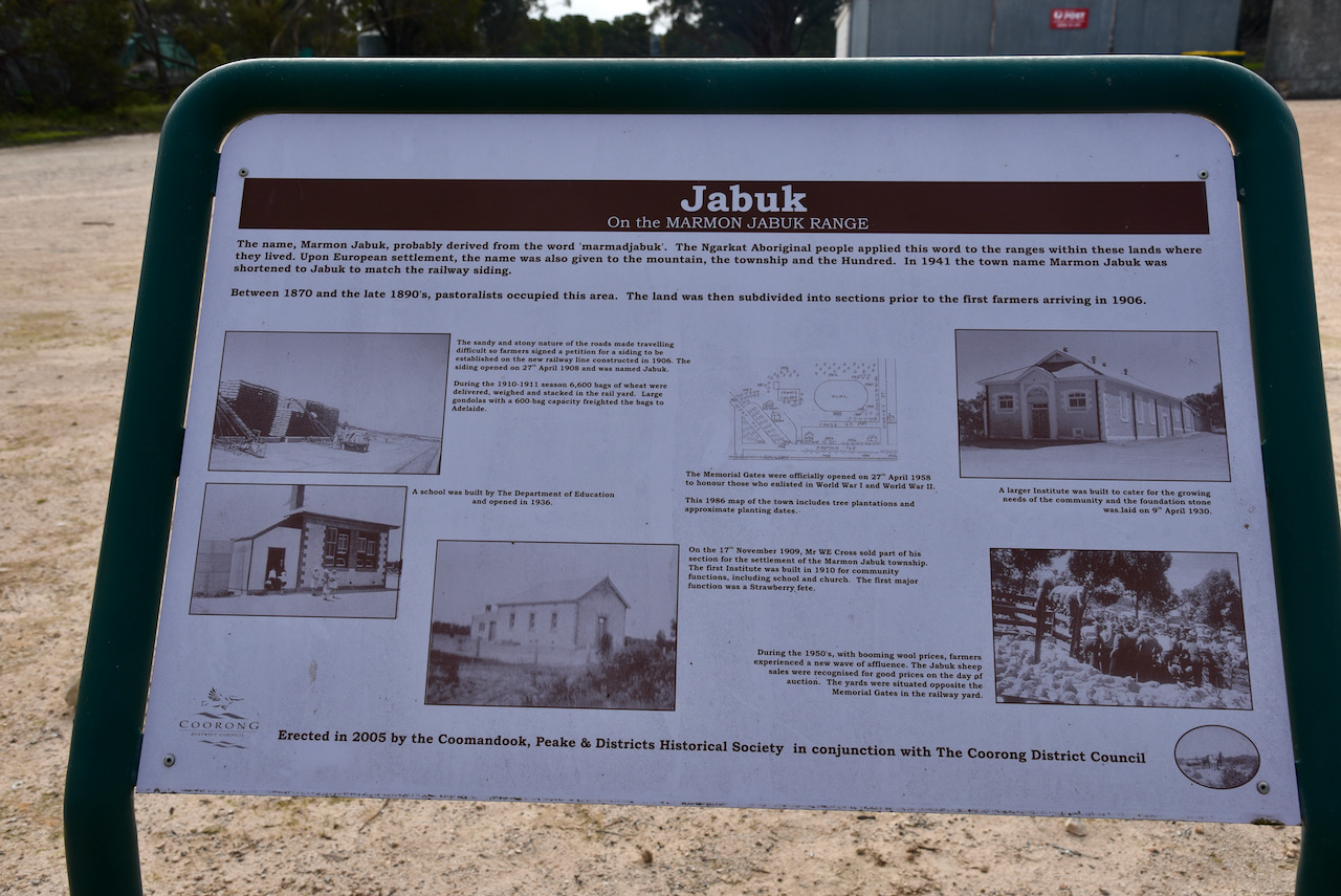
Jabuk, pronounced ‘jay-buck’ was formerly known as Marmon Jabuk until the 20th day of February 1941. The town was laid out in 1909 by William. E. Cross, a blacksmith of East Wellington. European pastoralists occupied the Jabuk area during the 1870’s and 1890s

Above:- the South Australian Govt Gazette showing the name change in 1941. Image c/o Wikipedia

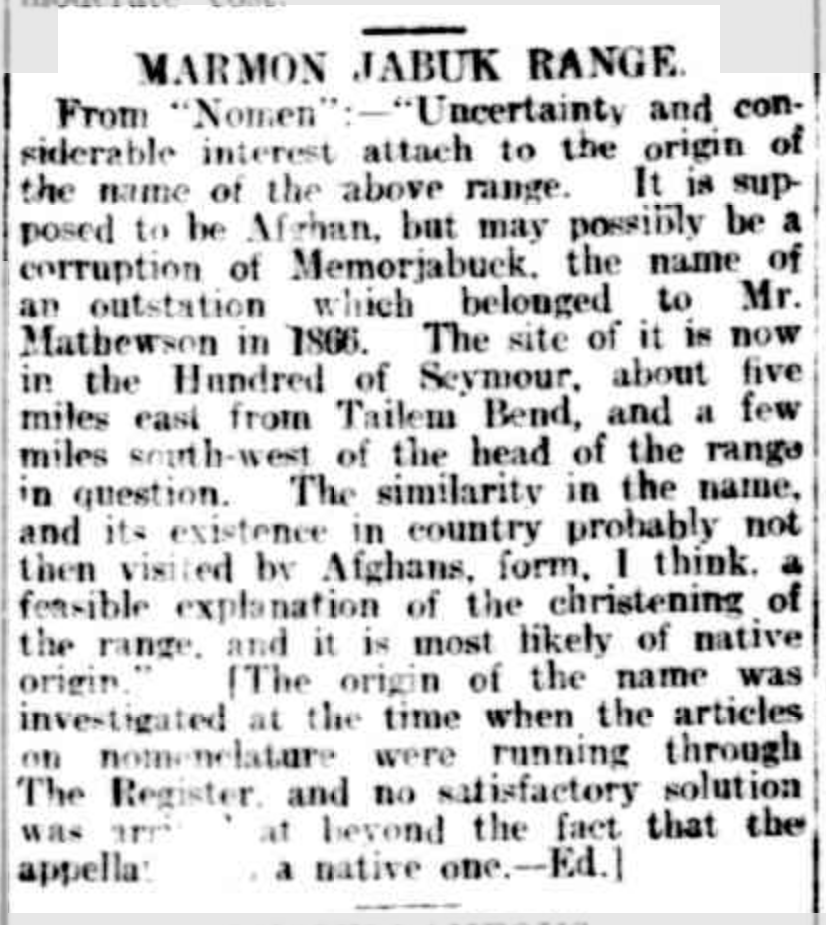
The name of the town appears to be derived from the nearby Marmon Jabuk Range which has an elevation of just 91 metres. The town also sits on the Marmon-Jabuk fault line. However the actual origin of that name is unclear. There are reports that it may be an Afghan word by a cameleer. Others state that it is from a local aboriginal word.

An article appeared in The Register (Adelaide) on Friday 2nd July 1909 (see below). It was suggested in the article that the name was ‘supposed to be Afghan in origin, but, possibly, a corruption of memorjabuk, the name
of an outstation owned by Mr Mathewson in 1866.”

An Editor’s note says that:

“The origin of the name was investigated when the articles on nomenclature were running through The Register and no satisfactory solution was arrived at beyond the fact that the appellation is a native one.”

Above:- from The Register, 2/7/1909. Image c/o Trove

Another article appeared in the Chronicle (Adelaide) on Saturday 3rd June 1911 which said:-

“Marmon Jabuk…….The name according to local residents, was bestowed upon a low mallee range to the south of the line because an Afghan was found dead there”.

Other reports state that ‘memorjabuk’, mentioned above, is believed to have been corrupted
from ‘marmadjabuk’, applied by Aborigines to an inland range of sand dunes extending from the River Murray,
south-east through the Hundreds of Hooper, Sherlock, Peake and Price.

This range was an old shoreline in the Pleistocene ice age. About 10 km north east of Tailem Bend, on the northern side of the Marmon Jabuk Range, was a place called mamondjabak. David Unaipon (b. 1872. d. 1967), an aboriginal preacher, author and inventor stated that the word means ‘father of fire’. The Marmon Jabuk Range is well known for its numerous fires started by storms and lightning strikers. This would account for the name given by the aborignals.

Other records say that ‘jabuk’ is believed to be aboriginal for ‘bullock’.

The sandy and stony nature of the roads in the Jabuk area made travelling difficult, so farmers signed a petition for a siding to be established on the new railway line constructed in 1906.

Above:- Just the sign of the Jabuk railway station remains today

An extract from South Australian Railways Weekly Notices on the 27th day of April 1908 said:

“The siding at the above place is now complete and open for passenger, parcels, goods, and livestock traffic
under the usual conditions attaching to sidings without resident staff. It is 112 miles 30 chains from
Adelaide, and trains will stop there when required. In computing charges 37 miles must be added to the Tailem Bend mileage. The station number for Marmanjabuk is 147.”

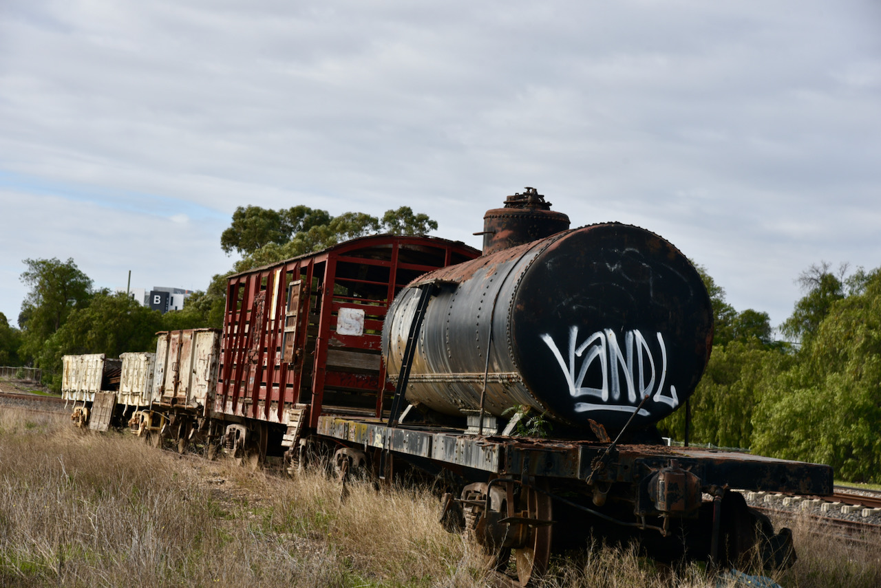
During the 1910-1911 season, a total of 6.600 bags of wheat were delivered, weighed and stacked in the rail yard. Large gonolas with a 600 bag capacity freighted the bags to Adelaide.

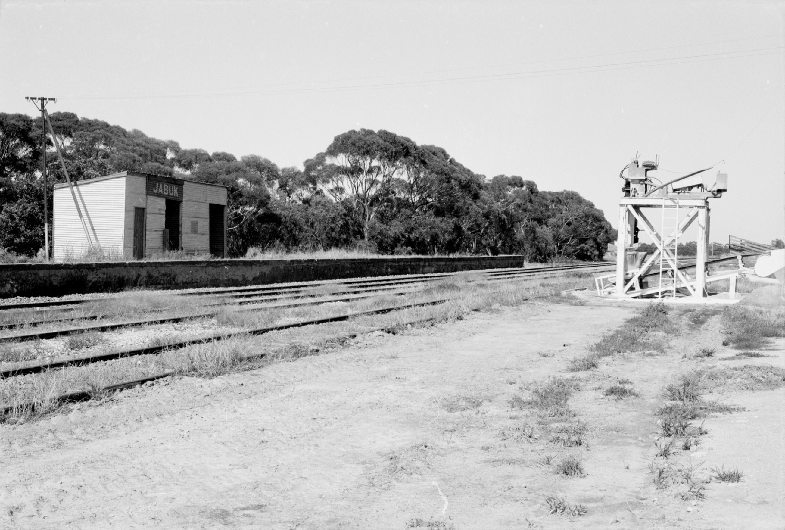
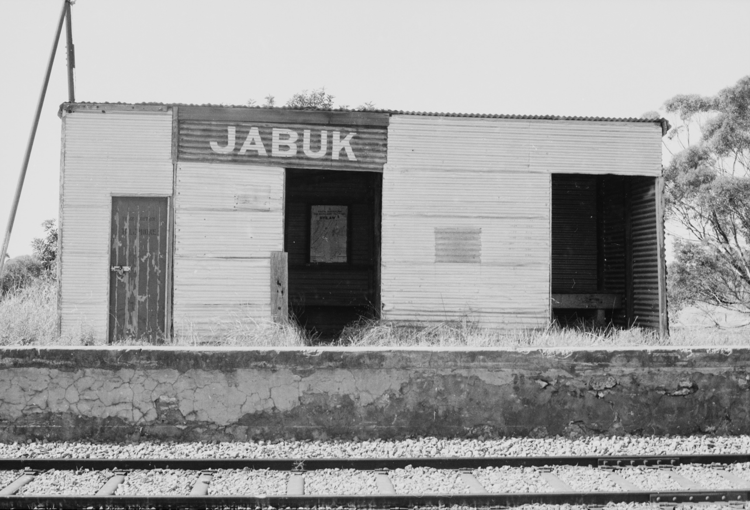
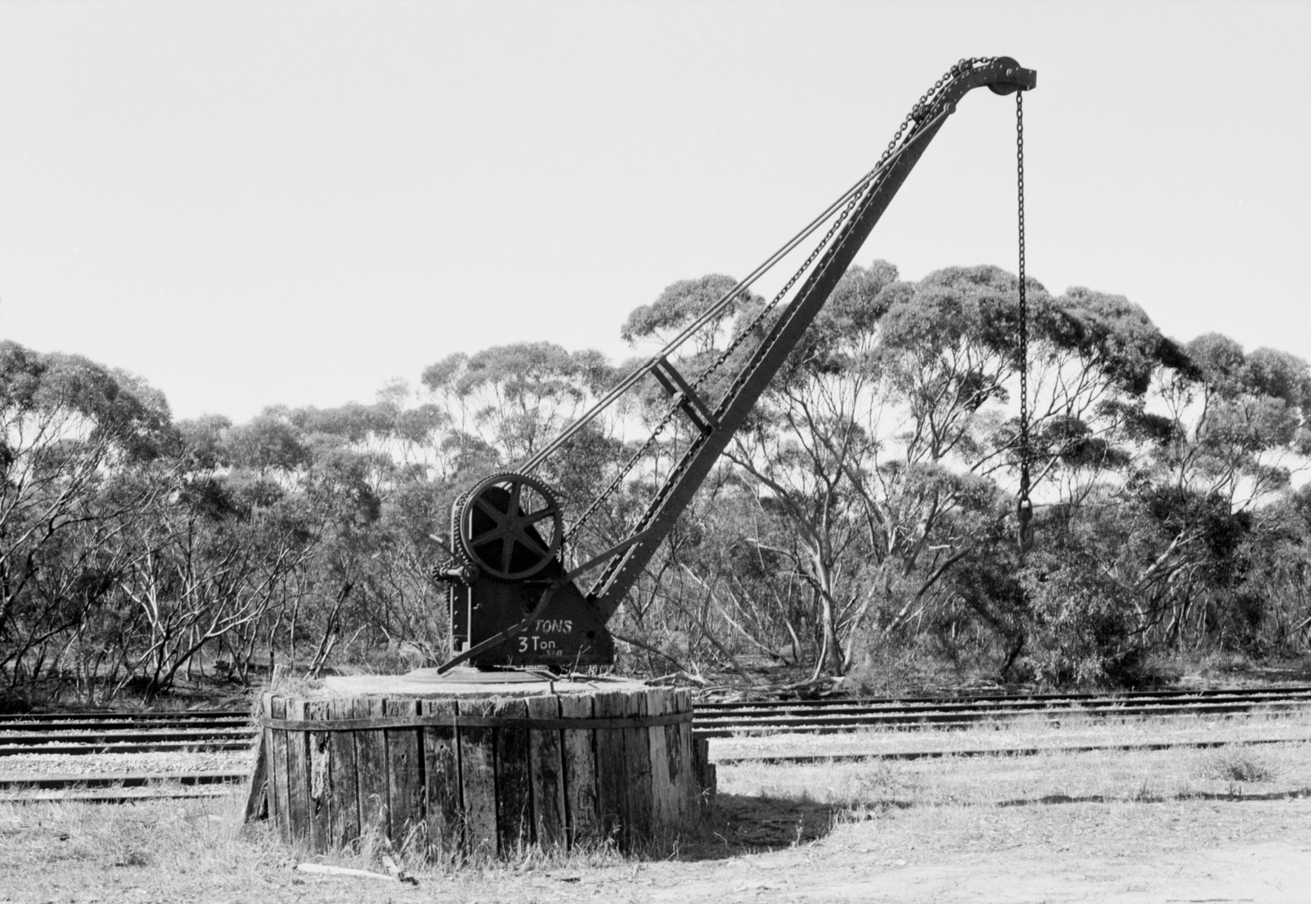
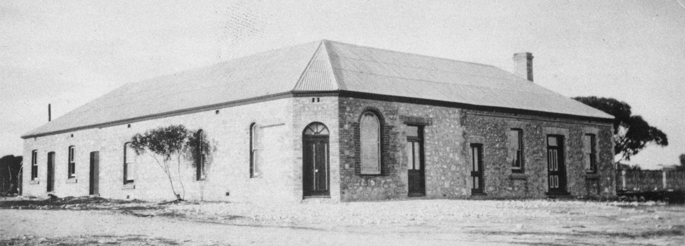
Above:- the old Jabuk railway station. Images c/o Trove.

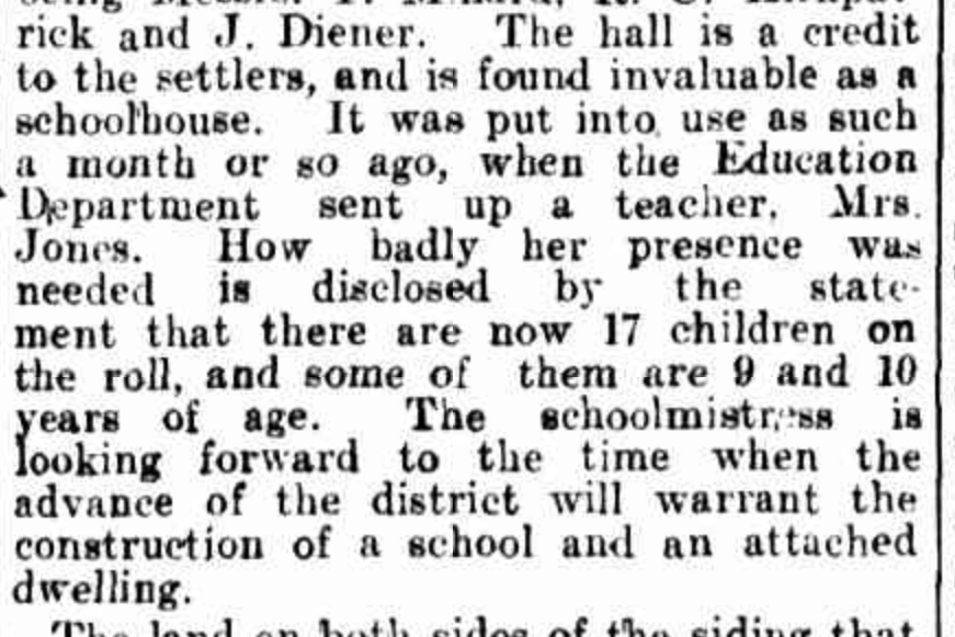
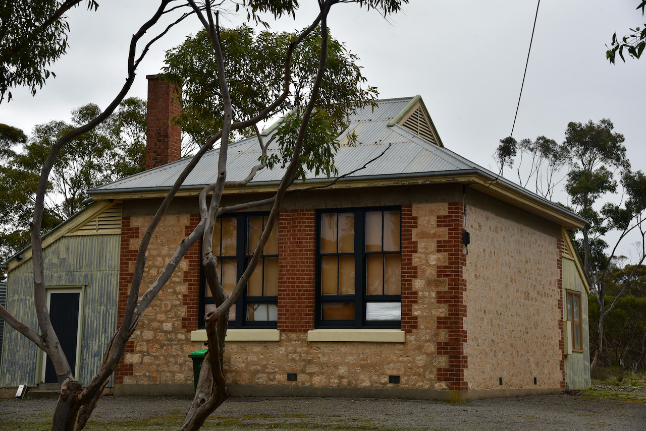
The first Institute in Jabuk was built in 1910 for community functions, including school and church. The first major function was a Strawberry fete. An article in the Chronicle (Adelaide) dated Saturday 3rd June 1911 said:-

“The hall is a credit to the settlers, and is found invaluable as a schoolhouse. It was put into use as such a month or so ago, when the Education Department sent up a teacher, Mrs. Jones. How badly her presence was needed is disclosed by the statement that there are now 17 children on the roll, and some of them are 9 and 10 years of age. The schoolmistress is looking forward to the time when the advance of the district will warrant the construction of a school and an attached dwelling”.

Above: Article from the Chronicle, 3/6/1911. Image c/o Trove

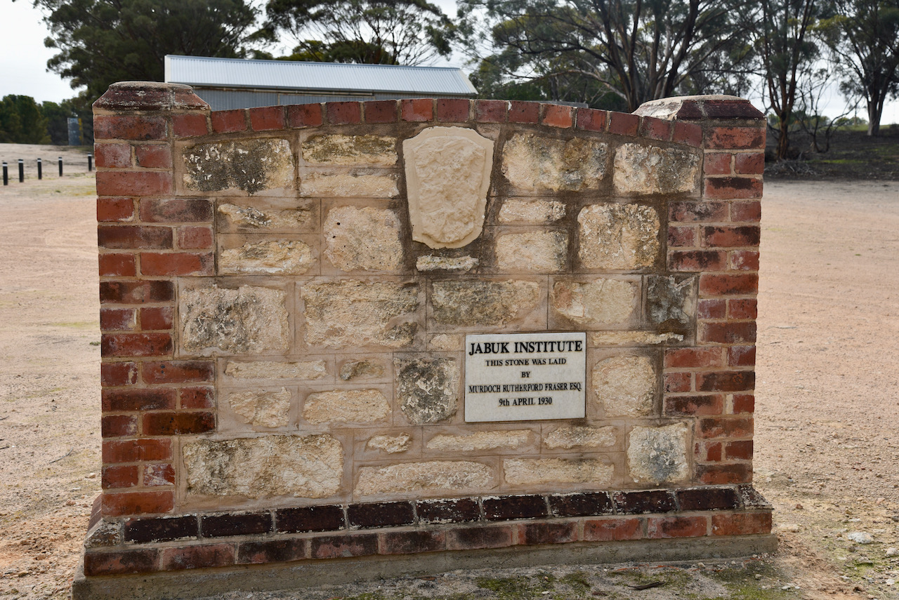
A larger Institute was built to cater for the growing needs of the community and the foundation stone was laid on the 9th day of April 1930.

In 1936 the Jabuk State School was built by the Department of Education. The school closed in 1964, with students being transferred to Geranium Area School.

During the 1950s, with booming wool prices, farmers experienced a new wave of affluence. The Jakub sheep sales were recognised for good prices on the day of auction. The yards were situated opposite the Memorial Gates in the railway yard.

Above:- the old Jabuk General store and Post office on left, Savings Bank on right. Image c/o Trove

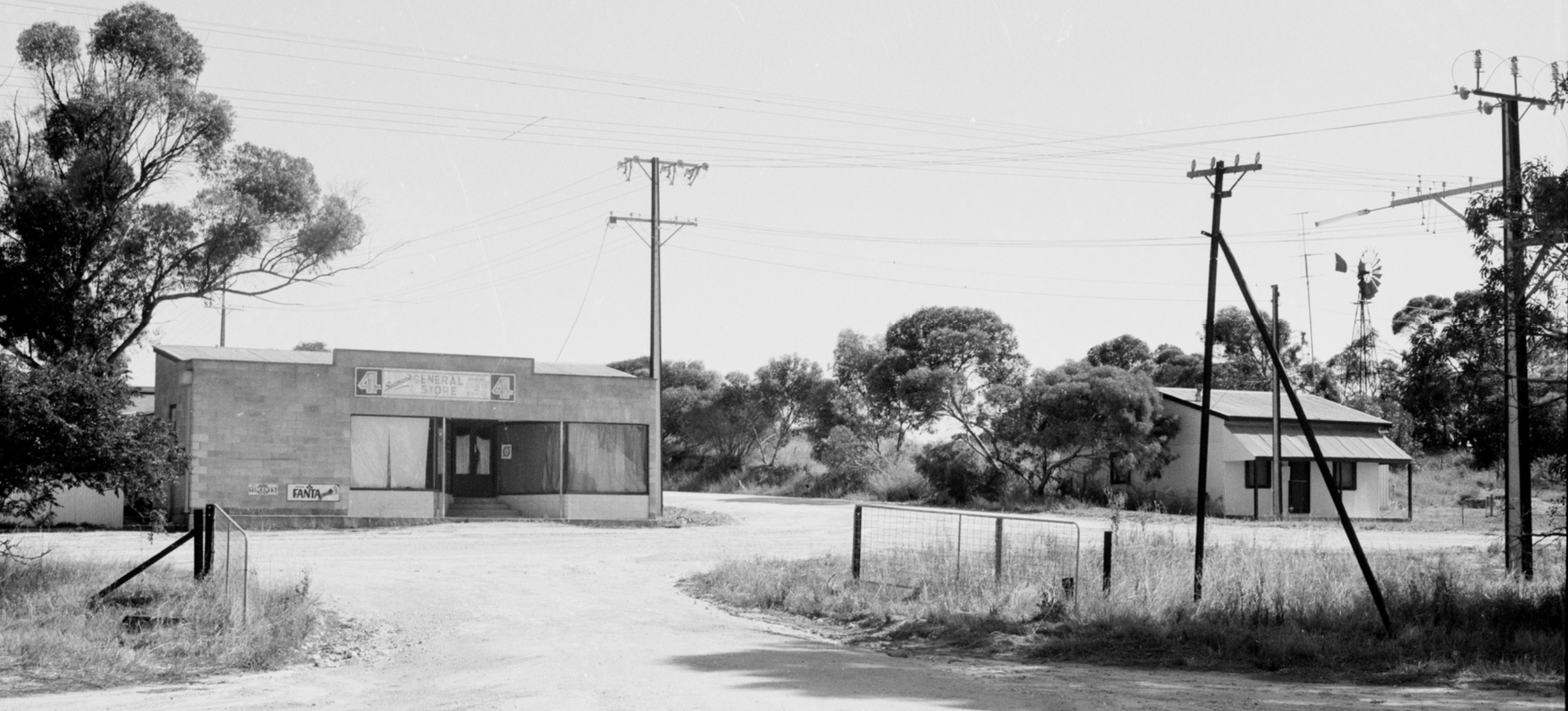
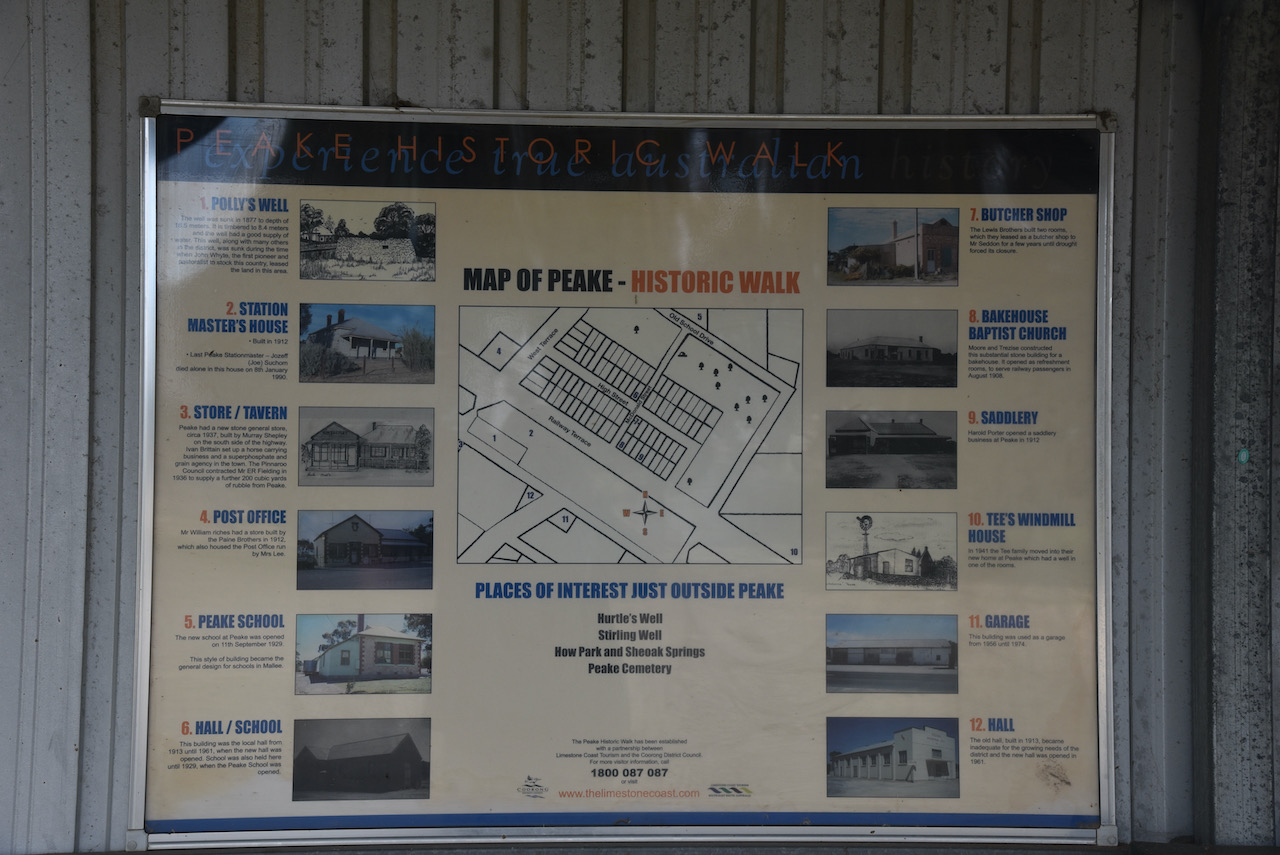
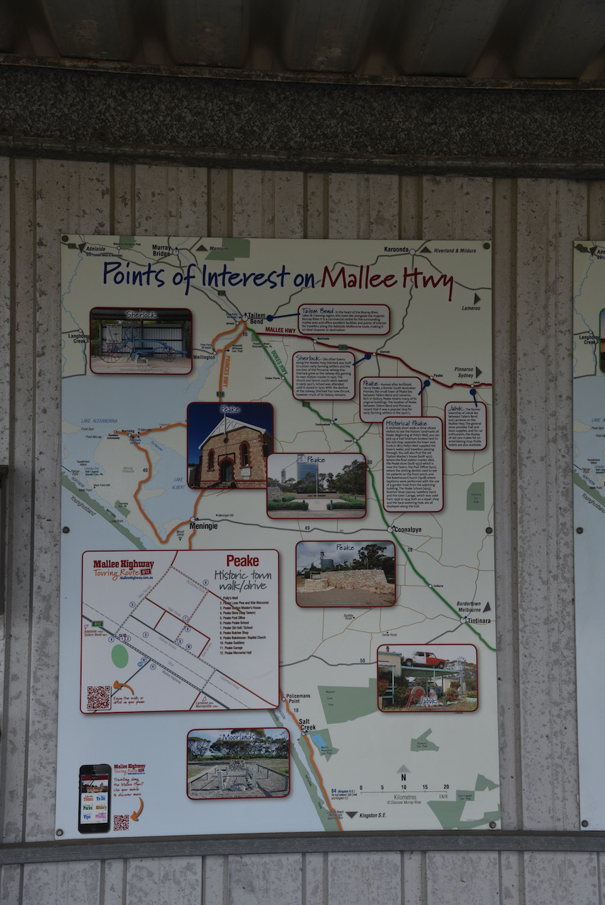
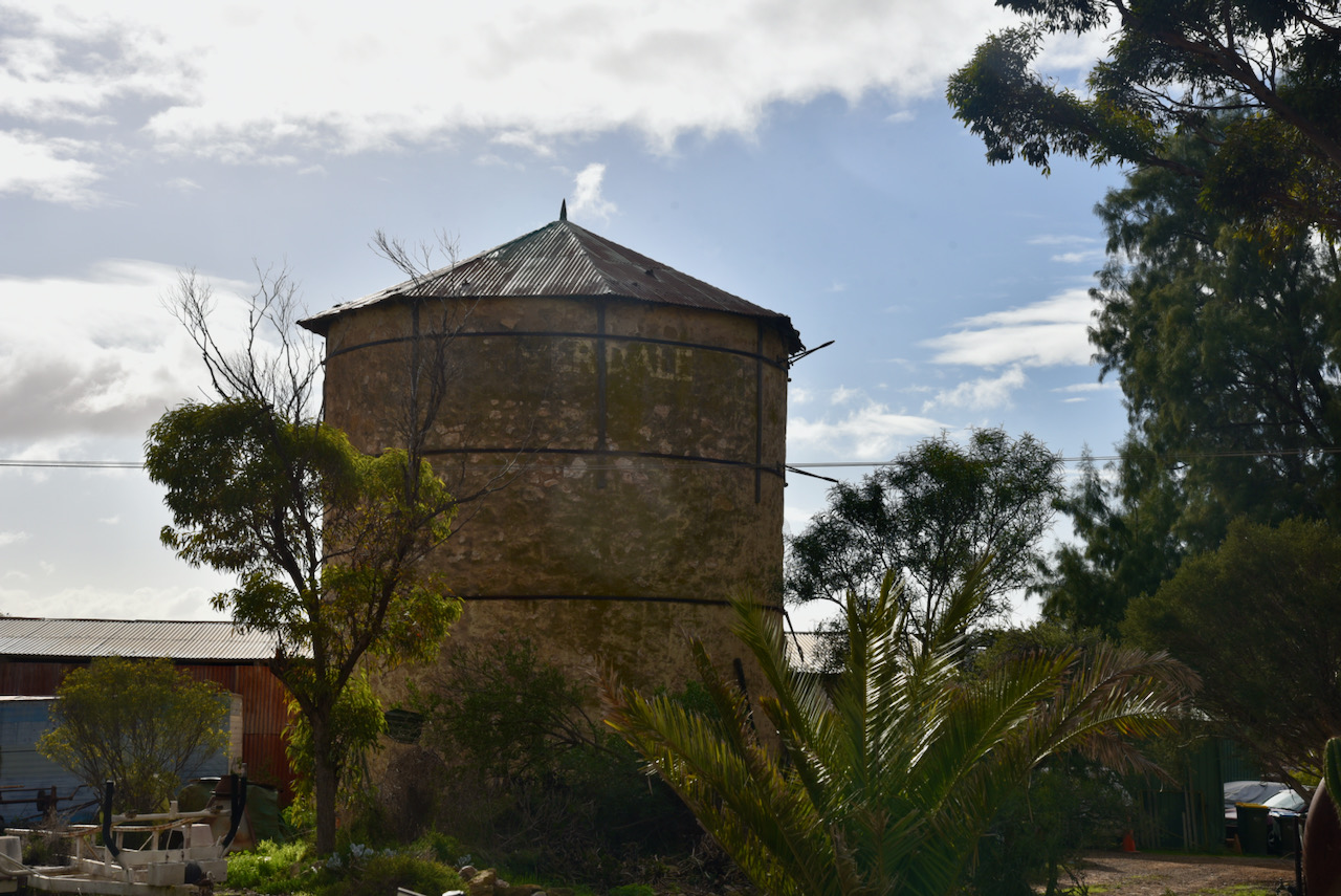
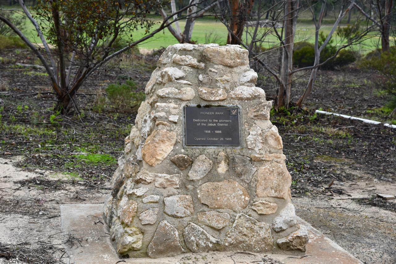
Today in Jabuk you can view an information board on Ampton Terrace. A number of historic buildings remain in Jabuk. You can also view the Jabuk Memorial Gates which were officialy opened on the 27th day of April 1958 to honour those who enlisted in World War I and World War II.

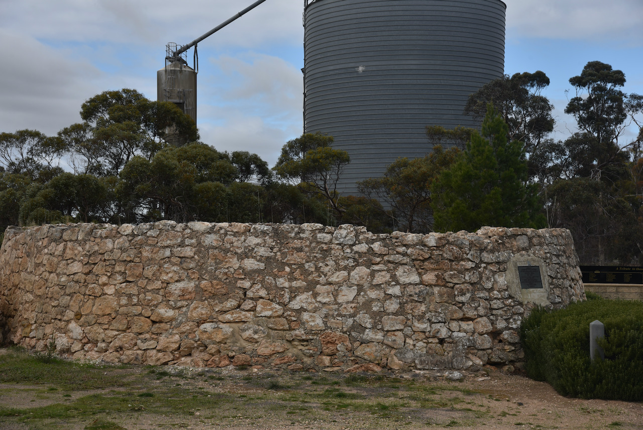
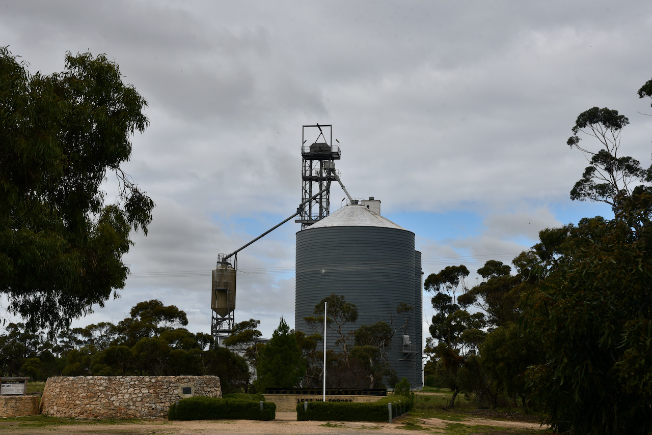
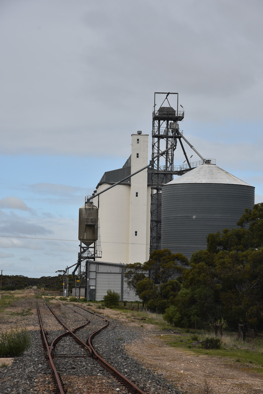
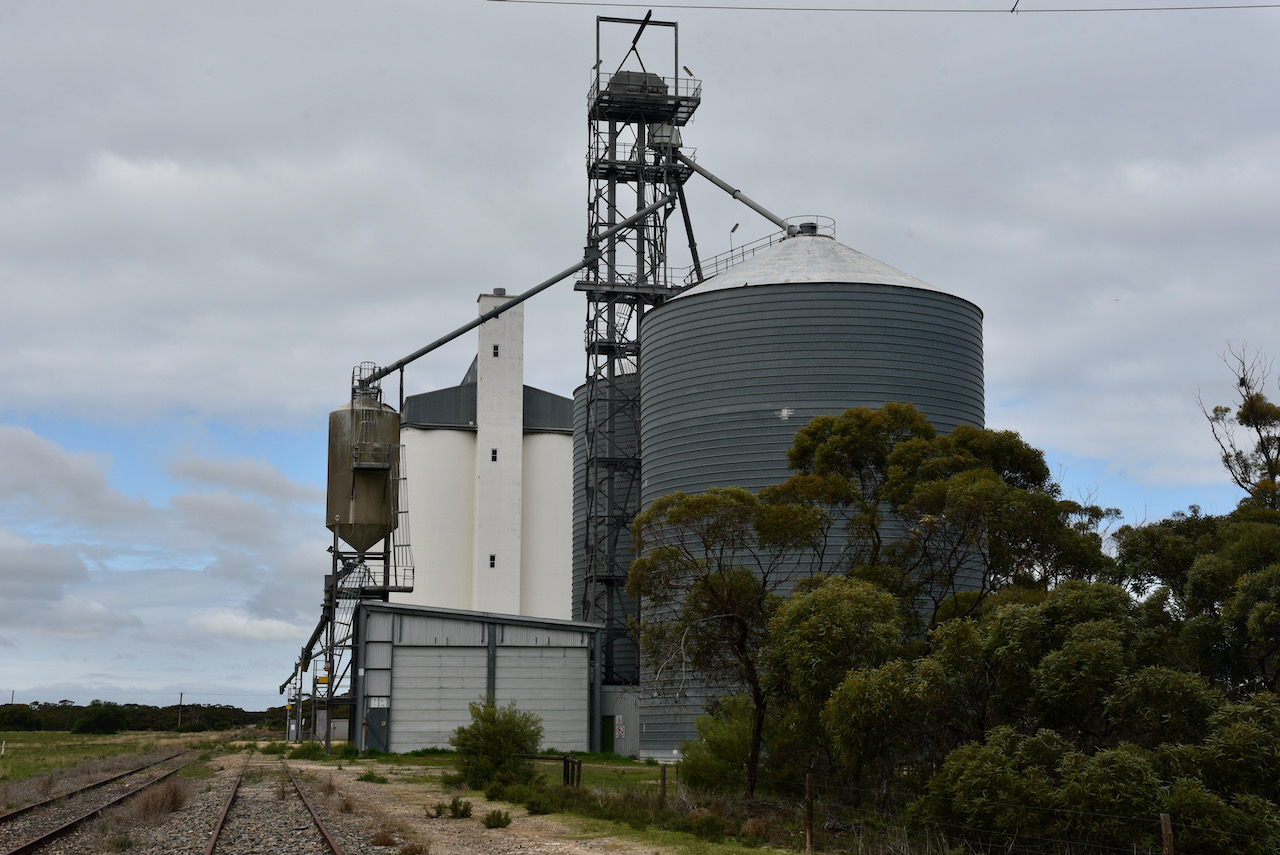
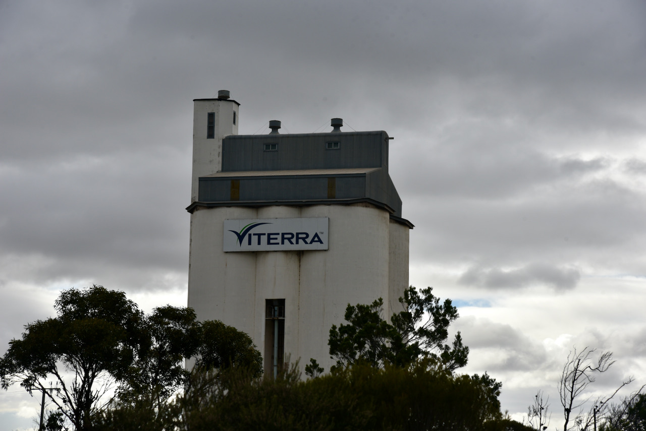
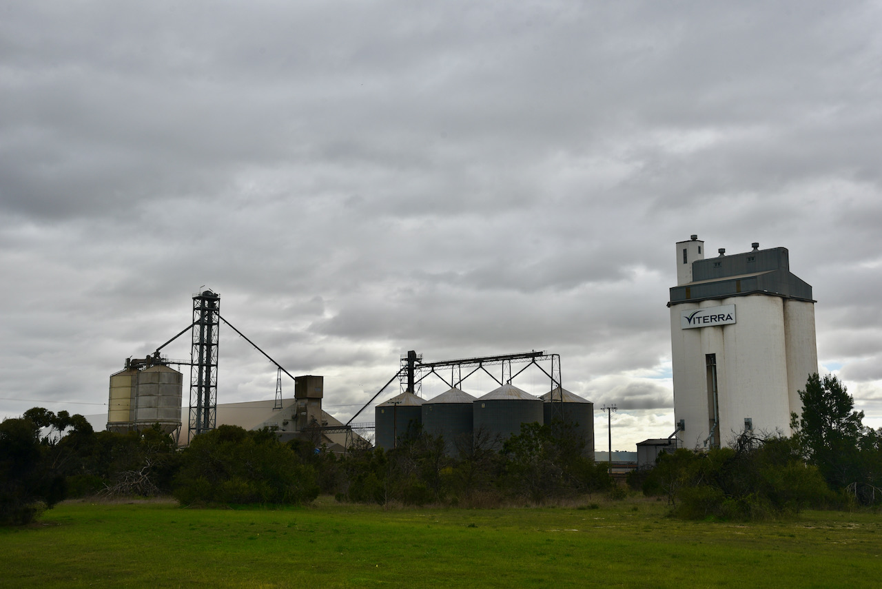
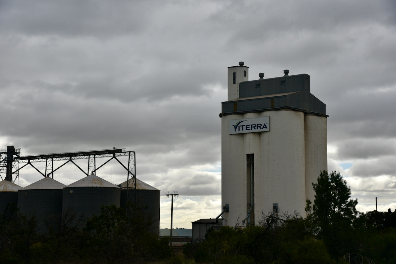
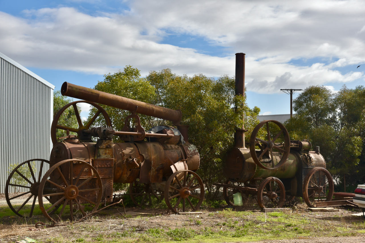
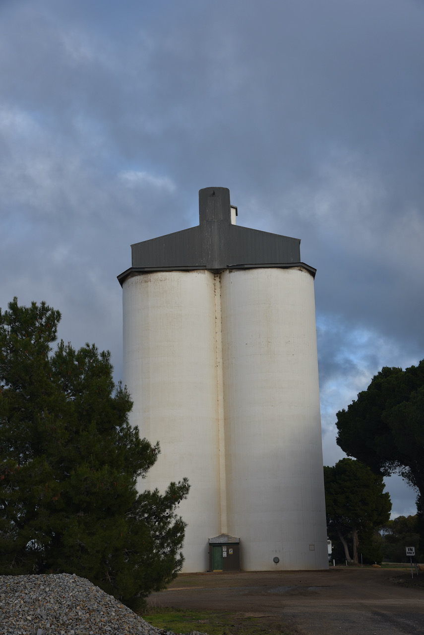
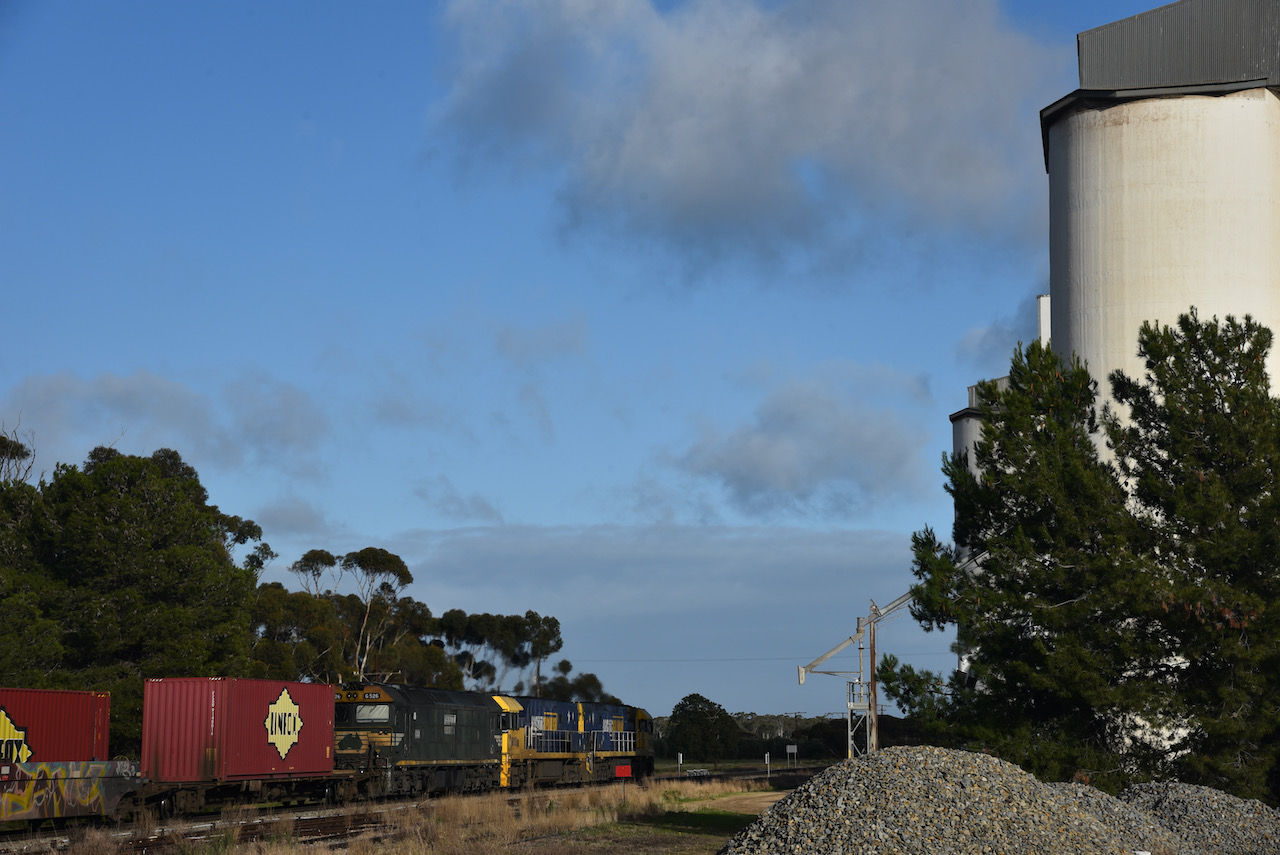
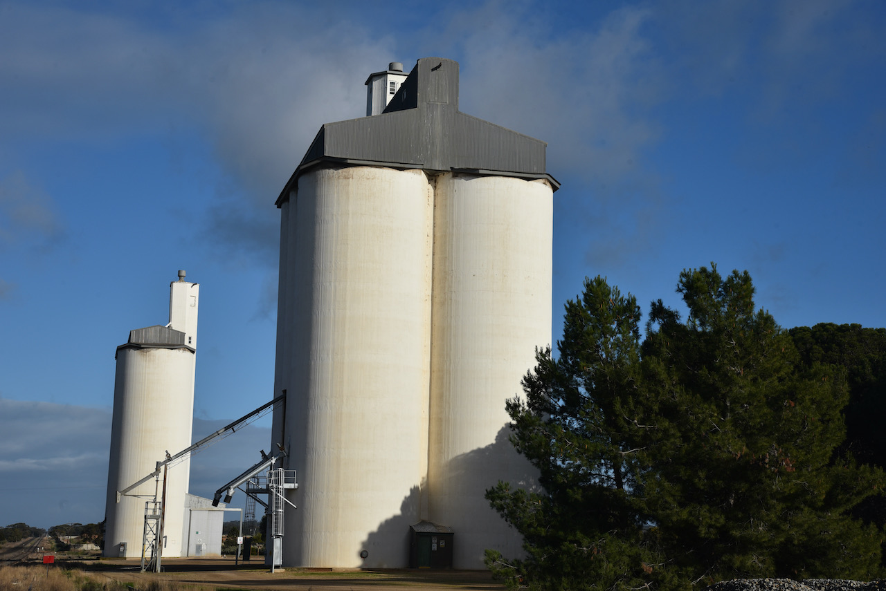
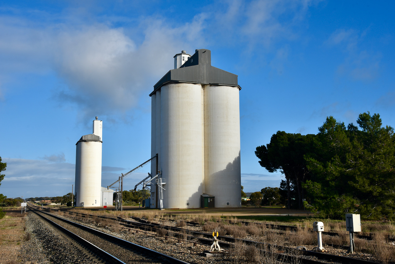
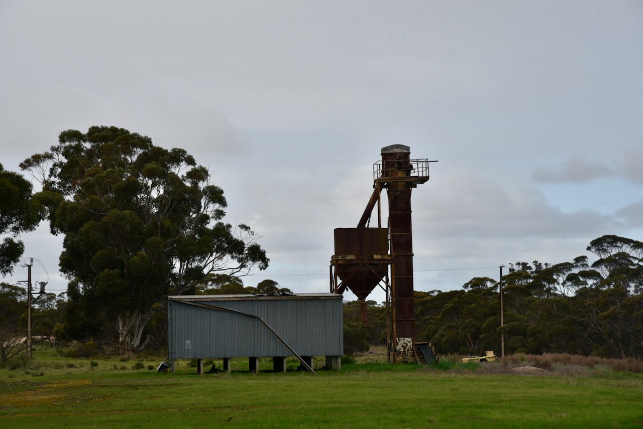
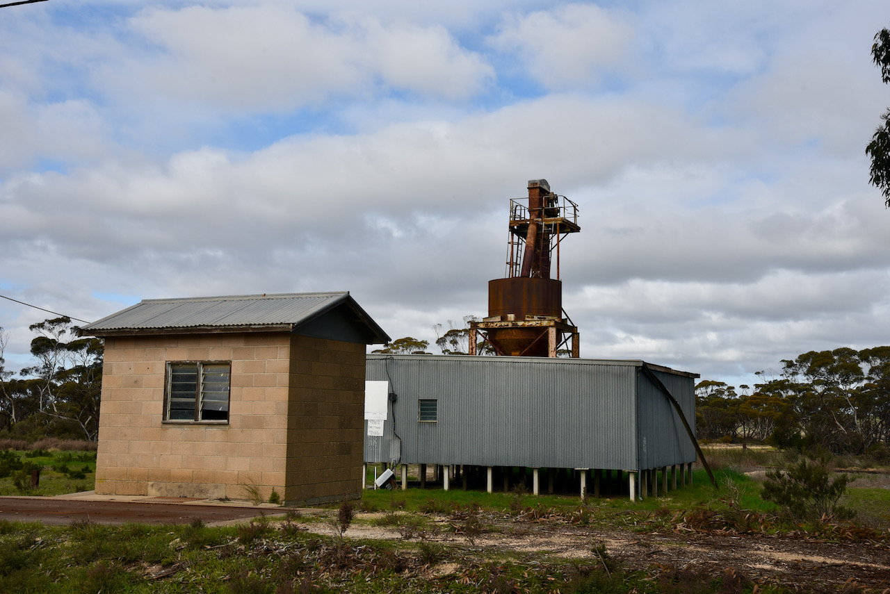
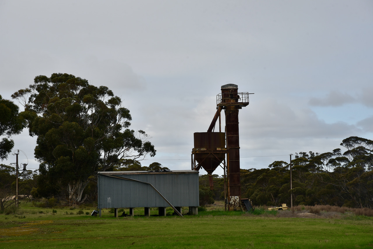
The silo at Jabuk is an old fertiliser silo. It is located alongside of the old railway line on Ampton Terrace on the southern side of the town.

I set up alongside of the old railway line and called CQ on 7.155. This was answered by Brett VK2VW who I had logged at all silos up to this point. Next in the log was VK3BWV, followed by Peter VK3PF. I had qualified another silo.

I logged a total of 15 stations on 40m from VK2, VK3, VK5, and VK7. This included Stuart who was activating the Teesdale Sheoak Nature Conservation Reserve VKFF-2206, and Dean VK3KXR who was in the You Yangs Regional Park VKFF-0982.

When callers dried up I headed to 80m and logged Marija Vk5MAZ and Adrian VK5FANA.

Unfortunately I had issues with tuning the antenna on 20m so I did not operate on that band.

I worked the following stations on 40m SSB:-

  1. VK2VW
  2. VK3BWV/p
  3. VK3PF
  4. VK5WG
  5. VK5KLV
  6. VK3OHM
  7. VK7ME
  8. VK3UAO/p (Teesdale Sheoak Nature Conservation Reserve VKFF-2206)
  9. VK3KXR/p (You Yangs Regional Park VKFF-0982)
  10. VK3AWA
  11. VK2GAZ
  12. VK5MAZ
  13. VK3SQ
  14. VK5FANA
  15. VK2MOP

I worked the following stations on 80m SSB:-

  1. VK5MAZ
  2. VK5FANA

References.

  1. A Compendium of the Places Names of South Australia, 2021, <https://published.collections.slsa.sa.gov.au/placenamesofsouthaustralia/>, viewed 14th July 2021.
  2. Kloeden; A & P, Heritage if the Murray Mallee, 1998.
  3. Mallee Highway Touring Route, 2021, <http://www.malleehighway.com.au/html/jabuk.html>, viewed 14th July 2021.
  4. Mapcarta, 2021, <https://mapcarta.com/>, viewed 15th July 2021.
  5. Wikipedia, 2021, <https://en.wikipedia.org/wiki/Jabuk,_South_Australia>, viewed 14th July 2021.

Peake silos VK5-PKE5 – Silos On The Air

My sixth silo for Monday the 12th day of July 2021 was the Peake silos VK5-PKE5. Peake is a small town located on the Mallee Highway about 145 km east of the city of Adelaide.

Above:- Map showing the location of Peake. Map c/o Google maps.

After leaving Tailem Bend I turned onto the Mallee Highway which runs east from Tailem Bend through cereal growing farmland to Pinnaroo near the South Australia – Victoria State border. It continues in Victoria and was formerly known there as the Ouyen Highway. The highway is the shortest route between Adelaide and Sydney.

On the Mallee Highway near the little town of Moorlands is a stone cairn with a plaque for the Horseman’s Grave.

I continued on into the town of Peake which is named after Archibald Henry Peake (b. 1859. d. 1920). He was the Premier of South Australia on three occasions. He served as the Premier from 1909 to 1910 for the Liberal and Democratic Union, and then from 1912 to 1915 and 1917 to 1920 for its successor, the Liberal Union. He had also been Treasurer and Attorney General in the Price-Peake coalition government from 1905 to 1909.

Above:- Archibald Peake. Image c/o Wikipedia

The town of Peake was proclaimed on the 8th day of August 1907. It had been surveyed during May 1907. One of the primary concerns of local councils at the time was the construction of serviceable roads. Many local farmers soon found a way to pay off their council rates, by working with teams building roads. Farmers could also make money by quarrying limestone from their properties and selling it. However, as there was very little stone around Lameroo and Pinnaroo, the Pinnaroo District Council contracted to buy stone from the area between Sherlock and Jabuk. Stone pickers could earn up to six shillings per ton of stone. A stone crushing plant was established in the 1930s at the Peake Railway station where rubble was crushed. It was then loaded on eastward bound trucks towards Pinnarroo. A bitumen road was eventually established between Tailem Bend and Peake. However it continued no further due to the outbreak of the Second World War which brought a standstill to further construction.

Above:- An aerial view of Peake. Image c/o Google maps

As you come into the town there is an excellent parking area with an information board on the Peake Historic Walk and points of interest along the Mallee Highway. It is located opposite the oval.

There is a significant amount of history to be found in this little town. In close proximity to the silos you can find Pollys Well. It was sunk by John Whyte, the first pastoralist and pioneer to stock the surrounding countryside.

In 1877 the well was sunk to a depth of 16.5 metres. The well is timbered to 8.4 metres and in its day had a good supply of water. Water was drawn from the well with the assistance of a horse and buckets. Early settlers depended highly on the well as it would take eight days to travel by bullock wagon from Tailem Bend to Pinnaroo. Water was also taken on here for the steam trains when they commenced operation in the area.

Above: Visitors to Pollys Well. Image c/o State Library SA.

There are numerous stories surrounding the origin of the name ‘Polly’s Well’. One of those is that the horse which drew buckets of water from the well was called ‘Polly’. While others report that a horse or cow called ‘Polly’ fell into the well meeting its fate. Another theory is that the well was named after the wife of an early pioneer.

Alongside of Pollys Well is the Peake War Memorial and Lone Pine. The pine was planted at Peake on the 25th day of April 2009 having been propagated from a pine tree at the War Memorial in Canberra. That particular tree can follow its origins back to Gallipoli, Turkey. The ridges at Gallipoli were once covered with Aleppo Pines. However, these were cut down to line over trenches. Just one solitary pine remained. Lance Corporal B.J. Smith of the 3rd Battalion sent several pine cones back to Australia. Thirteen years later, two seedlings were grown, one of which was planted at the Canberra War Memorial.

There is a historic walk which you can undertake in Peake. A brochure can be collected from the information bay. Historic buildings in the town include the old Station Master’s House (built 1912), the Peake Store/Tavern (built 1937). the Peake Post Office (built 1912), the Peake Bakehouse (built 1908), and the Peake Saddlery (built 1912).

Jozeff Suchon, the final station master at Peake died in the Station Masters House in 1990, aged 78 years. Today, the house is in a complete state of disrepair. It is reported that the visitjng dentist saw his patients on the front porch of the Post Office.

The Peake Baptist Church was originally built by Moore and Trezise in 1908 as a bakehouse and refreshment rooms to serve railway passengers. Apparently there was always a rush for the pie stall. In 1922 the building was purchased by the Home Mission Department to serve as a new Baptists church and manse. Baptisms were performed with the use of a garden hose.

Above:- the Peake Baptist Church. Image c/o State Library SA.

You can also find a monument for the old Peake Railway Station which was located on the Pinnaroo railway line. The line opened from Tailem Bend to Pinnaroo on the 14th day of September 1906, and on the 29th July 1915 it extended over the border into Victoria. The line closed in July 2015. It was at this time that Viterra announced that no more grain would be carried by rail after 31st day of July 2015. The 2015 harvest would be entirely transported by road. As the South Australian line closed, the Victorian government was upgrading part of its end of the line for regional freight.

In its day the town of Peake was a bustling place, as can be seen from the newspaper article below dated 14th December 1928.

Above:- News article from the Pinnaroo and Border Times, 14 Dec 1928. Image c/o Trove

The silos at Peake are both concrete and iron and are operated by Viterra.

I parked in the carpark directly adjacent to the silos and first in the log was Ian VK1DI/p who was activating a park for the World Wide Flora Fauna (WWFF) program, the Turallo Nature Reserve VKFF-2750.

I then moved up to 7.155 and called CQ. This was answered by Peter VK3PF, followed by Marc VK3OHM. I had qualified the silo with 3 QSOs.

I went on to work a further 5 stations before heading to 7.144 to get Gerard VK2HBG/p and Bob VK2BYF/p in the log. They were operating portable from the Batemans Marine Park VKFF-1406.

I then moved back to 7.155 and logged a further 7 stations including Gerard VK2IO/p who was in the Springwood Conservation Park VKFF-1653, and Roly ZL1BQD in New Zealand. I also logged Marty VK4KC for his first ever silo contact.

I then moved to the 80m band where I logged Marija VK5MAZ, Adrian VK5FANA, and Gordon VK5GY.

To complete the activation I headed to 14.310 on the 20m band where I logged Peter VK3PF, and Stuart VK3UAO who was in the Inverleigh Nature Conservation Reserve VKFF-2336.

With 22 contacts in the log it was time for me to pack up and head to my next silo at Jabuk a little further along the Mallee Highway.

I worked the following stations on 40m SSB:-

  1. VK1DI/2 (Turallo Nature Reserve VKFF-2750)
  2. VK3PF
  3. VK3OHM
  4. VK5MAZ
  5. VK3SQ
  6. VK2VW
  7. VK2DJP
  8. VK2MET
  9. VK2HBG/p (Batemans Marine Park VKFF-1406)
  10. VK2BYF/p (Batemans Marine Park VKFF-1406)
  11. VK3NCR
  12. VK2IO/p (Springwood Conservation Park VKFF-1653)
  13. ZL1BQD
  14. VK3SMW
  15. VK3AWA
  16. VK4KC
  17. VK2LEE

I worked the following stations on 80m SSB:-

  1. VK5MAZ
  2. VK5FANA
  3. VK5GY

I worked the following stations on 20m SSB:-

  1. VK3PF
  2. VK3UAO/p (Inverleigh Nature Conservation Reserve VKFF-2336)

References.

  1. Coorong District Council, 2021, <https://www.coorong.sa.gov.au/tourism/our-towns/our-towns-peake>, viewed 14th July 2021.
  2. Discover Murray, 2021, <http://www.murrayriver.com.au/peake/>, viewed 14th July 2021.
  3. Mallee Highway Touring Route, 2021, <http://www.malleehighway.com.au/html/peake.html>, viewed 14th July 2021.
  4. Wikipedia, 2021, <https://en.wikipedia.org/wiki/Mallee_Highway>, viewed 14th July 2021.
  5. Wikipedia, 2021, <https://en.wikipedia.org/wiki/Archibald_Peake>, viewed 14th July 2021.
  6. Wikipedia, 2021, <https://en.wikipedia.org/wiki/Pinnaroo_railway_line,_South_Australia>, viewed 14th July 2021.

Tailem Bend VK-WRN5 – Silos On The Air

My fourth silo for the day was Tailem Bend VK-WRN5. Tailem Bend is located about 96 km south-east of the city of Adelaide.

Above:- Map showing the location of Tailem Bend. Map c/o Google maps

The town of Tailem Bend is located on the cliffs above the east bank of the Murray River. There are various theories on the origin of the towns name which was once written as “Tail’em Bend”. Some claim that the words are a corruption of the Ngarrindjeri aboriginal word “thelim” meaning “bend”, which is associated with the sharp bend that the Murray River makes at Tailem Bend. Others claim that original Ngarrindjeri inhabitants called this part of the river ‘Thelum Ki’ which means bent water.

In 1884 a railway gang who were constructing the railway line east to Victoria. set up camp among some native pine trees, naming the site ‘Pine Camp’. From this time onwards the twonship commenced to grow. By 1887 the town had been proclaimed.

Major industries in the Tailem Bend area include pig farming, dairying, grain growing, hay exporting, and olives. Tailem Bend is also the home to The Bend Motorsport Park and Old Tailem Town, a pioneer village.

Large operational grain silos can be found on the western side of town on the northern side of the Princes Highway. This is where former railway branch lines into the Murray Mallee region join the main Adelaide-Melbourne line. The silos are run by Viterra.

The last two branches were the Pinnaroo railway line and the Loxton railway line via Karoonda. The Loxton line was originally one of five branch lines from the Barmera railway line and was the last to remain in service. It ran north-east from Tailem Bend to the grain silos at Loxton in the Riverland region. It was the only branch to be converted to standard gauge (along with the separate Pinnaroo line) when the main line was converted from broad gauge. However the lines remained as light rail and ballast with low speed limits, and they were only used for collection of bulk grain, as the speed limits are too low to be practical for transport of time-sensitive freight. The last grain train left the silos on the 20th day of June 2015, marking the closure of the line.

At the time. Viterra Group commercial manager Andrew Hannon said that road transport was more cost effective than rail.

The Tailem Bend silos is one of Viterra’s most significant silos in South Australia.

In 2014 it was reported by Viterra eastern region operations manager Jack Tansley that “during peak harvest periods the Tailem Bend site receives more than 16,000 tonnes of grain a day and is now in the process of out-turning the grain which includes trains running, on average, every second day from the site with road out-turns occurring daily.”

On the 30th day of November 2020 the Tailem Bend silos broke its daily receival record when 17,475 tonnes of grain was delivered in a single day.

I operated from the side of Princes Highway, directly opposite the silos. First in the log was Gerard VK2IO/p who was operating portable in the Springwood Conservation Park VKFF-1653. I then moved up to 7.150 and called CQ. This was answered by Peter VK3PF, and then Marc VK3OHM. I had qualified another silo.

I was then called by Stuart VK3UAO who was activating the You Yangs Regional Park VKFF-0982, followed by Roly ZL1BQD in New Zealand.

I logged a total of 10 stations on 40m before callers dried up. I then moved to 80m where I logged Marija VK5MAZ and John VK5BJE.

I worked the following stations on 40m SSB:-

  1. VK2IO/p (Springwood Conservation Park VKFF-1653)
  2. VK3PF
  3. VK3OHM
  4. VK3UAO/p (You Yangs Regional Park VKFF-0982)
  5. ZL1BQD
  6. VK5MAZ
  7. VK2VW
  8. VK2GAZ
  9. VK3SQ
  10. VK2MET

I worked the following stations on 80m SSB:-

  1. VK5MAZ
  2. VK5BJE

References.

  1. Murray Valley Standard, 2021, <https://www.murrayvalleystandard.com.au/story/2259474/new-ways-for-busy-tailem-bend-silo/>, viewed 14th July 2021.
  2. Murray Valley Standard, 2021, <https://www.murrayvalleystandard.com.au/story/3094164/end-of-line-for-murraylands-mallee-grain-trains/>, viewed 14th July 2021.
  3. Murray Bridge News, 2021, <https://www.murraybridge.news/p/records-fall-at-monarto-south-tailem>, viewed 14th July 2021.
  4. Wikipedia, 2021, <https://en.wikipedia.org/wiki/Tailem_Bend,_South_Australia>, viewed 14th July 2021.
  5. Wikipedia, 2021, <https://en.wikipedia.org/wiki/Loxton_railway_line>, viewed 14th July 2021.

Murray Bridge VK-MRE5 – Silos On The Air

My third silo activation for Monday 12th July 2021 was Murray Bridge VK/ MRE5. Murray Bridge is located about 75 km south-east of Adelaide.

Above:- Map showing the location of Murray Bridge. Map c/o Google maps.

In March 2020, Viterra announced that it was to close 12 grain delivery sites across South Australia, including Murray Bridge. Viterra reported that based on a five year average, the 12 closed sites took 3% of South Australia’s grain harvest.

In early 2021, Sun-Pork Farms and Big River Feed Mill approached the Murray Bridge Council about using the silos.

The silos can be located on Hume Reserve Road, on the northern side of the town of Murray Bridge. Hume Reserve was named after the Hume brothers, who had a factory on the site. They were world leaders in cement pipe construction in the 1920s.

Above:- An aerial view of the location of the silos. Image c/o Google maps

Opposite the silos I found a number of old machinery and derelict railway carriages.

I parked alongside of the silo and called CQ on 7.150. This was answered by Marija VK5MAZ, followed by Peter VK3PF, and then Brett VK2VW. I had qualified the silo.

I logged 8 stations on 40m. This included Roly ZL1BQD in New Zealand.

I then moved to the 80m band where I logegd just the 2 stations: Stuart VK3UAO/p in the You Yangs Regional Park VKFF-0982, and then Marija VK5MAZ.

To conclude the activation I moved back to 40m where I logged Stuart VK3UAO/p on a different band.

I worked the following stations on 40m SSB:-

  1. VK5MAZ
  2. VK3PF
  3. VK2VW
  4. VK3SQ
  5. VK3OHM
  6. VK3AWA
  7. VK2MOP
  8. ZL1BQD
  9. VK3UAO/p (You Yangs Regional Park VKFF-0982)

I worked the following stations on 80m SSB:-

  1. VK3UAO/p (You Yangs Regional Park VKFF-0982)
  2. VK5MAZ

References.

  1. Murray Bridge News, 2021, <https://www.murraybridge.news/p/murray-bridge-council-watch-february>, viewed 13th July 2021.
  2. Stock Journal, 2021, <https://www.stockjournal.com.au/story/6660507/viterra-cuts-12-silos-from-network/>, viewed 13th July 2021.
  3. Visit Murray Bridge, 2021, <https://visitmurraybridge.com.au/murray-bridge-history/murray-bridge-railway-and-riverboat-heritage/>, viewed 13th July 2021.

Monarto South VK-MNH5 – Silos On The Air

My second silo for the day was Monarto South VK-MNH5. The silo is located about 68 km south-east of Adelaide.

Above:- Map showing the location of Monarto South. Map c/o Google maps

The locality of Monarto was originally a private subdivision of section 210 of the Hundred of Monarto, from which it took its name. The hundred having been gazetted in 1847, and named after an aboriginal woman ‘Queen Monarto’ who lived in the area at the time the town was proclaimed. In 1908 the township of Monarto was laid out.

Above:- Article from the South Australian (Adelaide) Friday 3 Dec 1847. Image c/o Trove

I found the following article about ‘Queen Monarto’ on Trove from The Chonicle (Adelaide) dated 29th November 1934.

Above:- c/o Trove

Today, Monarto South is quite a booming industrial area. It also is home to the Monarto Safari Park, which is the largest open-range safari experience outside of Africa.

In 1970 the Premier of South Australia, Don Dunstan, announced a satelitte city of Adelaide to be established at Monarto. This was due to concerns that Adelaide would become overpopulated due to high rates of birth and immigration which took place during the 1960s. An expansion of the city to the south and north would impose on the wine production areas of the Southern Vales and Barossa.

There were a number of factors why the development of Monarto did not proceed. The main one being that the population growth was much smaller than predicted. Economic failure and suspicion from various interest groups also resulted in the collapse of the Monarto project.

The silos at Monarto are working silos and are owned by Viterra. In December 2020, Viterra’s Monarto South site set a new record for total grain received during a single harvest. The previous record dated back to 2016-2017 when South Australia’s farmers brought in the biggest harvest ever.

The main railway line between Adelaide and Melbourne runs right alongside of the silos. In October 1919, Monarto South became a junction station with the opening of the Sedan line (to the north). After standardisation of the line, the station was demolished. The old station building can be found at the Old Tailem Town Pioneer Village at Tailem Bend. Trucks now transport grain from the silos.

As this is a working silo I could not get into the yard as such, so I parked on Ferries McDonald Road, right alongside of the railway line and adjacent to the silos. I called CQ on 7.150 and this was answered by Peter VK3PF, followed by Brett VK2VW, and then Marija VK5MAZ. I had qualified the silo with 3 contacts.

I went on to work a total of 11 stations on 40m from VK1, VK3, VK3, VK4, and VK5. before callers dried up. I then moved to 80m where I logged 4 stations: Peter VK3PF, Marija VK5MAZ, Peter VK5VK, and Ian VK5IS.

I then moved back to 40m and logged three Park activators: Stuart VK3UAO/p in the You Yangs Regional Park VKFF-0982, and Bob VK2BYF & Gerald VK2HBG who were both in the Murramarang National Park VKFF-0371.

To complete the activation I went to 20m where I logged Matt ZL4NVW in new Zealand.

I worked the following stations on 40m SSB:-

  1. VK3PF
  2. VK2VW
  3. VK5MAZ
  4. VK3SQ
  5. VK4HNS
  6. VK1DI
  7. VK2MU
  8. VK3AWA
  9. VK2HHA
  10. VK7ME
  11. VK5VK
  12. VK3UAO/p (You Yangs National Park VKFF-0982)
  13. VK2BYF/p (Murramarang National Park VKFF-0371)
  14. VK2HBG/p (Murramarang National Park VKFF-0371)

I worked the following stations on 80m SSB:-

  1. VK3PF
  2. VK5MAZ
  3. VK5VK
  4. VK5IS

I worked the following station on 20m SSB:-

  1. ZL4NVW

References.

  1. Wikipedia, 2021, <https://en.wikipedia.org/wiki/Monarto,_South_Australia>, viewed 13th July 2021.
  2. Wikipedia, 2021. <https://en.wikipedia.org/wiki/Monarto_South,_South_Australia>, viewed 13th July 2021.
  3. Wikipedia, 2021, <https://en.wikipedia.org/wiki/Monarto_South_railway_station>, viewed 13th July 2021.

Strathalbyn silo VK-STN5 – Silos On The Air

My first silo activation for Monday 12th July 2021 was Strathalbyn VK-STN5. This was my first ever Silos On The Air (SiOTA) activation.

Above:- Map showing the location of Strathalbyn. Map c/o Google maps

Strathalbyn is just a short 14km drive from my home. I headed down Ashbourne into Strathalbyn and enjoyed a nice sunrise. If you look carefully in the photograph below you can see the silos in Strathalbyn.

Strathalbyn is a beautiful little town set on the banks of the Angas River, about 55 km south-east of Adelaide. Strathalbyn comes from two Gaelic words ‘strath’ meaning ‘broad valley’ and ‘Albion’ meaning ‘hilly land’. The town was founded in 1839. The town has more than 40 heritage listed buildings, including St Andrews Church which overlooks the Soldiers Memorial Gardens and the river.

The Strathalbyn silos are working silos and are part of the company Viterra, which is one of the largest buyers and exporters of Australian wheat, barley, canola, pulses, sorghum and cotton.

It is also part of Laucke Flour Mills, the last of Australia’s industry founding family owned and operated independent Millers.

Friedrich Laucke emigrated to Australia from Germany in 1895. His father had a watermill in Germany for turning furniture and attachments for milling flour. Once he arrived in Australia he commenced work as a miller at Edwin Davey & Sons flour mill in Salisbury, and then later as Davey’s Angaston mill in the Barossa Valley. He eventually purchased the Greenock Mill in the Barossa. By 1927 the Laucke milling business expanded to Strathalbyn, Angaston in 1933, and Stockwell and Eudunda in 1951.

In 1961 Laucke’s moved to their current site at the silos. Prior to that it was located on the corner of Commercial Road and Mill Street in the centre of Strathalbyn. The mill was built by Donald Gollan in 1849, who sold the mill to William Coleman in 1850/1851.

The mill was subsequently run by the Johnston family from 1883 until 1928 when it was sold to the Laucke family.  The old mill was replaced in 1961 with a newly built mill just down the road at Strathalbyn. Laucke is still a very well known name in the milling industry and are renowned internationally for the production of a wide range of high quality flours for the food industry and home bakers.

Above:- Early images of Laucke Flour Mill.  Courtesy of http://www.laucke.com.au

The Strathalbyn grain silos continue to operate to meets the needs of the district’s farming community, and are located on the corner of East Terrace and Callington Road.

The old Mount Barker to Strathalbyn railway line can be located alongside the silos. This is now used by the Steam Ranger tourist train. On the 27th day of November 1883, the railway line to Mt Barker was opened by the Governor of South Australia. The 500 workers then pressed on to complete the line to Strathalbyn by the 15th day of September 1884. Passenger services on the line ceased in April 1984 and the line was closed to all trains in 1989.

I parked on Callington Road opposite the school. Surprisingly the noise floor on 40m was quite low. I started off on 80m and logged Marija VK5MAZ, followed by John VK5NJ, Kevin VK3MKC, and then Dan VK5FDMG. Despite the 80m band being in pretty good condition, I logged just the 4 stations. But, I was happy as I had qualified the silo. Just 3 contacts are required for a successful activation.

I then moved to the 40m band. First in the log there was Marija VK5MAZ, followed by Daryl Vk3AWA, Geoff Vk3SQ, Brett VK2VW, and then Malcolm VK2AB.

It was time for me to head off to my next silo at Monarto South.

I worked the following stations on 80m SSB:-

  1. VK5MAZ
  2. VK5NJ
  3. VK3NKC
  4. VK5FDMG

I worked the following stations on 40m SSB:-

  1. VK5MAZ
  2. VK3AWA
  3. VK3SQ
  4. VK2VW
  5. VK2AB

References.

  1. Aussie Towns, 2021, <https://www.aussietowns.com.au/town/strathalbyn-sa>, viewed 13th July 2021
  2. Laucke Mills, 2021, <https://www.lauckemills.com.au/history>, viewed 13th July 2021.
  3. Steam Ranger Enthusiast, 2021, <https://steamranger.org.au/enthusiast/guides/guide6.htm>, viewed 13th July 2021.
  4. Viterra, 2021, <https://www.viterra.com.au/Who-we-are>, viewed 13th July 2021

Eleven silos for Silos On The AIR (SiOTA)

Yesterday I activated a total of 11 silos for the Silos On The AIr (SiOTA) program.

As I had a 500 km round trip, most of the activations were ‘quick’.

I headed to my local silo at nearby Strathalbyn, and then to Monarto, Murray Bridge & Tailem Bend. I then headed east on the Mallee Highway to the VK3/VK5 State border and then turned around and headed home.

I made a total of 183 QSOs on 20, 40, & 80m SSB into VK1, VK2, VK3, VK4, VK5, VK6, VK7, & ZL.

Below are the silos I activated:-

  • Strathalbyn VK-STN5 – 9 QSOs.
  • Monarto South VK-MNH5 – 19 QSOs.
  • Murray Bridge VK-MRE5 – 11 QSOs.
  • Tailem Bend VK-WRN5 – 12 QSOs.
  • Peake VK-PKE5 – 22 QSOs.
  • Jabuk VK-JBK5 – 17 QSOs.
  • Geranium VK-GRM5 – 33 QSOs.
  • Lameroo VK-LMO5 – 16 QSOs.
  • Parilla VK-PRA5 – 17 QSOs.
  • Pinnaroo VK-PNO5 – 19 QSOs.
  • Quarantine (Pinnaroo) VK-QRE5 – 8 QSOs.

I will slowly start adding my QSOs to the SiOTA database.

Thanks to everyone who called. It was a great day out. Many of these little towns have a lot of history, so other than activating there was quite a bit of ‘sightseeing’.

Broadcast Listener Licences

The first radio broadcast in Australia was on the 13th day of August 1919, when Ernest Fisk of Amalgamated Wireless Australia (AWA) arranged for the broadcast of the Australian National Anthem ‘God Save the Queen’ from one building to another at the end of a lecture he had presented to the Royal Society of NSW at 5 Elizabeth Street, Sydney.

The transmitted was a single valve AWA constructed transmitter which was located at Wireless House at 97 Clarence Street, Sydney.  The signal travelled about 100 years, with 20 telephone earpieces with tin horns attached which were hung from the ceiling as loudspeakers.

Above:- E.T. Fisk.  Image c/o Trove.

Led by Fisk of AWA, the Australian radio manufacturing industry lobbied the Australian Commonwealth Government for the introduction of radio broadcasting.  In May 1923 a conference was held in Melbourne which was attended by wireless manufacturers, retailers, broadcasters, listeners, and experimenters.

The conference led to the ‘Sealed Set Regulations’.  Radio stations were to be licenced to broadcast and then sell sets to ‘listeners-in’.  However, the radio set, or wireless as they were more commonly known, would be set to receive only that station.

Above:- newspaper article from the Daily Telegraph, 23rd November 1923.  Image c/o Trove.

Commercial radio broadcasts commenced in Australia in 1923.  Radio 2FC in Sydney was the first to be licenced on the 1st day of July 1923.  

However, broadcast licence number 3, radio 2SB (to become 2BL) was the first public radio station in Australia to go to air.  It  commenced broadcasting at 8.00 p.m. on the 23rd day of November 1923.  The number 2 denoted New South Wales, while SB stood for Broadcasters Sydney Limited. 

Broadcast Licence number 1, 2FC went to air on the 5th day of December 1923.

Only four stations commenced operation under the sealed system: Broadcasters Sydney Ltd 2SB, Farmers and Company 2FC Sydney, Associated Radio Company 3AR Melbourne, and Westralian Farmers Ltd 6WF Perth.

A wireless was regulated at purchase to the wavelength of a particular radio broadcaster.  Listeners paid a subscription fee to listen to that particular radio station.  In 1923 the subscription fee was 3 pounds 3 shillings, with an additional licence fee of 10 shillings which was payable to the Postmaster General’s Department.

The ‘Sealed Set Scheme’ was not accepted by listeners, with only 1,400 listeners obtaining licences between August 1923 and June 1924. 

Above:- Newspaper article dated September 1924.  Image c/o Trove.

By July 1924, new regulations governing wireless broadcasting in Australia were announced by the Prime Minister Stanley Bruce.  It involved two groups of stations – Class A and Class B.

Class A stations received revenue from the licence fees paid by listeners and from some limited advertising.  While all revenue for Class B stations came from advertising.  

The “A” class stations were the original sealed set stations, plus one in each other capital city – 2BL, 2FC, 3AR, 3LO, 7ZL, 5CL, and 6WF.

The first Class B station on air was Burgin Electric Company Ltd 2BE in November 1924.  The oldest surviving Class B station is 2UE which went on air on the 26th day if January 1925.

By the end of 1924 the number of listener licences was nearly 40,000.  Towards the end of 1925 it had doubled to about 80,000.

From as early as 1925, complaints about the cost of licences commenced to appear in newspapers.

In 1925 a Brighton Victoria Justice of the Peace made comments after fining people for not paying the ‘listening-in’ licence fee.  He expressed regret that such a high amount had been fixed and stated that it ‘tended to discourage experiments in wireless’.  He further stated ‘after all, it was better for young people to be at home at night with their wireles plants than walking the streets’.

​In response the Postal Director said that from a business point of view everyone needed to realise that it was essential to obtain adequate revenue from the licence fees, otherwise it would not be possible to maintain the service.

Above:- newspaper article from The Age Melbourne, Saturday 28th February 1925.  Image c/o Trove.

Nearly 300,000 radio receiver licences had been issued in Australia by the end of 1929. This was about 4.7% of a population of about 6,400,000. This equated to about 20% of households in Australia.

By the end of 1938, a total of 1,102,315 radio receiver licences had been issued in Australia. This was about 16% of a population of about 7,000,000, or 66% of households.

Despite the increase in the uptake of licences, Radio Inspectors often prosecuted those who did not have a licence.   A conviction could result in a 20 pound fine.  This was very onerous considering the average weekly wage in the 1930s was about 14 pounds.

Over the years the listeners licence underwent various changes relating to cost and the classes of use. 

Above:- A Broadcast Listeners Licence from 1952.  Image c/o ​https://collections.museumsvictoria.com.au/articles/15789

With the introduction of television in Australia in September 1956, a viewer licence was introduced.  By 1957 TV viewers were required to pay 5 pounds and an additional 2 pounds 15 shillings for radio.  A fine of up to 50 pounds could be imposed on those who did not comply.

Above:- a Broadcast Listeners Licence from 1965. Image c/o ebay.com.au.

During the 1950s the Post Master General placed advertisements in newspapers around Australia warning residents that visits from PMG officials may occur.

To avoid the fines, many people hid their radio and TV antennas in attics and chimneys, while radio and television receivers were often hidden in cupboards.

Officials were reported to use devices to measure RF frequencies generated by radio equipment. Listeners often resorted to using crystal sets which did not require electricity to operate and were unable to be detected.

Above:- Advertisement from the Canberra Rimes, October 1958.

During the 1950s and 1960s, the Post Master General ran numerous advertisements reminding the public of their responsibility to ensure they had a radio and TV licence.  The advertisement below features Australian actor Frank Thring (b. 1926 – d. 1994).

The Brits also had to pay for a TV licence. I found the advertisement below featuring John Cleese to be very funny.

By the 1970’s a combined TV and radio licence could be purchased in Australia at a cost of $26.50.

Above:- a Combined Receiving Licence from 1973. Image c/o ebay.com.au

On the 18th day of September 1974 the Australian Federal Whitlam Government abolished radio and TV licences.  The Australian Broadcasting Corporation (ABC) which had been financed by the licence fees, was then funded by Australian taxpayer revenue.

An attempt was made to reintroduce listener/viewer licences in 1975 by the Australian Fraser Government.  Recommended fees of $70.00 for a colour television and $50.00 for a black and white television set were met with huge opposition, and the proposal did not proceed.

References.

References.

1.   Australian Old Time Radio, 2021, <https://www.australianotr.com.au/radio-receiver-licences.html​&gt;, viewed 28th June 2021.
2.  Australian Old Time Radio, 2021, <https://www.australianotr.com.au/australias-first-radio-broadcasts.html&gt;, viewed 29th June 2021. 
3.  Langhans, R, 2013, ‘The First Twelve Months of Radio Broadcasting in Australia 1923-1924’  
4. The History of Australian Radio, 2021, <https://media.adelaide.edu.au/radio/intro/history_OZ-radio.pdf&gt;, viewed 29th June 2021.  
5.  Museums Victoria, 2021, <https://collections.museumsvictoria.com.au/articles/12666&gt;, viewed 30th June 2021.
6.  NFSA, 2021, <https://www.nfsa.gov.au/latest/radio-and-tv-licences​&gt;, viewed 28th June 2021.
7. Trove, 2021, <https://trove.nla.gov.au/​&gt;, viewed 30th June 2021.
8.  Wikipedia, 2021, <https://en.wikipedia.org/wiki/ABC_Radio_Sydney​&gt;, viewed 29th June 2021.