
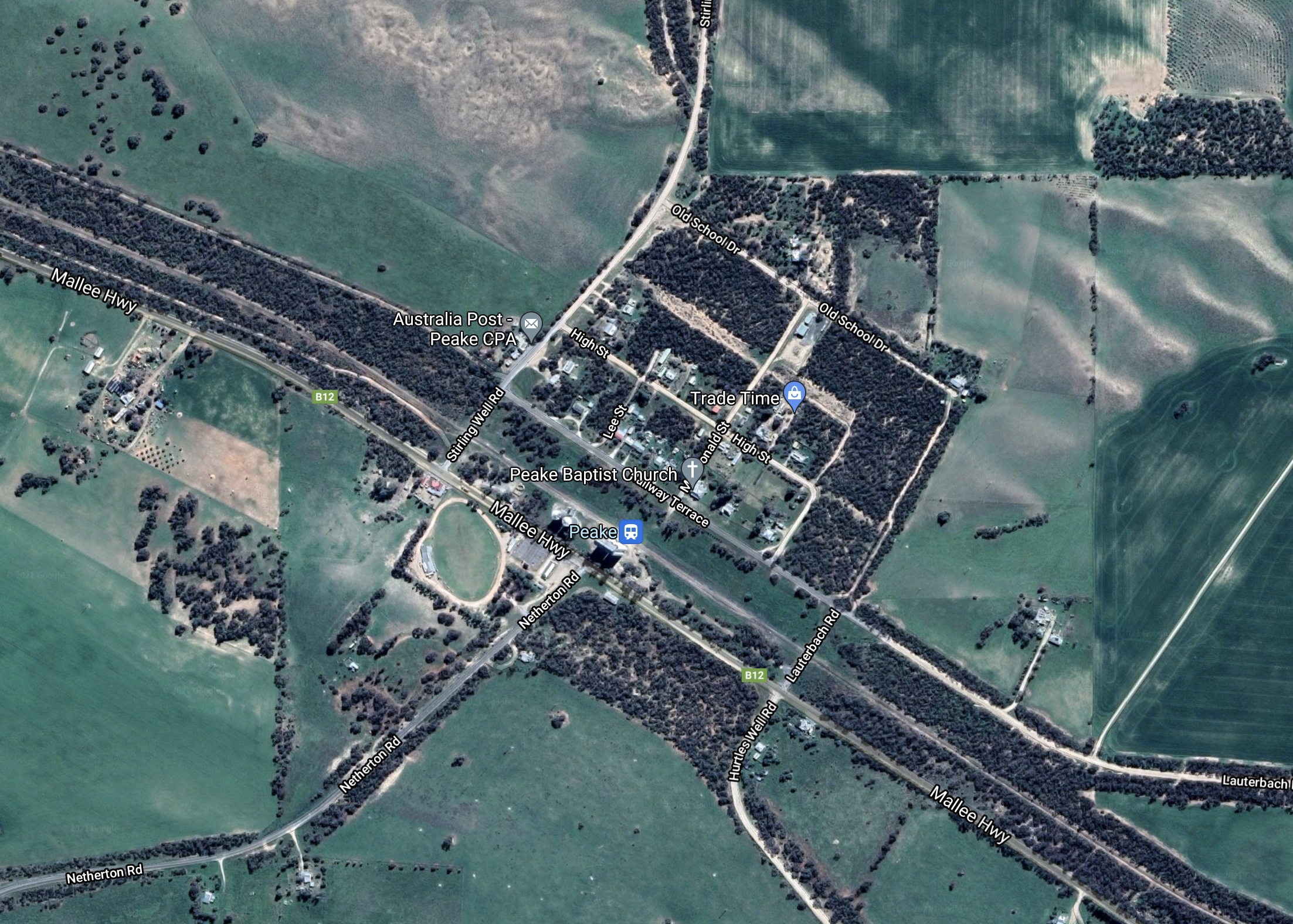
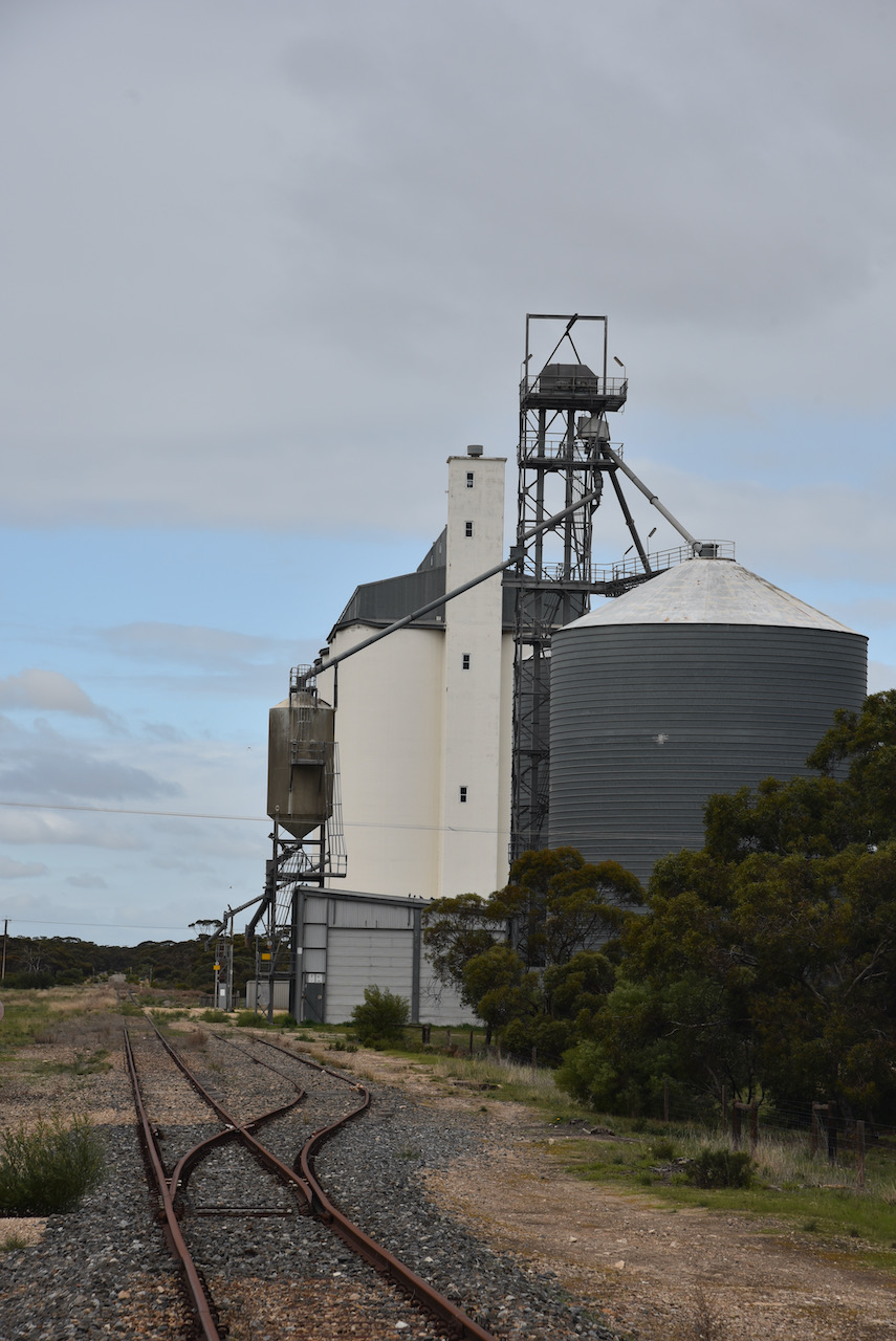
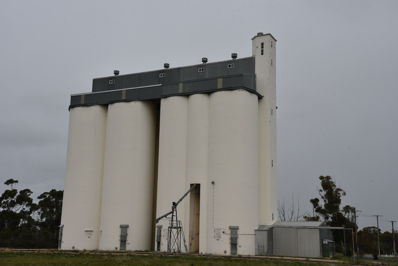
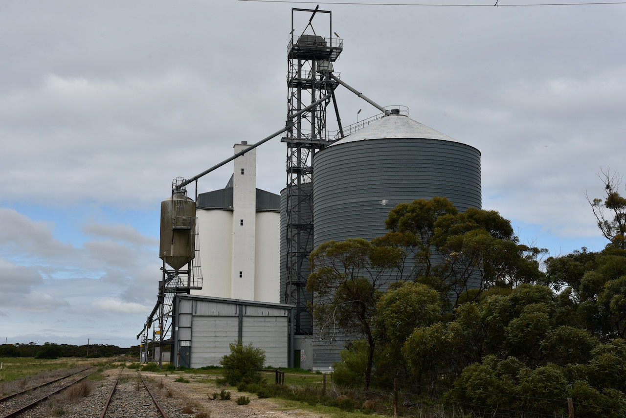
My sixth silo for Monday the 12th day of July 2021 was the Peake silos VK5-PKE5. Peake is a small town located on the Mallee Highway about 145 km east of the city of Adelaide.
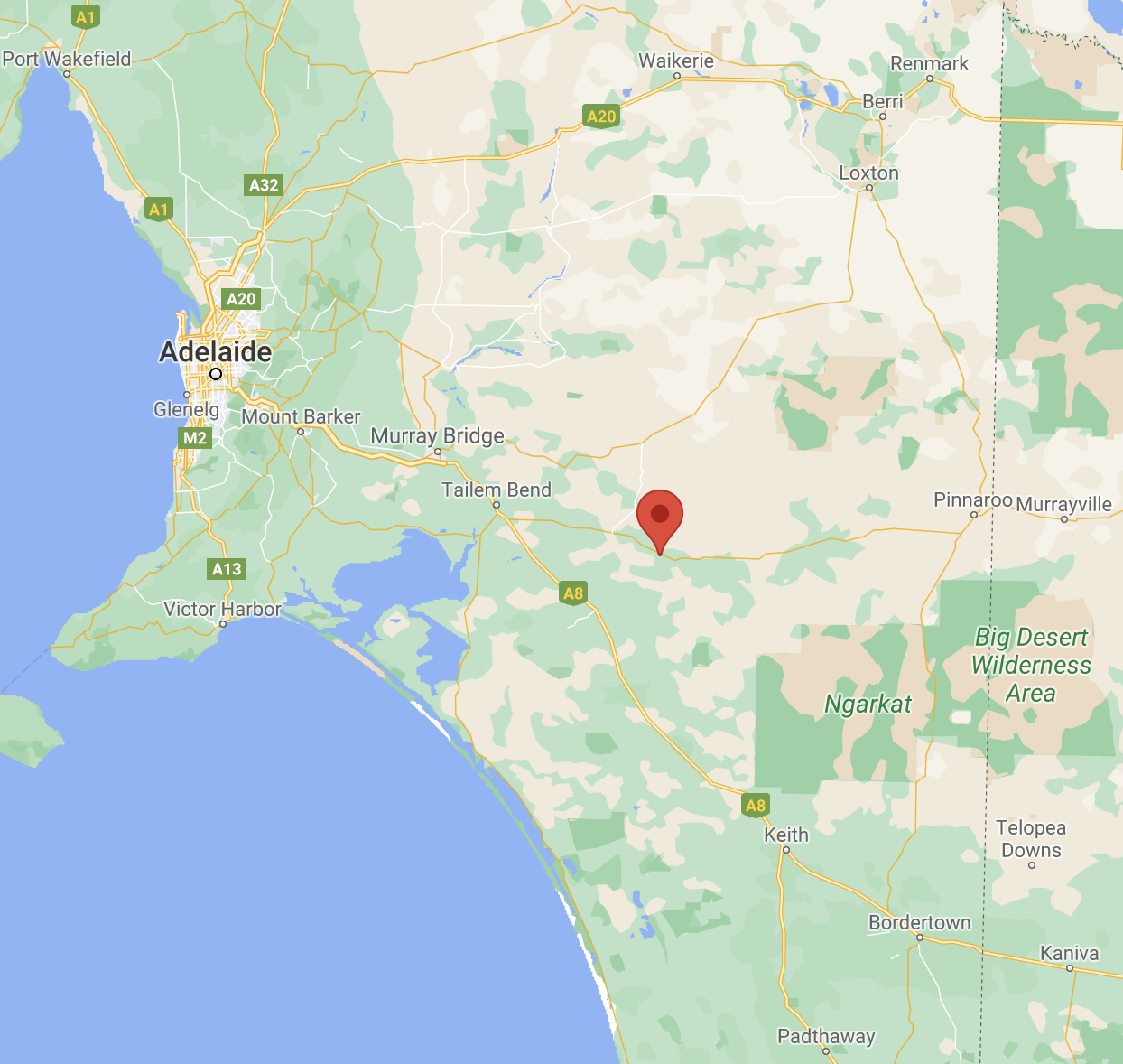
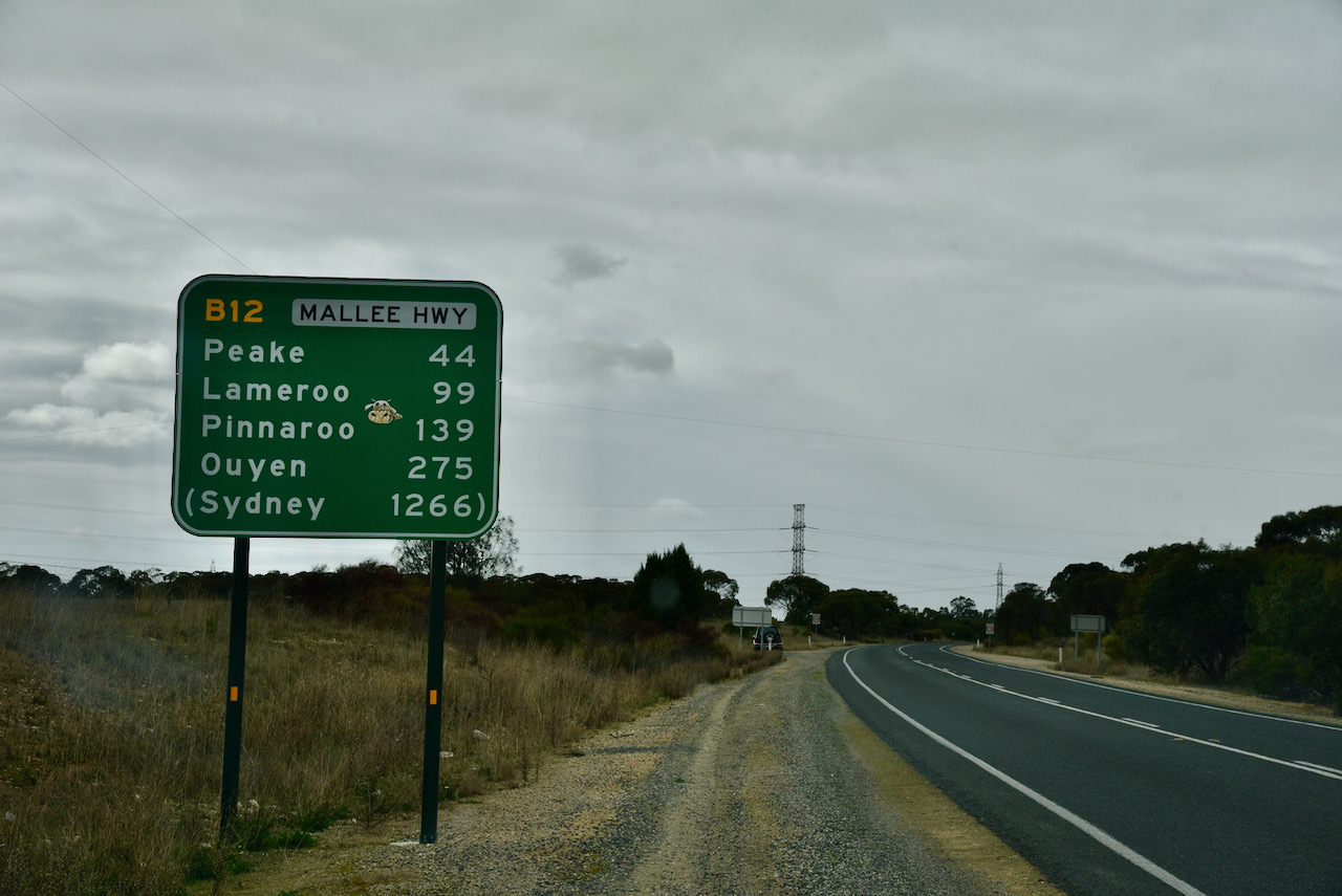
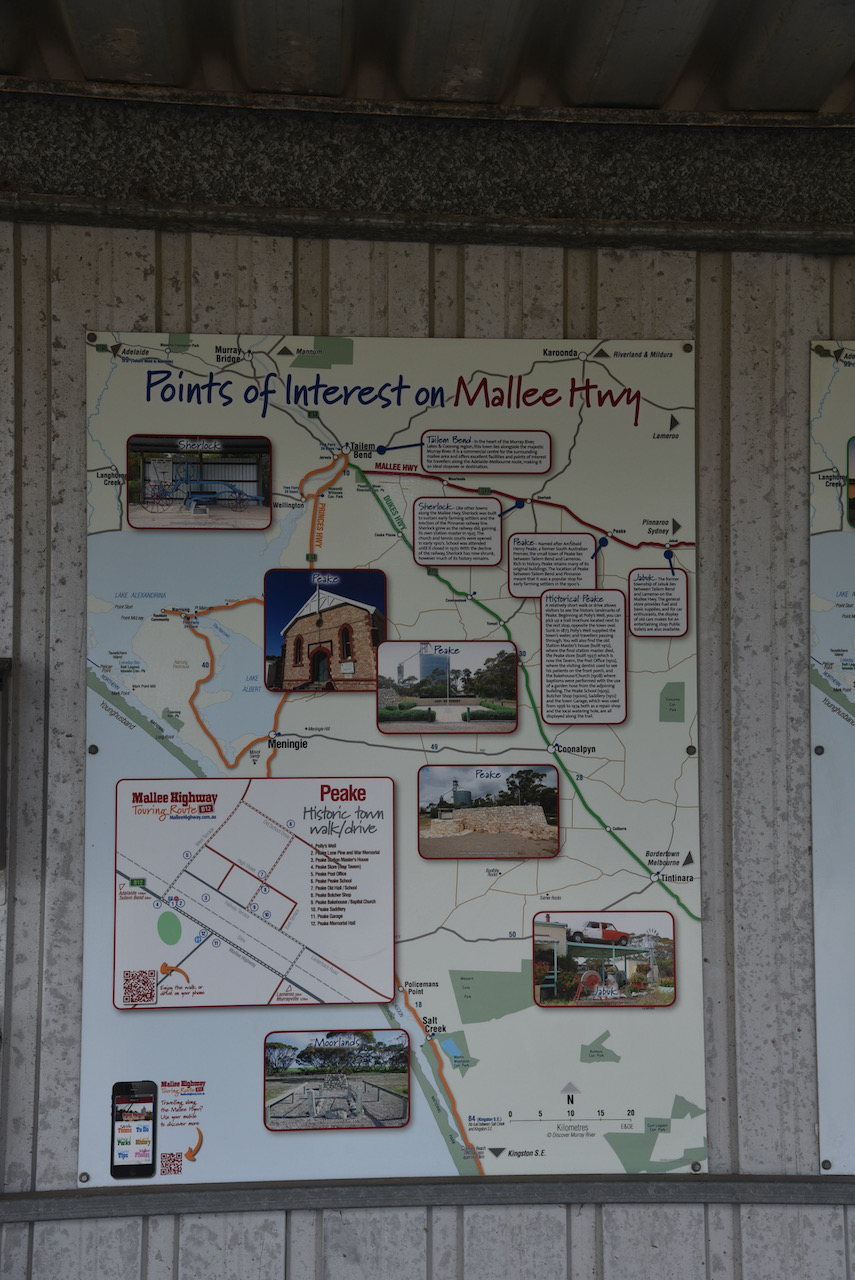
After leaving Tailem Bend I turned onto the Mallee Highway which runs east from Tailem Bend through cereal growing farmland to Pinnaroo near the South Australia – Victoria State border. It continues in Victoria and was formerly known there as the Ouyen Highway. The highway is the shortest route between Adelaide and Sydney.
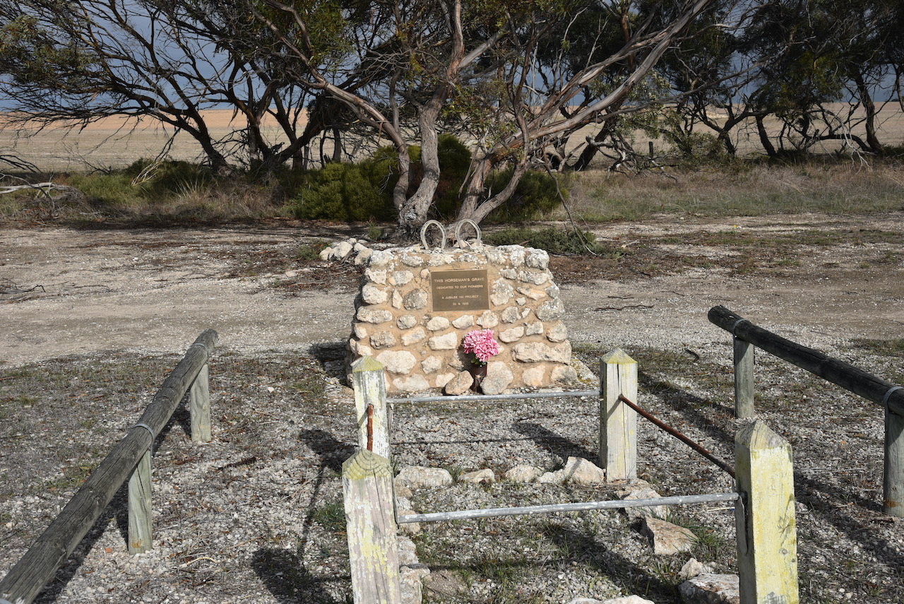
On the Mallee Highway near the little town of Moorlands is a stone cairn with a plaque for the Horseman’s Grave.
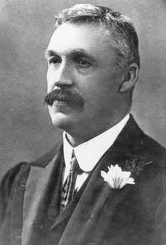
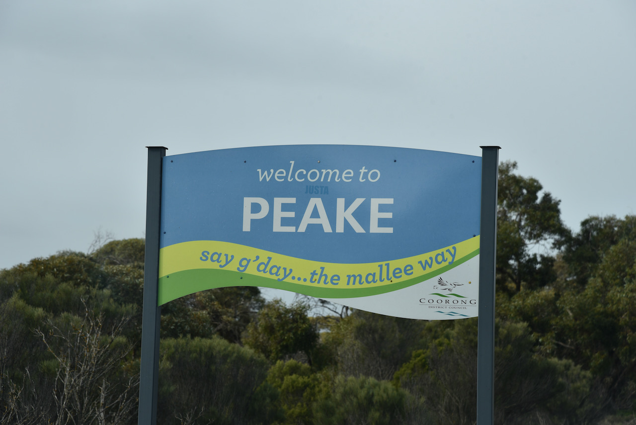
I continued on into the town of Peake which is named after Archibald Henry Peake (b. 1859. d. 1920). He was the Premier of South Australia on three occasions. He served as the Premier from 1909 to 1910 for the Liberal and Democratic Union, and then from 1912 to 1915 and 1917 to 1920 for its successor, the Liberal Union. He had also been Treasurer and Attorney General in the Price-Peake coalition government from 1905 to 1909.
The town of Peake was proclaimed on the 8th day of August 1907. It had been surveyed during May 1907. One of the primary concerns of local councils at the time was the construction of serviceable roads. Many local farmers soon found a way to pay off their council rates, by working with teams building roads. Farmers could also make money by quarrying limestone from their properties and selling it. However, as there was very little stone around Lameroo and Pinnaroo, the Pinnaroo District Council contracted to buy stone from the area between Sherlock and Jabuk. Stone pickers could earn up to six shillings per ton of stone. A stone crushing plant was established in the 1930s at the Peake Railway station where rubble was crushed. It was then loaded on eastward bound trucks towards Pinnarroo. A bitumen road was eventually established between Tailem Bend and Peake. However it continued no further due to the outbreak of the Second World War which brought a standstill to further construction.
As you come into the town there is an excellent parking area with an information board on the Peake Historic Walk and points of interest along the Mallee Highway. It is located opposite the oval.
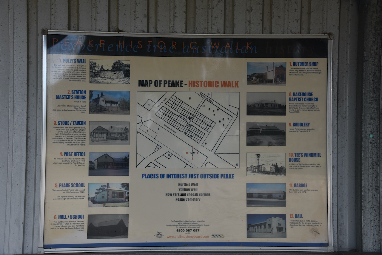
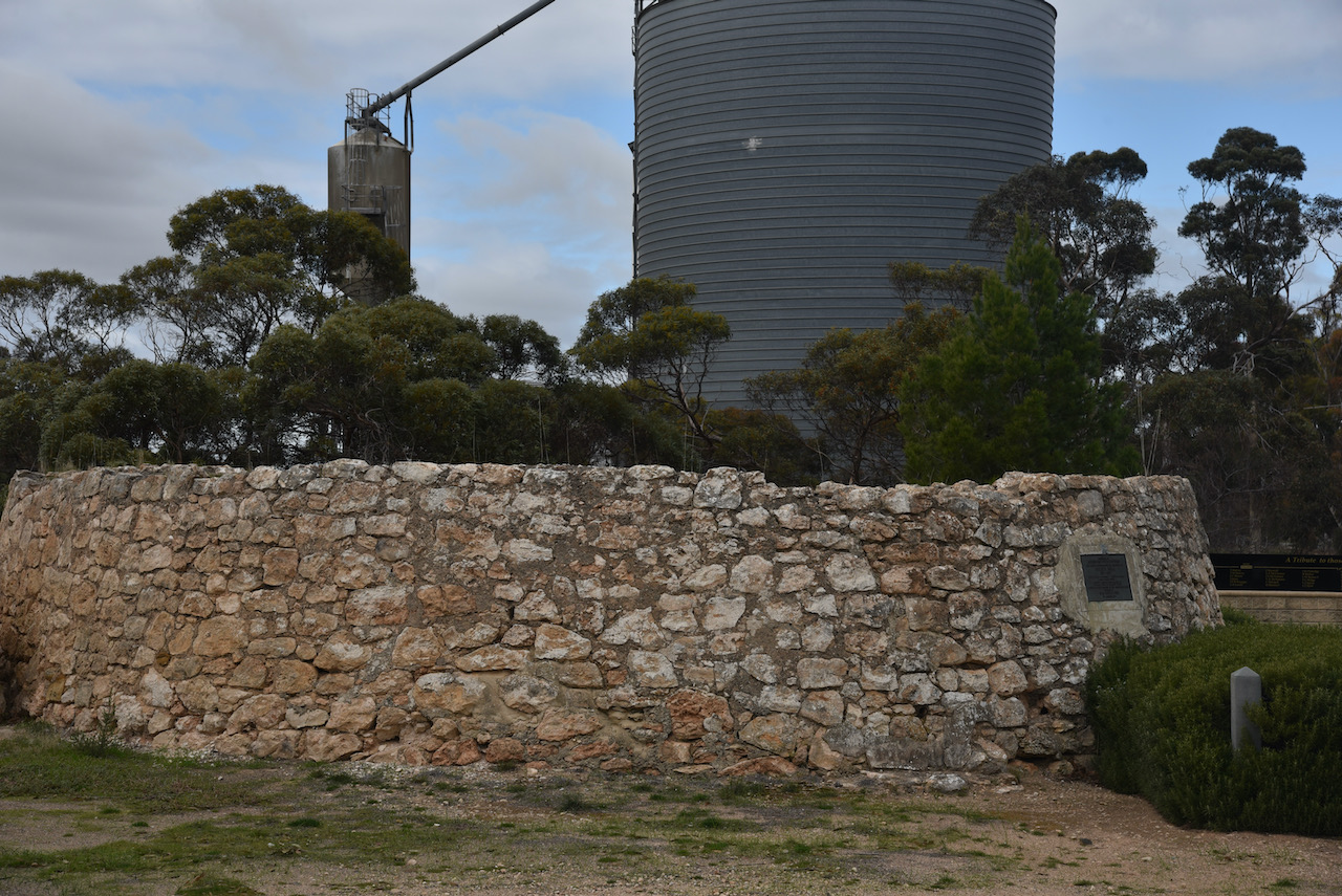
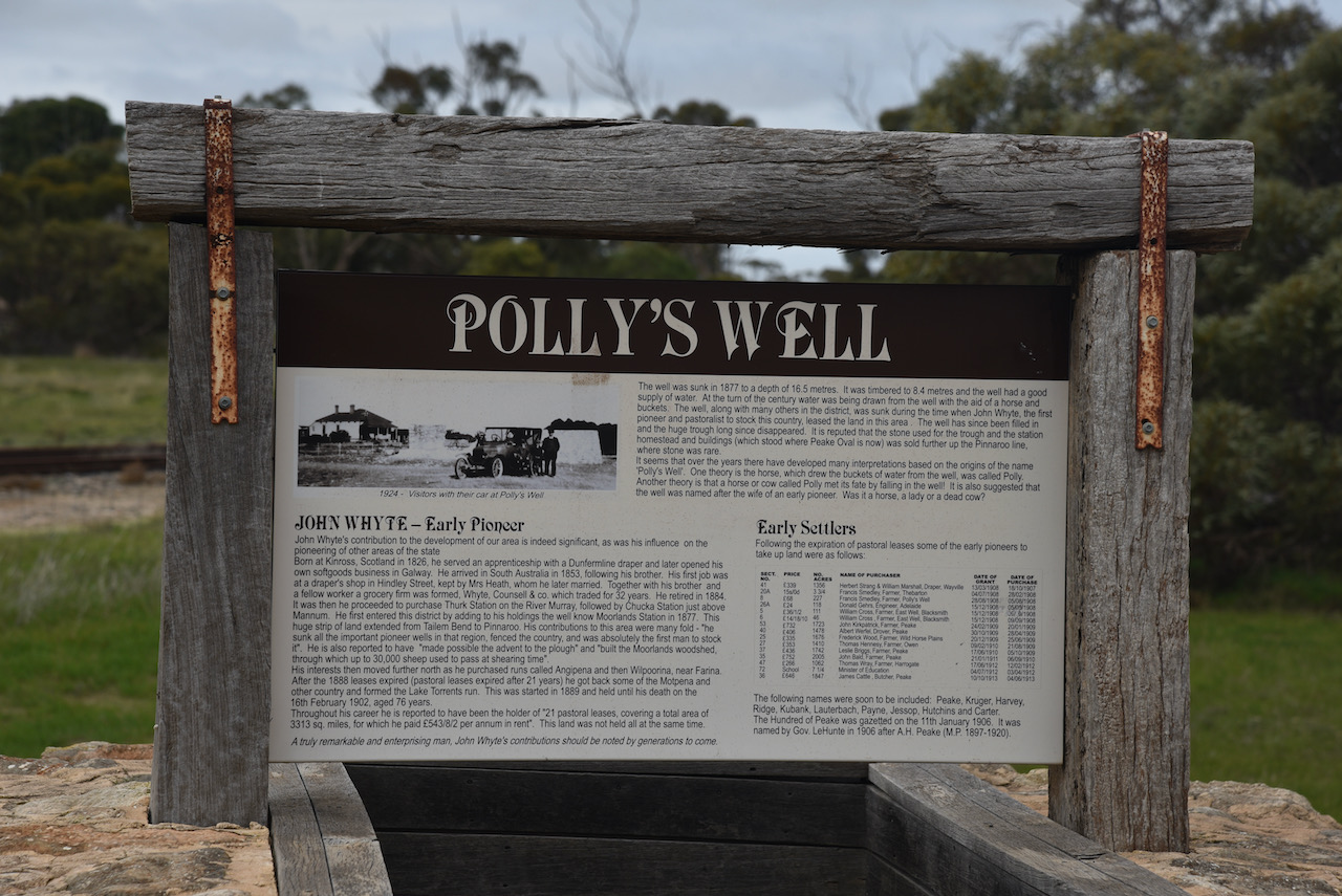
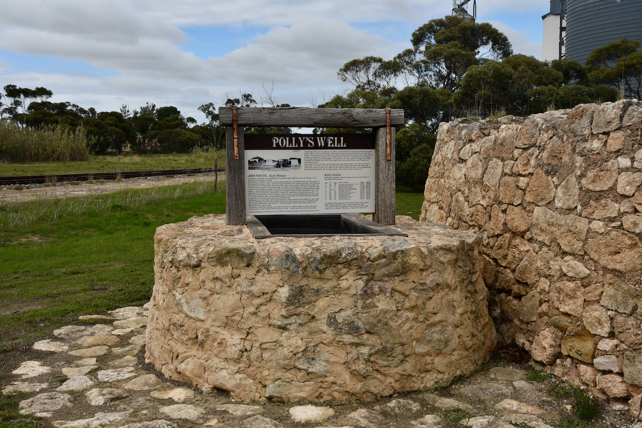
There is a significant amount of history to be found in this little town. In close proximity to the silos you can find Pollys Well. It was sunk by John Whyte, the first pastoralist and pioneer to stock the surrounding countryside.
In 1877 the well was sunk to a depth of 16.5 metres. The well is timbered to 8.4 metres and in its day had a good supply of water. Water was drawn from the well with the assistance of a horse and buckets. Early settlers depended highly on the well as it would take eight days to travel by bullock wagon from Tailem Bend to Pinnaroo. Water was also taken on here for the steam trains when they commenced operation in the area.

There are numerous stories surrounding the origin of the name ‘Polly’s Well’. One of those is that the horse which drew buckets of water from the well was called ‘Polly’. While others report that a horse or cow called ‘Polly’ fell into the well meeting its fate. Another theory is that the well was named after the wife of an early pioneer.

Alongside of Pollys Well is the Peake War Memorial and Lone Pine. The pine was planted at Peake on the 25th day of April 2009 having been propagated from a pine tree at the War Memorial in Canberra. That particular tree can follow its origins back to Gallipoli, Turkey. The ridges at Gallipoli were once covered with Aleppo Pines. However, these were cut down to line over trenches. Just one solitary pine remained. Lance Corporal B.J. Smith of the 3rd Battalion sent several pine cones back to Australia. Thirteen years later, two seedlings were grown, one of which was planted at the Canberra War Memorial.


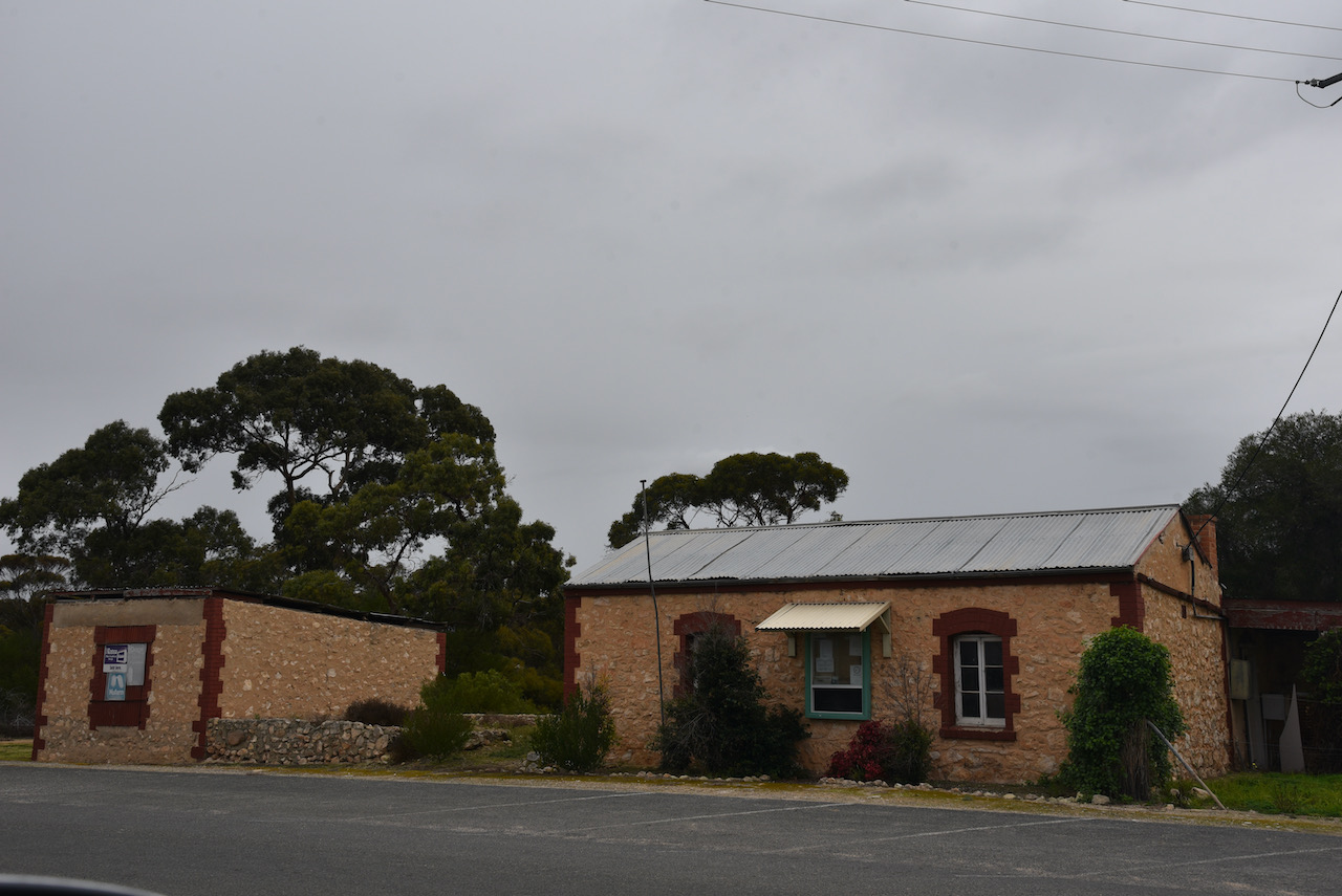
There is a historic walk which you can undertake in Peake. A brochure can be collected from the information bay. Historic buildings in the town include the old Station Master’s House (built 1912), the Peake Store/Tavern (built 1937). the Peake Post Office (built 1912), the Peake Bakehouse (built 1908), and the Peake Saddlery (built 1912).
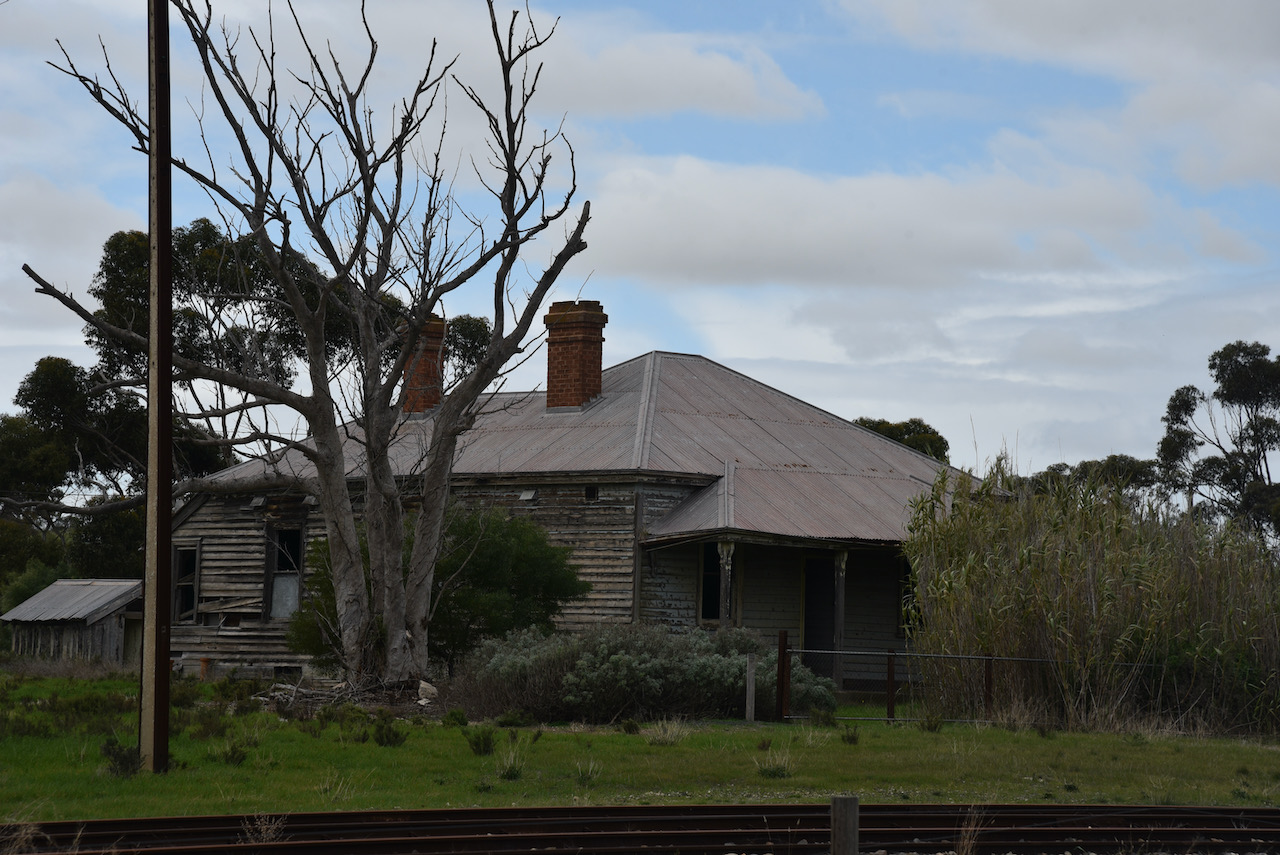

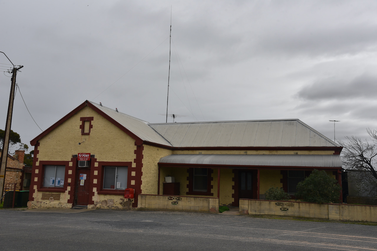

Jozeff Suchon, the final station master at Peake died in the Station Masters House in 1990, aged 78 years. Today, the house is in a complete state of disrepair. It is reported that the visitjng dentist saw his patients on the front porch of the Post Office.
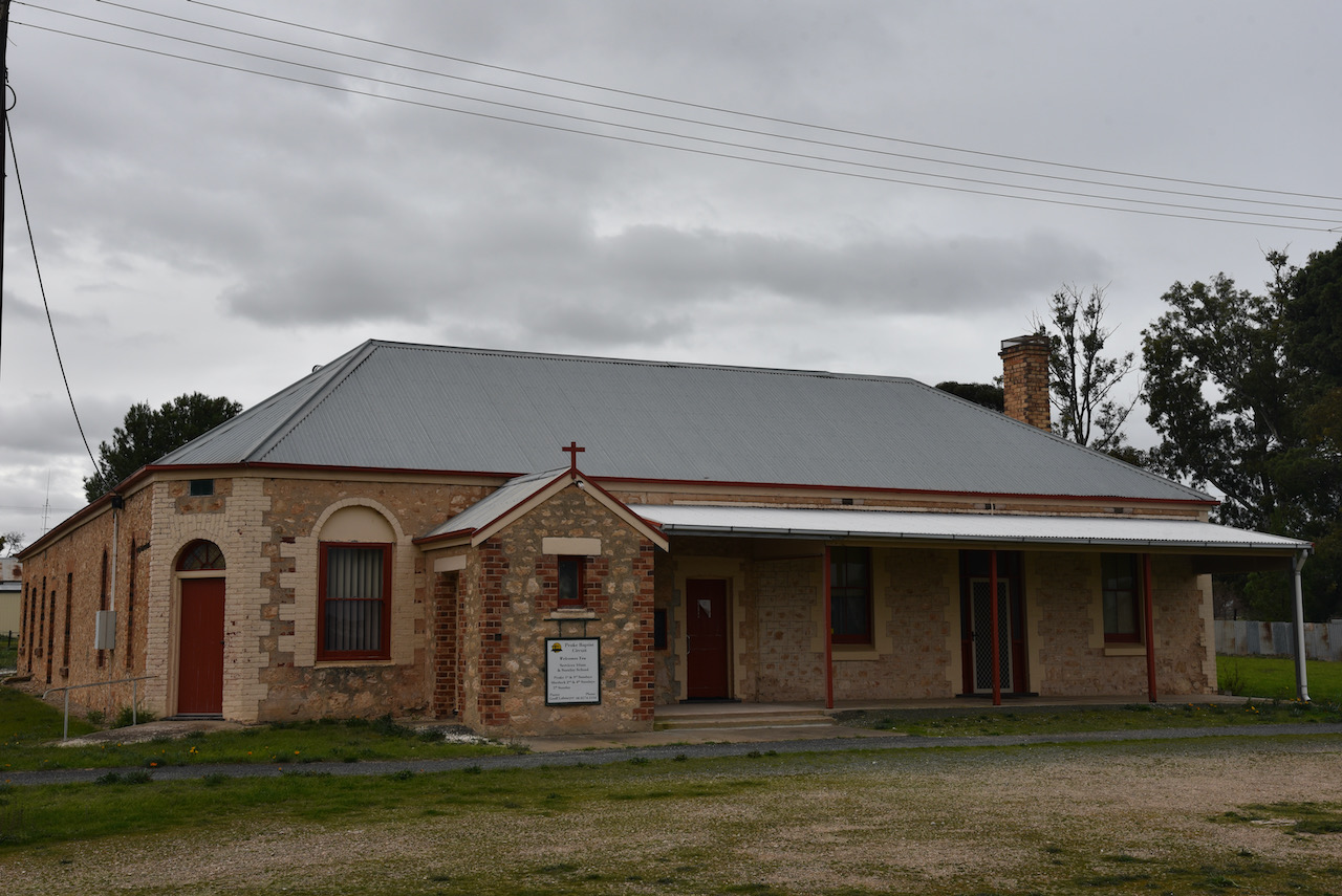
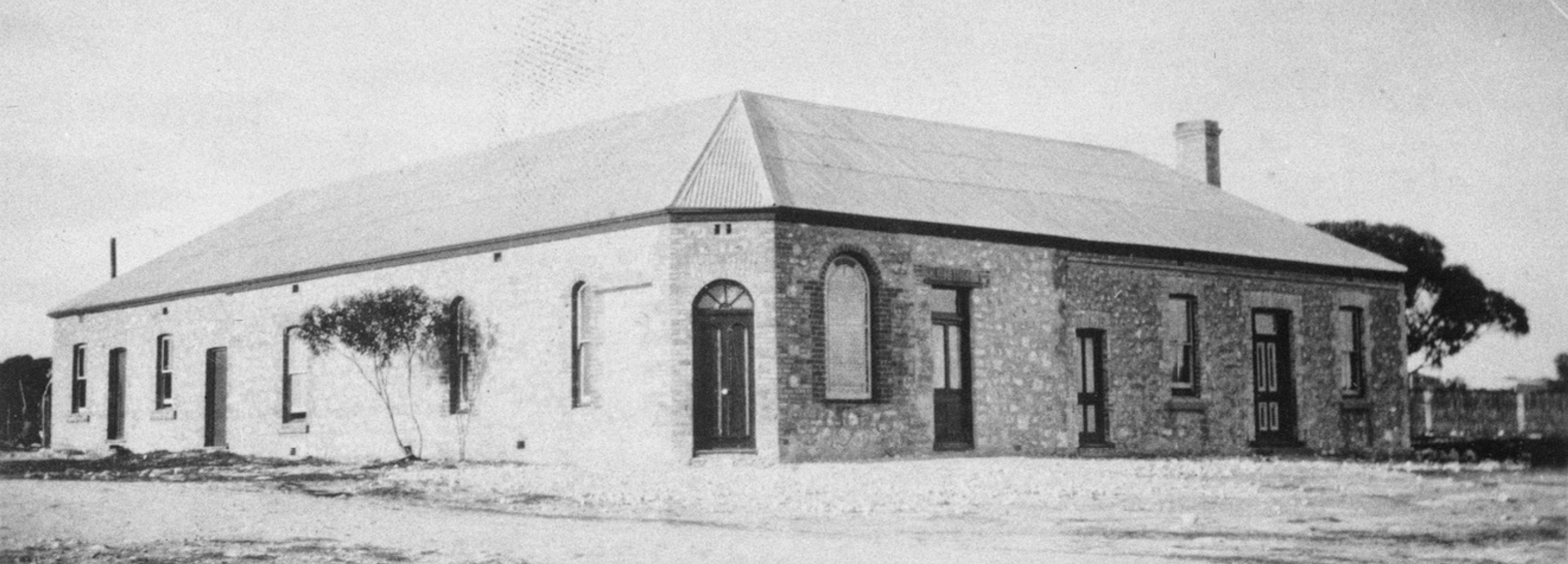
The Peake Baptist Church was originally built by Moore and Trezise in 1908 as a bakehouse and refreshment rooms to serve railway passengers. Apparently there was always a rush for the pie stall. In 1922 the building was purchased by the Home Mission Department to serve as a new Baptists church and manse. Baptisms were performed with the use of a garden hose.
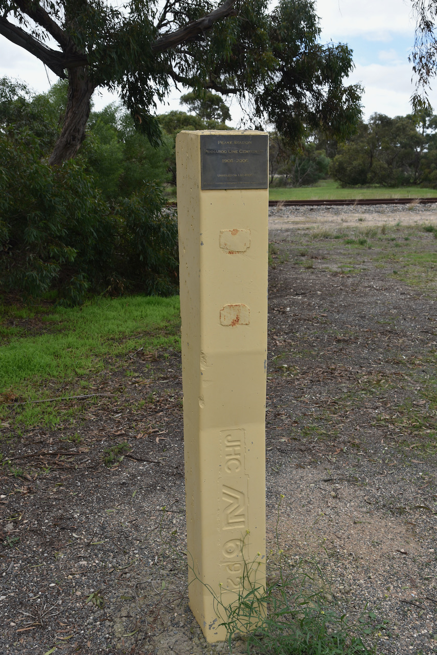
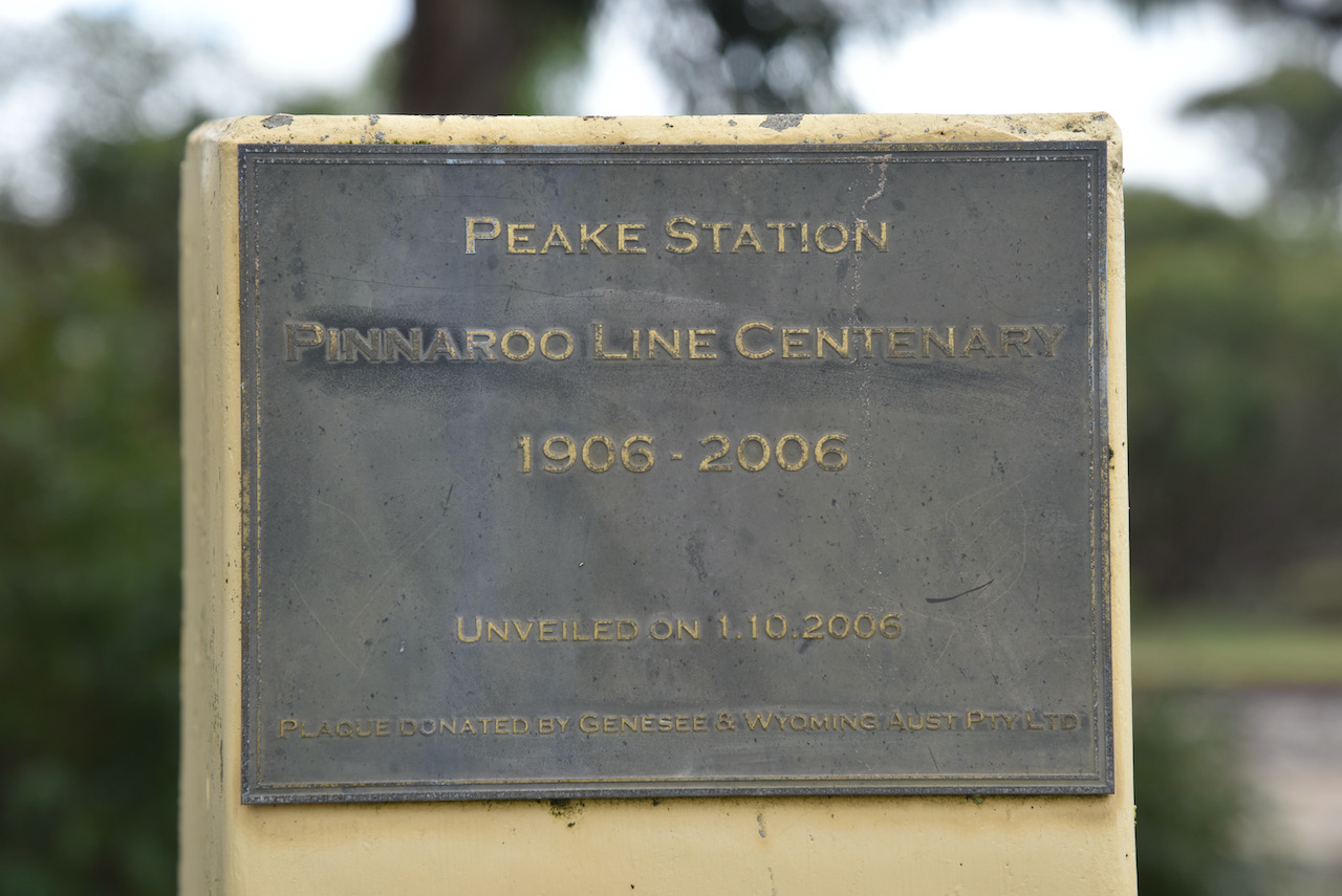
You can also find a monument for the old Peake Railway Station which was located on the Pinnaroo railway line. The line opened from Tailem Bend to Pinnaroo on the 14th day of September 1906, and on the 29th July 1915 it extended over the border into Victoria. The line closed in July 2015. It was at this time that Viterra announced that no more grain would be carried by rail after 31st day of July 2015. The 2015 harvest would be entirely transported by road. As the South Australian line closed, the Victorian government was upgrading part of its end of the line for regional freight.
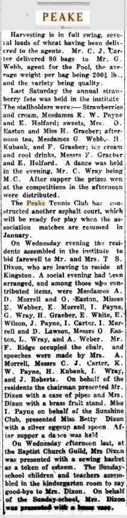
In its day the town of Peake was a bustling place, as can be seen from the newspaper article below dated 14th December 1928.
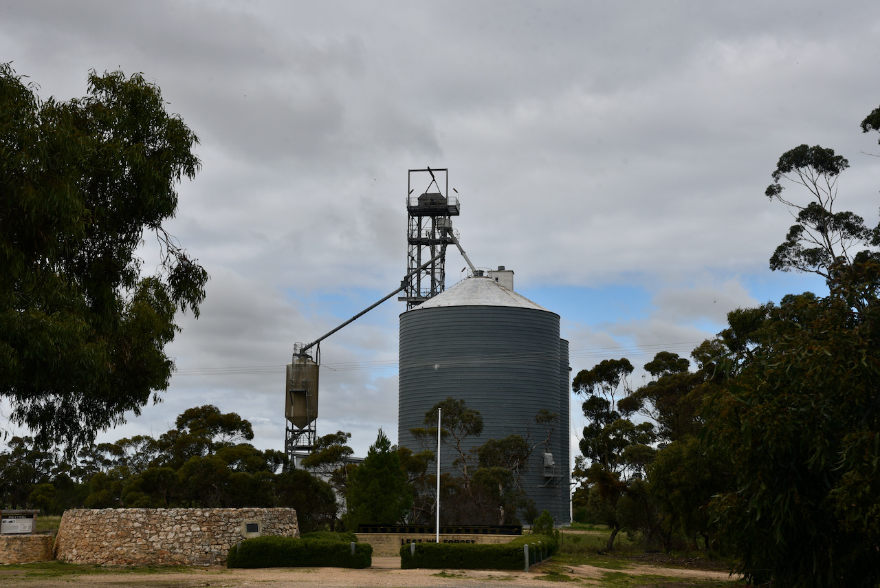
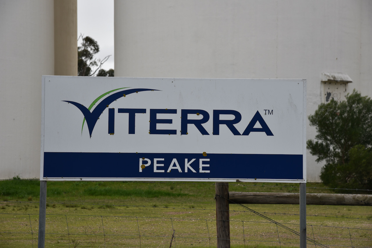
The silos at Peake are both concrete and iron and are operated by Viterra.
I parked in the carpark directly adjacent to the silos and first in the log was Ian VK1DI/p who was activating a park for the World Wide Flora Fauna (WWFF) program, the Turallo Nature Reserve VKFF-2750.
I then moved up to 7.155 and called CQ. This was answered by Peter VK3PF, followed by Marc VK3OHM. I had qualified the silo with 3 QSOs.
I went on to work a further 5 stations before heading to 7.144 to get Gerard VK2HBG/p and Bob VK2BYF/p in the log. They were operating portable from the Batemans Marine Park VKFF-1406.
I then moved back to 7.155 and logged a further 7 stations including Gerard VK2IO/p who was in the Springwood Conservation Park VKFF-1653, and Roly ZL1BQD in New Zealand. I also logged Marty VK4KC for his first ever silo contact.
I then moved to the 80m band where I logged Marija VK5MAZ, Adrian VK5FANA, and Gordon VK5GY.
To complete the activation I headed to 14.310 on the 20m band where I logged Peter VK3PF, and Stuart VK3UAO who was in the Inverleigh Nature Conservation Reserve VKFF-2336.
With 22 contacts in the log it was time for me to pack up and head to my next silo at Jabuk a little further along the Mallee Highway.
I worked the following stations on 40m SSB:-
- VK1DI/2 (Turallo Nature Reserve VKFF-2750)
- VK3PF
- VK3OHM
- VK5MAZ
- VK3SQ
- VK2VW
- VK2DJP
- VK2MET
- VK2HBG/p (Batemans Marine Park VKFF-1406)
- VK2BYF/p (Batemans Marine Park VKFF-1406)
- VK3NCR
- VK2IO/p (Springwood Conservation Park VKFF-1653)
- ZL1BQD
- VK3SMW
- VK3AWA
- VK4KC
- VK2LEE
I worked the following stations on 80m SSB:-
- VK5MAZ
- VK5FANA
- VK5GY
I worked the following stations on 20m SSB:-
- VK3PF
- VK3UAO/p (Inverleigh Nature Conservation Reserve VKFF-2336)
References.
- Coorong District Council, 2021, <https://www.coorong.sa.gov.au/tourism/our-towns/our-towns-peake>, viewed 14th July 2021.
- Discover Murray, 2021, <http://www.murrayriver.com.au/peake/>, viewed 14th July 2021.
- Mallee Highway Touring Route, 2021, <http://www.malleehighway.com.au/html/peake.html>, viewed 14th July 2021.
- Wikipedia, 2021, <https://en.wikipedia.org/wiki/Mallee_Highway>, viewed 14th July 2021.
- Wikipedia, 2021, <https://en.wikipedia.org/wiki/Archibald_Peake>, viewed 14th July 2021.
- Wikipedia, 2021, <https://en.wikipedia.org/wiki/Pinnaroo_railway_line,_South_Australia>, viewed 14th July 2021.
