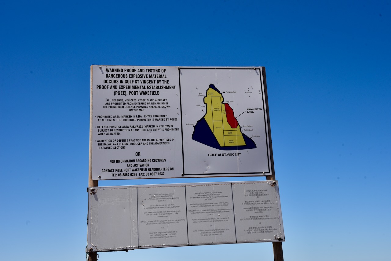
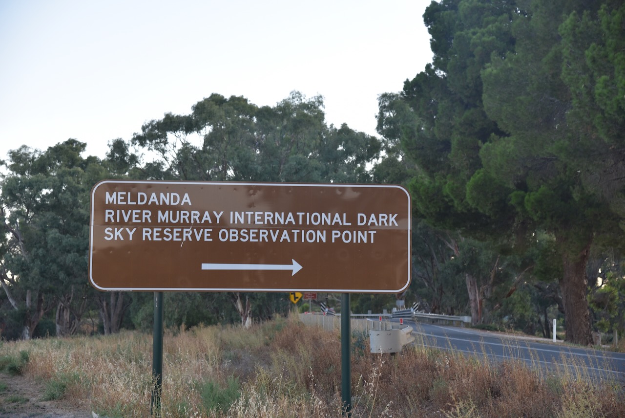
On our way to Troubridge Island, Marija and I stayed for 2 nights at Stansbury and activated a number of parks and silos. The first (Sunday 5th February 2023) was the Clinton Conservation Park VKFF-0813.
The park is located at the top of Gulf St Vincent, about 116 km north of the city of Adelaide.
Above:- Map showing the location of the Clinton Conservation Park. Map c/o Google maps.
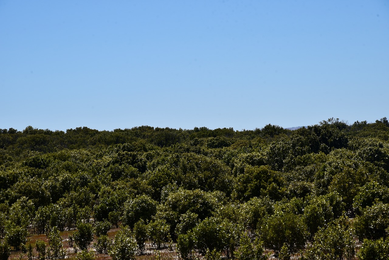
The Clinton Conservation Park run s around the top of Gulf St Vincent from south of Port Wakefield to Port Clinton. The total area of the park is about 2,072 hectares.
Above:- An aerial view of the park looking north. Image c/o Google maps.
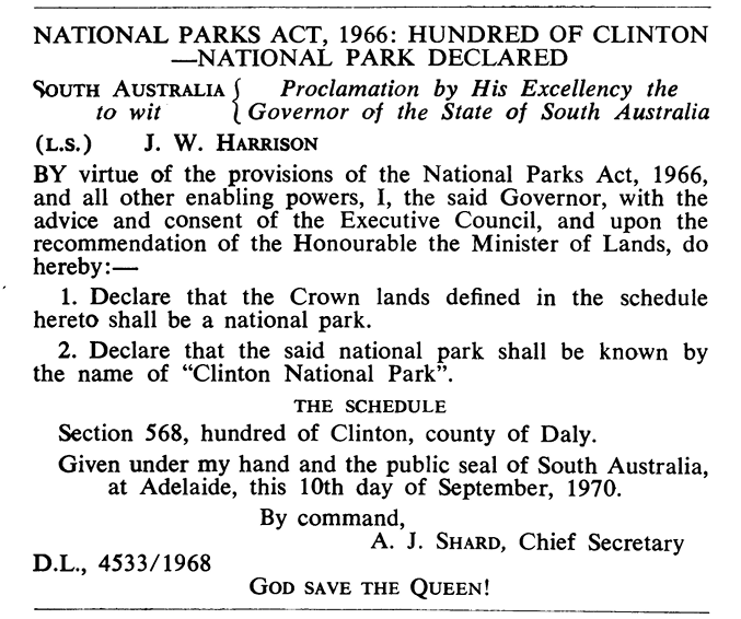
On the 10th day of September 1970, Section 568 was proclaimed as the Clinton National Park. It was proclaimed on the 27th day of April 1972 as the Clinton Conservation Park on 27 April 1972. Further sections were added on the 14th day of October 1976., the 28th day of July 1983, the 9th day of March 1989, and the 23rd day of Juner 2016.
Above:- The SA Govt Gazette, Sept 10 1970.
The park takes its name from the Hundred of Clinton which was proclaimed on the 12th day of June 1862. It was named Clinton by Governor Dominick Daly in honour of the Duke of Newcastle, Henry Pelham Fiennes Pelham-Clinton who was Secretary of State for the Colonies from 1859 until his death in October 1864.
Above:- Henry Pelham-Clinton, 5th Duke of Newcastle. Image c/o Wikipedia
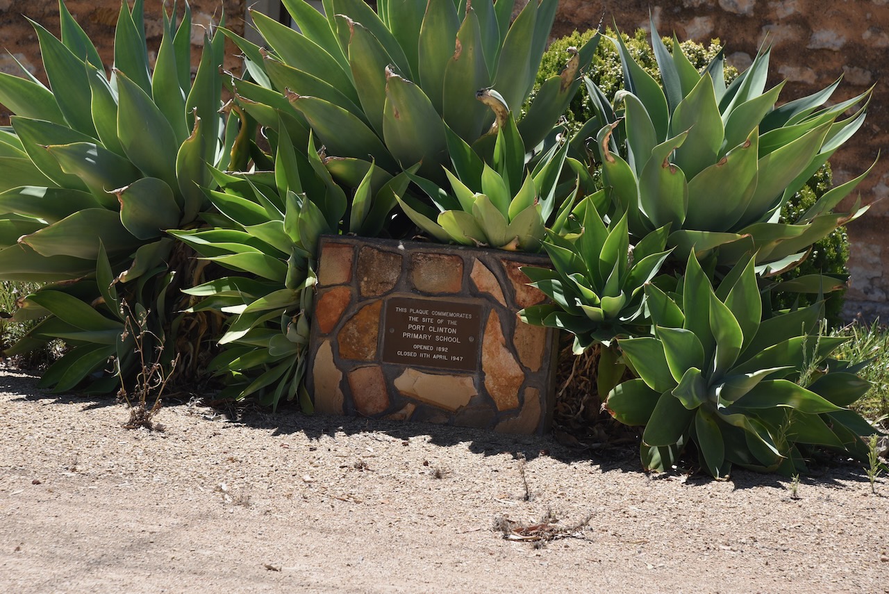
The first known European settler in the area was John Bowman who, in May 1853, took up lease no. 270. The town of Clinton was surveyed in 1862 and was offered for auction on the 14th day of August 1862. The Clinton School opened in 1881 and closed in 1889. The Clinton Centre School operated from 1886 until 1950, while the Clinton North School opened in 1886. The Port Clinton School opened in 1892 and closed in 1947.
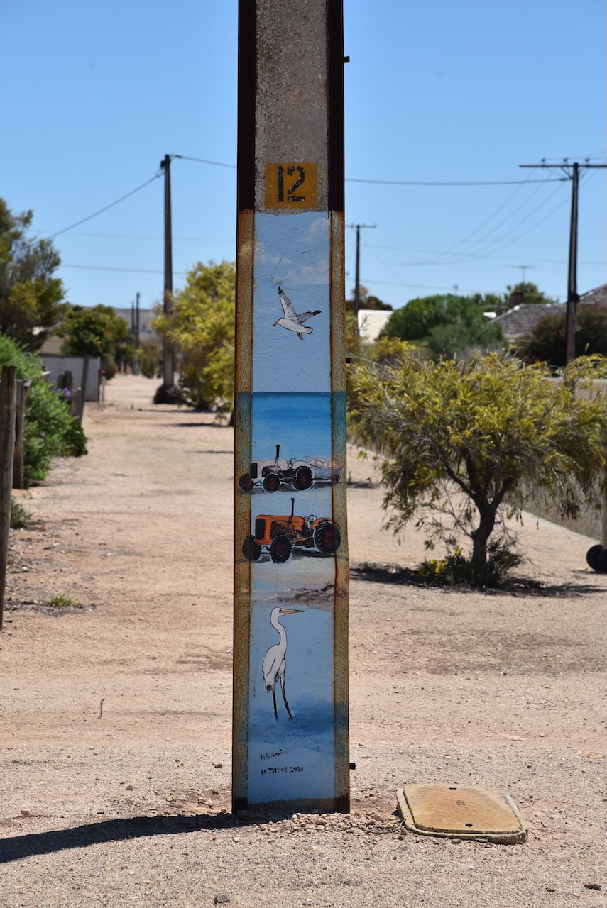
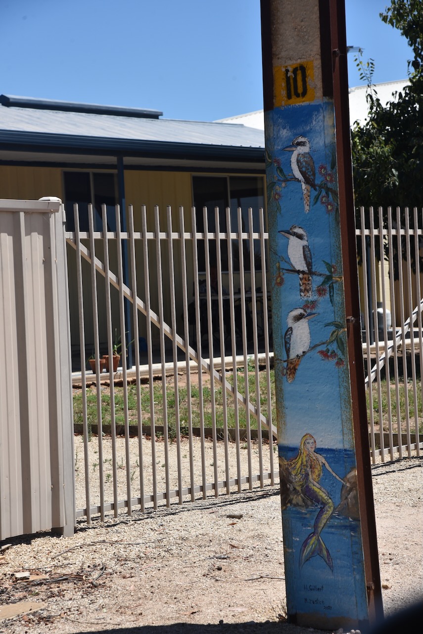
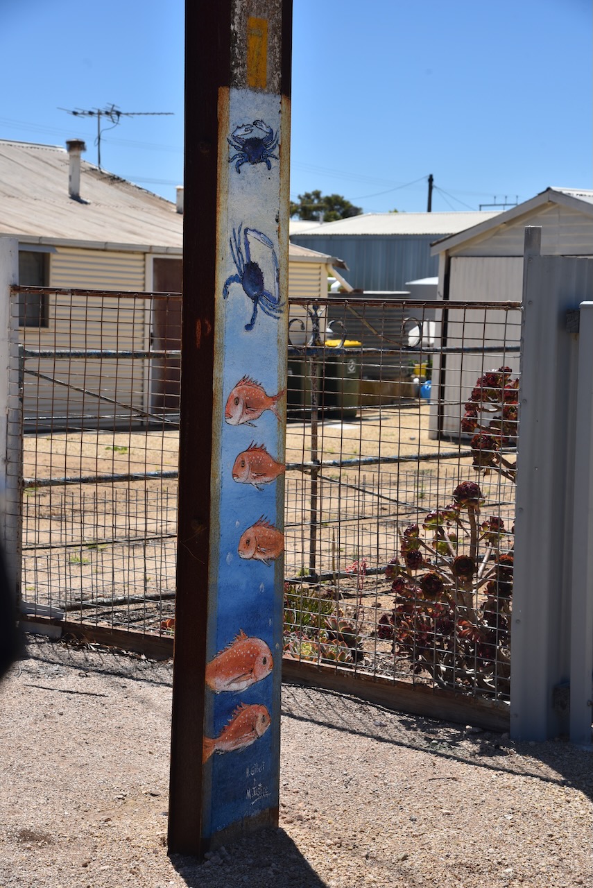
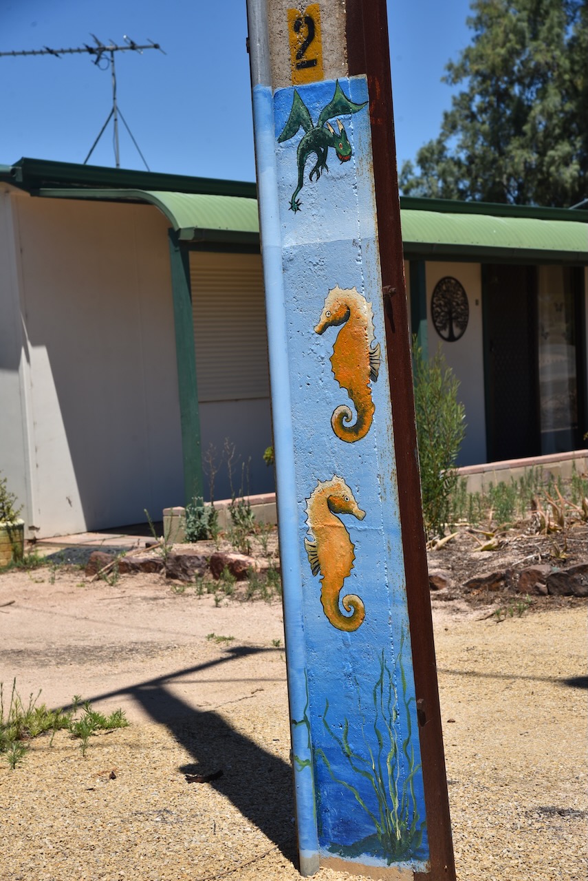
Port Clinton is a small town which we had a quick look at. All of the stobie poles in the town are painted with artwork. What is a stobie pole? It is a power line pole made of two steel joists held apart by a slab of concrete. The stobie pole was invented by James Cyril Stobie (B. 1895. d. 1953) who was an engineer with the Adelaide Electric Supply Company.
Above:- James Cyril Stobie. Image c/o South Australia, Australia’s best secret Facebook page.
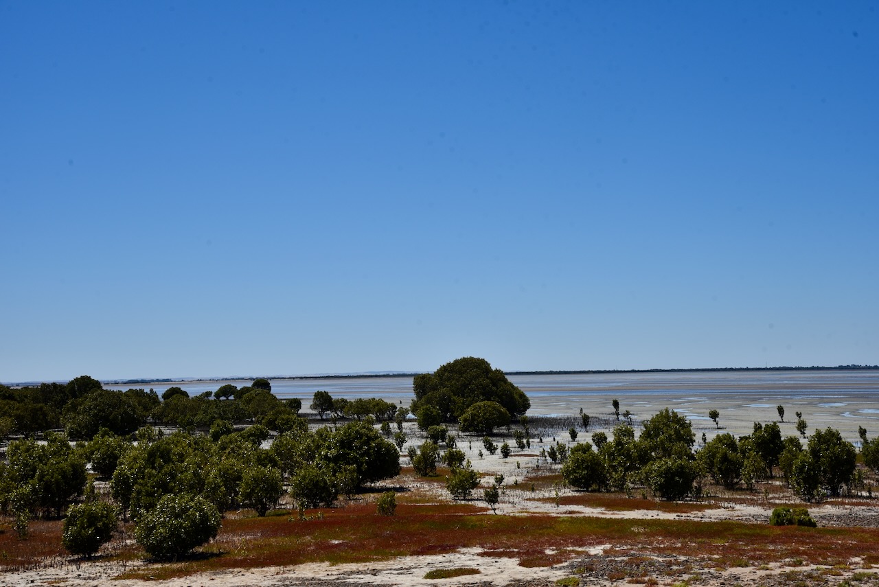
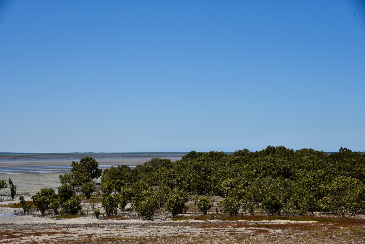
Vegetation in the Clinton Conservation Park includes Mangrove woodland, Low (Samphire) shrubland, Open scrub, Low woodland, and Low scrubland.
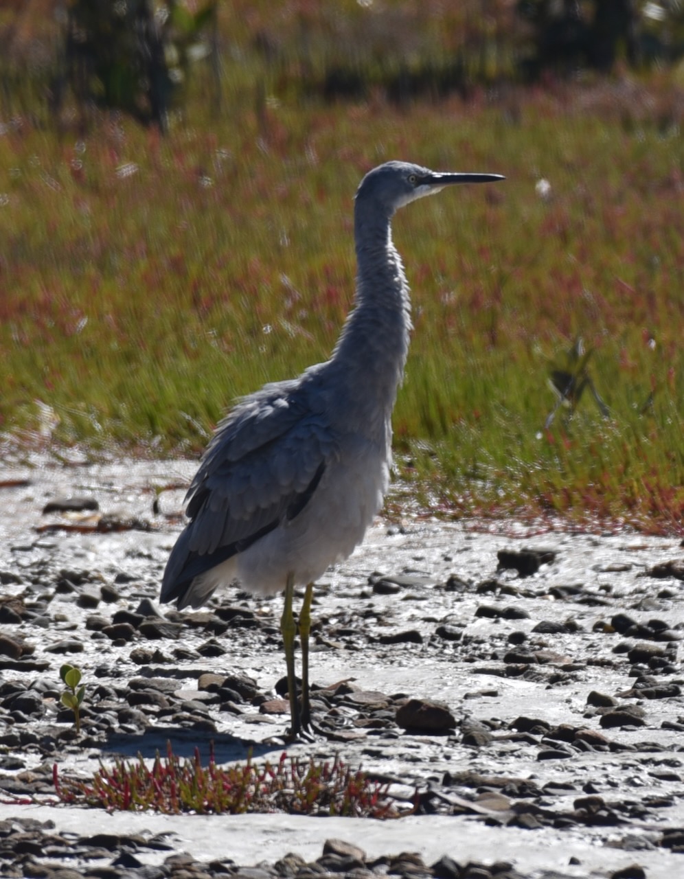
Birds SA have recorded 92 bird species in the park including Grey Teal, White-faced Heron, Far Eastern Curlew, Common Greenshank, Crested Pidgeon, Singing Honeyeater, and White-browned Scrubwren.
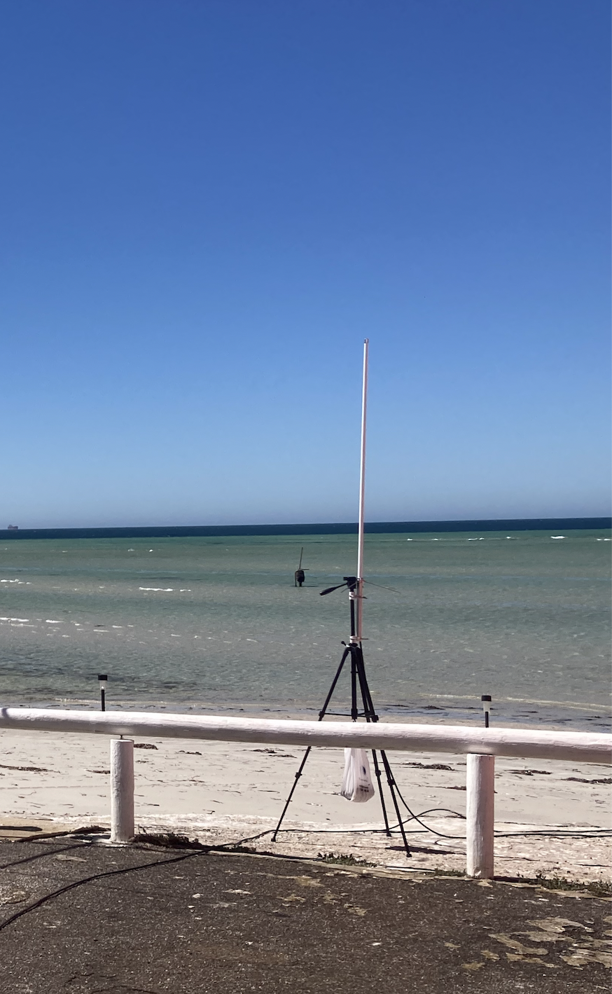
We set up at the end of a dirt track off the eastern side of the Yorke Highway near Dhanu’s relaxation park. This took us right down to the water’s edge.
Marija and I ran out the 20/40/80m linked dipole and used the Yaesu FT-857. For 10m and 15m we used the Icom IC-7000 and the Codan 9350 self-tuning antenna on the back of the 4WD.
Above:- Map showing the park and our operating spot. Map c/o Location SA Map Viewer.
With 101 contacts in the log it was time for us to pack up and head off to our next activation.
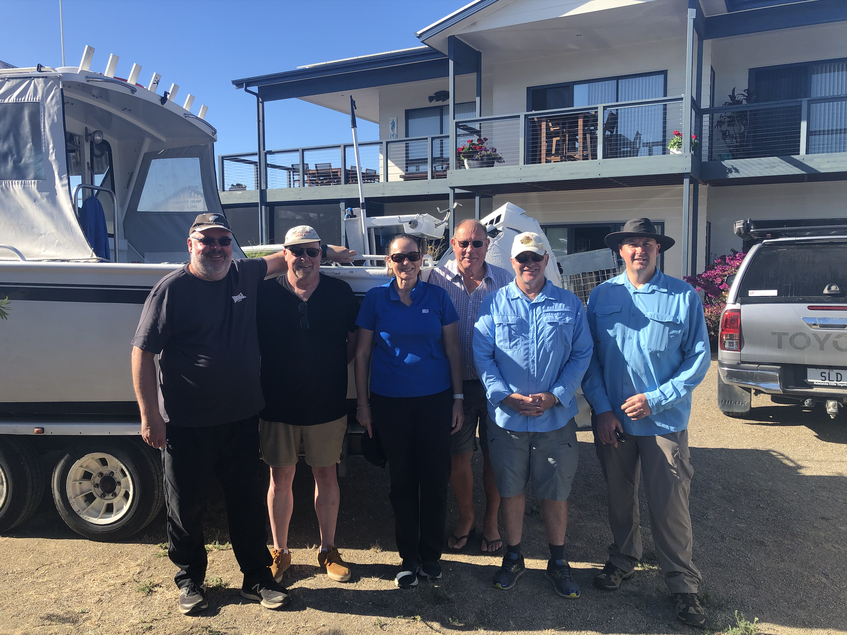
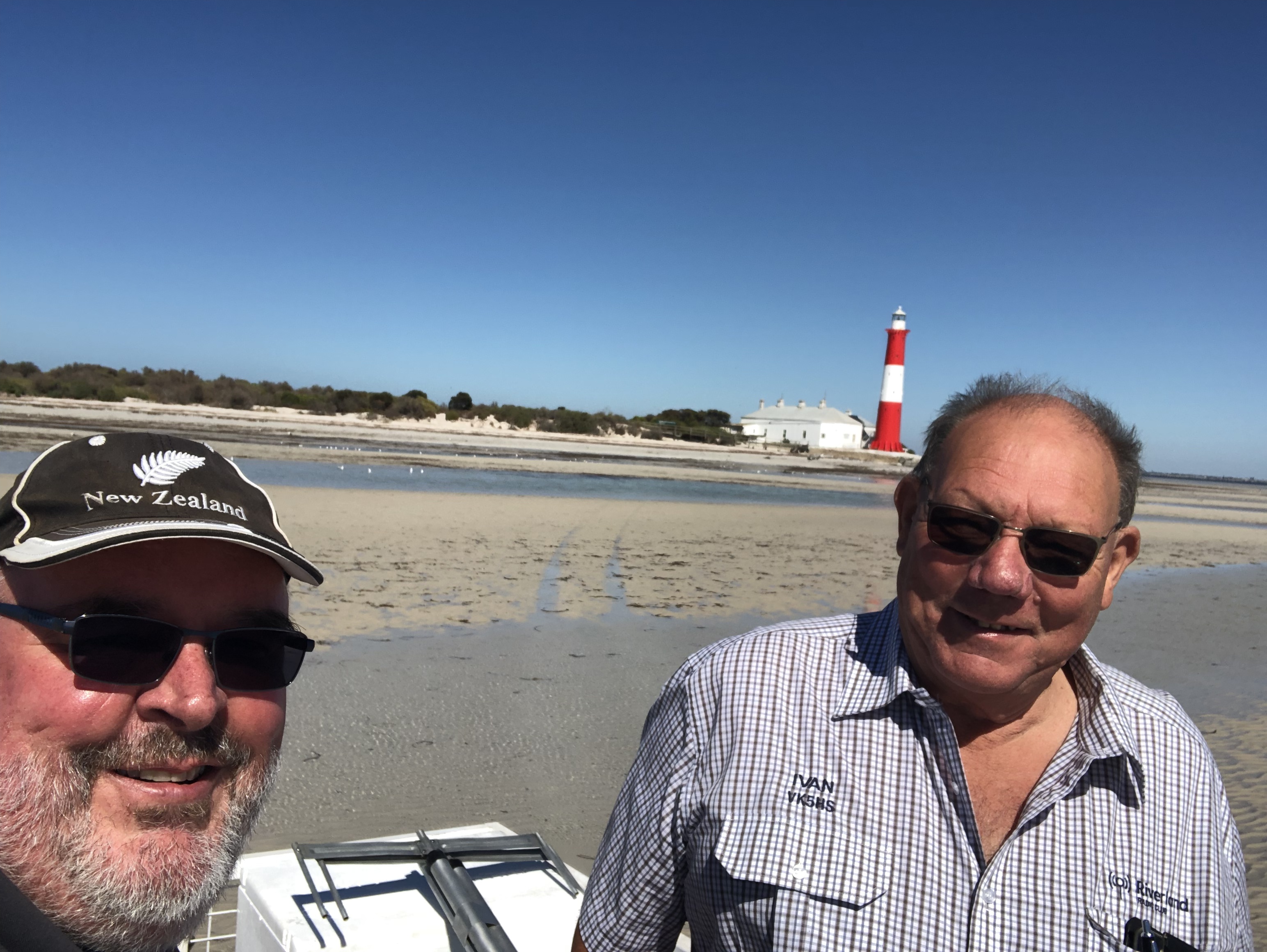
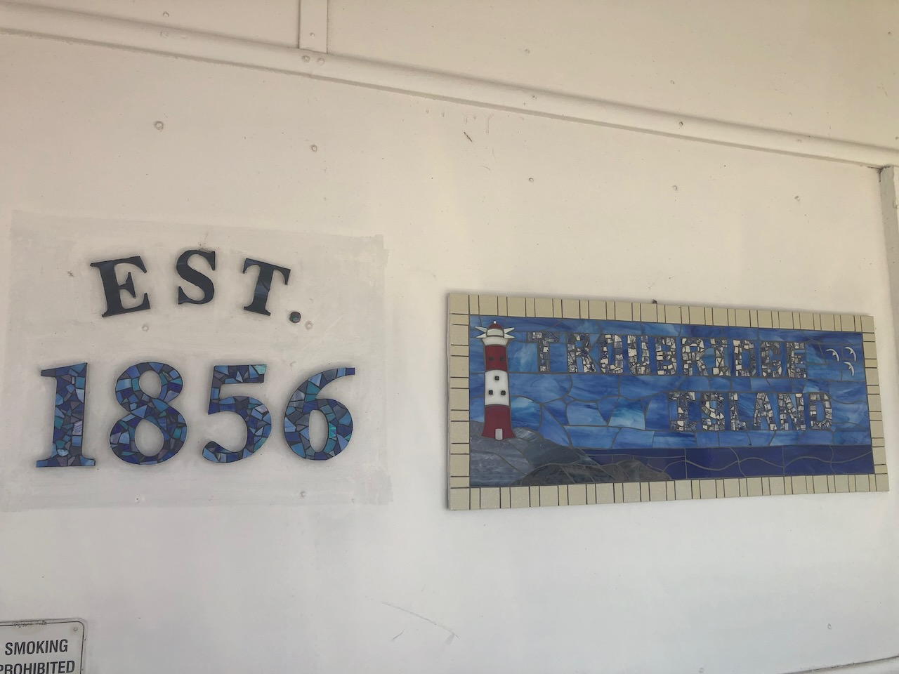
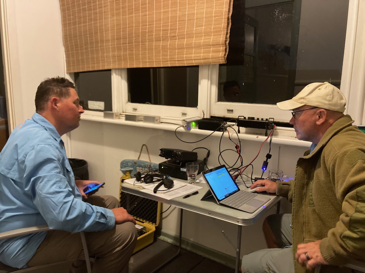
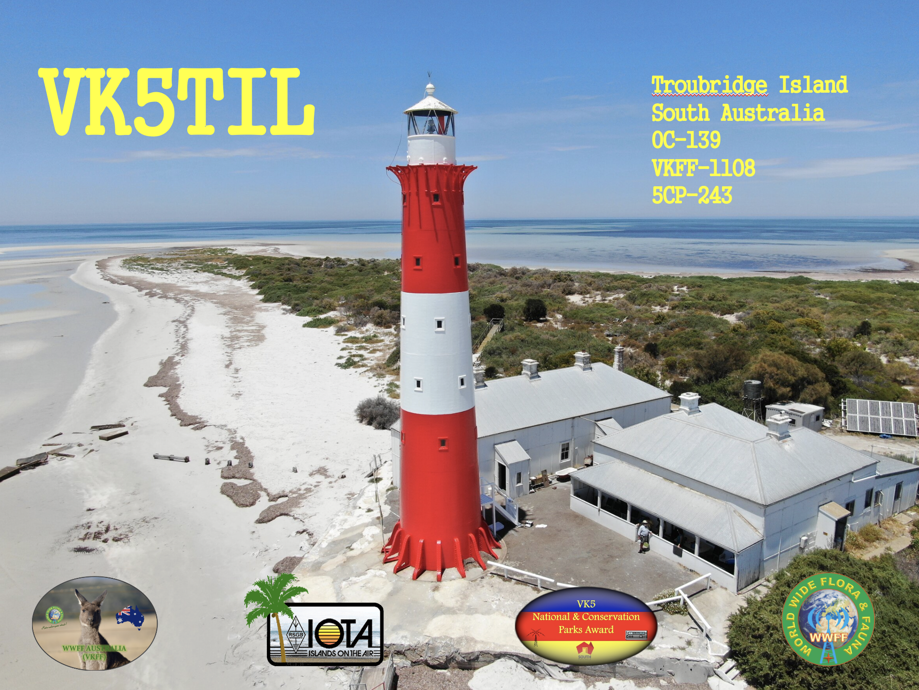
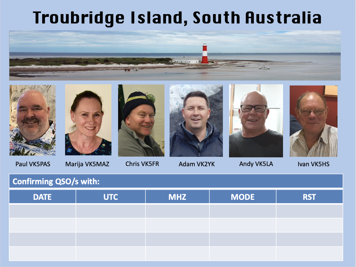
On Tuesday the 7th day of February 2023, I travelled to Troubridge Island with Marija VK5MAZ, Adam VK2YK, Andy VK5LA, Chris VK5FR, and Ivan VK5HS. We spent three nights on the island and operated as VK5TIL (Troubridge Island Lighthouse) ona mini amateur radio DXpedition.
This was our first trip away together as a group and we were definitely displaying ‘Learners plates’ when it comes to DXpeditions. We all know each other socially and we all had our own particular areas of expertise and interests in the hobby of amateur radio.
WHERE IS TROUBRIDGE ISLAND?
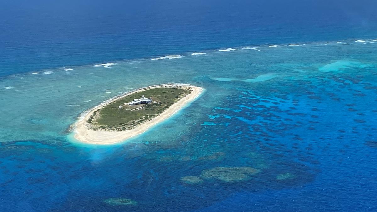
Troubridge Island is located in the southwestern corner of Gulf St Vincent in South Australia. It is a small sand atoll and is only 2 hectares in size.
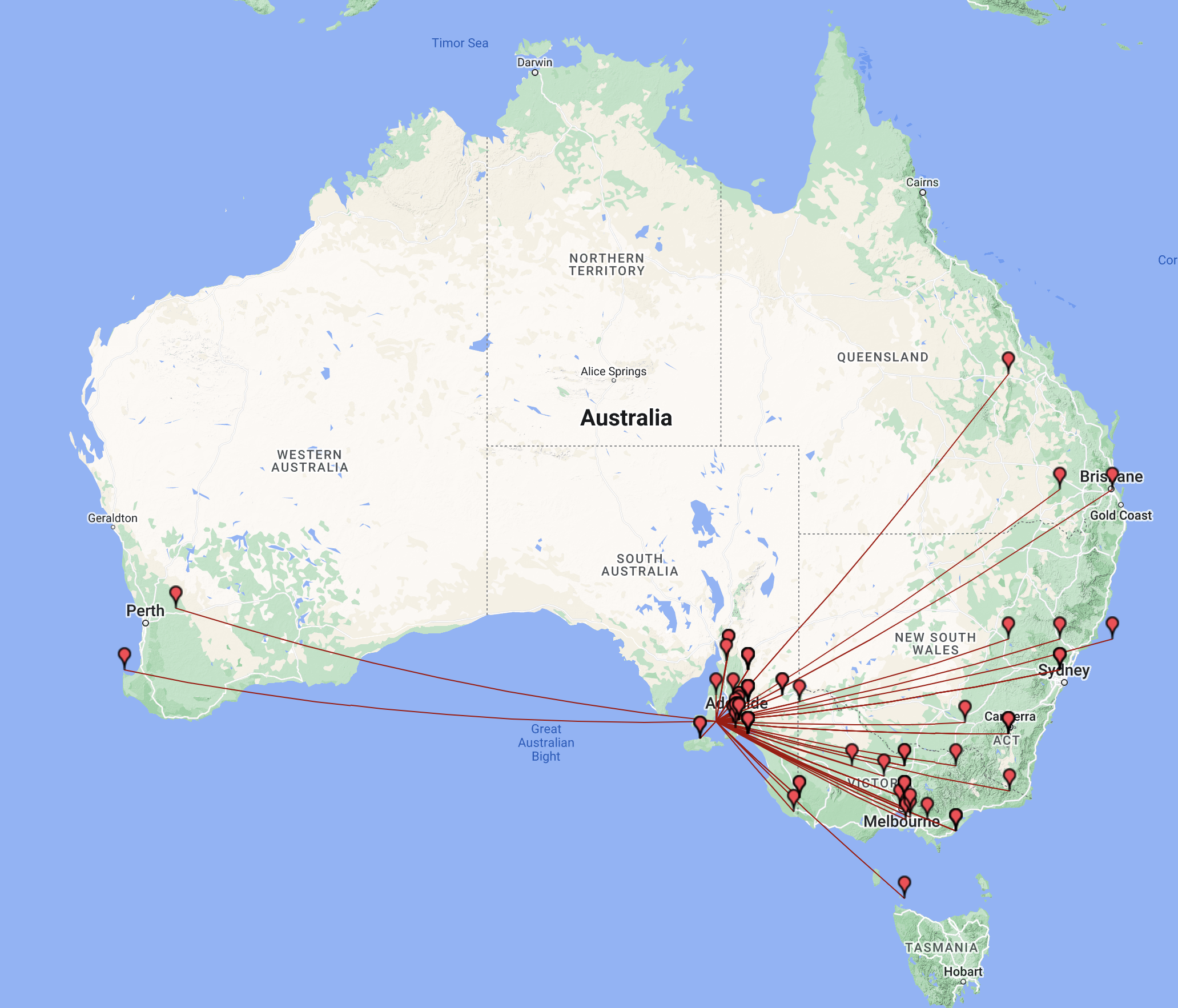
Above:- Map of Australia showing the location of Troubridge Island. Map c/o Google maps.
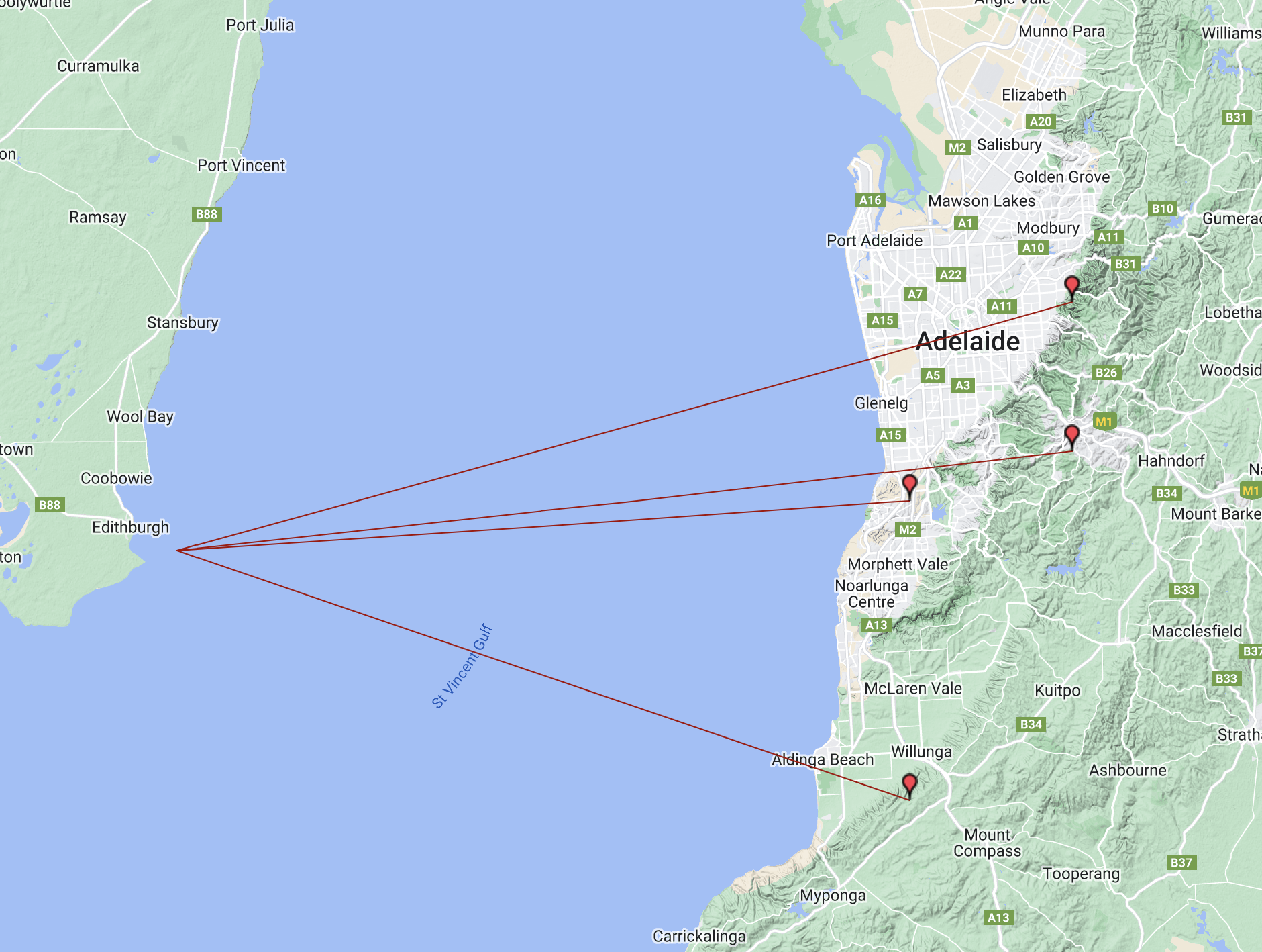
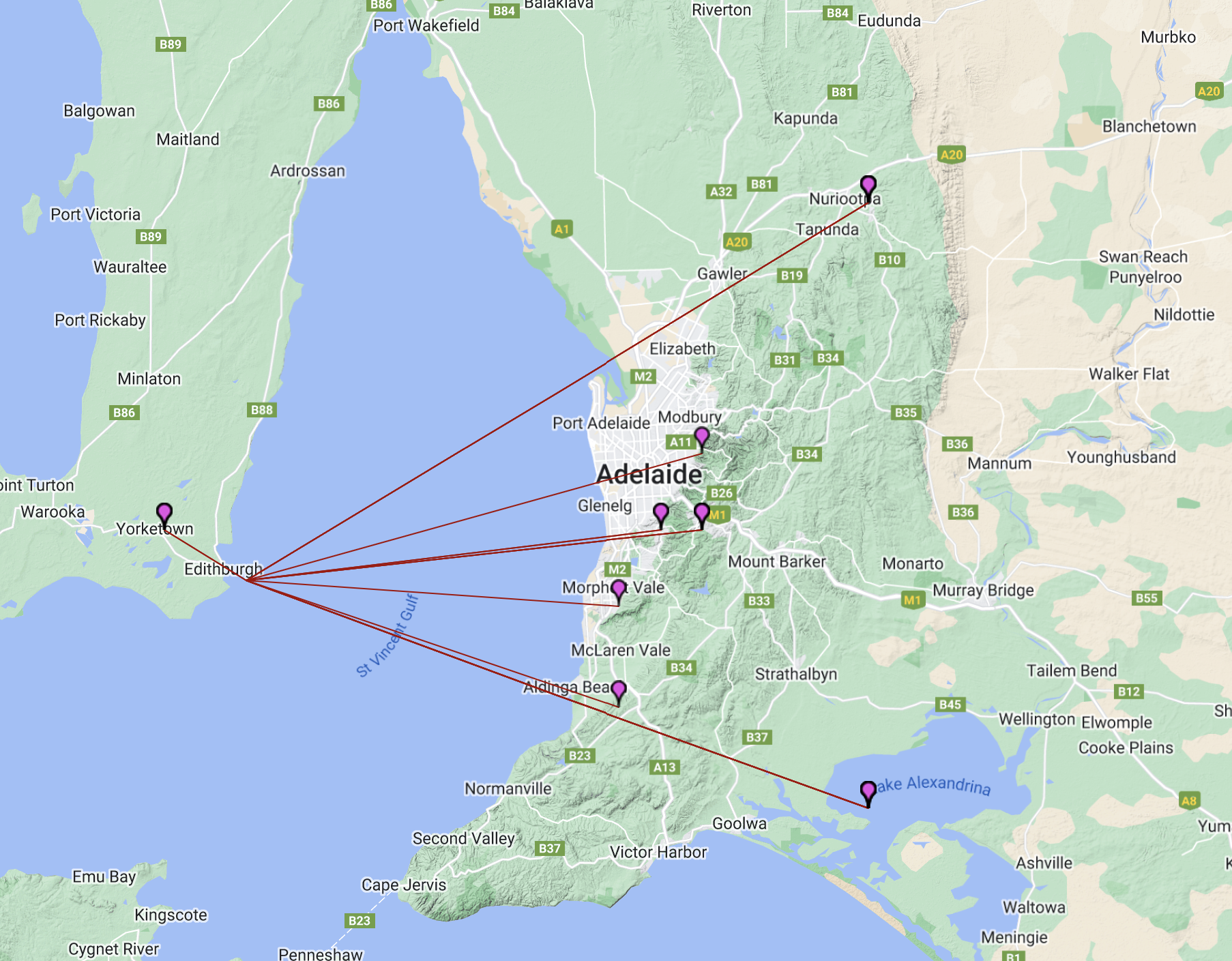
The island is about 8 km offshore from the town of Edithburgh on the Yorke Peninsula, and about 80 km southwest of the city of Adelaide across the water.
Above:- Map of Adelaide and the lower Yorke Peninsula, showing the location of Troubridge Island. Map c/o google maps.
WWFF and IOTA.
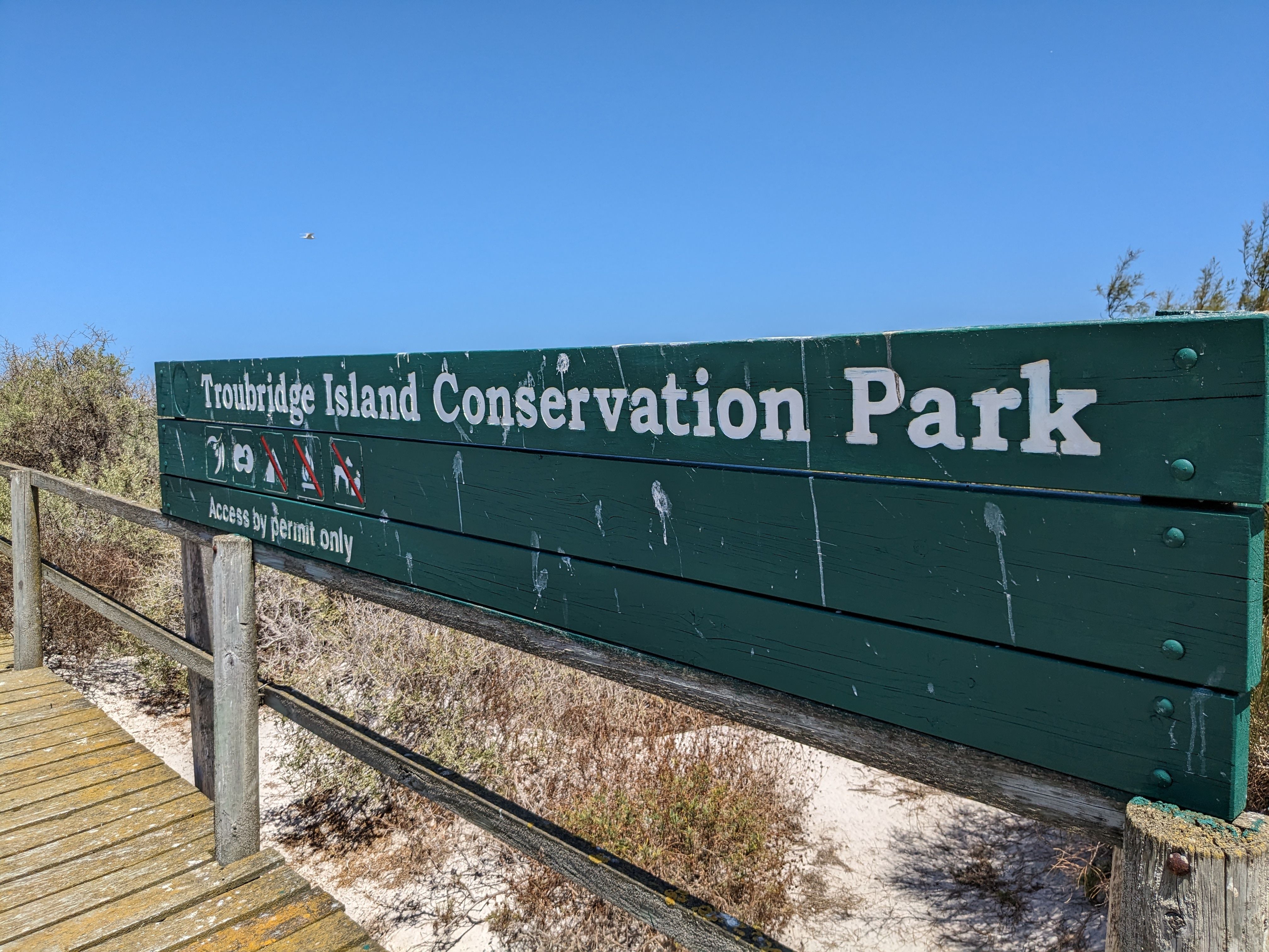
Troubridge Island qualifies for the World Wide Flora Fauna (WWFF) program and Islands On The Air (IOTA). The island is the Troubridge Island Conservation Park VKFF-1108 (WWFF) and IOTA OC-139. This was our reason for travelling to Troubridge Island – to activate it for WWFF and IOTA, and at the same time have a lot of fun.
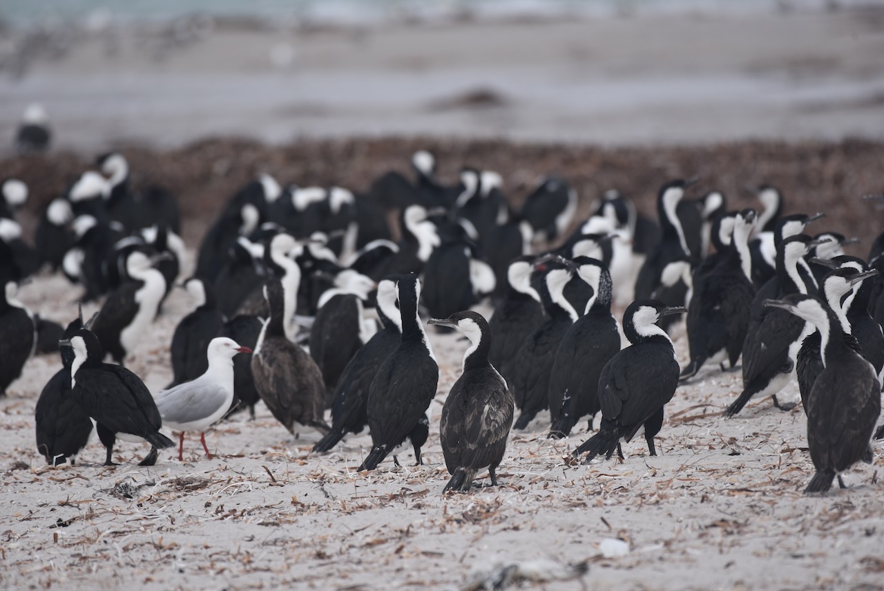
The island is part of the Troubridge Island Conservation Park. The park was proclaimed in 1982 to conserve sea-bird rookeries and to preserve the heritage values of the lighthouse and the associated keepers’ cottages. About 60 native bird species have been recorded on Troubridge Island. This includes 21 species of conservation significance and 22 species listed as migratory.
Troubridge Island has been nominated as an Important Bird Area (IBA) known as the Troubridge Island Important Bird Area by BirdLife International. The area supports over 1% of the world’s populations of both black-faced cormorants (with up to 4000 individuals) and silver gulls (with up to 10,000 breeding pairs) as well as supporting significant numbers of the vulnerable Fairy Tern.
HISTORY OF THE ISLAND.
The Narungga aboriginal people have a traditional association with Troubridge Island and other islands in the area. The island and shoal were first named by British navigator and cartographer Captain Matthew Flinders on the 24th day of March 1802, after Admiral Sir Thomas Troubridge.
Troubridge was a Royal Navy officer, who served during the Anglo-French War, the French Revolutionary Wars and Napoleonic Wars.
Above:- Captain Matthew Flinders (left) and Sir Thomas Troubridge (right). Images c/o Wikipedia.
Numerous ships were wrecked or grounded prior to the installation of the lighthouse on Troubridge Island. Official records state that 33 crews travelling west from Adelaide became shipwrecked in the early 1800s. It is believed there were many more.
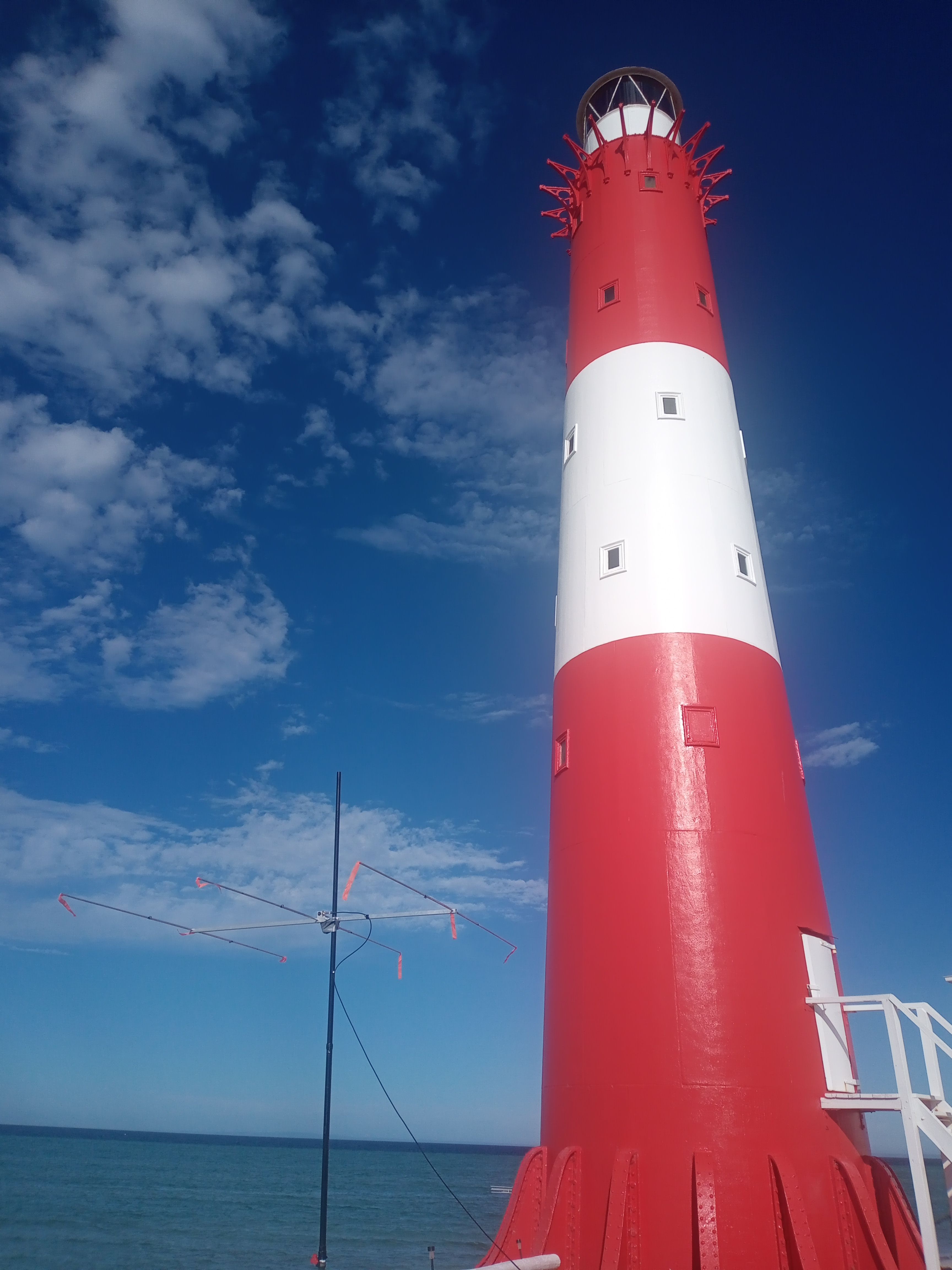
In 1855, the lighthouse was constructed.
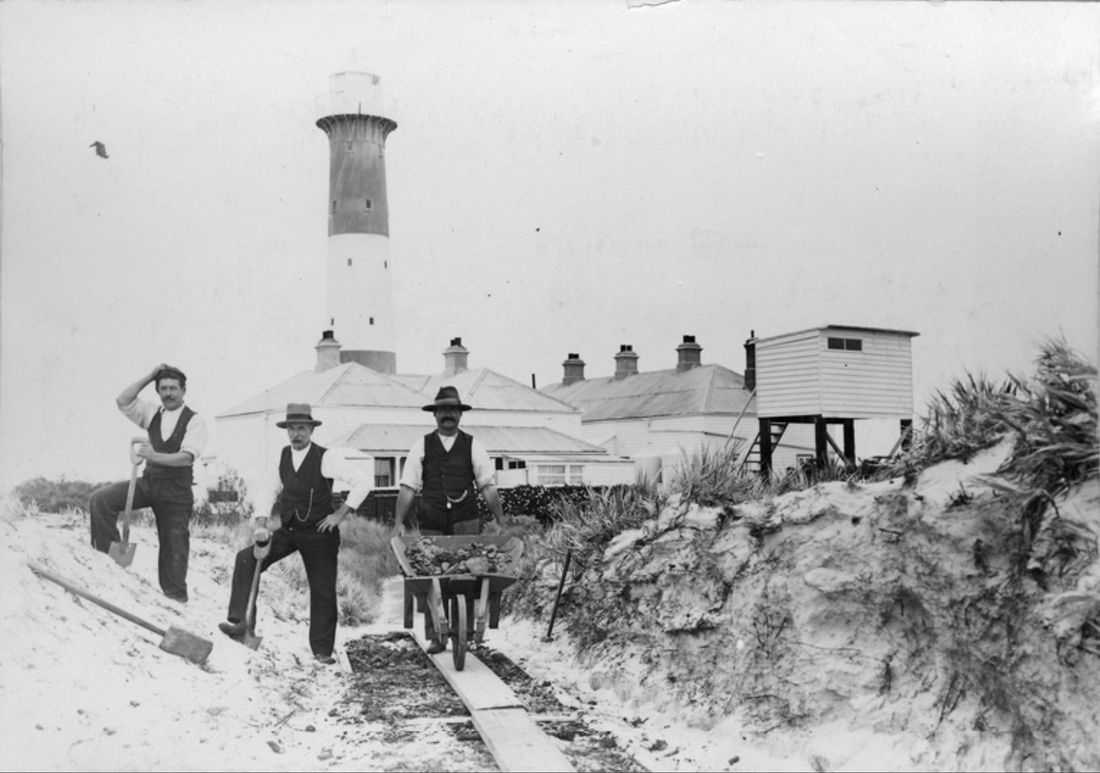
The lighthouse was constructed of ten cylindrical cast iron segments which were shipped out from Britain and were bolted together on site. It is believed that Troubridge Island lighthouse is only one of two towers of this type constructed in Australia. The lighthouse is 24 metres (79 feet) in height and is 340 tons. A cast iron spiral staircase runs between the outer and inner walls connecting five rooms at its core.
Above:- c. 1910. Three men working with spades and a wheelbarrow outside Troubridge Island lighthouse, South Australia. Image c/o State Library South Australia.
GETTING TO THE ISLAND.
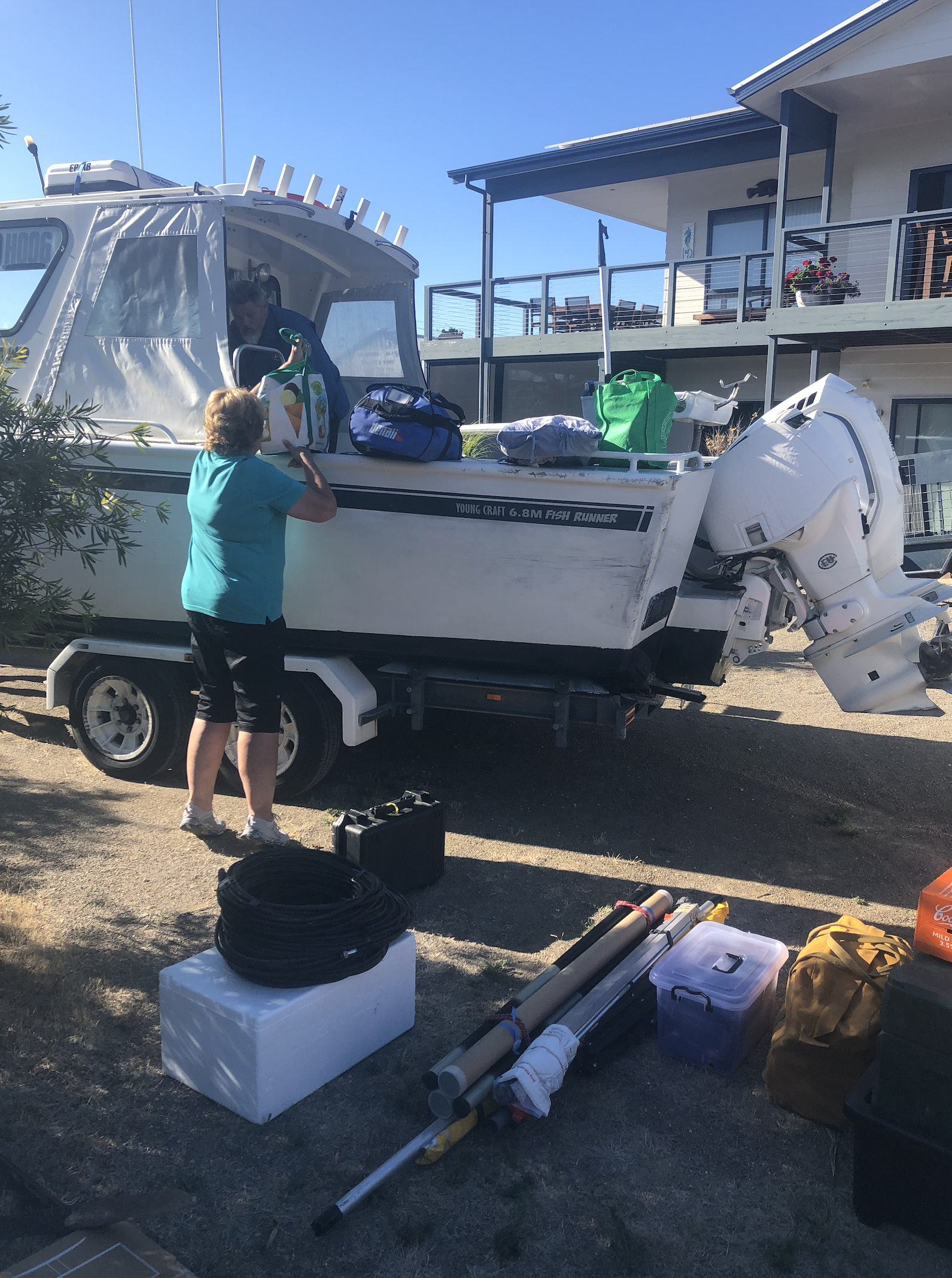
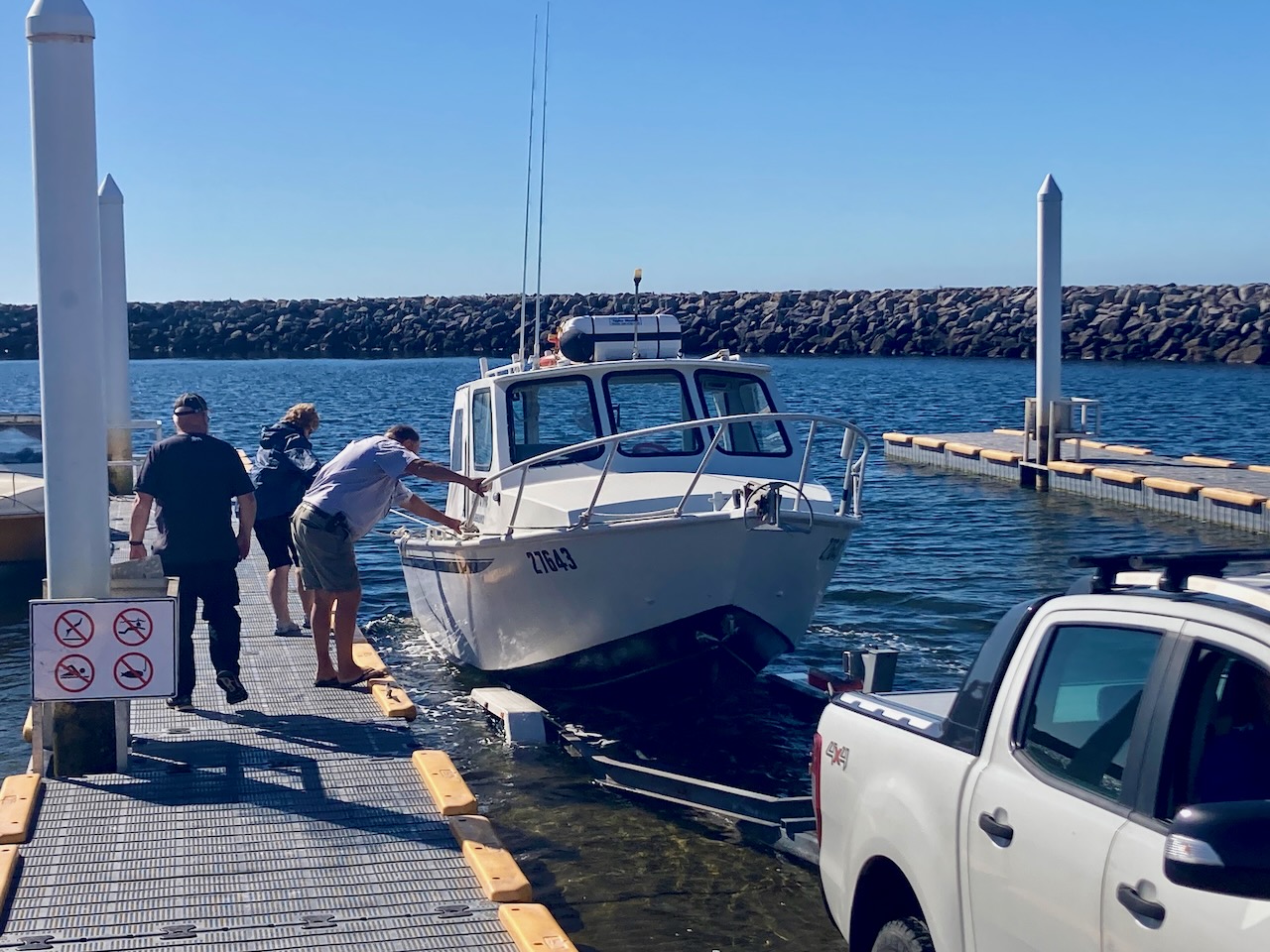
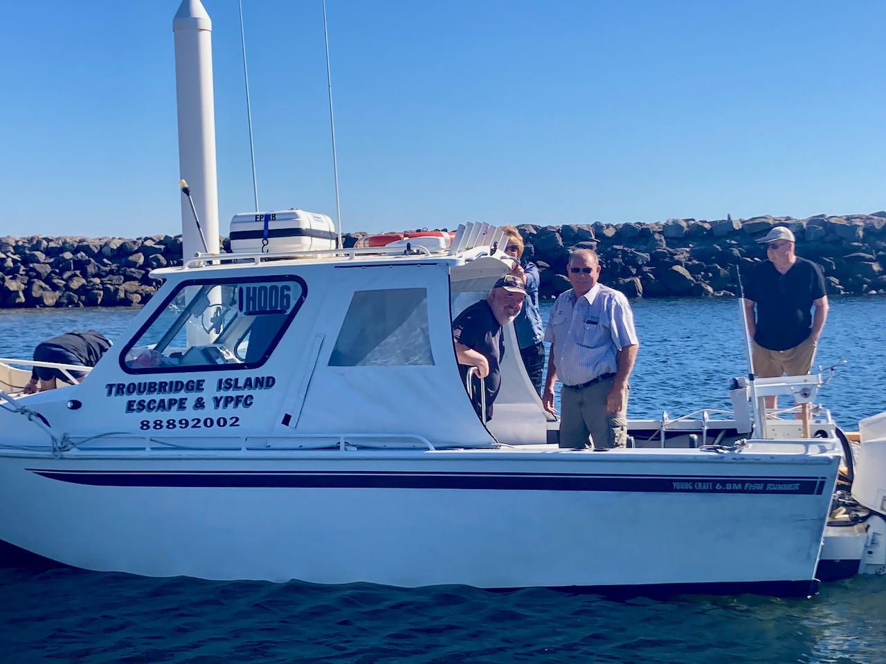
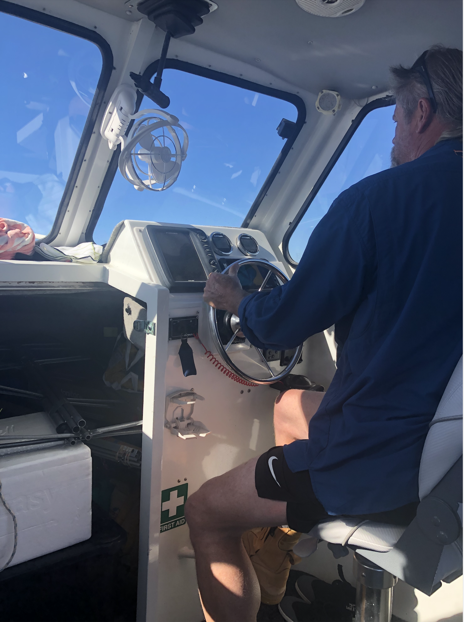
To get to the island we travelled by boat from Edithburgh with Mark and Lois of Troubridge Island Escape. We met Mark and Lois at their property at Wool Bay where we loaded the boat.
We then travelled down to Edithburgh in one vehicle towing the boat and the remainder of the team in a courtesy vehicle. We cannot speak highly enough of Mark and Lois. They were extremely friendly and helpful, not only during the trip but leading up to the trip.
Once we arrived in Edithburgh Ivan and I boarded the boat with Mark and Lois and headed to the island. The remaining four team members, Marija, Chris, Adam, and Andy headed off to get a coffee.
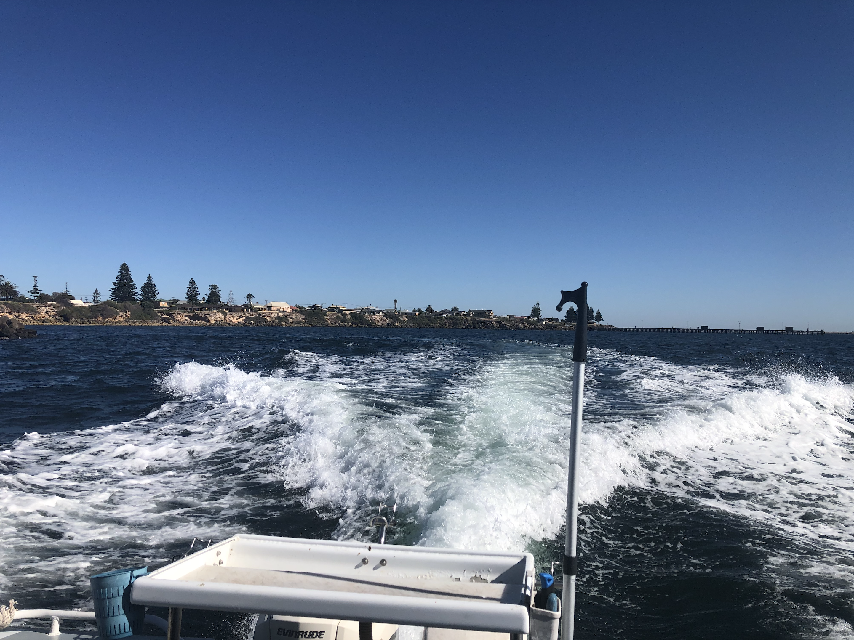
It takes just 15 minutes to get out to the island from Edithburgh. It was a beautiful sunny day and the water was quite calm.
Below is a view of Troubridge Island from the boat as we approached the sandbar. What a beautiful view!
WE HAVE LANDED.
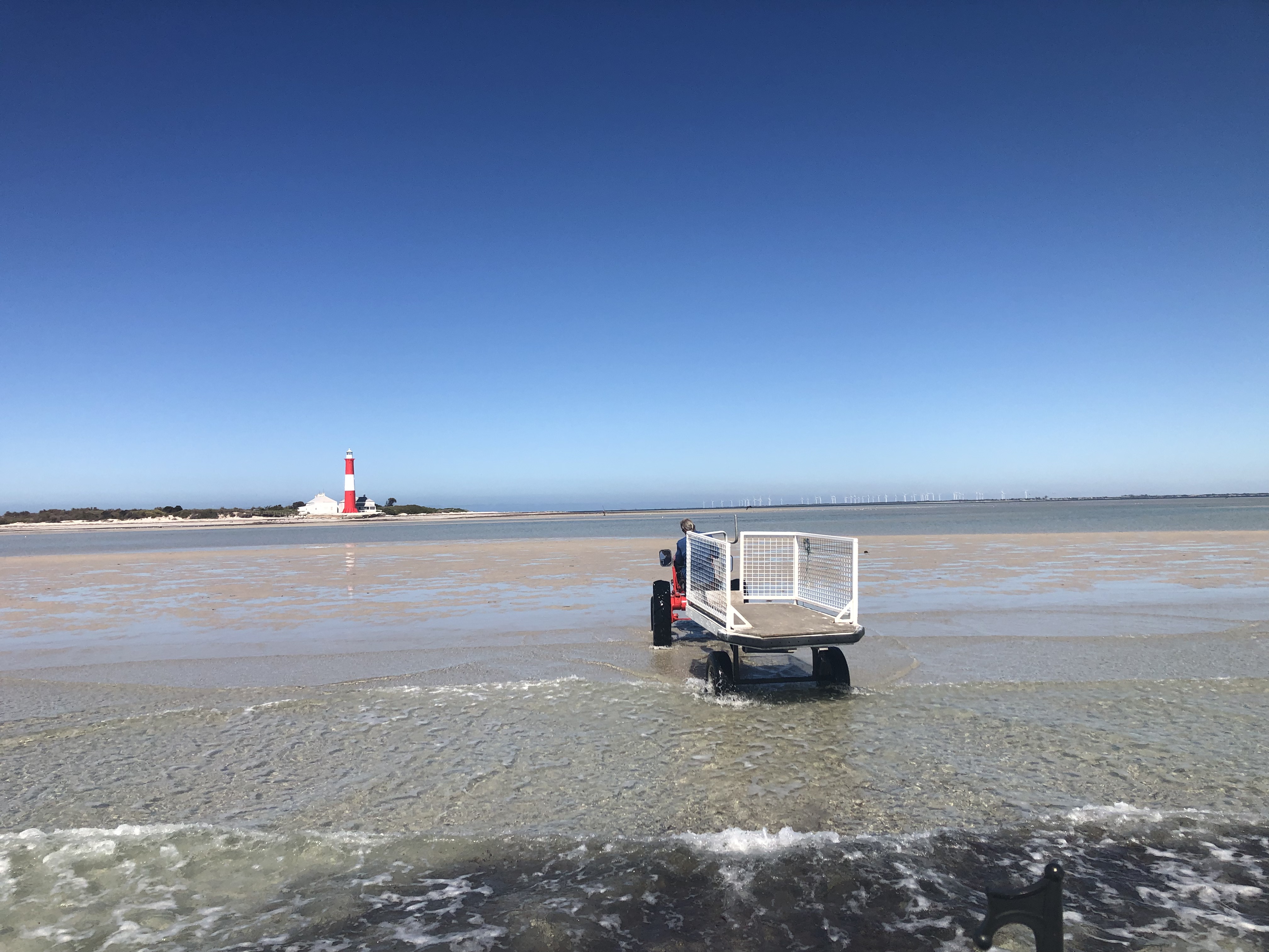
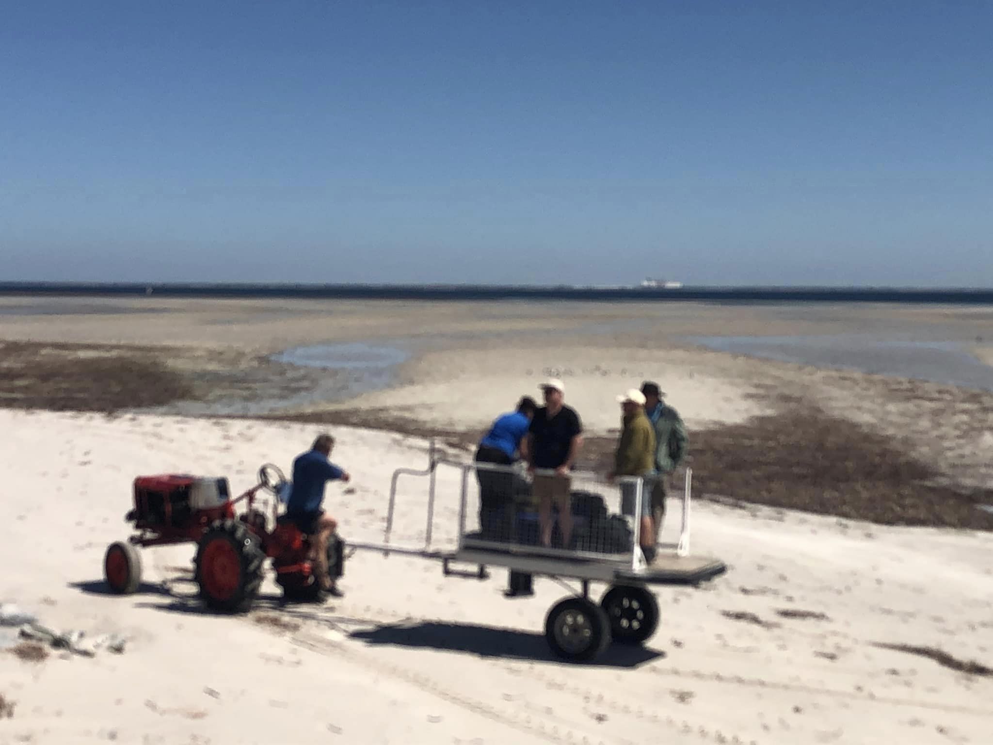
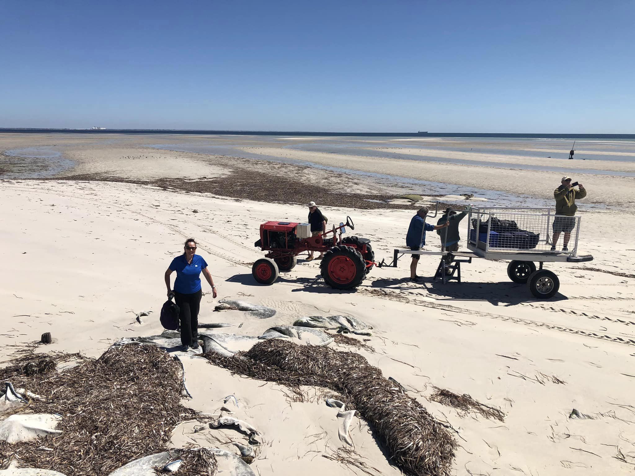
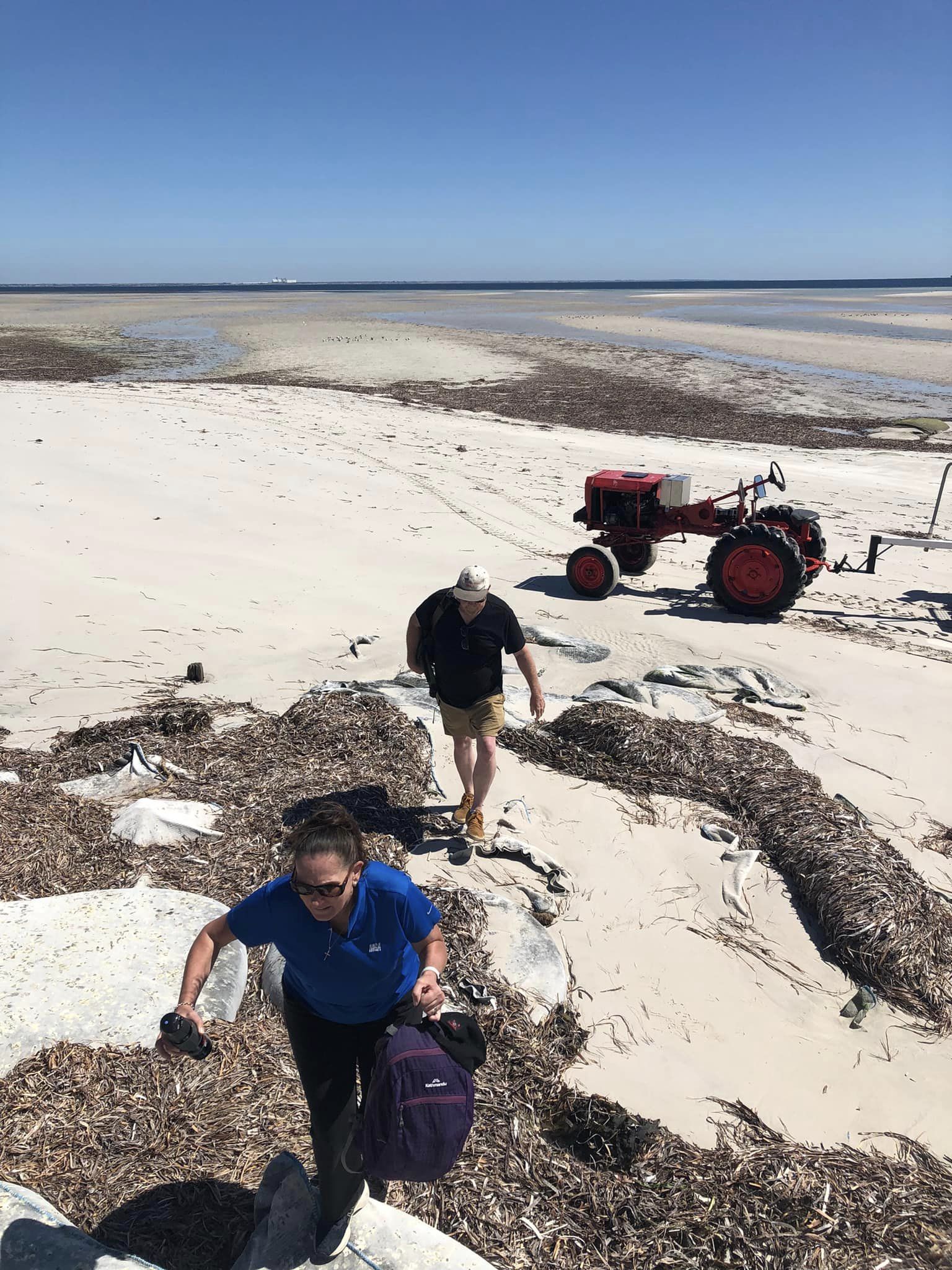
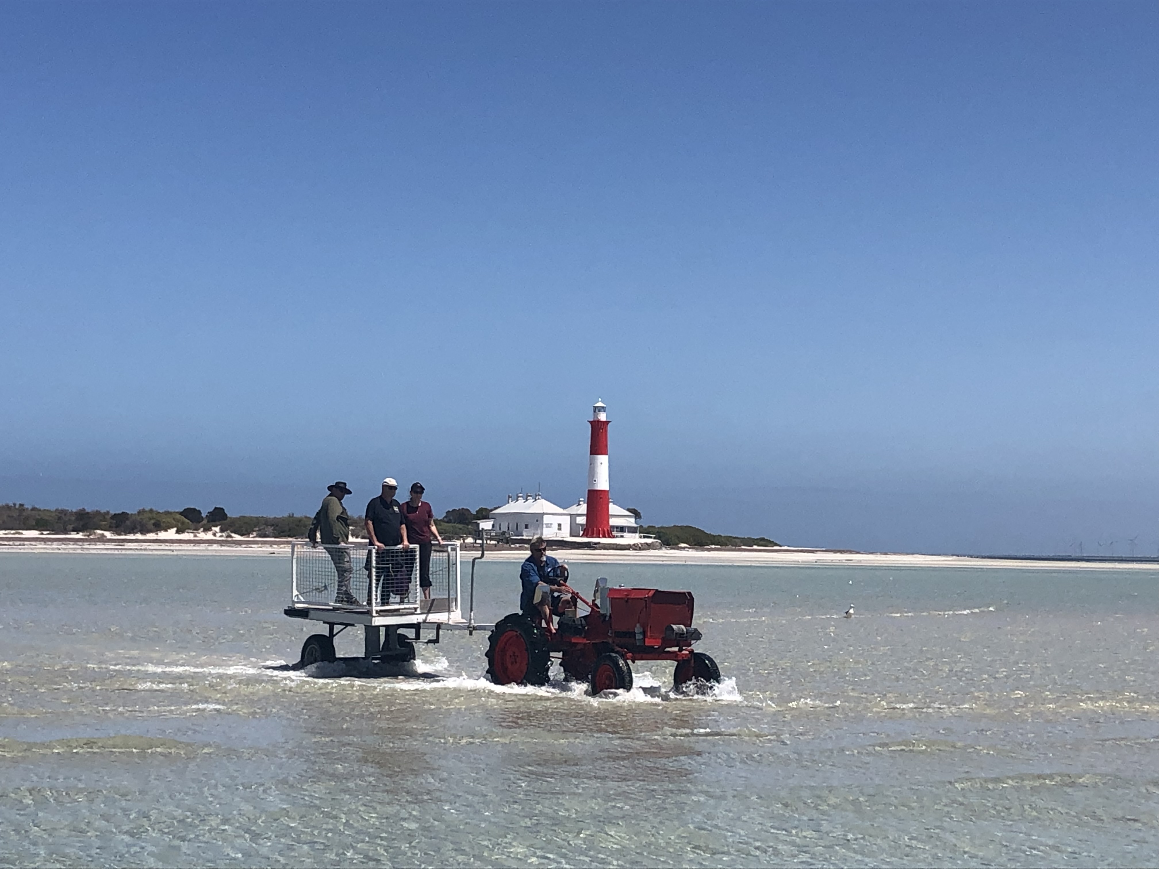
Once the boat was anchored, Mark walked to the island and collected a tractor and trailer and drove back to the boat. We loaded all of our gear onto the trailer and Lois drove us across the shallow water and sandbar to the island while Mark headed back to Edithburgh with the boat to collect the remainder of our team.
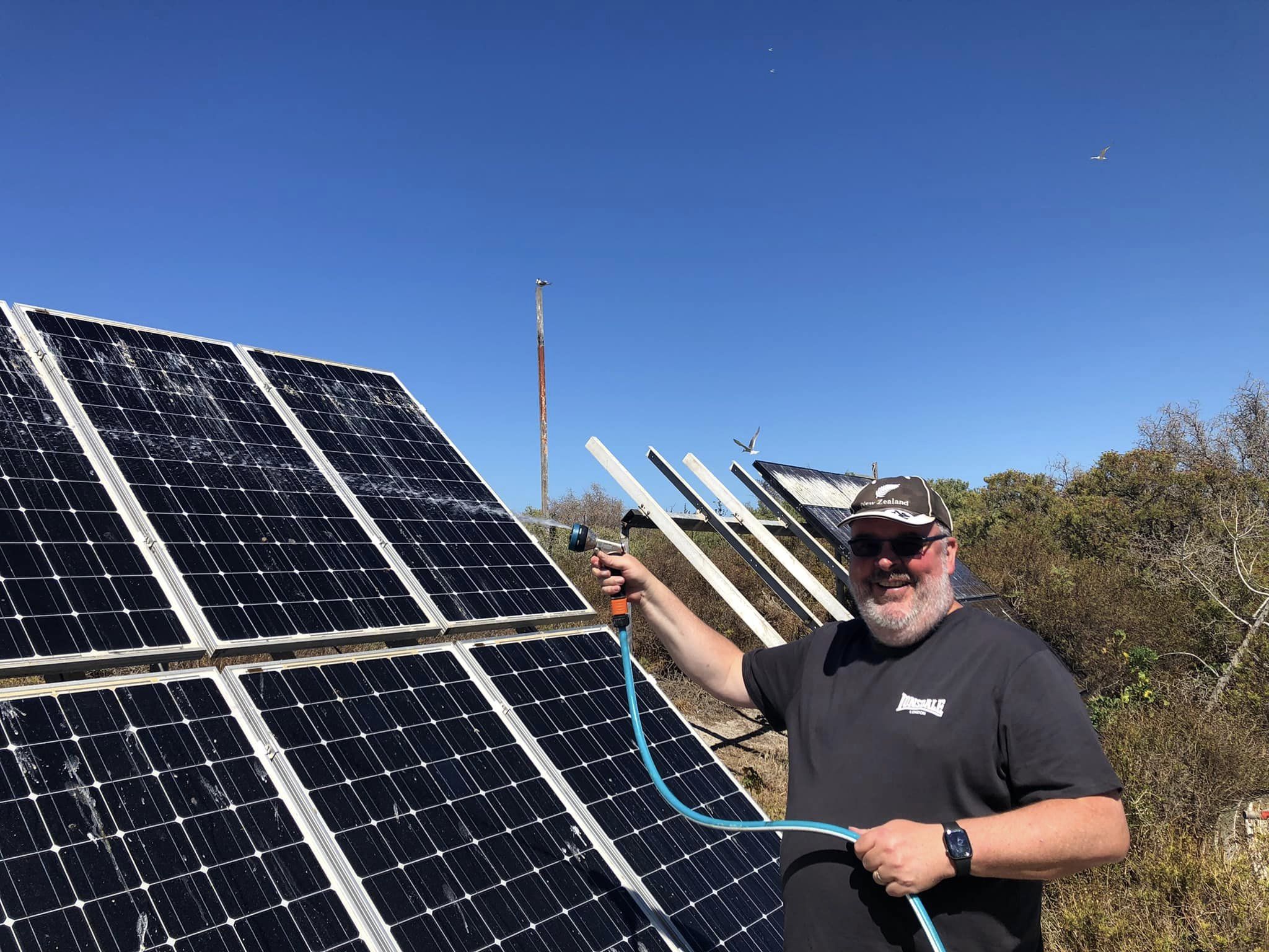
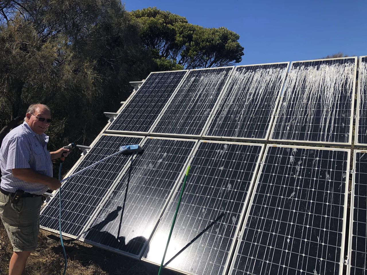
Upon arriving on Troubridge Island, Ivan and I offloaded the radio gear. Lois also took us for a tour around our accommodation. One of our first jobs on the island was to clean all the bird poo from the solar panels. Solar is the only power on the island.
It is about a 15-minute boat ride from Edithburgh to Troubridge Island. So after about an hour, the remaining four team members Marija, Adam, Andy, and Chris arrived safely on the island.
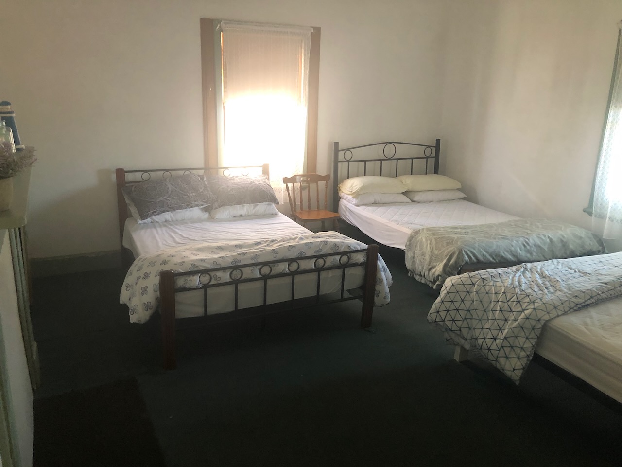
ACCOMMODATION.
Our accommodation on the island was one of the old lighthouse keepers’ cottages.
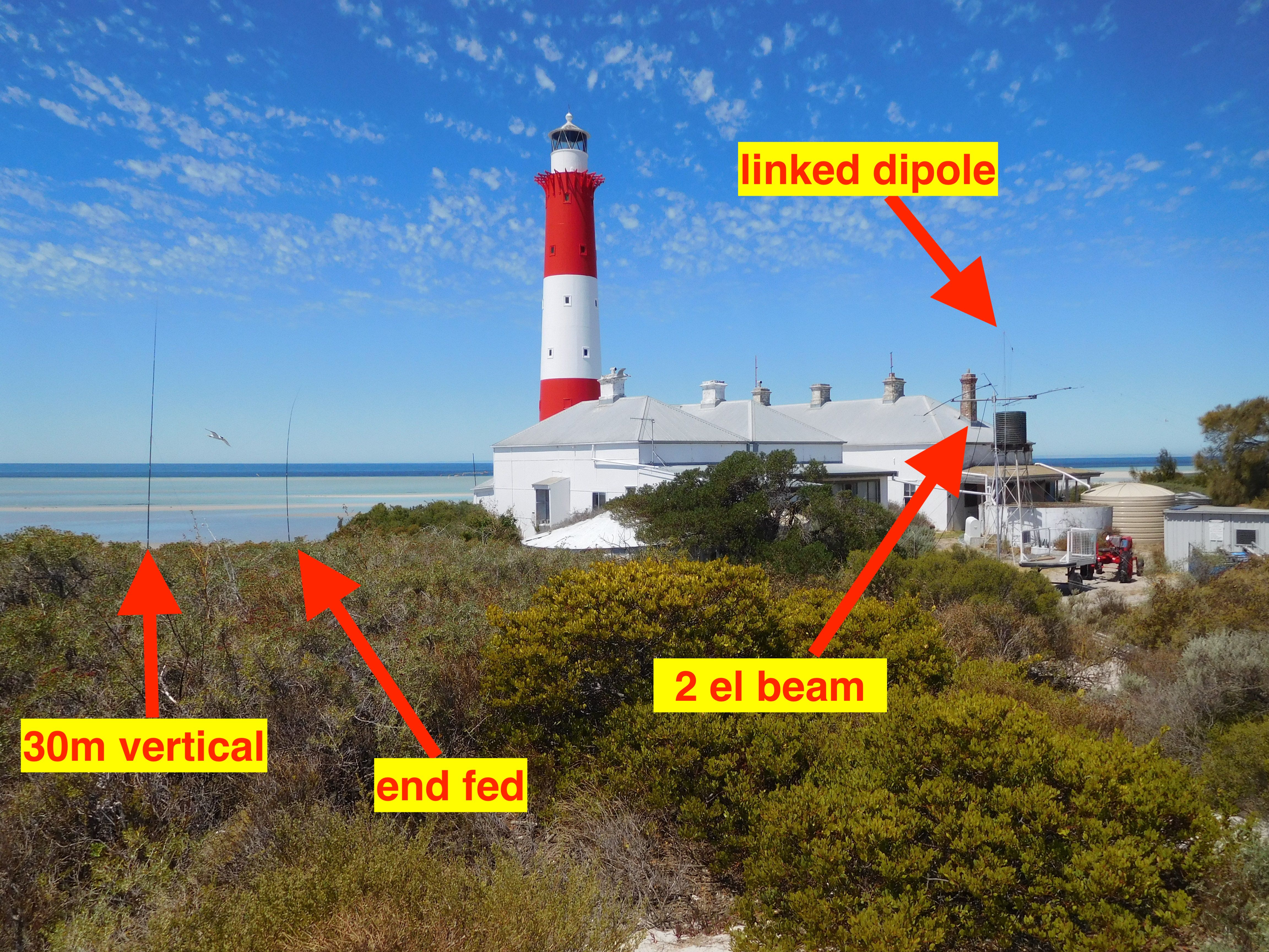
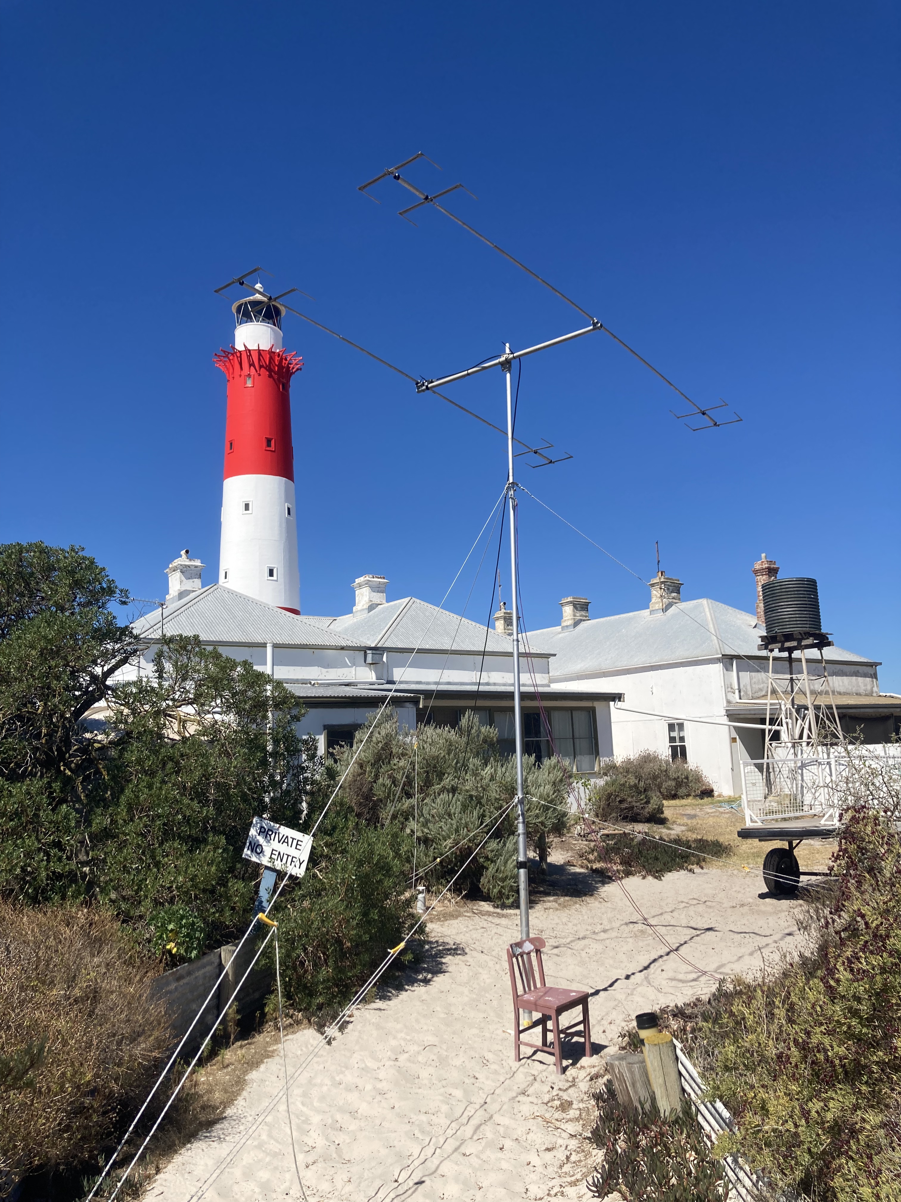
SETTING UP ANTENNAS AND STATIONS.
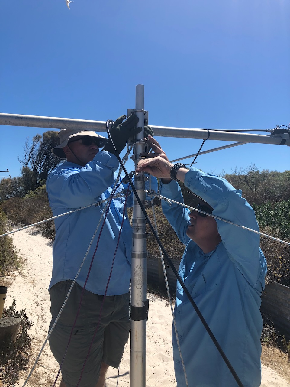
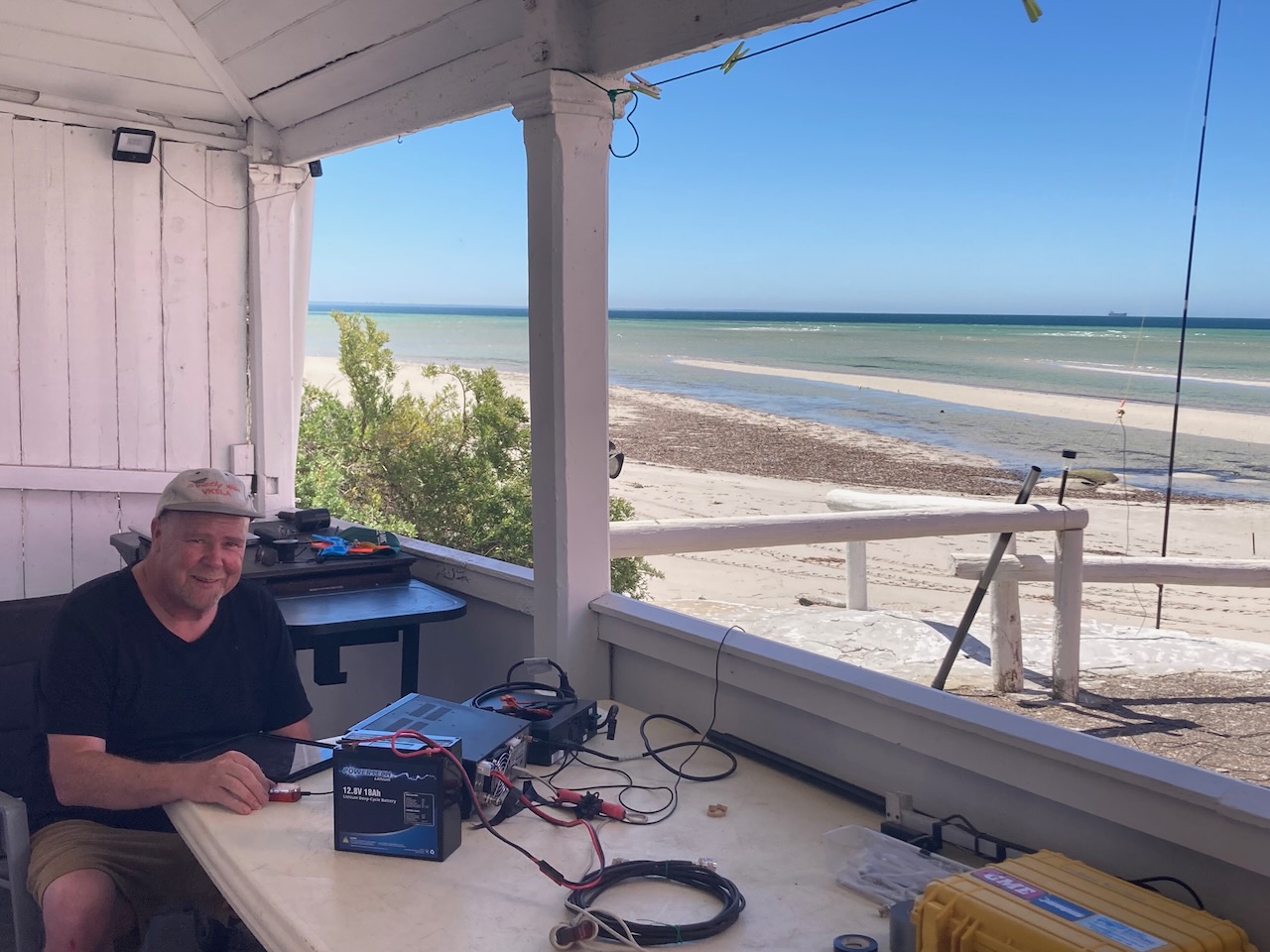
Once on the island, we commenced setting up. We set up four operating stations.
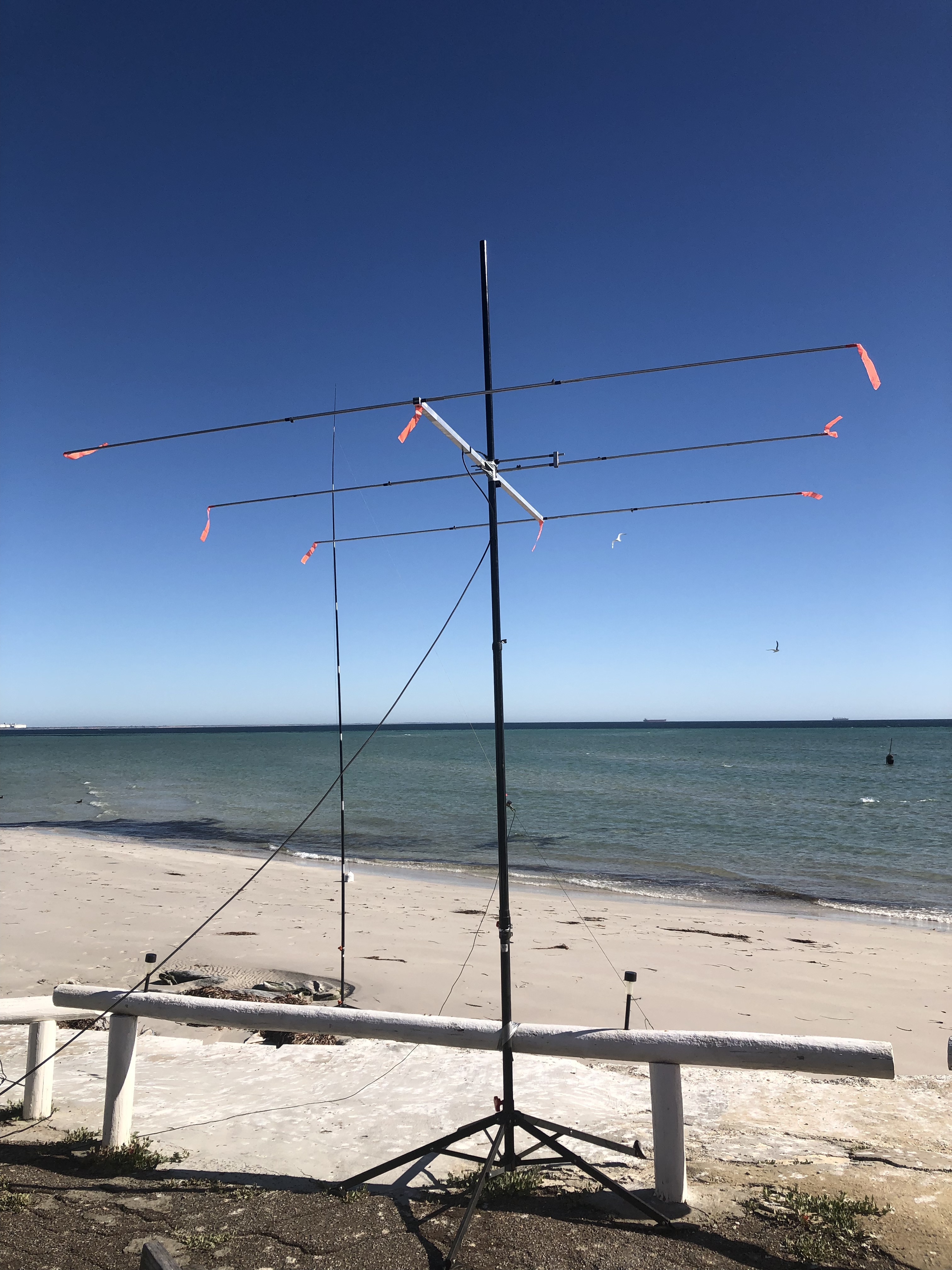
We established four separate stations located in both of the cottages and erected an array of antennas including linked dipoles, a vertical, an end fed, and a small 2-element beam.
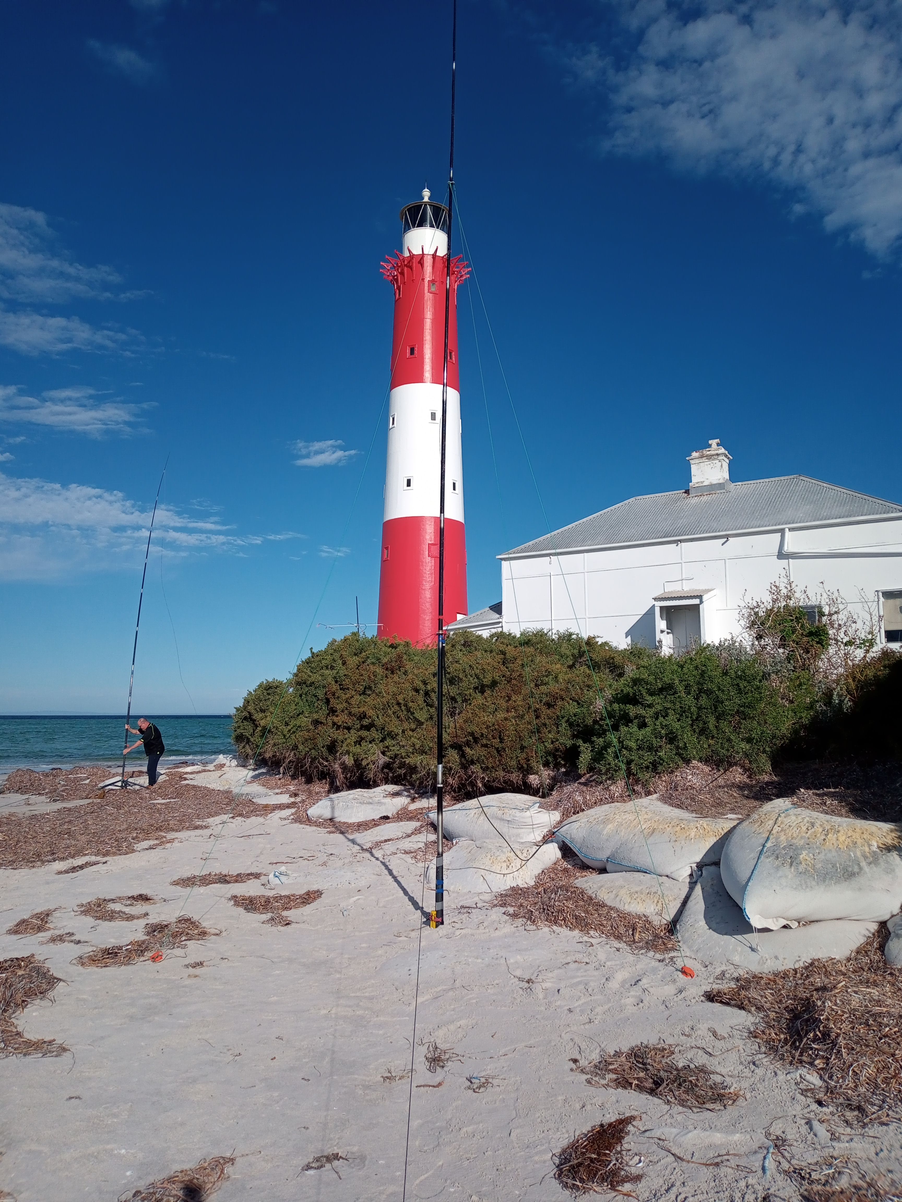
Below is a photo of the end fed and the 30m vertical on the beach.
Above:- the end fed and the 30m vertical on the beach – at sunset.
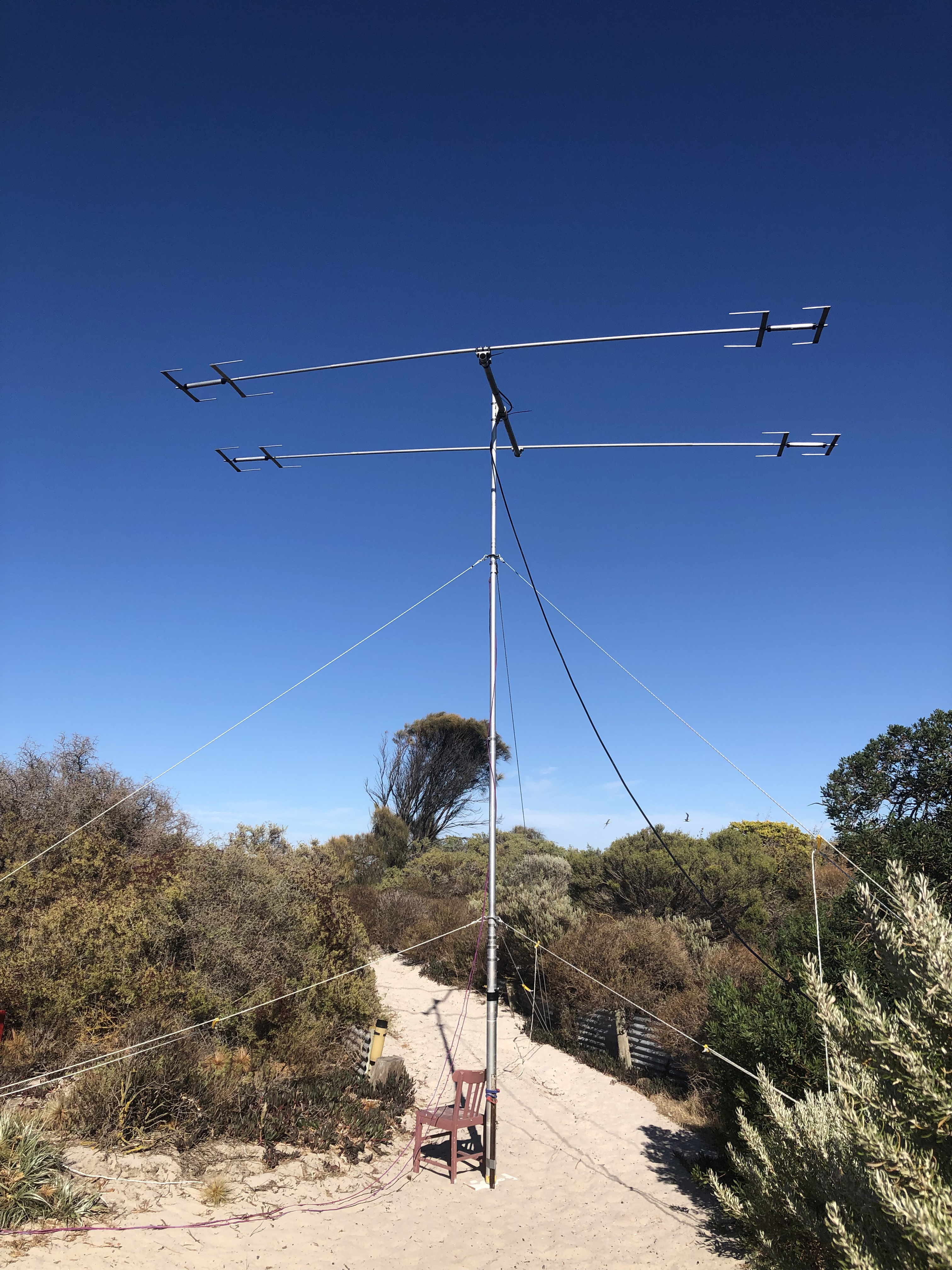
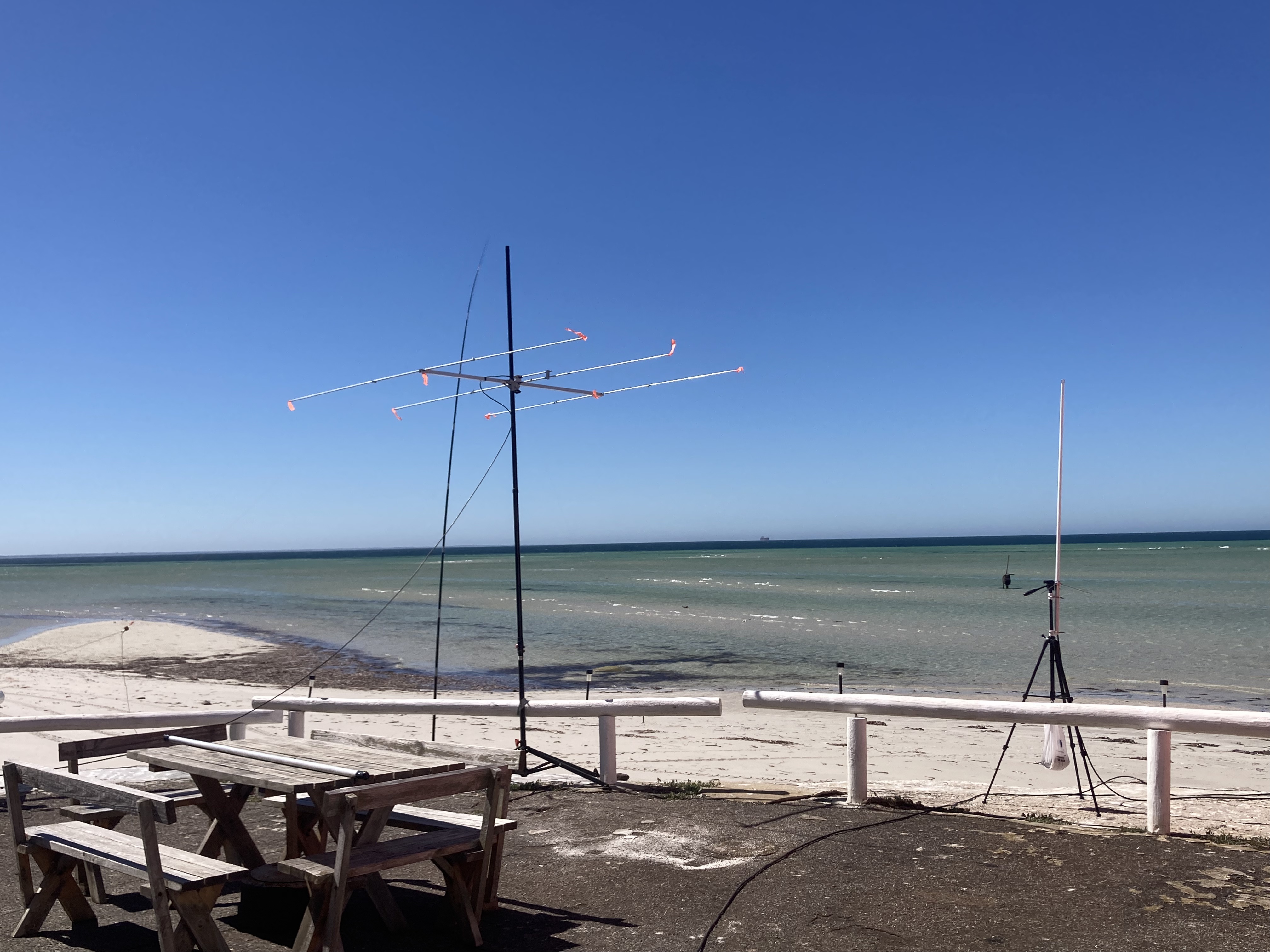
Below are some photos of the 2 element yagi.
Below is a photo showing the 20/40/80m linked dipole.
Improvisation was the name of the game. We had not been to the island before so we had to play everything by ear. The lighthouse keeper’s cottage that we slept in was clean and tidy. But the second cottage which is normally used for storage was not ideal, so we just set up one station in there.
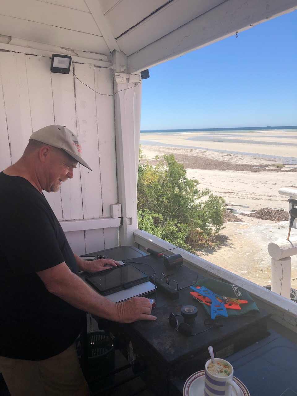
Above:- One of the stations set up on the front verandah of the lighthouse keeper’s cottage.
HOW MANY QSOS DID WE MAKE?
Our first QSO was with Peter VK3PF.
Our final QSO was with Ted VK6NTE.
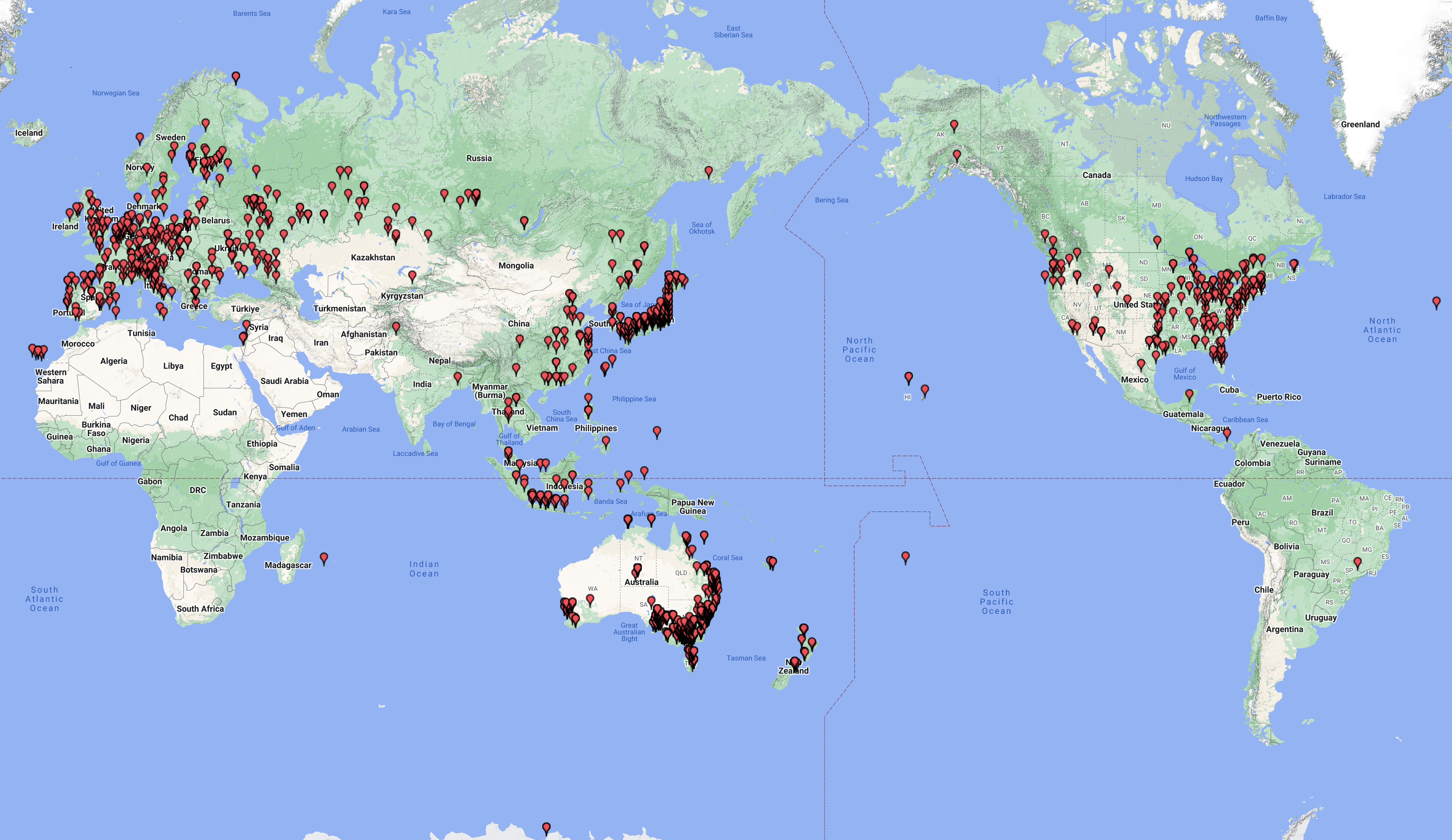
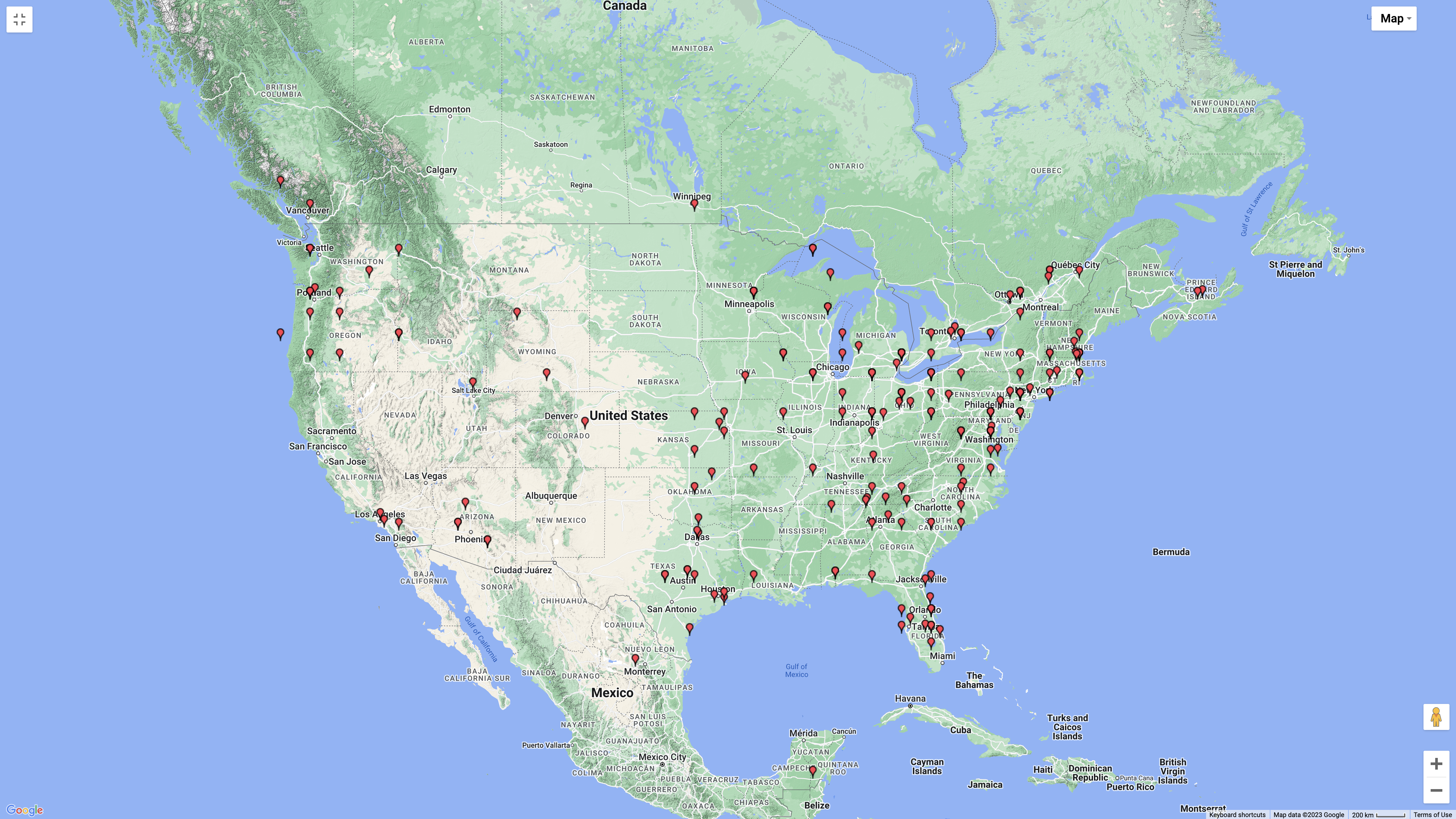
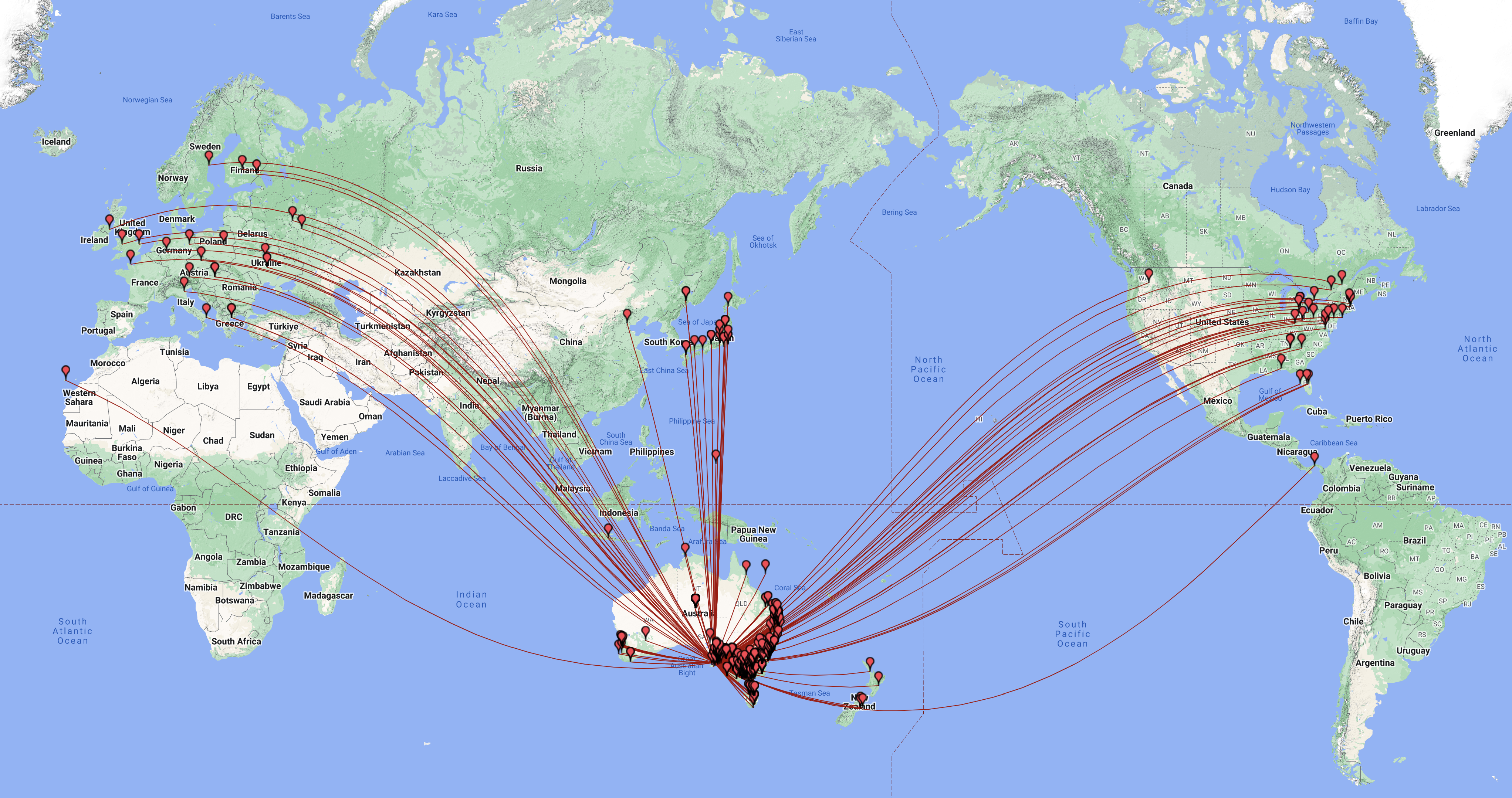
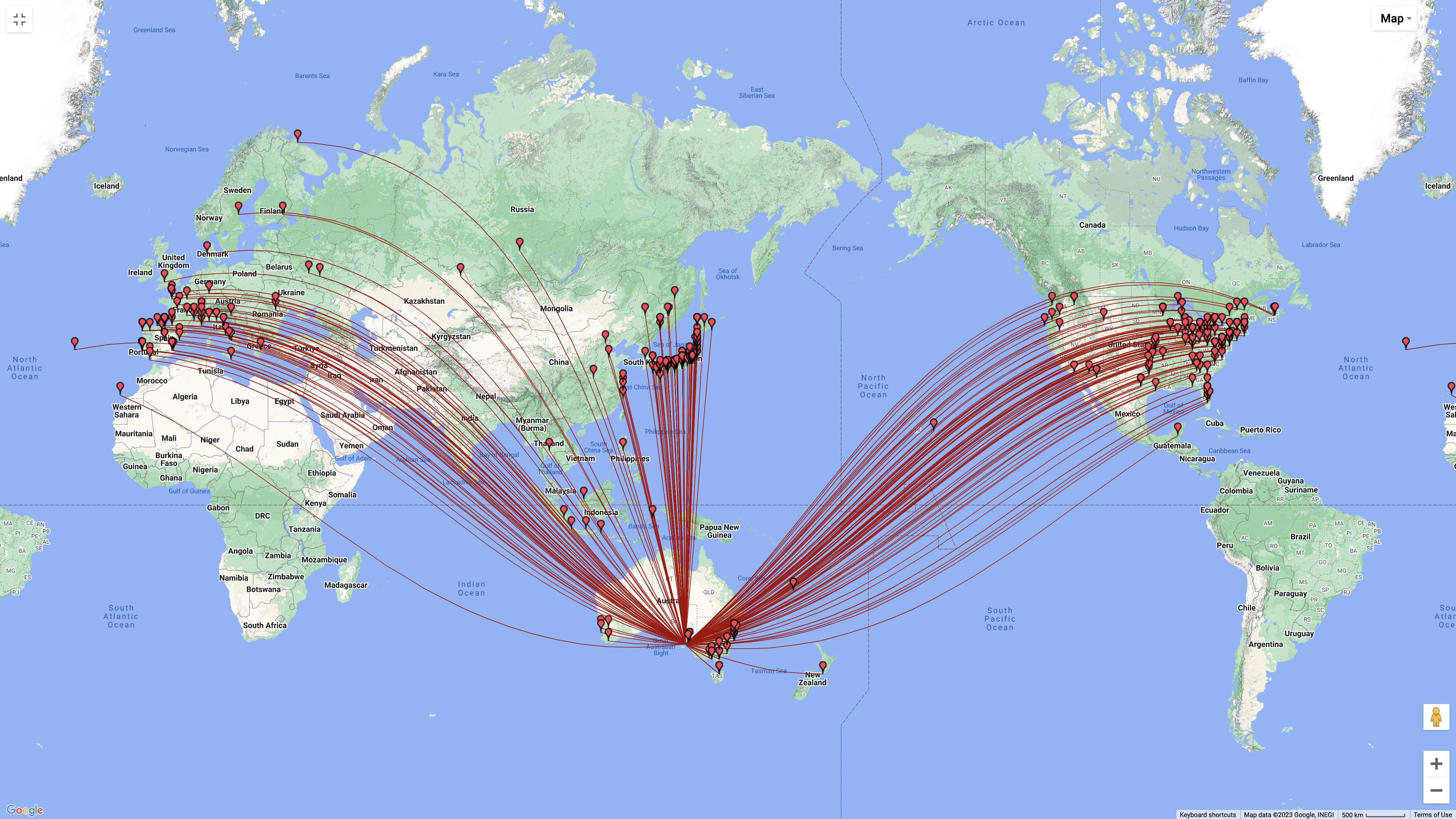
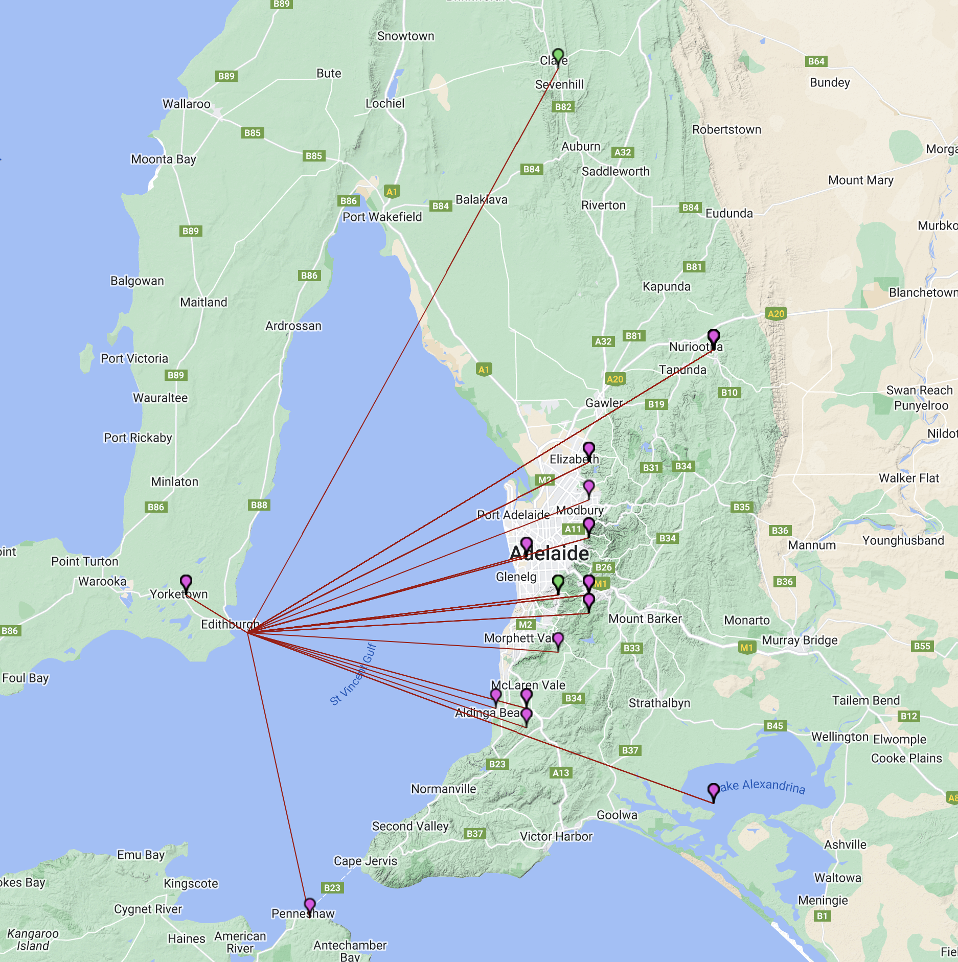
During our stay on the island, we made a total of 2,123 QSOs and worked 65 different DXCC entities. Below is a map showing our contacts around the world.
Above:- Map showing our contacts around the world. Map c/o QSOMAP.org
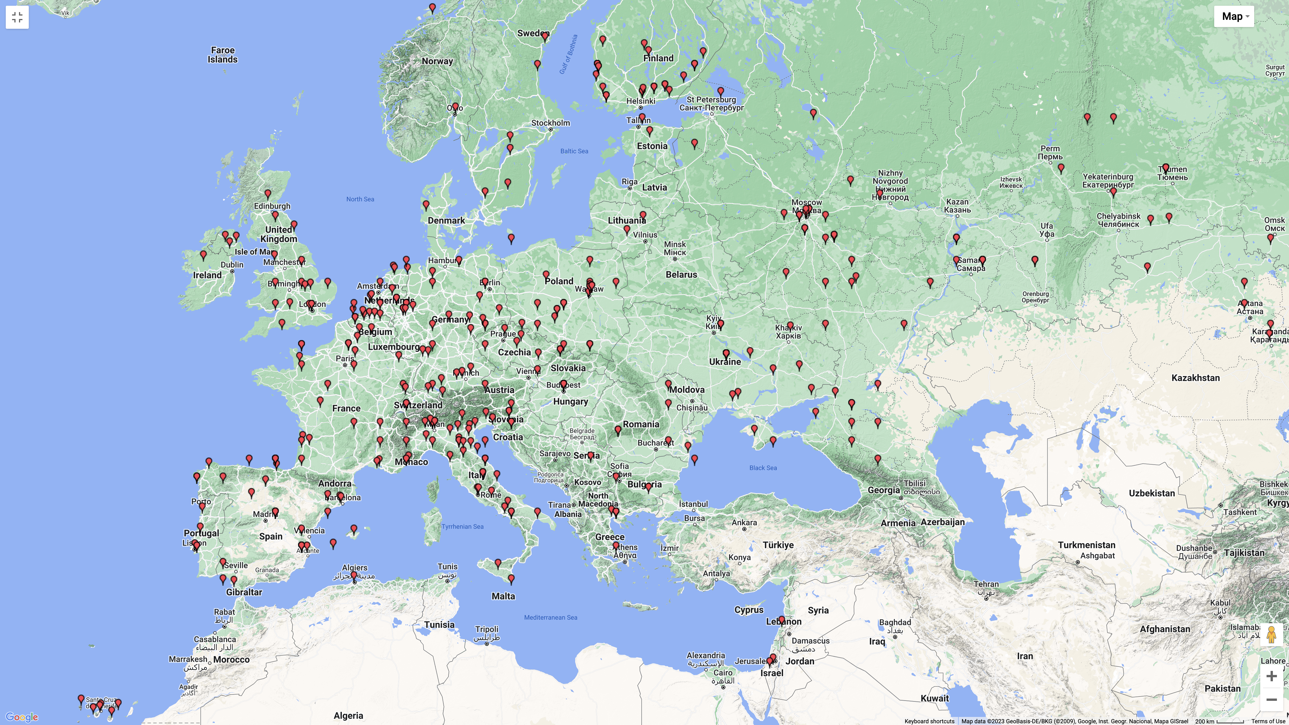
We had some nice openings into Europe and the United Kingdom on Wednesday and Thursday on the long path on SSB, along with numerous FT8 & CW contacts into Europe.
Above:- Map showing our contacts into Europe. Map c/o QSOMAP.org
We also made numerous contacts into North America.
Above:- Map showing our North American contacts. Map c/o QSOMAP.org
And of course we made numerous contacts around Australia.
The majority of our contacts were on the 40m band (594), followed by 20m (582) and then 30m (328).
Above:- Graph showing our contacts per band. Graph c/o meta-chart.com
We operated on SSB, CW and FT8 during our time on Troubridge. The majority of our contacts were on FT8 (974), followed by SSB (926), and then CW (133). We also made contacts on AM, 70cm DMR, 70cm FM, 70cm SSB, 2m DMR, 2m FM, and 2m SSB.
Above:- Graph showing our contacts per mode. Graph c/o meta-chart.com
WE ARE UNDERWATER.
In the early hours of Wednesday morning (our first night on the island) I was awoken by a large bang. A few of us went out to investigate to note that the wind had significantly picked up and had knocked over the 6m yagi. But worse, our 30m vertical was lying on its side flapping about in the water, and the end fed was also underwater, but was still standing. The tide had come in a lot further than we had believed it would. Fortunately, no damage was caused to the antennas.
Above:- The end fed. Take note of the seaweed up the top. The tide had started to go out when this photo was taken.
BANDS WORKED & MODES.
We operated on 70cm, 2m, 6m, 10m, 15m, 17m, 20m, 30m, 40m, 80m, & 160m.
We operated on SSB, FT8 & CW.
Below is a video showing one of our FT8 stations.
SUMMARY OF EACH BAND USED.
Below is a breakdown of our activity per band.
160M BAND.
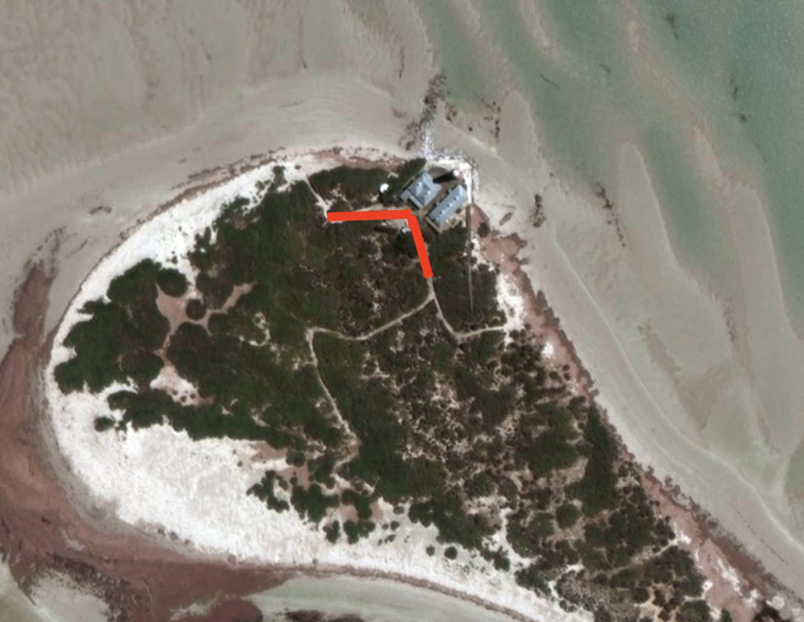
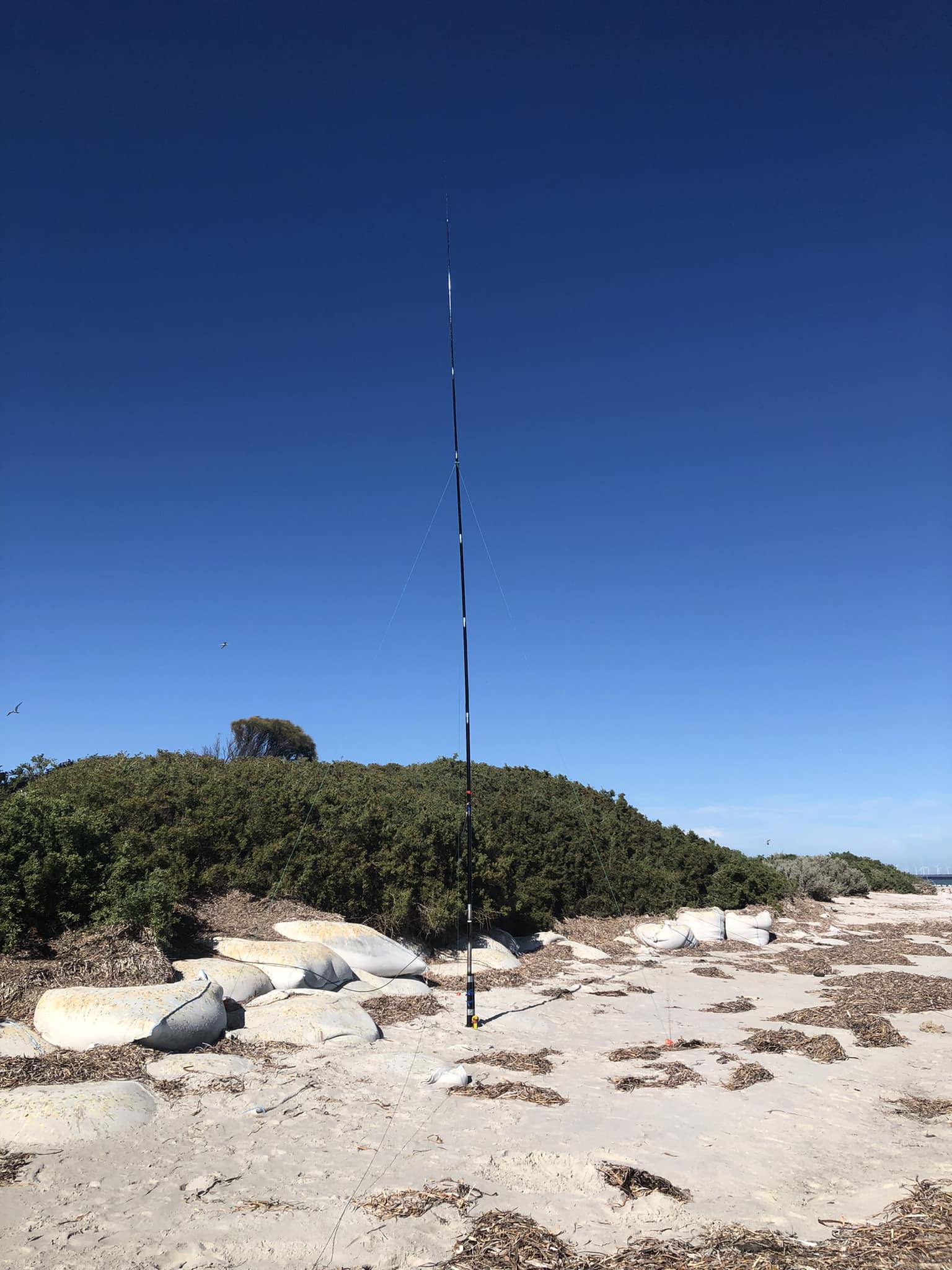
On Wednesday afternoon (8th February) we set up a linked dipole that Ivan VK5HS had put together. It included the 160-metre band.
We ran the legs of the 160m dipole along two sandy paths at the rear of the cottages. The legs of the dipole ran west and southeast.
Above:- Aerial shot of Troubridge Island, showing the 160m antenna.
A total of 29 QSOs were made on the 160m band into VK2, VK3, VK5, and VK6. Our longest distance QSO on 160m was with Brian VK6LO in Western Australia.
The majority of our contacts on 160m were on SSB. But we also made a handful of contacts on AM and FT8.
3 – AM
3 – FT8
23 – SSB
Above:- Map of Australia showing the location of the 160m band contacts. Image c/o Log Analyzer.
The video below shows Ivan VK5HS on 160m.
80M BAND.
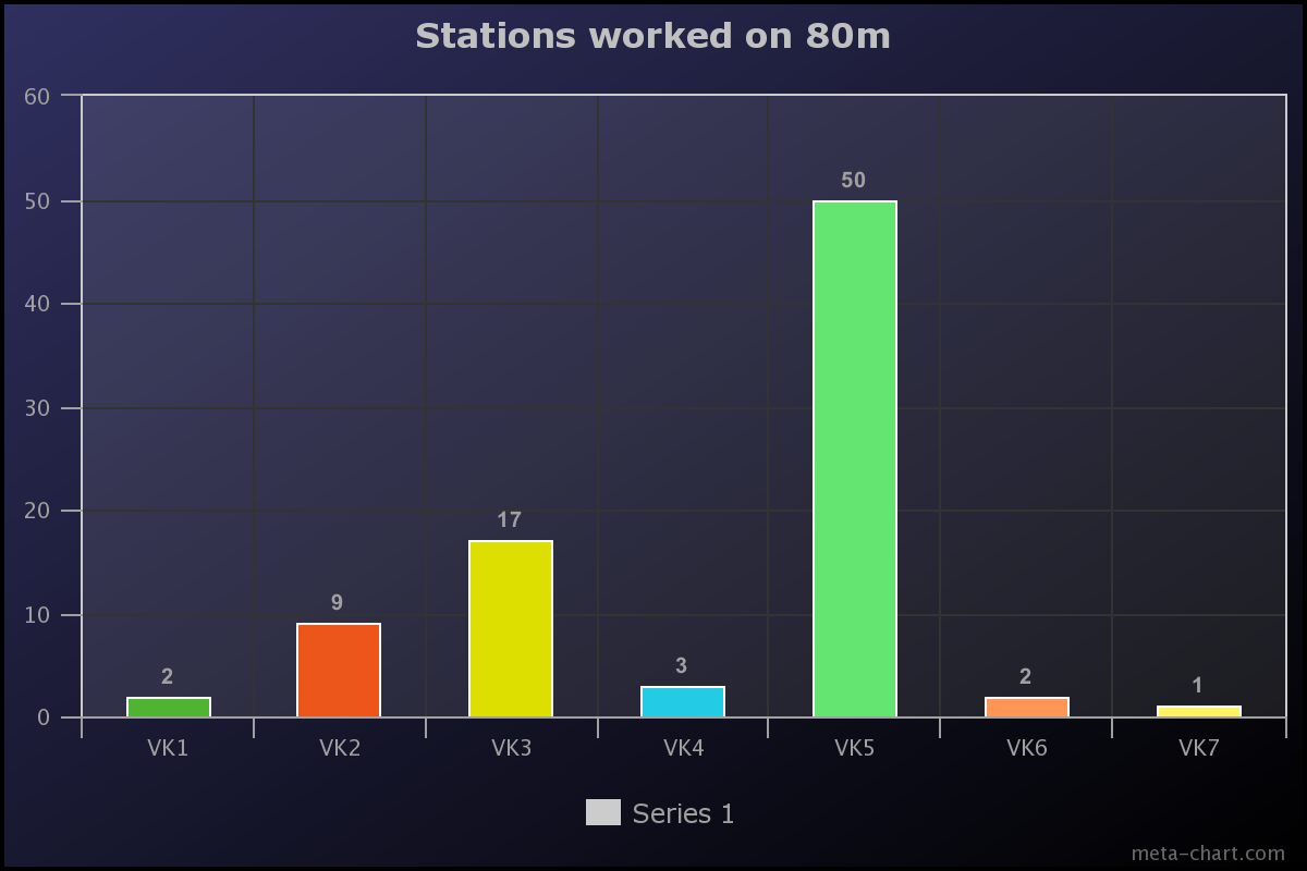
We made a total of 84 contacts on the 80m band into VK1, VK2, VK3, VK4, VK5, VK6, and VK7. All of these contacts were on LSB, excluding one AM contact with John VK5BJE in the Adelaide Hills.
Above:- Map of Australia showing our 80m contacts. Image c/o Log Analyzer.
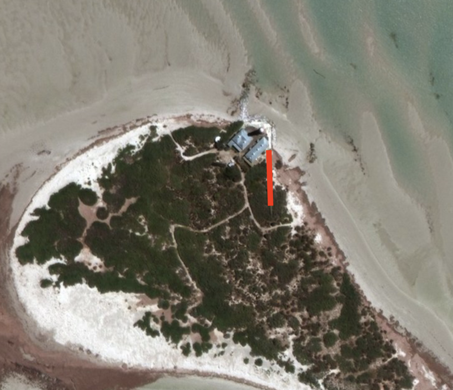
Our 80m SSB station consisted of a Yaesu FT857, 100 watts, and a linked dipole which ran north-south along a wooden boardwalk. The antenna was in an inverted vee configuration and was supported by a 7-metre telescopic heavy-duty squid pole.
Above:- The linked dipole, supported on a 7m squid pole.
There were times when the high tide came in, and half of one leg of the 80m section of the dipole was underwater, and yet it still seemed to perform well.
Above:- Aerial shot showing the orientation of the linked dipole, running north-south. Image c/o Google maps.
The 80m station was set up in a room in the second lighthouse keeper’s cottage. The room had a lot of echo, so we had to improvise and use some old mattresses to dampen the echo effect.
Above:- Adam VK2YK and Marija VK5MAZ on air on 80m SSB.
The majority of our contacts on the 80m band were around South Australia (VK5) – a total of 50. This was followed by Victoria (VK3) with 17 and then New South Wales (VK2) with 9.
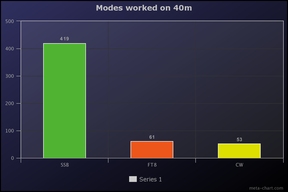
We made a total of 593 QSOs on 40m. The majority of those were on SSB (419), followed by FT8 (61), and then CW (53).
Above:- Graph showing the number of contacts made on 40m per mode. Graph c/o meta-chart.com
x
We worked the following 25 DXCC on the 40m band:-
Asiatic Russia (FT8)
Australia (SSB, CW, FT8)
Austria (FT8)
Canada (SSB, FT8)
Canary Islands (SSB)
China (FT8)
Czech Republic (FT8)
England (FT8)
European Russia (SSB)
Federal Rep of Germany (SSB)
Finland (CW, FT8)
France (FT8)
Greece (FT8)
Hungary (FT8)
Indonesia (FT8)
Italy (SSB, FT8)
Japan (SSB, CW. FT8)
New Zealand (SSB, FT8)
Northern Ireland FT8)
Panama (SSB)
Poland (SSB)
Sweden (SSB)
Ukraine (SSB, FT8)
United States of America (SSB, CW, FT8)
Willis Island (SSB)
The map below shows our contacts around the world on the 40m band.
Above:- Map of the world showing our 40m band contacts. Image c/o QSOLOG.org
A highlight on 40m was working Sands VK9WX on Willis Island on SSB. Willis Island is a tiny sand atoll and is ranked as 36 on the DXCC Most Wanted List.
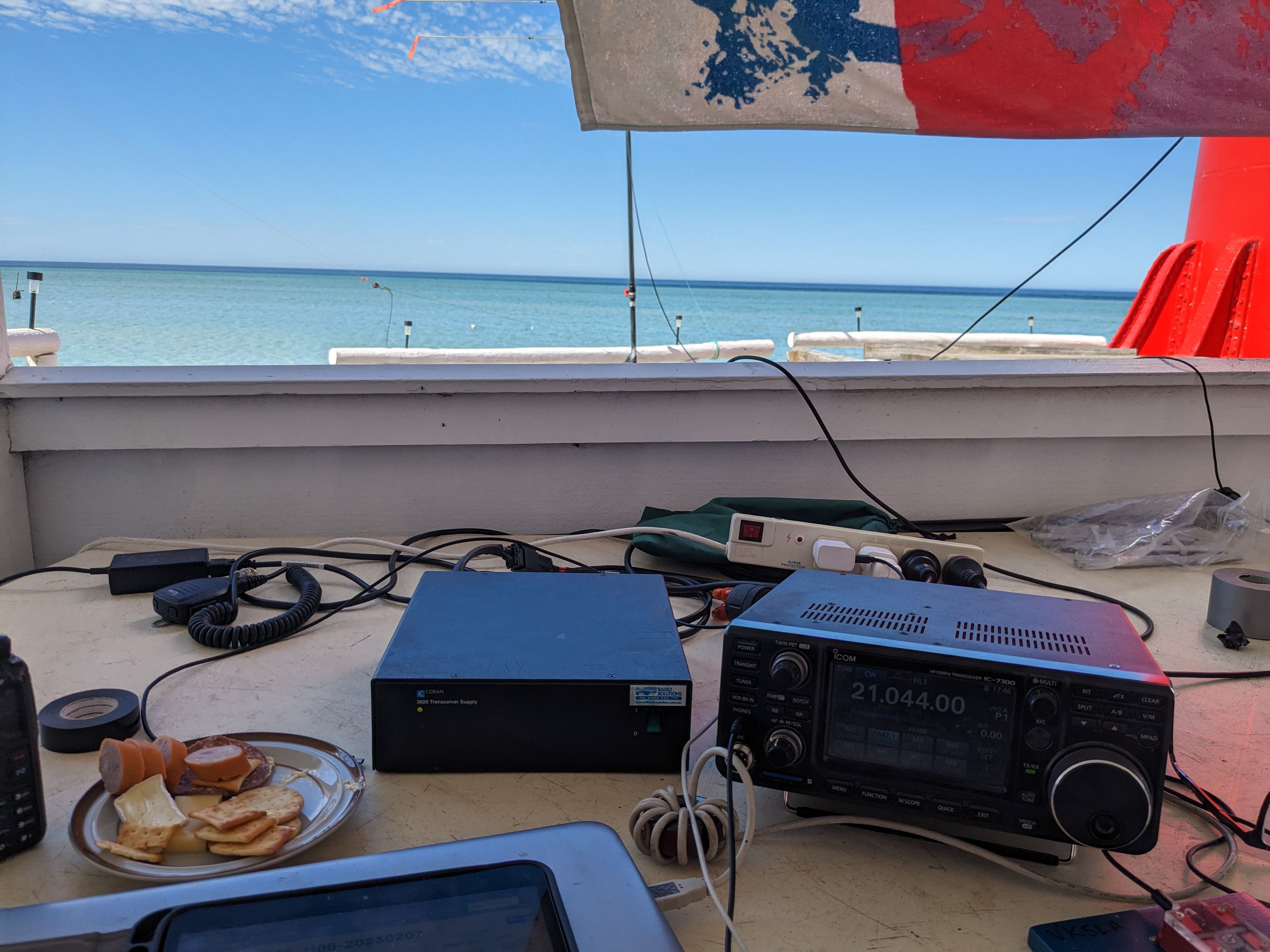
Our 40m SSB station was in the same operating spot as our 80m SSB station, in one of the rooms of the second lighthouse keeper’s cottage.
Above:- Paul VK5PAS on the mic at the 40m SSB station.
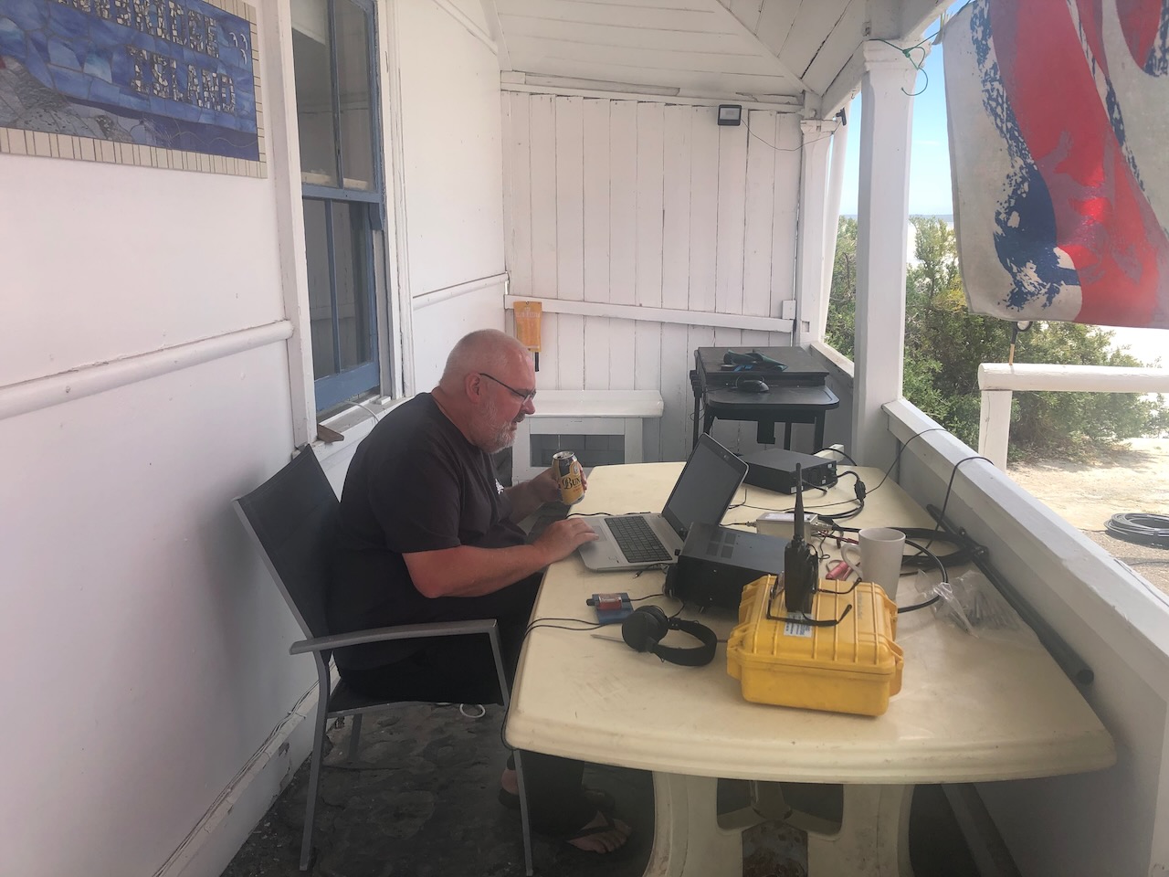
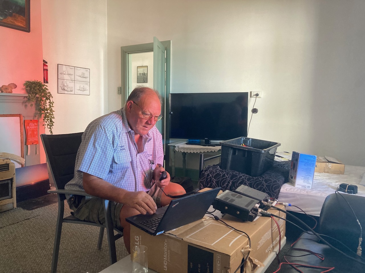
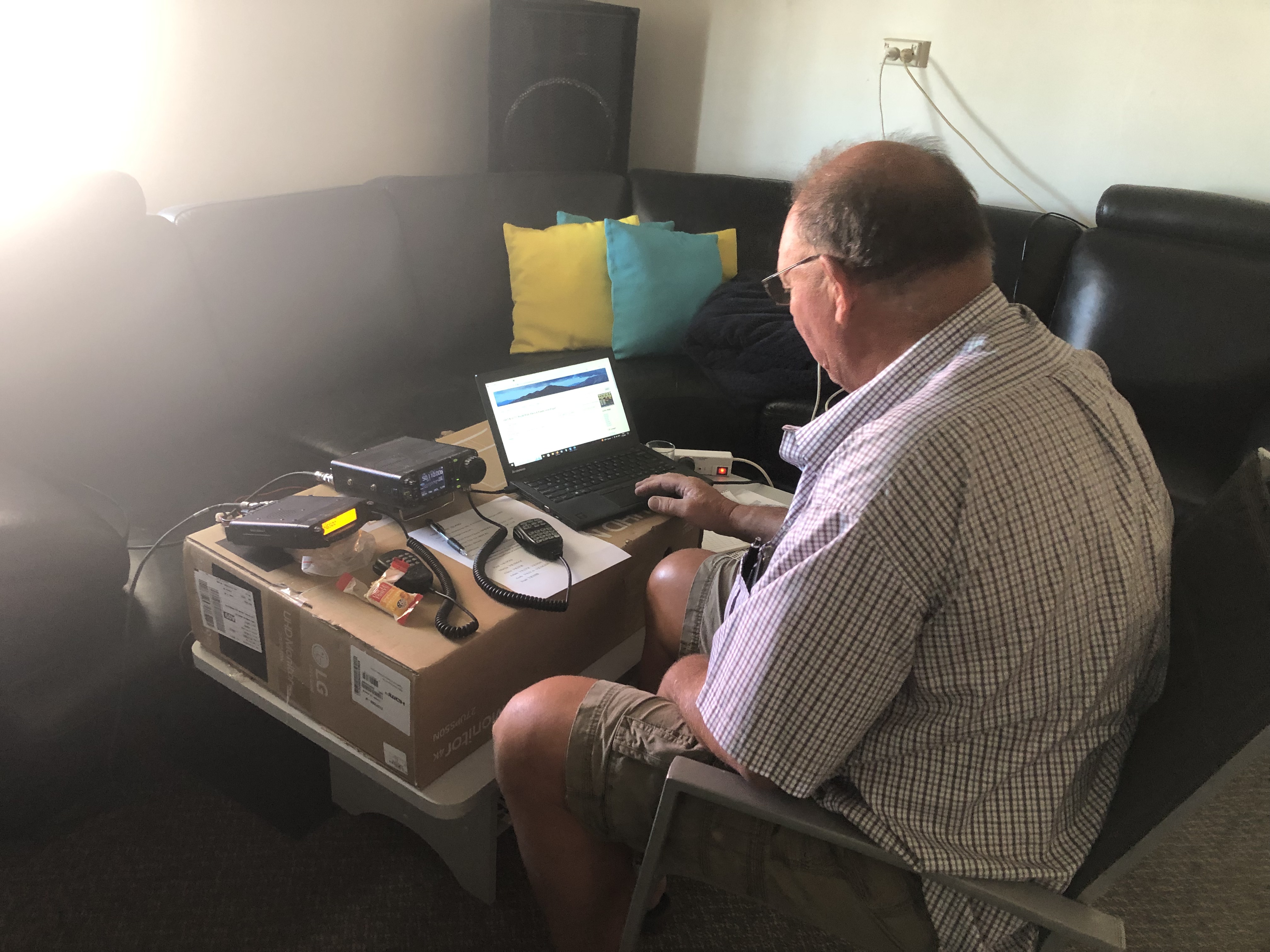
The 40m CW and FT8 station was set up under the front verandah of the cottage in which we were staying. This was the pick of the operating spots as it overlooked the ocean.
Above:- Andy VK5LA on CW making contacts and Paul VK5PAS on FT8.
30M BAND.
We made a total of 328 QSOs on the 30m band. These were all on FT8.
Our 30m station consisted of a 30m vertical kindly provided to us by Grant VK5GR. It was erected on the beach in front of the lighthouse keeper’s cottage.
The 30m station was set up in the back room of the lighthouse keeper’s cottage. It consisted of an Elecraft KX3.
Above:- Adam VK2YK (left) and Chris VK5FR (right) at the 30m FT8 station.
We worked a total of 58 DXCC entities on 20m.
Asiatic Russia
Australia
Azores
Belize
Canada
Canary Islands
China
Denmark
East Malaysia
England
European Russia
Fed Rep of Germany
Finland
France
Greece
Hawaii
Indonesia
Italy
Japan
Kazakhstan
New Caledonia
New Zealand
Philippines
Portugal
Rep of Korea
Romania
Slovenia
Spain
Sweden
Switzerland
Thailand
USA
The map below shows our contacts around the world on 30m FT8
Above:- Map showing our 30m FT contacts. Map c/o QSOMAP.org
20M BAND
We worked a total of 583 QSOs on the 20m band. A total of 301 of those were on SSB, 252 on FT8, and 30 on CW.
Above:- Graph showing the number of QSOs per mode on the 20m band. Graph c/o meta-chart.com
We worked a total of 58 DXCC entities on 20m.
Algeria (FT8)
Asiatic Russia (FT8)
Australia (SSB, FT8, CW)
Austria (SSB)
The Balearic Islands (SSB, FT8)
Belgium (SSB, FT8)
Brazil (FT8)
Bulgaria (FT8)
Canada (FT8)
Canary Islands (SSB)
China (FT8)
Croatia (FT8)
Czech Republic (SSB, FT8)
Denmark (FT8)
England (SSB, FT8)
Estonia (SSB, FT8)
European Russia (SSB, FT8, CW)
Federal Rep of Germany
Finland (SSB, FT8, CW)
France (SSB, FT8)
Greece (SSB)
Hong Kong (FT8, CW)
Hungary (FT8)
India (FT8)
Indonesia (SSB, FT8)
Ireland (SSB)
Israel (FT8)
Italy (SSB, FT8, CW)
Japan (SSB, FT8, CW)
Kazakhstan (FT8)
Lebanon (FT8)
Lithuania (SSB)
Netherlands (SSB, FT8)
New Caledonia (SSB)
New Zealand (SSB, FT8)
Northern Ireland (SSB)
Norway (FT8, CW)
Pakistan (FT8)
Philippines (SSB, FT8)
Poland (SSB, FT8, CW)
Portugal (SSB)
Republic of Korea (FT8)
Reunion Island (FT8)
Romania (SSB, FT8)
Scotland (SSB, FT8)
Serbia (SSB)
Slovak Republic (SSB, CW)
Slovenia (SSB)
South Cook Islands (SSB)
Spain (SSB, FT8)
Sweden (CW)
Switzerland (SSB, FT8)
Thailand (FT8)
Ukraine (SSB, FT8, CW)
United States of America (SSB, FT8, CW)
West Malaysia (FT8)
Willis Island (SSB)
The graph below shows our contacts per country on 20m. The big yellow spike is Australia (VK) with 140 QSOs. This is followed by Japan (blue Line) with 64 QSOs, and then the USA with 46 QSOs(the blue line to the right of the graph).
Above:- Graph showing our contacts per country on the 20m band.
The map below shows our contacts around the world on the 20m band.
Above:- Map of the world showing our 20m band contacts. Image c/o QSOLOG.org
On Wednesday 8th and Thursday 9th, there was a nice opening into Europe/United Kingdom on 20m SSB. The short video below shows Paul VK5PAS working some of the pile-up.
One of the highlights on 20m was working Dave G4AKC bicycle mobile, Steve G4NVF backpack mobile, and David M0DAD pedestrian mobile. Below is a short video of those contacts.
Another highlight on 20m was working Sands VK9WX on Willis Island on SSB for a second band. We also worked Sands on 40m SSB.
We made just three (3) contacts on the 17m band. Two on SSB with Paul VK2HV and Gerard VK2IO, and one on FT8 with Daryl VK3AWA.
15M BAND.
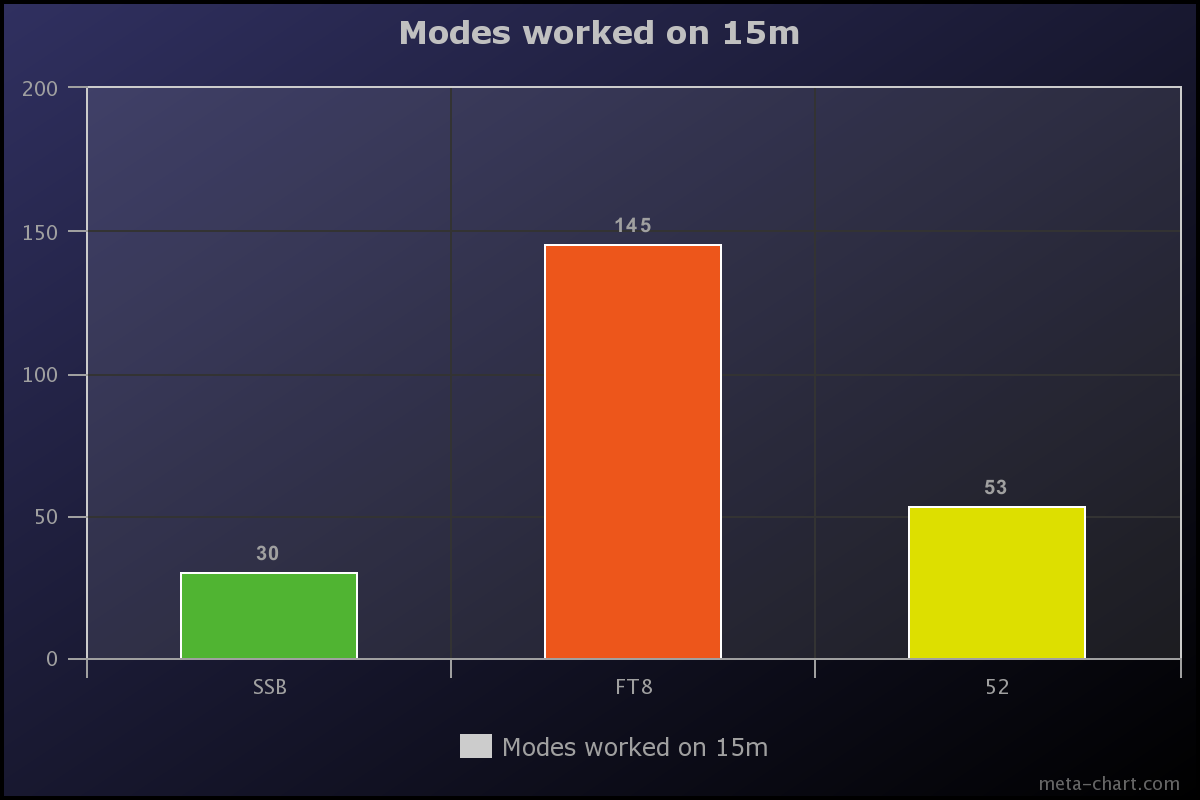
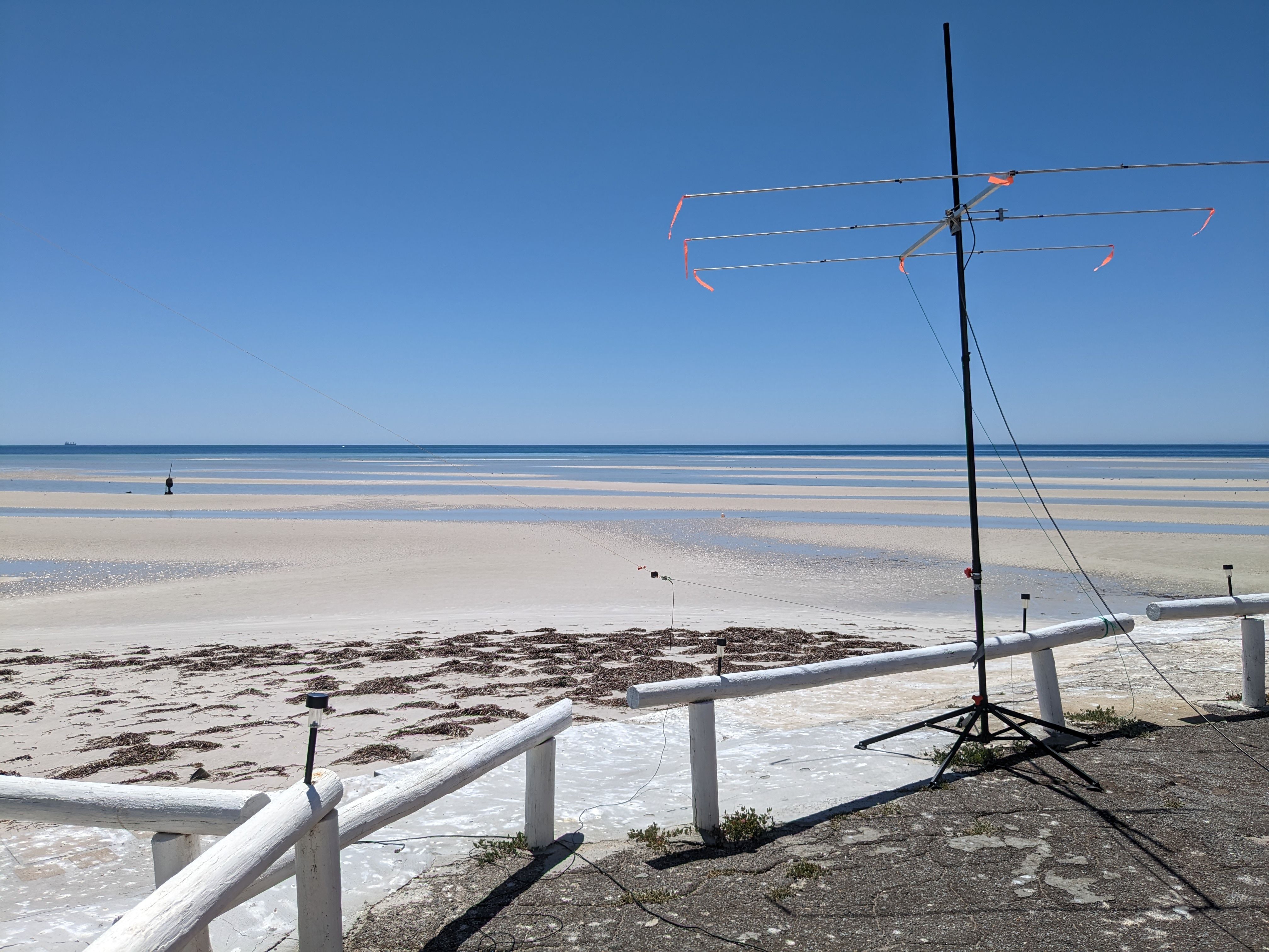
We made a total of 227 QSOs on the 15m band. Thirty (30) of those were on SSB, 145 on FT8, and 52 on CW. The majority of the 15m SSB contacts were made using the 2-element beam, while the CW and FT8 contacts were made using the end-fed antenna.
Above:- Graph showing the number of QSOs made per mode on 15m. Graph c/o meta-chart.com
We worked a total of 15 different DXCC entities on 15m.
Asiatic Russia (FT8, CW)
Australia (SSB, FT8, CW)
China (FT8)
France (CW)
Hong Kong (CW)
Indonesia (FT8, CW)
Italy (CW)
Japan (SSB, FT8, CW)
New Caledonia (SSB)
New Zealand (SSB)
Philippines (FT8, CW)
Republic of Korea (FT8)
Thailand (FT8)
Ukraine (CW)
United States of America (FT8, CW)
The graph below shows our contacts per country on 15m.
Above:- Graph showing our contacts per country on the 15m band.
The map below shows our contacts around the world on the 15m band.
Above:- Map of the world showing our 15m band contacts. Image c/o QSOLOG.org
We were a little surprised that we did not work more Japanese stations on 15m SSB. We certainly worked numerous JA on 15m on FT8 (88).
10M BAND.
We made a total of 179 QSOs on the 10m band. The vast majority of those were made on FT8 (180). We made just 3 contacts on SSB, 2 on CW, and 1 on FM.
Above:- Graph showing the number of QSOs made per mode on 10m. Graph c/o meta-chart.com
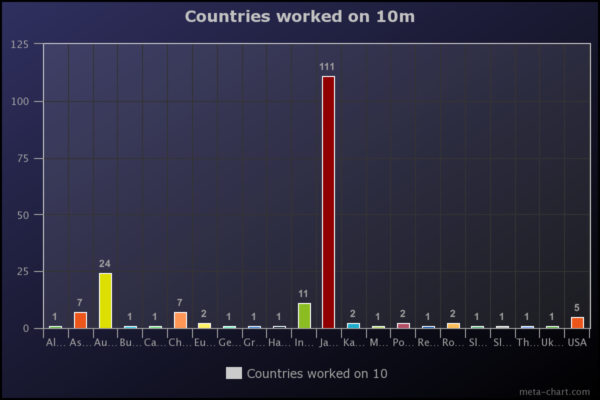
We worked a total of 22 different DXCC entities on 10m.
Alaska (FT8)
Asiatic Russia (FT8)
Australia (SSB, FT8, CW)
Bulgaria (FT8)
Canada (FT8)
China (FT8)
European Russia (FT8)
Federal Republic of Germany (FT8)
Greece (FT8)
Hawaii (FT8)
Indonesia (FT8)
Japan (FT8, CW)
Kazakhstan (FT8)
Mexico (FT8)
Poland (FT8)
Republic of Korea (FT8)
Romania (FT8)
Slovak Republic (FT8)
Slovenia (FT8)
Thailand (FT8)
Ukraine (FT8)
United States of America (FT8)
The graph below shows our contacts per country on 10m.
Above:- Graph showing our contacts per country on the 10m band.
The map below shows our contacts around the world on the 10m band.
Above:- Map of the world showing our contacts on the 10m band. Map c/o QSOMAPS.org
We were a little surprised that we did not make more contacts on 10m SSB. However, this may have been due to us being busy on other modes and other modes, and not dedicating enough time to 10m SSB.
6M BAND.
We made a total of 4 QSOs on the 6m band.
Above:- Map showing our 6m contacts back into Adelaide. Map c/o Log Analyzer.
The 6m station was set up in the loungeroom of the lighthouse keeper’s cottage where we were sleeping. It was coupled with the 2m/70cm station.
Above:- Ivan VK5HS on the 6m band.
The 6m antenna used was a home-brew 3-element yagi put together by Ivan Vk5HS.
The video below shows Adam on 6m in contact with Barry VK5KBJ.
2M and 70CM BANDS.
We made a total of 58 QSOs on 2m SSB and FM. Our 2m and 70cm station was set up in the lounge room of the lighthouse keeper’s cottage where we were sleeping.
The map below shows our 2m contacts. The green dots are the SSB contacts. The purple dots are the FM contacts.
We were very happy to work John VK5BJE on 2m SSB and 2m FM on Wednesday. John was activating the Scott Creek Conservation Park VKFF-0788. Some nice Park to Park contacts on 2m with John.
Above:- John VK5BJE in the Scott Creek CP. Image c/o John VK5BJE.
We also worked John VK5HAA on Thursday on 2m FM. John was activating the Cleland National Park VKFF-3185 & SOTA Mount Lofty VK5/ SE-005.
SATELLITES.
Adam VK2YK made 3 contacts on the satellites using his handheld and the Arrow antenna. Those worked were Dallin VK2USA, Damien VK2XDL, both in New South Wales, and Mark VK5QI.
Contacts were made via SO-50 and one ISS crossband repeater QSO.
MEALS AND DRINKS.
We did not starve on the island. Meals were all part of the planning before the trip. We had three meetings together on Skype to discuss logistics.
Marija prepared some beautiful chilli con carne and a pasta meal and brought those over to the island with us. On the remaining night we had a BBQ.
A significant amount of red wine and other beverages were consumed.
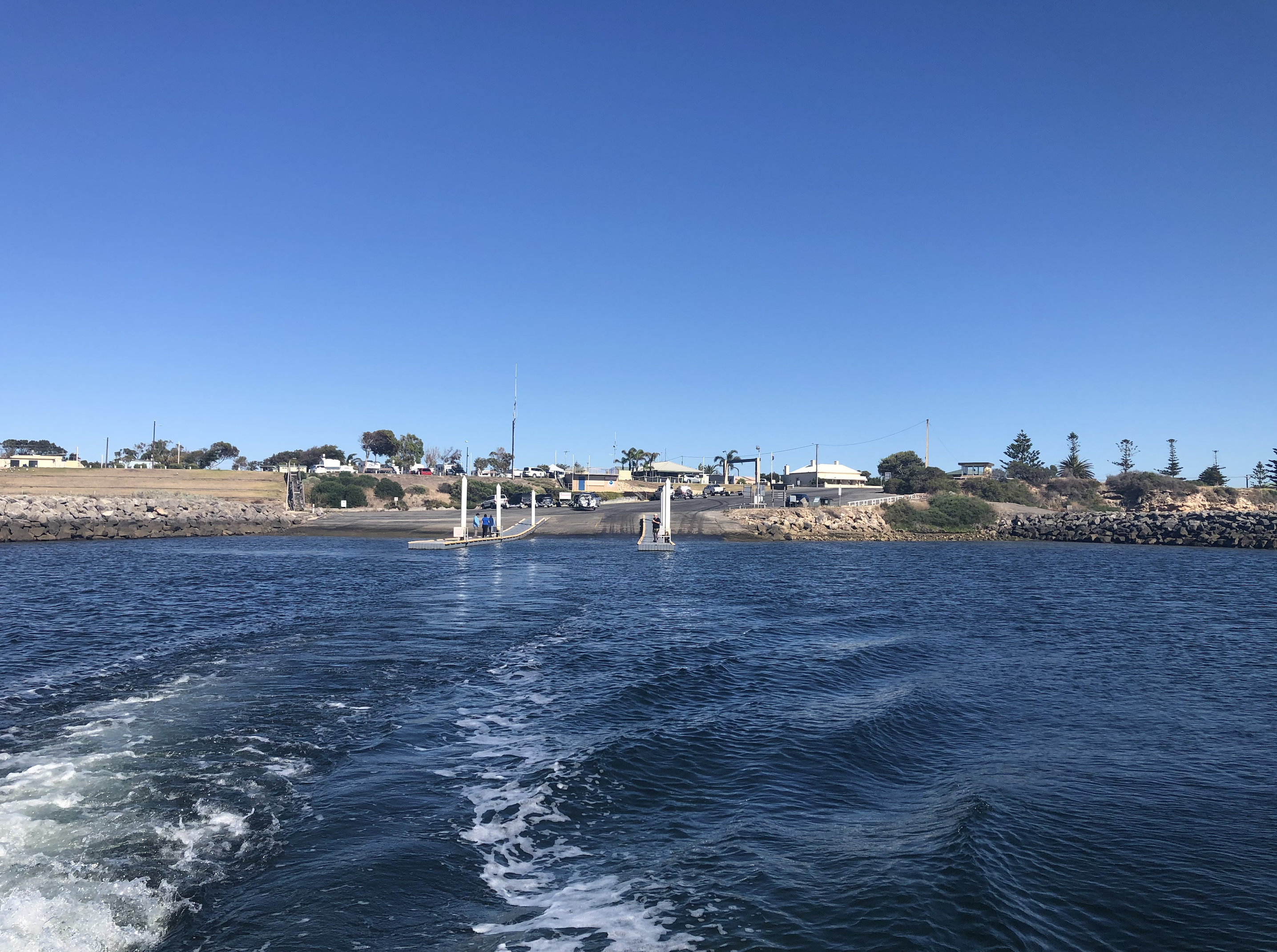
HEADING HOME.
It was now Friday 10th February and it was time for us to leave beautiful Troubridge Island. We were able to make a handful of contacts using a battery on Friday morning on the 40m and 15m bands, before packing up all of our gear and awaiting the arrival of the boat.
We enjoyed three fantastic nights on Troubridge Island and we will be back!
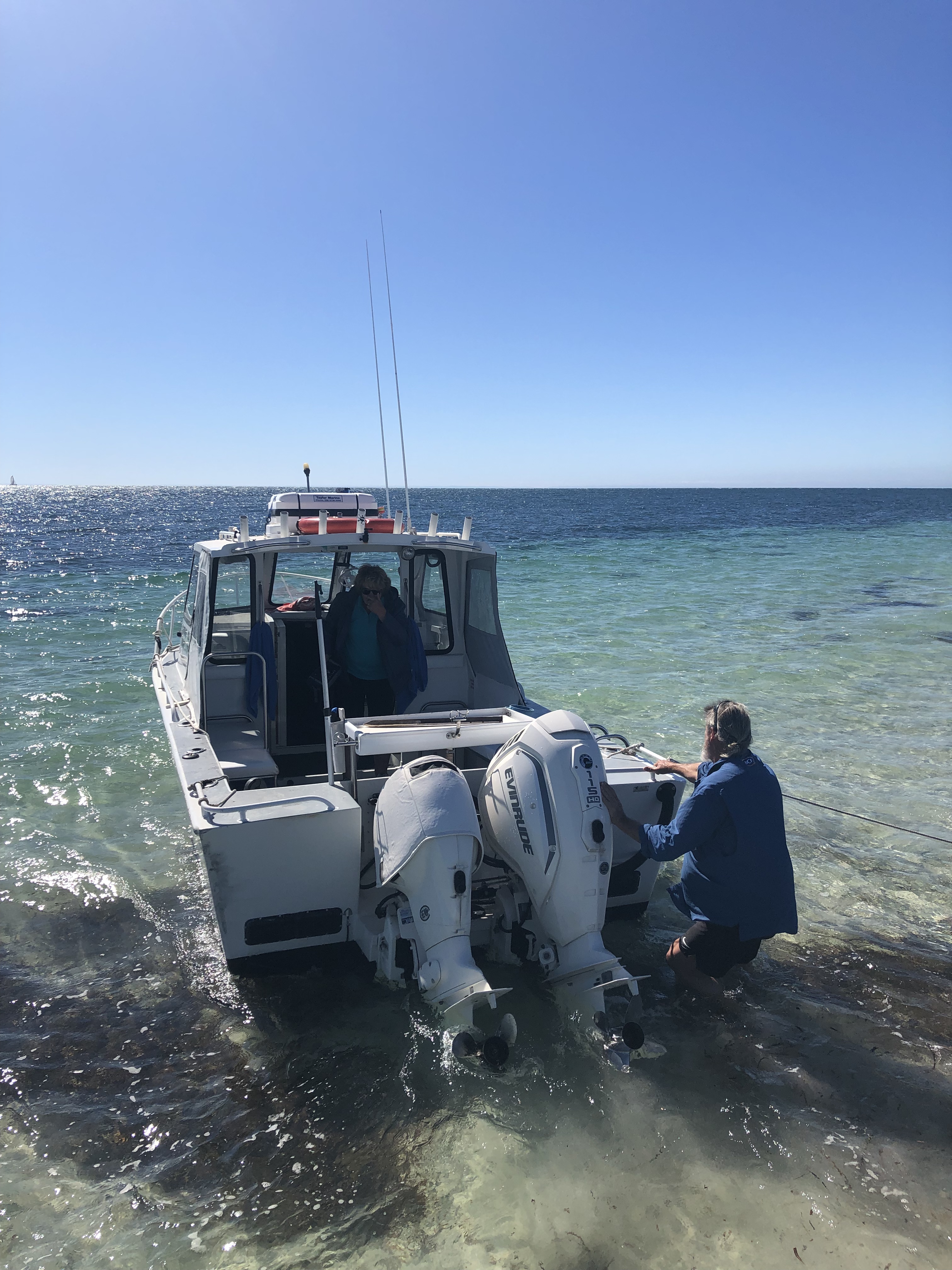
Mark and Lois arrived with the boat at about 1.00 p.m. and we loaded all of our gear onto the trailer. Ivan and I made the first trip out to the boat and loaded our luggage and radio gear onto the boat.
Mark then returned to the island and collected Marija, Chris, Andy, and Adam. Below is a short video showing of them arriving at the boat.
We headed back to Edithburgh enjoying another beautiful sunny day.
Once back at Edithburgh, we drove back to Wool Bay and loaded our vehicles. We all then drove down to Port Vincent where we had something to eat at the Port Vincent Cafe, which we highly recommend. We then all made our own way back home.
Thanks also to Grant VK5GR who loaned us the 30m vertical and bandpass filters.
LESSONS LEARNED.
As this was our first trip, we learnt a lot. This includes improving our logging system, better antennas, and various other issues We plan to have a debrief in the coming weeks.
QSL CARD.
Remember that we QSL via our QSL Manager Charles M0OXO (Direct and Bureau), and Logbook Of the World (LOTW) and eQSL.
Our hard copy QSL card is a full-colour 4-page foldable card.
MORE INFORMATION.
More information can be found on our website at…….
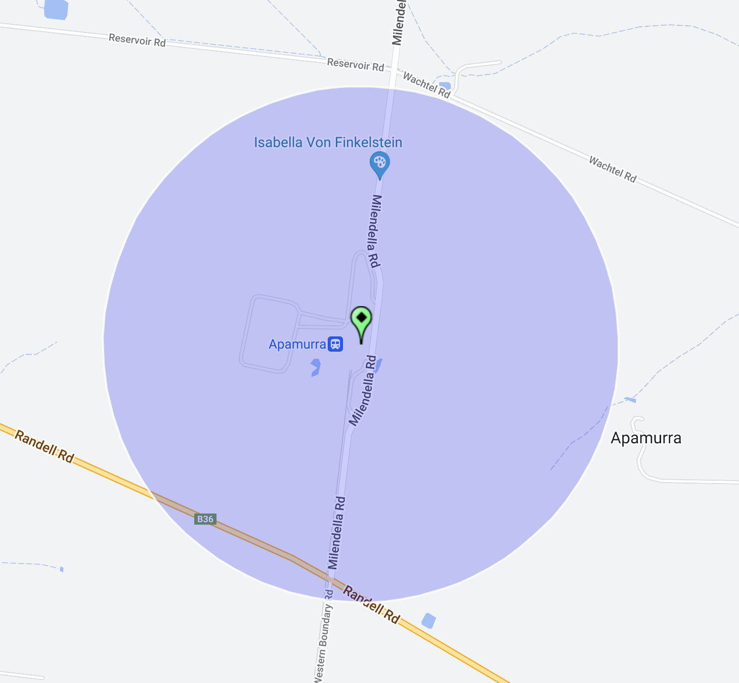
My final activation for my Riverland trip was the Apamurra silo VK-APA5.
Apamurra is located about 77 km east of Adelaide, and about 38 km north of Murray Bridge.
Above:- Map showing the location of Apamurra. Map c/o Google maps.
Apamurra is a railway siding on the former Monarto-Sedan railway. Apamurra is an aboriginal word meaning ‘fresh water’. The township of Apamurra was laid out in 1921 on part sections 30-31, Hundred of Finniss, by Johann Gottfried Hartmann. It comprised 19 allotments contiguous to the railway station. On the 17th day of February 1922, the Apamurra Post Office opened. It closed on the 31st day of July 1971.
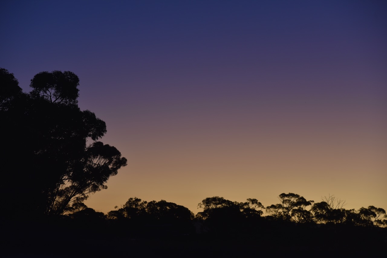
I operated from the 4WD on the side of the road opposite the silos.
Above:- The activation zone at the Apamurra silo. Image c/o SiOTA website.
As I operated I enjoyed a beautiful sunset.
I made the following contacts on 40m SSB:-
VK3PF
VK4SMA
VK1AO
VK2MET
VK2IO
VK3OHM
VK5MAZ
VK3WMF
VK5FANA
VK4GNG
VK2BED
VK3PWG
VK1CHW
VK5FB
VK3APJ
VK3MCA
I made the following contacts on 80m SSB:-
VK5MRE
VK3TCT
It was the end of a great couple of days in the Riverland and the Murray Mallee.
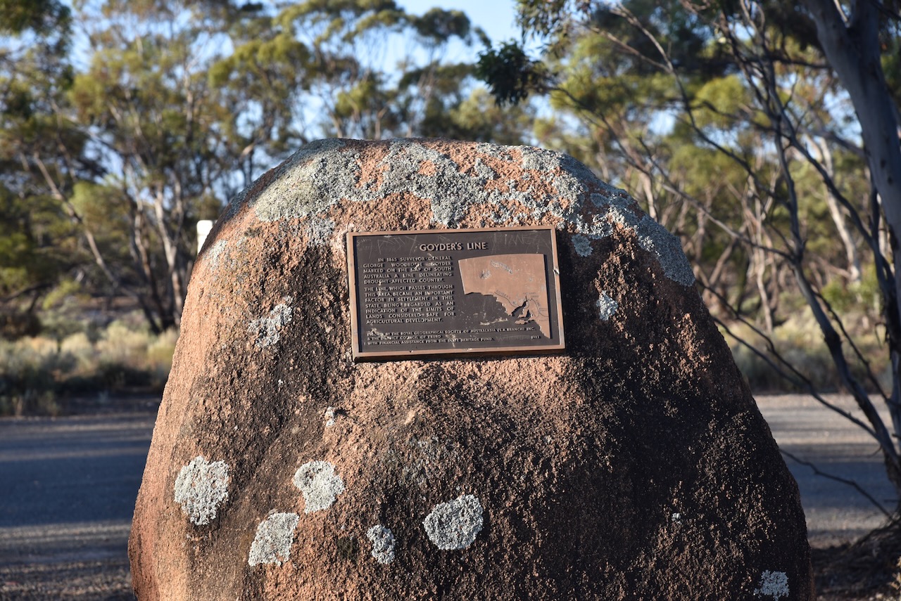
After leaving the Brookfield Conservation Park, I continued west on the Sturt Highway and then turned to travel south on Halfway House Road. Prior to that, I stopped briefly to have a look at the Goyders Line monument on the Sturt Highway. I have spoken about Goyders Line previously in other posts. But in summary, it is a boundary line across South Australia corresponding to a rainfall boundary believed to indicate the edge of the area suitable for agriculture.
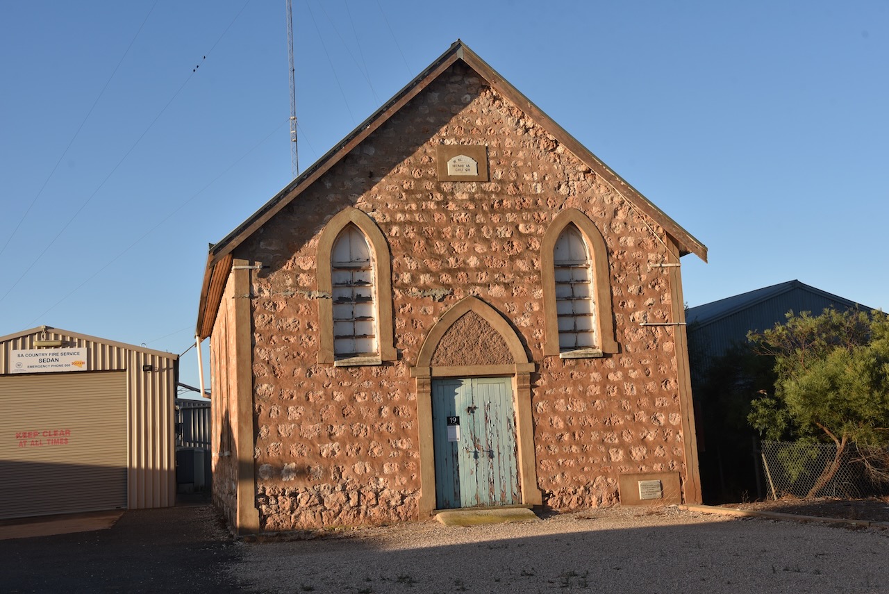
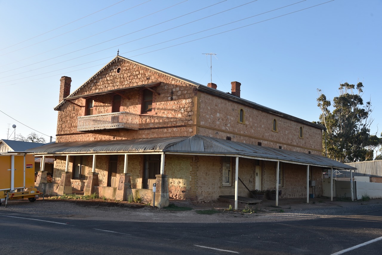
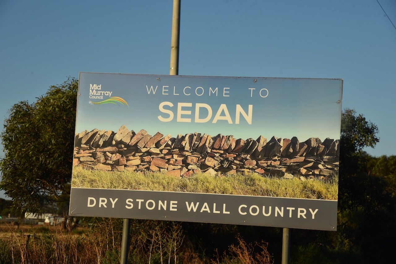
After travelling about 25 km along Halfway House Road, I reached the small town of Sedan. It is known as ‘Dry stone wall country’ due to the numerous dry-stone walls built by early settlers that can be found in the area.
The first known European settlement in the area was from 1845 when ‘Rhine Run’ was taken up by George Melrose (b. 1806. d. 1894), following his arrival in South Australia in 1839.
In 1872 the Sedan Post Office was opened. In 1873, portion of section 52 Hundred of Bagot, was granted to J.W. Pfieffer (b. 1825. d. 1910). He had arrived in South Australia aboard the Zebra in 1838. He subdivided the land in 1875 as the township of Sedan. It was extended in 1883, with the creation of Sedan East on part section 46, surveyed by C. Von Bertouch.
The Sedan School was opened in 1912 and was closed in 1980.
The town takes its name from the battle of Sedan in Europe and its affiliation with the German population in South Australia.
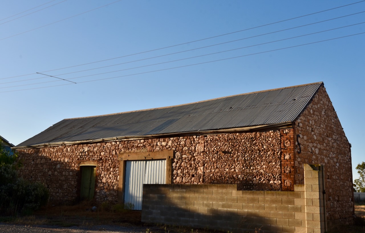
The town has a number of historic buildings.
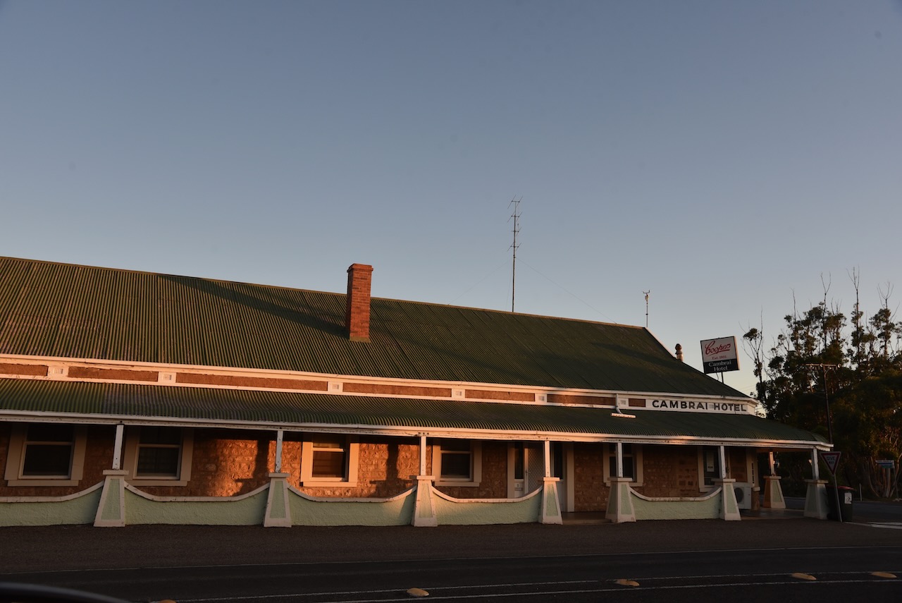
Just 10km down the road I reached the little town of Cambrai. It was originally laid out in 1882 by Abel Pollard Skinner as Rhine Villa. It was one of the numerous Australian towns which were re-named by the Nomenclature Committee during the First World War to remove any connection with German names. It was renamed Cambrai after the Battle of Cambrai. The original proposal was Pongaree Villa, but the government opted for Cambrai. Pongaree is an aboriginal word meaning ‘shade reflection in the water’.
The Rhine Villa school was opened in 1888, with the school being closed in 1916, along with all German schools. It reopened in 1935 and permanently closed in 1955.
Cambrai was located on the Sedan railway line and served as the terminus of the line from 1964 until the 1980s.
Sadly the old Cambrai hotel is closed. Marija and I enjoyed a very nice meal there a number of years ago on our way back from the Riverland. Like many towns, with the death of the railway….so to brought the death of the town.
Above:- the Rhine Villa Hotel, c. 1905. Image c/o State Library SA.
The Cambrai silos can be located on Silo Road which runs of Black Hill Road on the eastern side of the town.
I operated from the 4WD in the parking area adjacent to the silos. I ran the Icom IC-7000, 100 watts, and the Codan 930 self-tuning antenna mounted on the rear of the 4WD>
Above:- the activation zone at Cambrai for the silos. Image c/o SiOTA website.
I made the following QSOs on 40m SSB:-
VK3ACU
Vk5MAZ
VK2IO
VK3OHM
VK3PF
VK5FANA
VK1CHW
VK1AO
VK2MET
VK2NA
VK4SMA
VK3ACZ
VK1ARQ
VK3PWG
It was starting to get dark and I was hoping to active one more silo at Apamura, and I still had some way to go before reaching home. So with 14 QSOs in the log I hit the road and headed to Apamura.
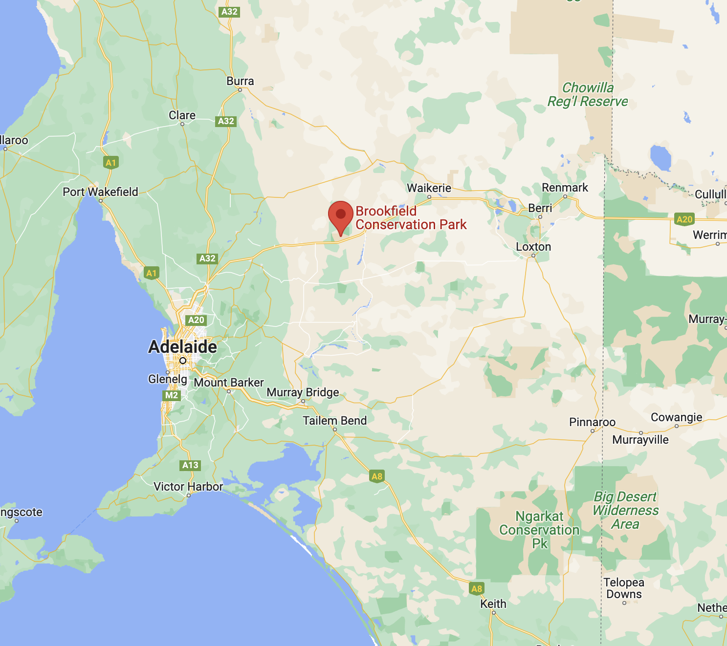
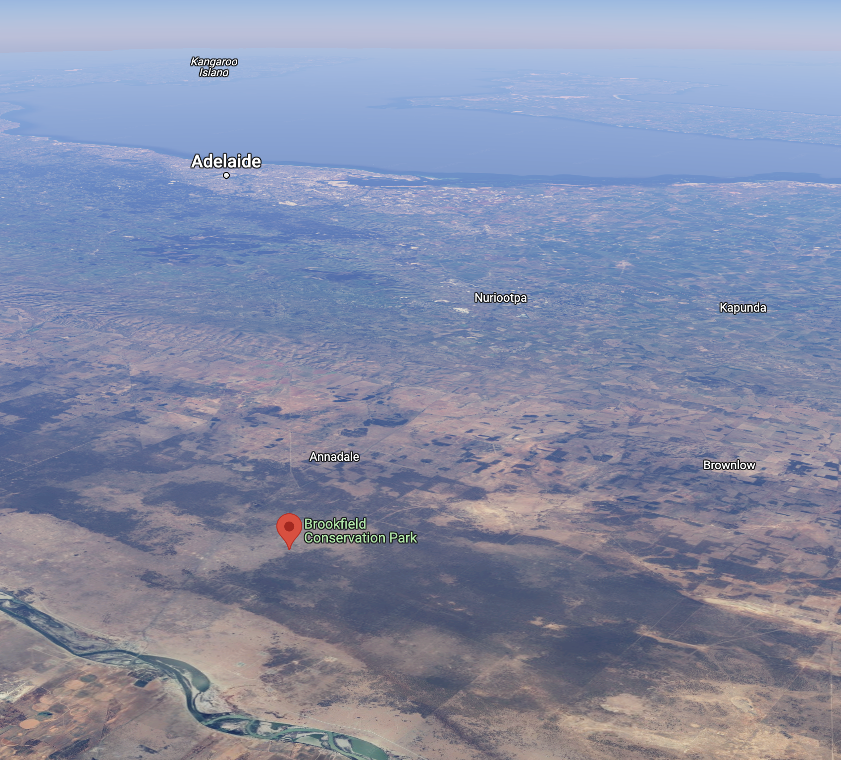
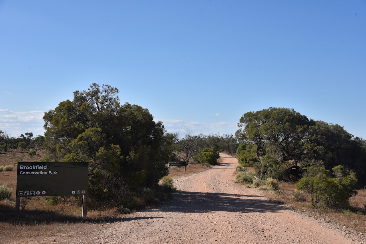
After leaving Blanchetown I continued west on the Sturt Highway and soon reached the Brookfield Conservation Park VKFF-0922.
The park is located about 130 km northeast of the city of Adelaide, and about 14km west of Blanchetown.
Above:- Map showing the location of the Brookfield CP. Map c/o Google maps.
Prior to European settlement of the area around Brookfield, the Ngaiawang aboriginal people occupied the area. The Ngaiawang nation consisted of about 388,000 hectares on the Western Murray Plains.
By 1836 the area was settled by Europeans who held pastoral leases with large holdings of sheep. In later years the area was known as Glen Leslie Station with about 1,800 to 2,00 sheep being grazed during good years. Timber was also cut on the station which was used for wood and for charcoal. Today, the charcoal pits and shearing sheds still remain in the park.
During the early 1970s, moves to purchase a reserve for the conservation of the Southern Hairy-nosed Wombat were initiated by the Director of the Brookfield Zoo in Chicago, Dr William Peter Crowcrof (b. 1922. d. 1996). Crowcroft was the former Director of the South Australian Museum.
Above:- Professor Peter Crowcroft. Image c/o Toronto Public Library.
In 1971, the Chicago Zoological Society purchased Glen Leslie Station, an area of 5,527 hectares. At this time it was named the Brookfield Zoo Wombat Reserve. The Reserve was administered by a committee of management funded by the Chicago Zoological Society, with the former landholder, Mr. Raymond Clifton Dorward, employed as full-time resident warden. One of the aims was:
“to achieve a wombat population of optimum size and structure consistent with the maintenance of an intact habitat.”
Due to rising costs, in 1977 the Chicago Zoological Society gifted Brookfield Zoo Reserve to the Southern Australian State Government. One of the conditions was that ‘the reserve would be proclaimed a Conservation Park‘. In August 1977 the then Department for the Environment assumed financial and managerial responsibility for the reserve. The Brookfield Conservation Park was proclaimed on the 6th day of July 1978.
The video below explains the history of the park.
There is a Restricted Access Zone over the majority of the park with prohibited entry to all except for the relevant authorities. Please ensure that you do not encroach into this area.
Above:- Map of the park showing the Scientific Research areas. Map c/o NPWS SA.
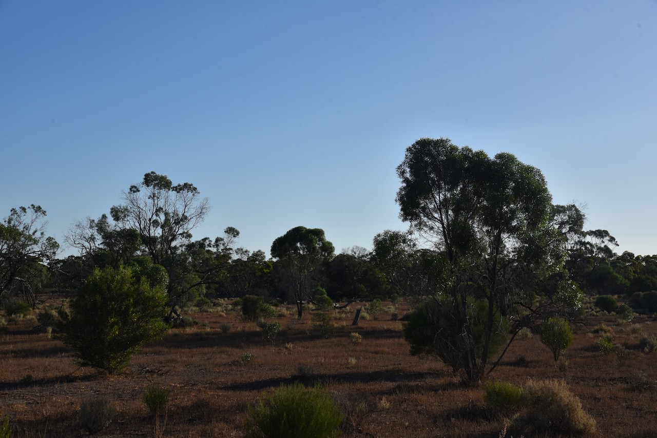
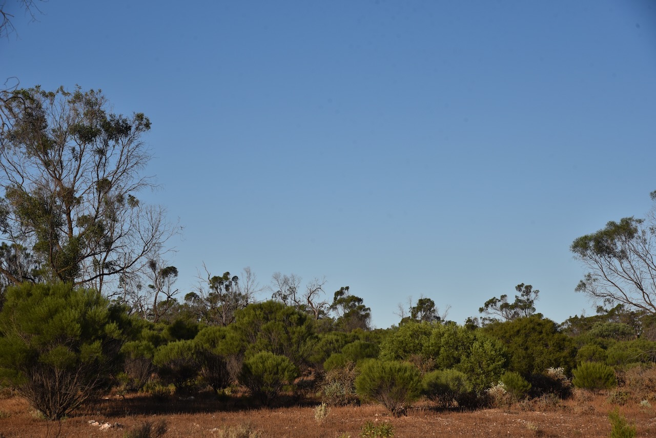
The vegetation in the park comprises on the ridge in the northern section of the park, and extending north into the adjacent area, ridge-fruited mallee, red mallee, and narrow-leaved mallee over porcupine grass and sparse bitter saltbush. The northwestern corner of the park is dominated by yorrell open mallee over sparse bitter saltbush and pearl bluebush. In the southeastern section of the park the understorey consists of a large expanse of regenerating pearl bluebush. The central areas of the park are covered by low woodland and tall shrubland typically dominated by sheep bush and sugarwood. Dryland tea-tree can be found around the claypans in the park. The understorey is characterised by Australian boxthorn, bullock bush, caustic weed, and heron’s bill.
Other than the Southern hairy-nosed Wombat, other native mammals found in the park include the fat-tailed dunnart, common dunnart, red & western grey kangaroos and emus.
Birds SA have recorded about 147 species of bird in the park including the vulnerable malleefowl and the rare stone curlew. Other bird species include Purple-backed Fairywren, Splendid Fairywren, Australian Magpie, Crested Pigeon, Chestnut-rumped Thornbill, Brown Treecreeper, Southern Whiteface, and Weebill.
I drove into the park via the entrance off the Sturt Highway and I set up opposite the information board. I ran the Yaesu FT-857, 40 watts, and the 20/40/80m linked dipole for this activation. For 15m and 10m, I used the Codan 9350 self-tuning antenna mounted on the rear of the 4WD.
I made the following contacts on 20m SSB:-
Vk3PF
ZL2WG
VK2IO
ZL3MR
VK1AO
VK2MET
VK4EMP
VK4TI
OH6GAZ
OH5EP
OE9WPV
VK4TJ
OH1MM
IW2BNA
VK4SMA
IW2NXI
F4ICM
OH1XT
ZL1TM
I made the following contacts on 15m SSB:-
VK1CHW
VK2IO
VK3PF
ZL1TM
VK4TJ
VK4SMA
VK4EMP
VK4TI
IW2NXI
VK4IDK
YL2BJ
VK1AO
VK2MET
VK2GMC
VK4KC
VK4MAD VK4DOG
I made the following contacts on 10m SSB:-
VK1AO
VK2MET
VK4OTZ
VK2IO
VK4HAT
VK4TJ
VK2MTZ
VK2JJM
I made the following contacts on 40m SSB:-
VK4HAT
Vk3CWF
VK5MAZ VK3PF
VK4SMA
VK2MOE
VK3MCA
VK5PHR
VK5FANA
VK4KTW
VK3PWG
VK3APJ
VK3DET
VK5WU
VK5TS
VK3AMO
VK2XB/m
VK4EMP
VK4TI
VK7EE
VK3PAX
VK3PAB
VK5MOS
VK3ACZ
VK2MTZ
VK5GY
With 70 QSOs in the log, it was time to move on to the Cambrai silo for a SiOTA activation.
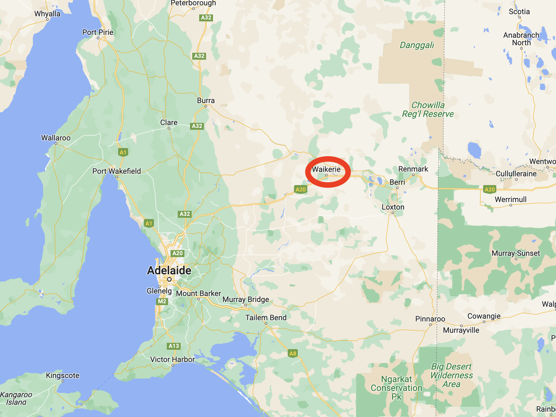
After leaving Bakara I drove north to Waikerie. Due to the recent Murray River floods, the ferry at Swan Reach was closed. This meant that I had to drive 44 km north to Waikerie and then over the bridge at Blancheown. It was fortuitist though, as I was able to activate the silo at Waikeries for the Silos On The Air (SiOTA) program.
I drove north on New Well Centre Road and then turned right on the Stuart Highway back towards Waikerie. I knew that I was back in the Riverland region of South Australia due to all of the orange orchards.
Waikerie is a rural town in the Riverland region of South Australia about 173 km northeast of the city of Adelaide. It sits on the south bank of the mighty Murray River. Waikerie is known for its citrus growing, stone fruit, and grapes.
The Ngawait aboriginal people inhabited the area prior to European settlement. They called the giant swift moth, “wei kari” meaning “many wings’. It is from this that the town of Waikerie derives its name.
The first European to visit the Waikerie area was the famous explorer Captain Charles Sturt. In late 1929 he rowed a whale boat down the Murrumbidgee River in an attempt to answer the question as to why rivers flowed westward from the Great Dividing Range. On the 14th day of January 1830, he reached the junction with the Murray River. He continued rowing down the Murray River, passing the site of current-day Waikerie. Sturt comments on the ‘grandeur of the cliffs’ in the Waikerie area. Sturt reached Lake Alexandrina on the 9th day of February 1830.
Above:- Captain Charles Sturt. Image c/o Wikipedia.
By 1880 the Shepherd brothers had settled the land around Waikerie. In 1882 W.T. Shepard established the Waikerie station.
Waikerie commenced as a village settlement in 1894 and was part of a government scheme to open up land along the upper Murray River. Steamers along the Murray brought 281 settlers to the area. The steamers brought the settlers rations of tea, sugar, flour and milk. Waikerie was one of nine such farming communities. Each settler was allotted land, tools, and a horse, including funds for food. The scheme eventually failed and in 1910 land was allotted to the first group of private settlers. They grew oranges, peaches, sultanas and other fruits on irrigated blocks.
Above: the Main Street of Waikerie, 1910. Image c/o State Library SA.
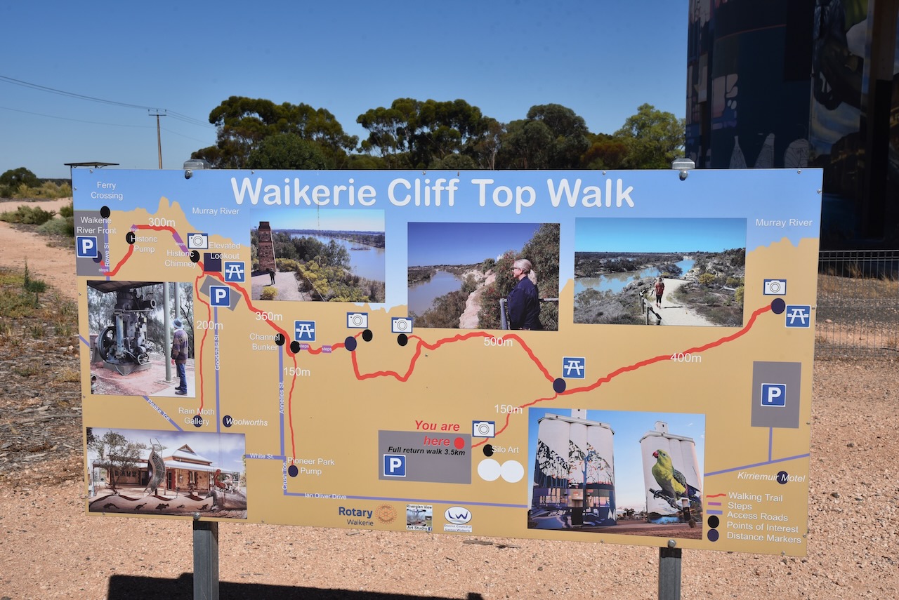
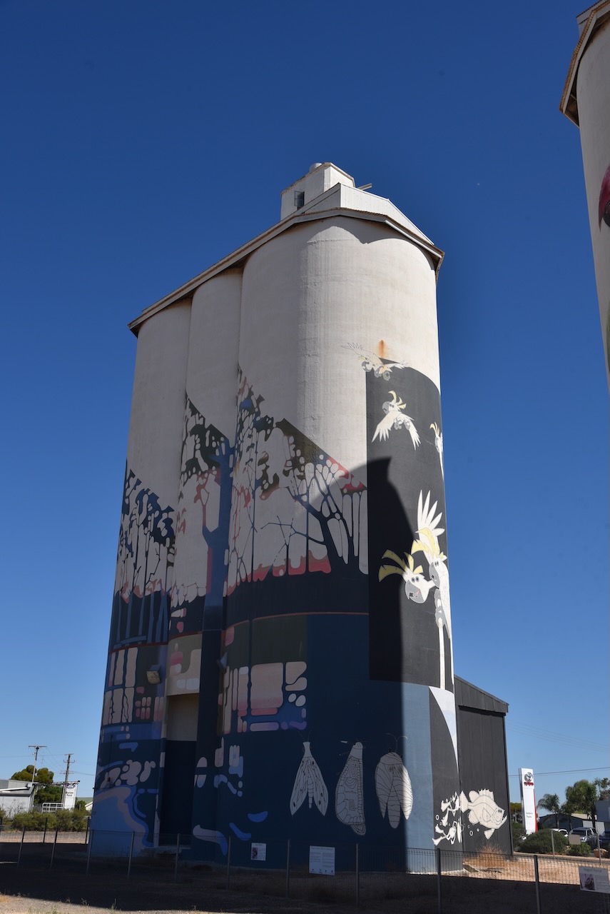
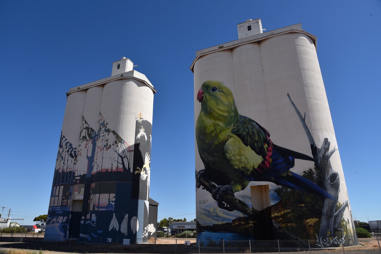
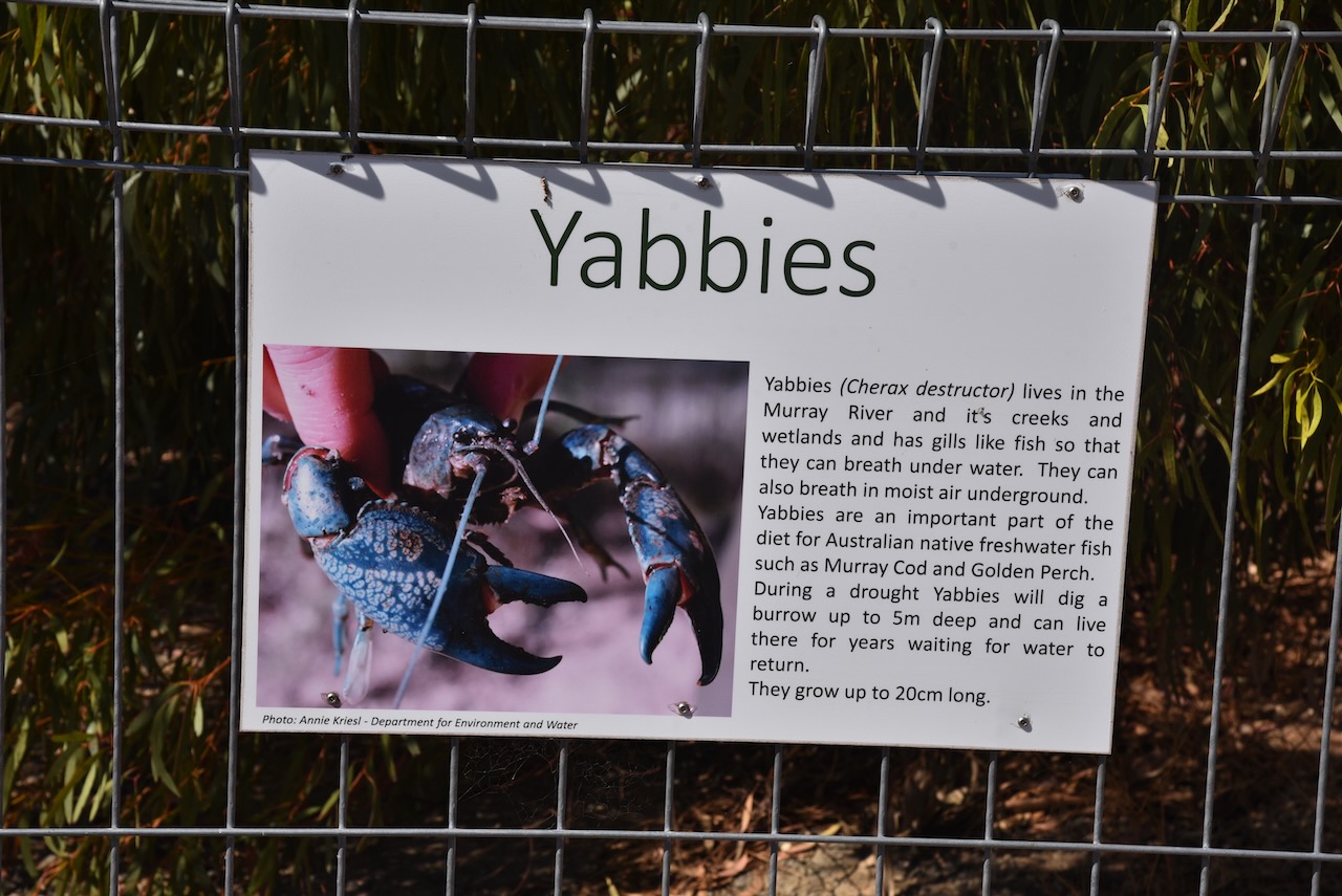
The Waikerie silos are part of the Australian Silo Art Trail and are non-working Viterra silos. They were the fifth silos in South Australia to have silo art/murals painted on them. They were completed in March 2019. South Australian artist Garry Duncan painted one silo with a semi-abstract river landscape. It includes pelicans, ducks, frogs and rain moths. The second silo was painted by Jimmy Dvate from Melbourne. It features a Regent parrot, a yabby and the endangered Murray hardyhead fish.
Exterior enamel paints were used by both artists and the work took 16 weeks to complete, with about 500 litres of paint used.
I set up in the car park right alongside of the silo and made a few contacts, but the noise floor was so high that I decided to move. I found a car park south-east of the silo overlooking the Murray River.
Above:- the activation zone for the Waikerie silo. Image c/o SiOTA website.
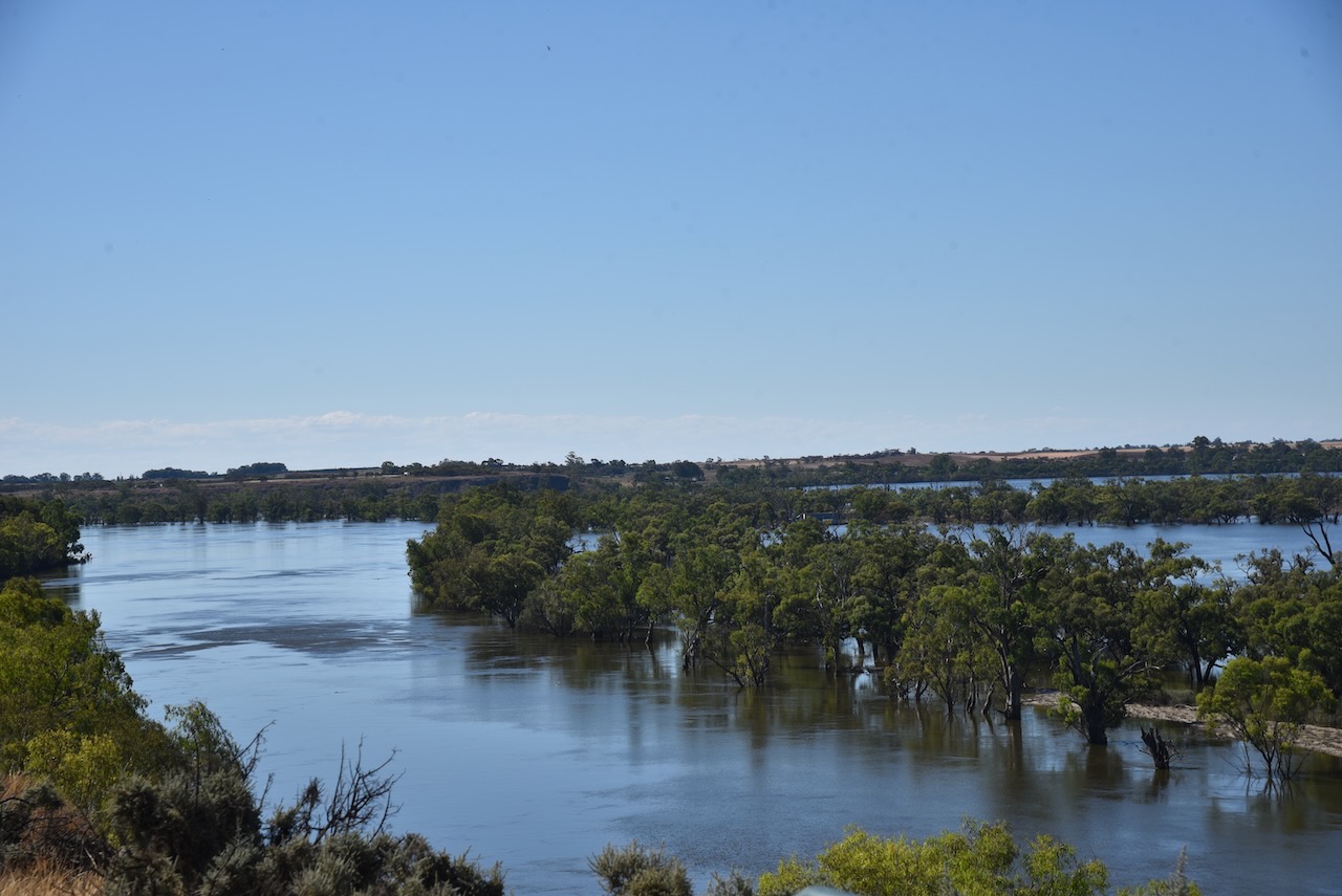
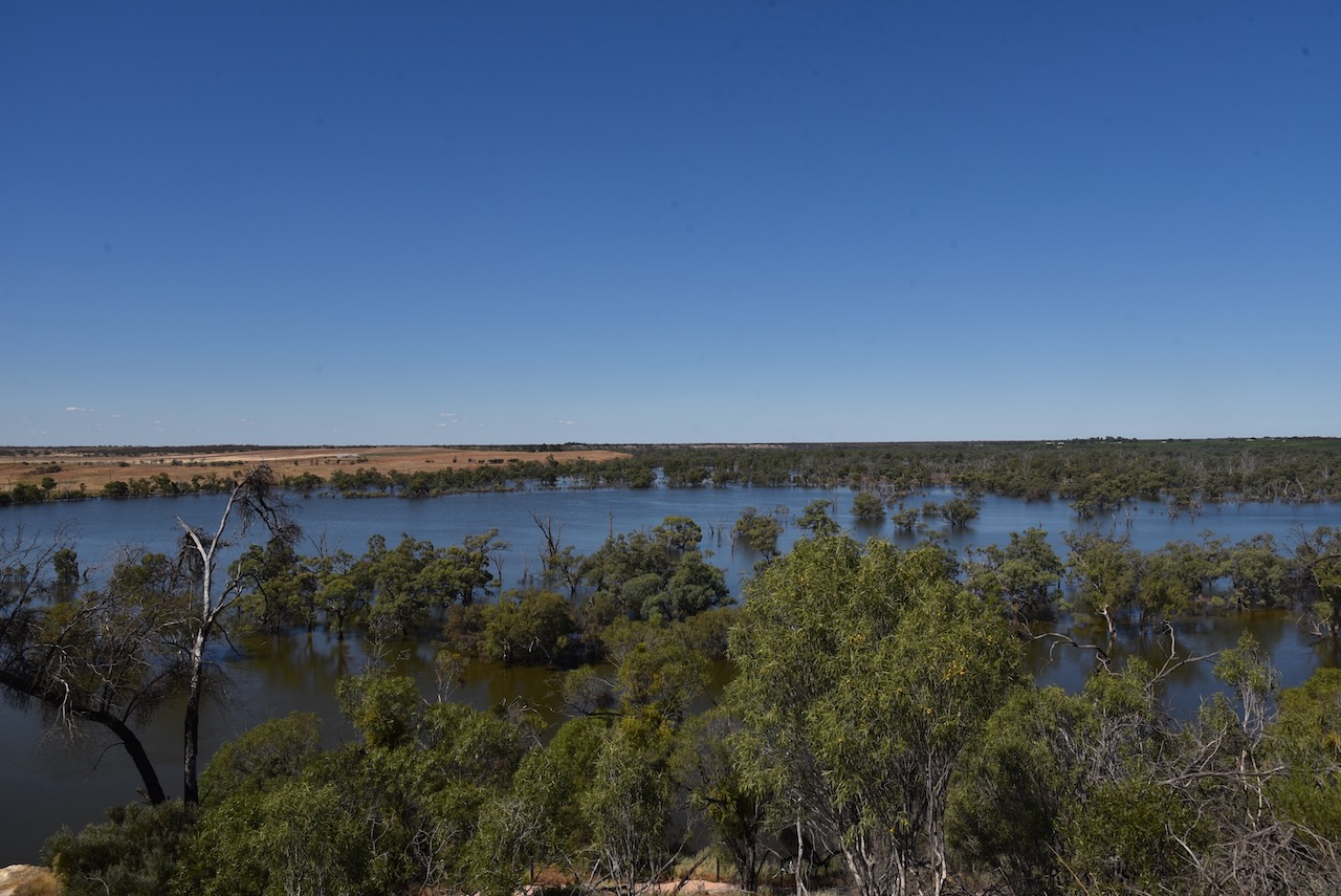
There were a number of interpretive signs at this location and some brilliant views of the Murray River.
I made the following contacts on 40m SSB:-
VK5MAZ
VK5GY
VK3OHM
VK5FB
VK5FANA
VK3PWG
VK5WY/m
I made the following contacts on 20m SSB:-
VK1AO
VK2MET
VK2IO
I made the following contacts on 15m SSB:-
VK6AV/2
VK1AO
VK2MET
VK4EW
VK7IAN
VK4FSC
VK2ADI
VK2MI
VK3PF
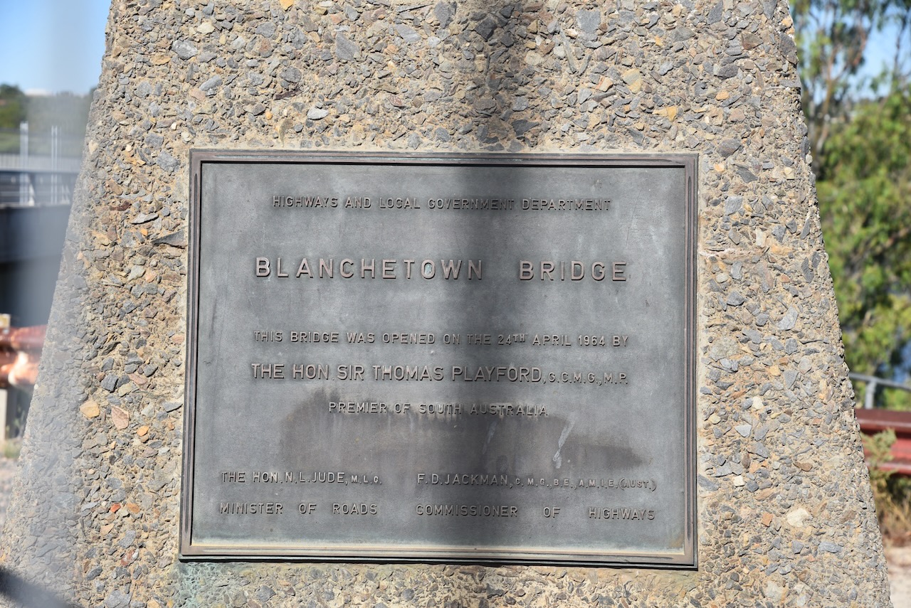
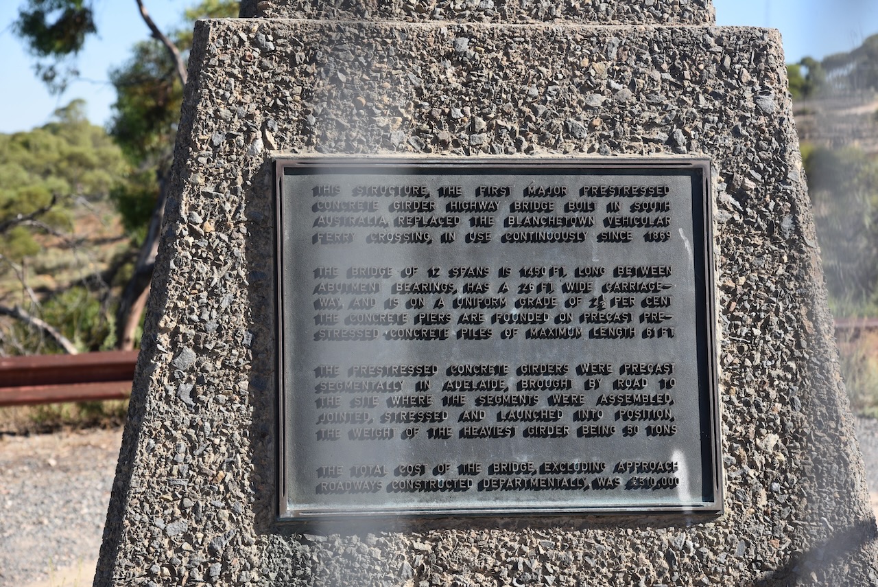
I left Waikerie and headed west on the Sturt Highway and stopped briefly at the town of Blanchetown.
Blanchetown was surveyed in 1855 and on the 27th day of August 1857, the land was offered for sale.
In 1855, Governor MacDonnell was in the area and ‘directed a convenient and beautifully situated rising ground about 5 miles north of Moorundie to be laid out as a township. It is his Excellency’s intention to remove there the quarters of the Native Police and of the Protector of Aborigines, as the houses now inhabited by them are annually subject to inundations.’
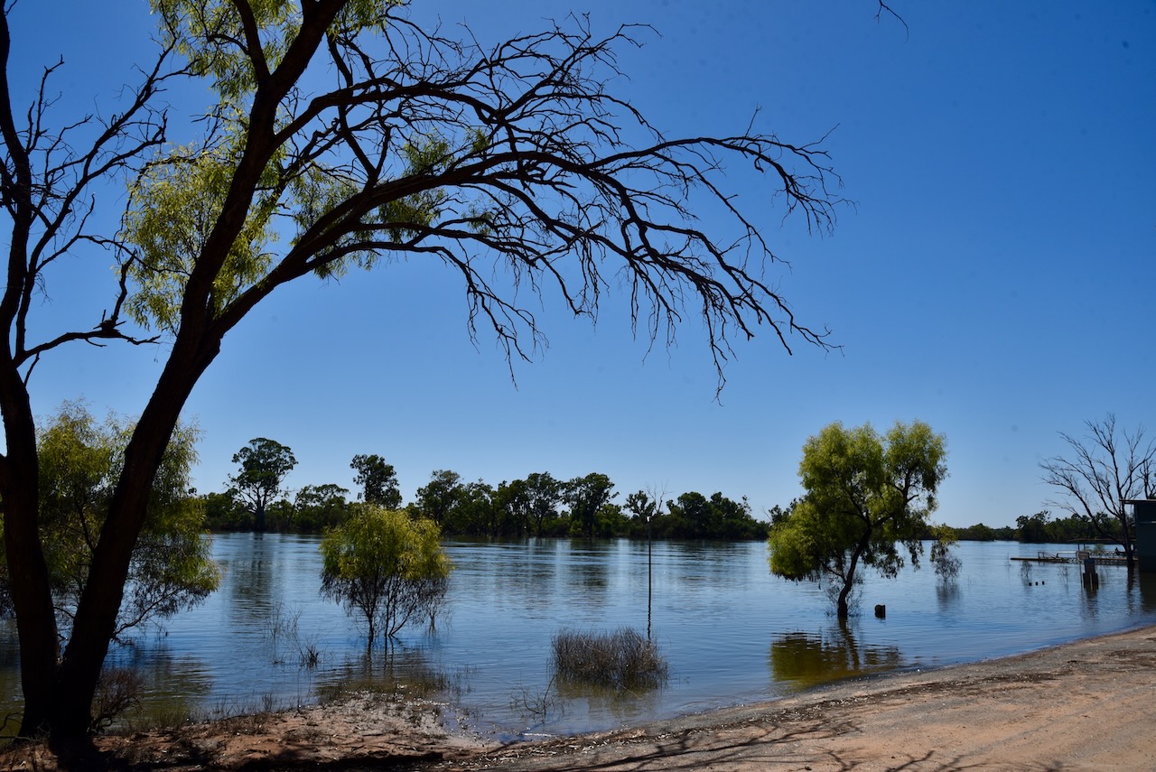
The lock at Blanchetown was still submerged due to the Murray River flooding.
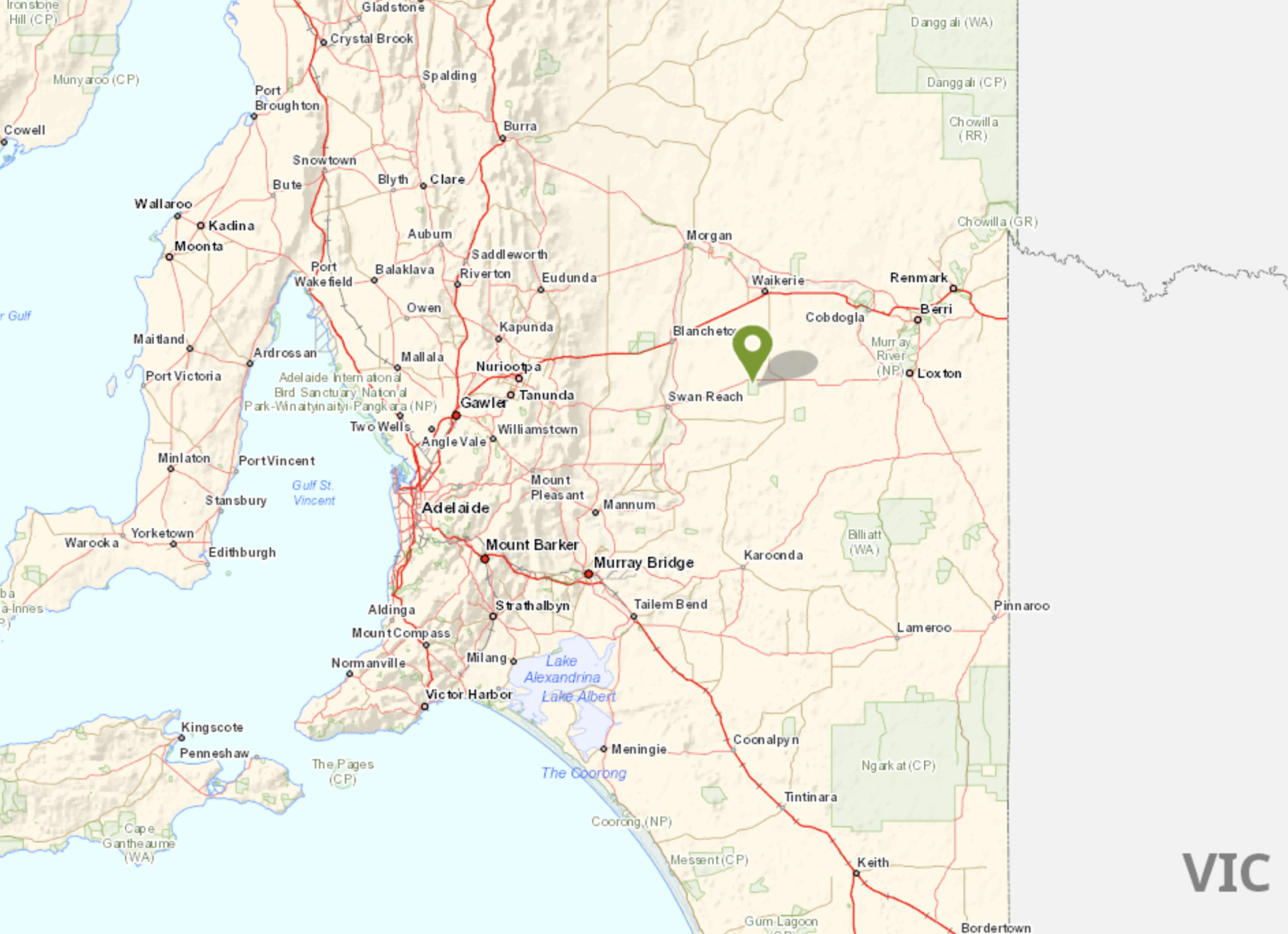
After packing up at Mantung Conservation Park (31st January 2023) I headed to the Bakara Conservation Park VKFF-0868. It was just a short 30 km drive to get to Bakara from Mantung.
The Bakara Conservation Park is located about 205 km northeast of Adelaide.
Above:- Map showing the location of the Bakara Conservation Park. Map c/o Location SA Map Viewer.
The park is located on the southern side of the Stott Highway at the junction of Start Road.
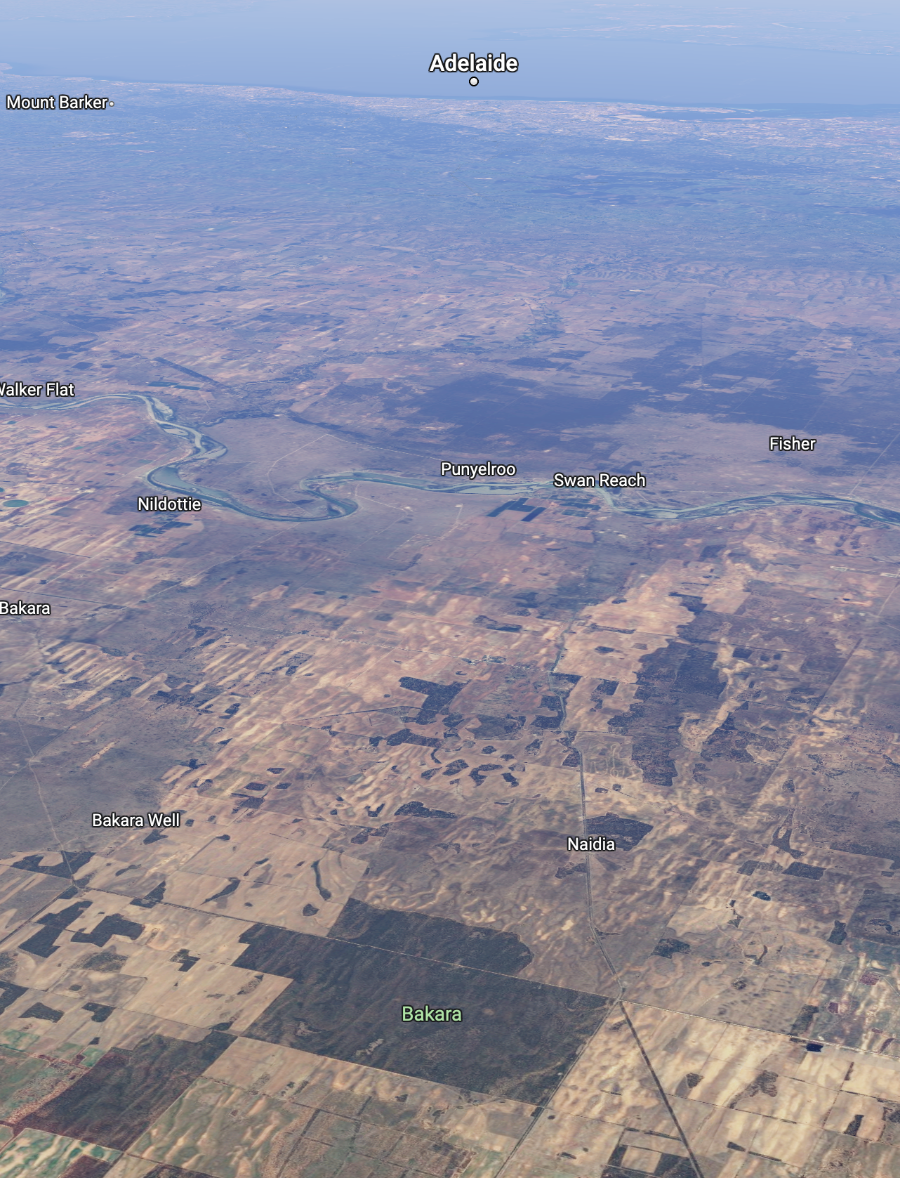
Above:- An aerial shot of the Bakara CP looking southwest towards Adelaide. Image c/o Google maps.
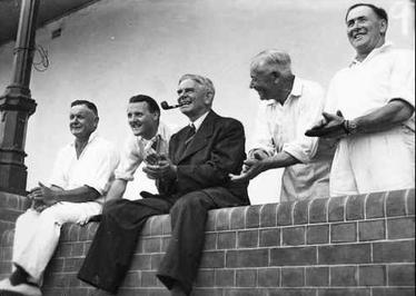
The Stott Highway runs from Angaston in the Barossa Valley, through Sedan and Swan Reach and on to Loxton in the Riverland region of South Australia. In 2008 the highway was named in honour of Tom Cleave Stott (b. 1899. d. 1976) who was a farmer and member of State Parliament from 1933 to 1970. The Stott family farm was at Mindarie in the Murray Mallee.
Above:- Tom Stott (far right) at a “Press v Parliament” cricket match, 1947. Image c/o Wikipedia.
The name Bakara was given by the aboriginal people to a native camp on a track from Swan Reach to Loxton. The word derives from either bakarra meaning ‘hot wind’ or balkara meaning ‘native dove.
In 1864 the Bakara Run was established by W.P. Barker (b. 1845. d. 1914) and D. McLean. The land was originally held by Messrs Lucas and Reid from February 1860. The Hundred of Bakara, County of Albert, was proclaimed on the 15th day of June 1893. The Netherleigh school was opened in 1909 as ‘Bakara’ and was closed in 1935. The Bakara Post Office was closed on the 30th day of June 1979.
The Bakara Conservation Park was proclaimed on the 15th day of May 1986.
Above:- from the SA Govt Gazette, 15 May 1986. Image c/o Wikipedia.
The park comprises land in sections 54 and 55 in the cadastral unit of the Hundred of Bakara. In 1983 the South Australian State Government compulsorily acquired Section 55 and this was proclaimed as the park. Section 54 was added on the 6th day of August 2009. The park currently covers an area of about 2,030 hectares.
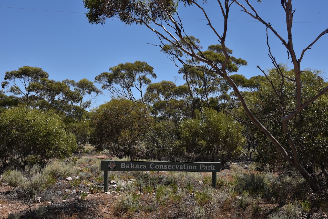
The park provides valuable habitat for the Malleefowl.
I drove into the park via one of the tracks off the Stott Highway. It was a hot afternoon so I chose some shade underneath a tree to get out of the sun.
Band conditions on 10m and 15m were very good and this helped me to easily get over the 44 QSO line for the global World Wide Flora Fauna (WWFF) program.
It was also nice to pick up a couple of Park to Park contacts with Andy VK5LA and Daryl VK3BEZ.
After leaving the Wunkar silo (31st January 2023), I drove south along Curtis Road and then west on Farr Road. It wasn’t long before I reached the northeastern corner of the Mantung Conservation Park VKFF-1055.
Above:- Map showing the location of the Mantung Conservation Park. Map c/o Google maps.
Mantung is aboriginal for ‘water on a native road’. Nomadic aboriginal people who followed sandhills from Jadko north of Swan Reach to Loxton, via Bakara, obtained water from mallee trees. Needle bush roots also yielded water. When the Hundred of Mantung, County of Albert, was proclaimed on the 15th day of June 1893, the name was shown as an Aboriginal waterhole on an 1864 land tenure plan.
The town of Mantung was proclaimed on the 8th day of July 1915. The post office was opened in September 1915. The Mantung school opened in 1921 and closed in 1944. The school was reopened in 1961 and was conducted in the Mantung Hall.
Early in 1914 a meeting was called to arrange for the inauguration of an agricultural show when ‘a strong committee was formed’: Subsequently, owing to the dryness of the season, the committee deemed it wise to postpone the show and hold a farmers’ picnic instead… Thanks largely to the untiring energy of the capable secretary, Mr A.E. Solly, everything went with a swing… Before the folk dispersed in the evening three rousing cheers were given for ‘King and country’…
Above:- Article from the Observer, Adelaide, Sat 10 Oct 1914. Image c/o Trove.
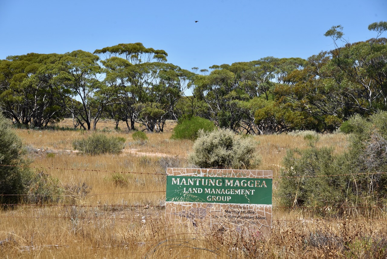
The Mantung Conservation Park is about 1,695 hectares in size and was created on the 16th day of October 2014. The park is part of an extensive area of native vegetation containing the largest intact remnants of deep sand habitat in the Northern Murray Mallee, supporting numerous rare plant species including the rasp daisy bush.
The park can be located on the southern side of Farr Road. The northwestern corner of the park is located at the junction of Farr Road and Evans Road.
Above:- An aerial view of the Mantung Conservation Park. Image co Google maps
The park is important for the conservation of the following bird species – malleefowl, southern scrub robin, shy heathwren, inland thornbill, white-browed babbler and purple-gaped honeyeater.
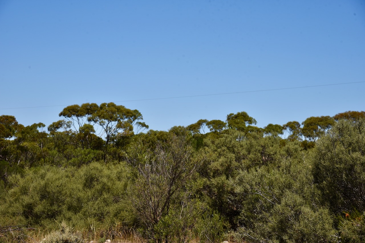
I pulled into one of the dirt tracks leading off Farr Road. It was a hot afternoon and the flies were out in force, so I operated from the 4WD.
Above:- An aerial view of the Mantung CP showing my operating spot. Image c/o Location SA Map Viewer.
I ran the Yaesu FT857, 40 watts, and the 20/40/80m linked dipole. For 10 & 15m SSB I ran the Icom IC-7000, and the Codan 9350 self tuning antenna.
I made the following QSOs on 40m SSB:-
VK3PF
VK5NIG
VK3SQ
VK5CZ
VK1AO
VK2MET
VK5PET
VK5FANA
VK3GRK
VK5MAZ
VK5BJE
VK3SMW
VK3BEL
I made the following QSOs on 20m SSB:-
VK1AO
Vk2MET
VK4FW
VK8MM
VK2IO
VK4EMP
VK4TI
VK3PF
VK4TJ
VK3MB
I made the following contacts on 15m SSB:-
VK4FW
VK8MM
VK3PF
Vk2IO
VK1AO
VK2MET
VK3MCA
VK7QP
VK2FR
VK4EMP
VK4TI
VK4TJ
VK3JLS
VK3UAO
VK4ABF
I made the following QSOs on 10m SSB:-
VK2FR
VK4TJ
VK2IO
VK4FW
VK8MM
WH6LU
VK3LVH
VK2FADV
With 46 QSOs in the log, I packed up and headed off to the Bakara Conservation Park.
After activating the Pike River Conservation Park (Tuesday 31st January 2023) I headed to the Wunkar silo. I turned off the Sturt Highway and travelled southwest on Stanitzki Road and into Loxton. I then took Kingston Road and detoured down to Milich’s Landing.
Milich’s Landing was named after early pioneers Johannes and Ernstine Pauline Milich. It was a regular stop for paddle steamers. Johannes and his oldest sons arrived and set up camp in 1899. Ernstine Paule and the remainder of the family arrived in 1902. The family lived in a kerosine tin hut near the site before moving into their new home at Pyap which was completed in 1913.
Ernstine Pauline was a midwife and at that time was the only medical assistance for Loxton and surrounding districts.
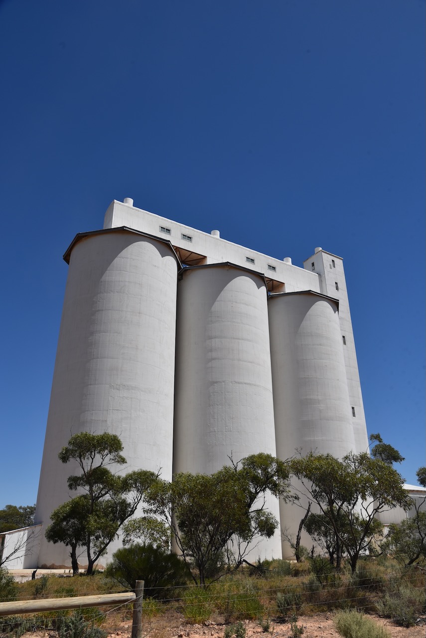
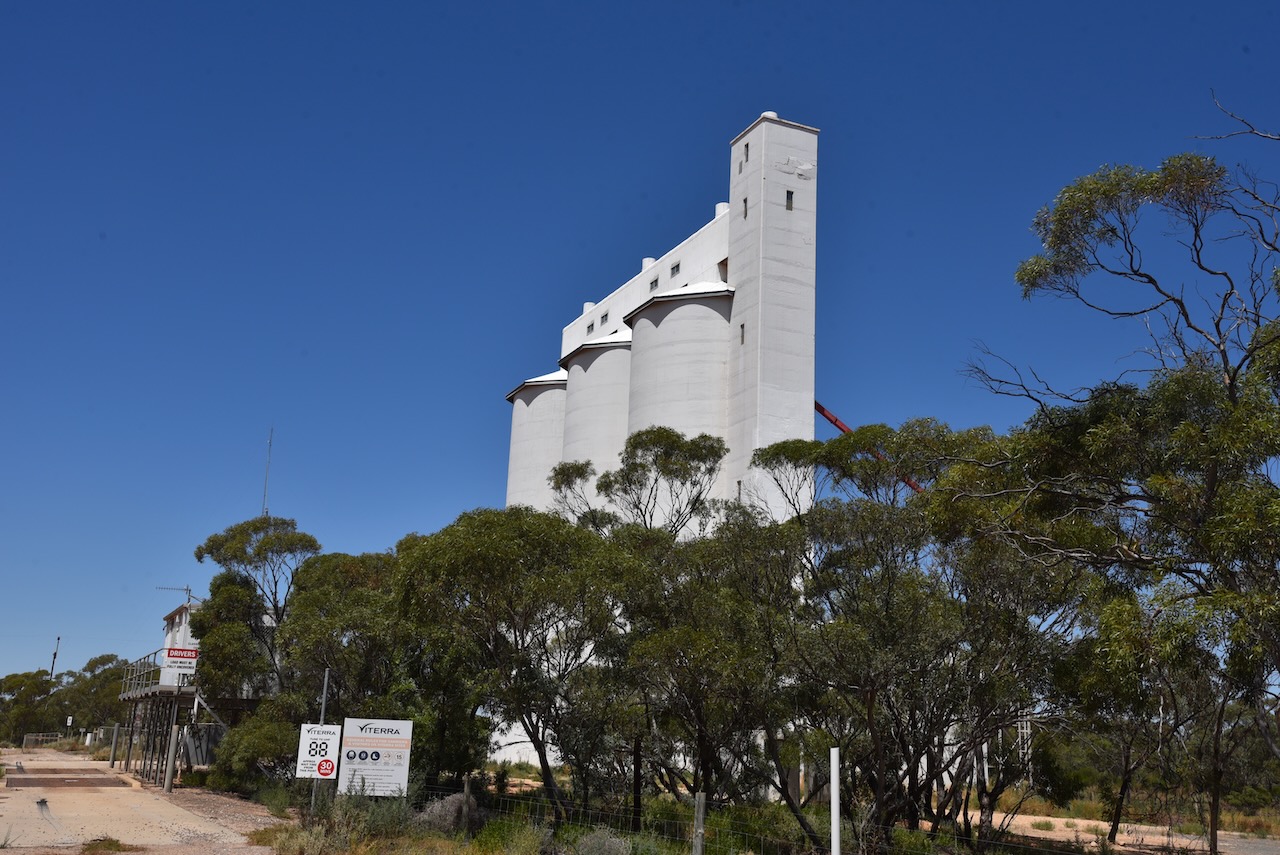
Wunkar is a tiny town in the Murray Mallee region of South Australia, about 27km west of Loxton.
Above:- Map showing the location of Wunkar. Map c/o Google maps.
It was originally a station on the Moorook railway line. The township of Wunkar was surveyed in 1926 after the railway station name was approved in 1925. The railway closed in 1971. The Wunkar school opened in 1925 and closed in 1973.
Above:- Surveyor map of Wunkar. Image c/o Trove.
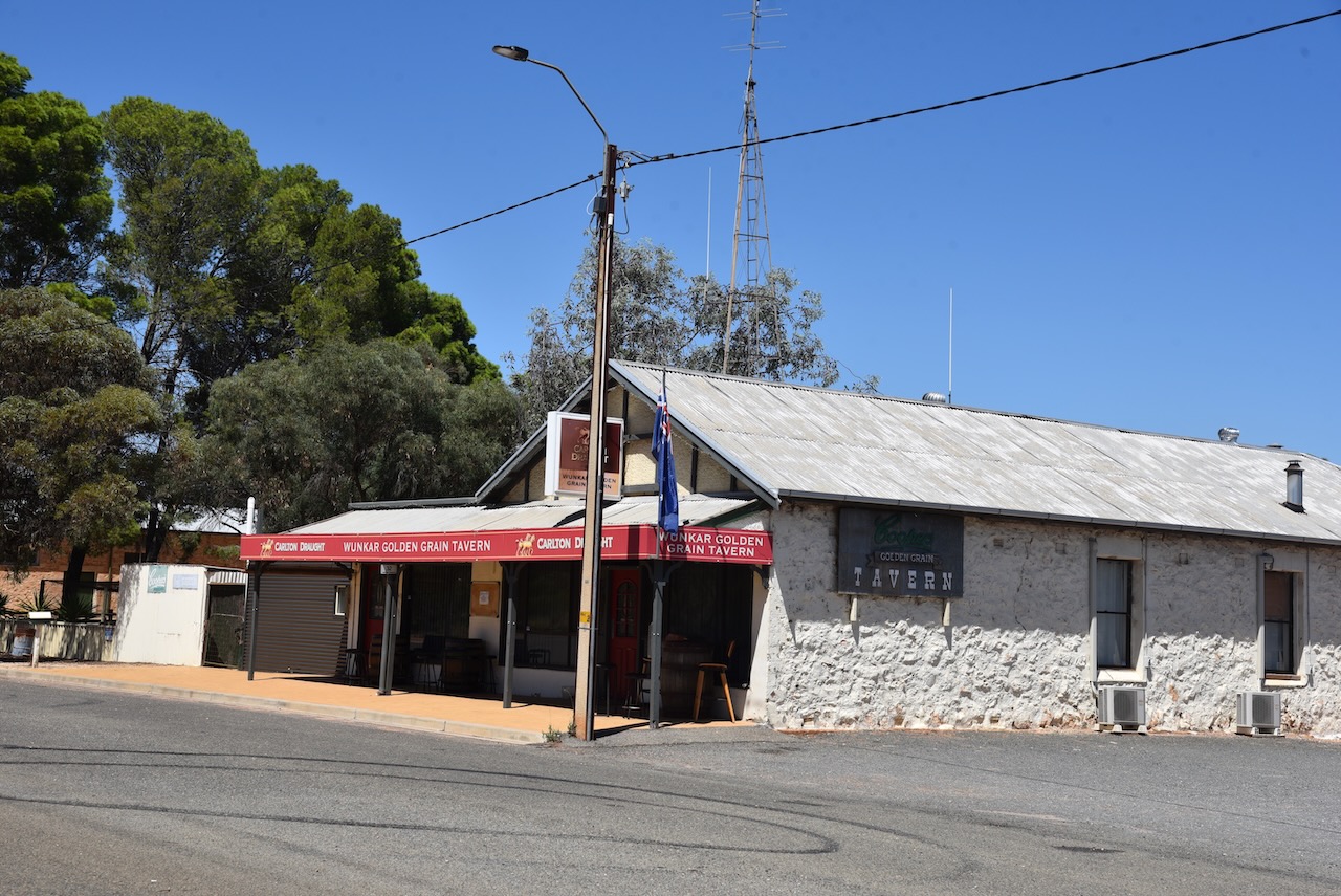
Wunkar’s population as of 2021 was 51 people. There are a few dozen homes, a hall, and the Golden Grain Hotel. Wunkar is an aboriginal word meaning ‘grass’.
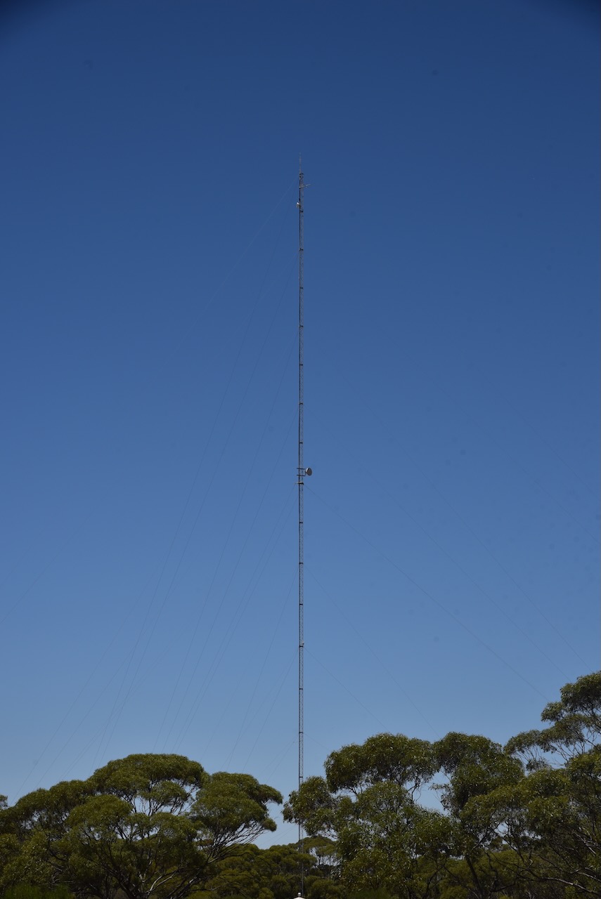
Adjacent to the silo was another very impressive tower that I would like to have at home with my antennas on top of.
The Wunkar silos are located in Snograss Road. They are located alongside of the old railway line.
I operated from the 4WD for this action and ran the Icom IC-7000, 100 watts, and the Codan 9350 self-tuning antenna.
Above:- the activation zone at the Wunkar silo. Image c/o SiOTA website.
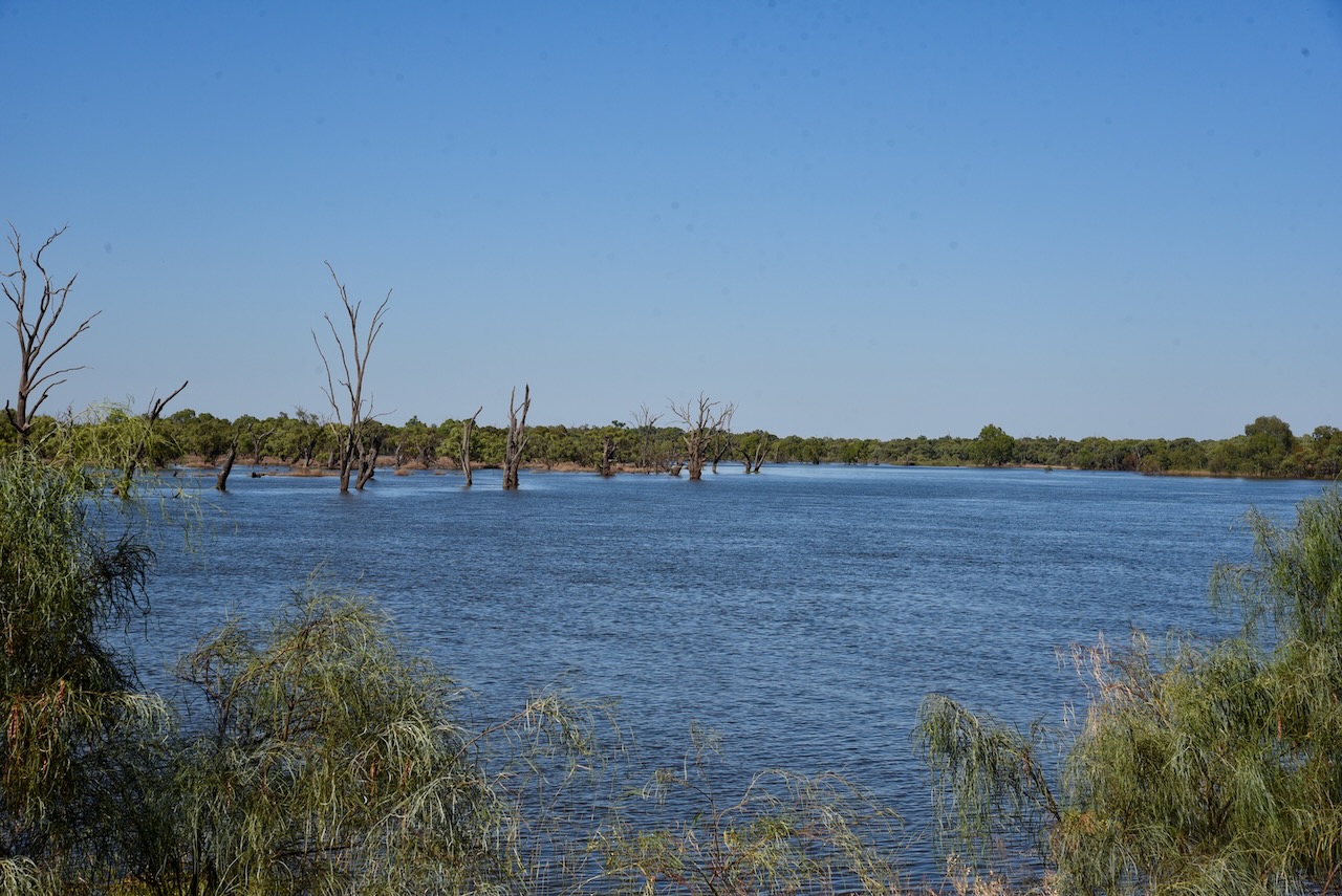
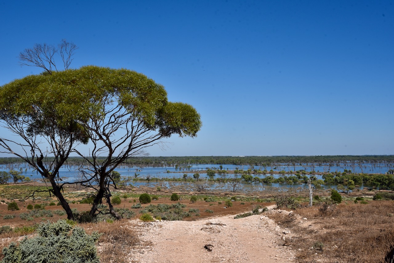
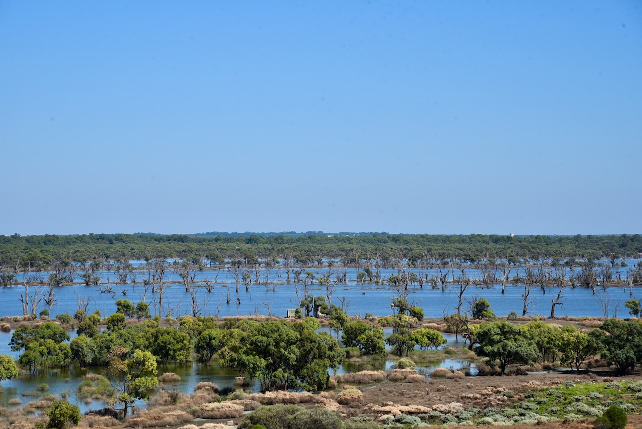
I packed up at the Paringa silo and headed to my next activation, the Wunkar silo. I stopped briefly at Paringa to look across the Pike River floodplain which was covered in water.
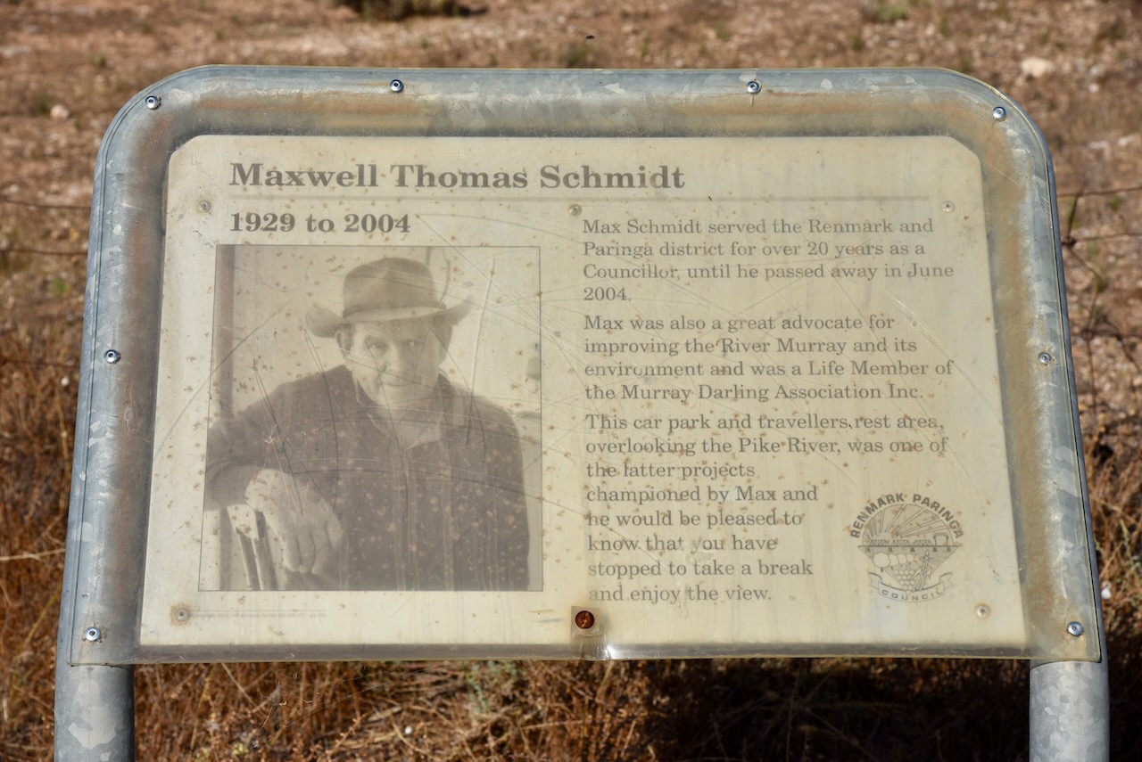
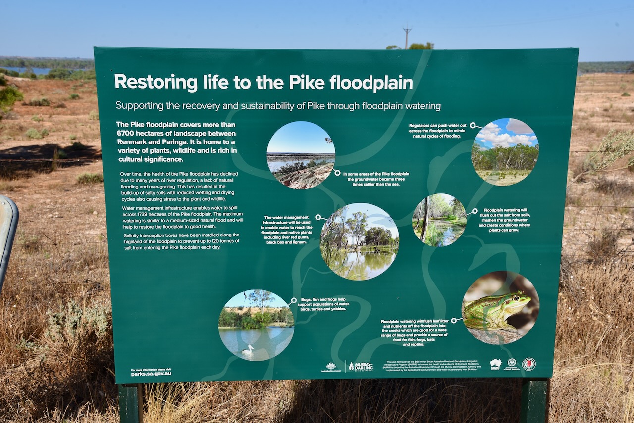
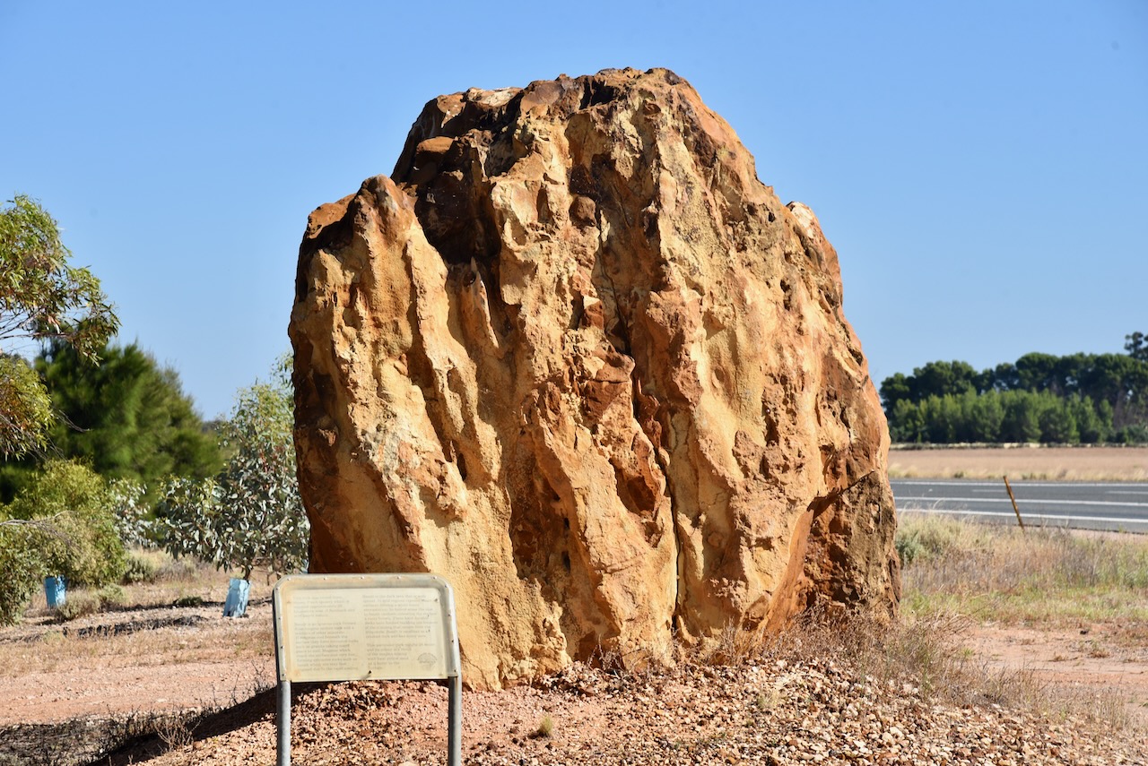
I then headed south on the Sturt Highway and stopped briefly at the roadside rest stop just outside of Paringa. There are some information boards here on the Pike floodplain, an old timber jinker, an information board from Maxwell Schmidt, and a large rock mined from Pinch Quarry.
The timber jinker was used in the 1930s at the Renmark Irrigation Trust’s No. 1 pumping station to haul red gum logs into the irrigation settlement for various purposes including pylons in culverts over the irrigation channels. It was hauled by a crawler tractor.
Maxwell Thomas Schmidt (b. 1929. d. 2004) served the Renmark and Paringa district for over 20 years as a Councillor, until he passed away in June 2004. He was a great advocate for improving the Murray River and its environment and was a Life Member of the Murray Darling Association Inc.
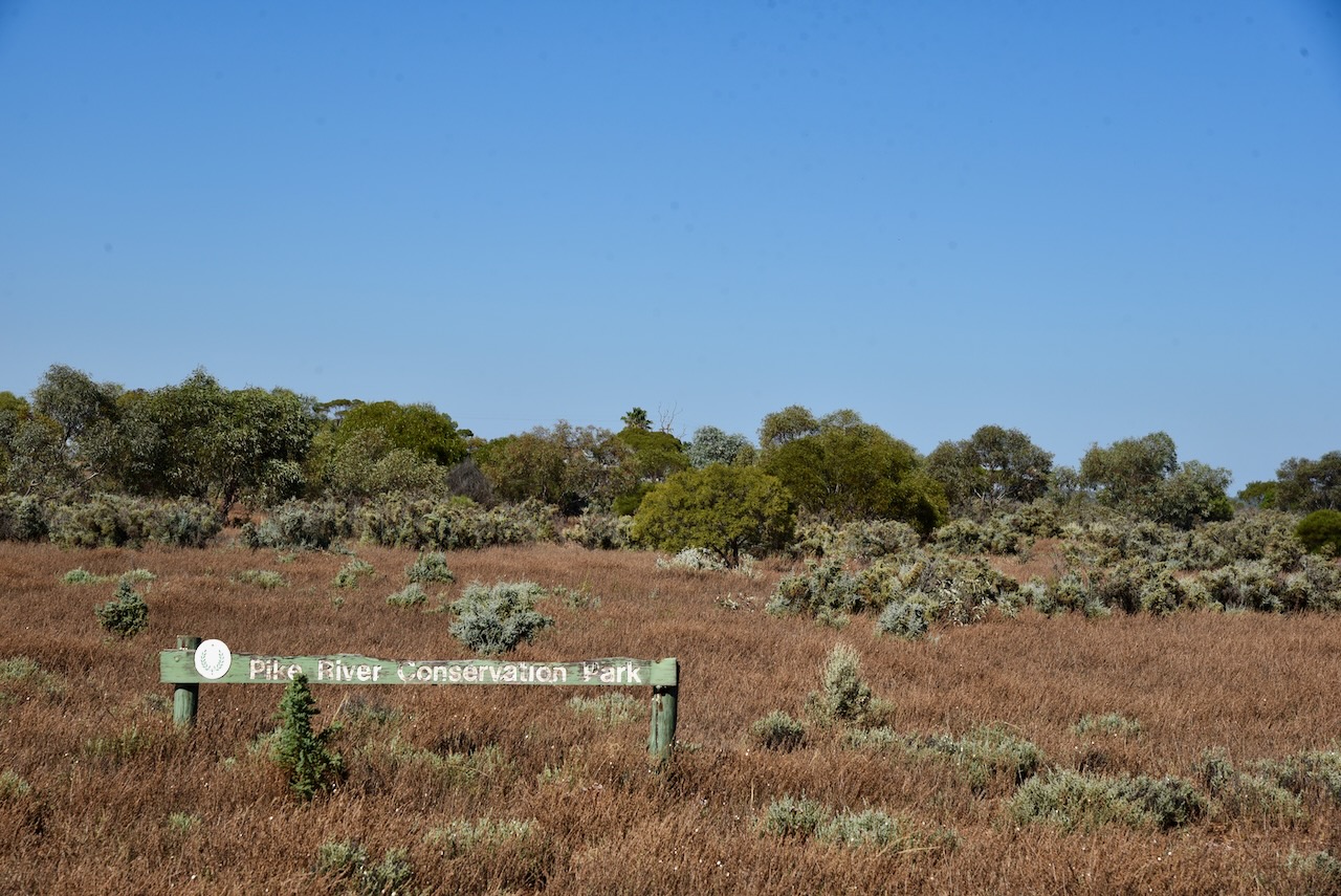
Although I had activated and qualified the park previously, I decided to drive into the Pike River Conservation Park VKFF-0831, and activate it for the World Wide Flora Fauna (WWFF) program.
Above:- Map showing the location of the Pike River CP. Map c/o Google maps.
The park is about 2.88 km2 in size and was established on the st day of February 1979.
Access to the park is via the Sturt Highway.
Above:- An aerial view of the Pike River Conservation Park. Image c/o Google maps
The park is named after Pike River, a stream that flows through the park’s eastern end. On the 10th day of December 2009, crown land in section 84 of the Hundred of Paringa which was formerly the Mundic Forest Reserve was added to its extent.
An 1865 map held at the South Australian Library refers to the ‘Billy Bong Pike River’. In 1910 it was reported that ‘adjacent to the Pyke for a distance of five or six miles was a perfect forest of tobacco trees so dense and vigorous that nothing but bare soil is seen between… On the other side of the road are several farms, fallow land, fair looking crops and an abundance of feed…’
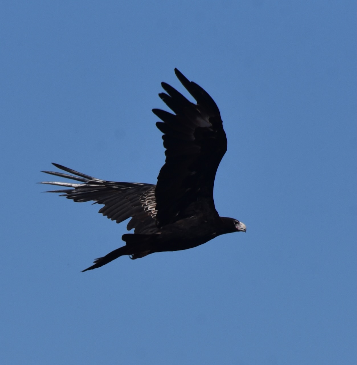
During my visit to the park, I had a pair of Wedge-tailed eagles soaring above. A brilliant sight!
I entered the park via the Sturt Highway and set up in the high section of the park. I operated from the 4WD running the Icom IC7000, 100 watts, and the Codan 9350 self tuning antenna.
Above:- map of the Pike River CP showing my operating spot. Map c/o Location SA Map Viewer.
I worked the following stations on 40m SSB before the UTC rollover:-
VK3AHR
VK5MAZ
VK3PF
VK1AD/p (HEMA VK1/ HCT-040 & VKFF-0837)
VK1DA/p (HEMA VK1/ HCT-045)
VK5BJE
VK5FANA
VK3MCA
VK3SQ
VK2IO
I worked the following stations on 40m SSB after the UTC rollover:-
VK2EXA
VK3VAR
VK5BJE
VK5KSW
I worked the following stations on 20m SSB:-
VK2IO
VK3PF
VK4TJ
ZL3MR/p (SOTA ZL3/ CB-416)
VK1DA/p (HEMA VK1/ HCT-045)
VK2MET
VK1AO
KG5CIK
VK4HAT
VK4FW
VK8MM
I worked the following stations on 15m SSB before the UTC rollover:-
VK4FW
VK8MM
VK4HAT
VK4FFAB
VK1AO
VK2MET
VK2IO
ZL1TM
VK4HMI
VK2DJP
I worked the following stations on 15m SSB after the UTC rollover:-