
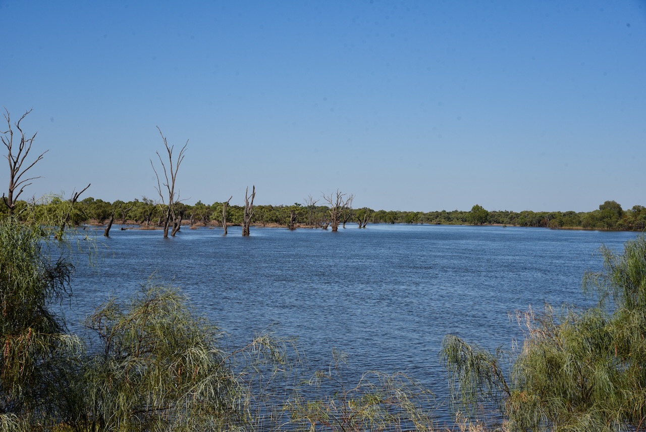
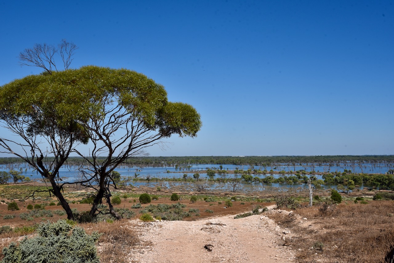
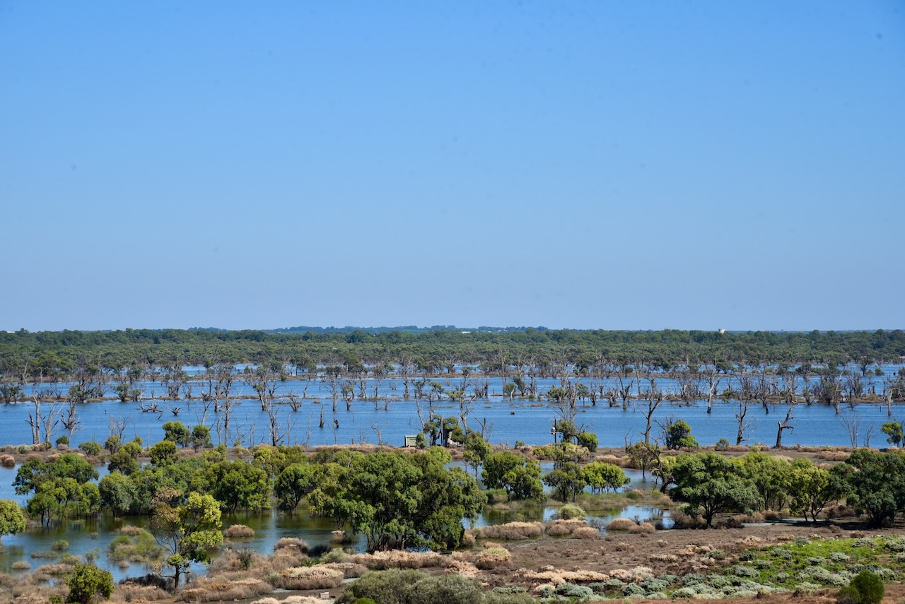
I packed up at the Paringa silo and headed to my next activation, the Wunkar silo. I stopped briefly at Paringa to look across the Pike River floodplain which was covered in water.

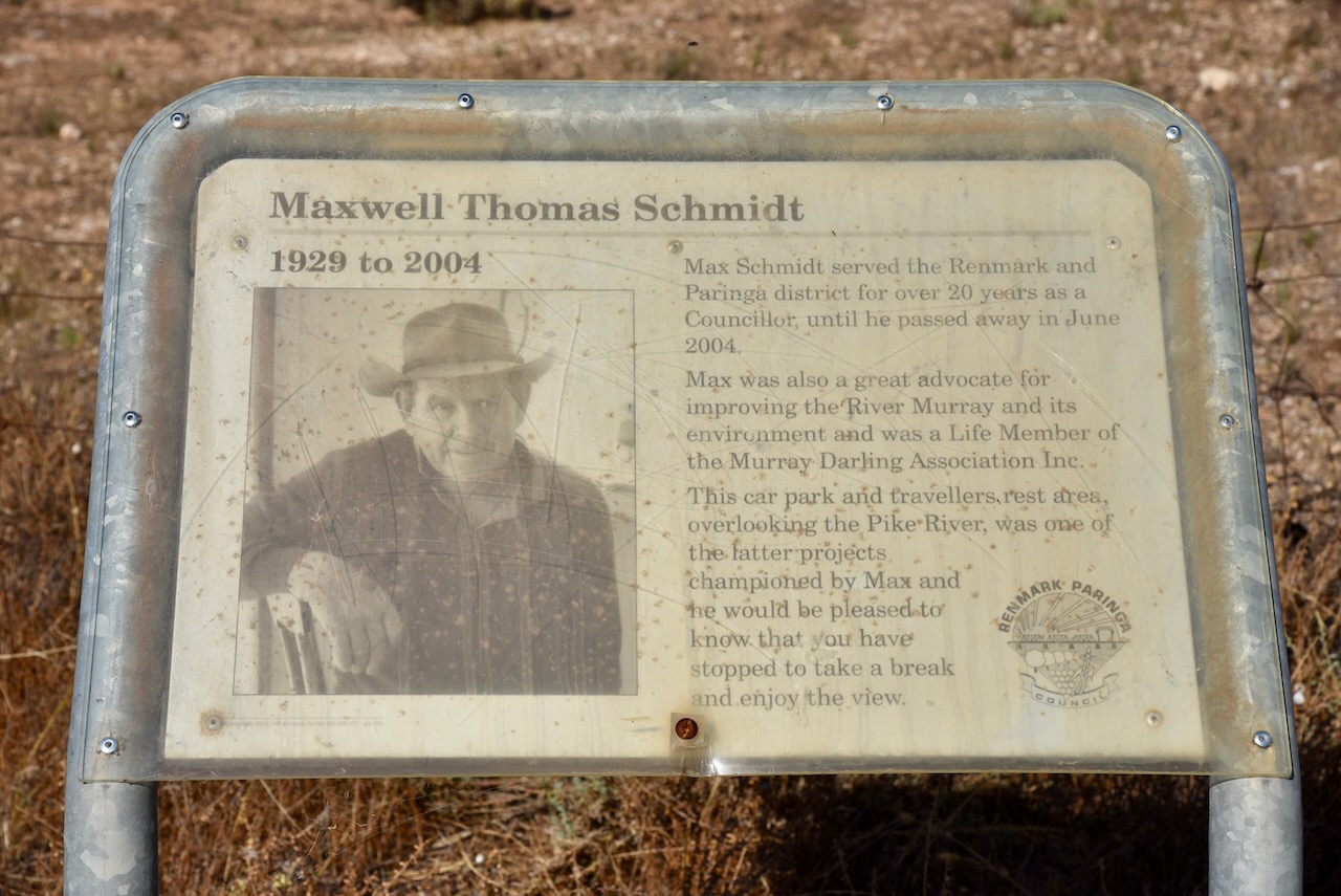
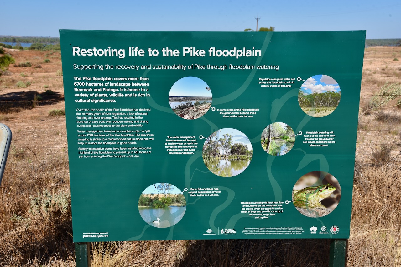
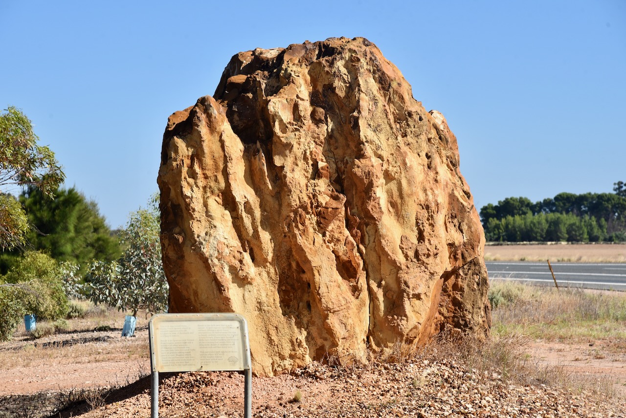
I then headed south on the Sturt Highway and stopped briefly at the roadside rest stop just outside of Paringa. There are some information boards here on the Pike floodplain, an old timber jinker, an information board from Maxwell Schmidt, and a large rock mined from Pinch Quarry.
The timber jinker was used in the 1930s at the Renmark Irrigation Trust’s No. 1 pumping station to haul red gum logs into the irrigation settlement for various purposes including pylons in culverts over the irrigation channels. It was hauled by a crawler tractor.
Maxwell Thomas Schmidt (b. 1929. d. 2004) served the Renmark and Paringa district for over 20 years as a Councillor, until he passed away in June 2004. He was a great advocate for improving the Murray River and its environment and was a Life Member of the Murray Darling Association Inc.


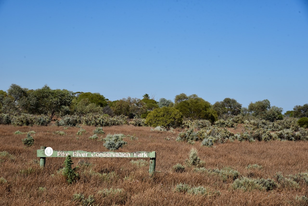
Although I had activated and qualified the park previously, I decided to drive into the Pike River Conservation Park VKFF-0831, and activate it for the World Wide Flora Fauna (WWFF) program.

Above:- Map showing the location of the Pike River CP. Map c/o Google maps.
The park is about 2.88 km2 in size and was established on the st day of February 1979.

Access to the park is via the Sturt Highway.

Above:- An aerial view of the Pike River Conservation Park. Image c/o Google maps
The park is named after Pike River, a stream that flows through the park’s eastern end. On the 10th day of December 2009, crown land in section 84 of the Hundred of Paringa which was formerly the Mundic Forest Reserve was added to its extent.


An 1865 map held at the South Australian Library refers to the ‘Billy Bong Pike River’. In 1910 it was reported that ‘adjacent to the Pyke for a distance of five or six miles was a perfect forest of tobacco trees so dense and vigorous that nothing but bare soil is seen between… On the other side of the road are several farms, fallow land, fair looking crops and an abundance of feed…’
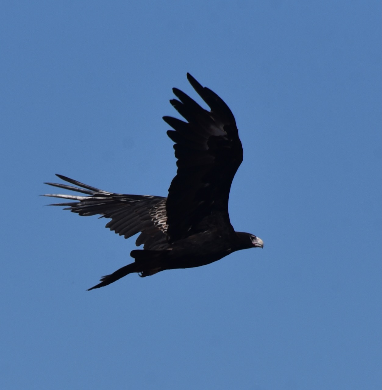
During my visit to the park, I had a pair of Wedge-tailed eagles soaring above. A brilliant sight!


I entered the park via the Sturt Highway and set up in the high section of the park. I operated from the 4WD running the Icom IC7000, 100 watts, and the Codan 9350 self tuning antenna.

Above:- map of the Pike River CP showing my operating spot. Map c/o Location SA Map Viewer.
I worked the following stations on 40m SSB before the UTC rollover:-
- VK3AHR
- VK5MAZ
- VK3PF
- VK1AD/p (HEMA VK1/ HCT-040 & VKFF-0837)
- VK1DA/p (HEMA VK1/ HCT-045)
- VK5BJE
- VK5FANA
- VK3MCA
- VK3SQ
- VK2IO
I worked the following stations on 40m SSB after the UTC rollover:-
- VK2EXA
- VK3VAR
- VK5BJE
- VK5KSW
I worked the following stations on 20m SSB:-
- VK2IO
- VK3PF
- VK4TJ
- ZL3MR/p (SOTA ZL3/ CB-416)
- VK1DA/p (HEMA VK1/ HCT-045)
- VK2MET
- VK1AO
- KG5CIK
- VK4HAT
- VK4FW
- VK8MM
I worked the following stations on 15m SSB before the UTC rollover:-
- VK4FW
- VK8MM
- VK4HAT
- VK4FFAB
- VK1AO
- VK2MET
- VK2IO
- ZL1TM
- VK4HMI
- VK2DJP
I worked the following stations on 15m SSB after the UTC rollover:-
- VK1AO
- VK2MET
- VK4TJ
- VK2DJP
- VK6NU
- VK2IO
- ZL1TM
- KG5CIK
- VK4KC
- VK4MAD
- VK4DOG
References.
- A Compendium of the Place Names of South Australia, 2023, <https://published.collections.slsa.sa.gov.au/placenamesofsouthaustralia/>, viewed 4th February 2023.
- Wikipedia, 2023, <https://en.wikipedia.org/wiki/Pike_River_Conservation_Park>, viewed 4th February 2023.
