Tintinara silo VK-TNA5

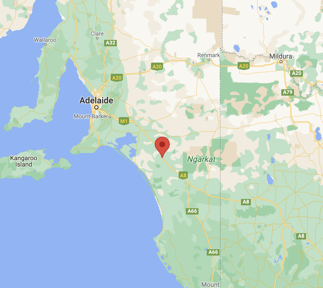
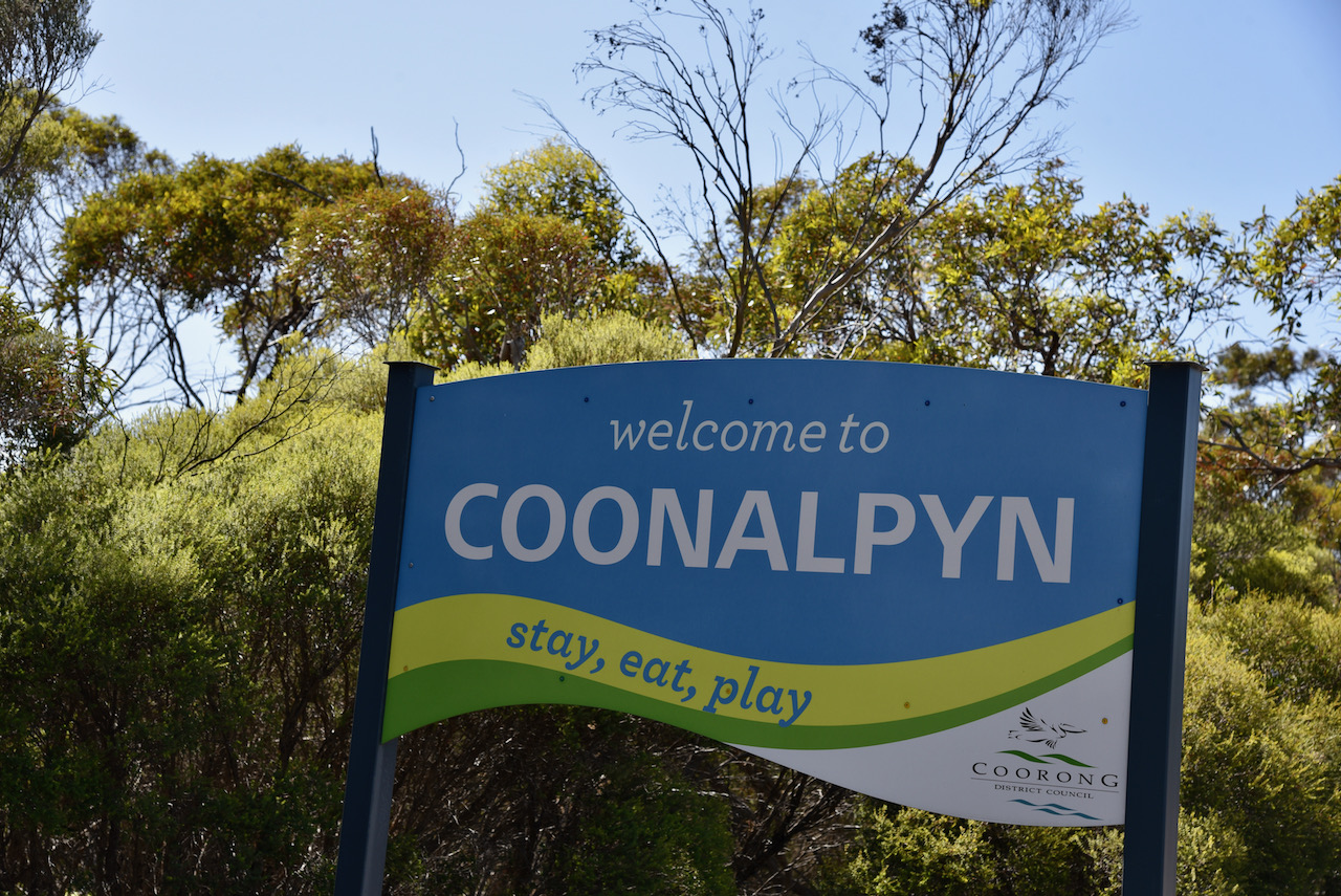
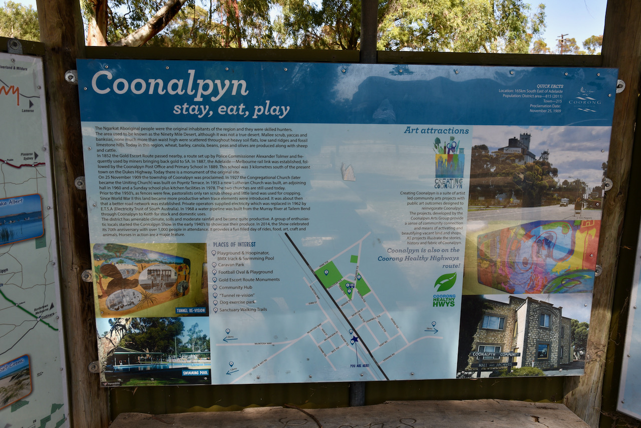
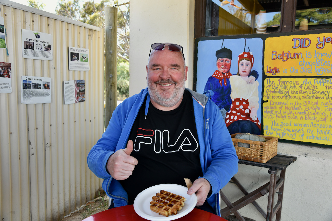
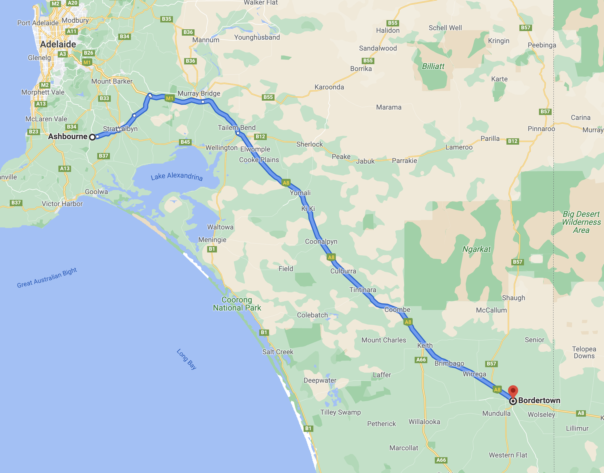
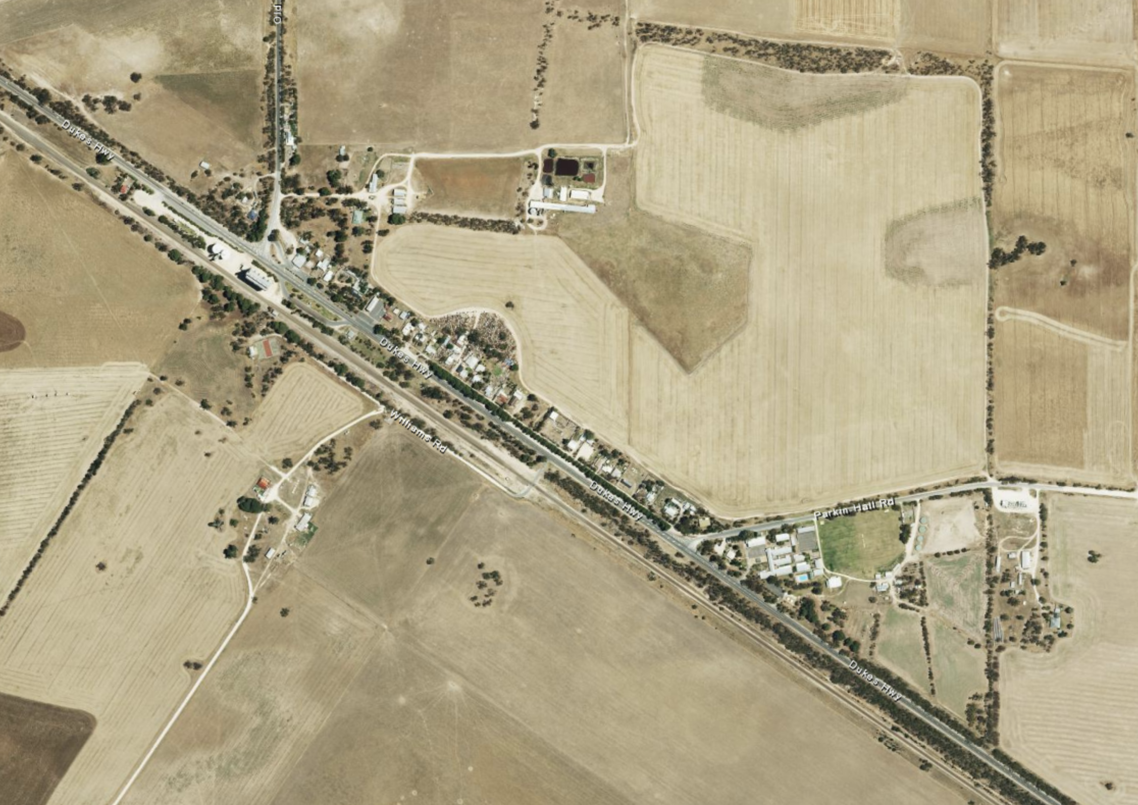
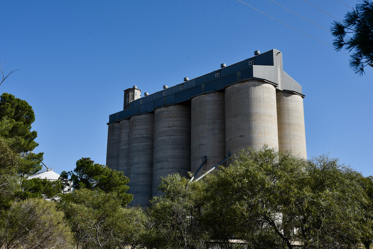
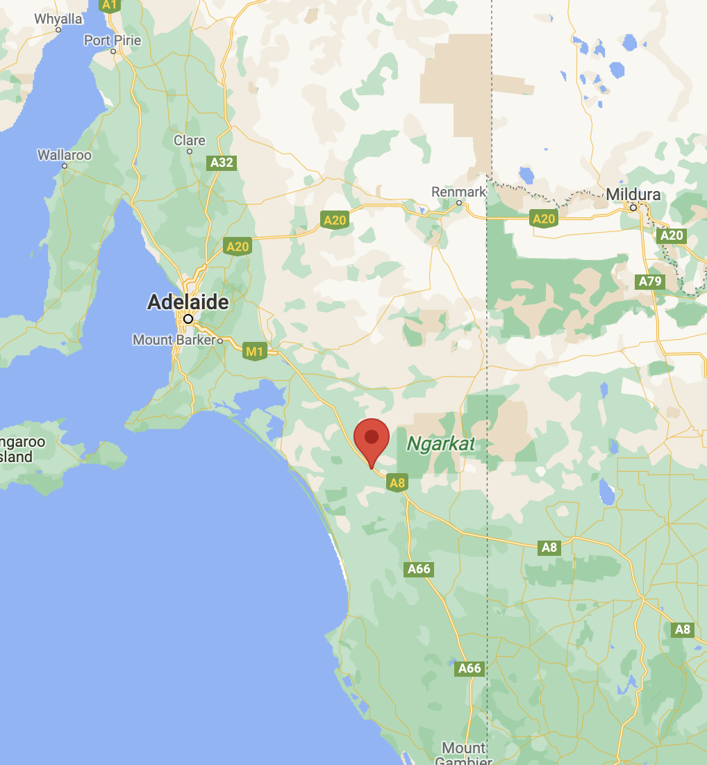
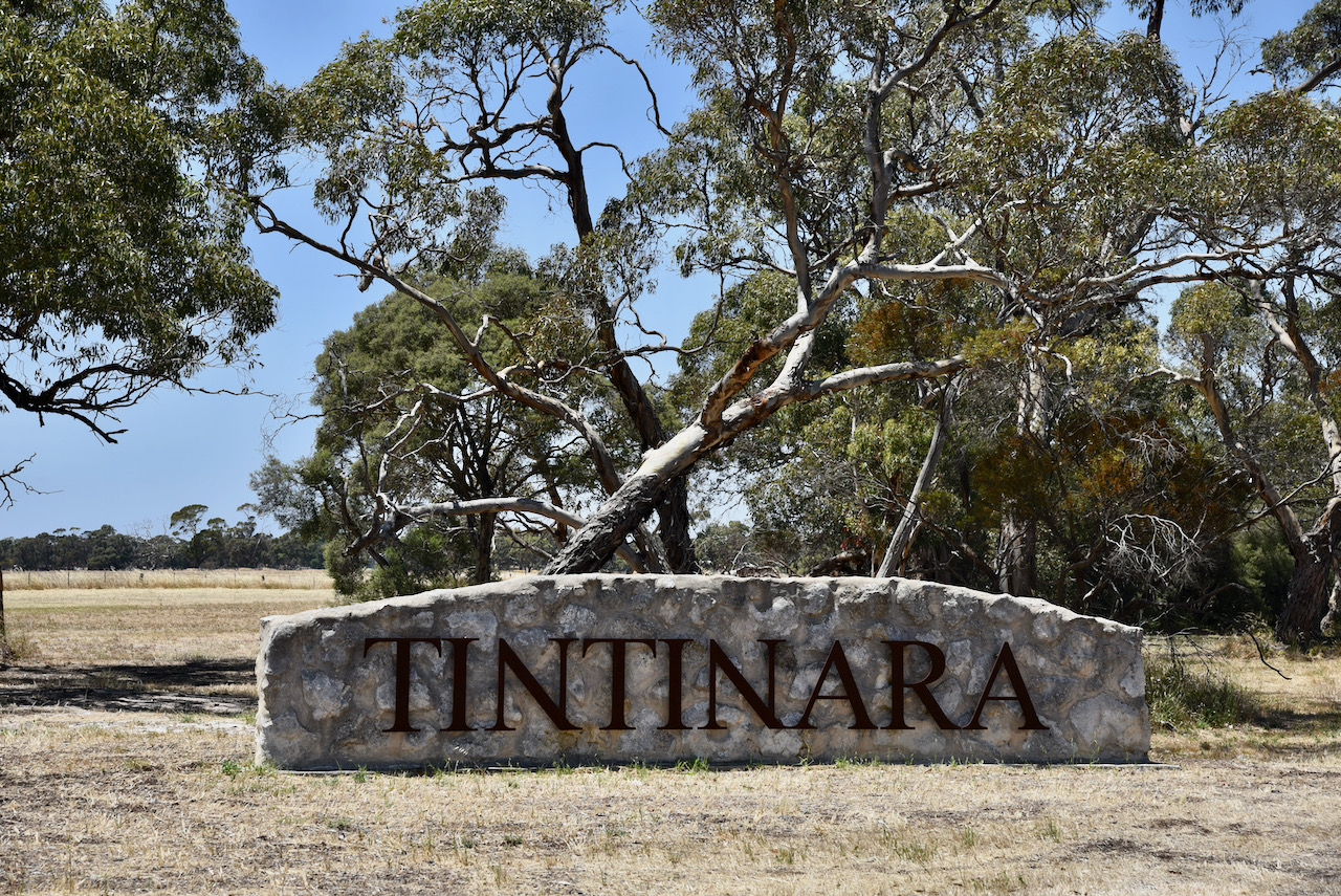
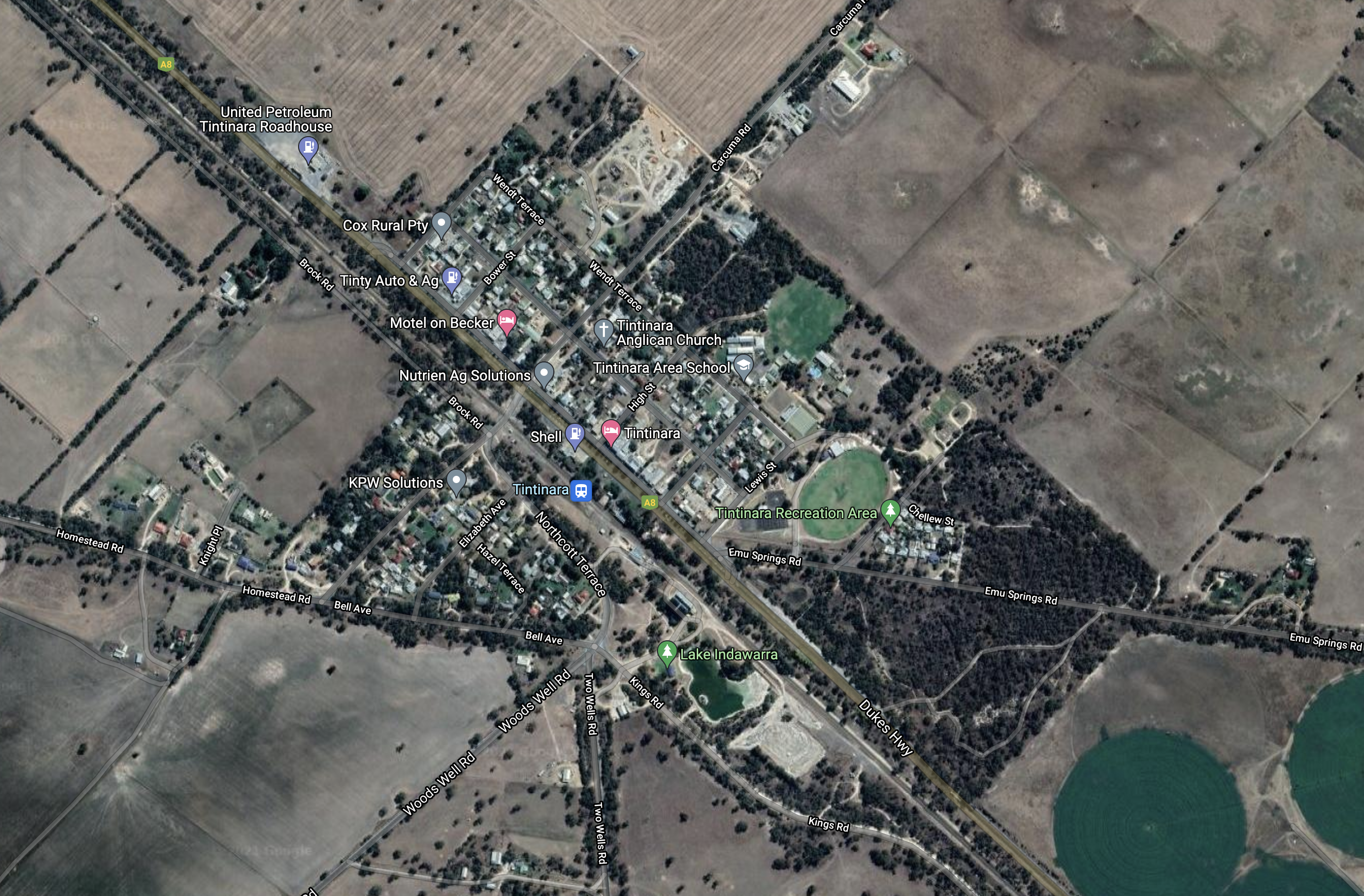
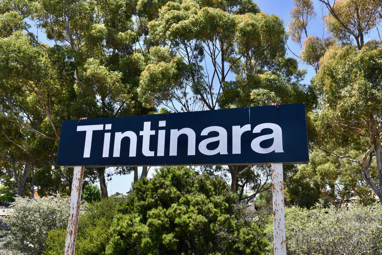
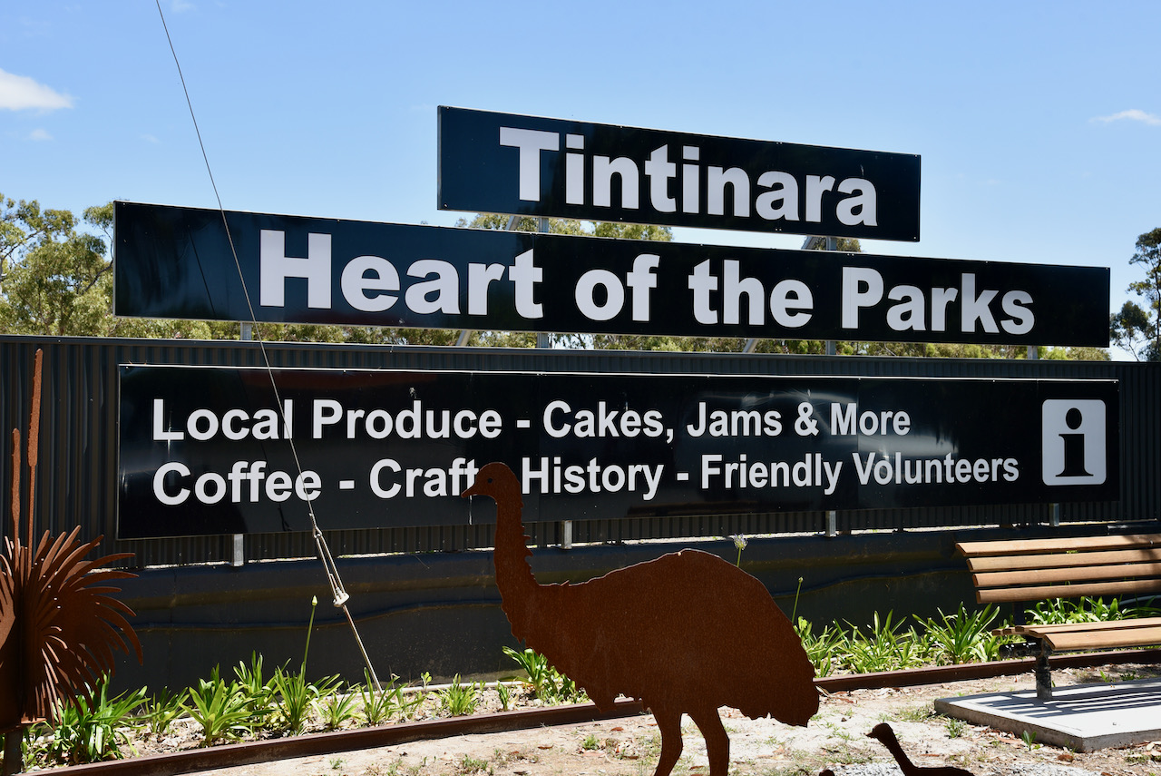
Marija and I packed up at Coonalpyn and hit the road once again, and travelled about 28 km and reached our next stop, the town of Tintinara. We had planned on activating the Tintinara silo VK-TNA5.

Tintinara is located on the Dukes Highway about 188 km southeast of Adelaide.

Above:- Map showing the location of Tintinara. Map c/o Google maps

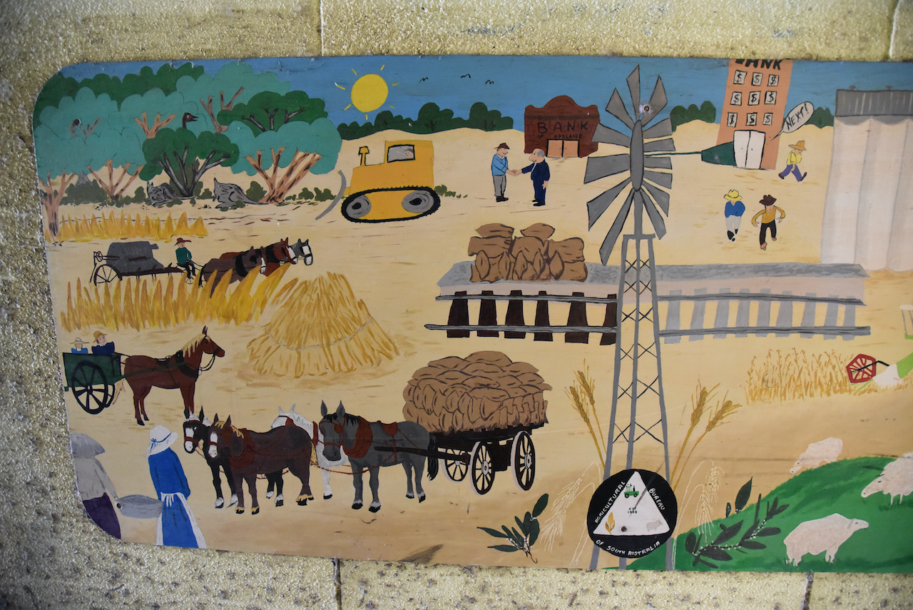
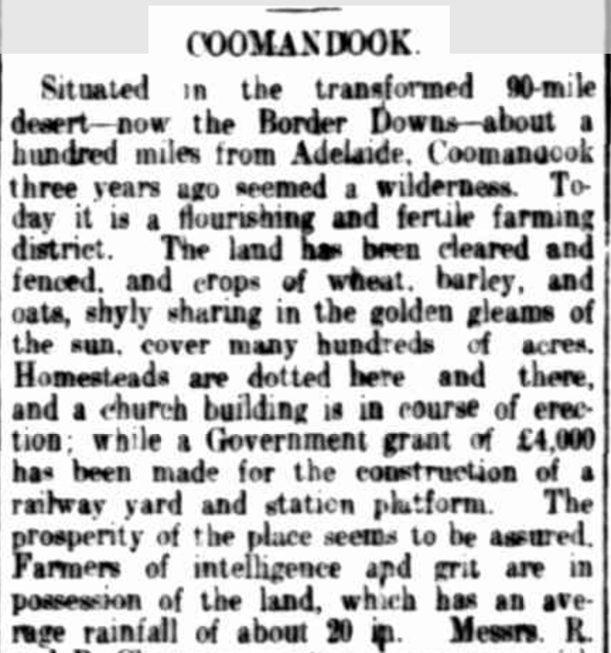
Tintinara and the surrounding district is based around the agricultural production of sheep, beef and cropping.

The origin of the name Tintinara is debated. During my research, I discovered a number of options. One of the original settlers, J.H. Boothby in his reminiscences recorded that he had a ‘smart young aborigine’ with a name that sounded like ‘Tin-tin’, and the suffix of ara was added to it. There is an aboriginal word tinyara which means ‘boy’.

Another explanation is that it is derived from tinlinyara, the aboriginal name for stars in Orion’s Belt, described in aboriginal mythology as a number of young men hunting emus, kangaroos and other game on the great celestial plain in the sky.

Above:- An aerial view of Tintinara. Image c/o Google maps.

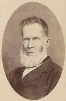
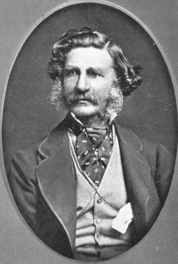
The Tintinara region was first settled by Europeans during the 1840s who grazed sheep in the area. Not long after, the Tintinara Homestead was built by the brothers Thomas Wilde Boothby (b. 1839. d. 1885) and James Henry Boothby (b. 1841. d. 1920) on their 165 sq. mile lease. They were the sons of Benjamin Boothby, a Judge of the Supreme Court of South Australia, and had emigrated to South Australia in 1853.

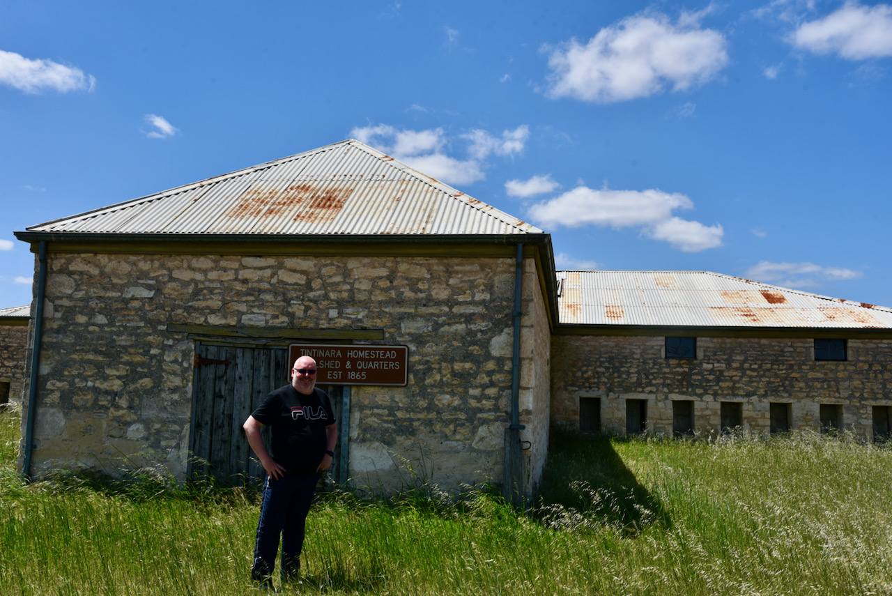
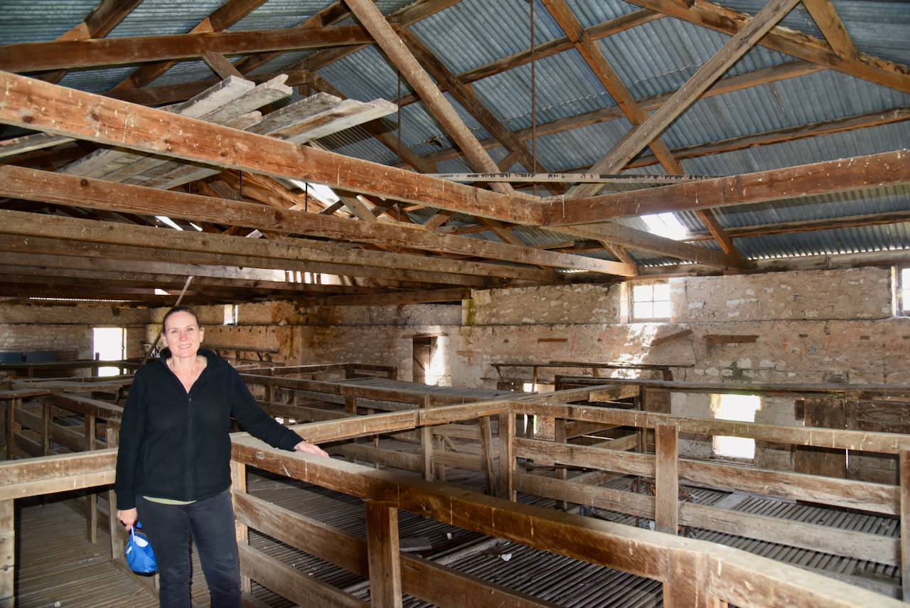
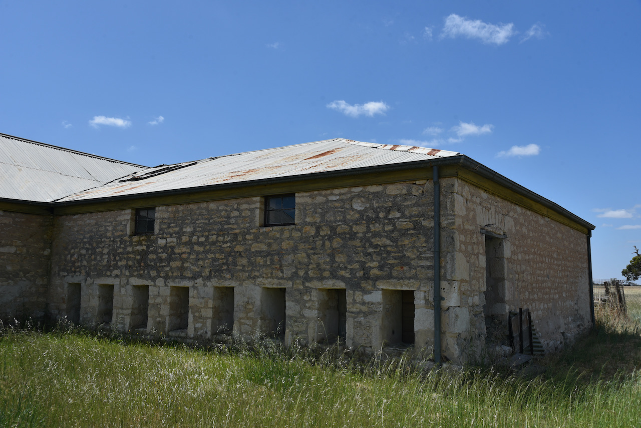
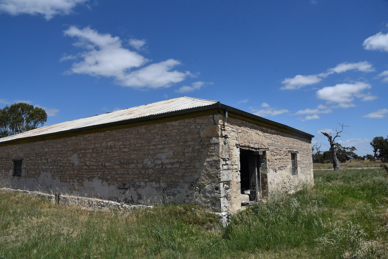
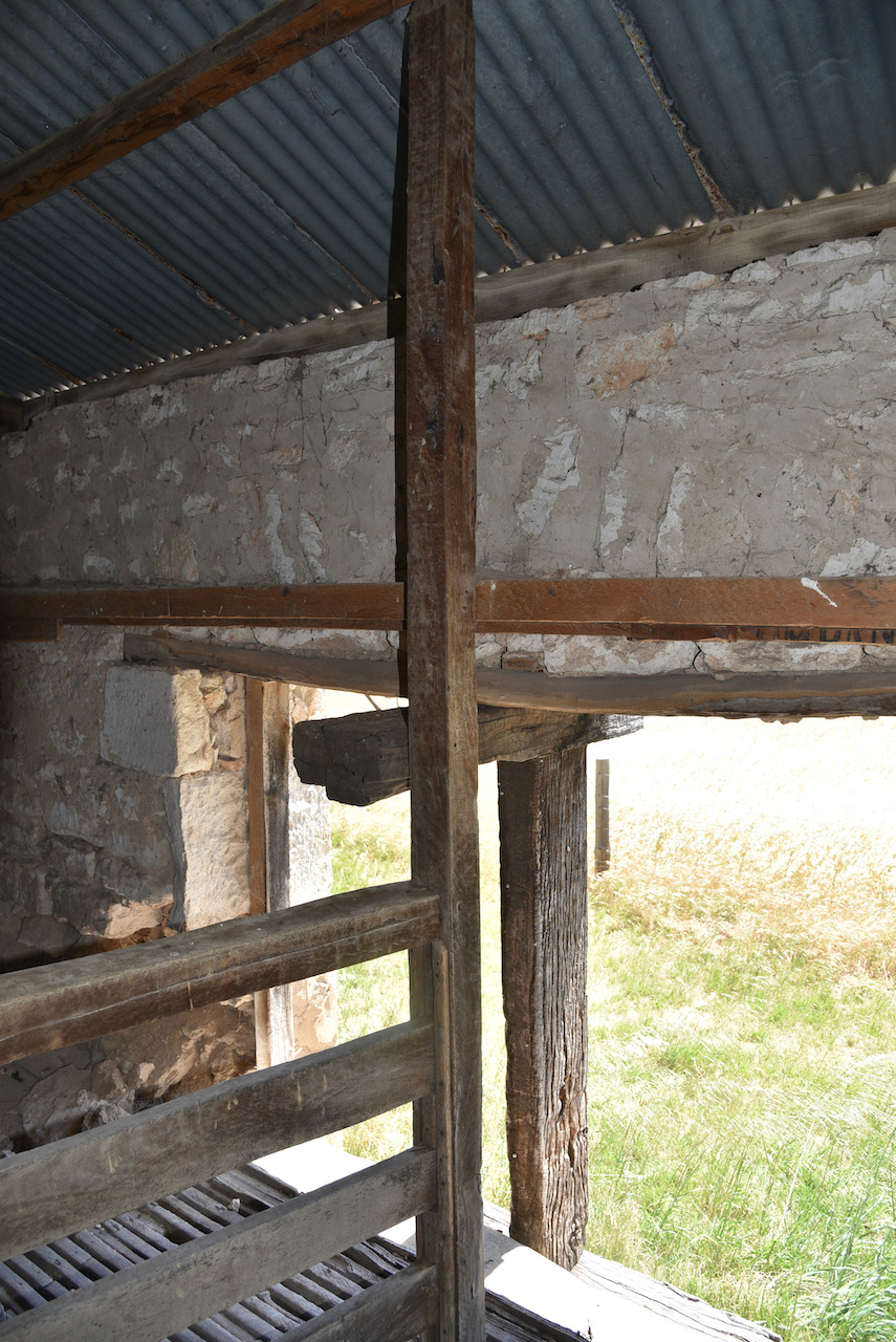
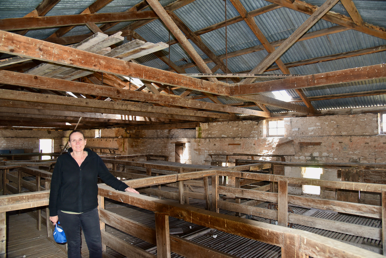
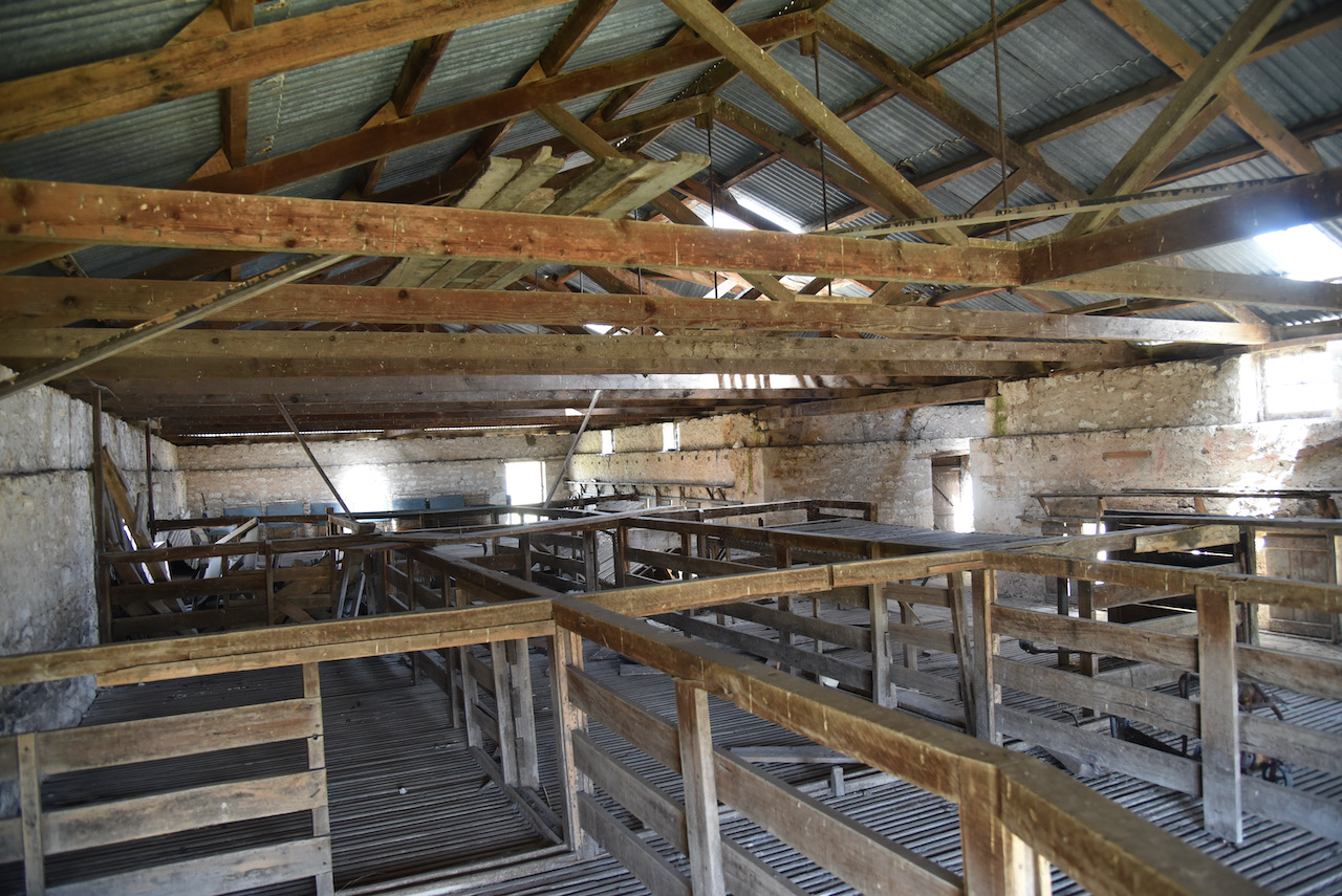
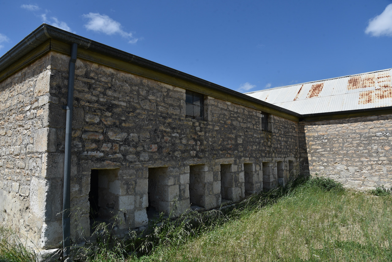
In 1865 a 16 stand shearing shed was constructed by the new owners William Harding and George Bunn (we visited the homestead and shearing shed – see below).

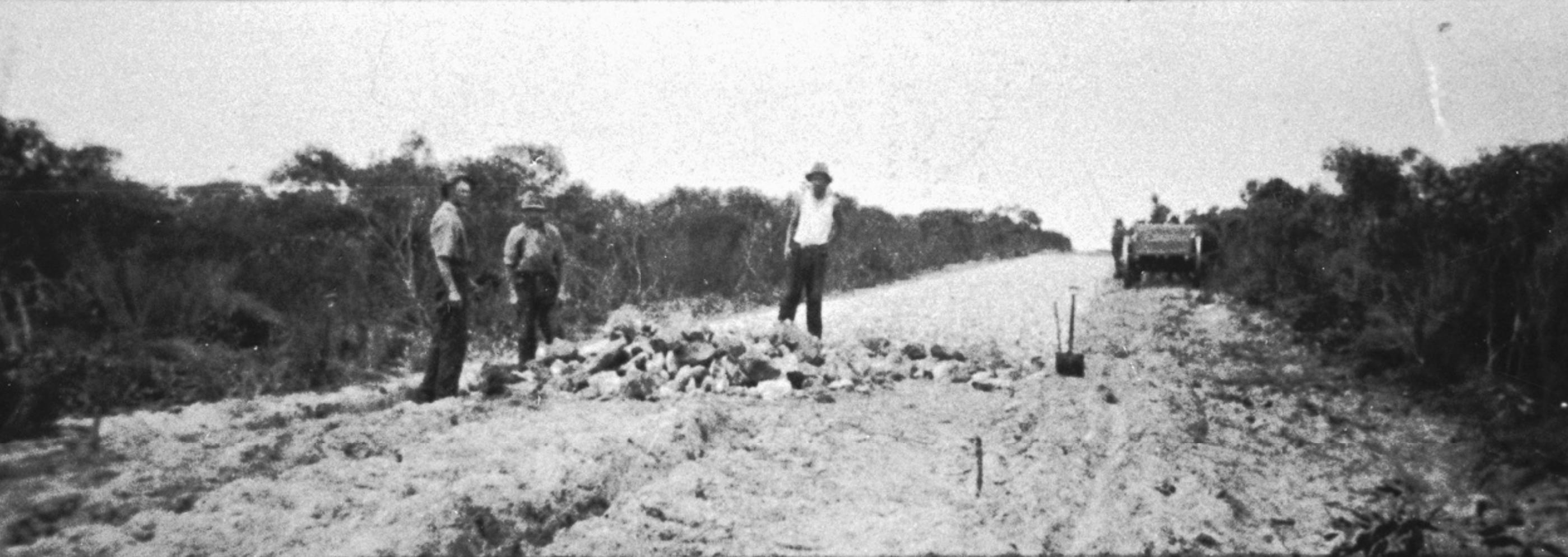
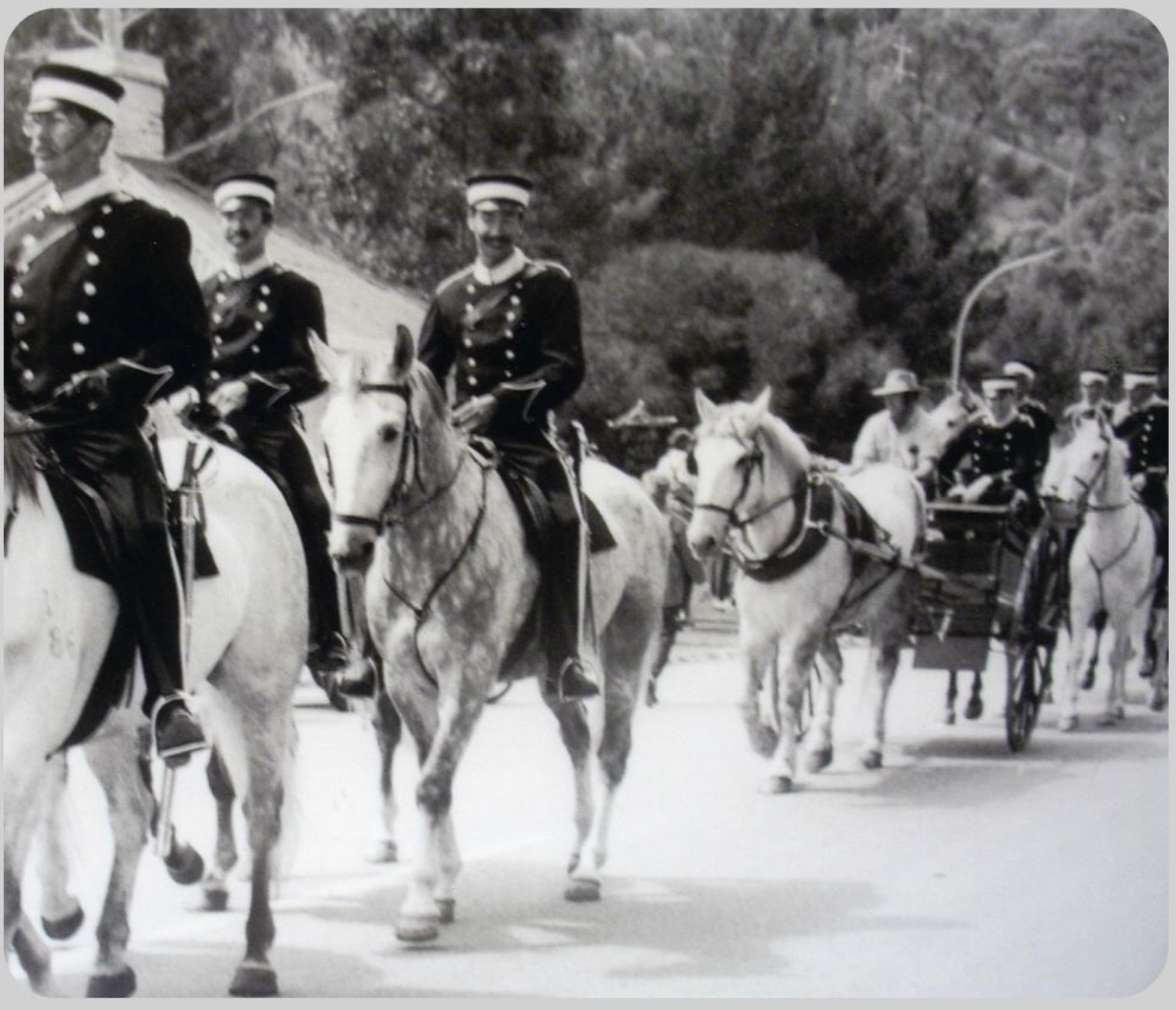
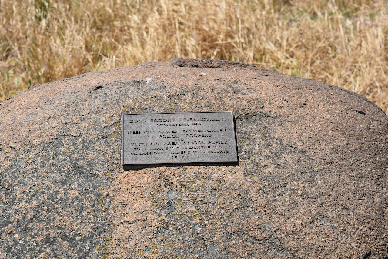
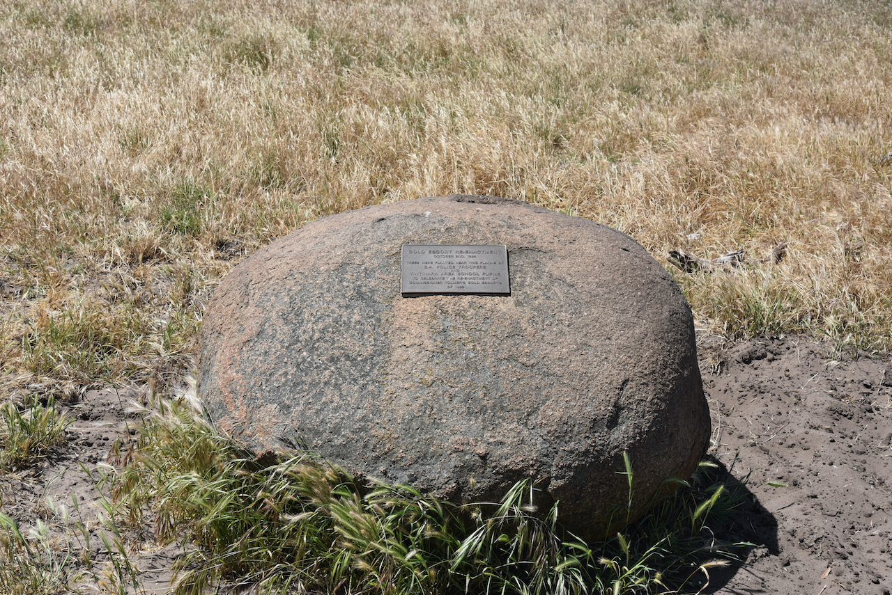
The Tintinara Well and the Reedy Well were regular stopping points for Alexander Tolmer’s gold escort team. During the 1850s Victorian Goldrush, a special armed detachment from South Australia provided a Gold Escort for the safe transportation of gold from the Victorian goldfields to Adelaide. The first of these was led by Alexander Tolmer, who later became the Police Commissioner in South Australia.

Above:- Alexander Tolmer. Image c/o Wikipedia

A total of eighteen Gold Escorts were made between 1852 and 1853, transporting 328,502 ounces (9,310 kg) of gold.

Above:- Police Gold Escort leaving Mount Alexander. Image c/o SA Police Facebook page

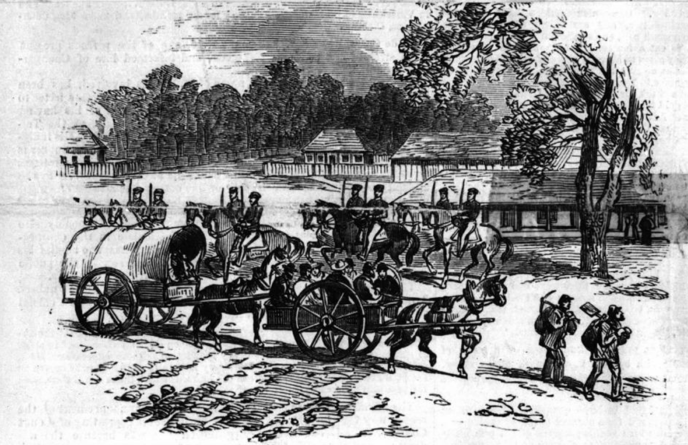
In 1986, a re-enactment of the Police Gold Escort was conducted as part of the 175th Commemoration program of the South Australia Police.

Above:- Gold Escort re-enactment. Image c/o SA Police Facebook page

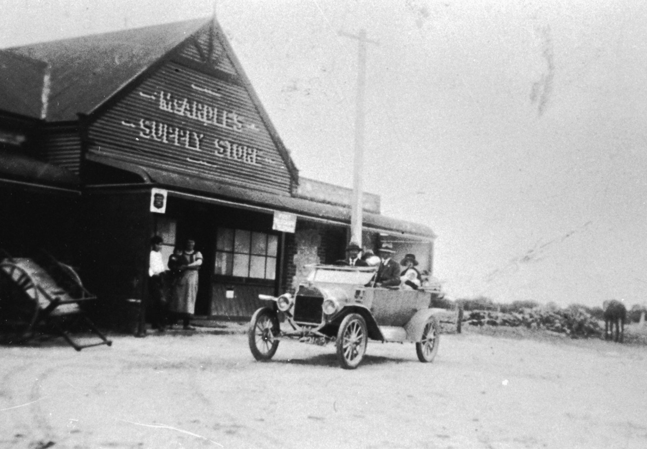
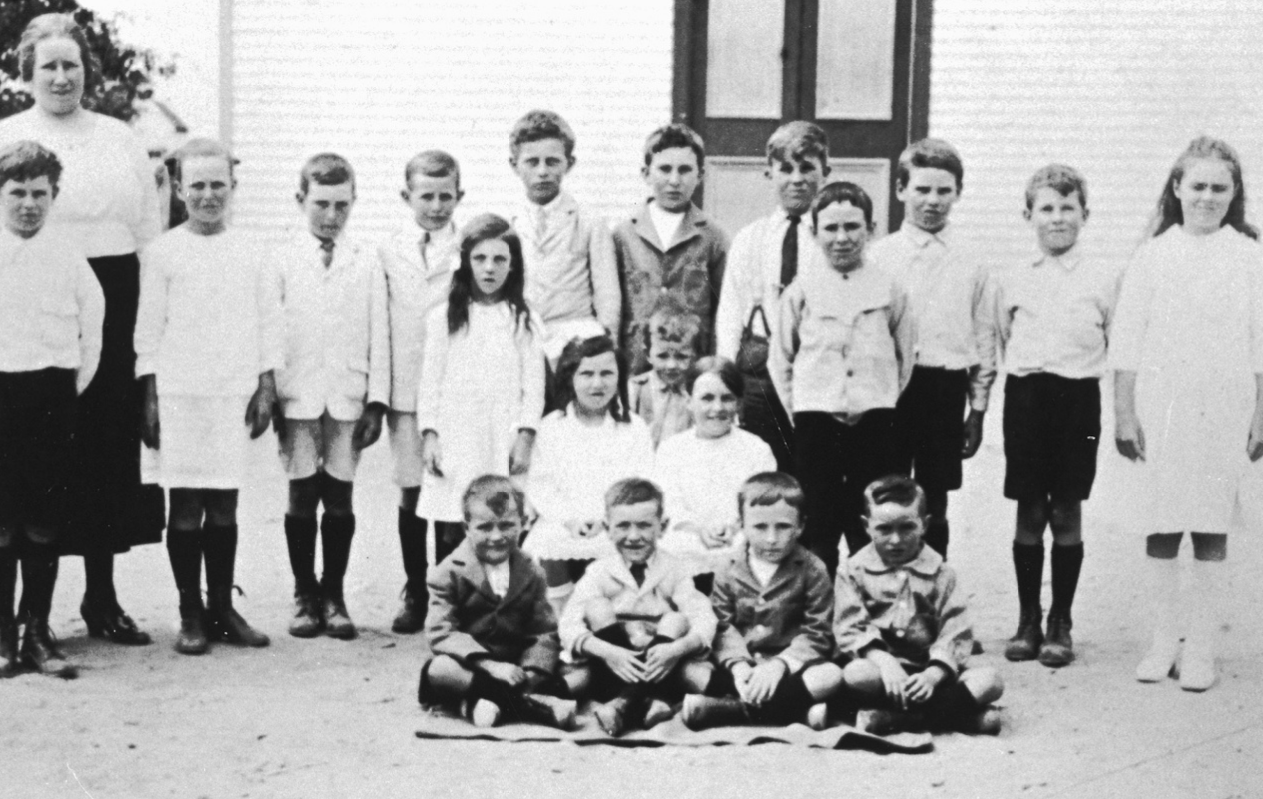
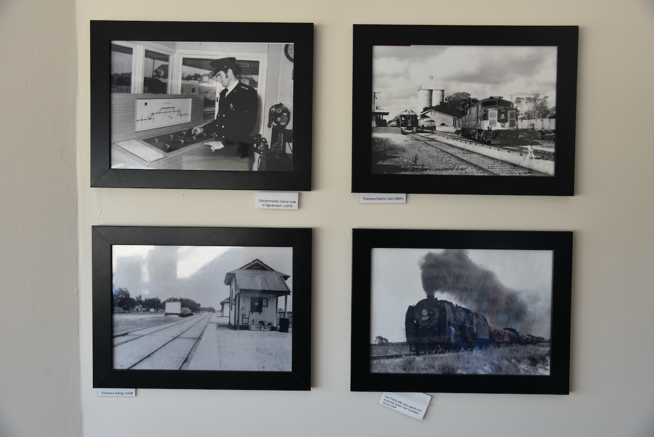
In 1868 the Tintinara Post office was opened. The town of Tintinara was proclaimed on the 30th day of August 1906. The Tintinara school was opened in 1907 with 12 students and Miss Maud Jackson as the teacher. The Tintinara Institute opened in 1911. A Congregational Church and a Methodist church were built in 1913.

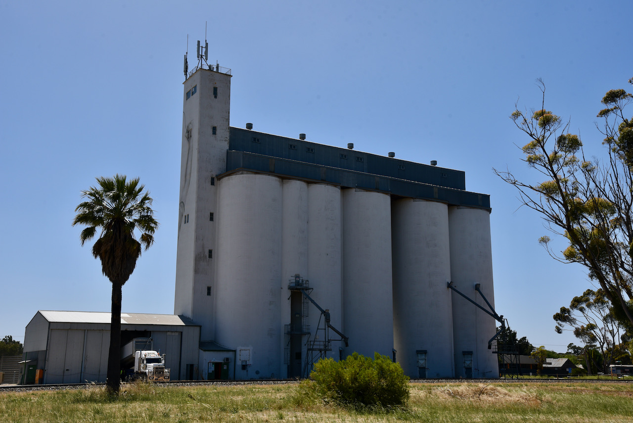
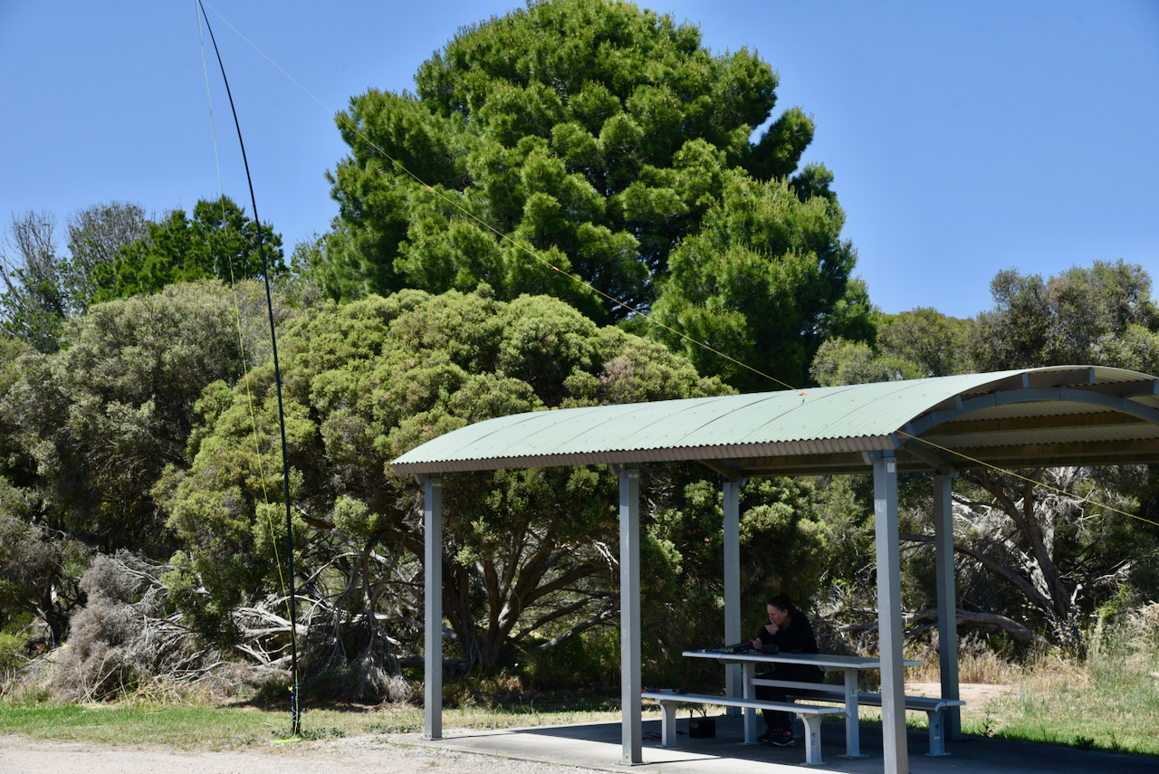
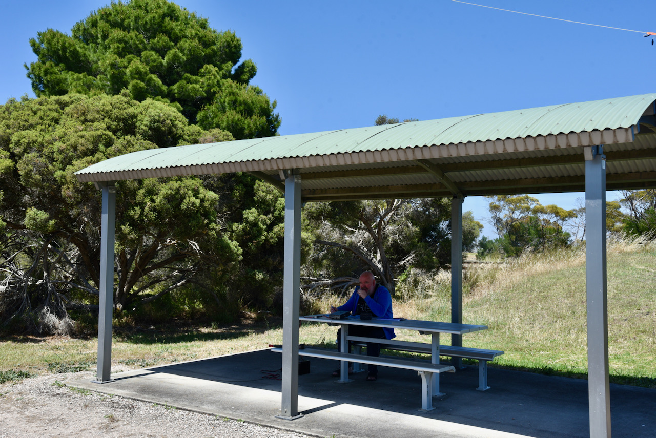
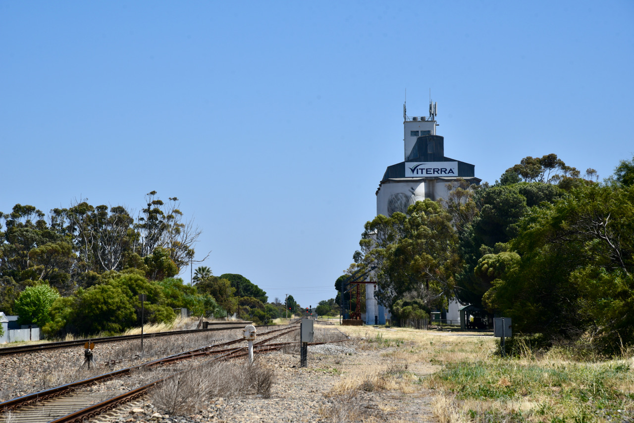
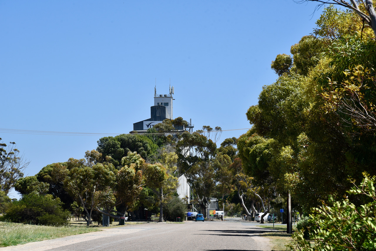
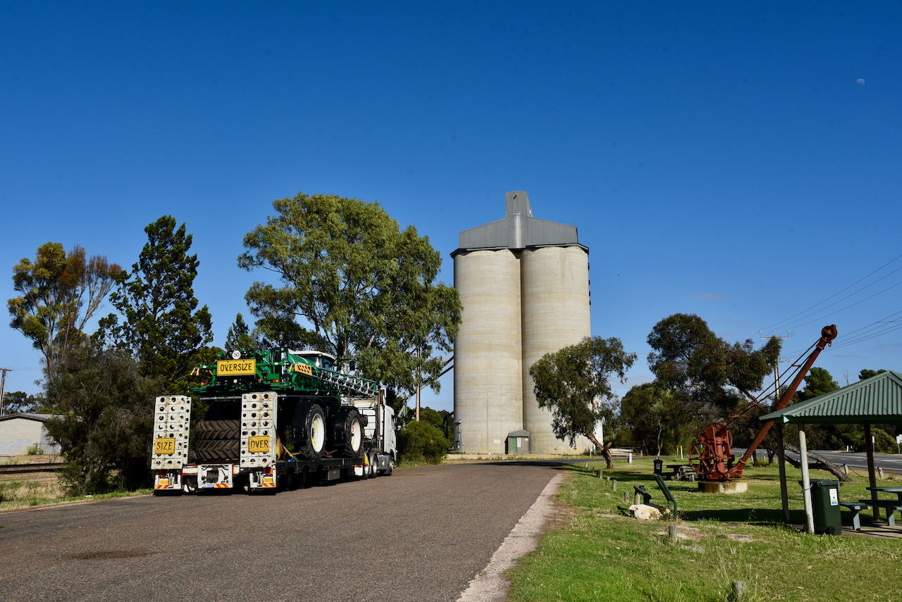
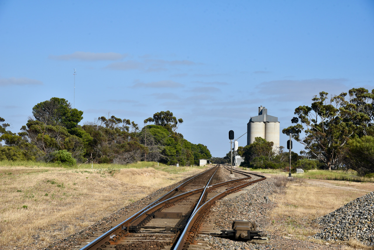
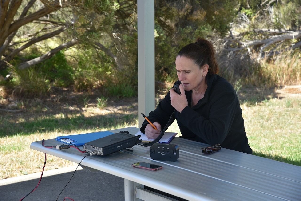
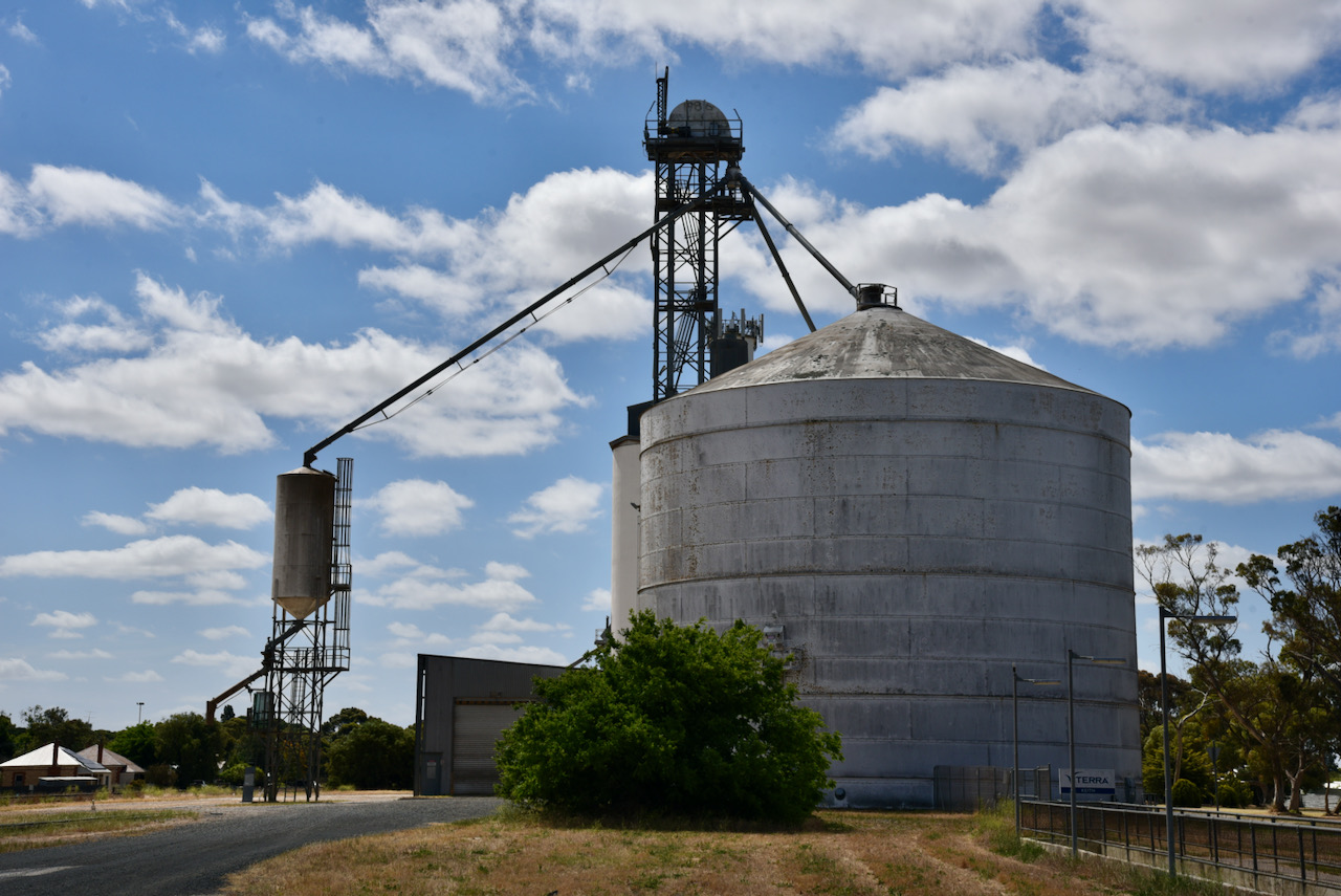
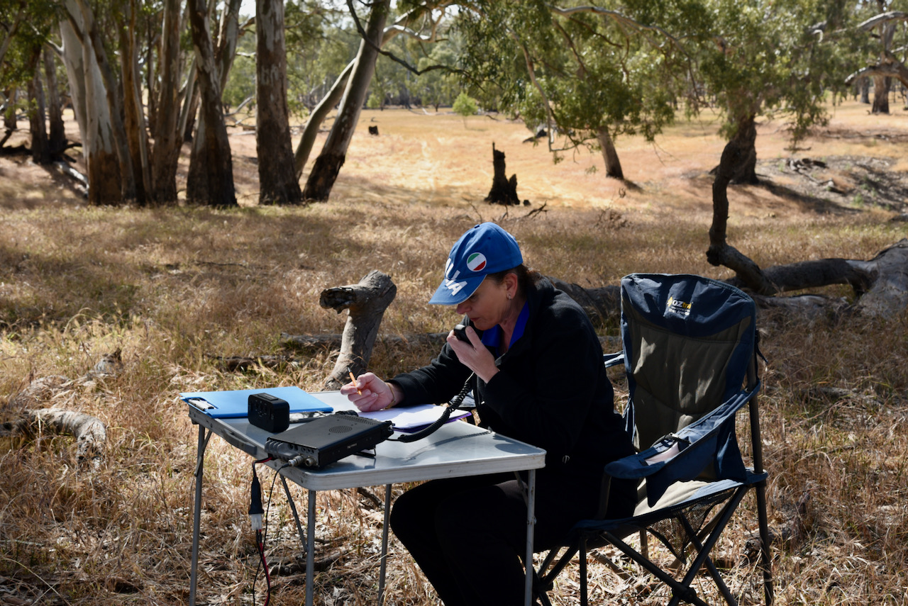
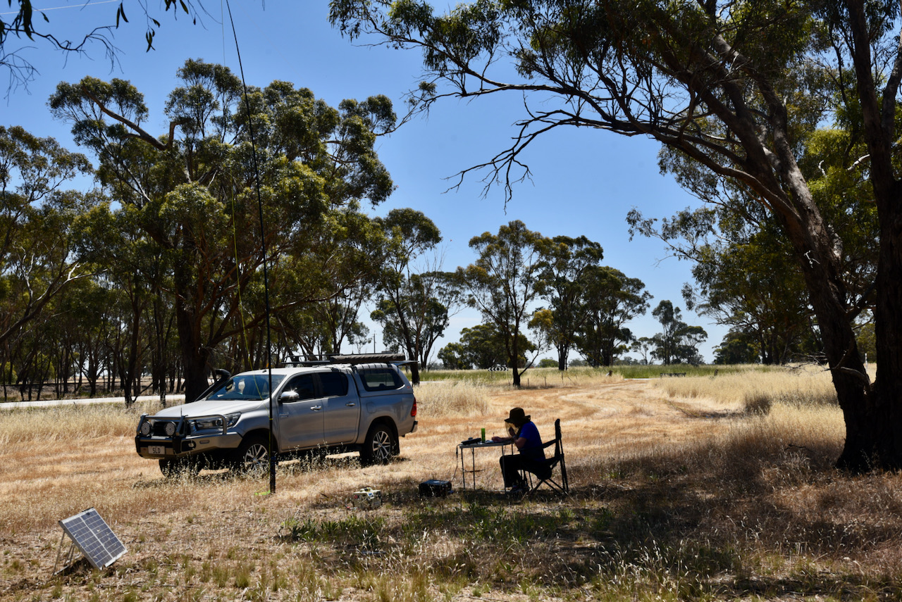
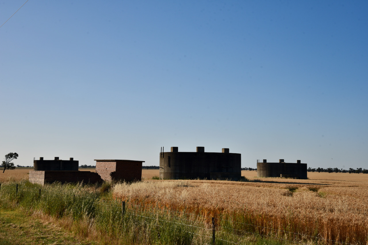
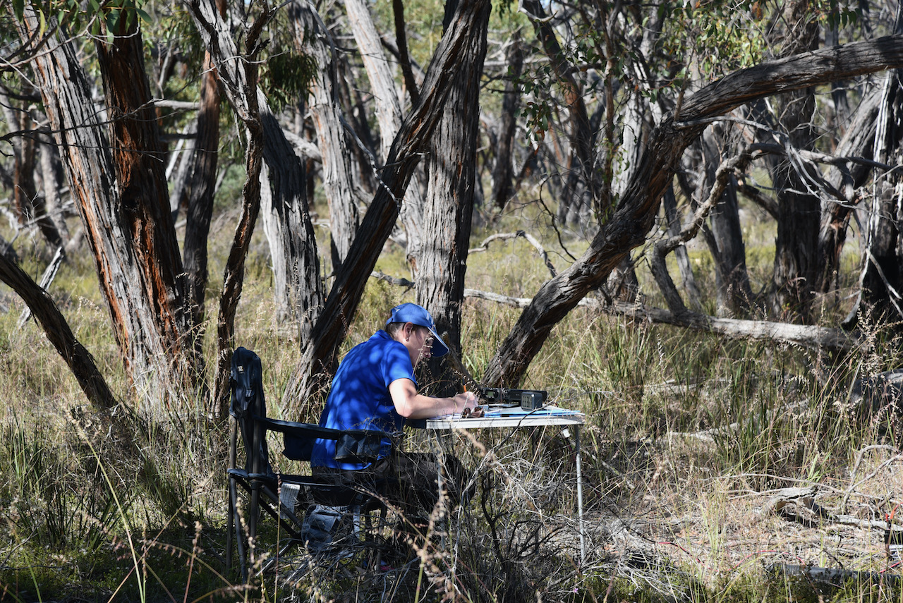
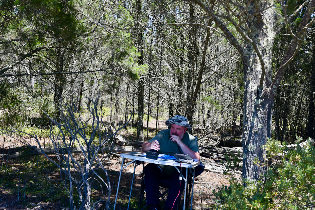
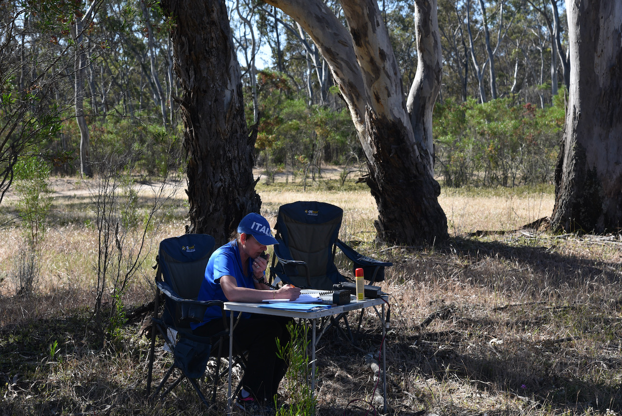
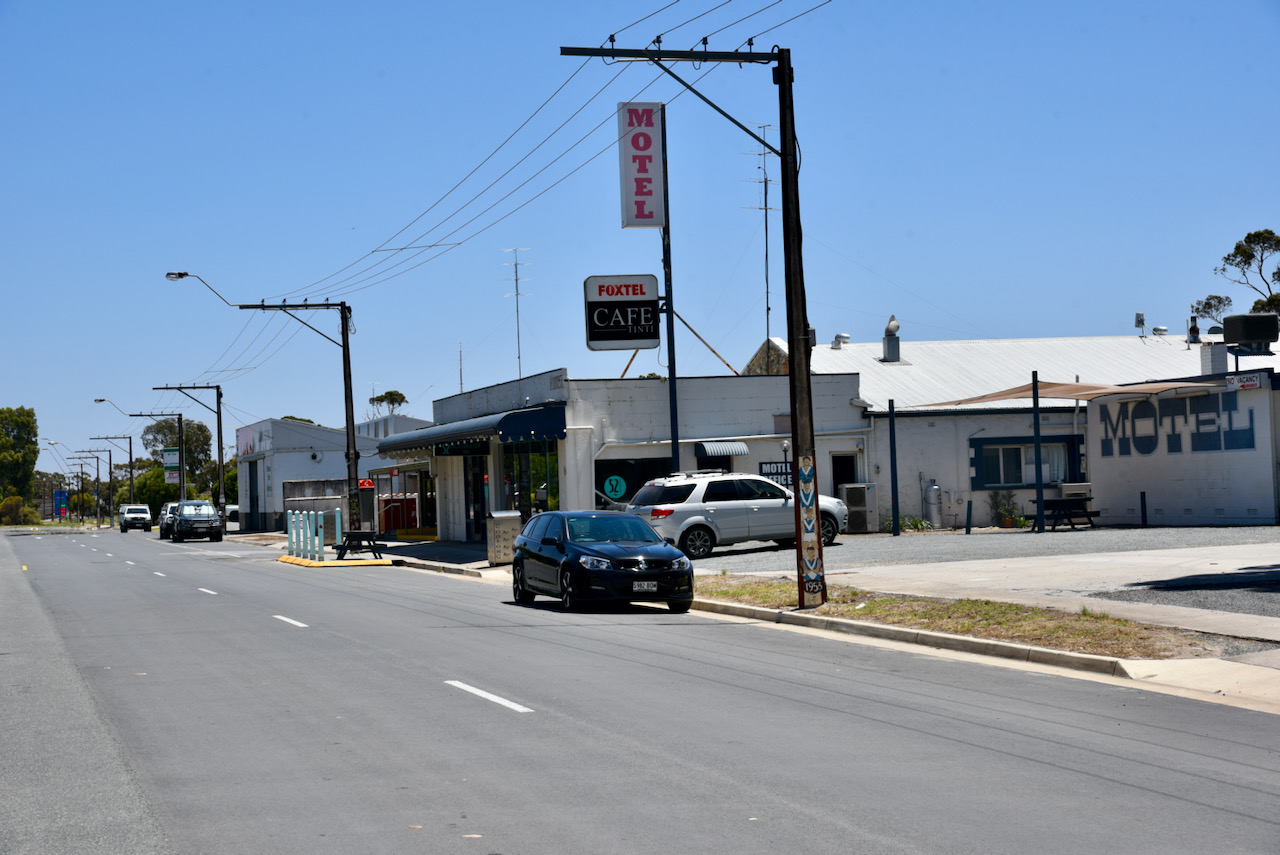
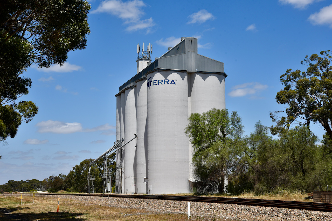
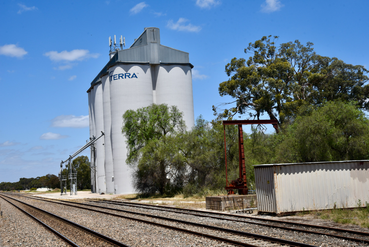
The Tintinara silos are located on the southern side of the Dukes Highway. It was quite noisy in town, so we drove a little further southeast on the Dukes Highway and set up amongst the trees and alongside of the highway and the railway line.

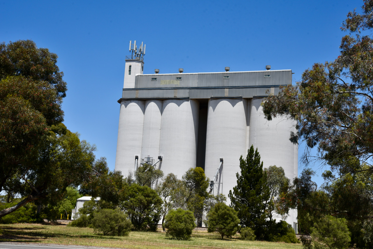
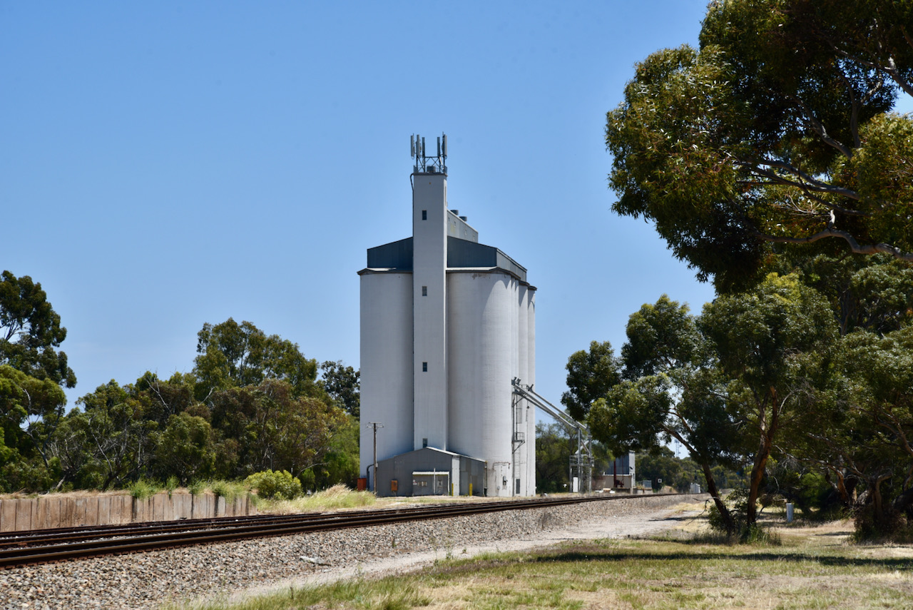
We ran the Yaesu FT-857, 40 watts, and the 20/40/80m linked dipole for this activation. We had strength 4 noise on 40m despite being a few hundred metres out of town.

I called CQ on 7.150 and this was answered by Peter VK3PF, followed by Ross VK3BEL, and then geoff VK3SQ. The silo had been activated. I then spoke with Peter VK3ZPF, Haucke VK1HW mobile, and Michael VK5LN, before swapping the operator’s chair with Marija.

Marija’s first contact was with Ross VK3BEL, followed by Peter VK3PF, and then Ian VK5CZ. Marija logged a further 5 stations before callers dried up.

We then headed to the 20m band where we logged a total of 6 stations, all from VK2.

To wrap up the activation I called CQ on 80m, but we had strength 9 noise and it made operating very difficult. We logged just the one station, John VK5HAA.

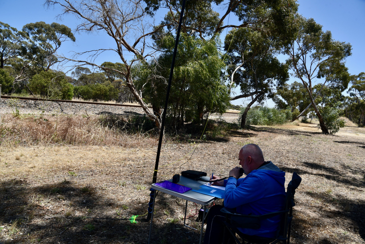
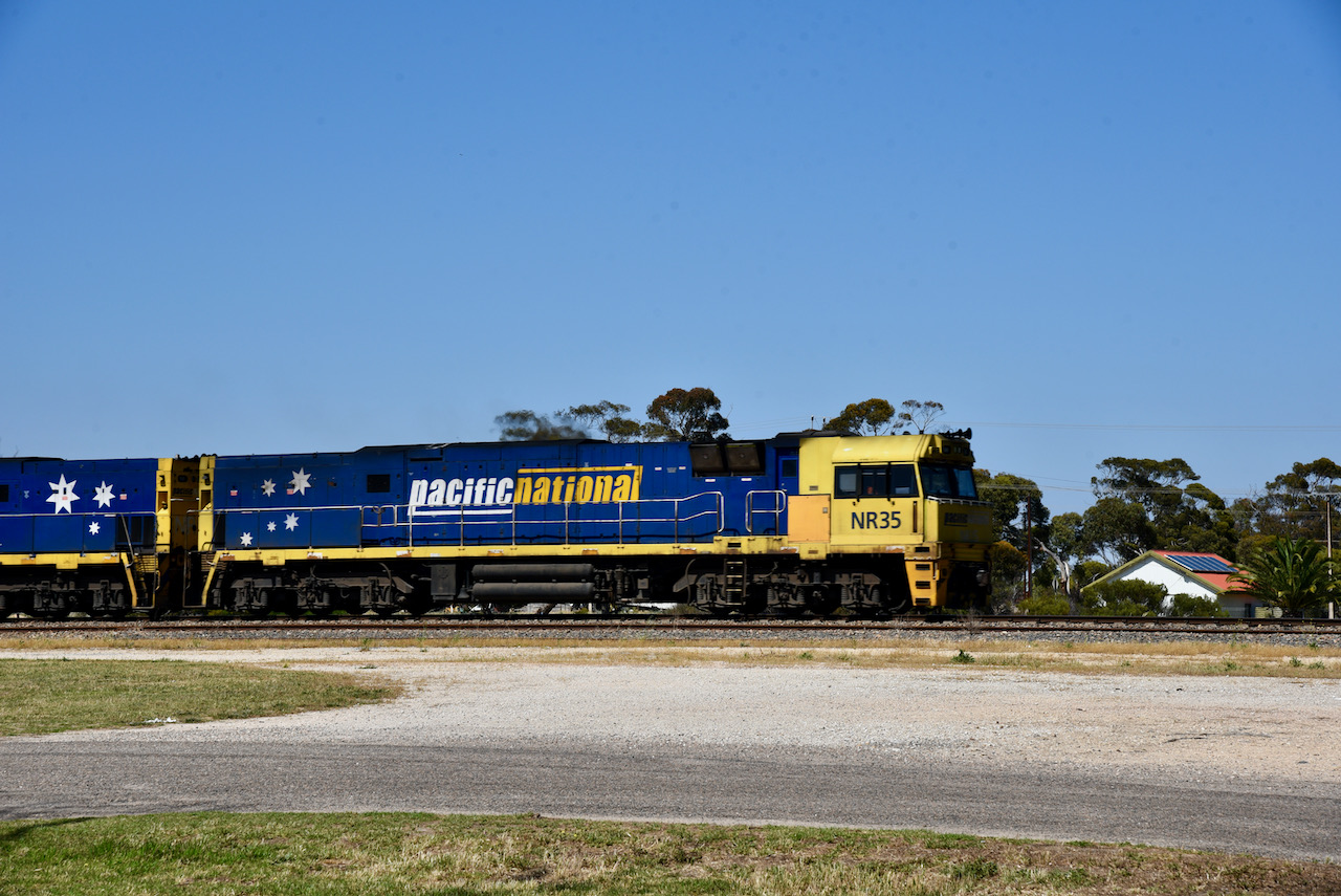
We were set up right alongside of the main railway line between Adelaide and Melbourne and at one point had to stop calling CQ as a large freight train passed by us.

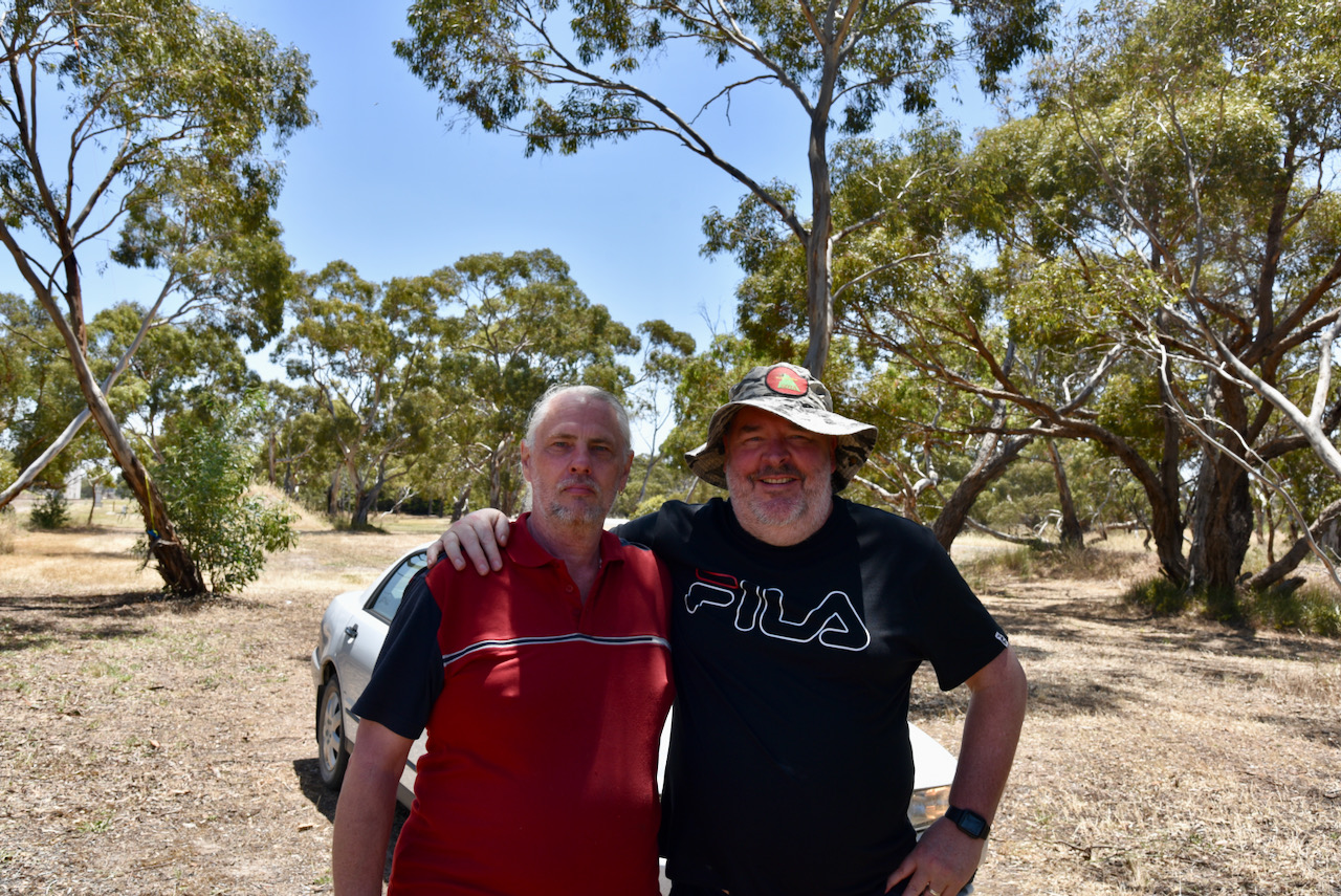
During our activation, we had a surprise visit by a local amateur radio operator, Terry VK5TM and his wife.

Marija made the following contacts on 40m SSB:-

  1. VK3BEL
  2. VK3PF
  3. VK5CZ
  4. VK5WG
  5. VK5LN
  6. VK3HKV
  7. VK5MSA
  8. VK5COL

Marija made the following contacts on 20m SSB:-

  1. VK2IO
  2. VK2VW
  3. VK2HFI

I made the following contacts on 40m SSB:-

  1. Vk3PF
  2. VK3BEL
  3. VK3SQ
  4. VK3ZPF
  5. VK5HW/m
  6. VK5LN

I made the following contacts on 20m SSB:-

  1. VK2VW
  2. VK2HFI
  3. VK2NP

I made the following contact on 80m SSB:-

  1. VK5HAA

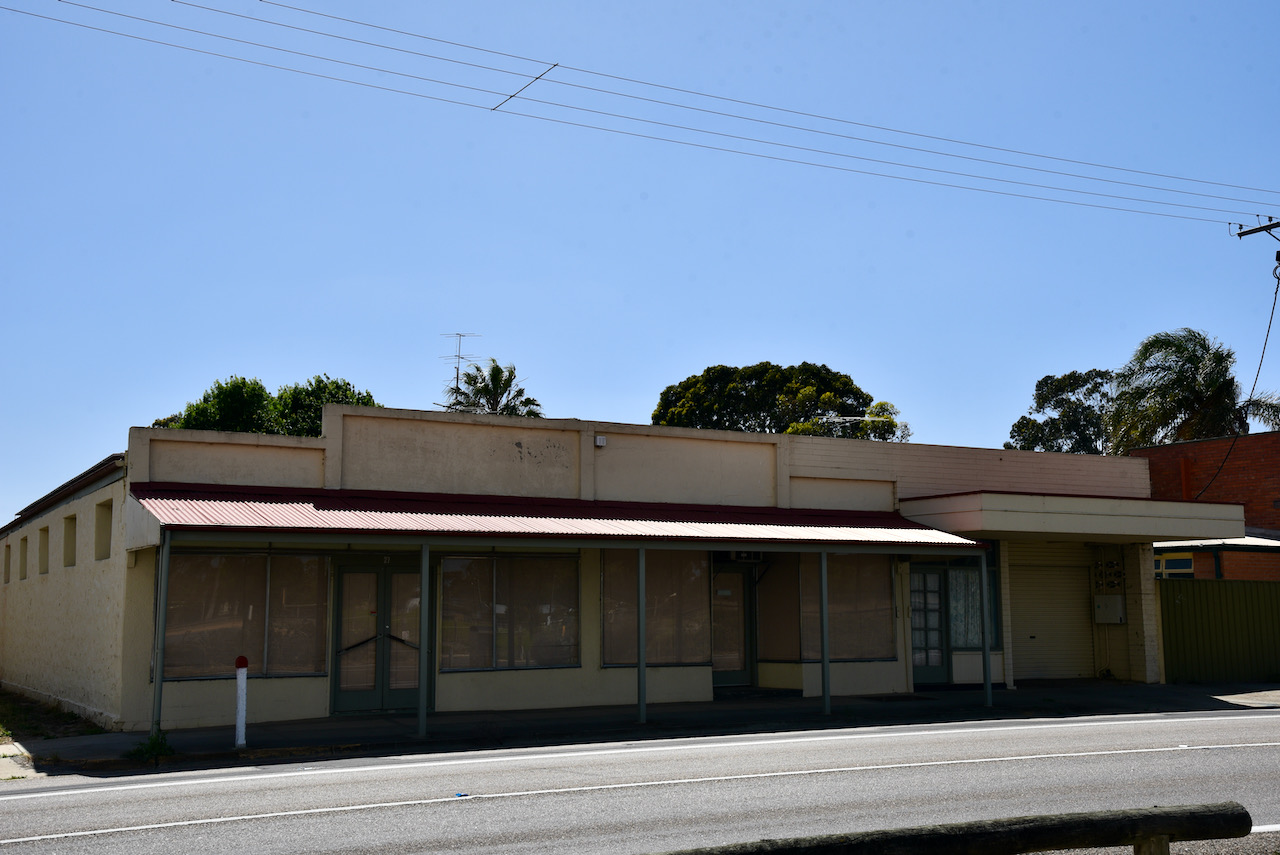
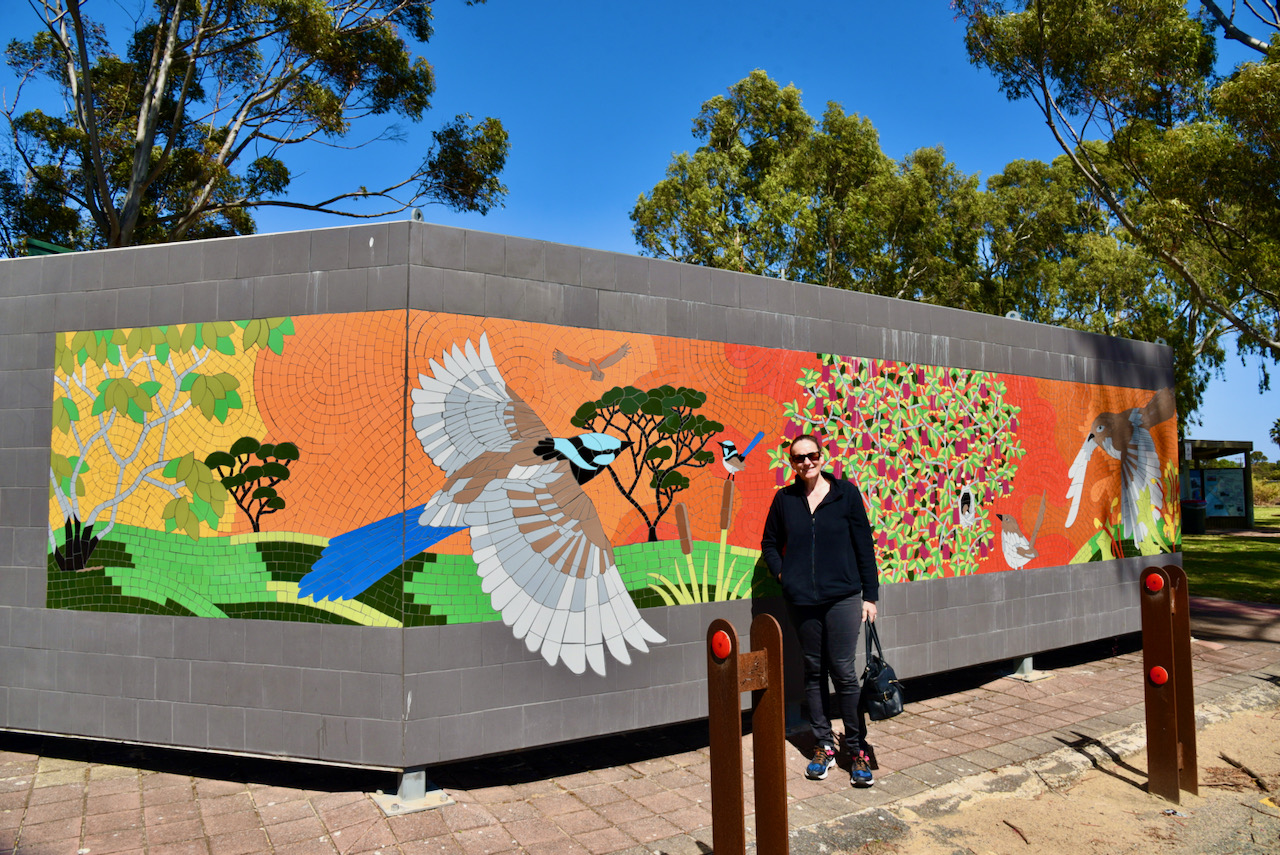
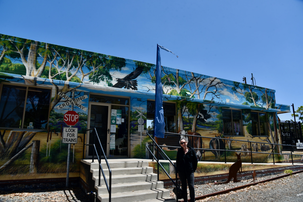
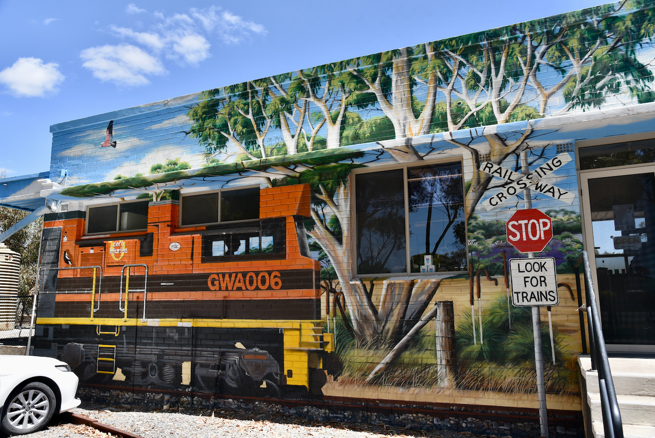
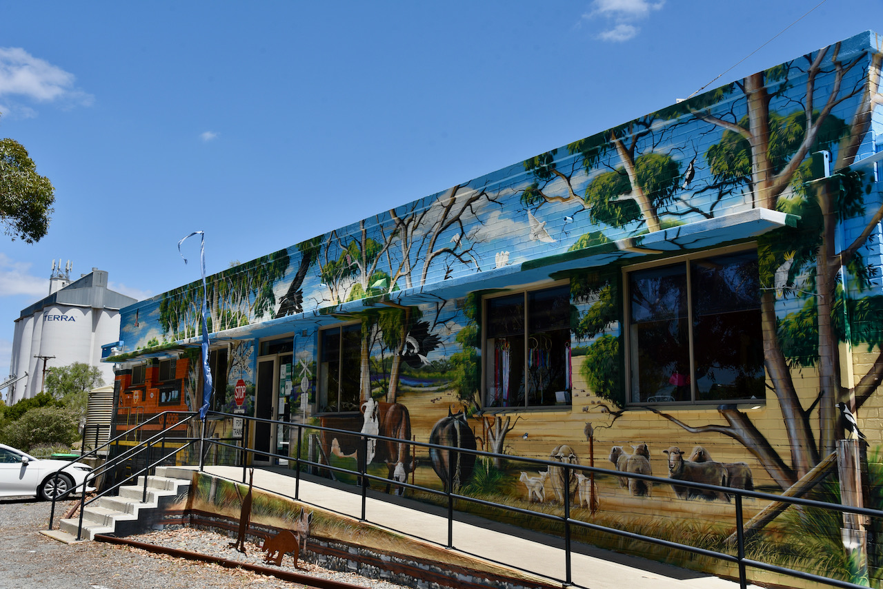
After packing up at the silo we headed to the Tintinara Visitor Information Centre which has a very distinctive mural painted on it that features a train, and the beef, sheep and wool industries of the district.

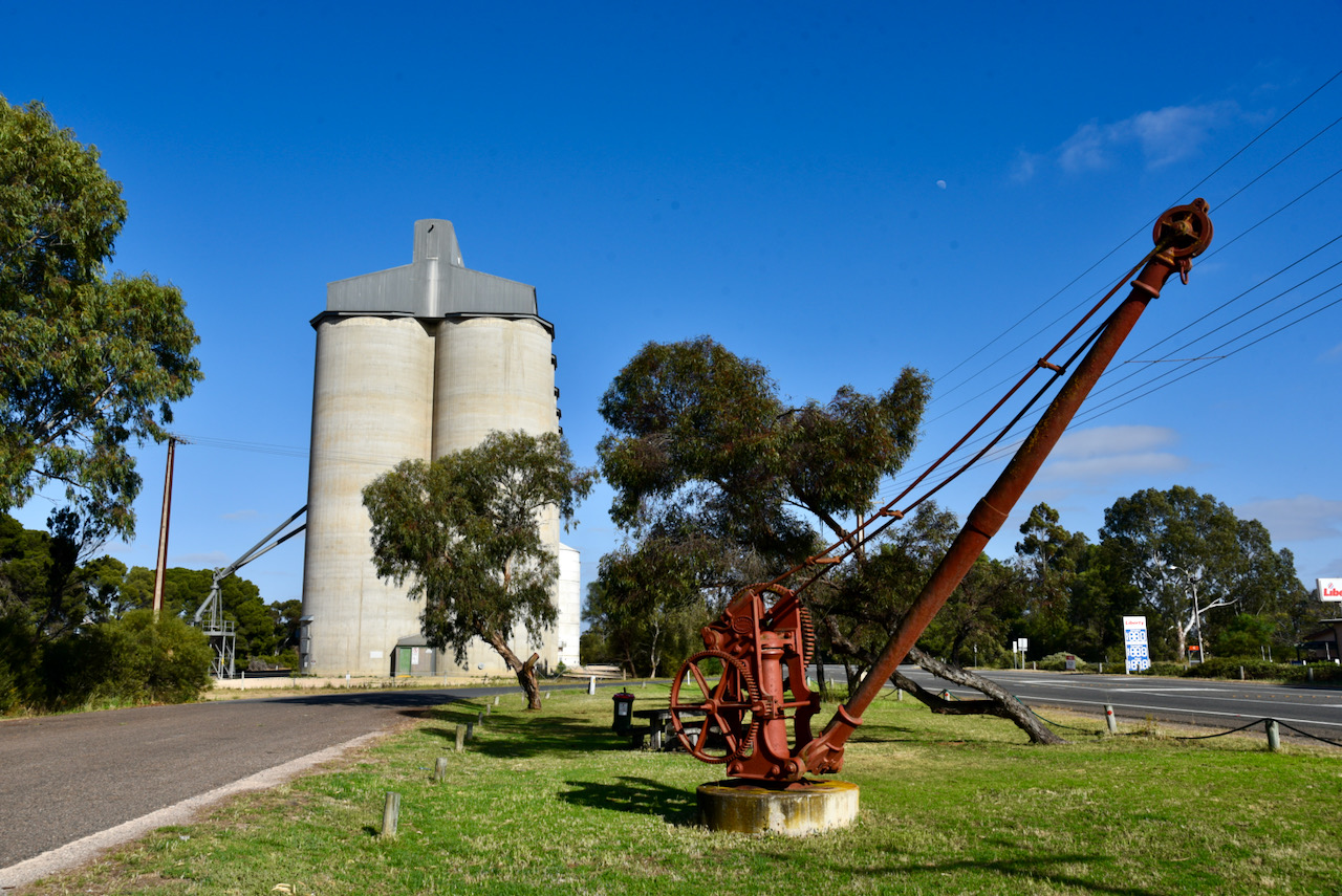
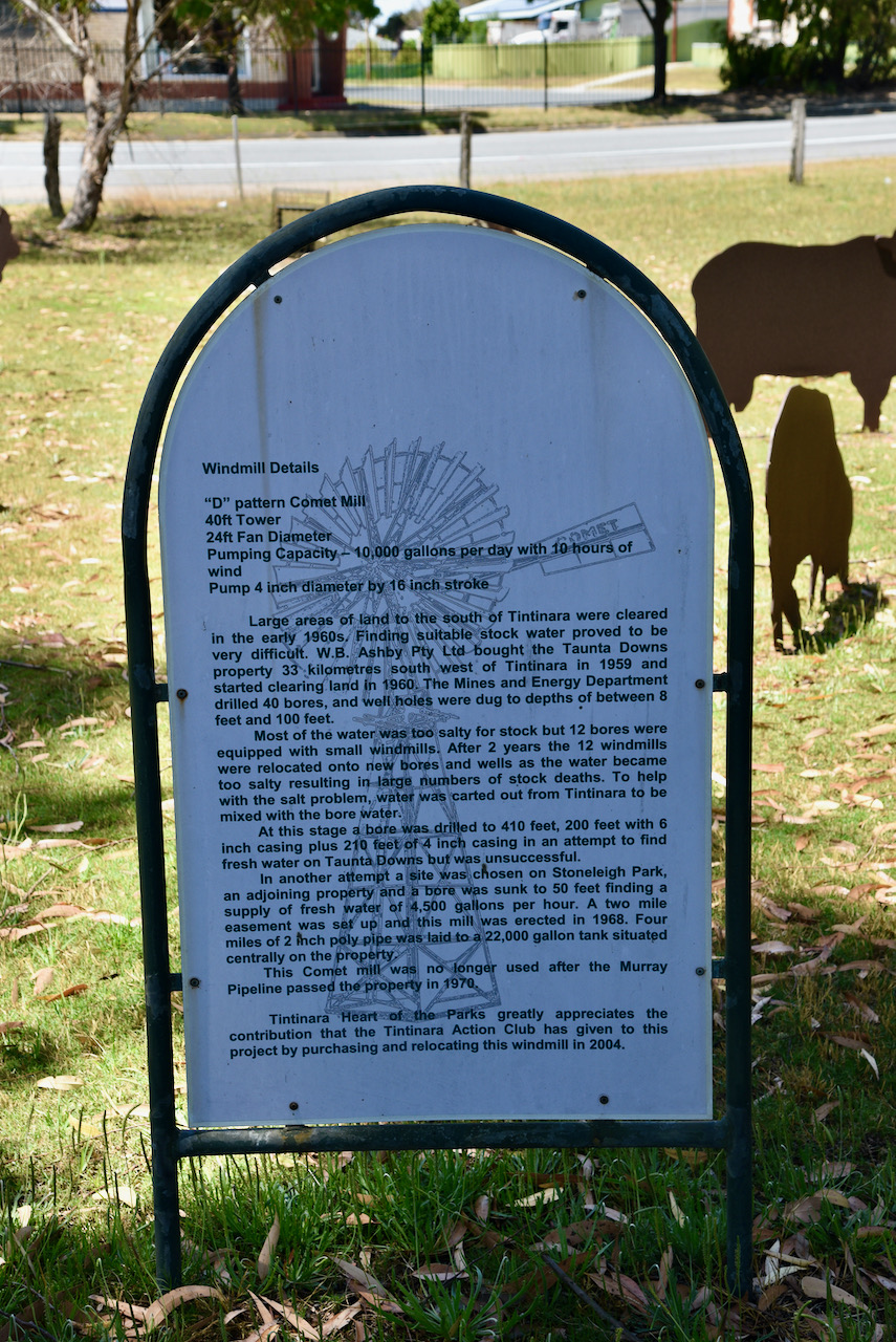
You can also find here an impressive D pattern Comet Windmill which stands at 40 feet. The windmill was previously used in the Tintinara district prior to the Murray Pipeline passing through the property.

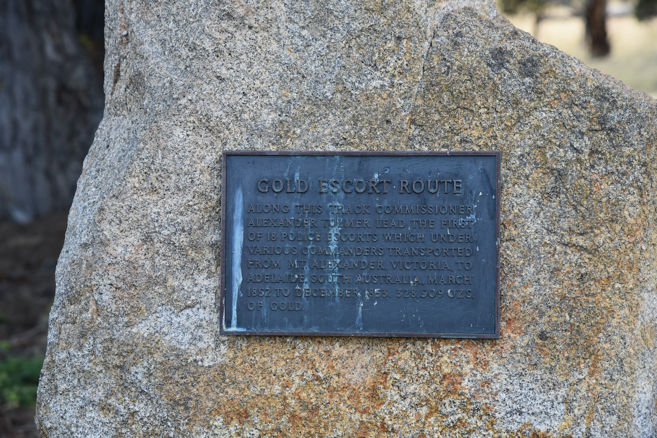
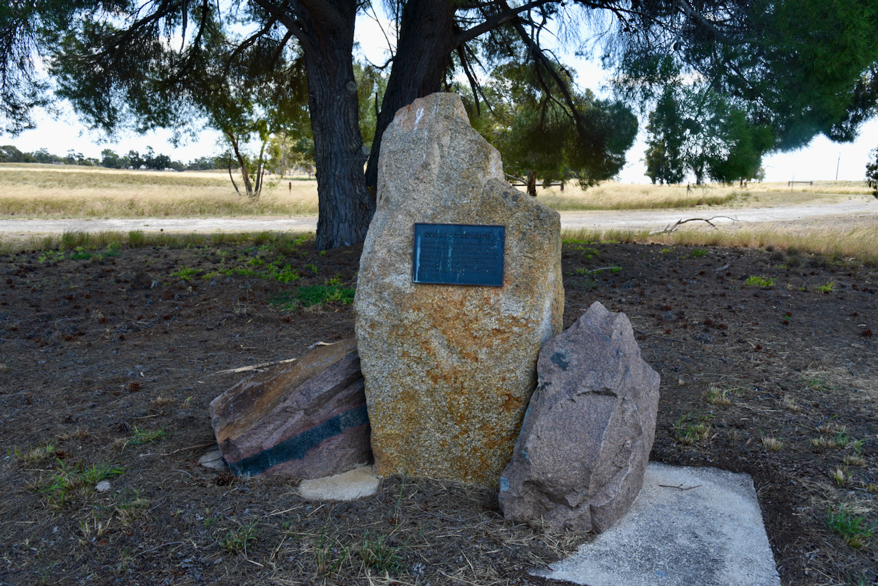
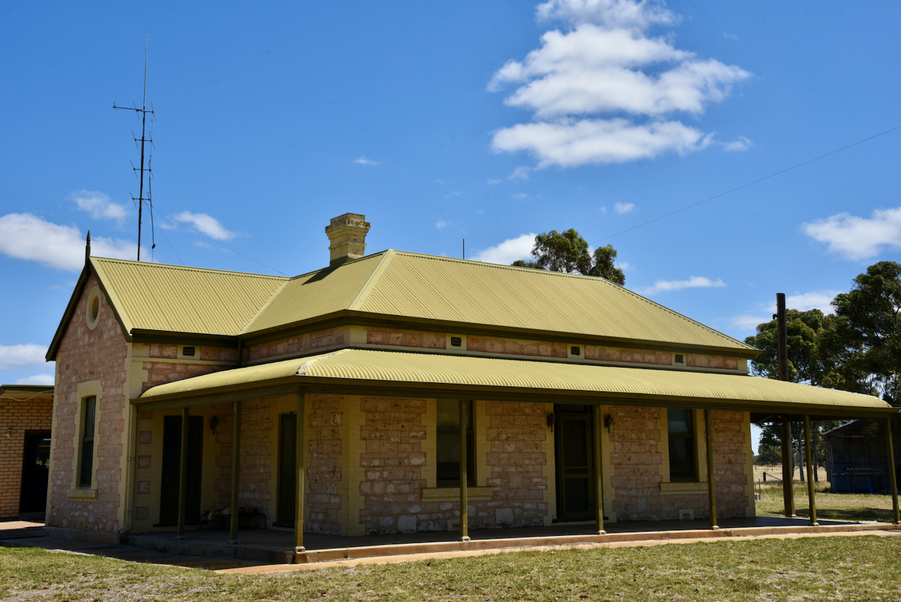
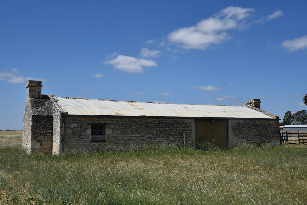
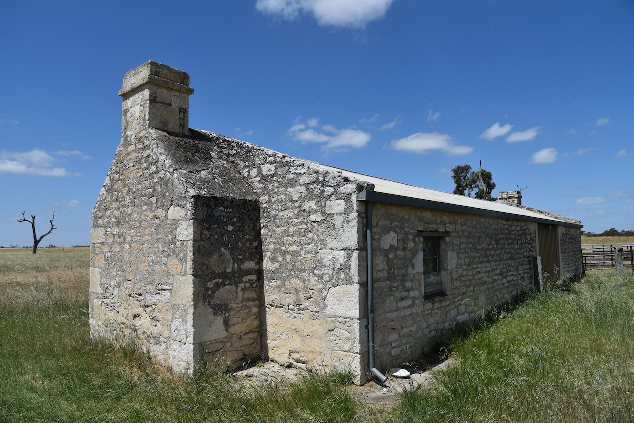
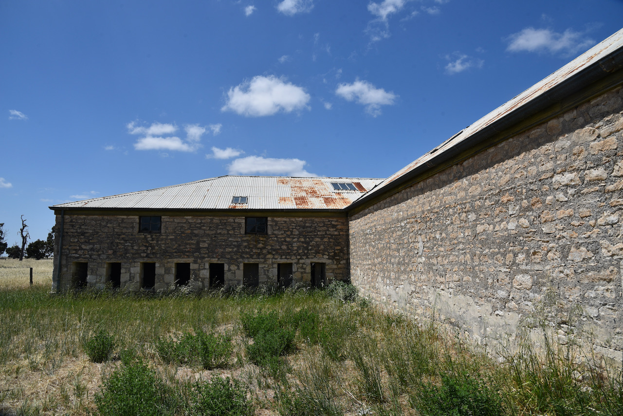
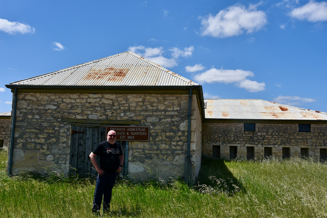
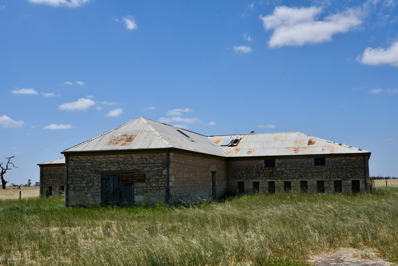
We then headed out to the Tintinara Homestead and the historic shearing shed. Out the front of the property is a cairn marking the Gold Escort route……

“Along this track Commissioner Alexander Tolmer lead the first of 18 police escorts which under various commanders transported from Mt Alexander Victoria to Adelaide, South Australia, March 1852 to December 1853, 328,509 ozs of gold”

The Tintinara homestead was constructed in 1865. Shortly afterwards it became a post office. For many years it was a stopping point for Tolmer and his gold escort group. The walls of the homestead were once papered with old copies of the Adelaide Chronicle.

Whilst there we realised that this was potentially on private property. We telephoned the Visitor Information Centre but sadly they did not have much information on the homestead other than to tell us it was on private property. On that basis, we decided to leave. We left a note for the owners, who very kindly sent us an SMS message later that day stating they were happy for us to have a look.

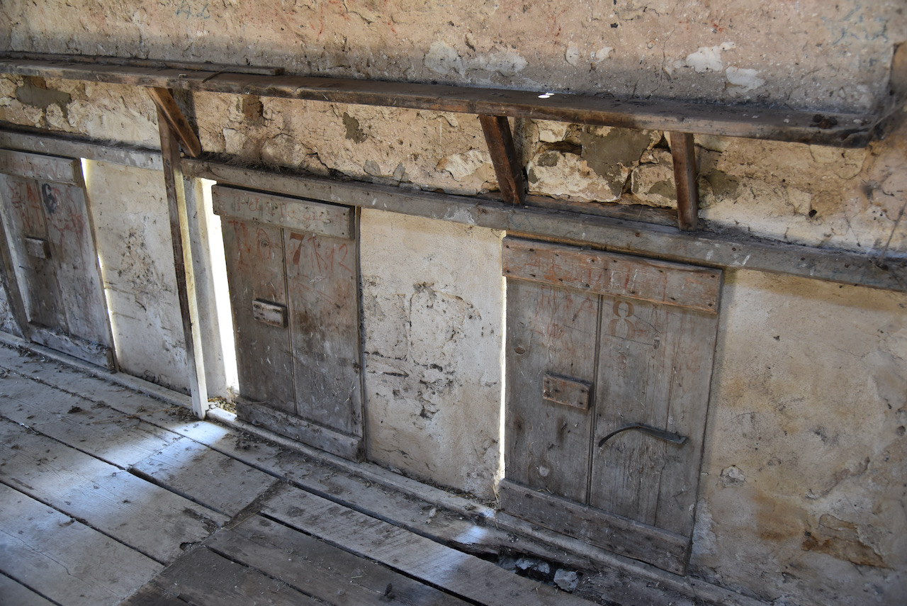
We drove a short distance to the Tintinara Woolshed which was built in 1865. I always enjoy looking in old woolsheds as the history is quite amazing. The limestone walls are 80cm thick and the roof timbers are up to 11 metres long. They were carted by bullock drays to the location from Kingston South East.

You can also find a marker here on the Gold Escort Route.

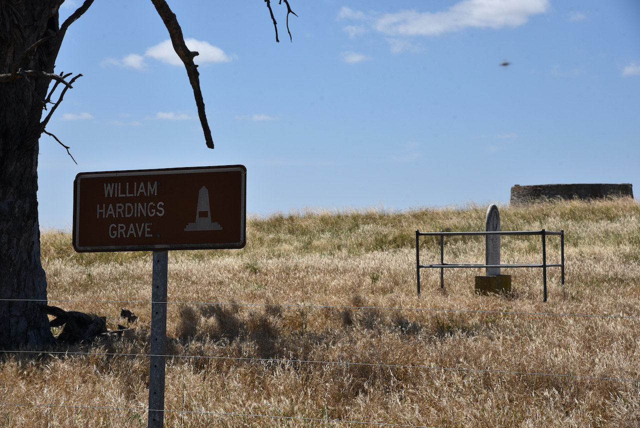
Also located on the property is the headstone of William Harding. The headstone reads:-

Affectionate Remembrance of William. The beloved husband of Mary Harding, who departed this life July 5th 1874. Ages 50 years. Remember your Creator in the days of thy youth’.

References.

  1. A Compendium of the Place Names of South Australia, 2021, <https://published.collections.slsa.sa.gov.au/placenamesofsouthaustralia/>, viewed 2nd December 2021.
  2. Aussie Towns, 2021, <https://www.aussietowns.com.au/town/tintinara-sa>, viewed 2nd December 2021.
  3. Australian Dictionary of Biography, 2021, <https://adb.anu.edu.au/biography/boothby-thomas-wilde-3323>, viewed 2nd December 2021.
  4. flickr, 2021, <https://www.flickr.com/photos/82134796@N03/39992634621>, viewed 2nd December 2021.
  5. Tintinara Heart of the Parks, 2021, <https://tintinara.com.au/visit/tintinara-homestead/>, viewed 2nd December 2021.
  6. Wikipedia, 2021, <https://en.wikipedia.org/wiki/Tintinara,_South_Australia>, viewed 2nd December 2021
  7. Wikipedia, 2021, <https://en.wikipedia.org/wiki/Alexander_Tolmer>, viewed 2nd December 2021.
  8. Wikipedia, 2021, <https://en.wikipedia.org/wiki/Gold_Escort>, viewed 2nd December 2021.

Coonalpyn silo VK-CNN5

After packing up at Coomandook, we continued east for about 30 km and we soon reached the town of Coonalpyn. Coonalpyn is located about 143 km southeast of Adelaide.

Above:- Map showing the location of Coonalpyn. Map c/o Google maps.

It is believed that Coonalpyn is derived from the aboriginal word konangalpun (or kunalpin) meaning ‘place of mice excreta’ – kuna, ‘dung’. This is due to the area regularly being subject to periodical mice plagues. Another source states the name derives from kunangalpe meaning ‘crow track, line of travel’. While a third source states it means ‘barren woman’.

An early pastoralist in the Coonalpyn district was John Barton Hack who named his property Coonalpyn Downs. Hack had arrived in South Australia in 1837.

Above:- John Barton Hack. Image c/o Wikipedia

A post office was opened at Coonalpyn in 1887 and this was followed by the Coonalpyn school in 1889. The school closed in 1927 following a diphtheria epidemic. The school was located about 3 km southeast of the town. In May 1886 the railway line opened. It was known as the Nairne to Bordertown Railway. The railway brought a regular mail service to Coonalpyn. By 1889 the Coonaplyn Post office was dispatching 3,946 letters, packages, and newspapers a year and receiving 2,838.

In 1894 a railway station, station master residence, porters house and gangers house were built.

The town of Coonalpyn was proclaimed on the 25th day of November 1909. The first shop, known as the Coonalpyn stores, was opened in 1915.

Above:- The SA Govt Gazette showing the proclamation of Coonalpyn.

Nowadays in Coonalpyn, you can find a hotel, a community swimming pool, bakery, cafes, the town hall, oval, rest area, school, a medical centre, the silo mural, the Mosiac project, Tunnel Vision, and more.

Above:- Aerial view of Coonalpyn. Image c/o Google maps.

The Coonalpyn silos are active silos and are operated by Vitera. Due to a rise in quality grain in the Coonalpyn district, the first 9,600 ton silo was built in 1965. This was followed by another in 1967 increasing the capacity to 15,000 ton.

The silo art was part of the Creating Coonalpyn initiative, a $100,000 joint project of the local Council, with Country Arts SA and Viterra. The idea was for the renewal of the town of Coonalpyn through the arts. The initiative also included sponsorship from local businesses and individuals. The silo art in Coonalpyn is just part of this initiative.

The silo art is the work of world-renowned large scale mural artist Guido van Helten. The murals on the silos depict five Coonalyn primary school children in various poses. The Coonalpyn silos were the first silos to be painted in South Australia and were completed in March 2017. The mural took 200 cans of paint to complete. The artists van Helten used photographs as a reference, and first drew a giant grid onto the face of the five silos. He then sprayed paint to create the designs.

During the month-long painting of the silo, it is estimated that each hour about 40 to 50 vehicles stopped each hour to view van Helten at work. Coonalpyn became the most photographed regional town in South Australia, with the silo art project attracting both local, national, and international media attention. As a result of the silo art, three new businesses opened up in Coonalpyn including the Silos Cafe.

Below is a time-lapse video of the painting of the silos.

Other than the silo art, you can also view the Mosaic Mural which was created by Mike Tye and Marcia Camac and a team of local mosaic enthusiasts. The mosiac has images of birds, echidna, Correa and other native flora and fauna of the region. It took 27 volunteers over 3,000 hours over a 12 month period to complete.

There is also the Tunnel Vision mural project which features numerous murals created by the local Coonalpyn children.

I have attached a brochure entities ‘Connalpyn Arts Trail’ below.

In the rest area, you can find an excellent information board with the history of Coonalpyn and the district. There is also a tractor and a plough to acknowledge the importance of farming in the Coonalpyn district.

We then stopped off at the Waffles & Jaffles Cafe at Coonalpyn and enjoyed some Belgium waffles.

Below is a great story on the ABC website about the history of the Coonalpyn Waffles cafe ……

https://www.abc.net.au/news/2021-01-24/coonalpyn-belgian-waffle-empire-in-australia/13054198

We then tried a few different spots for the silo activation, testing the noise floor with the transceiver in the Toyota Hi-Lux. Alongside the silos, the noise floor was S9 plus on 40m. Although the SiOTA rules state that the activation zone is within 1 km of the silo, we wanted to be relatively close to the silo, so we set up in the rest area a few hundred metres south of the silo.

The silos were within sight from our activation spot.

Unfortunately, when we turned on the Yaesu FT857d after setting up the 20/40/80m linked dipole, the noise floor on 40m was strength 9. It had been lower from the vehicle. We decided to soldier on despite the noise floor and the noise of passing trucks and trains.

First in the log for me was Andy VK3VKT, followed by Peter VK3PF and Adrian VK5FANA. I had qualified the silo. I logged a further 3 stations on 40m before Marija took charge of the microphone.

Marija’s first contact was with John VK2YW, followed by Peter VK3PF, and then Geoff VK3SQ. Marija logged a further 2 stations on 40m until the noise floor got the better of us and we decided to try the 20m band. We know there were other stations calling, but the noise was horrendous.

To our great pleasure, there was no noise at all on 20m. We logged a total of 9 stations on the 20m band from VK1, VK2, VK3, VK4, and New Zealand.

To complete the activation we tried our luck on the 80m band, but the noise floor there was also strength 9. We logged just the one station, Adrian VK5FANA, before deciding that we would pack up and head to the next silo.

We had a total of 21 stations in the log and another silo successfully activated.

Marija worked the following stations on 40m SSB:-

  1. VK2YW
  2. VK3PF
  3. VK3SQ
  4. VK5FANA
  5. VK1DA

Marija worked the following stations on 20m SSB:-

  1. VK1DA
  2. VK2UH

Marija worked the following station on 80m SSB:-

  1. VK5FANA

I worked the following stations on 40m SSB:-

  1. VK3VKT
  2. VK3PF
  3. VK5FANA
  4. VK3BEL
  5. VK5WG
  6. VK2YW

I worked the following stations on 20m SSB:-

  1. VK1DA
  2. VK2UH
  3. VK4NH
  4. VK2IO
  5. VK4SMA
  6. ZL3RIK
  7. VK3PF

References.

  1. Australian Silo Art Trail, 2021, <https://www.australiansiloarttrail.com/coonalpyn>, viewed 1st December 2021.
  2. Coorong District Council, 2021, <https://www.coorong.sa.gov.au/community/arts-and-cultural/creatingcoonalpyn>, viewed 2nd December 2021.
  3. Murray River.com, 2021, <https://www.themurrayriver.com/about/historical-story/>, viewed 2nd December 2021.
  4. Professional Historians Australia, 2021, <http://www.sahistorians.org.au/175/documents/a-heritage-history-of-the-south-east-of-south-aust.shtml>, viewed 2nd December 2021.
  5. State Library SA, 2021, <https://published.collections.slsa.sa.gov.au/placenamesofsouthaustralia/>, viewed 1st December 2021.
  6. Wikipedia, 2021, <https://en.wikipedia.org/wiki/John_Barton_Hack>, v iewed 1st December 2021.

Coomandook silo VK-CMK5

On Friday morning (26th November 2021) Marija VK5MAZ hit the road at about 7.00 a.m. and started heading towards Bordertown in the southeast of South Australia. We had planned to stay at Bordertown for three nights and activate six parks for the annual VKFF Activation Weekend for the World Wide Flora Fauna (WWFF) program. We had also planned to activate some silos on the way down to Bordertown.

It was about a 255 km drive to Bordertown along the Dukes Highway, which is the main highway between the cities of Adelaide and Melbourne.

Above:- Map showing our route to Bordertown. Map c/o Google maps.

The highway is named in honour of the Duke of York and becomes the Western Highway once you cross the South Australia -Victoria State border. There were some attempts in the 1950s by a Member of Parliament to rename the highway, the Tolmer Highway in honour of Inspector Alexander Tolmer who led a gold escort route from Bendigo.

Above:- Newspaper article from the Border Chronicle, Fri 28 Sep 1928. Image c/o Trove

By the late 1920s, funds were made available by the the Australian Commonwealth Government for highway construction. In 1930, work commenced on forming the Dukes Highway from Murray Bridge to Bordertown.

Above:- Work in progress on the Duke’s Highway between Coomandook and Yumali, c. 1930. Imagec/o State Library South Australia.

Our first stop for the morning was just down the road from home, the Strathalbyn bakery, where we had some coffee and a bacon & egg roll for breakfast.

We then continued east, with our first stop being the town of Coomandook where we planned to activate our first silo for the day. Coomandook is a small town situated about 140 km southeast of Adelaide.

Above:- An aerial view of Coomandook. Image c/o Location SA Map Viewer.

The town of Coomandook takes its name from the Coomandook Run, a pastoral lease that was held by John Whyte (b. 1826. d. 1902) from 1869. The area which was to become the town was originally known as Comandook Siding. Coomandook was not always the preferred name. Many locals petitioned the local Agricultural Bureau for a name change to Roby, after the Hundred of Roby, however, this did not occur.

Above:- from the Daily Herald, Adelaide, Thurs 1st Oct 1914. Image c/op Trove

Whyte was born in Kinross, Scotland in 1826. He emigrated to Australia in 1853. After arriving in the new colony of South Australia, his first job was in Louisa Heath’s drapery store in Hindley Street, Adelaide. In 1864, Whyte and his brother and other family members, established Whyte, Counsell & Co, wholesale grocers. They also owned several Murray River steamers which they used to transport goods from their warehouse in Currie Street, Adelaide, along the Murray-Darling river system.

Whyte also became involved as a pastoralist and took up several runs in the Murray Mallee region including Coomandook Run. By 1877 Whyte held a total of 21 pastoral leases covering an area of 8,660 km2 and grazed up to 61,783 sheep including some cattle.

The word Coomandook is an aboriginal word believed to mean ‘place of different speech’, which was a name applied by the aboriginal people of one area to an adjoining tribal area where a different language was spoken. Other publications report that the name means ‘place of strife’ and enemies country’.

The first European wheat farmers arrived in the Coomandook district in 1904. Mr E. Hunt was the first grain farmer, who was well known for his team of six to eight horses. In 1906 the first shipment of wheat was transported out of Coomandook by rail. In 1910 a general store had been established.

A 1910 news article (see below) describes Coomandook:-

Situated in the transformed 90-mile desert – now the Border Downs – about a hundred miles from Adelaide, Coomandook three years ago seemed a wilderness. Today it is a flourishing and fertile farming district”.

Above:- An article from The Register, Adelaide, Mon 21st Nov 1910. Image c/o Trove.

In 1911 a telegraph office was built at what was known as Coomandook Siding. In 1912, the town of Coomandook was laid out into 19 allotments by Thomas Dart. A small Institute/hall was constructed of wood and iron, and this was used as the Coomandook school for a number of years. The school was then moved to the Coomandook Amalgamated Pastimes Club (CAPC) Hall which was built in 1939 and still exists today.

In 1911 the Parkin Memorial Congregational Church was erected. This was also used as a school. The Parkin Hall School closed in 1938 when the Commandook CAPC Hall was opened. The church partially closed at this time and the hall was used for church services. This was until the new church was constructed in 1970. Sadly at this time, the Parkin Congregational Church was demolished. In 1960 the Coomandook Area School was opened.

Above:- Various images from Coomandook over the years. All images c/o Trove.

Today, there is not much in Coomandook, which was once a railway stop for passenger trains and the home to a full-time station master. The town has a General store, a CFS station, a Uniting Church, and the Commandook Area School. The population is about 134 people. The area surrounding Coomandook is used for sheep grazing, beef cattle rearing, and grain growing.

The silos at Coomandook lie alongside the main Adelaide-Melbourne rail line. The first concrete grain silo to be erected in Coomandook was completed in 1967. In 2020, grain handler Vitara closed 12 silo properties, including Coomandook.

On the northern side of the silos is a rest area. There was a truck parked in the rest area so we decided to head around to the southern side of the silos on Williams Road and set up near the tennis courts.

We used the Yaesu FT857d, 40 watts, and the 20/40/80m linked dipole for this activation. Fortunately, there was very little noise on 40m.

I called CQ and first in the log was Peter VK3PF, followed by Mark VK4SMA, John VK2JPR, and then Keith VK2PKT. I had qualified the silo for the Silos On The Air program.

I logged 8 stations on 40m before swapping the microphone with Marija. She soon had her 4 contacts in the log, with contact number four being Keith VK2PKT.

We then moved to the 80m band where we logged a total of 6 stations, all from VK5.

We then lowered the squid pole and removed the links and headed to the 20m band where I logged Brett VK2VW/VK2HFI.

To conclude the activation, Marija put out a few more calls on 7.150 on 40m and logged a further 3 stations.

After 50 minutes at the silo, we had a total of 25 contacts in the log from VK2, VK3, VK4, and VK5.

Marija logged the following stations 0n 40m SSB:-

  1. VK3PF
  2. VK2UXO
  3. VK3BEL
  4. VK2PKT
  5. VK5WG
  6. VK3ZPF
  7. VK4NH
  8. VK3OHM
  9. VK2IO

Marija logged the following stations on 80m SSB:-

  1. VK5HAA
  2. VK5FANA
  3. VK5IS/m

I logged the following stations on 40m SSB:-

  1. VK3PF
  2. VK4SMA
  3. VK2JPR
  4. VK2PKT
  5. VK4NH
  6. VK3VIN
  7. VK2VW
  8. VK2HFI

I logged the following stations on 80m SSB:-

  1. VK5HAA
  2. VK5IS/m
  3. VK5FANA

I logged the following stations on 20m SSB:-

  1. VK2VW
  2. VK2HFI

References.

  1. Coorong District Council, 2021, <https://www.coorong.sa.gov.au/tourism/our-towns/our-towns-coomandook>, viewed 1st December 2021
  2. fickr, 2021, <https://www.flickr.com/photos/82134796@N03/40328820734>, viewed 1st December 2021.
  3. flickr, 2021, <https://www.flickr.com/photos/82134796@N03/40328818574>, viewed 1st December 2021.
  4. Trove, 2021, <https://trove.nla.gov.au/newspaper/article/30757584>, viewed 1st December 2021.
  5. Wikipedia, 2021, <https://en.wikipedia.org/wiki/John_Whyte_(pastoralist)>, viewed 1st December 2021.
  6. Wikipedia, 2021, <https://en.wikipedia.org/wiki/Coomandook>, viewed 1st December 2021.

Home from our trip away

We are home from our trip to Bordertown.

We activated eight silos for the Silos On The Air (SiOTA) program, and six parks for the VKFF Activation Weekend for the World Wide Flora Fauna (WWFF) program.

We made a total of 944 QSOs and 272 Park to Park contacts.

Contacts into VK1, VK2, VK3, VK4, VK5, VK6, VK7, VK8, Japan, and New Zealand.

PARKS.

  • Poocher Swamp Game Reserve VKFF-1741 (122 QSOs)
  • Custon Conservation Park VKFF-1024 (95 QSOs)
  • Wolseley Common Conservation Park VKFF-1125 (126 QSOs)
  • Pine Hill Soak Conservation Park VKFF-1078 (173 QSOs)
  • Bangham Conservation Park VKFF-0869 (116 QSOs)
  • Geegeela Conservation Park VKFF-0883 (106 QSOs)

SILOS.

  • Coomandook VK-CMK5 (25 QSOs)
  • Coonalpyn VK-CNN5 (21 QSOs)
  • Tintinara VK-TNA5 (21 QSOs)
  • Keith VK-KTH5 (19 QSOs)
  • Wirrega VK-WRG5 (32 QSOs)
  • Bordertown South VK-BRN5 (23 QSOs)
  • Bordertown East VK-BRT5 (31 QSOs)
  • Wolseley VK-WLY5 (34 QSOs)

I will start adding posts about each of the activations over the next few weeks.

Thanks to everyone who called.  We had a fantastic 4 days away.

Radio Taiwan International – 12100 kHz

On 22nd November 2021, I tuned in to Radio Taiwan International broadcasting on 12100 kHz in the English language. This was a new frequency for me for this station.

This broadcast was from their 100kW transmitter site at Pao-chung.

The overall reception of Radio Taiwan was good. The signal strength was excellent, but there was interference from FEBC on 12095 kHz.

SINPO
53544

Below is a short video of my reception of Radio Taiwan International.

References.

  1. Short-Wave Info, 2021,<https://www.short-wave.info/>, viewed 22nd November 2021
  2. World Radio TV Handbook, 2021

4KZ QSL card

Back on the 8th October 2021, I tuned in to 4KZ at Innisfail, Queensland, on 5055 kHz. Yesterday I received an envelope from Al Kirton, the General Manager, who is also an amateur VK4FFKZ.

The envelope contained a letter from Al.

There was also a QSL card.

Also some 4KZ stickers.

And also an information pamphlet.

OA9DVK QSL card

Yesterday in the mail I received a QSL card from Daniel OA9DVK who was operating from Chayu Nain Communal Reserve OAFF-0040 in PERU.

I worked Daniel on the following dates:-

  • 3rd October 2021
  • 5th October 2021 (from home)
  • 5th October 2021 (whilst I was mobile)

CT2GSN QSL card

Yesterday in the mail I received some QSL cards from John CT2GSN in PORTUGAL. The cards were to confirm contacts that Marija VK5MAZ and myself had made with John on 26th September 2021 whilst he was activating a summit for the Summits on the Air (SOTA) program. John was running just 10 watts at the time.

John also sent us two SOTA Portugal patches.

John’s summit was Serra de Airo CT/ MN-045, a 403-metre peak.

Above:- Serra de Airo. Image c/o Google maps.