Mount Moliagul VK3/ VN-024

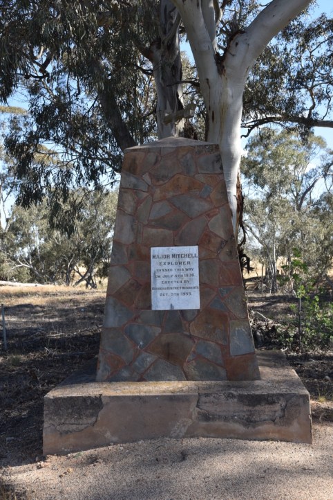
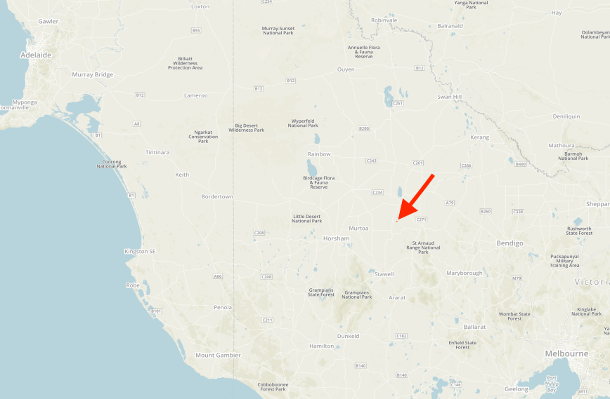
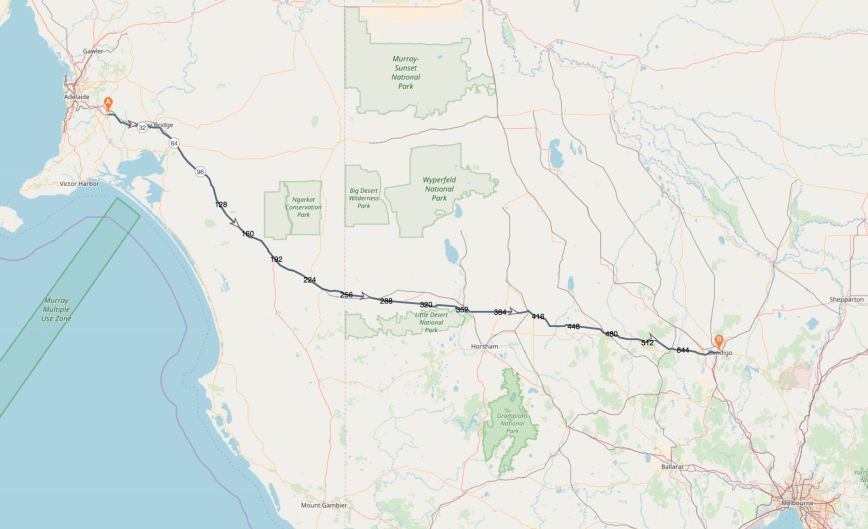
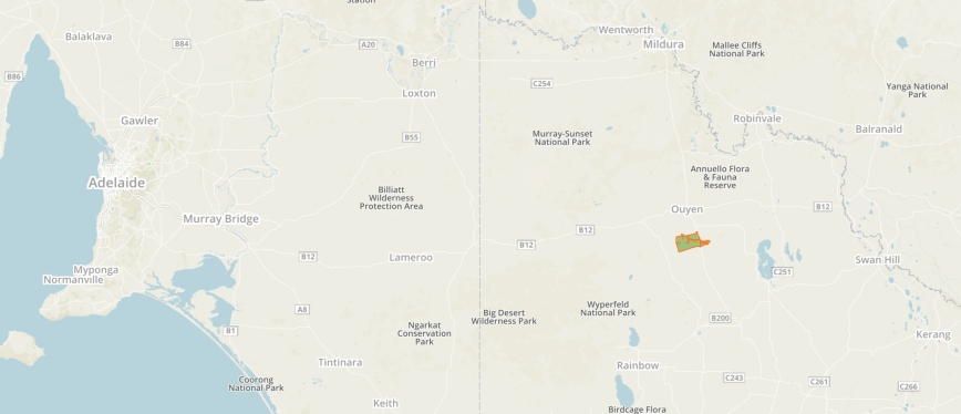
Our next planned activation was a SOTA summit for the Summits on the Air (SOTA) program.  This was to be the first of our SOTA activations for the trip.  Mount Moliagul VK3/ VN-024 lies just outside of the Moliagul Nature Conservation Reserve.  The summit is 525 metres above sea level and is worth 2 SOTA points.

Screen Shot 2018-12-02 at 9.27.04 pm.png

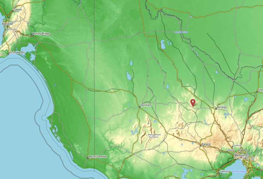
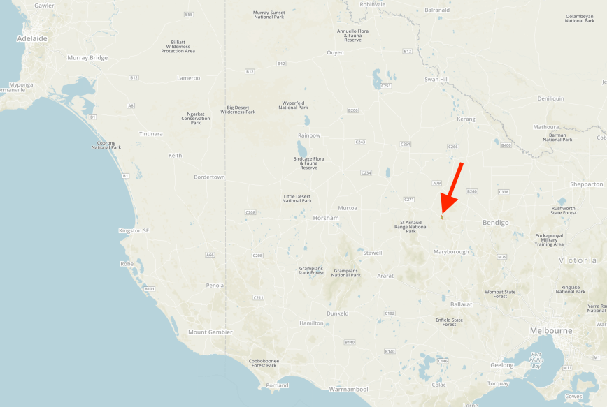
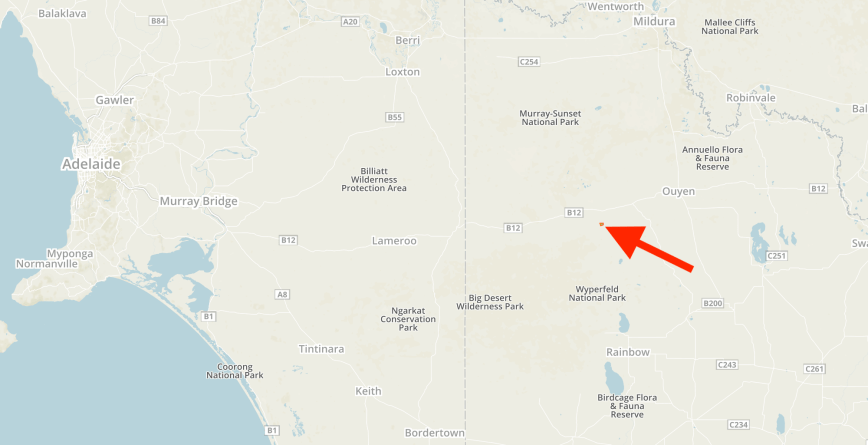
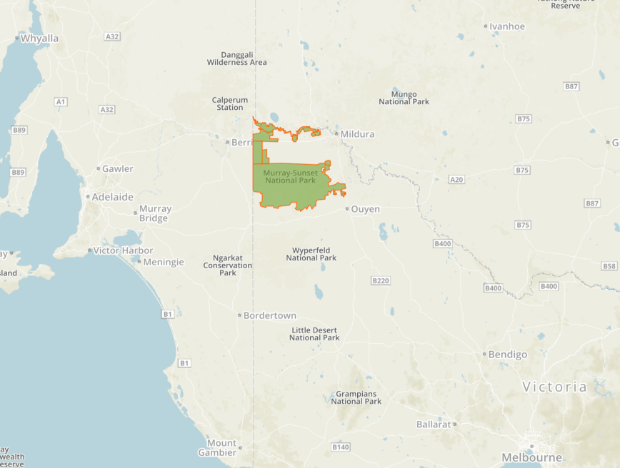
Above:- Map showing the location of Mount Moliagul.  Map courtesy of Open Topo Map.

Marija and I activated the summit last year in November, during our trip to Victoria.  As it is an easy drive up summit, there have been a total of 21 activations at Mount Moliagul.  The first being way back in November 2012, when it was activated by Wayne VK3WAM.

Screen Shot 2018-12-02 at 9.38.46 pm.png

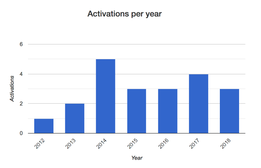
Above:- Activations per year from Mount Moliagul VK3/ VN-024.  Image courtesy of http://www.sota.org.uk.

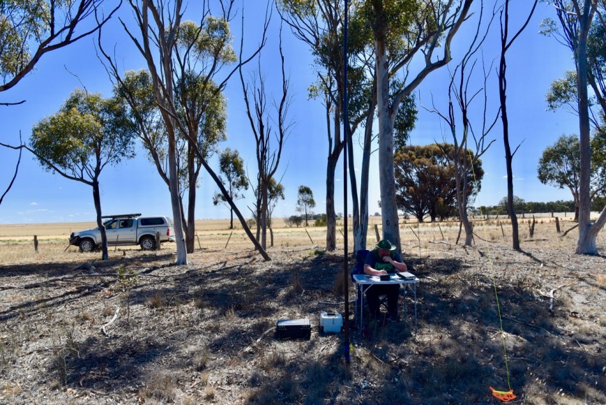
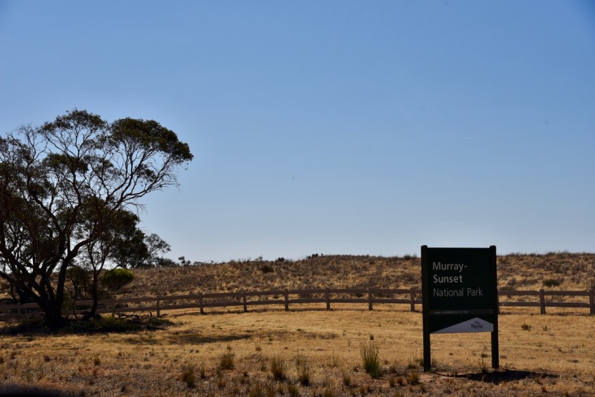
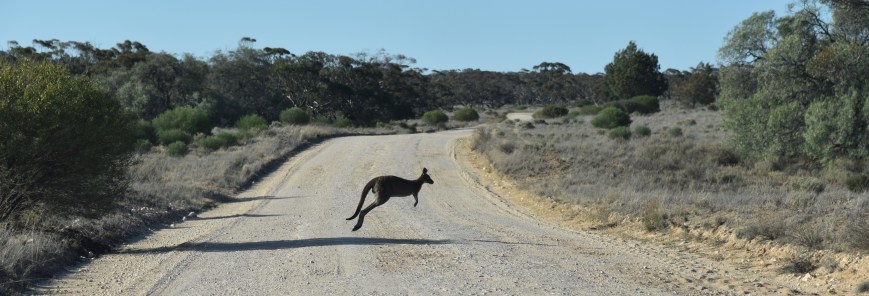
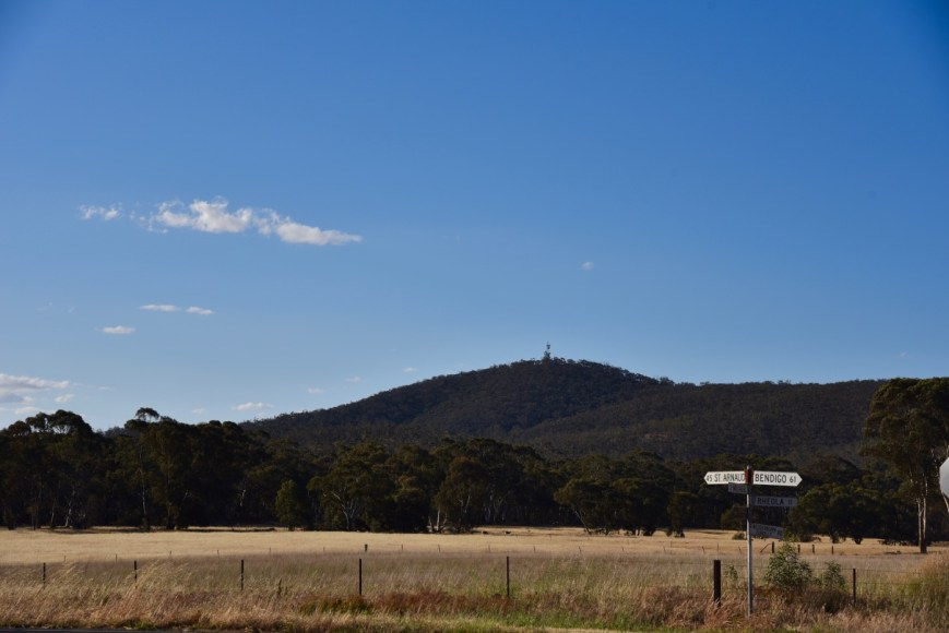
Mount Moliagul is easily seen from the Wimmera Highway, with its telecommunication towers sitting on the top.

DSC_3522

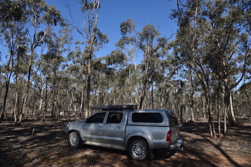
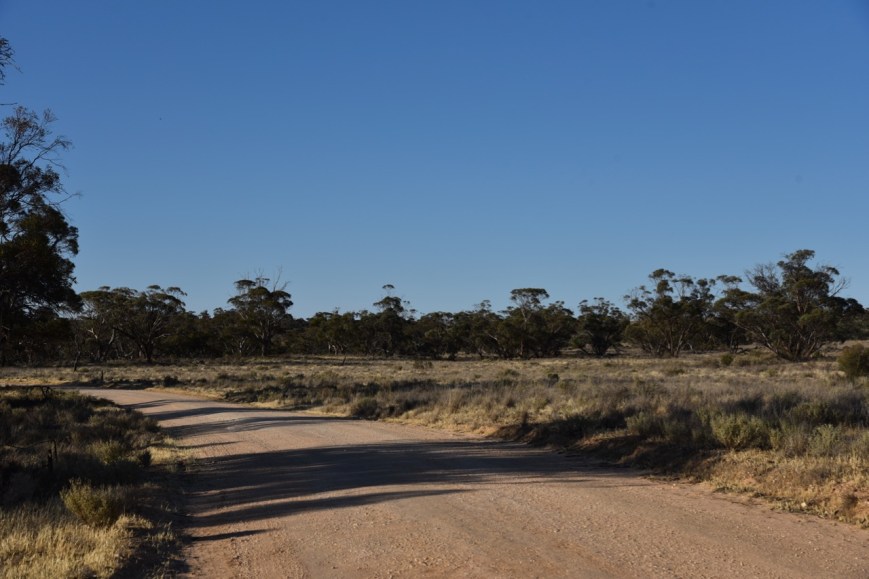
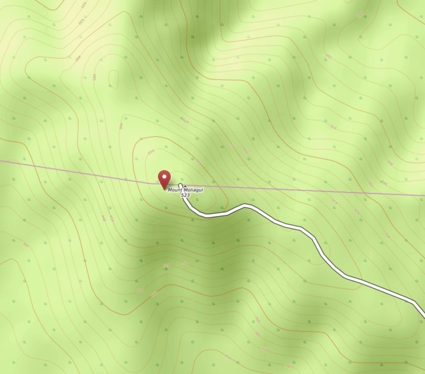
This is an easy summit if you are new to SOTA.  There is a road all the way to the top.  Although, dirt and steep, the track is passable in a conventional vehicle (in dry weather).

Screen Shot 2018-12-02 at 9.26.31 pm.png

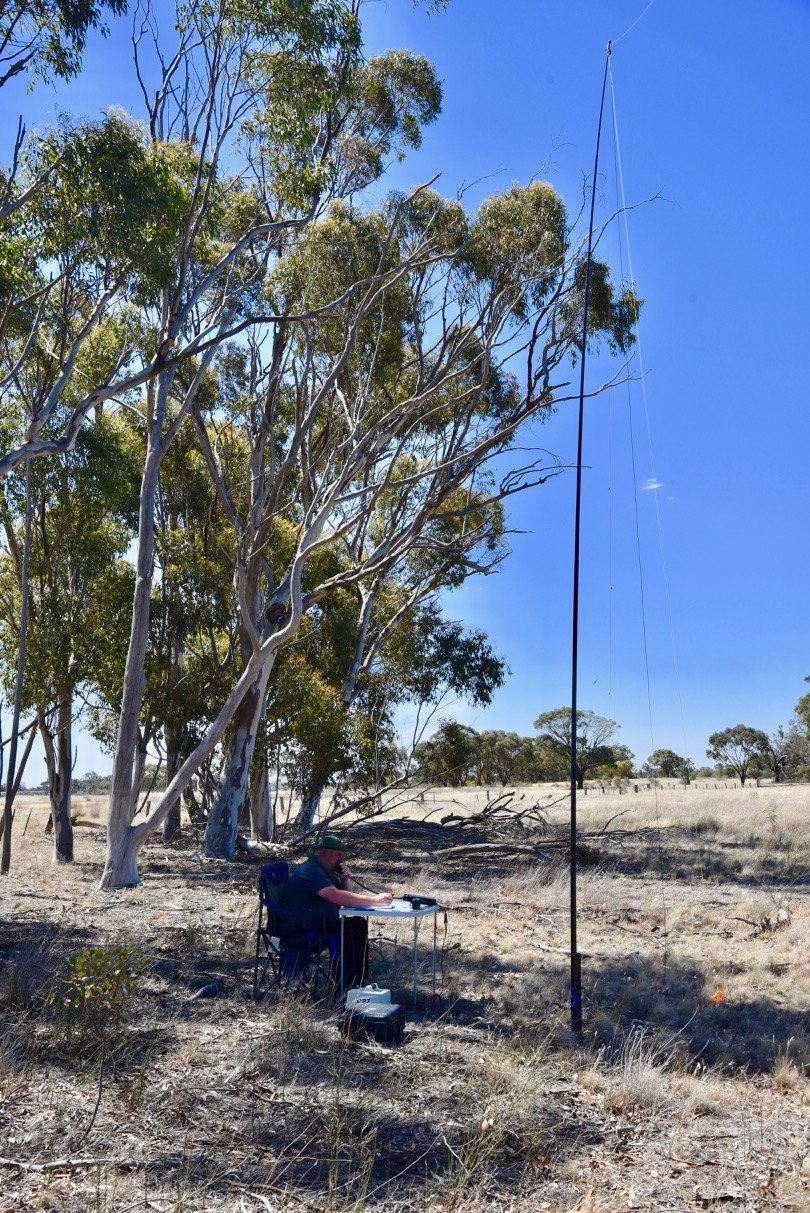
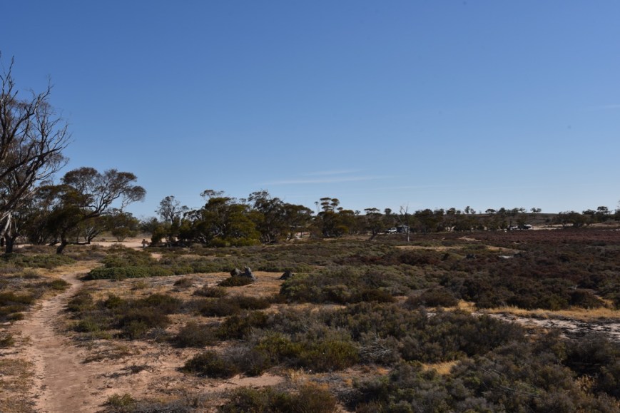
Above:- Mount Moliagul.  Image courtesy of Open Topo Map.

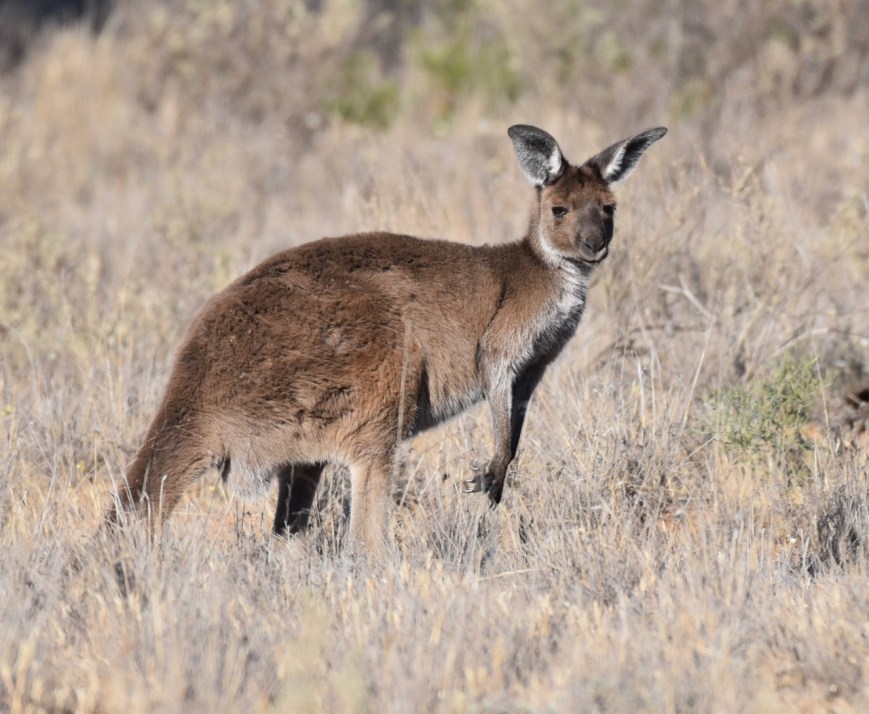
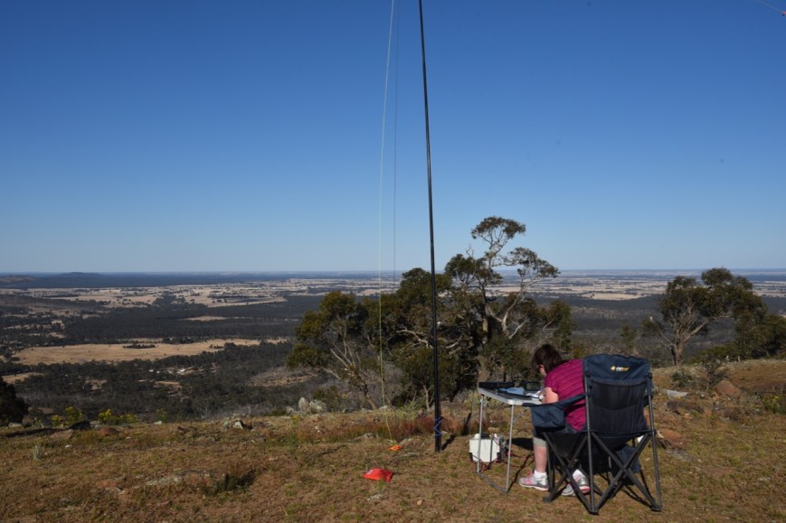
And once you are at the top you are rewarded with some amazing views of the surrounding countryside.

This slideshow requires JavaScript.

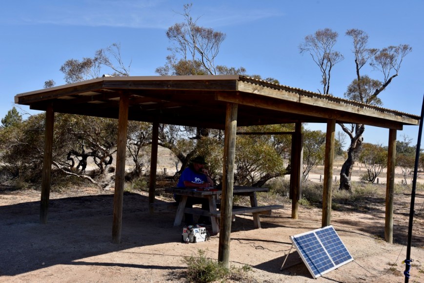
The summit contains a trig point and an array of communications equipment on towers.  Fortunately no noise was generated from them on the amateur bands.

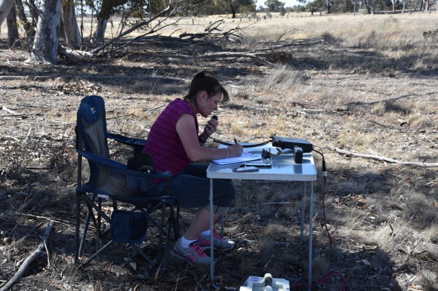
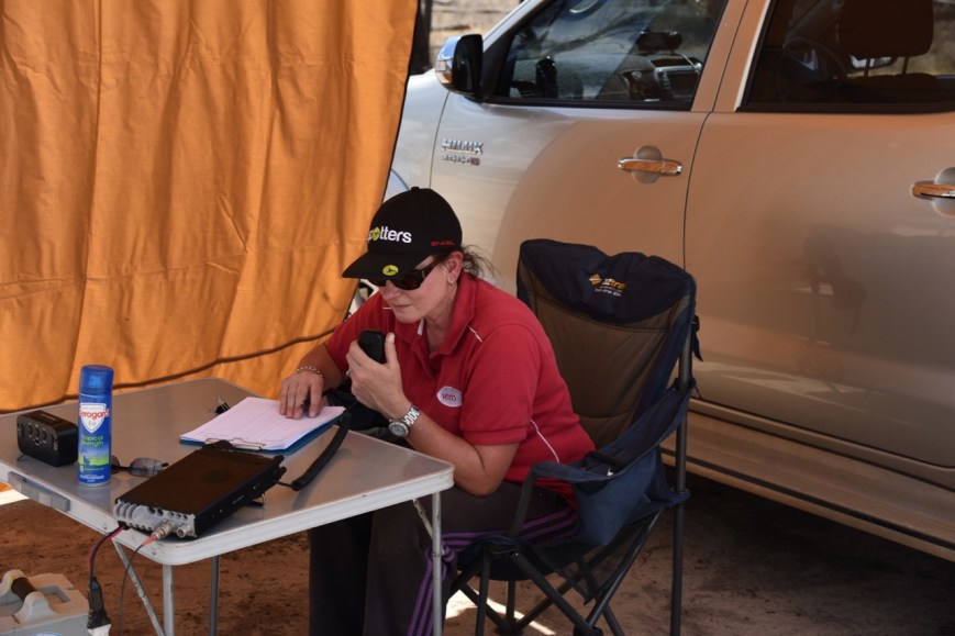
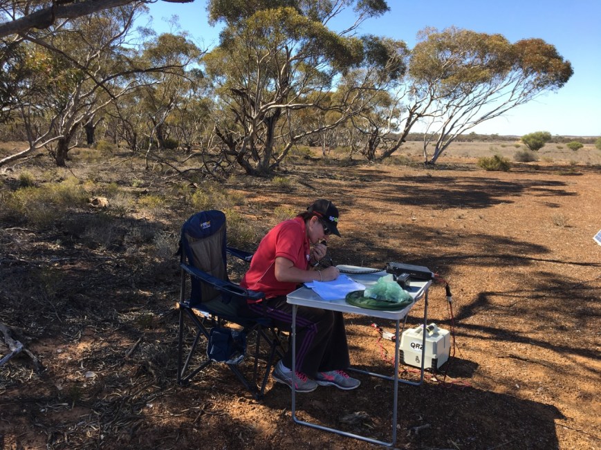
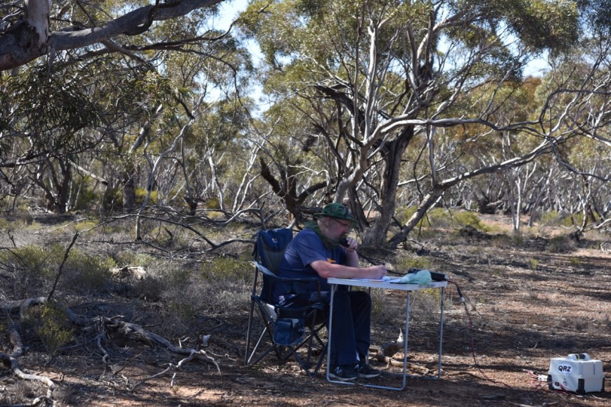
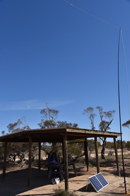
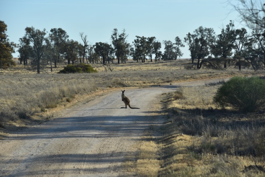
As this was an easy drive up, we had the luxury of a table and chair.  This is perfectly acceptable in SOTA.  The notion that SOTA is only for the young and fit is not an accurate reflection of the program.  The SOTA moderators want SOTA to be inclusive for everyone.

However, please remember, that ‘operation from within vehicles or the near  vicinity of activator’s vehicles is not permitted’.  The SOTA rules state ‘Operations must not be in, or in the close vicinity of, a motor vehicle.  No part of the station may be connected in any way with the motor vehicle’.

I qualified the summit within 1 minute.  Just 4 QSOs are required in the SOTA program for a summit to be qualified.  I logged a total of 14 stations on 40m from VK2, VK4, VK5, VK7 and New Zealand.  I logged two New Zealand stations: Andrei ZL1TM, and Graham ZL3TV mobile.

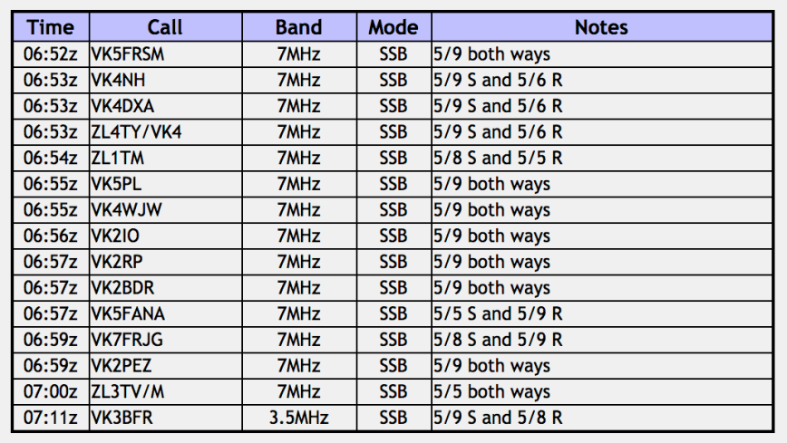
Once I had qualified the summit, Marija took charge of the mic, and had also soon qualified the summit.  Marija logged 6 stations on 40m.  To complete the activation I called CQ on 3.610, where I logged just the 1 station, Ian VK3BFR.

DSC_3511

Marija worked the following stations:-

Screen Shot 2018-12-02 at 9.16.02 pm.png

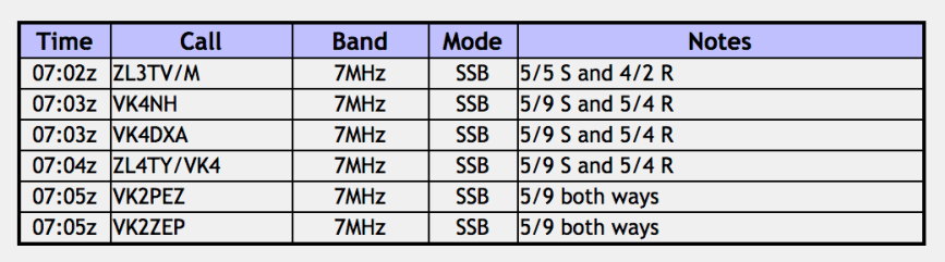
I worked the following stations:-

Screen Shot 2018-12-02 at 9.11.26 pm.png

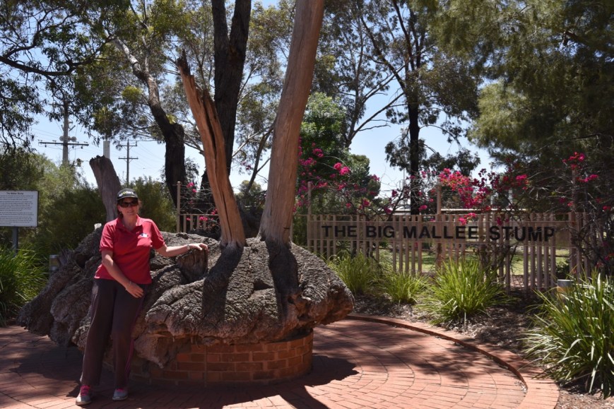
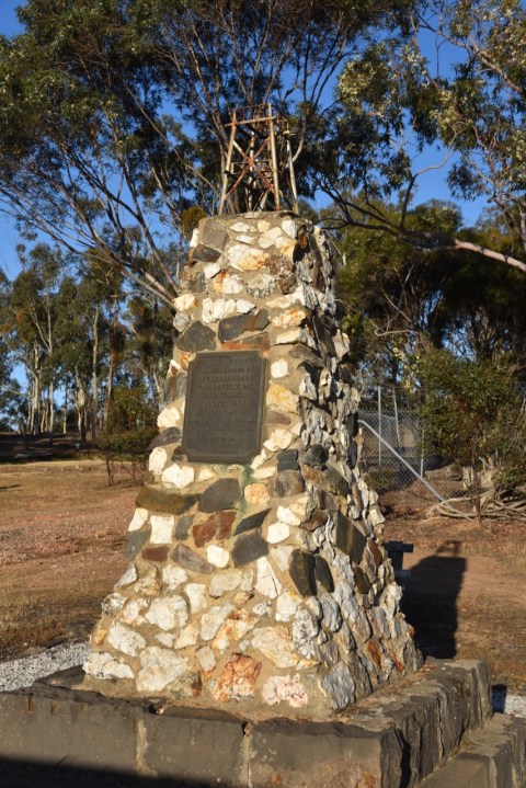
We then headed down off the summit and drove into the nearby town of Moliagul.  What was once a thriving gold mining town in the 1850’s, Moliagul is now a sleepy little hollow.  However it has some very interesting attractions.  That includes the memorial dedicated to Reverend John Flynn, the founder of the Flying Doctor Service, who was born in 1880 in Moliagul.

Historic buildings in Moliagul include the old Mount Moliagul Hotel which was established in 1856.  The Moliagul State School building was built in 1872, while the Anglican church was built in 1864-65.

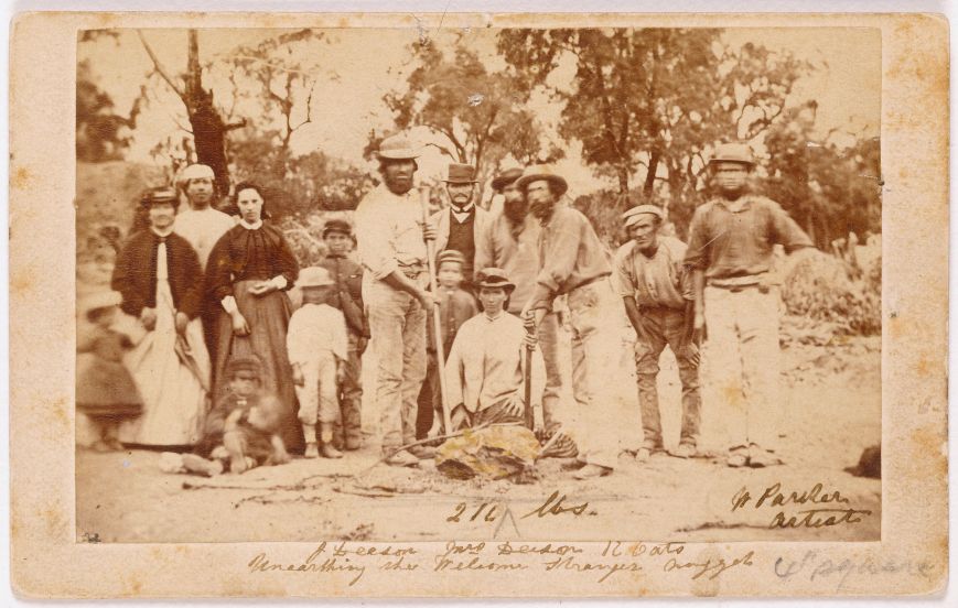
A short drive out of town takes you to the site where the 69 kg Welcome Stranger gold nuggest was discovered.  This is the largest gold nugget ever found in the world.  A Cornish miner, John Deason, discovered the nuggest on 5th February 1869.  The nugget was found just 2.5 cms below the surface while Deason was searching around the roots of a tree.  Deason broke a pick handle trying to lever the nugget out of the ground.  It was eventually extracted with the use of a crowbar.

We then drove a short distance down the road to the town of Tarnagulla.   This is also a small town, which contains a number of historic buildings.  Gold was discovered here in 1853.  Tarnagulla is phonetic meaning of Polish Czarnogóra (eng. Black Mountain – Montenegro).  The name was given by Polish explorer and geologist Paweł Strzelecki.

One of the historic buildings is the Tarnagulla Pavillion, which was built by William Roper & Co in 1884.

Other historic buildings include the Ebenezer Chapel-Baptist Church which was built in 1864; Bowmans Bakery built in 1861; the Wesleyan Methodist Church built in 1864 (partially destroyed by fire in 2000); the Victoria Hotel and Theatre built in 1862; and Locharron which was built in 1859 as the Union Bank of Australia.

This slideshow requires JavaScript.

There is also a monument to commemorate the discovery of gold by New Zealanders from Poverty Bay.  The gold reef was subsequently known as Poverty Reef.  It operated between 1852-53 and yielded 13 1/2 tons or 324,000 oz of gold.

DSC_3547

We continued on to the town of Newbridge, which is located on the banks of the Loddon River, the second longest river in Victoria after the Goulburn.  There is an interesting interpretive board about Arthur Bayley, who was born in Newbridge, and is considered one of Australia’s greatest gold prospectors.  It is said that Bayley had a ‘nose for gold’.

We then drove into Bendigo and booked in to our room at the Golden Reef Motor Inn on the McIvor Highway at Strathdale (Bendigo).

DSC_3558

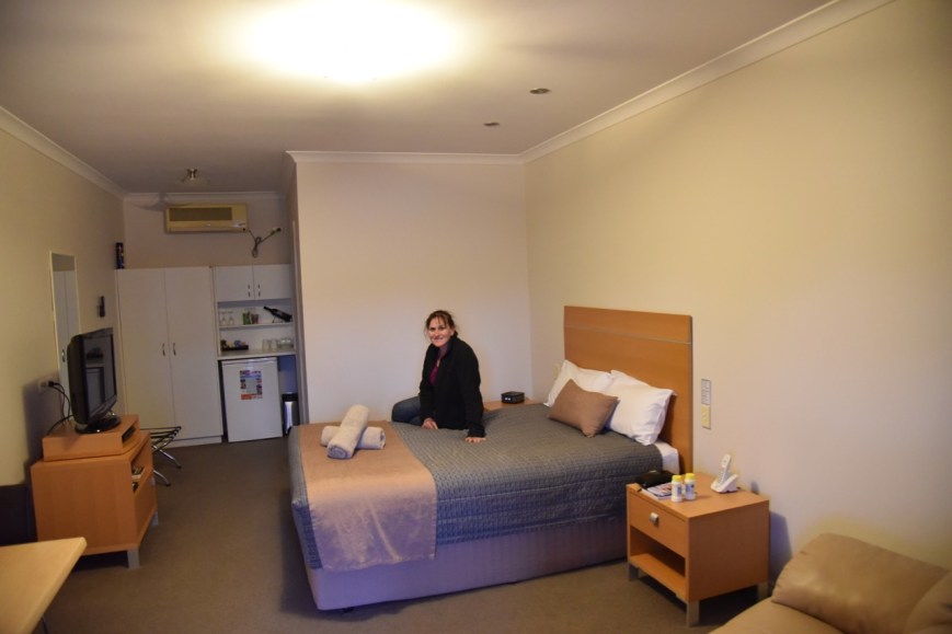
Above:- Motel room at Bendigo

We then headed across the road to the very conveniently located, Seasons Family Bistro where we enjoyed a very nice meal and a few cleansing ales.  It was the end of a long day one.

IMG_1451

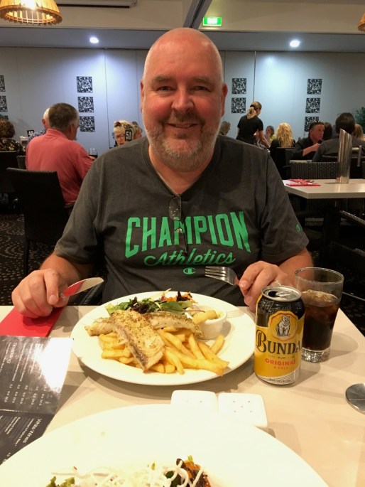
Above:- Enjoying a meal at the Seasons Family Bistro, Bendigo.


References.

Aussie Towns, 2018, <http://www.aussietowns.com.au/town/moliagul-vic>, viewed 2nd December 2018

Summits on the Air, 2018, <https://www.sota.org.uk/>, viewed 2nd December 2018

Wikipedia, 2018, <https://en.wikipedia.org/wiki/Loddon_River>, viewed 2nd December 2018

Moliagul Nature Conservation Reserve VKFF-2143

After packing up at Avon Plains, Marija and I headed into the town of St Arnaud, and then headed east out of town along the Wimmera Highway.  Our next planned activation was a SOTA activation at Mount Moliagul.

We stopped briefly at Kooreh to have a look at the Major Mitchell monument.  Lieutenant Colonel Sir Thomas Livingstone Mitchell (15 June 1792 – 5 October 1855), was a surveyor and explorer of south-eastern Australia.  The monument commemorates Mitchells’s passing through of this area on the 9th July 1836.

DSC_3495

We then continued along the Wimmera Highway, passing through Logan, Burkes Flat, and then Cochranes Creek.  We then saw the sign for the Moliagul Nature Conservation Reserve VKFF-2143., and decided to pull in there quickly, for me to qualify the park from the vehicle.  We were a bit short of time to set up the portable station.

Screen Shot 2018-12-02 at 8.33.04 pm.png

Above:- Map showing the location of the Moliagul Nature Conservation Reserve.  Map courtesy of Protected Planet.

Again, the Parks Victoria website only contains a map of this park, and no further information.  Moliagul is 530 hectares in size and incorporates existing state forest.

The park includes two large old tree sites and one fauna refuge and provides habitat for Powerful Owl and is a key site for Swift Parrot.

The park takes its name from the nearby town of Moliagul.  The town’s name is believed to be a derivation of the aboriginal word “moliagulk”, meaning “wooded hill”.  During the 1850’s this was a thriving area, following the discovery of gold.  This includes the world’s largest gold nugget, the Welcome Stranger, which was discovered in 1869 by John Deason and Richard Oates.

2880px-William_Parker,_Unearthing_the_Welcome_Stranger_Nugget,_H13298_original.jpg

Above:- Miners and their wives posing with the finders of the nugget, Richard Oates, John Deason and his wife.  Courtesy of Wikipedia.

We drove a short distance down a dirt track on the western side of the park.  I used the Icom IC-7000 in the vehicle for this activation, along with the Codan 9350 self tuning antenna on the rear of the Toyota Hi Lux.

Screen Shot 2018-12-02 at 8.30.49 pm.png

Above:- An aerial view of the Moliagul Nature Conservation Reserve, showing our operating spot.  Image courtesy of Protected Planet.

Marija placed a spot on parksnpeaks, advising that this was a quick activation from the vehicle.  First in the log was Andy VK5LA in the Riverland region of South Australia, followed by John VK4TJ, and then Rick VK5NM.  Contact number 10, qualifying the park for me for the VKFF program, was regular parks hunter, Keith VK2PKT in Parkes.

All up I logged 13 stations from VK2, VK3, VK4, VK5 and New Zealand (ZL1TM).  I apologise to anyone else who would have liked to log this park, but we were pressed for time.  I will return one day soon to get my 44 contacts to qualify the park for the global WWFF program.

DSC_3498

I worked the following stations on 40m SSB:-

  1. VK5LA
  2. VK4TJ
  3. VK4/AC8WN
  4. VK4/VE6XT
  5. VK5NM
  6. VK3UH
  7. VK3PF
  8. ZL1TM
  9. VK3TNL
  10. VK2PKT
  11. VK2YK
  12. VK2IO
  13. VK2PEZ


References.

Environment Conservation Council, 2018, http://www.veac.vic.gov.au/reports/385-Chapter-16.pdf>, viewed 2nd December 2018

Wikipedia, 2018, <https://en.wikipedia.org/wiki/Thomas_Mitchell_(explorer)>, viewed 2nd December 2018

Wikipedia, 2018, <https://en.wikipedia.org/wiki/Moliagul>, viewed 2nd December 2018

Avon Plains Swamp Nature Conservation Reserve VKFF-2257

After packing up at the Barrett Flora Reserve we headed for our second park for Friday 16th November 2018, was the Avon Plains Swamp Nature Conservation Reserve VKFF-2257.

First though, we stopped off at the little town of Minyip for a bite to eat.  We stopped at Emmas Cafe, as we have done before when visiting Minyip.

The name “Minyip” is derived from the Aboriginal word for “Ashes”.  The town is known as the ‘Heart of the Wheat belt’.  Minyip was established in the early 1870’s and flourished as a service centre for the productive wheat growing district.  It is also famous as the filming location for exterior scenes in the television series ‘The Flying Doctors’, representing the fictional outback town of Coopers Crossing.  The series ran between 1986-1993 and featured 221 episodes.  The series screened internationally.

Also worth a look in Minyip is the Majestic Hotel, also known as the Club Hotel.  And the Farrer Memorial  which commemorates William Farrer (1845-1906) who pioneered the scientific breeding of wheat strains which were productive and resistant to diseases such as rust which devastated wheat harvests late in the 19th century.  This is believed to be the only monument of its kind in Australia to William Farrer.

We were looking to top up the Hi Lux with fuel, but unfortunately there was no fuel in Minyip.  This meant that we had to drive 18 km south to the town of Rupanyup.  The name Rupanyup is an Aboriginal word meaning ‘branch hanging over water’.  The town is located on the banks of Dunmunkle Creek…..whata  great name.  The town was originally known as Lallat, but by 1876 the name of the town had changed to Rupanyup.

The short detour was well worth it, as we had the opportunity of looking at the silo art on the old silos at Rupanyup.  The silo art is the work of Russian artist Julia Volchkova.  The silos feature two local residents, both members of the local Rupanyup Football and Netball Club.

Rupanyup is a quaint little western Victoria town, and features a number of historic buildings including Custs store, which is now the visitor centre.  William Cust built the first store in Rupanyup in 1872.  The local Country Fire Authority station features its own mural, the work of Melbourne artist Georgia Goodie.

We then headed to the Avon Plains Swamp Nature Conservation Reserve.  The park is sometimes referred to as Hollands Lake.  The park is located about 38 km south east of Minyip, and about 35 km north west of St Arnaud.

Screen Shot 2018-12-02 at 6.50.51 pm.png

Above:- Map showing the location of the Avon Plains Swamp Nature Conservation Reserve in western Victoria.  Map courtesy of Protected Planet.

The park takes its name from the locality of Avon Plains, named after the Avon Plains pastoral run (1846).  The run was located near the Avon River which was named by the New South Wales Surveyor General Thomas Mitchell, on his Australia Felix expedition in 1836.

The Avon River flows through the area.  It rises on the northern slopes of the Great Dividing Range, near Beazleys Bridge, west of St Arnaud, before reaching its mouth to flow into the Richardson River at Banyena.

During the early 1870’s, farm selections were taken up in the Avon Plains area.  By 1876, local farmers at the Avon Plains hotel formed a farmers’ association.  A school was also opened in a Wesleyan chapel.

In 1903 it was described in the Australian handbook:

AvonPlains1903.jpg

Again, as I was unable to find a lot of information about this park on the internet.  The Parks Victoria website only contains a map of the park.  To the north and north west of the park is the Avon Plains Wildlife Reserve which contains Hancocks Lake and Walkers Lake.  This is currently not a WWFF/VKFF reference area.  It may be in the future.

Hollands Lake was bone dry during our visit.

We accessed the park via the Donald-Avon Plains Road.  There is no vehicular access to this park, so we parked the Hi Lux and climbed the fence to get into the park.  It was a warm day so we were cognisant of snakes.  Fortunately we did not encounter any.

Screen Shot 2018-12-02 at 6.57.36 pm.png

Above:- An aerial view of the Avon Plains Swamp Nature Conservation Reserve, showing our operating spot.  Image courtesy of Parks Victoria.

This was another unique park for Marija and I as activators.  And only the second time that the park had been activated for VKFF/WWFF.

I commenced the activation by calling CQ on 7.144 on the 40m band.  Luckily we had internet coverage, so Marija placed a spot on parksnpeaks and on Facebook.  First in the log for this activation was Geoff VK3SQ, followed by Joseph VK5WU, and then Gerard VK2IO.  Within 8 minutes I had the park qualified for VKFF.  Contact number 10 being a QSO with John VK4TJ.

DSC_3488

Once I had the park qualified for VKFF, I swapped the mic with Marija.  First in the log for her was John VK4TJ, followed by Kevin VK2HMV, and then Geoff VK3SQ.  Marija had the park qualified in just 10 minutes.  Her 10th contact was with Keith VK2PKT in Parkes.

DSC_3489

With the park qualified for Marija, I took charge of the mic again, and logged a further 19 stations from VK1, VK2, VK3, VK4, VK5, and New Zealand.  I was really pleased to log Andrei ZL1TM on 40m.

I then moved to the 80m band and called CQ on 3.610.  Geoff VK3SQ was first in the log on that band, followed by Peter VK3PF, and then Peter VK3ZPF.  I logged a total of 7 stations on 80m, and was now just 7 QSOs short of the 44 required to qualify the park for the global WWFF program.

I then called CQ on 14.310 on the 20m band, with Marija putting up a fresh spot for me on parksnpeaks.  Sadly the Over the Horizon Radar was active again on the band, making it quite difficult at time.  Jordan VK2LPF was first in the log, followed by John VK4TJ, Gerard VK2IO, and then Garry VK2GAZ.  I was now just 1 short of my 44.  Ray VK4NH came to my rescue.

I ended up with 47 contacts in the log for this park.

DSC_3486.jpg

Marija worked the following stations on 40m SSB:-

  1. VK4TJ
  2. VK4/AC8WN
  3. VK4/VE6XT
  4. VK2HMV
  5. VK3SQ
  6. VK4NH
  7. VK4DXA
  8. ZL4TY/VK4
  9. VK5FANA
  10. VK2PKT

I worked the following stations on 40m SSB:-

  1. VK3SQ
  2. VK5WU
  3. VK2IO
  4. VK5FANA
  5. VK2YK
  6. VK4NH
  7. VK4DXA
  8. ZL4TY/VK4
  9. VK4TJ
  10. VK4/AC8WN
  11. VK4/VE6XT
  12. VK2PKT
  13. VK5PL
  14. VK2HMV
  15. VK1AT
  16. VK3PF
  17. VK4HNS
  18. VK2MNR/m
  19. VK2ABK
  20. VK5NM
  21. VK5LA
  22. Vk2KYO
  23. VK3TNL
  24. VK2AB
  25. VK5ZZ/m
  26. VK1AC/2
  27. ZL1TM
  28. VK2NJP
  29. VK3ZPF
  30. VK5JDS

I worked the following stations on 80m SSB:-

  1. VK3SQ
  2. VK3PF
  3. VK3ZPF
  4. VK7FCIA
  5. VK3ZIP
  6. VK3UH
  7. VK3KAI

I worked the following stations on 20m SSB:-

  1. VK2LPF
  2. VK4TJ
  3. VK4/AC8WN
  4. VK4/VE6XT
  5. VK2IO
  6. VK2GAZ
  7. VK4NH
  8. VK4DXA
  9. ZL4TY/VK4
  10. VK2YK


References.

ABC, 2018, <https://www.abc.net.au/news/2017-04-12/russian-street-artist-paints-silo-rupanyup/8438826&gt;, viewed 2nd December 2018

Monument Australia, 2018, <http://monumentaustralia.org.au/themes/people/science/display/32626-william-farrer>, viewed 2nd December 2018

The Wimmera Mail Times, 2018, <https://www.mailtimes.com.au/story/4576036/final-street-art-for-rupanyup-photos/>, viewed 2nd December 2018

Victorian Places, 2018, <https://www.victorianplaces.com.au/avon-plains&gt;, viewed 2nd December 2018

Wikipedia, 2018, <https://en.wikipedia.org/wiki/Minyip>, viewed 2nd December 2018

Wikipedia, 2018, <https://en.wikipedia.org/wiki/The_Flying_Doctors>, viewed 2nd December 2018

Wikipedia, 2018, <https://en.wikipedia.org/wiki/Rupanyup>, viewed 2nd December 2018

Wikipedia, 2018, <https://en.wikipedia.org/wiki/Avon_River_(Grampians,_Victoria)>, viewed 2nd December 2018

Wimmera Mallee Tourism, ‘Minyip Victoria’ brochure

Wimmera Mallee Tourism, ‘Rupanyup Victoria’ brochure

Day one, Friday 16th Nov 2018, and the Barrett Flora and Fauna Reserve VKFF-2264

Day one (Friday 16th November 2018) of our 16 day trip to Victoria, involved a 582 km journey from our home in the Adelaide Hills, South Australia, to Bendigo in central Victoria.

Screen Shot 2018-12-02 at 4.43.03 pm.png

Above:- Map showing our approximate route from Mount Barker in the Adelaide Hills, to Bendigo in Victoria.  Map courtesy of plotaroute.

We left home at around 7.00 a.m. local time and headed east along the South Eastern Freeway and onto the Dukes Highway.  As we approached Murray Bridge I checked in to the Mid South Coast 40 metre Net on 7.065, run by John VK2NJP.  John was strength 9 and gave me a 5/7 signal report.  I also spoke with Ray VK2AX, Joe VK4BYE, and Neil VK4HNS.

Our first stop for the day was at Coonalpyn, a small town about 163 km south east of Adelaide.  The town’s name is derived from the Aboriginal word Coonalpyn, meaning Barren Woman.  Coonalpyn in recent times has come to the attention of tourists due to the artwork on the silos in the town.

We normally stop at the Coonalpyn Silo Cafe for a coffee, but this time we chose to pay another cafe a visit in the town, ‘Waffles and Jaffles’.  And I am very pleased we did.  Not only was the coffee great, but the waffles were absolutely delicious.  It was like a little slice of Belgium in country South Australia.

DSC_3440

Above:- Enjoying waffles at Coonalpyn.

We continued east, and travelled over the State border of South Australia and Victoria, and onto the Western Highway.  Our next stop was Loch lel (Pink Lake), just north west of the town of Dimboola.  And today, the lake was certainly pink.  The pink colour of the water comes from a pigment secreted by microscopic algae. The intensity of the pink varies with the amount of water in the lake.

While at the Pink Lakes, both Marija and I spoke with Andy VK5LA/p who was activating the Swan Reach Conservation Park VKFF-0832.  Andy had a nice 5/9 signal into the mobile.

Marija and I then turned off at Dimboola and travelled out along the Dimboola-Minyip Road, with our first intended activation of the trip being the Barrett Flora & Fauna Reserve VKFF-2264.

Screen Shot 2018-12-02 at 4.58.34 pm

Above:- Map showing the location of the Barrett Flora & Fauna Reserve in western Victoria.  Map courtesy of Protected Planet.

We soon reached the Murra Warra Wind Farm, east of Minyip.  The wind farm is under construction and will feature up to 116 turbines with hardstands.  The height to the tip of the blade at its highest point is up to 220 metres.

A short distance off the Dimboola-Minyip Road, we reached the park.  It was well signposted.

DSC_3450

The Barrett Flora and Fauna Reserve is about 223 hectares in size and is located at the north eastern corner of Dogwood Road and Bolwells Road, Wallup, south of Warracknabeal.  It consists of Buloke Woodlands.  Buloke woodlands are characterised by the buloke tree, which is a leafless casuarina or sheoak tree that grows to about 15m and has twisted branchlets and cones.

Screen Shot 2018-12-02 at 6.22.07 pm.png

Above: An aerial view of the Barrett Flora and Fauna Reserve, looking north east towards the town of Warracknabeal.  Image courtesy of Google maps

I was unable to find much information on this park on the web.  The Parks Victoria website only shows a map of this park, and no other details.  The park is signposted as a Flora & Fauna Reserve and this is its title in the CAPAD 2016 data, under the category of a Nature Conservation Reserve.  So depending on what map/s you look at, the park may be referred to as a Flora & Fauna Reserve, or a Nature Conservation Reserve.

The eBird website shows that 41 species of native bird have been recorded in the park including Black Honeyeater, Red-rumped parrot, Spiny-cheeked Honeyeater, and Chestnut-rumped Thornbill.

We set up off Dogwood Road.  This was a quiet country road, with plenty of room to pull off the road.  As it was quite a warm day, we set up underneath the shade of a tree.  For this activation we ran the Yaesu FT-857d and the 20/40/80-m linked dipole, supported on a 7 metre telescopic squid pole.  Power output was 10 watts PEP for Marija, and 40 watts for me.

Screen Shot 2018-12-02 at 5.06.23 pm.png

Above:- The Barrett Flora & Fauna Reserve, showing our operating spot.  Map courtesy of Protected Planet.

This was a unique park for Marija and I as activators, and the very first time that the park had been activated.  First in the log was Andy VK5LA/p who was activating the Swan Reach Conservation Park VKFF-0832.  Marija also logged Andy, before we moved up the band to 7.150.

I called CQ, while Marija placed a spot for me up on parksnpeaks.  Phil VK2HPN called in, followed by Peter VK3PF, Dennis VK2HHA, and then Geoff VK3SQ.  Contact number 10 came 13 minutes into the activation, with a QSO with regular park hunter Ken VK2KYO.  I logged one more station, Alan VK2MG, before swapping the mic with Marija.

Within nine minutes, Marija had 10 contacts in the log, thus qualifying the park for the VKFF (Australian chapter) of the WWFF program.  Marija logged a total of 15 stations from VK2, VK3, VK4, and VK5.

We had both qualified the park for VKFF, so I headed off to the 80m band.  Marija threw up another spot on parksnpeaks and I called CQ on 3.610.  Peter VK3PF was first in the log on 80m, followed by Geoff VK3SQ, Mike VK3MKE, and then Ken VK2KYO.

To conclude the activation I called CQ on 14.310, where I was very pleased to log Stuuie VK8NSB in Darwin.  Ray VK4NH followed, but despite a further 5 minutes of CQ calls I had no further takers on that band.

So with a total of 34 QSOs between the 2 of us, Marija and I packed up and headed off to Minyip.

Marija worked the following stations on 40m SSB:-

  1. VK5LA/p (Swan Reach Conservation Park VKFF-0832)
  2. VK3SQ
  3. VK2KYO
  4. VK3YSP/m
  5. VK3FOWL/m
  6. VK2MTC
  7. VK5FMLO
  8. VK3PF
  9. VK2IO/p
  10. VK3MKE
  11. VK3TKK
  12. VK2FADV
  13. VK4NH
  14. VK4DXA
  15. ZL4TY/VK4

I worked the following stations on 40m SSB:-

  1. VK5LA/p (Swan Reach Conservation Park VKFF-0832)
  2. VK2HPN
  3. VK3PF
  4. VK2HHA
  5. VK3SQ
  6. VK2IO
  7. VK4TJ
  8. VK4/AC8WN
  9. VK4/VE6XT
  10. VK2KYO
  11. VK2MG

I worked the following stations on 80m SSB:-

  1. VK3PF
  2. VK3SQ
  3. VK3MKE
  4. VK2KYO

I worked the following stations on 20m SSB:-

  1. VK8NSB
  2. VK4NH
  3. VK4DXA
  4. ZL4TY/VK4


References.

Australian Government, 2018, <http://www.environment.gov.au/biodiversity/threatened/publications/buloke-woodlands>, viewed 2nd December 2018

eBird, 2018, <https://ebird.org/pa/hotspot/L2551670?yr=all&m=&rank=mrec>, viewed 2nd December 2018

Cheal, D; Lucas, A; & Macaulay, L, Native Recovery Plan for Buloke Woodlands of the Riverina and Murray Darling Depression Bioregions, 2010.

Renewable Energy Systems, 2018, <http://www.murrawarra-windfarm.com/the-project/project-summary/>, viewed 2nd December 2018

Wikipedia, 2018, <https://en.wikipedia.org/wiki/Coonalpyn,_South_Australia>, viewed 2nd December 2018

Trip to Victoria

Marija and I are back home from our 16 day trip around Victoria.  We travelled to Bendigo, Shepparton, Marysville, Sorrento, Williamstown, Geelong, & Hamilton.

We did a lot of sightseeing on the trip, but also played radio.  We were away during the VKFF Activation Weekend, and activated 4 parks on that particular weekend.

We also caught up with Ron VK3JP, Alan VK3ALN, Rod VK3OB, Dallas VK3DJ, Peter VK3ZPF, and Steve VK3NSC.


This slideshow requires JavaScript.

Some stats from the trip are as follows…..

  • Parks: 36
  • Summits: 8
  • Total QSOs: 1,589
  • Total kms travelled: 3,413

I will slowly start uploading my logs to WWFF Logsearch.

And in the coming weeks I will also add info & photos on each of the activations to my WordPress site.

Thankyou to everyone who called us while we were away.
We hope we were able to give some of the park tragics, some new parks to add to their tally.

And a BIG thankyou to those who took the time to spot us on parksnpeaks, Facebook, etc. Many of the parks we were in, we had no internet coverage.

Below is a summary of our Park & SOTA activities whilst we were away……

Friday 16th November 2018

  • Barrett Flora & Fauna Reserve VKFF-2264
    • VK5FMAZ: 15 QSOs
    • VK5PAS: 19 QSOs
  • Avon Plains Swamp Nature Conservation Reserve VKFF-2257
    • VK5FMAZ: 10 QSOs
    • VK5PAS: 47 QSOs
  • Moliagul Nature Conservation Reserve VKFF-2143
    • VK5PAS: 13 QSOs
  • Mount Moliagul VK3/ VN-024
    • VK5FMAZ: 6 QSOs
    • VK5PAS: 15 QSOs

Saturday 17th November 2018

  • Greater Bendigo National Park VKFF-0623
    • VK5FMAZ: 10 QSOs
    • VK5PAS: 45 QSOs

Sunday 18th November 2018

  • Axedale Flora & Fauna Reserve VKFF-2037
    • VK5FMAZ: 10 QSOs
    • VK5PAS: 45 QSOs
  • Heathcote Graytown National Park VKFF-0624 & Mount Ida VK3/ VU-009
    • VK5FMAZ: 12 QSOs
    • VK5PAS: 54 QSOs
  • Spring Creek Nature Conservation Reserve VKFF-2193
    • VK5PAS: 15 QSOs
  • Costerfield Nature Conservation Reserve VKFF-2071
    • VK5PAS: 17 QSOs
  • Whroo Nature Conservation Reserve VKFF-2229
    • VK5FMAZ: 2 QSOs
    • VK5PAS: 15 QSOs

Monday 19th November 2018

  • Lower Goulburn National Park VKFF-0741
    • VK5FMAZ: 14 QSOs
    • VK5PAS: 24 QSOs
  • Gemmill Swamp Wildlife Reserve VKFF-2318
    • VK5FMAZ: 16 QSOs
    • VK5PAS: 52 QSOs

Tuesday 20th November 2018

  • Arcadia Nature Conservation Reserve VKFF-2036
    • VK5FMAZ: 15 QSOs
    • VK5PAS: 13 QSOs
  • Mount Wombat-Garden Range Flora & Fauna Reserve VKFF-2403 & Mount Wombat VK3/ VU-002
    • VK5FMAZ: 15 QSOs
    • VK5PAS: 45 QSOs
  • Seven Creeks Wildlife Reserve VKFF-2435
    • VK5PAS: 11 QSOs

Wednesday 21st November 2018

  • Mount Gordon VK3/ VN-027
    • VK5FMAZ: 7 QSOs
    • VK5PAS: 25 QSOs
  • Yarra Ranges National Park VKFF-0556
    • VK5FMAZ: 10 QSOs
    • VK5PAS: 14 QSOs
  • Cathedral Range State Park VKFF-0755
    • VK5PAS: 10 QSOs
  • Lake Eildon National Park VKFF-0625
    • VK5FMAZ: 13 QSOs
    • VK5PAS: 50 QSOs
  • Buxton Silver Gum Nature Conservation Reserve VKFF-2058
    • VK5PAS: 20 QSOs

Thursday 22nd November 2018

  • Yarra Ranges National Park VKFF-0556
    • VK5PAS: 9 QSOs
  • Mount Strickland VK3/ VN-030
    • VK5FMAZ: 6 QSOs
    • VK5PAS:  14 QSOs

Friday 23rd November 2018

  • Yarra Ranges National Park VKFF-0556
    • VK5PAS: 21 QSOs
  • Warramate Hills Nature Conservation Reserve VKFF-2224
    • VK5FMAZ: 11 QSOs
    • VK5PAS: 19 QSOs
  • Yellingbo Nature Conservation Reserve VKFF-2244
    • VK5FMAZ: 10 QSOs
    • VK5PAS: 11 QSOs

Saturday 24th November 2018

  • Mornington Peninsula National Park VKFF-0333
    • VK5FMAZ: 20 QSOs
    • VK5PAS: 58 QSOs
  • Main Ridge Nature Conservation Reserve VKFF-2135
    • VK5FMAZ: 15 QSOs
    • VK5PAS: 46 QSOs

Sunday 25th November 2018

  • Mount Martha Nature Conservation Reserve VKFF-2152
    • VK5FMAZ: 12 QSOs
    • VK5PAS: 52 QSOs
  • Point Nepean National Park VKFF-0628
    • VK5FMAZ: 16 QSOs
    • VK5PAS: 45 QSOs

Monday 26th November 2018

  • Arthurs Seat State Park VKFF-070 & Arthurs Seat VK3/ VC-031
    • VK5FMAZ: 11 QSOs
    • VK5PAS: 25 QSOs

Tuesday 27th November 2018

  • Jawbone Flora & Fauna Reserve VKFF-2339
    • VK5FMAZ: 13 QSOs
    • VK5PAS: 12 QSOs
  • Point Cook Coastal Park VKFF-1875
    • VK5FMAZ: 12 QSOs
    • VK5PAS: 51 QSOs

Wednesday 28th November 2018

  • Brisbane Ranges National Park VKFF-0055
    • VK5FMAZ: 10 QSOs
    • VK5PAS: 11 QSOs

Thursday 29th November 2018

  • Inverleigh Nature Conservation Reserve VKFF-2336
    • VK5FMAZ: 10 QSOs
    • VK5PAS: 31 QSOs
  • Cressy Flora Reserve VKFF-2301
    • VK5FMAZ: 13 QSOs
    • VK5PAS: 27 QSOs
  • Lake Rosine Wildlife Reserve VKFF-2362
    • VK5FMAZ: 13 QSOs
    • VK5PAS: 24 QSOs
  • Darlington Common Flora Reserve VKFF-2303
    • VK5FMAZ: 11 QSOs
    • VK5PAS: 48 QSOs

Friday 30th November 2018

  • Mount Rouse VK3/ VS-048
    • VK5FMAZ: 8 QSOs
    • VK5PAS: 15 QSOs
  • Mount Dundas VK3/ VS-045
    • VK5FMAZ: 6 QSOs
    • VK5PAS: 20 QSOs

Saturday 1st December 2018

  • Nigretta Falls Flora Reserve VKFF-2414
    • VK5FMAZ: 11 QSOs
    • VK5PAS: 44 QSOs
  • Wannon Flora Reserve VKFF-2476
    • VK5FMAZ: 14 QSOs
    • VK5PAS: 31 QSOs
  • Peter Francis Points Flora Reserve VKFF-2421
    • VK5FMAZ: 10 QSOs
    • VK5PAS: 10 QSOs
  • Edenhope Flora Reserve VKFF-2311
    • VK5FMAZ: 11 QSOs
    • VK5PAS: 18 QSOs


Wyperfeld National Park VKFF-0549

After leaving Bronzewing we travelled south on the Sunraysia Highway, through the little town of Tempy, and then on to Speed.  Our destination was the Wyperfeld National Park VKFF-0549 which is situated about 436 km north west of Melbourne.

Screen Shot 2018-11-15 at 8.05.49 pm.png

Above:- Map showing the location of the Wyperfeld National Park.  Map courtesy of Protected Planet.

The town of Speed was named after William, Harold and Gordon Speed, who settled in the district in 1903. Settlement by the Speed brothers coincided with the opening of the railway line and the opening up of the Mallee lands for farm selection. The Speed township was surveyed in 1910.  Speed is the venue of the Mallee Machinery Field Days.  Speed was once notable for the roadsigns on the highway each side of the town reading “WELCOME TO SPEED” but these have been replaced with council signs “Welcome to Speed – Where Time Ticks Faster.”  In January 2011, the residents of Speed started a safety campaign to get the name of the town to be renamed “SpeedKills” to raise awareness of the dangers of speeding. By mid-February 2011 the Facebook campaign had exceeded the designated 32,000 “likes” required to rename the town “SpeedKills”.  The outcome was to rename the town for one month.

DSC_3419

Above:- at the town of Speed.

We then took the Patchewollock-Sea Lake Road and soon reached the town of Patchewollock.  There is a sign in the town indicating that Wyperfeld is located to the west of the town.  And at the western end of the town there is an information board about the Wyperfeld National Park.

DSC_3420

Above:- Park information board at Patchewollock.

We travelled out of Patchewollock on the Baring Road, and then the Pine Plains Road.  About 25 km out of Patchewollock we reached the park, which was well signposted.

DSC_3421

Above:- Marija at the entrance to Wyperfeld.

We headed south on the Meridian Track, heading for the Casuarina campground.  The Meridian Track is dirt/gravel, and was in very good condition.  It is easily passable in a conventional vehicle.

DSC_3436

Above:- The Meridian Track.

The Wyperfeld National Park is a large park, being 3,570 km2 in size.  It is the third largest National Park in Victoria.  The history of national park reservation in the Mallee dates back to 20 October 1909, when the first part of Wyperfeld (38.9 km2 ) was temporarily reserved as a site for a national park.  Following the initial reservation in 1909, permanent reservation and subsequent additions were made in the 1920s, 30s and 40s. The Park increased from 565 km2 to 1000 km2 in 1979, to 3237 km2 in 1991 and to 3568 km2 in 1992.

The park is part of the Wyperfeld, Big Desert and Ngarkat Important Bird Area, identified as such by BirdLife International, due to its importance for the conservation of Malle Fowl and other species of mallee birds.

We set up in the Casuarina campgound.

Screen Shot 2018-11-15 at 8.05.29 pm.png

Above:- Aerial show of the Wyperfeld National Park.  Image courtesy of Protected Planet.

There was only one other vehicle in the campground, so we had plenty of choices for operating.

DSC_3433

I used the special call of VI100PEACE for this activation.

To kick off the activation, Marija and I logged Rob VK4HAT/VI4PEACE who was activating the Bribie Island National Park VKFF-0053.  Next was Bill VK3CWF/p who was in the Brisbane Ranges National Park VKFF-0055.  And our third contact was another Park to Park, with Gerard VK2IO/p in the Brisbane Water National Park VKFF-0056.

Marija then called CQ on 7.139 and this was answered by Alan VK3ALN/p at Rye, followed by Marc VK3OHM, and then Ray VK4NH.  Marija’s 10th contact was a QSO with Keith VK2PKT.  Marija logged a total of 15 stations before I jumped into the operator’s seat.

DSC_3422

I worked a total of 35 stations on 40m from VK2, VK3, VK4, VK5, VK7, and New Zealand.  This included a Park to Park with Peter VK3PF/p who was activating the Tarra Bulga National Park VKFF-0480.

I then moved to 14.183 on the 20m band and joined the ANZA DX Net, where I logged 6 stations from VK3, VK4, VK8, and New Zealand.

I then moved back to 40m and logged a further 10 stations from VK1, VK2, VK4, VK5, and VK7, including a Park to Park with Andy VK5LA who was in the Ridley Conservation Park VKFF-0932.

To conclude the activation I tried my luck on 3.610 on the 80m band.  Unfortunately we had no internet coverage, so we were unable to place a post on parksnpeaks.  So I was very pleased when Hans VK5YX gave me a shout on 80, with an excvellent 5/9 signal.

Marija had qualified the park for VKFF with 15 contacts.  I had qualified the park as VI100PEACE for VKFF and WWFF with a total of 56 contacts.

It was time to pack up and hit the road, as we had a 3 hour trip to get home.

Marija worked the following stations on 40m SSB:-

  1. VI4PEACE (Bribie Island National Park VKFF-0053)
  2. VK3CWF/p (Brisbane Ranges National Park VKFF-0055)
  3. VK2IO/p (Brisbane Water National Park VKFF-0056)
  4. VK3ALN/p
  5. VK3OHM
  6. Vk4NH
  7. VK4DXA
  8. ZL4TY/VK4
  9. VK7FRJG
  10. VK2PKT
  11. VK2FPAR
  12. VK2HRX
  13. VK3DOU
  14. VK2KT
  15. VK3MRO/m

I worked the following stations on 40m SSB as VI100PEACE:-

  1. VI4PEACE (Bribie Island National Park VKFF-0053)
  2. VK4HAT (Bribie Island National Park VKFF-0053)
  3. VK3CWF/p (Brisbane Ranges National Park)
  4. VK2IO/p (Brisbane Water National Park VKFF-0056)
  5. VK4NH
  6. VK4DXA
  7. ZL4TY/VK4
  8. VK3SQ
  9. VK2PKT
  10. VK3OHM
  11. VK3UH
  12. VK3MKE
  13. VK3UP
  14. VK2UXO
  15. VK3ALN/p
  16. VK4SMA
  17. VK3SX
  18. VK3PF/p (Tarra Bulga National Park VKFF-0480)
  19. VK7FJFD
  20. VK2AB
  21. VK3UCD
  22. VK7ZGK
  23. VK2MT
  24. VK5MAS
  25. VK2NP
  26. VK3TNL
  27. VK2YK
  28. VK3TKK/m
  29. VK3PTE
  30. VK2AR
  31. VK2HMV
  32. ZL1TM
  33. VK3LTL
  34. VK7FRJG
  35. VK2YE
  36. VK3VRA
  37. VK2KYO
  38. VK2ZRD
  39. VK4AJR/m
  40. VK7FTAS
  41. VK5LA/p (Ridley Conservation Park VKFF-0932)
  42. VK1FMGG
  43. VK5MJ
  44. VK4GSF
  45. VK7DX
  46. VK2EMI
  47. VK2PEZ
  48. VK4MAY
  49. VK7ALH

I worked the following station on 80m SSB as VI100PEACE:-

  1. VK5YX

I worked the following stations on 20m SSB as VI100PEACE:-

  1. VK7XX
  2. ZL1ANF
  3. VK8KMD
  4. VK4PDX
  5. VK4LMB
  6. VK3SX


References.

Wikipedia, 2018, <https://en.wikipedia.org/wiki/Speed,_Victoria>, viewed 15th November 2018

Wikipedia, 2018, <https://en.wikipedia.org/wiki/Wyperfeld_National_Park>, viewed 15th November 2018

Bronzewing Flora and Fauna Reserve VKFF-2280

After leaving the Welshmans Plain Nature Conservation Reserve, Marija and I headed towards Walpeup, hoping to get some diesel before heading to our next intended atcivation, the Wyperfeld National Park.  Unfortunately we found the service station at Walpeup closed.  So our next option was to travel a further 30 km to the east to Ouyen.

So it was off to Ouyen, a commercial, cultural and transport centre for the surrounding grain farming region.  The name is believed to be derived from the Wergaia word “wuya-wuya”, which some believe means “pink-eared duck”, whilst others claim it means “ghost waterhole”.

We took the time out to have a look at a few of the attractions in Ouyen.  One of those is the old Ouyen Courthouse.  It was built in 1914 and was used up until the 1980’s.

We also had a look at the Ouyen mural on Oke Street.

Our final stop in Ouyen was the Big Mallee Stump, which was relocated from Tiega to Ouyen.  The stump is estimated to be hundreds of years old and is believed to be the largest mallee stump in Australia.

DSC_3414

We then decided to head to the Bronzewing Flora & Fauna Reserve VKFF-2280, for a quick activation from the car.  Bronzewing is located about 21 km south of Ouyen on the Calder Highway.

Screen Shot 2018-11-15 at 7.32.23 pm.png

Above:- Map showing the location of the Bronzewing Flora & Fauna Reserve VKFF-2280.  Map courtesy of Protected Planet.

The Bronzewing Flora & Fauna Reserve is about 123.62 km2 in size.  eBird Australia have recorded about 77 species of native bird in the park, including the park by which it takes its name, the Common Bronzewing Pigeon.

Phaps_chalcoptera_-_Australian_National_Botanic_Gardens.jpg

Above:- A female Bronzewing.  Image courtesy of Wikipedia.

The park was well signposted on the Calder Highway.

DSC_3417

We pulled off the road on a 4WD track and I started calling CQ.  First in the log was Peter VK3PF who is the leading VKFF hunter in Australia.  This was followed by Gerard VK2IO/p who was activating the Brisbane Water National Park VKFF-0056.  It was slow going, but I eventually had my required 10 contacts in the log, with a QSO with John VK2AWJ/3 in the Dandenong Ranges National Park VKFF-0132.  My final contact was with Peter VK3TKK/p who was activating the Organ Pipes National Park VKFF-0627.

Screen Shot 2018-11-15 at 7.32.10 pm.png

Above:- Aerial shot of the Bronzewing Flora & Fauna Reserve, showing our operating spot.  Image courtesy of Protected Planet.

Thanks to everyone who called me during this ‘lightning quick’ activation.

I worked the following stations on 40m SSB:-

  1. VK3PF
  2. VK3KAI
  3. VK2IO/p (Brisbane Water National Park VKFF-0056)
  4. VK3SQ
  5. VK2EMI
  6. VK5FANA
  7. VK3TJC
  8. VK3OHM
  9. VK3IP
  10. VK2AWJ/3 (Dandenong Ranges National Park VKFF-0132)
  11. VK3TKK/p (Organ Pipes National Park VKFF-0627)


References.

Wikipedia, 2018, <https://en.wikipedia.org/wiki/Ouyen>, viewed 15th November 2018

Welshmans Plain Nature Conservation Reserve VKFF-2482

Our first park for Sunday 11th November 2018 was the Welshmans Plain Nature Conservation Reserve VKFF-2482, which is located about 71 km east of Murrayville, and about 487  km north west of Melbourne.

This was again, to be a brand new park for all hunters in the WWFF program.  It had never previously been activated.

Screen Shot 2018-11-15 at 6.42.25 pm.png

Above:- Map showing the location of the Welshmans Plain Nature Conservation Reserve.  Map courtesy of Protected Planet.

The Welshmans Plain Nature Conservation Reserve is about 2.34 km2 in size.  It is located on Welshmans Plain Road south of Underbool.  I was unable to find very much information on the park on the internet.

During our visit to the park we spotted two Rainbow Bee Eaters.  Unfortunately they were quite skittish, so I wasn’t able to get all that close.  I was relying upon the zoom lens for the 2 photos below.  Were we set up, the gum trees were alive with Swallows.

We set up on the eastern side of Welshman Plains Road, north of Lynch Road.

Screen Shot 2018-11-15 at 6.55.53 pm.png

Above:- Aerial shot of the Welshmans Plain NCR, showing our operating spot.  Image courtesy of Protected Planet.

There was a cleared area here, where we could drive off the road and get underneath the shade of some gum trees.

Marija started off the activation, logging Alan VK3ALN/p who was activating the Point Nepean National Park VKFF-0628.  After logging Alan, Marija moved up to 7.160 and started calling CQ.  This was answered by Peter VK3PF, then Brett VK2VW, and then Keith VK2PKT.  Marija soon had 10 contacts in the log, with a QSO with Les VK5KLV in Port Augusta.  Marija’s final contact, was another Park to Park, with Tony VK3XV/p in the Gunbower National Park VKFF-0740.

IMG_1447

I then jumped on the mic and started calling CQ.  Peter VK3PF was first in the log, followed by Greg VK2EXA, and then Andrew VK7DW.  Contact number 10 for me was a QSO with Cliff VK2NP.  I logged 22 stations on 40m, before the VK4 WIA broadcast came up on 7.158, 2 kc below me.  The signal was so strong, that I moved up to 7.165 where I logged a further 4 stations, including special event station VI2LWF, and a Park to Park with Tony VK3XV/p in the Gunbower National Park VKFF-0740.

DSC_3369

Whilst I was on air, Fred VK4FE phoned and spoke with Marija, and gave me permission to use VI100PEACE.

Marija and I took some time out at 11.00 a.m. local time for 2 minutes of silence for Remembrance Day.

I then operated as VI100PEACE for about 45 minutes and logged a total of 34 stations on 20m, 40m, & 80m.  This included a Park to Park on 40m with Alan VK3ALN/p in the Point Nepean National Park VKFF-0628, and a Park to Park on 80m with John VK5FLEA/p in the Giles Conservation Park VKFF-0884.  I also logged Geoff ZL3GA/p who was activating SOTA peak ZL3/ CB-806.  Geoff was running QRP 5 watts and was a good 5/5 signal.  He gave me a 5/9 to his New Zealand summit.  Below are some photos which Geoff took during his activation.

Marija worked the following stations on 40m SSB:-

  1. VK3ALN/p (Point Nepean National Park VKFF-0628)
  2. VK3PF
  3. VK2VW
  4. VK2PKT
  5. VK4SMA
  6. VK2IO/m
  7. VK3TNL
  8. VK2KYO
  9. VK2HHA
  10. VK5KLV
  11. VK3XV/p (Gunbower National Park VKFF-0740)

I worked the following stations on 40m SSB as VK5PAS:-

  1. VK3PF
  2. VK2EXA
  3. VK7DW
  4. VK2KYO
  5. VK2HHA
  6. VK2PKT
  7. VK3HSB
  8. VK2SR
  9. VK5KLV
  10. VK2NP
  11. VK4TJ
  12. VK4/AC8WN
  13. VK4/VE6XT
  14. VK7FRJG
  15. VK2KEL
  16. VK1DI
  17. VK4SMA
  18. VK3FIAN
  19. VK5PL
  20. VK2XXM
  21. VK3MAB
  22. VK2FBKR
  23. VI2LWF
  24. VK3LTL
  25. VK3XV/p (Gunbower National Park VKFF-0740)
  26. VK3HOT

I worked the following stations on 20m SSB as VK5PAS:-

  1. ZL3GA/p (SOTA ZL3/ CB-806)

I worked the following stations on 40m SSB as VI100PEACE:-

  1. VK3ALN/p (Point Nepean National Park VKFF-0628)
  2. VK2VW
  3. VK2PKT
  4. VK3FLEZ
  5. VK3PF
  6. VK3LTL
  7. VK2NP
  8. VK5KLV
  9. VK3LJD
  10. VK2UXO
  11. VK3UH
  12. VK3MKE
  13. VK3CWF
  14. VK3MET
  15. VK2NN
  16. VK3TKK/m
  17. VK5KPR
  18. VK5DW
  19. VK3JDA
  20. VK5HS
  21. VK3FIAN
  22. VK3NCC
  23. VK3PZ
  24. VK2EXA
  25. VK7KT/m

I worked the following stations on 80m SSB as VI100PEACE:-

  1. VK3MKE
  2. VK5HS
  3. VK5FANA
  4. VK3SQ
  5. VK5FLEA/p (Giles Conservation Park VKFF-0884)

I worked the following stations on 20m SSB as VI100PEACE:-

  1. ZL3GA/p (SOTA ZL3/ CB-806)
  2. VK4TJ
  3. VK2YK
  4. VK6ADF


References.

Protected Planet, 2018, <https://www.protectedplanet.net/welshmans-plain-f-f-r-nature-conservation-reserve>, viewed 15th November 2018

VI100PEACE in the Murrayville Flora Reserve VKFF-2407

On Saturday night (10th November 2018), after tea at the Murrayville Hotel, I headed out to the Murrayville Flora Reserve VKFF-2407, for a quick activation using the special call of VI100PEACE.

This is a special call to commemorate the 100 year anniversary since the signing of the armistice, to end the hostilities of World War One.

file.jpg

I spent about 1 hour in the park and made a total of 45 contacts from the park.  The majority of these, 37 QSOs, were on the 80m band.  Stations worked were from VK1, VK2, VK3, VK4, VK5, VK6, VK7, and VK8.  This included special event calls VI2LWF (Lest We Forget), and VI8PEACE.

Band conditions on 80m were pretty tough with the over the horizon radar and static crashes.

Below is a short video which Marija took of some of my contacts.

I worked the following stations on 80m SSB:-

  1. VI2LWF
  2. VK3MKE
  3. VK7BC
  4. VK3PF
  5. VK3STU
  6. VK3BY
  7. VK5FANA
  8. VK2IO
  9. VK3OHM
  10. VK3DQ
  11. VK3UCD
  12. VK3FDZE
  13. VK2KJJ
  14. VK5LA
  15. VK5DW
  16. VK5HS
  17. VK3VIP
  18. VK4SMA
  19. VK4TJ
  20. VK2MOP
  21. VK5PE
  22. VK2XXM
  23. VK4GSF
  24. VK3FKAR
  25. VK2CAB
  26. VK4HAT
  27. VK4HNS
  28. VK3SQ
  29. VK5KLV
  30. VK5FMLO
  31. VK2KYO
  32. VK3LGS
  33. VK1FMCG
  34. VK4PZZ
  35. VK3ANL
  36. VK3MPR
  37. VK3FSPG

I worked the following stations on 40m SSB:-

  1. VK4PZZ
  2. VI8PEACE
  3. VK8GM
  4. VK6XN
  5. VK6RZ
  6. VK2XXM
  7. VK2WY
  8. VK3ANL

Murray Sunset National Park VKFF-0373

Our fourth park for Saturday 10th November 2018, was the Murray Sunset National Park VKFF-0373, which is located about 66 km east or Murrayville, and about 496 km north west of Melbourne.

This was to be our first Victorian National Park activation for the 2018 Activation Weekend for the Keith Roget Memorial National Parks Award (KRMNPA).

Screen Shot 2018-11-15 at 3.03.37 pm.png

Above:- Map showing the location of the Murray Sunset National Park in north western Victoria.  Map courtesy of Protected Planet.

After packing up at Dering, we travelled a short distance down to the town of Patchewollock.  This little town was established in 1914.  The name Patchewollock is derived from two aboriginal words “putje” meaning plenty and “wallah” meaning porcupine grass.  This ‘the place of plenty porcupine grass’.  Despite this being a sleepy little town, there is a bit to see here.  Each year, Patchewollock holds a Music Festival, which commenced in 2012.  More information can be found at….

https://www.patchewollockmusicfestival.com.au/

One of the attractions of Patchewollock is the silo art on the local silo grains.  Brisbane artist, Fintan Magee based himself at the local hotel, and met a local sheep and grain farmer, Nick ‘Noodle’ Hulland.  Hulland’s image appears on the silo.  Why Hulland? According to Magee, the rugged, lanky local exemplified the no-nonsense, hardworking spirit of the region.

Another attraction is the Mallee Fowl sculptures in the grounds of the old railway yards.  The sculptures were installed by artist Phil Rigg in 2013.

A railway line once ran out to Patchewollock, but is was closed in 1986.  What remains is the historic railway station, constructed in 1919.  Sadly, the goods shed platform and loading platform have been removed.

Whilst in Patchewollock Marija worked special event call VI1LWF from the vehicle.

After leaving Patchewollock we drove back north on the Hopetoun-Walpeup Road into Walpeup.  We then travelled west along the Mallee Highway, passing through Torrita, and Underbool.  At Linga we turned right onto Pink Lakes Road.  Aas we drove along Pink Lakes Road I worked Peter VK3YE who was pedestrian mobile.  Marija and I soon reached the park boundary.

DSC_3304

The Murray-Sunset National Park is the second largest national park in Victoria, Australia, located in the Mallee district in the northwestern corner of the state, bordering South Australia.  The park is large, comprising 633,000-hectares (1,560,000-acres).  The park was established in 1979, and expanded to encompass the Pink Lakes State Park in 1999.  Over 600 species of plants have been recorded in the park, and 300 species of birds.  Most of the park lies within the Murray-Sunset, Hattah and Annuello Important Bird Area (IBA).

As we entered the Pink Lakes area of the park, our first lake which we encountered was Lake Hardy which is one of four lakes in the park.  Lake Hardy was glowing pink for us.  The lake’s water is actually crystal clear with the bed being made of solid salt. A red pigment called carotene is secreted from the algae that grows in the water which gives the lakes their pink hue.

We continued on to the Lake Crosbie camping area.  There are some nice walks from this point, with interpretive signs along the way.  The camping ground has toilets, gas barbecues, fireplaces and picnic tables.

DSC_3321

Above:- View from one of the walking trails back towards the Lake Crosby campground

There were a few caravaners in the camping area, but we found a spare shelter, which offered us some shade from the very hot sun.  It had a nice outlook, overlooking Lake Crosby.

DSC_3309

I started off the activation by calling CQ on 7.47.  First in the log was Dean VK3DAE, followed by Geoff VK3SQ, Peter VK3JRT, and then Keith VK2PKT.  By the 13 minute mark I had contact number 10 in the log, a QSO with Gerard VK2IO/p in the Rouse Hill Regional Park VKFF-2784.  I logged a total of 25 stations on 40m from VK2, VK3, VK4, VK5, VK7, and New Zealand.  This included 3 other Park to Park contacts: Peter VK3PF/p in the Morwell National Park VKFF-0626; Alan VK2MG/p in the Hunter Wetlands National Park VKFF-0595; and Neil VK4HNS/p in the Springbrook National Park VKFF-0463.  Regular park hunter, Andrei ZL1TM also made it into my log.

DSC_3310 (1)

It was time to swap the mic and allow Marija to qualify a new park for her.  Marija’s first contact was Geoff VK3SQ, followed by Neil VK4HNS/p in the Springbrook National Park VKFF-0463, and then Alan VK2MG/p in the Hunter Wetlands National Park VKFF-0595.  Marija’s 10th contact, qualifying the park for VKFF, was a QSO with Glenn VK4FSCC.

We then headed to the 80m band, where Marija made a total of 9 QSOs, whilst I made 4, including a Park to Park with Peter VK3PF/p in the Morwell National Park VKFF-0626.

Marija worked the following stations on 40m SSB:-

  1. VK3SQ
  2. VK4HNS/p (Springbrook National Park VKFF-0463)
  3. VK2MG/p (Hunter Wetlands National Park VKFF-0595)
  4. VK2FBRU
  5. VK2IO/p (Rouse Hill Regional Park VKFF-2784)
  6. VK2PKT
  7. VK2VK
  8. VK3PF
  9. VK5KLV
  10. VK4FSCC
  11. VK3FIAN
  12. VK1DI
  13. VK3UH

Marija worked the following stations on 80m SSB:-

  1. VK5HS
  2. VK5PE
  3. VK5LA
  4. VK5DW
  5. VK3NLK
  6. VK5YX
  7. VK5FANA
  8. VK3ANL
  9. VK5FMLO

I worked the following stations on 40m SSB:_

  1. VK3DAE
  2. VK3SQ
  3. VK3JRP
  4. VK2PKT
  5. VK5KLV
  6. VK3JDA
  7. VK3ZMD
  8. VK7QP
  9. VK3PF/p (Morwell National Park VKFF-0626)
  10. VK2IO/p (Rouse Hill Regional Park VKFF-2784)
  11. VK2MG/p (Hunter Wetlands National Park VKFF-0595)
  12. VK1DI
  13. VK7AN
  14. VK7KT/m
  15. VK3BCM
  16. VK4BR
  17. VK4HNS/p (Springbrook National Park VKFF-0463)
  18. VK3YE/p
  19. VK4NH
  20. VK4DXA
  21. ZL4TY/VK4
  22. VK3TKK/m
  23. VK7DW/m
  24. VK4FSCC
  25. ZL1TM
  26. VK3UH
  27. VK4SMA
  28. VK7FRJG
  29. VK3DOU
  30. VK4CZ

I worked the following stations on 80m SSB:-

  1. VK5LA
  2. VK3PF/p (Morwell National Park VKFF-0626)
  3. VK5HS
  4. VK5PE

We packed up around 6.00 p.m. local time and then drove around the park on Pioneer Drive.  As the day was starting to get a little cooler (but not by much), some of the local park dwellers were out, including kangaroos.

DSC_3329

Both Western Grey and Red Kangaroos can be found in the Murray Sunset National Park.  Murray Sunset is home to a number of rare and threatened species. These include the Paucident Planigale (a small carnivorous mouse-sized marsupial), the Regent Parrot and the Millewa Skink.

DSC_3332

Above:- A Western Grey kangaroo

There are a number of 4WD tracks through the park, but Pioneer Drive, which is dirt/gravel, is easily navigated using a conventional vehicle.  The first stage of the Drive took us around Lake Crosbie.

We stopped to have a look at the outdoor salt museum on the eastern side of Lake Crosbie.  There was once a thriving commercial salt industry here, which commenced in 1916 and concluded in 1979 when the area was declared as a State Park.

We continued along Pioneer Drive to the northern edge of Lake Crosbie.

We then stopped to have a look at Lake Kenyon.

A little further along the drive are a number of interpretive signs which detail the history of salt mining within the park.  During the 1920’s and 1930’s there was a small township at this location for the salt workers and their families.  This included houses, a school, and Otto the cook’s underground house.  Seasonal workers and local farmers also came on foot or by bicycle, horse, or car wo work on salt harvesting.  Camels carried sale to the railway at Underbool and Linga.  A short lived tramway was constructed but later abandoned and replaced by trucks.  Salt was shovelled into bags weighing up to 180 pounds (abt 60 kg) and loaded onto trucks by hand.  Very little remains today.

It was a slow drive along the track as there was quite a bit of local wildlife.

DSC_3355

Marija and I highly recommend this drive.  We intend to come back to Murray Sunset, to explore the park further on the many 4WD only tracks.

DSC_3354

Above:- Pioneer Drive in the Murray Sunset National Park.

Marija and I then headed back into Murrayville and off to the hotel for a meal.  On the way back to Murrayville I was really pleased to work Juan EA5CTE in Spain, and also Manuel EA8DO in the Canary Islands.  I was cruising along the Mallee Highway at the time, with the cruise control set at about 100 kph.


References.

Aussie Towns, 2018, <http://www.aussietowns.com.au/town/patchewollock-vic>, viewed 15th November 2018

Parks Victoria, 2018, <https://parkweb.vic.gov.au/explore/parks/murray-sunset-national-park/things-to-do/pink-lakes-lake-hardy-day-visitor-area>, viewed 15th November 2018

Silo Art Trail, 2018, <http://siloarttrail.com/works/patchewollock/>, viewed 15th November 2018

Wikipedia, 2018, <https://en.wikipedia.org/wiki/Murray-Sunset_National_Park>, viewed 15th November 2018