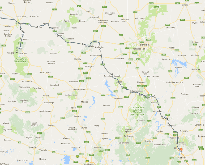
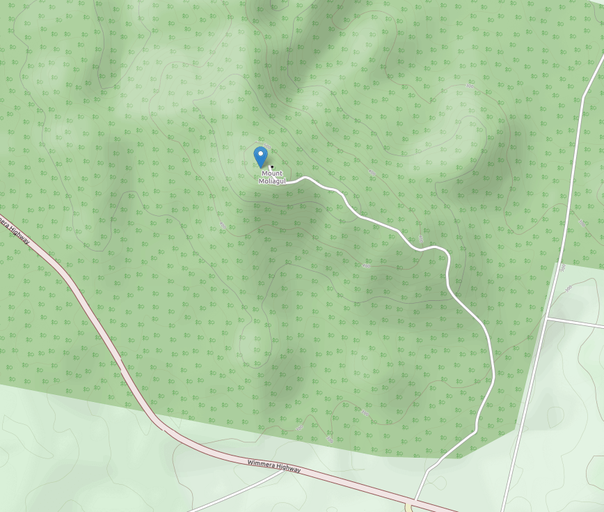
After leaving Mount Moliagul, Marija and I continued south east on the Wimmera Highway towards New Gisborne where we had booked in to stay for one night. Our next planned activation was the SOTA summit Mount Macedon VK3/ VC-007 which is located within the Macedon Regional Park VKFF-0972. I will have to return to the Moliagul area some time soon as I’d love to have a beer at the Mount Moliagul Hotel and I’d like to visit the John Flynn memorial, which I wasn’t aware was there until after leaving the area.
A little further down the Highway we stopped off at the little town of Tarnagulla. We had a look at the monument to commemorate the Poverty Reef which yielded an incredible 13 ton of gold in just 13 months. Just to the east of Tarnagulla is the Poseidon Lead which according to official records, yielded the greatest concentration of large gold nuggets ever taken from one small area anywhere in the world. It is estimated that the Tarnagulla Goldfields yielded 420,000 oz. of gold in the 19th century.

Above:- the Poverty Mine monument.
Tarnagulla contains a number of very beautiful historic buildings including the Victoria Hotel and Theatre which dates back to 1861.


We continued along the Wimmera Highway and crossed the Loddon River, and were amazed at the number of people who were camping on the riverbank. As it was a hot day, people were swimming in the river and fishing.


We then travelled south on the Bridgewater-Maldon Road, and a few kms down the road we couldn’t help but stop and get a photograph of Simmonds Road.

Our next stop was the little town of Maldon which is notable for its 19th century appearance, maintained since the 1850 gold rush days. It really is a beaut town with a lot to explore.

Above:- the main street of Maldon.
And during our visit to Maldon, the Maldon Folk Festival was in full swing. I wasn’t aware that this was on until we arrived in town, otherwise we would have changed our itinerary. Both Marija and I agreed that they will definitely being coming back to Maldon for perhaps next year’s Folk Festival. There was a lot of activity in the town and we spent an hour or so wandering the streets taking in the atmosphere.


We passed through Castlemaine and were stopped at an RBT and had a poor encounter with an extremely rude Sergeant who took exception to my IC-7000 mounted on the windscreen claiming that it was obstructing my view. After my blood pressure had calmed somewhat, we took the M79 Freeway and headed into New Gisborne, where we booked in to our accomodation.


After offloading our bags, Marija and I headed out of New Gisborne on the Mount Macedon Road heading for our SOTA/Park activation. It was a short 15 km drive.
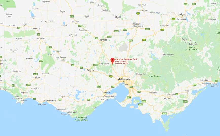
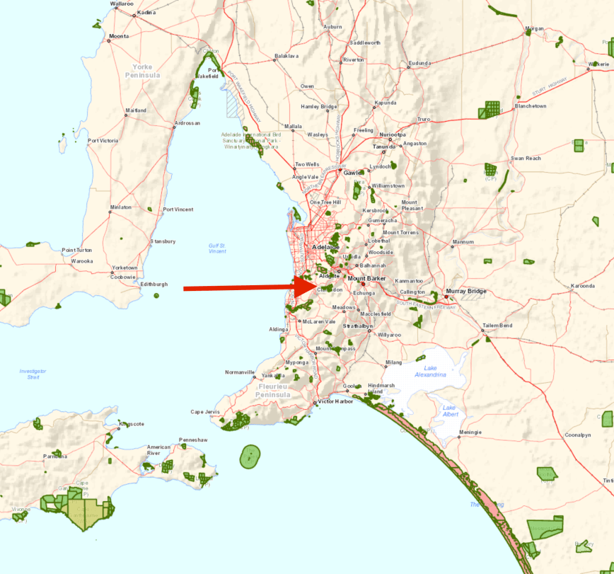
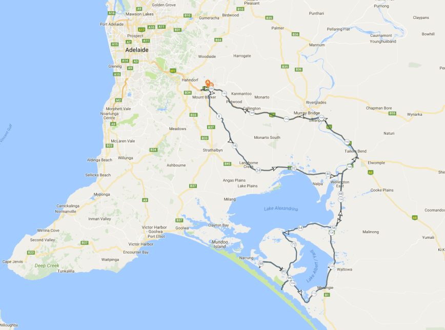
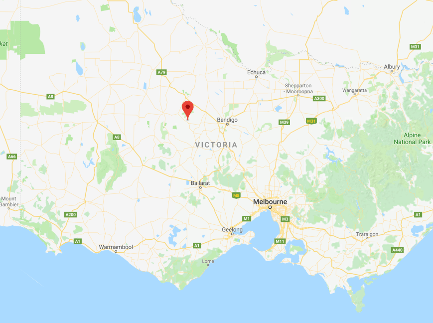
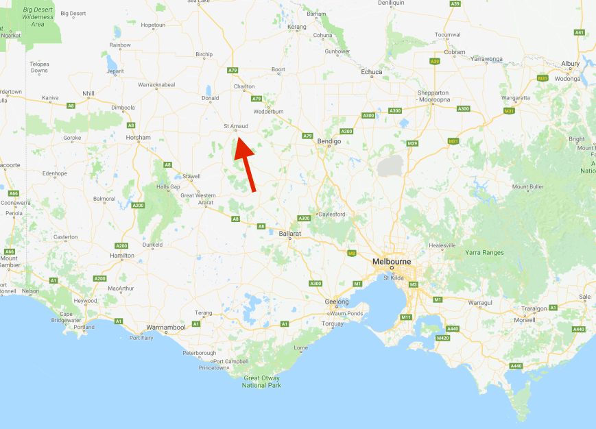
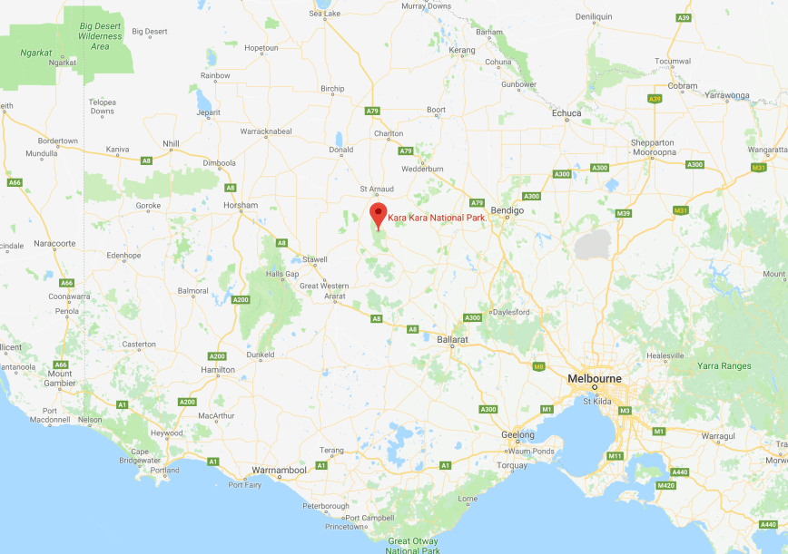
Above:- Map showing the location of Mount Macedon. Map courtesy of google maps.
Mount Macedon VK3/ VC-007 is 1,005 metres above sea level and is worth 6 points for the Summits on the Air (SOTA) program. It is quite a popular summit, having been activated 86 times prior to our visit.
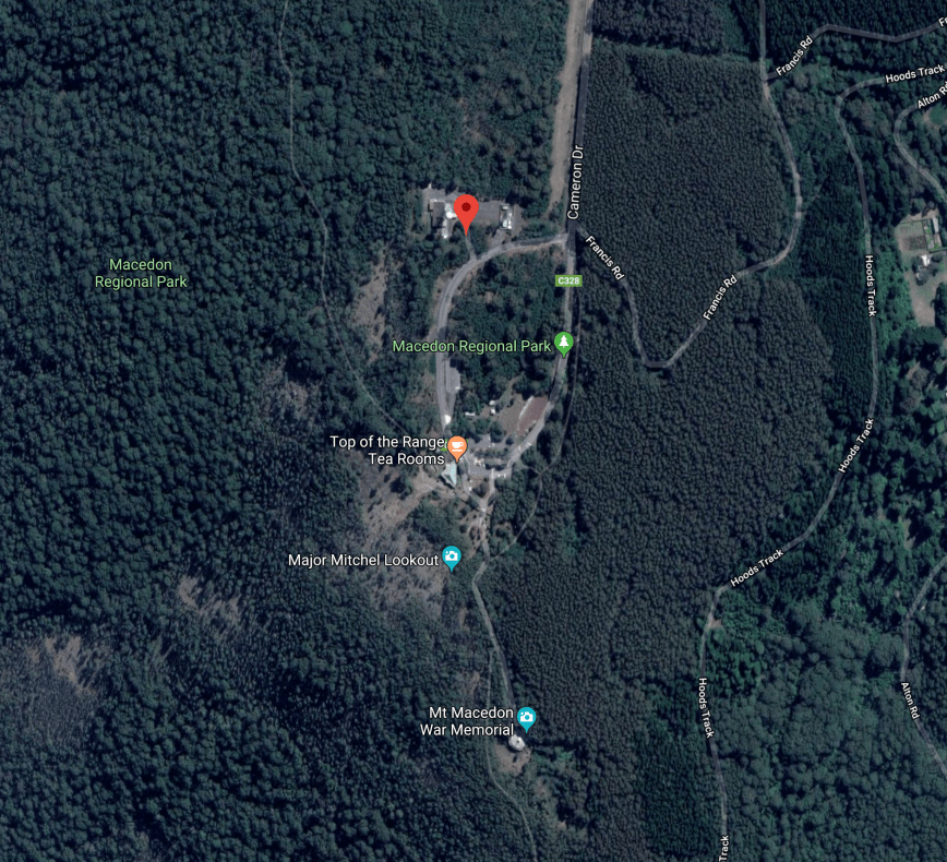
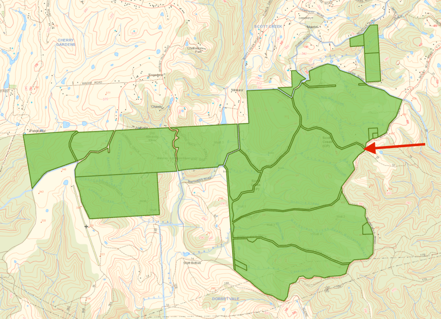
Above:- Aerial view of Mount Macedon VK3/ VC-007. Image courtesy of google maps
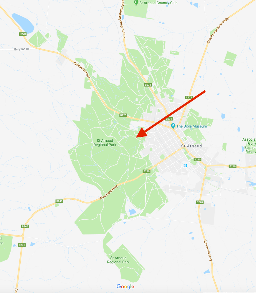
The summit is located in the Macedon Regional Park VKFF-0972 which is about 2,379 hectares in size. The Macedon Ranges form the southern end of Victoria’s Great Dividing Range, with Mount Macedon being one of the highest peaks in the range.
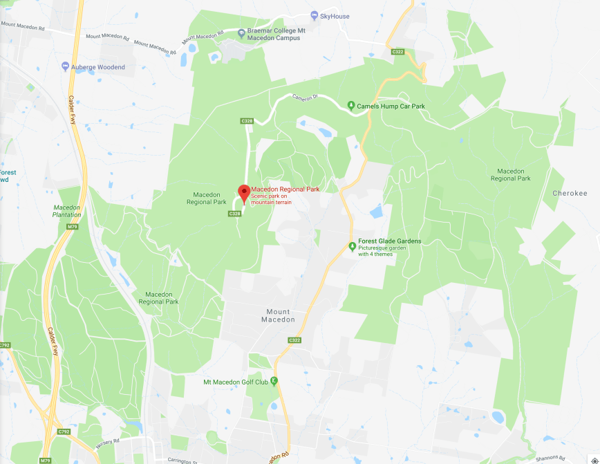
Above:- Map showing the Macedon Regional Park. Map courtesy of google maps
In 1983, the Ash Wednesday bushfires swept through this area. Most of Macedon and much of historic Mount Macedon to the north west of Melbourne was razed, including many heritage listed 19th century mansions and famed gardens.
The summit of Mount Macedon was originally sighted by explorers Hamilton Hume and William Hovell on their 1824 expedition to Port Phillip from New South Wales. They named the mountain, Mount Wenworth. It was renamed Mount Macedon by explorer Major Thomas Mitchell who ascended the mountain in 1836. He named it after Philip of Macedon in honour of the fact that he was able to view Port Philip from the summit.


On the summit there is a historic trigonmetry survey cairn. It is 8 metres in height and was built in the 1860’s as a reference point for land surveys. It is one of only three mortared stone Geodetic Traingulation Cairns in Victoria.


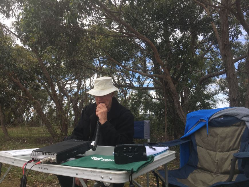
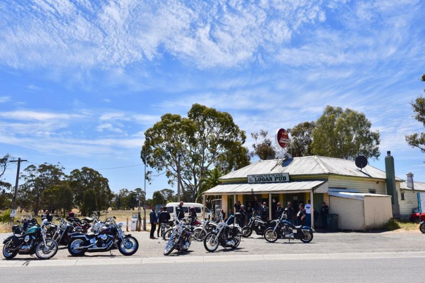
We drove along Cameron Drive and parked near the Top of the Range Tea Rooms. It was now 5.40 p.m. local time and the temperature had dramatically dropped. We were quite high above sea level and the temperature was now a chilly 12 deg C. As there were not too many people on Mount Macedon, we set up in the Harbison Picnic Ground area. We had a choice of a few wooden tables and benches.


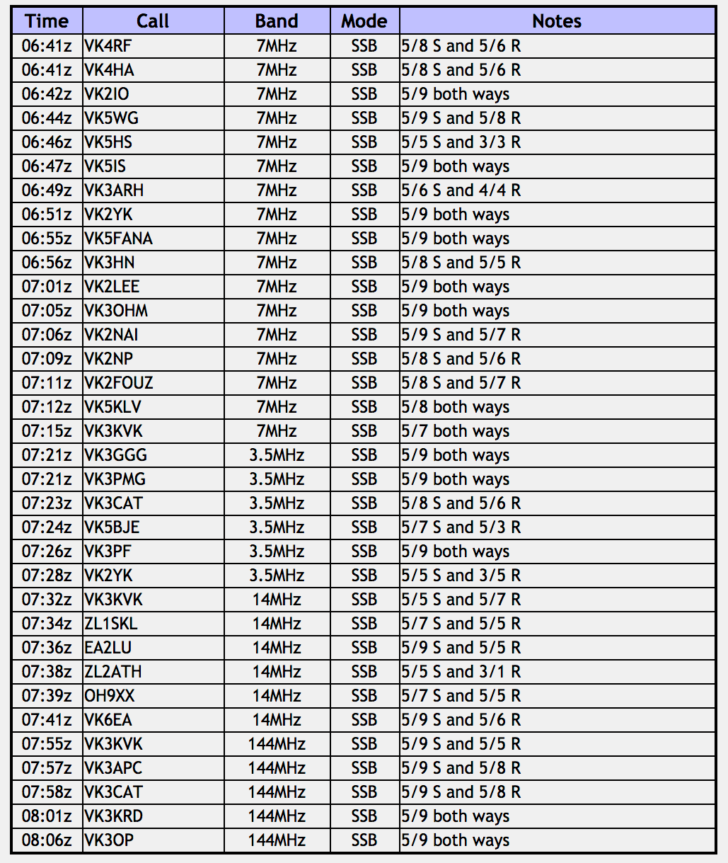
As it was getting late, Marija and I again decided to swap the mic, until Marija had her 10 QSOs to qualify the park for the VKFF program. We started calling CQ on 7.090 and this was answered by Rick VK4RF/VK4HA, followed by Gerard VK2IO, and then Nev VK5WG. We had both qualified the summit and had cleared the first hurdle for the activation. Contact number 10, qualifying the park for us for VKFF, was Paul VK3HN.
I then took control of the mic while Marija went for a walk and taking a few photographs. Sadly, conditions were very poor and I only logged a further 7 stations on 40m. Within 30 minutes of setting up the temperature had dropped from 12 deg C to 10 deg C. Numerous CQ calls on 7.090 went unanswered, so I headed to 3.610 on the 80m band, hoping to pick up some more VK3 stations. First in the log on 80m was Mick VK3GGG/VK3PMG who was an excellent 5/9 from western Victoria, followed by Tony VK3CAT, and then John VK5BJE in the Adelaide Hills. I logged just 2 more stations on 80m and after spending about 10 minutes on 80m, the temperature had dropped to a very chilly 8 deg C.
I then lowered the squid pole and removed the links and headed to the 20m band, where I called CQ on 14.310. This was answered by Richard VK3KVK who had followed me from 40m. Soren ZL1SKL then called from New Zealand, followed by Jorge EA2LU in Spain, Wynne ZL2ATH in New Zealand, Marko OH9XX in Finland, and finally Ian VK6EA.


Marija and I then wandered up to the War Memorial Cross and made 5 contacts on 2m FM using our Yaesu VX-6R handheld. Contacts were with Richard VK3VKV, Tony VK3CAT/VK3APC, Robert VK3KRD, and Frank VK3OP.


It was now very very cold, with the temperature down to about 5 deg C, so we had a quick look around the summit before heading back to the vehicle.
One of the major attractions of Mount Macedon is the 21-metre (69 ft) high memorial cross which was established by early resident William Cameron in 1935 as a memorial to those who died in World War I. After the Shrine of Remembrance, Mount Macedon Memorial Cross is considered to be the most significant war memorial in Victoria.


There is also a small memorial garden and a number of interpretive boards with respect to the memorial cross.


There is also a small memorial plaque to honour Major Thomas Mitchell who was the first European to ascend Mount Macedon. Additionally there is the Kurana Memorial. The Kurana, a DC-3, VH-UZK, took off from the Essendon Airport on the 8th November 1948 on its way to Deniliquin in New South Wales. The aircraft clipped trees in misty conditions and light rain, and crashed into a firebreak in a pine plantation on the southern slopes of Mount Macedon. The Captain and First Officer were fatally injured in the crash.


There are some nice views to be enjoyed from some of the lookouts at Mount Macedon.


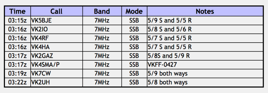
Marija worked the following stations:-

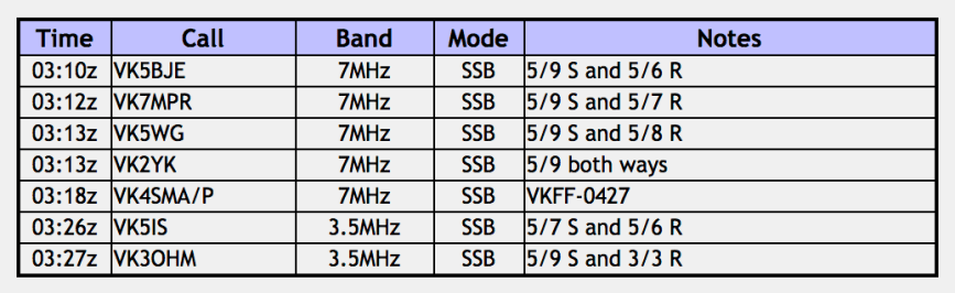
I worked the following stations:-
That night we drove into Gisborne and got a take away pizza from the local pizza shop and enjoyed a quiet night in at the bed and breakfast accomodation.
References.
Macedon and Mount Macedon Region, 2017, <http://www.mountmacedon.org.au/places/kurana-memorial>, viewed 21st November 2017
Parks Victoria, 2017, <http://parkweb.vic.gov.au/explore/parks/macedon-r.p.>, viewed 21st November 2017
Tarnagulla and Surrounds, 2017, <http://www.tarnagulla.com.au/>, viewed 21st November 2017
Top of the Range, 2017, <http://topoftherange.net/macedon-regional-park-survey-cairn.asp>, viewed 21st November 2017
Wikipedia, 2017, <https://en.wikipedia.org/wiki/Ash_Wednesday_bushfires>, viewed 21st November 2017
Wikipedia, 2017, <https://en.wikipedia.org/wiki/Mount_Macedon,_Victoria>, viewed 21st November 2017


")


")


")

")