2015 HF World Championship

I received in the mail the other day my certificate for the 2015 HF World Championship.  I came first in Zone 59 for my category, Single Operator/Phone only/Low power.

The objective of this contest is to make contact with as many other amateurs, especially IARU member society HQ stations, around the world.

VK5PAS HF World Championship 2015.jpg

WWFF statistics

I decided to have a look tonight at my stats for the World Wide Flora Fauna (WWFF) program.  I’m sitting on 745 different WWFF references worked around the world, and I was interested to see how that broke down per country.

Below is a bar graph showing the number of references worked in various countries around the world.  I have worked WWFF activators in 27 different countries (DXCC entities).

Of course, the most number of references worked is Australia on 504.  This is followed by Belgium with 63, Poland with 37, and then Italy with 32.

screen-shot-2016-09-24-at-11-18-23-pm

The graph below shows references worked around the world (excluding Australia).  As mentioned, leading is Belgium, followed by Poland, Italy, France, and then Germany.

screen-shot-2016-09-24-at-11-17-53-pm

  1. Australia-504
  2. Belgium-63
  3. Poland-37
  4. Italy-32
  5. France-19
  6. Germany-16
  7. Denmark-7
  8. Romania-7
  9. United Kingdom-7
  10. Finland-6
  11. Czech Republic-6
  12. Netherlands-6
  13. Spain-6
  14. Croatia-4
  15. Cyprus-3
  16. Portugal-3
  17. Hungary-3
  18. Greece-3
  19. Ukraine-3
  20. Switzerland-2
  21. Serbia-2
  22. New Zealand-2
  23. Lithuania-1
  24. Austria-1
  25. Sweden-1
  26. Israel-1
  27. Galapagos Island-1

Belgium, Poland, and Italy have very vibrant WWFF programs, and their activators often listen for ‘outside of Europe’ which helps us activators down here in Australia.

Franklin Harbour Conservation Park VKFF-0807 and 5CP-071

My eighth and final park whilst away was the Franklin Harbour Conservation Park VKFF-0807 and 5CP-071.

Screen Shot 2016-09-15 at 7.18.47 PM.jpg

Above:- Map showing the location of the Franklin Harbour Conservation Park.  Map courtesy of Protected Planet.

After leaving Middlecamp Hills, I travelled south along the Kimba-Cowell Road, and enjoyed some nice views down towards Cowell.  I was very cognisant of the time, as it has taken me longer to get my 44 QSOs at Middlecamp Hills than expected.  And I had to be back at Whyalla, about 100 km away, for lunch, and then a 5 hour drive back home to the Adelaide Hills.

dsc_2671

Above:- View towards Cowell.

I had activated Franklin Harbour CP previously, but this was to be another unique VKFF park for me.  My last activation of the park was back in June 2013, and was as part of the VK5 National and Conservation Parks Award.  It is amazing how the parks programs have progressed in Australia since that time.  For that activation I made a total of 7 contacts.  To read and see more have a look at my previous post at……

https://vk5pas.org/2013/06/13/franklin-harbour-conservation-park/

Franklin Harbour CP was established on 22nd January 1976, and is 1,356 hectares (3,350 acres) in size.  It is located about 5 km south of the town of Cowell.  The conservation park consists of land on a peninsula that encloses the south east side of Franklin Harbor and four islands including Entrance Island.  The park is important in that it preserves an area of mangrove and samphire flats.  This type of vegetation is dramatically depleted in South Australia.

Screen Shot 2016-09-22 at 7.02.56 PM.png

Above:- Aerial shot showing the location of the Franklin Harbour Conservation Park.  Image courtesy of Google Maps.

The Entrance Islands contain a population of Death Adders, which is one of the most venomous land snakes in Australia and the world.  Death Adders possess the longest fangs of any Australian snake and can deliver the fastest strike among all venomous snakes recorded in Australia.  Death can result within 6 hours of the bite.  Thankfully I was not going there.  I am no fan of snakes!  The islands also provide a safe roosting and feeding site for sea birds.

CSIRO_ScienceImage_3990_Death_Adder.jpg

Above:- A Death Adder.  Image courtesy of Wikipedia.

Cowell itself is a beautiful little town, with a population of around 1,070 people.  It is the centre of the surrounding agricultural district.  The town also supports the local fishing and oyster farming industry.

dsc_2690

I drove out of Cowell along Beach Road which was quite wet and boggy in parts.  Beach Road takes you out to The Knob and the south western tip of the Conservation Park.

dsc_2689

I found a dirt track off Beach Road and drove a short distance down that track and set up my station quickly, as I wanted to get back to Whyalla for lunch.

Screen Shot 2016-09-19 at 11.09.27 PM.jpg

Above:- Map showing my operating spot within the park.  Map courtesty of Protected Planet.

There were some stations on 7.146 so I decided not to operate on 7.144 as I did not want to cause any interference to them.  So I headed down to 7.142 and commenced calling CQ.  My first responder was Geoff VK3SQ in Beechworth with a nice 5/9 signal, followed by Col VK5HCF, and then Greg VK5GJ, running QRP 40 milliwatts again.  This time Greg was a good 5/5 with his QRP set up.

It was an extremely nice outlook from ‘my shack’ out across Spencer Gulf, and to top it off I had a lot of callers.  I had secured the elusive 44 contacts within 40 minutes, and that was with Peter VK3ZPF.  I worked a further 3 stations before going QRT.

I’m sorry if there was anyone else waiting there, but I did not want to push my luck with my wife Marija.  I had a total of 47 contacts in the log and another successful VKFF activation.

dsc_2681

The following stations were worked on 40m SSB:-

  1. VK3SQ
  2. VK5HCF
  3. VK5GJ
  4. VK4RF
  5. VK4HA
  6. VK3PF
  7. VK2HHA
  8. VK5EE
  9. VK3GGG
  10. VK3PMG
  11. VK1AT/3
  12. VK5FANA
  13. VK3SFG
  14. VK3MRH
  15. VK2YW
  16. VK3UH
  17. VK3ZMD
  18. VK5NFT/m
  19. VK2PKT
  20. VK3FRAB
  21. VK3FLCS
  22. VK5AFZ
  23. VK3ELH
  24. VK5FMID
  25. VK3BBB
  26. VK5MRT
  27. VK5VRB
  28. VK2IO
  29. VK5FR
  30. VK3VBI
  31. VK4HNS/p
  32. VK5HS
  33. VK2KYO
  34. VK5FLEX
  35. VK3FSPG
  36. VK5AYD
  37. VK3GP
  38. VK3FQSO
  39. VK5PL
  40. VK3KRH
  41. VK5KLV/m
  42. VK3PAT
  43. VK3TJS
  44. VK3ZPF
  45. VK6JON/7
  46. VK1DI
  47. VK7FOLK/m

At the conclusion of the activation I stopped off very quickly at the agricultural museum at Cowell, which contains a wide range of agricultural machinery.  It was then a 1 hour drive back to Whyalla.

And while on Whyalla, I’d be remiss not to mention something about the town.  I always joke that the best view of Whyalla is ‘in the rear vision mirror’.  It is not the most pleasing town on the eye.  But it is the birth place of my beloved, and we have family and many good friends there.

Whyalla, previously known as Hummock Hill, is the third most populous town/city in South Australia.  Only behind Adelaide and Mount Gambier.  It is known as the “Steel City’ due to its steelworks and shipbuilding heritage.  Whyalla has been exporting iron ore since 1903 and was founded by the Broken Hill Proprietary Company (BHP).  A shipyard was constructed at Whyalla to provide ships to the Royal Australian Navy during the Second World War.  The first ship that rolled off the shipyard, was in 1941, and the corvette was appropriately named HMAS Whyalla.  This is now a landlocked tourist attraction.


References.

Wikipedia, 2016, <https://en.wikipedia.org/wiki/Franklin_Harbor_Conservation_Park&gt;, viewed 22nd September 2016

Wikipedia, 2016, <https://en.wikipedia.org/wiki/Common_death_adder&gt;, viewed 22nd August 2016

Wikipedia, 2016, <https://en.wikipedia.org/wiki/Cowell,_South_Australia&gt;. viewed 22nd September 2016

Wikipedia, 2016, <https://en.wikipedia.org/wiki/Whyalla&gt;, viewed 22nd September 2016

Middlecamp Hills Conservation Park VKFF-1059 and 5CP-184

It was another early start on Sunday morning, 18th September 2016.  I had two scheduled park activations for the day, each being about one hour drive south of Whyalla.  The first being the Middlecamp Hills Conservation Park VKFF-1059 and 5CP-184.  So after a quick bite to eat and a morning coffee I was on the road, heading south out of Whyalla.

Screen Shot 2016-09-15 at 7.19.57 PM.jpg

Above:- Map showing the location of the Middlecamp Hills Conservation Park.  Map courtesy of Protected Planet.

I travelled south west to Cowell and then north west out along the Cowell-Kimba Road.  I then turned left onto the Cowell-Mangalo Road, and then on to Ferns Road.

These are all dirt roads, and after all the rain from the day before, they were quite muddy and slippery in spots.  So that combined with the kangaroos, it was quite slow going out to the park.

dsc_2653

Above:- Ferns Road, looking south west.  Yeldulknie Conservation Park is off in the distance.

This was another park that I struggled to find a lot of information about on the internet.  The park which is about 857 hectares in size, is around 13 km north west of Cowell.  It consists of rugged low hills with areas of dense mallee vegetation.   The native scrub here consists mostly of various kinds of eucalyptus and broombush.  The Silver daisy bush, which is listed as being vulnerable, can be found in the park.  A variety of native animals can be found in the park including Euros and western grey kangaroos.

Screen Shot 2016-09-22 at 3.17.49 PM.png

Above:- Aerial image showing the location of the park, to the north west of Cowell.  Image courtesy of Google maps.

The only way to access this park is via Ferns Road.  A small section of the park abuts the roadway.  I unpacked the Toyota Hi Lux and then carried the gear carefully over the barbed wire fence.  Sadly, this is another park which unless you are agile and game to climb over a barbed wire fence, does not offer any user friendly access.

Screen Shot 2016-09-15 at 7.19.45 PM.jpg

Above:-Aerial view of the park, showing my operating spot.  Image courtesy of Protected Planet.

As it was a Sunday morning, I did not venture up to 7.144.  The numerous WIA broadcasts are in that vicinity every Sunday morning.  So I commenced calling CQ on 7.090 and it was very very slow going to start off.  My first contact was with Rod VK7FRJG with a beautiful signal from Tasmania with his 2 elements.  This was followed by Tom VK5EE at Mount Gambier, and then Peter VK2NEO who almost lifted the Yaesu FT-857d off the fold up table.   Whilst I was speaking with Peter, the squid pole collapsed in the wind.  I could hear Peter and others saying ‘I wonder what happened there?’ until I came back to advise what had happened.

About 10 QSOs into the activation, the Western Australian guys started up on 7.088.  It wasn’t broadcast time, but a few VK6’s started chatting away, which caused a bit of QRM for me.  I persisted for another 12 QSO’s until it became unbearable, so I headed down to 7.084.  I had a total of 22 QSOs in the log by this time.

I started calling CQ again on 7.084 and this was answered by Bob VK5FO.  It was about this time that I started to experience some showers in the park, so it was quick dash back to the 4WD across the barbed wire fence to collect the bothy bag.

Screen Shot 2016-09-22 at 6.23.16 PM.png

I worked a total of 51 stations on 40m from VK1, VK2, VK3, VK4, VK5, VK6, and VK7.  This included Greg VK5GJ at Meadows who was operating QRP 4 watts.  I had worked Greg the day before when he was running just 40 milliwatts and I suggested he should try again.  So Greg dropped his power to 40 milliwatts and I dropped down from 40 watts to 5 watts.  Greg’s signal dropped from strength 9 to strength 6.  My signal report dropped from strength 9 down to strength 7.

dsc_2656

I then lowered the squid pole and adjusted the links in the dipole and heded off to 14.310 on 20m where I worked Neil VK4HNS/p.  Unfortunately Neil was my only contact on 20m, and I did not have any phone coverage to I was unable to spot on parksnpeaks.

dsc_2665

I then decided to try 80m before heading off to my next park.  Again, despite band conditions being quite good on 80m, I only had 2 callers.  I did however experience a little bit of noise on 80m.  Callers included Adrian VK5FANA on the Yorke Peninsula (5/8 sent and 5/6 received), and Gred VK5GJ running QRP 400 milliwatts.  Greg had a good signal and was peaking strength 8.  Below is a short video showing just how well I was receiving Greg at Middlecamp Hills.

The following stations were worked on 40m SSB:-

  1. VK7FRJG
  2. VK5EE
  3. VK2NEO
  4. VK1DI
  5. VK3NBL
  6. VK4RF
  7. VK4HA
  8. VK3AFW
  9. VK3UH
  10. VK2IO
  11. VK5FMLO
  12. VK6MB
  13. VK3FPSR
  14. VK3GGG
  15. VK3PMG
  16. VK5FR
  17. VK3PF
  18. VK2XXM
  19. VK5FMID
  20. VK4HNS/p
  21. VK5WG/m
  22. VK5AFZ
  23. VK5FO
  24. VK2LEE
  25. VK3SQ
  26. VK3ZPF
  27. VK3XDM/p
  28. VK3MCK
  29. VK5ZGY
  30. VK5ZX
  31. VK1AT/3
  32. VK3SFG
  33. VK5BJE
  34. VK3FRAB
  35. VK3BBB
  36. VK2HHA
  37. VK2KYO
  38. VK4RF
  39. VK4HA
  40. VK5NFT/m
  41. VK3GGG
  42. VK3PMG
  43. VK5NJ
  44. VK5GJ
  45. VK6JON/7
  46. VK5FANA
  47. VK3FADM
  48. VK5RR
  49. VK7FOLK
  50. VK3TKK
  51. VK2IO

The following station was worked on 20m SSB:-

  1. VK4HNS/p

The following stations were worked on 80m SSB:-

  1. VK5GJ
  2. VK5FANA


References.

Australian Heritage Database, 2016, <http://www.environment.gov.au/&gt;, viewed 22nd September 2016

Department Environment Water and Natural Resources, 2013, Approved Conservation Advice for Olearia pannosa.

Yeldulknie Conservation Park VKFF-1127 and 5CP-260

Sadly the rain had hit with vengeance, so I decided to cancel the activation of Sheoak Hill Conservation Park, and activate just one more park (from the vehicle), the Yeldulknie Conservation Park VKFF-1127 and 5CP-260.  However, this activation would not qualify for the VK5 National & Conservation Parks Award, as I was going to operate from the vehicle.  You must be completely autonomous from the vehicle for the VK5 Parks Award.  However, WWFF does allow mobile activity or operation from a vehicle.

screen-shot-2016-09-15-at-7-15-54-pm

Above:- Map showing the location of the Yeldulknie Conservation Park, west of Adelaide, on the Eyre Peninsula.  Map courtesy of Protected Planet.

The Yeldulknie Conservation Park was first proclaimed on 21st September 1989 and comprises around 3,297 hectares.  The park comprises three major landform features including steep gullies, ridges and hills, and a system of creeks and water ways.

screen-shot-2016-09-21-at-9-50-25-pm

Above:- Aerial shot showing the location of the park.   Image courtesy of Google maps.

After leaving the Plug Range, I headed back into Mangalo, and then out along the Mangalo-Cleve Road.  Yeldulknie is well signposted unlike some of the other Conservation Parks on the Eyre Peninsula.  There is a park sign in the north western corner of the park, and another sign in the south western corner.

The rain had really set in now, so there was definitely no chance of me operating from outside of the vehicle.  This proved a problem, as there were limited operating spots along the roadway.  I eventually found a small clearing in the scrub and pulled off the road as far as I could, without the risk of getting bogged.

Fortunately it only takes a few minutes to erect the linked dipole, but this was long enough for me to be absolutely drenched by the time I got back into the vehicle.

Screen Shot 2016-09-15 at 7.15.39 PM.jpg

I headed to 7.144 and found Rob VK4FFAB calling CQ from Conondale National Park VKFF-1513.  Rob was my first contact from Yeldulknie, and a nice way to start with a Park to Park contact.  I then moved down the band to 7.139 and called CQ and this was answered by a number of the usual suspects….Rick VK4TRF, Peter VK3PF, Chris VK5FR and Gerard VK2IO.

At times the rain was extremely heavy and the rain static was peaking up to strength 8, so I apologise to anybody who was calling that I did not acknowledge.  This combined with the rain hitting the roof of the Toyota Hi Lux, made conditions quite difficult at times.

I went on to work a total of 54 stations from Yelduknie, in VK1, VK2, VK3, VK4, VK5, and VK7.  Sadly due to the rain I did not get to work any other bands.  It was just too wet and cold to be standing out in the rain for any longer than what was required.

Other than Damien VK5FDEC running his usual 5 watts (5/8 sent and 5/9 received), I spoke with Greg VK5GJ again, running just 4 watts (5/8 sent and 5/9 received).  Greg then lowered his power down to 40 milliwatts and dropped to a 5/1.  Fortunately the rain had eased by this stage, and I was able to copy Greg very well from Meadows in the Adelaide Hills.

I was now getting very cold and in dire need for a hot shower and a cup of coffee, so it was back out into the rain to lower the squid pole and collect the antenna.  And then an hour drive back into Whyalla.

Thanks to the following stations for spotting me: Rick VK4RF & Col VK3LSD.

The following stations were worked on 40m SSB:-

  1. VK4FFAB/p (VKFF-1513)
  2. VK4RF
  3. VK4HA
  4. VK3PF
  5. VK5FR
  6. VK2IO
  7. VK3OHM
  8. VK5HS
  9. VK7CW
  10. VK5WG
  11. VK5MRT
  12. VK4AAC/3
  13. VK2HHA
  14. VK3BBB
  15. VK5BW
  16. VK7ALH
  17. VK3TKK
  18. VK3SQ
  19. VK5FMWW
  20. VK2VW
  21. VK2YW
  22. VK5KLV
  23. VK4HNS/p
  24. VK5FANA/m
  25. VK5BJE
  26. VK3FLCS
  27. VK5HDW
  28. VK3BL
  29. VK3ALA
  30. VK5VRB
  31. VK5EE
  32. VK3SFG
  33. VK7FRJG
  34. VK5FDEC
  35. VK5ZK
  36. VK2KYO
  37. VK3SL
  38. VK3FRAB
  39. VK3GGG/m
  40. VK3PMG/m
  41. VK3ZMD
  42. VK5GJ
  43. VK5FD
  44. VK3PAT
  45. VK3LSD
  46. VK3ARH
  47. VK5GJ
  48. VK1MTS
  49. VK2YK
  50. VK2MOR
  51. VK5NFB
  52. VK2XXM
  53. VK3FADM
  54. VK3KLB

At the end of the activation I paid a quick visit to the Yeldulknie Reservoir.  This was completed in 1912 and had a capacity of 740 mega litres.  The building of the reservoir involved the construction of a 108 metre long and 12.8 metre high concreate retaining wall across Yeldulknie Creek.  A further two reservoirs were completed by 1914.  The reservoirs are no longer in use today, however there is a picnic area at the reservoirs.  The restored wheelhouse is state heritage listed.


References.

District Council of Cleve, 2016, <http://arnobay.com/yeldulknie-conservation-park/&gt;, viewed 21st September 2016

Flinders Ranges Research, 2016, <http://www.southaustralianhistory.com.au/yeldulknie.htm&gt;, viewed 21st September 2016

The Plug Range Conservation Park VKFF-1107 and 5CP-231

After leaving the Heggaton Conservation Park I made my way to The Plug Range Conservation Park VKFF-1107 and 5CP-231.  The Plug Range is located about

screen-shot-2016-09-15-at-7-14-25-pm

Above:- Map showing the location of The Plug Range Conservation Park on Eyre Peninsula.  Map courtesy of Protected Planet.

I thought that this was going to be a short 30 minute drive from Heggaton and I would be there.  But that was not to be!   I drove down the Mangalo-Kielpa Road into the little area of Mangalo, which is easily identified as there are two large grain silos at the intersection with Burton Road.

DSC_2643.jpg

Above:- the grain silos at Mangalo

I then drove north on Burton Road, heading towards what I thought was the park.   Unfortunately mobile phone coverage was very poor and it wasn’t long before I was lost.  Fortunately a local lady came along and kindly turned her car around and guided me to where I wanted to be to get into the park.  I am very appreciative of this.  It was a set of gates on Watchanie Road with a dirt track leading towards the scrub through a farming property.  Definitely no signs for this park.

DSC_2631.jpg

Above: the track leading into the park (is actually a part of the park).

I drove to the end of the track and soon entered the scrub.  The dirt track leading to the scrub is actually part of the park.  You can see the narrow thin green line on the aerial below, which is the track leading to the park.  I set up off a little track following a ridgeline in the south western corner of the park.

Screen Shot 2016-09-21 at 8.51.37 PM.png

Above:- Aerial shot of The Plug Range Conservation Park, showing my operating spot in the south western section of the park.  Image courtesy of Location SA Map Viewer.

The Plug Range Conservation Park was established on the 6th September 2012 and comprises 2,582 hectares.  The park is surrounded by farming land.  Again, I could find very little on this park on the internet.

Screen Shot 2016-09-21 at 9.35.17 PM.png

Above:- Aerial shot from Google Maps showing the location of The Plug Range Conservation Park in relation to Heggaton Conservation Park.

The wet weather was moving in fast and I had my doubts that I was going to get my 44 contacts from the park before the rain started coming down.  I was on air at around 0315 UTC (1.45 p.m. local time), with my first contact in the log being a Park to Park contact with Adam VK2YK in the Glenrock State Conservation Area VKFF-1319.  I then moved down the band to 7.130 and started calling CQ.  This was answered by Mick VK3GGG who was mobile in the Grampians National Park VKFF-0213.  Next up was Gerard VK2IO, followed by Chris VK5FR, and then Tony VK5MRT.

As the rain was fast approaching I moved through each QSO quite quickly during this activation.  The band was completely devoid of any man made noise, but the static crashes were very strong from the nearby storms.  I had reached contact number 40 within 30 minutes of activating.  This was with Brian VK3BBB, when the heavens opened up.  Damn, I had 4 more contacts to get in the log to qualify the park.  So it was back to the 4WD and out with the bothy bag.

I returned to the deck chair and the fold up table, huddled underneath the bothy bag, and worked a further 5 stations before hurriedly going QRT.  My last contact was with Steve VK5SFA.  The rain was that heavy, that water was starting to seap through the bothy bag.  So out from underneath the bothy bag I came, and I commenced packing up the gear in the rain.  This normally only takes me around 2 minutes, but it was enough for me to be like a wet rat.

Unfortunately I did not have time or the opportunity to try any bands other than 40m during this activation.  The rain had beaten me.  But I had qualified the park with a total of 45 contacts.

Many thanks to the following stations who spotted me: Brett VK3FLCS, Rick VK4RF, and Robert VK2XXM.

The following stations were worked on 40m SSB:-

  1. VK2YK/p (VKFF-1319)
  2. VK3GGG/p (VKFF-0213)
  3. VK3PMG/p (VKFF-0213)
  4. VK2IO
  5. VK5FR
  6. VK5MRT
  7. VK3MRH
  8. VK5WG
  9. VK3BNJ
  10. VK2HHA
  11. VK3MCK
  12. VK3SFG
  13. VK3PF
  14. VK4RF
  15. VK4HA
  16. VK3FENC
  17. VK7ALH
  18. VK1AT
  19. VK5KLV
  20. VK3SIM
  21. VK5ZK
  22. VK4HNS/p
  23. VK4AAC/3
  24. VK7FOLK
  25. VK2KYO
  26. VK2YW
  27. VK3TKK
  28. VK3FLCS
  29. VK5EE
  30. VK5AFZ
  31. VK2VW
  32. VK5GJ
  33. VK2XXM
  34. VK2MOR
  35. VK3FRAB
  36. VK6JON/7
  37. VK5ZGY/m
  38. VK2JCC
  39. VK3FSPG
  40. VK3BBB
  41. VK3UH
  42. VK3BSG
  43. VK3NXT
  44. VK3AJA
  45. VK5SFA


References.

Department of Environment Water and Natural Resources, Eastern Eyre Peninsula Parks Management Plan 2014

Heggaton Conservation Park VKFF-1037 and 5CP-089

It was a bright and early start for me on Saturday 17th September 2016.  I had four planned park activations for the day, with the first being the Heggaton Conservation Park VKFF-1037 and 5CP-089.  So after some toast and a coffee I was on the road by just after 7.00 a.m.  I had about a one hour drive to get out to Heggaton.

Screen Shot 2016-09-15 at 7.12.13 PM.jpg

One thing that was reinforced with me from this activation was, don’t always rely on the GPS.  It took me the long way!  Instead of taking me down the Lincoln Highway to Cowell, I was guided out of Whyalla along the Lincoln Highway and then told to turn off on the Middleback Road through the very impressive Middleback Ranges.  It was slow going as the dirt was quite slippery in sections and there were a lot of kangaroos out and about.  The Middleback Road then became Sectus Tanks Road and this brought me out onto the Eyre Highway.  And directly in front of me was the Lake Gilles Conservation Park.  I was very tempted to stop off here for a quick activation.

dsc_2610

Above:- Sectus Tanks Road at Bama.

But I decided not to stop, and I continued south west on the Eyre Highway and into the little town of Kimba.  The word ‘Kimba’ is derived from the local aboriginal word for ‘bushfire’.  The town is known as being ‘halfway across Australia’ as the crow flies.  It is also well known for the Big Galah.  I stopped here briefly to stretch the legs and take a few photos.

I then travelled south out of Kimba along the Cleve-Kimba Road and then turned right onto Whitwell Road and on to the Old Cleeve Road.  A short distance up the Old Cleeve Road I turned right onto King Hicks Road.  The northern section of the park soon came in to view.

I set up in this northern section off King Hicks Road, in a clearing in the scrub.  Cleared land for cropping bordered the park at this location.

Screen Shot 2016-09-15 at 7.11.55 PM.jpg

I was unable to find a lot of information about the Heggaton Conservation Park on the internet.  The park is 6,476 hectares in size and is located to the south east of Kimba and the south west of Whyalla.  The park which was proclaimed on the 6th September 2012, provides important habitat for the Mallefowl and also the rare Gilbert’s Whistler.

It was quite a mild morning and the flies had not taken a rest from yesterday.  They were out in force again and no matter how much insect repellant I applied, it had no effect.  There was enough room in the clearing for me to string out the longer 80/40/20m linked dipole which is what I did.  I was all set to go by about 0020 UTC (9.50 a.m.).  It had taken me a lot longer to get to the park than expected.

My first caller of the morning on 7.144 on 40m was Brian VK5FMID at Mount Gambier who was 5/9.  This was followed by Geoff VK3SQ, Les VK5KLV and then Greg VK5ZGY mobile in the South East of South Australia.

About eight contacts into the activation, I had my first Park to Park contact in the log.  It was with Rob VK4FFAB who was portable in the Conondale National Park VKFF-0109. Rob’s signal was quite low, 5/4, but he was very readable as there was no man made noise at all on the band from within the park.

Shortly after I made a few QRP contacts.  The first was with Peter VK3PF who was 5/5, running just 1 watt.  And then Adrian VK5FANA running 5 watts who was 5/9 from the Yorke Peninsula.  About 12 QSOs later I was called by Greg VK5GJ running 4 watts from Meadows in the Adelaide Hills.  Greg was a terrific 5/9 signal to Heggaton.  This was followed by Ian VK5IS running just 5 watts from the Mid North of South Australia, and he too was 5/9.  Nev VK5WG, also in the Mid North, followed soon after running 5 watts (5/9 both ways).  The 40 m band was in great shape, and despite the quite strong static crashes, I was hearing everyone extremely well.

Peter VK3YE then called in, running just 5 watts, operating as a flagpole station with a kite antenna at Chelsea Bicentennial Park.  As it turned out, it was International Talk Like A Pirate Day, on which the Manly Warringah Radio Society run a Flagpole Contest.  Peter was a nice 4/4 signal, with Peter receiving me at 5/7 at his end.

But the QRP contact of the activation was with Greg VK5GJ.  After initially working him on 4 watts, Greg called back running just 400 milliwatts.  Greg had not dropped from a 5/9 down to a 5/2 but was still perfectly readable.  He called back shortly afterwards running just 40 milliwatts and had dropped to a 4/1.  AMAZING.  This was the highlight of this park activation for me.  Greg’s QTH was about 300 km to the east of Heggaton, across the Spencer Gulf and the St Vincent Gulf.

I worked a total of 53 stations on 40m before having a quick listen on 20m where I spoke with Cleeve VK2MOR, Lee VK2LEE and then John VK6NU.  Finally I headed over to 80m where I logged 2 contacts, Bill VK5MBD at Red Hill in the Mid North of SA, and then Ivan VK5HS in the Riverland region of SA.

Time was marching on, and the weather was moving in rapidly from the west.  A lof of rain was predicted and I still had three planned park activations.

Thankyou to the following who spotted me: Rick VK4RF, Robert VK2XXM, Adrian VK5FANA, Lee VK2LEE, and Cleeve VK2MOR.

The following stations were worked on 40m SSB:-

  1. VK5FMID
  2. VK3SQ
  3. VK5KLV
  4. VK5ZGY/m
  5. VK2IO
  6. VK4RF
  7. VK4HA
  8. VK4FFAB/p (VKFF-0109)
  9. VK1AT/3
  10. VK3PF
  11. VK5FANA
  12. VK5ZK
  13. VK5BJE
  14. VK5HCF
  15. VK5EE
  16. VK3GGG/m
  17. VK3PMG/m
  18. VK3OHM
  19. VK3SFG
  20. VK5MRT
  21. VK2HHA
  22. VK7ALH
  23. VK2PKT
  24. VK5FR
  25. VK5GJ
  26. VK5IS
  27. VK5VBR
  28. VK2XXM
  29. VK4HNS/p
  30. VK7CW
  31. VK3BBB
  32. VK5PL
  33. VK5RM/m
  34. VK3ZMD
  35. VK1DI
  36. VK2KYO
  37. VK5WG
  38. VK5HDW
  39. VK5HS
  40. VK3FLCS
  41. VK5GJ
  42. VK3IO
  43. VK3YE/p
  44. VK3FADM
  45. VK5MBD
  46. VK2LEE
  47. VK3MCK
  48. VK5AFZ
  49. VK5GJ
  50. VK5TRM
  51. VK5MRE/m
  52. VK5SFA/m
  53. VK2MOR

The following stations were worked on 20m SSB:-

  1. VK2MOR
  2. VK2LEE
  3. VK6NU

The following stations were worked on 80m SSB:-

  1. VK5MBD
  2. VK5HS


References.

Department of Environment Water and Natural Resources, Eastern Eyre Peninsula Parks Management Plan 2014


Whyalla Conservation Park VKFF-0805 and 5CP-253

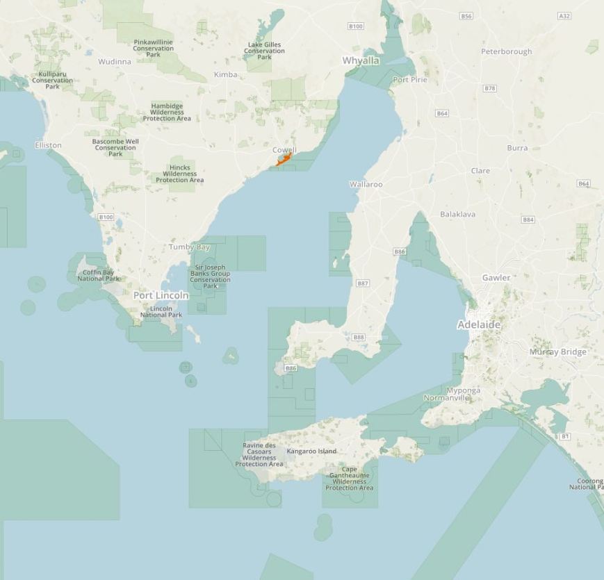
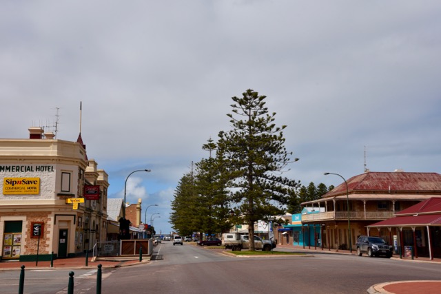
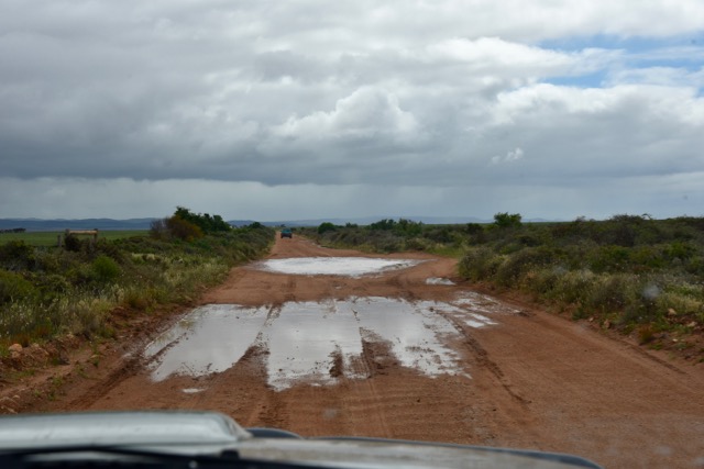
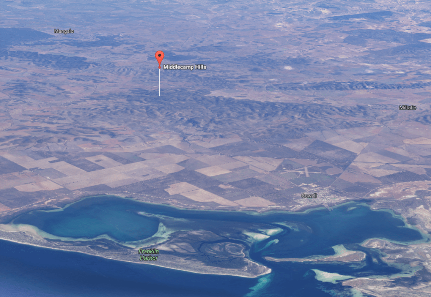
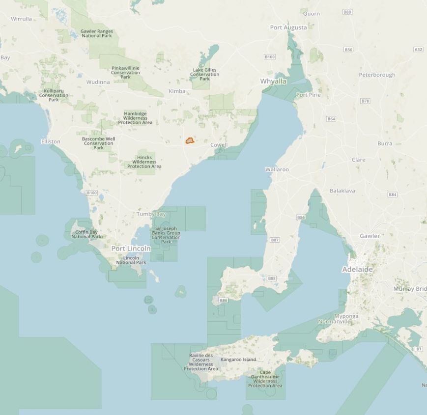
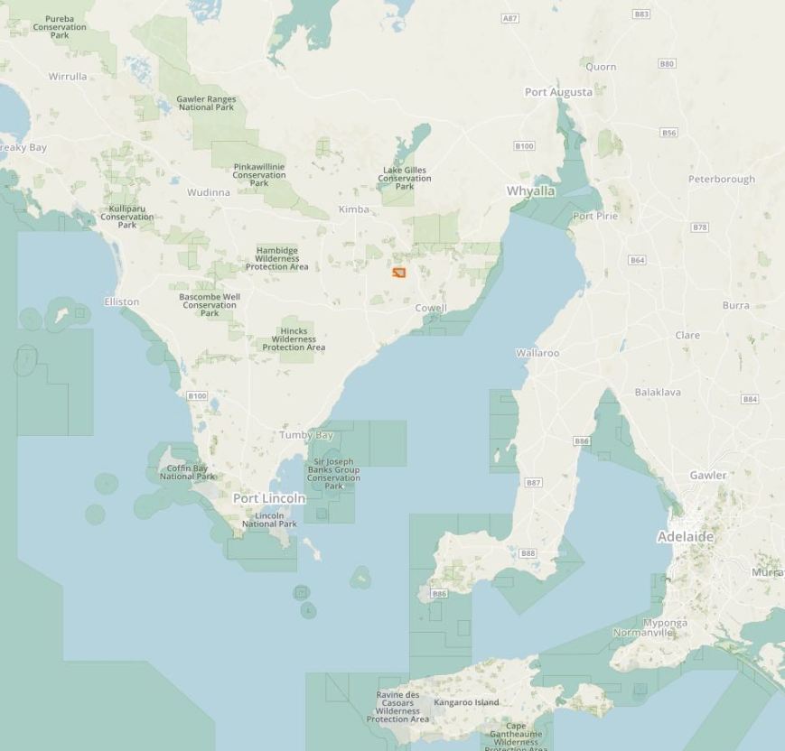
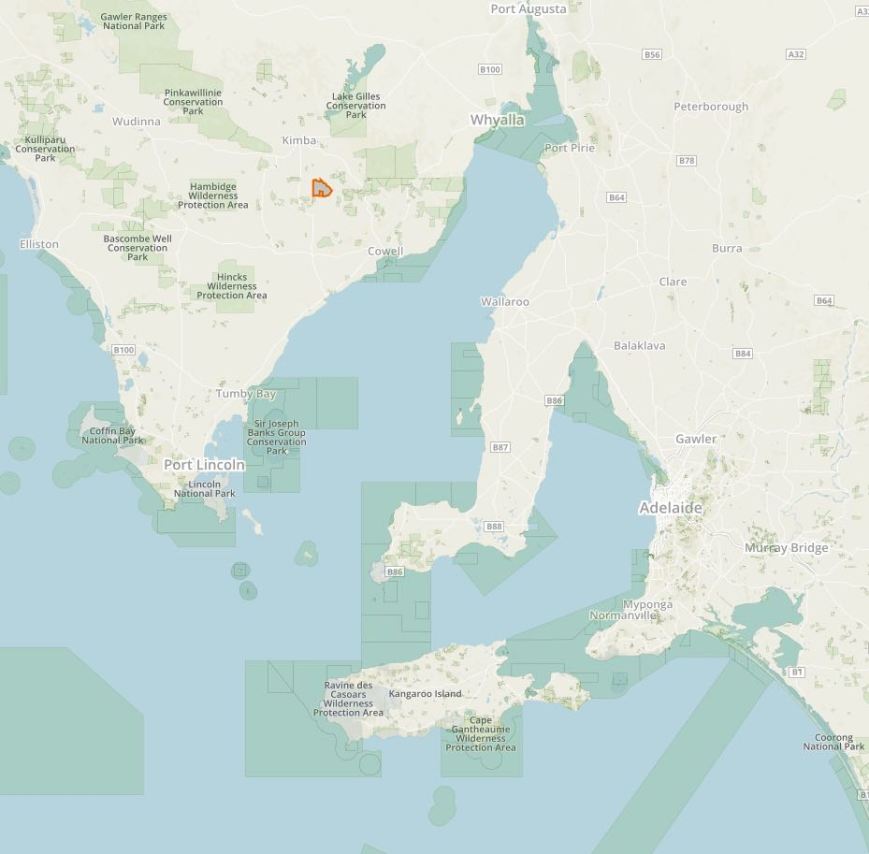
My last planned park activation for Friday 16th September 2016 was the Whyalla Conservation Park (CP) VKFF-0808 and 5CP-253.  Whyalla CP is about 10 km north of the town of Whyalla, on the Lincoln Highway.

Screen Shot 2016-09-15 at 7.07.15 PM.jpg

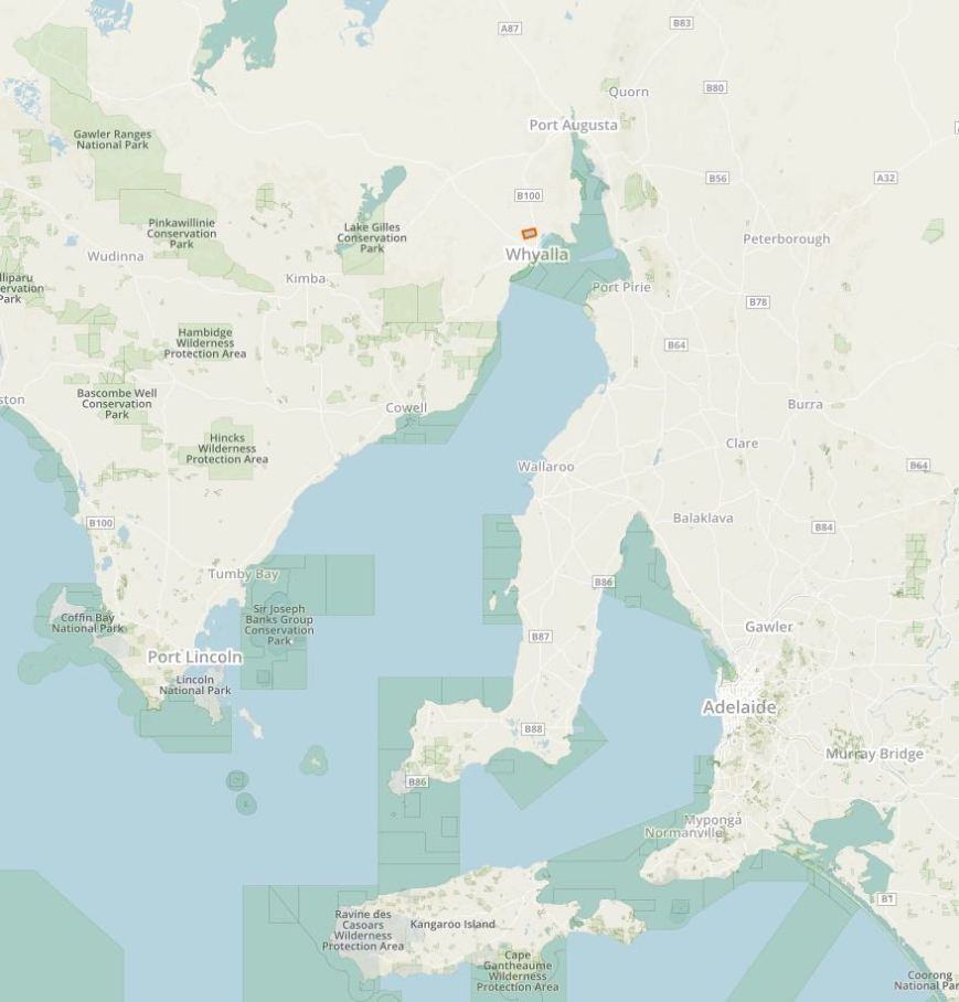
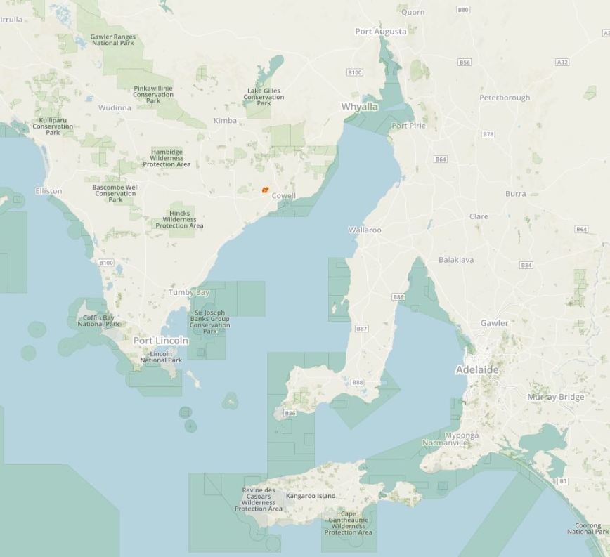
Above:- Map showing the location of the Whyalla Conservation Park, just north of the town of Whyalla.  Image courtesy of Protected Planet.

I have activated Whyalla Conservation twice before.  The first back in June 2013, and then again in December 2014.  For more information on those activations please see my previous posts at…..

https://vk5pas.org/2013/06/16/whyalla-conservation-park/

https://vk5pas.org/2014/12/28/whyalla-conservation-park-2/

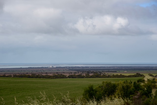
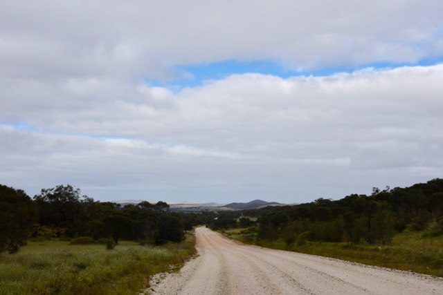
Below are some photographs from the December 2016 activation when I operated from Wild Dog Hill within the park….

Whyalla Conservation Park was proclaimed on the 4th November 1971 and comprises1,971 hectares (4,870 acres).  The park was conserved both for conservation value of Eyre Peninsula woodland and for its position just 10 km north of Whyalla.  It was intended to serve a recreational purpose for Whyalla as a picnic site.  The park originally covered an area of 1,011 hectares, and in 2003 an extra area of land to the south of the Park, almost identical in size, was added.

This land was originally part of the BHP Indenture Act land and was under BHP’s care and control. With the divestiture of it’s Whyalla steel making operations to a new company, OneSteel, some of the land that was excess to requirements was added to the Park and the remainder was handed back to the local community.

Within the north west corner of the park, Wild Dog Hill, a sandstone outcrop, rises above the surrounding plains and offers some great views of the surrounding countryside.  There is an easy walking trail to the top.  Below are some photos taken back in December 2014 at Wild Dog Hill.

The park is alive with Red and Grey kangaroos, along with Euros who are often sighted on the slopes of Wild Dog Hill.  The Common Dunnart, a carnivorous mouse sized marsupial which eats grasshoppers and small lizards is also found in the park.

Over 80 species of birds have been observed in the Park including Wedge-tailed Eagles, Australian Kestrels, Grey Butcherbird, Crested Pigeon, White-browed Babbler, Spiny-cheeked Honeyeater and the Black-faced Woodswallow.

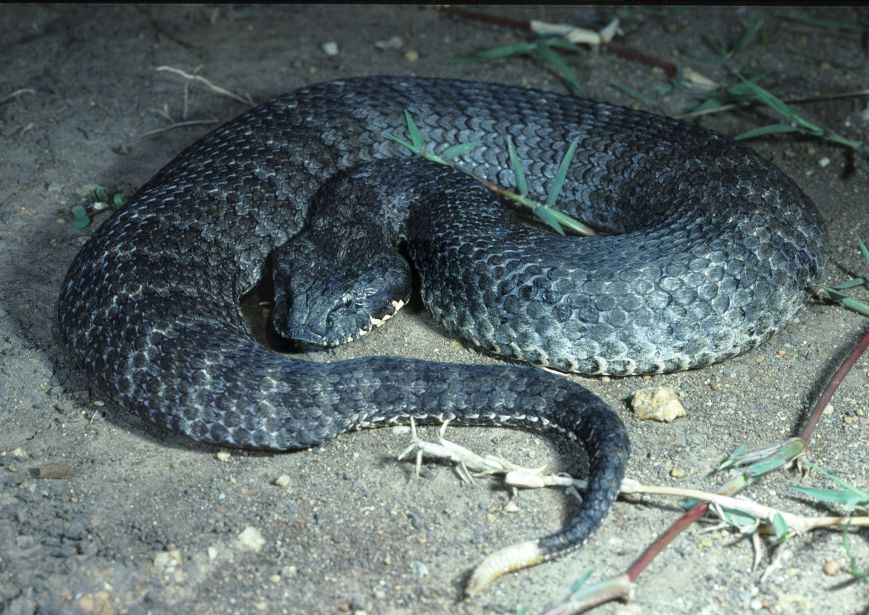
More than 20 species of reptiles have been recorded in the Whyalla Conservation Park, including the Western Brown Snake, Bearded Dragon, Western Bluetongue and Sleepy Lizard.

The most common tree that can be seen in the Park is the Western Myall, Acacia papyrocarpa. These majestic trees with their dome shaped canopy and silver-grey foliage can live to be over 250 years old. Sugarwoods, Bullock Bushes, Native Apricots, Quandongs and Black Oaks can also be found in many areas and Saltbush and Bluebush dominate the understorey.

Despite the sometimes oppresive weather conditions in the park, numerous wildflowers can be found at certain times of the year.  These include Fringe-lilies and Paper-daisies.  Delicate lilac Rock Isotomes flower almost constantly at the top of Wild Dog Hill, whilst the tube like flowers of Emu Bushes can be found throughout the Park.

It is reported that the lichens located on the rocks and trees within Whyalla Conservation Park, are some of the best examples in the world.

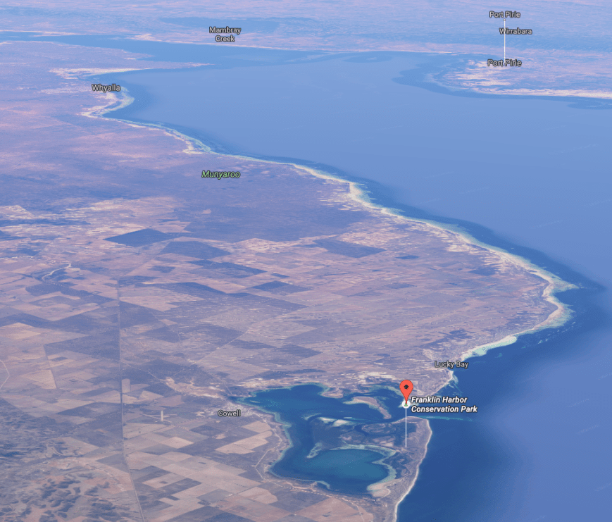
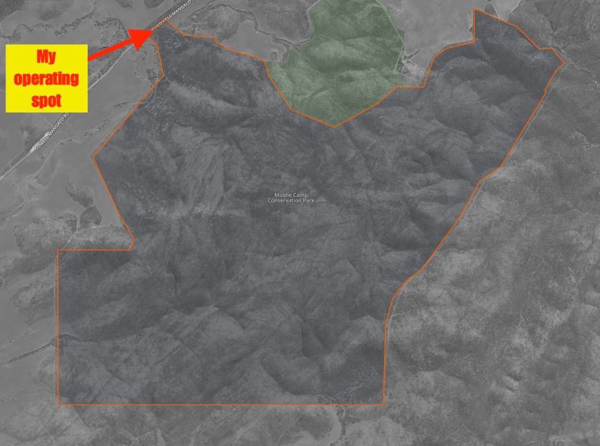
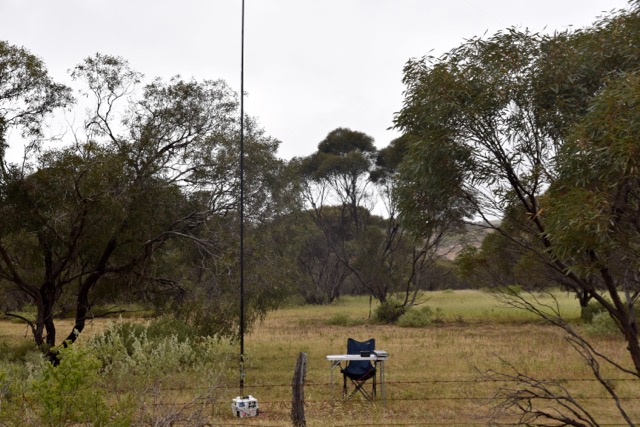
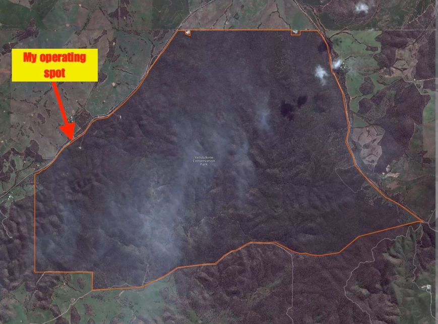
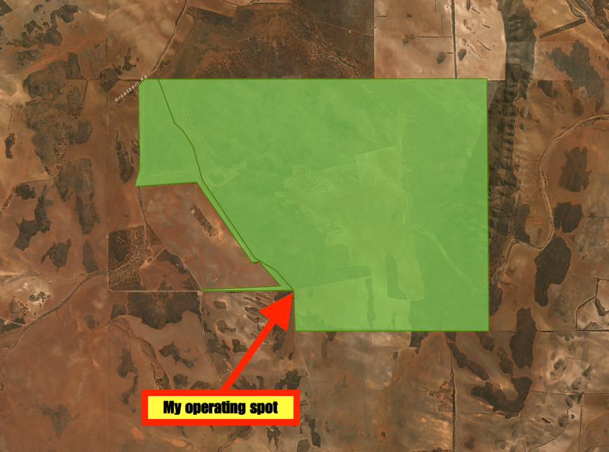
I set up just inside the park boundary on the eastern side of the park.  I again ran the Yaesu FT-857d, 40 watts and the 80/40/20m linked dipole.

Screen Shot 2016-09-15 at 7.07.00 PM.jpg

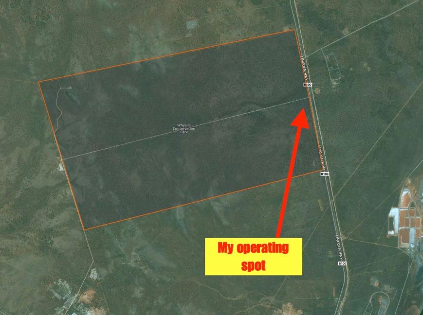
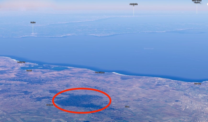
Above:- Map of the Whyalla Conservation Park, showing my operating spot on the eastern side of the park.  Image courtesy of Protected Planet.

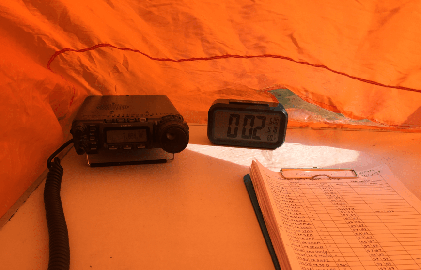
It was almost dark by the time I got to the park, so I had to use the headlights on the Toyota Hi Lux to help me set up.  I was all ready to go by around 0925 UTC (6.55 p.m. South Australian local time).

It was extremely difficult to find a spot on the 40m band.  Everything below 7.100 was totally taken up by Indonesian and Malaysian stations.  There were some North American stations close by to 7.144, and I eventually found 7.135 to be clear.  My first caller was Rick VK4RF/VK4HA, followed by Roald VK1MTS, and then Roy VK7ROY.  Even poor old Roy couldn’t get on to 7.130 for the 7.130 DX Net.  I offered to relinquish 7.135 to Roy and the net, but Roy very graciously declined and headed up a little higher.

My fifth contact from Whyalla was a Park to Park contact with Rob VK4FFAB, who was activating the Conondale National Park VKFF-0109.  Rob was a beautiful strong 5/8 signal to Whyalla.

I went on to work a total of 44 stations and qualified the park, before heading up the band to the 7.130 DX Net which was being held on 7.140.  On the net I worked Bill W1OW in Massachussetts USA, William FO5JV in French Polynesia, and Chuck K9RM in Indiana USA.  I then QSYd down the band a little to work Perrin VK3XPT who was operating remote.  Gerard VK2IO and Brian VK3BBB then called in to finish off the activation.

I had a total of 50 contacts in the log fom VK1, VK2, VK3, VK4, VK5, VK6, VK7, USA and French Polynesia.  It was back to my mother in law’s for some late dinner.

Thanks to the following who spotted me: Rick VK4RF and Brett VK3FLCS.

The following stations were worked on 40m SSB:-

  1. VK4RF
  2. VK4HA
  3. VK1MTS
  4. VK7ROY
  5. VK4FFAB/p (VKFF-
  6. VK2YW
  7. VK3LSD
  8. VK6MB
  9. VK6FFAR
  10. VK2HHA
  11. VK3GGG
  12. VK3PMG
  13. VK1AT/3
  14. VK4AAC/3
  15. VK4HNS/p
  16. VK5FMID
  17. VK3ELH
  18. VK4ME
  19. VK3FLCS
  20. VK4FBMW
  21. VK6VZZ/m
  22. VK5FANA
  23. VK3PAT
  24. VK5EE/m
  25. VK6XN
  26. VK3FSPG
  27. VK2MRX
  28. VK5ZGY
  29. VK6FBOS
  30. VK5CGM
  31. VK6DW
  32. VK4FAAJ
  33. VK1HW
  34. VK2YK
  35. VK2NEO
  36. VK5MJ
  37. VK2XZ
  38. VK6MSC
  39. VK4TJ
  40. VE6XT/VK4
  41. AC8WN/VK4
  42. VK5KLV
  43. VK6BSA
  44. W1OW
  45. FO5JV
  46. K9RM
  47. VK3XPT
  48. VK2IO
  49. VK3BBB


References.

Friends of the Whyalla Conservation Park, 2016, <http://www.fwcp.org/park.htm&gt;

Wikipedia, 2016, <https://en.wikipedia.org/wiki/Whyalla_Conservation_Park&gt;