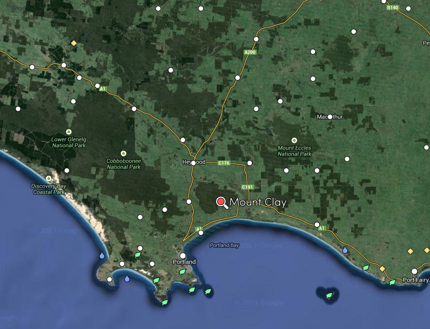
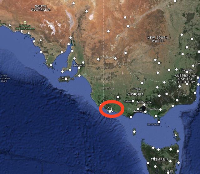
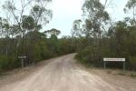
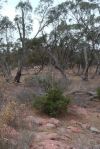
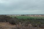
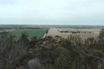
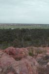
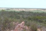
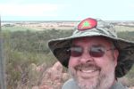
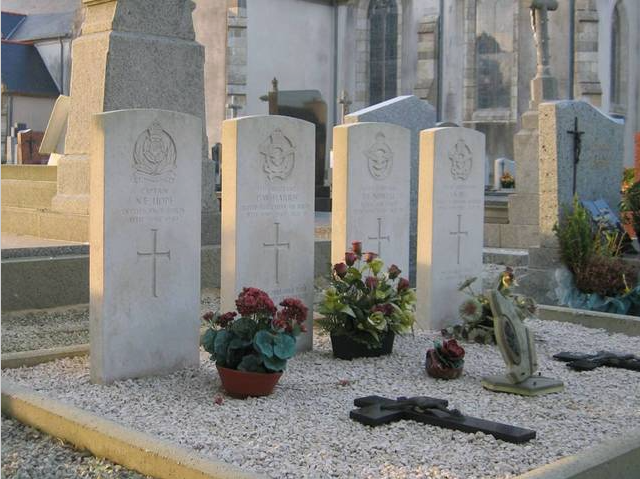
After activating Lower Glenelg National Park and Cobboboonee National Park, it was time for some action in the Summits on the Air (SOTA) program. After all, this was also the 2014 SOTA Spring Activation Weekend. So I headed to Mount Clay, VK3/ VS-051, which is located about 30 km north east of Portland.
Map courtesy of mapcarta.com
Mount Clay is 186 metres above sea level, and is worth just 1 SOTA point. It was first activated by VK3DEE in August, 2013, and has been activated a total of 5 times. Surprising really, because it is a very easy summit to access. The summit is a digital TV broadcast site, so there is a road leading all the way to the summit.
I called in to the Narrawong General Store for directions. Thanks to the very friendly people there, I found my way to the summit quite easily, via Mount Clay Road, then Tower Road, and then Angelino Road.
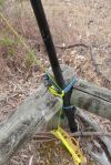
As the gate at the end of Angelino Road, has got a plethora of padlocks on it, I didn’t want to venture all the way to the trig point which was visible from the gate. Although there were no signs restricting access, I wasn’t 100 % sure, so I played it safe and set up at the gate. This is well inside the activation zone.
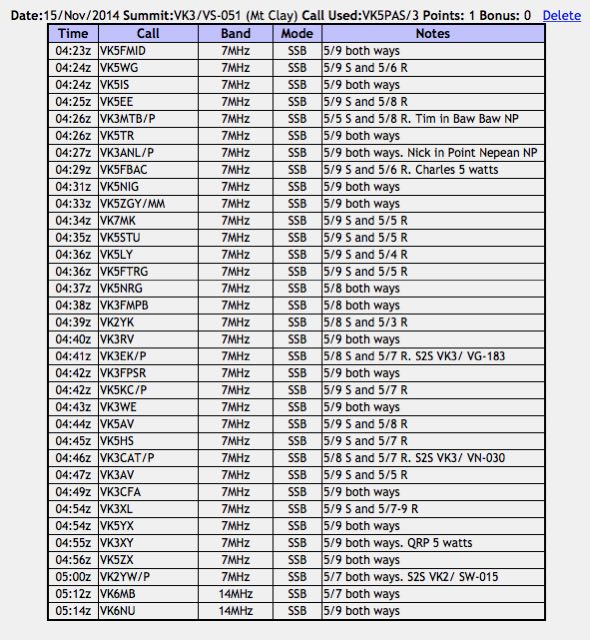
I tuned to 7.095 and started calling CQ SOTA and was greeted by Brian VK5FMID in Mount Gambier with a beautiful 5/9 signal. This was followed by Nev VK5WG in Cyrtsal Brook who was also 5/9, Ian VK5IS in the Beetaloo Valley, again 5/9, and then Tom VK5EE at Mount Gambier. I was pleased. I had my 4 qualifying SOTA contacts.
My 5th contact was with Tim VK3MTB who was portable in the Baw Baw National Park VKFF-020, as part of the 2014 KRMNPA Activation Weekend. And soon after this I was also called by another park activator. This time, Nick VK3ANL who was portable in the Point Nepean National Park, VKFF-628.
A steady flow of callers followed from VK2, VK3, VK5, & VK7. All had good signals and generally my signal with just the 5 watts appeared to making the journey to most parts of eastern and southern Australia.
This slideshow requires JavaScript.
My first Summit to Summit (S2S) contact was with Rob VK3EK who was portable on VK3/ VG-133. About 6 contacts later, I had my 2nd S2S with Tony VK3CAT who was portable on Mount Strickland, VK3/ VN-030.
After traffic had slowed on 7.095, I tuned down to 7.090 and found John VK2YW who was portable on Granite Mountain VK2/ SW-015. I gave John a call who was a good 5/7 signal to Mount Clay (5/7 received in return).
It was starting to get very dark, with rain threatening, and thunder & lightning nearby, so it was time for me to qickly lower the antenna and remove the links for 20m. I put out a CQ call on 14.310 and this was responded to by Mike VK6MB and then John VK6NU who had a very strong 5/9 plus signal coming in from Western Australia.
The rain was alomst here, so I quickly took down the gear and ran back down the road to car. Making it just in time, before the heavens opened up. I had a total of 34 contacts in the log.
Just as I had got back to the car I heard Rob VK2QR calling CQ from the top of SOTA peak, The Twins, VK3/ VE-017. I had just missed another S2S. But I did manage to make contact with Rob from the car (5/9 both ways).
I then worked Andrew VK1NAM/2 from the car. Andrew was on SOTA summit VK2/ SM-053, and then Peter VK3PF who was portable on SOTA summit, Monkeytop, VK3/ VE-041, which was also in the Snowy River National Park, VKFF-455. A new park for me. Yeeehhaa!
More information on Peter’s activation can be found on his WordPress site at…..
My second park activation for Saturday 15th November, 2014 was the Cobboboonee National Park, VKFF-728, which is located about 360 km west of Melbourne
Map courtesy of mapcarta
Map courtesy of mapcarta
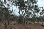
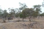
Cobboboonee is abut 18,510 hectares in size (45,700 acres) and was proclaimed as a National Park in November, 2008. Prior to this the area was formerly the Cobboboonee State Forest. The park has lowland forests, heathlands and wetlands. The Lower Glenelg National Park is located just to the west of Cobboboonee. There are a number of walking tracks in the park, including the spectacular 250 km long Great South West Walk. There is also the Great Cobboboonee Horse Trail.
The Gunditjmara aboriginal people are the Traditional Owners of this land. I presume that Cobboboonee is aboriginal for something, but I haven’t been able to find out what?
The forest within the park is home to a variety of plants and animals including towering Blackwoods, tree ferns and many small fungi. Endangered Powerful Owls, Yellow bellied fliders and Kingfishers can be seen. The park provided habitat for the endangered Long-nosed Potoroo.
Prior to calling CQ, I tuned around the 40m band and found Andrew VK1NAM on 7.090 who was portable on Blackfellows Hill VK2/ SM-033. More information on Andrew’s activation can be found on his WordPress site at…..
I then found Johnno VK3FMPB calling CQ on 7.095 from the Grampians National Park. Johnno was my first KRMNPA contact whilst in Lower Glenelg.
After finishing up with Johnno, I tuned up a little higher to 7.105 and located John VK2AWJ who was portable in the Warby Ovens National Park.
I then decided to prop on 7.110 and call CQ. It wasn’t long before I had a mini pile up going. First caller was the ever reliable Larry VK5LY from The Riverland, with a booming 5/9 plus signal. This was followed by Tom VK5FTRG in Mount Gambier, Rod VK5VRB at Meadows, and then Mike VK3XL who was operating portable in the Churchill National Park, VKFF-621. Mike had a very strong 5/9 signal. A few contacts later, I was called by Terry VK3UP who was portable in the Brisbane Ranges National Park.
About half a dozen contacts down the track, and Phil VK3BHR called in, on the top of Mount Alexander, VK3/ VN-016 (5/9 both ways).
It was starting to get very dark and I could hear the sound of thunder in the background. Greg VK5ZGY then called in. He was mobile at Penola in the South East, not all that far away, and advised that there was lightning at Penola. No doubt that was what I could hear, heading my way. But fortunately, there was no rain at Cobboboonee for the time being.
A few QSOs later, Ron VK3AFW called in, whilst portable on Arthurs Seat, VK3/ VC-031. Apparently Ron had bumped in to Nick VK3ANL a little earlier, who had been on the same summit.
And speak of the devil, just 4 QSOs down the log, Nick VK3ANL called in, whilst portable in the Mornington Peninsula National Park, VKFF-333.
I then had a lengthy char with Rob VK2QR who was portable on Mount Lock, VK3/ VE-005, in the Alpine National Park. Rob was very interested in the World Wide Flora Fauna (WWFF) program, which I explained to him.
I remained on 7.110 for another 25 minutes, before QSYing and having a tune around the 40m band. I found Amanda VK3FQSO calling CQ from SOTA summit, West of England Fire Tower, VK3/ VW-016 in the Kara Kara National Park.
I then spoke with Bernard VK2IB who was portable on Mumbulla Mountain VK2/ SC-025. Bernard’s signal was very weak and he was being clobbered by the static crashes from the thunder storm. But we managed to make it (3/1 sent and 5/1 received)
I then found Peter VK3PF calling CQ from Mount Ellery VK3/ VG-153, which is located in the Errinundra National Park. This was one of the last three Victorian National Parks I required to qualify for the Worked all 45 Victorian National Parks certificate for the KRMNPA. So it was with a fair degree of excitement, when Peter came back to my call. Some details on Peter’s activation can be found at his WordPress site at…..
I then went to 7.100 and started calling CQ and was called by Bernard VK3AV at King Lake. Bernard is a keen SOTA & Parks chaser/hunter. John VK2AWJ/3 then called in, portable in the Warby Ovens National Park, and this was followed by Hiro VK3EHG who was portable in the Yarra Ranges National Park VKFF-556, and then Tony VK3CAT who was portable on Mount Vinegar VK3/ VC-005.
I went on to work a few more stations, but the rain starting coming down quite heavy and it was time to head back to the warmth of the car.
I had a total of 53 contacts in the log. I was very pleased, as the meant I had again qualified the park for the local and global World Wide Flora Fauna (WWFF) programs.
The following stations were worked:-
Andrew VK1NAM/2
Johnno VK3FMPB/p
John VK2AWJ/3
Larry VK5LY
Tom VK5FTRG
Rod VK5VRB
Mike VK3XL/p
Tom VK5EE
John VK5BJE
Mick VK3FAFK
Jenny VK3WQ
Terry VK3UP/p
Frank VK2HFS
Roy VK5NRG
Gerhardt VK3HQ
Andrew VK2UH
Ivan VK5HS
Phil VK3BHR/p
Hans VK5YX
Ron VK3JP
Greg VK5ZGY/m
Matt VK1MA
Daniel VK5DF
Brian VK5FMID
Derek VK3XY
Ron VK3AFW/p
Lesley VK5LOL
John VK3FAVI/m
Ian VK3FD
Nick VK3ANL/p
Rob VK2QR/p
Ian VK3VIN
Peter VK3CFA
Ray VK3NBL
Steve VK7PSJ/m
Charles VK5FBAC
Tim VK5AV
John VK3PXJ/m
Amanda VK3FQSO/p
Bernard VK2IB/p
Peter Vk3PF/p
Bernard VK3AV
John VK2AWJ/3
Hiro VK3EHG/p
Peter VK3TKK
Terry VK3UP/p
VK3CAT/p
Nev VK5WG
VK3FCAT
Barry VK5BW
VK3OB
Winston VK7WH
Owen VK5HOS
After getting back to the car, I worked Terry VK3UP who was portable in the Brisbane Ranges National Park.
Below is a video of the activation at Cobboboonee National Park…..
References.
Parks Victoria, June 2014, ‘Cobbboboone National Park Visitor Guide’.
My first Victorian National Park activation for the 2014 Keith Roget Memorial National Parks Award (KRMNPA) activation weekend was the Lower Glenelg National Park (NP), VKFF-296, which I activated on the morning of Saturday 15th November 2014.
The park is located in South Western Victoria, about 420 km from Melbourne, and about 500 km from Adelaide. The park abuts the South Australian and Victorian border. The park is very popular, and receives over 200,000 visits per year.
Map courtesy of mapcarta.
So after a cooked breakfast at my hotel, the Whalers Rest at Portland, I headed out along the Princes Highway and then travelled into the park via a series of dirt roads. I can highly recommend the Whalers Rest. I stayed there on Friday, Saturday, and Sunday night. The room was spacious and very clean, and the cooked breakfasts on offer were very hearty.
Lower Glenelg NP is 27,300 hectares in size and encompasses the spectacular Glenelg River limestone gorge. The park, which was proclaimed in 1969, contains a wide range of forest, scrub, and heathland. The park has been included in the World List of National Parks and Equivalent Reserves compiled by the International Union for the Conservation of Nature and Natural Resources (IUCN 1985). The park includes the Princess Margaret Rose Caves.
Prior to being declared a park, the land in which Lower Glenelg is located was exploited by European settlement, which included timber harvesting and repeated fuel reduction burning to provide protection for nearby pine plantations and the Nelson township.
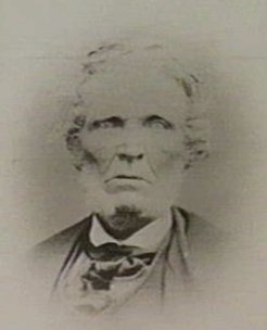
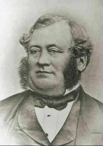
William Dutton first settled Southwestern Victoria in 1829 and this was followed by Edward Henty in 1834. The famous explorer, Major Mitchell travelled through the area in 1836. His journey of discovery included exploration of the Glenelg River from the present Dartmoor to Nelson. The area was quickly settled and large pastoral runs dominated until the late 1940s.
Above: William Dutton. Image courtesy of adb.anu.edu.au
Above: Edward Henty. Image courtesy of wikipedia.org
Even by the late 1800s the Glenelg River was already important to the local community for recreation, particularly angling. A number of shacks were erected along the river for this purpose. However, following proclamation of the Park in 1969 and a 15 year phase out period, nearly all the river shacks were removed, and the sites have been developed for public use.
During the 1920s the first pine plantations were established in the area. Two substantial forestry
companies established major pine plantations throughout southwest Victoria in the 1950s.
Following World War II some native forests now in the Park were selectively logged, by individual
tree selection. Little obvious evidence of the logging remains today.
It was during the early 1940s that the Princess Margaret Rose Caves were also developed
as a commercial visitor operation.
Recreational activities in the park include sightseeing, fishing, pleasure boating, canoeing, water skiing, picnicking, camping, and bushwalking.
A diverse number of plant species are found in the park. More than 500 species of flowering plants and 30 ferns occur in the Kentbruck Heath and Moleside areas alone.
The park is also home to a large amount of wildlife, as I found out. It was very slow going through the park due to the large number of kangaroos and euros. Over 30 native mammal species have been recorded in the park. A number of threatened species are found in the park. The rare bat, the Large-footed Myotis is found in the park.
Additionally, over 136 bird species have been recored in the Lower Glenelg NP. Three species are considered threatened in Victoria, including the Red-tailed Black Cockatoo, Rufuos Bristlebird, and the Powerful Owl.
A total of 14 species of reptiles are recorded as living in the park, and there are about 32 fish species also recorded.
This slideshow requires JavaScript.
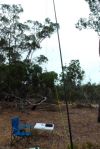
I was ready to go at 7.00 a.m. Victorian local time. I found a nice quiet spot and set up my deck chair and fold up chair. I ran the Yaesu Ft-450 and 40 watts for this activation into my 40m/20m linked dipole @ 7 metres. It was quite difficult finding a clear frequency, as the 40m band was already very busy. I called CQ on 7.097 and my first contact was with Charles VK5FBAC at Strathalbyn. Charles had a good 5/9 signal and he gave me a 5/9 signal report in return. So it appeared the band was in good condition. A number of the ‘regular suspects’ followed, all with excellent signals.
My first Summits on the Air (SOTA) contact in the park was with Rob VK2QR who was portable at Mount Hotham, VK3/ VE-006, which is also located within the Alpine National Park. Rob had a beautiful 5/9 signal to Lower Glenelg. This was followed by Andrew VK1NAM who was portable on VK2/ SM-036 within the Kosciuszko National Park. You can read about Andrew’s activation on his WordPress site at…..
About a dozen stations later, when things had slowed down a little, I found Rob VK3EK calling CQ in 7.110. Rob was portable on Mount Cann, VK3/ VG-133 in eastern Victoria, near the New South Wales border.
I then checked in to the Riverland Radio Club’s Saturday morning net, which is held on 7.078 each Saturday morning. The net is run by Ron VK5MRE. After working Ron and a few other stations on the net, I quietly disappeared and found Peter VK3FALA on 7.095, calling CQ from Mount Elizabeth, VK3/ VG-074. Peter’s signal was down a little (5/3) and I was very surprised when he gave me a 5/9 signal report in return.
I then spoke with Terry VK3UP who was portable in the Brisbane Ranges National Park, north of Geelong. Terry had a nice 5/7 signal coming in, and I received a 5/9 signal report.
After chatting with Terry for a while, I then found Nick VK3ANL, on 7.090. Nick was portable at Arthurs Seat, VK3/ VC-031.
I then found a clear frequency on 7.105 and put out a CQ call and was immediately greeted by Hans VK5YX at Hallett Cove with a 5/9 plus signal. This was followed by a number of callers from VK2, VK3, & VK5 who called in before and after the UTC rollover. They included Ian VK3TCX who was portable on Mount Elizabeth VK3/ VG-074, Fred VK3DAC on Mount Toolebewong VK3/ VC-033, and Peter VK3FALA on Mount Elizabeth VK3/ VG-074.
It was time to pack up. But before I did I had one last quick tune around the band and worked Rob VK3EK again, portable on VK3/ VG-133, for the new UTC day.
My last contact in the park was with Ron VK3AFW who was portable on Arthurs Seat VK3/ VC-031.
It was time to head off to Cobboboonee National Park. I had a total of 50 stations in the log, which meant that I had qualified the park for the KRMNP, and also for the National (VKFF) and global (WWFF) awards.
This included 10 x SOTA contacts and 3 x National Park contacts.
The following stations were worked:-
Charles VK5FBAC
John VK5BJE
Mick VK3FAFK
Frank VK3GFS
Greg VK5ZGY/m
Tim VK5AV
Ian VK5IS
Tom VK5EE
Geoff VK5HEL
Bernard VK3AV
Matt VK1MA
Les VK5KLV
Brian VK5FMID
Mark VK7MK
Rod VK5KFB
Rob VK2QR/p
Andrew VK1NAM/p
Greg VK5GJ
John VK5FMJC/p
Mike VK3XL
Peter VK3TKK
Amanda VK3FQSO
Col VK5HCF
Nev VK5WG
Mark VK3PI
Rob VK3EK/p
Ron VK5BRL
Rob VK5TRM
Dennis VK2HHA
Peter VK3FALA/p
Terry VK3UP/p
Nick VK3ANL/p
Hans VK5YX
John VK5DJ
Darrin VK3FDAP/p
Larry VK5LY
Steve VK3VM
Tom VK5FTRG
Andrew VK2UH
Norm VK5FNGM
VK3ZZS/2
Dallas VK5WA
Ian VK1DI
Charles VK5HD
Ian VK3TCX/p
Fred VK3FTAD
Fred VK3DAC/p
VK3FALA/p
Rob VK3EK/p
Ron VK3AFW/p
Below is a video of the activation at the Lower Glenelg NP…..
References.
Portland Region National Parks and Public Land Division, May 1991, “Lower Glenelg National Park Management Plan”.
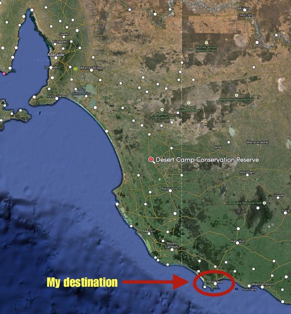
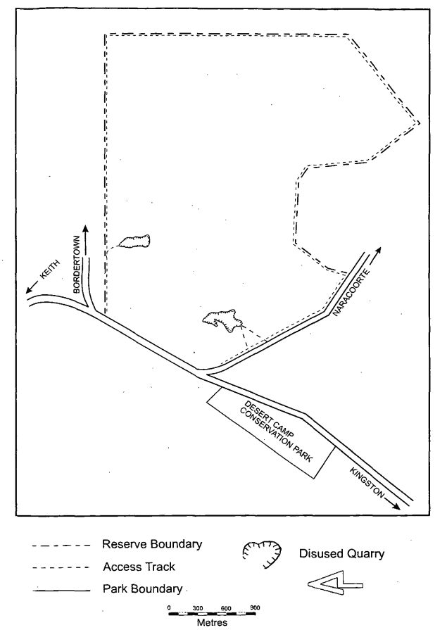
My fourth, and last South Australian park activation on Sunday 14th November, 2014, was the Desert Camp Conservation Park, which is located about 65 km north west of Naracoorte, on the northern side of the Kingston-Keith Road, and about 267 km south east of Adelaide.
Map courtesy of mapcarta.com
The park is about 49 hectares in size as was gazetted as Desert Camp National Park in 1967. About 14 months after the park was declared as a National Park, new works on the Keith-Kingston Road severed the park. On proclamation of the National Parks and Wildlife Act, 1972, the park became the Desert Camp Conservation Park.
A word of warning before activating this park. Desert Camp is a Conservation Reserve and a Conservation Park. Make sure you are in the Conservation Park area and not the Reserve.
I started off on 40m on 7.095 and my first caller was the ever reliable Brian VK5FMID in nearby Mount Gambier. This was followed by another South East park stalwart, Tom VK5FTRG, and then Peter VK3RV who had a very strong 5/9 plus signal.
I worked a few mobile stations from this park which was really pleasing. The first contact was with Andrew VK1NAM who although a little weak, was perfectly readable from those noise free environment of the park. My next mobile contact was with Peter VK3TKK with a nice 5/7 signal, and then Joe VK3YSP and Julie VK3FOWL who were a good strong 5/8. And I also spoke with Allen VK3HRA who was mobile and had a nice strong 5/8 signal.
A few QRP callers also called in. They included Damien VK5FDEC running 5 watts from his Yaesu FT-817. Damien seems to have been bitten by the QRP bug. And then Ron VK5ALR who was portable in Victoria and was running just 5 watts also.
After working a total of 20 stations I headed off to 20m where I put out numerous CQ calls but I had absolutely no takers. I tuned around the 20m band but all I could hear were some weak signals coming in from Europe. It was a little too early for long path into Europe.
So I decided to pack up and head off to Portland in south western Victoria. I still had a few hours on the road before reaching my destination and I was starting to get a bit hungry and wanted to avoid the kangaroos on the road.
This slideshow requires JavaScript.
So after 30 minutes in the park, I had a total of 20 contacts in the log from VK3 and VK5.
The following stations were worked:-
Brian VK5FMID
Tom VK5FTRG
Peter Vk3RV
Tom VK5EE
Andrew VK1NAM/m
Charles VK5FBAC
Peter VK3TKK/m
Nev VK5WG
Joe VK3YSP/m
Jenny VK3WQ
Arno VK5ZAR
Allen VK3HRA/m
Julie VK3FOWL/m
Tony VK3CAT
Mick VK3FAFK
David VK5NQP
Owen VK5HOS
Damien VK5FDEC/qrp
Hans VK5YX
Ron VK5ALR/p/qrp
References.
National Parks and Wildlife Service, 1992, ‘Small Parks of the Upper South East Management Plans’
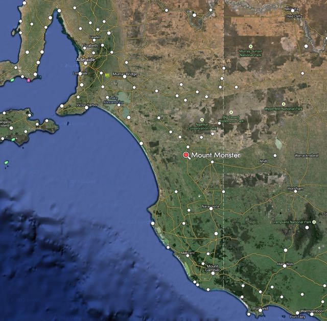
My third Conservation park activation on the way to Victoria on Friday 14th November, 2014, was the Mount Monster Conservation Park (CP). I had not originally intended to activate this park. However I had access concerns re the Lower Glenelg Conservation Park, so I decided to cancel that activation and fit in Mount Monster instead. This was to be a new unique park for me. Mount Monster CP is located about 14 km south of the town of Keith, and about 238 km south east of Adelaide.
Map courtesy of mapcarta.com
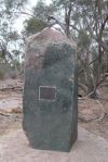
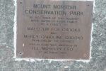
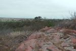
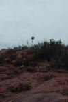
Mount Monster CP is about 93 hectares in size and was dedicated as a Conservation Park in September 1976 as a gift from three surrounding land owners, including the Buddle and Ellis families in memory of pioneers Malcolm and Mercy Crooks of ‘Maroona’. The park is dominated by steep rocky outcrops separated by narrow, deep gullies, producing a wide range of gradients and a number of sheer cliff faces. These rocky outcrops are dominated by an unusual granite, found in only one other location in South Australia. The park includes the Mount Monster summit, known as Joyce’s Plateau, named in honour of Joyce Buddle. Although only having a low profile, the summit dominates the countryside for many kilometres.
I have not been able to find out why the park was named Mount Monster? If anybody knows, I would be very keen to find out. But what I did learn, was that the nearby town of Keith was originally known as Mount Monster. It was not until 1889 when the town was officially proclaimed, that it was named Keith.
Prior to European settlement the area around Keith was part of the lands occupied by the Ngarranjeri aboriginal people. Within the park is the old Gold Escort Route. This is the famous route which brought gold into South Australia from the Victorian goldfields during the 1850’s. In fact, between March 1852 and December 1853, a total of 528 509 ounces of gold were brought into South Australia from the Victorian gold fields.
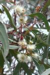
About 176 different plant species have been identified in the park, 30 of those are orchids. Some of these, including the Cradle of Incense, and the Monarto Mint Bush, are considered endangered nationally. Numerous mammals can be located in the park including kangaroos and echidnas. The park is also home to a large variety of birdlife, including red rumped parrots (I saw numerous) and honeyeaters (again I saw numerous feeding on the flowering natives).
The agricultural land surrounding Mount Monster is recognised as one of the major Lucerne seed producing areas in Australia. During the summer period, the fields are stocked with beehives for the pollination of the crops.
For more information on the park, have a look at the post by John VK5BJE on his blog…..
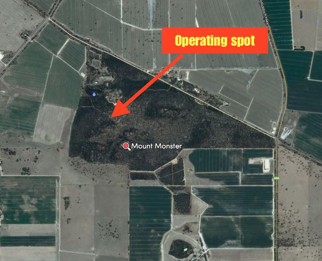
I entered the park off the Mount Monster Road, which runs off the Riddoch Highway, about 13 km south of the town of Keith. There is a dirt road (in good condition) which passes through the park (it is a one way road), that after about 1 km leads to a nice camping and parking area. This is where I set up.
map courtesy of mapcarta.com
My first contact was with Larry VK5LY in The Riverland with a nice 5/9 plus signal. This was followed by Brian VK5FMID in Mount Gambier, and then Norm VK5GI operating QRP 5 watts with his home brew transceiver. Despite using low power, Norm was still an excellent 5/9 signal all the way from Willunga.
Conditions on 40m seemed quite good, with a few contacts recorded with stations mobile in Victoria. They being with John VK3IC/m and Tony VK3CAT/m (both 5/9). I also had one more QRP contact and that was with Ian VK3FD, who although a little weak (5/1) was still very readable in the park with the non existent man made noise floor.
I was fortunate to work two Victorian National Parks whilst in Mount Monster. The first contact was with Peter VK3TKK who was operating portable in the Organ Pipes National Park, and then John VK2AWJ/3 was was operating portable in the Lower Goulburn National Park.
After working a total of 23 stations on 40m ssb, I lowered the squid pole and removed the links in the dipole, for 20m. I tuned to my nominated operating frequency of 14.310 and put out some CQ calls. However my only taker on 20m was Eric VK2ES. And there was a lot of QSB on Eric’s signal. I tuned across the 20m band and only heard one other station, a VK2 operating sub on 14.230 (the STV frequency).
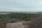
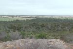
At the end of this activation, I was packing the gear away in the car and heard Rod VK2TWR working a ‘pile up’ from the top of a summit in New South Wales. I called a number of times but just could not break the pile up. So I decided to go for a walk to the top of the Mount Monster summit instead of persevering. I’m glad I did. There is a great walking trail to the top, which is not at all taxing. And you are rewarded with great views of the surrounding countryside. Sadly, it is not a qualifying summit for the Summits on the Air (SOTA) program, as Mount Monster only rises 93 metres above sea level. However, there are excellent 360 degree views to be had. A microwave repeater tower can be seen on the northern horizon, and Sugar Loaf Hill, from which Murray River water is reticulated to the nearby Keith township.
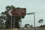
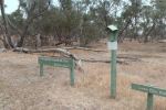
The sign off the Riddoch Highway
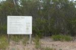
Entry into the park
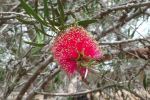
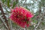
Flowering eucalypt
Commemorative plaque
View from Mt Monster (summit)
The trig point
The surrounding countryside
The main carpark & campsite
The quarry in the park
I had a total of 24 contacts whilst in Mount Monster, into VK2, VK3, VK5, and VK7.
The following stations were worked on 40m SSB:-
Larry VK5LY
Brian VK5FMID
Norm VK5GI
John VK5BJE
John VK5FTCT
Les VK5KLV
Nev VK5WG
Arno VK5ZAR
Ron VK3JP
Tom VK5EE
VK3IC/m
Tony VK3CAT/m
VK3FAFK
Tom VK5FTRG
Mal VK3AZZ
Tim VK5AV
Ian VK3FD
Joe VK3YSP
Don VK5NFB
Peter VK3TKK/p (Organ Pipes NP)
Winston VK7WH/p
Basil VK5BK
John VK2AWJ/3 (Lower Goulburn NP)
The following station was worked on 20m SSB:-
Eric VK2ES
Below is a quick video of the activation…..
References.
Department of Environment and Natural Resources, `997, ‘Aberdour and Mount Monster Conservation Parks, Desert Camp Conservation Reserve and Poocher Swamp Game Reserve Management Plans’.
Friends of Scott Creek Conservation Park, 2014, <www.users.on.net.au> viewed 24th November 2014.
Friends of the Upper South East Parks Volunteers Working for Conservation, ‘The Gwen Ellis Walking Trail, Mount Monster Conservation Park’.
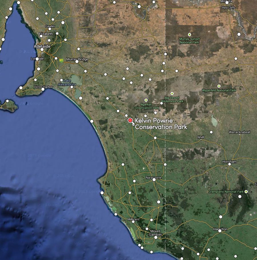
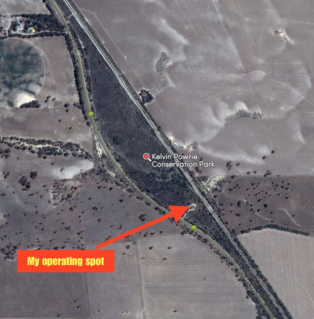
My second South Australian Conservation Park for Friday 14th November, 2014 was the Kelvin Powrie Conservation Park, which is located about 217 km south east of Adelaide and about 8 km north west of the town of Keith.
Map courtesy of mapcarta.com
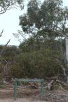
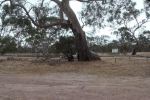
The park consists of an area of about 17.66 hectares and was gazetted in 1971. It is a narrow strip of scrub located between the busy Dukes Highway (main Highway between Adelaide-Melbourne), and the Adelaide-Melbourne rail line. The park was named after James Kelvin Powrie (1926-1968), who was an agricultural scientist. Powrie undertook research into what minerals were required to improve the soil quality of the infertile sands of the region. This entire region was once classified by farmers as ‘unproductive scrub’. Powrie was one of those who helped transform the district into valueable grazing and farming land. Not doubting this individual’s achievements, but surprising that a piece of scrub was named in honour of someone who played a hand in clearing the land. I have not been able to find a photograph on the internet of Powrie. I’m sure that many people that travel along the busy Dukes Highway, don’t even know that this park is here. There are no signs indicating its presence. Not until you get into the park itself. That might not be such a bad thing I guess. There is a carpark at the south eastern end of the park, and this is where I set up.
Map courtesy of mapcarta.com
Before you reach the park (if you are travelling east) you will reach the Ngarkat Rest Area on the Dukes Highway. It is worthwhile stopping off here for a look. There are some interpretive signs which tell you about the surrounding countryside and the ‘desert conquest’.
I already had the radio turned on to 40m and I quickly checked the VSWR and found it was a little high. In fact 1.7:1. A bit too high for my liking. Normally the antenna is 1.1:1 or thereabouts. I lowered the squid pole and checked the links, and then the coax, and everything appeared to be in order. In hindsight, I believe it might have been due to the fact that my car was parked very close by and affected the VSWR, which has happened before.
I tuned to 7.095 and I asked if the frequency was in use and I was immediately greeted by Larry VK5LY and John VK5BJE, advising me that the frequency was clear. Both had very strong 5/9 signals. John has activated this park before and he gave me some information about the lookout on top of the sand dune and advised it was well worth the short walk for the views.
Greg VK5GY from Meadows in the Adelaide Hills, then called me, running QRP 5 watts from his home brew transceiver. Other QRP callers followed, including Damien VK5FDEC running 5 watts, Norm VK5GI running 5 watts from his home brew transceiver, and Brenton VK3CBV also running 5 watts from a home brew transceiver. I also worked a few mobiles. Winston VK7WH called in with a nice 5/8 signal, and later Ian VK5SRV mobile at Fullarton in Adelaide with a 5/8 signal.
As I was operating in the park, the Overland train whizzed through on its way to Melbourne. And the serenity of the park was often disturbed by the ever present traffic, including the trucks, on the Dukes Highway, to and from Adelaide and Melbourne. Still, this is a great little park, and well worth the visit. I operated on 40m ssb for about 40 minutes and had 27 contacts in the log. I then went up to 14.310 on 20m ssb and put out a number of calls, but had no takers. I did not hear a solitary signal when I tuned across the 20m band. It was dead quiet.
After concluding operations I went for a walk to lookout as suggested by John. It is only a short walk to get there but gives you a very good overview of the park and its surroundings. As I walked to and from the lookout, I noted that the park was absolutely alive with bird life: honeyeaters, lorikeets, wrens, & magpies, to mention a few.
This slideshow requires JavaScript.
The following stations were worked:-
Larry VK5LY
John VK5BJE
Greg VK5GJ/qrp
Peter VK3TKK
Les VK5KLV
Tom VK5EE
Peter VK3YSP
Nev VK5WG
Bernard VK3AV
Damien VK5FDEC/qrp
Brian VK5FMID
Peter VK5NAQ
Arno VK5ZAR
Andrew VK2UH
Peter VK3RV
Gordon VK5KAA
Norm VK5GI/qrp
Jenny VK3WQ
John VK5DJ
Tom VK5FTRG
John VK5FTCT
Stan VK3BNJ
Darren VK5DT
Winston VK7WH/m
Benton VK3CBV/qrp
Mark VK7MK
Ian VK5SRV/m
Below is a short video of the activation…..
References.
National Parks and Wildlife Service, 1992, Small Parks of the Upper South East Management Plans. Reuter; D, 2007, Trace Element disorders in South Australian Agriculture.
The weekend (including the Friday) from Friday 14th November – Sunday16th November, 2014, was the 2014 Keith Roget Memorial National Parks Award (KRMNPA) activation weekend, and the 2014 Summits on the Air Spring activation weekend. So it was off to Victoria on Friday morning for me. On the way to Portland in western Victoria, I had planned to activate four South Australian Conservation Parks: Poonthie Ruwe, Kelvin Powrie, Desert Camp, and then Lower Glenelg. However, I had a change of plans and activated Poonthie Ruwe, then Kelvin Powrie, then Mount Monster (a new one for me), and finally Desert Camp (another new one).
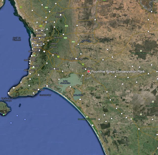
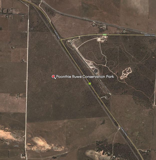
My first activation was the Poonthie Ruwe Conservation Park (CP), which is located about 100 km south east of Adelaide, and about 5 km south east of Tailem Bend on the Murray River. Poonthie Ruwe means ‘Hopping Mouse Country’ in the local Ngarrindjeri aboriginal language. Sadly, there is no Hopping Mouse population in the park anymore, courtesy of European settlement.
Map courtesy of mapcarta
map courtesy of mapcarta
I had activated the Poonthie Ruwe CP in June, 2013. For more information on that activation, and the history of the park, please have a look at my previous post…..
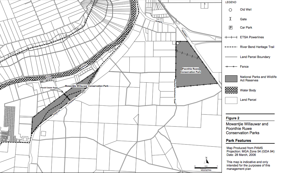
There is also an excellent publication, the ‘Mowantjie Willauwar and Poonthie Ruwe Conservation Parks Management Plan’, which can be found on the internet.
As I mentioned in my June, 2013 post, please make sure you know where you are going, if you intend to activate this park. It is not easy to find and there are no apparent signs indicating its presence.
Poonthie Ruwe is a small park consisting of about 241 hectares, full of rabbits and hardly visited by humans I would suspect. The Department for Environment and Heritage Management Plan for the park reports that reputedly the Southern Hairy-nosed Wombat had at one time established burrows in Poonthie Ruwe Conservation Park, prior to the initial rabbit invasion.
Map courtesy of Dept Environment and Heritage
The ground is nice and sandy in the park, so I drove the Haverford squid pole holder into the ground, and secured the squid pole to it, with the use of an octopus strap. I strung out the legs of the 40m/20m linked dipole and secured the links for the 40 m band. I was running about 25 minutes behind schedule, by the time I had turned the radio on. This was mostly due to my GPS taking me to a spot where the park was not. It was 7.55 a.m. South Australian local time and a beautiful mild morning. There were some other VK’s operating on 7.092 so I couldn’t operate on my promised frequency of 7.095. So I moved just slightly up to 7.096 and put out a CQ call and was called back immediately by Charles VK5FBAC at Strathalbyn with a good strong 5/9 signal. This was followed by David VK5NQP, John VK5BJE, and Amanda VK3FQSO.
This slideshow requires JavaScript.
The band appeared to be in quite good shape, and I continued to get a good steady flow of callers from VK3, VK5, & VK7, with good signals in and good signals being reported back. I was pleased to get Mick VK3FAFK, in the log. Mick only obtained his Foundation call the week before, and had a lovely signal coming in from Stawell in western Victoria. I would go on to work Mick many times over the next 4 days whilst I was either in a park or on a summit. Welcome to the world of amateur radio Mick.
My second to last contact at Poonthie Ruwe was with John VK2AWJ who was operating portable in the Barmah National Park, north east of Echuca. John was my first VK3 National Park contact for the 4 day period I was away.
After working a total of 26 stations on 40m ssb, I QSYd to 14.310 and put out numerous CQ calls with no takers. So I tuned across the 20m band and could only hear one other station, that being a VK4 in QSO with a VK2 who I couldn’t even hear. The VK4’s signal was well down, and sadly his signal was the only one I could hear on the entire 20m band. So I slipped back up to 14.310 with the intention to call CQ again. To my surprise when I got there, the frequency was occupied by a USA station, KZ8O, calling CQ. I called him back, but sadly received no response.
So, as 20m band conditions did not seem to be good, and I was behind schedule, I packed up the gear, and continued on my journey east, and towards my next park, the Kelvin Powrie Conservation Park. In about 45 minutes of operating in Poonthie Ruwe, I had a total of 26 contacts in the log.
As I left the park,I heard John VK2AWJ/3 calling CQ from the Barmah National Park, so I called John who was a good 5/9 into my mobile (5/9 received in return).
The following stations were worked:-
Charles VK5FBAC
David VK5NQP
John VK5BJE
Amanda VK3FQSO
Winston VK7WH
Peter VK5NAQ
Les VK5KLV
Greg VK5LG
Peter VK3TKK
Mick VK3FAFK
Dennis VK5LDM
Tim VK5AV
Ton VK3VBI/m
Tom VK5EE/qrp
Allen VK5FD
Ken VK3MKM
Larry VK5LY
Bob VK3XP
Mark VK7MK
Peter VK3RV
John VK5MG
Jenny VK3WQ
Col VK5HCF
Brian VK5FMID
John VK2AWJ/m
Nev VK5WG
References.
Department for Environment and Heritage, 2008, ‘Mowantjie Willauwar and Poonthie Ruwe Conservation Parks Management Plan’,
What a great 4 days I’ve just had. My wife Marija and my Boss at work gave me some ‘leave passes’ and it was off to Victoria for me, for the 2014 Keith Roget Memorial National Parks Award (KRMNPA) activation weekend, and the 2014 Summits on the Air (SOTA) Spring Activation weekend.
So I packed the car with my gear and headed off early on Friday morning, and returned Monday evening, covering over 1,500 km during my travels. On Friday I activated 4 SA Conservation Parks on the way to Victoria, and then on Saturday, Sunday and Monday I activated 6 Victorian National Parks, and 4 SOTA peaks. I based myself at Portland. I stayed at the Whalers Rest, which I can highly recommend.
I managed a total of 473 contacts whilst in a park or on a summit, and a further 13 QSOs whilst I was mobile. Most of those contacts were VK’s but I did manage about 30 DX contacts into Europe, UK, Pacific. I had just 8 summit to summit contacts, missing quite a few opportunities whilst either climbing or in transit.
Band conditions were excellent on Friday & Saturday, bu t then took a dive on Sunday & Monday, with lots of QSB. And absoultely no local (VK3) propagation on Sunday morning when I was on the top of Mount Rouse. But I did manage a contact into the Azores on 20m. Go figure!
Many thanks to Peter VK3PF, who I managed to work for my 3 remaining Victorian National Parks: Errinundra, Lind, & Snowy River. I’ve now managed to work all 45 Victorian National Parks and qualify for the Worked all 45 Victorian Parks KRMNPA certificate and the KRMNPA Merit plaque.
I worked the following activators in Victorian National Parks (a few a couple of times, when I had moved parks, or on different days, etc)…..
John VK2AWJ/3, Barmah National Park
Peter VK3TKK/p, Organ Pipes National Park
John VK2AWJ/3, Lower Goulburn National Park
Tim VK3MTB/p, Tarra Bulga National Park
Terry VK3UP/p, Brisbane Ranges National Park
Johnno VK3FMPB/p, Grampians National Park
John VK2AWJ/3, Warby Ovens National Park
Mike VK3XL/p, Churchill National Park
Nick VK3ANL/p, Mornington Peninsula National Park
Hiro VK3EHG/p , Yarra Ranges National Park
Tim VK3MTB/p, Baw Baw National Park
Nick VK3ANL/p, Point Nepean National Park
Peter VK3ZPF/p, Yarra Ranges National Park
Peter VK3PF/p, Alfred National Park
Peter VK3PF/p, Coopracamba National Park
Julie VK3FOWL/p, Wilsons Promontory National Park
John VK2AWJ/3, Chiltern-Mount Pilot National Park
Joe VK3YSP/p, Wilsons Promontory National Park
Peter VK3PF/p, Lind National Park
Peter VK3ZPF/p, Churchill National Park
Amanda VK3FQSO/p, Terrick Terrick National Park
Allen VK3HRA/p, Morwell National Park
John VK2AWJ/3, Burrowa Pine Mountain National Park
Thankyou to all of the activators. I really appreciate your efforts, as I know the weather conditions were less than ideal, and band conditions were very challenging at times.
And I worked the following SOTA activators (a few a couple of times with the UTC rollover and when I had moved parks, etc)…..
Rob VK2QR/3, Mount Hotham VK3/ VE-006
Andrew VK1NAM/p, VK2/ SM-036 and Kosciuszko National Park
Rob VK3EK/p, Mount Cann VK3/ VG-133
Peter VK3FALA/p, Mount Elizabeth VK3/ VG-074
Nick VK3ANL/p, Arthurs Seat VK3/ VC-031
Ian VK3TCX/p, Mount Elizabeth VK3/ VG-074
Fred VK3DAC/p, Mount Toolebewong VK3/ VC-033
Ron VK3AFW/p, Arthurs Seat VK3/ VC-031
Andrew VK1NAM/2, Blackfellows Hill VK2/ SM-033
Phil VK3BHR/p, Mount Alexander VK3/ VN-016
Rob VK2QR/p, Mount Lock VK3/ VE-005 & Alpine National Park
Amanda VK3FQSO/p, West of England Fire Tower VK3/ VW-016 & Kara Kara National Park
Bernard VK2IB,VK2/
Peter VK3PF/p, Mount Ellery VK3/ VG-153 & Errinundra National Park
VK3FCAT, Mount Vinegar VK3/ VC-005
Rob VK3EK/p, Mount Cann VK3/ VG-133
Tony VK3CAT/p, Mount Strickland VK3/ VN-030
John VK2YW/p, Granite Mountain VK2/ SW-015
Rob VK2QR/p, The Twins VK3/ VE-017
Andrew VK1NAM/2, VK2/ SM-053
Peter VK3PF/p, Mokeytop VK3/ VG-041 & Snowy River National Park
Allen VK3HRA/p, Mount Seldom Seen VK3/ VG-029 & Alpine National Park
Nigel VK5NIG/p, Mount Gawler VK5/ SE-013
Tony VK3CAT/p, Sugarloaf Peak VK3/ VN-011
Nick VK3ANL/p, Mt Dandenong VK3/ VC-025 & Dandenong Ranges National Park
Reuben VK7FREU/p, Mount WellingtonVK7/ SC-001
Rob VK2QR/3, Sam Hill VK3/ VG-049
Glen VK3YY/p, Mount Terrbile VK3/ VE-134
Kev VK3KAB/p, Mount Terrible VK3/ VE-134
Rob VK2QR/p, VK3/ VG-016
Rob VK2QR/p, VK3/ VE-023
Rick VK3EQ/p, Mccarthy Spur VK3/ VT-039
Rob VK2QR/3, Mount Murray VK3/ VE-025
Rick VK3EQ/p, Mount Beenak VK3/ VC-016
Thanks to all of the SOTA activators, who also braved the weather.
And I also worked Col VK5HCF in the Canunda National Park in the South East of South Australia.
This slideshow requires JavaScript.
Here’s a quick breakdown on my activations…..
Poonthie Ruwe Conservation Park
26 QSOs
Kelvin Powrie Conservation Park
27 QSOs
Mount Monster Conservation Park
24 QSOs
Desert Camp Conservation Park
20 QSOs
Lower Glenelg National Park
50 QSOs
Cobbobonee National Park
53 QSOs
Mount Clay summit, VK3/ VS-051
34 QSOs
Mount Napier summit, VK3/ VS-046
29 QSOs
Mount Eccles National Park
49 QSOs
Mount Richmond National Park
64 QSOs
Mount Rouse summit, VK3/ VS-048
7 QSOs
Mount Dundas summit, VK3/ VS-045
26 QSOs
Grampians National Park
32 QSOs
Little Desert National Park
32 QSOs
It was really pleasing to get my 44 + contacts from 5 of the 6 National Parks that I activated for the World Wide Flora Fauna program (WWFF). I fell a few short from Little Desert NP. I’ll have to revisit that park.
I will post some more details here in the next few weeks re each of the activations.
Many thanks to Tony VK3VTH and Andrew VK1NAM for their great efforts in the KRMNPA & SOTA activation weekend. It was a terrific weekend, and I will certainly be back over the border again next year.
And finally thanks to everyone that called. Without the Hunters and Chasers, these programs do not exist.
This weekend is the annual activation weekend for the Keith Roget Memorial National Parks Award (KRMNPA). As it turns out there is also a VK Spring Summits on the Air (SOTA) Party being held this weekend as well.
So this is a fantastic opportunity to work a stack of parks that qualify for KRMNPA and the World Wide Flora Fauna (WWFF) program, and SOTA summits.
I will be heading off to Victoria tomorrow morning and here is my itinerary…..
Friday 14th November, 2014
4 x South Australian Conservation Parks.
Poonthie Ruwe Conservation Park (2100 UTC Thursday, 7.30 a.m. SA local time Friday morning)
Kelvin Powrie Conservation Park (2330 UTC Thursday, 10.00 a.m. local time)
Desert Camp Conservation Park (0100 UTC)
Lower Glenelg River Conservation Park (0430 UTC)
Saturday 15th November 2014
2 x Victorian National Parks (qualify for both KRMNPA & WWFF) & 1 x VK3 SOTA peak
Lower Glenelg National Park, VKFF-296 (2200 UTC Sunday, 9.00 a.m. Victorian local time Saturday morning)
Cobbobonee National Park, VKFF-728 (0200 UTC)
Mount Clay, VK3/ VS-051(0700 UTC). Concides with the proposed VK/Europe SOTA activation day
Sunday 16th November 2014
1 x VK3 SOTA peak, & 2 x Victorian National Parks (qualify for both KRMNPA & WWFF)
Mount Napier, VK3/ VS-046 (2300 hrs UTC Saturday, 10.00 a.m. Victorian local time)
Mount Eccles National Park, VKFF-345 (0200 UTC)
Mount Richmond National Park, VKFF-361 (0700 UTC)
Monday 17th November 2014
2 x VK3 SOTA peaks & 2 x Victorian National Parks (both qualify for KRMNPA & WWFF)
Mount Rouse, VK3/ VS-048 (2100 UTC Sunday, 8.00 a.m. Victorian local time Monday morning)
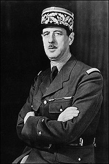
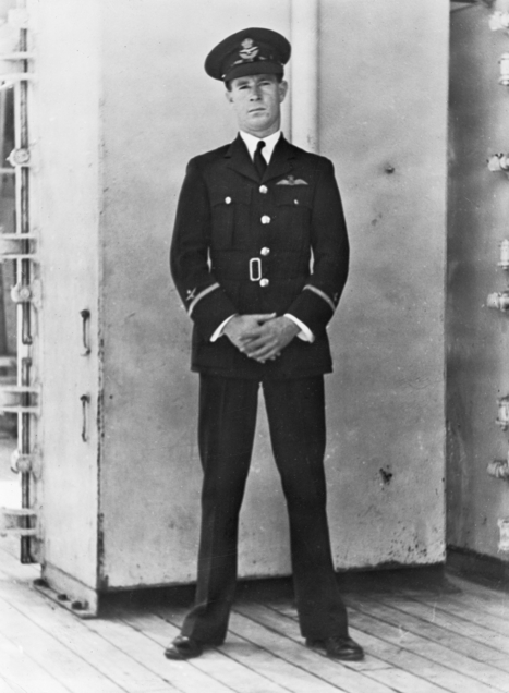
At 2.55 a.m. on the 18th June, 1940, an amphibious Walrus aircraft, took to the sky from Mount Batten, near Plymouth in England. There were four men aboard the plane: a crew of three and a special passenger, British Intelligence officer Captain Norman Hope. The crew consisted of an Australian pilot, Flight Lieutenant John Napier Bell, an Australian navigator, Sergeant Charles William Harris, and a British wireless electrical mechanic, Corporal Bernard Nowell. As they left Plymouth in the early hours of the morning, the crew were totally unaware of their mission and destination. It was the role of Captain Hope to brief the crew following their take off. What was their mission? To fly to the French coast and rescue the family of General Charles De Gaulle. Following the invasion of France by the Germans in May 1940, De Gaulle instructed his wife to take their three children and leave their home near Rheims, and travel to Brittany. There, safe passage to England would be arranged. It is reported that De Gaulle flew to London and met with British Prime Minister Winston Churchill and asked him to assist in the rescue of his family from Carantec on the coast of the English Channel, where they had sought refuge with an Aunt.
Image courtesy of wikipedia.
However, there are no known official records to confirm this meeting. What is known is that at 9.00 p.m. on the 17th June, 1940 a ‘green form’ (authority for a flight) was received at Mount Batten Station at Plymouth. It originated from Admiral Dunbar-Nasmith the Commander in Chief Western Approaches. It stated: “One Walrus to proceed with Admiralty passenger from Plymouth sound to north coast Brittany at earliest 18/6. Passenger will give details of destination on arrival about 2359/17. Aircraft to be fully armed and to keep defence watch at all time especially water borne. Return to base upon completion.”
Image courtesy of http://www.aircrewremembered.com
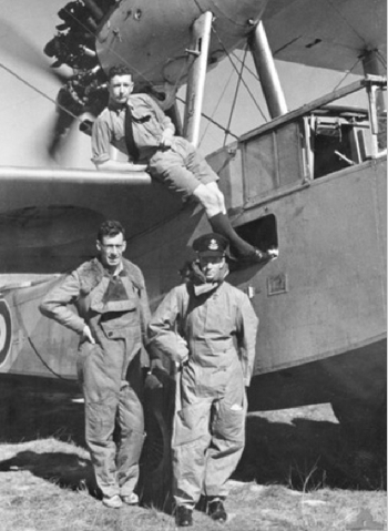
At about 4.30 a.m. on the 18th June, locals in the small village of Ploudaniel were awoken by the sound of a low flying aircraft. It was the Walrus. There is speculation that the plane may have been shot at. But what is known is that the plane subsequently crashed at Kerbiquet adjacent to Ploudaniel, and all 4 on board were killed. They were buried at the Ploudaniel churchyard, Ploudaniel, Brittany, France. Since 1940, each year the people from Ploudaniel honour the crew with a special service at the crash site and the local church grave site. So who were the crew and specifically the Captain? John Napier Bell was born on the 25th day of April, 1916 at Largs Bay South, South Australia, to parents John ‘Jack’ Henry Bell and Eva Annie Bell. Coincidentally, this was the same day that the Australian Government declared that day to be called Anzac Day. On leaving school, Bell helped his father to run Mansfield’s Store (later renamed as Bell’s Store) at Farina in the Far North of South Australia. Bell became an Air Force Cadet in July 1935 and in July 1936 at age 20, he was appointed Pilot Officer. In April 1937 he was promoted to Flying Officer.
Image courtesy of www.awm.gov.au
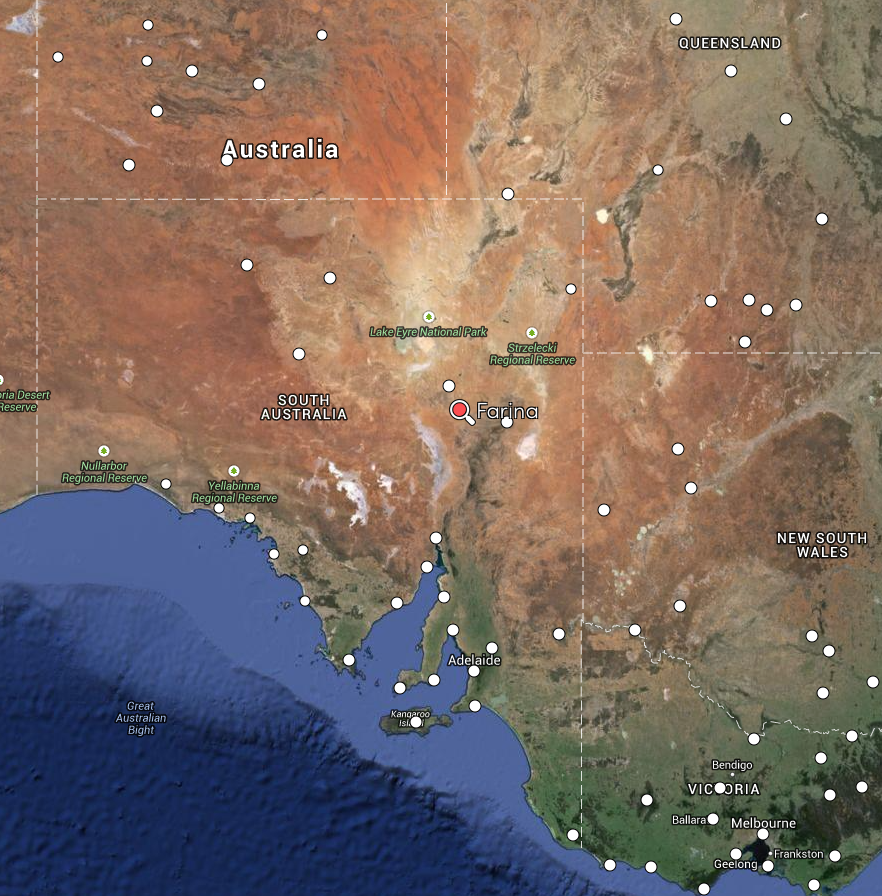
Where in the world is Farina? Farina is located about 617 km north of Adelaide and about 64 km north of the coal mining town of Leigh Creek. It is a ghost town located on the edge of the desert. Farina was first settled in 1878
In mid June, 2015, myself, Larry VK5LY, and John VK5BJE, will be travelling to Farina. The Farina Restoration Group has organised a special event at Farina. It is the 75th anniversary of the secret mission to rescue the De Gaulles. A flyover has been organised. We will be operating some amateur radio stations from Farina, and we hope to use the special call sign of VK100ANZAC.
We have applied for use of this special call sign and are awaiting the decision of the WIA Board. Alan Hall (VK3AJH) has written excellent book entitled ‘Four Men and the Walrus‘. It is well worth a read. For more information on this fascinating story, please have a look at the following websites…..
Larry and I plan on activating a number of National and Conservation Parks in the Far North of South Australia during this trip. Many of those will have never been activated previously. So please keep an eye on my WordPress site for further details.