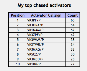
A number of times recently I have been asked about what parks qualify for the VK5 National and Conservation Parks award? and how parks become Conservation Parks in the first place? So, I am hoping that this blog will be of some interest and answer some questions on South Australia’s parks system.
It has certainly shed some light on the system for me, and has also revealed that the Region and District system has changed since the inception of the VK5 Parks Award in April last year. Yes, that means another spreadsheet to come out. But it has helped me in the formulative stages of the proposed new award certificate ‘Worked All VK5 Park Regions’.
Firstly, just how big is South Australia?
South Australia (S.A.) has a land area of 984,221 square km, of which about 4,600 square km are located on islands. South Australia has a coastline of 5,067 km which consists of 3,816 km of mainland coastline and 1,251 km of island coastline. South Australia’s land area is 12.7% of Australia’s total, with the state being the fourth largest of all the Australian States and Territories. The state’s coastal waters cover about 60,032 square km.
To put that into perspective, South Australia is larger than any country in Europe, excluding Russia. Ukraine comes the closest at 603,700 km², then France 547,030 km², and then Spain at 505,992 km². Italy could be placed into South Australia, more than three times over, whilst the whole of the United Kingdom could be placed into South Australia four times over. Although I couldn’t find an overlay map of South Australia, here is one of Australia showing how big Australia is compared to most of mainland Europe…..
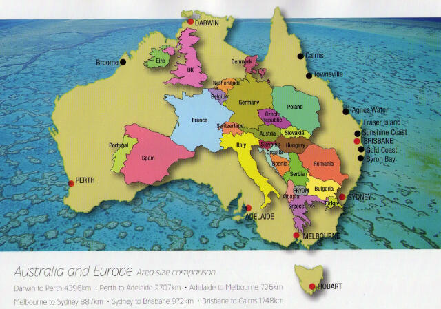
Image courtesy of http://letstourengland.com
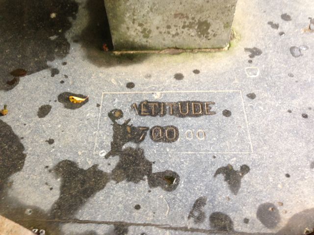
Mount Woodroofe is South Australia’s highest peak at 1,435 metres above sea level. It is a big 10 pointer for the Summits on the Air (SOTA) program, too by the way. South Australia is a relatively flat place, with more than 80% of South Australia being less than 300 metres above sea level. The lowest place is Lake Eyre at 15 metres below sea level. It is in this vicinity that South Australia receives its lowest rainfall. About 52,786 square km is occupied by agriculture, which equates to 53.6% of the State. South Australia’s parks and reserves are managed by the Department of Environment, Water and Natural Resources (DEWNR).
DEWNR was created on 1st July 2012 to bring together environment and natural resources management in South Australia. The new Department was created by amalgamating the Department for Water, and the Department of Environment and Natural Resources. DEWNR are responsible for establishing and managing South Australia’s parks. There are a total of 350 parks and reserves covering an area of 21,087,984 hectares, which equates to 21.5% of South Australia. The map below shows the extent of South Australia’s vegetation. 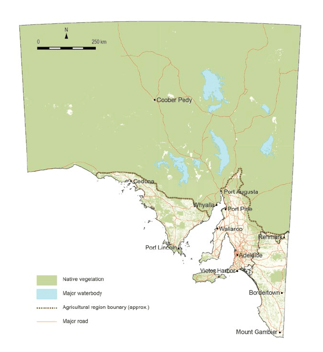
Map courtesy of http://www.epa.sa.gov.au
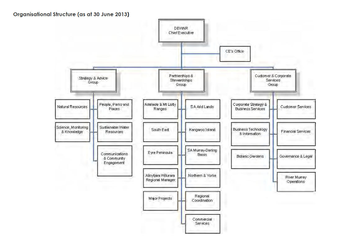
DEWNR has three groups within its structure:
- Strategy and Advice.
- Partnerships and Stewardship
- Customer and Corporate Services.
Below is an organisation structure chart of DEWNR, as of 30th June, 2013.
 In South Australia, National Parks and Conservation Parks (protected areas) are proclaimed under the National Parks Wildlife Act 1972, and the Wilderness Protection Act 1992. The term ‘protected area‘ is used internationally to embrace a wide variety of types of parks and reserves. The International Union for Conservation of Nature (IUCN) describes a protected area as:
‘A clearly defined geographical space, recognised, dedicated and managed, through legal or other effective means, to achieve the long term conservation of nature with associated ecosystem services and cultural values’ (Dudley 2008).
DEWNR are in partnership with the Natural Resources Management Council (NRM) which was established in 2004. This comes under the DEWNR’s umbrella of ‘Partnerships & Stewardships Group’. Additionally, there is the National Parks and Wildlife Council which was established in 1996 under the National Parks and Wildlife Act 1972. One of the main items of business for this Council is reviewing park management plans. ‘Conserving Nature 2012-2020‘ is a strategy for establishing a system of protected areas in South Australia. It is a big document, but it is worth a read and contains some very interesting information. The Conserving Nature document, advised that about 28.6% of the state of South Australia was under some form of ‘protected‘ status.
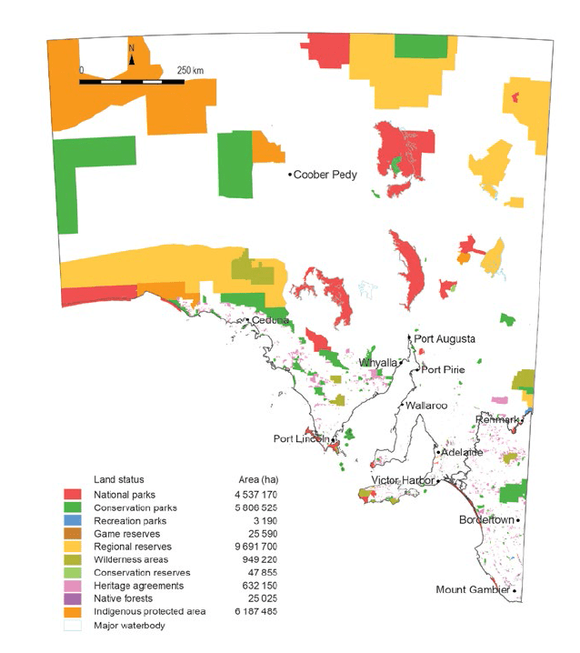
Map courtesy of http://www.epa.sa.gov.au
There are eight types of parks in South Australia’s Protected Area system. They are:
National Park
Land that is of national significance by reason of its wildlife or natural features.
There are 21 of these in S.A. that include an area of 3,995,444 hectares (4.1% of the State).
Conservation Park
Land that is protected or preserved for conserving wildlife or natural or historic features.
There are 268 of these in S.A. that cover an area of 5,859,256 hectares (6.0% of the State).
Recreation Park
Land that is conserved and managed for public recreation and enjoyment.
There are a total of 14 recreation parks, covering an area of 3,204 hectares (<0.1% of the State). Some examples of this type of Park are the Para Wirra Recreation Park, and Granite Island Recreation Park.
Game Reserve
Land that is preserved for the conservation of wildlife and management of game.
There are 10 of these covering an area of about 25,888 hectares (<0.1% of the State). A few examples of this type of park are Tolderol Game Reserve and Currency Creek Game Reserve. Duck open season applies to these Reserves.
For more information on Game Reserves, have a look at…..
http://www.environment.sa.gov.au/managing-natural-resources/plants-and-animals/Abundant_species/2014-duck-quail-open-season/game-reserves
Regional Reserve
Land that is protected or preserved for conserving wildlife or natural or historic features while, at the same time, permitting the utilisation of natural resources.
There are 7 of these covering an area of 9,342,641 hectares (9.5% of the State). An example of this is the Chowilla Regional Reserve near Renmark which comprises 75,036 hectares.
For more information on Regional Reserves, please have a look at…..
http://www.environment.sa.gov.au/managing-natural-resources/Park_management/Regional_reserves
Wilderness Protection Area
Land that is protected to conserve ecosystems that have not been affected, or have been affected to only a minor extent, by modern technology; and ecosystems that have not been seriously affected by modern exotic animals or plants or other exotic organisms.
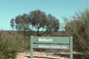
There are 14 of these, covering an area of 1,842,071 hectares (1.9 % of the State). An example of this type of park is the Billiatt Wilderness Protection Area, which was decimated by fire last Summer.
For more information on Wilderness Protection Areas, please have a look at…..
http://www.environment.sa.gov.au/managing-natural-resources/Park_management/Wilderness_protection_in_South_Australia
Conservation Reserve
Crown land that is specifically managed for conservation by the Government.
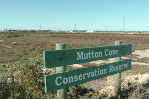
There are 16 of these covering an area of 19,480 hectares(<0.1% of the State). An example of this type of park is the Mutton Cove Conservation Park on the Le Fevre Peninsula. Which by the way, I activated earlier in the year, believing it was a Conservation park. Not so!
Native Forest Reserve
Managed for native flora and fauna conservation.
There are 61 of these, covering an area of 16,050 hectares. Examples of this type of park are Mount Crawford Forest, Kuipto Forest and Wirrabara Forest.
Many of these parks have Adopted Management Plans, which contain relevant management issues for each specific park. When those plans are in the preparation stage, the DEWNR provides the public and stakeholders the opportunity to become involved in the planning process. DEWNR place advertisements in The Advertiser and in local newspapers, where they call for suggestions on issues relevant to the management of a specific park. For more information on these plans, please have a look at…..
http://www.environment.sa.gov.au/managing-natural-resources/Park_management/Management_plans/Adopted_management_plans
Remember, that ONLY National Parks and Conservation Parks qualify for the VK5 National and Conservation parks award.
New parks
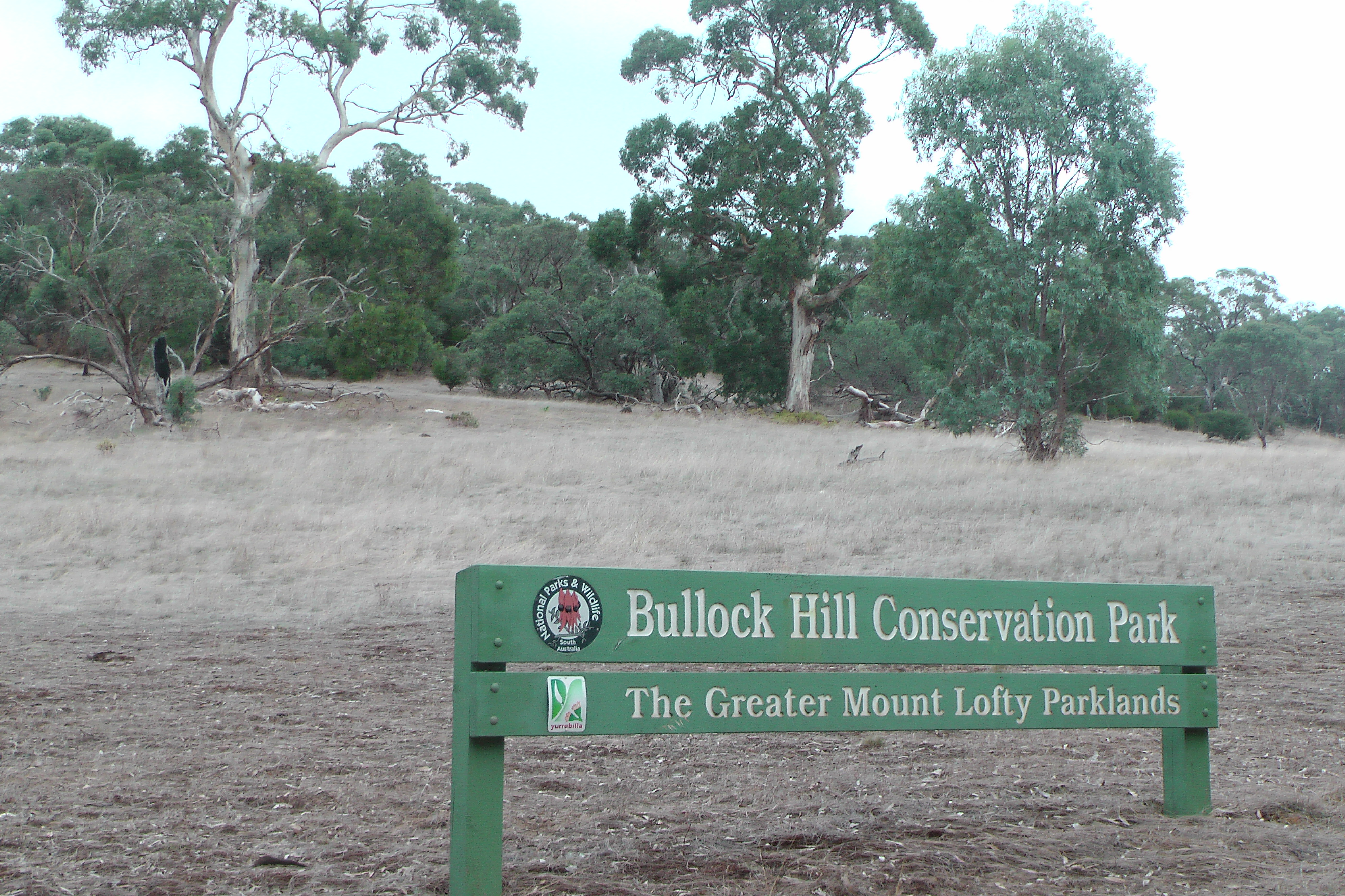
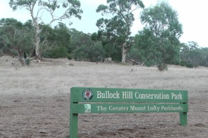
Since the inception of the VK5 National and Conservation parks Award, there has been a total of 6 Conservation Parks established/gazetted. These have been added to the VK5 Parks award list. Some of these have been activated including the Bullock Hill Conservation Park and the Ettrick Conservation Park. The DEWNR website records recent additions to park boundaries which is worth having a look at…..
http://www.environment.sa.gov.au/managing-natural-resources/Park_management/Parks_boundaries
Regions
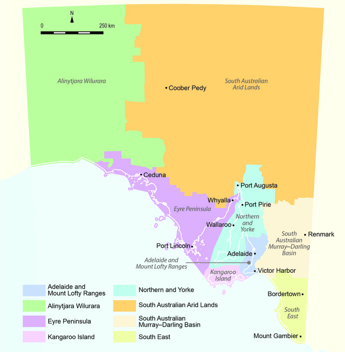
The State of South Australia is currently divided into 8 different natural resource management regions. They are as follows:
- Adelaide and Mount Lofty Ranges
- Alinytjara Wilurara
- Eyre Peninusla
- Kangaroo Island
- Northern and Yorke
- South Australian Arid Lands
- South Australian Murray-Darling Basin
- South East
This is a new group of regions which commenced in about July, 2013, after the inception of the VK5 Parks Award. The seven old regions were as follows:
- Adelaide
- Kangaroo Island
- Murraylands
- Northern and Yorke
- Outback
- South East
- West

Map courtesy of http://www.epa.sa.gov.au
The largest region is the SA Arid Lands region which covers over half of South Australia and encompasses the state’s north-east corner to its borders with NSW, Queensland, and the Northern Territory. It is more than 400,000 square km in size. This is followed by Alinytjara Wiluara (meaning ‘north west’ in Pitjantjatjara) which covers the north west third of South Australia and is more than 250,000 square km in size.
In turn those Regions are broken up into Districts. The 21 National Parks and 268 Conservation Parks in South Australia re located within those regions and Districts.
Please note that the regions referred to on the National Parks website, are totally different regions as mentioned above.
See the link below…..
http://www.environment.sa.gov.au/parks/Find_a_park/Browse_by_region The regions referred to at that link are geographical regions and not administrative regions.
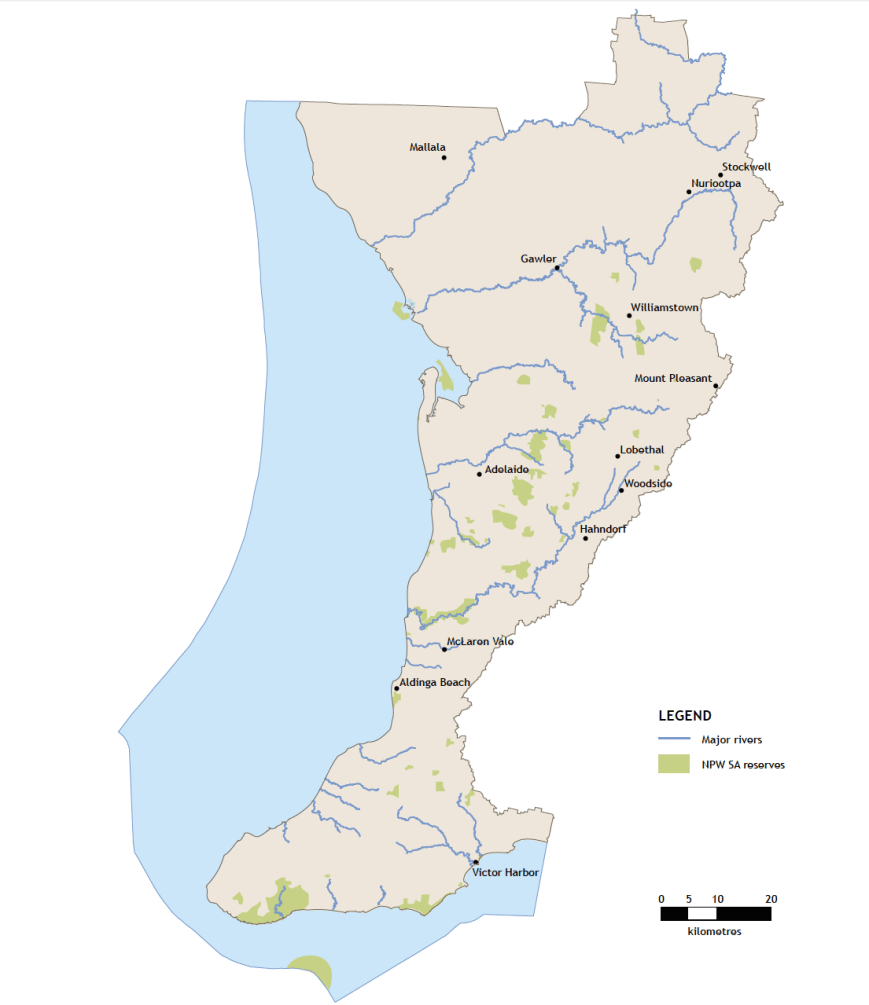
Adelaide & Mount Lofty Ranges Region.
This region covers 6,581 sq km of land, 4,627 sq km of sea, and has 364 km of coastline. It supports 1.2 million people which equates to 80 % of South Australia’s population. The northern boundary of this Region incorporates the whole of the Light Regional Council, the District of Mallala and the Barossa Council. The region stretches south to Cape Jervis on the southern tip of the Fleurieu Peninusla, from the ridge of the Mount Lofty Ranges to 35 km into Gulf St Vincent. The coastline of this region encompasses the District Council of Mallala in the north to Middleton Beach in the south in the Distrct Council of Alexandrina.
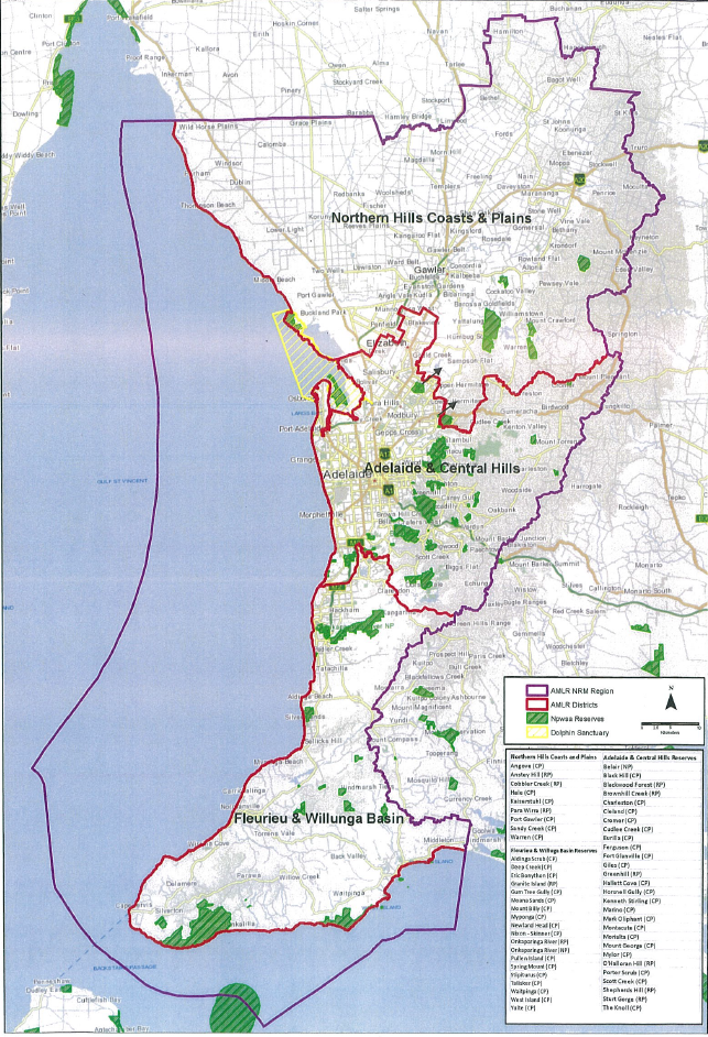
The area is divided into the following 3 districts:
- Adelaide & Central Hills
- Northern Hills Coasts & Plains
- Fleurieu & Willunga Basin
This region was previously known as Adelaide region, and consisted of the Fleurieu, Northern Lofty, and Southern Lofty districts.
There are a total of 46 parks in this region, comprising of 2 National Parks, and 44 Conservation Parks. They are as follows:
- Aldinga Scrub CP
- Angove CP
- Belair NP.
- Black Hill CP
- Charleston CP
- Cleland CP
- Cromer CP
- Cudlee Creek CP
- Deep Creek CP
- Eric Bonython CP
- Eurilia CP
- Ferguson CP
- Fort Glanville CP
- Giles CP
- Gum Tree Gully CP
- Hale CP
- Hallett Cove CP
- Horsnell Gully CP
- Kaisterstuhl CP
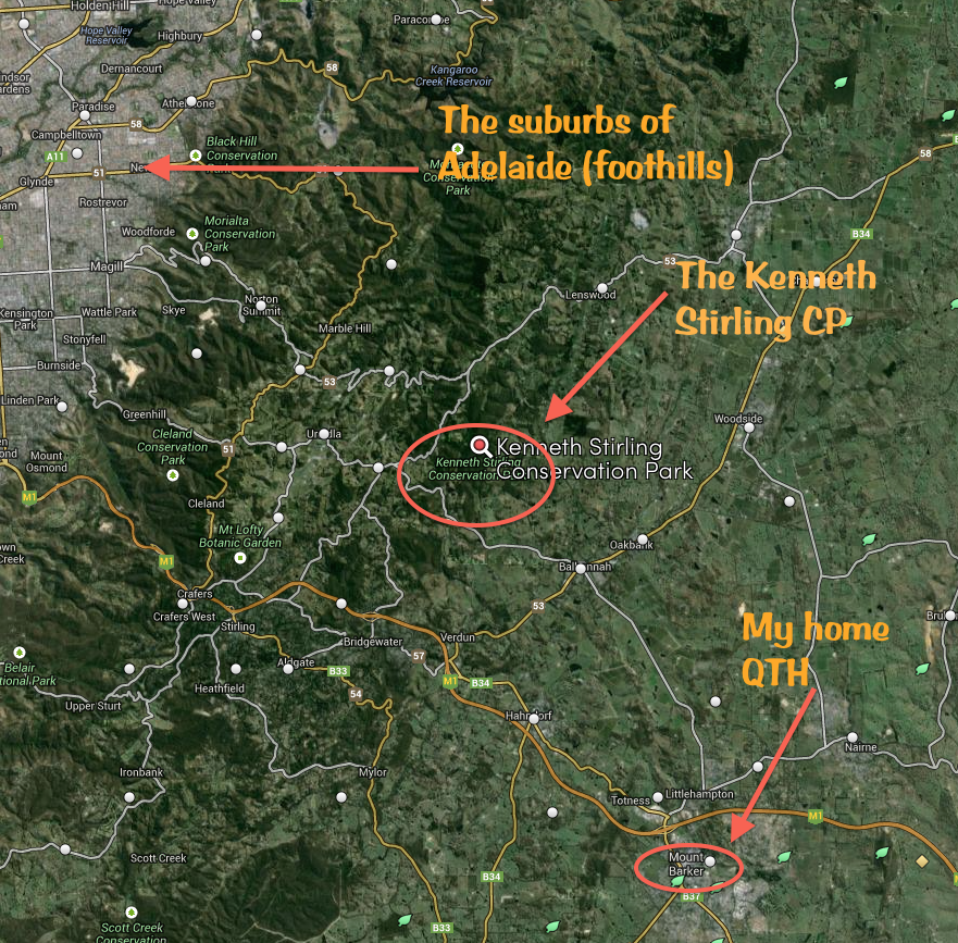
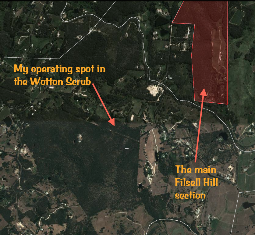
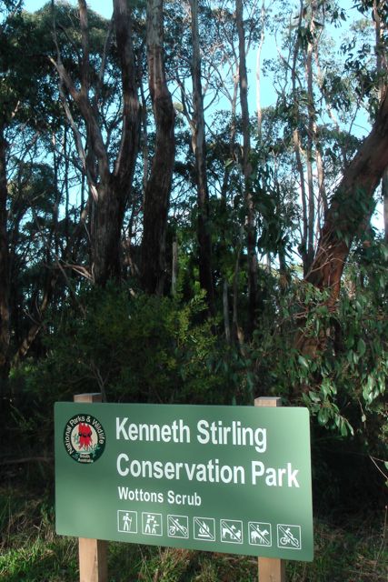
- Kenneth Stirling CP
- Marino CP
- Mark Oliphant CP
- Moana Sands CP
- Montacute CP
- Morialta CP
- Mount Billy CP
- Mount George CP
- Mylor CP
- Myponga CP
- Newland Head CP
- Nixon Skinner CP
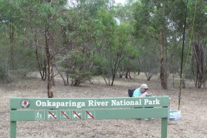
- Onkaparinga River NP.
- Port Gawler CP
- Porter Scrub CP
- Pullen Island CP
- Sandy Creek CP
- Scott Creek CP
- Spring Mount CP
- Stipturus CP
- Talisker CP
- The Knoll CP
- Torrens Island CP
- Waitpinga CP
- Warren CP
- West Island CP
- Yulte CP
A total of 5 parks that previously came within this Region in the old Fleurieu district, are now located in the Ranges to River District of the South Australian Murray-Darling Basin Region. They are:
- Bullock Hill CP
- Finnis CP
- Hesperilla CP
- Mount Magnificent CP
- Scott CP
DEWNR offices for this region exist at Eastwood, Lobethal, Gawler, Willunga, and Victor Harbour.
Map courtesy of wwww.naturalresources.sa.gov.au
The map below shows the Adelaide and Mount Lofty Ranges split into its three Districts.
Map courtesy of wwww.naturalresources.sa.gov.au
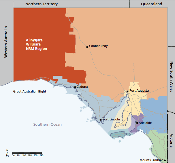
Alinytjara Wilurara
This region (meaning north west in Pitjantjatjara) covers the north west third of South Australia and is more than 250,000 square km in size.
The region is divided into the following 9 districts:
- Bunda Cliffs
- Yalata Coast
- Nullabor Plain
- Yalata Lands
- Yellabinna and Yumbarra
- Great Victoria Desert
- Southern APY
- APY Ranges
- Eastern APY and Tallaringa.
There iare a total of 6 parks in this region, comprising of 2 National Parks, and 4 Conservation Parks in this region. They are as follows:
- Great Australian Bight NP
- Mamungari CP
- Nullabor NP
- Pureba CP
- Tallaringa CP
- Yumbarra CP
A DEWNR office exists at Ceduna.
Map courtesy of http://www.naturalresources.sa.gov.au
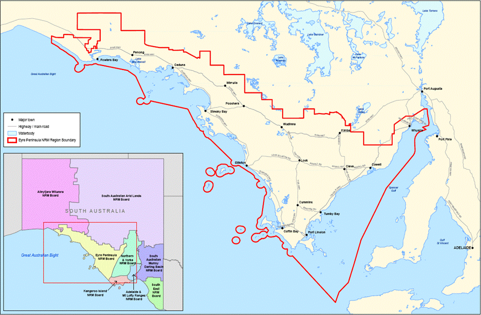
Eyre Peninsula
The Eyre Peninsula region covers an area of 80,000 square km or 8 million hectares. It includes parts of the upper Spencer Gulf, the City of Whyalla, and stretches across the southern boundaries of the Gawler Ranges, beyond Ceduna to the edge of the famous Nullabor plain, and south to Port Lincoln at the southern tip of the Eyre Peninsula.
Eyre Peninsula still has 43% of natural vegetation cover intact, making it one of the highest levels of surviving native vegetation for agricultural regions in South Australia. About 40 species of native plants are endemic to the area, with 26 plant and animal species of national conservation significance listed.
The Eyre Peninsula region includes over 1,800 km of coastline. This represents about 33% of the entire coastline of South Australia. The Eyre Peninsula NRM region contains over 100 different parks and reserves.
This region was previously called West region.
There are a total of 74 parks in this region, comprising of 3 National Parks, and 71 Conservation Parks. They are as follows:
This region does not appear to be divided into Districts.
- Acraman Creek CP
- Avoid Bay Islands CP
- Baird Bay Islands CP
- Barwell CP
- Bascombe Well CP
- Boondinna CP
- Calpatanna Waterhole CP
- Cap Island CP
- Cape Blanche CP
- Caralue Bluff CP
- Carapee Hill CP
- Chadinga CP
- Cocata CP
- Coffin Bay NP
- Corrobinnie Hill CP
- Darke Range CP
- Eba Island CP
- Fowlers Bay CP
- Franklin Harbor CP
- Gambier Islands CP
- Gawler Ranges CP
- Gawler Ranges NP
- Greenly Island CP
- Heggarton CP
- Hincks CP
- Kathai CP
- Kellidie Bay CP
- Kulliparu CP
- Lake Gilles CP
- Lake Newland CP
- Laura Bay CP
- Lincoln NP
- Lincoln CP
- Lipson Island CP
- Malgra CP
- Middlecamp Hills CP
- Moody Tank CP
- Mount Dutton Bay CP
- Munyaroo CP
- Murrunatta CP
- Neptune Islands CP
- Nicholas Baudin Island CP
- Nuyts Archipelago CP
- Nuyts Reef CP
- Olive Island CP
- Peachna CP
- Pigface Island CP
- Pinkawillinie CP
- Point Bell CP
- Point Labbatt CP
- Rocky Island (North) CP
- Rocky Island (South) CP
- Ruddall CP
- Sceale Bay CP
- Searcy Bay CP
- Shannon CP
- Sheoak Hill CP
- Sinclair Island CP
- Sir Joseph Banks Group CP
- Sleaford Mere CP
- The Plug Range CP
- Tucknott Scrub CP
- Tumby Island CP
- Venus Bay CP
- Verran Tanks CP
- Wahgunyah CP
- Waldegrave Islands CP
- Wanilla CP
- Wanilla Land Settlement CP
- Wharminda CP
- Whidbey Isles CP
- Whyalla CP
- Wittelbee CP
- Yeldulknie CP
DEWNR offices for this region exist at Port Lincoln and Ceduna.
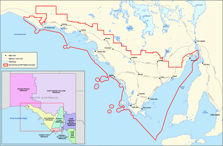
image courtesy of http://www.epnrm.sa.gov.au
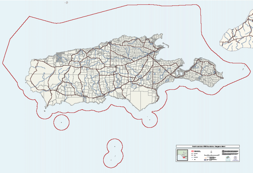
Kangaroo Island
The Kangaroo Island region encompasses Kangaroo Island which is about 15 km off the coastline of the southern Fleruieu Peninsula. The island covers an area of 4,370 square km. Off all the South Australian agricultural regions, Kangaroo Island contains the highest proportion of remnant vegetation. In fact, about 40% of the island is taken up by native vegetation.
The Kangaroo Island Region only contains one district. And that is Kangaroo Island.
There is a total of 22 parks in this region, comprising 1 National Park, and 21 Conservation Parks. They are as follows:
- Baudin CP
- Beatrice Islet CP
- Beyeria CP
- Busby Islet CP
- Cape Gantheaume CP
- Cape Willoughby CP
- Cygnet Estuary CP
- Dudley CP
- Flinders Chase NP
- Kelly Hill CP
- Lashmar CP
- Lathami CP
- Lesueur CP
- Mount Taylor CP
- Nepean Bay CP
- Parndana CP
- Pelican Lagoon CP
- Seal Bay CP
- Seddon CP
- Simpson CP
- The Pages CP
- Vivonne Bay CP
A DEWNR office for this region exists at Kingscote.
Image courtesy of Kangaroo Island NRM Plan 2009
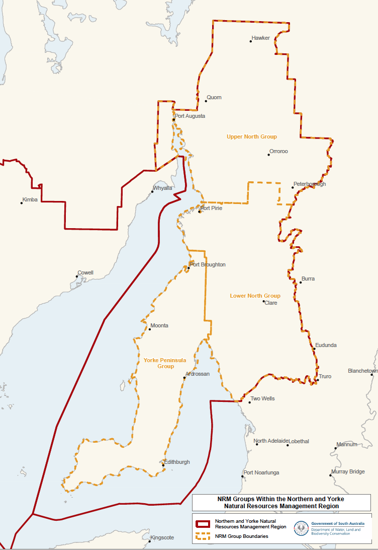
Northern and Yorke
The Northern and Yorke region totals 34,500 square km or more than 3 million hectares. It encompasses the Yorke Peninsula, the northern Mount Lofty Ranges, the southern Flinders Ranges, and significant areas of Spencer Gulf and Gulf St Vincent.
This region is divided into three districts as follows:
- Upper North
- Lower North
- Yorke Peninsula
There are a total of 24 parks in this region, comprising of 2 National Parks, and 22 Conservation Parks. They are as follows:
- Althorpe Islands CP
- Bird Islands CP
- Black Rock CP
- Carribie CP
- Clements Gap CP
- Clinton CP
- Goose Island CP
- Innes NP.
- Leven Beach CP
- Martindale Hall CP
- Minlacowie CP
- Mount Brown CP
- Mount Remarkable NP.
- Mount Brown CP
- Point Davenport CP
- Ramsay CP
- Spring Gully CP
- Telowie Gorge CP
- The Dutchmans Stern CP
- Troubridge Island CP
- Warrenben CP
- Wills Creek CP
- Winninowie CP
- Yalpara CP
A DEWNR for this region office exists at Clare.
Image courtesy of http://www.naturalresources.sa.gov.au
South Australian Arid Lands
This area covers over half of South Australia and takes up the state’s north east corner to its borders with New South Wales, Queensland, and the Northern Territory. The population within this semi arid region comprises less than 2% of the State’s entire population.
This region is divided into the following 6 districts:
- Gawler Ranges
- Kingoonya
- Marla-Oodnadatta
- Marree-Innamincka
- North Flinders
- North East
There are a total of 15 parks in this region, comprising of 7 National Parks, and 8 Conservation Parks in this region. They are as follows:
- Bimbowrie CP
- Breakaways CP
- Coongie Lakes NP.
- Ediacara CP
- Elliott Price CP
- Flinders Ranges NP.
- Ironstone Hill CP
- Kati Thanda-Lake Eyre NP
- Lake Gairdner NP
- Lake Torrens NP
- Pualco Range CP
- Simpson Desert CP
- Vulkathunha-Gammon Ranges NP
- Wabma Kadarbu Mound Springs CP
- Witjira NP
A DEWNR office exists at Port Augusta.
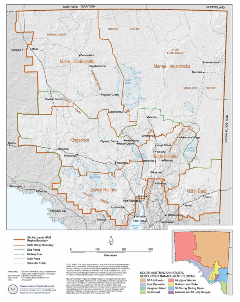
Map courtesy of http://www.naturalresources.sa.gov.au
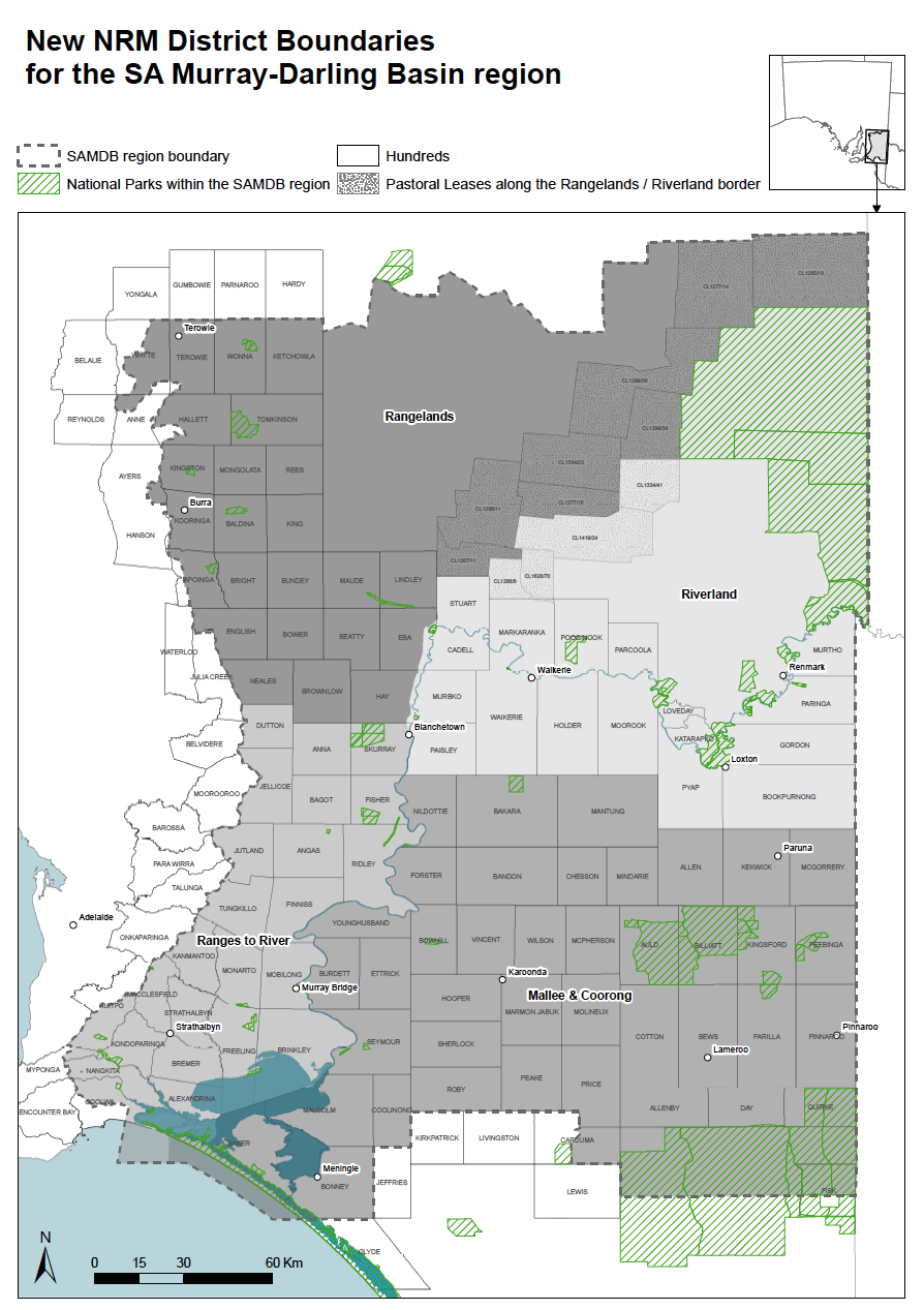
South Australian Murray-Darling Basin
The SA Murray-Darlling Basin region extends from where the mighty Murray River crosses the South Australian/Victorian border, down to where the Murray meets the sea at the Coorong. The region covers 70,000 square km.
This region was previously known as Murraylands and contained a number of parks that were in the old Adelaide area, e.g. Kyeema Conservation Park and parks that were in the old Northern & Yorke region including Mkotoa CP and Red Banks CP.
The region is divided into the following 4 districts:
- Rangelands
- Ranges to River
- Riverland
- Mallee & Coorong
There are a total of 46 parks in this region, comprising 2 National Parks, and 44 Conservation Parks. They are as follows:
- Bakara CP
- Bandon CP
- Billiatt CP
- Brookfield CP
- Bullock Hill CP
- Carcuma CP
- Caroona Creek CP
- Cooltong CP
- Coorong NP
- Cox Scrub CP
- Danggali CP
- Ettrick CP
- Ferries McDonald CP
- Finnis CP
- Hesperilla CP
- Hogwash Bend CP
- Hopkins Creek CP
- Kapunda Island CP
- Karte CP
- Kyeema CP
- Lowan CP
- Maize Island CP
- Marne Valley CP
- Media Island CP
- Mokota CP
- Monarto CP
- Morgan CP
- Mount Magnificent CP
- Mowantjie Willauwar CP
- Murray River NP
- Ngarkat CP
- Ngaut Ngaut CP
- Pandappa CP
- Peebinga CP
- Pike River CP
- Pooginook CP
- Poonthie Ruwe CP
- Ramco Point CP
- Red Banks CP
- Ridley CP
- Rilli Island CP
- Roonka CP
- Salt Lagoon Islands CP
- Scott CP
- Swan Reach CP
- White Dam CP
DEWNR offices exist at Murray Bridge and Berri.

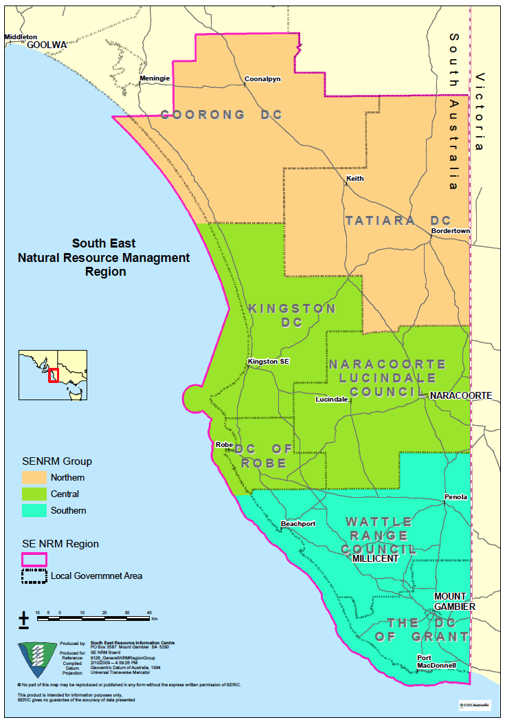
South East
The South East region covers an area of about 28,000 square km. It is bounded by the Victorian border to the east, the Southern Ocean to the south, and the Coorong to the west.
The region has three Districts:
- Southern
- Central
- Northern.
Three parks in this region overlap with the SA Murray-Darlling Basin. They are: Carcuma Conservation Park, Coorong Conservation Park, and Ngarkat Conservation Park.
There are a total of 57 parks in the South East region, comprising 2 National Parks, and 55 Conservation Parks. They are as follows:
- Aberdour CP
- Bangham
- Baudin Rocks
- Beachport
- Belt Hill
- Big Heath
- Butcher Gap CP
- Calectasia CP
- Canunda NP
- Carpenter Rocks CP
- Christmas Rocks CP
- Custon CP
- Desert Camp CP
- Dingley Dell CP
- Douglas Point CP
- Ewens Ponds CP
- Fairview CP
- Furner CP
- Geegeela CP
- Glen Roy CP
- Gower CP
- Grass Tree CP
- Guichen Bay CP
- Gum Lagoon CP
- Hacks Lagoon CP
- Hanson Scrub CP
- Jip Jip CP
- Kelvin Powrie CP
- Kungari CP
- Lake Frome CP
- Lake Hawdon South CP
- Lake St Clair CP
- Little Dip CP
- Lower Glenelg River CP
- Martin Washpool CP
- Mary Seymour CP
- Messent CP
- Mount Boothby CP
- Mount Monster CP
- Mount Scott CP
- Mullinger Swamp CP
- Narracoorte Caves NP
- Nene Valley CP
- Padthaway CP
- Penambol CP
- Penguin Island CP
- Penola CP
- Piccaninnie Ponds CP
- Pine Hill Soak CP
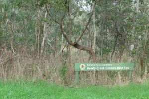
- Reedy Creek CP
- Talapar CP
- Tantanoola Caves CP
- Telford Scrub CP
- Tilley Swamp CP
- Vivigani Ardune CP
- Woakwine CP
- Wolsley Common CP
A DEWNR office exists at Mount Gambier.
Image courtesy of http://www.senrm.sa.gov.au
In summary.
So there you go. I have probably completely confused you. But I do hope it has shed some light on the parks system here in South Australia.
Finally, do not rely on all the information that you find on some of the ‘official’ websites on the internet. I have found some of them to be incomplete. For example I found a total of 20 Conservation Parks in the Adelaide & Mt Lofty Ranges District that were not recorded on the list on the NRM website for that Region.
Also, do not rely on Google maps. It does not show up all of the Conservation Parks Try using one of the following…..
http://mapcarta.com http://www.naturemaps.sa.gov.au
http://www.environment.sa.gov.au/haveyoursay/fire-management-assessment
For more information on parks in South Australia, please see the National Parks South Australia website at…..
http://www.environment.sa.gov.au/parks/Home
Or the Natural Resources website at…..
http://www.naturalresources.sa.gov.au/home
National Parks South Australia also has a Facebook site should you be interested…..
https://www.facebook.com/ParksSA/info
They also have an app called My Parx, which I will review in an upcoming post.
http://www.environment.sa.gov.au/marineparks/home/media/articles/130201-my-parx
Resources.
Department of Environment, Water and Natural Resources, http://www.environment.sa.gov.au/Home Natural Resources, http://www.epa.sa.gov.au/soe_2013/main/intro-overview-of-south.html