Belair National Park

On Saturday morning, 8th March, 2014, I headed over to the Belair National Park, to do an activation for both the VK5 Parks Award and WWFF.  This was my first activation of Belair NP for 2014, so it was 2 extra activator points for the VK5 Parks Award.  And I needed to try to get a few more QSO’s to head towards 44 for the global WWFF award.

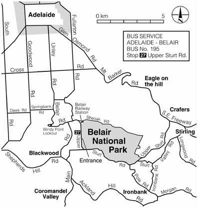
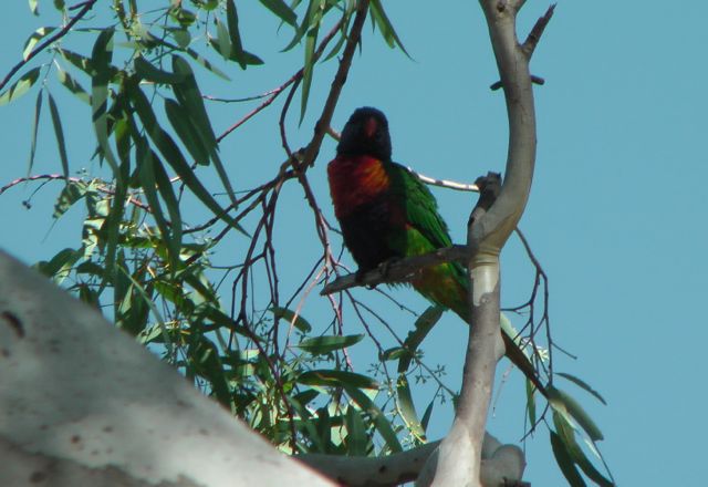
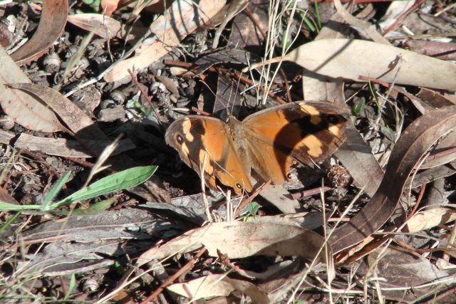
I have activated Belair NP previously and have talked about this beautiful park in other posts.  But very briefly, it is located about 13 km south east of Adelaide and is about 835 hectares in size.  Belair NP was the first dedicated National Park in South Australia, having been established in 1891.  About 250,000 visitors enjoy the park each year.

map adelaide

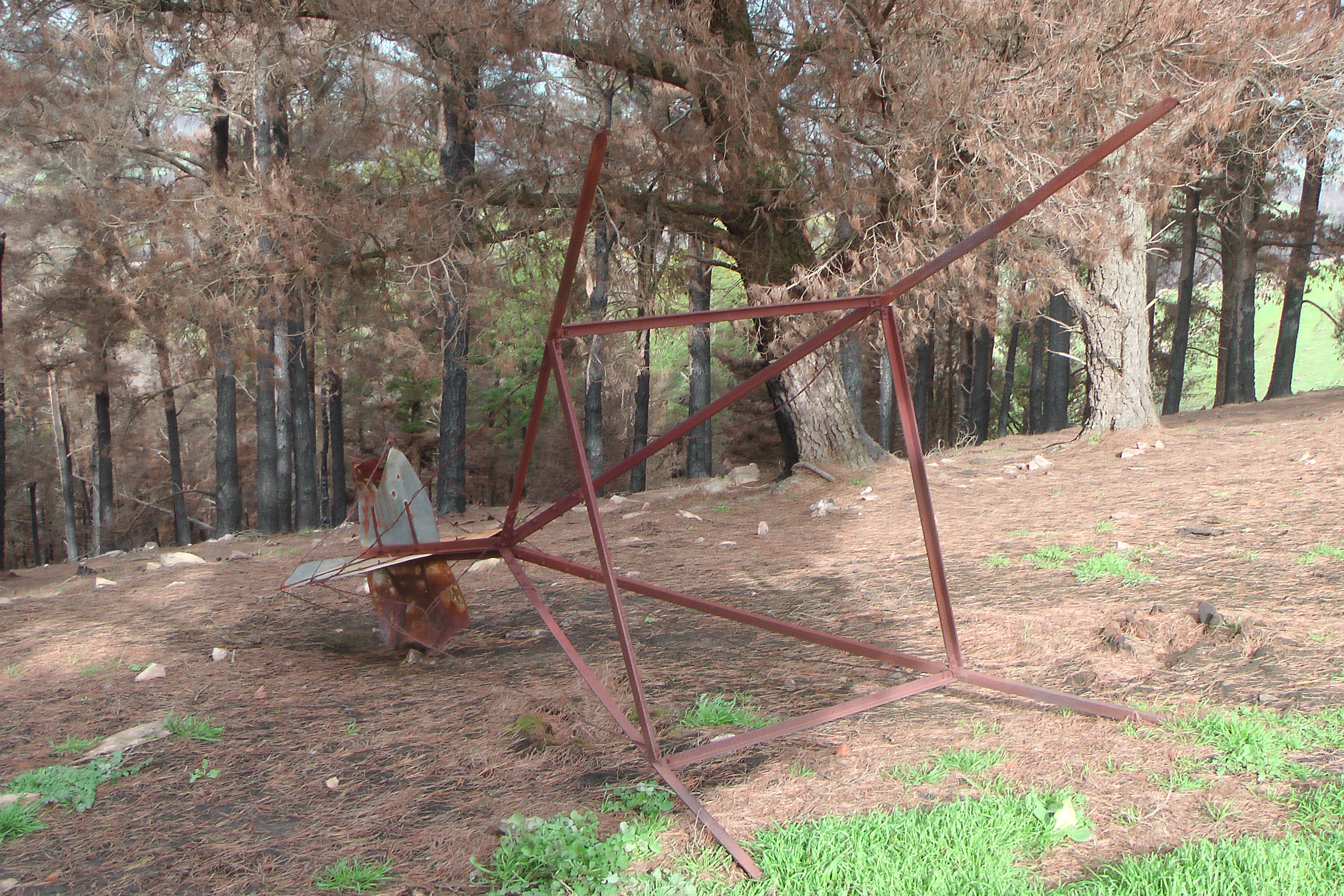
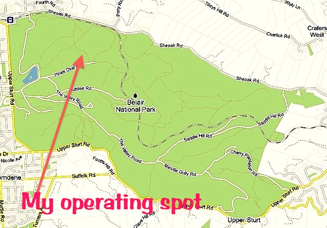
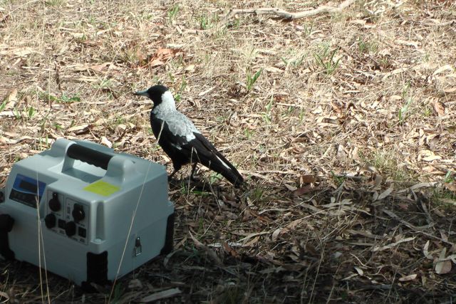
My ever faithful wife Marija came along, who enjoyed a bush walk through the park, whilst I played on the radio.  I set up near Pines Oval 2 just off Pines Oval Road.  Marija became all sentimental, because this is where we had our engagement party years ago.  Plenty of fond memories and lots of stories from that day which probably should not be mentioned here !

00Belair copy

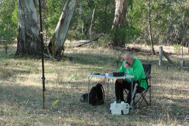
I set up my 40m/20m linked dipole on the top of the 7m squid pole, and for this activation I used by Yaesu FT-450, and ran 30 watts.

Band conditions seemed extremely good, however, there were not many stations on the 40m band at all.  My first contact was with Rod VK2ZRD who had a very strong 5/8 signal, with a 5/8 coming back to me.  This was followed by one of the regulars, Col VK5HCF down in Mount Gambier (5/9 both ways).  And then Nick VK3ANL called in with his QRP 5 watts with a nice 5/8 signal.  I also worked Ian VK3VIN, and David VK5NQP.  But the surprise call came from Neil VK8ZCU who was mobile 30 km south of Alice Springs with a very nice 5/7 signal from his mobile.

IMGA0008_2

I kept calling CQ for a while but there were no takers, so I headed down to the Riverland Radio Group Net where I spoke with Ron VK5BRL and a further 7 stations, including Col VK5FCDL/2.

After the UTC rollover I headed to 7.095 and called CQ and was called by Roy (VK5NRG) who was operating VK5BAR at the Adelaide Hills Amateur Radio Society clubrooms at nearby Blackwood.  This was followed by some of the regular Park Hunters including Nev VK5WG, Tim VK5AV, Bernard VK3AMB/m, and Don VK5NFB.  New to the park’s log was Murray VK5BWA.

IMGA0017_2

Things really slowed down on 40m, so I headed over to 20m and called CQ for about 5 minutes but there were absolutely no takers.  I think this is due to the fact that we have no audible alert system for the parks, like SOTAGoat and Rucksack Radio.  This is something we really need to work on.  So I tuned across the band and heard quite a few USA guys but their signals were down a bit so I didn’t bother calling.  But I did find John VK5TD calling CQ who was incredibly strong, so I had a chat with him.  I then worked felix VK4FUQ in Ingham in Queensland with a beautiful 5/9 signal, and then Ron VK6KRC who was a good 5/7 into Belair NP.

IMGA0023_2     IMGA0009_2

After about 90 minutes in the park, it was time to pack up.  I had a total of 24 QSO’s in the log.

The following stations were worked before the UTC rollover:-

Rod VK2ZRD; Col VK5HCF; Nick VK3ANL; Ian VK3VIN; Neil VK8ZCU/m; David VK5NQP; Ron VK5BRL; Grant VK5VGC; John VK5NJ; Dennis VK5LDM; Tim VK5AV; Daniel VK5DF; Col VK5FCDL/2; and Keith VK5ND.

The following stations were worked after the UTC rollover:-

Roy VK5BAR; Roy VK5NRG; Nev VK5WG; Tim VK5AV; Murray VK5BWA; Bernard VK3AMB/m; Don VK5NFB; John VK5TD; Felix VK4FUQ; and Ron VK6KRC.


References.

National Parks South Australia, http://www.environment.sa.gov.au

Talk at Whyalla ARC

On Wednesday 26th February 2014 I headed up to Whyalla (about 400 km from home) to deliver a presentation on SOTA, the VK5 Parks Award, & WWFF to the gents from the Whyalla Amateur Radio Club and a few members  who had made the journey from Port Augusta.

image_1_hires

So after work on Wednesday I headed down to the airport and flew up to Whyalla where I was met by my brother in law, who then dropped me off at my mother in law’s house.  They both live in Whyalla, which is where my wife Marija was born.

After a hearty Crotian meal (I think I put on an extra 5 kg), I headed to the meeting which was attended by a small but very keen group of amateurs.  The talk was split into 2 sections.  The first was on SOTA, and then after some coffee and cake, I spoke about the VK5 Parks Award and the World Wide Flora & Fauna program.

Thanks to Alex, VK5ALX for asking me up.  Alex has told me that the talk has…..

stimulated a lot of interest in both activities.  I have heard a couple of members chatting away on 2 mfrs about setting up suitable portable kits so expect to hear them on air before long“.

That is great to hear.

More fire damage

The Bangor fire in the southern Flinders Ranges continues to burn out of control.  It has now been burning for 23 days, and has burnt nearly 33,000 hectares.  The fire has destroyed a number of homes.  It is currently threatening the townships of Laura, Gladstone, and Beetaloo Valley.

This fire has impacted on the Telowie Gorge Conservation Park and also SOTA summit VK5/ NE-065.  The Telowie Gorge CP is home to a colony of yellow footed rock wallabies, so lets hope they have survived the fire, and not suffered the same fate as some other fauna in some of the other recent fires in South Australia.  The Telowie Gorge CP has been closed until further notice.  I operated from the Telowie Gorge CP mid last year and it is / was a beautiful park, with an excellent walking trail through the gorge.

1794592_718667188166161_148701699_n

Photo courtesy of the CFS Facebook page.

The Bluff, VK5/ NE-065, has also been impacted.  I activated this summit last year as well.  The summit is located just to the south of Wirrabara Forest, which has been devastated.

The map below shows the area that the fire has currently burnt out.  The yellow arrow indicates Telowie Gorge Conservation Park.  The red arrow indicates SOTA summit, The Bluff, VK5/ NE-065

1796533_719616904737856_819707010_n

Issues with SOTAGoat

Of late I have been experiencing lots of problems with SOTAGoat.  It appears that this has been since I upgraded to IOS 7.0.4 on my iPhone.  And I have read on the SOTA Yahoo group that others have been experiencing the same.

590206108x356

The problem is mainly that the goat does not bleat anymore to alert me of spots.  However at times when it has been working, I have been receiving duplicate notifications.  I have found that if I delete the SOTAGoat app, and then turn the iPhone off and wait a few minutes, and then turn the i-phone back on and reload the apple, that the spot alerts come through.  But they only work for a short period of time and then stop again.

I have sent off an e-mail to the developer, Rockwell Schrock, who was kind enough to respond promptly.  Rockwell advises that the duplicate alerts should be resolved now.  However, he has not been able to pinpoint that problem yet.

Rockwell would be keen to hear from you if you are experiencing problems.  His e-mail address is…..

cq@ww1x.com

‘Rare birds wiped out’

This morning my wife showed me an article in The Advertiser which was entitled ‘Rare birds wiped out by inferno‘.  I have attached a copy below.  In essence it talks about the possible geographical extinction of two South Australian birds, the Mallee emu wren, and the Black eared Miner as a result of the recent bushfires.  Very sad indeed !

rare birds

Article courtesy of the Adelaide Advertiser.

The Mallee emu wren is one of three species of the genus Stipiturus, commonly known as emu-wrens.  The common name of the genus is derived from the resemblance of their tails to the feathers of an Emu.  They are a tiny bird weighing just 4 – 6.5 grams.  It is a Nationally endangered species and is restricted to open mallee woodland with spinifex under storey in north western Victoria and south eastern South Australia.  It was estimated that there were just 3,000 of these birds in the wild.

malleeemuwren

Photo courtesy of wwww.beforeitsgone.com.au

Ironically, back in 2008, the International Union for Conservation of Nature (IUCN) elevated the bird’s status from ‘vulnerable’ to ‘endangered’.  The IUCN warned that the species ‘hold was so fragile that a big bushfire could wipe it out‘.  Sadly their predictions appear to have come true.  Due to recent fires in both South Australia and Victoria, it is believed that just a small pocket of these birds now exist in the Murray Sunset National Park in Victoria.

Mallee_Emu-Wren

Map showing the distribution of the Mallee-emu wren, courtesy of Wikipedia.

Click on the link below for more information on the Mallee-emu wren.

http://www.naturalresources.sa.gov.au/files/…bf05…/mallee-emu-wren-fact.pdf

The Black-eared Miner is an endangered honeyeater which is endemic to the mallee woodland area of south eastern Australia.

bemgc

BirdLife International identified the following sites as important areas for the bird: Riverland Mallee (including Billiatt Conservation Park), & Ngarkat Conservation Park in South Australia, and Murray Sunset National Park, Hattah-Kulkyne National Park, Wyperfeld National Park, & Big Desert in Victoria.  Due to the bush fires in Victoria, only a small pocket of these birds now exist in the Riverland region of South Australia.

220px-Black-eared_Miner

Click on the link below for more information on the Black-eared Miner.

http://www.environment.nsw.gov.au/resources/nature/recoveryPlanFinalBlackearedMiner.pdf


References.

The Advertiser, Saturday February 8, 2014.

The Age, http://www.theage.com.au/national/futures-deemed-grim-for-three-australian-bird-species-20080520-2ggh.html

Mallee Emu-wren, Wikipedia, http://en.wikipedia.org/wiki/Mallee_Emu-wren

Blackeared Miner, Wikipedia, http://en.wikipedia.org/wiki/Black-eared_Miner

Parks devastated by fire

Following the recent fires in South Australia, a number of South Australian National Parks and Conservation Parks have been severely impacted.

An estimated 450 bushfires engulfed parts of South Australia during the January heatwave, burning more than 445,000 hectares, as well as destroying livestock, and at least 15 homes and about 24 sheds.  About 200 farms were affected which included lost machinery and fencing.  More than 1,700 livestock perished during the fires.  The total damage bill is estimated to be about $10 million.  And the loss to flora and fauna is unmeasurable.

Billiatt Conservation Park has been totally decimated.  It is literally ‘gone’.  The status of the Billiatt fire is listed on the CFS website as ‘Controlled’.  It is reported that the fire ‘continues to burn with control lines’.  The fire has been burning since Wednesday 15th January, 2014.  The park is closed until further notice.  Two homes have been destroyed in this fire.

Billiatt CP has gone from this (photo taken during my activation at the park in September, 2013)……………

IMGA0107

To this……………….

IMG_7223

Below is a CFS map of the Billiatt fire.  I have placed a red line indicating the Billiatt CP boundaries.  As you can see the park is no more !

Billiatt fire110

Map courtesy of the CFS.

The nearby Ngarkat Conservation Park has also been significantly affected by fire.  The fire which was started after a light strike, has burnt out an area of more than 90,000 hectares.  The park is closed until further notice.

BeJLVD7CMAA4yO9.jpg-large

Photo courtesy of 7 News Adelaide

Below is a CFS map of the Ngarkat fire (dated 18/1/2014 – cannot get a more recent one).  I have placed a red line roughly indicating the Ngarkat CP boundaries.  As you can see, more than 1/3 of the park has been destroyed.

58909_759463077414932_1679398190_n

Map courtesy of the CFS.

Both Billiatt and Ngarkat Conservation Parks have been identified by BirdLife International due to their importance for the conservation of numerous rare and endangered species of mallee birds.  They are also the home of various endangered animals including the Western Pygmy possum.  Not too sure how many are left after these fires ?  Trees for Life are reporting ‘shelter for fauna is gone, shade and food now elusive, fauna losses extensive’.

I activated both Billiatt and Ngarkat in September last year, and it is incredibly sad to see the state that they are in at the moment.

The following parks have also been affected by the recent fires…..

  • Gawler Ranges National Park
  • Mount Remarkable National Park
  • The Katarapko section of the Murray River National Park
  • Telowie Gorge Conservation Park
  • Yellabinna Conservation Park
  • Yumbarra Conservation Park
  • Gum Lagoon Conservation Park.

In conjunction with Ivan VK5HS, I am currently working on a possible fund raiser / raffle, where money raised would go to Trees for Life.  Once I finalise this, I will let everyone know.  There will also be future tree planting days, which amateurs may want to get involved in.

1810_trees-for-life

Click on the link below to have a listen to local farmers Chris Bullen and Robyn Verrall who have a farm on the border of the Ngarkat Conservation Park.

http://www.abc.net.au/news/2014-01-22/ngarkat-fire-fighting/5212236

Resources

Country Fire Service website, viewed 1st February 2014, http://www.cfs.sa.gov.au

DEWNR website, viewed 1st February 2014, http://www.environment.sa.gov.au/Home

ABC, viewed 1st February, 2014, http://www.abc.net.au

Trig points and access to private property

Today I contacted the South Australian Lands Titles Office, Department of Planning, Transport, and Infrastructure, and also the SA Legal Services Commission, and queried them re the legality of access to privately owned land which has a trig point situated on it.  I had heard rumours that if there was a trig point, then the land owner was required to allow access to the public to the trig point.  So today I sought some official clarification on the South Australian perspective.

Firstly, what is a trig point ?  Trig points, sometimes called Trig Stations are hilltop survey marks.  They are so called because trigonometry is used to calculate their positions.  Their full and correct name is Trigonometric Points of Stations.   In Australia, trig points consist of a permanently marked point on the ground, and usually have a beacon or a cairn of rocks directly above them so that the trig point can be seen from a distance.

IMG_2442      IMG_3450

IMGA0046     IMGA0156_2

Trig points are known as trigonometrical stations in North America, triangulation pillars in the UK, trig beacons in South Afirca, and trig points or stations here in Australia.

Trig points are built on the most prominent geological formation in the surrounding countryside so that they are visible for many kilometres.  By sighting two or more trig points, and then taking a compass bearing, surveyors can accurately determine their position on a map when plotting boundary lines of property, etc.

The early explorers of Australia plotted their position by observations of the sun and stars and related this to visible landmarks such as prominent hills, rivers or local settlements.  However, as the colony of Australia expanded, so did the need for accurate maps.

In the early days, trig stations consisted of a brass plug which was fixed into concrete.  It had a large cairn of rocks erected over the top of it, and a pillar with metal vanes standing upright over the mark.  To access the brass plug, surveyors ere required to dismantle the cairn and then reassemble it afterwards.

B60681_30

A man standing beside the trig, Mt Samuel, Flinders Ranges, S.A. c. 1898.

Photo courtesy of State Library, S.A.

B73363_16

Two men standing beside the trig, Mt Wudinna, SA, c. 1911.

Photo courtesy of State Library, S.A.

This resulted in a concrete pillar version which has a solid concrete foundation and a pillar which is about 1.3 metres high.  It has a vane on the top which can be removed by surveyors to access a threaded spigot on top to mount survey equipment such as theodolites, Electronic Distance Measuring devices, and GPS antennas.

IMGA0110

I have noted in my SOTA travels, that many trig points are in dire need of some tender loving care.  Apparently this is a national trend, from what I read on the internet.  With all the modern technology available such as Global Navigational Satelite Systems (GNSS) and Continuosly Operating Refernce Station (CORS) networks, trig stations are become less relevant to surveyors.  Governments are loath to spend money as the upkeep required on trig stations has proved to be unmanageable.

IMGA0112

 2013-04-14 13.18.17

There is an excellent resource on the Queensland Govt website, entitled ‘Surveying history’…..

http://www.nrm.qld.gov.au/museum/surveying_history/index.html

And another one entitled, ‘Life of the surveyor in the field’….

http://www.nrm.qld.gov.au/museum/surveying_history/surveyors-work.html

And should you wish to view where all the trig points are in South Australia…check out the map at the DPTI website, at the following link…..

http://maps.sa.gov.au/plb/

Going back to my original question about access to privately owned land which has a trig point on it……….Under the Survey Act 1992, land surveyors have the right to enter onto private land to access trig points.

The Act states that a survey mark is…..

(a)  a mark or peg of a kind specified in survey instructions ion force under this Act that is placed on or in land for the purposes of defining a boundary of the land; or

(b)  a permanent survey mark.

Section 46 of the Survey Act 1992 states…..

A surveyor, or a person authorised in writing by a surveyor, may-

(a)  at any reasonable time, enter any land for the purpose of carrying out work in connection with a survey; and

(b)  take such action as is necessary to enable the survey to be carried out effectively (including excavating or breaking the surface of land to the extent necessary to uncover or place a survey mark).

It is also an offence under the Act to hinder or obstruct a person in the exercise of a power conferred by the Act.

So, the rumours are INCORRECT !  

You cannot enter land that has a trig point on it, unless you have the permission of the land owner.

In England, there is the freedom to roam, or everyman’s right.  This relates to the general public’s right to access certain public of privately owned land for recreation and exercise.  In both England and Wales, public access rights apply to certain categories of mainly uncultivated land—specifically “mountain, moor, heath, down and registered common land.”   Developed land, gardens and certain other areas are specifically excluded from the right of access.   Agricultural land is accessible if it falls within one of the categories described above.  Some other European countries have similar rights of access.  Here in Australia, we have no such rights of access.

There are some exceptions to access across privately owned land here in South Australia.  This includes the Heysen Trail, which is a long distance walking trail (1,200 km) stretching from the Flinders Ranges, via the Adelaide Hills, to the Fleurieu Peninsula.  Part of the trail traverses private property.  However this access would be documented and possibly included as right of way in the Title.

images

Section 17 of the Summary Offences Act 1953 of South Australia states…..

(1)  Where-

(a)  a person trespasses on premises; and

(b)  the nature of the trespass is such as to interfere with the enjoyment of the premises by the occupier; and

(c)  the trespasser is asked by an authorised person to leave the premises,

the trespasser is, if he or she fails to leave the premises forthwith or again trespasses on the premises within 24 hours of being asked to leave, guilty of an offence. 

References.

Australian Lesson Activities – Maths, viewed 31 January 2014, http://www.expedition360.com/australia_lessons_maths/2001/09/trig_points_and_geometry.html

State Library of South Australia, viewed 31 January 2014, http://www.slsa.sa.gov.au

The Friends of the Heysen Trail and Other Walking Trails, viewed 31 January, 2014, http://www.heysentrail.asn.au/heysen_trail/faq.php

The Intergovernmental Committee on Surveying and Mapping, viewed 31 January, 2014, http://www.icsm.gov.au

Wikipedia, 2014, Heysen Trail, viewed 31 January 2014,  http://en.wikipedia.org/wiki/Heysen_Trail

Wikipedia, Triangulation station, viewed 31 January 2014, http://en.wikipedia.org/wiki/Triangulation_station

Great website

Today I was doing a bit of research on trig points in South Australia, and I found a really neat website, which I hope you also find interesting.  It is called ‘Place Names Online.  South Australian State Gazetteer’.

It can be found at…..

http://www.placenames.sa.gov.au/pno/index.jsf

gaz

The Gazetteer is a database of place names in South Australia. The general aim of the database is to record of any place name that is, or has been used, in South Australia. Associated with each name is up to 38 fields of information relating to feature type, classification, location, derivation and cross-reference to current, previous and alternative names.

I have a great book here as well called ‘South Australia.  What’s in a Name?” written by Rodney Cockburn.  It is the third edition and seventh printing of Rodney Cockburn’s book which was first released in 1908.  It contains the origins of the names of nearly 4,000 of South Australia’s cities, towns, islands and other geographical features.

IMG_1288


VK5 SOTA and Parks symposium

On Sunday 9th March, 2014, there will be a VK5 SOTA & Parks symposium, which is to be held at the Guides Hall / AHARS shack, at Hannaford Road, BLACKWOOD.

map_shack

The doors will open at 8.30 a.m. and the symposium will officially commence at 9.00 a.m. by the AHARS President.  This will be followed by a number of guest speakers, who will give talks on a variety of aspects of SOTA, parks awards, and portable operation.

There will be morning tea, and the presentations will complete at 12.40 p.m. and a BBQ will follow.

A ‘donation’ of $4.00 would be asked for the cost of morning tea (tea, coffee, cake, biscuits), and the BBQ which will include bread & salads.

If you do intend to attend, please RSVP to me prior to 1st March, 2014, so that I can arrange suitable catering.

VK5 SOTA & Parks symposi105

Please find attached the program…..

0830–0900……….Doors to venue open.  Mingle with the  crowd/introductions.

0900 -0905……….Welcome.  President AHARS

0905–0925……….An overview of SOTAs progress in VK5 & VK  overall–Ian VK5CZ

0925–0945……….Tips for activators/Hunters of VK5 Parks Award  –Larry VK5LY

0945 – 1005………Overview of World Wide Flora & Fauna (WWFF)  program – Paul VK5PAS

1005–1025………Using lithium phosphate chemistry batteries, a  beginners perspective – John VK5BJE

1025 -1045………Morning tea

1045 – 1105 ……….The failed attempts at an end fed wire antenna –  Ian VK5CZ

1105–1125………SOTA for the beginner – Stu VK5STU

1125 – 1145……….Parksnpeaks spotting/alert program –Nigel VK5NIG

1145 –1205 ……….What is prominence ?– Paul VK5PAS

1205–!225……….TenTec Argonaut 6 -V- Yaesu FT817nd –John VK5BJE

1225– 1240……….General questions & Closure of symposium

1240………. BBQ lunch

!

3,000 Chaser points

On Saturday morning, I eagerly awaited the first of a number of SOTA activations.  I was sitting on 2,976 Chaser points, and was hoping to get across the 3,000 point line.

My first contact of the day was with Nick VK3ANL who was on an un-named summit, VK3/ VC-032, which is situated north of Ballan.  Another 4 points to the tally.

I then worked Nick another two times during the day, whilst he was on Mount Warrenheip VK3/ VC-019 and then Mount Buninyong VK3/ VC-018.  Nick activated 4 summits that day.  Great effort Nick.

I then saw a spot for Hans WN6E W6/ CT-026 on 15m and decided to have a listen.  And to my surprise, there he was, with a good signal (5/5).  So I gave Hans a call and got through first time with a 5/1 signal report received.

I then worked Phil VK2FPJR who was on un-named summit VK2/ IL-006, in the Illawarra region of NSW.  This took me to 2,992 points.

And then thanks to Rod VK2TWR, who was on VK2/ SM-036, a 10 pointer, I nudged over the 3,000 point mark.  I went on to work a further 17 SOTA activators that day and ended up with 3,097 SOTA Chaser points.

What was really enjoyable this day, was to get VK2 SOTA activators in the log.  It has been a real slog the past 6 months with the VK1 & VK2 Activators on 40m.

I have printed out & mailed off a certificate for Rod VK2TWR, just to say thanks.

Slide2