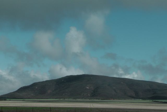
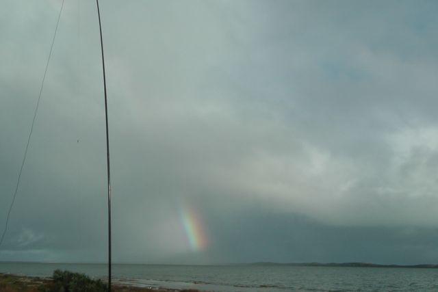
My first activation for Wednesday, 12th June, 2013, was Carprie Puntha Hill, VK5/ SW-003.
I had to leave earlier than planned this morning, due to staying att Whyalla overnight and not at Iron Knob. Unfortunately there was just so much rain that the 6km road out to my friend’s station’ Cooyerdoo’ at Iron Knob was impassable.
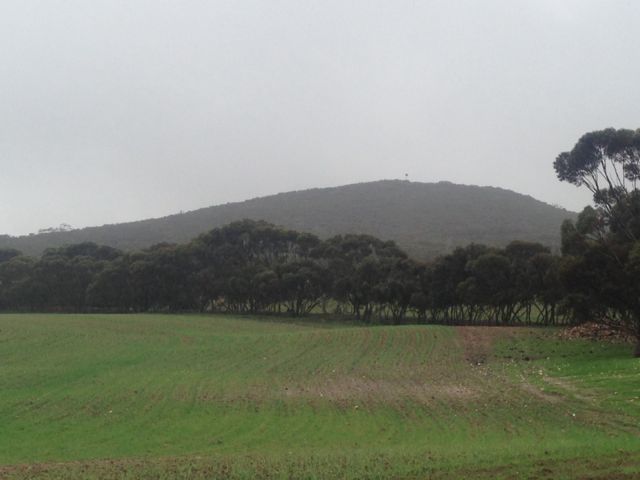
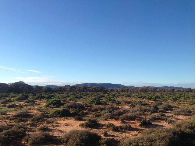
Carprie Puntha is aboriginal for ‘plenty of water’, and this was certainly the case for the Eyre Peninsula in the past few days. The summit is located on private property owned by Brian PETERS. Access to the summit is through paddocks off the northern side of Hicks Road.
The weather was absolutely lousy this morning. Very wet and windy. Many of the local dirt roads in the area were impassable in a 2wd vehicle. It was a very slow drive out to Brian’s property. There is normally an excellent view from the top of the summit, but the rain and the fog put pay to that.
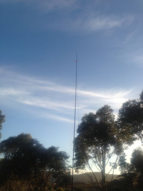
I set up the 7m squid pole using some moss rocks as support at the base, and tied the ends of the dipole off to the shrubs on the top of the summit. Because the weather was so terrible, I didn’t really plan hanging around for long. I had to ‘hide’ underneath some trees and shrubs to get out of the showers. Must invest in one of those ‘bothie’ bags. But I had plenty of ‘Chasers’ so I stayed around for the UTC rollover.
I ended up with a total of 23 QSO’s on 40m SSB.
Stations worked before the UTC rollover were:- David VK3VDL/m; Ron VK3AFW/m; Ed VK2JI; David VK5KC; Ernie VK3DET; Shaun VK5FAKV; Ian VK5CZ; Peter VK3PF; Col VK5HCF; Fred VK3JM; Nick VK3ANL; John VK5BJE; David VK5LSB; & Peter VK3FPSR.
Stations worked after the UTC rollover were:- Peeter VK3FPSR; Fred VK3JM; Ed VK2JI; Ron VK3AFW/m; Peter VK3PF; Col VK5HCF; David VK5KC; David VK5LSB; and Ian VK5CZ.
After activating the Darke Peak summit, I drove around the corner to the Darke Range Conservation Park, and activated the park as part of the VK5 National & Conservation Parks Award.
The Darke Peak summit is located within the Darke Range, but not within the Darke Range Conservation Park. The mountain range, summit, town, and Conservation Park take their name from the exploirer John Charles Darke, who was injured in a spear attack by Aborigines in the vicinity of the summit on the 24th October, 1844. He died the next day and was buried at the foot of the large peak.
The Conservation Park is contained within the central section of the Darke Range, a few kms from the town of Darke Peak. The hotel here is well worth popping in and having a feed or a beer.
I set up for about half an hour and worked 8 stations in VK2, VK3, & VK5, on 40m SSB.
The following stations were worked:- Peter VK2NEO; David VK5KC; Roy VK5NRG; Matt VK3FORD/m; Andrew VK3FABE; John VK5BJE; Ted VK5KBM; and Bill VK5MBD.
My 2nd summit for Tuesday 11th June, 2013, was Darke Range, VK5/ SW-006.
The Darke Range summit is situated in the Darke Range, in close proximity to the little town of Darke Peak, and about 53 kms south of Kimba.
The town takes its name from the explorer John Charles Darke, who was injured in a spear attack by Aborigines in the vicinity of the peak on 24 October 1844. He died the next day and was buried at the foot of the large peak. His grave can be located on the western side of the Darke Range. In 1910, the South Australian State Government erected a memorial at the site.
Governor Grey expressed a wish that some landform in the region of the grave should be named to honour him. In 1865 surveyor Thomas Evans who was performing a trigonometrical survey of the Gawler Ranges, and named the 1,564 ft (477 m) high mount, ‘Darke’s Peak’.
I gained access to the summit via the southern side. There is a track that will take you al the way to the summit, but this is for 4wd only, so I drove as far as I could and then walked the rest of the way. It is quite a few kms to the actual summit.
Fortunately the weather held off for me and I ended up with 22 QSO’s. The majority of these were on 40m SSB, but I did work some stations on 20m SSB, including some DX: England, New Zealand, French Polynesia, Hawaii. They were a bit of a struggle, but nether the less, they are in the log.
Stations worked were:- Peter VK3PF; Rod VK5FTTC; Ernie VK3DET; Peter VK3FPSR; Bill VK5MBD; John VK2YW; Nev VK5WG; Grant VK5VGC; Roger VK5NWE; Ian VK1DI/3; John VK5FTCT; Dale VK5DC; Andrew VK5ARP; Keith VK5FEKH; Paul VK2HMV; Don G0RQL; Rob ZL1RD; William FO5JV; Owen ZL2GLG; Ray VK4NH; Clem VK4XCS; and Jamie KH6KW.
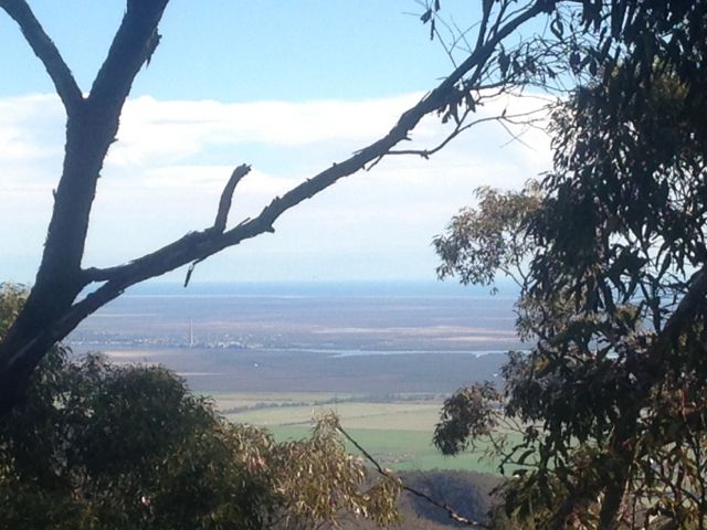
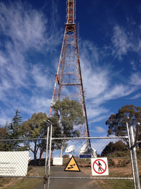
Caralue Bluff, VK5/ SW-002, was my first proposed SOTA activation for Tuesday, 11th June, 2013.
Caralue Bluff is 486 metres above sea level, and is worth 1 point. It is situated about 27kms west of the town of Kimba.
This was a real hit and run activation for me, as the weather during the morning was atrocious. I almost didn’t make it out of ‘Cooyerdoo’ at Iron Knob because of the weather. The upper Eyre Peninsula had torrential rain overnight and it continued until mid morning. And when it did stop raining, the sunny breaks only lasted a short period of time.
Fortunately there is a track which takes you up to the summit. So for the first time it was get 4 contacts and get out quick.
There is a communications tower and also a trig point at the top.
The following stations were worked:- David VK5KC; Peter VK3FPSR; John VK2YW; Peter VK3PF; Roger VK5NWE; Ernie VK3DET; and John VK5MG.
My first activation for Tuesday 11th June, 2013, was the Lake Gilles Conservation Park.
Lake Gilles was first discovered in 1839 by explorer Edward John EYRE, and was named after Osmond GILLES, who was the Colonial General at the time.
Lake Gilles Conservation Park was established in 1973, and protects a sample of original vegetation growing in the transition zone between pastoral leases and established agricultural lands. The lake was added in 1993, increasing the total area to 68,584 hectares. The southern section of the park was surveyed in 1925 for farming. Some sections were allocated to early settlers but only used for grazing.
Due to drought and the Great Depression, the Government decided against farming and reverted the area to pastoral leases. Although timber cutting by the early settlers was prevalent, the native vegetation in this area was saved from clearing for farms and remains in its original state.
I turned the Yaesu FT-817nd to 40m and called CQ for about 5 minutes but had no takers at all. So I QSY’d down the band a bit and heard Gary VK5ZK talking about my Eyre Peninsula trip. So at the end of his over I jumped in and had a really enjoyable conversation with Gary VK5ZK; John VK5BJE; Trevor VK5ZTJ/m; and John VK5NJ.
After about 30 minutes of chatting, I decided it was time to take the antenna down and head further west towards Caralue Bluff.
Corruna South, VK5/ SW-017, was my second summit for Monday, 10th June, 2013. It is 396 metres above sea level and is worth 1 point.
Corruna South is located about 10 kms north of Iron Knob, just off the Kingoonya-Iron Knob Road. It is situated on private property owned by Graham FRENCH.
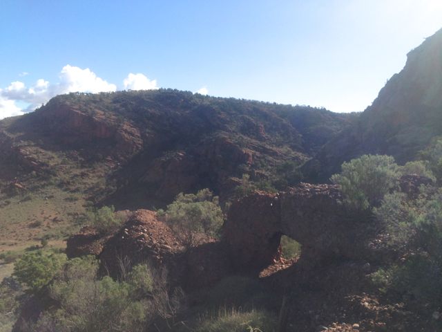
I met up with Graham and said g’day before tackling the hill. It took me about 1 hour to climb to the top. There is no track. There are sheer cliff faces on the southern side and a large waterfall, so I found the best way to tackle the summit was to start climbing from the eastern side. There is no track, so there was a fair bit of rock climbing and bush bashing.
Once at the top, the summit plateaus off quite a bit. There are a lot of rocks and trees at the top which you can attach a dipole to.
Conditions on 40m SSB locally were very good, but into the eastern states they were very poor. I did manage a summit to summit QSO with Ian, VK1DI who was portable on VK3/ VW-007 near Boroka lookout. Ian had a good strong 5/8 signal.
After working all the usual ‘Chasers’ on 40m I QSY’d to 20m SSB and spoke to John ZL2JBR (5/9 both ways). I then had a good chat with Dan K7SS who was 5/9 and I received 4/5 back. My last DX contact for the day was with Pat I5ZSS who was a very strong 5/9. I received a 5/7 signal report back from Pat.
What followed Pat’s QSO, was a constant stream of calls from the eastern states. Signals into VK1, VK2, VK3, & VK4 were excellent.
This just reinforced my ethic of trying 20m for contacts around Australia other than the close in states.
I ended up with a total of 42 QSO’s.
Stations worked were as follows:- Roy VK5NRG; Ian VK5CZ; Peter VK3PF; Graham VK5KGP; Trevor VK5ATW; Steve VK5AIM/p; Warren VK3BYD; Glenn VK3YY; Mal VK5MJ/m; Ernie VK3DET; Allen VK3HRA; Shaun VK5FAKV; Brian VK5FMID; Nick VK3ANL; Ian VK1DI/3 (SOTA); Tony VK3CAT; Paul VK5FUZZ; John VK5FTCT; Wayne VK3WAM/p; Hans VK5YX; Peter VK3ZPF; Ian VK5IS/qrp; Ron VK3AFW/m; John VK5BJE; VK3JP; John ZL2JBR; Dan K7SS; Pat I5ZSS; Bernard VK3AMB; Ed VK2JI; VK3DXJ; VK1OO; Simon VK3SIM; Dennis VK2HHA; Rob VK3EY; VK3XBC; Max VK3MCX; Don VK3MCK; Adam VK2YK; Alan VK4KO; and Tony VK5WC/4.
On Monday 10th June, 2013, I activated Mount Middleback North, VK5/ SW-011. This was my 2nd summit on my Eyre Peninsula trip. The summit is 425 metres above sea level, and is worth 1 point.
Mount Middleback North is located on private property, a large sheep station called ‘Cooyerdoo’, about 20 kms from Iron Knob, and about 380 kms north of Adelaide. The property belongs to some very good friends of ours, Matt and Jane, and is 173,000 acres in size.
I left Whyalla early in the morning, before sunrise and headed out towards Iron Knob on the Iron Knob-Whyalla Road. A journey of about 60 km. It was a slow drive out to the station because this is real serious kangaroo country through here. And the big ones too, the Red Kangaroo, which is the largest of all the kangaroos. Hit one of these and they will do serious damage to your car !
I had to drive through the town of Iron Knob prior to reaching the station. The town is a shadow of its former self. Iron ore was originally mined here for use as flux in the copper smelting industry. The iron ore was of such high quality that it started an iron smelting industry as well. It is referred to as the birthplace of the steel industry in Australia. Iron Knob gets its name for the fact that it has a large amount of iron ore and was a major contributor to Australia’s iron industry. Quarrying for iron at the town ended in 1998.
I then travelled west along the Eyre Highway and then down 6kms of dirt road leading to the homestead from the Eyre Highway.
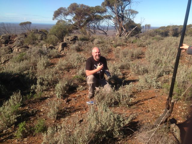
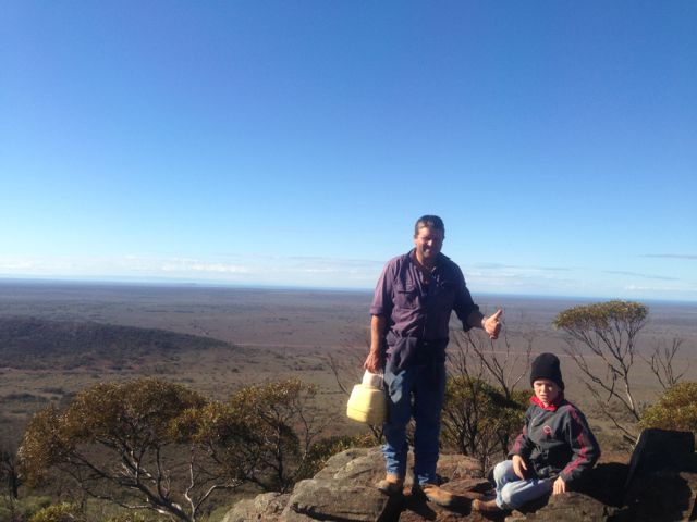
Matt and his young lad, Lachie and I jumped into the 4wd ute and started the 45 minute journey across the station to the base of the summit. Plenty of wildlife seen on the journey including feral goats, Red Kangaroos, and emus.
Once we reached the base of the hill, we started the hour long walk to the top. There is no path, so it was bushbashing through the scrub and over the rocky ground.
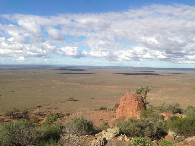
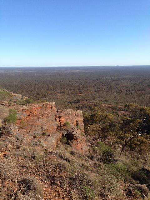
But the journey to the top was worth every bit of sweat. There were spectacular views in all directions, but particularly to the east and to the west. To the east we could see Whyalla and across the Spencer Gulf to Port Pirie. To the west, you could see as far as the eye would allow you to. This pretty rugged country out here. In recent years, a man went missing not far from here and his body was never recovered. It is not surprising when you stand on the top of Mt Midleback North and look out across the outback.
As Matt pointed out to me, this is not a summit to do during the summer. This is real snake country ! And some of the most dangerous snakes in the world, including the Death Adder, Western Brown snake, Tiger snake, and the Taipan (which is about 50 times more toxic than the Asian Cobra). There plenty of big goannas out here as well.
The 3 of us really enjoyed the morning. The climb was quite good, the views were amazing, and the weather was sensational.
Lachie has even borrowed my Foundation manual, so who knows. We may have a young amateur on air soon.
I ended up with a total of 21 QSO’s including 2 summit to summit contacts with Brian VK3MCD who was on top of VK3/ VC-001, and Mark VK3PI was on top of Pretty Sally, VK3/ VC-034.
The following stations were worked:- Steve VK5SE; Peter VK3PF; John VK2YW; Allen VK3HRA; David VK5KC; Marshall VK3MRG/p; Ed VK2JI/p; Rod VK2LAX/p; Peter VK3ZPF/p; Brian VK5FMID; Duncan VK3XBC; Ernie VK3DET; Fred VK3JM; VK1XP; Trevor VK5ATW; Rick VK5FIVE; VK5KBJ/p; John VK5FTCT; Col VK5HCF; Brian VK3MCD/p (SOTA); and Mark VK3PI/p (SOTA).
After activating the Clinton Conservation Park, Marija and I continued north along the Augusta Highway towards our destination of Whyalla. On the way, we got a call to say that Marija’s mum would not be out of hospital that day, so it was no longer a priority to get to Whyalla early. So, at Crystal Brook, we deviated to the east and travelled along Main North Road through the towns of Gladstone & Laura, to the eastern side of The Bluff, VK5/ NE-065. A spur of the moment activation.
You can’t miss The Bluff if you are travelling along the Augusta Highway, near Port Pirie. There is a huge TV & radio tower on the top.
Access to The Bluff is via Charcoal Road which runs off Main North Road, a few kms north of Laura. Laura is a beautiful little town. It is famous for the being the home of Golden North ice cream. And the famous poet, C.J. Dennis was born here. Travel west along Charcoal Road, and then turn left into Forest Road. This will take you up passed Taralee Orchards and the Wirrabara nursery. This is a very picturesque setting and a great drive. The road is dirt but is in good condition. You will eventually reach a ‘dead end’ where you will find a parking area and the start of a bitumen road which leads to the summit.
However, there is a padlocked gate, preventing vehicles from going any further at this point. In fact the gate has multiple padlocks on it. I think one for each of the stakeholders who use the tower at the top.
From this point, it is about a 5 km walk to the summit. The walk took us about 60 minutes. We mixed it up, using the sealed road and the Heysen trail as we got up higher. The Heysen trail walk through here is spectacular. You will reach a point towards the top of the ridge line where there is a T junction. It is at this point that you turn to the left and either follow the road up to the summit, or take the Heysen trail which is on the left hand side of the road. At this T junction there are spectular views out over Port Pirie and the Spencer Gulf.
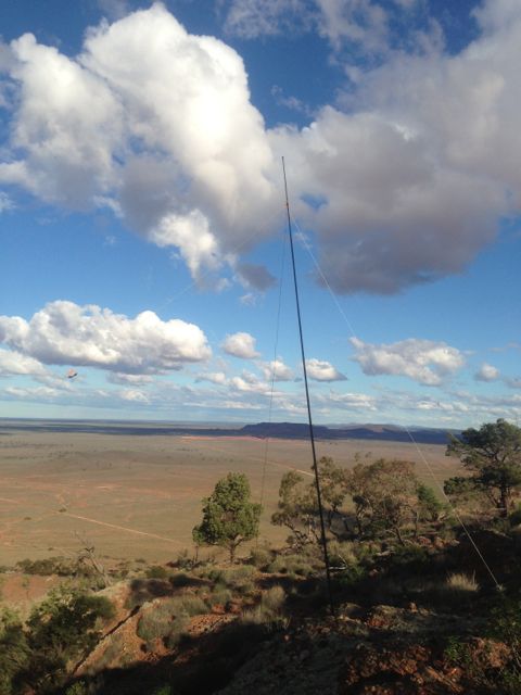
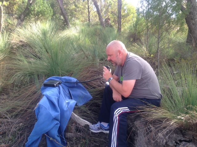
We set up the dipole on the 7m squid pole, just off the Heysen trail, down from the summit. The tower at the top is very big, with lots of antennas for TV and radio, so I expected there would a lot of noise generated from it. It paid off because the noise floor where I activated was very low.
My first QSO of the day was a Summit to Summit, with Wayne, VK3WAM, who was portable on Gurdgaragwurd / D’Alton Peak, VK3/ VW-001. Wayne had a great signal and was very strong. After working Wayne, he kindly allowed me 7.090 and I put out a CQ call. Many of the regular Chasers came back including Ernie VK3DET, Tony VK3CAT, Rik VK3KAN, Brian VK5FMID, and John VK5FTCT. All had terrific signals.
I managed to work David, VK5KC who was portable in the Red Banks Conservation Park, near Burra. That was a new park for me for the VK5 National & Conservation Parks Award. David had a very strong signal and was 5/9 on the top of The Bluff.
I also spoke with Allen, VK3HRA who was portable on Mt St Leonards, VK3/ VC-006, and Darren VK3FDJT who was portable on Mount Alexander, VK3/ VN-016. Two more summit to summit contacts was a real pleasure.
I worked a few more of the regular Chasers including Andrew VK2UH, Ron VK3AFW/mobile, Peter VK3PF, Rhett VK3GHZ, Roy VK5NRG, and John VK5BJE.
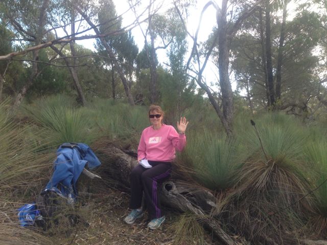
Conditions were very good on 40m. Marija went for a quick walk along the Heysen trail, because I think she was getting bored with being my scribe. So I took the opportunity of jumping onto 20m for a little while. I could hear plenty of good strong DX stations, but unfortunately did not work any on this peak.
I ended up with a total of 33 QSO’s. The majority of those were on 40m SSB, but I did sneak in 5 QSO’s into VK1, VK2, VK4, & VK7 on 20m SSB.
The following stations were worked:- Wayne, VK3WAM/p (SOTA); Ernie VK3DET; Tony VK3CAT; David VK5KC/p (Redbanks CP); VK3OHM; Dave VK3VCE; Rik VK3KAN/p; Brian VK5FMID; John VK5FTCT; Allen VK3HRA/p (SOTA); Andrew VK2UH; Ron VK3AFW/m; Peter VK3PF; James VK1DR; Warren VK3BYD; Ian VK3TCX; Mark VK1MDC; Darren VK3FDJT/p (SOTA); Rhett VK3GHZ; Jim VK5TR; Roy VK5NRG; Barry VK5KBJ; Shaun VK5FAKV; John VK5FMJC/p; Bernard VK3AMB; Colin VK2JCC/qrp; John VK5BJE; David VK5UG; Mark VK1MDC; Peter VK4AAV; Neil VK4HNS/p; Ed VK2JI; and Peter VK7KPC.
Below is a video of the activation, which I have placed on You Tube.
On Sunday morning, 9th June, 2013, my wife Marija and I headed up to Whyalla, which is about 400 kms north of our home in the Adelaide Hills. Our plan was to stay there a week and catch up with family and friends in both Whyalla and down in Port Lincoln at the bottom of the Eyre Peninsula. Marija’s mum, & Marija’s brother and his family live in Whyalla, which is a big mining city (iron ore). Marija’s mum was recovering from knee replacement surgery, so whilst Marija was looking after her during the day, I got permission to go out and play radio during the day.
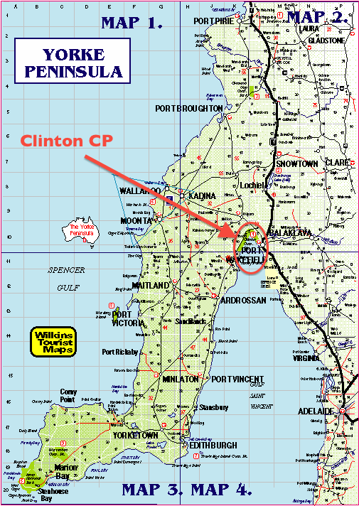
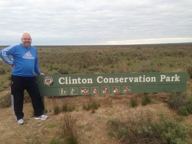
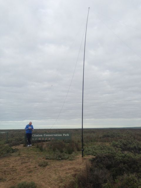
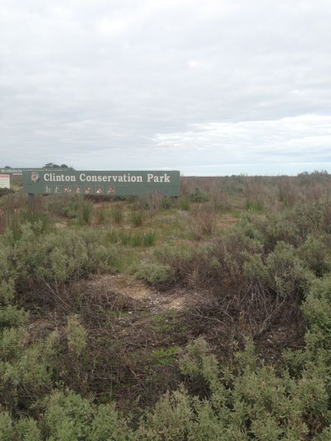
The first radio stop of the trip was the Clinton Conservation Park. The park follows the coastline at the top of Gulf St Vincent. The park commences near the town of Port Wakefield which is about 100 kms north of Adelaide and follows the gulf around in a boomerang shape to the little town of Port Clinton on the Yorke Peninsula. It was gazetted back in 1972.
We had a bit of difficulty accessing the park near Port Wakefield, so we “drove around the corner” onto the Copper Coast Highway, and then onto the Yorke Highway and accessed the park from here, on the western side of the gulf. We followed a short dirt track down off the Copper Coast Highway, but could not get down to the water’s edge due to a no entry sign.
There’s not a huge amount to see here, if you are not into low coastal shrub and saltbush. There are large areas of swampy, marshy ground, and tidal mud flats, which support a large variety of birdlife. The park is large and covers an area of about 1,900 hectares. The nearby Wakefield River flows out into the gulf here which provides a haven for migratory wading birds and acts as a fish nursery.
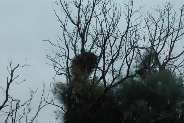
We did spot an Australian Kestrel in a nearby tree, very close to a nest. He/she kept soaring around us and keeping a watchful eye.
The goat was bleating on my i-phone from the SOTA Goat application, so with the help of Marija I quickly set up the gear and my 1st QSO was with Andy VK5LA who was operating portable from the top of Mount Lofty, VK5/ SE-005. Andy had a terrific strong signal. Mount Lofty is located only about 20 kms west of my home qth. This was Andy’s first ever SOTA activation. Congratulations Andy.
I then moved up the band a bit and called CQ, and a few of the regular ‘Hunters’ came back to me including John VK5BJE, Bill VK5MBD, Brian VK5FMID, and Andrew VK2UH.
I then went chasing some of the SOTA fellas again, as the goat kept bleating on my i-phone, and I worked Allen VK3HRA/p on Mount Mitchell VK3/ VN-012, and Marshall VK3MRG/p on Mount Dom Dom VK3/ VN-017, just before the UTC rollover.
Then on the new UTC day, I spoke again with Marshall, and Andy. Also managed to speak with Ron VK3AFW/p who was on the top of Mount Burr VK5/ SE-019, in the south east of South Australia, and also Rick VK3KAN/p who was on the top of Mount Bogong VK3/ VE-001.
I then worked a few more of the regular Park ‘Hunters’ including Roy VK5NRG, and Ernie VK3DET.
From where we set up I could clearly see South Hummocks, VK5/ SE-017, to the north of me. I have operated previously from the top of that summit, and there are great views of the Gulf St Vincent and the Yorke Peninsula from the top.
Conditions on 40m seemed quite good both locally in VK5, and into the eastern states. I ended up with a total of 19 QSO’s which included 7 SOTA contacts, which edged me ever closer to ‘Shack Sloth’. But it was time to pack up and head off to Whyalla.
Stations worked were:- Andy VK5LA/p (SOTA – Mount Lofty); John VK5BJE; Peter VK2TQ; Bill VK5MRD; Brian VK5FMID; David VK5UG; Rick VK4KRX/p; Andrew VK2UH; Peter VK5KX; Allen VK3HRA/p (SOTA – VK3/VN-012); Marshall VK3MRG/p; Chris VK5LTD/p; Roy VK5NRG; Ernie VK3DET; John VK5EMI; Ron VK3AFW/p; and Rick VK3KAN/p.
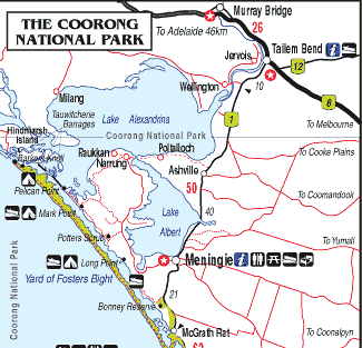
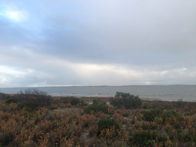
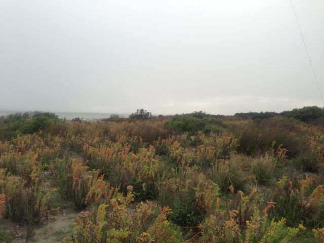
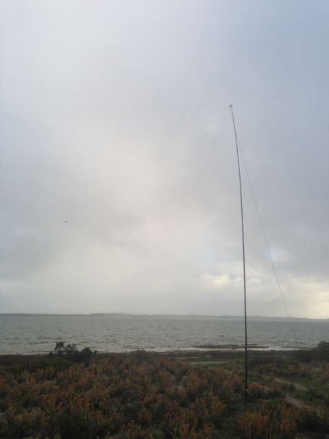
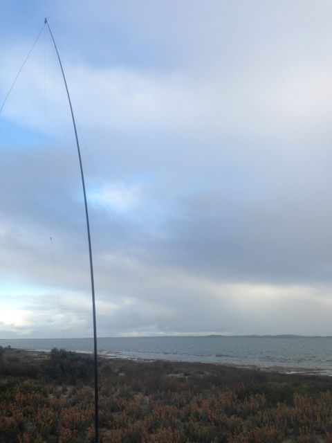
My last activation for Sunday was the Coorong National Park. After packing up at the Mowantjie Willauwar CP, I drove down the Princes Highway and into the town of Meningie, which sits on the shores of Lake Alexandrina, which is Australia’s largest frehwater lake.
I stopped in at the Meningie bakery for lunch, which I can highly recommend. After devouring a locally made pie and cream bun, whilst enjoying the view of the lake, I journeyed on down the road to the Coorong.
The Coorong National Park, which was established in 1966, stretches for a distance of about 130 kms. The western end of the Coorong is located at the mouth of the Murray River near Hindmarsh Island, whilst the eastern end is located near Kingston. The Coorong is approximately 142,500 hectares in size. You may remember this National Park from the 1977 movie called ‘Storm Boy’.
The Coorong consists of a string of lagoons which are protected from the Southern Ocean by the sweeping sand dunes of the Younghusband Peninsula. The area supports a huge array of bird and wild life. In fact some of the birds here are migratory and come from as far away as Siberia.
The exact meaning of the name ‘Coorong’ is open to discussion. It is thought to be a corruption of the local Aboriginal people’s word kurangh, meaning “long neck”; which is a reference to the shape of the lagoon system. The name is also thought to be from the Aboriginal word Coorang, meaning “sand dune”, a reference to the sand dunes that can be seen between the park and the Southern Ocean.
About 5 kms out of Meningie, I turned down Seven Mile Road, and travelled 2kms down to the waterfront, and then headed south along a dirt track through the scrub. It was a little bit boggy and sandy in parts but the Falcon XR6 handled it just fine. The photos below show the operating spot, amongst the low lying coastal vegetation.
Because the area was so sandy & soft I used the squid pole holder to drive into the sand to hold the squid pole in place. No trees here, so the ends of the legs of the dipole were pretty close to the ground. I was set up only about 30 feet from the water.
Compared to the 2 previous activations further inland, the weather was very different here. I was just 30 feet from the freshwater of the Coorong, and the sand dunes and the Southern Ocean were not that far away. I could actually hear clearly the pounding of the waves. So the weather off the ocean was pretty fresh and quite windy. And there was also annoying drizzly rain whilst I set up the antenna.
But for the most part I stayed dry, and had some good contacts on 40m. I managed 2 more SOTA contacts, with Mark VK3PI/p on VK3/VS-033; and then Kevin VK3KAB/p on the top of Gentle Annie VK3/ VT-078.
I also spoke with John VK5BJE/p who was operating from the Onkaparinga River National Park. I had spoken to John earlier from Mowantjie, so obviously John got itchy feet and went out to activate a park, which was great.
After a bit of a run on 40m, I decided to try 20m to see if I could work any DX, but I was a little disapointed. There didn’t seem to be too much activity on 20m. But I did manage to have a very enjoyable QSO with Paul EA5/GM0OPK in Spain, who was romping in, and also my good mate Phil ZL2TZE in New Zealand.
The waters of the Coorong are popular for fishermen, and indeed while I was there I saw about 3 boats heading off, and then returning with their catch. There was a large group of Pelicans waiting to be fed. Over the years I’ve had a good feed of fish that have come from the Coorong area, which is renowned for its Coorong Mullet and Mulloway.
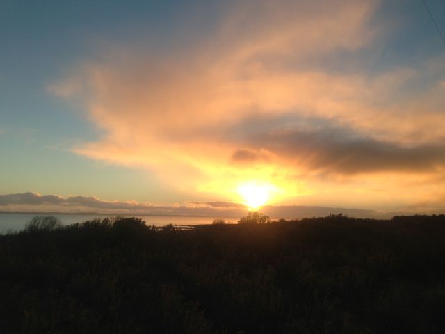
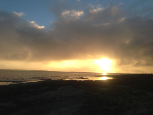
After packing up the gear, I sat back and enjoyed the sunset and then headed home to the Adelaide Hills.
I had a total of 19 QSO’s. Most of those were on 40m. I did manage 3 on 20m into NSW, Spain, and NZ.
The following stations were worked:- Mark VK3PI/p (SOTA); John VK5BJE/p; Ron VK3AFW; Nick VK3ANL; Allen VK3HRA; Brian VK5FMID; Peter VK3PAH; Andy VK5LA; Peter VK3ZPF/m; David VK5KC; Scott VK7NWT; Kevin VK3KAB/p (SOTA); Gerard VK2JNG; Shaun VK5FAKV; Dave VK3VCE; Roy VK5NRG; Adam VK2YK; Paul EA5/GM0OPK; and Phil ZL2TZE.