
Yesterday (Sunday 28th April 2019) I activated Mount Gawler VK5/ SE-013 for the Summits on the Air (SOTA) program, which is located in the Mount Gawler Native Forest Reserve VKFF-2888.
I have activated Mount Gawler many times previously, but this was a new calendar year and I would pick up another 2 SOTA activator points. This brings my SOTA activator points up to 397. At this rate, I will end up getting to Mount Goat level by the time I am 65. A big fat 1,000 points are required to reach the illustrious Mountain Goat level.
This was to be a first-time activation of the Mount Gawler Native Forest Reserve VKFF-2888, which has only just recently been added to the World Wide Flora Fauna (WWFF) program.
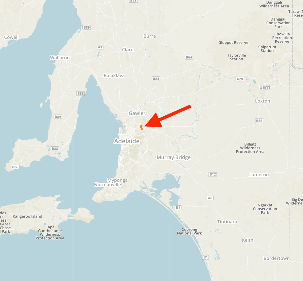
Mount Gawler is located near Kersbrook in the Adelaide Hills, about 35 km northeast of the city of Adelaide.
Above:- Map showing the location of the Mount Gawler Native Forest Reserve. Map courtesy of Protected Planet.
I left home at around 10.30 a.m. and headed towards Kersbook. It is a beautiful drive from my home in Mount Barker, north out through the Mount Lofty Ranges ‘Adelaide Hills’, through the towns of Nairne, Woodside, Lobethal, Gummeracha and then Kersbrook.
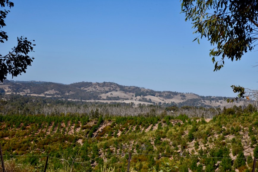
I travelled down Checker Hill Road towards the South Para Road and admired the terrific views towards Mount Gawler. Checker Hill Road is often used in the Tour Down Under cycle race as part of the King of the Mountain Hill climb.


The Union Cycliste Internationale (UCI) categories Checker Hill as a category 2 climb (the second hardest). Checker Hill is described as short but fierce, boasting an average gradient of 14.2%, with a maximum of around 20%. It has been described as a challenge even for the pros to conquer.
I then travelled into the town of Kersbrook which was named in 1841 by John Bowden who had arrived in South Australia aboard the Royal Admiral in 1838. He took up land in the district and called his property ‘Kersbrook’ after his birthplace in Cornwall, England.
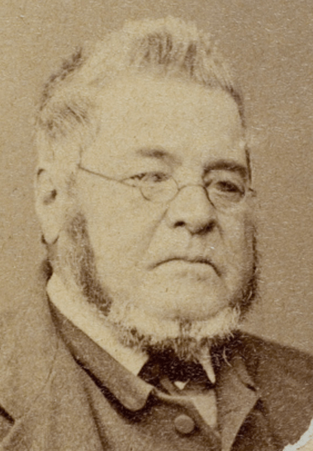
Above:- John Bowden, who founded Kersbrook. Image courtesy of SA State Library
I then travelled west on the Kersbrook-One Tree Hill and soon reached Mount Gawler Road where I turned left. On your right, you will see a sign for Mount Crawford Forest. This is on the western side of Mount Gawler Road. This is not the park. Nor is the pine plantation on the eastern side of the road. The park is a little further up on the eastern side of the road.
Above:- The pine plantation near the corner of Kersbrook Road & Mount Gawler Road.
This area was devastated by the Sampson Flat bushfire in January 2015. The fire was the most destructive in the Adelaide Hills for more than 30 years. It burnt an area of 12,569 hectares and destroyed 24 homes, 146 other structures, and five business premises. The majority of the Mount Gawler Native Forest Reserve was burnt out.
The Kersbrook Native Forest Reserve is part of the Mount Crawford Forest Reserve. It is 1,044 hectares in size and is a significant conservation area as it is representative of the original vegetation in the Southern Mount Lofty Ranges.


The park has two distinct sections. One on the eastern side of Mount Gawler Road, and the other on the western side of the road.
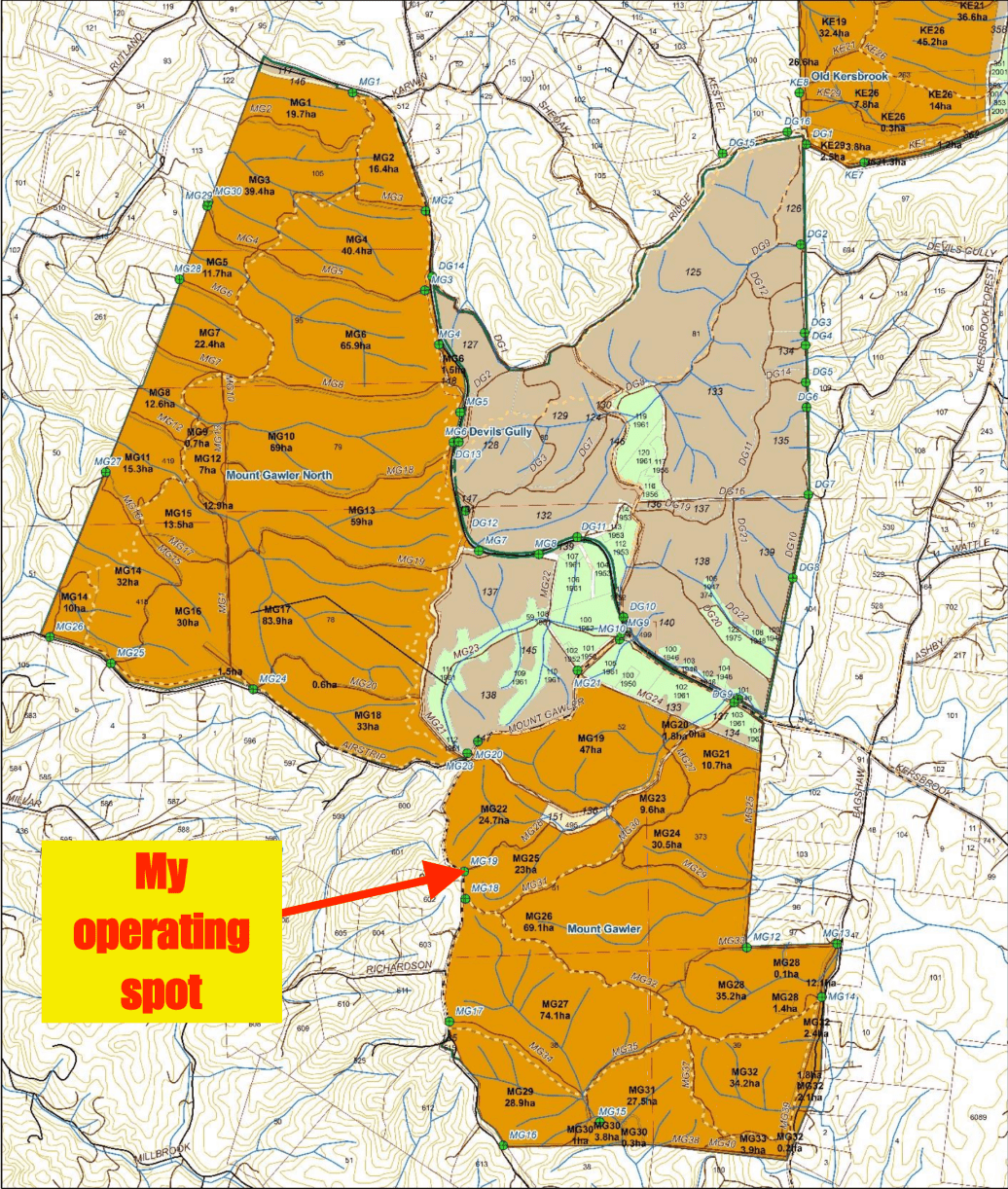
Above:- Map showing the Mount Gawler Native Forest Reserve, and my operating spot. Map courtesy of Forestry SA
Numerous native bird species can be found in the park, however, it is suspected that bird abundance and diversity has been reduced due to loss of habitat resources. The Nationally Endangered Chestnut-rumped Heathwren was recorded in Mount Gawler prior to the Sampson Flat bushfire.
Native mammals found in the park are Western Grey kangaroo, Yellow-footed antechinus, koala, Short-beaked echidna, and Common Brush-tailed possum.
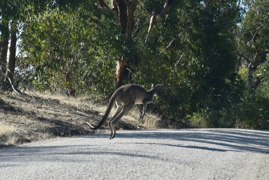
Above:- A Western-grey kangaroo I encountered on the Mount Gawler Road.
Mount Gawler is 541 metres above sea level and is the most activated SOTA summit in South Australia. It was first activated by Andy VK5AKH and has been activated 35 times since.
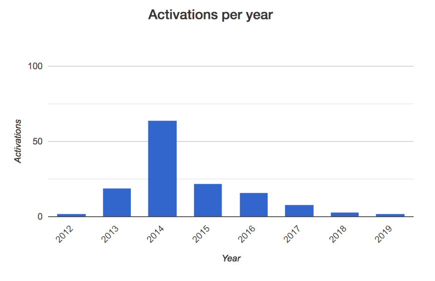
Above:- Graph showing activations per year of Mount Gawler VK5/ SE-013. Graph courtesy of Summits on the Air.
I set up just inside gate MG19, which is almost directly opposite the Mount Gawler trig point. The trig point is located on private property. This is well and truly within the activation zone of Mount Gawler. I made a few trips to and from the car, and as this was an easy activation I had the luxury of my fold up table and deck chair.
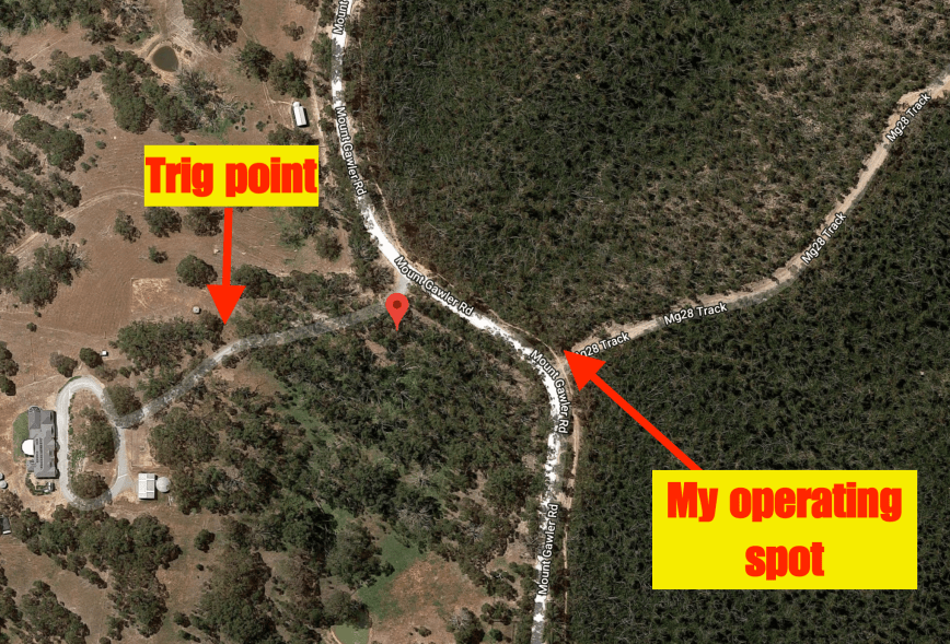
Above:- An aerial view of Mount Gawler, showing the location of the trig point, and my operating spot. Image courtesy of google maps.
There were some very nice views from here out to the east towards Mount Pleasant and the Eden Valley.


I ran the Yaesu FT-857d, and the 20/40/80m linked dipole for this activation, with a power output of about 40 watts. There was plenty of room to stretch out the dipole.
I headed to 7.144 after setting up and found Mike VK6MB/3 calling CQ from the Chiltern- Mount Pilot National Park VKFF-0620. Mike had a strong 5/9 and reciprocated with a 5/9 for me. I then moved down the band to 7.139 and started calling CQ. Cliff VK2NP in Sydney responded. This was followed by David VK5PL/p who was activating the Little Mount Crawford Native Forest Reserve VKFF-2884.
A few calls later I had my first Summit to Summit in the log for the activation. It was with Bill VK1MCW/2 who was on the top of Mount Mundoonen VK2/ ST-053 near Yass.
As this was a first-time park activation it did not take long for a fairly significant pile up to form. I apologise to those who did not get through. My only advice is not to give up. If you can’t crack the pile up, then stand by on the side, as things generally do slow down.
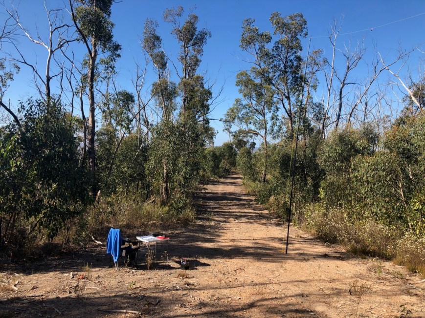
Above:- My shack for the afternoon.
I logged 42 stations in around 30 minutes before callers dried up on 40m. So it was down with the squid pole and out with the 20m links and off to the 20m band. I called CQ on 14.310 and this was answered by Mike VK6MB/2 in the Chiltern-Mount Pilot National Park. It was great to get Mike Park to Park on another band. Although, both out signals were much lower on this band (5/1 both ways).
I logged a total of 18 stations on 20m which included four New Zealand stations: ZL3GA, ZL1BYZ, ZL1WA and ZL4QJ. The Australian States worked on 20m were VK2, VK4, and VK6.
I then lowered the quid pole once again and inserted the links for the 80m section of the antenna. I logged my wife Marija VK5FMAZ on 3.615 and then saw a spot go up on parksnpeaks for Liz VK2XSE/p who was on 3.610 activating a park. I moved down to 3.610 and logged Liz who was in the South West Woodland Nature Reserve VKFF-2724.
I then moved back to 3.615 and logged a further 5 stations, all from South Australia. Despite conditions on that band being excellent, they were my only stations logged on the 80m band.
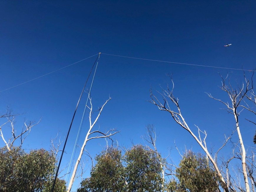
Above:- The 20/40/80m linked dipole, being support by the 7 metre telescopic squid pole. Note the plane in the top right of the photo.
I moved back to 40m and called CQ on 7.144. This was answered by Ron VK3AHR, followed by Terry VK3UP, and then Robert VK2YMU. A few calls later Liz VK2XSE gave me a shout from the South West Woodland Nature Reserve. Liz’s signal was much stronger here on 40m compared to 80m.
I logged a further 22 stations on 7.144 from VK2, VK3, and VK4. This included a Summit to Summit with Gerard VK2IO/p who was activating SOTA peak VK2/ MN-112. Perrin VK3XPT called in once again, using his Clansman military transceiver.
I saw a spot come up on parksnpeaks for Tait VK1FTRA who was activating a SOTA summit on 7.095. Tait was on Black Mountain VK1/ AC-042 which is within the Black Mountain Nature Reserve VKFF-0834. I quickly whizzed down there to log Tait for another Summit to Summit, before returning back to 7.144 where I logged a further 7 stations, including a Summit to Summit with Ben VK3FXBR who was activating Mount Kerang VK3/ VU-010.
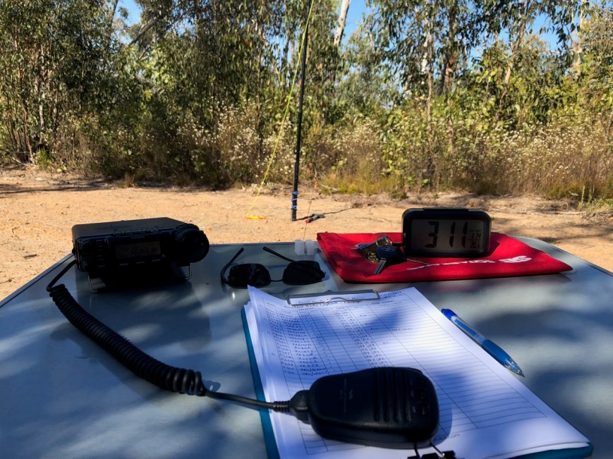
Above:- The transceiver and the log.
It was time to pack up and head off to my next activation, the Kersbrook Native Forest Reserve. It had been a terrific activation with a total of 102 contacts in the log, including 6 Park to Park contacts and 4 Summit to Summit contacts.
Thank you to everyone who called, and a big thank you to those who took the time to spot me.
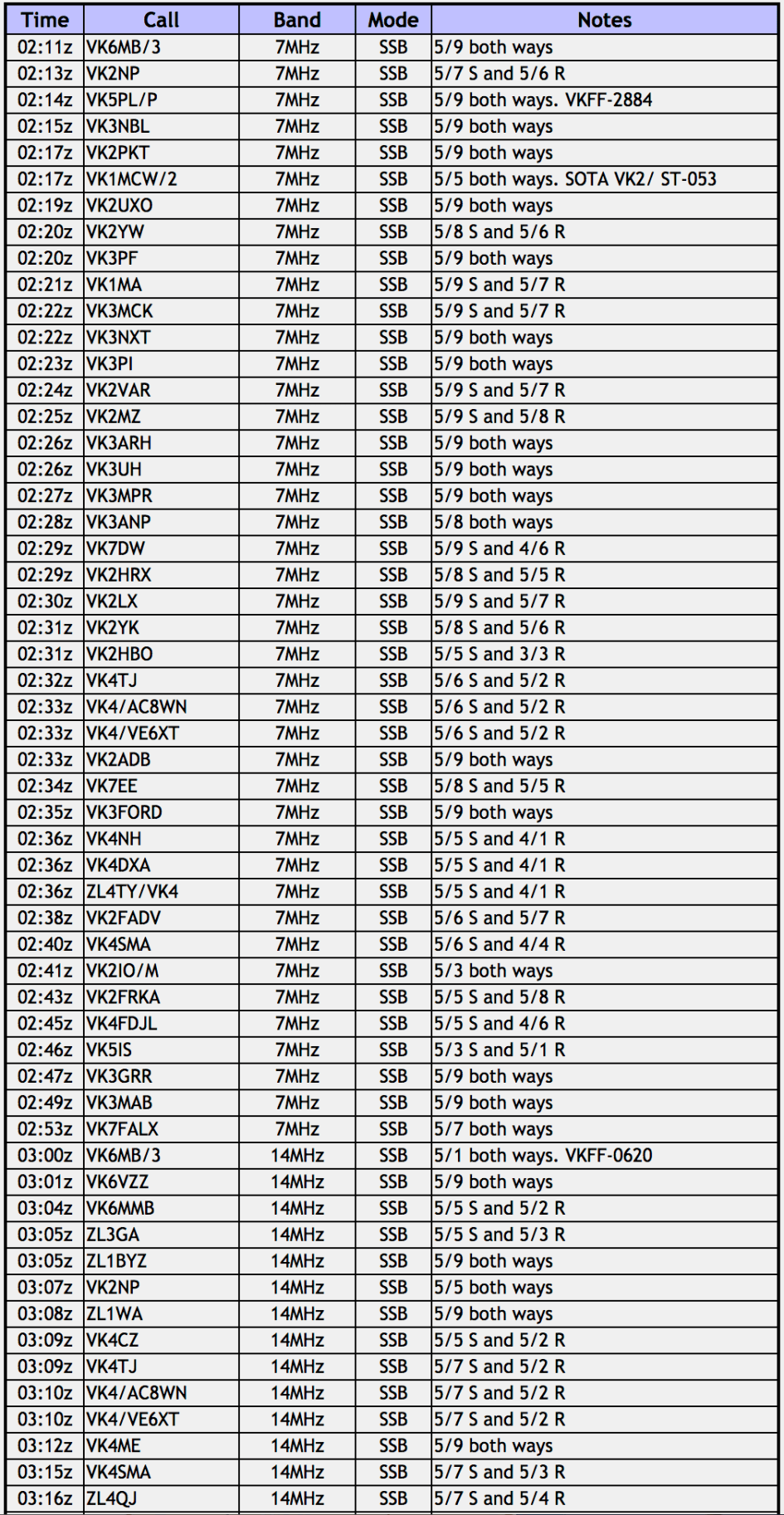
I worked the following stations:-

References.
A Compendium of the Place Names of South Australia, 2019, <http://www.slsa.ha.sa.gov.au/digitalpubs/placenamesofsouthaustralia/>, viewed 29th April 2019
Bushfire & Natural Hazards, 2019, <https://www.bnhcrc.com.au/news/2016/sampson-flat-fire-research-findings>, viewed 29th April 2019.
Forestry SA, 2016, Kersbrook & Mount Gawler Native Forest Reserves Management Plan.
Summits on the Air, 2019, <https://www.sota.org.uk>, viewed 29th April 2019
