
Today (Monday 3rd June 2019) was my first of 2 days off after working 7 straight shifts at work. Sadly the weather was less than ideal, with shower activity all morning and a very chilly temperature of around 10 deg C. I had an itchy PTT finger and was keen to get out to do an activation. I waited until after lunch when the weather cleared a little, and packed the 4WD and headed down to the Congeratinga Native Forest Reserve VKFF-2896 on the Fleurieu Peninsula.

Above:- Map showing the location of the Congeratinga Native Forest Reserve. Map courtesy of Protected Planet.
I travelled to the town Meadows and then through Mount Compass, and headed south on the Victor Harbor Road. Upon reaching Victor Harbor, I stopped briefly to admire the view from Range Road.


I headed west out of Victor Harbor on the Range Road and soon reached the area of Parawa. This is beautiful countryside, and there are some great views to be enjoyed from Range Road of the surrounding countryside.


After about an hour and twenty minutes on the road, I reached the Reserve. It was well signposted.


Congeratinga Native Forest Reserve forms part of the Second Valley Forest Reserve. Nearby Native Forest Reserves are Kalamunda and Springs Road. Together they comprise 250 hectares of native vegetation.
Congeratinga is located on the northern side of Range Road, with a small section also located on the southern side of Range Road. The reserve is about 77.3 hectares in size. Commercial pine plantations are located to the west of the reserve, with cleared farming land located on the other boundaries of the reserve. The Congeratinga River flows through the reserve.
Native mammals found in the reserve include the Western Grey Kangaroo, Short-beaked Echidna, Yellow-footed Antechinus, Bush Rat, and the Southern-brown Bandicoot. It is believed that the endangered Southern Emu-wren is located in the reserve.


I found a small 4WD track which ran adjacent to Range Road. I drove down the boggy track which followed the southern boundary of the reserve. There was plenty of room here to stretch out the 20/40/80m linked dipole. I ran the Yaesu FT-857d and 40 watts output for this activation.
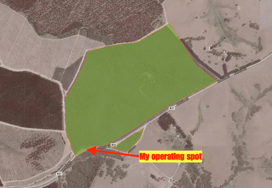
Above:- An aerial shot of the Congeratinga Native Forest Reserve, showing my operating spot. Image courtesy of Protected Planet.
I was set up and ready to go by about 2.30 p.m. local time. I found Rob VK4HAT/p on 7.144 calling CQ from Kurwongbah Park Nature Refuge VKFF-2868. After logging Rob Park to Park I moved up the band to 7.150 an asked if the frequency was in use. Dennis VK2HHA came back to let me know the frequency was clear. I logged Dennis, followed by Peter VK3PF, and then Ron VK3AHR.
It was a weekday, but I was very pleased to have a steady flow of callers. Contact number 10, qualifying the park for me for VKFF, was with Tom VK3ATO. I logged a total of 35 stations on 40m before callers slowed down. So it was down with the squid pole, and I inserted the links for the 80m band.
Unfortunately, I had no mobile phone coverage. But thanks to some very kind hams I was spotted on parksnpeaks. I logged a total of 6 stations on 80m. Two of those were from VK5, and four from VK3.
I then moved to the 20m band where I logged a total of 8 stations from VK3, VK4, and VK6. To conclude the activation I moved back to 40m where I logged a further 5 stations, before packing up and heading home.
I had qualified the park, with a total of 54 contacts in the log.

Above:- My operating spot for the afternoon.
I worked the following stations on 40m SSB:-
- VK4HAT/p (Kurwongbah Park Nature Refuge VKFF-2868)
- VK2HHA
- VK3PF
- VK3AHR
- VK4FDJL
- VK2NP
- VK3MIJ
- VK2YW
- VK7JON
- VK3ATO
- VK7FOLK
- VK2LEE
- ZL1TM
- VK2MG
- VK3FPSR
- VK5LG
- VK4TJ
- VK4/AC8WN
- VK4/VE6XT
- VK3UH
- VK2DWP/m
- VK2IO/m
- VK4VXX/2
- VK2UPR/p
- VK3FT
- VK4PDX
- VK4RF
- VK4HA
- VK3MKE
- VK2BHO
- VK4SMA
- VK7KT
- VK2DXM/m
- VK2ARL
- VK3MCK
- VK2UH
- VK3FKL
- VK2VW
- VK2MOP
- VK7QP/2
I worked the following stations on 80m SSB:-
- VK3PF
- VK5WU
- VK3NBL
- VK3RW
- VK3SQ
- VK5AYL
I worked the following stations on 20m SSB:-
- VK4LMB
- VK4HAT
- KH7AVC/VK4
- VK4SMA
- VK4PHD
- VK3PF
- VK3SQ
- VK6QS
I headed north along Hay Flat Road, stopping briefly to have a look at Ingala Falls. It is just a short 250-metre walk from the carpark to the falls.

Above:- Ingala Falls.
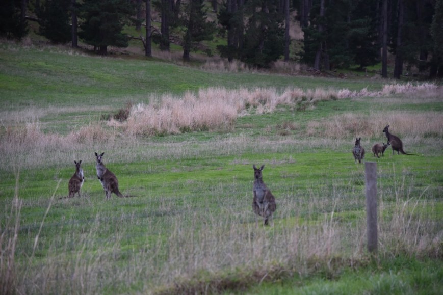
I headed back home through Yankalilla, Myponga, and Meadows. It was slow going home as it was starting to get dark and the kangaroos were out in force.
References.
Forestry SA, 2016, ‘Kalamunda, Springs Road & Congeratinga Native Forest Reserves Management Plan’
