Myponga Conservation Park 5CP-157 and VKFF-0921

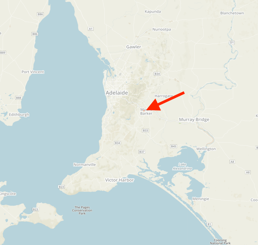
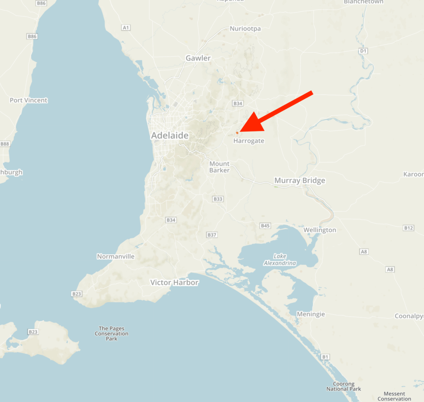
My final park for the 2019 VK Shires Contest was the Myponga Conservation Park 5CP-157 & VKFF-0921 which is located in the Yankalilla Council area (YD5).

The park is located about 67 km south of Adelaide and about 8 km south of the town of Myponga.

Screen Shot 2019-06-10 at 9.45.47 pm.png

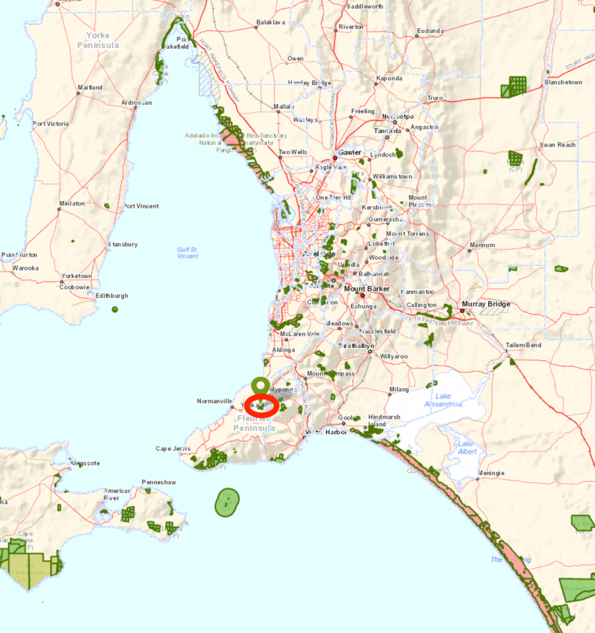
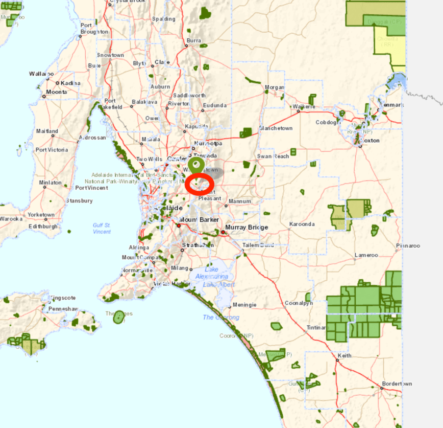
Above:- Map showing the location of the Myponga Conservation Park south of Adelaide.  Map courtesy of Location SA Map Viewer.

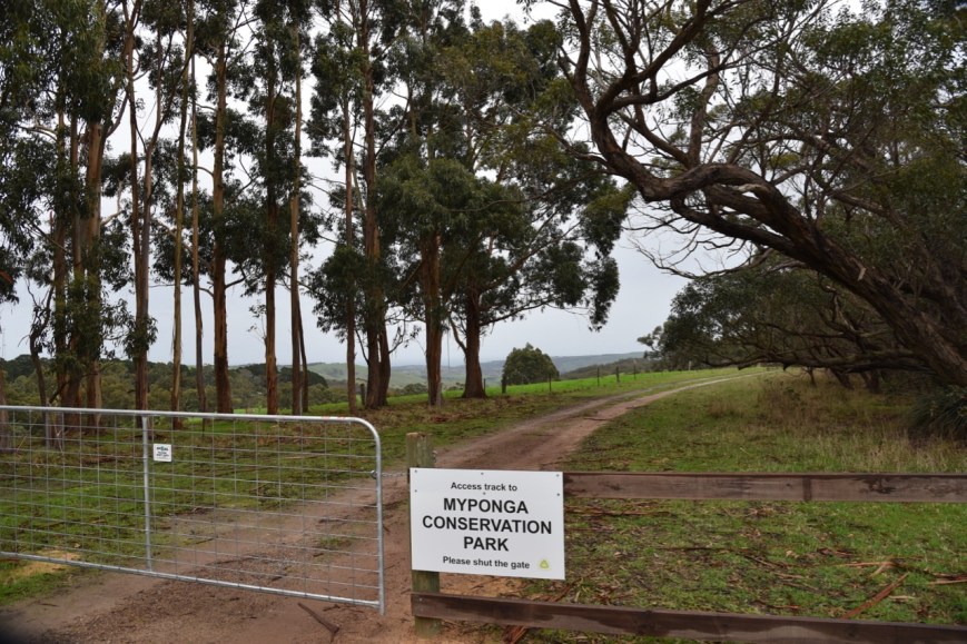
After leaving Mount Billy I travelled along Hindmarsh Tiers Road and then along Springmount Road and then on to James Track.  I soon reached the park.  Since my last visit, there is now a gate which is unlocked.

DSC_7536

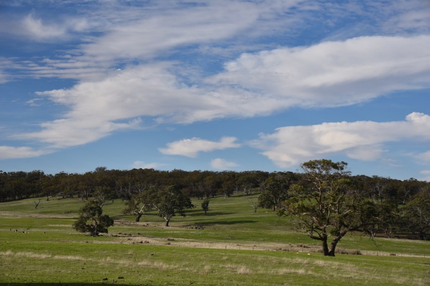
The Myponga Conservation Park is 167 hectares in size and was proclaimed on the 17th February 1997.  It is a hilly park and has several rocky outcrops and waterfalls.  Several habitats exist in the park including Open Forest Over Wet Heaths in the gullies – messmate stringybark and cup gum over prickly tea-tree and heath tea-tree.  Also found is Low Very Open Woodland – cup gum and pink gum over cranberry heath and common fringe-myrtle.

Screen Shot 2019-06-10 at 9.43.56 pm.png

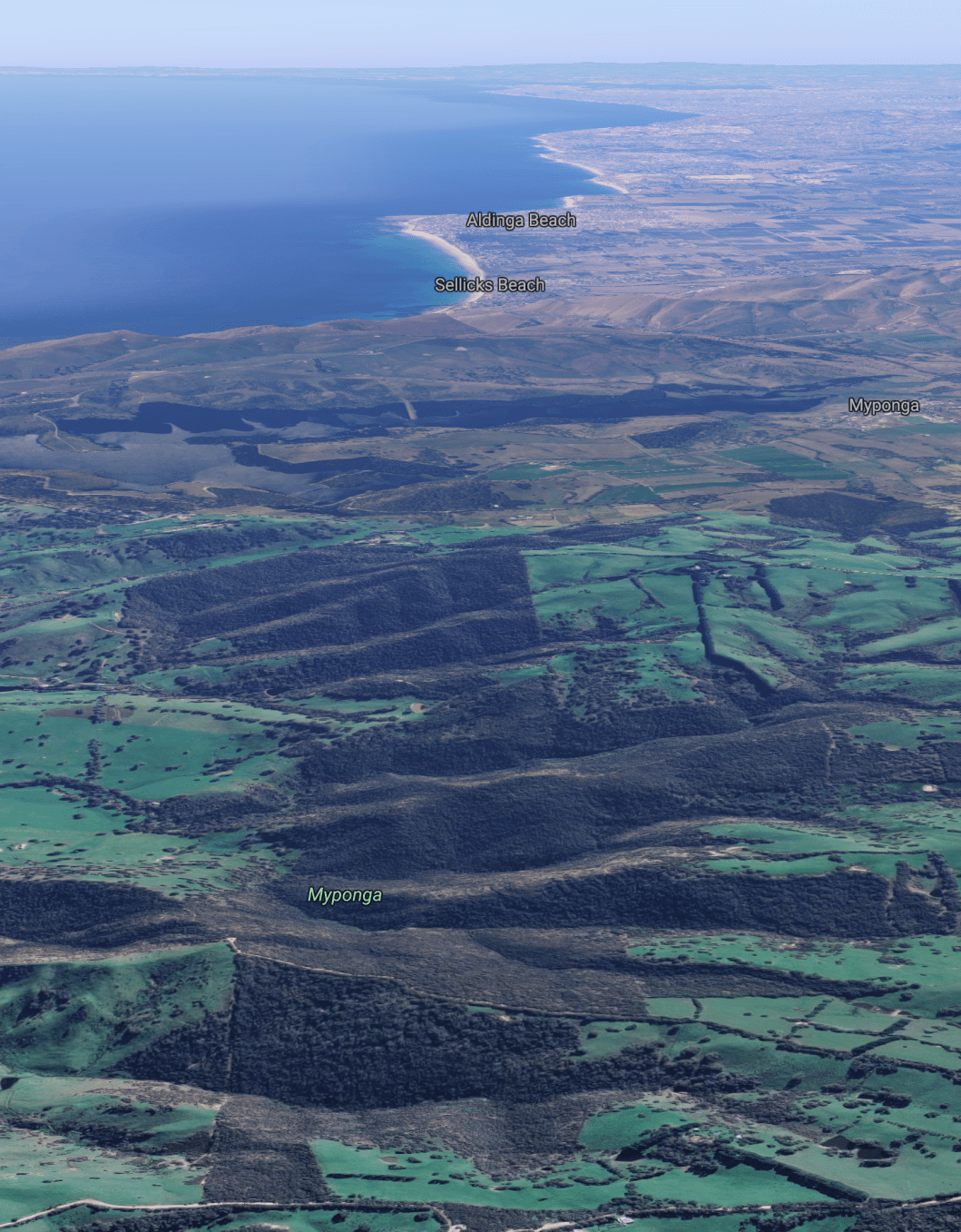
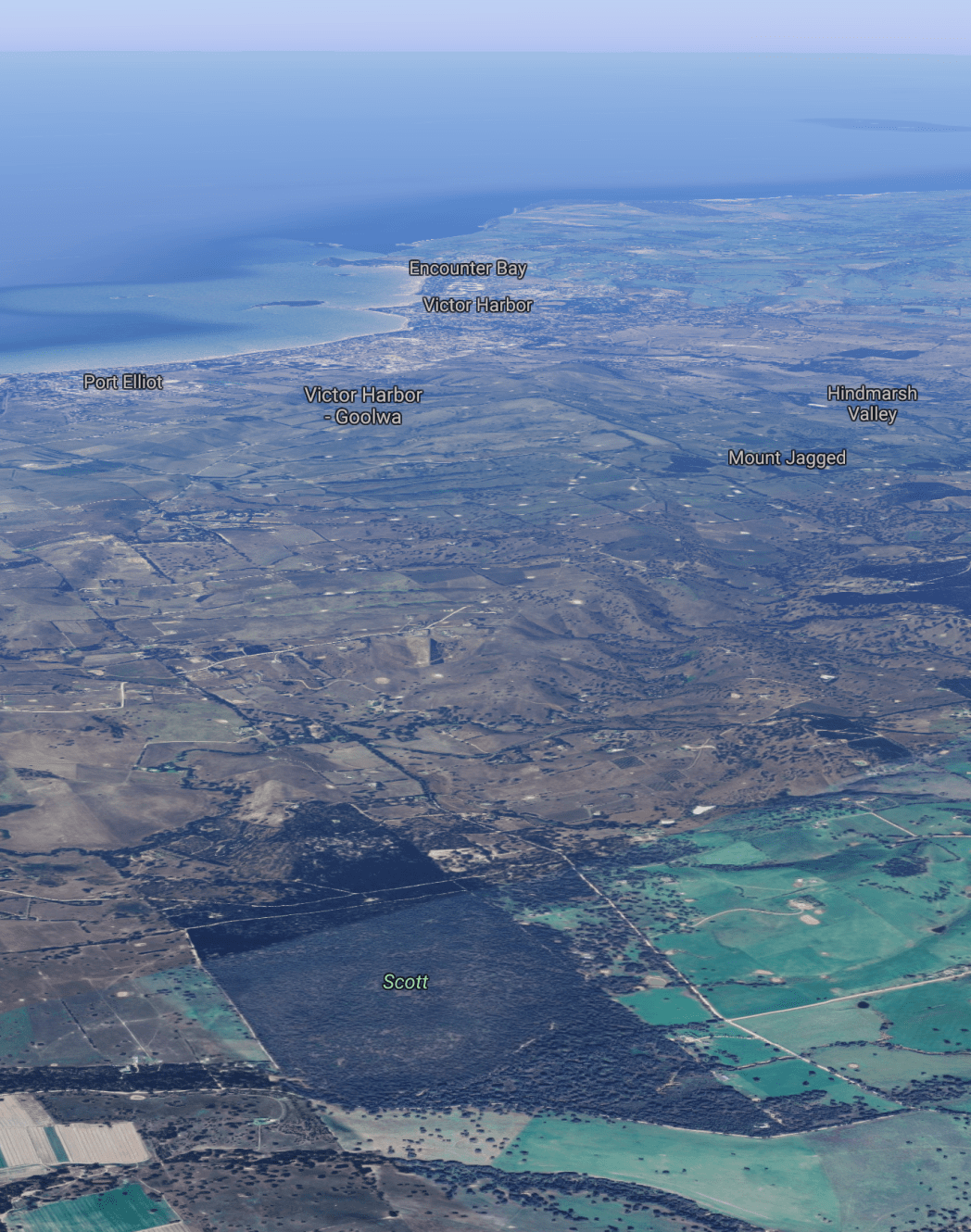
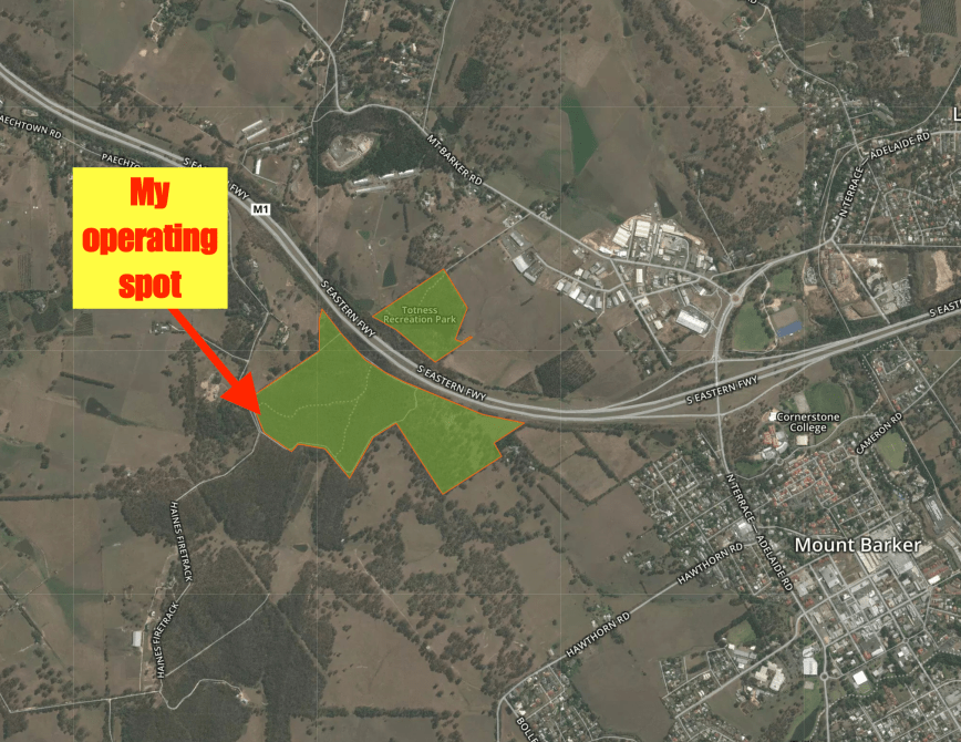
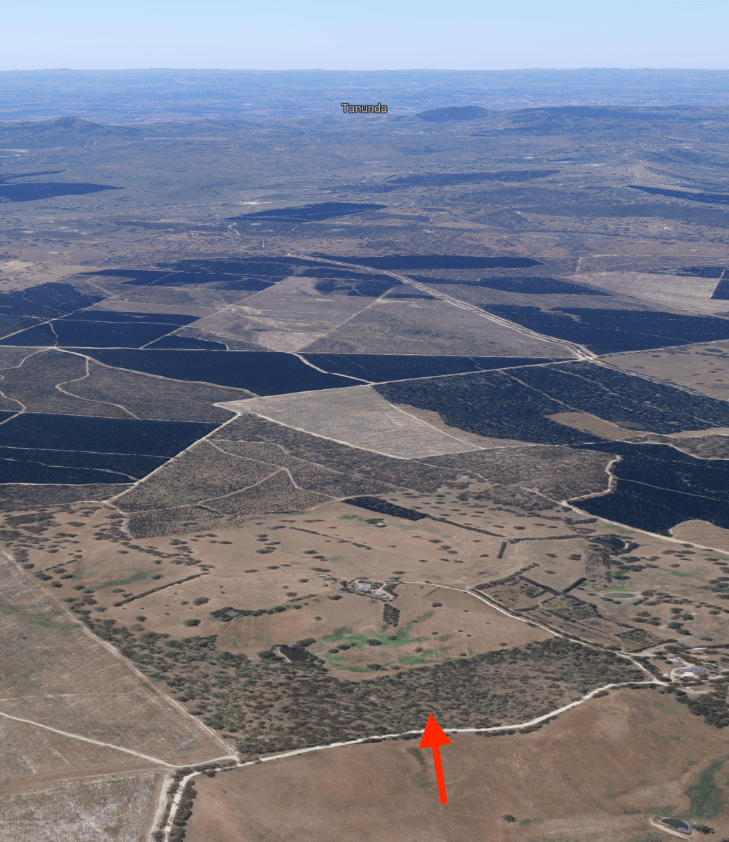
Above:- Aerial view of the Myponga Conservation Park looking north back towards Adelaide.  Image courtesy of Google maps.

More than 68 species of native bird have been recorded in the park including Crescent Honeyeater, New Holland Honeyeater, Australian Golden Whistler, Scarlet Robin, Grey Shrike-thrush, Red Wattlebird, Magpie-lark, Jacky Winter, and Hooded Robin.

Myponga which is at the centre of rich grazing and dairy country.  The name Myponga is derived from the Aboriginal word ‘maippunga‘ meaning locality of high cliffs.  Myponga is a sleepy little town with a population of about 550 people.  Many years ago, large gum trees were felled here and prepared for use in the Broken Hill mines.  A cheese factory was also established and its produce was noted for its high quality, much of which was exported.  This is now part of the Farmers Market.  Another worthwhile place to visit is the Smiling Samoyd Brewery.  In the early 1950s uranium was discovered and mining prospects investigated, however, no mines were developed.

The nearby Myponga Reservoir is fed by the Myponga River and other rivers in the Myponga catchment area.  The Reservoir provides about 5% of the water supply for Adelaide.  Construction of the reservoir commenced in 1958 and was completed in 1962.  The total capacity of the reservoir is 26 800 ML.

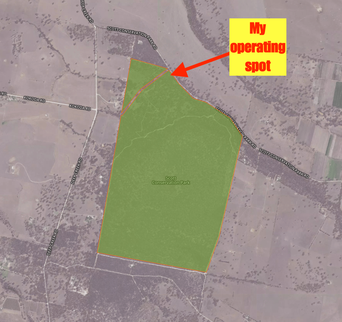
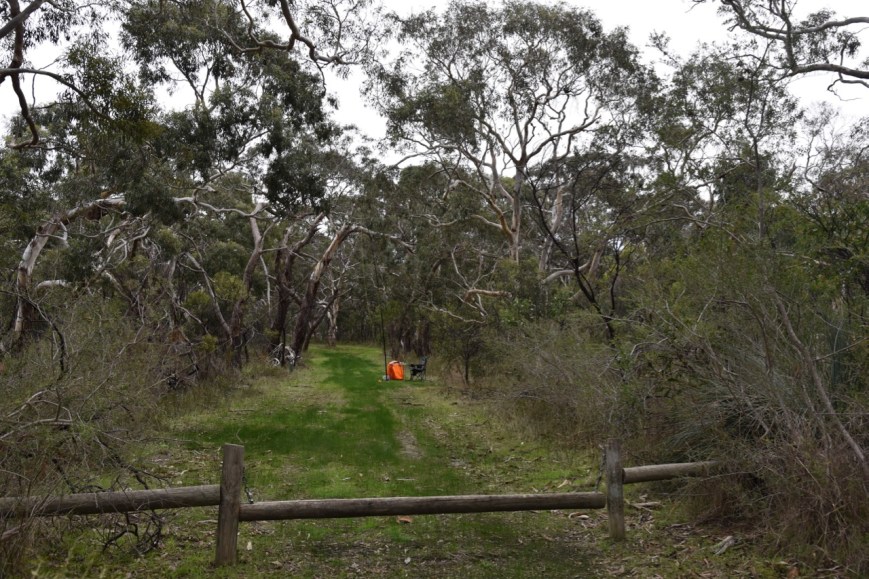
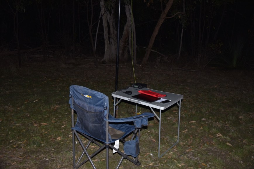
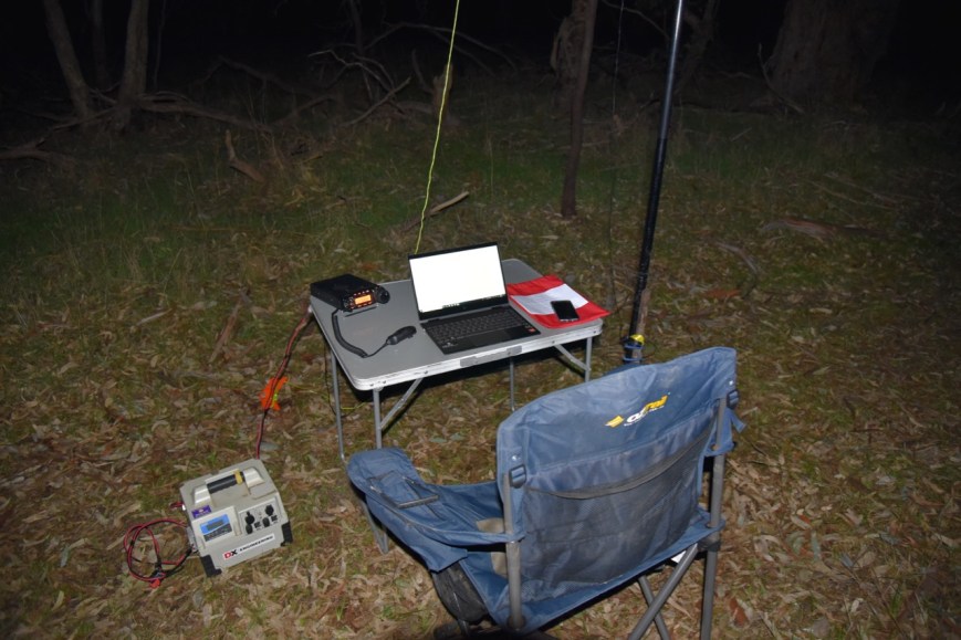
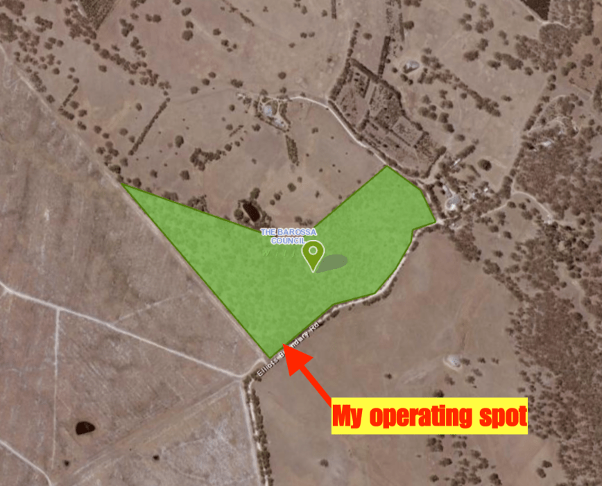
I set up in my normal operating spot along the Heysen Trail which runs off James Track.  This is beyond the gate and is a shared track for cars and walkers, so take care.

Screen Shot 2019-06-10 at 9.45.31 pm.png

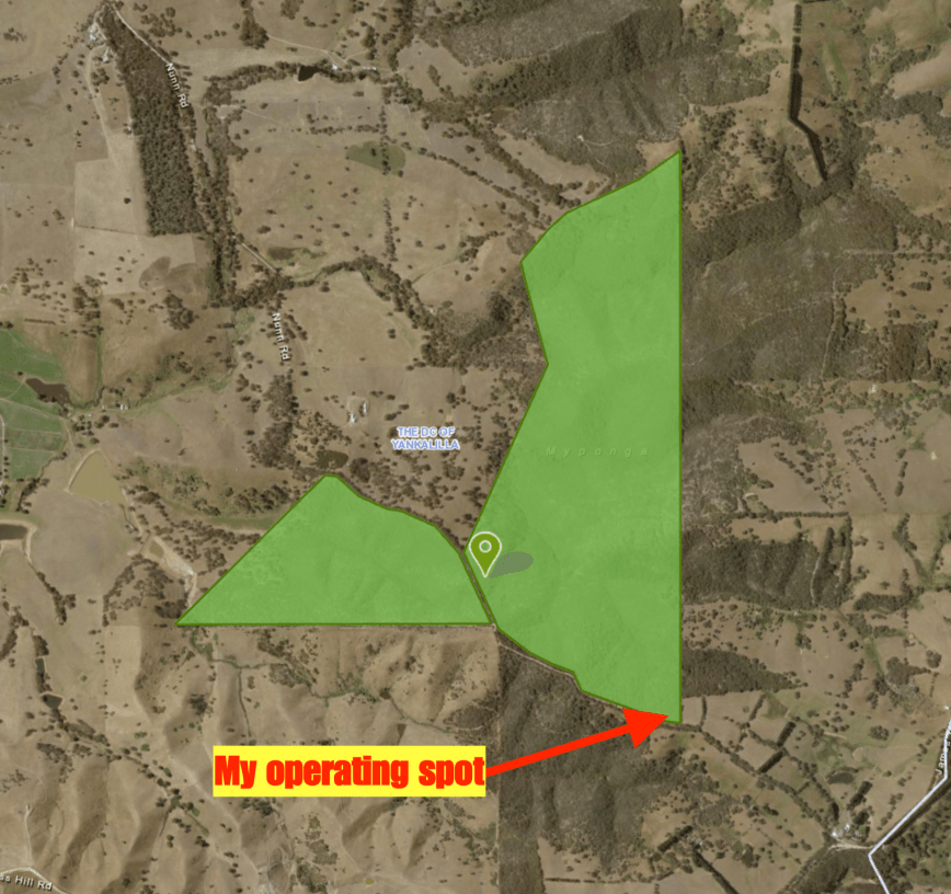
Above:- An aerial view of the Myponga Conservation Park showing my operating spot.  Image courtesy of Location SA Map Viewer.

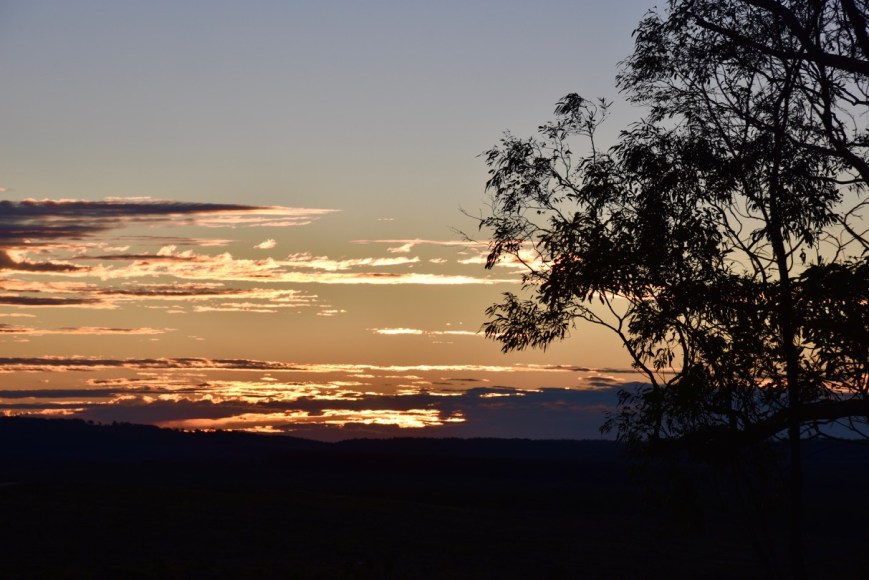
The showers had started to set in.  I started off outside of the car, but when the showers become a little heavy I retreated to the 4WD.  I had left it a little late to get to Myponga, with the time now being 0510 UTC (2.40 p.m. local time).  I had just 50 minutes before the finish of the contest.

I first tuned across the band and logged Roy VK3GB.  I then moved down the band and started calling CQ.  My first taker was Tony VK3XV, followed by Cliff VK2NP, and then Mike VK3MKE.

I logged a total of 43 stations on 40m.  This included three Park to Park contacts: Alan VK2MG/4 in the North Pine Dam Nature Refuge VKFF-2876; Peter VK3TKK/p in the Yarck Nature Conservation Reserve VKFF-2241; and Greg VK4VXX/2 in the Goobang National Park VKFF-0204.

Unfortunately, I did not have enough time to try 20m or 80m.  It was the end of the contest.  I had activated 6 different parks in 6 different shires.  I had logged a total of 310 contacts.  THANKS to everyone who called.

I worked the following stations on 40m SSB:-

  1. VK3GB
  2. VK3XV
  3. VK2NP
  4. VK3MKE
  5. VK7JGD
  6. VK4FARR
  7. VK5FANA
  8. VK2IO/5
  9. VK3SQ
  10. VK2VW
  11. VK3ER
  12. VK4FDJL
  13. VK2MG/4 (North Pine Dam Nature Refuge VKFF-2876)
  14. VK4NH
  15. VK3PF
  16. VK3TIN
  17. VK3TKK/p (Yarck Nature Conservation Reserve VKFF-2241)
  18. VK4TJ
  19. VK3EV
  20. ZL1TM
  21. VK2LX
  22. VK7KT
  23. VK3FRAB
  24. VK5FMAZ
  25. VK3LTL
  26. VK7ALH
  27. VK2GR
  28. VK3ATV
  29. VK2PAW
  30. ZL2AYZ
  31. VK7GH
  32. VK4PHD
  33. VK7LH
  34. VK3MAB
  35. VK2HMV
  36. VK4VXX/2 (Goobang National Park VKFF-0204)
  37. VK4DCM
  38. VK2MT
  39. VK2WTF
  40. VK4VSM
  41. VK2HHA
  42. VK2VU
  43. VK4SMA


References.

Australia’s Guide, 2017, <http://www.australias.guide/sa/location/myponga/&gt;, viewed 26th September 2017

Birds SA, 2017, <http://www.birdssa.asn.au/location/myponga-conservation-park/&gt;, viewed 25th September 2017

Department of Environment and Natural Resources, 2011, ‘Parks of the Fleurieu Peninsula’.

Wikipedia, 2017, <https://en.wikipedia.org/wiki/Myponga,_South_Australia&gt;, viewed 26th September 2017

Wikipedia, 2017, <https://en.wikipedia.org/wiki/Myponga_Reservoir&gt;, viewed 26th September 2017

Mount Billy Conservation Park 5CP-143 and VKFF-0912

My second park and Shire for the day was the Mount Billy Conservation Park 5CP-143 & VKFF-0912 which is located in the Victor Harbor Council area (VH5).

The park is located about 75 km south of Adelaide and about 14 km north of the town of Victor Harbor.

Screen Shot 2019-06-10 at 9.14.03 pm.png

Above:- Map showing the location of the Mount Billy Conservation Park on the Fleurieu Peninsula south of Adelaide.  Map courtesy of Location SA Map Viewer.

To get to the park after leaving Scott CP, I travelled along Kokoda Road and on to the Goolwa Road.  I then travelled south on the Victor Harbor Road and then turned right onto Pambula Road.  This is beautiful countryside with rolling hills and sea views.

On my way to the park, I experienced irregular showers and it was looking as if I was going to get wet at Mount Billy.

Mount Billy Conservation Park is about 199 hectares in size and represents some of the best preserved mallee and forest, not only on the Fleurieu Peninsula, but also in the entire Mount Lofty Ranges.  Mount Billy summit is located in the southern section of the park, along with the Hindmarsh Valley Reservoir.  Sadly, Mount Billy does not qualify for the Summits on the Air (SOTA) program.

The park is, as you would suspect, home to a large amount of native wildlife and native birds.  This includes Western Grey kangaroos, the Southern Brown Bandicoot and the endangered Bassian Thrush.

The scrub within the park is very thick and consists of Pink Gum, Blue Gum, Cup Gum, Woodland Sheaok, Banksias, flowering orchids, and ferns.

I set up in the eastern section of the park off Hindmarsh Tiers Road.  Again I ran the Yaesu FT-857d, 40 watts, and the 20/40/80m linked dipole for this activation.  I waited a few minutes for some showers to clear and then started calling CQ, with the bothy bag close at hand.

Screen Shot 2019-06-10 at 9.13.49 pm.png

Above:- Aerial view of the Mount Billy Conservation Park showing my operating spot.  Image courtesy of Location SA Map Viewer.

I found a quiet spot on the 40m band and started calling CQ.  First in the log was Catherine VK7GH, followed by Andrew VK3LTL and then Megan VK3TIN.  I logged a total of 44 contacts from VK2, VK3, VK4, VK6, VK7, and New Zealand.  This included three Park to Park contacts: Alan VK2MG/4 in the Kurwongbah Nature Reserve  VKFF-2868; Greg VK4VXX/2 in the Goobang National Park VKFF-0204; and Mark VK4SMA/p in the Mount Crosby Weir Nature Refuge VKFF-2873.

I then moved to the 20m band where I logged a total of 4 stations, all from Queensland, including a Park to Park with Mark VK4SMA/p in the Mount Crosby Weir Nature Refuge VKFF-2873.

To conclude this activation I called CQ on 80m where I logged 6 stations including a Park to Park with Peter VK3TKK/p who was in the Gobur Nature Conservation Reserve VKFF-2096.

I was now a bit pressed for time, and with 54 contacts in the log, I packed up and headed to the Myponga Conservation Park.

I worked the following stations on 40m SSB:-

  1. VK4HH
  2. VK7GH
  3. VK3LTL
  4. VK3TIN
  5. VK5FANA
  6. VK3AHR
  7. VK3MAB
  8. VK6POP
  9. ZL2AYZ
  10. VK3XV
  11. VK2NP
  12. VK7FJFD
  13. VK6YTS
  14. VK3MHZ
  15. VK3ER
  16. VK3PF
  17. VK3SQ
  18. VK4FBOL
  19. ZL1TM
  20. VK2LX
  21. VK7KEV
  22. VK4TJ
  23. VK2MG/4 (Kurwongbah Nature Reserve  VKFF-2868)
  24. VK3ATO
  25. VK4VXX/2 (Goobang National Park VKFF-0204)
  26. VK4FDJL
  27. VK3ZNK
  28. VK6XN
  29. VK2VW
  30. VK4RF
  31. VK4HA
  32. VK7JGD
  33. VK3PDC
  34. VK2JNA
  35. VK7NET
  36. VK4CZ
  37. VK6TWJ/2
  38. VK3NBL
  39. VK2ADB
  40. VK4CPS
  41. VK5FMAZ
  42. VK4SMA/p (Mount Crosby Weir Nature Refuge VKFF-2873)
  43. VK2UXO
  44. VK3GB

I worked the following stations on 20m SSB:-

  1. VK4TJ
  2. VK4SMA (Mount Crosby Weir Nature Refuge VKFF-2873)
  3. VK4PDX
  4. VK4MGL

I worked the following stations on 80m SSB:-

  1. VK3SQ
  2. VK5FMAZ
  3. VK3TKK/p (Gobur Nature Conservation Reserve VKFF-2096)
  4. VK5FANA
  5. VK5PL
  6. VK3PF


Scott Conservation Park 5CP-206 and VKFF-0934

My first park and Shire activation for Sunday 9th June 2019 was the Scott Conservation Park 5CP-206 & VKFF-0934 which is located in the Alexandrina Council area (AX5).

The park is located about 76 km south of Adelaide and about 4 km north west of Currency Creek.

Screen Shot 2019-06-10 at 8.30.22 pm.png

Above:- Map showing the location of the Scott Conservation Park on the Fleurieu Peninsula south of Adelaide.  Map courtesy of Protected Planet.

The Scott Conservation Park is 210 hectares in size.  The park was first proclaimed in 1969 and re-proclaimed as Scott Conservation Park on 27th April 1972.  The park is relatively flat and is situated east of the Mount Lofty Ranges.  The park consists of Blue and Pink gum woodlands.

Screen Shot 2019-06-10 at 8.28.06 pm.png

Above:- An aerial view of the Scott Conservation Park looking towards Victor Harbor.  Image courtesy of Google maps.

Birds SA have recorded a total of 148 native bird species at Scott.  This includes Common Bronzewing, White-throated Treecreeper, Superb Fairywren, New Holland Honeyeater, Red Wattlebird, Grey Shrike-thrush, Cockatiel, Eastern Rosella, Tawny-crowned Honeyeater,  Restless Flycatcher, Hooded Robin, and Eastern Shrike-tit.

Upon leaving home the weather was not looking good.  The Adelaide Hills were experiencing occasional light showers and they continued as I reached the Fleurieu Peninsula.

I accessed the park via Gould Road which runs off the Alexandrina Road (Strathalbyn – Goolwa Road).  I parked the car in the small car parking area and walked a short distance down an access track.

Screen Shot 2019-06-10 at 8.30.11 pm.png

Above:- An aerial shot of the Scott Conservation Park showing my operating spot in the northern section of the park.  Image courtesy of Protected Planet.

I was still getting the occasional very light shower after setting up, so I had the bothy bag ready.  You can see the bright orange bothy bag in the photograph below.

I found a clear spot on 40m and started calling CQ contest.  First in the log was Brian VK4VAZ, followed by Angus VK2SB, and then Ken VK7DY.  My sixth contact was with Andrew VK1DA/2 who was activating SOTA summit Mount Marulan VK2/ ST-039.

It was pleasing to have a steady flow of callers and reasonably good band conditions.  It was just a shame about the shower activity.

I logged a total of 36 stations on 40m including two Park to Park contacts: Rob VK4SYD/p in the Samford Conservation Park VKFF-1639, and Angela VK7FAMP/p in the Cape Deslacs Nature Reserve

DSC_7526

I then moved to the 20m band where I logged a total of 4 stations, three from Queensland, and one from New South Wales.  But it was very slow going, as I was unable to self spot on parksnpeaks.

I then moved down to the 80m band and logged just 2 stations, Marija VK5FMAZ and Hans VK5YX.  Again it was very slow going on that band and there is no doubt that the inability to spot reduced the number of regular callers.

To conclude the activation I moved back to 40m where I logged 7 contacts including two further Park to Park contacts: Linda VK7QP/2 in the Ulandra Nature Reserve VKFF-2009, and Alan VK2MG/4 in the Kurwongbah Nature Reserve VKFF-2868.

I had 49 contacts in the log and it was time to move to my next park, the Mount Billy Conservation Park.

DSC_7527

I worked the following stations on 40m SSB:-

  1. VK4VAZ
  2. VK2SB
  3. VK7DY
  4. VK3EV
  5. VK3ER
  6. VK1DA/2 (SOTA Mount Marulan VK2/ ST-019)
  7. VK7GH
  8. VK3MKE
  9. VK7FJFD
  10. VK2LX
  11. VK2PAW
  12. VK3IH
  13. VK3MRG
  14. VK3MDH
  15. VK2NP
  16. VK2FMIA
  17. VK3XV
  18. VK3PF
  19. VK2GR
  20. VK4FDJL
  21. VK3JP
  22. VK4RF
  23. VK4HA
  24. VK4SYD/p (Samford Conservation Park VKFF-1639)
  25. VK5AYL
  26. VK4HH
  27. VK4RZ
  28. VK3LTL
  29. VK7ALH
  30. VK3ZPF
  31. VK3EIR
  32. VK3SQ
  33. VK7JGD
  34. VK3KIX
  35. VK4TJ
  36. VK7FAMP/p (Cape Deslacs Nature Reserve VKFF-2930)
  37. VK7QP/2 (Ulandra Nature Reserve VKFF-2009)
  38. VK7LH
  39. VK3ANL
  40. VK2MG/4 (Kurwongbah Nature Reserve VKFF-2868)
  41. VK2HMV
  42. VK2MIX
  43. VK2TTL

I worked the following stations on 20m SSB:-

  1. VK4HH
  2. VK4SYD/p (Samford Conservation Park VKFF-1639)
  3. VK4TJ
  4. VK2TTL

I worked the following stations on 80m SSB:-

  1. VK5FMAZ
  2. VK5YX


References.

Birds SA, 2018, <https://birdssa.asn.au/location/scott-conservation-park/>, viewed 25th June 2018

Department of Environment and Natural Resources, 2011, ‘Parks of the Fleurieu Peninsula’.

Totness Recreation Park VKFF-1754

My final park for Saturday 8th June 2019 was the Totness Recreation Park VKFF-1754, which is situated in the Mount Barker District Council area (MB5).  The park is located about 40 km east of Adelaide.

Screen Shot 2019-06-10 at 7.50.56 pm

Above:- Map showing the location of the Totness Recreation Park in the Adelaide Hills.  Map courtesy of Protected Planet.

The Totness Recreation Park is 41 hectares (101 acres) in size and was established in 1970.  It is divided into two sections by the busy South Eastern Freeway (the main highway between Adelaide and Melbourne).  The northern section consists of 9 hectares (22 acres) of scrub and a dam.  The southern section comprises 32 hectares (79 acres) of scrub.  The park is surrounded by rural properties which are primarily used for grazing.

The park consists of Messmate Stringybark and Manna Gum woodlands, which at one time prior to European colonisation were common throughout the Mount Lofty Ranges.  More than 180 native plants species have been recorded within the park.  Plant species of conservation significance recorded within the park include the state rare Manna Gum and the regionally rare Spider Orchid.

Screen Shot 2019-06-10 at 8.10.18 pm.png

Above:- Aerial shot of the Totness Recreation Park on either side of the South Eastern Freeway.  Image courtesy of Google maps.

I set up in my normal operating spot off Haines Fire Track.

Screen Shot 2019-06-10 at 7.50.45 pm

Above:- An aerial view of the Totness Recreation Park showing my operating spot.  Image courtesy of Protected Planet.

Once again for this activation, I commenced by calling CQ on the 80m band.  First in the log was my ever reliable wife Marija VK5FMAZ.  This was followed by VK6MIL, VK5PL and VK2GR.

The 80m band seemed to be in very good shape.  There was absolutely no man-made noise on the band from within the park, and the static crashes on the band were quite low.

I logged a total of 42 stations on 80m from VK2, VK3, VK4, VK5, VK6, VK7, and New Zealand.  It was nice to log Andrei ZL1TM and Bill ZL2AYZ in New Zealand.  I also spoke with Perrin VK3XPT using his military Clansman transceiver.

DSC_7524

I then moved to the 40m band and called CQ.  Sadly I logged just the one station there, Steve VK4VCO.  As this was a contest I was unable to self spot on parksnpeaks which normally results in a number of calls.

It was starting to get mighty cold in the park, with the temperature having dropped to 6 deg C.  It was now just after 1200 UTC (9.30 p.m. local time).

DSC_7521

I worked the following stations on 80m SSB:-

  1. VK5FMAZ
  2. VK6MIL
  3. VK5PL
  4. VK2GR
  5. VK6OZ
  6. VK3YE
  7. VK6WB
  8. VK3PF
  9. VK3MKE
  10. VK7GH
  11. VK7JGD
  12. VK5FANA
  13. VK3ANL
  14. VK4SMA
  15. VK2NP
  16. ZL1TM
  17. VK3XPT
  18. VK5LJ
  19. VK2DEK
  20. VK4ATH
  21. VK3ARH
  22. ZL2AYZ
  23. VK3TIN
  24. VK3LTL
  25. VK6MB/3
  26. VK6XN
  27. VK2WGW
  28. VK4XAC
  29. VK6POP
  30. VK5AYL
  31. VK3XV
  32. VK2YW
  33. VK3TJS
  34. VK5HEL
  35. VK2LEE
  36. VK3VEF
  37. VK3CWM
  38. VK2VU
  39. VK2WY
  40. VK5VGC
  41. VK4FAAF
  42. VK3GB

I worked the following station on 40m SSB:-

  1. VK4VCO


References

Government of South Australia, 2007, ‘Totness Recreation Park Management Plan’

Charleston Conservation Park 5CP-041 and VKFF-0777

My second park for Saturday 8th June 2019 was the Charleston Conservation Park 5CP-041 & VKFF-0777.  The park is located in the Adelaide Hills Council area (AH5).

After leaving Wiljani I headed back into Mount Pleasant and on to Birdwood and then Mount Pleasant.  I soon reached the park which is located about 45 km east of Adelaide and about 5 km east of the town of Charleston.

Screen Shot 2019-06-10 at 7.19.38 pm.png

Above:- Map showing the location of the Charleston Conservation Park in the Adelaide Hills.  Map courtesy of Protected Planet.

The Charleston Conservation Park was proclaimed on the 8th April 1976 and comprises 54 hectares (130 acres) of pristine remnant scrub.  The park consists of Woodland with Manna Gum, Rough-barked Manna Gum and Golden Wattle.

The park takes its name from the little township of Charleston.  The town was named after Charles Newman, who left Somersetshire in England in July 1837 under engagement to the South Australian Company as a shepherd.  In 1843 he took up land in the vicinity of Mount Charles and built a home there.  To this day, the Newman homestead remains on Newman Road at Charleston.

Screen Shot 2019-06-10 at 7.36.40 pm.png

Above:- An aerial shot of the Charleston Conservation Park, looking west towards Adelaide.  Image courtesy of Google maps.

I set up in my normal operating spot, off Bellspring Road in the northern section of the park.  I again ran the Yaesu FT-857d and the 20/40/80m linked dipole for this activation.

Screen Shot 2019-06-10 at 7.19.26 pm.png

Above:- An aerial shot of the Charleston Conservation Park showing our operating spot.  Image courtesy of Protected Planet.

As it was now about 0840 UTC (6.20 p.m. local time) and it was dark, I decided to quick off the activation on the 80m band.  I found a clear spot and started calling CQ contest.  First in the log was Mike VK6MB/3, followed by Catherine VK7GH, and then Wayne VK3EV.

DSC_7516

I logged a total of 41 contacts on 80m before callers dried up.  I decided to head to the 40m band, hoping that I might get a little bit of North American DX in the log.  My antenna is a bit of a sky warmer and isn’t ideal for DX, but I have often worked the USA & Canada on 40m during the evenings.

Unfortunately, this was not to be on this occasion.  I worked just 4 stations, with three of those being from Queensland, and one in New South Wales.

I had 45 contacts in the log and it was time to head off to my final park for the day, the Totness Recreation Park.

DSC_7519

I worked the following stations on 80m SSB:-

  1. VK6MB/3
  2. VK7GH
  3. VK3EV
  4. VK5PL
  5. VK5FMAZ
  6. VK3XV
  7. VK2MWK
  8. ZL1TM
  9. VK5FANA
  10. VK3LTL
  11. VK2HRX
  12. VK2HMV
  13. VK2NP
  14. VK2LEE
  15. ZL2AYZ
  16. VK5LJ
  17. VK4SMA
  18. VK4TJ
  19. VK5IS
  20. VK5LTD
  21. VK3ANL
  22. VK3PF
  23. VK3NXT
  24. VK7JGD
  25. VK3ER
  26. VK6XN
  27. VK4FDJL
  28. VK6AHR
  29. VK4KY
  30. VK3GH
  31. VK2IO/5
  32. VK2MT
  33. VK4HH
  34. VK4SN
  35. VK2DEK
  36. VK4CWG/2
  37. VK4PHD
  38. VK2MOP
  39. VK2TTL
  40. VK4PDX
  41. VK2GLJ

I worked the following stations on 40m SSB:-

  1. VK4PDX
  2. VK4FDJL
  3. VK4HKK
  4. VK2TTL


References.

Birds SA, 2019, <https://birdssa.asn.au/location/charleston-conservation-park/>, viewed 10th June 2019

Wikipedia, 2019, <https://en.wikipedia.org/wiki/Charleston_Conservation_Park>, viewed 10th June 2019

Wiljani Conservation Park 5CP-274 and VKFF-1159

My first park for the 2019 VK Shires Contest was the Wiljani Conservation Park 5CP-274 & VKFF-1159, which is located in the Barossa Council area (BA5).  The park is located about 55 km north east of Adelaide.

Screen Shot 2019-06-10 at 10.42.50 am.png

I headed out from home at Mount Barker through the towns of Nairne, Charleston, Mount Torrens and then Birdwood.  I then travelled northeast on the Torrens Valley Road and soon entered into the southern part of the Barossa Valley.

DSC_7501

The Barossa Valley is notable as a major wine-producing region and tourist destination.  The Barossa Valley derives its name from the Barossa Range, which was named by Colonel William Light in 1837. Light chose the name in memory of the British victory over the French in the Battle of Barrosa, in which he fought in 1811.  The name “Barossa” was registered in error, due to a clerical error in transcribing the name “Barrosa”.

This part of the southern Barossa consists of rolling green hills with pockets of native scrub and vineyards.

DSC_7502

The Wiljani Conservation Park was gazetted on the 25th February 2016.  Wiljani was a family group of the Peramangk Aboriginal people whose traditional lands are primarily located in the Adelaide Hills.  The lands of the Tarrawatta and Yira-Ruka (Wiljani) extended to the east down as far as Mount Torrens and Mannum.

I have activated the Wiljani Conservation Park on two prior occasions.  Details of those activations can be found at…….

https://vk5pas.org/2016/05/01/wiljani-conservation-park-5cp-274-and-vkff-1159/

https://vk5pas.org/2017/03/18/wiljani-conservation-park-5cp-274-and-vkff-1159-2/

Screen Shot 2019-06-10 at 11.23.05 am.png

Above:- An aerial view of the Wiljani Conservation Park.  Image courtesy of Google maps.


I accessed the park via Elliotts Boundary Road which runs off Cricks Mill Road which runs north-west out of the town of Mount Pleasant.

Screen Shot 2019-06-10 at 10.39.28 am.png

Above:- An aerial view of the Wiljani Conservation Park showing my operating spot.  Image courtesy of Location SA Map Viewer.

I ran the Yaesu FT-857d and the 20/40/80m linked dipole for this activation.  The linked dipole was supported by a 7 metre heavy duty telescopic squid pole.  My power output was 40 watts.

I called CQ contest on 40m.  First in the log was Laurie VK5LJ.  I logged a total of 53 stations on 40m.  This included three New Zealand stations: Bill ZL2AYZ, Andrei ZL1TM, and Gary ZL1WL.  But the big surprise was a call from Frederic F5USK in France who had a big 5/9 signal.  I also logged Peter VK3PF/p who was activating the Won Wron Flora Reserve VKFF-2488.

I then tried 20m, calling CQ on 14.310, but had no callers.  As this was a contest I was unable to self spot on parksnpeaks.

Prior to packing up I headed to the 80m band where I logged a total of 21 stations including Bill ZL2AYZ and Paul ZL1AJY.

It was time for me to head to my next park.  I had a total of 74 stations in the log.

DSC_7514

I worked the following stations on 40m SSB:-

  1. VK5LJ
  2. VK2FHQQ
  3. VK3EV
  4. VK2VU
  5. VK3XV
  6. VK6QM
  7. VK3TIN
  8. VK4PDX
  9. VK3MKE
  10. VK2UXO
  11. VK3TKK/m
  12. VK4VXX/2
  13. VK2ND
  14. VK7ALH
  15. VK2VIN
  16. VK3ZE
  17. VK3ZMD
  18. VK2MTM
  19. VK3MAB
  20. VK6POP
  21. VK3ERT
  22. VK3WAR
  23. VK6MB/3
  24. VK3MPR
  25. VK4FFKZ
  26. VK3BAP
  27. ZL2AYZ
  28. VK7GH
  29. ZL1TM
  30. VK4CZ
  31. VK3FGDN
  32. VK2YW
  33. VK2NP
  34. VK4SMA
  35. VK2NN
  36. F5USK
  37. VK4FARR
  38. VK4FDJL
  39. VK2PKT
  40. VK4TJ
  41. VK7LH
  42. VK2QK
  43. VK2FAAA
  44. VK3PI
  45. VK3VRO
  46. VK2GLJ
  47. VK3PF (Won Wron Flora Reserve VKFF-2488)
  48. VK3RU
  49. VK4QH
  50. VK3FAIP
  51. VK3CDR
  52. VK4SN
  53. VL2LX
  54. ZL1WL

I worked the following stations on 80m SSB:-

  1. VK5FMAZ
  2. VK4PDX
  3. VK3XV
  4. VK3BSA
  5. VK5FANA
  6. VK3TIN
  7. VK6MB/3
  8. VK3ANL
  9. VK3MKE
  10. VK2YW
  11. VK2IO/5
  12. VK2PAW
  13. VK3ARH
  14. VK3VBC
  15. VK2XJA
  16. VK5NM
  17. VK7JGD
  18. VK2FMEM
  19. VK3EV
  20. ZL2AYZ
  21. ZL1AJY


References.

Wikipedia, 2019, <https://en.wikipedia.org/wiki/Barossa_Valley>, viewed 10th June 2019