
Today (Monday 17th June 2019) the weather had changed dramatically. Yesterday we had a beautiful sunny day for mid-June. But today the cloud cover and occasional showers had rolled in. Despite the weather, I packed the 4WD and headed for a unique park, the Kalamunda Native Forest Reserve VKFF-2894.
The reserve is about 82 km south of the city of Adelaide, and about 6 km south of the town of Yankalilla.
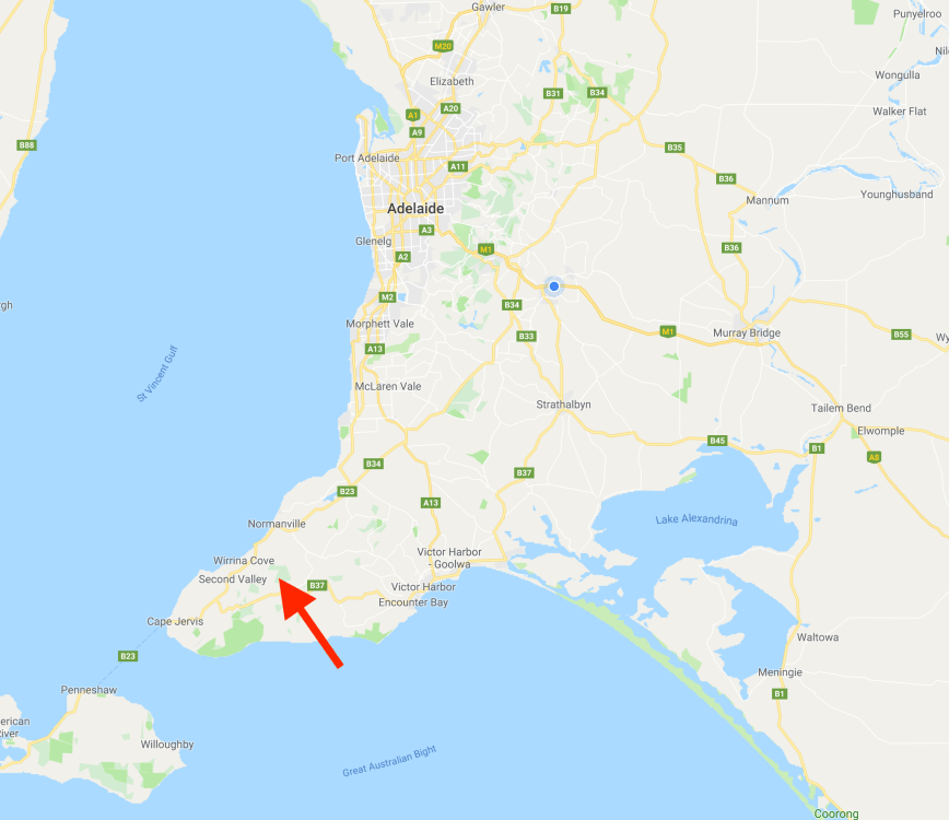
Above:- Map showing the location of the Kalamunda Native Forest Reserve. Map courtesy of google maps.
The Kalamunda Native Forest Reserve (MFR) forms part of the Second Valley Forest Reserve on the Fleurieu Peninsula. Together with the Springs Road Native Forest Reserve and the Congeratinga Native Forest Reserve, the 3 NFR’s comprise 250 hectares of native vegetation. The name Kalamunda comes from the aboriginal words Cala meaning home, and Munnda meaning forest. Thus Kalamunda means ‘A home in the forest’.
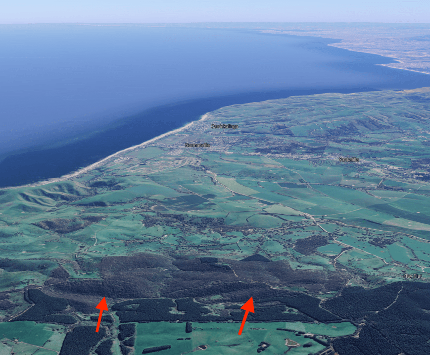
Above:- An aerial shot showing the location of the reserve. Image courtesy of Google maps.
The Kalamunda NFR consists of about 83 hectares of native scrub. It is surrounded by pine plantations and private land which has been cleared for farming purposes. The reserve preserves remnant native vegetation, 15% or less of which now remains on the Fleurieu. Kalamunda contains Pink Gum woodland, Rough-bark Manna gum woodland and Messmate Stringybark forest. The reserve contains a number of native plants which are of high conservation significance including the Nationally vulnerable species Clover glycine.
I travelled from home to Willunga and then took the Victor Harbor Road and then turned right onto Pages Flat Road to the little town of Myponga. I then drove south along Main South Road and soon reached the town of Yankalilla. I then travelled into Normanville and took Hay Flat Road and headed south. I then turned right onto Maple Lane.
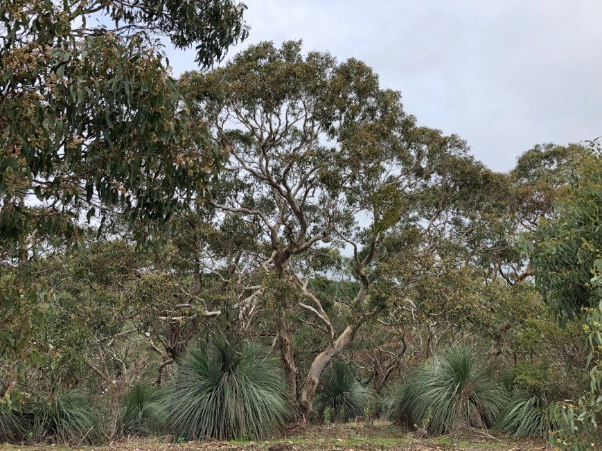
Above:- the start of Maple Lane.
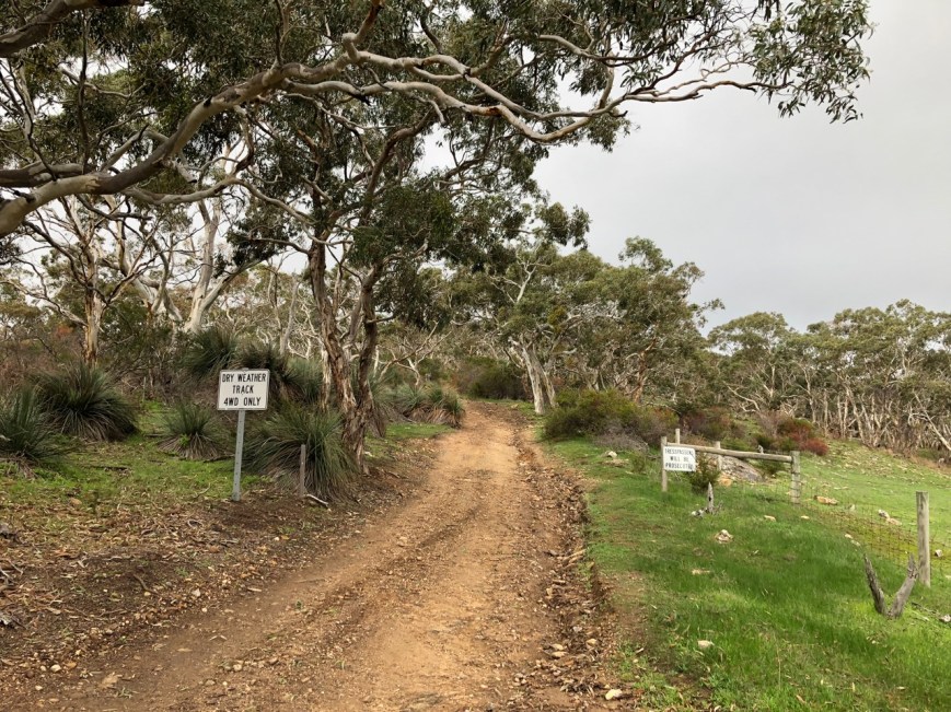
It wasn’t long and I reached two signs, one which read ‘Dry weather track 4WD only’. The other read ‘Trespassers will be prosecuted’. Maple Lane is a government road but I erred on the side of caution and decided not to proceed any further.
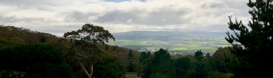
I then headed back to Hay Flat Road and headed south towards Range Road enjoying some of the amazing views of the surrounding countryside on the way.
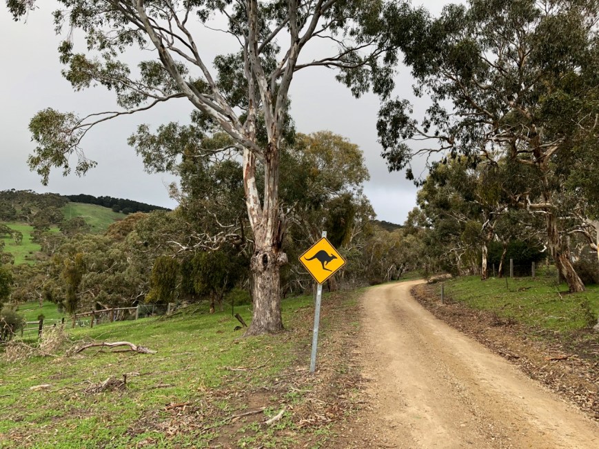
Once I reached Range Road I headed west and then turned right onto Springs Road, and then right again onto Mount Hayfield Road. After a number of kms, I reached Attril Track. There is no gate here and it appears access is allowed on the track.
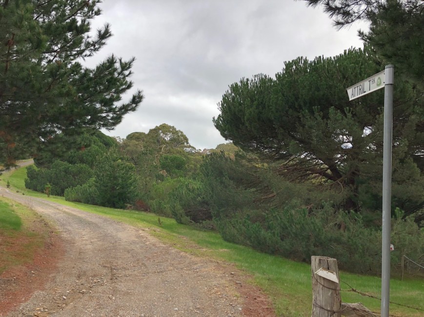
Above:- Attril Track.
It didn’t long and I soon reached the southeastern corner of the park which is adjacent to the pine forest.


There were some great views looking south towards Normanville as I drove along Attril Track.
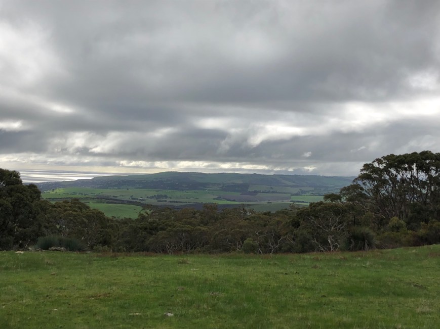
Above:- View to the south towards Normanville from Attril Track.
I parked the 4WD and climbed over the fence into the reserve. I ran the Yaesu FT-857d and the 20/40/80m linked dipole for this activation.
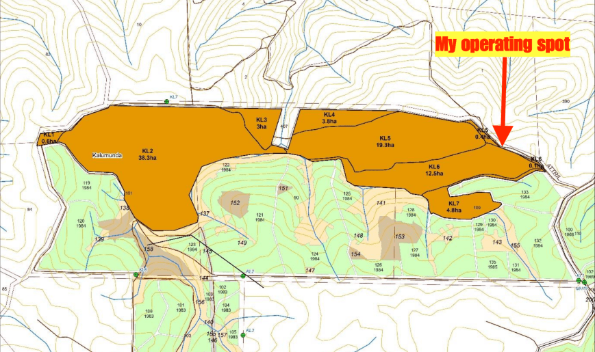
Above:- Map of the reserve showing my operating spot. Map courtesy fo Forestry SA.
Before calling CQ I tuned across the band and found Mike VK6MB/3 calling CQ on 7.150 from the Nurmurkah Nature Conservation Reserve VKFF-2167. It was a nice way to start the activation with a Park to Park. Next in the log was Marc VK3OHM/p who was activating the Swan Bay-Edwards Point Wildlife Reserve VKFF-2444.
After speaking with Marc I headed down the band to 7.139 and started calling CQ. Dennis VK2HHA came back to my call, followed by some of the park regulars, Peter VK3PF, Ken VK2KYO, and then Cliff VK2NP. Within a few minutes, I had qualified the park for VKFF, with contact number ten being with Adrian VK5FANA.
I logged a total of 21 stations on 40m including 2 further Park to Park contacts: Gerard VK2IO/5 in the Tilley Swamp Conservation Park VKFF-0938 and Peter VK3TKK/p in The Spit Wildlife Reserve VKFF-2452.
I then moved to 3.610 on the 80m band where I logged 9 stations including Gerard VK2IO/5 in the Tilley Swamp Conservation Park VKFF-0938 and Peter VK3TKK/p in The Spit Wildlife Reserve VKFF-2452.
It was time for me to try 20m which had been a poor performer of late. I logged 4 contacts on 20m, from New South Wales and Queensland.
To wrap up the activation I headed back to 40m for a few final CQ calls. I logged a further 11 stations including Andrei ZL1TM in New Zealand, and Mike VK6MB/3 activating the Broken-Boosey State Park VKFF-0752.
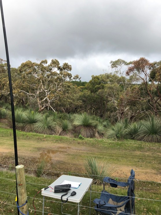
Above:- My shack for the afternoon at Kalamunda.
I had 46 contacts in the log, including 7 Park to Park QSOs, and I had qualified the park for VKFF and WWFF. I had also beaten the rain which threatened during the activation.
I worked the following stations on 40m SSB:-
- VK6MB/3 (Nurmurkah Nature Conservation Reserve VKFF-2167)
- VK3OHM/p (Swan Bay-Edwards Point Wildlife Reserve VKFF-2444)
- VK2HHA
- VK3PF
- VK2KYO
- VK2NP
- VK4FDJL
- VK5IS
- VK3FRAB
- VK5FANA
- VK1HW
- VK3SQ
- VK4TJ
- VK4/AC8WN
- VK4/VE6XT
- VK2VW
- VK5PL
- VK2IO/5 (Tilley Swamp Conservation Park VKFF-0938)
- VK3TKK/p (The Spit Wildlife Reserve VKFF-2452)
- VK3BBB/p
- VK2XXM
- VK3AHR
- VK3KAI
- VK3GV
- VK4FARR
- ZL1TM
- VK3AHA
- VK3FMPC
- VK2UH
- VK3UH
- VK6MB/3 (Broken-Boosey State Park VKFF-0752)
- VK4SMA
I worked the following stations on 80m SSB:-
- VK5CZ
- VK5BJE
- VK5FANA
- VK5PL
- VK3SQ
- VK3UFO
- VK2IO/5 (Tilley Swamp Conservation Park VKFF-0938)
- VK2UH
- VK3TKK/p (The Spit Wildlife Reserve VKFF-2452)
I logged the following stations on 20m SSB:-
- VK2UH
- VK2VW
- VK4TJ
- VK4/AC8WN
- VK4/VE6XT
References.
Forestry SA, 2016, ‘Kalamunda, Springs Road & Congeratinga Native Forest Reserves Management Plan’
