Red Gum Swamp (Yanac) Wildlife Reserve VKFF-2427

Our second park for Saturday 3rd August 2019 was the Red Gum Swamp (Yanac) Wildlife Reserve VKFF-2427.  The park is located about 31 km north of the town of Kaniva in western Victoria.  This was to be another first time activation.

Screen Shot 2019-08-05 at 8.47.54 pm.png

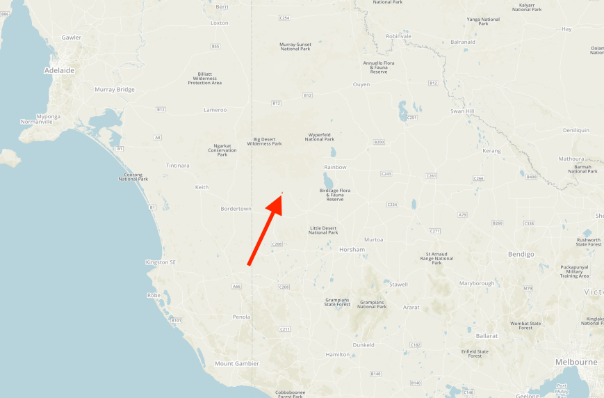
Above:- Map showing the location of the Red Gum Swamp (Yanac) Wildlife Reserve in western Victoria.  Map courtesy of Protected Planet.

After leaving Miramparim, Marija and I headed north on Broughton Road until we reached the junction with Block 40 Road.  Broughton Road makes a sharp right turn here.  A few hundred metres up the road we turned into an access track which leads to the park and runs in between two paddocks.

DSC_9816

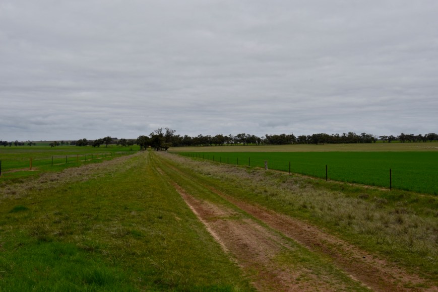
Above:- Access track to the park from Broughton Road.

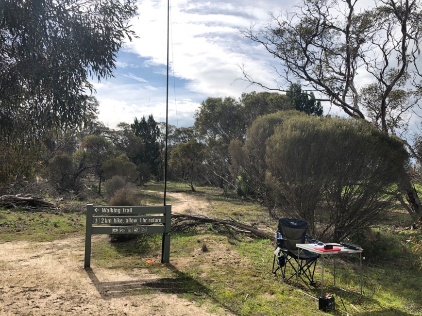
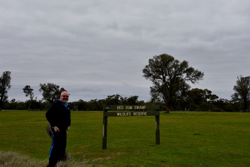
We soon reached the southwestern corner of the park which was well signposted.

DSC_9817

The Red Gum Swamp (Yanac) Wildlife Reserve is about 220 acres in size.  It takes its name from the small town and area of Yanac which was named after the Yanac-a-Yanac pastoral run which was established in 1846).  The run had a homestead near the Yanac swamp which is about 4 km south-east of the village.  This swamp is not to be confused with the Red Gum Swamp.  It is believed that the name was derived from an Aboriginal expression describing bats flying at night.

Further European settlement commenced in the Yanac district during the late 1870s.  In 1880 a school was opened at Yanac South.   In 1887 a Methodist church was built and in 1905 a Lutheran church was opened.  In 1912 the railway arrived in Yanac.  By the late 1880s, the Yanac School had opened in the methodist church and a blacksmith was established.

Screen Shot 2019-08-05 at 9.30.41 pm.png

Above:- The Yanac railway station, c. 1940s.  Image courtesy of ‘Wimmera Way Back When’.

Due to the establishment of the railway, Yanac became a minor local centre, with football, tennis and rifle clubs.  In 1921 a public hall was built.  The Yanac general store remained open until about 1998.   In addition to the store, post office and silos, Yanac has a recreation reserve, a hall, a Uniting church.  The 1990s saw several closures in Yanac including the school (1993), the Lutheran church (1995) and the Salvation Army Hall (1998).

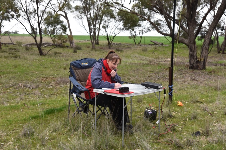
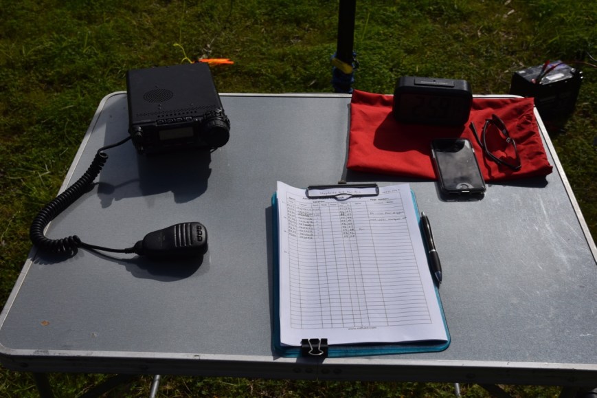
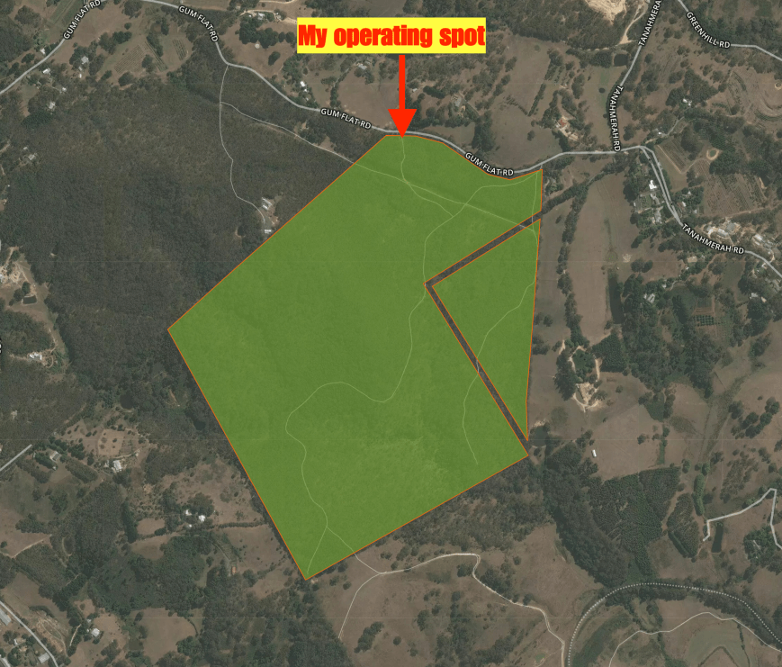
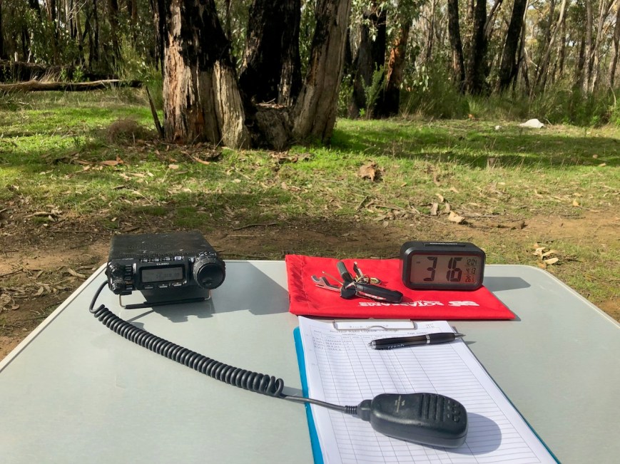
We set up on the western side of the park.  We found a gate, however, it was locked, so we climbed over the fence and set up just inside the boundary fence.  Again for this activation, we ran the Yaesu FT-857d and the 20/40/80m linked dipole.

Screen Shot 2019-08-05 at 8.56.21 pm.png

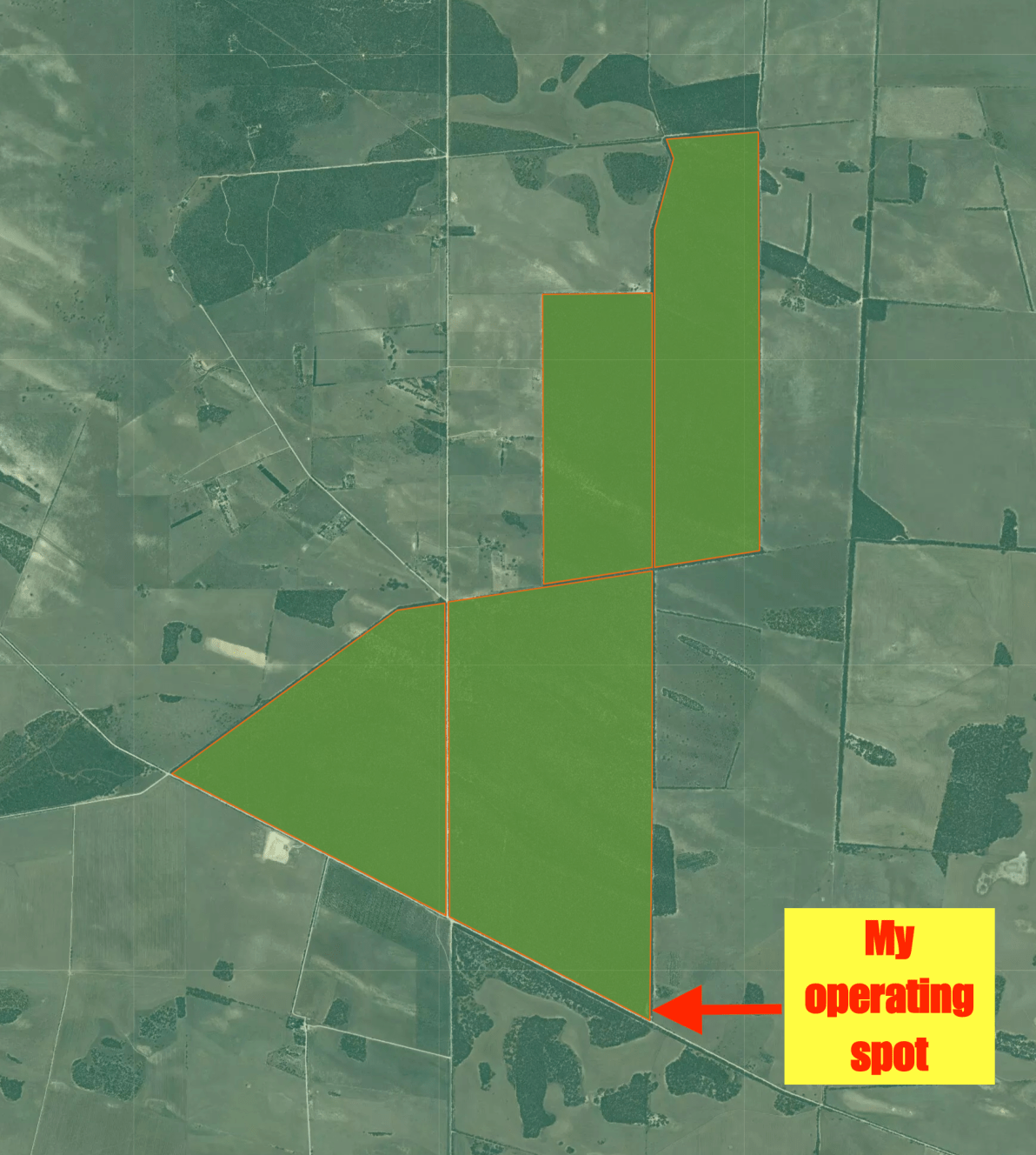
Above:- An aerial view of the park showing our operating spot.  Image courtesy of Google maps

Prior to calling CQ we tuned across the band and found Mark VK4SMA/p calling CQ from the Lockyer National Park VKFF-0719.  After logging Mark I moved down the band to 7.139 and started calling CQ.  Cliff VK2NP was the first to come back to my call, followed by John VK4TJ and then Jim VK1AT.

It didn’t take me long, just 6 minutes, and I had contact number ten in the log, a contact with Gerard VK2IO/5 who was activating SOTA peak St Marys Peak VK5/ NE-001 in the Flinders Ranges National Park VKFF-0176.  Mary also took the opportunity of logging the SOTA summit and Park to Park with Gerard.

I logged a further 6 six stations from VK2. VK3, VK4, and VK7, before swapping the mic with Marija.  This included another Park to Park, with Adam VK2YK/p who was activating the Hunter Wetlands National Park VKFF-0595.

DSC_9824

Having lowered the power down to 10 watts for Marija to work Adam VK2YK/p, we decided it was a good opportunity for Marija to stay in the operator’s chair and get her ten contacts to qualify the park for VKFF.

Marija called CQ which was answered by a number of the park regulars, Lee VK2LEE, Peter VK3PF, and then Ray VK4NH.  Shortly thereafter, Marija had ten contacts in the log with a QSO with Mark VK4SMA/p in the Lockyer National Park VKFF-0719.

Happy with having qualified the park for VKFF, we again swapped the mic.

DSC_9822

I called CQ again on 7.139 which was answered by Brett VK2VW.  It was once again clear that there was very little if any, propagation around Victoria and back into South Australia on 40m.  So with 29 contacts in the log, I headed off to the 80m band.

Marija placed a spot up for me on parksnpeaks and I called CQ on 3.610.  John Vk5BJE came back to my call with a good strong 5/9 signal from the Adelaide Hills, followed by Ken VK2KYO, and then Adrian VK5FANA.

We were cognizant of time and wanted to fit in as many parks during the day as possible, so my thanks go out to John VK5NJ and Peter VK3PF who gave me some of their other calls to go towards my tally of 44.  I also logged Gerard VK2IO/5 for a second band from St Marys Peak VK5/ NE-001 & Flinders Ranges National Park VKFF-0176.

I was now just 1 QSO away from the magical 44 and I moved to the 20m band.  I called CQ on 14.310 and this was answered by Rick VK4RF, followed by Ray VK4NH and then Andrei ZL1TM.

DSC_9819

We had both qualified the park for VKFF and I had qualified the park for WWFF.  With a total of 59 QSOs in the log including 7 Park to Park contacts, it was time to pack up and head off to our next park.

Marija worked the following stations on 40m SSB:-

  1. VK2IO/5 (SOTA St Marys Peak VK5/ NE-001 & Flinders Ranges National Park VKFF-0176)
  2. VK2YK/p (Hunter Wetlands National Park VKFF-0595)
  3. VK2LEE
  4. VK3PF
  5. VK4NH
  6. VK4DXA
  7. ZL4TY/VK4
  8. VK7OT
  9. VK2JXA
  10. VK4SMA/p (Lockyer National Park VKFF-0719 VKFF-0719)

I worked the following stations on 40m SSB:-

  1. VK4SMA/p (Lockyer National Park VKFF-0719)
  2. VK2NP
  3. VK4TJ
  4. VK4/Ac8WN
  5. VK4/VE6XT
  6. VK1AT
  7. VK2HRX
  8. VK2PKT
  9. VK2LEE
  10. VK2IO/5 (SOTA St Marys Peak VK5/ NE-001 & Flinders Ranges National Park VKFF-0176)
  11. VK3PF
  12. VK4NH
  13. VK4DXA
  14. ZL4TY/VK4
  15. VK7OT
  16. VK2YK/p (Hunter Wetlands National Park VKFF-0595)
  17. VK2VW
  18. VK2AD
  19. VK2IK/m
  20. VK7ME
  21. VK3MH/2
  22. VK2SLB
  23. VK5KLV
  24. VK2FALL
  25. VK7DW
  26. VK7AN
  27. VK2ARZ
  28. VK2RU/4
  29. VK2QA
  30. VK4FARR

I worked the following stations on 80m SSB:-

  1. VK5BJE
  2. VK2KYO
  3. VK5FANA
  4. VK5PL
  5. VK3PF
  6. VK5LEX
  7. VK5CZ
  8. VK5NJ
  9. VK5JN
  10. VK5/ZL1NJ
  11. VK3KAI
  12. VK3GV
  13. VK2IO/5 (SOTA St Marys Peak VK5/ NE-001 & Flinders Ranges National Park VKFF-0176)

I worked the following stations on 20m SSB:-

  1. VK4RF
  2. VK4HA
  3. VK4NH
  4. VK4DXA
  5. ZL4TY/VK4
  6. ZL1TM


References.

Victorian Place Names, 2019, <https://www.victorianplaces.com.au/yanac>, viewed 5th August 2019

Mirampiram Flora Reserve VKFF-2387

Our first park for our weekend away was the Mirampiram Flora Reserve VKFF-2387, which is located about 17 km (by road) north of the town of Kaniva in western Victoria.  This was the first time that the park had been activated.

Screen Shot 2019-08-05 at 3.11.35 pm.png

Above:- Map showing the location of the Mirampiram Flora Reserve VKFF-2387 in western Victoria.  Map courtesy of Protected Planet.

Marija and I left home on Saturday morning (3rd August 2019) bright and early.  We were on the road by just after 6.00 a.m.  We had a 313 km drive ahead of us before reaching Mirampiram.  Our first stop for the day was at Coonalpyn where we filled up with some hot coffee and a bacon & egg sandwich at the Silo Cafe.  We then continued east along the Dukes Highway and soon reached the South Australian/Victorian State border.

DSC_9929.jpg

The Mirampiram Flora Reserve takes its name from the locality of Mirampiram or Miram-Piram in the County of Lowan in western Victoria.  The park is not to be confused with the Mirammpiram Bushland Reserves which are four separate reserves located to the north and south of the Flora Reserve.

Screen Shot 2019-08-05 at 6.15.32 pm.png

Above:- An aerial view of the Mirampiran Flora Reserve, looking east.  Image courtesy of Google maps.

The tiny town of Miram which is located on the Adelaide-Melbourne railway line, about 10 km northeast of Kaniva was named after the locality of mripiram later expressed as Miram Piram.  It was shortened to Miram in 1904.  Miram is an Aboriginal word for the bough of a tree.

European settlement commenced in the area during the 1870s.  In 1884 a school was opened.  In 1887 the railway from Dimboola to Serviceton was extended and this resulted in the expansion of the district’s farming activity.  Prior to this the district’s wheat crops were carried to Dimboola or South Australia by road wagons.

In 1888 Miram’s first store was opened by George Coles (1833-1866).  His son, Sir George James Coles, was the founder of the national variety stores chain, G.J. Coles and Company.   In April 1903 the Miram store was acquired by Philip Wheaton.  It was operated by the Wheaton family up until 2000.

The store was more than a grocery store.  It also stocked drapery, footwear, millinery, glassware, menswear, timber, hardware, iron, motor oils, and even wireless receivers.   It provided an electricity supply for the town and a permanent water supply.  Fresh eggs were sold from the Wheaton’s poultry farm, fresh milk from their Friesian dairy herd, cream & butter, and a meat supply from their beef herd.  The store also served as a Post Office.

In 1890 an Anglican church was opened in Miram, with the Wheaton family running a Methodist Sunday school for nearly 50 years.  In 1914, a public hall was built and in 1939 silos were built near the railway station.  The 1950s started to see the demise of Miram.  In 1952 the Miram school was closed with children being bussed to the Kaniva Consolidated School.  In 1960 the Anglican church close, followed by the Methodist church in 1964.

On some maps the park may show as the Mirampiram Nature Conservation Reserve.  It is located on Sandsmere Hall Road, a few hundred metres east of the Broughton Road intersection.  The park is a small piece of remnant scrub which is surrounded by cleared farming land.

DSC_9815

Above:- Cleared farming land on the southern side of the park.

The park contains Jumping-jack wattle which is only found in the southern part of mainland Australia, with patchy distribution in the Wimmera area of western Victoria and some adjacent areas of South Australia.

Although the park is only small, it was alive with birdlife during our visit.  Whilst Marija was on air I snuck away for a walk through the park and took some photographs of birds observed in the park.

Marija and I travelled east on Sandsmere Hall Road and soon reached the park, which is not signposted.  We parked near the eastern boundary of the park and set up in the southeastern corner of the park.

We ran the Yaesu FT-857d and the 20/40/80m linked dipole for this activation.  I ran 30 watts output, whilst Marija ran her 10 watts PEP abiding with her Foundation licence conditions.

Screen Shot 2019-08-05 at 6.12.40 pm.png

Above:- Aerial view of the Mirampiram Flora Reserve showing my operating spot.  Image courtesy of Google maps

We were set up and ready to go by just after the UTC rollover.  It was around 10.00 a.m. Victorian local time.  After turning on the transceiver we found Ian VK1DI/2 on 7.144 calling CQ from the Sappa Bulga National Park VKFF-1180.  Marija and I both logged Ian for a Park to Park contact.

I then moved down the band to 7.139 and Marija placed a spot up for me on parksnpeaks whilst I started calling CQ.  John VK7FJFD came back to my CQ call, followed by some of the park regulars Adam VK2YK, and Rick VK4RF.  Within about 12 minutes I had qualified the park for VKFF, with contact number ten being with John VK4TJ using his Canadian callsign.  I logged a further 4 stations before swapping the mic with Marija.

DSC_9787

Marija started calling CQ on 7.139.  Rick VK4RF was the first to come back to her CQ call, followed by Lee VK2LEE, John VK4TJ, and then Adam VK2YK.  It only took Marija about 7 minutes to get ten contacts in the log, thus qualifying the park for VKFF.  Contact number ten was with Terry VK2MTJ.

Marija went on to work 14 stations from VK2, VK3, VK4, and VK7.  It was clear that there was no obvious propagation into South Australia on 40m from our spot in western Victoria.  And our only Victorian contact was a local VK3 station.

DSC_9789

I jumped back into the operator’s chair and called CQ again on 7.139.  It was hard going as there was no real propagation to VK3 and VK5.  I logged a further 9 stations from VK1, VK2, and VK4.  The biggest signal logged was Tex VK1TX in Canberra with a big 5/9 plus signal.

Marija and I then lowered the squid pole and inserted the links for 80m and headed for 3.610 hoping to get some VK3 and VK5 stations in the log.  Marija spotted me on parksnpeaks and I started calling CQ on 3.610.  John VK5BJE in the Adelaide Hills came back to my call, followed by Peter VK3PF, and David VK5PL.  All signals were strength 9.  Although the 80m band was again proving to be very reliable, I only had 7 callers.

I then moved to the 20m band and started calling CQ on 14.310, competing at times with the Over the Horizon Radar which was strength 9 plus when it came on.  First in the log on 20m was Rob VK4SYD/p who was activating the North Pine Dam Nature Refuge VKFF-2876.

I now had 32 contacts in the log and required another 12 contacts to qualify the park for the global WWFF program.  I headed back to 40m and worked Mark VK4SMA/p on 7.144 who was in the Lockyer National Park VKFF-0719.  This was followed by Andrew VK1DA/2 and Wade VK1MIC/2 who were activating SOTA summit VK2/ SW-027.  Marija also logged Andrew and Wade.

Two QSOs later I was called by Rob VK4SYD/p in the North Pine Dam Nature Refuge VKFF-2876 for a second band.  Marija also worked Rob.

It didn’t take me long and I soon had contact number 44 in the log, a QSO with Ray VK4NH.  I logged a total of 52 contacts before callers dried up.  It was now just after 11.30 a.m. local time and it was time for us to pack up anyway and head off to our next park.

DSC_9788.jpg

Between us, Marija and I had logged 71 stations including 7 Park to Park contacts.  It ahd been a good start to our trip.

Marija worked the following stations on 40m SSB:-

  1. VK1DI/2 (Sappa Bulga National Park VKFF-1180)
  2. VK4RF
  3. VK4HA
  4. VK2LEE
  5. VK4TJ
  6. VK4/AC8WN
  7. VK4/VE6XT
  8. VK2YK
  9. VK3LY
  10. VK2MTJ
  11. VK7FJFD
  12. VK7EE
  13. VK2VW
  14. VK4HNS
  15. VK2FAMG/p
  16. VK4SMA/p (Lockyer National Park VKFF-0719)
  17. VK1DA/2 (SOTA VK2/ SW-027)
  18. VK1MIC/2 (SOTA VK2/ SW-027)
  19. VK4SYD/p (North Pine Dam Nature Refuge VKFF-2876)

I worked the following stations on 40m SSB:-

  1. VK1DI/2 (Sappa Bulga National Park VKFF-1180)
  2. VK7FJFD
  3. VK2YK
  4. VK4RF
  5. VK4HA
  6. VK2NN
  7. VK2FRKO
  8. VK4TJ
  9. VK4/AC8WN
  10. VK4/VE6XT
  11. VK4FARR
  12. VK2LEE
  13. VK2PKT
  14. VK5NJ
  15. VK2VW
  16. VK4HNS
  17. VK3FORD/4
  18. VK1TX
  19. VK7FRJG
  20. VK3PF
  21. VK2AX
  22. VK2KEL
  23. VK2LX
  24. VK4SMA/p (Lockyer National Park VKFF-0719)
  25. VK1DA/2 (SOTA VK2/ SW-027)
  26. VK1MIC/2 (SOTA VK2/ SW-027)
  27. VK2NJP
  28. VK4SYD/p (North Pine Dam Nature Refuge VKFF-2876)
  29. VK2HRX
  30. VK2SLB
  31. VK2RU/4
  32. VK4QA
  33. VK7OR
  34. VK2GIB
  35. VK4NH
  36. VK4DXA
  37. ZL4TY/VK4
  38. VK7OT
  39. VK7VZ
  40. VK1AT
  41. VK4HAT
  42. VK4CZ
  43. VK3MH/2

I worked the following stations on 80m SSB:-

  1. VK5BJE
  2. VK3PF
  3. VK5PL
  4. VK3OCD
  5. VK3LPG
  6. VK3MCK
  7. VK5FANA

I worked the following stations on 20m SSB:-

  1. VK4SYD/p (North Pine Dam Nature Refuge VKFF-2876)
  2. VK6MMB


References.

State Wide Integrated Flora and Fauna Teams, 2019, <https://www.swifft.net.au/cb_pages/sp_jumping-jack_wattle.php>, viewed 5th August 2019

Victorian Place Names, 2019, <https://www.victorianplaces.com.au/miram>, viewed 5th August 2019

Wimmera Way back when, 2019, <http://wimmera-w-b-w.blogspot.com/2014/02/in-beginning-gj-coles.html>, viewed 5th August 2019

Trip to the south east of South Australia, and western Victoria

Thank you to everyone who called Marija VK5FMAZ and me during our weekend away in the south-east of South Australia and western Victoria.

We activated a total of eight (8) different parks.  Seven (7) of those were first time activations.

  • Mirampiram Flora Reserve VKFF-2387
    • 71 QSOs
  • Red Gum Swamp (Yanac) Wildlife Reserve VKFF-2427
    • 59 QSOs
  • Boyeo Flora Reserve VKFF-2275
    • 64 QSOs
  • Nhill Swamp Wildlife Reserve VKFF-2412
    • 78 QSOs
  • Jumping Jack Wattle NCR VKFF-2120
    • 55 QSOs
  • Yarrangook Flora Reserve VKFF-2497
    • 67 QSOs
  • Red Bluff NCR VKFF-2426
    • 64 QSOs
  • Hardings Springs Conservation Reserve
    • 60 QSOs

We made a total of 518 QSOs on 20, 40, & 80m SSB into VK1, VK2, VK3, VK4, Vk5, VK6, VK7, New Zealand, Italy, & the Canary Islands.

This included 35 Park to Park contacts with:-

  • Ian VK1DI/2
  • Mark VK4SMA
  • Rob VK4SYD
  • Gerard VK2IO/5
  • Adam VK2YK
  • Neil VK4HNS
  • Ian VK5CZ
  • Jonathan VK7JON
  • Helen VK7FOLK
  • Greg VK4VXX
  • Brett VK3FLCS

We would like to thank those who took the time to spot us on parksnpeaks and Facebook, as a number of the parks we were in, were remote, and we had no phone coverage.

More info and photos on each activation will appear on my WordPress site in the coming week or so.

This slideshow requires JavaScript.

2019 World Ranger Day

Yesterday (Wednesday 31st July 2019) was World Ranger Day which commemorates Rangers killed or injured in the line of duty and celebrates the critical work Rangers do to protect the world’s natural and cultural treasures.  World Ranger Day is observed annually on the 31st of July.

The VKFF program has a special activator certificate on offer for any amateur who activated a VKFF reference on World Ranger Day.

Screen Shot 2019-08-01 at 9.29.47 pm.png

My digging around shows that a total of 23 amateurs took part as Activators.  A total of 29 different parks were activated.

  1. Andrew VK1DA
    • Red Hill Nature Reserve VKFF-0860
  2. Ian VK1DI/2
    • New England National Park VKFF-0385
    • Oxley Wild Rivers National Park VKFF-0406
  3. Gerard VK2IO/5
    • Wabma Kadarbu Mound Springs Conservation ParkVKFF-1114
    • Lake Eyre National Park VKFF-0276
  4. Ken VK2KYO
    • Murray Valley Regional Park VKFF-1785
  5. Brett VK3FLCS
    • Lerderderg State Park VKFF-0763
  6. Mark VK3PI
    • Heathcote-Graytown National Park VKFF-0624
  7. Peter VK3PF
    • Tarra Bulga National Park VKFF-0480
    • Traralgon South Flora Reserve VKFF-2465
    • Traralgon South Flora & Fauna Reserve VKFF-2464
    • Callignee Wildlife Reserve VKFF-2287
    • Gormandale Nature Conservation Reserve VKFF-2325
  8. Peter VK3TKK
    • The Spit Wildlife Reserve VKFF-2452
  9. Rob VK4AAC/3
    • Dandenong Ranges National Park VKFF-0132
  10. Neil VK4HNS
    • Tamborine National Park VKFF-0475
  11. Grant VK4JAZ
    • Pooh Corner Nature Reserve VKFF-2878
  12. Steve VK4JSS
    • Daisy Hill Conservation Park VKFF-1525
  13. Ade VK4SOE
    • Sundown National Park VKFF-0471
  14. John VK5BJE
    • Mylor Conservation Park VKFF-0785
  15. Adrian VK5FANA
    • Upper Gulf St Vincent Marine Park VKFF-1755
  16. Marija VK5FMAZ
    • Mount George Conservation Park VKFF-0784
  17. Keith VK5OQ/3
    • Alpine National Park VKFF-0619
  18. Paul VK5PAS
    • Mount George Conservation Park VKFF-0784
  19. Peter VK5PET
    • Tolderol Game Reserve VKFF-1752
  20. Mike VK6MB/3
    • Wychitella Conservation Reserve VKFF-2032
    • Wychitella Nature Conservation Reserve VKFF-2236
  21. Phil VK6ADF
    • Burma Road Nature Reserve VKFF-2800
  22. Hans VK6XN
    • Stinton Cascades Nature Reserve VKFF-2940
  23. Angela VK7FAMP
    • South Arm Nature Recreation Area VKFF-2929

THANKS to everyone who took part.  It certainly turned out to be a very popular day.  The VKFF program will be running similar activation days on future special dates.

Remember, if you activated a park, and would like a special 2019 World Ranger Day certificate, please drop me a quick email at…..vk5pas@wia.org.au

Mount George Conservation Park 5CP-147 and VKFF-0784, and 2019 World Ranger Day

Yesterday (Wednesday 31st July 2019) was World Ranger Day, and after finishing work a little earlier, I headed out to one of my local parks, the Mount George Conservation Park 5CP-147 & VKFF-0784.

I have activated and qualified this park many times over.  However, it was close to home and handy, as I did not finish work until after 3.00 p.m. local time.

Mount George is located about 26 km east of Adelaide in the Mount Lofty Ranges ‘Adelaide Hills’.

Screen Shot 2019-08-01 at 8.18.24 pm.png

Above:- Map showing the location of the Mount George Conservation Park.  Map courtesy of Protected Planet.

World Ranger Day is observed annually on the 31st day of July and commemorates Rangers killed or injured in the line of duty and celebrates the critical work Rangers do to protect the worlds natural and cultural treasures.

Believe it or not, about 149 rangers were lost in 2019 alone.  Amazing.

images

Below are a few videos on World Ranger Day.

The Mount George Conservation Park is located on the northern side of the busy South Eastern Freeway.  The park was proclaimed on the 7th November 1996 and conserves 85 hectares of important native vegetation in the Mount Lofty Ranges ‘Adelaide Hills’.  The park was originally 67 hectares in size before the boundaries were extended in 2003, adding a further 18 hectares.

The park is characterised by steep slopes adorned with Stringybark Open Forest.  The State endangered Mountain Gum can be found in the park.  The park also contains creeks, wetlands, and freshwater bogs.  The Mount George summit, 520 metres, is located within the park.  Sadly it does not have the required prominence for the Summits on the Air (SOTA) program.

I set up in the picnic ground area at the end of Mount George Road.  I used one of the wooden tables and benches and stretched out the 20/40/80m linked dipole.

My only gripe with this location is the fact that people visit this part of the park with their dogs which run amok, piddling and pooing and running off-leash.  Dogs are permitted in this section of the park, but they are required to be kept on a lead.  I have never seen this occur and have never seen it policed.

And this activation did not disappoint.  I had one dog piddle on my squid pole and my battery, with the owner hardly blinking an eye.

Screen Shot 2019-08-01 at 8.15.50 pm.png

Above:- An aerial shot of the Mount George Conservation Park showing my operating spot.  Image courtesy of Protected Planet.

I was set up and ready to go by about 0610 UTC (3.40 p.m. local time).  First in the log was Ade VK4SOE/p in the Sundown National Park VKFF-0471.

I logged a total of 35 stations on 40m from VK2, VK3, VK4, VK5, VK6, VK7, and New Zealand.  This included the following Park to Park contacts:-

  • Ade VK4SOE/p (Sundown National Park VKFF-0471)
  • Peter VK3PF/p (Callignee Wildlife Reserve VKFF-2287)
  • Rob VK4AAC/3 (Dandenong Ranges National Park VKFF-0132)
  • Rob VK2VH/3 (Dandenong Ranges National Park VKFF-0132)
  • Gerard VK2IO/5 (Lake Eyre National Park VKFF-0276)
  • Brett VK3FLCS/p (Lerderderg State Park VKFF-0763)
  • Steve VK4JSS/p (Daisy Hill Conservation Park VKFF-1525)

This was Steve VK4JSS first ever park activation.  It was great to get Steve in the log Park to Park.

I then moved to 20m where I logged Hans VK6XN who was activating the Stinton Cascades Nature Reserve VKFF-2940.  This was followed by Rick VK5VCR who was quite low down but very readable and then Peter VK6RZ.

I then moved down to the 80m band where I logged 12 stations including the following Park to Park contacts:-

  • Brett VK3FLCS/p (Lerderderg State Park VKFF-0763)
  • Adrian VK5FANA/p (Upper Gulf St Vincent Marine Park VKFF-1755)
  • Mike VK6MB/3 (Wychitella Nature Conservation Reserve VKFF-2236)
  • Peter VK3PF/p (Gormandale Flora Reserve VKFF-2325)

I then moved back to 40m where I logged Hans VK6XN/p in the Stinton Cascades Nature Reserve VKFF-2940 for a second band, and then Brett VK2VW

IMG_2389

It was now around 5.15 p.m. and my wife Marija VK5FMAZ arrived at the park.  Marija’s first contact was with Brett VK2VW, followed by Hans VK6XN/p in the Stinton Cascades Nature Reserve VKFF-2940.

Marija logged 10 stations on 40m from VK2, VK4, VK5, VK6 and VK7 before callers dried up.  It was late afternoon and the 40m band had fallen out to Victoria.

We then moved back down to the 80m band where Marija logged 9 stations including a Park to Park with Mike VK6MB/3 in the Wychitella Nature Conservation Reserve VKFF-2236.

IMG_2386

It was now freezing cold.  The temperature had dropped to about 3 deg C and the local time was about 6.30 p.m.  We packed up and were about to drive out of the park when I found Andrew VK1DA calling CQ on 7.144 from the Red Hill Nature Reserve VKFF-0860.  After we logged Andrew, he was called by Phil VK6ADF/p who was in the Burma Road Nature Reserve VKFF-2800.  Andrew kindly allowed Marija and I to log Phil Park to Park.

Together we made a total of 86 QSOs on 20, 40, & 80m SSB. This included 19 Park to Park QSOs.

Thanks to everyone who called us and thanks to all of the activators who took part in the 2019 World Ranger Day activation event.

IMG_2391

Marija worked the following stations on 40m SSB:-

  1. VK2VW
  2. VK6XN/p (Stinton Cascades Nature Reserve VKFF-2940)
  3. VK2YK
  4. VK7OTC
  5. VK6GLX
  6. VK4SMA
  7. VK5BJE
  8. VK4TJ
  9. VK4/AC8WN
  10. VK4/VE6XT
  11. VK1DA/p (Red Hill Nature Reserve VKFF-0860)
  12. VK6ADF/p (Burma Road Nature Reserve VKFF-2800)

Marija worked the following stations on 80m SSB:-

  1. VK5BJE
  2. VK5FANA
  3. VK5LA
  4. VK3SQ
  5. VK3NBL
  6. VK5VCR
  7. VK5SFA
  8. VK6MB/3 (Wychitella Nature Conservation Reserve VKFF-2236)
  9. VK2YK

I worked the following stations on 40m SSB:-

  1. VK4SOE/p (Sundown National Park VKFF-0471)
  2. VK3PF/p (Callignee Wildlife Reserve VKFF-2287)
  3. VK4AAC/3 (Dandenong Ranges National Park VKFF-0132)
  4. VK2VH/3 (Dandenong Ranges National Park VKFF-0132)
  5. VK2KNV/m
  6. VK3MCK
  7. VK2IO/5 (Lake Eyre National Park VKFF-0276)
  8. VK4SMA
  9. VK4FDJL/8
  10. VK2LEE
  11. VK4FARR
  12. VK3SQ
  13. VK2KYO
  14. VK2NP
  15. VK5BJE
  16. VK3ATO
  17. VK2YMU
  18. VK2EXA
  19. ZL1TM
  20. VK3FLCS/p (Lerderderg State Park VKFF-0763)
  21. VK4HAT
  22. VK4NH
  23. VK4DXA
  24. ZL4TY/VK4
  25. VK2PKT
  26. VK4RF
  27. VK4HA
  28. VK4JSS/p (Daisy Hill Conservation Park VKFF-1525)
  29. VK2ADB
  30. VK3FIAN
  31. VK4COA
  32. VK3ZLT
  33. VK6RZ
  34. VK4VXX
  35. VK4/AG7WB
  36. VK6XN/p (Stinton Cascades Nature Reserve VKFF-2940)
  37. VK2VW
  38. VK6KJ
  39. VK1DA/p (Red Hill Nature Reserve VKFF-0860)
  40. VK6ADF/p (Burma Road Nature Reserve VKFF-2800)

I worked the following stations on 20m SSB:-

  1. VK6XN/p (Stinton Cascades Nature Reserve VKFF-2940)
  2. VK5VCR
  3. VK6RZ

I worked the following stations on 80m SSB:-

  1. VK3FLCS/p (Lerderderg State Park VKFF-0763)
  2. VK5FANA/p (Upper Gulf St Vincent Marine Park VKFF-1755)
  3. VK5VCR
  4. VK2LEE
  5. VK3VKT/m
  6. VK5WG
  7. VK7ROY
  8. VK6MB/3 (Wychitella Nature Conservation Reserve VKFF-2236)
  9. VK3SQ
  10. VK5AYL
  11. VK2YK
  12. VK3PF/p (Gormandale Flora Reserve VKFF-2325)
  13. VK5BJE
  14. VK3SQ
  15. VK7ME
  16. VK5LA
  17. VK3PF
  18. VK3MPR
  19. VK7FJFD
  20. VK2TTP
  21. VK3HN
  22. VK3NRG/4


References.

Department for Environment and Heritage, 2006, Mount George Conservation Park Management Plan.

The Thin Green Line, 2019, <https://thingreenline.org.au/world-ranger-day/>, viewed 1st August 2019

O’Halloran Hill Recreation Park VKFF-1737

My second park for Tuesday 30th July 2019 was the O’Halloran Hill Recreation Park VKFF-1737.  This was another park that I had never activated previously.

O’Halloran Hill is located about 16 km south of the city centre of Adelaide.

Screen Shot 2019-08-01 at 5.50.21 pm.png

Above:- Map showing the location of the O’Halloran Hill Recreation Park south of Adelaide.  Map courtesy of Protected Planet.

The O’Halloran Hill Recreation Park is about 253 hectares (630 acres) in size and was established on the 7th day of September 1989.  It is located in the suburbs of Seaview Downs and O’Halloran Hill.  The park is popular with walkers, joggers, horse riders and mountain bike riders.   Parts of the park are leased to recreational organisations involved in archery, target shooting and model aircraft.

Screen Shot 2019-07-30 at 5.34.40 pm.png

Above:- An aerial shot of the O’Halloran Hill Recreation Park looking north.  Image courtesy of Google maps

O’ Halloran Hill takes its name after Major Thomas Shuldham O’Halloran (1797-1870), the first Police Commissioner of South Australia and first Police Magistrate of South Australia.  He had a reputation for belligerence, with one of his mounted troopers from the 1840s commented that “Old Major O’Halloran used to say ‘I never hated a man longer than a day'”.

Screen Shot 2019-08-01 at 5.53.44 pm

Above:- Major Thomas O’Halloran.  Image courtesy State Library SA

In June 1840 the brig ‘Maria‘ wrecked near Kingston in the South East of South Australia.  Local aboriginal people are reported to be responsible for the massacre of all 25 survivors.  Governor Gawler ordered O’Halloran, who at that time was the Police Commissioner and Police Inspector Alexander Tolmer to lead a party of police and sailors to the area to find and execute those responsible.  On the 22nd day of August 1840 following several days of investigation and interviews, two local Ngarrindjeri aboriginal men were publicly hanged on the Coorong in front of 65 members of their tribe.  Upon O’Halloran’s orders, their bodies remained In situ as a warning against violence towards Europeans by the aborigines.

2560px-Major_O'Halloran's_expedition_to_the_Coorong,_August_1840_-_Google_Art_Project

Above:- Major O’Halloran’s expedition to the Coorong, August 1840. Painting by an unknown artist, held at the Art Gallery of South Australia.  Courtesy of Wikipedia.

O’Halloran established a farm at what is now O’Halloran Hill.  It was called Lizard Lodge.  O’Halloran died at his home “Lizard Lodge”, and was buried at Christ Church, O’Halloran Hill, an Anglican church which he helped to establish and is also located in the suburb, now overlooking the old Glenthorne CSIRO Research station, which is soon to become the Glenthorne National Park.

Screen Shot 2019-08-01 at 7.45.35 pm.png

Above:- Lizard Lodge 1865.  Image courtesy of State Library SA.

At one stage, virtually all of the O’Halloran Hill Recreation Park was cleared grazing land.  However, over the last 30 years, much of the area has been revegetated.  In the decade prior to the park’s proclamation under the National Parks and Wildlife Act 1972, the previous management agency (the State Planning Authority) made a concerted effort to re-vegetate the area and sponsored mass plantings of thousands of trees.

It is believed that 26,500 trees were planted in the late 1970s and more than 78,000 were planted from 1990 to 2000.

The park contains Grey Box woodland, Golden Wattle, Sheoak, Tea Tree, River Red Gum, Peppermint Box, Grevillia and Hakea.

The park consists of undulating land and there are some magnificent views to be enjoyed of the Adelaide metropolitan coastline.

And if you head to the northern section of the park there are some terrific views of the city of Adelaide.

DSC_9769

Above:- View of the city of Adelaide from the park.

The park is inhabited by various native fauna including Common Brushtail Possum and Common Ringtail Possum.  Birds SA have recorded about 68 species of bird in the park including Weebill, Superb Fairywren, New Holland Honeyeater, Red Wattlebird, Australian Magpie, Silvereye, Eastern Rosella, Australian Golden Whistler, Magpielark, Brown Songlark, and Mistletoebird.  Some of those I sighted appear in my photos below.

I parked in the carpark on Majors Road near Adams Road.  There is a large carpark here at the start of a number of Mountain bike trails and walking trails.

I ran the Yaesu FT-857d, 40 watts, and the 20/40/80m linked dipole for this activation.

Screen Shot 2019-07-30 at 5.34.57 pm.png

Above:- An aerial view of the park showing my operating spot.  Image courtesy of Google maps.

Despite there being large power lines nearby, I was surprised to hear a low noise floor when I turned on the transceiver.  First in the log was Geoff VK3SQ, followed by Marc VK3OHM, Steve VK3YW, and then John VK4TJ.

It only took me about 12 minutes to get 10 contacts in the log, and I had the park under my belt for VKFF.  It may have been a weekday, but there were plenty of callers and within an hour I had 39 contacts in the log and was just 5 short of the required 44 contacts to qualify the park for the global WWFF program.

I also had two Park to Park contacts in the log, with Ian VK1DI/2 in the Gibraltar Range National Park VKFF-0197 and Mike VK6MB/3 in the Leaghur Wildlife Reserve VKFF-2367.

DSC_9747

However, callers had dried up, so I lowered the squid pole and inserted the links for the 80m band and headed for 3.610.  First, in the log, there was Adrian VK5FANA, followed by John VK5BJE, Ian VK5KKT and then John VK5MJC.  Unfortunately, they were my only callers despite the band being wide open across South Australia.

To complete the activation I moved up to 14.310 on the 20m band where I logged 8 stations from VK2 and VK4.

IMG_2377

I worked the following stations on 40m SSB:-

  1. VK3SQ
  2. VK3OHM
  3. VK3YW
  4. VK4TJ
  5. VK4/AC8WN
  6. VK4/VE6XT
  7. VK3ZLT
  8. VK2VW
  9. VK2IO/5
  10. VK3BCM
  11. VK3AHR
  12. VK3PF
  13. VK2NP
  14. VK5BJE
  15. VK3DBP
  16. VK1DI/2 (Gibraltar Range National Park VKFF-0197)
  17. VK4NH
  18. VK4DXA
  19. ZL4TY/VK4
  20. VK3MKE
  21. VK5LG
  22. VK5CZ
  23. VK3AWG/m
  24. VK5KC
  25. VK3MCK
  26. VK4RF
  27. VK4HA
  28. VK2LEE
  29. VK4HNS
  30. VK4FARR
  31. VK4MWB
  32. VK2SS
  33. VK2KNV/m
  34. VK5FANA
  35. VK6MB/3 (Leaghur Wildlife Reserve VKFF-2367)
  36. VK3BBB
  37. VK7OT
  38. VK2XSE/m
  39. VK3ZE

I worked the following stations on 80m SSB:-

  1. VK5FANA
  2. VK5BJE
  3. VK5KKT
  4. VK5MJC

I worked the following stations on 20m SSB:-

  1. VK2NP
  2. VK4RF
  3. VK4HA
  4. VK2JON
  5. VK4TJ
  6. VK4/AC8WN
  7. VK4/VE6XT
  8. VK2YES


References.

Birds SA, 2019, <https://birdssa.asn.au/location/ohalloran-hill-recreation-park/>, viewed 1st August 2019

Department for Environment and Heritage, 2008, O’Halloran Hill Recreation Park Management Plan.

Wikipedia, 2019, <https://en.wikipedia.org/wiki/O%27Halloran_Hill_Recreation_Park>, viewed 1st August 2019

Wikipedia, 2019, <https://en.wikipedia.org/wiki/Thomas_Shuldham_O%27Halloran>, viewed 1st August 2019

Shepherds Hill Recreation Park VKFF-1744

Today (Tuesday 30th July 2019) I decided to head down to town to activate two new parks for me.  The first being the Shepherds Hill Recreation Park VKFF-1744.

The park is located in the foothills of the Mount Lofty Ranges, about 9 km south of the city centre of Adelaide.

Screen Shot 2019-07-30 at 6.21.31 pm.png

Above:- Map showing the location of Shepherds Hill Recreation Park.  Map courtesy of Protected Planet.

The Shepherds Hill Recreation Park is 77 hectares in size and was established on the 1st January 1955.  The park is located in the south-west extremity of a much larger area of remnant native vegetation stretching across the foothills to Brownhill Creek. Much of that remnant vegetation is on reserved land and Shepherds Hill Recreation Park is part of a complex of public open-space land that protects native vegetation and provides a range of opportunities for outdoor recreation. In particular, it adjoins the Watiparinga Reserve managed by the National Trust of South Australia, and the Saddle Hill and Ellis Avenue Reserves managed by the City of Mitcham

Screen Shot 2019-07-30 at 5.33.08 pm.png

Above:- An aerial view of the Shepherds Hill Recreation Park, looking north back towards the Adelaide CBD.  Image courtesy of Google maps.

The park was originally known as St Marys Reserve and was acquired by the South Australian State Government in 1953 as ‘public open-space for recreation purposes’ and was managed by the South Australian Government Tourist Bureau as a dedicated National Pleasure Resort from 1955 until 1972.  In 1972 it became the Shepherds Hill Recreation Park.

Screen Shot 2019-07-30 at 6.36.58 pm.png

Above:- Article from The News, Tues 3rd November 1953

The park takes its name from William Henry Shephard (c. 1812-1848) who arrived on board the Tam O’Shanter in 1836.  In April 1842 he registered the purchase of section 8, ‘Survey B’, adjacent to the hill that was mapped as ‘Shepherd’s Hill’.

Screen Shot 2019-07-30 at 9.11.18 pm.png

Above:- William Henry Shephard.  Image courtesy State Library SA

The park preserves old-growth Grey Box Woodland and creeks lined with old-growth River Red Gums.  The park includes the confluence of Walkers and Wattiparringga Creeks.  The park also includes native grasses and a number of rare plants occur in Shepherds Hill.   Grey Box is considered to be uncommon in the Southern Mount Lofty Ranges and Grey Box Woodlands are limited in their distribution to the foothills and hill slopes south of Adelaide.  Referred to in colonial times as the ‘Black Forest’ they have borne the brunt of suburban settlement and invasion by exotics.  There are only a few degraded examples in other nearby parks including Belair National Park, Sturt Gorge Recreation Park and Onkaparinga River National Park.  The Shepherds Hill Recreation Park, together with Watiparinga Reserve, has the last substantial remnant of River Red Gum Woodland in the southern Hills Face Zone.

There are some nice views of the city of Adelaide from the high points within the park.

DSC_9742

Native mammals that call the park home include the Common Brushtail Possum, Common Ringtail Possum, Yellow-footed Marsupial Mouse, Echidna, Koala, and Bush Rat.  About 15 species of reptile have been recorded in the park including Cunningham’s Skink which is rated as endangered in South Australia.  About 38 species of bird have been found in the park including the Tawny Frogmouth, Nankeen Kestrel, Red Wattlebird, Laughing Kookaburra, Superb Fairy Wren, and Brown Falcon.  The park was alive with Rainbow Lorikeets and Eastern Rosellas during my visit.  Some of the birds I observed are shown in my photos below.

After leaving home I travelled west on the South Eastern Freeway and down into the suburbs of Adelaide.  I travelled down Fiveash Drive and on to Ayliffes Road and soon reached the northern section of the park.  The carpark here was full so I decided to try the other side of the park.

DSC_9717

I was hoping to access the park through the Women’s Playing Fields on Shepherds Hill Road, but the gates were locked.  So I then turned onto Mill Terrace and parked at the end of Springwood Close.  There is an access point to the park here.

Screen Shot 2019-07-30 at 5.31.48 pm.png

Above:- Map of the Shepherds Hill Recreation Park showing my operating spot.  Image courtesy of National Parks SA.

This appeared to be a quiet section of the park and there was plenty of room to string out my 20/40/80m linked dipole without interfering with any other park users.

Screen Shot 2019-07-30 at 5.32.00 pm.png

Above:- An aerial view of the park showing my operating spot.  Image courtesy of Google maps. 

Sadly when turning on the transceiver I saw that the noise floor was strength 7 to 8 on the 40m band.  I realised then, why I had not activated this park before, as I always expected that it would be noisy and busy with people.

First in the log was Peter VK3PF, followed by Liz VK2XSE mobile, and then Gerard VK2IO/5 who was near Oodnadatta in the Far North of South Australia.  Deryck VK4FDJL/8 followed, with a good signal from near Alice Springs.

It took me about 12 minutes to get 10 contacts in the log, qualifying the park for the VKFF (Australian) program.  There were a lot of stations calling, but many I was unable to pull out of the noise.

I logged a total of 24 stations on 40m from VK2, VK3, VK4, VK5, and VK8.  This included a Park to Park contact with Mike VK6MB/3 who was in the Boort Nature Conservation Reserve VKFF-2052.

DSC_9654

I then headed to the 80m band and logged 4 stations there, John VK5BJE, Steve VK5SFA, Adrian VK5FANA, and Mike VK6MB/3 in VKFF-2052 for a second band.  Unfortunately, I had to put up with strength 7 to 8 noise on this band also.

The 20m band was my next stop and surprisingly the noise floor was strength 2.  I logged 8 stations on 20m from VK2, VK3, and VK4.

To conclude the activation I moved back to 40m, with 36 stations in the log and a further 8 stations for the magical 44 QSOs.  To my listening pleasure, the noise floor had dropped down to strength 3 to 4 on 40m.  I logged 8 stations just getting me over the line.  Contact number 44 was with Keith VK3MKE.  I also logged Ian VK1DI/2 who was activating the Washpool National Park VKFF-0521, one of the Gondwana parks.

Thank you to everyone who called and a BIG THANK YOU to those who took the time to spot me.

DSC_9656

I worked the following stations on 40m SSB:-

  1. VK3PF
  2. VK2XSE/m
  3. VK2IO/5
  4. VK4FDJL/8
  5. VK3GA
  6. VK4NH
  7. VK4DXA
  8. ZL4TY/VK4
  9. VK5BJE
  10. VK2YW/m
  11. VK2KTG
  12. VK2VW
  13. VK2NP
  14. VK2LEE
  15. VK3YW
  16. VK4RF
  17. VK4HA
  18. VK3MCK
  19. VK2ADB
  20. VK5SFA
  21. VK6MB/3 (Boort Nature Conservation Reserve VKFF-2052)
  22. VK3SQ
  23. VK3OHM
  24. VK3ZMD
  25. VK2KNV/m
  26. VK4MWB
  27. VK1DI/2 (Washpool National Park VKFF-0521)
  28. VK3BBB/m
  29. VK7FRJG
  30. VK3MJR
  31. VK2SLB
  32. VK3MKE

I worked the following stations on 80m SSB:-

  1. VK5BJE
  2. VK5SFA
  3. VK5FANA
  4. VK6MB/3 (Boort Nature Conservation Reserve VKFF-2052)

I logged the following stations on 20m SSB:-

  1. VK3OHM
  2. VK4RF
  3. VK4HA
  4. VK2XXM
  5. VK4TJ
  6. VK4/AC8WN
  7. VK4/VE6XT
  8. VK2VW


References.

Department for Environment and Heritage, 2008, Shepherds Hill Recreation Park Management Plan.

State Library South Australia, 2019, <http://www.slsa.ha.sa.gov.au/digitalpubs/placenamesofsouthaustralia/>, viewed 30th July 2019

Wikipedia, 2019, <https://en.wikipedia.org/wiki/Shepherds_Hill_Recreation_Park>, viewed 30th July 2019

Ferries McDonald Conservation Park 5CP-067 and VKFF-0881

On Sunday 28th July 2019 I decided to do another quick park activation before heading off to work on afternoon shift.  I chose the Ferries McDonald Conservation Park 5CP-067 & VKFF-0881.

This is another park I have activated and qualified many times before, so this activation would count towards the Boomerang Award.

Ferries McDonald is located about 71 km south-east of Adelaide and about 20 km southwest of the town of Murray Bridge.

Screen Shot 2019-07-29 at 2.41.05 pm.png

Above:- Map showing the location of the Ferries McDonald Conservation Park.  Map courtesy of Protected Planet.

I travelled east along the South Eastern Freeway and took the Monarto exit and then travelled south on the Ferries McDonald Road.  I travelled passed the Monarto Conservation Park and soon was bisecting the park.  I then turned left onto Chauncey’s Line Road.

Chauncey’s Line Road was surveyed in 1854 for the Government by civil engineer William Snell Chauncey (1820-1878).  It commenced at Hahndorf and proceeded to Wellington on the Murray River.  The road was planned for anticipated trade between the River Murray and Adelaide.  The official designation of the proposed road was ‘The South Eastern Road, Hahndorf to the Wellington Ferry’ but it is frequently referred to in records as ‘Chauncey’s Line’.   Chauncey had arrived in South Australia in 1840 aboard the Appoline and surveyed the Adelaide-Port Adelaide railway in 1848.

WSChauncy.jpg

Above:- William Snell Chauncey.  Image c/o Wikipedia

Eventually, a road and a railway bridge were built at Murray Bridge and the use of the historic ferry at Wellington decreased.  This effectively saw Chauncey’s line sink into obscurity and the Woodchester locality becoming a quiet backwater.

IMG_2375

Above:- Chaunceys Line Road

The Ferries McDonald Conservation Park is about 880 hectares in size and consists of dense mallee habitat.  During spring the park is alive with native orchids.  The park contains numerous sandy ridges forming part of the Murray Plains.  They provide evidence that this area was once part of the ocean bed.

The park is home to a variety of rare and endangered plant species.  Resin Wattle is a compact, resinous spreading shrub that grows up to 2 metres in height with bright yellow flowers. It is endemic to South Australia and is only found in a few locations across the state including three populations in Ferries McDonald.


The park was once part of a vast area of mallee bushland which was cleared for farming during the late 1800s.  Fortunately, a few rocky outcrops were unsuitable for farming and were preserved in their original state.  In January 1938, an area of 1,600 acres was gazetted under the Animals and Birds Protection Act, as a closed area for birds and animals, thus creating the first reserve in South Australian specifically for mallee fauna.  A total of 233 acres were made available by Robert Sweet McDonald of ‘Preamimma’, Monarto, 583 acres made available by Mr. G Lemmey of Two Well, whilst a further 779 acres allocated by the State.  It was initially known as Chauncey’s Line Scrub.

IMG_2371.jpg

Above:- Plaque in the park

An addition to the park was made in 1953 from a bequest from James Ferries, thus creating the Ferries-McDonald Conservation Park.

Screen Shot 2019-07-29 at 7.13.26 pm.png

Above:- Obituary of James Ferries from the Southern Argus, 1951.  c/o Trove.

Birds SA have recorded about 89 species of bird in the park including Galah, Variegated Fairywren, Weebill, Southern Scrub-Robin, Australian Magpie, Australian Golden Whistler, Grey Shrike-thrush, Spotted Nightjar, Tawny-crowned Honeyeater, Chestnut-rumped Hornbill, White-browed Scrubwren, and White-winged Triller.

A focus within the park has been the protection of the Malleefowl (Leipoa ocellata), a native bird species that originally inhabited much of the natural mallee environment. Malleefowl are easy prey for common predators such as foxes and feral cats and are now only found at a handful of sites across Australia, including Ferries McDonald.

IMG_2373

Above:- Cleared farming land on the eastern side of the park.

I set up in my normal spot in the southeastern corner of the park.  There is a carpark at this location.  I ran the Yaesu FT-857d, 40 watts, and the 20/40/80 m linked dipole for this activation.

Screen Shot 2019-07-29 at 2.40.51 pm.png

Above:- An aerial view of the Ferries McDonald Conservation Park showing my operating spot.  Image courtesy of Protected Planet.

I called CQ on 7.144 and this was answered by Rod VK3OB who was mobile and had a strong 5/8-9 signal.  This was followed by Rob VK4SYD, Cliff VK2NP, and then Ian VK5CZ/p who was activating the Hopkins Creek Conservation Park VKFF-0893 in the Mid North of South Australia.

A few QSOs later I had another two Park to Park contacts in the log.  The first was with Gerard VK2IO/8 who was activating SOTA summit VK8/ AL-100 in the West McDonnell Ranges National Park VKFF-0532.  And then Ian VK1DI/2 who was in the Broken Head Nature Reserve VKFF-1898.

The 40m band was very unstable and there was lots of fading on most signals, but this did not deter callers as on occasions I had quite a little pileup going.

I logged a total of 39 stations before a visitor arrived at the park.  It was Steve, a member of the Friends of the Parks who was there to take photos of native orchids.  As it turned out Steve follows my blog.  He is not an amateur radio operator.

IMG_2369

After having a quick chat with Steve I got back to the radio and logged a further 9 stations on 40m.  Contact number 44 was with Adam VK2YK.  I also snared another Park to Park, with Mike VK6MB/3 who was activating the Waitchie Flora & Fauna Reserve VKFF-2469.

With 48 contacts in the log on 40m I headed down to the 80m band and started calling CQ on 3.610.  First in the log was John VK5BJE, followed by Ivan VK5HS mobile 3 at Birchip, and Adrian VK5FANA.  I logged a total of 7 stations on 80m from VK2, VK3, and VK5.  This included my wife Marija VK5FMAZ.

I then moved to the 20m band and called CQ on 14.310.  John VK7XX was first to call with a 5/5 signal with lots of fading.  John was struggling to hear me and gave me a 3/1 signal report.  I then logged Greg VK4VXX mobile, followed by Alan VK4XAC, and Mike VK6TX mobile.  In total, I logged 10 stations on 20m from VK2, VK4, VK6, VK7, and New Zealand.

To complete the activation I moved back to the 40m band.  Prior to calling CQ I tuned across the band and logged Ian VK1DI/2 who had moved into another park, the Cape Byron State Conservation Area VKFF-1295.

I then moved down to 7.139 and called CQ.  Deryck VK4FDJL/8 was the first to give me a shout, followed by Lee VK2LEE, and then Ross VK7ALH.  I logged a further 4 stations before it was time to call it quits for the day and head home for a shower and some lunch and off to work.

IMG_2370

For this activation, I made a total of 73 contacts which included 5 Park to Park contacts.

I worked the following stations on 40m SSB:-

  1. VK3OB/m
  2. VK4SYD
  3. VK2NP
  4. VK5CZ/p (Hopkins Creek Conservation Park VKFF-0893)
  5. VK5FLEA
  6. VK3ARH
  7. VK2IO/8 (SOTA VK8/ AL-100 & West McDonnell Ranges National Park VKFF-0532)
  8. VK1DI/2 (Broken Head Nature Reserve VKFF-1898)
  9. VK3PF
  10. VK3IH/m
  11. VK3AFW
  12. VK3SQ
  13. VK2PKT
  14. VK3JM
  15. VK4RF
  16. VK4HA
  17. VK2HHA
  18. VK2ADB
  19. VK4CZ
  20. VK3MPR
  21. VK7FRJG
  22. VK3NXT
  23. VK2KJJ
  24. VK3CLR/m
  25. VK3MAB
  26. VK2UXO
  27. VK3FPSR/m
  28. VK4TJ
  29. VK4/AC8WN
  30. VK4/VE6XT
  31. VK4AZZ/m
  32. VK3SX
  33. VK2KYO
  34. VK7FJFD
  35. VK2SLB
  36. VK3LTL
  37. VK3FT
  38. VK3MKE
  39. VK3FIAN
  40. VK7QP/m
  41. VK3HN
  42. VK2WR
  43. VK7ME
  44. VK2YK
  45. VK6MB/3 (Waitchie Flora & Fauna Reserve VKFF-2469)
  46. VK2VW
  47. VK2EZT
  48. VK3OHM
  49. VK1DI/2 (Cape Byron State Conservation Area VKFF-1295)
  50. VK4FDJL/8
  51. VK2LEE
  52. VK7ALH
  53. VK3ZPF
  54. VK3ANL
  55. VK7LH
  56. VK3RW

I worked the following stations on 80m SSB:-

  1. VK5BJE
  2. VK5HS/3
  3. VK5FANA
  4. VK5LA
  5. VK5FMAZ
  6. VK3SQ
  7. VK2NSS

I worked the following stations on 20m SSB:-

  1. VK7XX
  2. VK4VXX/m
  3. VK4/AG7WB/m
  4. VK4XAC
  5. VK6TX/m
  6. VK2HOT
  7. ZL1TM
  8. VK6XN
  9. VK4CZ
  10. VK6GLX


References.

Birds SA, 2019, <https://birdssa.asn.au/location/ferries-mcdonald-conservation-park/>, viewed 29th July 2019

National Parks and Wildlife Service, 2019, <https://www.parks.sa.gov.au/find-a-park/Browse_by_region/Fleurieu_Peninsula/ferries-mcdonald-conservation-park>, viewed 29th July 2019

State Library South Australia, 2019, <http://www.slsa.ha.sa.gov.au/manning/pn/c/c6.htm>, viewed 29th July 2019

State Library South Australia, 2019, <http://www.slsa.ha.sa.gov.au/digitalpubs/placenamesofsouthaustralia/W.pdf>, viewed 29th July 2019

Wikipedia, 2019, <https://en.wikipedia.org/wiki/Ferries_McDonald_Conservation_Park>, viewed 29th July 2019

Kenneth Stirling Conservation Park 5CP-104 and VKFF-0781

On Saturday 27th July 2019 I was on afternoon shift at work so I decided to head out to activate the Kenneth Stirling Conservation Park 5CP-104 & VKFF-0781 before I headed off to work.

I have activated and qualified this park previously, to this activation was to go towards the Boomerang Award.

The Kenneth Stirling Conservation Park is located about 17 km east of Adelaide in the Mount Lofty Ranges ‘Adelaide Hills’.

Screen Shot 2019-07-29 at 2.36.11 pm.png

Above:- Map showing the location of the Kenneth Stirling Conservation Park in the Adelaide Hills.  Map courtesy of Protected Planet.

The Kenneth Stirling Conservation Park consists of four autonomous sections: Wotton Scrub, Filsell Hill, White Scrub, and Burdett Scrub.  The largest section being Filsell Hill.

Screen Shot 2019-07-29 at 2.35.38 pm.png

Above:- Map showing the four sections of the Kenneth Stirling Conservation Park.  Map courtesy of Protected Planet.

The park is about 253 hectares in size and protects valuable remnant eucalypt vegetation.  The park habitat includes Messmate Stringybark, Bracken, Heaths, Pea-flowers, Guinea-flowers, and Wattles.  There is a 4.7 loop walking circuit in the park.  More details on that can be found on the Walking SA website.

The park is named in honour of Kenneth George Stirling, who was an accountant and benefactor.  He died suddenly in 1973, of heart disease, aged just 38.  Stirling earnt considerable wealth due to shareholding in mining interests, and apparently, this paper value embarrassed him.  According to his wife, ‘he believed he hadn’t earned the money the mining boom brought him’ and ‘his main concern was to use it for the good of the community’.  He was a member of the Nature Conservation Society of South Australia and other organisations and over the years made several anonymous gifts including $200,000 to the Australian Conservation Foundation (ACF) to establish national parks in South Australia. The money he gave to the A.C.F. helped to establish national parks at Montacute and Mount Scott, both near Adelaide, and in the extension of existing reserves at Scott Creek, in the Mount Lofty Ranges, and Warrenben, on Yorke Peninsula.  In 1990 the State government acquired land in the Adelaide Hills for the Kenneth Stirling Conservation Park.

screen-shot-2018-09-04-at-8-58-14-pm.png

Above:- Kenneth George Stirling.

I set up in the Wotton Scrub section of the park which is 82 hectares in size.  Access is via Gum Flat Road.  There is a carpark at the northwestern corner of the park.  There is also a nice cleared fire access track with plenty of room to string out a dipole.

I ran the Yaesu FT-857d, 40 watts output and the 20/40/80m linked dipole for this activation.

Screen Shot 2019-07-29 at 2.35.55 pm.png

Above:- Aerial shot of the Wotton’s Scrub section of the park, showing my operating spot.  Image courtesy of Protected Planet.

Once I turned the transceiver on it was already set to 7.144.  I asked if the frequency was in use and Peter VK3PF came back to me to advise it was free.  So Peter was once again first in the log, followed by Geoff VK3SQ, Wade VK1MIC/2, and then Peter VK2KNV.

Contact number 8 was a Park to Park contact with Gerard VK2IO/8 who was activating the Kuyynba Conservation Reserve VKFF-1243 in the Northern Territory.

Although I have activated and qualified Kenneth Stirling many times previously, it is always nice to get 10 contacts (the threshold required to qualify the park for the VKFF program) and 44 contacts (to qualify the park for the global WWFF program).  And for this activation, I soon reached the 10 QSO level after 8 minutes in the park, with a QSO with Ken VK2KYO.

As it was a weekend, I had a steady flow of callers from across Australia.  This included another Park to Park, this time with Ade VK4SOE/p who was in the Sundown National Park VKFF-0471.  I logged a total of 30 stations on 40m from VK2, VK3, VK4, VK5 and VK8.  This included Alexi VK3FAXI.  I was Alexi’s first HF contact.

I had logged just three local VK5 stations on 40m: Ian VK5CZ in the Clare Valley, John VK5BJE at Scott Creek in the Adelaide Hills and Marija VK5FMAZ at Mount Barker in the Adelaide Hills.  It was clear that my signal for John and Marija was via ground wave.  Ian’s signal up in the Clare Valley about 150 km away was quite low down, but as we both had low noise floors we were able to copy each other very well.

IMG_2339

I then lowered the squid pole and inserted the links for the 80m band and headed to 3.610.  I asked if the frequency was in use and this was responded to by John VK5BJE to let me know that he was waiting for me for a second band.  John was a beautiful strong signal.  This was followed by Andy VK5LA and Danny VK5DW with equally strong signals from the Riverland region of South Australia.

This was followed by my third Park to Park for the activation, a contact with Mike VK6MB/3 who was activating the Passage Camp Nature Conservation Reserve VKFF-2173.  My good wife Marija VK5FMAZ followed Mike.

With 8 stations in the log on 80m and 38 contacts in total for the activation, I headed off to the 20m band.  I called CQ on 14.310 and this was answered by Andrei ZL1TM in New Zealand, followed by John VK4TJ.

I now had just 2 contacts to go to get to the 44, so once callers had dried up on 20m I headed back to 40m.  I tuned across the band and worked Neil VK4HNS/p who was in the Mount Barney National Park VKFF-0338, and then Ian VK1DI/2 who was activating the Whian Whian State Conservation Area VKFF-1394.  I then logged Rob VK4AAC/2 who was in the Murray Valley Regional Park VKFF-1785.

I then headed down to 7.133 and called CQ.  This was answered by Peter VK3ZPF and then followed by VK2RSB.  Initially, I thought I had copied this callsign incorrectly as this appeared to be a repeater callsign, but the caller repeated it.  However I was not able to get a name, so I suspect this may have been a bogus call.

I logged a further 4 stations on 40m and was about to pack up when I saw a spot pop up on parksnpeaks for Rob VK4AAC/2 on 80m in VKFF-1785.  So it was down with the squid pole and in with the links, and another Park to Park logged with Rob on a second band.

IMG_2340

I had 54 contacts in the log including 9 Park to Park QSOs.

I worked the following stations on 40m SSB:-

  1. VK3PF
  2. VK3SQ
  3. VK1MIC/2
  4. VK2MNV
  5. VK2BAI
  6. VK4RF
  7. VK4HA
  8. VK2IO/8 (Kuyynba Conservation Reserve VKFF-1243)
  9. VK2VW
  10. VK2KYO
  11. VK2HHA
  12. VK4SYD
  13. VK2PKT
  14. VK3LAJ
  15. VK2NP
  16. VK3ZNK
  17. VK2KJJ
  18. VK3HN
  19. VK3UH
  20. VK3FLEZ
  21. VK3FAXI
  22. VK4FDJL/m
  23. VK5CZ
  24. VK3ANL
  25. VK3AFB
  26. VK5BJE
  27. VK4SOE/p (Sundown National Park VKFF-0471)
  28. VK2YK
  29. VK5FMAZ
  30. VK2FPAR
  31. VK4HNS/p (Mount Barney National Park VKFF-0338)
  32. VK1DI/2 (Whian Whian State Conservation Area VKFF-1394)
  33. VK4AAC/2 (Murray Valley Regional Park VKFF-1785)
  34. VK2VH (Murray Valley Regional Park VKFF-1785)
  35. VK3ZPF
  36. Vk2RSB
  37. VK7ALH
  38. VK1HW
  39. VK3GL
  40. VK3EIR

I worked the following stations on 80m SSB:-

  1. VK5BJE
  2. VK5LA
  3. VK5DW
  4. VK6MB/3 (Passage Camp Nature Conservation Reserve VKFF-2173)
  5. VK5FMAZ
  6. VK5FANA
  7. VK5HS
  8. VK5CZ
  9. VK4AAC/2 (Murray Valley Regional Park VKFF-1785)
  10. VK2VH (Murray Valley Regional Park VKFF-1785)

I worked the following stations on 20m SSB:-

  1. ZL1TM
  2. VK4TJ
  3. VK4/AC8WN
  4. VK4/VE6XT


References.

Birds SA, 2019, <https://birdssa.asn.au/location/kenneth-stirling-conservation-park-wotton-scrub/>, viewed 29th July 2019.

Friends of Parks, 2019, <http://www.friendsofparkssa.org.au/members-directory/friends-of-kenneth-stirling>, viewed 29th July 2019

2018 Oceania DX Contest

On returning to South Australia from my trip to Perth I found an email from the Oceania DX Contest Committee with the results of the 2018 Oceania DX Contest.

I entered into the Single Operator Low Power All Band-Phone category.  A total of 40 VK operators entered into this category.

I was placed in position 2 in this category and 6th in Oceania, with 279 QSOs and a score of 104,896 points.  Congratulations to Steve VK2NSS who came in 1st position.

Thank you to everyone who called me during the contest, and thanks you to the organisers of the contest.

VK5PAS 2018 Oceania DX Contest