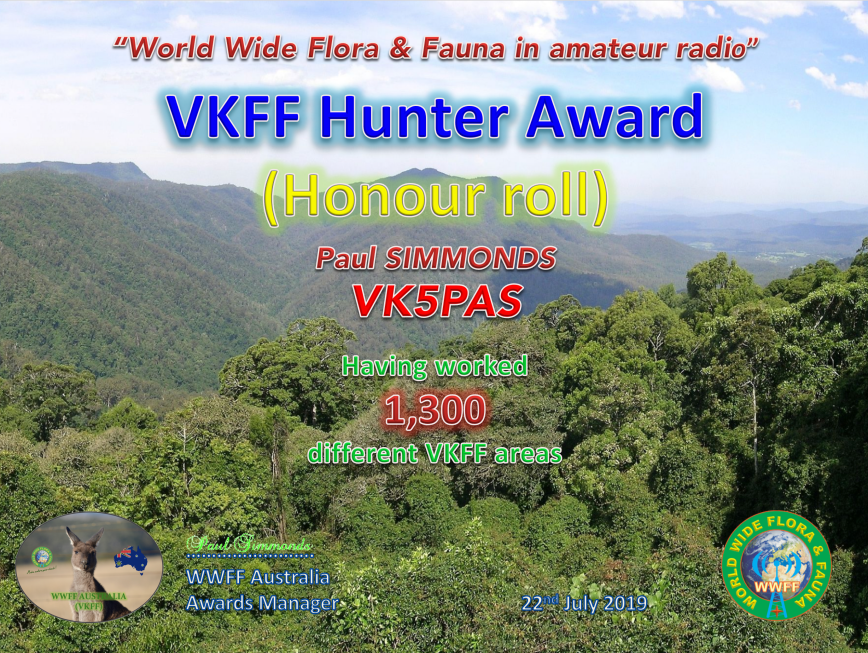
In the last few days, I have qualified for my latest VKFF award certificate.
It is the VKFF Hunter Honour Roll 1,300 certificate, issued for having worked 1,300 different VKFF references.
I have not been anywhere near as active this year in the WWFF/VKFF program for a variety of reasons. One of those is the noise floor here at home. I have gone from strength 5 noise on 40m to strength 9, making it almost impossible to work activators from home nowadays. VKFF activators are now logged either from my mobile or when I go out portable myself.
Many thanks to all of the VKFF activators who have made this certificate level possible.
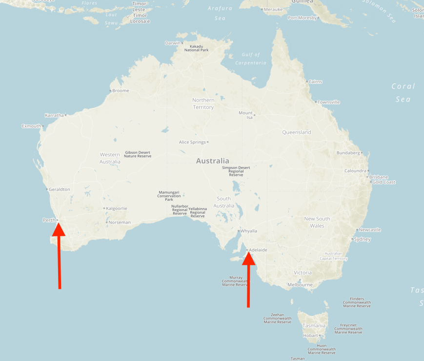
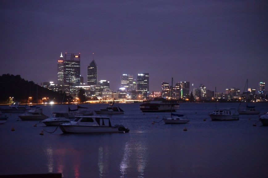
Marija and I arrived home late this afternoon (Monday 22nd July 2019) from our week away in Perth in Western Australia. We spent 6 nights at the Hyatt Regency Perth. This was NOT a radio adventure, but a one week holiday in Perth.
For overseas readers, Perth is about a 2,700 km drive from my home in the Adelaide Hills across the Nullabor Plain. We flew via Qantas which took us about 2 and 1/2 hours. The map below shows my home in Adelaide and Perth on the west coast of Australia.
Above:- Map of Australia showing my home in Adelaide, and Perth on the west coast of Australia. Map courtesy of Protected Planet.
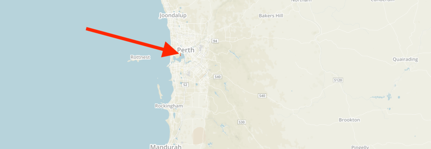
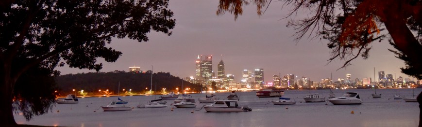
We activated just the one park while we were away, the Matilda Bay Reserve VKFF-2825, which is located about 6 km south-west of the Perth Central Business District.
Above:- Map showing the location of the Matilda Bay Reserve in Perth. Map courtesy of Protected Planet.
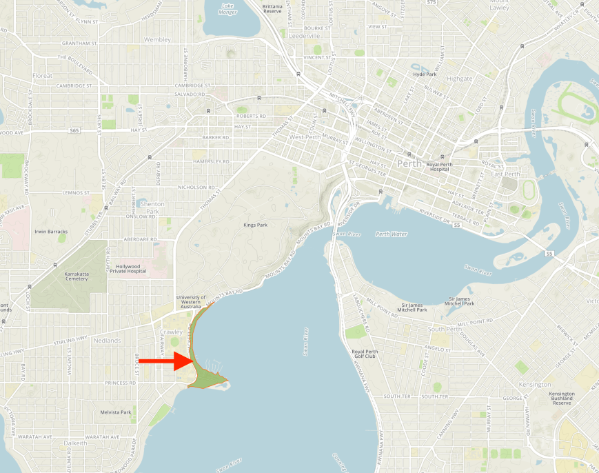
Matilda Bay Reserve is a thin strip of land which covers about 20.6 hectares between Hacket Drive and the Swan River. The reserve extends from Mount Bay Road in the north to the windsurfing ramp at the southern section of the park. It is located adjacent to the suburb of Crawley.
Above:- Map showing the location of the Reserve to the south-west of the Perth CBD. Map courtesy of Protected Planet.
Matilda Bay takes its name from Matilda Elizabeth Roe, the wife of John Septimus Rose, the first Surveyor of Western Australia.
Above:- Matilda Elizabeth Roe nee Bennett. Image courtesy of geni.com
Matilda Bay Reserve incorporates Pelican Point, an important breeding sanctuary for international migratory birds. It takes its name for the pelicans which rest on sand bars at the end of the point. Pelican Point was formerly named Point Currie after Captain Mark John Currie who in 1829 received an allotment of land in the area which became known as Crawley.
During the Second World War, the US Navy had a Seaplane Base at Pelican Point. It was known as Pelican Point Advance Base “A” for “Able”. QANTAS also used five RAF-supplied PBY-5 Catalinas at the Crawley Sea Base.
Above:- A Catalina. Image courtesy of Wikipedia.
It is reported that about 20 Bottlenose dolphins inhabit the Swan River and can often be seen from Matilda Bay Reserve. The reserve is also home to numerous water birds including pelicans, swans, ducks, terns, herons and cormorants.
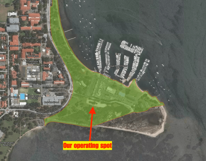
Hans VK6XN kindly picked Marija and I up from Optus Stadium after a guided tour we had gone on there. We drove out to Matilda Bay and set up in the carpark opposite the Royal Perth Yacht Club.
Above:- An aerial view of the park showing our operating spot. Image courtesy of Protected Planet.
The Royal Perth Yacht Club is the third oldest yacht club in Australia. It can trace its origins back to 1841 when a group of sailors staged a modest regatta to celebrate Foundation Day. In 1865 this original group of pioneer sailors formalised the Perth Yacht Club.
In 1983 an Australian syndicate representing the Royal Perth Yacht Club fielded the Australia II, skippered by John Bertrand, against defender Liberty, skippered by Dennis Conner. Australia II won the match races to win the America’s Cup – the first winning challenge to the New York Yacht Club, which had successfully defended the cup over a period of 132 years.
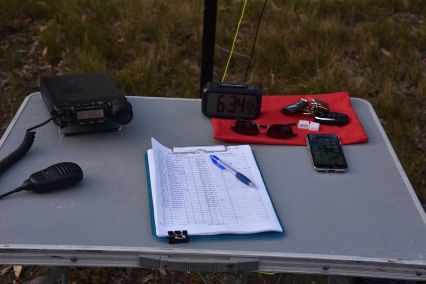
For this activation, we ran Hans’ equipment, consisting of a Yaesu FT-857d and an end-fed wire and a vertical.
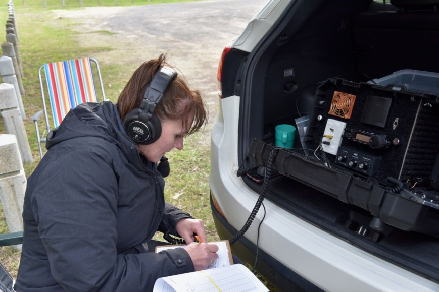
We were set up and ready to go by about 0720 UTC (3.20 p.m WA local time). Maria placed a spot up for me on parksnpeaks and I started calling CQ. Sadly we had strength 8 noise on 40m from the park. It made it incredibly difficult to hear a lot of the stations that were calling.
First in the log was Ivan VK5HS in the Riverland region of South Australia, followed by Adrian VK5FANA on the Yorke Peninsula, and then Peter VK5PE. I logged five stations before swapping the mic with Marija. I know there were a lot of stations calling, but sadly the noise was shocking.
Marija’s first contact was with Gary VK6GC/m who was on his way to the park to catch up with us, followed by John VK5BJE in the Adelaide Hills, Marija battled with the noise and logged a total of 6 stations from VK2, VK3, and VK5, before the noise got just too much for her.
I then tried my luck on 20m, logging 3 stations there, Scott VK4CZ, Allen VK3ARH, and Nik VK3ZNK. But again I battled with noise, with strength 7 noise on the 20m band.
It was then off to 80m where sadly again we had strength 8 noise. But this band did result in both Marija and I qualifying the park for VKFF with 10 contacts. I logged 5 stations on 80m, whilst Marija logged 4. The biggest signal on 80m was Ted VK6NTE who was strength 9 plus.
To finish the activation I headed back to 40m where I called CQ on 7.130. Mark VK4SMA was first in the log, followed by Geoff VK3SQ, Peter Vk3PF, Les VK5KLV and then John VK2FALL. It wasn’t long before an Indonesian station popped up on the frequency, so I moved up to 7.135 where I logged Gerard VK2IO/8 and then Andrei ZL1TM in New Zealand.
Above:- Marija VK5FMAZ on the mic battling with the noise.
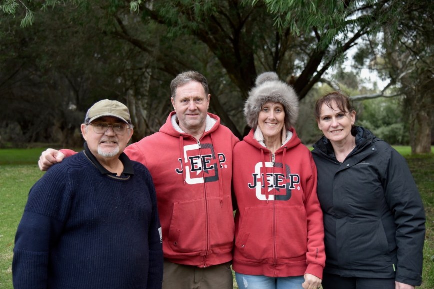
During our activation, Gary VK6GC and his wife Veronica popped out for a chat.
Above:- L-R: Hans VK6XN, Gary VK6GC, Veronica, & Marija VK5FMAZ
It was starting to get a bit chilly, so we decided to call it a day. Marija had qualified the park for VKFF with 10 contacts. I had also qualified the park for VKFF, with 22 contacts in the log.
We packed up just after 5.00 p.m. and Marija and I were dropped back into the city to our motel by Hans. THANKS, Hans.
I worked the following stations on 40m SSB:-
VK5HS
VK5FANA
VK5PE
VK34PDX
VK6GC
VK5BJE
VK5FRSM
VK4SMA
VK3SQ
VK3PF
VK5KLV
VK2FALL
VK2IO/8
ZL1TM
I worked the following stations on 20m SSB:-
VK4CZ
VK3ARH
VK3ZNK
I worked the following stations on 80m SSB:-
VK6ADF
VK6GC/m
VK6VCK/p
VK6NTE
VK6EA
It was dark as we headed back into the Perth CBD. I took the photos below in the carpark adjacent to the Royal Perth Yacht Club.
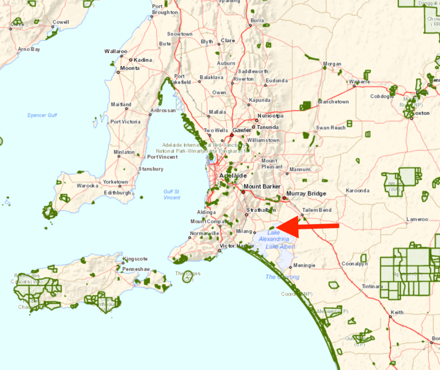
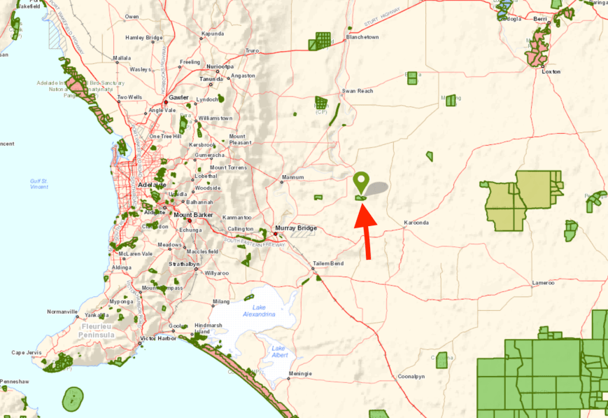
Today (Monday 15th July 2019) I packed the 4WD and headed south to the Tolderol Game Reserve VKFF-1752. I have activated Tolderol previously, so today’s activation would go towards the Boomerang Award.
Tolderol is located about 77 km south-east of Adelaide, and about 12 km south of Langhorne Creek.
After leaving home I headed south on Wellington Road, travelling through the town of Woodchester. I then took Meechi Road and soon reached the Langhorne Creek wine growing region and then the town of Langhorne Creek which takes its name from Alfred Langhorne, a cattle drover who brought cattle overland from New South Wales during the 1840s.
Langhorne stopped to rest and feed his stock on the fertile local pastures, then referred by ‘overlanders’ as Langhorne’s Station. The place where Langhorne traversed the Bremer River became known as Langhorne’s Crossing. The first bridge built over the Bremer River in 1847 and the town surveyed in 1849, becoming known as Langhorne’s Bridge.
Areas known as Bremerton (Bremer Town) and Kent Town were encompassed in the broader area that became Langhorne’s Creek and later renamed Langhorne Creek.
In 1850 Frank Potts settled on the rich ancient flood plain of the Bremer River and planted the first vineyards in the district in the early 1860s.
Today the Langhorne Creek wine region is well known for the production of outstanding Cabernet Sauvignon and Shiraz. These two red wine grape varieties constitute approximately 70% of the total vineyard plantings in the region.
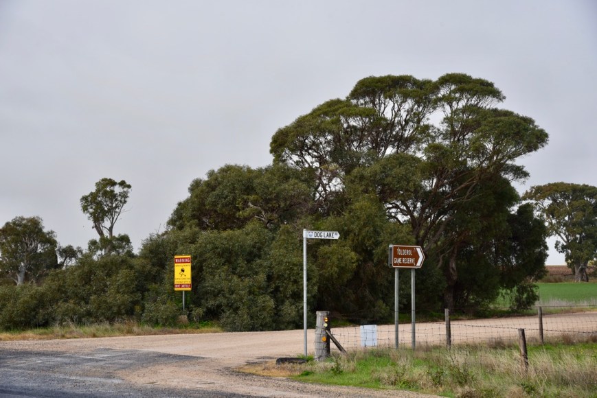
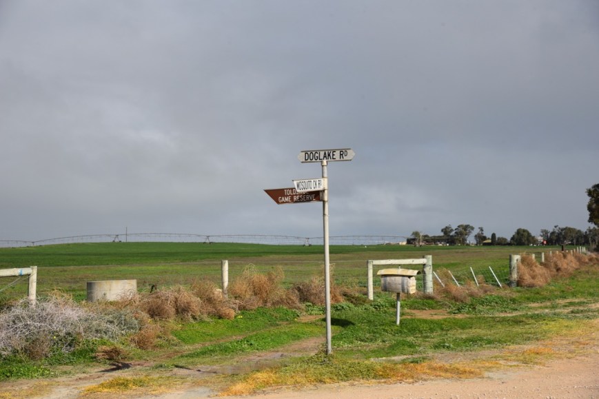
I headed out of Langhorne Creek on the Langhorne Creek to Wellington Road and soon reached the turnoff to Tolderol. This is well signposted and is located at the junction with Dog Lake Road.
After a number of km I reached the intersection of Dog Lake Road, Mosquito Creek Road, and Marandoo Road. Tolderol is signposted at this location. I continued south on Dog Lake Road.
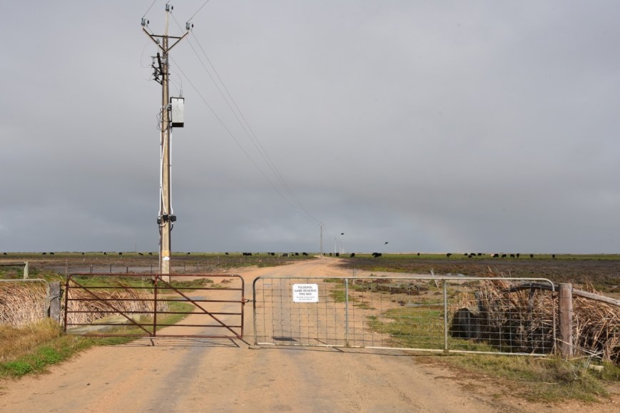
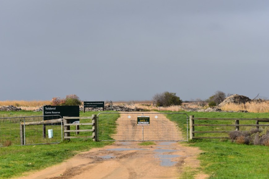
I soon reached the first of two gates. Today the gate was closed. Sometimes you will find it open. As the sign on the gate says, leave the gate as you find it.
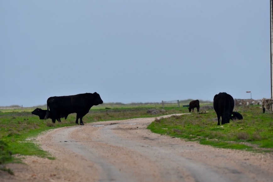
I headed slowly along Dog Lake Road with a number of obstacles along the way in the form of cattle.
I then turned left at the dog leg in the road. There is another park sign here.
I then reached gate one of the park, the start of the Tolderol Game Reserve.
Tolderol Game Reserve is 428 hectares in size and was first proclaimed on the 8th day of January 1970. Initially, the reserve consisted of 226 hectares. On the 26th day of February 1970, the land was re-proclaimed as a fauna conservation reserve. Two years later on the 27th day of April 1972, it was reconstituted as a game reserve. An additional 202 hectares were added on the 10th day of January 1980.
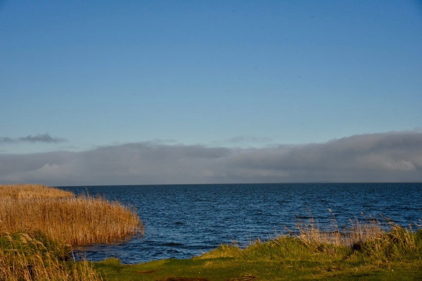
The reserve consists of extensive areas of samphire, reed and sedges with large open areas of water. A series of seventeen ponds have been constructed which provide habitat for a wide variety of waterbirds. The park is located on the northwestern side of Lake Alexandrina.
Tolderol is a highly regarded bird watching location, The shallow basins, reed beds, lakeshore and grassy banks, attract a wide range of birds. Tolderol is part of the internationally significant RAMSAR wetlands. Tolderol is open for hunting during gazetted dates, however, it remains a critical habitat for protected birds.
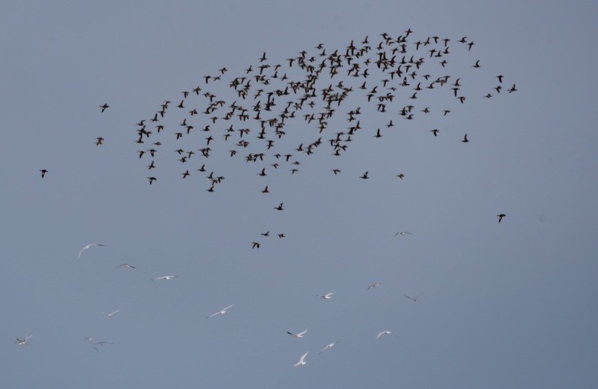
As I entered the park a large flock of waterbirds were disturbed. Initially, I thought it was me and the sound of the 4WD.
But I then noticed a bird of prey which was flying across the pond and it was the cause of the other birds to take to the sky.
About 182 species of bird have been recorded in the reserve by Birds SA. This includes Black Swan, Pacific Black Duck, Whiskered Tern, Straw-necked Ibis, Spur-winged Plover, Golden-headed Cisticola, Australia Reed Warbler, Latham’s Snipe, White-winged Tern, Spotless Crake, Baillon’s Crake, Ruff, and Long-toed Stint.
Below is a short documentary showing the wide variety of birds located in the park.
I took quite a few bird photos during my visit to Tolderol. Some of those appear below.
This slideshow requires JavaScript.
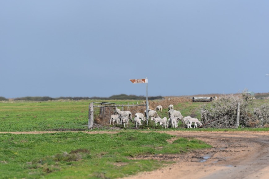
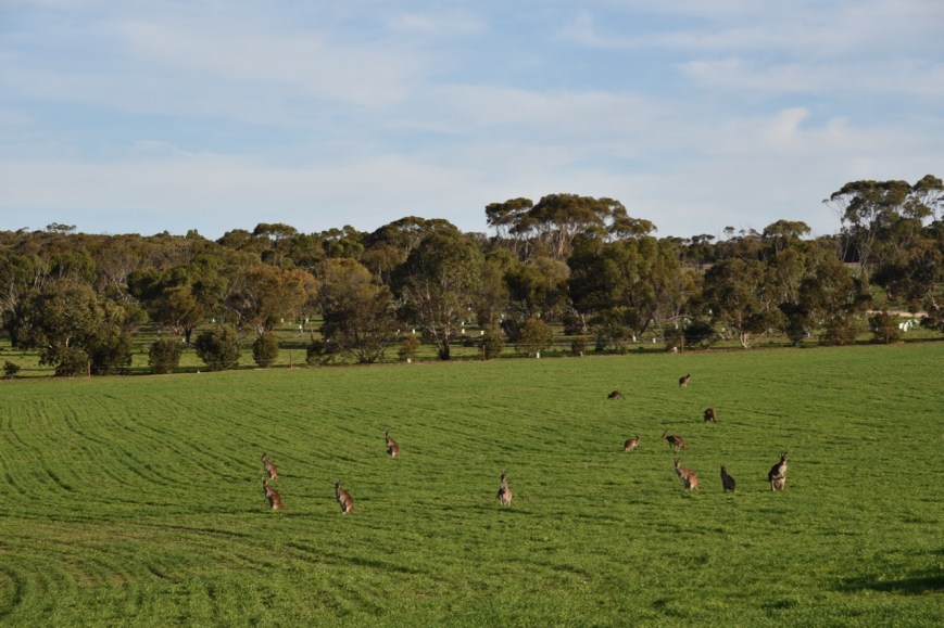
During my visit to the park, I also observed a number of kangaroos.
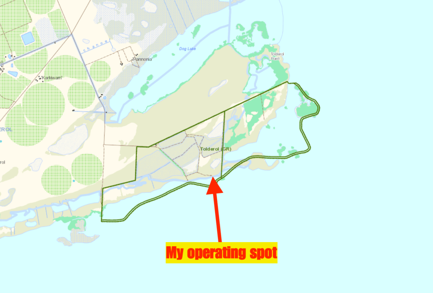
I travelled to the picnic area in the park. There are three tables and benches here and plenty of area to stretch out a dipole.
My operating spot was right alongside the northern shore of Lake Alexandrina which takes its name after Princess Alexandrina, the niece and successor of King William IV of Great Britain and Ireland.
For this activation, I ran the Yaesu FT-857d, 30 watts output, and the 20/40/80m linked dipole which was supported by my 7-metre telescopic squid pole. I secured the legs of the antenna with some tent pegs.
After switching on the transceiver I tuned to 7.144 and asked if the frequency was in use. Ron VK3AHR came back to my call to advise that the frequency was clear. This happens quite often where I don’t even get the chance to call CQ. It appears that some of the park diehards sit on 7.144 waiting for activity.
After logging Ron I spoke with Brett VK2VW, Karl VK2GKA, and then Cliff VK2NP. This was followed by a Park to Park with Mike VK6MB/3 who was activating the Bolton Flora & Fauna Reserve VKFF-2272.
Contact number ten was with Ray VK4NH, just 9 minutes into the activation. Although I had previously qualified the park it is always nice to get 10 and then 44 contacts in the log during an activation.
I logged a total of 24 stations on 40m from VK2, VK3, VK4, VK5, and VK7. It appeared that close in propagation was non-existent again, with just the one South Australian station logged. That being Adrian VK5FANA on the Yorke Peninsula. Adrian was very low down, 4/1, but was readable due to the low noise floor in the park.
I moved down to the 80m band and stated calling CQ on 3.610 after placing a self spot on parksnpeaks. First in the log was Gerard VK2IO/5 who was mobile near Woomera in the north of South Australia. This was followed by John VK5BJE, Sue VK5AYL, and then Peter VK3PF. I logged a further 5 stations on 80m before callers on that band dried up.
With 33 contacts in the log, I lowered the squid pole and removed the links for the 20m band. I was about to start calling CQ on 20m when I saw a spot pop up on 40m for Mike VK6MB/3 who was now in a different park.
So it was back down with the squid pole and in with the 40m links. I headed for 7.135 and logged Mike who was in the Moss Tank Flora & Fauna Reserve VKFF-2394.
After working Mike I moved back to 20m and called CQ on 14.310 for about 5 minutes with no callers. So I headed back to 40m for one final go on that band before packing up for the day. Ken VK2HBO was the first to come back to my call, followed by Compton VK2HRX/5 mobile near Maree in the Far North of South Australia.
I logged a further 13 stations from VK1, VK2, VK4, and VK7.
I worked the following stations on 40m SSB:-
VK3AHR
VK2VW
VK2GKA
VK2NP
VK6MB/3 (Bolton Flora & Fauna Reserve VKFF-2272)
VK3PF
VK4HNS
VK4NH
VK4DXA
ZL4TY/VK4
VK4FARR
VK3UH
VK3MCK
VK2ADB
VK4FDJL
VK3AWG/m
VK2MG
VK2AVT
VK3MH
VK5FANA
VK2IO/5
VK7LT
VK2LEE
VK3ZMD
VK6MB/3 (Moss Tank Flora & Fauna Reserve VKFF-2394)
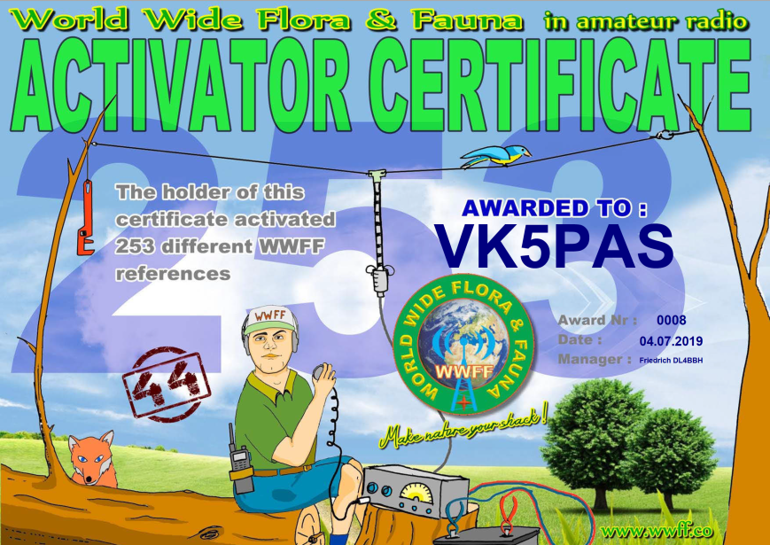
In the past week, I received another global WWFF certificate. It is issued for having activated a total of 253 WWFF references and having reached 44 QSOs during each of those activations.
My current park tally is 307 park activations, with 256 where I have reached the 44 QSO threshold for the global WWFF awards.
Thank you to Friedrich DL4BBH the Awards Manager, and thank you to everyone who has called me during those activations.
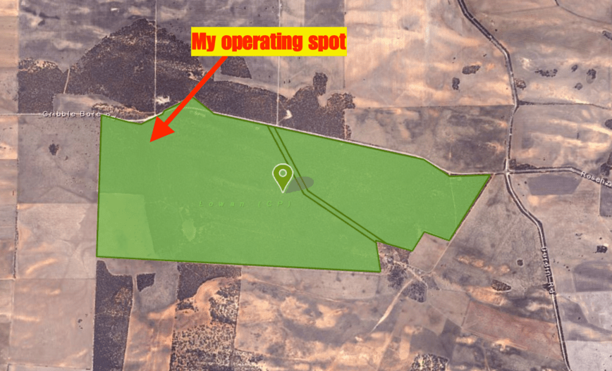
I left Ettrick Conservation Park and headed for my next park, the Lowan Conservation Park 5CP-121 and VKFF-1052. Again this was another park I had activated previously, so this activation would go towards the Boomerang Award and count towards my stats for the 2019 Top Activator.
Above:- Map showing the location of the Lowan Conservation Park. Map courtesy of Location SA Map Viewer.
I travelled along Glenburr Road and then Piggy Back Road and turned left onto Bowhill Road. It wasn’t long before I reached the intersection with Gribble Bore Road. There is a cairn here to commemorate the sealing of the Bowhill Road, and an old well and windmill.
I travelled east along Gribble Bore Road and soon reached the park which is well signposted.
The Lowan Conservation Park was established on the 9th day of September 1971 and was formerly known as the Lowan National Park. The land was purchased by the South Australian State Government on the advice of “the Land Board and National Parks Council” from the owner “who were anxious to see scrub remain on the block.
On the 27th day of April 1972, the park was reconstituted as the Lowan Conservation Park upon the proclamation of the National Parks and Wildlife Act 1972. On the 2nd day of August 1973, land in section 73 of the Hundred of Bowhill was added to the conservation park.
The park consists of tall open scrubland and open mallee.
Birds SA have recorded a total of 88 species of bird in the park including Common Bronzewing, Spiny-cheeked Honeyeater, White-eared Honeyeater, Yellow-rumped Thornbill, Weebill, White-winged Chough, Striped Honeyeater, Yellow Thornbill, Chestnut Quail-thrush, Gilbert’s Whistler, Magpie-lark, and Southern Scrub-Robin.
The park takes its name from the endangered Malleefowl which is also known as the Lowan.
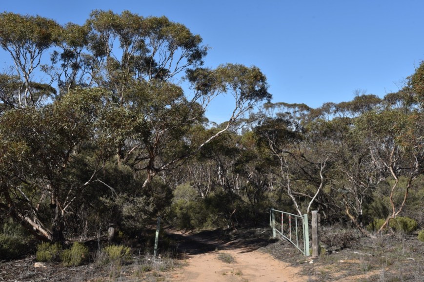
I entered the park via one of the open gates on Gribble Bore Road and travelled down the 4WD track.
I found a small clearing and set up my gear, the Yaesu FT-857d and the 20/40/80m linked dipole.
Above:- An aerial shot of the Lowan Conservation Park showing my operating spot. Image courtesy of Location SA Map Viewer.
Once again I had very little if any phone coverage in the park. I called CQ on 7.144 and within a short period of time, Deryck VK4FDJL came back to my call. John VK2MOP followed, then Peter VK1JH on his way to a SOTA summit, and then Warren VK7WN/p on Bruny Island.
My first Park to Park for the activation came 13 QSOs into the activation. It was with Peter VK3PF/p who was activating the Rokeby Flora Reserve VKFF-2428. A few QSOs later I was called by Peter VK1JH who was now on top of his SOTA summit, Tuggeranong Hill VK1/ AC-038. A few QSOs I had another Park to Park in the log, with a QSO with Rob VK4AAC/3 in the Tocumwal Regional Park VKFF-0978.
I logged a total of 51 QSOs on 40m including three more Park to Park contacts: Ian VK1DI/p in the Goorooyaroo Nature Reserve VKFF-0841; Adam VK2YK/p in the Medowie State Conservation Area VKFF-1349; and David VK2JDS/m in the Sturt National Park VKFF-0470.
I then headed off to 20m where I logged 8 stations from VK2, VK4, New Zealand, and Canada. I was very surprised to be called by Marvin VE3VEE in Canada.
It was then off to 80m where I called CQ on 3.610. Andy VK5LA in the Riverland was first in the log, followed by Marija VK5FMAZ, and then John VK5BJE. I logged a total of QSOs on 80m including three Park to Park contacts with Ian VK1DI/p in the Goorooyaroo Nature Reserve VKFF-0841; Gerard VK2IO/5 in the Upper Gulf St Vincent Marine Park VKFF-1755; and Peter VK3PF/p in the Sweetwater Creek Nature Conservation Reserve VKFF-2200.
To conclude the activation I moved back to 40m. I now had 68 contacts in the log. I logged a further 14 stations on 40m including Max IK1GPG in Italy, and two further Park to Parks: Adam VK2YK/p in the Tilligerry State Conservation Area VKFF-1377; and Peter VK3PF/p in the Bull Beef Creek Nature Conservation Reserve VKFF-2055.
It was now 3.30 p.m. and time to head home. It had been another great activation, with 82 contacts in the log including 12 Park to Park QSOs.
Again, MANY THANKS to those who spotted me.
I worked the following stations on 40m SSB:-
VK4FDJL
VK2MOP
VK1JH
VK7WN/p
VK3SQ
VK4RF
VK4HA
VK4NH
VK4DXA
ZL4TY/VK4
VK2HHA
VK2CZ
VK3PF/p (Rokeby Flora Reserve VKFF-2428)
VK3MPR
VK1JH/p (Tuggeranong Hill VK1/ AC-038)
VK4SMA
VK2NP
VK2VW
VK4AAC/3 (Tocumwal Regional Park VKFF-0978)
VK2VH/2 (Tocumwal Regional Park VKFF-0978)
VK2FGJO
VK5LA
Vk3PAT
VK3MCK
VK4FARR
VK5BJE
VK4CZ
VK3MAB
VK2KNV/m
VK2DJP
VK4TJ
VK4/AC8WN
VK4/VE6XT
VK3ANL
VK3ZNK
VK3BHR
VK5FANA
VK3CWF
VK6EA
VK1DI/p (Goorooyaroo Nature Reserve VKFF-0841)
VK2YK/p (Medowie State Conservation Area VKFF-1349)
VK2PKT
VK2ADB
VK3SWV/p
VK5PE
VK2JDS/m (Sturt National Park VKFF-0470)
VK3FLAK/p
VK5IS
VK5CZ
VK3PF/m
VK2KT
VK7AN
VK4MWB
VK7DW/m
VK4FDJL/m
VK2YK/p (Tilligerry State Conservation Area VKFF-1377)
VK3FRC
VK3MKE
IK1GPG
VK4FGZA/2
VK2ESG
VK3MRO/m
VK2QK
VK3PF/p (Bull Beef Creek Nature Conservation Reserve VKFF-2055)
VK2KJJ
I worked the following stations on 20m SSB:-
VK2VW
VE3VEE
ZL1TM
VK6XN
VK6EA
VK4TJ
VK4/AC8WN
VK4/VE6XT
I worked the following stations on 80m SSB:-
VK5LA
VK5FMAZ
VK5BJE
VK5ZX
VK1DI/p (Goorooyaroo Nature Reserve VKFF-0841)
VK2IO/5 (Upper Gulf St Vincent Marine Park VKFF-1755)
VK5FANA
VK3SQ
VK3PF/p (Sweetwater Creek Nature Conservation Reserve VKFF-2200)
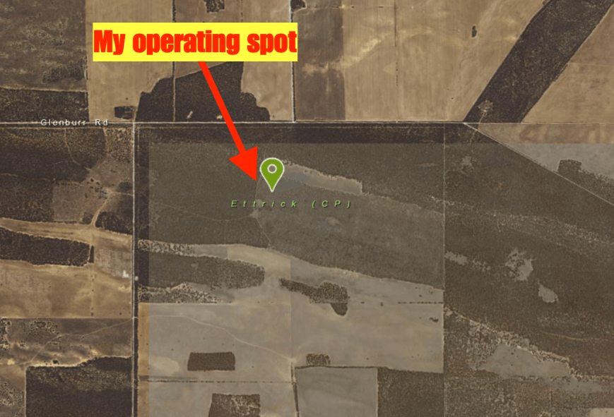
Today (Saturday 6th July 2019) was a beautiful sunny day ahead of some wet weather coming in from the west. So I took the opportunity of heading east to activate some Murray Mallee parks. The first park was to be the Ettrick Conservation Park 5CP-267 & VKFF-1029. I have activated and qualified this park previously so today’s activation would go towards the Boomerang Award.
The park is located about 110 km east of Adelaide and about 33 km north east of the town of Murray Bridge.
Above:- Map showing the location of the Ettrick Conservation Park in the Murray Mallee. Map courtesy of Location SA Map Viewer.
I left home at around 9.30 a.m. and headed east along the South Eastern Freeway to Murray Bridge. I then headed north on Burdett Road and stopped briefly to admire some of the views of the Murray River.
I then turned right onto Glenburr Road. This took me past a number of cropping properties and some old abandoned stone farm buildings.
About 4-5 km along Glenburr Road I reached the junction with Boundary Road. This is the northwestern corner of the park which is not signposted. I have mentioned this in previous posts, but do not get some of the surrounding scrub confused with the park and end up on private property. There is a lot of native vegetation around the park which is not part of the Ettrick Conservation Park.
The Ettrick Conservation Park was established on the 31st day of October 2013 and is about 479 hectares in size.
Above:- An aerial view of the Ettrick Conservation Park looking north. The Murray River can be seen to the north of the park. Image courtesy of Google Maps.
The park takes its name after the Hundred of Ettrick which was proclaimed on 4th May 1893. It was named by Governor Kintore who hailed from Scotland where there is a ‘Parish of Ettrick’ in Selkirk, derived from the Gaelic eadar-dha-eas – ‘between two waterfalls’.
ABove:- Ninth Earl of Kintore, Governor Kintore. Image courtesy of adb.anu.edu.au
The park is made up of open mallee with several species of Eucalpyt. It is also home to one of the few remaining examples of tussock grassland in this part of the Murray Darling Basin. The park is an important refuge for species such as the Malleefowl and Regent Parrot.
Birds SA have recorded about 65 species of bird in the park including Mallee Ringneck, Galah, Spiny-cheeked Honeyeater, Spotted Pardalote, White-browed Babbler, White-winged Chough, Peaceful Dove, Purple-backed Fairywren, Splendid Fairywren, Grey Butcherbird, Black-faced Cuckoo-shrike, and Gilbert’s Whistler.
If you follow the main track through the park it will bring you to an old abandoned farmhouse which I suspect was the original homestead on the property before it was acquired by the South Australian Government as a park.
I travelled along a 4WD track which led into the park via a gateway (minus the gate) on Glenburr Road. I found a clearing in amongst the scrub and set up my station comprising the Yaesu FT-857d and the 20/40/80m linked dipole. I ran about 30 watts for this activation.
Above:- Aerial shot of the park showing my operating spot. Image courtesy of Location SA Map Viewer.
I had very little phone coverage in the park so had a lot of difficulty in trying to self-post on parksnpeaks. I called CQ on 7.144 and this was almost immediately answered by Hans VK5YX with a big signal from the southern suburbs of Adelaide. I had forgotten to write down the park reference so Hans kindly looked it up for me. Geoff VK3SQ and Brett VK2VW followed and I was informed that Rob VK4AAC/3 was down on 80m in a park. So it was down with the squid pole and in with the 80m sections of the antenna and off to 3.640. I logged Rob who was activating the Tocumwal Regional Park VKFF-0978.
I then headed back to 7.144 on 40m and found that there was quite a pile up waiting for me. I logged Lee VK2LEE, followed by Mike VK6MB/2 in the Kemendok National Park VKFF-1174. About 8 QSOs later Rob VK4AAC/3 gave me a shout for a Park to Park on a different band.
Within an hour I had 44 contacts in the log, with QSO number 44 being with Peter VK2FPAR. A few QSOs after Pete I had my fifth Park to Park QSO in the log with a contact with Peter VK3PF/p who was activating the Rokeby Flora Reserve VKFF-2428.
I logged a total of 49 stations on 40m before heading over to the 20m band. I called CQ and this was answered by Scott VK4CZ with a lovely 5/9 signal, although the pesky Over the Horizon Radar was present on 20m once again. Hans VK6XN then gave me a shout followed by Ian VK6EA who has become a regular park hunter of late.
I logged 12 stations on 20m and then headed down to 3.610 on 80m. As I had no internet coverage I was hoping there may be someone on that frequency monitoring. And fortunately, there was. John VK5BJE was first in the log, followed by Peter VK3PF/p in the Rokeby Flora Reserve VKFF-2428, and finally Gerard VK2IO/5.
I had 64 contacts in the log in a little under 90 minutes and it was time to pack up and head off to my next park the Lowan Conservation Park.
A BIG THANKS to those who took the time to spot me during this activation.
Today (Friday 5th July 2019) after work I headed to the Kinchina Conservation Park 5CP-277 & VKFF-1764 for a quick late afternoon activation. I have activated and qualified Kinchina a number of times previously, so today’s activation for me would count towards the Boomerang Award.
The Kinchina Conservation Park is located just to the west of the town of Murray Bridge, about 75 km east of the city of Adelaide.
Above:- Map showing the location of the Kinchina Conservation Park. Map courtesy of Location SA Map Viewer.
I drove east along the South Eastern Freeway and took the Monarto exit. I then travelled east on the Old Princes Highway and then turned left onto Maurice Road. This is good cropping land, and many of the crops were full of kangaroos. Much to the farmer’s disgust, I suspect.
I soon reached the western section of the Kinchina Conservation Park which is very well signposted.
The Kinchina Conservation Park was established on the 22nd day of September 2016 and is 414 hectares in size. It is located in the north of the Gifford Hill Range on the eastern flanks of Rocky Gully and White Hill, west of the town of Murray Bridge. The Gifford Hill Range was named after South Australian pioneer John Gifford.
Above:- An aerial shot of the Kinchina Conservation Park looking east. The town of Murray Bridge and the mighty Murray River are located nearby. Image courtesy of Google maps
During my visit to the park, it was alive with Western Grey Kangaroos. The beautiful Diamond Firetail finch can be found in the park. However, it wasn’t spotted by me during this visit. I did, however, see a number of other bird species including Red Wattlebirds and Mulga parrots.
Walking SA has a number of great walks in this park listed on their website.
I parked my vehicle in the second carpark along Maurice Road, just above the Mobilong Prison. I walked a short distance inside the park gate and set up my station consisting of the Yaesu FT-857d and the 20/40/80m linked dipole. I ran about 30 watts for this activation.
I placed a self spot on parksnpeaks and started calling CQ on 7.144. First in the log was Brett VK2VW with a big 5/9 plus signal, followed by John VK4TJ, Deryck VK4FDJL, and then Rick VK4RF.
I logged a total of 18 stations on 40m from VK1, VK2, VK4, VK7 and New Zealand. Not a single station from Victoria or South Australia was logged. It appeared that the close in propagation was not working resulting in no VK5’s. I’ve also noted of recent times that the 40m band often shuts down into Victoria. And today was no exception.
It was getting a bit late, about 0715 UTC, but I then headed off to the 20m band. I called CQ on 14.310 and logged a total of 5 stations, all from Queensland.
I then tried my luck on 80m. For whatever reason, I had strength 7 noise on that band, which resulted in me missing a few callers. However, I did log a total of 22 stations from VK2, VK3, VK4, VK5 and VK7. This included a number of stations from Victoria and South Australia, but also as far afield as Queensland.
To complete the activation I went back to 40m hoping to log Stuie VK8NSB in Darwin who had posted on Facebook that he was keen for a contact and unable to hear me on 20m. However, it was not to be. I logged 5 stations from VK2, VK4, VK6, and Vanuatu. It was a real pleasure to be called by Mike YJ0MB in Vanuatu who had a bit 5/9 signal.
I was being eaten alive by the mosquitoes and it was time for me to pack up and head for home. I had a total of 50 stations in the log.
This afternoon (Tuesday 2nd July 2019) I headed out to the Monarto Woodlands Conservation Park 5CP-276 & VKFF-1763. I have activated and qualified this park previously, so today’s activation was to go towards the VKFF Boomerang Award. Another reason for heading out into the field today was to film a short introduction to another video for the VKFF YouTube channel. I also intended taking a few photos to enter into the Birdlife Australia photographic competition.
Above:- Map showing the location of the Monarto Woodlands Conservation Park east of Adelaide. Map courtesy of Location SA Map Viewer.
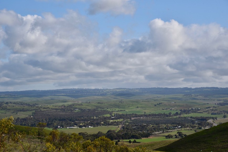
I headed out to Callington and headed up the hill out of Callington on the old Princes Highway. There are some great views to be had here of the Bremer Valley.
During the 1970s, plans were implemented by the Labor State Government under the leadership of Don Dunstan to establish a satellite city at Monarto, about 70 km east of Adelaide. Concerns were held that the city of Adelaide would become overpopulated following rapid population growth. Originally named ‘Murray New Town’, the proposed city was subsequently known as the ‘City of Monarto’. Dunstan’s vision did not succeed. In 1975 the Australian Federal Whitlam government was controversially dismissed which resulted in the “new cities programme” programme being shut down.
ABove;- Don Dunstan. Image courtesy of Wikipedia
The video below was produced by the South Australian Film Corporation in 1975. It gives an interesting insight into the farmers of the area at the time, many of whom sold their land believing that the satellite city would go ahead.
As part of the Monarto development, substantial areas of cleared farming land were revegetated. This was in an effort to beautify the environment, reduce dust and make the area more attractive for human habitation. This has been the largest revegetation program conducted in South Australia, with some 600,000 plants established on 1850 ha of land. A total of 250 species of trees and large shrubs were planted.
Above:- Aerial shot of the Monarto Woodlands Conservation Park, looking west back towards Adelaide. The blue marker is my home location.
The Monarto Woodlands Conservation Park is a relatively new park. It was gazetted on the 22nd day of September 2016 and is 426 hectares in size. Monarto takes its name from the Hundred of Monarto which was gazetted in 1847. It was named after ‘Queen Monarto’ an aboriginal woman who lived in the area at the time. In 1908 the town of Monarto was laid out.
During my visit to the park, I saw numerous Western Grey kangaroos, a number of whom had joeys in their pouches.
About 92 species of native birds have been recorded in the Monarto area including 40 species which are considered to be declining. During my visit, I was hoping to spot a Diamond Firetail finch, but I wasn’t that lucky. But I did spot many other birds, some of which feature in my photos below.
I ran the Yaesu FT-857d, 40 watts, and the 20/40/80m linked dipole for this activation. The dipole is supported on a 7-metre telescopic squid pole and is inverted vee configuration.
After turning the transceiver on, I asked if the frequency was in use on 7.144. Geoff VK3SQ and Peter VK3PF both came back to let me know it was clear. Amazing how popular the WWFF program has become in Australia in recent years. This happens regularly, in that, I don’t even need to call CQ.
After logging Geoff and Peter, Dennis VK2HHA then called, followed by Brett VK2VW, Peter VK2KNV mobile, and then Glenn VK4FARR. Brett and Glenn kindly spotted me on parksnpeaks which resulted in a mini pile up, despite it being a weekday.
I logged 44 contacts in around 60 minutes with contacts into VK2, VK3, VK4, VK6, VK7 and New Zealand. This included a Park to Park with Peter VK3TKK/p who was activating the Sydney Harbour National Park VKFF-0473. I was also called by Tony VK7LTD/p and Angela VK7FAMP/p who were operating from SOTA summit VK7/ NE-034.
I then headed to 14.310 on the 20m band and started calling CQ after putting up a self spot on parksnpeaks. Rick VK4RF was first in the log on 20m, followed by Cliff VK2NP and then Ray VK4NH. I logged a total of 9 stations on 20m including another Park to Park with Peter VK3TKK/2 on a second band from Sydney Harbour.
When callers slowed down I tuned across the band and heard a few North American stations at around strength 7-8. The ANZA DX Net was running on 14.183 and was about to close, so I quickly booked in and was lucky enough to work Stan KE5EE with a strong 5/8 signal. He gave me a 5/7 signal report.
I then moved down to 80m where I was hoping to log some of the local South Australian stations, as I had not logged a single VK5 on 40m. I logged a total of 6 stations on 3.610. Four of those were from VK5, while two were from VK3.
To conclude the activation I had one last go on 40m calling CQ on 7.144. I logged a further 9 stations.
It was now just before 4.30 p.m. local time and it was time for me to pack up and go for a walk through the park. I had a total of 69 stations in the log.
I worked the following stations on 40m SSB:-
VK3SQ
VK3PF
VK2HHA
VK3AHR
VK2VW
VK2KNV/m
VK4FARR
VK4FDJL
VK4NH
VK4DXA
ZL4TY/VK4
VK4RF
VK4HA
VK4CPS
VK4AAC/2
VK2VH
VK2FGJO
VK7QP
VK2NP
VK2JON
VK2HRX
VK3DBP/2
ZL1TM
VK3LAJ
VK2YMU
VK4HNS
VK3TKK/2 (Sydney Harbour National Park VKFF-0472)
VK4TJ
VK4/AC8WN
VK4/VE6XT
VK6EA
VK3MCK
VK4VXX/m
VK3ZNK/m
VK2UXO
VK3ZMD
VK3BBB/p
VK7LTD/p (SOTA VK7/ NE-034)
VK7FAMP/p (SOTA VK7/ NE-034)
VK3UH
VK4/AG7WB
VK2KJJ
VK3FMPC
VK3CU
VK7ROY
VK1MA
VK7FJFD
VK3MPR
VK3MKE
VK2XSE
VK1DI
VK2HBO
VK2LEE
I worked the following stations on 20m SSB:-
VK4RF
VK4HA
VK2NP
VK4NH
VK4DXA
ZL4TY/VK4
VK4MWB
VK6EA
VK3TKK/2 (Sydney Harbour National Park VKFF-0472)
KE5EE
I worked the following stations on 80m SSB:-
VK5BJE
VK3PF
VK5FANA
VK2IO/5
VK3BBB
VK5AYL
References.
Birds Australia, 2019, ‘The State of Australia’s Birds 2019’
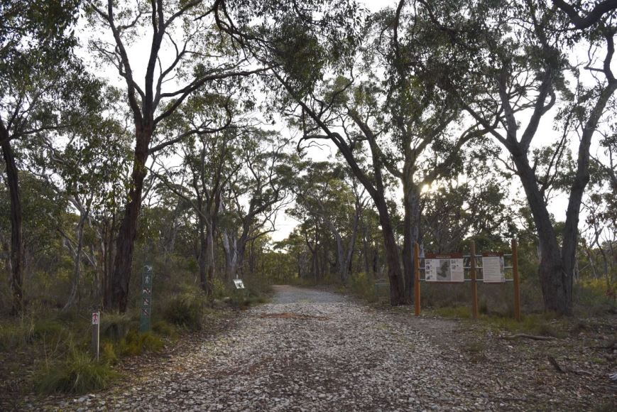
Today (Monday 1st July 2019) was the first of my 2 days off after working 7 shifts straight. And as it was a fine day I packed the 4WD and headed to the Morialta Conservation Park 5CP-142 & VKFF-0783. I have activated and qualified Morialta previously, so today’s activation was to go towards the Boomerang Award. Morialta CP is located about 12 km east of the city of Adelaide.
Above:- Map showing the location of the Morialta Conservation Park in the Adelaide Hills. Map courtesy of Protected Planet.
To get to the park I headed west on the South Eastern Freeway and took the Bridgewater exit and into the town of Uraidla. I then took the Lobethal Road into the town of Norton Summit and then travelled north on Colonial Drive.
This took me passed the Morialta Barns which were built in the late 1840s by John Baker who arrived in the colony of South Australia in 1838. Baker built the mansion Morialta at Magill in 1847.
Above:- John Baker. Image courtesy of Wikipedia
The barns were part of the Morialta House Estate where a farm and orchard was established. The stone buildings of Morialta Barns included two barns, a well house, a bakehouse, a dairy, stables, a stoned walled enclosure around the barns, the original stables and coach house, poultry shed, an old piggery, and a number of other small farm buildings.
I continued along Colonial Drive and soon reached Morialta cottage. This is often confused for the Morialta Homestead built by John Baker in 1847.
I turned up Moores Road and soon reached the eastern side of the park. I continued along Moores Road and parked at the carpark at the end of Moores Road. Although some maps may show that Moores Road continues, it does not. There is a locked gate here and only foot traffic is allowed from this point on.
The Morialta Conservation Park is about in size and was established on the 15th day of July 1915. The park consists of a narrow gorge with three waterfalls, bounded by steep ridges and cliffs. Morialta is believed to be an aboriginal Karuna word moriatta meaning “ever flowing” or “running water”,
The park is bounded by Black Hill Conservation Park on the north, Norton Summit road on the south, the suburb of Rostrevor on the west, and by agricultural land on the east. The park caters for a variety of activities, including bushwalking, picnics, rock climbing and bird watching
Above:- An aerial view of the Morialta Conservation Park looking west back towards the city of Adelaide. Image courtesy of Google Maps.
John Smith Reid was a major landholder in the area. In 1911, he offered to donate part of his land as a national reserve. In 1913 Reid donated 218 hectares (540 acres), and in 1915 the area was declared a National Pleasure Resort.
Above:- Newspaper article from the Adelaide Register, Fri 18th April 1913
Much of the construction work in the park was commenced in the 1920s and 1930s, although floods and bushfires have destroyed much of this original work. In 1966 additional property to the east was added, and the park was declared a National park. In 1972 the park was re-proclaimed as Morialta Conservation Park.
There are a number of walks in the park with all tracks being well signposted. There are also a number of information boards.
Birds SA have recorded about 92 species of native bird in the park including Yellow-tailed Black Cockatoo, Adelaide Rosella, Rainbow Lorikeet, Superb Fairywren, New Holland Honeyeater, Striated Pardalote, Black-winged Currawong, Australian Magpie, Magpie-lark, Little Raven, Little Buttonquail, Shining Bronze-Cuckoo, Chestnut-rumped Heathwren, Yellow-rumped Thornbill, and Restless Flycatcher.
The video below will give you a good idea on the beauty of this park.
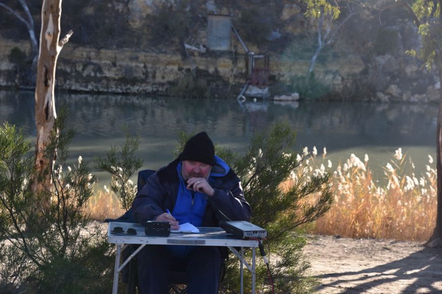
I set up on the edge of Third Falls Track. It was just a short walk from the vehicle and there was plenty of room to string out the 20/40/80m linked dipole.
Above:- Aerial shot of the Morialta Conservation Park showing my operating spot. Image courtesy of Protected Planet.
I called CQ on 7.144 with Peter VK3PF being first in the log, followed by Deryck VK4FDJL, and then a Park to Park with Nik VK3ZNK/p who was in the Yarrawonga Regional Park VKFF-0981. Despite it being a weekday, there was a steady flow of callers. It is a testament as to how popular the WWFF program has become in Australia nowadays. Within half an hour I had 33 stations in the log.
I moved down to the 80m band to 3.610 and asked if the frequency was in use. John VK5BJE came back to advise he and others had been waiting for me. I was then called by Hans VK5YX, Ian VK5CZ in the Clare Valley, and Tony VK5FBIC.
I then saw a spot pop up on parksnpeaks on 40m for Mike VK6MB/3 who was activating a park. So I quickly lowered the squid pole and took out the links and headed to 7.144. I logged Mike who was in the Tragowel Swamp Nature Conservation Reserve VKFF-2216.
After logging Mike I moved back down to 80m where I logged two stations, Keith VK3MKE and Nik VK3ZNK/p in the Yarrawonga Regional Park VKFF-0981 for a second band.
I then saw another spot pop up for Angela VK7FAMP. So it was back to 40m where I spoke with Angela who was in the St Helens Conservation Area VKFF-1153. This was my fourth Park to Park for the activation.
I then tried my luck on the 20m band but was to be sadly disappointed. The 20m band has been incredibly poor of late and today was no exception. I tried 14.310 the normal WWFF calling frequency in Australia, but I was being drowned out by the Over the Horizon Radar. So I moved down to 20m and called CQ which was answered by Matt VK1MA. Matt was 5/5 and gave me a 3/3. About 5 minutes more of CQ calls yielded no callers on that band.
So it was back to 40m where I called CQ on 7.140. Peter VK2UXO was the first to call with his normal big signal. Next was Andrei ZL1TM in New Zealand who is a regular park hunter. I logged a further 6 stations and whilst monitoring parksnpeaks I saw a spot for Gerard VK2IO/5 just below me. I moved down to 7.135 and logged Gerard, Park to Park from the Granite Island Recreation Park VKFF-1711.
To conclude the activation I moved back up to 7.140 where I logged a further 9 stations.
I had 60 contacts in the log and the temperature had now dropped to 9 deg C. It was time for me to pack up and head off for a bush walk through the park.
Our final planned activation for the trip was the Maize Island Lagoon Conservation Park 5CP-123 & VKFF-0827. Both Marija and I have qualified this park previously, so this activation was to go towards our 2019 activators stats and the Boomerang Award.
The park is located about 186 km Adelaide and about 8 km northeast of the town of Waikerie in the Riverland region of South Australia.
Above:- Map showing the location of the Maize Island Lagoon Conservation Park. Map courtesy of Protected Planet.
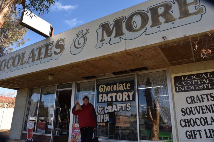
But before going to the park Marija and I stopped off at one of our favourites, the Chocolates & More store at Monash. We left with a bag of goodies sure to do great harm to our waistline.
We then continued west on the Sturt Highway and called into the Banrock Station winery for some lunch. The winery includes a cellar door, wetland centre, gallery and restaurant. I enjoyed a Baked Riverland Murray Cod with lime and almond butter, roasted vegetables and pearl couscous salad. Marija enjoyed Pan Fried prawns with crab and Barramundi cakes, crisp salad and aioli. And a few glasses of red.
This slideshow requires JavaScript.
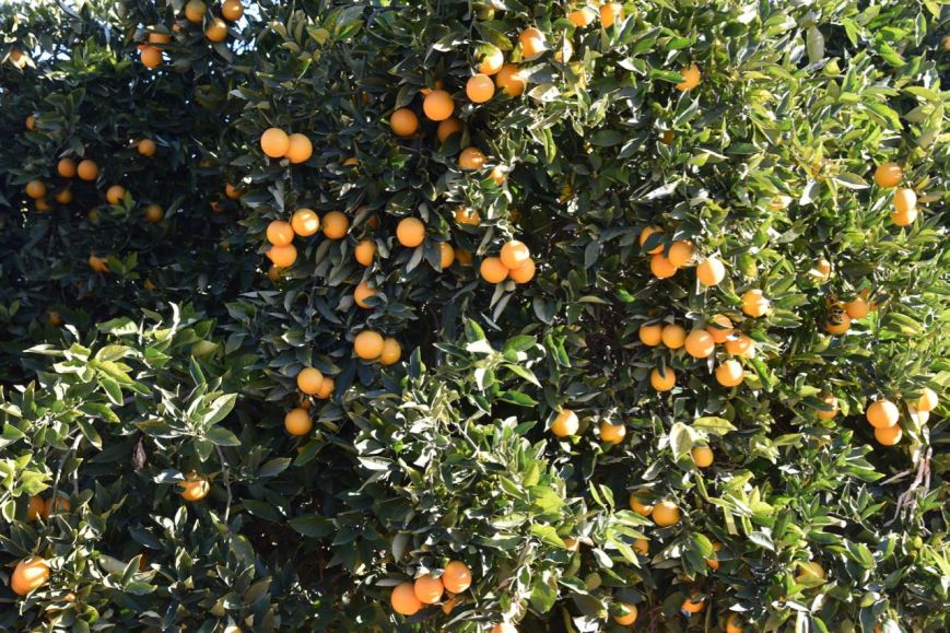
After leaving Banrock we continued along the Sturt Highway, turning right onto Barratt Road and then on to Hawkes Hill Road, passing a number of orange orchards.
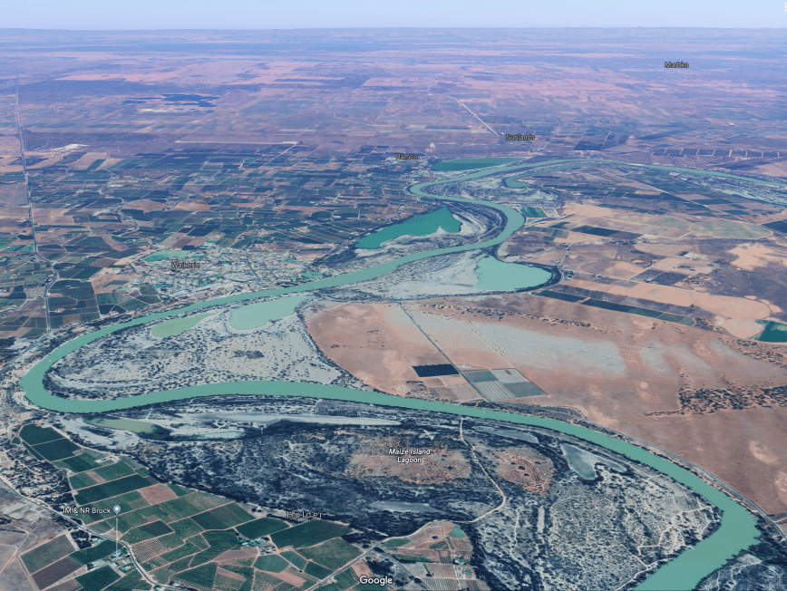
We soon entered into the Maize Island Lagoon Conservation Park. The park is located on the southern side of the mighty Murray River and covers an area of about 214 hectares. Most of the park comprises low lying, seasonally inundated River Redgum flats.
Above:- An aerial shot of the Maize Island Lagoon Conservation Park (located in the foreground) with the town of Waikierie in the centre left of the image. Image courtesy of Google Maps.
The park includes Holder Lagoon. The park was so named because early pioneers had grown crops of maize as fodder for cattle and horses on the drying lagoon bed following high rivers.
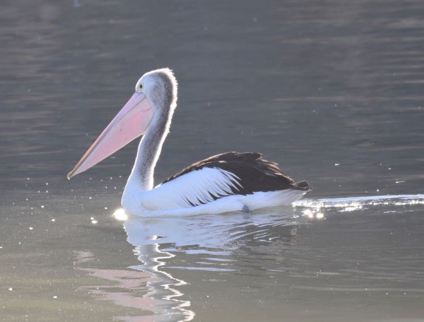
During our visit to the park, there were about 6 or so Pelicans enjoying the sun on the Murray, directly opposite where we set up.
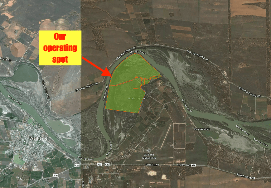
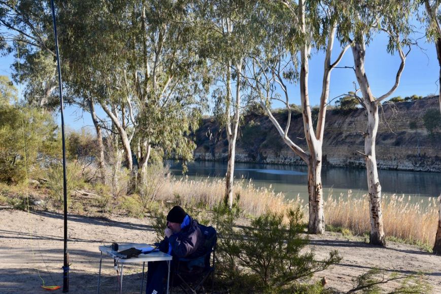
We drove down the 4WD track running through the park and set up right on the banks of the Murray.
Above:- An aerial shot showing the park and our operating spot. Image courtesy of Protected Planet.
To kick off the activation Marija and I logged Mike VK6MB/3 who was on 7.160 activating the Tenneriffe Flora Reserve VKFF-2448. Mike was about to go QRT and kindly gave us the frequency. After Mike, Peter VK3PF was next in the log, followed by Scott VK4CZ and then Ray VK4NH. The familiar mini pile up soon developed and I had soon qualified the park for VKFF.
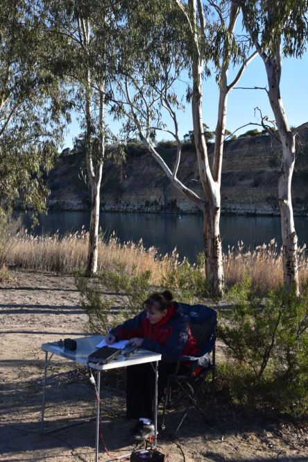
I logged a total of 28 stations on 40m before swapping the microphone with Marija so that she could qualify the park for VKFF.
Marija’s first contact after calling CQ was with Bill VK3CWF, followed by Mark VK4SMA, and then Angela VK7FAMP. Within 7 minutes Marija had qualified the park for VKFF, with contact number ten being with regular park hunter Cliff VK2NP.
Marija logged a total of 17 stations on 40m from VK2, VK3, VK4, and VK7.
I then jumped back into the operator’s chair and unfortunately 42 minutes into the activation, W6KH came onto the frequency with a strength 9 plus signal. Wow, was he strong! He was taking part in the Field Day and sadly was not able to hear me. Some of the guys running big antennas and 400 watts came up to let him know that the frequency was in use, but that didn’t work.
I decided it wasn’t worth competing with him so I moved down the band slightly to 7.157. I worked just 1 station, and then much to my surprise, W6KH came up on this frequency as well. I worked just 5 more stations and gave it away as most of the stations calling me were getting drowned out.
It was the perfect time to head down to 80m, where I logged a total of 18 stations from VK2, VK3, VK4, VK5, and VK7. The 80m band was in great shape, but it was getting late and we needed to pack up and hit the road.
Marija worked the following stations on 40m SSB:-
VK6MB/3 (Tenneriffe Flora Reserve VKFF-2448)
VK3CWF
VK4SMA
VK7FAMP
Vk2PKT
VK4AAC/3
VK2VH/3
VK3MPR
VK4FDJL
VK2NP
VK4MGL
VK4NH
VK4DXA
ZL4TY/VK4
VK3PF
VK7LTD
VK3GB
Marija worked the following station on 80m SSB:-
VK2IO/5 (SOTA Mount Lofty VK5/ SE-005 & Cleland Conservation Park VKFF-0778)
I worked the following stations on 40m SSB:-
VK6MB/3 (Tenneriffe Flora ReserveVKFF-2448)
VK3PF
VK4CZ
VK4NH
VK4DXA
ZL4TY/VK4
VK3ANL
VK3ZPF
VK3SQ
VK2KJJ
VK4SMA
VK4RF
VK4HA
VK2QK
VK4FDJL
VK3MPR
VK2VW
VK2TM
VK2JXA
VK5NJ
VK2PKT
VK2FMEM
VK2LAD
VK1MIC
VK2NP
VK7KW
VK3CWF
VK2YK
VK3FT
VK4AAC/2
VK2VH
VK4TJ
VK4/AC8WN
VK4/VE6XT
VK3XPT/p
VK4MGL
VK3ARH
VK2WGW
VK7HCK
VK5FANA
VK7LTD
I worked the following stations on 80m SSB:-
VK5FANA
VK3SQ
VK4AAC/2
VK2VH
VK3ZPF
VK5AYL
VK3FT
VK5BJE
VK4TJ
VK4/AC8WN
VK4/VE6XT
VK2NP
VK3MCK
VK2IO/5 (SOTA Mount Lofty VK5/ SE-005 & Cleland Conservation Park VKFF-0778)
VK7LTD
VK7FAMP
VK2LEE
VK4CZ
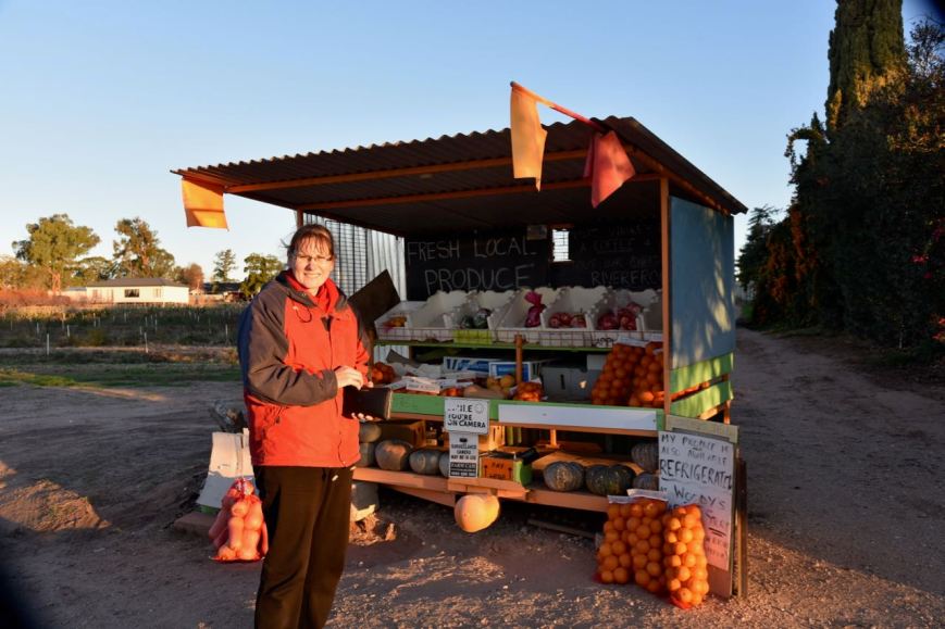
On the way home, we stopped off briefly to buy some local Riverland oranges and apples.
We then stopped in Waikerie to have a look at the Waikerie Silo Art. The silos at Waikerie were the fifth silo artwork in South Australia and the 25th in Australia. They are the work of artists Garry DUNCAN and Jimmy DVATE.
It was time to hit the road again and head for home. We stopped off at one of the hotels in Mount Pleasant for a meal and arrived home at around 8.30 p.m.
On the way home I had some very nice contacts from the mobile. This included a contact with Matt VK0HZ on 40m. Matt was at Davis Station, Antartica. Marija also made contact with Matt and received a 5/1 signal report. This was a memorable QSO for both Marija and me.
References.
National Parks and Wildlife, 1994, ‘Maize Island Lagoon Management Plan’