Loch Luna Game Reserve VKFF-1723

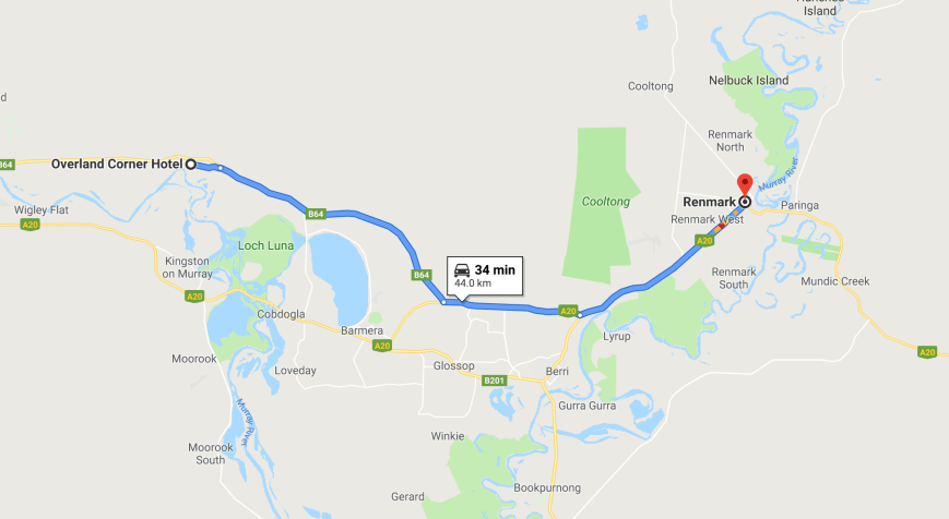
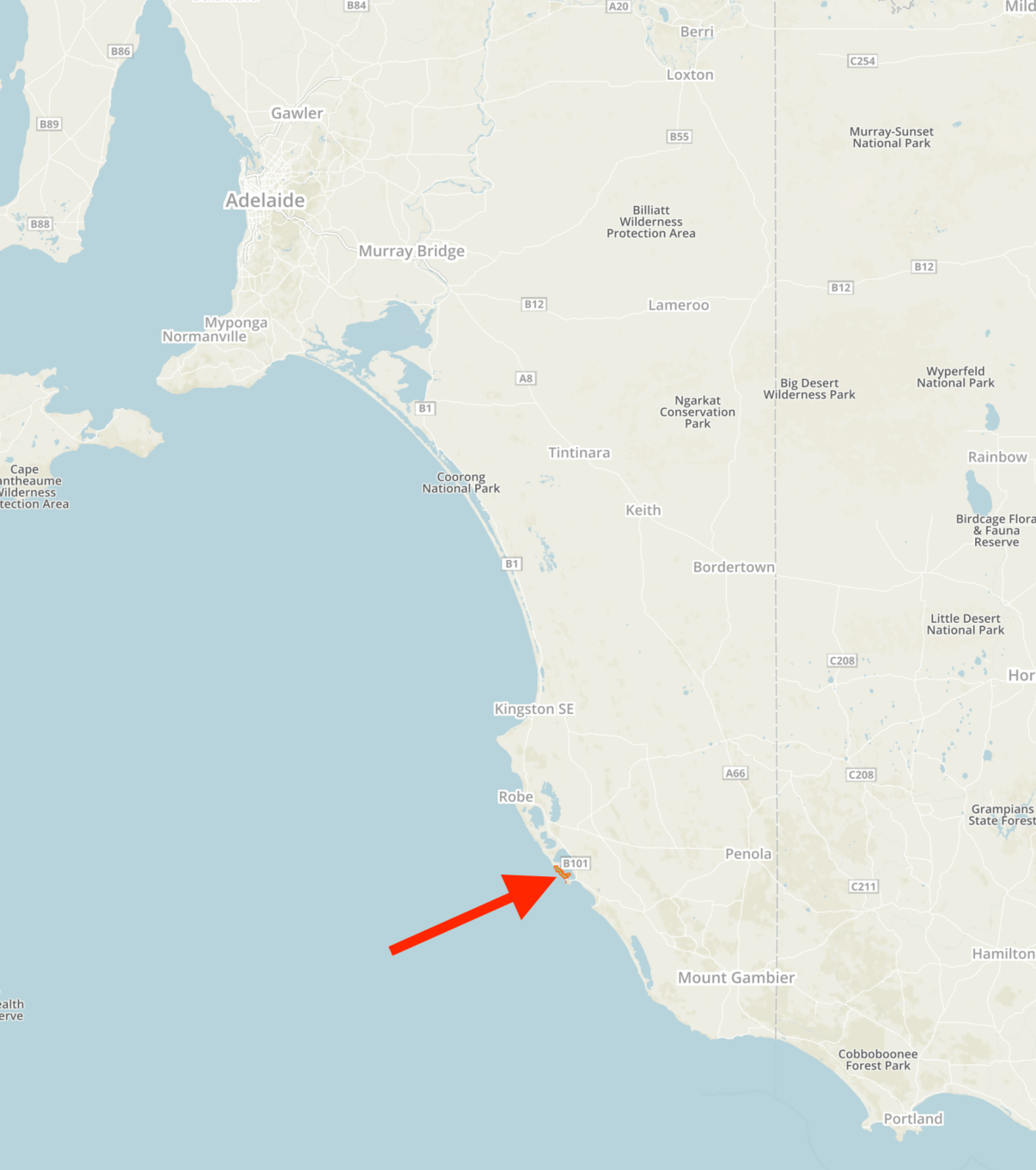
After leaving Overland Corner, Marija and I headed to the Loch Luna Game Reserve VKFF-1723, for a quick activation prior to dinner.  The park is located about 233 km north east of Adelaide, and about 15 km (by road) to the northwest of the town of Barmera.

Screen Shot 2019-04-08 at 3.09.15 pm.png

Above:- Map showing the location of the Loch Luna Game Reserve in the Riverland region of South Australia.  Map courtesy of Protected Planet.

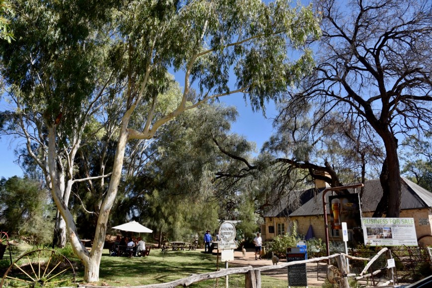
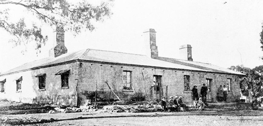
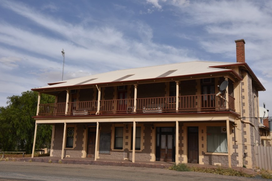
Prior to driving into the park, we stopped to have a look at the Lake Bonney Hotel ruins.  The ruins are the remains of the 11 room hotel and a separate store hut which once stood on the site and was built in 1860.

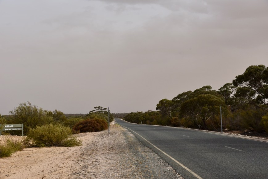
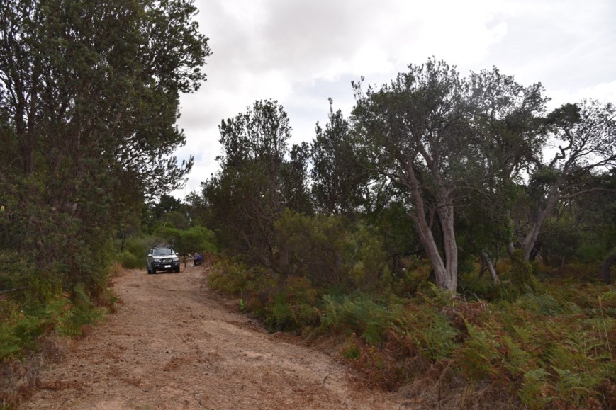
Marija and I then accessed the northern section of the park off the Morgan Road.  We followed the dirt track (definitely 4WD – lots of corrugations) until we reached the Sugarloaf campground area.

The Loch Luna Game Reserve is 1,905 hectares in size and was established on the 7th day of November 1985, with exception to a parcel of land known as Sugarloaf Hill within the boundaries of the game reserve which has been excluded from protection for the purpose of mining activity.  The park covers the floodplain on the north side of the River Murray between the towns of Kingston-on-Murray in the west and Cobdogla in the east.

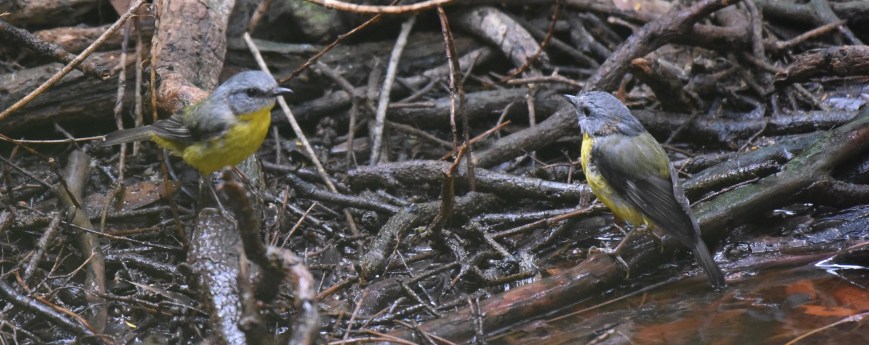
The park contains numerous narrow creeks and shallow swamps which provide important habitats for many birds and mammals including the rare White-bellied Sea Eagle.  During our visit, we spotted Western Grey kangaroos, Whistling Kites, Emus, and Pelicans, and numerous other native birds.

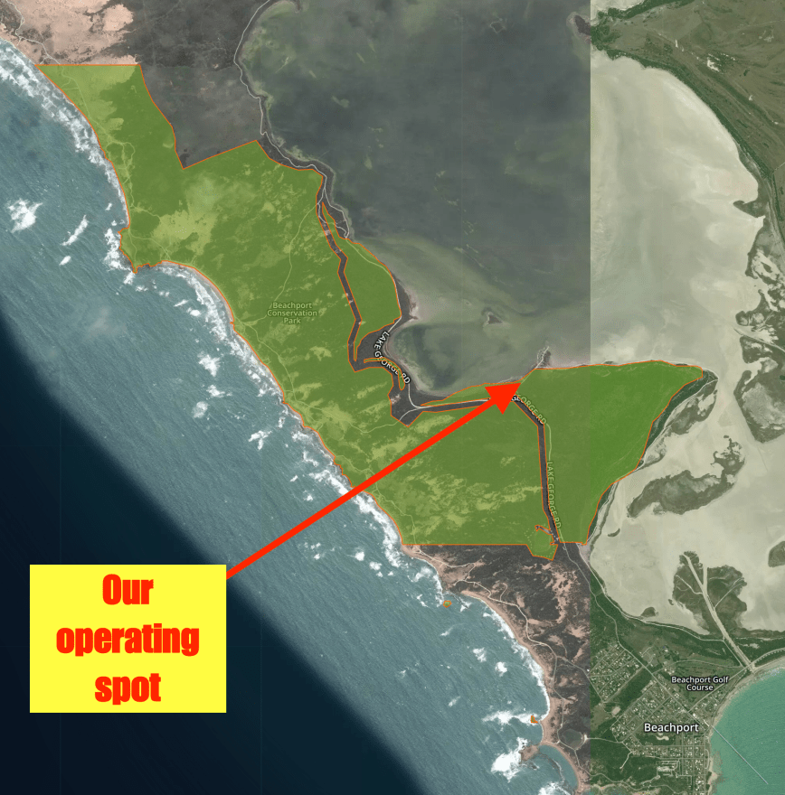
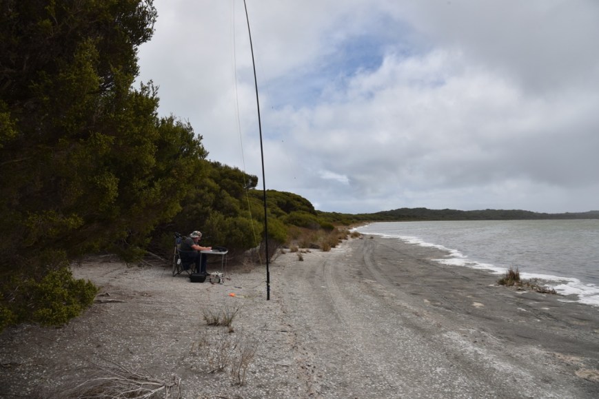
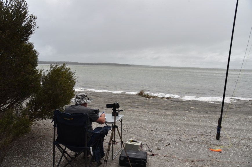
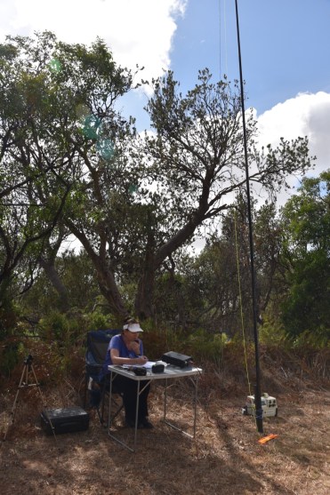
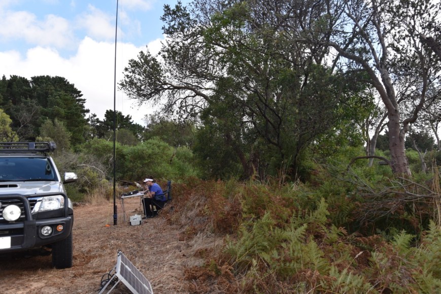
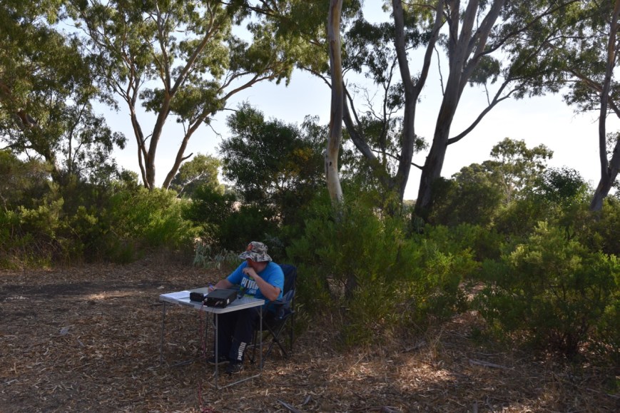
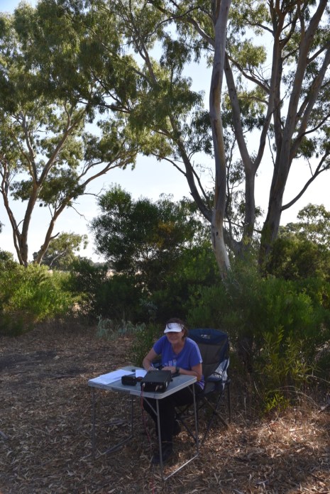
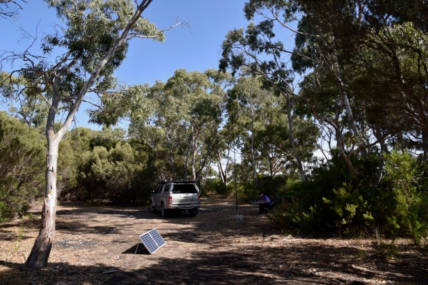
We set up in the Sugarloaf campground area, which we had entirely to ourselves.  There was plenty of room here to string out the 20/40/80 metre linked dipole.

Screen Shot 2019-04-08 at 3.10.06 pm.png

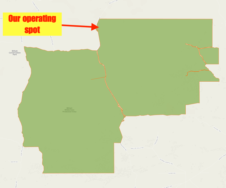
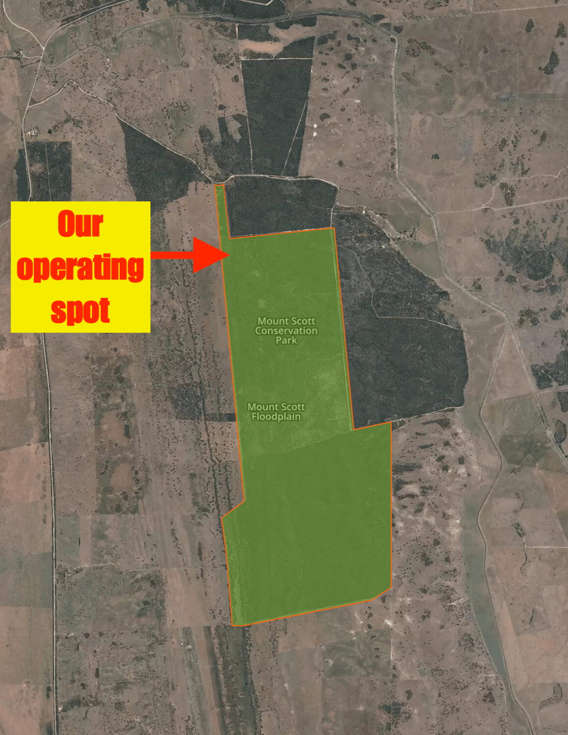
Above:- An aerial view of the park showing our operating spot.  Image courtesy of Protected Planet.

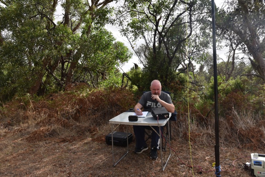
Marija placed a spot up for me on parksnpeaks and I called CQ on 7.139.  David VK3FDZE was first in the log, followed by Scott VK4CZ, Carl VK2ADB, and then Ray VK4NH.  Compared to the day prior, the 40m band was in good shape, and it didn’t take me long to get 10 QSOs in the log, qualifying the park for VKFF.  Contact number 10 for me was with Ben VK3WRL/7 who was activating the Ben Lomond National Park VKFF-0028.

Unfortunately about 20 minutes into the activation, I started to experience QRM from an Italian station just 1 kc above me, calling CQ.  I boxed on until I had 36 contacts in the log, before the interference became so strong, that I could not stay on the frequency.

One of those 36 QSOs was with Wade VK1MIC/p who was activating SOTA summit VK1/ AC-048.  There was a VK/ZL/EU SOTA event on, and there were quite a few Australian SOTA activators out and about.  I also logged Rod VK2ARJ/p who was activating SOTA peak VK2/ HU-093.

DSC_6876

I was just 8 short of my 44.  I moved up the band to 7.144 and called CQ once again.  First in the log was Andy VK5LA, followed by Andrei ZL1TM, and the Clem VK3CYD.  Stuart VK4TSB became my 44th contact.  I also logged Jonathan VK7JON/p and Helen VK7FOLK/p on SOTA summit VK7/ NW-062.

Once I had 44 in the log, I swapped the mic with Marija, who started calling CQ on 7.144.  Grant VK2LX was first in the log with his normal big 5/9 signal, followed by Linda VK7QP, and then Geoff VK3SQ.  It took Marija just 9 minutes to qualify the park for VKFF, with her 10th contact being with Rod VK2ARJ on SOTA peak VK2/ HU-093.

Marija worked a further 6 stations including Peter VK3PF/p on SOTA summit VK3/ VT-049, before we once again changed operator positions.

I called CQ for around 5 minutes on 14.310, but sadly had no takers.  So I headed off to 3.610 on the 80m band where I logged just the one station, Adrian VK5FANA on the Yorke Peninsula.  To complete the activation, I had one last tune across the 40m band and logged two more SOTA contacts.  The first was with Andrew VK1AD/p on SOTA summit VK1/ AC-008, and then Sam VK2GPL/p on SOTA peak VK2/ CT-056.

Marija worked the following stations on 40m SSB:-

  1. VK2LX
  2. VK7QP
  3. VK3SQ
  4. VK2ADB
  5. VK4SMA
  6. VK3AHR
  7. VK3ANL
  8. VK3MPR
  9. VK1DI
  10. VK2ARJ (SOTA VK2/ HU-093)
  11. VK3AFW
  12. VK4MWB
  13. VK3ZNK
  14. VK3FGDN
  15. VK2PKT
  16. VK3PF/p (SOTA VK3/ VT-049)

I worked the following stations on 40m SSB:-

  1. VK3FDZE
  2. VK4CZ
  3. VK2ADB
  4. VK4NH
  5. VK4DXA
  6. ZL4TY/VK4
  7. VK7AN
  8. VK3SQ
  9. VK7QP
  10. VK3WRL/7 (Ben Lomond National Park VKFF-0028)
  11. VK4FDJL
  12. VK1DI
  13. VK3FGDN
  14. VK2YW
  15. VK7DW
  16. VK4MWB
  17. VK2PKT
  18. VK1MIC/p (SOTA VK1/ AC-048)
  19. VK4SMA
  20. VK5NE/p (Kangaroo Island)
  21. VK3MPR
  22. VK3ZMD
  23. VK4AAC/3
  24. VK2VH/3
  25. VK7HCK
  26. VK7FJFD
  27. VK4FSCC/m
  28. VK3XPT
  29. VK2ARJ/p (SOTA VK2/ HU-093)
  30. VK3ZNK
  31. VK4TJ
  32. VK4/AC8WN
  33. VK4/VE6XT
  34. VK4HNS
  35. VK2VKB
  36. VK3LCM
  37. VK5LA
  38. ZL1TM
  39. VK3CYD
  40. VK3ANL
  41. VK3AFM
  42. VK7JON/p (SOTA VK7/ NW-062)
  43. VK7FOLK/p (SOTA VK7/ W-062)
  44. VK4TSB
  45. VK3PF/p (SOTA VK3/ VT-049)
  46. VK1AD/p (SOTA VK1/ AC-008)
  47. VK2IO/p
  48. VK2GPL/p (SOTA VK2/ CT-056)

I worked the following station on 80m SSB:-

  1. VK5FANA.

We hurriedly packed up our gear and hit the road, and headed back into Renmark.  As we left the park Marija spoke with Andrew VK1AD/p who was activating SOTA summit VK1/ AC-008.  Once we got out onto the Sturt Highway Marija spoke with Wade VK1MIC who was activating SOTA summit VK1/ AC-048.

Upon arriving back in Renmark we quickly freshened up at the motel and then headed to the Mallee Fowl Restaurant for dinner.

DSC_6919

The Mallee Fowl Restaurant is quite a quirky place, with many old wares and Australiania on display.  Despite there being a wedding at the venue, the meals came out very quickly.  I had Sizzling Prawns and they were excellent.

This was a great evening.  Terrific food and company, and a great way to complete the day.


References.

Wikipedia, 2019, <https://en.wikipedia.org/wiki/Loch_Luna_Game_Reserve>, viewed 8th April 2019

2019 BRL Gathering at Overland Corner

Marija and I were on the road by about 7.15 a.m. on Saturday morning (6th April 2019) and were on our way to the 2019 BRL Gathering at the historic Overland Corner Hotel.  The day was to kick off at about 7.30 a.m. with a cooked breakfast, and concluding at about 2.30 p.m. following some presentations.

Screen Shot 2019-04-08 at 1.18.18 pm.png

It was about a 44 km drive from Renmark out to Overland Corner, along the Sturt and Goyder Highways.

Screen Shot 2019-04-08 at 1.21.23 pm.png

Above:- Route from Renmark to Overland Corner.  Map courtesy of google maps.

The Overland Corner Hotel is located about 21 km from Barmera, and is situated off the Goyder Highway.  It is the oldest structure to remain standing in the area and is set amongst a beautiful lawned area with plenty of shade.

DSC_6829

Above:- The Overland Corner Hotel.

The hotel was originally established as a watering hole for drovers and overlanders operating between New South Wales and Adelaide in the colony of South Australia.  It also served as a temporary camping ground for steamers passing through the area along the mighty Murray River, about 600 feet from the hotel.  The hotel was erected in 1859 and since that time has served as a staging point, a general store, a police station and a local Post Office.

screen-shot-2017-04-27-at-2-49-06-pm.png

The Overland Corner Hotel, c. 1910.  Courtesy of Trove.

The hotel was originally established as a watering hole for drovers and overlanders operating between New South Wales and Adelaide in the colony of South Australia.  It also served as a temporary camping ground for steamers passing through the area along the mighty Murray River, about 600 feet from the hotel.  The hotel was erected in 1859 and since that time has served as a staging point, a general store, a police station and a local Post Office.

screen-shot-2017-04-27-at-3-45-09-pm.png

The Brand brothers.  Courtesy of Barmera Visitor Information Centre

After saying g’day to everyone upon our arrival, we enjoyed a bacon and egg sandwich, which was prepared by Ivan VK5HS who was hard at work at the BBQ.  Also a nice warm coffee.

DSC_6751

Above:- Ivan VK5HS cooking up breakfast

At about 8.30 a.m. local time, Ron VK5MRE kicked off the Saturday morning BRL Net on 40m, using Steve VK5SFA’s loop antenna.

DSC_6743

Above:- Ron VK5MRE running the BRL Net on 40m.

Steve VK5SFA was to be one of the guest speakers of the day and was certainly a popular man, explaining his loop antennas to many an interested onlooker.

This is a great gathering to catch up with radio mates in a terrific social environment.

This slideshow requires JavaScript.

Mid-morning, Steve VK5SFA delivered a presentation on loop antennas.  In 2018 Steve won the ARRL antenna competition.  The criteria for 2017 called for compact designs for those with space restrictions.  Congratulations Steve.  I have heard Steve’s presentation a few times now, and it never ceases to amaze me of his ability.

After a short break, Grant VK5GR then delivered a presentation on his involvement in the Islands on the Air (IOTA) program.  Grant has operated from a number of Pacific islands including Niue and Vanuatu and is about to embark on a trip to Tonga.  A very interesting presentation which gave an invaluable insight into just how much work goes into such DXpeditions.

DSC_6763

Above:- Grant VK5GR delivering his IOTA presentation.

It was now about lunchtime, with lunch served from the hotel.  I had a very nice chicken schnitzel parmigiana and a few ciders.  The raffle was also drawn, and a number of people were the lucky recipients of various prizes.

This slideshow requires JavaScript.

A group photograph was then taken of all in attendance.

DSC_6794

Above:- Group photograph of those in attendance at Overland Corner.

A homebrew competition took place this year, with a number of people entering various equipment including antennas and tuners.

DSC_6793

Above:- Some of the homebrew equipment in the homebrew competition.

A number of presentations then took place, with trophies and other goodies being presented.  The Riverland Radio Group kindly gave Marija a bottle of wine, a RRG mug, and some coated almonds for her assistance in taking photographs at the event.  I was also given the same for my continued promotion and attendance of the event and my involvement in the VK5 Parks Award.  It was greatly appreciated and certainly came as a pleasant surprise.

This slideshow requires JavaScript.

The day officially wrapped up at around 2.30 p.m.  It was the end of another highly successful BRL Gathering.  We had the remainder of the afternoon to ourselves prior to the evening meal at the Mallee Fowl Restaurant.

For just a small radio club, the Riverland Radio Club are certainly boxing above their weight.

Billiatt Wilderness Protection Area VKFF-1685

On the weekend just gone (Saturday 6th April 2019), the Riverland Radio Club held their annual gathering at the historic Overland Corner Hotel in the Riverland region of South Australia.  Marija and I have attended the past 5 years, since its inception, as it is a terrific weekend to catch up with amateurs from across Australia.

I am on my last few days of holidays, but Marija took half of Friday 5th April off, and we headed off to Renmark.  For this trip, we travelled up through Tailem Bend, Karoonda, Sandalwood, Alawoona, Loxton, Berri, and into Renmark.  It’s a drive of around 3 hours.

Screen Shot 2019-04-08 at 11.32.04 am.png

Above:- Map showing our route to Renmark in the Riverland.  Map courtesy of google maps

Our first quick stop on the trip was the town of Karoonda, about 145 km east of Adelaide.  Karoonda takes its name from the Aboriginal word for “winter camp”.  Karoonda was founded on wheat growing early in the 20th century, and was proclaimed as a town on the 11th December 1913.

DSC_6682

Each year in April, the 2 day Karoonda Farm Fair is held in the town.  The event showcases local, state and interstate farming and general interest products, services and events.  The Farm Fair attarcks about 7,000 – 10,000 pople.  Marija and I have promised ourselves that next year we are going to attend to have a look.

We continued northeast on the Karoonda Highway, travelling through the little towns of Borrika, Sandalwood, Halidon, Mindarie, and Wanbi.  Not much exists in many of these places anymore, I suspect due to the closure of the railway line.  It never ceases to amaze Marija and I on our travels, that many towns are a shadow of their former selves due to the closure of nearby rail lines.

We stopped briefly to have a look at the Goyders Line monument.  Goyders Line is a line which runs roughly east-west across South Australia and, in effect, joins places with an average rainfall of 250 mm.  North of Goyder’s Line, annual rainfall is usually too low to support cropping, with the land being only suitable for grazing.

Another sad example of the demise of many towns in the region is the old Simpsons Hotel at Wanbi.  The hotel was constructed in 1931 for Mrs Ellen Barnes, the licensee and lessee at the time, of the Karoonda Hotel.  It was built at a cost of 3,000 pounds and was opened in 1932.  The hotel was the only licenced hotel in the former District Council of East Murray, with its nearest competitors being at Loxton and Karoonda.  Upon its opening, it featured a swimming pool at the rear.

DSC_6694

Our next brief stop was at the town of Alawoona, about 211 km east of Adelaide.  Alawoona was established as one of the original sidings during the construction of the Barmera railway line in 1906.  The town which was surveyed in 1914, takes its name from the aboriginal word meaning ‘place of hot winds’.

Our one and only intended park activation for the day was the Billiatt Wilderness Protection Area VKFF-1685, which is located about 20 km south of the town of Alawoona, and about 30 km north of the town of Lameroo.

Screen Shot 2019-04-08 at 12.20.44 pm.png

Above:- Map showing the location of the Billiatt Wilderness Protection Area, east of Adelaide.  Map courtesy of Protected Planet.

Marija and I headed south on Billiatt Road out of Alawoona.  It was an overcast but very hot day, with the temperate just shy of 35 degrees C.    There was a very strong wind blowing, and as a result, a dust storm had been created.

DSC_6717.jpg

We soon reached the park which is well signposted.  A word of warning, this is quite a remote area, with very little phone coverage.  It is very easy to become bogged if you venture off-road and are not prepared.

DSC_6699

Billiatt Wilderness Protection Area is about 59, 125 hectares in size and was established on the 24th day of July 2008.  It is not to be confused with the much smaller Billiatt Conservation Park which is about 801 hectares in size which is located at the northwestern corner of the Wilderness Protection Area.

The Billiatt Wilderness Protection Area conserves some of the largest remnant stands of pristine mallee heath and shrubland habitat in South Australia.  The park was devastated by a significant bushfire in 2004, but it appears to have recovered quite well.

Some attempts were made to farm the land in the Billiatt area between the 1870s and 1930s.  However, the land ultimately proved unsuitable for conventional farming methods.

Wilderness is defined as land which has not been seriously affected by moderan technology or exotic plants, animals and organisms.  In 2005, the South Australian Wilderness Advisory Committee assessed the wilderness quality of the former Billiatt Conservation Park.  The high National Wilderness Inventory values identified during the assessment prompted the Committee to recommend the reserve receive protection under the Wilderness Protection Act 1992.  Billiatt Wilderness Protection Area was subsequently proclaimed by the Governor in 2008.

The park is named in honour of John William Billiatt, who was an explorer, adventurer, and tutor.  He was born in Lincolnshire, UK, in 1842, and arrived in Adelaide in 1861.

Screen Shot 2019-04-08 at 12.31.56 pm.png

Above:- John William Billiatt.  Image courtesy of the State Library of South Australia.

As it was a hot day, we chose a nice shady spot underneath a gum tree.  We had very little phone coverage, and the only way to get a signal out was to climb to the top of one of the sand dunes in the park.  Marija managed to get enough coverage to place a spot up for me on parksnpeaks, and I started calling CQ on 7.144 on the 40m band.

Screen Shot 2019-04-08 at 12.49.29 pm.png

Above:- Map of the Billiatt Wilderness Protection Area, showing our operating spot.  Map courtesy of Protected Planet.

Sadly, band conditions were awful.  It took a few minutes before I had my first caller in the log, Keith VK7FKLW.  But much to my pleasure, my next caller was Andrei ZL1TM in New Zealand.  After around 15 minutes I had just 8 stations in the log, which is very unusual for the parks program which has become incredibly popular.

DSC_6706

So I swapped the mic with Marija who called CQ.  Marija’s first contact was with Alan VK2MG, followed by Andrew VK7DW, and then Ian VK1DI.  Marija did better than me, even with lower power.  Within 10 minutes Marija had qualified the park with 10 contacts for VKFF.  Her 10th QSO being a contact with John VK2JON.

I then jumped back into the operator’s chair and called CQ once again.  Ray VK4NH came back to my call, and with his 2 other callsigns, I now had 10 contacts in the log.  I worked a further 3 stations before callers totally dried up.

I then moved to 14.310 on the 20m band, where my sole caller was Lauro IK4GRO in Italy with a good 5/7 signal.  To complete the activation I moved to 3.610 on the 80m band where I logged a total of 5 stations from VK3 and VK5.

With both of us having qualified the park for VKFF, it was time to pack up and head off to Renmark.

Marija worked the following stations on 40m SSB:-

  1. VK2MG
  2. VK7DW
  3. VK1DI
  4. VK4NH
  5. VK4DXA
  6. ZL4TY/VK4
  7. VK2PKT
  8. VK7FKLW
  9. VK1MCW
  10. VK2JON

I worked the following stations on 40m SSB:-

  1. VK7FKLW
  2. ZL1TM
  3. VK2BHO
  4. VK2MG
  5. VK1DI
  6. VK3UH
  7. VK2JON
  8. VK7DW
  9. VK4NH
  10. VK4DXA
  11. ZL4TY/VK4
  12. VK2PKT
  13. VK2LX
  14. VK3PF

I worked the following station on 20m SSB:-

  1. IK4GRO

I worked the following stations on 80m SSB:-

  1. VK3PF
  2. VK5HS
  3. VK5PE
  4. VK2VH/3
  5. VK4AAC/3

We continued on our journey north on the Karoonda Highway and soon reached the town of Loxton.  We headed north out of Loxton on the Bookpurnong Road and into the town of Berri, crossing the mighty Murray River.  The photos below are of the Murray River at Berri.

We were now in Riverland country, with orchards of oranges and miles of vineyards.  The region enjoys a warm Mediterranean climate and has vast acres of fertile soil and a readily available water source in the Murray River.

After booking into our motel, the Citrus Valley Motel, we headed out for dinner at the Renmark Club.  It was a beautiful warm evening so we sat in the outdoor area, admiring the view of the Murray River.

After dinner, we took a stroll along the Renmark riverfront to have a look at the ‘Possum Parade’.  Each evening at dusk fruit and vegetables are placed on the trees on the riverfront, attracting the local possum population, and as a result a number of tourists, including us.

We also had a quick look at the Murray River Queen, a paddle ship built in 1974 as a luxury passenger cruise boat.  Murray River Queen retired from regular service in 1993, and spent ten years initially as a floating hotel at Goolwa, then stored near Mannum. In 2003, she was moved to Waikerie, South Australia, running dinner cruises and occasional longer trips until 2012.  In August 2017, the Murray River Queen was moved from Waikerie 200 km upstream to Renmark.

We then headed back to the motel room, where I watched a bit of the footy on TV before having an early night.


References.

Department of Environment and Natural Resources, 2011, Reserves of the Billiatt District.

Heritage of the Murray Mallee, 1998, Bruce Harry & Associates.

Wikipedia, 2019, <https://en.wikipedia.org/wiki/Karoonda,_South_Australia>, viewed 8th April 2019

Wikipedia, 2019, <https://en.wikipedia.org/wiki/Goyder%27s_Line>, viewed 8th April 2019

Wikipedia, 2019, <https://en.wikipedia.org/wiki/Alawoona>, viewed 8th April 2019

Wikipedia, 2019, <https://en.wikipedia.org/wiki/Billiatt_Wilderness_Protection_Area>, viewed 8th April 2019

A weekend away in the Riverland

Marija VK5FMAZ and I, are now home after our trip to the Riverland region of South Australia, to attend the Riverland Radio Club’s annual gathering at the historic Overland Corner Hotel.
 
On the way up to Renmark on Friday afternoon, Marija and I activated the Billiatt Wilderness Protection Area VKFF-1685. Band conditions were very tough, but we both qualified the park for VKFF and made a total of 30 contacts.
 
Bright and early on Saturday morning, we were out at Overland Corner, enjoying breakfast, and then the remainder of the day’s festivities and a meal and a few ales in the pub’s garden. Steve VK5SFA delivered a presentation on magnetic loop antennas, whilst Grant VK5GR spoke about Islands on the Air (IOTA).
 
It was a great day as always, and for a small club, the Riverland Radio Club certainly put on a great show, which we can highly recommend.
 
Late on Saturday afternoon, Marija and I activated the Loch Luna Game Reserve VKFF-1723 and made a total of 65 contacts.
 
On Saturday evening, a group of us headed out for dinner at the Mallee Fowl Restaurant, enjoying a great meal and plenty of laughs.
 
On Sunday morning, Ivan VK5HS, Peter VK5PE, Marija, and I headed downstream in Ivan’s boat and activated the Bulyong Island section of the Murray River National Park 5NP-016 & VKFF-0372 (this section only accessible by boat). We all qualified the park.
 
After lunch, Marija and I headed for home, stopping off at the Moorook Game Reserve VKFF-1729, where I made a total of 47 QSOs.
 
I will add more info and photos here in the coming week.

This slideshow requires JavaScript.

Cancellation of the remainder of our trip

My Dad has been terminally ill for some time, and sadly, after a long battle, he passed away on Sunday morning.  As a result, Marija and I canceled the remainder of our park activations and our trip, and we headed back to Adelaide.

Dad served with the South Australia Police between 1955-1992, and attained the rank of Sergeant.  He also performed National Service with the Army and attained the rank of Sergeant.

Dad was awarded the National Medal, the Australian Police Medal, and the Australian Defence Medal for his service in both the Police and the Army.

Dad, you will be very sorely missed.  We all love you very much.

Beachport Conservation Park 5CP-014 and VKFF-0791

Our second park for Saturday 23rd March 2019 was the Beachport Conservation Park 5CP-014 & VKFF-0791.  The park is located about 383 km south-east of Adelaide, and immediately to the north of the town of Beachport.

Screen Shot 2019-03-29 at 2.14.32 pm.png

Above:- Map showing the location of the Beachport Conservation Park.  Map courtesy of Protected Planet.

The Beachport Conservation Park is 875 ha (2,160 acres) and was established on the 1st January 1959.  The park protects sand dunes and coastal vegetation between Lake George and the Southern Ocean.

Lake George is part of the Lake Hawdon System Important Bird Area. The wetland system was identified by BirdLife International as an IBA because it regularly supports over 1% of the world populations of red-necked stint, and often of sharp-tailed sandpipers, double-banded plovers and banded stilts. It also provides habitat for orange-bellied parrots, Australasian bitterns, rufous bristlebirds and striated fieldwrens.

Screen Shot 2019-03-29 at 4.25.08 pm.png

Above:- Aerial view of the Beachport Conservation Park.  Image courtesy of Google maps.

Marija and I entered the park via Lake George Road and headed to the 3 Mile Bend Campground area.  On our way in to the park, I spoke with Mike VK6MB/3 who was in the Moondarra State Park VKFF-0764.

Screen Shot 2019-03-29 at 2.14.18 pm.png

Above:- Aerial shot of the Beachport Conservation Park, showing our operating spot on the southern shore of Lake George.  Map courtesy of Protected Planet.

We set up right on the edge of Lake George.  It was a magnificent outlook, looking across the lake, which was alive with birdlife.  Unfortunately, the sun had disappeared and during our activation, we had the occasional sprinkle of rain.

I started calling CQ on 7.144, with first in the log being Nick VK3ANL, followed by Dennis VK2HHA, and then Gerard VK2IO/p who was activating the Rouse Hill Regional Park VKFF-2784.  I logged a total of 21 stations from VK2, VK3, VK4, and VK5, including the following Park to Park contacts:

  • Gerard VK2IO/p – Rouse Hill Regional Park VKFF-2784
  • Peter VK3PF/p – Ada Tall Trees Nature Conservation Reserve VKFF-2253
  • Mike VK6MB/3 – Moondarra State Park VKFF-0764
  • Adrian VK5FANA/p – Clinton Conservation Park 5CP-044 & VKFF-0813
  • Tony VK5MRT/p – Lawari Conservation Park 5CP-278 & VKFF-1767
  • Andrew VK5MR/p – Sheoak Hill Conservation Park VKFF-0935

DSC_6542

I had qualified the park for VKFF, so it was Marija’s turn to jump into the operators chair.  First in the log for Marija was Peter VK2UXO with a very big signal, followed by Wayne VK2DWP, and then Andrew VK5MR/p in the Sheoak Hill Conservation Park VKFF-0935.  Within 9 minutes, Marija had qualified the park for VKFF, with 10 QSOs.  Contact number 10 was with regular park hunter, John VK4TJ.

With 19 contacts in the log for Marija, I again called CQ on 7.144 and logged a further 24 stations.  I had now qualified the park for the global WWFF program.  Further Park to Park contacts were as follows:

  • Adam VK2YK/p – Port Stephens/Great Lakes Marine Park VKFF-1410
  • Perrin VK3XPT/p – Barmah National Park VKFF-0739
  • Jonathan VK7JON/p – St Helens Conservation Area VKFF-1152
  • Helen VK7FOLK/p – St Helens Conservation Area VKFF-1152

It was nice to log Perrin VK3XPT who was in the Barmah National Park, and was using a military manpack transceiver.

DSC_6544

Marija and I then moved to the 80m band, where I logged 8 stations, and Marija logged 5 stations.  This included the following Park to Park contacts:

  • VK5FANA/p – Clinton Conservation Park 5CP-044 & VKFF-0813
  • VK5FLEA/p – Talisker Conservation Park 5CP-223 & VKFF-0790
  • VK2IO/p – Rouse Hill Regional Park VKFF-2784
  • VK5YX/p – Hallet Cove Conservation Park VKFF-0890
  • VK5LOL/p – Hallet Cove Conservation Park VKFF-0890

To conclude the activation I went back to 40m to 7.144 and logged a further 6 stations before we called it a day.

Marija worked the following stations on 40m SSB:-

  1. VK2UXO
  2. VK2DWP
  3. VK5MR/p (Sheoak Hill Conservation Park VKFF-0935)
  4. VK2HHA
  5. VK3CWF
  6. VK3NXT
  7. VK2IO/p (Rouse Hill Regional Park VKFF-2784)
  8. VK7FAMP/p (Scamander Conservation Area VKFF-1147)
  9. VK7LTD/p (Scamander Conservation Area VKFF-1147)
  10. VK4TJ
  11. VK4/AC8WN
  12. VK4/VE6XT
  13. VK3ZPF
  14. VK7KEV
  15. VK7ALH
  16. VK3UH
  17. VK2KNV
  18. VK5FANA/p (Clinton Conservation Park 5CP-044 & VKFF-0813)
  19. VK2EXA
  20. VK2YK/p (Port Stephens/Great Lakes Marine Park VKFF-1410)

Marija worked the following stations on 80m SSB:-

  1. VK5FANA/p (Clinton Conservation Park 5CP-044 & VKFF-0813)
  2. VK5FLEA/p (Talisker Conservation Park 5CP-223 & VKFF-0790)
  3. VK5YX/p (Hallet Cove Conservation Park VKFF-0890)
  4. VK5LOL/p (Hallet Cove Conservation Park VKFF-0890)
  5. VK7ALH

I worked the following stations on 40m SSB:-

  1. VK3ANL
  2. VK2HHA
  3. VK2IO/p (Rouse Hill Regional Park VKFF-2784)
  4. VK5KLV
  5. VK4HNS
  6. VK4NH
  7. VK4DXA
  8. ZL4TY/VK4
  9. VK3MKE
  10. VK3CWF
  11. VK3LTL
  12. VK3UH
  13. VK3PF/p (Ada Tall Trees Nature Conservation Reserve VKFF-2253)
  14. VK2XSE/m
  15. VK2LEE
  16. VK6MB/3 (Moondarra State Park VKFF-0764)
  17. VK1DI
  18. VK5FANA/p (Clinton Conservation Park 5CP-044 & VKFF-0813)
  19. VK5MRT/p (Lawari Conservation Park 5CP-278 & VKFF-1767)
  20. VK3XM
  21. VK5MR/p (Sheoak Hill Conservation Park VKFF-0935)
  22. VK2EXA
  23. VK7KEV
  24. VK7ALH
  25. VK2HOT
  26. VK3SQ
  27. VK3BYD
  28. VK3ZPF
  29. VK2KYO
  30. VK2YK/p (Port Stephens/Great Lakes Marine Park VKFF-1410)
  31. VK2KNV/m
  32. VK2PKT
  33. VK3XPT/p (Barman National Park VKFF-0739)
  34. VK7JON/p (St Helens Conservation Area VKFF-1152)
  35. VK7FOLK/p (St Helens Conservation Area VKFF-1152)
  36. VK2UXO
  37. VK1MIC/p
  38. VK4FDJL
  39. VK3HQZ
  40. VK3MCK
  41. VK4CZ
  42. VK2IR
  43. VK7HCK
  44. VK7LH
  45. ZL1TM
  46. VK3PF/m
  47. VK4MWB
  48. VK3SX
  49. VK3MLU
  50. VK4PDX
  51. VK4FARR

I worked the following stations on 80m SSB:-

  1. VK5FANA/p (Clinton Conservation Park 5CP-044 & VKFF-0813)
  2. VK5FLEA/p (Talisker Conservation Park 5CP-223 & VKFF-0790)
  3. VK5LSB
  4. VK3UCD
  5. VK7ALH
  6. VK2IO/p (Rouse Hill Regional Park VKFF-2784)
  7. VK5YX/p (Hallet Cove Conservation Park VKFF-0890)
  8. VK5LOL/p (Hallet Cove Conservation Park VKFF-0890)

During the activation, Marija and I had both heard gunshots.  At first, I thought it may have been some sort of bird scarer at a nearby property.  But the shots became increasingly louder and appeared to be coming to the west – north west of our location, within the park.  It was quite off-putting, considering the way the world is nowadays.  But when we started hearing shots started coming just to our east, I decided to call the Police.

It was then that Marija saw a person about 300 metres to our east carrying a long object and occasionally walking out into the water.  With the aid of my camera’s telephoto lens, I was able to confirm that there was, in fact, a male with a shotgun.  This was our reason for going QRT quickly.

Once we packed up, Marija and I drove along Lake George Road, on the southwestern shoreline of Lake George.  Sadly, at a number of locations, we located numerous duck heads, duck wings, and gizzards.  The gunshots continued.

We googled duck shooting for Lake George, but could not find anything definitive.  We had not observed any signs to indicate that shooting was taking place, nor was there anything on the Department for Environment and Water website to advise that duck shooting was in progress.

The Department’s website states:

‘…..an array of birdlife……Bring your binoculars for the chance to spay a pied oystercatcher, small waders on the beach, a white faced heroin or pied coromorants….

It further states:

“enjoy a picnic at Lake George”

Considering we had people wandering around with firearms, and there were duck body parts all around the shoreline, we both believed this was totally unsatisfactory.  I have contacted the Department and was advised that there were campers at 3 Mile Bend that weekend who also heard the shots and left the park feeling very concerned.  I don’t blame them.  I am awaiting an official response from the Department.

We then drove towards the exit of the park, stopping briefly to take a few bird photos.

We stopped for 10 minutes or so to have a look at Wooley Waterhole, at the park entrance.  Native birds, including Superb Fairy-wrens, Red-browned Finches, and Yellow-rumped Thornbills, depend on this waterhole for fresh water.  During our visit we observed dozens of Silvereyes, Fantails, and Eastern Yellow Robins.

DSC_6606

Also near the entrance to the park is a moument to commemorate the old Robe to Beachport track, once used by mail coaches and travellers passing through the area.

We headed back into Beachport, and once again went out for tea at Bompas, enjoying another very nice meal.


References.

National Parks and Wildlife Service, 1990, ‘Beachport Conservation Park Management Plan’

Wikipedia, 2019, <https://en.wikipedia.org/wiki/Beachport_Conservation_Park>, viewed 29th March 2019

Belt Hill Conservation Park 5CP-016 and VKFF-0870

It was now Saturday 23rd March 2019, and day one of the 6th anniversary activation weekend of the VK5 National and Conservation Parks Award.  Our first intended activation for day was the Belt Hill Conservation Park 5CP-016 & VKFF-0870.  The park is located about 379 km south east of Adelaide, and about 20 km east of the town of Beachport.

Screen Shot 2019-03-29 at 9.52.57 am.png

Above:- Map showing the location of the Belt Hill Conservation Park in the South East of South Australia.  Map courtesy of Protected Planet.

Prior to heading to the park, Marija and I had breakfast at the Waterfront Cafe at Beachport, enjoying some poached eggs on toast and coffee.  We then headed out of Beachport and stopped briefly to have a look at the monument for the South East Drainage Scheme.  There is a cairn commemorating the commencement in 1863 of drainage construction in the Millicent district.

On our way to the park both Marija and I checked in to the 10AM Net on 7.097 run by Ron VK3AHR.

We drove north along Stuckey Lane and took a dirt track which followed the southern boundary of the park.  This led to another track which took us into the park.

DSC_6489

Above:- track inside the park.

Belt Hill Conservation Park is 10 hectares (25 acres) in size and was established on the 27th April 1972.  It is situated in the locality of Hatherleigh.  In 1971, the land was offered by its owner, A. McArthur of Rendelsham, to the “then National Parks Commission” for “dedication as a Reserve.”  The park consists of Banksia, Blackwood and Golden Wattle.

There are two aboriginal archaeological sites in the park, both located in the dune area.  It is believed that the area supported a substantial aboriginal population as it is elevated, well sheltered and watered, and would have offered many sources of food.

During our visit to the park, we spotted numerous native birds, including Silvereyes and Fantails.  Some of my snaps appear below.

There weren’t any cleared spots in the park, so we set up on the 4WD track in the southern section f the park.  We suspected it was highly unlikely that there would be other visitors to the park.

Screen Shot 2019-03-29 at 9.52.31 am.png

Above:- An aerial shot of the park showing our operating spot.  Image courtesy of Protected Planet.

After setting up I joined the 10am Net on 7.097 and there worked a total of 5 stations.  I then moved up the band to 7.139 and started calling CQ, whilst Marija placed a spot up on parksnpeaks.  John VK3HBG was the first to call in, followed by Geoff VK3SQ and then Peter VK3PF.  I worked a total of 30 stations from VK2, VK3, VK4, VK5, and VK7.  This included a Park to Park contact with Greg VK5GJ/p who was activating the Thidna Conservation Park 5CP-281 & VKFF-2250.

DSC_6502

Marija then jumped on the mic and called CQ on 7.139.  Dennis VK2HHA was first in the log, followed by Tony VK3XV mobile in VK5, and then Dale VK1POP/2.  Marija worked a total of 17 stations from VK2, VK3, VK4, and VK5.  This included the following Park to Park contacts;

  • David VK5DG/p – Little Dip Conservation Park 5CP-120 & VKFF-0904
  • Mike VK6MB/3 – Moondarra State Park VKFF-0764

DSC_6497

Marija and I then tuned across the band and found Tom VK5EE/p on 7.130, activating the Big Heath Conservation Park 5CP-018 & VKFF-0792.  We also worked Adrian VK5FANA/p in the Wills Creek Conservation Park 5CP-254 & VKFF-0819.

It was then off to the 80m band, where Marija logged 8 stations, and I logged 13 stations, including the following Park to Park contacts:

  • Peter VK5PET/p – Lawari Conservation Park 5CP-278 & VKFF-1767
  • Adrian VK5FANA/p – Wills Creek Conservation Park 5CP-254 & VKFF-0819
  • Greg VK5GJ/p – Thidna Conservation Park 5CP-281 & VKFF-2250
  • Peter VK5PET – Murray River National Park 5NP-016 & VKFF-0372
  • Ivan VK5HS/p -Murray River National Park 5NP-016 & VKFF-0372
  • Danny VK5DW/p – Murray River National Park 5NP-016 & VKFF-0372
  • Peter VK5PE/p – Murray River National Park 5NP-016 & VKFF-0372
  • Rob VK5TRM/p – Murray River National Park 5NP-016 & VKFF-0372
  • Dean VK5FDOG/p – Murray River National Park 5NP-016 & VKFF-0372
  • Sandy VK5FSGP/p – Murray River National Park 5NP-016 & VKFF-0372
  • David VK5FVIN/p – Murray River National Park 5NP-016 & VKFF-0372

DSC_6486

I had now qualified the park for the global WWFF program, with 47 contacts in the log.  I moved to 14.310 on the 20m band and called CQ.  Dale VK1POP/2 was first in the log, followed by Dick VK4OP, and then Scott VK4CZ.  I logged 10 stations from VK1, VK2, and VK4.  This included a Park to Park contact with Gerard VK2IO/p who was activating the Rouse Hill Regional Park VKFF-2784.  The Over the Horizon Radar was present on 20m once again, being strength 9 and blocking out some of the stations that I was talking with.

Marija and I moved back to the 40m band.  Marija had 26 contacts in the log, and we were hoping she might get close to the 44 required to qualify the park for WWFF.  Within half an hour, Marija had her 44th contact in the log, a QSO with Tom VK5AA/p.  Marija and I logged the following Park to Park contacts:

  • Gerard VK2IO/p –  Rouse Hill Regional Park VKFF-2784
  • Tom VK5EE – Mary Seymour Conservation Park 5CP-131 & VKFF-0908
  • Col VK5HFC/p – Mary Seymour Conservation Park 5CP-131 & VKFF-0908
  • Tom VK5TA/p – Mary Seymour Conservation Park 5CP-131 & VKFF-0908
  • Tom VK5AA/p – Mary Seymour Conservation Park 5CP-131 & VKFF-0908
  • David VK5PL/p – Marne Valley Conservation Park 5CP-128 & VKFF-0906

To complete the activation, Marija and I tuned across the band, and found Andrew VK5MR/p on 7.165, activating the Heggaton Conservation Park 5CP-089 & VKFF-1037.  It was a great way to complete the activation with a Park to Park contact.

DSC_6500

Marija logged a total of 48 contacts including 18 Park to Park QSOs.

I logged a total of 62 contacts including 21 Park to Park QSOs.

Marija worked the following stations on 40m SSB:-

  1. VK2HHA
  2. VK3XV/5
  3. VK1POP/2
  4. VK2PKT
  5. VK4NH
  6. VK4DXA
  7. ZL4TY/VK4
  8. VK3NXT
  9. VK5KLV
  10. VK5DG/p (Little Dip Conservation Park 5CP-120 & VKFF-0904)
  11. VK3MPR
  12. VK2LEE
  13. VK3ANL
  14. VK6MB/3 (Moondarra State Park VKFF-0764)
  15. VK3SQ
  16. VK3ZPF
  17. VK3AHR
  18. VK5FANA/p (Wills Creek Conservation Park 5CP-254 & VKFF-0819)
  19. VK3PF/m
  20. VK3MKE
  21. VK3IRM
  22. VK5CZ
  23. VK2IO/p (Rouse Hill Regional Park VKFF-2784)
  24. VK4CZ
  25. VK2FAAA
  26. VK4TJ
  27. VK4/AC8WN
  28. VK4/VE6XT
  29. VK2ND
  30. VK2KYO
  31. VK2EXA
  32. VK7EK
  33. VK5EE/p (Mary Seymour Conservation Park 5CP-131 & VKFF-0908)
  34. VK5HCF/p (Mary Seymour Conservation Park 5CP-131 & VKFF-0908)
  35. VK5TA/p (Mary Seymour Conservation Park 5CP-131 & VKFF-0908)
  36. VK5AA (Mary Seymour Conservation Park 5CP-131 & VKFF-0908)
  37. VK2UH
  38. VK5PL/p (Marne Valley Conservation Park 5CP-128 & VKFF-0906)
  39. VK5MR/p (Heggaton Conservation Park 5CP-089 & VKFF-1037)

Marija worked the following stations on 80m SSB:-

  1. VK5PET/p (Lawari Conservation Park 5CP-278 & VKFF-1767)
  2. VK5HS/p (Murray River National Park 5NP-016 & VKFF-0372)
  3. VK5DW/p (Murray River National Park 5NP-016 & VKFF-0372)
  4. VK5PE/p (Murray River National Park 5NP-016 & VKFF-0372)
  5. VK5TRM/p (Murray River National Park 5NP-016 & VKFF-0372)
  6. VK5FDOG/p (Murray River National Park 5NP-016 & VKFF-0372)
  7. VK5FSGP/p (Murray River National Park 5NP-016 & VKFF-0372)
  8. VK5FVIN/p (Murray River National Park 5NP-016 & VKFF-0372)

I worked the following stations on 40m SSB:-

  1. VK3AHR
  2. VK7EK
  3. VK3PTE
  4. VK3KHS
  5. VK2ASS
  6. VK3HBG
  7. VK3SQ
  8. VK3PF
  9. VK7EE
  10. VK4FDJL
  11. VK4NH
  12. VK4DXA
  13. ZL4TY/VK4
  14. VK3SQ
  15. VK4HNS
  16. VK4TJ
  17. VK4/AC8WN
  18. VK4/VE6XT
  19. VK5FLEA/p (SOTA VK5/ SE-016)
  20. VK5GJ/p (Thidna Conservation Park 5CP-281 & VKFF-2250)
  21. VK3PF
  22. VK2MTC
  23. VK2IO
  24. VK2EXA
  25. VK1POP/2
  26. VK3ZPF
  27. VK2KNV/m
  28. VK3XV/5
  29. VK3NXT
  30. VK2HHA
  31. VK5DG/p (Little Dip Conservation Park 5CP-120 & VKFF-0904)
  32. VK6MB/3 (Moondarra State Park VKFF-0764)
  33. VK5EE/p (Big Heath Conservation Park 5CP-018 & VKFF-0792)
  34. VK5FANA/p (Wills Creek Conservation Park 5CP-254 & VKFF-0819)
  35. VK5HCF/p (Mary Seymour Conservation Park 5CP-131 & VKFF-0908)
  36. VK5EE/p (Mary Seymour Conservation Park 5CP-131 & VKFF-0908)
  37. VK5PL/p (Marne Valley Conservation Park 5CP-128 & VKFF-0906)
  38. VK3XPT/p (Barmah National Park VKFF-0739)
  39. VK5MR/p (Heggaton Conservation Park 5CP-089 & VKFF-1037)

I worked the following stations on 80m SSB:-

  1. VK5PET/p (Lawari Conservation Park 5CP-278 & VKFF-1767
  2. VK5BJE
  3. VK5FANA/p (Wills Creek Conservation Park 5CP-254 & VKFF-0819)
  4. VK5WU
  5. VK5HS/p (Murray River National Park 5NP-016 & VKFF-0372)
  6. VK5DW/p (Murray River National Park 5NP-016 & VKFF-0372)
  7. VK5PE/p (Murray River National Park 5NP-016 & VKFF-0372)
  8. VK5GJ/p (Thidna Conservation Park 5CP-281 & VKFF-2250)
  9. VK5TRM/p (Murray River National Park 5NP-016 & VKFF-0372)
  10. VK5FDOG/p (Murray River National Park 5NP-016 & VKFF-0372)
  11. VK5AYL
  12. VK5FSGP/p (Murray River National Park 5NP-016 & VKFF-0372)
  13. VK5FVIN/p (Murray River National Park 5NP-016 & VKFF-0372)

I worked the following stations on 20m SSB:-

  1. VK1POP/2
  2. VK4OP
  3. VK4CZ
  4. VK2IO/p (Rouse Hill Regional Park VKFF-2784)
  5. VK2BY
  6. VK2NMC
  7. VK4NH
  8. VK4DXA
  9. ZL4TY/VK4
  10. VK1DI

We then headed to the Beachport Conservation Park.  Just after leaving Belt Hill I logged Andrew VK5MR/p who was in the Heggaton Conservation Park VKFF-1037.


References.

National Parks and Wildlife Service, 1990, ‘Small Parks of the Lower South East Management Plans’.

Wikipedia, 2019, <https://en.wikipedia.org/wiki/Belt_Hill_Conservation_Park>, viewed 29th March 2019

Mount Scott Conservation Park 5CP-150 and VKFF-0918

After leaving Tilley Swamp, Marija and I headed for our next intended park activation, the Mount Scott Conservation Park 5CP-150 & VKFF-0918.  The park is located about 317 km south east of Adelaide, and about 25 km east of the town of Kingston.

Screen Shot 2019-03-28 at 5.07.40 pm.png

Above:- Map showing the location of the Mount Scott Conservation Park.  Map courtesy of Protected Planet.

On the way, we detoured off the Princes Highway, onto the Old Coorong Road and drove through the Coorong National Park.  We stopped off at The Granites, which is located at Long Bay.  The Granites consist of some large rocks on this beautiful section of beach, just south of The Coorong.

We then drove into the town of Kingston, stopping off at the Big Lobster for a quick photo.  It’s a bit sad to see that the shop adjacent to the Big Lobster is empty.  It was previously a visitor complex which included a restaurant.  The Big Lobster was opened on 15 December 1979 after six months of construction.  The structure is 17 metres high, 15.2 metres long, and 13.7 metres wide.

DSC_6440

We then stopped at the foreshore and enjoyed some lunch.  As you can see from the photo below, Marija acquired some friends, who were keen on their share of our lunch.

DSC_6442

We then stopped off briefly to have a look at the Cape Jaffa lighthouse, which was originally built on the Margaret Brook Reef, 8 km out to sea from Cape Jaffa, and 20 km south west of Kingston.  The lighthouse was constructed to protect ships in the area, with work commencing in late 1868, and completing in January 1872.

DSC_6443

Kingston contains many historic buildings and there is a heritage trail which highlights many of these.  We took the time to admire some of those buildings.

We then stopped off at the Fish Sales shop on the foresehore and purchased some fresh South Australian prawns.

DSC_6456

It was then off to the Mount Scott Conservation Park, which is 1,267 hectares in size and located in the locality of Blackford.  The park takes its name from the nearby small hill of Mount Scott.  The park was proclaimed on the 9th day of November 1972, and is located on part of the South East relict beach dunes.  The park protects a variety of vegetation, including large River Red Gums, South Australian Blue Gum, Pink Gum, Swamp Paper-bark, and Mallee Honey-myrtle.

Birds SA have recorded mored than 136 native species of bird in the park including Malleefowl, Galah, Eastern Rosella, New Holland Honeyeater, Grey Shrikethrush, White-browed Babbler, Silvereye, Painted Buttonquail, Cockatiel, Blue-winged Parrot, and Crested Bellbird.

We took the Princes Highway out of Kingston, and turned on to Rowney Road West.  We then turned right onto Mount Scott Road.  The park is signposted at this location.

DSC_6473

We soon reached the park which was well signposted.  But at the same time we saw the park sign, we saw another sign advising that the park was closed for pest eradication.  Fortunately it was for 2018.  The authorities had not bothered to take down the sign.

We drove a short distance down a dirt track to a camping area and set up.

Screen Shot 2019-03-28 at 5.07.24 pm.png

Above:- An aerial shot of the Mount Scott Conservation Park, showing our operating spot.  Image courtesy of Protected Planet.

Once again I kicked off the activation, calling CQ on 7.144.  Unfortunately, we had very little, if any phone coverage, so we were unable to throw up a spot on parksnpeaks.  We were lucky because Mike VK6MB/3 came back to my CQ call.  This was followed by Ken VK3UH, Dennis VK2HHA, and then John VK4TJ.  I had soon qualified the park for VKFF, with 10 contacts, and swapped the mic with Marija.

DSC_6459

Marija then took charge of the station and her first contact was with Rob VK2QR.  Rob was gracious enough to provide Marija with his 4 other callsigns, so Marija was already halfway there in qualifying the park for VKFF.  Within 6 minutes, Marija had 10 contacts in the log.  Contact number 10 was with Paul VK3HN.

DSC_6465

We then swapped the mic once again.  I logged a further 4 stations on 40m, before callers tapered off.  It was time to head to 20m.  I called CQ on 14.310 and this was answered by Ray VK4NH, followed by John VK4TJ, and then Andrei ZL1TM in New Zealand.  I then moved down the band to 14.183 and booked in to the ANZA DX Net, where I logged a total of 4 stations, from VK4, New Zealand, and the South Cook Islands.

I now had 26 stations in the log and headed to 3.610 on the 80m band.  I logged 5 stations here, from VK3 and VK5.  Conditions on 80m were exceptional, but despite that, I only worked the 5 stations.  This included Hans VK5YX in the southern suburbs of Adelaide who was super strong and gave me a 15/9 signal report.  Hans was really surprised at the performance of the 80m band for this time of the day.  I also logged Mike VK5FMWW who gave me a 15/9 signal report.

DSC_6464.jpg

I then moved back to 40m and both Marija and I logged Angela VK7FAMP and Tony VK7LTD who were in the Freycinet National Park VKFF-0188.   I soon had 44 contacts in the log, with contact number 44 being Gary VK2FABE.  Marija and I also spoke with Jonathan VK7JON and Helen VK7FOLK who were in the St Helens Conservation Park VKFF-1153.  But the biggest surprise of the afternoon was to be called on 40m by Lauro IK4GRO.  Lauro was 5/7 and gave me a 5/3 signal report.  Not bad for 40 watts and a little piece of wire.

I ended up making a total of 48 QSOS.

Marija worked the following stations on 40m SSB:-

  1. VK2QR
  2. VK2SWL
  3. VK2TTY
  4. VK3TTY/2
  5. VK3QJ/2
  6. VK6MB/3
  7. VK2HHA
  8. VK2KYO
  9. VK3UH
  10. VK3HN
  11. VK7FAMP/p (Freycinet National Park VKFF-0188)
  12. VK7LTD/p (Freycinet National Park VKFF-0188)
  13. VK7FOLK/p (St Helens Conservation Park VKFF-1153)
  14. VK7JON/p (St Helens Conservation Park VKFF-1153)

I worked the following stations on 40m SSB:-

  1. VK6MB/3
  2. VK3UH
  3. VK2HHA
  4. VK4TJ
  5. VK4/AC8WN
  6. VK4/VE6XT
  7. VK3HN
  8. VK2QR
  9. VK2SWL
  10. VK2TTY
  11. VK3TTY/2
  12. VK2LEE
  13. VK3HQZ
  14. VK2YW
  15. VK7DW
  16. VK7FAMP/p (Freycinet National Park VKFF-0188)
  17. VK7LTD/p (Freycinet National Park VKFF-0188)
  18. VK3QJ
  19. VK3PF
  20. VK4NH
  21. VK4DXA
  22. ZL4TY/VK4
  23. ZL1TM
  24. VK4RF
  25. VK4HA
  26. VK2HRX
  27. VK2IO/m
  28. VK2FABE
  29. IK4GRO
  30. VK7HCK
  31. VK7FOLK/p (St Helens Conservation Park VKFF-1153)
  32. VK7JON/p (St Helens Conservation Park VKFF-1153)

I worked the following stations on 20m SSB:-

  1. VK4NH
  2. VK4DXA
  3. ZL4TY/VK4
  4. VK4TJ
  5. VK4/AC8WN
  6. VK4/VE6XT
  7. ZL1TM
  8. VK4LMB
  9. ZL2GLG
  10. E51JD
  11. VK4PDX

I worked the following stations on 80m SSB:-

  1. VK3PF
  2. VK3FPSR
  3. VK5HY
  4. VK5YX
  5. VK5FMWW

After packing up, Marija and I stopped briefly to have a look at the old Bullocky Bridge, which was a 90 feet long bridge built in the 1850’s, spanning the Reedy Creek.  It served as the main outlet for heavily laden bullock wagons between the Tatiara district and Port Caroline (Kingston), between 1856 and 1910.  The remaining logs are approximately 160 years old.

We then drove back along the Princes Highway and I worked Franc F5PAU in France.  Franc was 5/9 and gave me a 5/6 into western Europe.  Marija and I then stopped briefly to have a look at a monument, erected in honour of the crew of an Avro Anson aircraft which crashed in 1942 at Reedy Creek, killing the five airmen.

We then reached Beachport and booked in to our accommodation, the Beachport Motor Inn, which we can highly recommend.

We then headed out for tea to Bompas and had a terrific Chinese meal.  It was then back to the motel to watch a bit of telly and then retire for the night.


References.

Birds SA, 2019, <https://birdssa.asn.au/location/mount-scott-conservation-park/>, viewed 28th March 2019

Wikipedia, 2019, <https://en.wikipedia.org/wiki/Big_Lobster>, viewed 28th March 2019

Wikipedia, 2019, <https://en.wikipedia.org/wiki/Mount_Scott_Conservation_Park>, viewed 28th March 2019