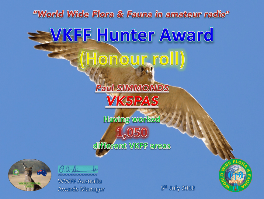
Today I qualified for my latest VKFF award certificate, the VKFF Hunter Honour Roll 1,050, which is issued for having worked 1,050 different VKFF references.
The certificate features a photograph of a Whistling Kite.
Between Friday the 22nd June 2018 to Tuesday 26th June 2018, I was privileged to use the special call of VI70MI. This was courtesy of Lee VK3GK, who is the custodian of this special call.
VI70MI is issued to commemorate 70 years of ANARE (Australian National Antarctic Research Expeditions) for Macquarie Island, which since 1947 have served Australia in the south polar regions.
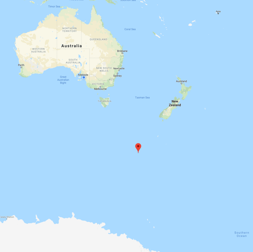
Where is Macquarie Island? It lies in the southwest Pacific Ocean, about halfway between New Zealand and Antarctica, at 54° 30′ S, 158° 57′ E.
Above:- Map showing the location of Macquarie Island in the sub Antarctic. Map courtesy of google maps.
Macquarie Island, affectionately known as ‘Macca’, is regionally part of Oceania and politically a part of Tasmania, Australia, since 1900, it became a Tasmanian State Reserve in 1978 and was inscribed on the World Heritage List in 1997.
The island is named after the former New South Wales Governor, Lachlan Macquarie. It is believed that Macquarie was first discovered on 11th July 1810, by Captain Frederick Hasselborough of the brig Perseverance who sighted the island during a sealing voyage out of Sydney.
The island has numerous bird species including Royal penguins, Macquarie shags, King penguins, southern rockhopper penguins and gentoo penguins. Macquarie has been identified by BirdLife International as an Important Bird Area because it supports about 3.5 million breeding seabirds of 13 species.
Gentoo penguins
Eastern Rockhopper penguin
Sooty Albatross
A royal penguin rookery on Macquarie Island.
Mammals found on the island include subantarctic fur seals, Antarctic fur seals, New Zealand fur seals and southern elephant seals, of which over 80,000 individuals of this species can be found on Macquarie.
Australia’s Sir Douglas Mawson, in 1911, established Macquarie Island’s first scientific station. In 1912, Australians established the first radio link between Australia and Antarctica by setting up a radio relay station on Wireless Hill on Macquarie Island, which could communicate with both Mawson’s main expedition group at Commonwealth Bay, and Australia. The first ANARE expedition to Macquarie Island was in March 1948.
The 1948 ANARE team
1912 radio shack on the island, with 1.5 kW spark gap transmitter
The antenna array used in 1912
Interestingly, there has never been a ham radio DXpedition to Macquarie Island. The only activities on the island are from hams stationed on Macquarie. Currently there is only one active amateur on Macquarie Island, and that is Norbert VK0AI.
I operated from both home and out in the field using the call. On Monday I activated the Scott Conservation Park using the call, and on Tuesday evening I activated the Ferries McDonald Conservation Park.
Unfortunately work got in the way during my first days of operation. I was on Afternoon shift, but gave the call a run in the morning and the early afternoon. But on Monday and Tuesday I had 2 days off and had some fun on 20m and 15m with the DX.
My very first contact using the call was with John VK5BJE on 40m.
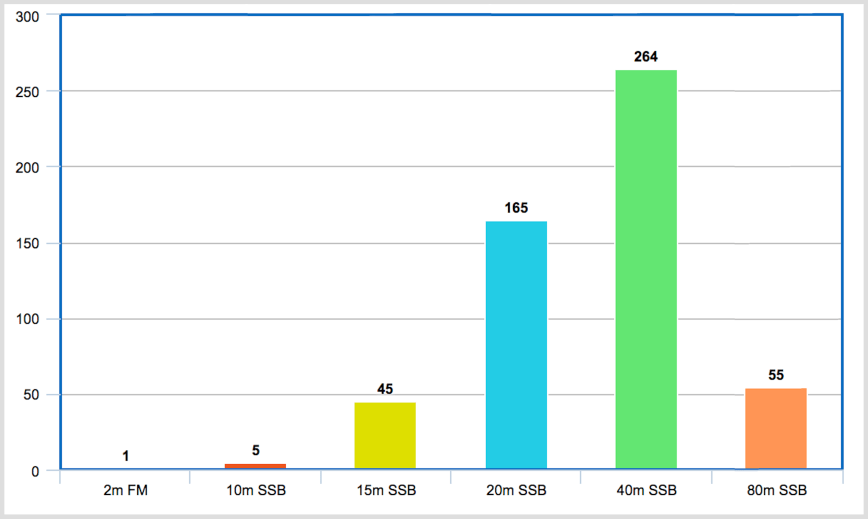
I ended up working a total of 535 stations on 2m FM and 10, 15, 20, 40, & 80m SSB. I worked a total of 16 DXCC entities, 23 of the 50 US States, 15 out of 40 of the ITU zones, and 11 IOTA entities.
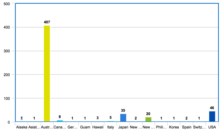
The bar graph below shows my contacts broken down by DXCC entity.
Most of my contacts, 264 of them, were on 40m SSB, followed by 165 on 20m SSB. Sadly I left my run on 10m a little too late on Sunday. By the time I got there from 20m where I was working into North America, the 10m band had almost completely closed.
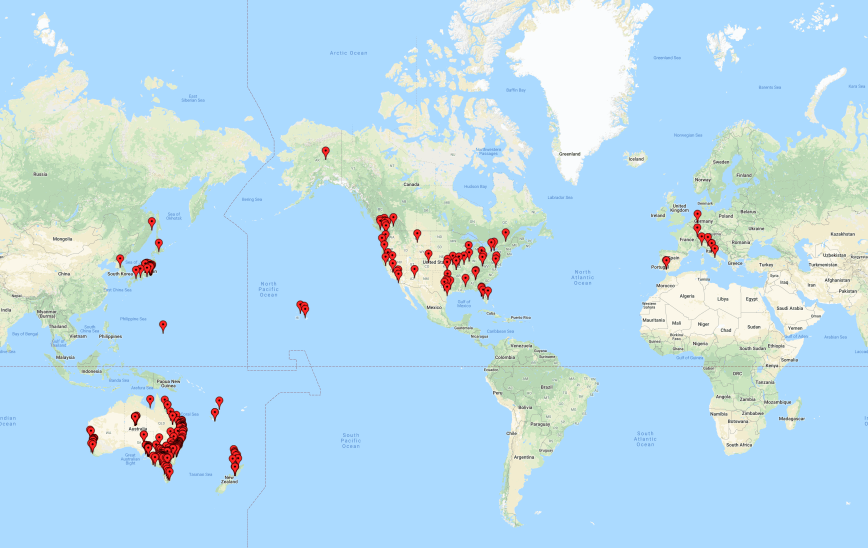
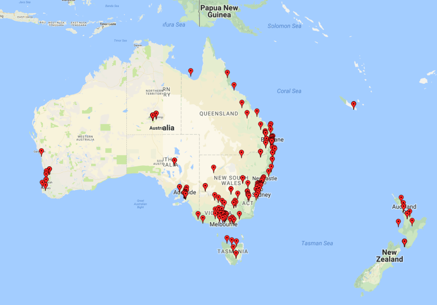
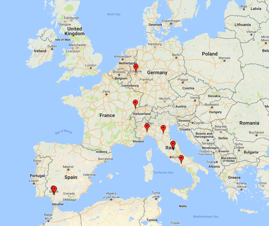
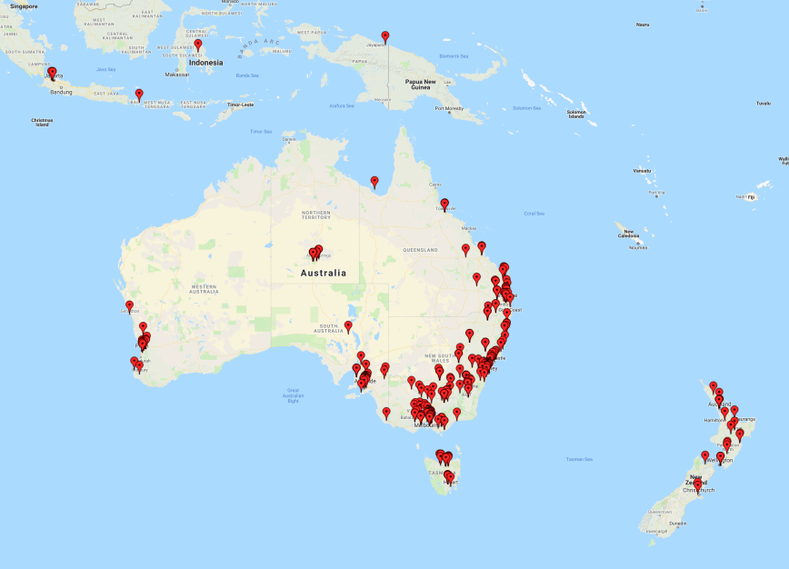
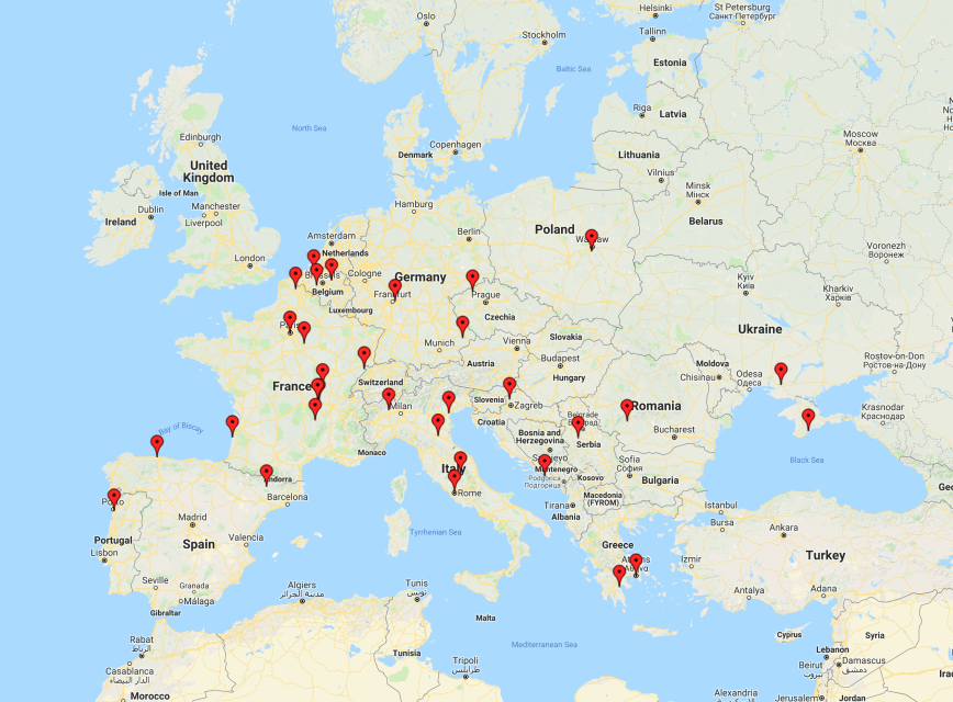
The map below shows my contacts around the globe using VI70MI. Unfortunately no contacts into Africa or South America.
The vast majority of my contacts were around Australia. A total of 407 Australian stations were logged. I worked all States/Territories from VK1-VK8.
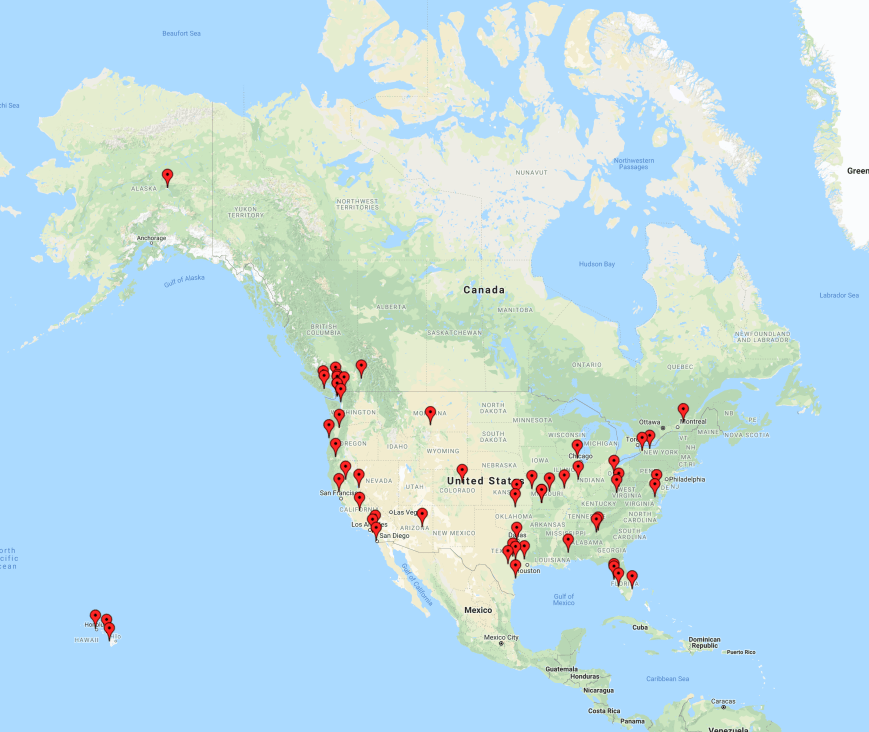
I had some reasonable openings on 20m short path into North America, with stations worked in the USA, Canada, and Alaska.
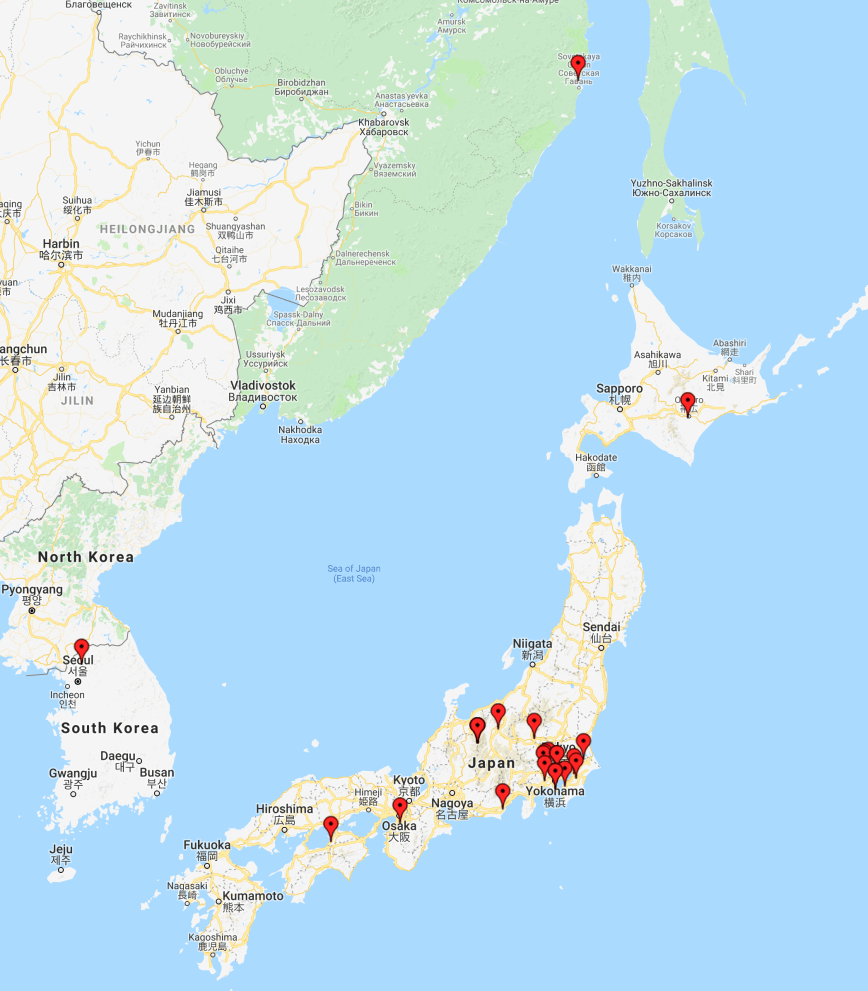
On Sunday I had a small, but very enjoyable opening on 15 metres, to Japan. Whilst beaming in that direction I also logged one station from South Korea, and another in Asiatic Russia. I did not hear a single station on 15m before calling CQ, and then all of a sudden, following a few CQ calls, and a spot on the DX Cluster, the band came alive.
Sadly there was very little long path propagation on 20m to Europe. I only logged 9 European stations, from Germany, Italy, Spain, and Switzerland. And due to work and some other committments, I did not stay up late or get up early in the morning to take advantage of the short path to Europe.
Here is a short video of how I sounded to Tony VK5TT.
I had a lot of fun using the call and would like to thank Lee VK3GK, and everyone who called me. VI70MI will be on air until the end of 30th August 2018. So if you missed me, there will be plenty of opportunities of getting this special call in your log.
A special commemorative QSL card will be available after completion of the activation via M0OXO our QSL manager.
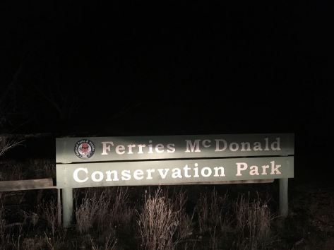
Last night (Tuesday 26th June 2018) I decided at the last minute to head out to active the Ferries McDonald Conservation Park 5CP-067 & VKFF-0881 using the special call of VI70MI. This was my last night using the call, and as I currently have no dedicated 80m antenna at home, I headed out for an evening park activation, particularly focussing on the 80m band.
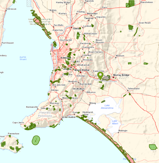
The Ferries McDonald Conservation Park is about 70 km east of Adelaide and about 25 km south west (by road) from Murray Bridge.
Above:- Map showing the location of the Ferries McDonald Conservation Park. Map courtesy of Location SA Map Viewer.
To get to the park I travelled east along the South Eastern Freeway until I got to the Monarto turnoff. I then travelled along Ferries McDonald Road at a slow pace, as there were lots of kangaroos on the road. The area is also known to be the home of the endangered Mallee Fowl and there are signs in place reminding you to drive with care with respect to the local wildlife.
The Ferries McDonald Conservation Park is quite a large park, comprising 842 hectares of dense mallee scrub. Much of the land surrounding the current park was cleared years ago for agriculture, but a few rocky outcrops, not suitable for farming practices, preserved fragments of the original vegetation. The park is home to a variety of rare and endangered plant species. Resin Wattle (Acacia rhetinocarpa) is a compact, resinous spreading shrub that grows up to 2 metres in height with bright yellow flowers. It is endemic to South Australia and is only found in a few locations across the state including three populations in Ferries McDonald CP.
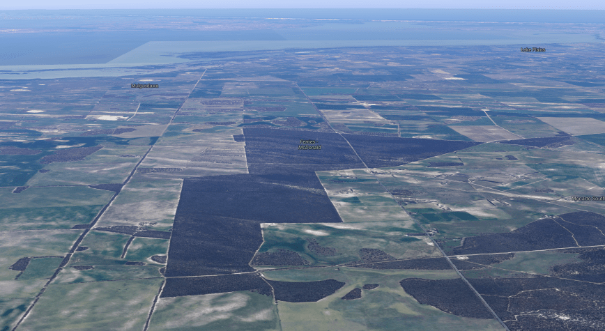
Above:- Aerial shot showing the Ferries McDonald Conservation Park, looking south out towards the Coorong and the Southern Ocean. Image courtesy of google maps
On 28th July 1938 the area was gazetted as a Closed Area for Birds and Animals, creating the first reserve specifically for mallee fauna. The area was named after Robert Sweet McDonald, the donor of much of the land. In 1953 an addition to the park was made with monies from a bequest from James Ferries, thus creating the Ferries-McDonald Reserve. The area was previously known as Chauncey’s Line Scrub.
A number of native animals call the park home including the Red, Western Grey and Euro Kangaroos.
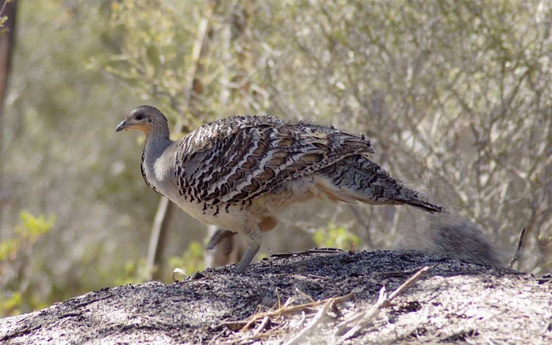
A focus within the park has been the protection of the Malleefowl (Leipoa ocellata), a native bird species that originally inhabited much of the natural mallee environment. Malleefowl are listed as vulnerable nationally but are critically endangered in the Northern Territory and Western Australia.
Above:- Malleefowl. Image courtesy of wikipedia.
Birds SA have recorded a total of 89 native birds in the park includingGalah, Variegated Fairywren, Weebill, Southern Scrub Robin, Australian Magpie, Australian Golden Whistler, Grey Shrikethrush, Spotted Nightjar, Tawny-crowned Honeyeater, Chestnut-rumped Hornbill, White-browed Scrubwren, and White-winged Triller.
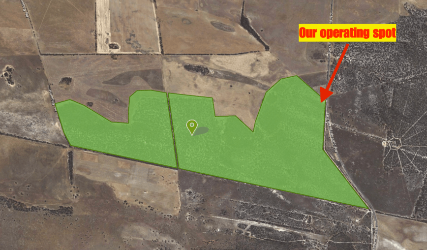
I set up in my normal operating spot, in the carpark in the south eastern corner of the park. I braved the cold during this activation, with the temperature dropping down to 4 degree C during my time in the park. I ran the Yaesu FT-857d, set at 40 watts output, and the 20/40/80m linked dipole.
Above:- Aerial shot of the park showing my operating spot. Image courtesy of Location SA Map Viewer.
First in the log on 3.603 on 80m was John VK5NJ at Mount Gambier with a strong t/9 plus signal. This was followed by Adrian VK5FANA on the Yorke Peninsula who was equally as strong. Adrian gave me a 40/9 signal report. Conditions on the band were great, with no man made noise of course in the park, but also limited static crashes.
I logged 29 stations on 80m from VK1, VK2, VK3, VK4, VK5, VK6, VK7 and New Zealand. This included a Park to Park contact with Gerard VK2IO/p who was activating the Eusdale Nature Reserve VKFF-1929.
I then moved to 40m as Les Vk5KLV up at Port Augusta was hoping to log me and did not have a dedicated antenna for 80m. Sadly Les was unable to hear me on 40m. But I did log 10 stations including Greg VK8GM in Alice Springs.
I moved back to 80m before packing up. I logged a further 13 stations, including Les VK5KLV who was able to make it with his compromise 80m antenna. I was pleased to get Les in the log.
I was now freezing and it was time to pack up and head home to the warmth. I had a total of 52 contacts in the log which I was very happy with.
On Monday 25th June 2018 I headed to the Scott Conservation Park 5CP- & VKFF-0934 to activate the park using the special call sign of VI70MI. The special call issued to Commemorate 70 years of ANARE (Australian National Antarctic Research Expeditions) for Macquarie Island, which since 1947 have served Australia in the south polar regions.
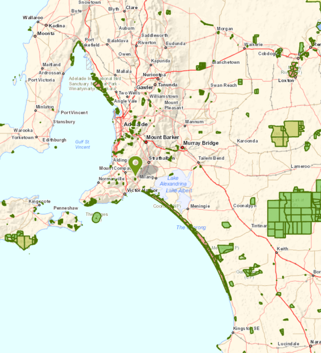
Scott Conservation Park is about 75 km south of Adelaide and about 7 km north west of Currency Creek.
Above:- Map showing the location of the Scott Conservation Park. Map courtesy of Location SA Map Viewer.
The Scott Conservation Park is 210 hectares in size. The park was first proclaimed in 1969 and re-proclaimed as Scott Conservation Park on 27th April 1972. The park is relatively flat and is situated east of the Mount Lofty Ranges. The park consists of Blue and Pink gum woodlands
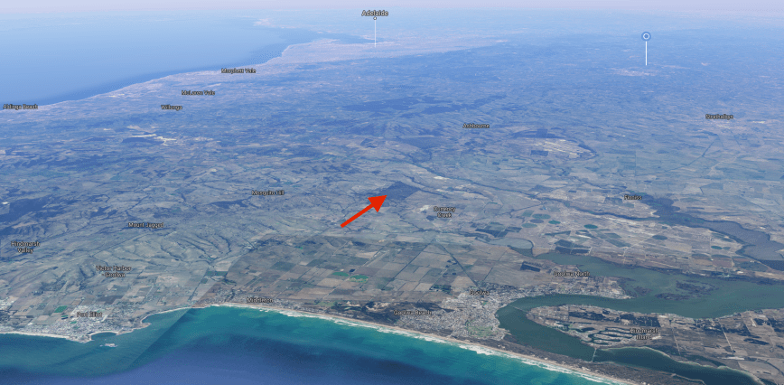
The park is a terrific piece of native scrub which is generally surrounded by cleared farming land. The next largest piece of scrub near Scott is the Cox Scrub Conservation Park.
Above:- Aerial shot showing the location of the park on the Fleurieu Peninsula. Image courtesy of google maps
Birds SA have recorded a total of 148 native bird species at Scott. This includes Common Bronzewing, White-throated Treecreeper, Superb Fairywren, New Holland Honeyeater, Red Wattlebird, Grey Shrikethrush, Cockatiel, Eastern Rosella, Tawny-crowned Honeyeater, Restless Flycatcher, Hooded Robin, and Eastern Shriketit.
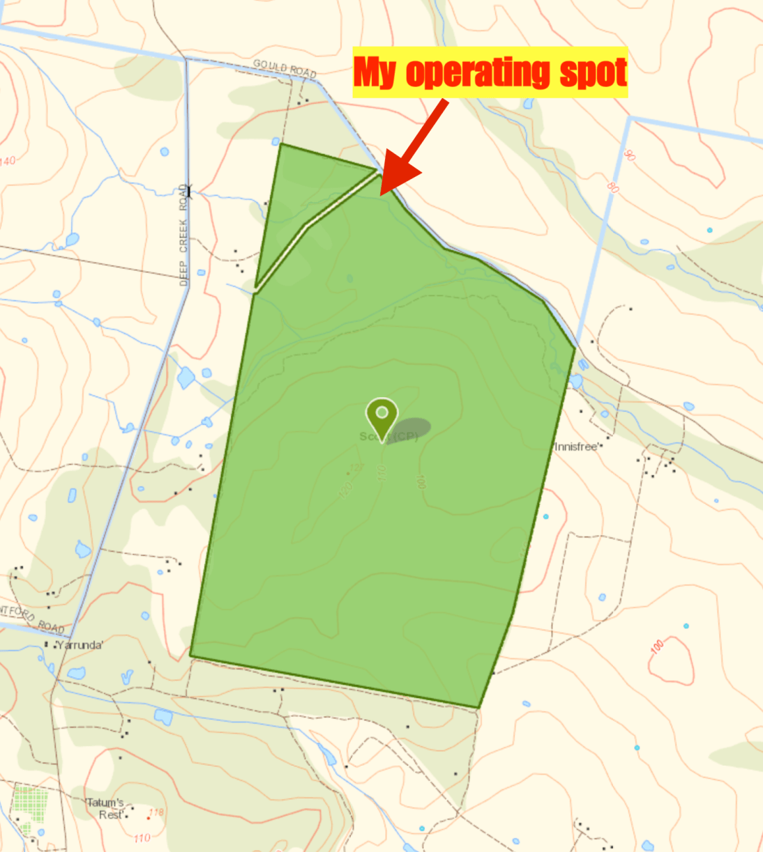
Above:- Map of the park showing my operating spot. Map courtesy of Location SA Map Viewer.
Unfortunately I did not plan this activation very well, and left home without the camera, and secondly with an almost flat mobile phone. So I was only able to take 3 photos during this trip to Scott. And I wasn’t able to self post on parksnpeaks and facebook, so I was relying upon the good will of park hunters.
I kicked off the activation by calling CQ on 7.144 which was answered by Geoff VK3SQ, followed by Lee VK3FLJD, and then Nick VK3ANL. Although it was a weekday I was pleased to have a good flow of callers eager to get the VI70MI callsign in their log.
I managed to log 31 contacts on 40m including two Park to Park contacts, with Bill VK4FW/p in the Sheep Island Conservation Park VKFF-1642, and Allan VK2MG/p in the Bouddi National Park VKFF-0049. I then lowered the squid pole and inserted the links for the 80m section of the dipole. I called CQ on 3.610 and thus was answered by Greg VK5GJ with a big 5/9 signal, followed by Hans who was also 5/9 plus. I was really pleased to log a total of 9 stations on 80m from VK3, VK5 and VK7.
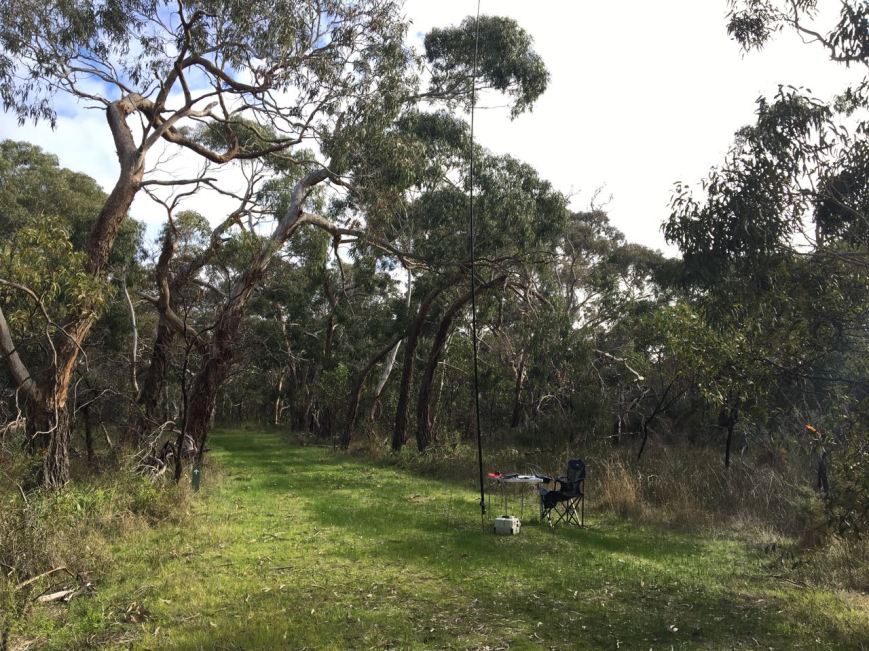
Above:- My shack for the morning. A nice setting.
I then headed to 20m and called CQ on 14.310. First in the log was Greg VK5GJ who had followed me from 80m. Next was regular park hunter John VK4TJ, who become contact number 44 in the log. This was followed by Bill VK4FW/p for another Park to Park contact from the Sheep Island Conservation Park.
With 11 stations in the log on 20m, I headed back to 7.144 on 40m where I logged 10 stations. This included Gerard VK2IO/p on SOTA peak Mount Walker VK2/ CT-019 and Peter VK3TKK/p in the Conglomerate Gully NCR VKFF-2297.
To complete the activation I headed down to 3.610 and logged Gerard VK2IO/p on his SOTA summit, and then Peter VK3TKK/p for another Park to Park. Last in the log was Peter VK3PF.
It had been a fun 90 minutes in the park and I had 64 contacts in the log, including five Park to Park contacts.
I worked the following stations on 40m SSB:-
VK3SQ
VK3FLJD
VK3ANL
VK3UH
VK5LA
VK4SOE/p
VK4TJ
VK4/AC8WN
VK4/VE6XT
VK3PF
VK5GJ
VK4FW/m
VK2UH
VK7RN
VK2HHA
VK2MOP
VK5MR
VK5BJE
VK4NH
VK4DXA
ZL4TY/VK4
VK3DHW/p
VK3MCM
VK3GGG/p
VK3PMG/p
VK4FW/p (Sheep Island Conservation Park VKFF-1642)
VK2MG/p (Bouddi National Park VKFF-0049)
VK4COA/p
VK1AT
VK2DLR
VK2PKT
VK1MA
VK2IO/p (Mount Walker VK2/ CT-019)
VK2SB
VK3AHR
VK3WAR
VK3TKK/p (Conglomerate Gully NCR VKFF-2297)
ZL1TM
VK2ESG
VK3GMC
VK2XXM
I worked the following stations on 80m SSB:-
VK5GJ
VK5YX
VVK5FANA
VK5BJE
VK3GGG/p
VK3PMG/p
VK5VC
VK7RN
VK5NBQ
VK2IO/p (Mount Walker VK2/ CT-019)
VK3TKK/p (Conglomerate Gully NCR VKFF-2297)
VK3PF
I worked the following stations on 20m SSB:-
VK5GJ
VK4TJ
VK4/AC8WN
VK4/VE6XT
VK4FW/p (Sheep Island Conservation Park VKFF-1642)
Today I received my latest activator certificate for the World Wide Flora Fauna (WWFF) program. It is issued for having activated 209 different WWFF reference areas and having made 44 QSOs’ during those activations.
Looking at WWFF Logsearch (as of 21st June 2018) I have activated a total of 236 parks, but I have fallen short of achieving the required 44 QSOs for the ‘global’ WWFF program in some of those. So my current total is 211 parks where 44 QSOs were obtained.
Thankyou to all of the WWFF hunters and thankyou to Friedrich DL4BBH the awards manager.
Today I qualified for my latest VKFF certificate, the VKFF Hunter Honour Roll 1,025 certificate. The certificate is issued for having worked 1,025 different VKFF references.
Between Monday 11th June 2018 and Sunday 17th June 2018 I had the privilege of operating as VI50IARU3. This is a special call to celebrate the 50th anniversary of Region 3 of the International Amateur Radio Union (IARU).
During my time with the call I operated from home and also activated one summit for Summits on the Air (SOTA), and four parks for World Wide Flora Fauna (WWFF). Unfortunately work got in the way on Wednesday, Thursday, and Friday.
I ended up making a total of 631 contacts on 10m SSB, 15m SSB, 20m SSB, 40m SSB, 80m SSB, & 2m FM. I found band conditions pretty tough at times, particularly with the DX. I only had the one real opening to Europe on the long path on 20m. I did not work any Japanese or Asian stations on 15m which is very unfamiliar. Propagation just wasn’t there.
But despite the average conditions I did work a total of 26 different DXCC entities:
Alaska – 1
Asiatic Russia – 1
Australia – 531
Belgium – 2
Canada – 1
Croatia – 2
Czech Republic – 1
Dominican Republic – 1
European Russia – 1
Germany – 2
France – 9
Greece – 2
Hawaii -1
Indonesia – 6
Italy – 5
Japan – 6
Netherlands – 1
New Zealand – 27
Poland – 1
Portugal – 1
Romania – 1
Serbia – 1
Spain – 2
Switzerland – 1
Ukraine – 1
USA -23
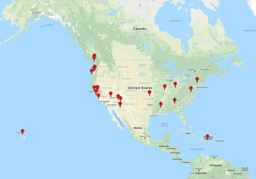
The map below shows my contacts around the globe using VI50IARU3. I worked 16 of the 40 CQ Zones, and 13 IOTA entities.
I worked 14 of the 50 US States. This was a mixture of contacts on 40m SSB & 20m SSB.
Most of my contacts were around Australia, with New Zealand in 2nd place. I also worked a few stations in Indonesia.
On Tuesday I had a short opening on the long path on 20m into Europe.
I think the most interesting call logged was HI8RD in the Dominican Republic on the 40m band.
I had a great time with the call and would like to thank Fred VK3DAC for giving me the opportunity of using the call. I would also like to thank everyone who called me.
Don’t forget….there is a special QSL card available (downloadable only) and also a special Award on offer. Details can be found by clicking on the link on the VI50IARU3 QRZ.com page.
After leaving Mount Lofty we headed east to the Monarto Conservation Park VKFF-0828 hoping to log some more stations using the special VI50IARU3 call sign to celebrate the 50th anniversary of region 3 of the International Amateur Radio Union (IARU).
As we drove east we could see blue sky which was very promising. Sadly that didn’t last for long and we soon had a huge downpour of rain. It wasn’t looking good to be sitting out in the park.
Above:- Map showing the location of the Monarto Conservation Park. Map courtesy of Location SA Map Viewer.
Once we got to Monarto the weather had started to clear somewhat, but not enough for me to sit outside of the vehicle. We set up the 20/40/80 m linked dipole and operating from the comfort of the Toyota Hi Lux.
Our operating location was our normal spot in the carpark off the Ferries McDonald Road.
Above:- Aerial shot of the Monarto Conservation Park showing our operating spot. Image courtesy of Location SA Map Viewer.
We started off the activation on the 40m band. First in the log was Bill VK4FW/p who was activating the King Conservation Park VKFF-1572. After logging Bill we moved down the band to 7.130 and I called CQ. Andrew VK2UH had followed me down and was logged with a strong 5/9 signal. Next up was Peter VK3PF, followed by Ray VK3NBL, and then Brett VK2VW.
I logged 40 stations on 40m from VK2, VK3, VK4, VK5 VK7 and VK8. This included another Park to Park, this time with Nik VK3NLK/2 in the Murray Valley National Park VKFF-1178.
I then moved to the 20m band and called CQ on 14.310. Greg VK4VXX/8 had followed me up from 40m, and was first in the log. Next was Snow VK4FE. But despite a number of further CQ calls I had no further takers on that band.
So to finish off the activation I called CQ on 3.610 on the 80m band. I logged 13 calls on that band from VK2, VK3, & VK5.
I ended up with a total of 55 stations in the log for the activation.
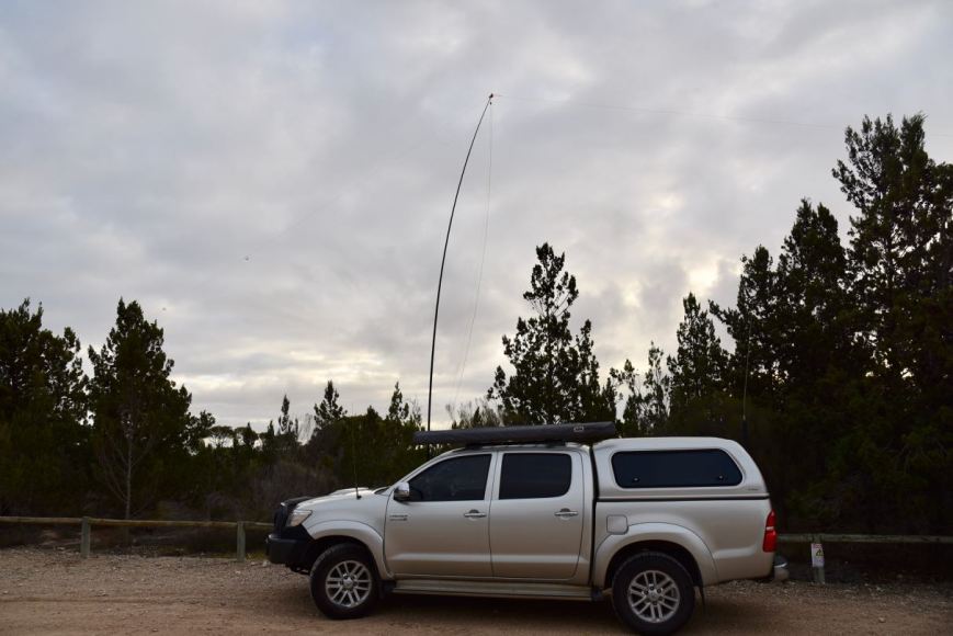
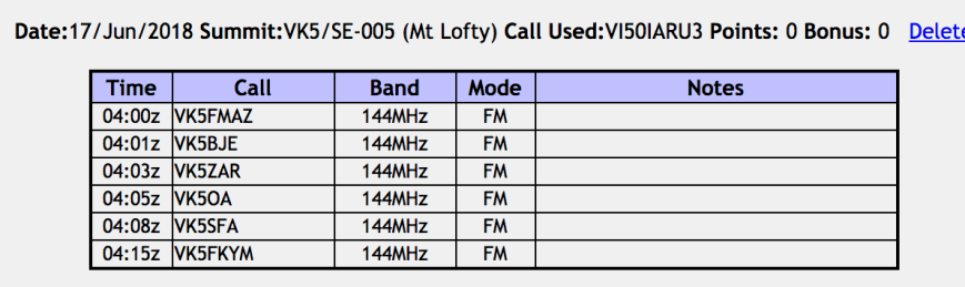
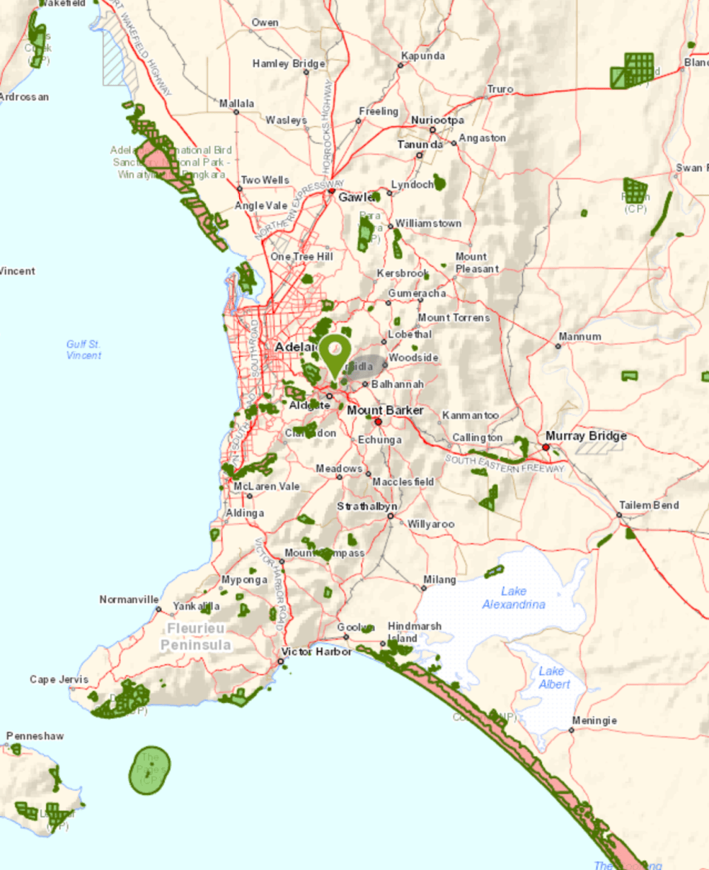
On Sunday 17th June 2018 I activated Mount Lofty summit VK5/ SE-005 using the special VI50IARU3 call sign. This was an impromptu activation. I had wanted to get out to do something portable that day, but the weather was miserable. However by 1.00 p.m. there was some blue sky appearing, so Marija and I packed the 4WD and headed for Mount Lofty, which is also located within the Cleland Conservation Park 5CP-042 & VKFF-0778.
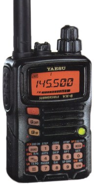
We decided to try to activate the summit on 2m FM using my little handheld, Yaeu VX-6R. Along the way we telephoned John VK5BJE who kindly placed a post on the Facebook page of the Adelaide Hills Amateur Radio Society. Many thanks John.
We were all set up and ready to go on the summit by around 1.30 p.m. First in the log was Marija VK5FMAZ who had remained in the car as it was too cold and windy for her initially. It was then fitting that I was able to log John VK5BJE at nearby Scott Creek. Arno VK5ZAR followed and he had a very strong signal. Next was John VK5OI in the southern suburbs, followed by Steve VK5SFA (very strong), and Kym VK5FKYM in the southern suburbs.
But that was the extent of calls sadly. I thought more people may have called, but perhaps they couldnt hear me.
Marija and I were hoping to activate the summit on HF as well, but just when we thought the weather had cleared, the heavens opened up and it started raining again. Plan B. Head to the Monarto Conservation Park on the other side of the Mount Lofty Ranges, where it may be a little clearer.
On Wednesday evening (13th June 2018) I headed to the Mount George Conservation Park 5CP-147 & VKFF-0784 for an evening activation using the special call of VI50IARU3.
The Mount George Conservation Park is located just a short drive down the South Eastern Freeway from my home.
Above:- Map showing the location of the Mount George Conservation Park. Map courtesy of Location SA Map Viewer.
I have activated this park many times previously for both the WWFF program and the VK5 Parks Award.
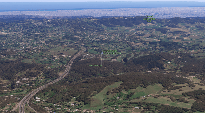
Above:- Aerial view showing the Mount George Conservation Park, looking back towards Adelaide. Image courtesy of google maps.
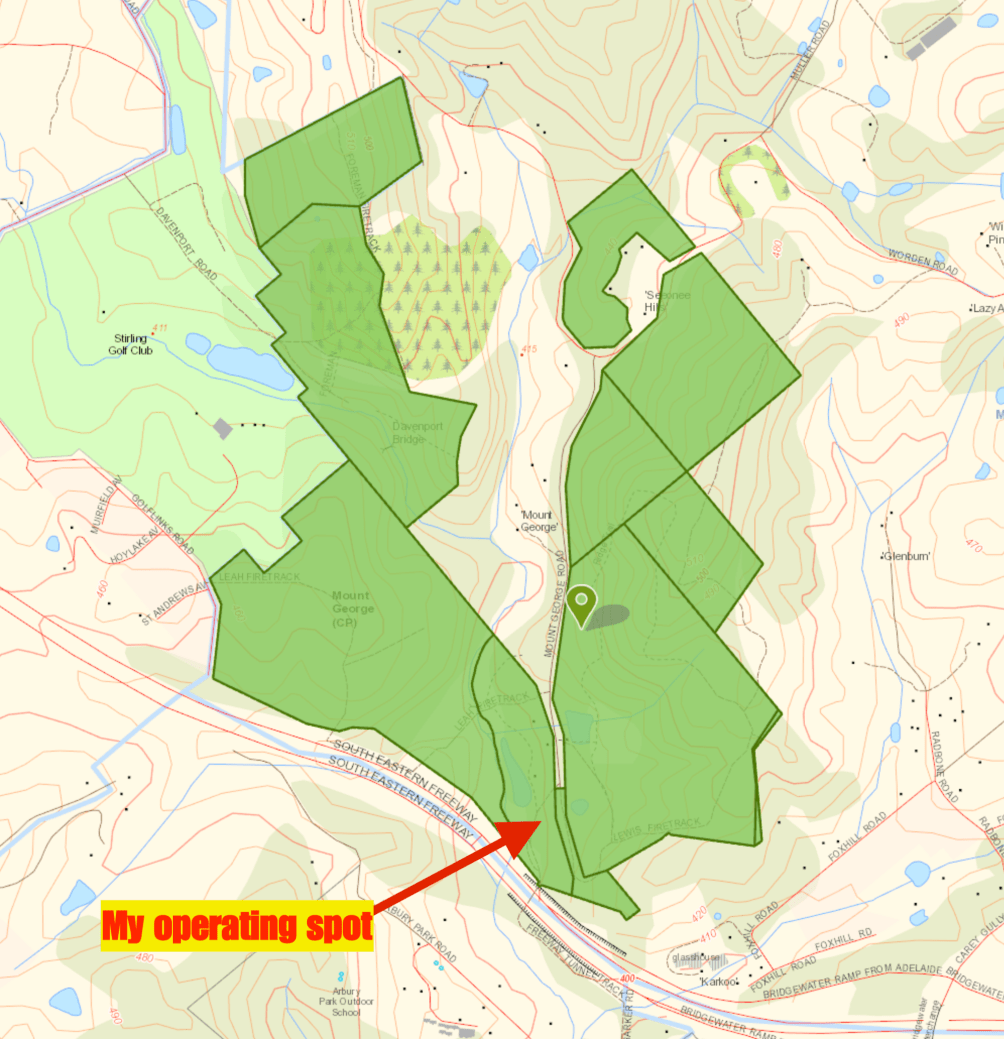
I set up in my normal operating spot, in the picnic ground at the end of Mount George Road.
Above:- Map of the park showing my operating spot. Map courtesy of Location SA Map Viewer.
It was quite a miserable night weather wise and I had to retreat to the vehicle on a number of occasions. I kicked off the activation on 3.620 on the 80m band. First in the log was John VK4TJ with a strong 5/8 signal, followed by Tony VK5TT and then Ivan VK5HS. Despite there being strong static crashes on the band, I had a steady flow of callers and ended up logging a total of 22 stations on 80m in 35 minutes, from VK2, VK3, VK4, VK5, VK6, VK7 and VK8. It was great to speak with Owen ZL2OPB/VK5 who has just moved to South Australia. And also Wayne VK6JR/8 who was about 100 km west of Alice Springs.
I then headed to 7130 hoping to check into the 7130 DX Net, but it had already closed due to poor band conditions. But I did log my good wife Marija VK5FMAZ. Unfortunately I soon started to experience Indonesian interference, so I moved up the band to 7.180 where I logged 7 stations from VK3, VK4 & New Zealand.
I then moved back to 80m and called CQ on 3.615 logging a total of 5 stations from VK3 and VK6. But callers dried up, so I tuned across the band and booked into the North East Victoria ARC Net where I logged 6 stations. I then tuned across the band and found another group on 3.600 including Mark VK2PH. I logged 5 stations on that frequency, before deciding it was just too wet and windy to continue the activation.
It was time to pack up and head back home to the warmth and out of my wet clothes. I had a total of 46 contacts in the log and had hopefully given some more people the opportunity of logging the special call of VI50IARU3.