Deep Creek Conservation Park 5CP-054 and VKFF-0780

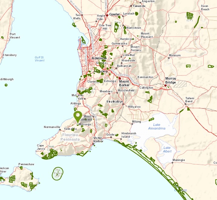
After leaving Myponga, Marija and I continued south along the Main South Road, with our destination being the Deep Creek Conservation Park, 5CP-054 and VKFF-0780.  Deep Creek CP is located about 108 km south of Adelaide on the Fleurieu Peninsula.

Screenshot 2016-04-07 07.58.36

Above:- Map showing the location of the Deep Creek Conservation Park, south of Adelaide.  Map courtesy of Location SA Map Viewer.

After passing the Myponga Reservoir we then drove through Wattle Flat until we reached the little two of Yankalilla.  I worked here way back in the mid 1980’s.  We continued on to Normanville and followed the coast, admiring the fantastic views of Lady Bay and Yankalilla Bay.  This is a very scenic drive through the beautiful Fleurieu Peninsula.  We continued on to Second Valley and the little town of Delamere.  It was here that we turned left onto Cole Road.  It wasn’t long until we reached a sign for the park and Goondooloo Cottage on the corner of Cole Road and Dog Trap Road.

DSC_0035

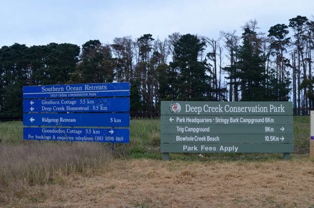
We continued south on Dog Trap Road until we reached the intersection with Three Bridges Road.  The SOTA summit, Black Bullock Hill VK5/ SE-016 is located here.  We continued south on Tent Rock Road until we reached the cottage which was well signposted.  The fun of unpacking then started.

The land on which Goondooloo Cottage stands and adjacent areas was originally opened up by Mr. Aaron Bennett in the 1880’s.  The nearby Aaron Creek and its walking trail commemorate this early pioneer.  The land was periodically fired on a north wind, burnt to the coast and then grazed with sheep and cattle until the scrub became too thick when the process was repeated.

In 1937, Arthur and Mavis Loch purchased the land and the adjacent ‘Tent Rock’ property where they built their house and commenced to clear the land using bulldozers.  The area around the cottage was cleared in 1951 to 1952 and the dam below the cottage was constructed about the same time.

Lennard and Hazel Graves, store keepers from Streaky Bay purchased the land from the Loch’s in 1955 and called their property ‘Karella’.  It was on this land that Mr. Graves and his sons Colin and Ross built a one room shed/garage from hand made bricks.  This was the basis of the cottage.  It was shortly after that a kitchen, two bedrooms, outside bathroom and toilet, laundry and enclosed sleepout/verandah were added.

This was to be a ‘temporary dwelling’ until 1961 when Mr. and Mrs. Graves built the house south of the cottage.  The cottage was then used as aresidence by Mr. Graves’ son, Ross and his wife Jean.  The surrounding land continued to be cleared and a dairy was established with the milking shed approximately 400 metres down the road from the cottage.

In 1972 the property and buildings were sold to W.H. ‘Bill’ McGrath and Anntette Forrest who renamed the property ‘Goondooloo’, the local aboriginal name for the Southern Cross star constellation.  The cottage underwent refurbishing, with front glass sunroom internal bathroom and vernadah added.  In 1979 the property was sold to the National Parks and Wildlife Service as part of the Deep Creek Conservation Park.

The cottage was leased out as a private residence until 1981 when it became the first Park Headquarters.  It was used for this purpose until the headquarters were shifted to the current location above Glenburn Cottage in 1985.  The building was used as a temporary Ranger’s residence and as a storage area until 1987 when it became a holiday cottage.

In 1984, Southern Ocean Retrests took on the management of the cottages in Deep Creek Conservation Park and embarked upon an extensive rennovation program for each cottage.  Work on Goondooloo commenced in 1998 and included a complete refit of the bathroom and kitchen areas, the laying of slate floors throughout and use of larger windows.  Other less visible changes included the establishment of an independent rainwater supply system no longer leaving the cottage at the mercy of dam water.  Revegetation of the surrounding area was undertaken at the same time by Southern Ocean Restreats utilising seedlings grown from seeds collected in the park.  These include stringy bark, sheoak, pink gum, cup gum and mauye bottle brush.

Marija and I highly recommend a stay here.  More information can be found at……

http://www.southernoceanretreats.com.au/

Screenshot 2016-04-07 08.05.16

Above:- Map showing the location of Goondooloo cottage within the Deep Creek Conservation Park.  Image courtesy of Location SA Map Viewer.

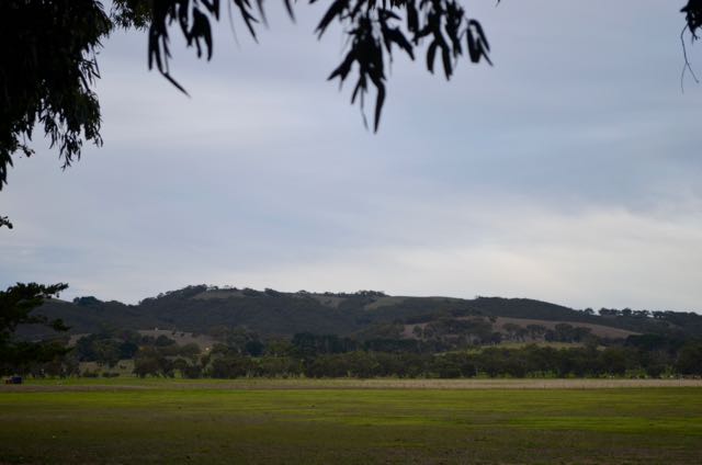
Deep Creek Conservation Park is 44.96 km2 (about 4,500 hectares) and is a spectacular park, with very thick scrub amongst some very hilly terrain.  The park contains some of South Australia’s most spectacular semi-wilderness areas and coastal scenery.  There are some amazing views to be enjoyed out to the Southern Ocean and across Backstairs Passage to Kangaroo Island.    The famous Heysen Trail passes through the park, and there are numerous other walking trails through the park.  Deep Creek CP was named after the waterfall which flows through the year.  The park is alive with Western Grey kangaroos.  Over 100 species of birds have been recorded in the park, and we certainly saw a lot including Wedge Tailed eages, Superb Blue wrens, numerous honeyeaters, and Rosellas.

Screenshot 2016-04-07 07.58.11

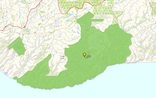
Above:- Map showing the extent of the Deep Creek Conservation Park.  Image courtesy of Location SA Map Viewer.

After unpacking and settling in to the cottage, Marija helped me set up the portable station in the ‘back yard’ of the cottage.  I ran the Yaesu FT-857d, 400 watts, and the 20m/40m linked dipole for the activation (supported on the 7m heavy duty squid pole).  My first contact was with Mick VK3PMG who kindly spotted me on parksnpeaks.  This was followed by many of the ever keen park hunters including John VK5BJE, Amanda VK3FQSO (running just 1 watt and was 5/3), and Tony VK7LTD.

Nine QSOs into the activation and I worked Stef Vk5HSX ‘Park to Park’.  Stef was operating portable in the Little Dip Conservation Park 5CP-120 and VKFF-0904, in the South East of South Australia.  Unfortunately I started to experience the normal QRM from a VK2 Net on7.146.  Bill VK4FW tried calling but we just couldn’t quite make it due to the QRM, which fortunately did not last for long.  I continued to work a steady pile up of callers from VK2, VK3,, VK5, and VK7.  Sadly, the QRM free frequency didn’t last, with the stations starting up again on 7.144.  I perservered and worked a number of other stations including another “Park to Park” contact, this time with Rob VK4AAC/3 in the Barmah National Park VKFF-0739.  But it just got too tough and I decided to QSY to 20m.

I commenced calling CQ on 14.310 and was pleased to get Bill VK4FW in the log as number one on 20m.  This was followed by Cliff VK2NP, Jim VK1AT/3, and then my first DX for the park, Sergey RA3PCI in Russia.  This was followed soon after by Pista HA8CE in Hungary.  I then spoke with Garry VK1ZZ/4 in the Forty Mile Scrub National Park VKFF-0181, my first “Park to Park” for this activation on 20m.  I worked a few more VK4 and VK6 stations and also Alex UA3AR in Russia, but it was still a little too early for good long path Europe propagation.

So I headed down the band to the ANZA DX Net and checked in there.  I worked a total of 7 stations on the Net from VK1, VK4, VK6, New Caledonia, South Cook Islands, and China.  I then headed back to 40m.

I had a listen on 7.144 and heard Peter VK5PET calling CQ from the Mount Magnificent Conservation Park 5CP-148 and VKFF-0916.  Peter was activating the park as part of our normal Friday afternoon/evening event for the VK5 National and Conservation Parks Award, and had a beautiful 5/9 signal.  I knew that there were some more VK5 Park Activators out and about, so I decided to have a tune across the 40m band before finding somewhere to prop and start calling CQ.  It didn’t take me long to find Adrian VK5FANA on 7.130, operating from the Innes National Park 5NP-010 and VKFF-0243.  Adrian had a very strong 5/9 plus signal coming in from the bottom of the Yorke Peninsula.

Soon after I found Peter VK3PF on 7.100 on SOTA summit Granite Peak, VK3/ VG-137 which is located within the Alfred National Park VKFF-0618.  I then headed up to 7.150 and started calling CQ and it wasn’t long before the throng of park hunters had found me.  First taker was Ron VK3AFW, followed by Matt VK3FORD, and then Peter VK3TKK operating portable in the Organ Pipes National Park VKFF-0627.  Quite a pile up ensued with callers from VK1, VK2, VK3, VK4, and VK5, all with excellent signals.

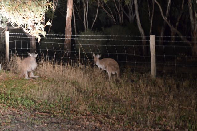
Whilst operating I had a crowd of onlookers.  No not people, but a mob of kangaroos who were grazing in the clearing about 100 feet from where I was operating.

When things quietened down a little I took the opportunity of looking around the 40m band again, and I soon found Gerard VK2IO in Gariral National Park VKFF-0191.  This was a very first time activation of the park, so I was very pleased to get Gerard in the log with a beautiful 5/9 signal.

I decided to head back to 20m and started calling CQ on 14.245.  To my surprise this was immediately answered by Mike M0FCD in England with a strong 5/9 signal (5/6 received).  This was followed by Steve who kindly placed me on the DX Cluster.  This clearly resulted in quite a few subsequent calls from Europe.  I worked into Italy, Belgium, Poland, Spain, Hungary, England, Portugal, Netherlands, Russia, Finland, France, Germany and Ukraine.  Signals were quite good.  In fact the best I had heard whilst out portable for some time.  I even got to work my good mate Danny ON4VT.

Danny asked if I could QSY up the band to work a Belgian Foundation operator.  Apparently they cannot operate below 14.250.  So I headed up the band to 14.285 where I spoke with ON3EVO/m (5/5 both ways).  I then returned back down to 14.245 where I worked into VK2, Alaska, Belgium (including my mate Swa ON5SWA), Germany, Slovak Republic, and Finland.  I then headed inside the cottage for some dinner and a few beers from the Smiling Samoyd Brewery at Myponga.

After dinner, I headed back outside again and called CQ on 7.150, which was answered by Rick VK5FGFK, followed by Lewis VK2JDW mobile, and then Darrell VK3AWA.  Next in the log was Oliver ZL1AAW in Auckland.  Band conditions were excellent again, with further calls from VK3, VK4, and VK6.  This included contacts with John VK6VZZ and Jonathan VK6JON, who were both mobile in Perth.

It was approaching 8.00 p.m. South Australian local time (0930 UTC) so I headed to the 7130 DX Net where I booked in and subsequently worked into VK4, VK6, VK7, and USA.  This included another “Park to Park’ contact with Garry VK1ZZ/4 in Forty Mile Scrub, Bill W1OW in Massachusetts in the USA, and Carstern VK6PCB portable on the banks of the Swan River in Perth, running just 5 watts.

It was the end of a great day.  I had 113 contacts in the log already from Deep Creek.

The following stations were worked on 40m SSB:-

  1. VK3PMG
  2. VK5BJE
  3. VK3FQSOP
  4. VK7LTD
  5. VK5GJ
  6. VK5GI
  7. VK3SFG/p
  8. VK3FOWL
  9. VK5HSX/p (Little Dip Conservation Park 5CP-120 and VKFF-0904)
  10. VK2YW
  11. VK5KBB
  12. VK5ZGY
  13. VK2HHA
  14. VK3TUL/p
  15. VK2LEE
  16. VK5FTVR
  17. VK5FMID
  18. VK2NP
  19. VK2XXM
  20. VK3FAPH/p
  21. VK7CW
  22. VK3AWG
  23. VK4AAC/3 (Barman National Park VKFF-0739)
  24. VK3SIM
  25. VK5PET/p (Mount Magnificent Conservation Park 5CP-148 and VKFF-0916)
  26. VK5FANA/p (Innes National Park 5NP-010 and VKFF-0243)
  27. VK3PF/p (SOTA VK3/ VG-137 and Alfred National Park VKFF-0618)
  28. VK3AFW
  29. VK3FORD
  30. VK3TKK/p (Organ Pipes National Park)
  31. VK5KLV
  32. VK3OF
  33. VK2RM
  34. VK4RF
  35. VK4HA
  36. VK5TRM
  37. Vk5LDM
  38. VK3FCCK
  39. VK5JK
  40. VK3FQSO
  41. VK4QQ
  42. VK5NRG
  43. VK5KPR
  44. VK5ZRY
  45. VK1EL/p
  46. VK4FFAB
  47. VK2IO/p (Gariral National Park VKFF-0191)
  48. VK5FGFK
  49. VK2JDW/m
  50. VK3AWA
  51. ZL1AAW
  52. VK3MCD/p
  53. VK3TJK
  54. VK4FBMW
  55. VK4NAI/6
  56. VK6VZZ/m
  57. VK6JON/m
  58. VK6WE
  59. VK7ROY
  60. VK4TH
  61. VK1ZZ/4 (Forty Mile Scrub National Park VKFF-0181)
  62. VK4MON
  63. W1OW
  64. VK6PCB/p

The following stations were worked on 20m SSB:-

  1. VK4FW
  2. VK2NP
  3. VK1AT/3
  4. RA3PCI
  5. VK4HNS
  6. VK3MCK
  7. HA8CE
  8. VK1ZZ/4 (Forty Mile Scrub National Park VKFF-0181)
  9. VK6BG
  10. VK4MNM/m
  11. UA3AR
  12. FK8HZ
  13. BD4CZX
  14. VK4DGU
  15. VK4LJ
  16. E51JD
  17. VK4NH/6
  18. VK1TX
  19. M0FCD
  20. VK4OZI
  21. IZ1JMN
  22. I5FLN
  23. ON4VT
  24. SQ1GQT
  25. EA4DTV
  26. HA6OB
  27. G4OJY
  28. CT2IHP
  29. ON1JU
  30. PD2JAM
  31. M5AFD
  32. R2AGM
  33. G0RQL
  34. EA2KV
  35. OH6IU
  36. F5XL
  37. UR7ET
  38. F1BLL
  39. F6BWA
  40. OT4V
  41. DF4TD
  42. ON3EVO/m
  43. VK2QM
  44. AL7KC
  45. ON5SWA
  46. OM7OM
  47. DL1LQC
  48. OH1NYD

Yulti Conservation Park, 5CP-261 and VKFF-1128

On Friday 1st April 2016, Marija and I made a bright and early start and we headed off for the Fleurieu Peninsula south of Adelaide.  We had booked in to stay for 3 nights at Goondooloo Cottage in the Deep Creek Conservation Park and had plans to activate that weekend a total of six parks for the 3rd year anniversary of the VK5 National and Conservation Parks Award.  Our first, and only activation for Friday was to be the Yulti Conservation Park, 5CP-261 and VKFF-1128.

Yulte Conservation Park is located about 60m south of Adelaide, and about 3 km south east of the town of Myponga.

Screenshot 2016-04-06 09.53.50

Above:- Map showing the location of the Yulte Conservation Park, on the Fleurieu Peninsula.  Image courtesy of Location SA Map Viewer.

I have activated Yulti Conservation Park twice before, but this was to be my first activation of the park for the World Wide Flora Fauna (WWFF) program.  The park had not been on the WWFF list during my two previous activations.  So I was keen to get 44 QSOs.

Yulti Conservation Park is often referred to as Yulte Conservation Park on maps and various websites.  The Department of Environment Water & Natural Resources (DEWNR) website lists the park spelling as Yulte.  But the sign in the park itself shows the spelling as Yulti.  The road leading up to the park is spelt as Yulte.  The park derives its name from the Kauna aboriginal word ‘yulti’ meaning stringy bark.

The park is 41 hectares in size and consists of a series of hills and gullies.  It is disected by several small creeks with gurgling waterfalls.  The Heysen Trail passed through the dense overgrowth in the park.

As we drove along Pages Flat Road, the park soon came into view to our left across the cleared farming land.

DSC_0001

We then turned left onto Barclay Road, and then right onto Rowley Road until we reached Yulte Road.  The Fleurieu Milk & Yoghurt Company has their processing plant on this corner.  We continued south along Yulte Road, which becomes Coopers Road.  On maps, Cooper Road continues out to Trig Point Road (but in reality this is not the case).  There is no vehicular access to the park from the Trig Point Road end.

Since last being at the park, it was evident that access up to the park sign was not possible, as there were a lot of tree branches down over Coopers Road (which is a 4WD track).  We parked the car at the ‘turn around’ at the end of Yulte Road, just down from the property called ‘Highlands’, and started carrying the gear a short distance up the track to our operating spot.

Screenshot 2016-04-06 09.52.22

Above:- Map showing our operating spot on the western side of the Yulte Conservation Park.  Image courtesy of Location SA Map Viewer.

The track leading up to the park is quite a gentle slope and it is only a few hundred metres until you reach the park boundary.

As Yulte Conservation Park is located in the hills around Myponga, there are some very nice views to be enjoyed of the surrounding countryside if you get up high enough.

This slideshow requires JavaScript.

We were up on air by 9.50 a.m. South Australian local time.  I headed to my nominated operating frequency of 7.144 and commenced calling CQ.  This was answered by Mick in Stawell in western Victoria with a beautiful 5/9 plus signal.  Mick kindly spotted me on parksnpeaks and this resulted in a mini pile up.  My second caller was Don VK3MCK who had become a regular park hunter of late, followed by Graham VK2MGA who was mobile on the Hume Highway, and had a strong 5/9 signal from his mobile.

Fourteen contacts into the activation and I had my first ‘Park to Park’ contact for the activation.  It was with Adrian VK5FANA who was operating portable in the Leven Beach Conservation Park, 5CP-117 and VKFF-0814, on the Yorke Peninsula (5/9 both ways).

I continued to work quite a pile up, with callers from VK2, VK3, VK4, VK5, and VK6 with many of the regular park hunters featuring, but also some new callers.  I worked a total of 27 stations prior to the UTC rollover.  There were some nice QRP contacts and they included Paul VK3DBP running 2.5 watts and who was a good 5/3.  Also Amanda VK3FQSO running just 1 watt and who was 5/6.  Amanda often runs QRP and is always very readable to me whilst I’m out portable.

After the UTC rollover I worked a total of 22 stations on 40m from VK2, VK3, VK4, and VK5.  This included another ‘Park to Park’ contact with Adrian VK5FANA.   Adrian stayed on the frequency with me, and we worked stations in tandem.  A few more QRP operators called in, including Greg VK5GJ at Meadows (5/7), and Brian VK5FMID running 5 watts (5/8 sent),  I lowered my power down to 5 watts and I dropped from a 5/9 to Brian, down to a 5/7, down to Mount Gambier, about 500 km to my south east.

I also tried 20m where I made a total of 5 contacts into VK2 and VK4.  Rick VK4RF/VK4HA was about 30db over S9, and gave me 20/9.  Other callers including Bill VK4FW, Geoff VK2WFF and Paul VK2PG running just 5 watts were also very strong.  But despite the 20m band being in very good shape, there were very few callers.

We spent a little under 2 hours in the park, and a total of 53 contacts were in the log.  Hopefully I had given some of the park hunters a brand new park, and I was pleased as I had qualified the park as an Activator.

The following stations were worked on 40m SSB prior to the UTC rollover:-

  1. VK3PMG
  2. VK3MCK
  3. VK2MGA/m
  4. VK4FFAB
  5. VK5BJE
  6. VK4NH/6
  7. VK5FMID
  8. VK1AT
  9. VK2HHA
  10. VK3MEG
  11. VK3DBP
  12. VK5HCF
  13. VK4HNS/p
  14. VK5FANA/p (Leven Beach Conservation Park)
  15. VK2MOR
  16. VK3FQSO
  17. VK5HS
  18. VK2NP
  19. VK5PL
  20. VK5ZGY
  21. VK2XXM
  22. VK2YK
  23. VK4RF
  24. VK4HA
  25. VK5BXN
  26. VK2MTC
  27. VK3FADM

The following stations were worked on 40m after the UTC rollover:-

  1. VK2LEE
  2. VK3PMG
  3. VK2IO
  4. VK3HKV/p
  5. VK4RF
  6. VK4HA
  7. VK3ZMD
  8. VK5KLV
  9. VK3AV
  10. VK3FLCS
  11. VK2FAAA
  12. VK7BC
  13. VK3NBL
  14. VK5GJ
  15. VK5FANA/p (Leven Beach Conservation Park)
  16. VK3MRH
  17. VK5FMID
  18. VK3PAT
  19. VK3VIN
  20. VK3EJS
  21. VK2HHA

The following stations were worked on 20nm SSB:-

  1. VK4RF
  2. VK4HA
  3. VK4FW
  4. VK2WDD
  5. VK2PG

After the park activation we drove down into the little town of Myponga and went to the Smiling Samoyd Brewery for lunch and some refreshments.  We started off with Arancini balls (containing rice, cheese & pumpkin), followed by a wood fired pizza.  BEAUTIFUL!  We also tried some of the home made beer: Kolsch, a German style Golden Ale, and a Full Flavoured Australian Dark Ale.  We highly recommend this place.  More info on the Smiling Samoyd can be found at…..

Home


References.

Department of Environment and Natural Resources, 2011, Parks of the Fleurieu Peninsula

3rd year anniversary of the VK5 Parks Award

Screenshot 2014-11-19 15.49.00 (1)

The weekend just gone (Saturday 2nd and Sunday 3rd April 2016) saw the special activation weekend to celebrate the 3rd year anniversary of the VK5 National & Conservation Parks Award.

Firstly a huge thankyou to everyone who took part in the weekends event.  I hope everyone who took park, whether that was either as a park activator, or a park hunter, had a great time.

I activated 6 different Conservation Parks down on the Fleurieu Peninsula south of Adelaide, and had a total of 602 QSOs.

I activated the following parks between Friday 1st and Monday 4th:-


  • Yulte Conservation Park, 5CP-261 and VKFF-1128. Total of 53 contacts on 40m ssb & 20m ssb.
  • Deep Creek Conservation Park 5CP-054 and VKFF-0780. Total of 158 contacts on 40m ssb & 20m ssb.
  • Talisker Conservation Park 5CP-223 and VKFF-0790. Total of 121 contacts on 40m ssb, 20m ssb, & 15m ssb.
  • Waitpinga Conservation Park 5CP-243 and VKFF-0940. Total of 113 contacts on 40m ssb, 20m ssb & 15m ssb.
  • Eric Bonython Conservation Park 5CP-062 and VKFF-0877. Total of 100 contacts on 40m ssb, 20m ssb, & 15m ssb.
  • Myponga Conservation Park 5CP-157 and VKFF-0921. Total of 57 contacts on 40m ssb, 20m ssb, & 15m ssb.


I will add some more photos and info here my WordPress site in the coming weeks.

I will also start compiling some stats re the weekend and will post those details here once complete.

Again, thanks to everyone who took part.


Wolseley Common Conservation Park 5CP-258 and VKFF-1125

On my way home from Victoria last week (Wednesday 30th March 2016) I called in to the Wolseley Common Conservation Park 5CP-258 and VKFF-1125, for a brand new activation for the World Wide Flora Fauna (WWFF) program.  The park had been activated previously for the VK5 National and Conservation Parks Award, but this was to be the very first time that the park had been put on air for WWFF/VKFF.  It was also to be a unique park for me.

The Wolseley Common Conservation Park is located about 287 km south east of Adelaide and just 4 km from the South Australian/Victorian State border.

Screenshot 2016-04-05 11.15.46

Above:- Map showing the location of the Wolseley Common Conservation Park near the Victorian border.  Image courtesy of Location SA Map Viewer.

Travelling west on the Western Highway in Victoria, I turned off at the Serviceton Road and made a short detour into the little town of Serviceton.  Why?  It was to view the historic Serviceton Railway Station.  I have been here before, but this building always impresses me.  The town of Serviceton was named after Sir James Service, Premier of Victoria in 1880, and again from 1883-1886.

In 1887, when the Victorian and South Australian railways were joined at the old State border, a railway station was constructed on the border.  The cost of the 3 level building was to be equally shared by the 2 colonies.  It was constructed of Horsham made bricks on the then ‘Disputed Territory’ and was completed in 1889.

The State border was intended to be on the 141st meridian east, however owing to a surveying error, border markers were placed 3.6 km west of the meridian.  In November 1913, the State of Victoria finally succeeded in having the erronously surveyed border declared to be the legal border .  As such, Serviceton is now fully in Victoria.

Today, the railway station is no longer in use, however The Overland and freight trains, pass through the town of Serviceton.  

After leaving Serviceton I travelled west along the Serviceton-Wolseley Road, crossing the South Australian/Victorian State border.

DSC_0050

It wasn’t long until I reached the little town of Wolseley, which has an area population of about 351 people.  The town is situated about 5 km south of the Dukes Highway.  Wolseley was first proclaimed as a town in 1884 and was initially named Tatiara.

During the early 1880’s the railway line from Adelaide to Wolseley was opened.  The railway line from Melbourne to nearby Serviceton was completed in 1886.  The remaining ‘3 miles’ of track from Wolseley to Serviceton was completed by the South Australian Railways in 1887.  The railway station in the town was named after Field Marshal Garnet Joseph Wolseley, 1st Vicount Wolseley KP, GCB, OM, GCMG, VD, PC, who was the Commander in Chief of the British Army.  The name of the town was changed to match the name of the station on the 20th February 1941.

Screenshot 2016-04-05 14.53.43

Above:- Lord Wolseley.  Image courtesy of Wikipedia.

Wolseley Common Conservation Park is a small park, comprising about 25 hectares of one of the few remaining stands of Buloke Woodland on gilgai soil (comes from an aboriginal word meaning small waterhole), which is classified as endangered under national legislation.  The park which was proclaimed on the 29th November 2001, comprised the former parklands of Wolseley.  The commonages were used by locals for depasturing animals, firewood gathering, recreation and rubbish dumping.

The Buloke Woodland conserved by the park has been found to represent the best example of a remnant pure Buloke Low Woodland ecosystem on gilgai soil in South Australia. About 68 indigenous plant species can be found in the park, with 32 of those being of State and or Regional conservation significance.

It is reported that by the 1960’s, the land that now forms part of the park was reported to have been reduced to virtually bare ground with only a few scattered Buloke trees.  But with the decline of the town, the associated pressures on the land abated, and native vegetation commenced to regenerate.

It is estimated that Pre-European vegetation cover for Buloke Woodland was around 18,400 hectares, and currently only about 530 hectares remains (2.9%).

The park provides a vital food source for the endangered South Eastern Red-tailed Black Cockatoo, which is restricted to a small area of South Australia and Victoria.  More information on this beautiful bird can be found on the Red-tailed Black Cockatoo Recovery Project website at…..

http://www.redtail.com.au/

Screenshot 2016-04-05 15.16.50

Above:- Red tailed black cockatoo.  Image courtesy of wikipedia.

I set up on the western side of West Terrace, on the southern side of the town of Wolseley.  I drove along a track which follows the fenceline, and established the station in a clearing.

Screenshot 2016-04-05 11.15.16

Above:- Map showing the location of the Wolseley Common Conservation Park on the outskirts of the town of Wolesley and my operating spot.  Image courtesy of Location SA Map Viewer.

Enroute to the park I had telephoned John VK5BJE and asked him to place an alert for me on parksnpeaks, which he kindly did.  I then switched the transceiver in the 4WD over to 7.144 and heard John chatting to Adrian VK5FANA, waiting for me to come up.  So it was appropriate that John and Adrian were my first two contacts from the park.  This was followed by park devotees Col VK5HCF, Peter VK3PF, Peter VK3TKK mobile, and Mick VK3PMG.  Many of the normal ‘suspects’ called in across VK2, VK3, and VK5.

Unfortunately, after being on 7.144 for 15 minutes, I started to experience QRM from some stations on 7.142.  The splatter was just too great, so I decided to QSY to 20m.  I headed for 14.310 as Peter VK3PF had informed me that Glen VK6HAD was on a SOTA summit on that frequency.  I was pleased to find Glen coming in very well, with a nice 5/3 signal.  Not a strong signal, but perfectlly readable due to the low noise floor in the park.

I then worked Paul VK2KTT, Russell VK4ARW, Steve VK7CW, and finally Rick VK4RF/VK4HA.  All had solid 5/9 signals into Wolseley Common.

I then headed back to 40m and called CQ on 7.144 and this was answered by Lee VK2LEE.  The SOTA Goat app on my iphone then bleated, indicating that there was a SOTA activator out and about.  As it was quiet, I took the opportunity of heading to 7.090 where I worked Derek VK3XY on SOTA peak Mount Sarah VK3/ VE-032.  I then returned back to 7.144 where I worked a total of 27 stations in VK1, VK2, VK3, VK4, and VK5.  This included Gerard VK2IO who was portable on SOTA summit Mount Wolgan VK2/ CT-065 located within the Gardens of Stone National Park VKFF-0190.

Time was pushing on, so I had one last quick listen on 20m where I worked my good mate Greg VK8GM, Fred OE6BMG and Luciano I5FLN.  Sorry to all the other European stations that would have liked to have got this park in their log.  I still had a 3 hour journey home ahead of me and I had to go QRT.

Thanks to those who patiently waited for me on 2 occasions after my squid pole de-telescoped.  It is a brand new pole from Haverfords and has a crook section, and occasionally in high winds it collapses.  And that’s what it did here in Wolseley Common.

After a little under 2 hours in the park, I had a total of 59 contacts in the log.

The following stations were worked on 40m SSB:-

  1. VK5BJE
  2. VK5FANA
  3. VK5HCF
  4. VK3PF
  5. VK3TKK/m
  6. VK3PMG
  7. VK5KLV
  8. VK5ND
  9. VK5GJ
  10. VK5PL
  11. VK3SIM
  12. VK3ZMD
  13. VK2AJD
  14. VK5FMID
  15. VK2HHA
  16. VK2NP
  17. VK3PAT
  18. VK3HSB
  19. VK3DBP/2
  20. VK5GI
  21. VK3FJBA
  22. VK2LEE
  23. VK3XY/p
  24. VK3TJK
  25. VK3NRG
  26. VK5ZGY
  27. VK2JDS
  28. VK3FOWL
  29. VK4CPS
  30. VVK5FTVR
  31. VK5HDW
  32. VK4RF
  33. VK4HA
  34. VK3KWB
  35. VK1MA
  36. VK3FQSO
  37. VK2YW
  38. VK4HNS/p
  39. VK3MCK
  40. VK5WG
  41. VK3AAE/p
  42. VK3BBB
  43. VK5KS
  44. VK2FJCQ
  45. VK2IO/p (SOTA VK2/ CT-065 and VKFF-0190)
  46. VK5FD
  47. VK3MRH
  48. VK3MLU
  49. VK2VAA
  50. VK5YX

The following stations were worked on 20m SSB:-

  1. VK6HAD/p (SOTA VK6/ SW-007 and VKFF-0467)
  2. VK2KTT
  3. VK4ARW
  4. VK7CW
  5. VK4RF
  6. VK4HA
  7. VK8GM
  8. OE6BMG
  9. I5FLN

After the activation I stopped off for a look at the old fuel tanks on the edge of town.  During the early stages of the Second World War, No. 12 Inland Aircraft Fuel Depot was established at Wolseley, with an initial capacity of 1.27 megalitres  in three tanks camouflaged to look like farm buildings. The depot started operations in 1942 and three additional tanks were added later.  It was disbanded on 14 June 1944


References.

Department for Environment and Heritage, 2006, Department for Environment and Heritage Management Plan

Kaniva live the country life, <http://www.kaniva.info/serviceton-railway&gt;, viewed 5th April 2016

Wikipedia, 2016, <https://en.wikipedia.org/wiki/Serviceton,_Victoria&gt;, viewed 5th April 2016

Mount Arapiles VK3/ VW-022 and Mount Arapiles/Tooan State Park VKFF-0765

Early on Tuesday evening (29th March 2016), after booking in to my motel, I decided to head out to Mount Arapiles for an activation for both the Summits on the Air (SOTA) program and the World Wide Flora Fauna (WWFF) program.  The Mount Arapiles summit, VK3/ VW-022 is located within the Mount Arapiles-Tooan State Park VKFF-0765.

Screenshot 2016-04-05 09.51.13

Above:- Map showing the location of Mount Arapiles in western Victoria.  Map courtesy of Forest Explorer.

The summit and park is just a short 25 km drive west of Horsham, out along the Wimmera Highway.  It is located about 10 km west of the little town of Natimuk, which is where my Nana spent her final years before passing away aged 96 years.

Screenshot 2016-04-05 09.52.41

Above:- Map showing the location of Mount Arapiles in western Victoria, to the west of Natimuk.  Map courtesy of Forest Explorer.

Mount Arapiles summit is 369 metres above sea level and is worth just 1 SOTA point.  The summit has been activated a total of 11 times (including by myself back in September 2013).

Screenshot 2016-04-05 10.05.39.jpg

The Mount Arapiles-Tooan State Park has been activated a total of 4 times.  The last time I activated the SOTA peak, the park was not part of the WWFF program, so this was to be a unique park activation for me.

Screenshot 2016-04-05 10.09.02

Mount Arapiles, known as Djurite for the local Dhurid Balud aboriginal people, is one of Australia’s best rock climbing areas and rises very sharply from the Wimmera plains.  It is world renowned and has more than 2,000 developed routes on the many cliffs, crags and pinnacles.  The park, which is 7,475 hectares in size, was created in 1987.

The first recorded ascent of Mount Arapiles was on the 23rd day of July 1836, by Major Thomas Mitchell, who was the European who discovered the summit.  He named the summit after the Arapiles hills near Salamanca in Spain, where the Battle of Salamanca took place, and where Mitchell had seen action.

Mitchell said the following in his diary on the 22nd July 1836…..

“This certainly was a remarkable portion of the earth’s surface, and rather resembled that of the moon as seen through a telescope.”

A total of 14% of Victoria’s flora species are represented in the park.  The Peregrine Falcon, which can reach speeds of up to 389 kmh, can be found at Mount Arapiles.

Peregrine_falcon_(Australia)

Above:- Peregrine Falcon.  Image courtesy of wikipedia.

As I drove to west, it looked very gloomy and I could see some shower activity around Mount Arapiles.  Fortunately as I got closer, the rain band had moved away from the area of the summit/park.

The park is well sign posted off the Wimmera Highway, and a bitumised road leads to a carparking area at the top of the summit.

DSC_0031

I parked the 4WD in the carpark and then lugged the gear up the flight of steps to the trig point (a distance of around 50 metres).


Once at the top I set up just to the north of the trig point and fire tower.

Screenshot 2016-04-05 09.58.44

Above:- Map showing the road leading up to the summit.  Courtesy of OpenStreetMap.

After setting up I took the opportunity of taking some photographs prior to it getting dark.  There are terrific views in all directions from the top of the summit.

This slideshow requires JavaScript.

At 7.20 p.m. Victorian local time I commenced calling CQ on 7.090 and it wasn’t long for a mini pile up to commence.  The first caller of the activation was Peter VK3PF, followed by Brian VK3BBB, Col VK3LED, and then Mike VK5FVSV.  The 40m band was in excellent condition, with strong signals from all across Australia: VK1, VK2, VK3, VK4, VK5, and VK6.  I also received three calls from New Zealand: Andrew ZL3CC in Christchurch, Ken ZL4KD in Christchurch, and ZL3NF in Timaru.

I was thrown a bit by one call, and that was VK5/HF9ZZ.  It was Jack from Poland who is on holidays in South Australia.

I also managed a park to park contact with Rob VK4AAC/3 who was in the Echuca Regional Park VKFF-0966.  Sadly there were no summit to summit contacts to be had.

After 50 minutes on the summit/in the park, it was dark, and I had a total of 50 contacts in the log.  I had qualified the SOTA peak and also the park for both the VKFF and WWFF programs.

The following stations were worked:-

Screenshot 2016-04-05 09.41.06.jpg


References.

Parks Victoria, June 2014, Mount Arapiles-Tooan State Park

Wikipedia, 2016, <https://en.wikipedia.org/wiki/Mount_Arapiles&gt;, viewed 5th April 2016


Kelvin Powrie Conservation Park 5CP-103 and VKFF-0899

Last week I had to travel to Victoria to attend a funeral in Horsham in the Wimmera region of Victoria.  One of my Uncles had been battling cancer for some time and succumbed to the illness.   So to break up the drive I decided to activate the Kelvin Powrie Conservation Park (CP), 5CP-103 and VKFF-0899 on Tuesday 29th March 2016.  That morning I had attended a morning coffee session in Mount Barker with other amateurs, so straight after coffee I headed east towards the Victorian border.

Kelvin Powrie Conservation Park is situated about 217 km south east of Adelaide, and around 8 km north west of the town of Keith.

Screenshot 2016-04-05 08.36.31


Above:- Map showing the location of the Kelvin Powrie Conservation Park in the South East of the State.  Image courtesy of Location SA Map Viewer.

I had activated Kelvin Powrie CP previously (back in November 2014) for the VK5 National and Conservation Parks Award, but the park was now part of the World Wide Flora Fauna (WWFF) program, so this was to be a unique VKFF activation for me.

The park consists of an area of about 17.66 hectares and was gazetted in 1971.  It is a narrow strip of scrub located between the busy Dukes Highway (main Highway between Adelaide-Melbourne), and the Adelaide-Melbourne rail line. The park was named after James Kelvin Powrie (1926-1968), who was an agricultural scientist.  Powrie undertook research into what minerals were required to improve the soil quality of the infertile sands of the region.  This entire region was once classified by farmers as ‘unproductive scrub’.  Powrie was one of those who helped transform the district into valueable grazing and farming land.

Sadly Powrie died in his early 40’s, on the 22d day of May 1968 as a result of a motor car accident on the 20th May near Penola.  His obituary stated:

“Kelvin Powrie was a gentleman; and nobody – student, colleague or friend – could help but be aware of it, no matter what his nationality or cultural background’.

Not doubting this individual’s achievements, but it is a little surprising that a piece of scrub was named in honour of someone who played a hand in clearing the land.

On the way to the park, as I was passing through Tailem Bend I had a chat with Luke VK3HJ who was also mobile, and Gary VK5ZK on 7.095.  As I travelled further east, between Tailem Bend and Coomandook I spoke with Ray VK3NBL in Melbourne, and then Tim VK3TJK near Bendigo.

Just prior to reaching the park I stopped off at the Ngarkat Rest Area on the Dukes Highway.  There are some interesting plaques here telling the story of the Ninety Mile Desert and the breakthroughs of the many agricultural scientists, including Powrie.

I continued a short distance up the road, until reaching the turn off on the Dukes Highway, into the park.  It is not signposted.  So don’t blink.  You will miss it.  The sign to the park is only visible once you’ve entered the carparking area.

DSC_0005

There is a nice area here, with plenty of room to park the car.  I set up just outside of the carpark, in a small clearing on the south eastern side.  I didn’t have a lot of time in the park, so I quickly set up the deck chair, the fold up table, the 7m squid pole and the remainder of the station.

DSC_0026

I was fortunate in that I had the carpark all to myself.  The sound of passing traffic on the busy Dukes Highway and the occasional train passing by were a reminder that this park is a little piece of paradise surrounded by road, rail, and farming land.

Screenshot 2016-04-04 21.38.46

Above:- A map showing my operating position in the south eastern section of the park.  Map courtesy of Location SA Map Viewer.

I headed for my nominated operating frequency of 7.144 and found that it was already occupied by Ben VK7BEN who was operating portable from the Peter Murrell State Reserve, VKFF-1146.  Ben had a good 5/7 signal so I gave him a shout.  As it turned out, this was Ben’s first time out in a park for WWFF.  Ben had an antenna issue whilst we were chatting, and Peter VK3PF took the opportunity of calling in and getting me in the log.  Kelvin Powrie CP was a unique park for Peter.

After chatting with Ben and Peter, I then headed down to 7.150 and started calling CQ and this was answered by Col VK5HCF in Mount Gambier, followed by Rob VK4AAC/3 in the Echuca Regional Park VKFF-0966.  Not bad at all, two park to park contacts in just 4 QSOs.  Despite the fact that it was  a weekday, there was a steady flow of callers, with many of the regular call signs appearing in the log.  The 40m band was in quite good shape, with signals into VK3 and around VK5 being strong.  Signals into VK2 and VK4 were strong to moderate in strength.

It was pleasing to get two QRP contacts in the log.  The first was with Damien VK5FDEC running 5 watts from the norther suburbs of Adelaide (5/9 both ways), and then Paul VK3DBP/2 also running 5 watts (5/3 sent and 5/8 received).

After working 25 stations on 40m I lowered the squid pole and removed the links in the dipole and headed to 14.310 on 20m.  I commenced calling CQ and Cliff VK2NP came up to say hello with a strong 5/8 signal from Sydney.  Cliff had also called me on 40m, and he was an S point stronger on 20m.  This was followed by Mr. Reliable, Rick VK4RF/VK4HA who was his normal 5/9, and whom kindly spotted me on parksnpeaks.  Gerard VK2IO mobile then called in, followed by Martin VK6ZMS mobile in Fremantle, and finally John VK6NU.

I was only up to contact number 31.  I had spent just under an hour in the park, and I really needed to get back on the road and continue my journey to Horsham.  I would not be qualifying the park for the global WWFF program this time around.  But I did have my 10 contacts, so I had qualified the park for the Australian (VKFF) program.

After packing up I took the time to climb the short distance to the top of the sandhill for a view accross the park.  At the start of the walk there is a small plaque to honour Kelvin James Powrie.

There is a very easy walk and the path is well maintained.  The park was alive with native flowers including Banksias and Correas, and of course the honeyeaters were out in force.  Despite the fact that it was overcast, it was quite a warm day, so I made as much noise as possible, in the hope that it might scare off any unwelcome visitors in the form of snakes.

The view from the top of the sandhill is quite impressive.  Although not really high, it gives you a very good feel for the park.  The busy Dukes Highway and the passing traffic is clearly visible to the south, and to the north of the park you can see the Adelaide-Melbourne rail line and the surrounding farm land.

I returned to the 4WD and continued on my trip towards the Victorian border.  Kelvin Powrie is a great little park, which I suspect most people would not even know about.  So if you are down in the south east, don’t forget the Kelvin Powrie Conservation Park.

The following stations were worked on 40m SSB:-

  1. VK7BEN/p (Peter Murrell State Reserve VKFF-1146)
  2. VK3PF
  3. VK5HCF
  4. VK4AAC/3 (Echuca Regional Park VKFF-0966)
  5. VK5PL
  6. VK3TJK
  7. VK5KLV
  8. VK2GAZ
  9. VK3PMG
  10. VK5FDEC
  11. VK2HHA
  12. VK3DPP/2
  13. VK5HDW
  14. VK3SIM
  15. VK3MCK
  16. VK2IO
  17. VK5FMID
  18. VK3FD
  19. VK3DAZ
  20. VK3TKK/m
  21. VK2JAZ
  22. VK2NP
  23. VK5BGN
  24. VK4RF
  25. VK4HA

The following stations were worked on 20m SSB:-

  1. VK2NP
  2. VK4RF
  3. VK4HA
  4. VK2IO/m
  5. VK6ZMS/m
  6. VK6NU

After leaving the park (and whilst between Bordertown & Keith) I heard Rob VK4AAC/3, still in the Echuca Regional Park.  Rob had such a good strong signal that I couldn’t resist calling him.  After chatting with Rob, I headed up the band a bit and called CQ again and this was answered by Grant VK5VGC, followed by Tony VK5FTVR, and then Ian VK3VIN.  Ian and I had quite a chat until I got to Kaniva in western Victoria.

After leaving Kaniva I again called CQ and spoke with Ed VK3EE and then had an enjoyable chat with Jen VK3FJEN.  As I approached Nhill I was called by  John VK5EMI, and as I entered Nhill I again spoke with Ben VK7BEN/p in the Peter Murrell State Reserve.  I continued east on the Western Highway, and as I approached Horsham I booked in to the Kandos Group on 7.093 and spoke with VK2ARK (Ron VK5MRE).


References.

Australian Society of Soil Science, 1968, ‘Soils News’ No. 24 June 1968

Coffee morning

On Tuesday 29th March 2016, I met with a number of other amateurs at Cafe Aqua at Mount Barker, for morning coffee.  This was the inaugural meeting of a monthly get together I have organised for amateurs who are interested in parks activating, SOTA, QRP, etc.

The following amateurs attended:-

  1. Paul VK5PAS
  2. John VK5BJE
  3. Peter VK5PM
  4. Gordon VK5GY
  5. Tony VK5FTVR
  6. Peter VK5PET
  7. Iain VK5ZIF
  8. Kevin VK5KS
  9. David VK5KC
  10. Bob (friend of David VK5KC)

A number of stories were shared about portable operating experiences, and information exchanged about interesting websites.

Screenshot 2016-04-04 19.51.14.png

We will hold these events each month in different locations, allowing amateurs from all across the Adelaide area to attend.  It is planned that they will be coffee mornings, and lunches, and will occasionally include a quick talk on a particular subject.

I will post details about the next meeting date and venue on the AHARS Facebook site, the VK5 Parks Facebook site, and the VKFF/SOTA Facebook site.  I also have an email list, so if you would like to be added, please send me an email to…………..

vk5pas@wia.org.au

Murray River Parks Award

The Murray River Parks Award has now been officially released.  And my email has been running hot with applications via Logsearch.  I’ve sent out 12 already this morning.

The award is issued to Activators and Hunters, for operating from, or making contact with activators, in certain parks along the stretch of the mighty Murray River.  There are 32 qualifying parks.

I have made the levels very achievable to get involved.  Level 1 = 10 parks.  Level 2 = 20 parks.  Level 3 – all 32 parks.

Thankyou to Andrew M0YMA for incorporating the award into Logsearch.

More info can be found at…….

http://www.wwffaustralia.com/murray-river-parks-award.html

Screenshot 2016-03-31 14.22.01

Scott Creek Conservation Park, VKFF-0788 and 5CP-207

On Friday afternoon (25th March 2016) I had organised with my good mate John VK5BJE to activate the Scott Creek Conservation Park (CP), VKFF-0788 and 5CP-207, with a view to field testing a Spiderbeams OCF dipole and also trying our luck on 2m.  John and I had long since talked about trying 2m and some other bands during park activations, so we organised this day in advance.

So after packing the 4WD to the brim, I headed over to Scott Creek to John’s home QTH.  John was patiently and eagerly awaiting for me.  A little more gear was placed into my vehicle and off we went to the Scott Creek CP.  We were followed by John’s wife Jenny, who is involved with the Friends of the Park group for Scott Creek.  They have an excellent website which can be located at…….

http://www.users.on.net/~dld/Friends%20of%20scott%20creek/Website/

The park is just a stone throw from John’s home, and about 20 km south east of Adelaide, in the Mount Lofty Ranges ‘Adelaide Hills’.

Screenshot 2016-03-27 09.50.47

Above:- Map showing the location of the Scott Creek Conservation Park.  Image courtesy of Location SA Map Viewer.

The park was gazetted as a Conservation Park in 1985.  Prior to that most of the park was privately owned, with the South Australian State Government purchasing some of the land during the early 1970s, and then making a major acquisition in 1975.  The Friends of the Park group has some excellent history on the park on their page.

http://www.users.on.net/~dld/Friends%20of%20scott%20creek/History%20of%20Scott%20Creek.html

The park owes its name to a Mr Scott who in about 1847, brought a flock of sheep into the area and established a camp near a creek in the park which flows into the Onkaparinga River.  The people of nearby Cherry Gardens referred to that locality as Scott’s Bottom, and the stream as Scott’s Creek.  Between the 1850’s and the 1870’s the area was mined for copper and silver by the Almanda Silver Mining Association.  Around 310 kilograms of silver was produced by the mine.  In the lower section of the park you can view the ruins of the old silver mine including the old engine house, chimney, mine office, and a number of mine shafts.

Scott Creek Conservation Park is about 750 hectares in size and contains an excellent example of the indigenous native vegetation of the Mount Lofty Ranges.   Most of the terrain within the park is hilly and rugged.  The scrub is very thick, and about 60 species of orchids can be found in the park.

The park is home to numerous native animals including Southern Brown Bandicoot, Koala, Western Grey Kangaroo, Yellow-footed Antechinus, Common Ringtail Possum, Southern Bush Rat, and the Common Brush-tailed Possum.  Over 28 species of birds have been recorded in the park.

We headed along Longwood Road and then Mount Bold Road, until we reached gate 8.  John and I have been to this park a number of times before and have activated from this specific location previously.  There is a nice area here to park any vehicles off the road, and it is then just a short walk to a pedestrian entry gate which leads into the park.

This is a high section of the park, with our operating spot being about 420 metres ASL, and just off the Cup Gum Track.

Screenshot 2016-03-27 09.51.36.jpg

Above:- Map showing the location of our operating spot in the park, about 420 metres ASL.  Image courtesy of Location SA Map Viewer.

We set up two operating stations, one for HF and the other for VHF.  The HF station consisted of my Yaesu FT-857d, 40 watts, and a 40m/20m linked dipole, supported on a 7 metre telescopic heavy duty squid pole.  I powered the radio with my 44 amp hour power pack.

The VHF station consisted of John’s Yaesu FT-897, 20 watts, and a Cushcraft 3 element yagi mounted on a painters pole.  John’s tx was powered by a LiFePO4 battery.

After setting up both stations John and I set about field testing a Spiderbeam Off Centre Fed (OCF) dipole antenna.  Rick DJ0IP had kindly supplied me with the antenna for free.  The antenna is a Spiderbeam Aerial-51 Model 404-UL, which is a lightweight (weights 400 grams) 20m long OCF dipole.  It has a balun which uses two matched toroidal transformers which are potted in epoxy.

We set up the antenna on the top of a 7 metre telescopic squid pole and ran the antenna in a north-south direction.  We used a Rig Expert antenna analyser to check the VSWR of the antenna prior to any tuning.  These were the results:-

  • 7.030 = 2:1
  • 7.100  = 2.1:1
  • 7.090 = 2.1:1
  • 7.144 = 2.1:1
  • 14.200 = 1.9:1
  • 14.310 = 1.8.1
  • 21.250 = 1.9:1
  • 28.450 = 1.3:1

We then tried to tune up the antenna but experienced some difficulties with the tuner so did not get the antenna on air.  However I am on holidays for a further 3 weeks so I will be heading out portable again and will try the antenna again, and will post a more detailed review.

John and I headed to our respective stations and while John called CQ on 2m, I trolled across the 40m band and found Stef VK5HSX operating portable in the Hallet Cove Conservation Park, VKFF-0890 and 5CP-087.  Stef had a very strong 5/9 signal coming in to Scott Creek from south of Adelaide at Hallet Cove.

I then headed up the band to 7.150 and started calling CQ and this was responded to by Mick VK3PMG in Stawell in western Victoria who had a cracking 5/9 plus signal.  It didn’t take long for the park hunters to find me and a mini pile up soon ensued with callers from VK3, VK4, and VK5.  All signals were very strong with very little atmospheric noise on the band.  And certainly no man made noise on the band.

During the pile up, John came running over to me to advise that he had Gordon VK5GY on 2m SSB in the Bullock Hill Conservation Park.  So I ran over to the 2m station whilst John took over the reigns on 40m.  I was more than happy to be able to work Gordon as he was my very first ‘park to park’ contact on 2m SSB.  I was then called by David VK5KC, followed by Phil VK5AKK.  But despite a number of further CQ calls on 144.1 I had no further takers.

I then handed back the 2m mantle to John and I headed back to 40m.  I had just started calling CQ when a few bushwalkers came by my operating spot which was just off Cup Gum Track.  Thank you to all those who patiently waited for me to come back on air.  I had a chat with these 2 gentlemen and explained what John and I were doing, and all about the hobby of amateur radio.  They seemed very interested.

I then went back to 7.150 and called CQ and this was answered by Brian VK5FMID, followed by Don VK3MCK, and then Mike VK5FVSV.  David VK5PL who was portable in the Hale Conservation Park then called in, and it was great to get another ‘park to park’ contact in the log.  A few QSOs later I was called by Gordon VK5GY in Bullock Hill CP, for my third park to park contact for the activation on 40m, and fourth for the activation in total.

I continued to work stations all across Australia, including Mike VK6MB in Western Australia (5/8 sent and 5/6 received).  It was at this time that Peter VK5PM arrived at the park.  Peter had called me earlier in the day asking if he could pop out to check out our portable set up.  Peter is very keen to take up portable activating.

When things slowed down a little I spoke with Peter VK5PET and Rick VK5FGFK in the nearby Mark Oliphant Conservation Park, on 2m FM on the Yaesu VX6R handheld.  This wa say first ever ‘park to park’ contact on 2m FM.  Only something small I know, but another milestone and something different.  John and Peter also spoke with Peter and Rick.

Time was starting to push on a little and it was now just after 5.00 p.m.  John had to get up early the next morning and had a drive ahead of him, so John started packing up his 2m station.  We lowered the squid pole and erected a 6m dipole and started calling CQ on 52.2.  Sadly, our only taker was David VK5KC.

John and Jenny, and Peter then left the park.  I replaced the 6m antenna with the 20m/40m linked dipole and headed for the 20m band hoping to get some DX in the log.  Prior to calling CQ, I found Phil VK6ADF on 14.310 in the Drovers Cave National Park VKFF-0146.

After working Phil I then went down to 14.305 and started calling CQ and this was answered by Al VK7AN, followed by Steve VK4KUS and then Ted VK6NTE & Ray VK4NH/6.  This was followed by the first DX for the day on 20m Max IK1GPG.  Sadly I only worked a further 4 DX stations (Italy, Japan, and Spain), along with a number of VK’s (VK2, VK4, and VK6).  This included my good mate Ted VK6NTE and Ray VK4NH/6 (staying with Ted), and Jonathan VK6JON mobile.

I decided to take a break from operating and went for a walk along the Cup Gum Track for about 1.5 km until I reached a clearing where you are rewarded with some amazing views of the surrounding countryside.  The sun was just setting, so there was a  nice orange glow off the gum trees in the park.

This slideshow requires JavaScript.

I returned back to my operating spot, and prior to heading back to 40m, I had a glance across the 20m band and found it to be fairly quiet, with very little DX.  But I did find Bill KE0HWZ in Colorado calling CQ on 14.229 (5/9 both ways).  Bill was operating remote from Texas.  But that was the extent of the DX.

So I headed back to 40m and started calling CQ on 7.135 and this was answered by Steve VK5FSPJ who was operating portable from his backyard, followed by Steve VK7FTAS, and then Ian VK5IS.  It was pleasing to hear a steady flow of callers again, with conditions being very good.  Callers on 40m were from VK2, VK3, VK4, VK5, VK6 and New Zealand.  This included Ken ZL4KD, the ZLFF co-ordinator.

After working a total of 37 stations, I had a tune across the band and found Phil VK6ADF again, in VKFF-0146, with an equally good signal on 40m, as he had on 20m.

It was starting to get very cold with the temperature dropping down to 8 degrees C.  Local South Australian time was 8.40 p.m. (1020 UTC), so I headed to 7.130 and booked in to the 7130 DX Net. I worked Carsten VK6PCB who was portable and QRP, William FO5JV and Paul VK7CC.

At around 9.15 p.m. local time I packed up the gear and headed home.  It was a slow drive home avoiding all the kangaroos.

DSC_0029

For me, this was a very enjoyable activation.  I had a total of 102 stations in the log, including eight ‘park to park’ contacts.  That included some 2m contacts and a 6m contact, and the company of John and Peter.  John’s most distant contact of the day was with Bill VK3LY in Nhill in western Victoria, and a number of amateurs in the South East of South Australia.  I think I have been bitten by the 2m bug and I will definitely be trying some more 2m action this year during my park activations.

More information on our activation can also be found on John’s WordPress site at……

http://vk5bje.com/

I worked the following stations on 40m SSB:-

  1. VK5HSX/p (Hallet Cove CP VKFF-0890 & 5CP-087)
  2. VK3PMG
  3. VK5TR
  4. VK5FANA
  5. VK4RF
  6. VK4HA
  7. VK3PF
  8. VK3SQ
  9. VK5ZGY
  10. VK5JK
  11. VK5KBB
  12. VK3ZPF
  13. VK5FMID
  14. VK3MCK
  15. VK5FVSV
  16. VK5PL/p (Hale CP VKFF-0889 & 5CP-086)
  17. VK5DK
  18. VK3FADM
  19. VK5GY/p (Bullock Hill CP VKFF-0873 & 5CP-265)
  20. VK3NBL
  21. VK3FALE
  22. VK5QI
  23. VK4FAAS
  24. VK3ZMD
  25. VK5DJ
  26. VK5MRE/p
  27. VK5FANA
  28. VK4AAC/3
  29. VK7LTD
  30. VK3LY
  31. VK2NCS
  32. VK2GFE/p
  33. VK2AR
  34. VK4FW
  35. VK5NIG
  36. Vk5DC
  37. VK3AWG
  38. VK6MB
  39. VK5FSPJ/p
  40. VK7FTAS
  41. VK5IS
  42. VK6JON/m
  43. VK3LED
  44. VK5FDEC
  45. VK6NU
  46. ZL4KD
  47. VK3VKT/m
  48. VK5KPR
  49. VK5KLV
  50. VK2IAN
  51. VK2VOO
  52. VK3VIN
  53. VK2ND
  54. VK2ALH
  55. VK5TT
  56. VK3HN/p
  57. VK3IO
  58. VK5MJ
  59. VK2FROD/p
  60. VK5LDM
  61. VK4NSA
  62. VK5FCLK
  63. VK3FSPG
  64. VK4MNM
  65. VK5HW/m
  66. VK4NAI/6
  67. VK2SR
  68. VK4MWG
  69. VK5HS
  70. VK3CM
  71. VK4MON
  72. VK3FJBA
  73. VK2JDW
  74. VK4IL
  75. VK7PSJ
  76. VK6ADF/p (Drovers Cave NP, VKFF-0146)
  77. VK6PCB/p
  78. FO5JV
  79. VK7CC

I worked the following stations on 20m SSB:-

  1. VK6ADF/p (Drovers Cave NP, VKFF-0146)
  2. VK7AN
  3. VK4KUS
  4. VK6NTE
  5. VK4NH/6
  6. IK1GPG
  7. BK6JON/m
  8. VK6WE
  9. VK6BG
  10. VK4ABH
  11. JA8RJE
  12. IZ6CLZ
  13. VK2NP
  14. IK8FIQ
  15. EA5CTE
  16. KE0HWZ

I worked the following station on 2m SSB:-

  1. VK5GY/p (Bullock Hill CP VKFF-0873 & 5CP-265)
  2. VK5KC
  3. VK5AKK

I worked the following station on 2m FM:-

  1. VK5PET/p (Mark Oliphant CP VKFF-0782 & 5CP-127)
  2. VK5FGFK/p (Mark Oliphant CP VKFF-0782 & 5CP-127)

I worked the following station on 6m SSB:-

  1. VK5KC


Here is a short 10 minute video I have put together of the activation……


References.

Friends of the Parks, <http://www.users.on.net/~dld/Friends%20of%20scott%20creek/ABOUT%20THE%20PARK.HTML&gt;