Morkala Bushland Reserve VKFF-4119

After booking into our motel at Renmark on Thursday 26th October 2023, Hans, Marija and I headed over the border from South Australia into Victoria to activate some new parks. I had added a number of Victorian parks to the World Wide Flora Fauna (WWFF) program, specifically for amateurs who were visiting the area for the VKFF National Get Together.

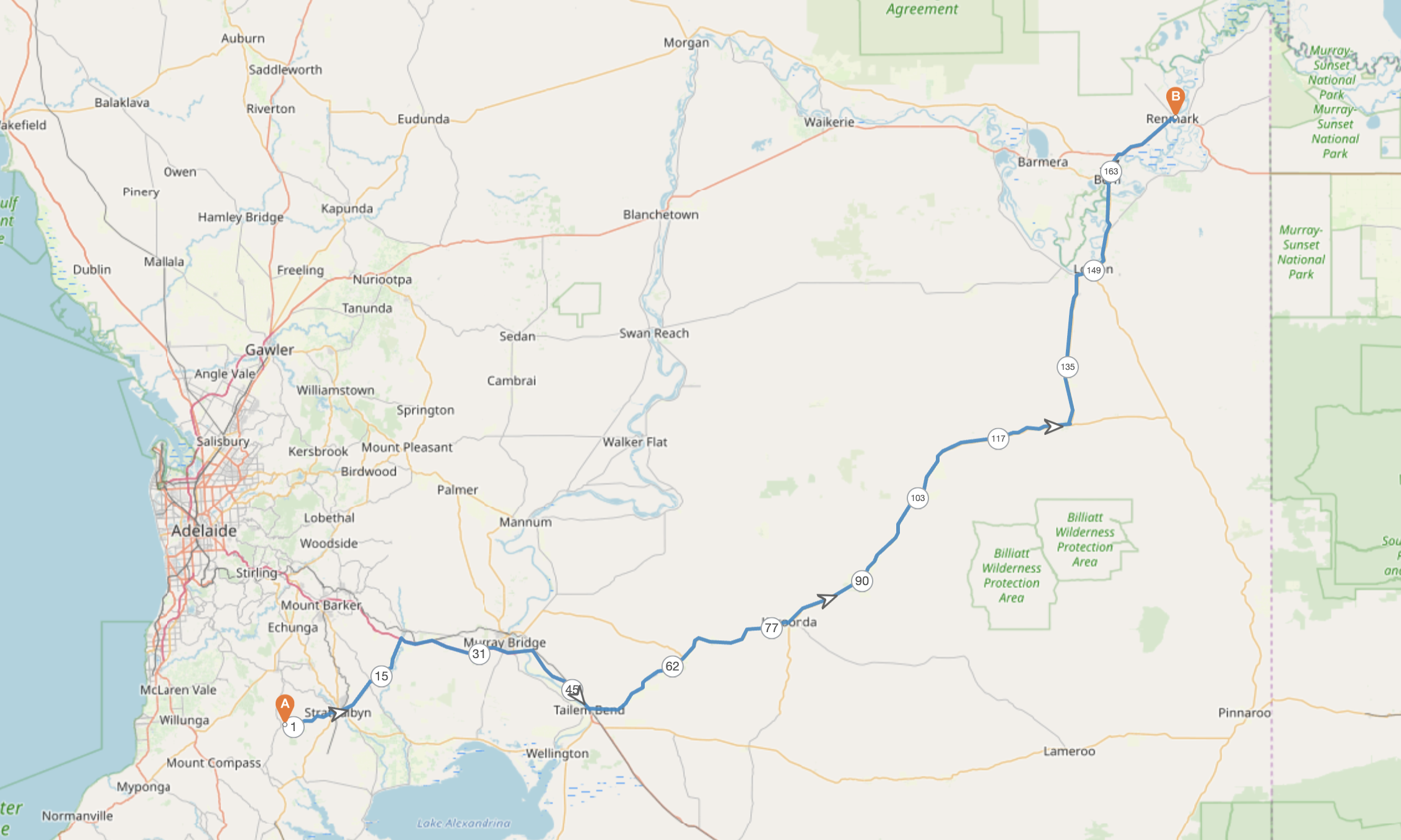
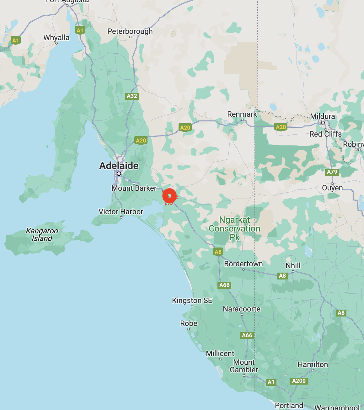
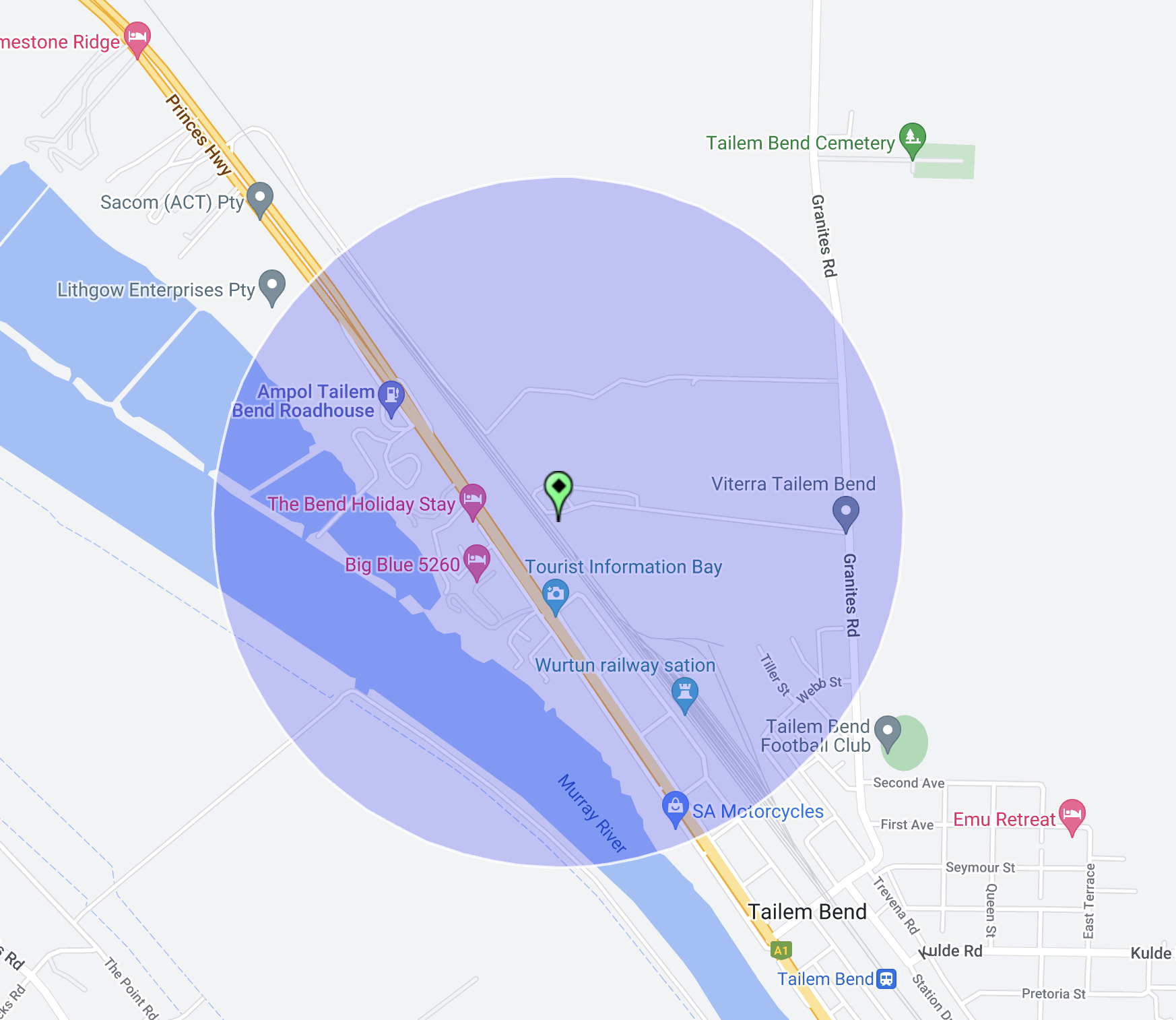
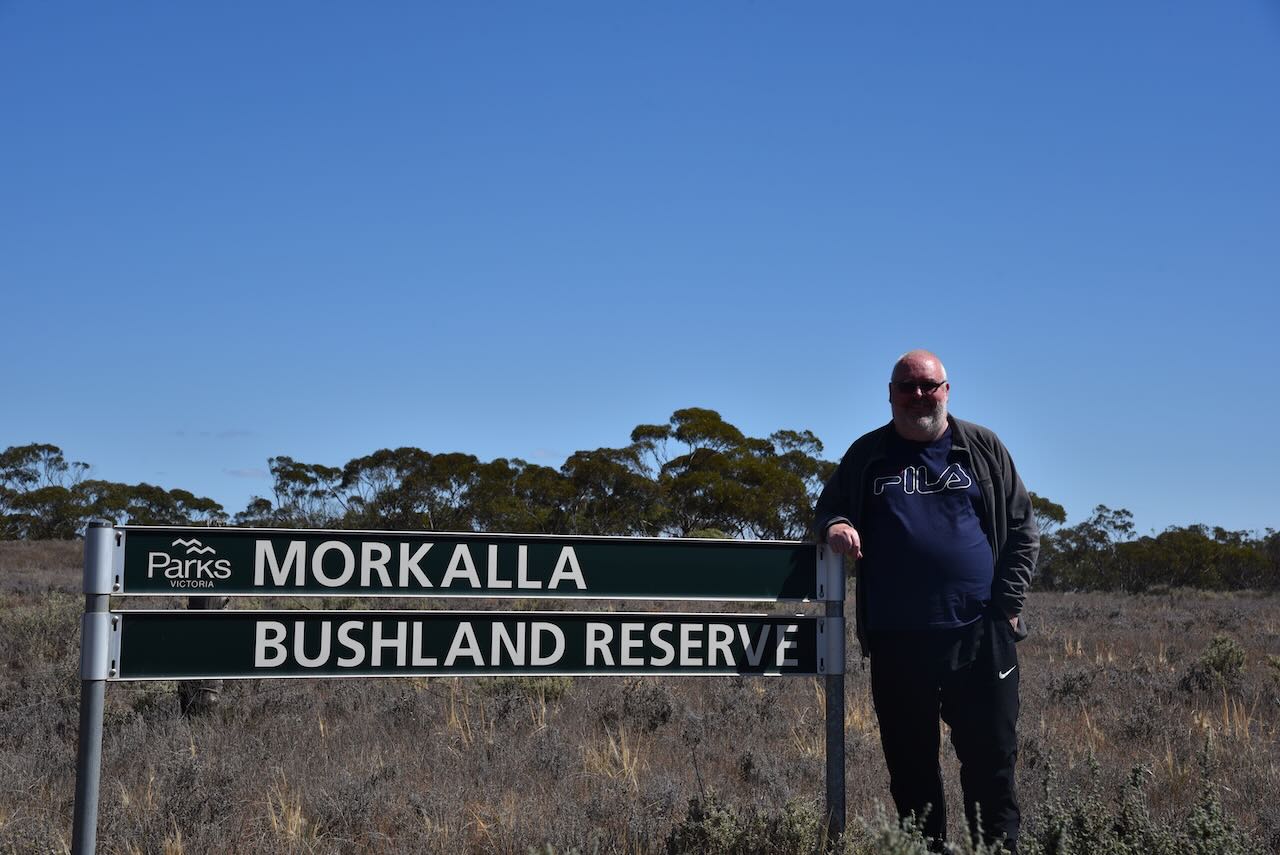
Our first park was the Morkala Bushland Reserve VKFF-4119 which is located about 57 km (by road) from Renmark. This was to be a first time activation of this park.

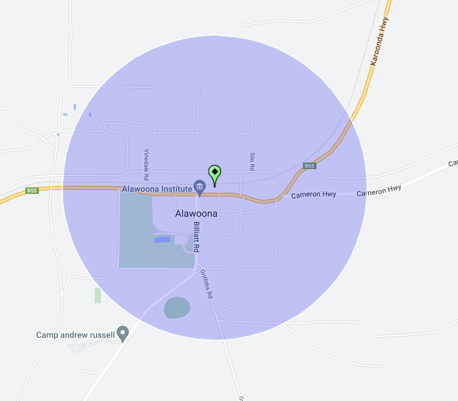
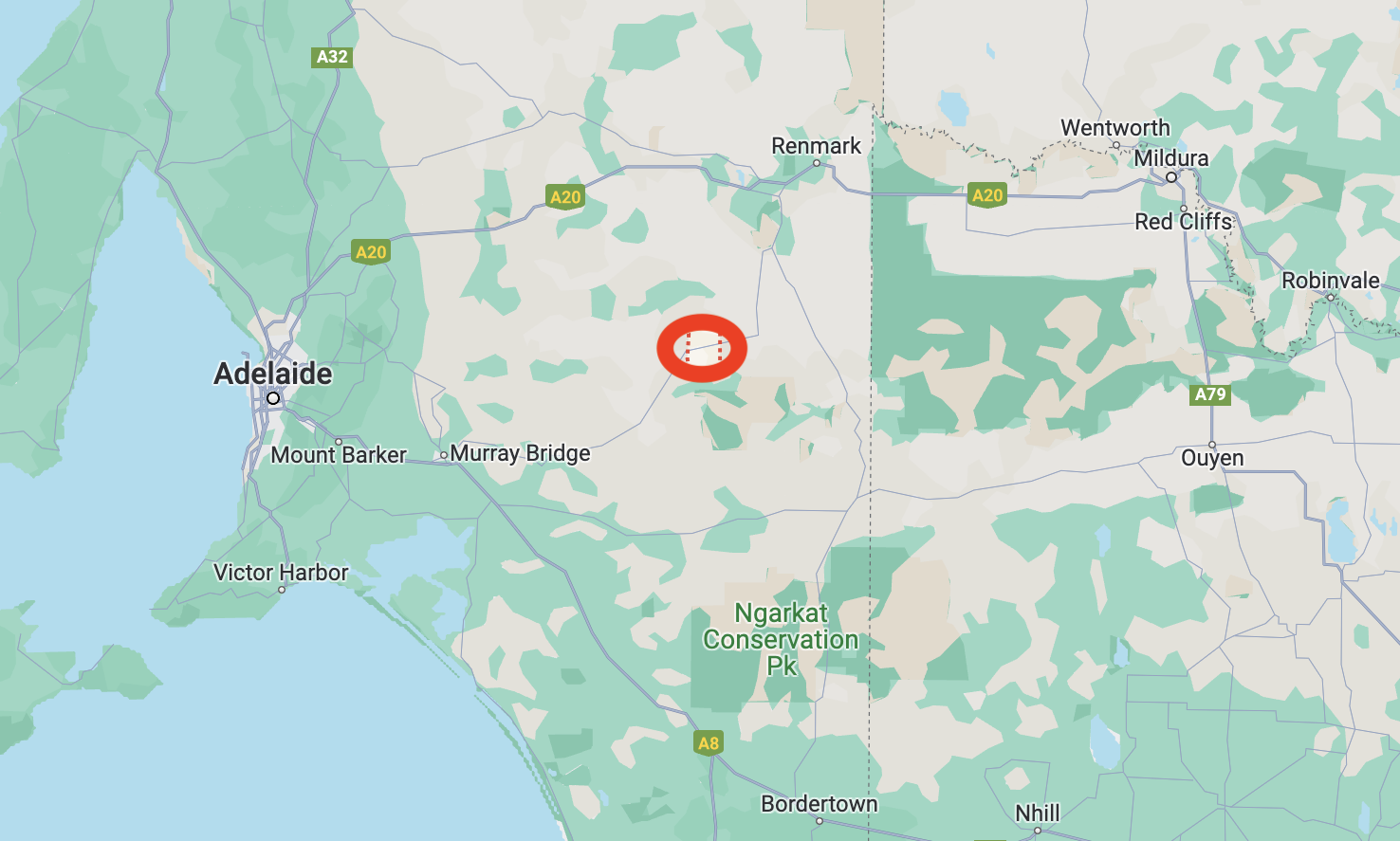
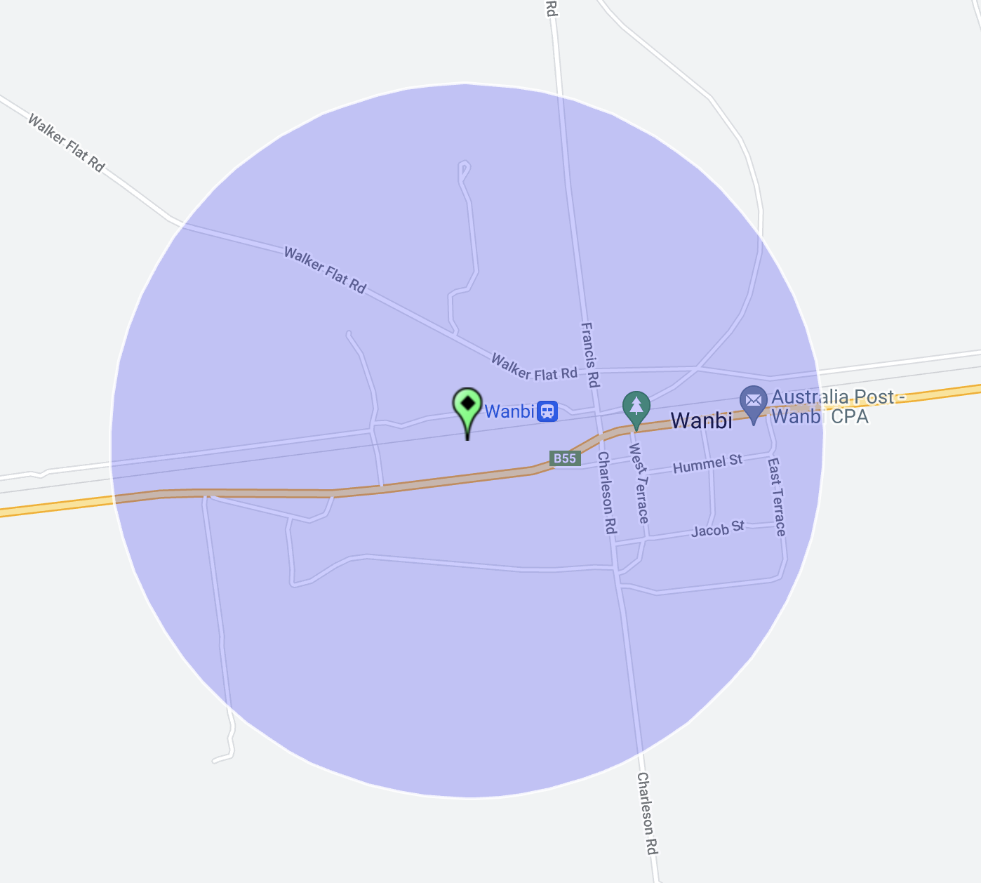
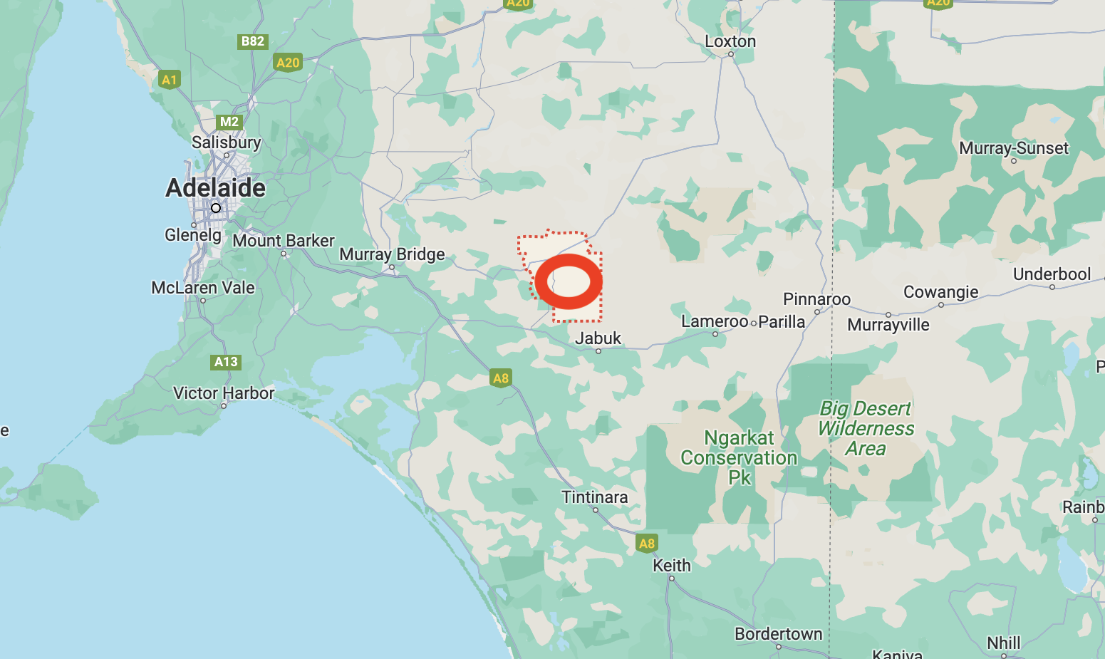
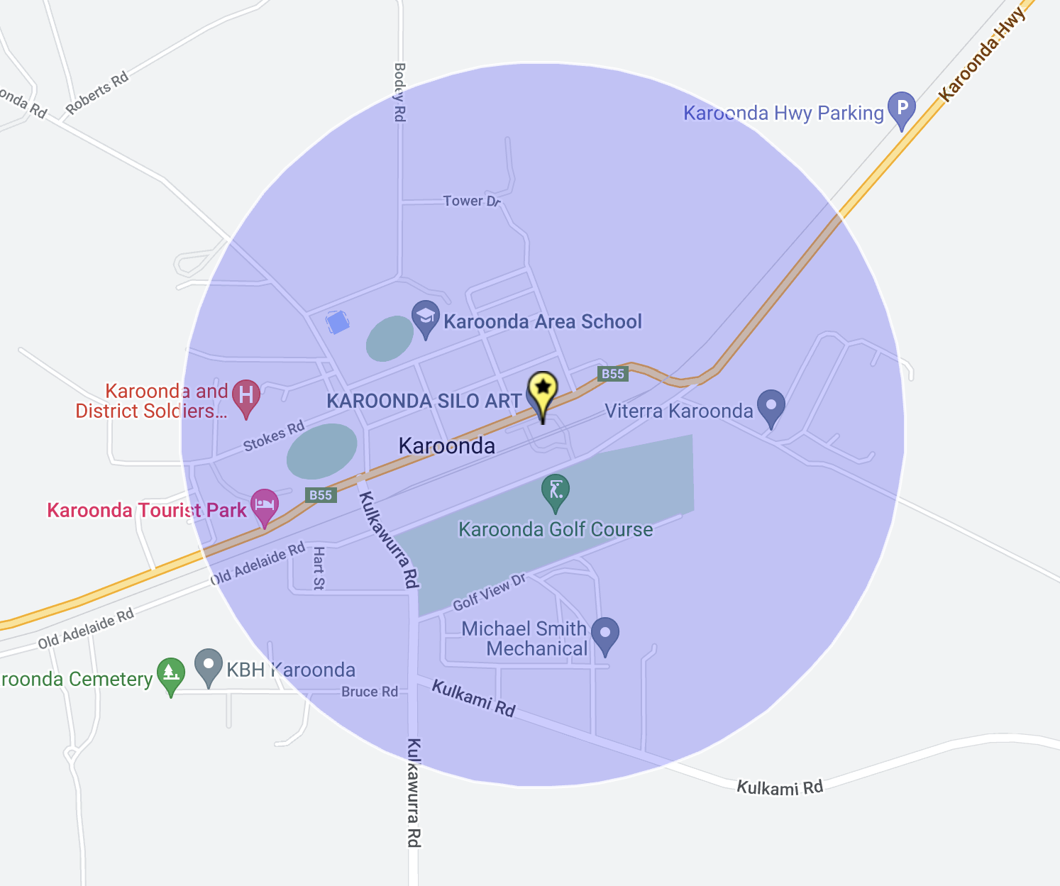
Above:- Map showing the location of the Morkala Bushland Reserv e. Map c/o Google Maps.

The Parks Victoria website has a page for the Morkala Bushland Reserve, but it contains no information other than a park boundary image.

The Morkala Bushland Reserve was declared on the 8th day of May 1990 and is 56 hectares in size. eBird Australia has recorded 16 species of native birds in the reserve including Black-shouldered Kite, Stubble Quail, Emu, Nankeen Kestrel, and Common Bronzewing.

Morkala Bushland Reserve is located in the Millewa Mallee region of northwest Victoria. The Millewa region is a large strip of land that is located between sections of the vast Murray Sunset National Park. The reserve is located on the corner of Morkala South Road and Milewa Road at Meringur. It is located on either side of Millewa Road.

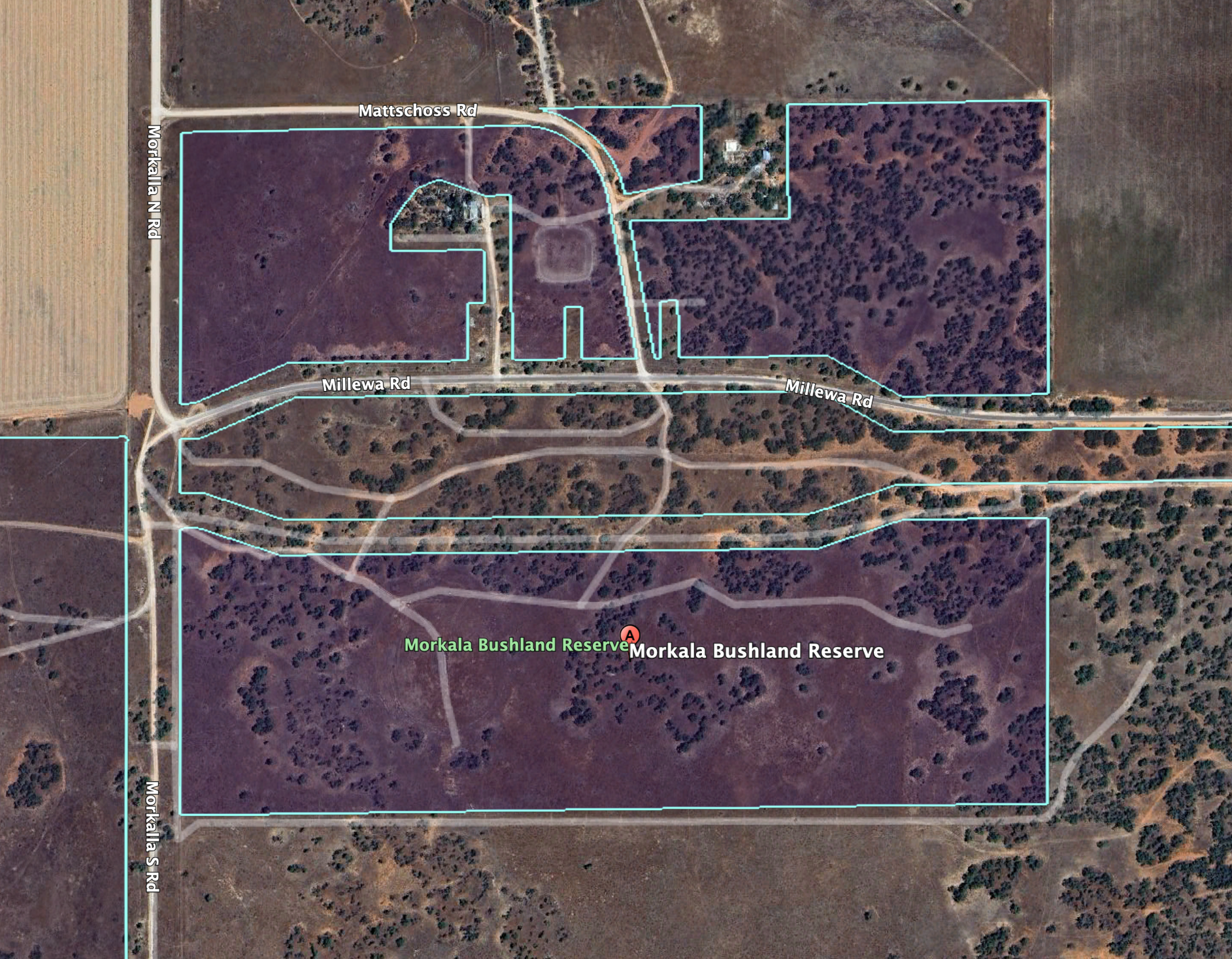
Above:- Aerial view of the Morkala Bushland Reserve. Image c/o Google Earth.

Meringur is an aboriginal word meaning ‘grey kangaroo. Prior to European settlement, the land was inhabited by the Latje Latje aboriginal people.

The Meringur area was opened up for European settlement in the 1920s. Prior to this, a number of large pastoral holdings existed in the area. A railway line was built from Red Cliffs to Meringur, and in 1925 the Meringur railway station opened. It had facilities to cater for passengers, sheep and grain. On the 2nd day of February 1926, the post office opened. In 1927 the school was opened. By 1928 about 600,000 acres of land in the area had been taken up by about 708 settlers.

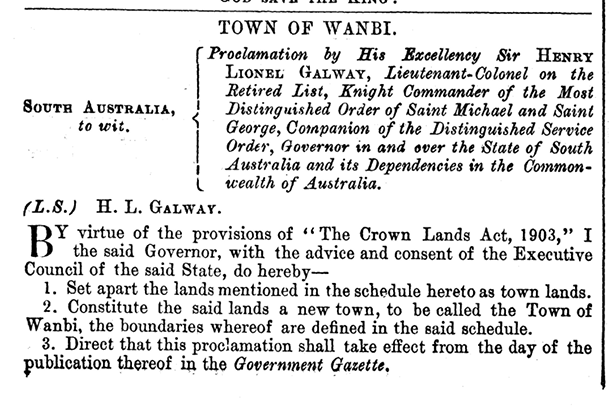
Above:- a plan of the town of Meringur. Image c/o State Library Victoria.

The railway line to Morkala was extended in 1931 but closed in 1965. The entire railway line was closed by 1988.

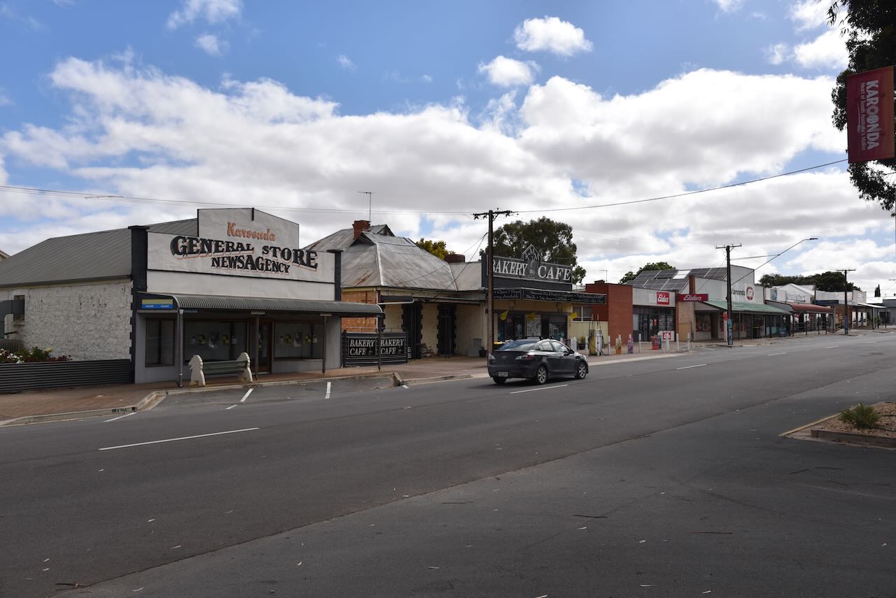
In the mid- 1940s Werrimull, which is centrally located in the Millewa region, became the district centre. Merringur’s store and lands office closed in the 1970s. By 1988 the railway had closed, and in 1998 the Merringur school, with 16 pupils, also closed.

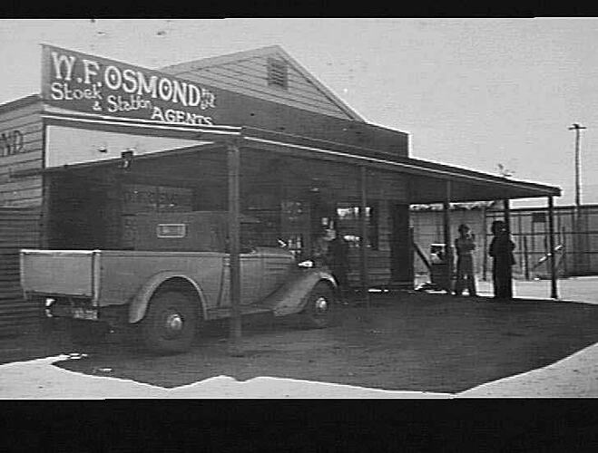
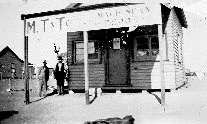
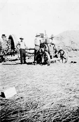
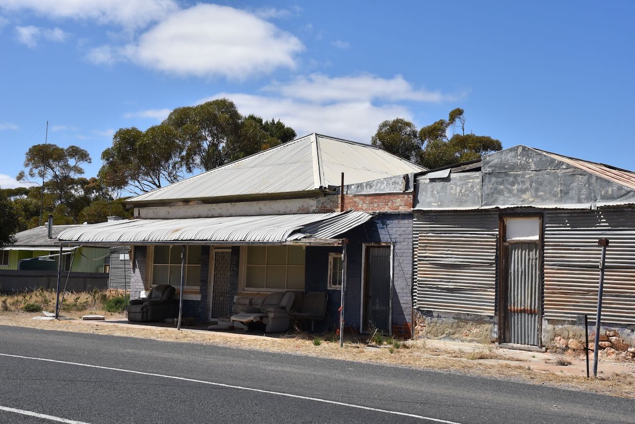
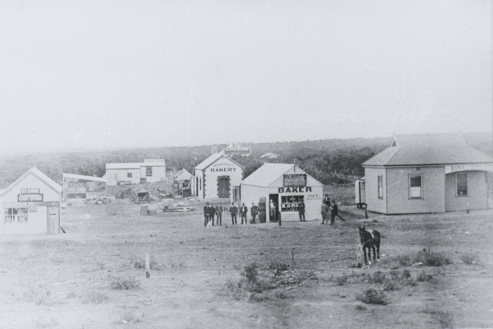
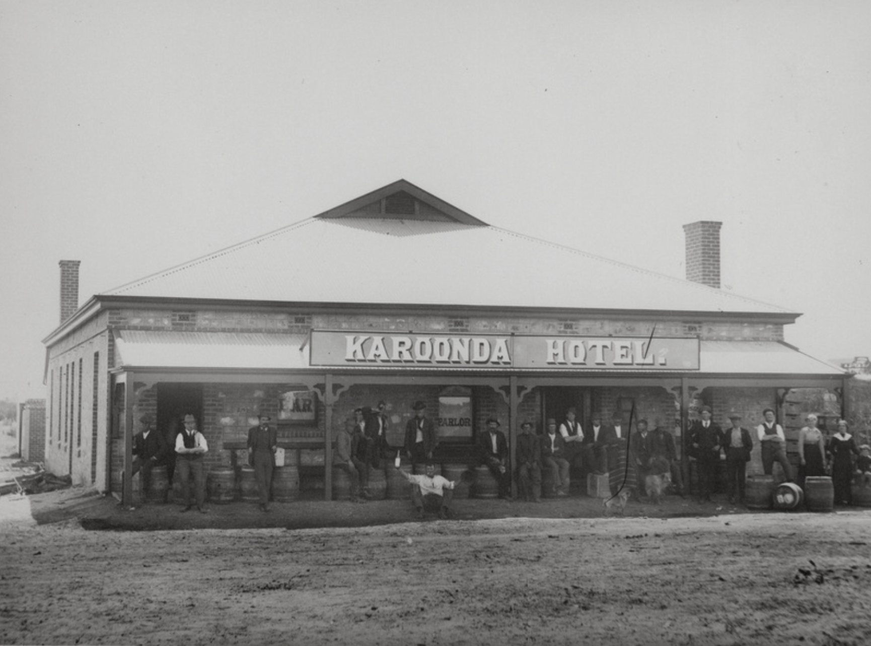
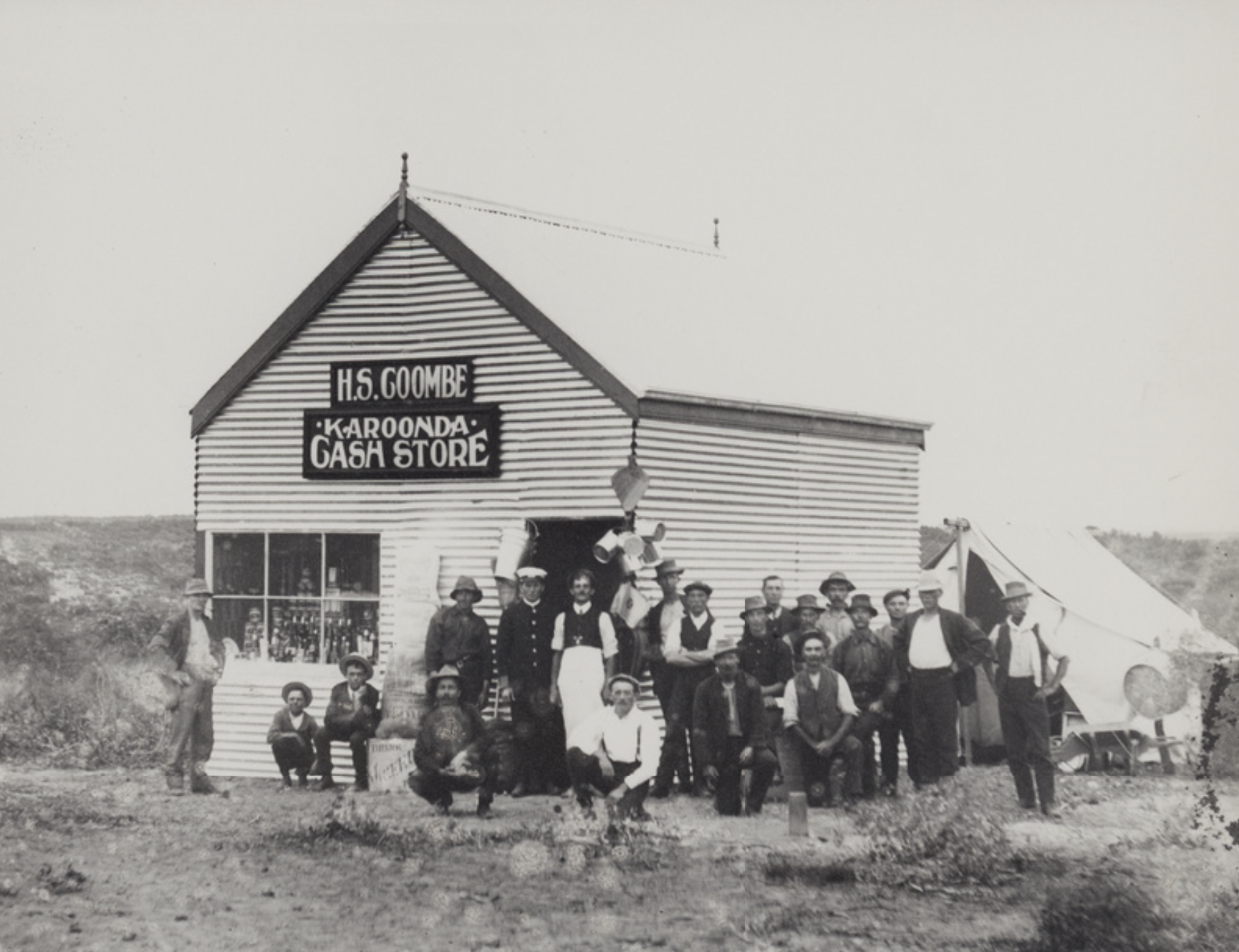
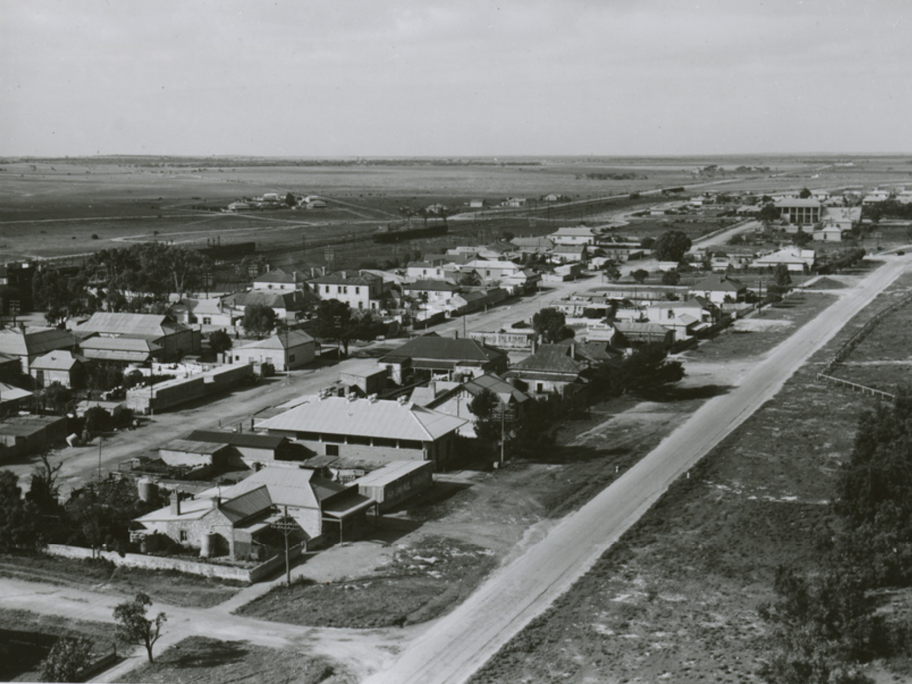
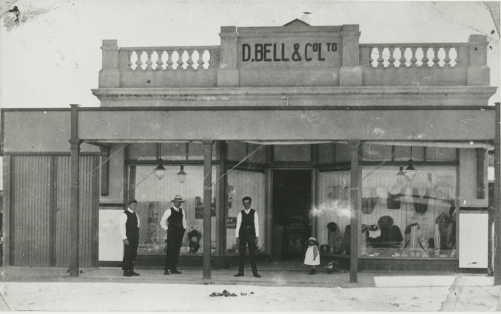
Above:- Meringur in days of old. Images c/o Museums Victoria.

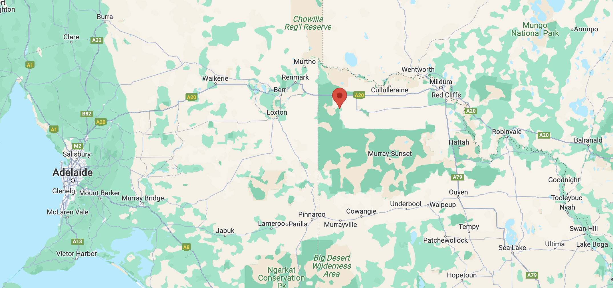
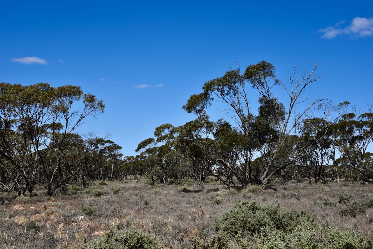
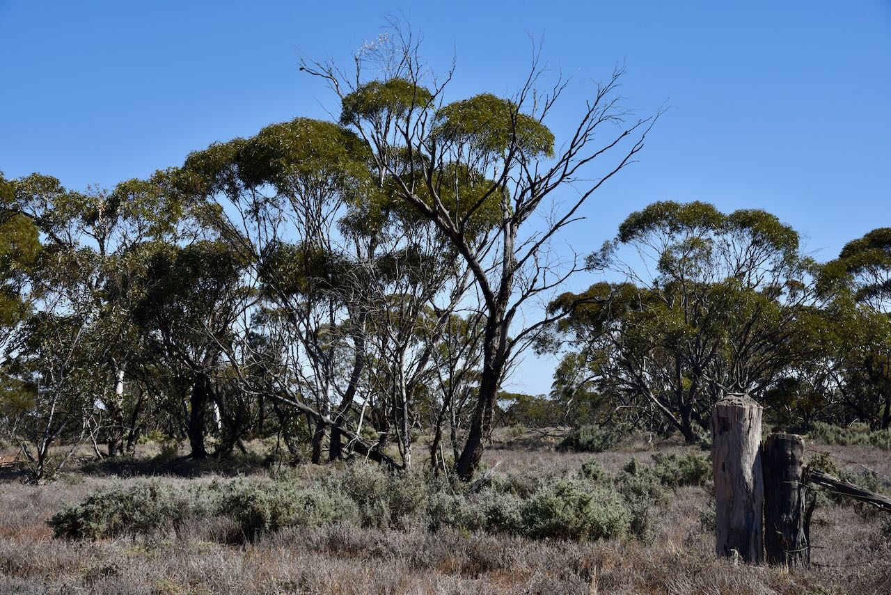
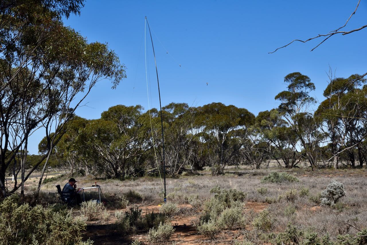
We set up in the southern section of the park and chose some coverage under a tree as it was quite a hot afternoon.

At its peak, Meringur had an open-air palais theatre, general store, post office, milk bar, tea rooms, bakehouse, dressmaker, mechanics shop, hardware store, guest house, hairdresser, saddlery store, greengrocer, tobacconist, timber yard, blacksmith, butchers, billard room, ice works, hall and a school.

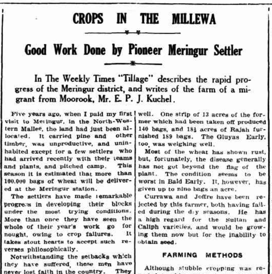
Above:- part of an article from the Murray Pioneer newspaper, Fri 9 Jan 1931. Image c/o Trove.

We ran the Yaesu FT857, 40 watts, and the 20/40/80m linked dipole for this activation. The flies were out in force, so Marija wore her fly netting hat to keep them at bay.

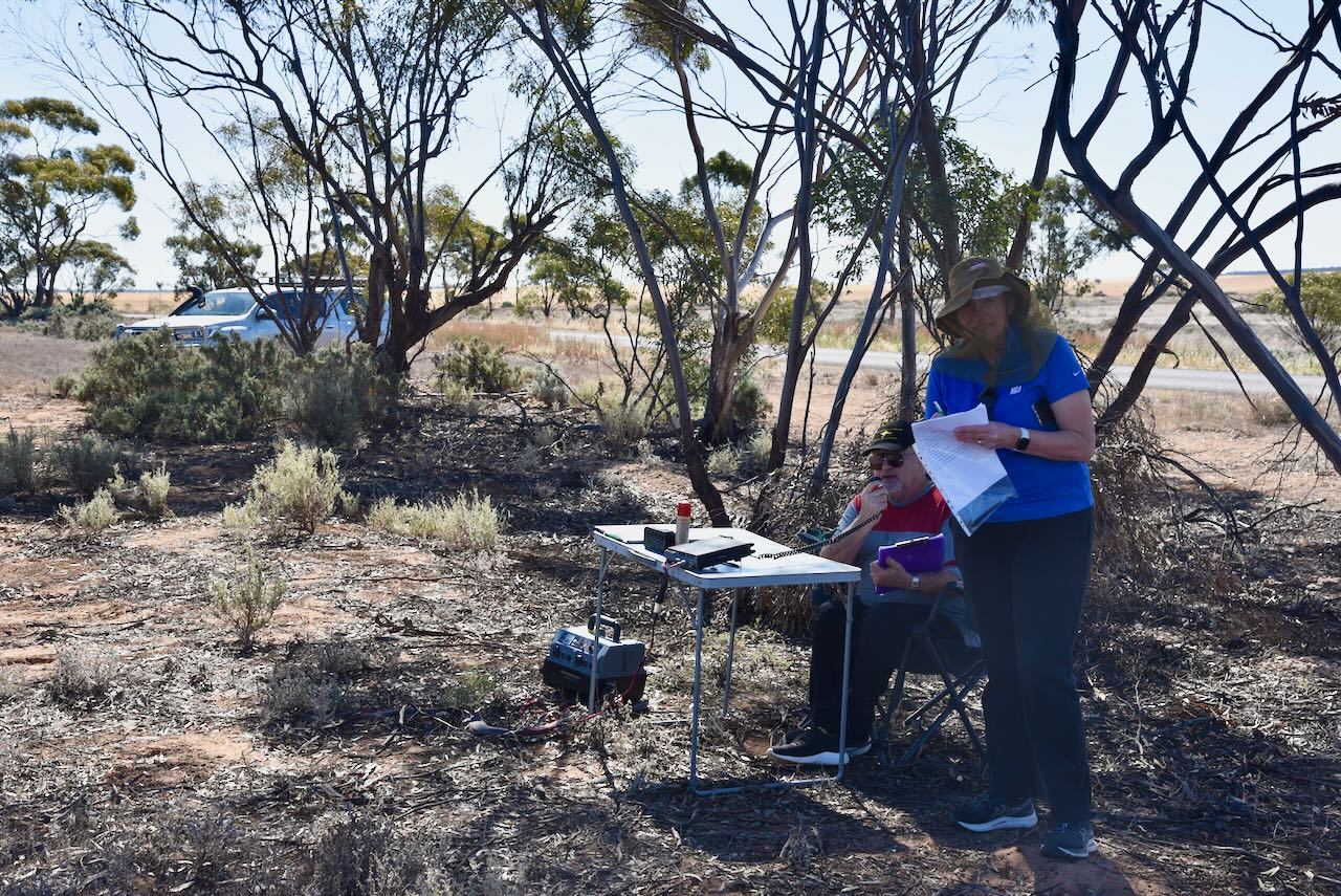
I operated using the special callsign of VI10VKFF to celebrate 10 years of the VKFF program. I qualified the park with 56 QSOs.

Marija and Hans also qualified the park for the VKFF program.

Marija worked the following stations on 40m SSB:-

  1. VK3OAK/p (Green Lake Regional Park VKFF-0967)
  2. VK3PWG/p (Green Lake Regional Park VKFF-0967)
  3. VK2IO/p (Mildura I220A Bushland Reserve VKFF-4139)
  4. VK3PF/p (Merrinee Bushland Reserve VKFF-4124)
  5. VK5BJE
  6. VK3SQ
  7. VK2BD
  8. VK5KLV
  9. VK3SX
  10. VK3VD
  11. VK5TN
  12. VK2BYF/p (Mount Barrow State Reserve VKFF-1818)
  13. VK2GOM/p (Mount Barrow State Reserve VKFF-1818)
  14. VK2IO/p (Merbein Bushland Reserve VKFF-4140)

I worked the following stations on 40m SSB:-

  1. VK3OAK/p (Green Lake Regional Park VKFF-0967)
  2. VK3PWG/p (Green Lake Regional Park VKFF-0967)
  3. VK5GY
  4. VK2IO/p (Mildura I220A Bushland Reserve VKFF-4139)
  5. VK5HS
  6. VK5IS
  7. VK3VIN
  8. VK3EJ
  9. VK3APJ
  10. VK3SG
  11. VK3SQ
  12. Vk2BD
  13. VK3DCQ
  14. VK4NH
  15. VK4DXA
  16. VK3AEI
  17. VK3SX
  18. VK3DL
  19. VK3HJW
  20. VK5MSA
  21. VK3CM
  22. VK5TN
  23. VK3AXH
  24. VK3UH
  25. VK3PF/p (Merrinee Bushland Reserve VKFF-4124)
  26. VK3MKM
  27. VK5BJE
  28. VK3SO
  29. VK5SCR
  30. VK5BB
  31. VK2GOM/p (Mount Barrow State Reserve VKFF-1818)
  32. VK2BYF/p (Mount Barrow State Reserve VKFF-1818)
  33. VK2IO/p (Merbein Bushland Reserve VKFF-4140)
  34. VK1MA
  35. VK2UK/1
  36. VK8GMT/1
  37. VK2HHA
  38. VK3MCK
  39. VK2EXA
  40. VK5ST
  41. VK5FANA
  42. VK3HBG
  43. VK3ANL
  44. VK3CEO
  45. VK4EW
  46. VK5MH
  47. VK3BWS
  48. VK3BAP

I worked the following stations on 20m SSB:-

  1. VK4NH
  2. VK4DXA
  3. ZL4NVW
  4. VK4EMF
  5. KG5CIK
  6. OH1MM
  7. VK4EW
  8. VK7ID

References.

  1. Discover Murray, 2023, <http://www.murrayriver.com.au/meringur>, viewed 8th November 2023.
  2. eBird Australia, 2023, <https://ebird.org/australia/hotspot/L7809895?yr=all&m=&rank=mrec>, viewed 8th November 2023.
  3. flickr, 2023, <https://www.flickr.com/photos/129023979@N05/49471611407>, viewed 8th November 2023.
  4. Millewa History Photos Facebook page, 2023, <https://www.facebook.com/groups/294088674263524>, viewed 8th November 2023.
  5. Victorian Places, 2023, <https://www.victorianplaces.com.au/meringur>, viewed 8th November 2023.

Alawoona silo VK-ALA5

Our fourth silo for Thursday 26th October 2023, was the Alawoona silo VK-ALA5. Alawoona is located about 221 km northeast of the city of Adelaide.

Above:- Map showing the location of Alawoona. Map c/o Google Maps.

As we approached Alawoona, the three of us worked Peter VK3ZPF from the mobile. Peter was activating Bridgewater Streamside Reserve VKFF-3609 and silo VK-LCE3. We let Peter know that we would soon be set up at the Alawoona silo.

Alawoona is a corruption of the aboriginal word ngalawuna meaning ‘place of hot winds’. The town of Alawoona was proclaimed on the 9th day of July 1914.

Alawoona was established as one of the original sidings during the construction of the Barmera railway line. The Alawoona school operated from 1915 to 1967 when it was consolidated with the Browns Well Area School. During the 1930s Alawoona had three churches, a railway refreshment hall, a school, a police station, a bank, a bakery, a butcher shop, two general stores, football clubrooms and a 400-person Institute/hall which held balls and dances.

Above:- the Alawoona Institute 1932 (left) and loading mallee roots (right). Images c/o State Library SA.

Today, many of the shops in Alawoona have closed. The beautiful stone Alawoona Institute remains and is in excellent condition.

The Alawoona silos are located on the northern side of the Karoonda Highway in the middle of town.

We parked on the Karoonda Highway, opposite the silos and operated from the 4WD for this activation. We ran the Icom IC-7000, 100 watts, and the Codan 9350 antenna.

Above:- the activation zone at the Alawoona silo. Image c/o SiOTA website.

Band conditions on 40m were awful, but all three of us managed to qualify the silo.

Marija worked the following stations on 40m SSB:-

  1. VK3ZPF/p (Bridgewater Streamside Reserve VKFF-3609 and silo VK-LCE3)
  2. VK3AWA
  3. VK3PF (Pirlta Bushland Reserve VKFF-4125)
  4. VK3CLD
  5. VK2USH
  6. VK3SMW
  7. VK3UAO (Koonwarra Flora Reserve VKFF-2350)

I worked the following stations

  1. VK3ZPF/p (Bridgewater Streamside Reserve and silo VK-LCE3)
  2. VK3AWA
  3. VK3PF (Pirlta Bushland Reserve VKFF-4125)
  4. VK3CLD
  5. VK2USH
  6. VK3SMW
  7. VK3UAO (Koonwarra Flora Reserve VKFF-2350)

References.

  1. A Compendium of the Place Names of South Australia, 2023, <https://published.collections.slsa.sa.gov.au/placenamesofsouthaustralia/>, viewed 7th November 2023.
  2. ABC News, 2023, <https://www.abc.net.au/news/2019-12-15/alawoona-ghost-town-building-looking-for-a-saviour/11788728>, viewed 7th November 2023.

Wanbi silo VK-WNI5

Our third silo for Thursday 26th October 2023, was the Wanbi silo VK-WNI5. Wanbi is a small town located about 202 km northeast of the city of Adelaide

Above:- Map showing the location of Wanbi. Map c/o Google Maps

Wanbi is an aboriginal word meaning ‘dingo’. The town of Wanbi was proclaimed on the 9th day of July 1914.

Sadly not much remains in Wanbi today. The old Wanbi Memorial Hall built in 1925 is in a state of disrepair, and the beautiful two-storey former hotel is closed.

The Wanbi silos are located on Francis Road, just north of the Karoonda HIghway.

We parked alongside the old tennis courts (see below) that have ‘seen better days’.

This was within the silo activation zone.

Above:- the activation zone at the Wanbi silo. Image c/o SiOTA website.

The band conditions on 40m were terrible. However, all three of us managed to activate and qualify the silo with more than 3 QSOs each. This was the third SiOTA activation for Hans VK6XN.

Marija worked the following stations on 40m SSB:-

  1. VK3ZSC
  2. VK2VH
  3. VK4AAC
  4. VK5TN
  5. VK5KBJ

I worked the following stations on 40m SSB:-

  1. VK3ZSC
  2. VK2VH
  3. VK4AAC
  4. VK5TN
  5. VK5KBJ

We then headed off to our next stop, the little town of Alawoona for another silo activation.

References.

  1. A Compendium of the Place Names of South Australia, 2023, <https://published.collections.slsa.sa.gov.au/placenamesofsouthaustralia/>, viewed 7th November 2023.

Karoonda silo VK-KRA-5

Our next planned stop on our journey to Renmark on Thursday 26th October 2023, was the town of Karoonda, about 146 km east of Adelaide in the Mallee region of South Australia.

Above:- Map showing the location of Karoonda. Map c/o Google Maps.

On our way to Karoonda we logged Gerard VK2IO was activating Mildura I14 Bushland Reserve VKFF-4137. Signal reports were 5/9 both ways.

Karoonda is a Ngarkat aboriginal word meaning ‘winter camp’. Prior to European occupation, the area was inhabited by the Ngarkat aboriginal people. The town of Karoonda was founded during the early 1900s due to wheat growing in the region. The town was served in 1910, but was not proclaimed until the 11th day of December 1913. In 1922 the District Council of Karoonda was established.

Above:- proclamation of the town of Karoonda in the SA Govt Gazette. Image c/o Wikipedia.

Prior to the establishment of the town, land in the Mallee region of South Australia was taken up for sheep grazing on large pastoral leases during the 1850s. This included Chucka Bend (Bowhill) Station which was established in 1859. The station included where Karoonda is located today.

The Karoonda region is an important wheat and sheep production area. Each year the Karoonda Farm Fair is held, a two-day event attracting over 10,000 visitors to the town.

The video below gives you a good impression of the town of Karoonda.

Karoonda also has its own Pioneer Park which can be found in East Terrace. The park contains a collection of early Mallee memorabilia including buildings, railway information, and farming machinery.

A memorial to Senior Constable Harold Rae Pannell can be found in the park in the main street. Senior Constable Pannell was shot dead by John Fischer in March 1957, at Bow Hill, whilst executing a warrant to seize property from Fishcer who had failed to pay damages awarded against him in a court case. Fischer was found not guilty of murder in the Supreme Court on the grounds of insanity. Justice Reed ordered Fischer into strict custody in a mental health institution at the Governor’s pleasure. Fischer died in 1988, aged 67 years.

Senior Constable Pannell was buried with full police honours at Centennial Park Cemetery on the 14th day of March 1957. He had served the South Australian community as a police officer for almost 20 years.

Above:- Senior Constable Pannell. Image c/o SA Police Association Facebook page.

In 1997, the Karoonda Development Group constructed a Merino ram sculpture in the park in the main street of Karoonda to commemorate the importance of the Merino sheep industry in the region.

Also in the park in the main street, you can find a monument to commemorate the Karoonda meteorite. The town of Karoonda achieved brief international fame in 1930 when a meteorite fell to earth about 3.6 km east of the town on the 25th day of November 1930. You can view a piece of the actual meteorite at the Council Chambers, which Marija and I have done in the past. The inscription on the case in which the meteorite piece is contained, reads: “On November 25th 1930 South Australians were started by the appearance of a brilliant Fire Ball”.

Following reports of the ‘brilliant fireball’, a University party led by Professor Kerr Grant and Mr G.F. Dodwell, conducted a search of the Karoonda area. On the 9th day of December 1930, some 15 days after the meteorite’s sighting, the meteorite site was located. The meteorite shattered on impact, however the surviving material consisted of two large pieces and several smaller fragments, all up weighing about 92 lbs. It was reported that the Karoonda meteorite was of the Stony Type and was of very unusual composition.

The University reported: “The dark greyish interior of the meteorite consists of a dull ground-mass relieved by numerous black chondrules and spangles of a brassy mineral which is probably troilite (ferrous sulphide). The chondrules are very hard and compact and may quite easily be rubbed away from the friable ground-mass by the fingers. Undoubted metallic nickel-iron is present in such small ammount as to be indistinguishable in the hand specimen. A rough microscopical examination reveals that olivine is by far the most important mineral in the ground-mass. Some hypersthene is also present.”

Above:- Part of an article from the Murray Pioneer, Fri 19 Dec 1930. Image c/o Trove

The Karoonda silo art is the work of renowned Australian artist Heesco. He has painted a number of Australian silos. It took Heesco about 38 days to paint the Karoonda silo, which was completed on the 26th day of July 2019.

At night the silo is lit up by an ever-changing display of art from South Australian artists. The Karoonda silo is the first of its kind in Australia to offer Silo Art by day and Cinema Art by night.

The video below shows the Karoonda silo art in time-lapse.

We parked alongside the silo and surprisingly had very little noise. We operated from the vehicle, running the Icom IC7000, 100 watts, and the Codan 930 antenna mounted on the rear of the Toyota Hi- Lux.

Above:- the activation zone at the Karoonda silo. Image c/o SiOTA website.

Hans qualified the silo, this being his second ever SiOTA activation.

Marija worked the following stations on 40m SSB:-

  1. VK5IS
  2. VK3GRX
  3. VK3WMD
  4. VK5HS
  5. VK3PWG
  6. VK3OAK
  7. VK3PF

I worked the following stations on 40m SSB:-

  1. VK5IS
  2. VK3GRX
  3. VK3WMD
  4. VK5HS
  5. VK3PWG
  6. VK3OAK
  7. VK3PF
  8. VK3CJN
  9. VK5GY
  10. VK2EXA

References.

  1. Aussie Towns, 2023, <https://www.aussietowns.com.au/town/karoonda-sa>, viewed 6th November 2023.
  2. Australian Silo Art Trail, 2023, <https://www.australiansiloarttrail.com/karoonda>, viewed 6th November 2023.
  3. District Council of Karoonda East Murray, 2023, <https://www.dckem.sa.gov.au/discover/community-history>, viewed 6th November 2023.
  4. Mallee Touring Route, 2023, <https://www.malleehighway.com.au/html/karoonda.html>, viewed 6th November 2023.
  5. Monument Australia, 2023, <https://monumentaustralia.org.au/themes/people/crime/display/50966-senior-constable-harold-rae-pannell>, viewed 6th November 2023.
  6. Wikipedia, 2023, <https://en.wikipedia.org/wiki/Karoonda,_South_Australia>, viewed 6th November 2023.

Tailem Bend silo VK-WRN5

Marija VK5MAZ, Hans VK6XN and I left home at about 8.00 a.m. on Thursday 26th October 2023, en route to Renmark for the 2023 VKFF Team Championship. It was about a 280 km drive up to Tailem Bend, and then on to Karoonda, Loxton, and then Renmark.

Our first stop for the morning was the Strathalbyn bakery where we enjoyed a coffee and a brekkie roll. We then headed towards Tailem Bend.

On the way from the mobile, we logged Liz VK2XSE on 40m who was activating Mount Dundas Regional Reserve VKFF-3375 in Tasmania. Signal reports were 5/9 both ways.

We then logged Peter VK3PF who was activating Benetook Bushland Reserve VKFF-4126. Signal reports were 5/9 both ways.

We then arrived at Tailem Bend and as Hans had never previously activated a silo for the Silos On The Air (SiOTA) program, we decided to stop and do a quick activation from the vehicle.

Tailem Bend is about 96 km southeast of the city of Adelaide. It is located on the lower reaches of the Murray River, not far from the town of Wellington where the Murray River flows into Lake Alexandrina. The Murray is located on the western edge of the town and features magnificent cliffs.

Above:- Map showing the location of Tailem Bend. Map c/o Google Maps.

Prior to European settlement, the Tailem Bend area was inhabited by the Ngarrindjeri aboriginal people. The town’s name is derived from an aboriginal word “thelim” which means “bend”. This refers to the sharp bend that the Murray River makes at Tailem Bend. Other references suggest that this part of the Murray River was called “Thelum Ki”, meaning “bent water”.

In 1884, the building of the railway eastwards to the colony of Victoria commenced. During construction, a track-laying gang set up camp among some native pine trees and they named their site “Pine Camp”. A township commenced from that time on and by 1887 a year after the railway line opened, the ton of Tailem Bend was proclaimed.

Above:- Some early photographs of Tailem Bend. Images c/o State Library South Australia.

Today the major industries in the Tailem Bend area include pig farming, dairying, and growing grains, hay and olives. Tailem Bend is also the home to The Bend Motorsport Park and Old Tailem Town, a pioneer village.

The silos at Tailem Bend are owned by Viterra. The Tailem Bend silos is one of Viterra’s most significant silos in South Australia. In 2014 it was reported by Viterra eastern region operations manager Jack Tansley that “during peak harvest periods the Tailem Bend site receives more than 16,000 tonnes of grain a day and is now in the process of out-turning the grain which includes trains running, on average, every second day from the site with road out-turns occurring daily.”

On the 30th day of November 2020, the Tailem Bend silos broke its daily receival record when 17,475 tonnes of grain was delivered in a single day.

We pulled up on the side of the Princes Highway, within the silo activation zone, and operated from the vehicle. We ran the Icom IC7000, 100 watts, and the Codan 9350 self-tuning antenna.

Above:- Map showing the activation zone at the Tailem Bend silo. Image c/o SiOTA website.

Hans qualified the silo, whilst Marija and I also made a handful of contacts and qualified the silo for SiOTA.

Marija worked the following stations on 40m SSB:-

  1. VK3PF/p (Benetook Bushland Reserve VKFF-4126)
  2. VK2IO/p (Mildura I14 Bushland ReserveVKFF-4137)

Marija worked the following stations on 20m SSB:-

  1. VK6DS

I worked the following stations on 40m SSB:-

  1. VK3PF/p (Benetook Bushland Reserve VKFF-4126)
  2. VK2IO/p (Mildura I14 Bushland ReserveVKFF-4137)

I worked the following stations on 20m SSB:-

  1. VK6DS

We then hit the road again and headed for Karoonda, which was to be our next stop.

References.

  1. Murray Valley Standard, 2023, <https://www.murrayvalleystandard.com.au/story/2259474/new-ways-for-busy-tailem-bend-silo/>, viewed 4th November 2023.
  2. Murray Valley Standard, 2023, <https://www.murrayvalleystandard.com.au/story/3094164/end-of-line-for-murraylands-mallee-grain-trains/>, viewed 4th November 2023.
  3. Murray Bridge News, 2023, <https://www.murraybridge.news/p/records-fall-at-monarto-south-tailem>, viewed 4th November 2023.
  4. Wikipedia, 2023, <https://en.wikipedia.org/wiki/Tailem_Bend,_South_Australia>, viewed 4th November 2023.