Heggaton Conservation Park VKFF-1037 and 5CP-089

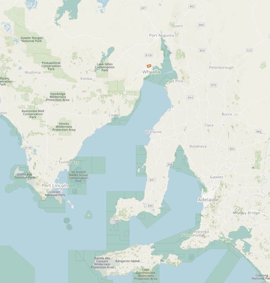
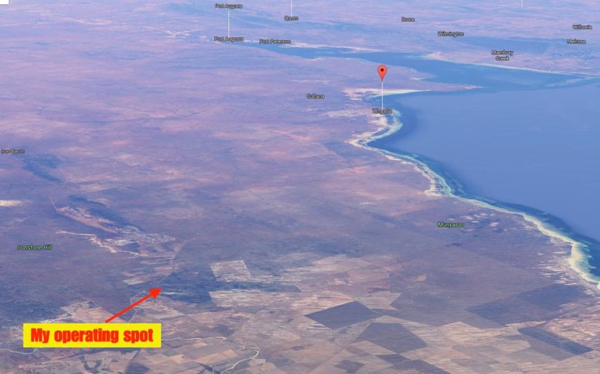
It was a bright and early start for me on Saturday 17th September 2016.  I had four planned park activations for the day, with the first being the Heggaton Conservation Park VKFF-1037 and 5CP-089.  So after some toast and a coffee I was on the road by just after 7.00 a.m.  I had about a one hour drive to get out to Heggaton.

Screen Shot 2016-09-15 at 7.12.13 PM.jpg

One thing that was reinforced with me from this activation was, don’t always rely on the GPS.  It took me the long way!  Instead of taking me down the Lincoln Highway to Cowell, I was guided out of Whyalla along the Lincoln Highway and then told to turn off on the Middleback Road through the very impressive Middleback Ranges.  It was slow going as the dirt was quite slippery in sections and there were a lot of kangaroos out and about.  The Middleback Road then became Sectus Tanks Road and this brought me out onto the Eyre Highway.  And directly in front of me was the Lake Gilles Conservation Park.  I was very tempted to stop off here for a quick activation.

dsc_2610

Above:- Sectus Tanks Road at Bama.

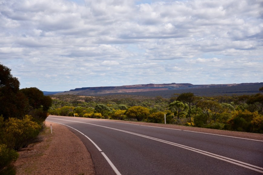
But I decided not to stop, and I continued south west on the Eyre Highway and into the little town of Kimba.  The word ‘Kimba’ is derived from the local aboriginal word for ‘bushfire’.  The town is known as being ‘halfway across Australia’ as the crow flies.  It is also well known for the Big Galah.  I stopped here briefly to stretch the legs and take a few photos.

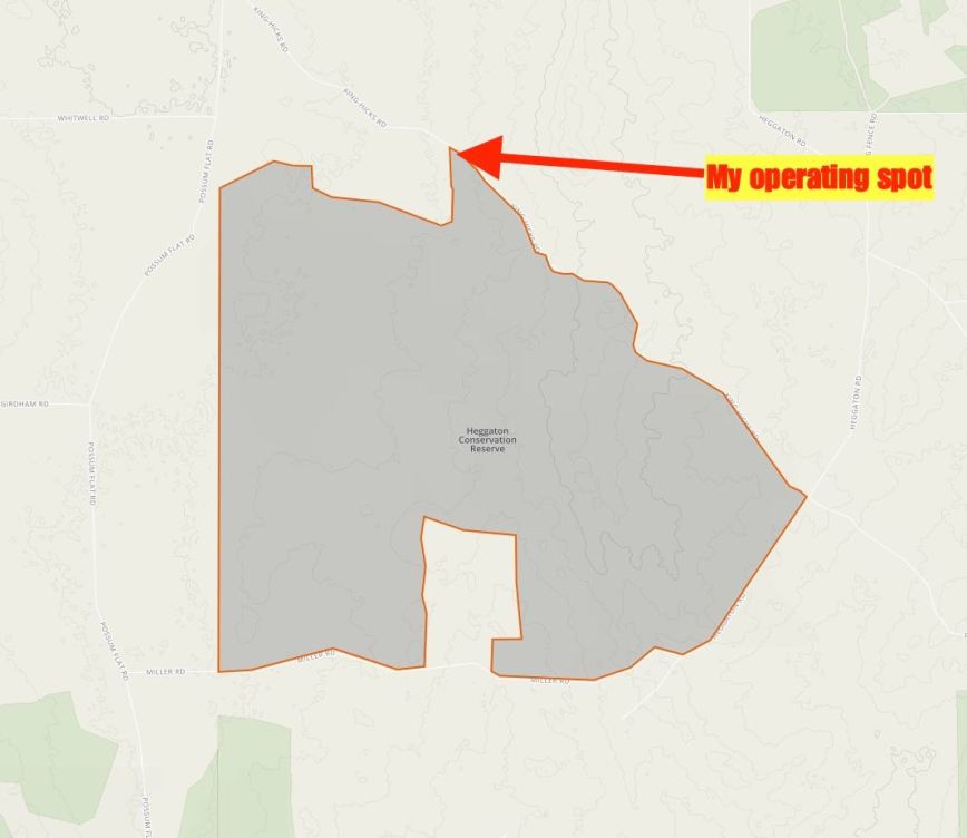
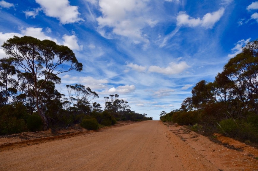
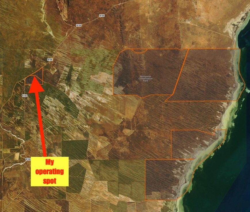
I then travelled south out of Kimba along the Cleve-Kimba Road and then turned right onto Whitwell Road and on to the Old Cleeve Road.  A short distance up the Old Cleeve Road I turned right onto King Hicks Road.  The northern section of the park soon came in to view.

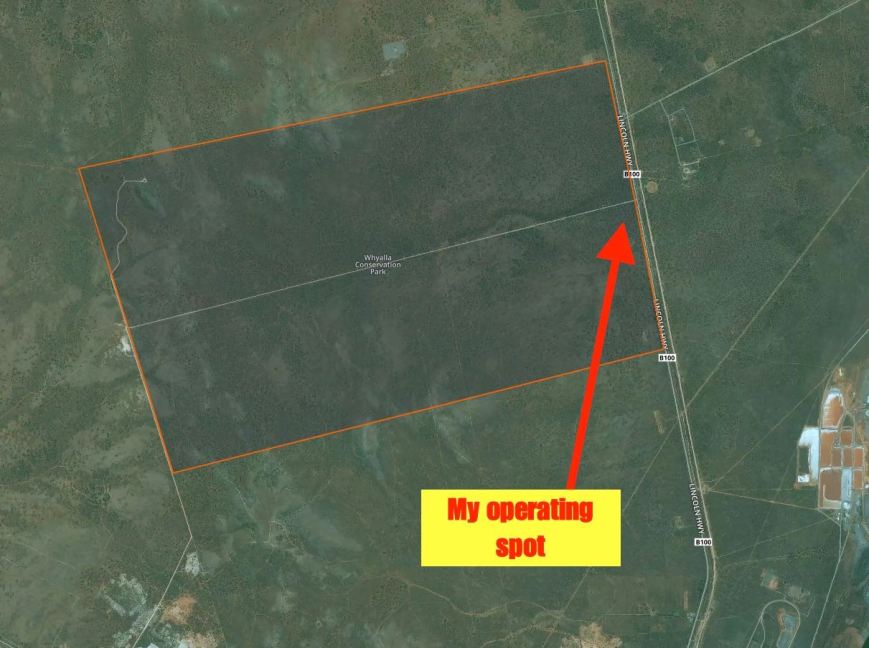
I set up in this northern section off King Hicks Road, in a clearing in the scrub.  Cleared land for cropping bordered the park at this location.

Screen Shot 2016-09-15 at 7.11.55 PM.jpg

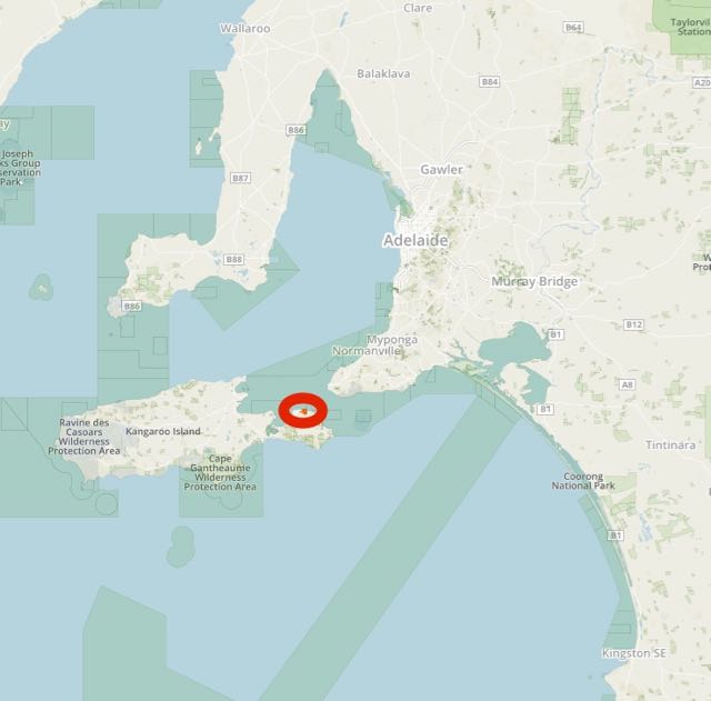
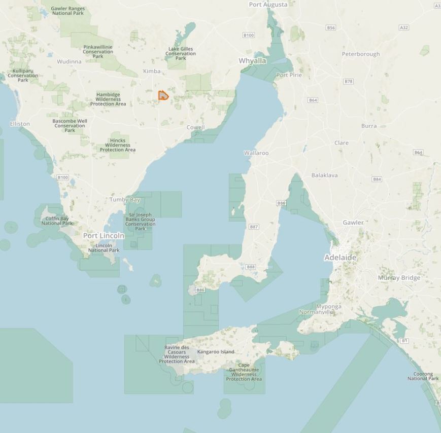
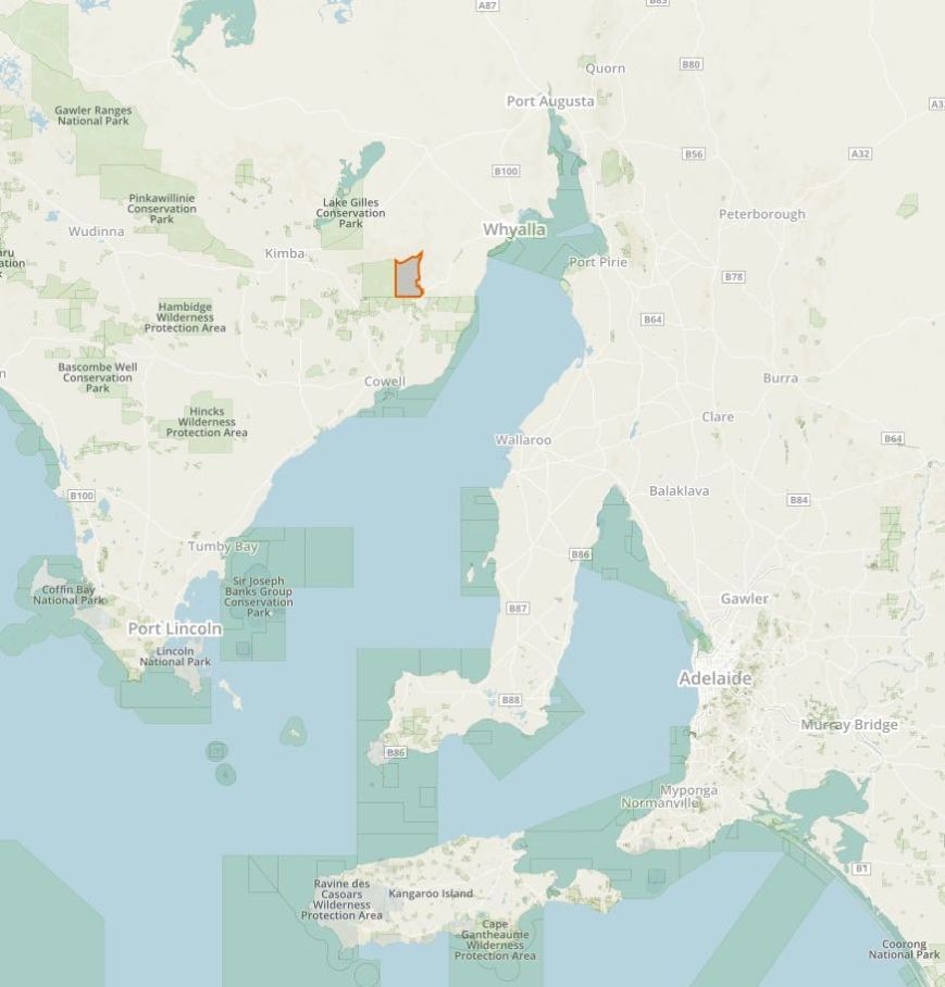
I was unable to find a lot of information about the Heggaton Conservation Park on the internet.  The park is 6,476 hectares in size and is located to the south east of Kimba and the south west of Whyalla.  The park which was proclaimed on the 6th September 2012, provides important habitat for the Mallefowl and also the rare Gilbert’s Whistler.

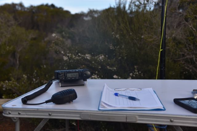
It was quite a mild morning and the flies had not taken a rest from yesterday.  They were out in force again and no matter how much insect repellant I applied, it had no effect.  There was enough room in the clearing for me to string out the longer 80/40/20m linked dipole which is what I did.  I was all set to go by about 0020 UTC (9.50 a.m.).  It had taken me a lot longer to get to the park than expected.

My first caller of the morning on 7.144 on 40m was Brian VK5FMID at Mount Gambier who was 5/9.  This was followed by Geoff VK3SQ, Les VK5KLV and then Greg VK5ZGY mobile in the South East of South Australia.

About eight contacts into the activation, I had my first Park to Park contact in the log.  It was with Rob VK4FFAB who was portable in the Conondale National Park VKFF-0109. Rob’s signal was quite low, 5/4, but he was very readable as there was no man made noise at all on the band from within the park.

Shortly after I made a few QRP contacts.  The first was with Peter VK3PF who was 5/5, running just 1 watt.  And then Adrian VK5FANA running 5 watts who was 5/9 from the Yorke Peninsula.  About 12 QSOs later I was called by Greg VK5GJ running 4 watts from Meadows in the Adelaide Hills.  Greg was a terrific 5/9 signal to Heggaton.  This was followed by Ian VK5IS running just 5 watts from the Mid North of South Australia, and he too was 5/9.  Nev VK5WG, also in the Mid North, followed soon after running 5 watts (5/9 both ways).  The 40 m band was in great shape, and despite the quite strong static crashes, I was hearing everyone extremely well.

Peter VK3YE then called in, running just 5 watts, operating as a flagpole station with a kite antenna at Chelsea Bicentennial Park.  As it turned out, it was International Talk Like A Pirate Day, on which the Manly Warringah Radio Society run a Flagpole Contest.  Peter was a nice 4/4 signal, with Peter receiving me at 5/7 at his end.

But the QRP contact of the activation was with Greg VK5GJ.  After initially working him on 4 watts, Greg called back running just 400 milliwatts.  Greg had not dropped from a 5/9 down to a 5/2 but was still perfectly readable.  He called back shortly afterwards running just 40 milliwatts and had dropped to a 4/1.  AMAZING.  This was the highlight of this park activation for me.  Greg’s QTH was about 300 km to the east of Heggaton, across the Spencer Gulf and the St Vincent Gulf.

I worked a total of 53 stations on 40m before having a quick listen on 20m where I spoke with Cleeve VK2MOR, Lee VK2LEE and then John VK6NU.  Finally I headed over to 80m where I logged 2 contacts, Bill VK5MBD at Red Hill in the Mid North of SA, and then Ivan VK5HS in the Riverland region of SA.

Time was marching on, and the weather was moving in rapidly from the west.  A lof of rain was predicted and I still had three planned park activations.

Thankyou to the following who spotted me: Rick VK4RF, Robert VK2XXM, Adrian VK5FANA, Lee VK2LEE, and Cleeve VK2MOR.

The following stations were worked on 40m SSB:-

  1. VK5FMID
  2. VK3SQ
  3. VK5KLV
  4. VK5ZGY/m
  5. VK2IO
  6. VK4RF
  7. VK4HA
  8. VK4FFAB/p (VKFF-0109)
  9. VK1AT/3
  10. VK3PF
  11. VK5FANA
  12. VK5ZK
  13. VK5BJE
  14. VK5HCF
  15. VK5EE
  16. VK3GGG/m
  17. VK3PMG/m
  18. VK3OHM
  19. VK3SFG
  20. VK5MRT
  21. VK2HHA
  22. VK7ALH
  23. VK2PKT
  24. VK5FR
  25. VK5GJ
  26. VK5IS
  27. VK5VBR
  28. VK2XXM
  29. VK4HNS/p
  30. VK7CW
  31. VK3BBB
  32. VK5PL
  33. VK5RM/m
  34. VK3ZMD
  35. VK1DI
  36. VK2KYO
  37. VK5WG
  38. VK5HDW
  39. VK5HS
  40. VK3FLCS
  41. VK5GJ
  42. VK3IO
  43. VK3YE/p
  44. VK3FADM
  45. VK5MBD
  46. VK2LEE
  47. VK3MCK
  48. VK5AFZ
  49. VK5GJ
  50. VK5TRM
  51. VK5MRE/m
  52. VK5SFA/m
  53. VK2MOR

The following stations were worked on 20m SSB:-

  1. VK2MOR
  2. VK2LEE
  3. VK6NU

The following stations were worked on 80m SSB:-

  1. VK5MBD
  2. VK5HS


References.

Department of Environment Water and Natural Resources, Eastern Eyre Peninsula Parks Management Plan 2014


Whyalla Conservation Park VKFF-0805 and 5CP-253

My last planned park activation for Friday 16th September 2016 was the Whyalla Conservation Park (CP) VKFF-0808 and 5CP-253.  Whyalla CP is about 10 km north of the town of Whyalla, on the Lincoln Highway.

Screen Shot 2016-09-15 at 7.07.15 PM.jpg

Above:- Map showing the location of the Whyalla Conservation Park, just north of the town of Whyalla.  Image courtesy of Protected Planet.

I have activated Whyalla Conservation twice before.  The first back in June 2013, and then again in December 2014.  For more information on those activations please see my previous posts at…..

https://vk5pas.org/2013/06/16/whyalla-conservation-park/

https://vk5pas.org/2014/12/28/whyalla-conservation-park-2/

Below are some photographs from the December 2016 activation when I operated from Wild Dog Hill within the park….

Whyalla Conservation Park was proclaimed on the 4th November 1971 and comprises1,971 hectares (4,870 acres).  The park was conserved both for conservation value of Eyre Peninsula woodland and for its position just 10 km north of Whyalla.  It was intended to serve a recreational purpose for Whyalla as a picnic site.  The park originally covered an area of 1,011 hectares, and in 2003 an extra area of land to the south of the Park, almost identical in size, was added.

This land was originally part of the BHP Indenture Act land and was under BHP’s care and control. With the divestiture of it’s Whyalla steel making operations to a new company, OneSteel, some of the land that was excess to requirements was added to the Park and the remainder was handed back to the local community.

Within the north west corner of the park, Wild Dog Hill, a sandstone outcrop, rises above the surrounding plains and offers some great views of the surrounding countryside.  There is an easy walking trail to the top.  Below are some photos taken back in December 2014 at Wild Dog Hill.

The park is alive with Red and Grey kangaroos, along with Euros who are often sighted on the slopes of Wild Dog Hill.  The Common Dunnart, a carnivorous mouse sized marsupial which eats grasshoppers and small lizards is also found in the park.

Over 80 species of birds have been observed in the Park including Wedge-tailed Eagles, Australian Kestrels, Grey Butcherbird, Crested Pigeon, White-browed Babbler, Spiny-cheeked Honeyeater and the Black-faced Woodswallow.

More than 20 species of reptiles have been recorded in the Whyalla Conservation Park, including the Western Brown Snake, Bearded Dragon, Western Bluetongue and Sleepy Lizard.

The most common tree that can be seen in the Park is the Western Myall, Acacia papyrocarpa. These majestic trees with their dome shaped canopy and silver-grey foliage can live to be over 250 years old. Sugarwoods, Bullock Bushes, Native Apricots, Quandongs and Black Oaks can also be found in many areas and Saltbush and Bluebush dominate the understorey.

Despite the sometimes oppresive weather conditions in the park, numerous wildflowers can be found at certain times of the year.  These include Fringe-lilies and Paper-daisies.  Delicate lilac Rock Isotomes flower almost constantly at the top of Wild Dog Hill, whilst the tube like flowers of Emu Bushes can be found throughout the Park.

It is reported that the lichens located on the rocks and trees within Whyalla Conservation Park, are some of the best examples in the world.

I set up just inside the park boundary on the eastern side of the park.  I again ran the Yaesu FT-857d, 40 watts and the 80/40/20m linked dipole.

Screen Shot 2016-09-15 at 7.07.00 PM.jpg

Above:- Map of the Whyalla Conservation Park, showing my operating spot on the eastern side of the park.  Image courtesy of Protected Planet.

It was almost dark by the time I got to the park, so I had to use the headlights on the Toyota Hi Lux to help me set up.  I was all ready to go by around 0925 UTC (6.55 p.m. South Australian local time).

It was extremely difficult to find a spot on the 40m band.  Everything below 7.100 was totally taken up by Indonesian and Malaysian stations.  There were some North American stations close by to 7.144, and I eventually found 7.135 to be clear.  My first caller was Rick VK4RF/VK4HA, followed by Roald VK1MTS, and then Roy VK7ROY.  Even poor old Roy couldn’t get on to 7.130 for the 7.130 DX Net.  I offered to relinquish 7.135 to Roy and the net, but Roy very graciously declined and headed up a little higher.

My fifth contact from Whyalla was a Park to Park contact with Rob VK4FFAB, who was activating the Conondale National Park VKFF-0109.  Rob was a beautiful strong 5/8 signal to Whyalla.

I went on to work a total of 44 stations and qualified the park, before heading up the band to the 7.130 DX Net which was being held on 7.140.  On the net I worked Bill W1OW in Massachussetts USA, William FO5JV in French Polynesia, and Chuck K9RM in Indiana USA.  I then QSYd down the band a little to work Perrin VK3XPT who was operating remote.  Gerard VK2IO and Brian VK3BBB then called in to finish off the activation.

I had a total of 50 contacts in the log fom VK1, VK2, VK3, VK4, VK5, VK6, VK7, USA and French Polynesia.  It was back to my mother in law’s for some late dinner.

Thanks to the following who spotted me: Rick VK4RF and Brett VK3FLCS.

The following stations were worked on 40m SSB:-

  1. VK4RF
  2. VK4HA
  3. VK1MTS
  4. VK7ROY
  5. VK4FFAB/p (VKFF-
  6. VK2YW
  7. VK3LSD
  8. VK6MB
  9. VK6FFAR
  10. VK2HHA
  11. VK3GGG
  12. VK3PMG
  13. VK1AT/3
  14. VK4AAC/3
  15. VK4HNS/p
  16. VK5FMID
  17. VK3ELH
  18. VK4ME
  19. VK3FLCS
  20. VK4FBMW
  21. VK6VZZ/m
  22. VK5FANA
  23. VK3PAT
  24. VK5EE/m
  25. VK6XN
  26. VK3FSPG
  27. VK2MRX
  28. VK5ZGY
  29. VK6FBOS
  30. VK5CGM
  31. VK6DW
  32. VK4FAAJ
  33. VK1HW
  34. VK2YK
  35. VK2NEO
  36. VK5MJ
  37. VK2XZ
  38. VK6MSC
  39. VK4TJ
  40. VE6XT/VK4
  41. AC8WN/VK4
  42. VK5KLV
  43. VK6BSA
  44. W1OW
  45. FO5JV
  46. K9RM
  47. VK3XPT
  48. VK2IO
  49. VK3BBB


References.

Friends of the Whyalla Conservation Park, 2016, <http://www.fwcp.org/park.htm&gt;

Wikipedia, 2016, <https://en.wikipedia.org/wiki/Whyalla_Conservation_Park&gt;

Ironstone Hill Conservation Park VKFF-0895 and 5CP-095

My second planned park activation for Friday 16th September 2016 was the Ironstone Hill Conservation Park, VKFF-0895 and 5CP-095, just a relatively short drive away from Munyaroo Conservation Park.  The park is around 50 km south west of Whyalla.

Screen Shot 2016-09-15 at 7.05.30 PM.jpg

Above:- Map showing the location of the Ironstone Hill Conservation Park on the Eyre Peninsula.  Image courtesy of Protected Planet.

Ironstone Hill Conservation Park was proclaimed on the 26th August 2010.  The park’s total are is 19,650 hectares (196.50 km2).  Sections 10 and 13 of the park, comprising 5,862 ha, were added to the park on 6th September 2012.  Prior to be declared a Conservation Park, the land was part of the Shirrocoe Pastoral Lease.  In 2014, the conservation park was described as being “particularly significant for the protection of sandy dunes, which are preferred habitat of the endangered Sandhill Dunnart.

APSF_11_4_image_01_full.jpg

Above:- A Sandhill Dunnart.  Image courtesy of Australia & Pacific Science Foundation

The park is predominantly malle vegetation, and protects various plant species including the Desert Greenhood and Sandalwood which are listed as vulnerable under the National Parks and Wildlife Act“.  The conservation park is bounded on its western side by the private protected area, the Secret Rocks Nature Reserve.  Arium’s Iron Duke mine is situated immediately to the east of the park.

Over 60 species of birds have been recorded in the park including Mulga Parrots, White-eared Honeyeaters, Weebill, Striated Pardalote, Willy Wagtail, and Jacky Winter.  Mallee Fowl have been sighted in the park, and many have fallen victim to traffic on the surrounding roads.   A series of powerpoint presentations were delivered in January 2012, by the Environmental Representative of HWE Mining Pty Ltd.  This was to raise awareness of the presence of Mallefowl on the Lincoln Highway, south of the Iron Duke mine towards Cowell.  Notices were also placed in crib-rooms and small items submitted in work bulletins.   It wasn’t long before mine workers began reporting sightings of Malleefowl on the entrance road to the mine.

leipoa_ocellata_-ongerup_western_australia_australia-8

Above:- A Mallefowl.  Image courtesy of wikipedia.

Screen Shot 2016-09-22 at 8.23.58 PM.png

Above:- Aerial shot showing the park and its proximity to the mine.  Image courtesy of Google Maps.

I entered the park off the Lincoln Highway, to the south west of the entry into the Arium mine.  There is a small section of the park here that abuts the Lincoln Highway.  However, it is not signposted, so please ensure that you are within the boundaries of the park.

Screen Shot 2016-09-15 at 7.04.49 PM.jpg

Above:- Map showing my operating spot in the park.  Image courtesy of Protected Planet.

A large portion of the park appeared to be recovering from a fire.  I have since read that a controlled burn took place in the park in September last year.  I suspect it is still recovering from that.  But in amongst the burnt vegetation, there were a number of flowering plants.

A very significant fire burnt through the park back in 1991, and crossed the Lincoln Highway into surrounding countryside.

Again for this activation I ran the Yaesu FT-857d, 40 watts and the 80/40/20m linked dipole.  I was ready to go by just after 0630 UTC (4.00 p.m. South Australian local time).  I immediately headed to 7.144 again and found Les VK5KLV who was still in the Upper Spencer Gulf Marine Park VKFF-1757.  After working Les he kindly handed the frequency over to me, and a mini pile up soon ensued.  The first caller being Mick VK3GGG, followed by Rob VK4AAC/3 and then Ross VK7ALH.

The flies here were no less forgiving than Munyaroo, and they were joined in tag team action by mosquitos.  And no matter how much insect repellant I applied, they would not take no for an answer.

Nine QSOs into the activation I had a further Park to Park contact in the log.  This was with Rob VK4FFAB who was portable in Conondale National Park VKFF-0109.  Rob had an excellent 5/8 signal to me, and reciprocated with a 5/9 for me.

I worked a total of 40 stations on 40m from VK1, VK2, VK3, VK4, VK5, VK6, and VK7.  Band conditions were very good, and the frequency was very quiet until around 45 minutes into the activation when a ZL4 came up on 7.143 calling CQ.

I then QSY’d to 20m and commenced calling CQ on 14.310.  This was answered by Rick VK4RF/VK4HA, followed by Gyula HA6OB in Hungary,  Jonathan VK6JON/7, and finally Peter VK4PHD.  Sadly despite conditions appearing to be quite good, I had no further callers on 20m.  The Over the Horizon Radar did not help and was running at strength 8-9 to me.

I then lowered the squid pole and inserted the links for the 80m section of the antenna and started calling CQ on 3.610.  This was answered by Marc VK3OHM who was 5/9 to me, but who was sadly struggling with noise at his end.  Next was Adrian VK5FANA (5/9 both ways), and then Nev VK5WG who was running QRP from his little X1M transceiver.  I worked a further 7 stations on 80m from VK2, VK3, and VK5.  All with great signals.  Who says that 80m is only open at night!

It was now just after 5.30 p.m. and the sun was starting to set.  I still had the Whyalla Conservation Park to activate, so it was time to pack up and hit the road.

Other than the amazing sunset, I was also rewarded with a glorious full moon which occasionally darted in behind the clouds.

I had a total of 55 contacts in the log and another successful and unique VKFF park activation completed.

Thanks to the following stations who spotted me: Mick VK3GGGG, Marc VK3OHM, Adrian VK5FANA and Rick VK4RF.


References.

Birds SA, 2016, <http://www.birdssa.asn.au/location/ironstone-hill-conservation-park/&gt;, viewed 21st September 2016

National Mallefowl Recovery Team, 2012, ‘Around the Mounds’ newsletter, Spring 2012 Edition Two.

Wikipedia, 2016, <https://en.wikipedia.org/wiki/Ironstone_Hill_Conservation_Park&gt;, viewed 21st September 2016

Munyaroo Conservation Park VKFF-0920 and 5CP-154

My wife Marija was born in Whyalla in the ‘Iron Triangle’ region of South Australia, the name given to the iron producing region in the north of South Australia which is bounded by the towns of Whyalla, Port Augusta and Port Pirie.  Marija’s mum, and brother and his family still live there, so we venture up to Whyalla on a fairly frequent basis.  And we were due for another visit.  So bright and early on Friday morning (16th September 2016), we left home in the Adelaide Hills and commenced our 420 km drive north.

We headed into the city and then north out along Port Wakefield Road.  It wasn’t long before we came across the famous Port Wakefield Road protest sculptures at Lower Light.  These were built back in the 1990’s as a public protest to the South Australian Government who had proposed to build a large waste dump in the area.  Sadly the dump went ahead anyway, but the imposing sculptures stand as a reminder of people’s outrage at the building of the dump.

We continued north to Port Wakefield where we stopped briefly for a coffee and a sausage roll, and then headed further north through the Mid North of South Australia.  Along the way we passed the 3 little SOTA summits in the Hummock Range ‘The Hummocks’ and then a number of SOTA summits in the lower Flinders Ranges.  Also Telowie Gorge Conservation Park and the Mount Remarkable National Park.  I had an itchy PTT finger already.

We arrived at Whyalla around lunchtime and headed straight to Marija’s mum’s house.  My mother in law is of Croatian background.  So after a typical big meal, consisting of Snapper, calamari, and prawns, I headed out to the Munyaroo Conservation Park (CP) VKFF-0920 and 5CP-154, whilst Marija and her mum went shopping.   Munyaroo CP is about 36 km south west of Whyalla.

screen-shot-2016-09-15-at-7-02-30-pm

Above:- Map showing the location of the Munyaroo Conservation Park on the Eyre Peninsula of South Australia.  Map courtesy of Protected Planet. 

Munyaroo consists of three autonomous sections of land comprising a total of 123 km2.  Two of these adjoin the coastline with Spencer Gulf,  immediately south of Muminnie Beach and Plank Point and the third being located to the west on the east side of the Lincoln Highway.  I have operated from this park previously from one of the coastline sections, but for this activation I headed to the Lincoln Highway section.

This was to be a unique VKFF park for me, and the first time the park had been activated for World Wide Flora Fauna (WWFF).  I did operate portable from Munyaroo back in December 2014, but that was prior to the park being added to the WWFF program.  So that activation was exclusively for the VK5 National and Conservation Parks Award.  For more information on my previous activation of this park, please have a look at…..

https://vk5pas.org/2014/12/28/munyaroo-conservation-park/

Munyaroo was proclaimed in 1977, and is considered to be significant in that it provides an important habitat link between the coastal vegetation and inland mallee of the Eyre Peninsula.  The two large coastal sections include low impact sandy beaches with an intertidal zone of mangrove and samphire communities.   This provides habitat for various shorebirds including plovers, terns and the rare Sooty Oystercatcher.

Haematopus_fuliginosus_Bruny.jpg

Above:- Sooty Oystercatcher.  Courtesy of Wikipedia.

Low open woodlands of Western Myall and False Sandalwood, with a Bluebush and Bladder Saltbush understorey, exist behind the coastal dune system.  Yellow Swainson-pea which is listed as vulnerable can be found here, along with Dwarf Four-toed Slider which is listed as rare.

screen-shot-2016-09-19-at-11-29-04-pm

Above:- Map showing my operating spot in the park, and the nearby coastline, and the towns of Whyalla and Port Augusta.  Image courtesy of Google maps.

Prior to the establishment of the park, the area was used for grazing, and a small coastal strip was cropped.  The ruins of a farm dwelling and various farm implements can be found in the park.

A large variety of native animals are found in the park including Red Kangaroos, and Sandhill Dunnarts.  A large variety of birdlife can be also be found in the park including emus, Mallefowl, Stubble quail, Pied Cormorants, pelicans, white-faced herons, Little Eagles, Blue breasted fairy wrens, but to name a few.

As I travelled south along the Lincoln Highway, the Iron Duke mine came into view in the Middleback Ranges.  Arrium mining control the mine here, and they are an exporter of hematite iron ore.  They supply iron ore feed to Arrium’s integrated steelworks at Whyalla.  My brother in law works for Arium.  The business currently exports approximately 12 million tonnes per annum of hematite ore, primarily to China.  Iron ore has been mined in the Middleback Ranges for around 100 years.

dsc_2538

Above:- View of the Iron Duke mine from the Lincoln Highway.

I continued south west on the Lincoln Highway until I reached Plane Road which runs off to the south east.  I turned left here and entered the park.  Plane Road actually disects the park.  So if you set up on either side of the road, you are safely within the park boundary.

dsc_2554

Above:- Looking along Plane Road, with the park on either side.

A few hundred feet from the Lincoln Highway and Plane Road junction, I found a clearing in the scrub and set up my station here.  This was on the south western side of Plane Road.

screen-shot-2016-09-15-at-7-02-14-pm

Above:- Aerial image of the Munyaroo Conservation Park, showing the 3 autonomous sections, and indicating my operating spot.  Image courtesy of Protected Planet.

For this activation I ran the Yaesu FT-857d, 40 watts, and the 80/40/20m linked dipole supported on the 7m squid pole.  The ground was quite sandy so the squid pole holder slid into the ground nicely.  It was quite a warm afternoon, so I made as much noise as possible to keep any snakes at bay.  The flies here were absolutely relentless.

The park was alive with flower during my visit as you can see from the photographs below.

I headed to 7.144 and found Les VK5KLV calling CQ from the Upper Spencer Gulf Marine Park VKFF-1757.  As Les was only a 100km or so away,unsurprisingly he was 5/9 plus to me.  A nice way to start the activation with a Park to Park contact.

I then moved down to 7.135 and was followed there by Mick VK3GGG.  Next up was Rick VK4RF, followed by Dennis VK2HHA, and Ron VK3MRH.  Rick was a strong 5/8 signal but there was some QSB on his signal.  Netherless a good signal coming to the West Coast of South Australia from Queensland, about 2,000 km away.

I scored one further Park to Park for this activation, and that was with Rob VK4FFAB who was portable in the Maleny National Park VKFF-0690.  Rob had a good 5/5 signal into Munyaroo.  I also spoke with Dave VK2JDS in the Norah?? National Park and Paul VK2WPT/7 in the South West National Park.  Sadly they do not partake in the WWFF program, so although they were Park to Park contacts, they will not count on Logsearch.

I worked a total of39 stations on 40m from VK2, VK3, VK4, VK5, and VK7, before QSYing to 20m.  I headed to 14.310 and commenced calling CQ and this was almost immediately answered by Fred VK4FE who was a strong 5/8 signal, but who was competing with the Over the Horizon Radar.  My next caller was Joszef OK1ES in the Czech Republic, followed by Bill VK4FW, and then Rick VK4RF.  I went on to work a further 6 stations from Western Australia, Japan, Czech Republic, Germany, and Croatia.  It was now 0550 UTC and just a little too early for long path Europe.

Finally to finish off the activation, I headed to 80m where I called CQ on 3.610.  This was answered by Adrian VK5FANA on the Yorke Peninsula with a strong 5/8 signal.  Adrian responded with a 5/8 for me.  But despite a number of CQ calls, Adrian was my only taker on the 80m band.

It was approaching 3.30 p.m. South Australian local time and it was time to pack up and head off to my next park, the Ironstone Hill Conservation Park.  I was very pleased, with another unique VKFF activation under my belt, and a total of 51 contacts in the log.

Thanks to the following stations for spotting me: Mick VK3PMG, Fran OK7WA, Rick VK4RF, and Adrian VK5FANA.

The following stations were worked on 40m SSB:-

  1. VK5KLV/p (Upper Spencer Gulf Marine Park VKFF-1757)
  2. VK3GGG
  3. VK3PMG
  4. VK4RF
  5. VK4HA
  6. VK2HHA
  7. VK3MRH
  8. VK4FW
  9. VK1AT/3
  10. VK3LSD
  11. VK2YW
  12. VK3SFG
  13. VK4AAC/3
  14. VK5FMID
  15. VK5FDEC
  16. VK3PF
  17. VK3SQ
  18. VK3NKC/p
  19. VK2KYO
  20. VK4HNS/p
  21. VK5EE
  22. VK2JDS/p
  23. VK2IO
  24. VK2NEO
  25. VK4FFAB/p (Maleny National Park VKFF-0690)
  26. VK2HEW/m
  27. VK2EJW
  28. VK7LTD
  29. VK3GP/m
  30. VK3OHM
  31. VK2WPT/7
  32. VK6VCK/p
  33. VK3KN
  34. VK7FRJG
  35. VK7EE
  36. VK2MTC
  37. VK3PAT
  38. VK3MCK
  39. VK5FANA

The following stations were worked on 20m SSB:-

  1. VK4FE
  2. OK1ES
  3. VK4FW
  4. VK4RF
  5. VK4HA
  6. VK6MB
  7. JA1QVR
  8. OK7WA
  9. OK1FFU
  10. DL2ND
  11. 9A709A

The following station was worked on 80m SB:-

  1. Adrian VK5FANA


References.

Arium, 2016, <http://www.arrium.com/our-businesses/arrium-mining&gt;, viewed 21st September 2016

Scientific Expedition Group, Expedition Munyaroo, Eyre Peninsula September 2012, Expedition Handbook

Wikipedia, 2016, <https://en.wikipedia.org/wiki/Munyaroo_Conservation_Park&gt;, viewed

Celebrating Belair National Park’s 125th birthday

This year the Belair National Park turns 125, and as part of these celebrations, an Open Day was held at the park on Sunday 11th September, 2016.  My good friend John VK5BJE was approached by the Senior Ranger for the Mount Lofty Parklands, asking if he would be interested in setting up an amateur radio station in the park as part of the Open Day.  John kindly invited myself and my wife Marija VK5FMAZ, to come along and participate.

scan20160809_1249510399-977x440

Belair National Park qualifies for the World Wide Flora Fauna (WWFF) program – VKFF-0022, and the VK5 National and Conservation Parks Award – 5NP-001.  The park is located in the Mount Lofty Ranges (Adelaide Hills), about 13 km south east of Adelaide.

Screen Shot 2016-09-08 at 10.09.38 PM.png

Above:- Map showing the location of Belair National Park in the Mount Lofty Ranges (Adelaide Hills).  Image courtesy of Protected Planet.

Belair is South Australia’s oldest and most loved National Park, and was established in 1891.  It was the second park to be declared a National Park in Australia, falling only behind the Royal National Park in New South Wales which was established in 1879.  The park is 835 hectares (2,060 acres) in size

Screen Shot 2016-09-08 at 10.09.25 PM.png

Above:- Aerial shot showing the location of the park to the south east of the Adelaide CBD.  Image courtesy of Protected Planet.

Screen Shot 2016-09-12 at 6.40.44 PM.png

Above:- location of the park with respect to Adelaide.  Image courtesy of Google maps.

Nicholas Foott was the first European known to have settled on land that is today the Belair National Park.  He squatted in a rent free building known as Manning cottage, to which he added several stone out buildings, on the priviso that he would move if the land was sold.  In fact, this location was just a stone throw from where we would set up at Belair.  Foott was given notice to quit in July 1840 as Governor Gawler had made the decision to set up a farm for the purpose of growing hay for police horses and other Government livestock.

DSC_2475.jpg

In 1840 the South Australian Government formally took over 800 acres of land along with a considerable portion of unsurveyed land, making a total of 2,148 acres. As compensation, Foott was awarded ₤300 for his improvements.   John McLaren was appointed superintendent of the farm.  In July 1841 an announcement was placed in the South Australian Government Gazette advising of the intended sale by auction of the land.  This was due to a task by new Governor of South Australia, George Grey, to cut Government expenditure and raise revenue.

This however, did not take place, and during the 1842-1982 depression, a few dozen unemployed men and their families were given permission to settle temporarily in the area.  In June 1844, about 400 acres of land, comprising four sections at the western end of the farm were sold.   In 1848 a cottage was erected alongside the creek as a residence for the farm manager, and for occasional use by the Governor.  Sadly, this cottage has long been demolished.

In 1858 a residence, complete with swimming pool, was built as a “summer house” for Sir Richard MacDonnell, the Governor of South Australia.  This was used by his successors until the more imposing building at Marble Hill was completed.


Photographs above courtesy of Trove

During 1866/1867 summer, and again in 1877, large bushfires spread through the area, which resulted in the destruction of numerous beautiful old trees.

During 1881 a number of proposals were put to sell off parts of small portions of the Government farm.  These were opposed by Walter Gooch, James Page and the Australian Natives Association.  Such was the opposition that in 1883 it led to an Act of Parliament prohibiting the sale of the land. In 1888 further agitation by Gooch, A. F. Robin and Samuel Dixon of the Royal Society o South Australia, led to a parliamentary decision that the Government Farm be established as a public park.  After some delays the National Park Act received the Governor’s assent in January 1892.

screen-shot-2016-09-12-at-4-21-48-pm

Above:- article from The Register, Thur 21 Nov 1929

Screen Shot 2016-09-12 at 4.27.19 PM.png

Above:- article from The Mail (Adelaide), Sat 26 Nov 1932.  Courtesy of Trove

Due to its historical connections with early European settlement of South Australia, the park contains a combination of European plants and native vegetation.  Many of the native plant species located in Belair are listed as endangered or vulnerable.  Early colonial plantings in the park resulted in clearing of native woodland areas.

During the early years of the park, management needed to develop the park as a financially viable recreation ground.  Considerable efforst were directed towards encouraging visitors.  From 1890 to 1920 a tree planting committee was formed to make the park more attractive.  For nearly 30 years, exotic trees were proudly planted in the park.  During this era, park managers had little appreciation of native flora.  Attiudes commenced to change by the 1920’s and exotic tree planting ceased.  Many of the trees planted in the 1800’s are still growing.  While they have historic value as a reminder of the park’s colonial heritage, they may not be replaced when they die.

There is a lot to see and do in the park.  The pines located outside the old pavillion date back to 1895.  They include Bunya pine, Norfolk Island Pine and Hoop Pine.

The tree in the photo below is a Thick-skinned Cork Oak.  It was one of several planted in the park during the 1900’s.  It is one of the finest specimens located in South Australia.

dsc_2501

Old Government House in the park can be visited during opening times.

In the eastern section of the park, you can view a number of plantings, made to honour servicemen and women.

John had made an early start and was at the park by 2200 hrs UTC (7.30 a.m. South Australian local time), with Marija and I arriving just before 8.30 a.m.  We set up near the Adventure playground off The Valley Road in the park.

Even though it was only early, there was already a lot of activity in the park.  Not surprising really, as it was a magnificent sunny day, after three very ordinary preceeding days of rain and strong winds.

Screen Shot 2016-09-08 at 10.02.36 PM.png

Above: Map showing our operating spot within the park.  Map courtesy of Environment SA.

John’s station comprised a Yaesu FT-857d, a linked dipole which was supported on a 10 metre squid pole, and dual band 2m/70cm antenna mounted on an aluminium post.   As it was a nice sunny day, John had the solar panels out which helped top up the 33 amp hour battery.

The second station set up by myself and Marija consisted of a Yaesu FT-857d, a 20,/40m/80m linked dipole supported on a 7 metre squid pole (inverted vee), powered by a 44 amp hour power pack.

In close proximity to our operating spots is the Commissioners shack, which was built in 1926 for the park blacksmith.  It measured 12 feet X 10 feet.  However in 1934, the Park’s Commissioners added another room to the structure, along with a verandah and fireplace.  It was then used by the Commissioners as a weekend shack.

Our first contact for the day was with Trevor VK5TW on 146.500.  Our first contact on HF was with Les VK5KLV on 40m, with Marija on the mic.

During the day we had quite a bit of interaction with the public.  People approached us, asking us inquisitively what we were doing.  We had a scout troop come over and John explained to them the amazing hobby of amateur radio.  We also had a few brave souls (children and adults alike) pick up the microphone and say hello to some interstate and local amateurs.   A number of promotional brochures re the hobby and the parks awards were handed out during the day.

The park was alive with wildlife.  This included some very noisy Sulphur Crested Cockatoos who kept us entertained during the day.  We also had a koala perched high atop a nearby gum tree.

Our last contact of the day was with Rob PA3GVI in the Netherlands.

A few of the highlights of the day for me were:-

  • convincing some of the children to pick up the microphone to say hello
  • contact with newly licenced amateur, Helen VK7FOLK/p
  • contact with Stephen VK2LAD, activating his very first park
  • contact with Chris VK5CP, operating portable with just 200 milliwatts
  • contact into St Lucia in the Carribean with J68HZ, a rare DXCC entity.
  • contact on 40m with my mate Danny ON4VT in Belgium
  • contact with Peter VK2PV using 300m of fencing wire as his antenna

During the day, John, Marija and I made a total of 221 contacts on 2m, 20, 40m, and 80m.  This included 24 Park to Park contacts, and 7 SOTA contacts.

More information on the day can be found at John’s WordPress site at…..

Belair National Park,VKFF-022 & 5NP-001, 11th September 2016

Also at…….

http://www.environment.sa.gov.au/goodliving/posts/2016/04/Belair-125-anniversary

dsc_2522

I worked the following stations on 40m SSB:-

  1. VK3PF/p (SOTA VK3/ VU-011) – before the UTC rollover
  2. VK3PF/p (SOTA VK3/ VU-011) – after the UTC rollover
  3. VK5FDEC
  4. VK3SFG
  5. VK2KJJ
  6. VK6JON/7
  7. VK5NFT/m
  8. VK3FLCS
  9. VK7FOLK/p
  10. VK3JP
  11. VK2PKT
  12. VK3FRAB
  13. VK3FABE
  14. VK5WG
  15. VK3LSD
  16. VK5GJ
  17. VK3UH
  18. VK3BSG
  19. VK3FSPG
  20. VK3MRH
  21. VK3FORD
  22. VK5MRT
  23. VK5HTZ
  24. VK5KC/3
  25. VK2LAD/p (Woomargama National Park VKFF-0547)
  26. VK3GGG
  27. VK3PMG
  28. VK5CP
  29. VK2SK
  30. VK4RF
  31. VK4HA
  32. VK7DW
  33. VK1AT
  34. VK5FGRY/p
  35. VK5FUZZ
  36. VK3BNJ
  37. VK7QP
  38. VK5FMID
  39. VK2NP
  40. VK5NTO
  41. VK1DI/p (Mount Mugga Mugga Nature Reserve VKFF-0852)
  42. VK5KLV/p (Clements Gap Conservation Park VKFF-0812)
  43. VK3PF/p (Shepparton Regional Park VKFF-0976)
  44. VK4AAC/3 (Lower Goulburn National Park VKFF-0741)
  45. VK5WTF/p (Sandy Creek Conservation Park VKFF-0933)
  46. VK3FRAD
  47. VK5AFZ
  48. VK3BBB
  49. VK2YK/p (Medowie State Conservation Area VKFF-1349)
  50. VK2STO/4
  51. VK3SQ/m
  52. VK2YW
  53. VK5NM
  54. VK5EMI
  55. VK2HHA
  56. VK3ZMD
  57. VK2QH
  58. VK3MBW
  59. ON4VT
  60. VK2LX
  61. VK3FADM
  62. VK2PV/p
  63. VK3FPSR
  64. VK2HBM
  65. VK3UCD

I worked the following stations on 20m SSB:-

  1. VK3ANL/4 (SOTA VK4/ SE-117 and D’Aguilar National Park VKFF-0129)
  2. UA4HBW
  3. UA6NT
  4. UA4HTZ
  5. VK4HNS/p
  6. VK2UPR
  7. VK5NRG
  8. VK4FE
  9. VK8KMD
  10. VK4LJ
  11. J68HZ
  12. OK7WA
  13. OK1ES
  14. S57DX
  15. VK4RF
  16. VK4HA
  17. S58AL
  18. DL2ND
  19. SP9CTW
  20. JA7IC
  21. S52KM
  22. VK6LDX/p (Serpentine National Park VKFF-0446)
  23. VK5CJC
  24. VK6DW
  25. DL2SAX
  26. HB9CA
  27. ON4VT
  28. VK5KLT
  29. ON4ON
  30. F5IDJ
  31. F1BLL
  32. IK1GPG
  33. ON5SWA/p (ONFF-)
  34. JA0LXP
  35. PA3GVI

I worked the following stations on 80m SSB:-

  1. VK5NRG
  2. VK5BW
  3. VK5FGFK


References.

Wikipedia, 2016, , viewed 12th September 2016


Hunting/Chasing European Parks and SOTA in the wee hours of the night

Last weekend (Saturday 3rd and Sunday 4th September 2016) was the 57th All Asian DX Contest, which coincided with the IARU Region 1 Field Day.  So for the first time in a long time I was up late into the morning working DX.

In amongst the All Asian DX Contest contacts, I made a few contacts on the 20m band into Europe with Park activators for the World Wide Flora Fauna (WWFF) program and summit activators for the Summits on the Air (SOTA) program.

Activators worked were:-

  • Andy G7SQW/p, WWFF GFF-0198
  • Bernard PB7Z/p, WWFF PAFF-0061
  • Chris OU7M/p, WWFF OZFF-0012
  • Iratxe EA2DNO/p, SOTA summit EA/ LE-182
  • Antonio EC2AG/p, SOTA summit EA1/ CT-081
  • Dariusz SP9DPM/p, SOTA summit SP/ BS-026

Equipment used at home here in the shack was my Yaesu FT-2000 and 100 watts, Heil Pro4 headset, and TET Emtron TE-53, a 5 element tribander @ 16 metres on the tower in the back yard.

dsc_0001

First up for the morning was Andy G7SQW who was operating portable from Orford Ness National Nature Reserve, GFF-0198.  This was at 1446 UTC (12.16 a.m. South Australian local time).  Due to antenna restrictions, Andy only operates on HF from his mobile station.  Andy had a very nice 5/8 signal on the short path to me and reciprocated with a 5/9 for me from England.

G7SQW_2014_2_.jpg

Orford Ness National Nature Reserve is an internationally important coastal nature reserve which is located in Orford in Suffolk in the United Kingdom.  It has a diverse range of habitats including shingle, saltmarsh, mudflat, brackish lagoons and grazing marsh.  The Reserve is the largest vegetated shingle spit in Europe.

Above:- Orford Ness National Nature Reserve.  Photos courtesy of https://anneguygardendesigns.files.wordpress.com

More information on Orford Ness can be found at…..

https://www.nationaltrust.org.uk/orford-ness-national-nature-reserve

Next up was Bernard PB7Z who was portable in Boswachterij Sleenerzand PAFF-0061 in the Netherlands.  UTC time was 1453 (12.23 a.m. local time).  My noise floor at home on 20m was strength 1, so I was receiving Bernard very well at 5/5.  Bernard gave me a 5/9 signal report.

pb7z_qrzcom

Boswachterij Sleenerzand is located near the town of Wezeperbrug, in the Drenthe region of the Netherlands.  It contains quiet wood with ancient burial mounds and dolmens (a type of single-chamber megalithic tomb), which are interspersed with shifting sands, moors and fens.

Screen Shot 2016-09-08 at 7.41.33 PM.png  Above:- Map showing the location of Boswachterij Sleenerzand.  Map courtesy of Google maps.

I then spoke with Chris who was at the mic of OU7M, the club station for the EDR Mors-Nordthy Radio Club in Denmark.  Chris was portable in Feggeklit OZFF-0012 and had a very nice 5/7 signal to me, with my signal being 5/9 to Denmark.  The time had now crept up to 1542 UTC (1.12 a.m. local time).

Feggeklit is a large moler embankment which previously lay as an island in the sea.  It is located on the northern tip of the island of Mors.  To the west Feggeklit is covered in grass, and on the steep slopes the shelves of earth slides are clearly seen.  On the east side the moler is visible on the steep cliff and to the south west Skamol, the factory which processes the moler, can be seen.  In 1916 Denmark’s first moler tile works ”Skarrehage Molerværk” was established on this site.

dk_fegge03
Above:-Feggeklit.  Image courtesy of http://www.geospectra.net/

A Danish Myth tells that it was on Feggeklit that Hamlet murdered his wicked stepfather, King Fegge, who had his royal estate here.  King Fegge had in jealous rage killed his brother, and then, married his sister-in-law, Geruth, thus becoming Hamlet’s stepfather. After Hamlet’s revenge, King Fegge was buried at the top of Feggeklit in a grave surrounded by large stones which can still be seen today.

feggeklit9-17a

Above:- King Fegge’s grave.  Image courtesy of http://thyra2005.blogspot.com.au/

My first European SOTA activator logged for the morning was with Iratxe EA2DNO who was portable on SOTA peak Pico del Águila EA1/ LE-182.  I was receiving Iratxe at 5/5 and she was receiving me on the summit in Spain at 5/7.  UTC time was 1639 (1.39 a.m. local time).

Pico del Águila, meaning ‘Beak of the Eagle’ is a tabular mountain at the limits of the high plane Alcarria in the Spanish province of Guadalajara with a prominent drop of about 200 m at its northern side.  The summit is 1,451 metres above sea level and is worth 6 SOTA points.

I was Iraxte’s first contact into Australia and she told me “I am very happy‘.  Iraxte was kind enough to send me some photographs of her activation.

Iratxe has a WordPress site which can be found at…..

http://www.irratimendi.com/

My second SOTA contact was at 1643 UTC (2.13 a.m. South Australian local time) with Antonio EC2AG who was portable on La Nieves, pico de EA1/ CT-081 in the Cantabria region of Spain.  I have worked Antonio previously when he has been activating a summit for SOTA.  On this occasion Antonio was running QRP 5 watts from a Yaesu FT-817 and a dipole and had a good 5/5 signal to me, with a 5/8 signal report coming back from Spain.

screen-shot-2016-09-08-at-7-13-05-pm

Above:- Map showing the location of the summit.  Image courtesy of Google maps.

Las Nievos, pico de, also known as Castro de Las Nieves, is 778 metres and is worth 2 SOTA points.  It is located in northern Spain north west of the city of Bilbao.  It is not to be confused with the summit of the same name on the island of Gran Canaria in the Canary Islands.  The summit is typically rocky and is the highest in a series of craggy elevations or forts that rise above the dividing of the Ason and Aguera point.

Screen Shot 2016-09-09 at 11.49.54 AM.png

Above:- view of the summit.  Courtesy of Google maps.

Every 5th August the summit is climbed by people all around the area as part of the Feast of the Virgin.  On the top of the summit you can find the little chapel of the Virgen de las Nieves.

Antonio was kind enough to put a short video together of our contact.  You can watch it below……..

My last portable contact for the morning was with Dariusz SP9DPM who portable on SOTA peak Chyrowa SP/ BS-026 in Poland.  It was now getting pretty late for me….1646 UTC (2.16 a.m. local time).

Screen Shot 2016-09-08 at 8.10.12 PM.png

Above:- Map showing the location of Chyrowa.  Map courtesy of Google maps.

The summit which is located in the Beskidy Srodkowe region of Poland is 695 metres above sea level and is worth 2 SOTA points. Dariusz was the weakest of the portable stations of the morning, being only 5/2, but very readable.  Dariusz gave me a 5/1 signal report.

Screen Shot 2016-09-09 at 12.20.34 PM.png

Above:- Chyrowa summit.  Image courtesy of Google maps.

A fun morning, in the wee hours of the night, working both stations for the contest and 3 WWFF stations and 3 SOTA stations.


References.

Mendikat, <http://www.mendikat.net/com/mount/1610&gt;, viewed 8th September 2016

Suffolk Tourist Guide, 2016, <http://www.suffolktouristguide.com/Orford/Orford-Ness-National-Nature-Reserve-1133.asp&gt;, viewed 8th September 2016

Summits on the Air, 2016, <http://www.sota.org.uk/&gt;, viewed 8th September 2016

Wikipedia, 2016, <https://da.wikipedia.org/wiki/Feggeklit&gt;, viewed 8th September 2016

Logging contacts whilst portable

I’ve been asked a few times of late, ‘How do you log contacts in the field?’.

Well I still use a good old paper log whilst activating either a park for World Wide Flora Fauna (WWFF) or the VK5 Parks Award, or a hilltop for Summits on the Air (SOTA).  I have a good supply of the logsheet you can see below, which is A4 in size and sits nicely on a plastic A4 clipboard which I carry.

logsheet371.jpg

I like to scribble down information, names, etc.  I also use a technique in the field to run the small VK pileups, whereby I get stations to spread their calls out and I jot down the call signs I hear, and I bring the stations in that way.  I find it works very well to move through the mini pile ups that parks and SOTA activators now often experience.

I must admit that I have not tried out some of the available portable logging apps such as Peter VK3ZPF’s logger.  I have only ever used paper for my parks and SOTA trips, except for those occasions when it has been an event such as the John Moyle Memorial Field Day.  That is when I have used VK Contest Log.

So, paper it is for me in the field.  But, at home, I do run an electonic log, and have done so ever since becoming a licenced amateur back in June 2010.  I have never had a paper log at home.  I am a Mac fan and I use an electronic logging program called MacLoggerDX.

Screen Shot 2016-09-05 at 6.08.45 PM.png

So, what do I do with the contacts from the paper log when I get home?   I use a program called Fast Log Entry (FLE) to rapidly enter my QSOs from my park/SOTA activation, and this creates an ADIF file which I can then use to upload to MacLoggerDX and also WWFF Logsearch, the electronic database for the WWFF program.

Screen Shot 2016-09-05 at 6.24.54 PM

What is an ADIF file?  ADIF stands for Amateur Data Interchange Format.  It is an open standard for exchange of data between amateur radio software packages available from different vendors.  More information can be found at http://www.adif.org/

The latest version of FLE is version 2.8 which was released on August 30th 2016.  This latest version of FLE now not only includes WWFF logging, but SOTA logging has also been introduced.

Screen Shot 2016-09-05 at 6.07.31 PM.png

FLE can be used for:

  • regular logging
  • contest logging
  • WWFF logging
  • SOTA logging

Even though I use a Mac, I run a virtual machine program called Parallels which allows me to run Windows on my Mac.

More information on Fast Log Entry can be found at…..

http://www.df3cb.com/fle/

So for me, at the moment, logging in the field using paper is the way to go.  And now that I understand FLE well, it takes me a very very short period of time to enter 100 QSOs or more.

DSC_2191.jpg


Baudin Conservation Park, 5CP-012 and VKFF-1002

My third park activation for Wednesday 24th August 2016, and my final activation whilst on Kangaroo Island was the Baudin Conservation Park 5CP-012 and VKFF-1002.  This was to be another unique park me to add my to my activator tally.

Screen Shot 2016-08-15 at 10.06.53 PM.jpg

Above:- Map showing the location of the Baudin Conservation Park on the Dudley Peninsula on Kangaroo Island.  Map courtesy of Protected Planet.

Prior to heading to Baudin, I drove down to the beach at Antechamber Bay after my activation at Lashmar.    This is part of the Lashmar Conservation Park and is a spectacular part of KangarooIsland.

When you reach the end of Shorty Road (which becomes Lashmar Road) you will notice two gravesites underneath a pepper tree  They are for Jane Lashmar (1847-1865) and Thomas Clark (-1894).  Jane Hannah Lashmar died aged just 18 years.  Her father was Thomas Young Lashmar (b. c. 1813.  d. Dec 1860).  The Clark family married into the Lashmar family.

I then headed for the Baudin Conservation Park, travelling west on Cape Willoughby Road for a few km and then turning on to Binneys Track (pposite Willson River Road).  The first few km of this road are okay for a conventional vehicle, but you will then reach a sign which states ‘4WD’s only’.  If you have a car, you will need to park here and walk the rest of the way to the park.  The road is easily passable however if you have 4WD, which fortunately I did.

Baudin Conservation Park is located on the north coast of the Dudley Peninsula, about 2 km south east of Penneshaw.  The park is 310 ha (770 acres) in size and was established on the 28th March 2002.  Prior to this time the park was originally a family farm, between 1861-2001.  It comprised os she-oak woodland and rolling hills, with some fantastic views out across Backstairs Passage to the Fleurieu Peninsula on the mainland of South Australia.

Within the park you can undertake the Ironstone Hill hike which follows part of the original bullock track to Cape Willoughby.  The area was previously farmed by the Bates family, and remnants of the Bates cottage can still be seen.

The park is home to a large amount of wildlife including tammar wallabies, wedge tailed eagles and the rare glossy black cockatoo.

The park is named after Nicolas Baudin (1754-1803, a French explorer, cartographer, naturalist and hydrographer.

Nicolas_Baudin_2.jpeg

Above:- Nicolas Baudin.  Courtesy of wikipedia.

Baudin was responsible for the Freycinet map of 1811, which was the first full map of Australia to be published which howed the full outline of Australia.  It preceded the publication of British explorer Matthew Flinders’ map of Australia, Terra Australis or Australia, by three years.

1280px-1811_Freycinet_Map

Above:- The Freycinet map of 1811.  Courtesy of wikipedia.

There were no places for me to pull off the side of the road, so after driving a short distance down Binneys Track, I pulled the HiLux as far to the left of the track as possible.  This was on a downward part of the track.  I set up my fold up table and deck chair in a small clearing of the scrub and then ran out the 20/40/80m linked dipole.  There wasn’t much room, so the antenna actually straddled across the track.

Screen Shot 2016-08-15 at 10.06.35 PM

Above:- Aerial shot showing my operating spot in the Baudin Conservation Park.  Image courtesy of Protected Planet.

My first contact from Baudin was with Peter VK3PF on 7.144 on the 40m band.  This was followed by Les VK5KLV and then Dennis VK2HHA.  Already a pile up had ensued.  But Peter had informed me that Charlie VK5KDK was in a park a little higher up the band.  So after working Dennis I slid up to 7.153 and spoke with Charlie who was in the Venus Bay Conservation Park VKFF-1111 on the Eyre Peninsula.  I then moved back to 7.144 where the masses were waiting.  I worked a total of 38 stations on 40m from VK1, VK2, VK3, VK4, VK5, VK6, and VK7.

Whilst operating on 40m, one of the local farmers drove down the track and I took a bit of time out to explain to him what I was doing.  He seemed very interested.  Band conditions on 40m were exceptionally good, with great signals from all across Australia.  I experienced a little bit of QRM from a VK2 net on 7.146 which started up about 10 minutes into my activation, and also a little bit of QRM from below as well.  Marcos CT1EHI was attracting a bit of attention on 7.142.

I then lowered the squid pole and removed the links in the dipole and headed for 14.310 on the 20m band.  First taker was the ever reliable Rick VK4RF/VK4HA, followed by Mike VK6MB and then Mark VK4MON.  It wasn’t long and the DX long path from Europe started to call in.  Gerard F1BLL was the first, followed by Max IK4GRO.  But it was at this time that a 4WD with 3 ladies came down the track and they were…..number one……curious what I was doing…….and number two……concerned about the track.  So I took the time out to explain to them the hobby of amateur radio and handed out a few promotional brochures on amateur radio and the parks programs.

Once they were on their way, I decided that time was marching on, so rather than call CQ on 20m again, I headed off to 80m where I logged a total of 16 stations from VK1, VK2, VK3, VK4, and VK5.  I’m sure that I could have kept going and got a lot more contacts but it had just passed 5.00 p.m. local time and I really needed to pack up.

I was more than happy with a total of 61 contacts in the log.

The following stations were worked on 40m SSB:-

  1. VK3PF
  2. VK5KLV
  3. VK2HHA
  4. VK5KDK/p (Venus Bay VKFF-1111)
  5. VK3OHM
  6. VK4RF
  7. VK4HA
  8. VK3UH
  9. VK3MRH
  10. VK2KYO
  11. VK3SQ
  12. VK5FANA
  13. VK2XXm
  14. VK3SFG
  15. VK7BC
  16. VK5FMLO
  17. VK3HSB
  18. VK6MB
  19. VK3ELH
  20. VK3BBB
  21. VK2EJW
  22. VK2NP
  23. VK1HW
  24. VK7ALH
  25. VK4JK
  26. VK3ANP
  27. VK4AAc/3
  28. VK2IO
  29. VK7FPRN
  30. VK2QH
  31. VK4FE
  32. VK3MCK
  33. VK3SIM
  34. VK3CM
  35. VK4MON
  36. VK4FAAS
  37. VK3ZMD
  38. VK5YX

The following stations were worked on 20m SSB:-

  1. VK4RF
  2. VK4HA
  3. VK6MB
  4. VK4MON
  5. VK4NHT
  6. F1BLL
  7. IK4GRO

The following stations were worked on 80m SSB:-

  1. VK3GGG
  2. VK3PMG
  3. VK4RF
  4. VK4HA
  5. VK5FMLO
  6. VK5PL
  7. VK3BSG
  8. VK5BRT
  9. VK3FI
  10. Vk5FMID
  11. VK5FANA
  12. VK2NP
  13. Vk5FVSV
  14. VK5FGAZ
  15. VK1DI
  16. VK3SQ

Following the activation I headed into Penneshaw.  It was around 5.15 p.m. and I had a little over 2 hours before my ferry departed Kangaroo Island.  As I drove down Binneys Track into the eastern section of Penneshaw I could see the 5.00 p.m. ferry departing Penneshaw on its way to Cape Jervis.

DSC_2374

I stopped to have a look at ‘Frenchman’s Rock’.  It was here, that in 1803, French explorer Nicolas Baudin anchored in Hog Bay.  One of his crew noted their arrival of the expedition by carving on a rock.  The rock was subsequently removed and is now located in the Gateway Information Centre.  A replica now stands in its place.

The rock reads……

“Expedition de decourverte par le commandant Baudin sur le Geographe 1803”

Meaning in English……”Expedition of discovery by Captain Baudin in the Geographe 1803″.

Just above Frenchmans Rock is the Contemplation Seat.  Here, you can sit, whilst admiring the view, and recall the aboriginal women who were brought o Kangaroo Island to assist the whalers and sealers prior to official settlement of the island.

Prior to heading to the hotel for a meal, I admired a magnificent sunset at Penneshaw.

I was then off to the Penneshaw pub for a meal.  I had Kangaroo washed down by a few cans of Bundy and coke.

DSC_2397

Screen Shot 2016-08-25 at 1.41.56 PM

By 7.15 p.m. the ferry had commenced loading vehicles.  As it was the late ferry there wasn’t a huge amount of traffic, so I did not have to take the whip off the Codan antenna.

I sat back and relaxed and enjoyed the 45 minute trip back to the mainland.  It had been a fantastic 6 days on beautiful Kangaroo Island.


References

National Parks South Australia, <https://www.environment.sa.gov.au/parks/Find_a_Park/Browse_by_region/kangaroo-island/baudin-conservation-park&gt;, viewed 6th September 2016

Wikipedia, 2016, <https://en.wikipedia.org/wiki/Baudin_Conservation_Park&gt;, viewed 6th September 2016.

Wikipedia, 2016, <https://en.wikipedia.org/wiki/Nicolas_Baudin&gt;, viewed 6th September 2016