Poocher Swamp Game Reserve VKFF-1741

After leaving the Geegeela Conservation Park I decided to do a quick activation at the Poocher Swamp Game Reserve VKFF-1741.  This would be my 5th park for the day, and another unique park for me as an activator.

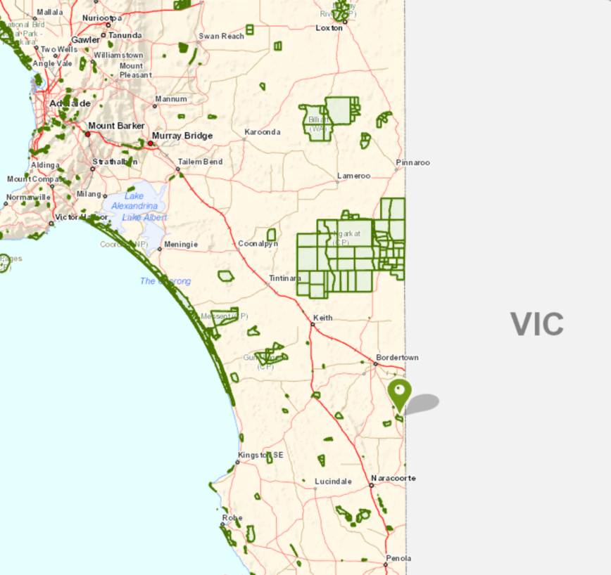
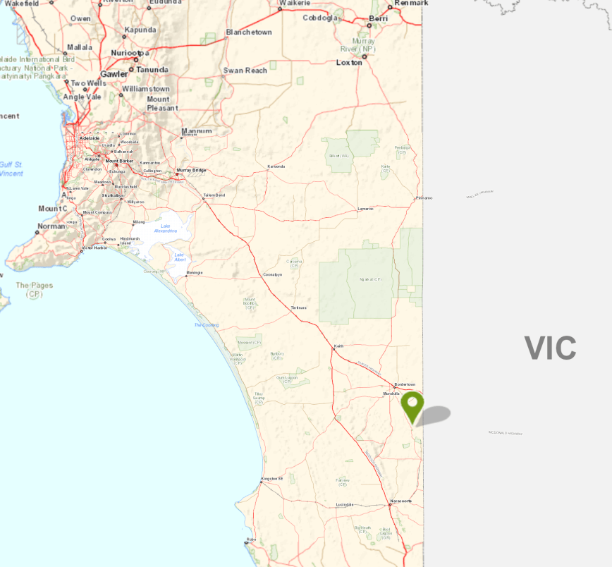
Poocher Swamp is about 271 km south east of Adelaide, and about 8 km west of the town of Bordertown.

Screen Shot 2018-07-12 at 10.13.15 pm.png

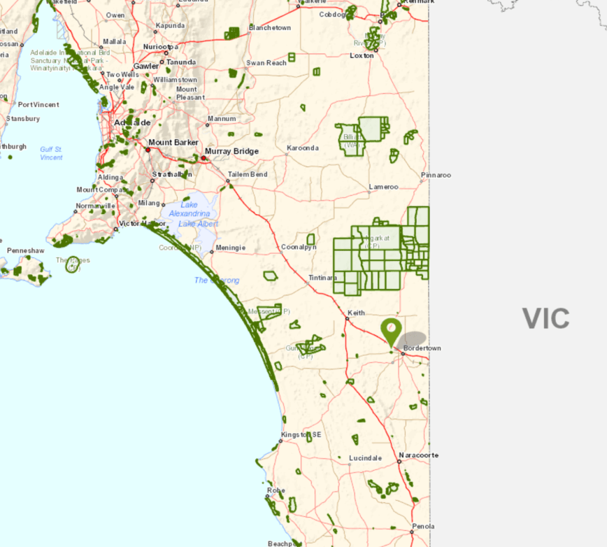
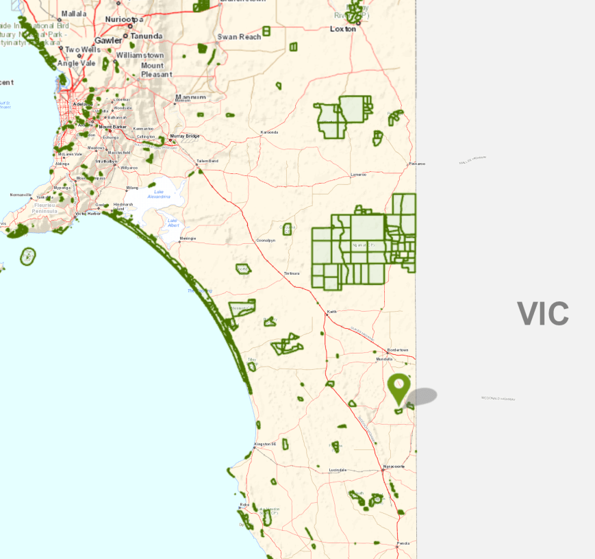
Above:- Map showing the location of the Poocher Swamp Game Reserve in the south east of South Australia.  Map courtesy of Location SA Map Viewer.

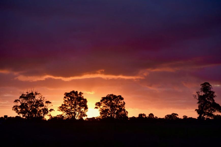
This was to be a quick activation, as it was now 5.30 p.m. and I had a 2 & 1/2 hour drive ahead of me.  As I drove towards the park I enjoyed a magnificent sunset.

DSC_2032

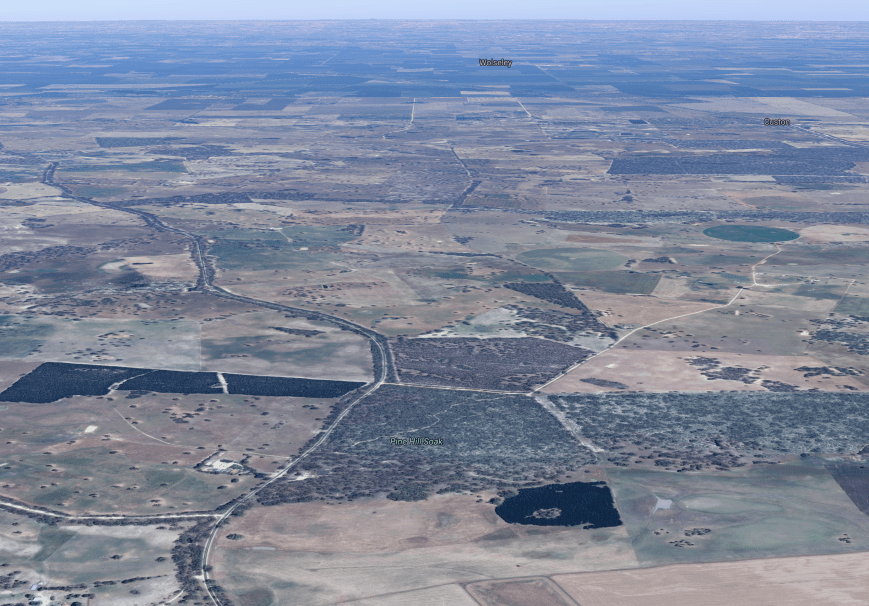
The Poocher Swamp Game Reserve is 77 hectares in size  and was proclaimed on 14th November 1985, with additional land added on 16th March 1989.  During the late 1950’s, a number of levee banks were constructed in the swamp to impound water and attract bird life.

Screen Shot 2018-07-12 at 10.15.28 pm.png

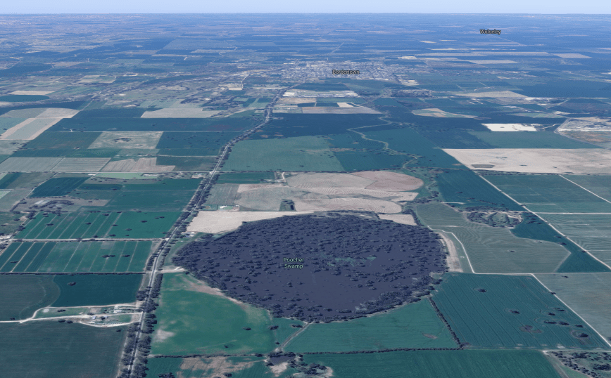
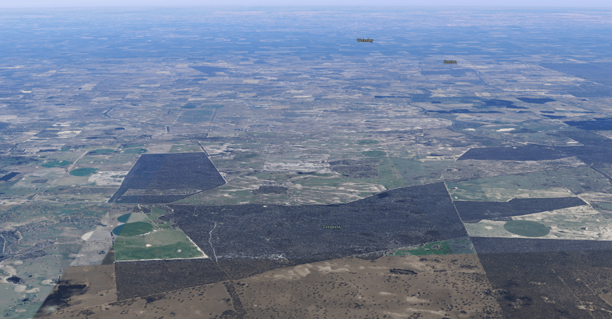
Above:- Aerial view of the Poocher Swamp Game Reserve.  Image courtesy of google maps

Over many years, the impoundment of water has caused the inundation of the River Red Gums in the reserve, and as a result many have died.  However regrowth is occurring at the upper limits of the floor waters and at the Tatiara Creek entrance to the swamp.

Birds SA have recorded a total of 85 bird species in the park including Grey Teal, Pacific Black Duck, Black-tailed Nativehen, Galah, Red-rumped Parrot, Australian Magpie, White-plumed Honeyeater, Magpielark, Australian Pelican, Royal Spoonbill, Purple-crowned Lorikeet, New Holland Honeyeater, and Rufous Songlark

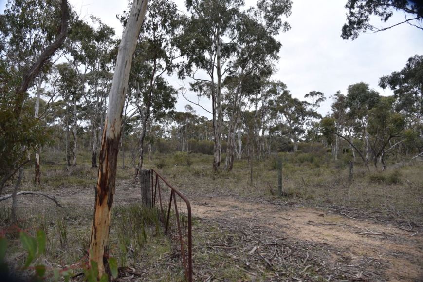
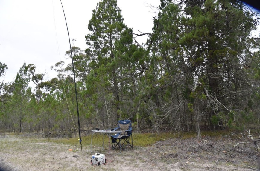
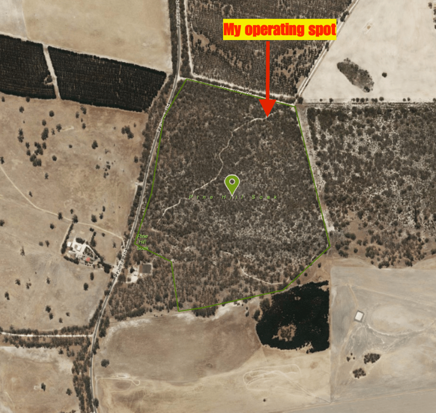
Unfortunately I was very short of time, so I only spent a few short minutes having a look at the park.  I didn’t even get the time to walk down to the actual swamp in the reserve.  I set up just inside the gate leading into the reserve.

Screen Shot 2018-07-12 at 10.11.11 pm.png

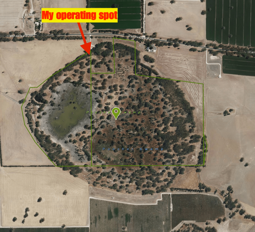
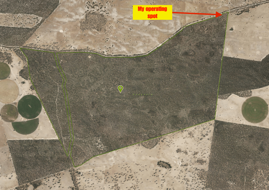
Above:- Aerial view of Poocher Swamp showing my operating spot.  Image courtesy of Location SA Map Viewer.

Once I had set up it was almost dark, so I decided to kick off the activation on the 80m band.  I self spotted on parksnpeaks and called CQ on 3.610 and this was answered by Adrian VK5FANA.  This was followed by Gerard VK2IO, Compton VK2HRX, and then Peter VK3PF.  Contact number 10, qualifying the park for me for VKFF, was a QSO with Bill VI50IARU3 in the Calliope Conservation Park VKFF-1499, just 9 minutes into the activation.

I logged a total of 26 stations on 80m from VK1, VK2, VK3, VK4, and VK5.  Unfortunately callers then dried up, so I headed off to 7.144 on 40m.  First in the log there was Ray VK4NH.  After working 11 stations, Bill VI50IARU3 gave me a shout, and remained on the frequency with me, working the hunters, giving them 2 parks at the same time.

Contact number 44 was a QSO with Gerard VK2IO, who was struggling to hear me.  We moved frequency 3 times as Gerard was suffering from noise, but we eventually made it.  At just after 6.30 p.m. local time I had 46 contacts in the log after an hour in the park, which really amazed me.  Time to pack up and hit the road.

THANKYOU to everyone who called me during my 5 activations.  And a BIG THANKYOU to those who took the time to spot me, as I had no internet coverage at some of the parks.

I worked the following stations on 80m SSB:-

  1. VK5FANA
  2. VK2IO
  3. VK2HRX
  4. VK3PF
  5. VK2LEE
  6. VK4TJ
  7. VK4/AC8WN
  8. VK4/VE6XT
  9. VK5DW
  10. VI50IARU3 (Calliope Conservation Park VKFF-1499)
  11. VK4FW (Calliope Conservation Park VKFF-1499)
  12. VK1DI
  13. VK5KLV
  14. VK2FPEZ
  15. VK5FMAZ
  16. VK5HS
  17. VK3GGG
  18. VK3PMG
  19. VK5BJE
  20. VK2NP
  21. VK3AJA
  22. VK2KJJ
  23. VK3BFR
  24. VK5SFA
  25. VK4FFAB
  26. VK4HNS

I worked the following stations on 40m SSB:-

  1. VK4NH
  2. VK4DXA
  3. ZL4TY/VK4
  4. VK4HNS
  5. VK5FANA
  6. VK4FFAB
  7. VK4FARR
  8. VK2NP
  9. Vk4TJ
  10. VK4/AC8WN
  11. VK4/VE6XT
  12. VI50IARU3 (Calliope Conservation Park VKFF-1499)
  13. VK4FW (Calliope Conservation Park VKFF-1499)
  14. VK5FMAZ
  15. VK4SYD
  16. VK2FOUZ
  17. VK2FPEZ
  18. VK2IO
  19. VK5/ZL2OPB
  20. VK2YX


References.

Birds SA, 2018, <https://birdssa.asn.au/location/poocher-swamp-game-reserve/>, viewed 12th July 2018

Geegeela Conservation Park 5CP-075 and VKFF-0883

My fourth planned park for the day (Tuesday 10th July 2018) was the Geegeela Conservation Park 5CP-075 & VKFF-0883.  This was to be another unique park for me as an activator.

Geegeela is situated about 298 km south east of Adelaide and about 27 km south of the town of Bordertown.

Screen Shot 2018-07-09 at 5.16.02 pm.png

Above:- Map showing the location of the Geegeela Conservation Park.  Map courtesy of Location SA Map Viewer.

The Geegeela Conservation Park, which is 858 hectares in size, was established in July 2005.  It takes its name from the Hundred of Geegeela which was originally known as the Hundred of Pflaum.  However this was changed in 1918 as a result of the anti German sentiment during World War One.  Geegeela is derived from the Aboriginal Tjitjila language meaning ‘wallaby’.

Screen Shot 2018-07-09 at 7.01.58 pm.png

Above:- Aerial view of the Geegeela Conservation Park.  Image courtesy of google maps

The Geegeela Conservation Park is home to numerous rare and endangered plant and animal species.  More than 90 species of native bird have been recorded in the park.  These include 17 threatened species within South Australia and 29 which have an identified conservation rating within the south east region.  The park provides critical habitat for the endangered South-Eastern Red-Tailed Black Cockatoo and Swift Parrot.  Other vulnerable listed birdlife includes the Brown Quail, Little Lorikeet, Brolga, Blue Winged Parrot, and the rare Shining Bronze-cuckoo, Blue Faced Honeyeater and Flame Robin.

The park consists of Blue Gum, and River Red Gum woodland.  The woodland and shrubland ecosystems found in the park are threatened on both State and National levels.

As I travelled along the Frances Road and then My Mi Mi Road, there were signs warning of kangaroos.

DSC_2009

And it didn’t take me long to bump into a few of the locals.

DSC_2015

I soon reached the north eastern corner of the park which was well signposted.

DSC_2016

A short distance from the NE corner, I found an opened gate and drove along the perimeter track.

DSC_2023

I set up about 20 metres from the gate.  There was plenty of room to string out the 20/40/80m linked dipole.

Screen Shot 2018-07-09 at 5.15.48 pm.png

Above:- Aerial view of the Geegeela Conservation Park, showing my operating spot in the north eastern corner of the park.  Image courtesy of Location SA Map Viewer.

Fortunately I had some internet coverage from Geegeela and was able to throw up a self spot on parksnpeaks.  I called CQ on 7.144 and this was answered by Adrian VK5FANA, followed by John VK2YW, Gerard VK2JNG mobile, and then John VK4TJ.  Contact number 10, with Linda VK7QP, came 7 minutes into the activation.  I had qualified the park for the VKFF National program.

The 40m band was in excellent shape, and within 37 minutes I had my 44th contact in the log, with a QSO with Rob VK2TTY.  After logging 49 contacts on 40m I moved off to 3.610 on the 80m band, which was also in great shape.  I logged 16 stations on 80m from VK2, VK3, VK5, and VK7.

I then put out about 10 or so CQ calls on 14.310 on the 20m band, but had no takers, so with it now being 4.10 p.m. local time, it was time to pack up and move on.  I still had a 2 & 1/2 hour drive to get home and I was contemplating activating the Poocher Swamp Game Reserve.

I worked the following stations on 40m SSB:-

  1. VK5FANA
  2. VK2YW
  3. VK2JNG/p
  4. VK4TJ
  5. VK4/AC8WN
  6. VK4/VE6XT
  7. VK1XP/m
  8. VK4HNS
  9. VK2NP
  10. VK7QP
  11. VK4FE
  12. VK4RF
  13. VK4HA
  14. VK2IO
  15. VK7LCW
  16. VK4NH
  17. VK4DXA
  18. ZL4TY/VK4
  19. VK4FDJL
  20. VK1FMGG
  21. VK4FFAB
  22. VK4RG
  23. VK2UXO
  24. VK3PF
  25. VK2QR
  26. VK7JON
  27. VK2VW
  28. VK3UH
  29. VK7GG
  30. VK7FOLK
  31. VK2HRX
  32. VK3BBB
  33. VK2OQ/m
  34. VK1HW
  35. VK3SQ
  36. VK2KJJ
  37. VK6FARB
  38. VK6XN
  39. VK4FARR
  40. VK2YX
  41. VK3LBW
  42. VK2SWL
  43. VK2TTY
  44. VK3TTY
  45. VK3QJ/2
  46. VK2KYO
  47. VK3AHR
  48. VK5KLV
  49. VK6AV/4

I worked the following stations on 80m SSB:-

  1. VK2JNG/m
  2. VK3GGG
  3. VK3PMG
  4. VK2KJJ
  5. VK2HHA
  6. VK3SQ
  7. VK2NP
  8. VK7GG
  9. VK5KBF
  10. VK5BJE
  11. VK3PF
  12. VK5DW
  13. VK5PL
  14. VK3AHR
  15. VK6PCT/3
  16. VK4FDJL


References.

National Parks South Australia, 2018, <https://www.environment.sa.gov.au/parks/find-a-park/Browse_by_region/Limestone_Coast/geegeela-conservation-park>, viewed 12th July 2018

State Library South Australia, 2018, <http://www.slsa.sa.gov.au/digitalpubs/placenamesofsouthaustralia/G.pdf>, viewed 12th July 2018

Bangham Conservation Park 5CP-009 and VKFF-0869

My third park for the day was the Bangham Conservation Park 5CP-009 & VKFF-0869, which is located about 304 km south east of Adelaide and about 34 km south east of the town of Bordertown.   Again, this was to be another unique park for me as an activator.

Screen Shot 2018-07-09 at 4.58.47 pm.png

Above:- Map showing the location of the Bangham Conservation Park.  Map courtesy of Location SA Map Viewer.

The Bangham Conservation Park is a large park, comprising 869 hectares.  In 1971 the land was offered to the South Australian State Government for conservation purposes.  At the time it consisted of 6.76 square kilometres of “native scrub” and 1.25 square kilometres of “cleared land” with the majority of the latter occupying its south-east corner.

There was a subsequent study which revealed that the land was used by the endangered Red-Tailed Black Cockatoo.  This made the land “particularly suitable for conservation purposes”.  Bangham was first proclaimed on the 22nd November 1973, with further land being added on 18th February 2010.  A Government survey of 1908 described the area as having the ‘greater part undulating white sand, with stringybark, buck honeysuckle, heath, yacca with a few pines’ and supporting ‘little grass’, and considered to be ‘inferior pasture’.

Screen Shot 2018-07-09 at 7.01.36 pm.png

Above:- Aerial view of the Bangham Conservation Park, looking north.  Image courtesy of google maps

Three major associations located in the park are: South Australian Blue Gum (Eucalyptus leucoxylon) open forest – woodland; River Red Gum (Ecamaldulensis) – in areas subject to inundation; and Brown Stringybark (E. baxteri) open forest – low open forest.

The park takes its name from the nearby area of Bangham.  Edward Bangham had land in the area in the 1840’s.  The Bangham Hall opened in 1953 and can still be found on the Frances Road.

Birds SA have recorded a total of 135 species of native birds in the park including Sulphur-crested Cockatoo, Crimson Rosella, White-throated Treecreeper, Brown Treecreeper, Superb Fairywren, Tawny-crowned Honeyeater, Red Wattlebird, Black-chinned Honeyeater, Little Corella, Spiny-cheeked Honeyeater, Blue-faced Honeyeater, White-fronted Chat, Crested Bellbird, Hooded Robin, and Grey-crowned Babbler.

I turned into the park off the Frances Road and travelled down a sandy 4WD track which then took me to the northern boundary of the park.

DSC_2004

Above:- the track in the park

I pulled the Hi Lux off to the side of the track and set up ‘the shack’ comprising the Yaesu FT-857d (set at 40 watts output) and the 20/40/80m linked dipole.

Screen Shot 2018-07-09 at 4.58.03 pm.png

Above:- Aerial shot of the Bangham Conservation Park showing my operating spot in the northern section of the park.  Image courtesy of Location SA Map Viewer.

Once I had set up I headed to 7.144 and found Alan VK2MG/p calling CQ from the Tuggerah State Conservation Area VKFF-1383.  After logging Alan, Park to Park, I moved down the band to 7.135 and called CQ.  Unfortunately I had no internet coverage and was hoping that someone would find me.  Fortunately Peter VK3PF did.  I then logged Peter VK7LCW, Adrian VK5FANA, and Gerard VK2JNG mobile.

Contact number 10 was a QSO with Brett VK2VW, nine minutes into the activation.  I logged 33 stations on 40m from VK2, VK3, VK4, VK5 and VK7.  I then moved to 3.610 on the 80m band and logged 11 stations from VK2, VK3, and VK5.  This included Andrew VK1DA/3 who was activating SOTA summit Goonmirk Rocks VK3/ VG-048 in the Errinundra National Park VKFF-0158.  Contact number 44 was Geoff VK3SQ.

I then QSYd to the 20m band and called CQ on 14.310.  First in the log on that band was Ray VK4NH, followed by John VK4TJ and Rob VK4SYD.

dsc_2005.jpg

I had qualified the park, with 49 contacts in the log, and time to head to my fourth park, the Geegeela Conservation Park.

I worked the following stations on 40m SSB:-

  1. VK2MG/p (Tuggerah State Conservation Area VKFF-1383)
  2. VK3PF
  3. VK7LCW
  4. VK5FANA
  5. VK2JNG/m
  6. VK2IO
  7. VK3BBB
  8. VK4RF
  9. VK4HA
  10. VK2VW
  11. VK3SQ
  12. VK7JON
  13. VK4FDJL
  14. VK4HNS
  15. VK2HHA
  16. VK7FOLK
  17. VK2QR
  18. VK2SWL
  19. VK2TTY
  20. VK3TTY/2
  21. VK3QJ/2
  22. VK2NP
  23. VK4NH
  24. VK4DXA
  25. ZL4TY/VK4
  26. VK4TJ
  27. VK4/AC8WN
  28. VK4/VE6XT
  29. VK2KYO
  30. VK2GZ
  31. VK7VZ/p
  32. VK2IPK
  33. VK2HPN/m

I worked the following stations on 80m SSB:-

  1. VK3GGG
  2. VK3PMG
  3. VK5FANA
  4. VK3PAT
  5. VK5BJE
  6. VK3FLJD
  7. VK5YP
  8. VK1DA/3 (Goonmirk Rocks VK3/ VG-048 & Errinundra National Park VKFF-0158)
  9. VK5ATN
  10. VK2HHA
  11. VK3SQ

I worked the following stations on 20m SSB:-

  1. VK4NH
  2. VK4DXA
  3. ZL4TY/VK4
  4. VK4TJ
  5. VK4SYD


References.

Birds SA, 2018, <https://birdssa.asn.au/location/bangham-conservation-park/>, viewed

State Library South Australia, 2018, <http://www.slsa.sa.gov.au/digitalpubs/placenamesofsouthaustralia/>, viewed

Wikipedia, 2018, <https://en.wikipedia.org/wiki/Bangham_Conservation_Park>, viewed

Pine Hill Soak Conservation Park 5CP-181 and VKFF-1078

My second park for the day (Tuesday 10th July 2018) was the Pine Hill Soak Conservation Park 5CP-181 & VKFF-1078.  This was to be another unique park for me as an activator in the WWFF program and the VK5 Parks Award.

Pine Hill Soak is located about 301 km south east of Adelaide, and about 30 km south of the town of Bordertown.

Screen Shot 2018-07-09 at 4.46.35 pm.png

Above:- Map showing the location of the Pine Hill Soak Conservation Park in the south east of South Australia.  Map courtesy of Location SA Map Viewer.

Pine Hill Soak Conservation Park is 51 hectares (130 acres) in size and was proclaimed on the 17th September 1987.  The park’s name is derived from a soak known as Pine Hill Soak which is located near the conservation park’s southern boundary.  A soak or soakage, is a source of water and is so called because the water generally seeps into the and, and is stored below, sometimes as part of an ephemeral river or creek. 

Screen Shot 2018-07-09 at 7.00.55 pm.png

Above:- Aerial view of the Pine Hill Soak Conservation Park.  Image courtesy of google maps

The park is bounded on the western side by the Frances Road, McCarthy Road to the north and by a vehicle track to its east and south boundaries.  The park consists of brown stringybark open forest, with desert banksia, and woodland of river red gum and South Australian blue gum with an open understorey of grasses, sedges and herbs.  The park also contains native pine.

After I left Custon Conservation Park I put Pine Hill Soak into the GPS.  All was looking good until the GPS took me down a dead end road (Ivan Road) and into a farmer’s property.  So it was a manual look at some maps, and back to the Frances Road.  I then encountered a flock of sheep and alpaccas who were out grazing on the side of the road under the watchful eye of a local farmer.

I soon reached the north western corner of the park and travelled down McCarthy Road, which is a no through road.  I travelled down a sandy track which passed through the park.  I found a clearing in the scrub and pulled off the track and set up.  I ran the Yaesu FT-857d and the 20/40/80m linked dipole for this activation.

Screen Shot 2018-07-09 at 4.46.13 pm.png

Above:- Aerial view of the Pine Hill Soak Conservation Park, showing my operating spot in the northern section of the park.  Image courtesy of google maps 

First in the log was Rob VK2QR with a big signal, followed by Geoff VK3SQ, Neil VK4HNS, and then Ron VK3AHR.  Within 6 minutes I had contact number 10 in the log, with a QSO with Vinnie VK2VIN in Wollongong.

The band had really opened up nicely since my first activation, with some excellent signals.  Contact number 44, a QSO with Rob VK3QJ/2 came within 28 minutes.  I logged a total of 50 stations on 40m from VK1, VK2, VK3, VK4, VK5 VK7 and New Zealand.  I was pleased as always to log regular park hunter Andrei ZL1TM.  I also made two Park to Park contacts, with Gerard VK2JNG/p in the Bullala National Park VKFF-0580, and Alan Vk2MG/p in Tuggerah State Conservation Area VKFF-1383.

So with the park qualified, everything from here on in was going to be a bonus.  I lowered the squid pole and inserted the links for the 80m section of the dipole.  First in the log on 3.610 was Mick VK3GGG with a big big 5/9 plus signal.  This was followed by Ron VK3VBI and then John VK5BJE.  I logged a further 4 stations on 80m from VK2, VK3 and VK5.

To finish off the activation I called CQ on 14.310 and logged John VK4TJ and then Ray VK4NH and his 2 other callsigns.

I had a total of 62 contacts in the log and it was now 1.10 p.m. local time, and time for me to pack up and head off to the Bangham Conservation Park.

I worked the following stations on 40m SSB:-

  1. VK2QR
  2. VK3SQ
  3. VK4HNS
  4. VK3AHR
  5. VK2OQ/m
  6. VK2NP
  7. VK4FDJL
  8. VK7LCW
  9. VK2KYO
  10. VK2VIN
  11. VK2SK
  12. VK2IPK
  13. VK2IO
  14. VK7JON
  15. VK4FFAB
  16. VK4CPS
  17. ZL1TM
  18. VK3MLU
  19. VK3TKK/m
  20. VK4NH
  21. VK4DXA
  22. ZL4TY/VK4
  23. VK7RN
  24. VK2HHA
  25. VK5KLV
  26. VK2JNG/p (Bullala National Park VKFF-0580)
  27. VK5MCB
  28. VK2VW
  29. VK4RF
  30. VK4HA
  31. VK3MDH/m
  32. VK3PF
  33. VK3OF
  34. VK3UH
  35. VK7FAMP
  36. VK4TJ
  37. VK4/AC8WN
  38. VK4/VE6XT
  39. VK2MG/p (Tuggerah State Conservation Area VKFF-1383)
  40. VK7LTD
  41. VK2SWL
  42. VK2TTY
  43. VK3TTY/2
  44. VK3QJ/2
  45. VK5FANA
  46. YB1AQM/VK4
  47. VK1RZ
  48. VK2JNG/m
  49. VK1XP/m
  50. VK1FMGG

I worked the following stations on 80m SSB:-

  1. VK3GGG
  2. VK3PMG
  3. VK3VBI
  4. VK5BJE
  5. VK5FANA
  6. VK3SQ
  7. VK3PF
  8. VK2HHA

I worked the following stations on 20m SSB:-

  1. VK4TJ
  2. VK4NH
  3. VK4DXA
  4. ZL4TY/VK4


References.

Wikipedia, 2018, <https://en.wikipedia.org/wiki/Pine_Hill_Soak_Conservation_Park>, viewed 12th July 2018

Wikipedia, 2018, <https://en.wikipedia.org/wiki/Soakage_(source_of_water)>, viewed 12th July 2018