
Our next intended activation, and the final one for day three (Sunday 18th November 2018), was the Whroo Nature Conservation Reserve VKFF-2229. The park is located about 9 km south of the town of Rushworth, and about 161 km north of the city of Melbourne.
This would be the first time that the park had been activated for the World Wide Flora Fauna (WWFF) program.
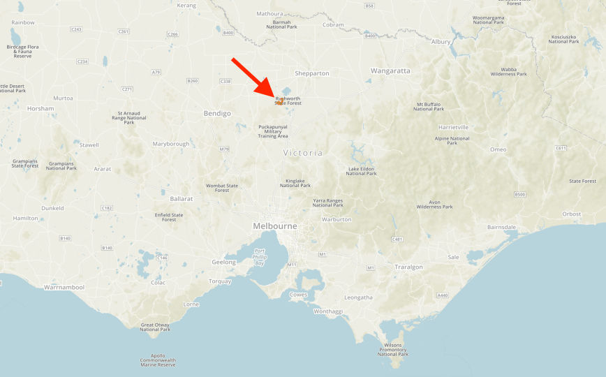
Above:- Map showing the location of the Whroo Nature Conservation Reserve. Map courtesy of Protected Planet.
After leaving Spring Creek, Marija and I drove east on the Heathcote-Nagambie Road, and then north on the Nagambie-Rushworth Road. We soon reached the southern boundary of the park which was well signposted. There is a lot of scrub out here, and it could be confusing if you are actually within the park boundaries. So if you intend to activate this park, you will need to ensure that you are within its perimeter, and not in another section of scrub. And don’t get this park confused with the Whroo Historic Area. They are completely separate parks.
The Whroo Natural Features Reserve is 5,367 acres in size, and is located on both the eastern and western side of the Nagambie-Rushworth Road. The park supports a range of threatened flora and fauna species, including four threatened orchids. It is of national significance as it is a key site for Swift Parrot and supports four other threatened fauna species and six threatened flora species, including the Squirrel Glider, the Grey-crowned Babbler, and the Bush-Stone Curlew. The park was previously known as the Rushworth State Forest.


The park takes its name from the ghost town of Whroo, pronounced ‘roo’. It is thought to be derived from an aboriginal word meaning lips. Gold was discovered in Whroo in October 1854, one year after the discovery of gold at nearby Rushworth. The location of the gold find was named Balaclava Hill, as it coincided with the Battle Balaclava in the Crimean War. As a result of the rush, Whroo’s population exploded to the thousands. However, within 4 years the population had dwindled to around 450.
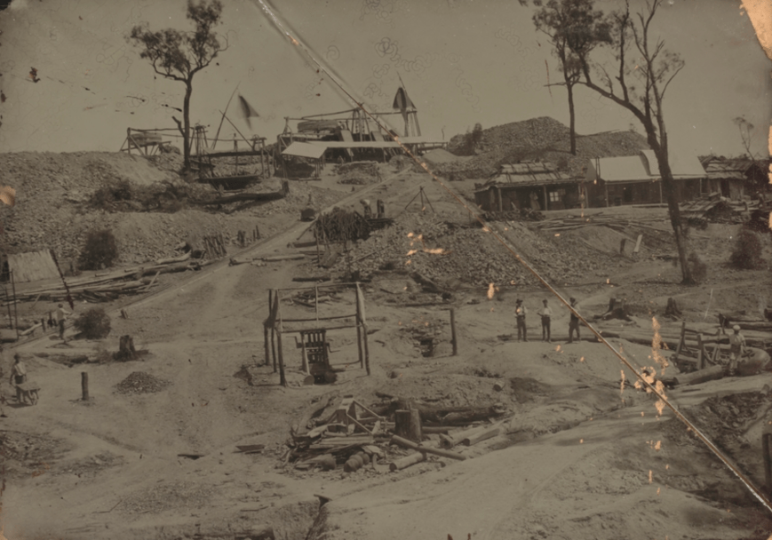
Above:- The view is of the “Balaclava Hill Whroo, from the north in about 1858/9, with the workings on the horizen: the wind sails ventilate the shafts, and the drums are the whims for raising quartz by horsepower. The tramway on the left runs down to Lewis and Nickinson’s crusher. A small hand operated crusher is visible in the centre foreground. c/o Trove
The township of Whroo was surveyed in 1856, 2 years after the discovery of gold. In 1857 the first school had been established in Whroo. By 1865 Whroo had a steady gold mining industry and included a mechanics’ institute and library, Presbyterian and United Methodist churches, three hotels, a cordial factory and three ore crushing mills.
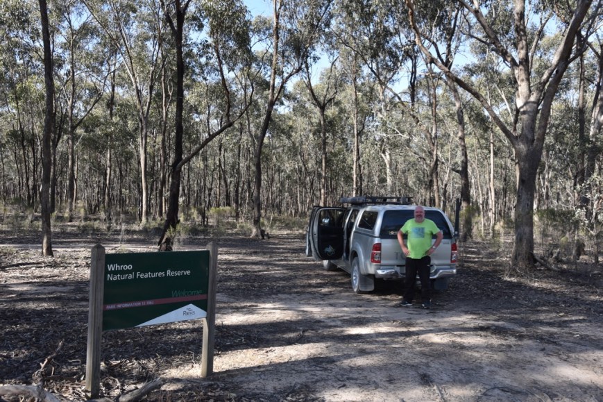
Marija and I pulled off the Nagambie-Rushworth Road, into Le Deux Road, and operated from the vehicle for this activation. Again, the equipment used was the Icom IC-7000, 100 watts, and the Codan 9350 antenna.
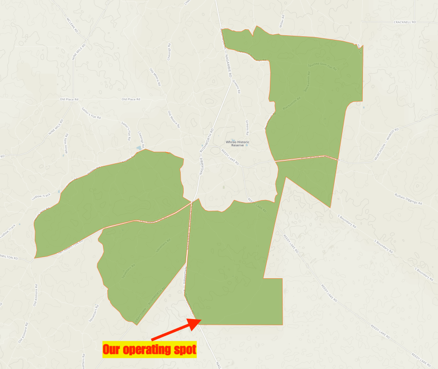
Above:- Map showing the Whroo Nature Conservation Reserve. Map courtesy of Protected Planet.
Our first contact from Whroo, was a Park to Park contact with Gary VK2GZ/p who was activating the Seven Mile Beach National Park VKFF-0447. We then moved down the band to log another Park to Park, this time with John VK5FLEA/p in the Mylor Conservation Park VKFF-0785.
I then propped on 7.115 and started calling CQ after Marija had popped up a spot for me on parksnpeaks. Andrei ZL1TM in New Zealand called in with a good 5/5 signal, followed by Andrew VK2PEZ and then Graham VK7ZGK.
I soon had 10 contacts in the log, qualifying the park for the VKFF program, with contact number 10 being a QSO with Adam VK2YK. I logged a further 2 stations on 40m before heading down to 3.610 on the 80m band where I logged 3 Victorian stations.
It was now around 4.30 p.m. and we still had hoped to have a look at the historic town of Rushworth before reaching our destination of Shepparton. So we hit the road again, with another park qualified for VKFF.
Marija worked the following stations on 40m SSB:-
- VK2GZ/p (Seven Mile Beach National Park VKFF-0447)
- VK5FLEA/p (Mylor Conservation Park VKFF-0785)
I worked the following stations on 40m SSB:-
- VK2GZ/p (Seven Mile Beach National Park VKFF-0447)
- VK5FLEA/p (Mylor Conservation Park VKFF-0785)
- ZL1TM
- VK2PEZ
- VK2ZEP
- VK7ZGK
- VK4NH
- VK4DXA
- ZL4TY/VK4
- VK2YK
- VK5FANA
- VK7EE
I worked the following stations on 80m SSB:-
- VK3PF
- VK3SQ
- VK3TNL
After packing up we drove into the Whroo Historic Reserve. This includes the site of the former Whroo township and the Whroo goldfields.
We visited the historic Whroo cemetery. The town of Whroo was established in 1853, however the earliest burial record at the Whroo cemetery is 1858. It would appear that the cemetery was used for burials before it was made official. There are about 400 graves recorded in the cemetery, however not all are marked. Just inside the gate to the right was the Chinese section. The 1863 Census indicates that of the 702 residents at Whroo, about 15% were Chinese.
Among the people’s sirnames at Whroo, the countries represented during the gold rush era were England (Lewis), France (Bartholmi), Sparin (Manuel), New Zealand (Murray Cluney, Rush & Bregan), Ireland (Ryan, SUllivan, Scarry, & O’Brian), China (Cheong), Prussia (Schleswig), and Austria (Holstein).
A short distance down the road we found an old Puddling machine, which became the main method for working the alluvial fields. Large quantities of gold bearing clay were taken from the gullies and mixed with water in the puddlers. A single horse would drag harrows around the circular trench to break up the clay and allow the heavier gold to settle to the bottom of the trench.
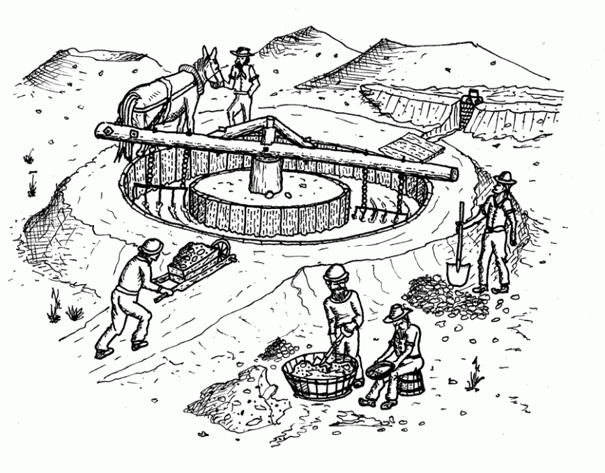
Above:- A puddling machine, c/o egold.net.au
This particular puddler was owned by William Puckey. Records from 1863 indicate that there were 17 puddling machines at Whroo, The Chinese operated four puddling machines around Rushworth and eigh around Whroo.

We then entered the town of Rushworth. Right on the edge of town there is an information board about ‘The Gold and Ironbark Trail’, a tourist drive which can be undertaken to relive the Victorian gold rush.
There is also a historic sign, the Rushworth Whistle Post. Its purpose was to instruct the drivers of Steam Traction engines to warn any approaching horse-drawn vehicles to wait whilst the Traction engine could proceed up the narrow road and avoid frightening the horses. There were originally two whistle posts; the remaining post is as original and was erected about 1906 to assist Anderson and Colliver, Timber Contractors, to haul timber from Whroo Forest to the Rushworth Sawmill.


We stopped of in Rushworth for about 30 minutes, and take a walk around the town admiring the many historic buildings. Today Rushworth is a service centre, but was once a thriving and bustling gold mining town, originally known as Nuggesty. The town was named by Richard ‘Orion’ Horne, a poet and a friend of Charles Dickens. The exact reason why the town was names Rushworth is not known. One option is that Horne simply took ‘rush’ from goldrush, and added ‘worth’. While others suggest that during his journey to Australia, Horne had befriended two fellow passengers named Rush and Worth.
Also within the town are two busts/monuments for Air Marshall Sir George Jones, who flew 120 offensive patrols and 20 bombing raids during WW1, and was awarded the distinguished Flying Cross Award. And also Air Vice Marshall Francis ‘Frank’ McNamara, who in 1917 became the first and only Australian airman to be decorated with the Victoria Cross. Both Jones and McNamara were born in Rushworth.


We then travelled out of Rushworth on the Rushworth-Tatura Road, stopping briefly to have a look at the Waranga Basin, an important off-river storage, where water is diverted from the Goulburn River at Goulburn Weir.


We had hoped to stop in the town of Tatura to have a look around, but we were running short of time, so we continued on to Shepparton. We booked in to our accomodation, the Addison Motor Inn, which we were very impressed with.

After freshening up a bit we headed out for tea at the King City Chinese Restaurant and had the all you can eat smorgasboard.
References.
Aussie Towns, 2018, <http://www.aussietowns.com.au/town/rushworth>, viewed 9th December 2018
Environment Conservation Council, <http://www.veac.vic.gov.au/reports/385-Chapter-16.pdf>, viewed 9th December 2018
Goulburn Murray Water, 2018, <https://www.g-mwater.com.au/water-resources/catchments/storages/goulburn/warangabasin>, viewed 9th December 2018
Victorian Places, 2018, <https://www.victorianplaces.com.au/whroo>, viewed 9th December 2018
Victorian Heritage Database, 2018, <https://vhd.heritagecouncil.vic.gov.au/places/67662>, viewed 9th December 2018
Whroo cemetery Victoria, 2018, <https://whroocemeteryinterments.weebly.com/history-of-whroo-cemetery.html>, viewed 9th December 2018
