Point Nepean National Park VKFF-0628

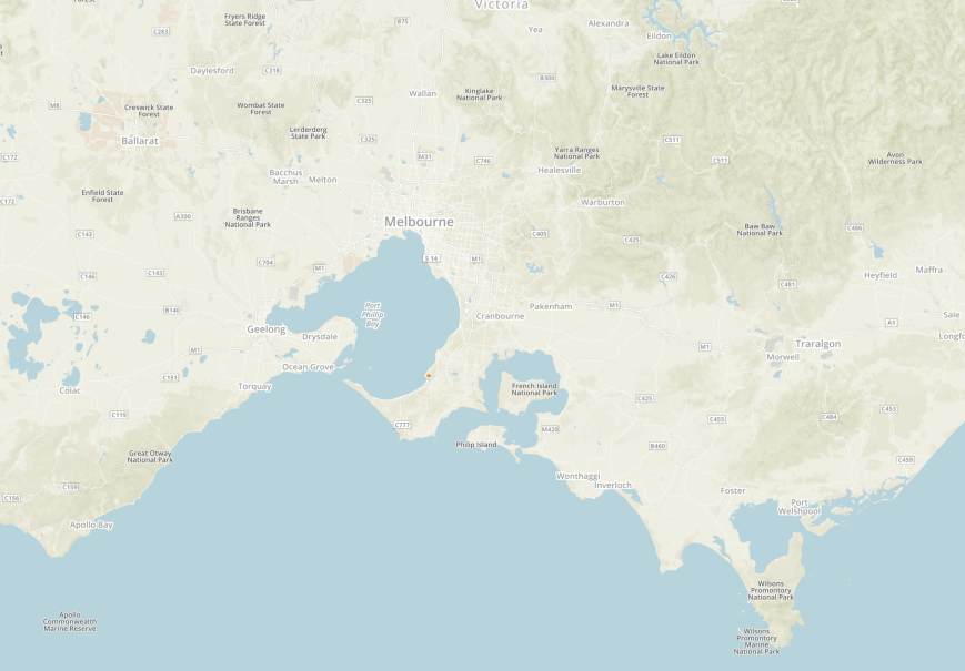
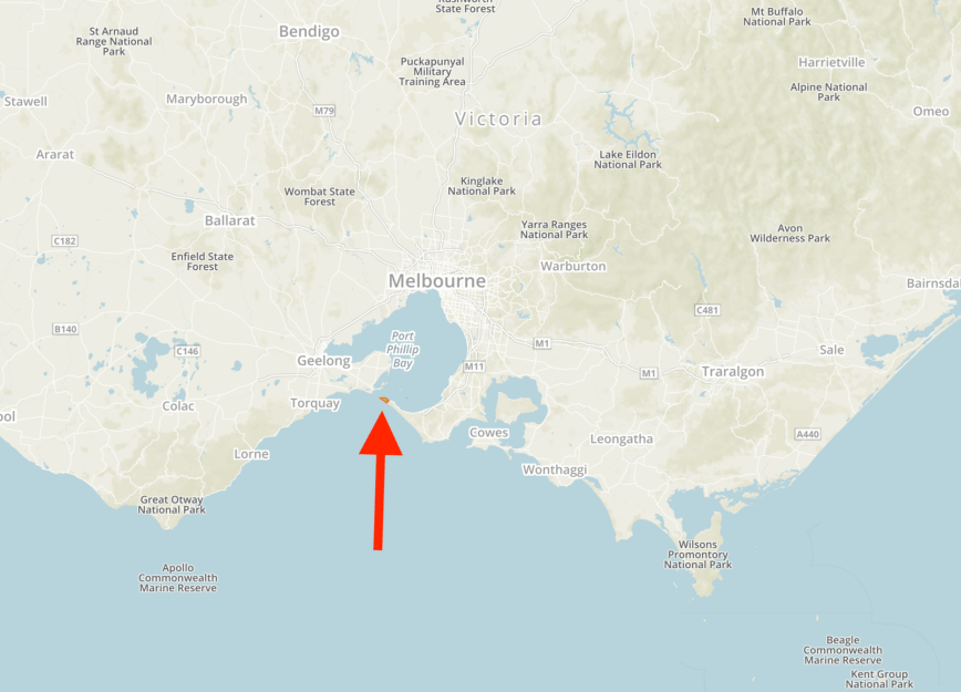
After leaving the Sorrento Museum, Marija and I headed to our next park, the Point Nepean National Park VKFF-0628, which is about 111 km (by road) south of the city of Melbourne.  This was to be another unique park for Marija and I as activators for both the World Wide Flora Fauna (WWFF) program, and the Keith Roget Memorial National Parks Award (KRMNPA).  And it was to be our final park for the 2018 VKFF Activation Weekend.

Screen Shot 2018-12-18 at 11.51.55 am.png

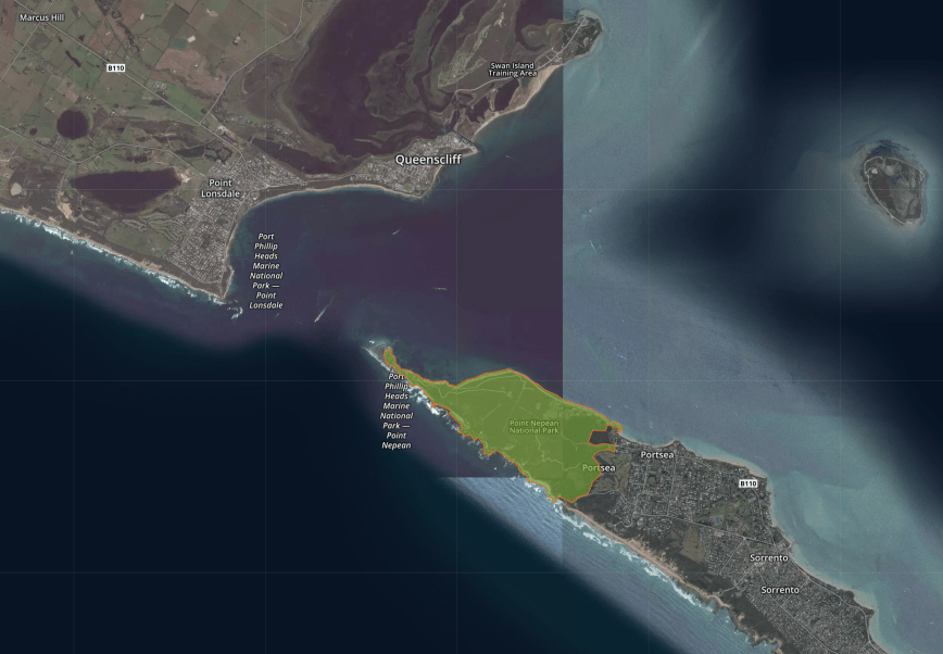
Above:- Map showing the location of the Point Nepean National Park.  Map courtesy of Protected Planet.

The Point Nepean National Park is a narrow strip of land on the Mornington Peninsula, located between Bass Strait and Port Phillip, comprising 560 hectares.  It is Victoria’s most visited National Park.  The park’s adjacent waters have been protected since 1975 and in 2002 were proclaimed as part of the Port Phillip Heads Marine National Park.  Point Nepean National Park includes South Channel Fort, the former Quarantine Station, various fortifications, Wilsons Folly conservation area, Defence Road and the former Range Area.

Screen Shot 2018-12-18 at 11.51.40 am

Above:- Aerial shot of the Point Nepean National Park.  Image courtesy of Protected Planet.

The park takes its name from the British politician and colonial administrator, Sir Evan Nepean.  Explorer John Murray named Point Nepean in 1802 during his journey through the area aboard the Lady Nelson.

SirEvanNepean.jpg

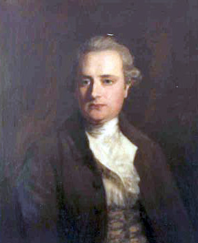
Above:- Sir Evan Nepean (1752-1822).  Image courtesy of wikipedia

The park contains beaches, cliffs, flats and sand dunes.  Vegetation includes coastal scrub, grassland and shrubland.


The traditional owners of the land are the Kulin aboriginal people.  In 1802 European navigators arrived in the area.  Between 1840-1855, limestone from Point Nepean’s dunes was burned for the manufacture of mortar to be used with the bluestone of early Melbourne.  In 1852 the Quarantine Station was established at Point Nepean, following the arrival of the Ticonderoga in 1852.  The Quarantine Station ran continuously until 1980.  By 1878, forts commenced at Point Nepean.  The Eagles Nest was established in 1889 and Fort Pearce in 1911.  They were used during both the First and Second World Wars.

Screen Shot 2018-12-18 at 11.57.31 am.png

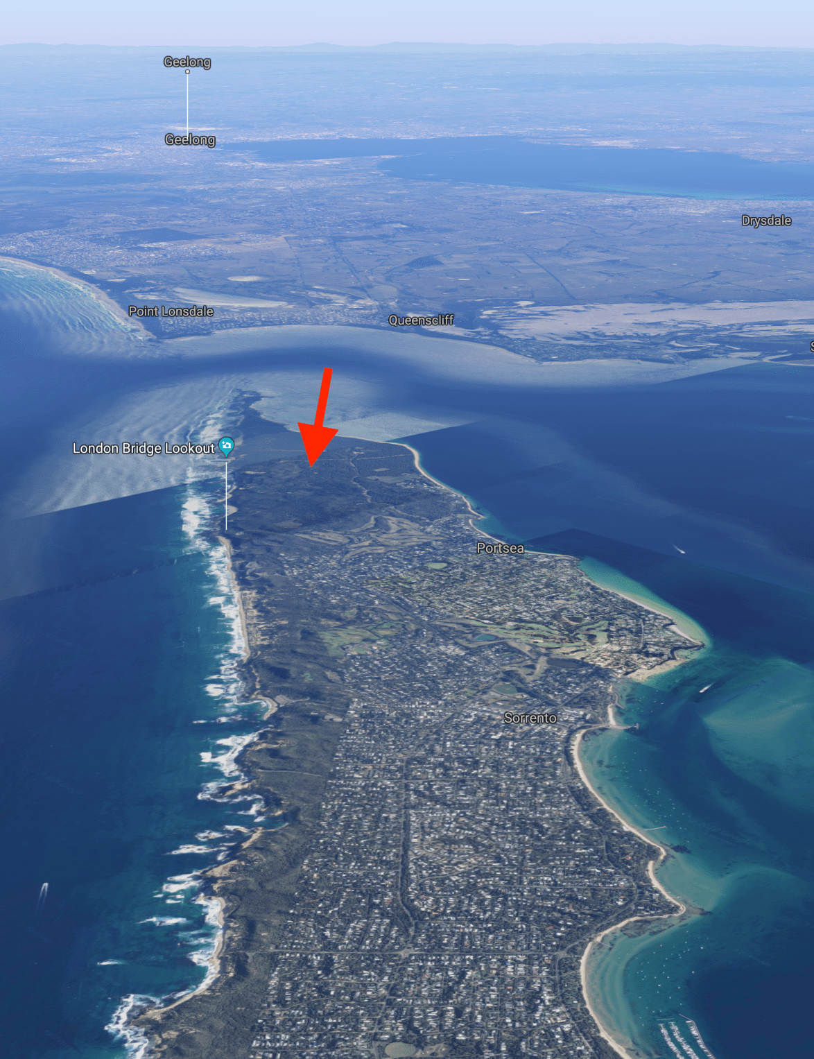
Above: An aerial view of the Point Nepean National Park, looking north west towards Point Lonsdale and Geelong.  Image courtesy of google maps

We first headed to the London Bridge Lookout carpark, as Peter VK3ZPF had given us some local knowledge re an operating spot.  Unfortunately this was a very busy spot during our visit, and it was not possible to operate from here.  But we were pleased we did visit, as it offered sensational views of the coastline.  There were a number of para gliders enjoying the great conditions.  We also had a look at The London Bridge, a sandstone formation which has been formed through the weathering action of wind, rain and sea.

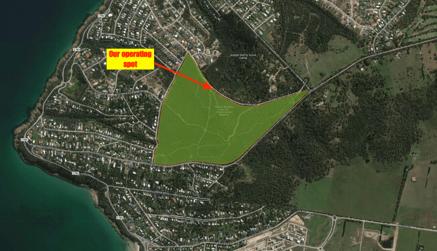
Alan VK3ALN had warned us that there was a market this afternoon at the park near the Quaratntine Station, but we decided to roll the dice and head there to see if we could find an operating spot.  Unfortunately the main oval was closed, but we did find a spot on the lawn a few hundred metres away from the visitor centre.  It was just far enough away, that we were not encroaching on anybody elses enjoyment of the park, and just enough room to stretch out the 20/40/80m linked dipole.

Screen Shot 2018-12-18 at 1.09.22 pm.png

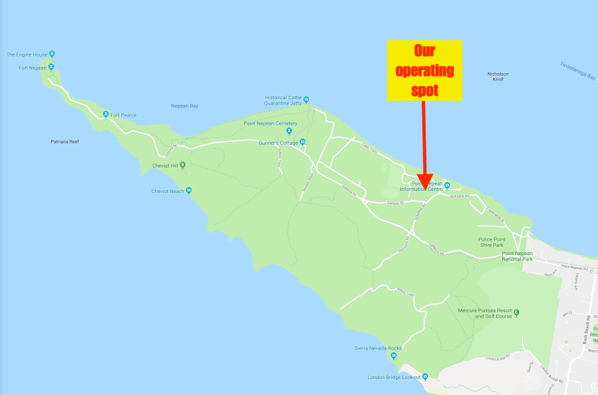
Above:- Map of the Point Nepean National Park, showing our operating spot.  Map courtesy of google maps

I kicked off the activation, while Marija went for a walk through the many historic buildings at the Quarantine Station.

This slideshow requires JavaScript.

Prior to calling CQ I tuned across the 40m band and found Chris VK1CT/p on 7.138 calling CQ from Bruce Ridge Nature Reserve VKFF-0835.  It was a nice way to start the activation with a Park to Park contact.

I then moved down to 7.133 and started calling CQ.  First in the log was Jim VK2FADV, followed by another Park to Park, with Ian VK1DI/p in the Farrer Ridge Nature Reserve VKFF-0840.  The 40m band had opened up very nicely, with good strong signals and lots of callers.

Contact number ten came 13 minutes into the activation, with a QSO with Cliff VK2NP.  I went on to work a total of 44 stations on 40m.  Contact number 44 was with Paul VK3HP.  This included the following Park to Park contacts:-

  • Chris VK1CT/p in the Bruce Ridge Nature Reserve VKFF-0835
  • Ian VK1DI/p in the Farrer Ridge Nature Reserve VKFF-0840
  • Gerard VK2IO/p in the Agnes Banks Nature Reserve VKFF-1881
  • Rob VK4AAC/p in the Freshwater National Park VKFF-0187
  • Alan VK2MG/p in the Munmorah State Conservation Area VKFF-1361
  • Peter VK3ZPF/p in the Langwarrin Flora & Fauna Reserve VKFF-2031
  • Andy VK5LA/p in the Moorook Game Reserve VKFF-1729

Marija returned from her walk and jumped into the operators chair.  Her first contact was with Compton VK2HRX, followed by Stephen VK5FETS, and then Andy VK5LA/p in the Moorook Game Reserve VKFF-1729.  Marija’s tenth contact was with Andrew VK2PEZ.  A further 5 stations were logged by Marija on 40m including a Park to Park with Gerard VK2IO/p in the Agnes Banks Nature Reserve VKFF-1881.

To complete the activation we headed down to the 80m band and logged Peter VK3PF/p who was in the Bruthen Flora Reserve VKFF-2282.  Unfortunately we did not have time to try 20m as I wanted to have a look at some of the Quarantine buildings and then head into Rye and head out for tea with Alan VK3ALN and his wife Robyn.

Marija worked the following stations on 40m SSB:-

  1. VK2HRX
  2. VK5FETS
  3. VK5LA
  4. VK4NH
  5. VK4DXA
  6. ZL4TY/VK4
  7. VK2PKT
  8. VK5HS
  9. VK2DRB
  10. VK2PEZ
  11. VK2ZEP
  12. VK2IO/p (VKFF-1881)
  13. Vk7QP
  14. VK7FOXX
  15. VK7FJFD

Marija worked the following station on 80m SSB:-

  1. VK3PF/p (VKFF-2282)

I worked the following stations on 40m SSB:-

  1. VK1CT/p (Bruce Ridge Nature Reserve VKFF-0835)
  2. VK2FADV
  3. VK1DI/p (Farrer Ridge Nature Reserve VKFF-0840)
  4. VK2FTDX
  5. VK2IO/p (Agnes Banks Nature Reserve VKFF-1881)
  6. VK2LX
  7. VK4AAC/p (Freshwater National Park VKFF-0187)
  8. VK5GJ
  9. VK3SQ
  10. VK2NP
  11. VK4NH
  12. VK4DXA
  13. ZL4TY/VK4
  14. VK5FMLO
  15. VK2GZ
  16. VK4CZ
  17. VK2MG/p (Munmorah State Conservation Area VKFF-1361)
  18. VK5PE
  19. VK5HS
  20. VK2HBO
  21. VK5CZ
  22. VK3ZZS
  23. VK7FJFD
  24. VK5PL
  25. VK3ZPF/p (Langwarrin Flora & Fauna Reserve VKFF-2031)
  26. VK7ZGK
  27. VK3MB
  28. VK2KNV/m
  29. VK2XSE/m
  30. VK2BHO
  31. VK5LA/p (Moorook Game Reserve VKFF-1729)
  32. VK2PKT
  33. VK5FETS
  34. VK7QP
  35. VK2YK
  36. VK2HMV
  37. VK7FTAS
  38. VK3FORD
  39. VK2VW
  40. VK3NLK
  41. VK3OY
  42. VK3BAP
  43. VK2MKE
  44. VK3HP

I worked the following station on 80m SSB;-

  1. VK3PF/p (Bruthen Flora Reserve VKFF-2282)

This is a major shipping channel, with overseas ships travelling through the narrow inlet between Point Nepean and Point Lonsdale into Port Phillip Bay and on to Melbourne.

Unfortunately I had left it a little too late, and many of the buildings which Marija had looked through, were now closed.  I will have to come back here another time.  But we did spend about 30 minutes walking around the old Quarantine Station.

This slideshow requires JavaScript.

We had a little bit of time up our sleeve before heading out for tea with Alan and Robyn, so we took a walk up the main street of Sorrento, admiring many of the town’s historic buildings.

We also took a walk along the foreshore.  The Sorrento Pier was essential to Sorrento’s development.  It was built in 1870 and served the paddle steamers carrying passengers from Melbourne, right up until 1942.   The largest, the Weeroona, carried 1,927 passengers.  They were met by horse drawn cabs, wagonettes, or they could climb steps and cross the bridge to the train terminus and travel direct to the back beach, or ‘Ocean Ampitheatre’.  The steam tramway started in 1889 and continued until 1921.

We then headed to the Rye Hotel and enjoyed a very nice meal with Alan and Robyn.


References.

Parks Victoria, 2017, ‘Point Nepean National Park Master Plan 2017’

Wikipedia, 2018, <https://en.wikipedia.org/wiki/Point_Nepean>, viewed 18th December 2018

Day ten, Mount Martha Nature Conservation Reserve VKFF-2152

Day ten of our two week trip was now here (Sunday 25th November 2018), and it was the second day of the 2018 VKFF Activation Weekend.  After breakfast we headed out to our first park, the Mount Martha Nature Conservation Reserve VKFF-2152.

Screen Shot 2018-12-18 at 10.29.02 am.png

Above:- Map showing the location of the Mount Martha Nature Conservation Reserve.  Map courtesy of Protected Planet.

This was another park which I was able to find very little about on the internet.  The park takes its named from the seaside town of Mount Martha, which was named in 1836 by Captain William Hobson, commander of HMS Rattlesnake, after Martha Lonsdale (Smythe). Martha Lonsdale was the wife of Captain Lonsdale, Port Phillip’s first Police Magistrate.

Mount Martha Nature Conservation Reserve is 50 hectares in size and includes the summit of Mount Martha which is 166 metres above sea level.  Sadly Mount Martha is not a SOTA summit, as it does not have the required 150 metres of prominence.

Mount Martha was originally the land of the Boonerwurrung aboriginal people.  Bythe early 1900’s most of the Mount Martha area had been totally cleared by the Europeans who had settled in the area.  This was initially by sheep grazers, and then for timber which was used in the bakeries in Melbourne and local lime kilns.

Mount Martha was first reserved as a public park during the 1940’s, with the concept of a ‘community forest’ being initiated in 1947.  Over the following 20 years replanting took place, including a pine forest and an Australian Native Plant Arboretum.  The pine trees were removed in 1985 and replaced with native plants.  Today, Mount Martha supports one of the few large intact remnants of Lowland Snowgum Grassy Woodland in Victoria.

We drove along the southern boundary of the park on Bradford Road and then the western boundary on Churchill Road.  But there were houses opposite the park at these locations.  We continued along Churchill Road and then turned on to Park Road to follow the northern boundary of the park.  This looked more promising, with the Joseph Harris Park on the opposite side of Park Road.  We parked the vehicle and walked about 100 metres down a walking track.

Screen Shot 2018-12-18 at 10.28.47 am.png

Above:- An aerial view of the Mount Martha Nature Conservation Reserve, showing our operating spot.  Image courtesy of Protected Planet.

There was plenty of room here to stretch out the 20/40/80m linked dipole without encroaching on other park users.

Marija kicked off the activation by calling CQ on 7.115.  We normally operate higher in the band, around 7.144, but being a Sunday morning, the 40m band was busy with the weekly news broadcasts from the Wireless Institute of Australia.  Marija’s first contact was a Park to Park with Gerard VK2IO/p who was activating the Yellomundee Regional Park VKFF-0558.  This was followed by Ray VK4NH, and then some more Park to Park contacts, with Peter VK2KNV/p and Liz VK2XSE/p in the Langtree Nature Reserve VKFF-2642.

We then had an unexpected visitor.  It was Peter VK3ZPF.  I had seen Peter walking down the track and initially thought he was a bushwalker, but once closer I recognised Peter.  It was great to see him.

Marija logged a total of 10 stations on 40m, qualifying the park for the VKFF program.

I then jumped into the operators chair, and Peter and I decided to swap the mic for each QSO.  First in the log was Mike VK5FMWW.  I soon had the park qualified for VKFF, with a contact with Andrew VK7DW in Tasmania.

Peter and I logged a total of 34 stations on 40m including the following Park to Park contacts:-

  • Gerard VK2IO/p in the Yellomundee Regional ParkVKFF-0558
  • Liz VK2XSE/p in the Langtree Nature Reserve VKFF-2642
  • Rob VK2QR/5 in the Gum Lagoon Conservation Park VKFF-0886
  • Peter VK3PF/p in the Holey Plains State Park VKFF-0758
  • Fred VK3DAC/p in the Bunurong Marine National Park VKFF-0945
  • Phil VK3BHR/p in the Greater Bendigo National Park VKFF-0623
  • Neil VK4HNS/p in the Boomi West Nature Reserve VKFF-2537
  • Tony VK3XV/p in the Rokewood Common Nature Conservation Reserve VKFF-2182

We then headed down to the 80m band and I called CQ on 3.610.  I didn’t take too long, and I had contact number 44 in the log, a Park to Park contact with Rob VK2QR/5 in the Gum Lagoon Conservation Park VKFF-0886.  This was followed by another Park to Park, with Malcolm VK3OAK/p in the Lake Rosine Wildlife Reserve VKFF-2362.

With the park qualified for WWFF, I then called CQ on 14.310 where I logged 5 stations including Andrei ZL1TM in New Zealand.  To complete the activation we headed back to 40m to see if there were any park activators about.  I logged Neil VK4HNS/p who was activating the Boomi West Nature Reserve VKFF-2537, and then Tony VK3XV/p in the Rokewood Common Nature Conservation Reserve VKFF-2182.

It was time to park up and head back into Sorrento for some lunch and a visit to the Sorrento Museum.  Marija and I had 64 contacts in the log between the 2 of us from Mount Martha, including 17 Park to Park contacts.

Marija worked the following stations on 40m SSB:-

  1. VK2IO/p (Yellomundee Regional Park VKFF-0558)
  2. VK4NH
  3. VK4DXA
  4. ZL4TY/VK4
  5. VK2KNV/p (Langtree Nature Reserve VKFF-2642)
  6. VK2XSE/p (Langtree Nature Reserve VKFF-2642)
  7. VI2WG50/p (Langtree Nature Reserve VKFF-2642)
  8. VK5FMWW
  9. VK7ME
  10. VK5PL
  11. VK3PF/p (Holey Plains State Park VKFF-0758)
  12. VK3XV/p (Rokewood Common Nature Conservation Reserve VKFF-2182)

I worked the following stations on 40m SSB:-

  1. VK2IO/p (Yellomundee Regional ParkVKFF-0558)
  2. VK2XSE/p (Langtree Nature Reserve VKFF-2642)
  3. VK5FMWW
  4. VK5TRM
  5. VK5MJ
  6. VK2QR/5 (Gum Lagoon Conservation Park VKFF-0886)
  7. VK4CZ
  8. VK4HAT
  9. VK2LEE
  10. VK7DW
  11. VK4NH
  12. VK4DXA
  13. ZL4TY/VK4
  14. VK5VGC
  15. VK5YX
  16. VK2XXM
  17. VK5PL
  18. VK3PF/p (Holey Plains State Park VKFF-0758)
  19. VK5LA
  20. VK2LX
  21. VK2NP
  22. VK2PKT
  23. VK3DAC/p (Bunurong Marine National Park VKFF-0945)
  24. VK7BEN
  25. VK1HW
  26. VK1TX
  27. VK5MRT
  28. VK7KR
  29. VK2IO/p (Yellomundee Regional Park VKFF-0558)
  30. VK2KYO
  31. VK3BHR/p (Greater Bendigo National Park VKFF-0623)
  32. VK5KSW
  33. VK5LA
  34. VK5FANA
  35. VK5PE/m
  36. VK5HS/m
  37. VK4HNS/p (Boomi West Nature Reserve VKFF-2537)
  38. VK3XV/p (Rokewood Common Nature Conservation Reserve VKFF-2182)

I worked the following stations on 80m SSB:-

  1. VK3YB
  2. VK3TNL
  3. VK3MPT
  4. VK3PAT
  5. VK2KYO
  6. VK3ARH
  7. VK3UH
  8. VK2QR/5 (Gum Lagoon Conservation Park VKFF-0886)
  9. VK3OAK/p (Lake Rosine Wildlife Reserve VKFF-2362)

I worked the following stations on 20m SSB:-

  1. ZL1TM
  2. VK4NH
  3. VK4DXA
  4. ZL4TY/VK4
  5. VK2LEE

After packing up we drove east on Park Road and found that there was a major parking area and picnic area near the Park Road and Forest Drive intersection.  We stopped there briefly to have a look at the information boards at this location.

We drove back to Sorrento via The Esplanade, through Safety Beach, admiring some terrific views of the western coastline of the Mornington Peninsula.

Once back in Sorrento we had a quick bite to eat, whilst waiting for the Sorrento Museum to open up at 1.30 p.m. local time.  The museum is located in the National Trust classified old Mechanics Institute, a limestone building built during the 1870’s.  The museum first opened in 1967.

DSC_4875

We can highly recommend a visit here to the museum which is run by the Nepean Historical Society.  For just a meager $5.00 admission fee, there is an excellent display of local history.  It includes local aboriginal history and artefacts, an original water cask from the 1803 Sullivan Bay settlement, a maritime display, costumes and household items, and information on William Buckley, a convict who escaped from the settlement and lived with the local aborigines for 33 years.

This slideshow requires JavaScript.

Part of the museum is Watts Cottage, also known as Ilfracombe, a wattle and daub limeburners home which was built in 1869-1870.  It was the home of Sorrento pioneers John Francis Watts and his wife Jenny ‘Jane’.  They had nine children, seven of whom whilst they were living at Ilfracombe.  It is a fine example of the type of home built by early Sorrento settlers.

After leaving the museum we headed out to our next park activation at the Point Nepean National Park.


References.

Victorian Places, 2018, <https://www.victorianplaces.com.au/mount-martha>, viewed 18th December 2018