Main Ridge Flora Reserve VKFF-2135

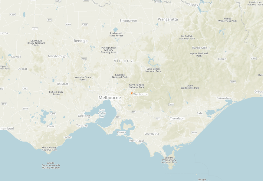
Our second planned park for the 2018 VKFF Activation Weekend was to be the Point Nepean National Park, but we chose to alter our plans and head to the Main Ridge Flora Reserve VKFF-2135.  Main Ridge is located about 105 km south of Melbourne on the Mornington Peninsula.  This was to be a first time activation for both Marija and I.

Screen Shot 2018-12-17 at 8.19.41 pm.png

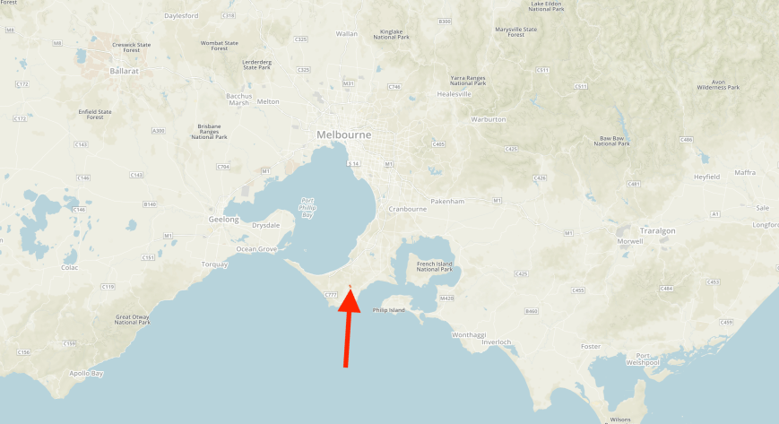
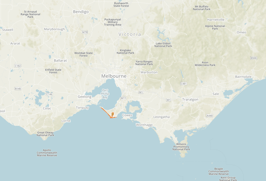
Above:- Map showing the location of the Main Ridge Flora Reserve.  Map courtesy of Protected Planet.

The Main Ridge Flora Reserve is about 158 acres in size.  It is located in relatively close proximity to the Greens Bush section of the Mornington Peninsula National Park.  I was unable to locate much information about this park on the internet.  The Parks Victoria website only contains 3 photos and a map, with no further detail.

The park is one of the last remaining remnant pieces of bushland on the Mornington Peninsula.  The park takes its name from the locality of Main Ridge, which was originally known as Main Creek.

Screen Shot 2018-12-17 at 8.16.06 pm.png

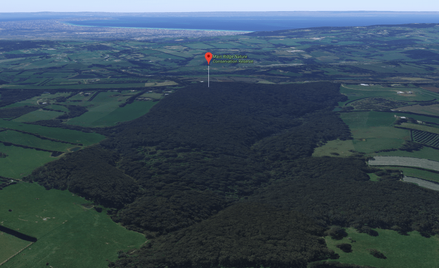
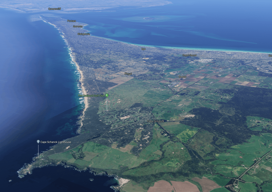
Above:- An aerial view of the Main Ridge Flora Reserve.  Image courtesy of google maps

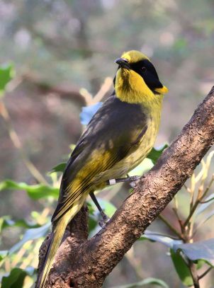
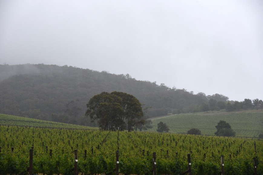
The park was alive with birdlife during our visit, including Kookaburras, Crimson Rosellas, Superb Fairy Wrens, White-throated Treecreepers, Eastern Yellow Robins, and  Grey Fantails.  Some of those appear in the photos below which I snapped during my visit to the park.

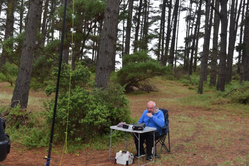
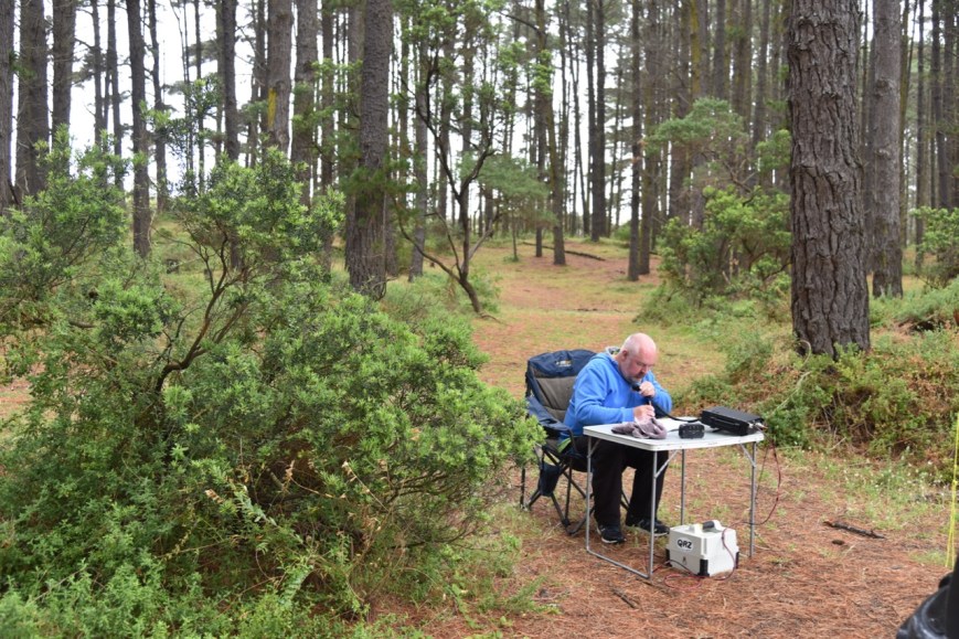
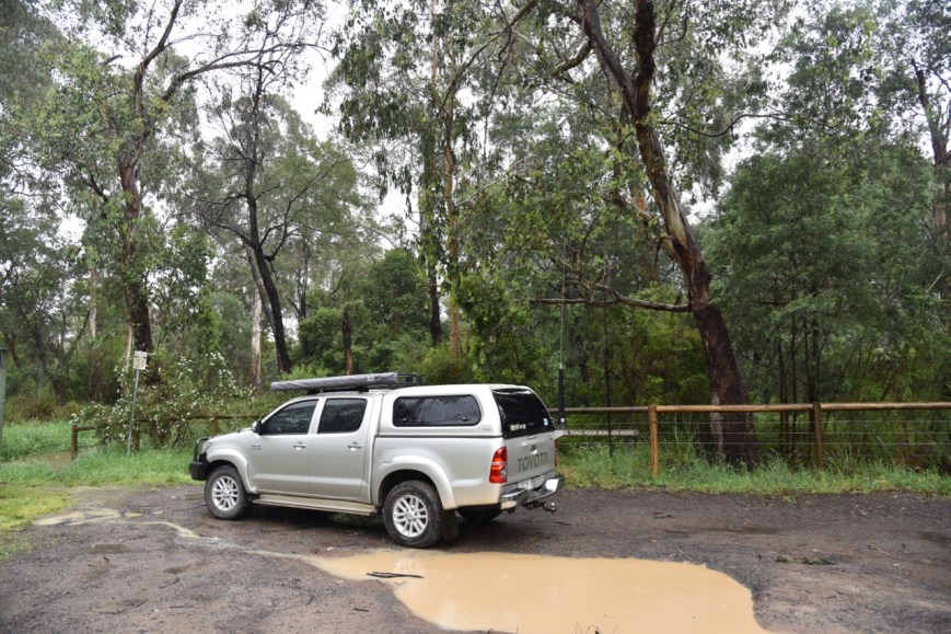
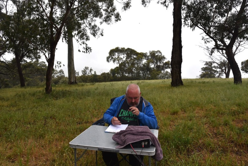
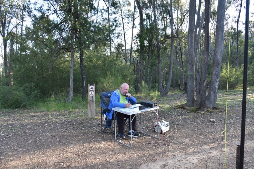
We accessed the park via the Mornington-Flinders Road.  There was a small area out the front where we parked out vehicle, and we walked a short distance down the walking trail and set up.  We ran the Yaesu FT-897 and the 20/40/80m linked dipole for this activation.  Power output for me was 40 watts, and 10 watts PEP for Marija.

Screen Shot 2018-12-17 at 8.19.28 pm.png

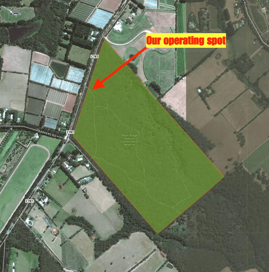
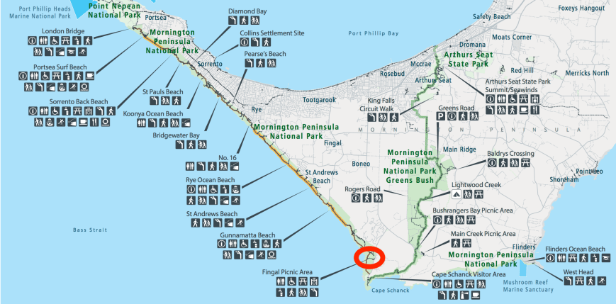
Above:- Aerial shot of the Main Ridge Flora Reserve, showing our operating spot.  Image courtesy of Protected Planet.

We had the park all to ourselves, so we were able to use the walking trail to our advantage, by stringing out the linked dipole.

DSC_4818

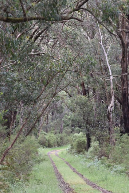
Above:- the walking trail through the park

Prior to calling CQ, Marija and I tuned across the band to see if we could log some other park activators.  We found Mark VK4SMA/p, Ade VK4SOE/p, and Steve VK4FNOR.p on 7.144.  Mark was in the Giraween National Park VKFF-0198, whilst Ade & Steve were activating the Bald Rock National Park VKFF-0011.

After speaking with Mark, Ade & Steve, I headed down the band to 7.135 and started calling CQ.  This was answered by Ray VK4NH, who was also keen to log Marija, so we swapped the mic after lowering the power for Marija.  We decided it was too hard going in and out of the menu, so Marija continued to operate.  Andy VK5LA/p then called in, who was activating the Murray River National Park VKFF-0372, followed by Linda VK7QP.  This was followed by Ian VK1DI/p in the Urambi Hill Nature Reserve VKFF-0864.  I also logged Ian, Park to Park.

DSC_4784

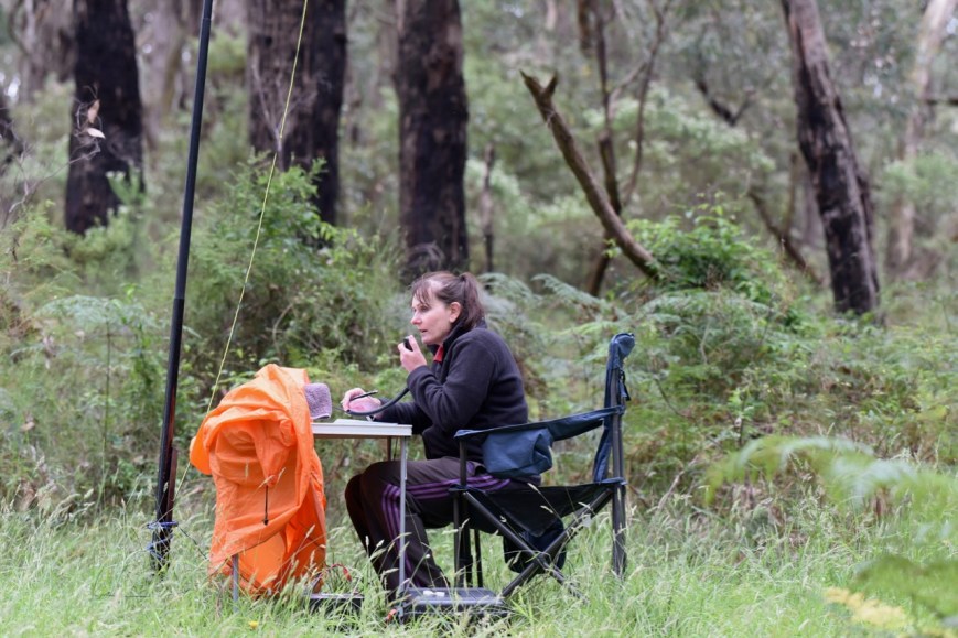
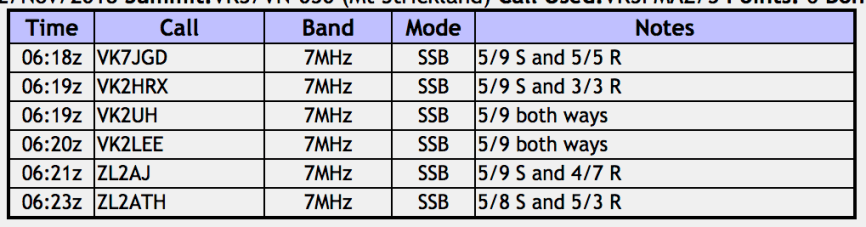
But it was very slow going on the band, and Marija logged just 2 further stations on 40m, Grant VK2LX, and Rod VK7FRJG.  So I jumped back on the mic, ramping the power back up to 40 watts.  It had started to drizzle again with rain, so Marija headed back to the vehicle for shelter, while I huddled underneath the bothy bag.  I logged a further 20 stations on 40 m including the following Park to Park contacts:-

  • Ian VK1DI/p in the Urambi Hill Nature Reserve VKFF-0864
  • Alan VK2MG/p in the Watagans National Park VKFF-0522
  • Liz VK2XSE/p in the Loughnan Nature Reserve VKFF-2651
  • Gerard VK2IO/p on SOTA peak VK2/ CT-032 in the Blue Mountains National Park VKFF-0041
  • Nik VK3NLK/p in the The Pines Flora & Fauna Reserve VKFF-2451
  • Alan VK3ALN/p in the Point Nepean National Park VKFF-0628
  • Les VK5KLV/p in the Munyaroo Conservation Park VKFF-0920
  • Steve VK5MSD/p in the Munyaroo Conservation Park VKFF-0920
  • Rob VK4AAC/p in the Bunyaville Conservation Park VKFF-1493

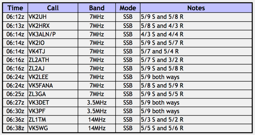
I then moved to the 80m band and started calling CQ on 3.610 after placing a spot on parksnpeaks.  Sadly my only taker on 80m was Geoff VK3SQ in Beechworth.

I then headed to 14.310 on the 20m band where I logged a total of 4 stations from VK4 and New Zealand.  I decided to have a tune across the 20m band before heading back to 40m, and I am very pleased I did.  I managed to log A35EU in Tonga on 14.185.  This was a new DXCC entity for me whilst being portable.  I am trying to get my DXCC from operating portable, and I am slowly getting there, being in the high 80’s now.

I then moved back to 40m and tuned across the band hoping to find some park activators.  I found Rob VK2QR/3 on 7.135 calling CQ from the Lonsdale Nature Conservation Reserve VKFF-2132.  I shouted out to Marija and she jumped out of the vehicle to also log Rob Park to Park.

I then moved up to 7.155 and called CQ.  I logged 5 stations including some more Park to Park contacts: Adam VK2YK/p in the Port Stephens/Great Lakes Marine Park VKFF-1410, and Peter VK2KNV/p in the Loughnan Nature Reserve VKFF-2651.

Marija and I saw a spot pop up for Peter VK3PF/p on 3.615, so we lowered the squid pole and inserted the 80m sections of the antenna and headed to 3.615.  We both logged Peter who was in the Crossover Regional Park VKFF-0965.  Peter became my 44th contact, qualifying the park for me for WWFF, so I encouraged Marija to get back on the mic whilst I headed off for a walk to take some more photographs.

But Marija found conditions difficult, logging just a further 2 stations on 40m, Mike VK5FMWW and Lee VK2LEE.

We packed up with a total of 61 contacts in the log between the 2 of us, including 27 Park to Park contacts.

Marija worked the following stations on 40m SSB:-

  1. VK4SMA/p (Girraween National Park VKFF-0198)
  2. VK4SOE/p (Bald Rock National Park VKFF-0011)
  3. VK4FNOR/p (Bald Rock National Park VKFF-0011)
  4. VK4NH
  5. VK4DXA
  6. ZL4TY/VK4
  7. VK5LA/p (Murray River National ParkVKFF-0372)
  8. VK7QP
  9. VK1DI/p (Urambi Hill Nature Reserve VKFF-0864)
  10. VK2LX
  11. VK7FRJG
  12. VK2QR/3 (Lonsdale Nature Conservation Reserve VKFF-2132)
  13. VK5FMWW
  14. VK2LEE

Marija worked the following station on 80m SSB:-

  1. VK3PF/p (Crossover Regional Park VKFF-0965)

I worked the following stations on 40m SSB:-

  1. VK4SOE/p (Bald Rock National Park VKFF-0011)
  2. VK4FNOR/p (Bald Rock National Park VKFF-0011)
  3. VK4SMA/p (Girraween National Park VKFF-0198)
  4. VK4NH
  5. VK4DXA
  6. ZL4TY/VK4
  7. VK5LA/p (Murray River National ParkVKFF-0372)
  8. VK1DI/p (Urambi Hill Nature Reserve VKFF-0864)
  9. VK7FRJG
  10. VK2LX
  11. VK2BY
  12. VK2MG/p (Watagans National Park VKFF-0522)
  13. VK2XSE/p (Loughnan Nature Reserve VKFF-2651)
  14. VK2IO/p (SOTA VK2/ CT-032 & Blue Mountains National Park VKFF-0041)
  15. VK3NLK/p (The Pines Flora & Fauna Reserve VKFF-2451)
  16. VK3ALN/p (Point Nepean National Park VKFF-0628)
  17. VK5HS
  18. VK2PKT
  19. VK2LEE
  20. VK5PL
  21. VK5KLV/p (Munyaroo Conservation Park VKFF-0920)
  22. VK5MSD/p (Munyaroo Conservation Park VKFF-0920)
  23. VK5FANA
  24. VK7QP
  25. VK4AAC/p (Bunyaville Conservation Park VKFF-1493)
  26. VK3SX
  27. VK5LG
  28. VK2FMNW
  29. VK2QR/3 (Lonsdale Nature Conservation Reserve VKFF-2132)
  30. VK2YK/p (Port Stephens/Great Lakes Marine Park VKFF-1410)
  31. VK2HRX
  32. VK7BEN
  33. VK2KNV/p (Loughnan Nature Reserve VKFF-2651)
  34. VI2WG50/p (Loughnan Nature Reserve VKFF-2651)
  35. VK5FMWW

I worked the following station on 80m SSB:-

  1. VK3SQ
  2. VK3PF/p (Crossover Regional Park VKFF-0965)
  3. VK3KAI/p (Crossover Regional Park VKFF-0965)
  4. VK3GV/p (Crossover Regional Park VKFF-0965)
  5. VK3ANL

I worked the following stations on 20m SSB:-

  1. VK4NH
  2. VK4DXA
  3. ZL4TY/VK4
  4. ZL1TM
  5. A35EU

We headed back down the Mornington Peninsula and stopped at Rye to catch up with Alan VK3ALN and hsi wife Robyn.  We enjoyed a nice coffee at Alan and Robyn’s motorhome, and arranged to catch up for tea the next night.

DSC_4847

We then headed back into Sorrento and ordered some Chinese take away.  Whilst waiting for the food we had a quick drive around Rye.  The weather had cleared up quite nicely compared to the dull and overcast conditions the day before.  We then headed back to the motel room for a relatively early night.


References.

Wikipedia, 2018, <https://en.wikipedia.org/wiki/Main_Ridge,_Victoria>, viewed 18th December 2018

Day nine, the VKFF Activation Weekend, and the Mornington Peninsula National Park VKFF-0333

Day nine (Saturday 24th November 2018) had rolled around very quickly, and it was now the first day of the 2018 VKFF Activation Weekend.  Our first intended activation for the day was the Mornington Peninsula National Park VKFF-0333.

Screen Shot 2018-12-17 at 6.53.53 pm.png

Above:- Map showing the location of the Mornington Peninsula National Park.  Map courtesy of Protected Planet. 

The Mornington Peninsula National Park is a large park, comprising 2,686-hectares (6,640-acres).  The park was declared on 1st December 1975.   The park follows the coastline from near Portsea to Cape Schank, and also an inland area known as Greens Bush, which is the largest remnant of bushland on the Mornington Peninsula.

The first European settlement on the Mornington Peninsula, was also the first settlement in Victoria.  This was at Sullivans Bay, now Sorenton, where a penal colony was established in 1803.  This was 30 years prior to the establishment of Melbourne.  At this time the majority of the peninsula was covered with she-oak forests, however these were quickly cleared and subsequently planted with fruit orchards.

Screen Shot 2018-12-17 at 7.57.20 pm.png

Above:- An aerial view of the Mornington Peninsula National Park.  Image courtesy of google maps.

Marija and I were not exactly sure where in the park we were going to activate from.  We first tried Sorrento Back Beach, but found that there wasn’t enough room here to stretch out the dipole, without encroaching on other park users.  So we decided to head to Fingal Picnic Area further along the coastline.  Along the way we detoured to Gunnamatta Beach to admire the views of the coast.

We travelled along Cape Schank Road and soon reached the Fingal Picnic Area, about 2 km north of Cape Schank.  This area was subdivided for housing but was re- purchased by the government from 1974 to 1977.

There was plenty of room here for us to set up without interfering with others in the park.  Our operating spot was amongst some pine trees.

Screen Shot 2018-12-17 at 7.04.08 pm.png

Above:- Map of the Mornington Peninsula National Park, showing our operating spot.  Map courtesy of Parks Victoria.

We were set up and read to go by about 10.30 a.m.  We ran the Yaesu FT-897 and the 20/40/80m linked dipole for this activation.  Marija placed a spot up for me on parksnpeaks and I started calling CQ.  The first station in the log for us for the 2018 VKFF Activation Weekend was Ray VK4NH, followed by Rob VK4SYD, Nev VK5WG, and then Murray VK1UU.  But it was very slow going, and it took me 24 minutes to get contact number 10 in the log, a QSO with Pete VK2FPAR.

I logged a total of 11 stations on 40m before the UTC rollover, and afurther 7 after the UTC rollover.  This included five Park to Park contacts:

  • Alan VK2MG/p in the Watagans National Park VKFF-0522
  • Johnno VK3FMPB/p who was also in the Mornington Peninsula National Park.
  • Liz VK2XSE/p in the Lachlan Valley National Park VKFF-0255
  • Mark VK4SMA/p in the Girraween National Park VKFF-0198
  • Gerard VK2IO/p in the Blue Mountains National Park VKFF-0041

Unfortunately Johnno had not advised he was going to be in the same park as us, and we experienced a lot of bleed over across the band during the morning, so I apologise to any of the weaker stations that may have been calling us.

DSC_4720

The UTC rollover had just passed, and Marija jumped on the mic.  Marija’s first contact after calling CQ, was a Park to Park with Liz VK2XSE/p in the Lachlan Valley National Park VKFF-0255.  This was followed by another Park to Park with Peter VK2KNV/p who was also in VKFF-0255 with Liz.  Marija had soon qualified the park for VKFF with 10 contacts.  Her 10th contact was with Ray VK4NH.  Marija logged 12 stations on 40m including further Park to Park contacts with Mark VK4SMA/p, and Gerard VK2IO/p.

I then took charge of the microphone again and continued to call CQ on 7.144.  I logged just 6 further contacts before callers dried up.  So Marija and I lowered the squid pole and inserted the 80m legs of the dipole, and headed off to 3.610 on the 80m band.  I there logged 5 stations including a Park to Park with Tony VK3XV/p who was in the Dereel Lagoon Wildlife Reserve VKFF-2306.  Marija also logged Tony, Park to Park.

I now had 24 contacts in the log, and had just 20 more to go to qualify the park for the global WWFF program.  I called CQ on 14.310 and this was answered by Scott VK4CZ.  Unfortunately he was my only contact on that band.

So I headed back to 40m and called CQ on 7.145 where I logged a total of 8 stations, including a Park to Park with Alan VK3ALN/p, also in the Mornington Peninsula National Park.  Callers dried up very quickly, so I took the opportunity of tuning across the band, hoping to hear some other park activators.  Marija and I logged Steve VK4FNOR/2 who was on 7.140 activating the Bald Rock National Park VKFF-0011.  But Steve was the only activator we heard.  So it was back to 7.145.

It didn’t take long and I had contact number 44 in the log, a QSO with Ron VK3AHR.  I logged a total of 19 stations on 7.145 including the following Park to Park contacts:-

  • Peter VK2KNV/p in the Lachlan Valley National Park VKFF-0255
  • Les VK5KLV/p in the Munyaroo Conservation Park VKFF-0920
  • Steve VK5MSD/p in the Munyaroo Conservation Park VKFF-0920
  • David VK5PL/p in the Adelaide Dolphin Sanctuary VKFF-1880
  • Alan VK3ALN/p in the Point Nepean National Park VKFF-0628
  • Neil VK4HNS/p in the Dthinnawan Nature Reserve VKFF-2590
  • Rob VK2QR/3 in the Lonsdale Nature Conservation Reserve VKFF-2132
  • John VK5FLEA/p in the Montacute Conservation Park VKFF-0910

DSC_4721.jpg

The time had raced away to nearly 1.00 p.m., so we packed up and headed off to have a look at the Cape Schank lighthouse.  Marija and I had both qualified the park for VKFF & the KRMNPA, and I had qualified the park for WWFF.  Between us we had 78 contacts in the log, including 29 Park to Park contacts.

Marija worked the following stations on 40m SSB:-

  1. VK2MG/p (Watagans National Park VKFF-0522)
  2. VK2XSE/p (Lachlan Valley National Park VKFF-0255)
  3. VK2KNV/p (Lachlan Valley National Park VKFF-0255)
  4. VK2LX
  5. VK5HS
  6. VK4SMA/p (Girraween National Park VKFF-0198)
  7. VK2IO/p (SOTA VK2/ CT-032 & Blue Mountains National Park VKFF-0041)
  8. VK7QP
  9. VK5KLV/m
  10. VK4NH
  11. VK4DXA
  12. ZL4TY/VK4
  13. VK4FNOR/2 (Bald Rock National Park VKFF-0011)
  14. VK5MSD/p (Munyaroo Conservation ParkVKFF-0920
  15. VK5KLV/p (Munyaroo Conservation Park VKFF-0920)
  16. VK5PL/p (Adelaide Dolphin Sanctuary VKFF-1880)
  17. VK4HNS/p (Dthinnawan Nature Reserve VKFF-2590)
  18. VK2QR/3 (Lonsdale Nature Conservation Reserve VKFF-2132)
  19. VK5FLEA/p (Montacute Conservation Park VKFF-0910)

Marija worked the following stations on 80m SSB:-

  1. VK3XV/p (Dereel Lagoon Wildlife Reserve VKFF-2306)

I worked the following stations on 40m SSB before the UTC rollover:-

  1. VK4NH
  2. VK4DXA
  3. ZL4TY/VK4
  4. VK4SYD
  5. VK5WG
  6. VK1UU
  7. VK2BAI
  8. VK5NJ
  9. VK2MG/p (Watagans National Park VKFF-0522)
  10. VK2FPAR
  11. VK3FMPB/p (Mornington Peninsula National Park VKFF-0333)

I worked the following stations on 40m SSB after the UTC rollover:-

  1. VK2MTC
  2. VK5KLV/m
  3. VK5HS
  4. VK2lX
  5. VK2XSE/p (Lachlan Valley National Park VKFF-0255)
  6. VK4SMA/p (Girraween National Park VKFF-0198)
  7. VK2IO/p (SOTA VK2/ CT-032 & Blue Mountains National Park VKFF-0041)
  8. VK4NH
  9. VK4DXA
  10. ZL4TY/VK4
  11. VK2RP/m
  12. VK2BDR/m
  13. VK7DW
  14. VK2YK
  15. VK5LA
  16. VK3ALN/p (Mornington Peninsula National Park VKFF-0333)
  17. VK5AYL
  18. VK2PEZ
  19. VK2ZEP
  20. VK5AYD
  21. VK5FNVT
  22. VK4FNOR/2 (Bald Rock National Park VKFF-0011)
  23. VK5FAKV
  24. VK5FANA
  25. VK5FMWW
  26. VK5MRE
  27. VK3AHR
  28. VK2KNV/p (Lachlan Valley National Park VKFF-0255)
  29. VK5FMLO
  30. VK5KLV/p (Munyaroo Conservation Park VKFF-0920)
  31. VK5MSD/p (Munyaroo Conservation ParkVKFF-0920
  32. VK5PL/p (Adelaide Dolphin Sanctuary VKFF-1880)
  33. VK5IS
  34. VK5NBQ
  35. VK3ALN/p (Point Nepean National Park VKFF-0628)
  36. VK7EE
  37. VK4HNS/p (Dthinnawan Nature Reserve VKFF-2590)
  38. VK2QR/3 (Lonsdale Nature Conservation Reserve VKFF-2132)
  39. VK5FLEA/p (Montacute Conservation Park VKFF-0910)
  40. VK2MNR
  41. VK7FMAC

I worked the following stations on 80m SSB:-

  1. VK3XV/p (Dereel Lagoon Wildlife Reserve VKFF-2306)
  2. VK3ZPF
  3. VK3TNL
  4. VK3ANL
  5. VK3OHM

I worked the following station on 20m SSB:-

  1. VK4CZ

After packing up, we drove the short distance down Cape Schank Road until we reached the Cape Schank lighthouse, which was built in 1859 as the second coastal lighthouse in Victoria.  The lighthouse is 21 metres in height and is constructed of limestone.  The lighthouse is still operational.

There are some nice walks within the lighthouse reserve, dependant on your level of fitness.  We took a short walk, admiring the spectacular coastline.

We then attended the lighthouse museum which is located in one of the old assistants quarters.

We then took a tour of the lighthouse itself.  We were the only ones on this particular tour, so we had the tour guide all to ourselves.

The views from the balcony of the surrounding countryside and coast were quite amazing, despite it being a gloomy day.

We then headed off to our next park, the Main Ridge Nature Conservation Reserve.


References.

Parks Victoria, 2018, <https://parkweb.vic.gov.au/explore/parks/mornington-peninsula-national-park>, viewed 17th December 2018

Wikipedia, 2018, <https://en.wikipedia.org/wiki/Cape_Schanck_Lighthouse>, viewed 17th December 2018

Wikipedia, 2018, <https://en.wikipedia.org/wiki/Mornington_Peninsula_National_Park>, viewed 17th December 2018

Yellingbo Nature Conservation Reserve VKFF-2244

After leaving Warramate Hills Marija and I drove in to Lilydale and quickly called in to the home of Tony VK3AN, to pick up an antenna.  Tony had kindly given me a shortened whip for the Codan 9350 for the back of my Toyota Hi Lux.  After leaving Tony’s house we decided to activate the Yellingbo Nature Conservation Reserve VKFF-2244, which is located about 63 km east of Melbourne.

Screen Shot 2018-12-17 at 5.03.50 pm.png

Above:- Map showing the location of the Yellingbo Nature Conservation Reserve.  Map courtesy of Protected Planet.

The Yellingbo Nature Conservation Reserve is 590 hectares in size and was established in 1965.  It is located near the towns of Yellingbo, Launching Place, Yarra Junction, Hoddles Creek, Cockatoo, Emerald, Monbulk and Seville.  It is a narrow riparian (interface between land and a river or stream) reserve with stream frontage land along the Woori Yalloc, Shepherd, Cockatoo, Macclesfield and Sheep Station Creeks.  The name Yellingbo imeans ‘today’ in the Woiwurrung aboriginal language.

About 285 native flora species have been recorded in the park, along with 230 native animals and birds.  The park is home to the Helmeted Honeyeater, a critically endangered bird, which exists in the wild only in a tiny relict population in Victoria.  Yellingbo is the only location where all of Victoria’s State terrestrial emblems can be found in the one place, the Helmeted Honeyeater, Leadbeater’s Possum, and Pink Heath.

Captively_bred_Helmeted_Honeyeater_at_the_Healesville_Sanctuary_in_Healesville,_Victoria,_Australia

Above:- Helmeted Honeyeater.  Image courtesy of Wikipedia.

We parked in a car park off the Macclesfield Road, near the Woori Yallock Creek.  As it was drizzling with rain, we operated from the vehicle for this activation.

Screen Shot 2018-12-17 at 5.03.38 pm.png

Above:- An aerial shot of the park showing our operating spot.  Image courtesy of Protected Planet

Marija placed up a spot for me on parksnpeaks and I started calling CQ on 7.144.  Liz VK2XSE/p was the first to call in.  It was a great way to start to the activation with a Park to Park.  Liz was in the Langtree Nature Reserve VKFF-2642.  Next up was Peter VK2UXO with his normal booming signal, and then Andy VK5LA.

Unfortunately a buzzing noise came up on the frequency, so I moved up to 7.148 and called CQ again.  This was answered by Ray VK4NH.  I logged a further 4 stations on 40m, before swapping the microphone with Marija.

Marija logged a total of 8 stations on 40m from VK2, VK3, VK4 and VK5, until callers dried up.  We then moved down to 3.610 on the 80m band where we logged Peter VK3PF/VK3KAI.

We had both qualified the park for the VKFF program and the local time was now approaching 4.00 p.m. local time.  So we hit the road again and headed off to Sorrento.

DSC_4693

Marija worked the following stations on 40m SSB:-

  1. VK2XSE/p (Langtree Nature Reserve VKFF-2642)
  2. VK3SQ
  3. VK2IO
  4. VK2MG
  5. VK5FANA
  6. VK4NH
  7. VK4DXA
  8. ZL4TY/VK4

Marija worked the following stations on 80m SSB:-

  1. VK3PF
  2. VK3KAI

I worked the following stations on 40m SSB:-

  1. VK2XSE/p (Langtree Nature Reserve VKFF-2642)
  2. VK2UXO
  3. VK5LA
  4. VK4NH
  5. VK4DXA
  6. ZL4TY/VK4
  7. VK5FANA
  8. VK5MAS
  9. VK2IO
  10. VK2MG

I worked the following station on 80m SSB:-

  1. VK3PF

We made our way down onto the Mornington Peninsula and into the town of Sorrento, which is located on the shores of Port Phillip.  It is believed that the town was named back in the 1870’s after Sorrento in Italy.

We booked in to our accomodation, the Sorrento Beach Motel, which we were very impressed with.  After freshening up we headed out for tea to the Itali.co restaurant.  The food was brilliant.

DSC_4987.jpg


References.

Wikipedia, 2018, <https://en.wikipedia.org/wiki/Helmeted_honeyeater>, viewed 17th December 2018

Wikipedia, 2018, <https://en.wikipedia.org/wiki/Yellingbo_Nature_Conservation_Reserve>, viewed 17th December 2018

Warramate Hills Flora and Fauna Reserve VKFF-2224

After leaving the Fernshaw Picnic ground, we continued along the Maroondah Highway, until just outside of Healesville, where we detoured off the road to visit the Maroondah Reservoir Park.  The park contains feature gardens with stands of both native and exotic trees.  And of course it features the Maroondah Dam, which was constructed between 1920-1927.  The total capacity of the dam is 6,255 million gallons, with the total length being 956 feet and a depth of 125 feet.  The storage created by the dam is called Maroondah Reservoir.

This slideshow requires JavaScript.

We then headed in to the town of Healesville, which is most famouse for the Healesville Sanctuary, a nature park with hundreds of Australian animals including an active platypus breeding program.  Unfortunately we did not have sufficient time to visit the sanctuary on this occasion.  We will have to come back.  We did stop at one of the local cafes for a coffee and some cake.

IMG_0169

Whilst at the cafe we decided to activate the Warramate Hills Flora and Fauna Reserve VKFF-2224.  The park is located about 11 km south of Healesville, and about 59 km east of the city of Melbourne.

Screen Shot 2018-12-17 at 3.58.20 pm.png

Above:- Map showing the location of the Warramate Hills Flora & Fauna Reserve.  Map courtesy of Protected Planet.

The Warramate Hills Flora and Fauna Reserve is 500 hectares in size and was established in September 1992.  Formerly, the park was private land known as Yarraloch.  At the time it was the largest and most significant conservation and recreation land purchase by the Victorian State Government since it began the programme in 1988.

The reserve contains one of the last remaining areas of undisturbed bush in the Yarra Valley and is home to more than 200 species of trees, shrubs and grasses and provides habitat for about 74 native birds and about 20 native reptiles and mammals including the endangered Tree Goanna.

The Warramate Hills were first surveyed by T.H. Nutt in 1840.  The area was described as ‘steep stringybark ranges, thickly timbered’.

Screen Shot 2018-12-17 at 3.58.07 pm.png

Above:- Aerial view of the Warramate Hills Flora & Fauna Reserve.  Image courtesy of Protected Planet.

We travelled south out of Healesville and into the Yarra Valley wine growing region which is best known for producing Chardonnay, sparkling wine and Pinot noire.

DSC_4683

It was drizzling with rain, so Marija and I were keen to find a spot where we could drive into the park and hopefully operate from the vehicle.  But as this was a first time activation for us, we weren’t sure if this was possible.  Maps indicated there were tracks within the park, but from past experience we knew not to trust the maps.

We first tired to access the park via the northern side on Range Road.  However there was no vehicular access, just a locked gate.

So we drove around to the southern side of the park along Killara Road and then Yarraloch Way.  Unfortunately there was no vehicular access here either.  So we sat for 10 minutes waiting for the showers to clear.

I kicked off the activation by calling CQ on 7.144.  This was answered by Ivan VK5HS who was mobile, followed by Adrian VK5FANA who kindly spotted me on parksnpeaks.  Within 6 minutes I had 10 contacts in the log.  Contact number ten was a QSO with Kieran VK2QK.  I worked a further 3 stations, and with 13 contacts in the log, I swapped the mic with Marija.

Marija’s first contact was with Adrian VK5FANA, followed by Rob VK5TS and then Jim VK2FADV.  Within 8 minutes Marija had contact number 10 in the log and the park qualified for the VKFF program.  This included three Park to Park contacts, with VK2XSE/p, VK2KNV/p and VI2WG50/p in the Langtree Nature Reserve VKFF-2642.

We were experiencing the occasional drop of rain and the bothy bag, combined with towells, kept us and the equipment relatively dry.

I logged a further 3 stations on 40m before heading to 80m where I logged 3 stations, Al VK7AN, Peter VK3PF, and Geoff VK3SQ.

Unfortunately due to the weather I did not get to try 20m, as the heavens opened up, and it was a made dash to get the gear back into the vehicle.

DSC_4689

Marija worked the following stations on 40m SSB:-

  1. VK5FABNA
  2. VK5TS
  3. VK2FADV
  4. VK5KLV
  5. VK4NH
  6. VK4DXA
  7. ZL4TY/VK4
  8. VK2YW
  9. VK2XSE/p (Langtree Nature Reserve VKFF-2642)
  10. VI2WG50 (Langtree Nature Reserve VKFF-2642)
  11. VK2KNV/p (Langtree Nature Reserve VKFF-2642)

I worked the following stations on 40m SSB:-

  1. VK5HS/m
  2. VK5FANA
  3. VK4NH
  4. VK4DXA
  5. ZL4TY/VK4
  6. VK2IO
  7. VK5LA
  8. VK2RP/m
  9. VK2BDR/m
  10. VK2QK
  11. VK5KLV
  12. VK5TS
  13. VK2YK
  14. VK7AN
  15. VK3FDZE
  16. VK2FADV

I worked the following stations on 80m SSB:-

  1. VK7AN
  2. VK3PF
  3. VK3SQ


References.

Parks Victoria, 2018, <https://parkweb.vic.gov.au/explore/parks/maroondah-reservoir-park>, viewed 17th December 2018

Wikipedia, 2018, <https://en.wikipedia.org/wiki/Maroondah_Dam>, viewed 17th December 2018

Wikipedia, 2018, <https://en.wikipedia.org/wiki/Healesville,_Victoria>, viewed 17th December 2018

Wikipedia, 2018, <https://en.wikipedia.org/wiki/Yarra_Valley_(wine)>, viewed 17th December 2018

Yarra Ranges Conservation Alliance, 2018, <https://yarrarangesconservationalliance.weebly.com/warramate-hills-conservation-area.html>, viewed 17th December 2018

Day eight, Yarra Ranges National Park VKFF-0556

Day eight (Friday 23rd November 2018) had arrived.  It was time to leave Marysville and head to Sorrento on the Mornington Peninsula. We had about a 164 km drive ahead of us.

Screen Shot 2018-12-17 at 3.17.21 pm.png

Above:- Map showing our intended travel route from Marysville to Sorrento.  Map courtesy of google maps

It was breakfast again at Fragas Cafe at Marysville, and then on the road, heading south west out of Marysville on the Marysville Road and then the Maroondah Highway.  We soon entered the Yarra Ranges National Park, passing through spectactular rainforest.

We decided to stop briefly at the Fernshaw Picnic area and do some activating from the car.  Sadly it was too wet to operate from the car, so I ran the Icom IC-7000 from the Toyota Hi Lux with the Codan 9350.  Not the set up I would have liked, but I didn’t have any other option, it was just too wet.

Screen Shot 2018-12-17 at 3.28.45 pm.png

Above:- Map of the Maroondah section of the Yarra Ranges National Park, showing our operating spot.  Image courtesy of Parks Victoria.

The weather was a real shame, as this was a beautiful picnic area, with a number of picnic tables scattered throughout a European garden area.  There were a number of information boards here, some of which had seen better days with the effects of weather and graffiti.

This area was a popular rest point for miners travelling along the Yarra Track to the Woods Point goldfields, and was known as Watts.  It eventually developed into the township of Fernshaw by the mid 1800’s.  The meaning of the word Fernshaw is believed to be from an old English word ‘shaw’, meaning a grove, thicket or wood.  Hence, Fernshaw, means a thicket of ferns.

The area was settled by timber-sploitters, road markers, fruit growers and teamsters and surveyed in 1865.  By the 1870’s the forest was reserved for water catchment and further applications for saw milling was declined.  In 1871 the Fernshaw Rural School was established to support 29 students.  By the period 1870’s to 1880’s, Fernshaw’s magnificent scenery had made it Victoria’s most popular tourist destination.  ver an 8 day period in 1885, Cob and Co. Coaches carried a total of 1,064 people on the Healesville-Marysville route.  On the 17th day of May 1890 a closing down sale for the village of Fernshaw was held.  Buyers were given 14 days to remove their purchases, with the remnants burnt.

I started calling CQ on 7.144 and it wasn’t long before Andy VK5LA came back to me call with a strong 5/9 signal from the Riverland of South Australia.  Andy kindly placed a spot up for me on parksnpeaks.  Next in the log was Rod VK7FRJG, followed by Peter VK2KNV and Liz VK2XSE who were mobile.

I logged a total of 11 stations on 7.144 before the callers dried up, so I tuned across the band and joined the 10am Smoko Net on 7.105.  I there logged 3 stations, but unfortunately net control was having difficulty in hearing me.

It had just clicked over the UTC rollover, so I headed back up to 7.144 and called CQ again, logging 5 stations.  I then moved down to 3.610 on the 80m band where I logged Peter VK3PF/VK3KAI.  I now had sufficient stations in the log to qualify the park, and it was time again to hit the road and head into Healesville.

I worked the following stations on 40m SSB before the UTC rollover:-

  1. VK5LA
  2. VK7FRJG
  3. VK2KNV/m
  4. VK2XSE/m
  5. VK2GKA
  6. VK5FMWW
  7. VK2YW
  8. VK2XXM
  9. VK4TJ
  10. VK4/AC8WN
  11. VK4/VE6XT
  12. VK5FUZZ
  13. VK5IS
  14. VK5FIVE

I worked the following stations after the UTC rollover:-

  1. VK5HS
  2. VK2IO
  3. VI2WG50
  4. VK2XSE/m
  5. VK2KNV/m

I worked the following stations on 80m SSB:-

  1. VK3PF
  2. VK3KAI


References.

Parks Victoria, 2018, <https://parkweb.vic.gov.au/explore/parks/yarra-ranges-national-park/things-to-do/fernshaw-picnic-area>, viewed 17th December 2018

Mount Strickland VK3/ VN-030

Marija and I had run out of options of things to see in Marysville, so we decided to try to brave the weather and head to Mount Strickland VK3/ VN-030 for a Summits on the Air (SOTA) activation.  The weather had cleared a little and we were hopeful of being able to activate a brand new summit for both of us.

Screen Shot 2018-12-17 at 2.10.45 pm.png

Above:- Map showing the location of Mount Strickland.  Map courtesy of Open Topo Maps.

We headed out of Marysville on the Marysville-Narbethong Road, passing the Marysville Trout Farm.  The GPS took us along Anderson Mill Road and then on to Strickland Link Track.  Although it was a bleak and overcast day, there were still some nice views along the way of the surrounding countryside.

We soon reached the summit which is located at the corner of Strickland Link Track, Mnbw Boundary Track, Road 8, and the Strickland Spur Track.

DSC_4634

Above: the summit.

Mount Strickland is 1,068 metres above sea level, and is worth 6 SOTA points.  Being an easy drive up summit, it is not surprising that the summit had been activated a total of 37 times prior to our visit.  The first activation was back in February 2014, by David VK3KAB.

Screen Shot 2018-12-17 at 2.14.19 pm.png

Above:- An Aerial view of Mount Strickland with Marysville in the background.  Image courtesy of google maps

The summit lies just outside the park boundary for the Yarra Ranges National Park.  Although I suspect if you drove up Mnbw Boundary Road for a short distance where the road adjoins the park, I suspect you would still be in the activation zone.  Don’t expect views from this summit, as there really aren’t anywhere.

Just as we started to set up the drizzle rolled in again, which required the deployment of the bothy bag.  I threw up a quick spot on SOTAWatch and started calling CQ on 7.088.  First in the log was Andrew VK2UH, followed by Compton VK2HRX, Alan VK3ALN, and then Gerard VK2IO.  I was wet, but happy, as I had qualified the summit.  I logged a further 3 stations, John VK4TJ, Wynne ZL2ATH in Wellington New Zealand, and Warren ZL2AJ in Te Awamutu in New Zealand.

It was out of the bothy bag and into the rain, and under the bothy bag for Marija.  Marija’s first contact was with Gary VK7JGD, followed by Compton VK2HRX, Andrew VK2UH, and then Lee VK2LEE.  This was followed by Warren ZL2AJ and Wynne ZL2ATH, who both struggled a little with Marija’s 10 watts PEP output.

Marija had now qualified the summit, so I put out a fe final calls on 40m, logging a further 3 stations, including Geoff ZL3GA in Kaiapoi in New Zealand.  I then moved to 3.610 on the 80m where I logged 2 Victorian stations, Ernie VK3DET, and Peter VK3PF.

To conclude the activation I called CQ on 14.310 on the 20m band after throwing up a quick spot.  I there logged Andrei ZL1TM in New Zealand, and then Nev VK5WG.

Marija and I were both soaking wet, and it was time to pack up and head back into Marysville.

DSC_4638

Above:- Marija on air, under the bothy bag.

Marija worked the following stations:-

Screen Shot 2018-12-17 at 2.00.18 pm.png

I worked the following stations:-

Screen Shot 2018-12-17 at 2.00.35 pm.png

We drove back into Marysville through some amazing countryside.

Once back in Marysville we headed to the local take away where we had fish and chips.  This was a very nice meal, with our eyes bigger than our bellies.  And very friendly staff.


References.

Summits on the Air, 2018, <https://www.sota.org.uk/Summit/VK3/VN-030>, viewed 17th December 2018

Day seven, Yarra Ranges National Park VKFF-0556

We had now been away for one week, and it was day seven (Thursday 22nd November 2018).  As we had done the morning previously, we headed to Fragas Cafe for a cooked breakfast and coffee.  We can highly recommend Fragas…..great food and friendly service.

Marysville is a very pretty town which has recovered since the devastating 2009 Black Saturday bushfires.  The town was literally destroyed as a result of the fire, with the primary school, police station, and almost all of its houses being burnt to the ground.  The Murrindindi-Marysville bushfire killed 40 people and destroyed at least 500 properties.

DSC_4546

Above:- the main street of Marysville.

It was a pretty bleak morning with lots of shower activity.  We decided to visit the Lake Mountain Ski Resort, so we headed east out of Marysville on the Marysville-Woods Point Road.  We soon reached the Yarra Ranges National Park, and took the Lake Mountain Road.  As we travelled towards Lake Mountain, the outside temperature dropped to just 1 deg C.

DSC_4547

Above: Sign at the start of Lake Mountain Road.

Once we got to Lake Mountain, it had dropped to nearly 0 deg C and was bitterly cold.  We spoke to one of the staff who told us that just 10 minutes earlier it had been a ‘white out’.  Amazing, considering this was late November.  There was quite a bit of snow still on the ground, the buildings, and vehicles parked in the carpark.

Lake Mountain is the closest Alpine resort to Melbourne.  It was named after George Lake, who was the Surveyor-General of the area.  Lake Mountain summit is 1,433 metres above sea level.  The highest point in the area is along the Hut trail and is 1,480 metres.

As it was quite wet and cool, we decided against the summit walk, and took a short walk along Leadbeaters Track towards Koala Creek.  The track is named after the elusive and critically endangered Leadbeaters Possum. Despite the weather, it was an enjoyable walk, with quite a bit of snow on the ground and the fronds of the ferns.  There were a number of Flame Robins along the track.

We then drove back down Lake Mountain Road and stopped off at the Bjarne K Dahl Memorial Boardwalk.  The boardwalk which was opened in March 2014, is dedicated to Bjarne K Dahl who had a passion for eucalypts and left his entire estate to support the establishment, cultivation and conservation of eucalpyts.  There are a number of information/interpretive boards along the walk which describe the surrounding bush and the history of skiing in the area.

Our next planned stop was the historic area of Cambarville.  We continued along the Marysville-Woods Point Road, passing through the Yarra Ranges National Park.

We soon reached the Cambarville Picnic area in the Yarra Ranges National Park.  As I was short of my 44 QSOs from my activation of this park the day before, we decided to put out a few CQ calls from the vehicle.  It was drizzling with rain outside and just too wet to operate from outside of the Hi Lux.

We had no internet coverage, so we were relying upon the good will of park hunters to spot us.  I called CQ on 7.144 for about 5 minutes with no takers.  Things were not looking good.  So I tuned across the band and found the 10AM Smoko Net in full swing.  Sadly the net control Paul VK5FUZZ could not hear me.  But I did log 3 stations on the net, Scott VK7NWT, Peter VK5NAQ, and Ron VK5MRE.

When the net concluded I continued to call CQ, and logged Andrew VK2UH and David VK3FDZE.  But they were my only callers on that frequency, so I moved up to 7.144 hoping that some of the park die hards who monitor that frequency, might pop up.  Adam VK2YK was first in the log, and he kindly spotted me on parksnpeaks.  I logged just a further 3 stations, David VK5PL, Ian VK5CZ, and finally Gerard VK2IO.

I had another 9 contacts in the log for the Yarra Ranges.  This was proving to be a difficult park to qualify.

I worked the following stations on 40m SSB:-

  1. VK7NWT
  2. VK5NAQ
  3. VK5MRE
  4. VK2UH
  5. VK3FDZE
  6. VK2YK
  7. VK5PL
  8. VK5CZ
  9. VK2IO

Marija and I then drove up the Cambarville Road to the ghost town of Cambarville, which was once a thriving small timber community.  Gold was discovered at nearby Woods Point in 1861, with logging commencing in about 1880.  Cambarville was established as a timber mill town in the 1940’s.  Two businessmen from Marysville, Alex Cameron and Fred Barton, constructed the Cambarville timber mill to harvest Alpine Ash which was vital to the economy of the town of Marysville.  In 1956 a fire at the mill temporarily forced its closure, however it soon re-opened and continued until its closure in 1971.

The town was once featured a school, numerous houses, and various buildings associated with the mill.  Very little remains today, however there are a number of information/interpretive signs detailing the history of the area.

This slideshow requires JavaScript.

We then drove back towards Marysville, stopping briefly to have a look at the Big Culvert, a granite and bluestone arch culvert on the historic Yarra Track.  The culvert was constructed in the 1870’s as part of the improvements of the road between Melbourne and Woods Point, and the Jordan goldfields.

This is a truly pictureque drive, and we stopped every now and again to brave the wet weather and get a photo or two of the forest and ferns.

We had arranged to meet Tony VK3AN at Marysville, so we headed back that way, stopping briefly at Jock Lookout to admire the view of Marysville.

Once back in Marysville we met up with Tony and enjoyed a very nice meal and a few cold ales at The Duck Inn at Marysville.  I had spoken to Tony many times on air, so it was great to catch up with him in person for the very first time.

After lunch Marija and I headed next door to the Marysville Lolly Shop.  The shop was re-opened in 2012 after it was destroyed by the 2009 bushfires.  If you have a sweet tooth, like us, this is a very difficult shop to walk out of without bag full of lollies and chocolates.

The weather had fined up a little, so Marija and I took a walk around Marysville, admiring some of the attractions including the old water wheel, the old police office, and the Steavenson River.

This slideshow requires JavaScript.


References.

Lake Mountain Alpine Resort, 2018, <https://www.lakemountainresort.com.au/summer/the-mountain/facts-and-figures/>, viewed 17th December 2018

Wikipedia, 2018, <https://en.wikipedia.org/wiki/Cambarville,_Victoria>, viewed 17th December 2018

Wikipedia, 2018, <https://en.wikipedia.org/wiki/The_Big_Culvert>, viewed 17th December 2018

Buxton Silver Gum Nature Conservation Reserve VKFF-2058

During our activation of Lake Eildon, we were encouraged by Peter to try to activate the Buxton Silver Gum Nature Conservation Reserve VKFF-2058, on our way back to Marysville.  The park is located on the western side of the Maroondah Highway, about 5 km south of the town of Buxton, and about 104 km north east of the city of Melbourne.

Screen Shot 2018-12-17 at 10.40.22 am.png

Above:- Map showing the location of the Buxton Silver Gum Nature Conservation Reserve.  Map courtesy of Protected Planet.

The little town of Buxton contains a general store, a fishing & outdoors store, a town hall, a primary school, a number of bed and breakfast accomodation, and a Trout & Salmon Farm.  The area around Buxton was severely impacted by the 2009 Black Saturday bushfires.  The town itself was isolated for several days with no power or telephone.  The Marysville Police Station was temporarily relocated in the town of Buxton, after it was destroyed during the bushfires.

The Buxton Silver Gum Nature Conservation Reserve is about 17 hectares in size, and adjoins the Acheron River.  It was established to protect the endangered Buxton Gum, a native to Victoria, however there are only two known populations.  One of those is here in the park along the Acheron River, and the other being about 64 km away at Yering.  The Buxton Gum is a small tree growing to about 12 metres on height.

Screen Shot 2018-12-17 at 11.21.16 am.png

Above:- An aerial view of the Buxton Silver Gum NCR, with the town of Buxton and the Cathedral Range in the background.  c/o google maps

The park was severely impacted by the Black Saturday bushfires, however the native plants regenerated quickly following the fire.  Within 5 months, many of the trees were resprouting at the base.

Prior to the fires, a large amount of fauna called the park home, including Mountain Brushtail Possums, Greater Gilders, Black Wallaby, Wombat, Boobook Owl, and White Throated Treecreeper.  It is believed that these have slowly returned to the reserve.

Screen Shot 2018-12-17 at 10.39.25 am.png

Aerial view of the Buxton Silver Gum Nature Conservation Reserve.  Image courtesy of Protected Planet.

The shower activity had set in, so we operated from the vehicle for this activation.  Plus it was getting late, and we were keen to get back to Marysville, as it had been a long day.  I joined the 7130 DX Net on 40m and there logged a total of 7 stations from VK2, VK5, VK6, VK7, and New Zealand.

I then headed off to 3.610 on the 80m band, expecting to hear from Peter, who we had sent a quick SMS to advise we were in the park.  Sure enough, Peter was first in the log on 80m.  I logged a total of 13 stations on 80m from VK2, VK3, VK4 and VK5.

With 20 contacts in the log, and the local time now approaching 9.30 p.m., it was time to hit the road and travel the short distance back to Marysville.  This is a park we will have to revisit, so Marija can qualify it, and we can explore it during daylight hours.

DSC_4544.jpg

I worked the following stations on 40m SSB:-

  1. VK2HMV
  2. VK6VZZ/m
  3. ZL2ASH
  4. VK7ROY
  5. ZL3SV
  6. ZL4SY
  7. VK5MJ

I worked the following stations on 80m SSB:-

  1. VK3PF
  2. VK3KAI
  3. VK3GV
  4. VK3UH
  5. VK3ANL
  6. VK5LA
  7. VK4TJ
  8. VK4/AC8QN
  9. VK4/VE6XT
  10. VK3ARH
  11. VK2IO
  12. VK5FANA
  13. VK5FMWW


References.

Melbourne’s Yarra Valley Official Visitor Site, 2018, <https://visityarravalley.com.au/activity/buxton>, viewed 17th December 2018

Wikipedia, 2018, <https://en.wikipedia.org/wiki/Buxton,_Victoria>, viewed 17th December 2018

Lake Eildon National Park VKFF-0625

Our final ‘intended’ activation for day six (Wednesday 21st November 2018), was the Lake Eildon National Park VKFF-0625.  The park is located about 148 km (by road) north east of the city of Melbourne.  This would be the first time that both Marija and I had activated this park for both the World Wide Flora Fauna (WWFF) program, and the Keith Roget Memorial National Parks Award (KRMNPA).

Screen Shot 2018-12-16 at 8.24.23 pm.png

Above:- Map showing the location of the Lake Eildon National Park.  Map courtesy of Protected Planet.

The Lake Eildon National Park was established on the 4th day of June 1997 and is 27,750 hectares (68,600 acres) in size.  It is located in the northern foothills of the Central Highlands of Victoria, and is adjacent to the shores of Lake Eildon.

The land in which the park is located is the home of Taungaurung aboriginal people.  But when they inhabited the area, Lake Eildon was not here.  It is a man made lake, with construction commencing in 1915.  Originally known as Sugarloaf Reservoir, the Eildon Dam and Weir was completed in 1929.  The impounded reservoir is known as Lake Eilson.  Its capacity is about 377,000 megalitres.  The dam wall is about 84.5 metres in height.

In 1957 an area of 2,670 hectares, which consisted of land along the Goulburn and Delatite Rivers was declared as the Fraser National Park.  In 1980, an area of 24,000 hectares of State Forest adjacent to Lake Eildon was declared as the Eildon State Park.  These two parks were combined in 1997, to form the Lake Eildon National Park.

About 34 species of native animals, 89 species of bird, 17 reptiles, 10 amphibians, and three freshwater fish are known to frequent the park.  This includes the threatened species of the Brush-tailed Phascogale and the Spotted Tree Frog.  During out visit we encountered a number of Sulphur Crested Cockatoos and King Parrots (see below).

Before activating the park, Marija and I drove in to the little town of Eildon, which is set on the banks of the Goulburn River and adjacent to Lake Eildon.  The name of the town, the lake, and the park, is taken from Eildon Station, a pastoral run of about 25,000 hectares which was taken up in 1846 by Mr and Mrs Archibald Thom.  The name was chosen due to the area reminding them of Mrs Thom’s birthplace of the Eildon Hills near Abbortsford in Scotland.

We took a drive out along Embankment Road which follows the southern edge of the lake and takes you past the spillway.  There is a monument here with a number of plaques recognising the ‘skill and labour of the men of many occupations who made possible the building of this great dam’.

We then drove our of Eildon on the Jerusalem Creek Road and soon reached the Lake Eildon National Park.

DSC_4493

We headed to Foggs/Mount Pinniger Lookout which is 543 metres above sea level and offers some nice views of nearby Eildon, and Lake Eildon.  It  is named after Wilkinson Pinniger, a surveyor involved in the Victorian Geodetic Survey completed in 1858.   During the late 1950’s the lookout was renamed as Foggs Lookout, after James D. Fogg, Project manager for UTAH Constructions during the building of the Big Eildon Dam.

We set up and I kicked off the activation with a contact with Compton VK2HRX, followed by Ken VK2HBO, and then Peter VK3PF.  I soon had my 10 contacts in the log, with a QSO with Steve VK5KSW on the Yorke Peninsula.

Marija then jumped on the mic, with her first contact being a QSO with Angela VK7FAMP, followed by Andrew VK2PEZ and then Andrew VK2UH.

IMG_1475

I then looked at Google maps and realised we may not be inside the park which set off the alarm bells.  Although other maps, and various websites indicated we were, and some assurances from certain amateurs, we decided to be absolutely sure, and packed up and moved to another location.  We stopped occasionally to admire the magnificent views of Lake Eildon.

We drove a short distance down the road to the Jerusalem Creek campground area and continued our radio activities.  Sorry to anyone if we went off air in a hurry.  We just wanted to make sure we were within the park boundaries.

Marija soon qualified the park with 10 contacts and ended up with a total of 13 contacts in the log from VK2, VK3, VK4, VK5 and New Zealand.

It was getting quite late, with the local time approaching 6.30 p.m. and the 40m band was opening up very nicely.  So it didn’t take me long to get my 44 contacts, to qualify the park for the global WWFF program.  Contact number 44 was John VK4TJ.

DSC_4512

Whilst I was on air Marija went for a short walk down to the water’s edge from the campground.  There is a marina here where a number of houseboats are moored.

So with the park qualified it was time to pack up and head into Eildon for a bite to eat.  It was now 7.15 p.m. and we were keen to get to the local pub which had been recommended to us by an amateur during our activation.

Marija worked the following stations on 40m SSB:-

  1. VK7FAMP
  2. VK2PEZ
  3. VK2ZEP
  4. VK2UH
  5. VK7LTD
  6. VK5FANA
  7. ZL1TM
  8. VK5PL
  9. VK2IO
  10. VK3SQ
  11. VK7JON
  12. VK5BJE
  13. VK4HNS

I worked the following stations on 40m SSB:-

  1. VK2HRX
  2. VK2BO
  3. VK3PF
  4. VK2NNN
  5. VK4BX
  6. VK5PL
  7. VK2HFC
  8. VK2PKT
  9. VK2JON
  10. VK5KSW
  11. VK2PEZ
  12. VK2ZEP
  13. VK7LTD
  14. VK2UH
  15. VK4HNS
  16. VK5BJE
  17. VK7JON
  18. VK7KT
  19. VK2HHA
  20. VK7GG

Sadly when we got back into Eildon we discovered that the Golden Trout Hotel was closed.  For a tourist town like this, Marija and I were very surprised to find very few options for food.  So it was off to the local take away for a steak sandwich, which was very nice indeed.

Directly outside the shop is the ‘Earl of Eildon’ statue, which is designed so that tourists can sit at the feet of the Earl and have their photograph taken.  We couldn’t resist.

DSC_4540


References.

Artworkz Lookouts, 2018, <http://www.esplash.me/pdf/etbook_district_lookouts.pdf&gt;, viewed 17th December 2018

Lake Eildon Tourism, 2018, <https://www.lakeeildon.com/history-of-lake-eildon/>, viewed 17th December 2018

Wikipedia, 2018, <https://en.wikipedia.org/wiki/Eildon_Dam>, viewed 16th December 2018

Wikipedia, 2018, <https://en.wikipedia.org/wiki/Lake_Eildon_National_Park>, viewed 16th December 2018