Edenhope Flora Reserve VKFF-2311

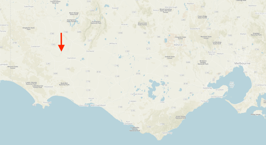
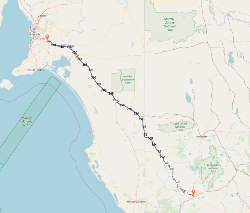
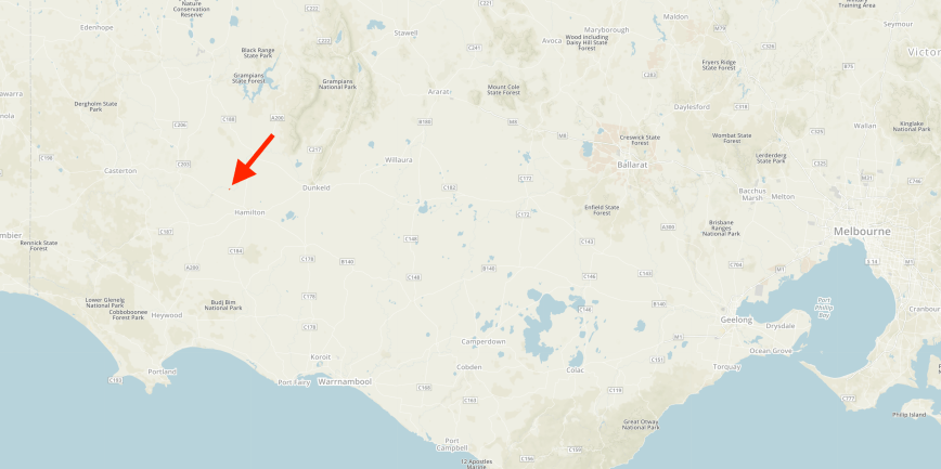
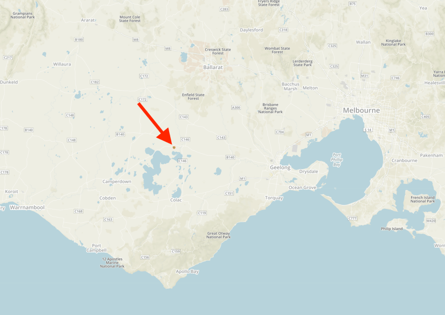
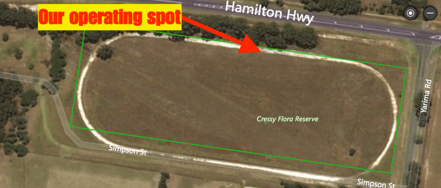
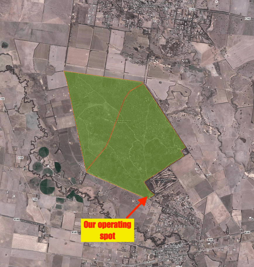
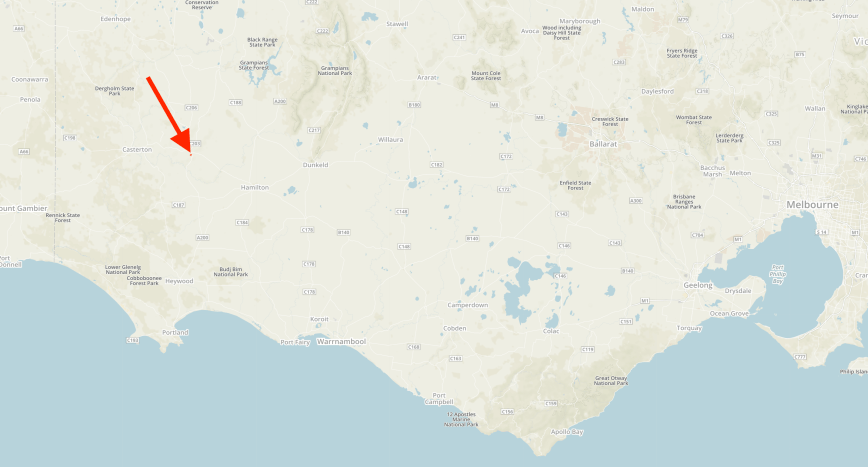
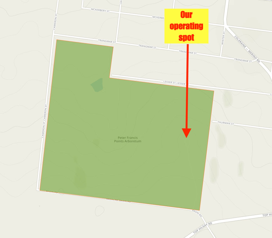
Our final activation for the trip was the Edenhope Flora Reserve VKFF-2311, located at Edenhope, about 384 km north west of Melbourne.

Screen Shot 2018-12-22 at 7.55.30 pm.png

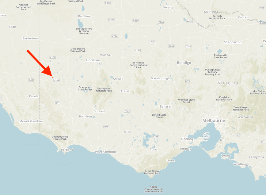
Above:- Map showing the location of the Edenhope Flora Reserve.  Map courtesy of Protected Planet.

The Edenhope Flora Reserve is about 111 acres.  Do not get this park confused with the adjacent Edenhope Natural Features Reserve.

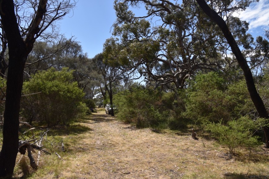
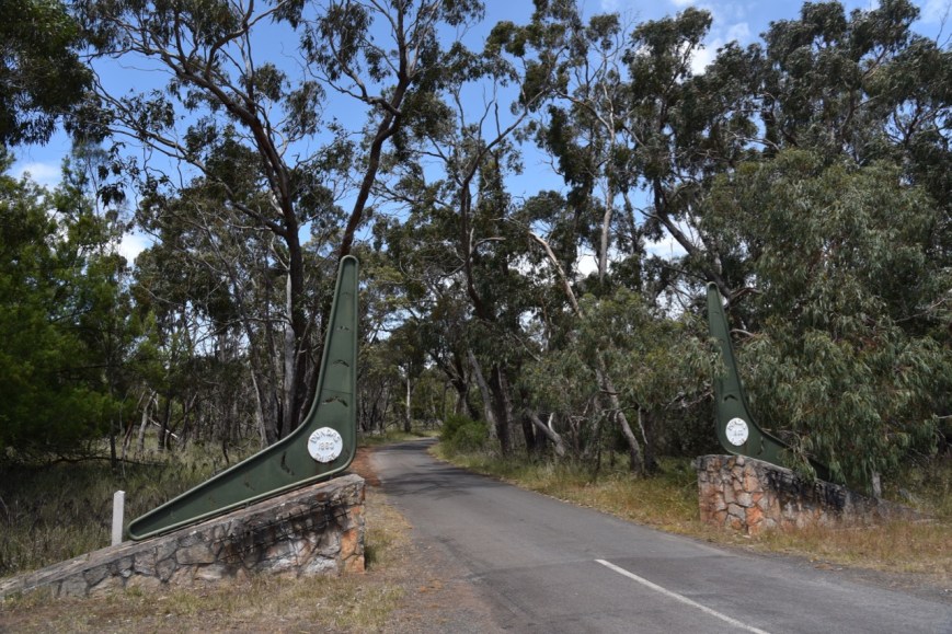
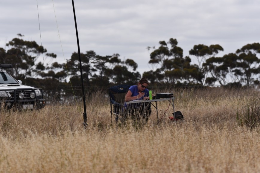
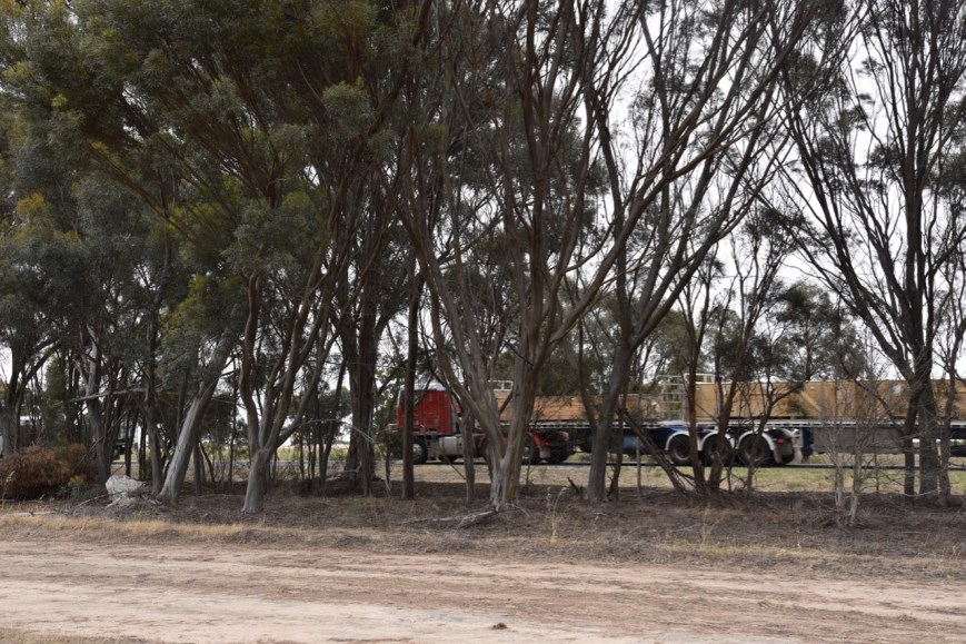
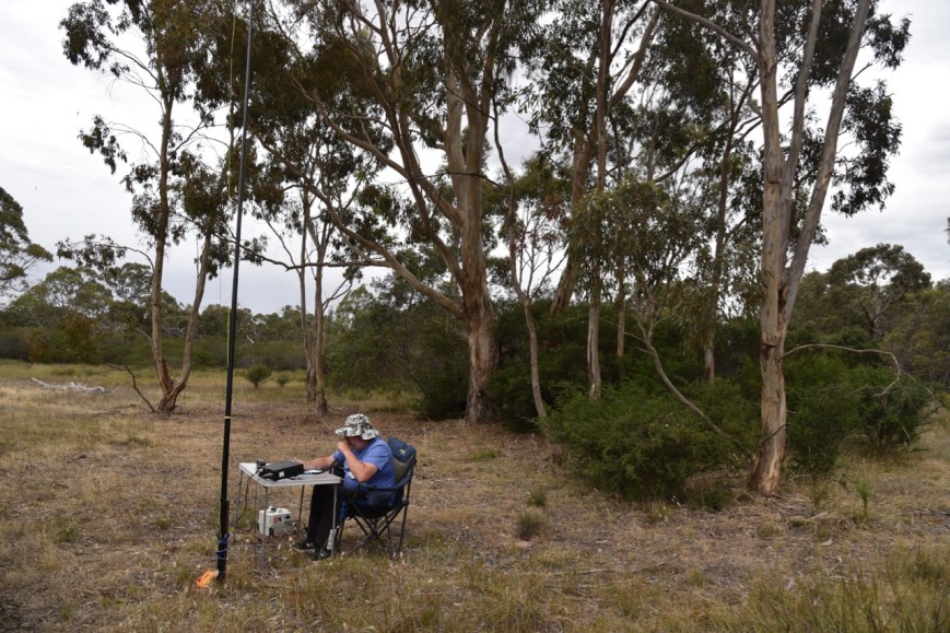
To get into the park we travelled along Charles Street and through a gate and then followed a sandy track with the golf course to our right.  The track was very sandy and I would not recommend it in a comventional vehicle, as it is highly likely you will get bogged.

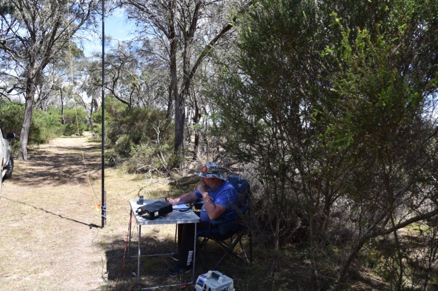
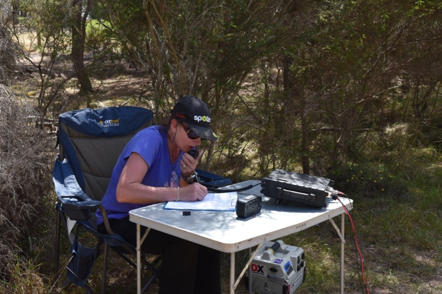
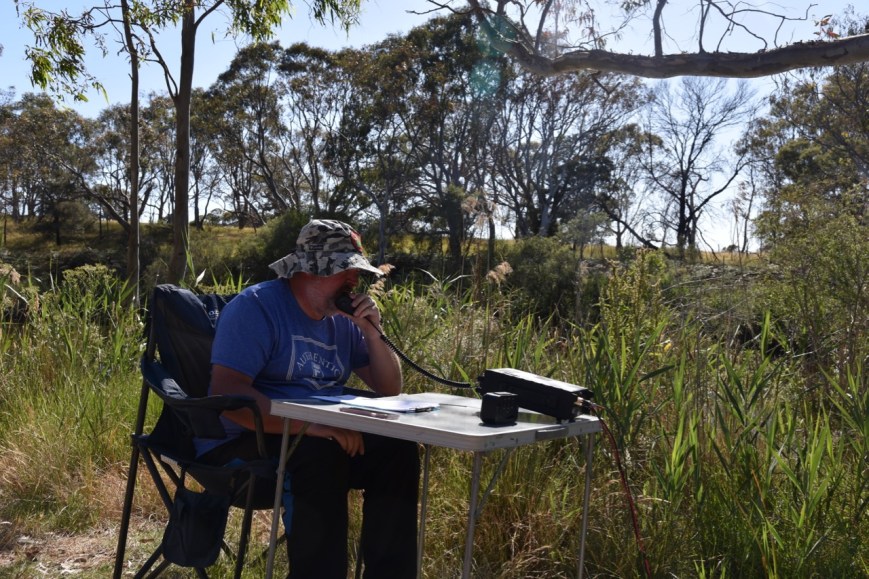
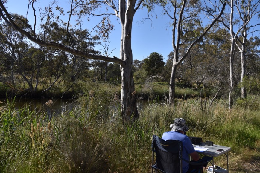
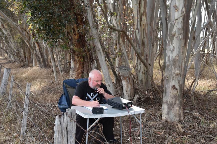
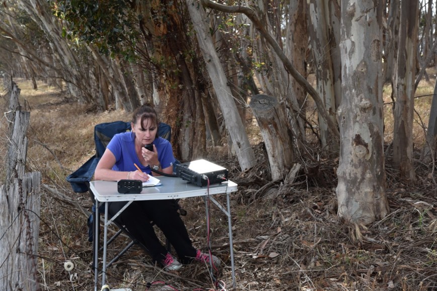
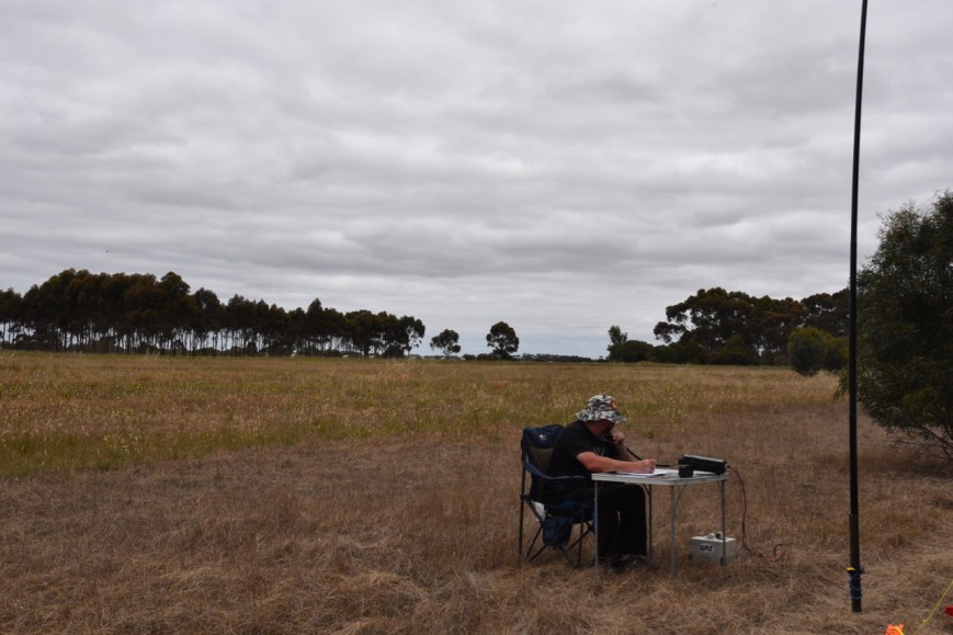
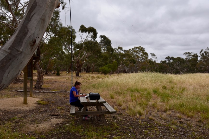
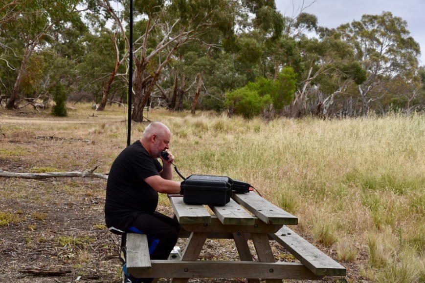
We set up in the northern section of the park on the side of a sandy track.  There was plenty of room here to string out the 20/40/80m linked dipole.

Screen Shot 2018-12-22 at 7.55.13 pm.png

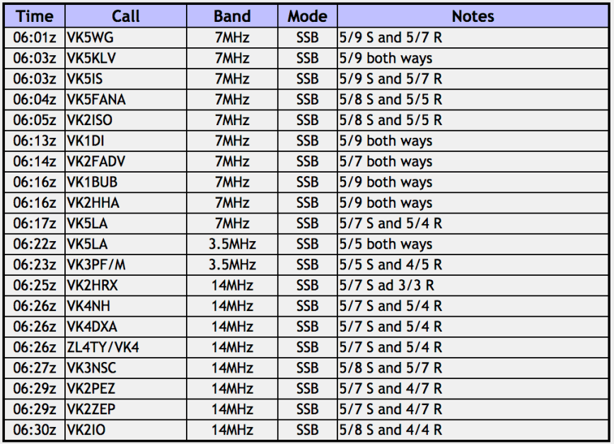
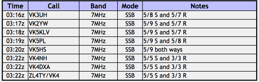
It was quite late in the afternoon, 4.30 p.m. local time, and we were aware that we still had quite a distance to get home.  Marija placed a spot up on parksnpeaks and I called CQ on 7.144.  This was answered by Ray VK4NH who used his other 2 calls, and then John VK4TJ who also used his other 2 calls.  So in the space of 2 minutes I had 6 contacts in the log.

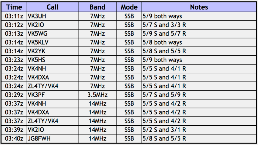
A few minutes later I had the park qualified for VKFF, with a contact with Scott VK7NWT.  I then logged Gerard Vk2IO mobile, before swapping the operators chair with Marija.

DSC_6337

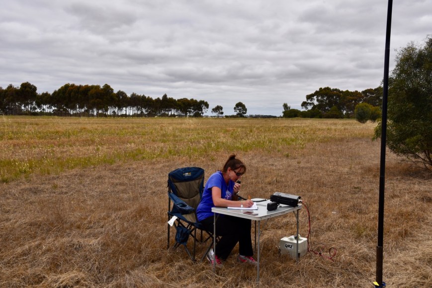
First in the log for Marija was Scott VK7NWT, followed by Ray VK4NH and then John VK4TJ.  Within 5 minutes Marija had qualified the park for VKFF with 10 contacts.  her tenth QSO being with Andrew VK2AR.

I then put out a few CQ calls on 3.610 on the 80m band and logged 4 stations there, David VK5PL, Adrian VK5FANA, Andy Vk5LA, and Kevin VK3VEK.  To complete the activation I logged 3 stations on 20m.

We then went QRT from the park.  Our apologies to those that may have needed this park, but we had a big drive ahead of us.  We will be back to get our 44 contacts from this park.

DSC_6342

Marija worked the following stations on 40m SSB:-

  1. VK7NWT
  2. VK4NH
  3. VK4DXA
  4. ZL4TY/VK4
  5. VK4TJ
  6. VK4/AC8WN
  7. VK4/VE6XT
  8. VK1DI
  9. VK7PSJ
  10. VK2AR
  11. VK2IO

I worked the following stations on 40m SSB:-

  1. VK4NH
  2. VK4DXA
  3. ZL4TY/VK4
  4. VK4TJ
  5. VK4/AC8WN
  6. VK4/VE6XT
  7. VK1DI
  8. VK2XXL
  9. VK7FTAS
  10. VK7NWT
  11. Vk2IO/m

I worked the following stations on 80m SSB:-

  1. VK5PL
  2. VK5FANA
  3. VK5LA
  4. VK3VEK

I worked the following stations on 20m SSB:-

  1. VK4TJ
  2. VK4/AC8WN
  3. VK4/VE6XT

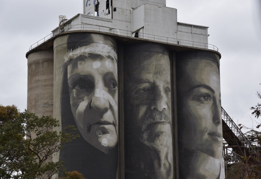
After packing up we had a look at the Aboriginal Cricket Team mural at the Edenhope College.  The aboriginal crickets practised where the college now stands before they toured England in 1868.  Local artists Win Forster and Ella McLaren are responsible for the artwork.

There is also a monument here commemorating the 1868 Aboriginal Cricket Team.

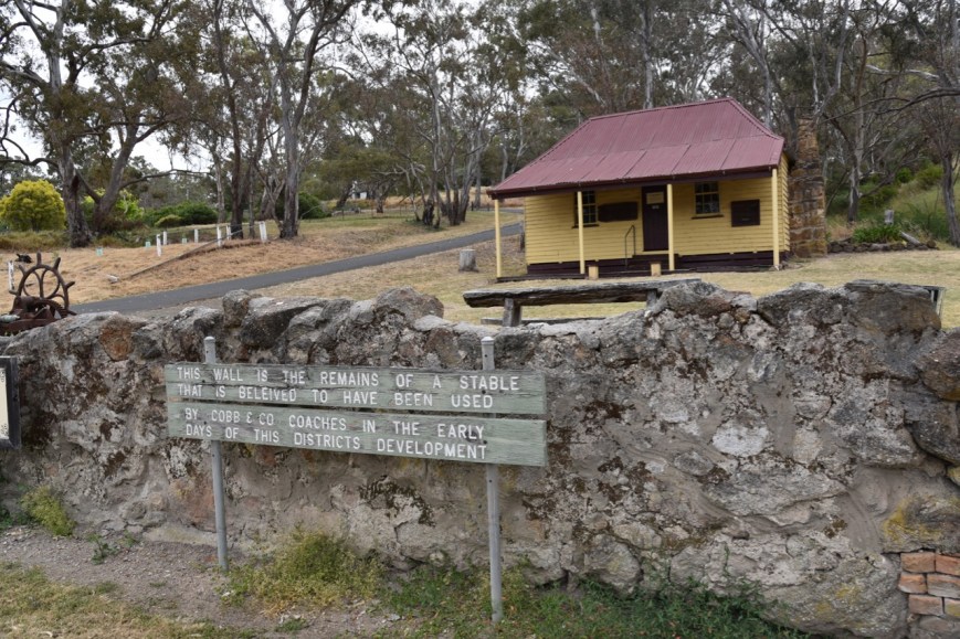
We also paid a quick visit to the Edenhope Visitor Info Centre which is houses in the former Edenhope Court House.  The old lockup building can also be found here.

Lake Wallace was our next stop.  It is located in Edenhope.  An annual fishing competition is held here.

We headed out of Edenhope along the Wimmera Highway and soon reached the little town of Apsley, named after Apsley House in London.  We visited the local cemetery where Murrumgunerrimin (Jimmy Tarpot) is buried.  He was one of the Aboriginal cricket team who toured England.  He is also the World Record holder, running backwards 100 yars in 14 seconds at the MCG on 28th December 1866.

Whilst in Apsley we also looked at the large Red-flowering Gum on Wallace Street which is listed on the National Trust of Australia’s Significant Tree Register for Victoria.  It is reputed to be the largest flowering gum in Australia.  There is also a c. 1870 wooden wagon.  It was used for hauling heavy loads around a farming property in the Kaniva district.

It was 6.00 p.m. local time and we decided to stop at the Border Inn Hotel at Apsley for a meal.  And I am very pleased we did.  I enjoyed some very nice crumbed lamb cutlets.

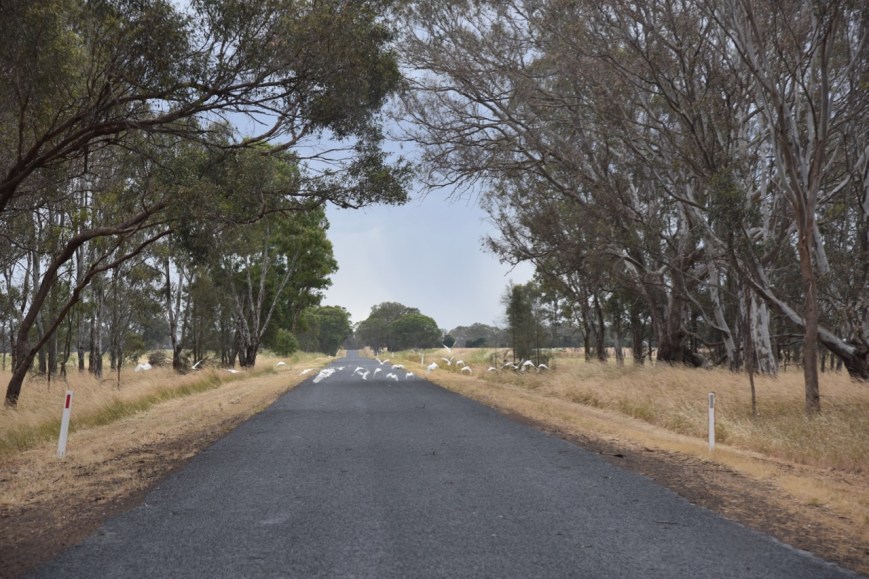
We then headed out of Apsley on the Benayeo Road and soon crossed the South Australia/Victoria State border.  The weather had now set in, with a big storm rolling in.  As a result, there were flocks of corellas, galahs and cockatoos on the road seeking out the pools of water for a drink.

DSC_6366

As we approached Bordertown, the heavens had really opened up.  But it soon cleared and we rewarded with a rainbow.

DSC_6369

Our final stop was Wiese’s Horse Dip.  It was built in 1931 by local landholders using timber from nearby bulloak trees.  Its main function was to control a parasitic itch in working Clydesdale horses.  This malady caused great discomfort to the Clydesdale’s manes and tails, so much so that they used to rub constantly against fences and so cause damage to many fence lines.  Horses were walked into the dip, and due to the horses size, the operators bucketed and sponged the solution over the horses to complete the task.

We continued along the Dukes Highway through the towns of Keith, Tintinara, Coonalpyn, Coomandook, and Tailem Bend.  And then onto the South eastern Freeway, passing Murray Bridge.  We arrived hom at about 9.45 p.m. local time, unpacked and went off to bed.  It was the conclusion of a very enjoyable trip.

THANKYOU to everyone who called us during our PARK and SOTA activations over the 2 week period.


References.

Wikipedia, 2018, <https://en.wikipedia.org/wiki/Apsley,_Victoria>, viewed 22nd December 2018

Peter Francis Points Flora Reserve VKFF-2421

Our next intended activation was the Peter Francis Points Flora Reserve VKFF-2421 which is located at Coleraine, about 329 km west of Melbourne.  This was to be the first time that the park had been activated for the World Wide Flora Fauna (WWFF) program.

Screen Shot 2018-12-22 at 7.00.01 pm.png

Above:- Map showing the location of he Peter Francis Points Flora Reserve at Coleraine.  Map courtesy of Protected Planet.

As we drove into Coleraine, we stopped briefly to have a look at the Adam Lindsay Gordon monument on the edge of town.  It commemorates the 19th century poet, who developed a reputation as a distinguished horse rider in the town’s Great Western Steeplechase.  Poems related to the race are “The Fields of Coleraine” and “Banker`s Dream”.

We then stopped for a drinks and toilet break at the Coleraine Visitor Info Centre which is et in the old Coleraine Railway Station.

We then headed to the Peter Francis Points Flora Reserve, also known as the Peter Francis Points Arboretum Nature Conservation Reserve.  We travelled south on the Coleraine-Merino Road and then turned right into Top Hilgay Road, and then Points Road and entered the park.

There were some very nice views of the town of Coleraine as we travelled along Top Hilgay Road.

The Peter Francis Points Arboretum is 37 hectares in size and is a collection of native Australian plants.  There are more than 10,000 recorded Australian native plants in the reserve, including several threatened species.  ‘The Points’ gets its name from two peaks of land on the site.

The Points Arboretum was started in 1966 by Mr. Joe Wright, Shire Engineer, Mrs. Mary Hope and Mr. Peter Francis.

We travelled to the lookout which overlooked the town of Coleraine.  As we were running a bit short of time, this was to be a very quick activation from the vehicle, using the Icom IC-7000 and the Codan 9350 self tuning antenna mounted on the rear of the Toyota Hi Lux.

Screen Shot 2018-12-22 at 7.00.35 pm.png

Above:- Map of the Peter Francis Points Flora Reserve, showing our operating spot.  Map courtesy of Protected Planet 

There were some nice views of Coleraine through the trees from the lookout.

First in the log for this activation was a Park to Park contact, with Gerard VK2IO/p who was activating the Rouse Hill Regional Park VKFF-2784.  Both Marija and I logged Gerard.  We then found Mark VK4SMA on 7.140, activating the Freshwater National Park VKFF-0187.

After both logging Mark I moved down to 7.135 and started calling CQ.  The IC-7000 was then just about rattled off the windscreen, as I was called Steve VK3NSC who lives at Coleraine.  I logged Steve and arranged to pop in to see him quickly following the activation.

I made my 10 contacts and then handed the mic to Marija.  We were keen to qualify the park for VKFF and then get down to say hi to Steve and then continue on our journey, as we still had a few things we wanted to see, and a long way before we got home.

DSC_6263

Marija worked the following stations on 40m SSB:-

  1. VK2IO/p (Rouse Hill Regional Park VKFF-2784)
  2. VK4SMA/p (Freshwater National Park VKFF-0187)
  3. VK3NSC
  4. VK4TJ
  5. VK4/Ac8WN
  6. VK4/VE6XT
  7. VK7QP
  8. VK2LX
  9. VK4KY/p
  10. VK7GN

I worked the following stations on 40m SSB:-

  1. VK2IO/p (Rouse Hill Regional Park VKFF-2784)
  2. VK4SMA/p (Freshwater National Park VKFF-0187)
  3. VK3NSC
  4. VK7QP
  5. VK7FJFD
  6. VK2LX
  7. VK3SQ
  8. VK4TJ
  9. VK4/AC8WN
  10. VK4/VE6XT

After Marija had qualified the park we headed down the road to Steve’s home, where he showed us his radio shack.  Unfortunately we were a bit pressed for time and after a 20 minute chat, we hit the road once again.  It was great to catch up with Steve, who I have spoken to a number of times on air, but had never met.

DSC_6275

Our next stop was Glenelg Fine Confectionary, a specialist chocolate shop in Coleraine.  We ended up walking out with a number of bags of chocolates.

DSC_6277

We then headed north out of Coleraine on the Coleraine-Edenhope Road, with out next intended stop being the town of Harrow.  We soon reached the outskirts of Harrow where there is a monument to commemorate the 1836 expedition of the explorer Major Thomas Mitchell.  We also stopped at the Glenelg River at Harrow where there is another monument recognising that Major Mitchell camped at the location on 31st July 1836.  This part of the Major Mitchell Trail, and there is an information board here with a number of interesting facts.

We then drove into Harrow, a little town which was originally known as Upper Glenelg.  The name of the town changed to Harrow in 1854.  There are claims that Harrow is the oldest inland town in Victoria.

DSC_6321

We stopped to have a look at the old log gaol, which was built in 1858 from locally sawn logs.  It was used by police up until 1869.

There is also a stone wall here which is the remains of a stable which is believed to have been used by Cobb & Co coaches in the early days of Harrow.

DSC_6281

Also nearby is Kalang Cottage, a settlers cottage built in 1876.  It was shifted into the town of Harrow and restored.  The cottage contains pit sawn boards and a single roof under the iron.

We then visited The Johnny Mullagh/Harrow Discovery Centre.  The museum features numerous exhibits relating to the Australian aboriginal cricket team which toured England in 1868.  I suspect not many Australians would know that this was the first Australian cricket team to tour England, and was comprised of aboriginals.  Johnny Mullagh was a member of that team, and is buried in Harrow.

The museum also features the largest Sir Donald Bradman collection in Australia.  If you are a cricket fan, you could spend hours here.  We highly recommend a visit here.

This slideshow requires JavaScript.

We also visited the Harrow Bone Yard which contains a number of funny headstones.

Harrow is a town which both Marija and I confirmed we want to revisit and spend some time in.  It is an incredibly historic town and the caravan park/camping area on the Glenelg River looked idealic.


References.

Monuments Australia, 2018, <http://monumentaustralia.org.au/themes/people/arts/display/30870-adam-lindsay-gordon->, viewed 22nd December 2018

Peter Francis Point Arboretum, 2018, <http://www.thepoints.org.au/>, viewed 22nd December 2018

Victorian Heritage Database Report, 2018, ‘Peter Francis Points Arboretum’

Wikipedia, 2018, <https://en.wikipedia.org/wiki/Harrow,_Victoria>, viewed 22nd December 2018

Wannon Flora Reserve VKFF-2476

After leaving Nigretta Falls we drove the short distance to the Wannon Flora Reserve VKFF-2476, which is about 316 km west of Melbourne.

Screen Shot 2018-12-22 at 5.25.14 pm.png

Above:- Map showing the location of the Wannon Flora Reserve.  Map courtesy of Protected Planet.

Again, this is another park which is subject to some possible confusion.  Do not get it confused with the Wannon Falls State Reserve, which at this time does not qualify for VKFF/WWFF.  The Wannon Flora Reserve is located on the north western corner of the Wannon-Nigretta Road and the Glenelg Highway.

Screen Shot 2018-12-22 at 5.25.01 pm.png

Above:- Map showing the location of the Wannon Flora Reserve (indicated by the arrow), and the nearby Wannon Falls Reserve (which is not VKFF).  Image courtesy of Protected Planet

The Wannon Flora Reserve is about 20 acres in size and takes its name from the Wannon River.  The The name ‘Wannon’ is believed to have been obtained by Major Mitchell from the local Jardwadjali people.  The park does not contain the falls.  They are located in the Wannon Falls Reserve, about 1 km to the south.

We found a narrow track off the Wannon-Nigretta Road, which followed the northern boundary of the park.  We pulled slightly off the track and set up our station.

DSC_6239

Once again I commenced the activation, calling CQ on 7.144.  Gerard VK2IO was first in the log, followed by Linda VK7QP, Adrian VK5FANA, and Dennis VK2HHA.  It took around 6 minutes for contact number 10.  That being a QSO with Ray VK4DXA.  I then logged Keith VK2PKT, and as I had qualified the park for VKFF, I got Marija into the operators chair.

DSC_6230

Marija’s first contact was with Ray VK4NH, then Greg VK2EXA, Adrian VK5FANA, and then Dennis VK2HHA.  It did not take Marija long to qualify the park for VKFF.  She had contact number 10 in the log after 9 minutes, a QSO with Peter VK2KNV mobile.  Marija logged a further 4 QSOs, and happy with having qualified the park for VKFF, handed me back the mic.

I called CQ again on 7.144 and logged a further 7 stations, before callers dried up.  I then moved to 3.610 on the 80m band where I logged Peter VK3PF mobile, Hans VK5YX, and then John VK5FBBJ.

It did not look as through I was going to get my 44 from this park, as despite it being the first time the park had been activated, hunter traffic was fairly slow.  I moved to the 20m band and called CQ on 14.310 where I logged 6 stations.  John VK4TJ had mentioned that the 10m band was open, so I put out a few calls on 28.490 from the vehicle to finish off the activation.  And as luck would have it I logged John, who was quite low down but very workable.

DSC_6236

Marija worked the following stations on 40m SSB:-

  1. VK4NH
  2. VK4DXA
  3. ZL4TY/VK4
  4. VK2EXA
  5. VK5FANA
  6. VK2HHA
  7. VK3JNL
  8. VK1DI
  9. VK2PKT
  10. VK2KNV/m
  11. VK4TJ
  12. VK4/AC8WN
  13. VK/VE6XT
  14. VK3SQ

I worked the following stations on 40m SSB:-

  1. VK2IO
  2. VK7QP
  3. VK5FANA
  4. VK2HHA
  5. VK2EXA
  6. VK3SQ
  7. VK5KLV
  8. VK5PL
  9. VK4NH
  10. VK4DXA
  11. ZL4TY/VK4
  12. VK2PKT
  13. VK3UH
  14. VK2VW
  15. VK2KNV/m
  16. VK4TJ
  17. VK4/AC8WN
  18. VK4/VE6XT
  19. VK2FADV

I worked the following stations on 80m SSB:-

  1. VK3PF/m
  2. VK5YX
  3. VK5FBBJ

I worked the following stations on 20m SSB:-

  1. VK4TJ
  2. VK4/AC8WN
  3. VK4/VE6XT
  4. VK4NH
  5. VK4DXA
  6. ZL4TY/VK4

I worked the following stations on 10m SSB:-

  1. VK4TJ
  2. VK4/AC8WN
  3. VK4/VE6XT

We packed up and headed off to the Wannon Falls which is located in the Wannon Falls State Reserve.

DSC_6245

The Wannon Falls are a punchbowl style waterfall, meaning that water descends in a constricted form and then spreads out in a wider pool.  The falls are fed by the Wannon River.  They plunge over a basalt lava cliff dropping into a large plunge pool 30 metres below.

There are a number of information boards here detailing both the aboriginal and European history of the area.

We then headed off towards Coleraine along the Glenelg Highway.


References.

Australian Electoral Commission, 2018, <https://www.aec.gov.au/profiles/vic/wannon.htm>, viewed 22nd December 2018

Wikipedia, 2018, <https://en.wikipedia.org/wiki/Wannon_Falls>, viewed 22nd December 2018

Day sixteen, Nigretta Falls Flora Reserve VKFF-2414

It was now our final day (Saturday 1st December 2018) of our 2 and a bit week trip away in Victoria.  Time to head home, with about 460km to get there.  We had a few parks planned and quite a bit of sightseeing, so it was going to be a long day.

Screen Shot 2018-12-22 at 4.41.19 pm.png

Above:- Map showing our route back home to the Adelaide Hills from Hamilton in Victoria.  Map courtesy of plotaroute

Our first intended activation for the day was the Nigretta Falls Flora Reserve VKFF-2414, which is located about 16 km north west of Hamilton, and about 311 km west of Melbourne.

Screen Shot 2018-12-22 at 4.30.02 pm.png

Above:- Map showing the location of the Nigretta Falls Flora Reserve.  Map courtesy of Protected Planet.

Don’t get this park confused with the Nigretta Falls Scenic Reserve.  They are two different parks.  The Nigretta Falls Flora Reserve does NOT include the picnic area as you enter the entrance.  The majority of the qualifing VKFF Flora Reserve is located on the northern side of the Wannon River.  Access there does not appear possible, except if you cross the Wannon River on a boat or access this area via private property.  There are however a few little sections along the river where you are within the park boundary.

DSC_6206

Above:- The entrance to Nigretta Falls.

The Nigretta Falls were previously known as the Upper Wannon Falls.  They are fed by the Wannon River, whose headwaters are located in the Grampian Mountains.  The Wannon River descends 214 metres over its 188 km course.  It is believed that the word Wannon was obtained by Major Mitchell from the local Jardwadjali aboriginal people.

The Nigretta Falls tumble over numerous rocky outcrops and then into a large pool at the base, before continuing downstream to the Wannon Falls about 10 km away.

The falls take their name from the Nigretta pastoral run of the 1800’s.  The Nigretta Falls and the nearby Wannon Falls have been the consistent subject of significant art including works by some of Australia’s most celebrated colonial artists, such as Nicholas Chevalier, Eugen von Guerard, Louis Buvelot, S. T. Gill and Thomas Clark.

After entering the park we drove down a very rough 4WD track until we reached the dog leg in the Wannon River.

DSC_6218

We set up alongside the river, and ran the Yaesu FT-897 and the 20/40/80m linked dipole.  It was quite a warm morning, and we kept an ever vigilant watch for snakes.

Screen Shot 2018-12-22 at 4.33.42 pm.png

Above:- Aerial view of the Nigretta Falls Flora Reserve.  Image courtesy of Protected Planet

Marija placed a post for me on parksnpeaks and I started calling CQ on 7.137 on 40m.  I couldn’t get on to 7.144 as there was a very strong station from the USA on 7.142.  It didn’t take long for my first caller, that being Rod VK7FRJG.  Contact number 10 was Geoff VK3SQ.  I then logged Les VK5KLV and Gerard VK2IO, before handing the microphone over to Marija.

DSC_6207

Marija’s first contact was with Geoff VK3SQ, followed by Hans VK5YX, Les VK5KLV, and then John VK4TJ.  Marija’s 10th contact was with Ian VK1DI.  Marija logged just 1 more contact, Kevin VK7KR, before handing me the mic.  I was very keen to try to get my 44 contacts to qualify the park for WWFF.

I logged a further 15 stations on 40m from VK1, VK2, VK3, VK4, and VK5, before callers stalled.  I now had 27 contacts in the log, and still a little way off the 44.  I then headed to 3.610 on the 80 m band and called CQ.  But sadly I logged just the 1 contact there, Nick VK3ANL.  This was a real shame, as Nick was nice and strong, and there was absolutely no noise on 80m.  It was dead quiet.

I then moved up to 14.310 on the 20m band where I logged 8 stations from VK2 and VK4.  I was now close, with 36 contacts in the log.  So I moved back to 40m and called CQ on 7.144 and logged a further 2 stations, leaving me just 7 contacts short.  But sadly, callers were few and far between, so I headed down to 7.115 and booked in to the Riverland Radio Group Net.  Ron VK5MRE, the Net Control came to my rescue, and put a call out for anybody on the net who was able to hear me.  I soon had contact number 44 in the log, Frank VK3VEF.

DSC_6211

It was time to pack up and head off to have a look at the falls themselves, and then off to the Wannon Falls.

Marija worked the following stations on 40m SSB:-

  1. VK3SQ
  2. VKVK5YX
  3. VK5KLV
  4. VK4TJ
  5. VK4/AC8WN
  6. VK4/VE6XT
  7. VK3ANL
  8. VK3TKK/m
  9. VK2YK
  10. VK1DI
  11. VK7KR

I worked the following stations on 40m SSB:-

  1. VK7FRJG
  2. VK4TJ
  3. VK4/AC8WN
  4. VK4/VE6XT
  5. VK2YK
  6. VK3YE/p
  7. VK5MJ
  8. VK5PL
  9. VK2HHA
  10. VK3SQ
  11. VK5KLV
  12. VK2IO
  13. VK4NH
  14. VK4DXA
  15. ZL4TY/VK4
  16. VK7KR
  17. VK1DI
  18. VK3FPREM
  19. VK3TKK/m
  20. Vk3MVP
  21. VK5FANA
  22. VK3TJK
  23. VK2EXA
  24. VK3MPT
  25. VK3MLU
  26. VK3ANL
  27. VK5LA
  28. VK2LEE
  29. VK2JDR
  30. VK5BRL
  31. VK5MRE
  32. VK7NWT
  33. VK5IS
  34. Vk2SLB
  35. VK3VEF

I worked the following station on 80m SSB:-

  1. VK3ANL

I worked the following stations on 20m SSB:-

  1. VK4NH
  2. VK4DXA
  3. ZL4TY/VK4
  4. VK2LEE
  5. VK4TJ
  6. VK4/AC8WN
  7. VK4/VE6XT
  8. VK2IO

Once we had packed up we drove the short distance to the Nigretta Falls.  There is a viewing platform here, along with a walk down to the falls, and an information board.


References.

Australian Electoral Commission, 2018, <https://www.aec.gov.au/profiles/vic/wannon.htm>, viewed 22nd December 2018

Victorian Heritage Database Report, 2018, ‘Nigretta Falls Reserve’

Wikipedia, 2018, <https://en.wikipedia.org/wiki/Nigretta_Falls>, viewed 22nd December 2018

Wikipedia, 2018, <https://en.wikipedia.org/wiki/Wannon_River>, viewed 22nd December 2018

Mount Dundas VK3/ VS-045

After leaving Penshurst we headed to Mount Dundas VK3/ VS-045.  The summit is located near the town of Cavendish, and is about 320 km west of the city of Melbourne.

Screen Shot 2018-12-22 at 3.40.31 pm.png

Above:- Map showing the location of Mount Dundas, VK3/ VS-045.  Map courtesy of google maps

We headed north along the Penshurst-Dunkeld Road and soon reached the little town of Dunkeld.  We stopped briefly to have a look at the information boards just outside of the town, and admire Mount Sturgeon and Mount Abrupt, both of which are SOTA summits.

We had a very quick look at the town of Dunkeld, and we both agreed that we would have to come back here for a better look around.  The area here is the traditional home of the Djab wurrung aboriginal people.  The first Europeans to settle here were pastoralists during the late 1830’s.  A small settlement developed and was known as Mount Sturgeon.  By 1854 the township was known as Dunkeld due to the majority of settlers being of Scottish origin.  It was named after a Scottish town which was the principal locality of the Caledonian picts in Roman times.

We then drove north west along the Dunkeld-Cavendish Road, admiring the Grampian Mountains which were to our north east.

We then reached the town of Cavendish, which was settled during the early 1950’s.  We stopped to have a look at the old Cavendish Gaol, built of bluestone, and erected in 1862, at the cost of 640 pounds (about $1,280.00).  The first inmate was housed on the 3rd day of October 1862, with PC Kennedy the first watch house keeper.

Inside the cell is a very interesting collection of photographs and police documents.

Nearby is an old settlers cottage, known as Smiths House.  It was built in Cavendish in the 1850’s and was last occupied by the Hadden family in the 1960’s.  It has been restored and furnished, and is an example of the original two room cottage of its time.

DSC_6079

I had the Bunyip Hotel written down on my list of things to visit whilst in Cavendish, but we were running short of time, and didn’t get the opportunity of paying the pub a visit.  There is also a Settlers Walk in Cavendish which follows the banks of the Wannon River.  Marija and I both agreed that we would need to come back to Cavendish.

We headed out of Cavendish on the Natimuk-Hamilton Road and soon reached Dundas Gap Road where we turned left.  A few km up the road we reached Mount Dundas Road and the start of the Mount Dundas Scenic Reserve, which does not yet qualify for the WWFF/VKFF program.

Mount Dundas is 459 metres above sea level and is worth just 1 point in the Summits on the Air (SOTA) program.  Prior to our visit, the summit had been activated a total of 4 times.  I had previously activated the summit back in November 2014.  In fact this was the first time the summit had been activated.

Screen Shot 2018-12-22 at 3.39.31 pm.png

Above:- An aerial view of Mount Dundas.  Image courtesy of google maps

The road to the top is dirt, but it is in good condition and easily passable in a conventional vehicle.  On top of the summit you will find a large array of communications towers and equipment, and a trig point.

And there are some very nice views of the surrounding countryside.

This slideshow requires JavaScript.

We set up just down from the communications equipment.  There was just enough room to string out the 20/40/80m linked dipole.  My first contact was with SOTA regular Nev VK5WG,  followed by Les VK5KLV, Ian VK5IS, and then Adrian VK5FANA.  I had my 4 contacts and had qualified the summit.  I logged just the 1 further station, Sven VK2ISO, before handing the microphone over to Marija.

DSC_6080

Marija’s first contact was with Les VK5KLV, followed by Dennis VK2HHA, Adrian VK5FANA, and then Compton VK2HRX.  Marija had qualified the summit.  Marija logged a further 2 stations, Jim Vk2FADV and then Ian VK1DI.

I then called CQ for a few more minutes on 40m, logging 5 stations from VK1, VK2 and VK5, before heading to 3.610 on the 80m band.  I there logged 2 stations, Andy VK5LA and Peter VK3PF mobile.  Unlike 40m, there was an strength 5 noise here on 80m.  Undoubtedly from the communications equipment on the summit.

To conclude the activation I called CQ on 14.310 on the 20m band where I logged a total of 8 stations from VK2, VK3, and VK4.

DSC_6084

Marija worked the following stations:-

Screen Shot 2018-12-22 at 2.33.12 pm.png

I worked the following stations:-

Screen Shot 2018-12-22 at 2.32.59 pm.png

We packed up and headed off to Tarrington.  That evening was a special festival occurring in the town, known as Laternenfest, or Festival of the Lanterns.  It is the celebration of the life of a man who helped the poor.  German communities celebrated Laternenfest in honour of St Martin who was known for his generosity of spirit.  He brought light into poor people’s lives, and this is symbolised by the lights of the lantern parades.

The Laternenfest featured the lantern parade, a stein holding challenge, traditional German dancing and culture, and plenty of traditional German food and beer.

This slideshow requires JavaScript.

For tea we had German sausages in bread with sauerkraut, and some home made German cakes.  And to wash it down, some nice cold beer.

As part of the festival, the St Michaels Church at Tarrington was opened up for tours.  The foundation stone for the church was laid in July 1926.  This is the fourth church in Tarrington, with the first being built in 1854 by Lutherans who had emigrated from the Kingdom of Prussia.  We even got to ring the church bells.  St Michael’s bells were the largest in the southern hemisphere when the church was built.

This slideshow requires JavaScript.

The stein holding competition was particularly interesting.  The juniors started off and it was quite funny seeing the expression on the faces of some of the children.

It was then time for the adults.  The winner held the stein out in front of him for around 8 minutes, no easy feat.

It was starting to get dark, and the sun shining off the Tarrington church was quite impressive.

It was then time for the carrying of the lanterns, with the procession led by two drummers.  They did one lap of the church and the local oval and then returned to the main area.

It was the end of a really enjoyable evening.  I have researched my family history, and this had a special place considering my mum’s Prussian background.  She would have certainly enjoyed this evening.


References.

Australia’s Christian Heritage, 2018, <https://www.churchesaustralia.org/list-of-churches/denominations/lutheran/directory/814-st-michaeland%2339%3Bs-lutheran-church>, viewed 22nd December 2018

Wikipedia, 2018, <https://en.wikipedia.org/wiki/Dunkeld,_Victoria>, viewed 22nd December 2018

Wikipedia, 2018, <https://en.wikipedia.org/wiki/Cavendish,_Victoria>, viewed 22nd December 2018

Mount Rouse VK3/ VS-048

We now only had 2 days left of the holiday.  It was now day 15, Friday 30th November 2018.  We had 2 planned activations for the day, both SOTA summits, and also a lot of sightseeing.

Our first stop for the day were the Big Woolbales in Hamilton.  They were originally built in 1989 for the disabilty group Yooralla, but were sold to private buyers.  They were part of a cafe, museum and souvenir shop, but that appears to have closed down.

DSC_5910

We then visited the Hamilton Bandicoot Enclosure and Parklands, which is part of the Hamilton Institute of Rural Learning.  This is a 100 hectare woodland which was established to protected the elusive and critically endandgered bandicoot.

Unfortunately we did not spot a bandicoot, but this was a terrific bird watching location.  Some of the birds we spotted feature below in some photographs taken in the reserve.

We also spotted a number of wallabies.

It was then off to the Sir Reginald Ansett Transport Museum in Hamilton.  Don’t be turned off by the outside of this museum.  At first glance it does not look like much, just a simple tin shed.  In fact it is based on the Ansett company’s first aircraft hangar.

DSC_6017

But inside there is a sensational collection of memorabillia associated with the former iconic Australian company Ansett, formed by Sir Reginald Ansett.  The centrepiece of the museum is a Fokker universal aircraft, similar to the one used on the first Ansett flight n 1936.  And a 1928 Studebaker, which was where Sir Reginald commenced his operations, driving passengers from Hamilton to Ballarat.  We highly recommend a visit here.

This slideshow requires JavaScript.

And a bonus to the visit, was finding a photograph of my Papa (my Dad’s father) who worked for Ansett Roadways, driving Clipper buses.

Below is what a Clipper bus looks like.

We then left Hamilton and drove out to the town of Penshurst, which is located at the foot of an extinct volcano, Mount Rouse.  The town was settled in the 1850’s.

We visited the Volcanoes Discovery Centre which is located in the old Shire of Mount Rouse offices.  It contains an audio visual display of volcanoes.   There is plenty of information on how volcanoes are formed, their geology, and their history in western Victoria.  I had driven passed the museum a number of times previously, but had never popped in to pay a visit, until now.

We then headed to SOTA summit, Mount Rouse VK3/ VS-048, which is located just above the town of Penshurst.

Screen Shot 2018-12-22 at 2.21.55 pm.png

Above:- Map showing the location of Mount Rouse near Penshurst in south western Victoria.  Map courtesy of google maps.

Mount Rouse is an extinct volcano which is about 369 metres above sea level.  The summit had been activated a total of 8 times before our visit.  I last activated Mount Rouse in November 2014.  It is worth just the solitary 1 SOTA point.

Screen Shot 2018-12-22 at 2.19.25 pm.png

Above:- An aerial view of Mount Rouse showing its close proximity to the town of Penshurst.  Image courtesy of google maps

The summit was named in 1836 by the New South Wales Surveyor General Thomas Mitchell during the Australia Felix expedition.  The aboriginal name for the mountain is Collorrer.

Screen Shot 2018-12-22 at 2.20.02 pm.png

Above:- An aerial view of Mount Rouse with the town of Penshurst visible, along with the Grampian Mountains.  Image courtesy of google maps

There is a short climb up a flight of stairs to get to the actual summit.

DSC_6047

At the base of the stairs there is a monument for Napier Waller (1893-1972), a mural, water colour and sketch artist, who was born and raised near Mount Rouse.

DSC_6048

On the top of the summit, you will find a fire spotting tower, an array of communications equipment, and a trig point.

And you will be rewarded with some terrific views of Penshurst and the surrounding countryside.

This slideshow requires JavaScript.

I kicked off the activation, calling CQ on 7.144.  Ken VK3UH was first in the log, followed by Gerard VK2IO, Nev VK5WG, and then Les VK5KLV.  I had qualified the summit.  Just the 4 contacts are required for SOTA.  I logged 1 further station, Adam VK2YK, before handing over the mic to Marija.

Marija’s first contact was with Ken VK3UH, followed by John VK2YW, Les VK5KLV, and then David VK5PL.  Marija had now also qualified the summit.  Marija logged a further 4 stations from VK4 and VK5, before handing the microphone back to me.

I then logged another 4 stations on 40m, before heading off to 3.610 on the 80m band.  Surprisingly I made just one contact on 80m, that being with Peter VK3PF.  Geoff VK3SQ called me, and although I could hear Geoff well, sadly he could not hear me, and we were unable to successfully exchange signal reports.

To complete the activation I called CQ on 14.310 on the 20m band and logged 5 stations, including JG8FWH in Japan.

Marija worked the following stations:-

Screen Shot 2018-12-22 at 2.28.29 pm.png

I worked the following stations:-

Screen Shot 2018-12-22 at 2.28.14 pm.png

We then headed down off the summit, stopping briefly to have a look at Crater Lake.

We then drove back into Penshurst to have a look at some of the many historic buildings which are located in the town.

It was then off to Mount Dundas, our second SOTA activation for the day.


References.

Grampians Point, 2018, <https://www.grampianspoint.com.au/attractions/big-woolbales/>, viewed 22nd December 2018

Sir Reginald Ansett Transport Museum, 2018, <https://ansettmuseum.com.au/what-you-see/>, viewed 22nd December 2018

Darlington Common Flora Reserve VKFF-2303

Our next activation for Thursday 29th November 2018 was the Darlington Common Flora Reserve VKFF-2303, which is located about 198 km west of the city of Melbourne.

Screen Shot 2018-12-22 at 1.38.45 pm.png

Above:- Map showing the location of the Darlington Common Flora Reserve.  Map courtesy of Protected Planet.

The Darlington Common Flora Reserve is about 130 acres in size and is located on the northern side of the Western Highway.  The park consists of a stand of gum trees and grassland.

The park takes its name after the town of Darlington which was an early place of European settlement, being situated on a track which forded the Mount Emu Creek, which was also known as Taylor’s Creek, after Frederick Taylor who settled in the area in 1839.

A bridge was built in 1849 across the creek, which resulted in the area being known as Elephant Bridge.  This was due to the fact that the track passed in close proximity to Mount Elephant.  In 1852 the township of Darlington was gazetted, and named after Darlington in Durham, England.

We parked the vehicle on a dirt track which runs parallel to the Hamilton Highway and climbed the wire fence so that we were inside the park boundary.

Screen Shot 2018-12-22 at 1.18.55 pm.png

Above:- Aerial shot of the Darlington Common Flora Reserve, showing our operating spot.  Image courtesy of Protected Planet.

It was quite noisy during our activation as we were very close to the busy Hamilton Highway.

DSC_5885

Marija placed a spot for me on parksnpeaks, and I started calling CQ on 7.144 on the 40m band.  Ken VK3UH was the first to call in, followed by Dennis VK2HHA, then Murray VK1UU and Ray VK4NH.  Within 6 minutes I had contact number 10 in the log, a QSO with Gerard VK2IO.

I logged a total of 15 stations on 40m from VK1, VK2, VK3, VK4 and VK5 before swapping the mic with Marija.  The local time was 5.00 p.m. local time and it was a great time of the day to be on 40m, which was in very good condition.

DSC_5893

Marija then started calling CQ, with Peter VK3PF being first in the log, followed by Adrian VK5FANA, Ron VK3AHR and Dennis VK2HHA.  It didn’t take Marija long to qualify the park for VKFF, with contact number ten being Ken VK3UH.

DSC_5892

We were a little pushed for time, but I was keen to hopefully get my 44 contacts to qualify the park for the global WWFF program.  Marija phoned the motel at Hamilton to confirm check in time,  while I called CQ on 40m.  I logged a further 17 stations on 40m from VK1, VK2, VK3, VK4, VK5, and VK7.

I now had 32 contacts in the log, and needed just 12 more to qualify the park.  But callers had dried up on 40m, so I lowered the squid pole and inserted the 80m links, and started calling CQ on 3.610 on the 80m band.  Peter VK3PF was first to call in on that band, followed by some more of the park regulars, Geoff VK3SQ and Dennis VK2HHA.  I logged 9 contacts on 80m and I was now just 3 contacts short of the 44.

I then moved to 14.310 on the 20m band and was called by Ray VK4NH.  Ray regularly uses his two other callsigns, so I knew I was now over the line.  A total of 7 stations made it into my log on 20m.

It was now nearly 7.00 p.m. local time and it was time that we hit the road and headed off to Hamilton.

Marija worked the following stations on 40m SSB:-

  1. VK3PF
  2. VK5FANA
  3. VK3AHR
  4. VK2HHA
  5. VK4NH
  6. VK4DXA
  7. ZL4TY/VK4
  8. VK4FARR
  9. VK5HS
  10. VK3UH
  11. VK2UH

I worked the following stations on 40m SSB:-

  1. VK3UH
  2. VK2HHA
  3. Vk1UU
  4. VK4NH
  5. VK4DXA
  6. ZL4TY/VK4
  7. VK3PF
  8. VK5KBJ/p
  9. VK2BHO
  10. VK2IO
  11. VK7DW
  12. VK5FANA
  13. VK4TJ
  14. VK4/AC8WN
  15. VK4/VE6XT
  16. VK2UH
  17. VK2NP/3
  18. VK5KLV
  19. VK5LA
  20. VK4FARR
  21. VK7ZGK
  22. VK3SQ
  23. VK1DI
  24. VK5KSW
  25. VK2PKT
  26. VK2PEZ
  27. VK2ZEP
  28. VK2UXO
  29. VK2NZ
  30. VK2FADV
  31. VK5NPP
  32. VK7VZ/2

I worked the following stations on 80m SSB:-

  1. VK3PF
  2. VK3KAI
  3. VK3GV
  4. VK3SQ
  5. VK2HHA
  6. VK3MKE
  7. VK2UH
  8. Vk3HMV
  9. VK1DA/2

I worked the following stations on 20m SSB:-

  1. VK4NH
  2. VK4DXA
  3. ZL4TY/VK4
  4. VK6ADF
  5. VK4TJ
  6. VK4/AC8WN
  7. VK4/VE6XT

As we drove along the Hamilton  Highway, there were some nice views of the nearby Grampian Mountains, and also Mount Rouse as we drove into Penshurst.

We then stopped briefly to have a look at the site of the old Crosskeys Hotel near Tarrington, which was formerly known as Hochkirch.  Ferdinand Zerbst established this hotel in 1867, which operated until 1885.  Following its closure, the building became a private residence, until 1953, when sadly it was dismantled.

We then entered Tarrington and stopped to have a look at the many entrants in the annual Hay Bale Art competition.  Tarrington was formerly known as Hochkirch, meaning ‘church on a hill’.  The town was settled in 1853 by Lutheran emigrants from the Kingdom of Prussia.  The name of the town was changed from Hochkirch to Tarrington in 1918 due to anti German sentiment.

Whilst in Tarrington we saw that on the following night there was going to be a festival in the town.  I have researched my family history and my mum’s side of the family came from the Kingdom of Prussia.  So with that in mind, Marija and I decided that we would attend the festival tomorrow night.

We finally reached our accomodation at Hamilton, the Hamilton Town House Motel.  After checking in we headed out for some Chinese takeway.

DSC_5909


References.

Victorian Places, 2018, <https://www.victorianplaces.com.au/darlington>, viewed 22nd December 2018

Lake Rosine Wildlife Reserve VKFF-2362

We left Cressy and drove a very short distance to our next activation for Thursday 29th November 2018, the Lake Rosine Wildlife Reserve VKFF-2362.  The park is located just 6 km west of Cressy.

Screen Shot 2018-12-22 at 12.23.51 pm.png

Above:- Map showing the location of the Lake Rosine Wildlife Reserve.  Map courtesy of Protected Planet.

Lake Rosine is located in the Lakes and Craters region of the Victorian Volcanic Plains of south western Victoria.  It is also in the Western District Lakes area, which was recognised on 15th December 1982 as wetlands of international importance by listing under the Ramsar Convention.  The Ramsar Convention on Wetlands of International Importance especially as Waterfowl Habitat is an international treaty for the conservation and sustainable use of wetlands.  Lake Rosine is one of nine lakes ith a combined area of 329 square km.

Lake Rosine and the surrounding lakes provide refuge for tens of thousands of waterbirds.  Lake Rosine and the surrounding lakes support over 1% of the world populations of Australian shelducks, chestnut teals and banded stilts and irregularly support over 1% of the world populations of freckled ducks, musk ducks, blue-billed ducks, black swans, Australasian shovellers, pink-eared ducks, hoary-headed grebes, straw-necked ibises, sharp-tailed sandpipers and white-headed stilts.

The park was absolutely covered with ducks, swans, and other waterbirds during our visit.

We accessed the park via a track which ran off the Foxhow Road.  We jumped over a barbed wire fence and set up.

I started off the activation by calling CQ on 7.144, with first in the log being Geoff Vk3SQ, followed by a Park to park contact with David Vk5DG/p who was activating the Beachport Conservation Park VKFF-0791.  I logged a further 16 stations on 40m from VK2, VK3, VK4, VK5 and VK7.

Marija then commenced her quest to qualify the park for VKFF.  First in the log was Ivan VK5HS, followed by Dennis VK2HHA, and then Tony VK1VIC.  Contact number 10 came 6 minutes into Marija being on air, a contact with John VK4TJ.

After Marija had qualified the park I got back onto the mic and put out a few CQ calls on the 80m band.  I logged Ivan VK5HS, Geoff VK3SQ, and then Peter VK3PF.  I completed the activation by calling CQ on 14.310 on the 20m band where I logged John VK4TJ, before the Over the Horizon Radar appeared, virtually wiping out the band.

DSC_5841

Marija worked the following stations on 40m SSB:-

  1. VK5HS
  2. VK2HHA
  3. VK1VIC
  4. VK2VIC
  5. VK2GIB
  6. VK4NH
  7. VK4DXA
  8. ZL4TY/VK4
  9. VK2FADV
  10. VK4TJ
  11. VK4/AC8WN
  12. VK4/VE6XT
  13. VK3SQ

I worked the following stations on 40m SSB:-

  1. VK3SQ
  2. VK5DG/p (Beachport Conservation Park VKFF-0791)
  3. VK2IO
  4. VK2HHA
  5. VK3PF
  6. VK5FANA
  7. VK2UXO
  8. VK3UH
  9. VK3AHR
  10. VK4NH
  11. VK4DXA
  12. ZL4TY/VK4
  13. VK2FADV
  14. VK7FJFD
  15. VK4TJ
  16. VK4/AC8WN
  17. VK4/VE6XT
  18. VK5HS

I worked the following stations on 80m SSB:-

  1. VK5HS
  2. VK3SQ
  3. VK3PF

I worked the following stations on 20m SSB:-

  1. VK4TJ
  2. VK4/AC8WN
  3. VK4/VE6XT

We then returned back to the Hamilton Highway and drove in to the town of Lismore and out to the Gnarpurt Homestead and woolshed.  The extact date of the construction of the bluestone homestead is not known, but the adjacent woolshed and shearers quarters were constructed in 1880 by Alexander Hamilton.   Sadly the homestead is in a total state of disrepair.  We didn’t walk out to the shearing shed as we were not sure if it was private property.

We then drove into the town of Derrinallum, which lies at the foot of Mount Elephant, an extinct volcano, which qualifies for the Summits on the Air (SOTA) prorgram.  Marija and I have activated the summit previously, and it requires a vigorous uphill climb for a single 1 SOTA point.  We did not have time to activate the summit on this occasion as we still had a way to run before reaching Hamilton.

Another interesting point here at Derrinallum is the Hamilton Highway wall, one of many of the dry stone walls through the region built in the 1800’s.

DSC_5877

We continued along the Hamilton Highway, and soon reached the little town of Darlington.  We stopped briefly to have a look at the old Elephant Bridge Hotel which was built in 1842.

DSC_5879

We then headed to our next activation, the Darlington Common Flora Reserve.


References.

Heritage Council of Victoria, 2018, <https://vhd.heritagecouncil.vic.gov.au/places/67831>, viewed 22nd December 2018

Wikipedia, 2018, <https://en.wikipedia.org/wiki/Western_District_Lakes>, viewed 22nd December 2018

Wikipedia, 2018, <https://en.wikipedia.org/wiki/Ramsar_Convention>, viewed 22nd December 2018

Cressy Flora Reserve VKFF-2301

Our next intended activation was the Cressy Flora Reserve VKFF-2301, which is located about 138 km west of Melbourne.  This would be another unique park for Marija and I as activators in the World Wide Flora Fauna (WWFF) program.

Screen Shot 2018-12-22 at 11.29.50 am.png

Above:- Map showing the location of the Cressy Flora Reserve.  Map courtesy of Protected Planet.

But prior to getting to the park, we stopped off to have a look at the historic Barunah Plains Homestead which is located on the Hamilton Highway at Hesse. The sign on the highway indicated it was private property, and we could not find any detailed information on the internet about access.  So we decided to try our hand, and drove down the driveway.  We spoke with the groundsman who kindly allowed us to have a look around the property.

The Barunah Plains Homestead is a heritage listed homestead which dates from 1866.  Additions and alterations were made in the late 19th century, and again between 1900-1910.  The property also includes formal gardens, a bakehouse and laundry, stables, coach house, implement shed, a woolshed, two bluestone cottages and a ram shed.

This slideshow requires JavaScript.

The Cressy Flora Reserve supports remnant native grassland, and you could easily mistake the park for just a simple paddock on the edge of the Hamilton Highway.  Vast native grasslands and grassy woodlands once covered the volcanic plains surrounding Cressy.  Unfortunately very few of these remain today.

Screen Shot 2018-12-22 at 11.34.08 am.png

Above:- An aerial shot show the Cressy Flora Reserve.  Image courtesy of google maps

The loss of these grasslands has occurred since European settlement, as a result of cropping and grazing.  This dramatic loss of graslands now means that this is one of the most threatened ecosystems in Australia.

The native grasslands are home to a wide variety of flora and fauna, including the Striped Legless Lizard which is a nationally threatened species.

During our visit there were a number of wildflowers in bloom in amongst the dried grassland.

We drove along a dirt track, which ran parallel with the Hamilton Highway, and set up.  We ran the Yaesu FT-897 and the 20/40/80m linked dipole for this activation.

Screen Shot 2018-12-22 at 11.49.55 am.png

This was a busy spot, with lots of traffic travelling by on the Hamilton Highway.

DSC_5833

I called CQ on 7.144 on the 40m band, and first in the log was Peter VK3PF, followed by Gerard VK2IO, Geoff VK3SQ, and then Dennis VK2HHA.  Peter kindly placed up a spot for us on parksnpeaks.  I logged a total of 13 stations on 40m from VK2, VK3, VK4 and VK5, before getting Marija into the activators chair.

DSC_5822

Marija’s first contact was James VK2HFC, followed by Ivan VK5HS, Adrian VK5FANA, and then Ron VK3AHR.  Marija had soon qualified the park for VKFF, with her 10th contact being Ray VK4NH.

I then returned to the mic and called CQ on 7.144 where I logged a further 6 stations, before heading to 3.610 on the 80m band.  I logged Dennis VK2HHA, Ken VK3UH, Peter VK3PF, and then Ken VK2KYO.  Despite band conditions being quite good, they were my only callers on 80m.

To complete the activation I headed to the 20m band where I logged 4 stations from VK2 and VK4.

DSC_5825

Marija worked the following stations on 40m SSB:-

  1. VK2HFC
  2. VK5HS
  3. VK5FANA
  4. VK3AHR
  5. VK7FRJG
  6. VK3ARH
  7. VK7PSJ
  8. VK3SQ
  9. VK2KYO
  10. VK4NH
  11. VK4DXA
  12. ZL4TY/VK4
  13. VK3PF

I worked the following stations on 40m SSB:-

  1. VK3PF
  2. VK2IO
  3. VK3SQ
  4. VK2HHA
  5. VK3AHR
  6. VK5KBJ/p
  7. VK4NH
  8. VK4DXA
  9. ZL4TY/VK4
  10. VK3ARH
  11. VK5KLV
  12. VK5HS
  13. VK2HFC
  14. VK5FANA
  15. VK3AXF
  16. VK4TJ
  17. VK4/AC8WN
  18. VK4/VE6XY
  19. VK3UH

I worked the following stations on 80m SSB:-

  1. VK2HHA
  2. VK3UH
  3. VK3PF
  4. VK2KYO

I worked the following stations on 20m SSB:-

  1. VK4TJ
  2. VK4/AC8WN
  3. VK4/VE6XT
  4. VK2IO

We then headed in to the town of Cressy for a quick look.  The area of Cressy was first discovered in about 1836 when George Russell reported that there was some fine inland country of treeless windswept plains with a few lakes.  In 1841 a Frenchman, Jean Duverney, was issued a licence to establish the Frenchmans Inn on the Cressy site, named after his home town in Crecy, France.  Between 1939 and 1946, the Royal Australian Air Force operated a combat training aerodrome at Cressy.

DSC_5835


References.

Wikipedia, 2018, <https://en.wikipedia.org/wiki/Barunah_Plains_Homestead>, viewed 22nd December 2018

Day fourteen, Inverleigh Nature Conservation Reserve VKFF-2336

It was day fourteen (Thursday 29th November 2018) and time for us to leave Geelong and head to Hamilton in western Victoria.  This involved a drive of about 234 km, with a number of intended park activations along the way.

Screen Shot 2018-12-22 at 10.28.22 am.png

Above:- Map showing the route between Geelong and Hamilton.  Map courtesy of google maps.

After leaving the motel we headed to ‘GMHBA’ Stadium, otherwise known as Kardinia Park, which is the home to the AFL footy club Geelong.  I have been to the Melbourne Cricket Ground (MCG) and the Docklands Stadium, but I had never seen Kardinia Park, except on television.

We then stopped off to have a look at St Mary of the Angels Parish Church in Geelong.  In 1846 the foundations for a stone church were laid on the present site of the cathedral.  In 1854 the foundation stone of the current church was laid and in 1872 St Mary of the Angels was officially opened by Bishop Goold.

The church has the tallest bluestone spire in Australia at 150 feet and it has the 4th tallest no cathedral spire in Australia.  It is the tallest building in Geelong.

We then headed down to the Corio Bay foreshore at Geelong, where there was some sort of car rally taking place.  We stopped off at one of the cafes for a cooked breakfast.

We then headed out of Geelong on the Western Highway.  Our next intended stop was to be the Inverleigh Nature Conservation Reserve VKFF-2336, which is about 30 km west of Geelong.

Screen Shot 2018-12-21 at 9.36.18 pm.png

Above:- Map showing the location of the Inverleigh Nature Conservation Reserve.  Map courtesy of Protected Planet

On the way out of Geelong we stopped to have a look at the silo art on the former Geelong Cement Works site.  The artwork on the silos is the work of a street artist known as Rone, who has worked in London, New York and Berlin.  The three images are those of Corrina Eccles, a descendent of the queen of the Wadawurrung and traditional owner, Cor Horsten, who has had a 35-year career at the Geelong Cement Works, and Kelly Cartwright, a dual Paralympic gold medal-winner.

Sadly, we could not find a viewing spot close to the silos.  They appeared to be fenced off.  The track leading towards the silos was littered with rubbish and used syringes/needles, so we viewed the silos at a distance.

DSC_5778.jpg

We drove in to the town of Inverleigh and then along Common Road, passing the local golf club.  We then took Links Track and drove into the park.

The Inverleigh Nature Conservation Reserve is about 1,050 hectares in size and contains remnant grassy woodland.  The reserve is surrounded by farmland and provides a living example of the landscape that existed in the dry southern inland areas prior to European settlement.

The park contains 507 species of native flora and fauna, representing 37% of all species recorded in the Victorian Volcanic Plains Bioregion.  During spring the park is alive with wildflowers and nearly 50 species of native orchids.

Native animals that call the park home include the Eastern Grey Kangaroo, Black Wallaby, Koala and Echidna.  More than 130 species of birds can be found in the park including the Eastern Rosella, White-browned Woodswallow, Diamond Firetail, Wedge-tailed Eagle and Australian Owlet-nightjar.

We had the park all to ourselves, and there was plenty of room here to string out the 20/40/80m linked dipole.  We set up right alongside of the information board on Links Track.

Screen Shot 2018-12-21 at 9.36.03 pm.png

Above:- An aerial shot of the Inverleigh Nature Conservation Reserve, showing our operating spot

Prior to calling CQ I booked in quickly to a net on 7.095 and worked the net control Ron VK3AHR.  I then moved up to 7.144 and started calling CQ.  Rod VK7FRJG came back to my call, followed by Ivan VK5HS, Peter VK3TKK mobile, and then Hans VK5YX.  The 40m band appeared to be in good shape, with most signals being very strong.  I logged a total of 15 stations on 40m from VK2, VK3, VK4, and VK5.

Marija then took charge of the microphone and started calling CQ.  First in the log for Marija was Geoff VK3SQ, followed by Nev VK5WG, Dennis VK2HHA and Peter VK3PF.  It took Marija just 8 minutes to qualify the park for VKFF.  Marija’s 10th contact was with Ken VK2KYO.

DSC_5784

I was keen to try to get my 44 QSOs and qualify the park for the global WWFF program, so once Marija had qualifed the park for VKFF, I jumped back onto the mic and called CQ on 3.610 on the 80m band.  Geoff VK3SQ was first in the log.  Ivan VK5HS then gave me a call, but despite being able to hear Ivan well, he was struggling with me, and we were unable to successfully exchange signal reports, so it was a negative contact.  I then logged Peter VK3PF and Dennis VK2HHA.

With 18 contacts in the log, it was time to try 20m.  I called CQ on 14.310 and logged John VK4TJ, along with his USA and Canadian calls.  I then moved back to 40m where I logged a total of 10 further stations from VK2, VK3, VK4, and VK5.  But the callers soon dried up, so we packed up.

DSC_5782

Marija worked the following stations on 40m SSB:-

  1. VK3SQ
  2. VK5WG
  3. VK2HHA
  4. VK3PF
  5. VK5HS
  6. VK5YX
  7. VK4TJ
  8. VK4/AC8WN
  9. VK4/VE6XT
  10. VK2KYO

I worked the following stations on 40m SSB:-

  1. VK3AHR
  2. VK7FRJG
  3. VK5HS
  4. VK3TKK/m
  5. VK5YX
  6. VK5MJ
  7. VK3SQ
  8. VK3UH
  9. VK2HHA
  10. VK2IO
  11. VK5WG
  12. VK4NH
  13. VK4DXA
  14. ZL4TY/VK4
  15. VK3PF
  16. VK5FANA
  17. VK3SQ
  18. VK4TJ
  19. VK4/AC8WN
  20. VK4/VE6XT
  21. VK3UH
  22. VK2BL
  23. VK2VIC
  24. VK1VIC/2
  25. VK5KLV

I worked the following stations on 80m SSB:-

  1. VK3SQ
  2. VK3PF
  3. VK2HHA

I worked the following stations on 20m SSB:-

  1. VK4TJ
  2. VK4/AC8WN
  3. VK4/VE6XT

We drove in to the town of Inverleigh for some morning tea.  We also had a look at the historic Inverleigh Hotel, a magnificent bluestone building which was built in 1856.

We also had a look at Lawsons Tree.  William Lawson, who is credited with the beginning of the township of Inverleigh which was originally called Lawsons.  He set up home under what is now known as Lawsons Tree.  By 1842 he had opened the Horeshoe Inn, just across the track and opposite the site of the present day hotel.

DSC_5793


References.

St Marys Catholic Parish Geelong, 2018, <http://www.stmarysgeelong.com.au/history.html>, viewed 22nd December 2018

Wikipedia, 2018, <https://en.wikipedia.org/wiki/St_Mary_of_the_Angels_Basilica,_Geelong>, viewed 22nd December 2018