
Day thirteen (Wednesday 28th November 2018) was upon us. We only had one planned park activation for the day, with quite a bit of sightseeing around Geelong in today’s schedule. Our intended park was the Brisbane Ranges National Park VKFF-0055, which was to be a new park for both Marija and I in both the WWFF and the KRMNPA programs.
Prior to activating the park, Marija and I planned on visiting the historic town of Steiglitz. We headed north west out of Geelong on the Steiglitz Road. Our first stop of the day was the Bunjil Lookout at Maude. The lookout was opened on the 27th February 2015, with a traditional smoking ceremony. The design of the lookout takes its inspiration from the aboriginal indigeneous story of the Great Creator Ancestor Spirit, Bunjil, the Wedge-Tailed Eagle, who was the creator of the Kulin land and its people. The lookout, which represents a wedge tailed eagle in flight, overlooks the Moorabool River valley.


We continued on for a few more kms and soon reached Steiglitz which is located along the banks of the Sutherlands Creek. It was so named after the Von Stieglitz family who were early pioneers in the district during the 1830’s. No, that isn’t a typo with the spelling of Von Stieglitz and town as Steiglitz. For some reason this is the way the town name is spelt. Stieglitz in German translates to Goldfinch.
Gold was discovered in the area during the 1850’s. By May 1856, about 750 ounces of gold per week, increasing to 900 ounces per week by July. This resulted in the population of Steiglitz increasing to over 1,000. At its peak, Steiglitz had over 6 hotels, a doctor, a bank, a butcher, a cobbler, blacksmiths, a race club, a tennis club and numerous other services.
By the 1860’s gold was in decline in the area. It was reported though that the quality of the gold from Steiglitz was superior to that of Ballarat. Right up until 1941 gold was mined in the area, until the closure of the mines and operations.
Nowadays, there are only about 10 residents in Steiglitz, but there are a number of historic buildings to be viewed. It is a very interesting place to visit.
We then headed to the Brisbane Ranges National Park, which are located about 82 km east of the city of Melbourne.
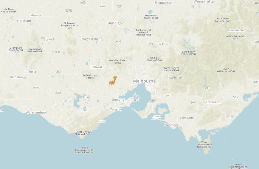
Above:- Map showing the location of the Brisbane Ranges National Park. Map courtesy of Protected Planet.
The park is 7,718-hectare (19,070-acre) in size and was established on the 15th day of August 1973. The key feature of the park is the Brisbane Ranges, a series of low hills forming an undulating plateau. Almost one sixth of Victoria’s plant species have been recorded within the park. Twenty six of those are listed as rare, threatened or significant in Victoria.


In 1918 the Field Naturalists Club of Victoria proposed the reserve of the Brisbane Ranges as a National Park, but nothing eventuated. In 1956, Cr. H.A. Boardman of the Barwon Regional Commission embarked on a campaign for a national park. It was strongly supported by the Victorian National Parks Association and the Country Women’s Association, along with a number of prominent persons including Professor John Turner of the University of Melbourne, and J.H. Willis of the National Herbarium.
Three years later in 1959, the Geelong Water and Sewerage Trust offered large areas of its reserves as a national park, with the area covered including parts of the present park. One year later in 1960 the National Parks Authority entered into discussions with the Forests Commission of Victoria, who were prepared to cut about 1,100 acres of State Forest along Anakie Gorge Road. The Lands Department at the same time offered an area of about 273 acres.
In September 1963 the National Parks Authority discussed the proposal to create the Brisbane Ranges National Park, with a recommendation made to the Minister for State Development in early 1964. Despite ministerial endorsement in 1964, it would take another nine years before the park was proclaimed in 1973. Over the years, additional areas of land have been added to the park.
The park was alive with birdlife during our visit. Below are some of the photographs I took whilst in the Brisbane Ranges.


We decided upon the Anakie Gorge Picnic Area. The name is believed to be derived from ‘Anakie Youang’, an expression in one of the local Australian Aboriginal languages, meaning ‘little hill’ or ‘twin hills’.
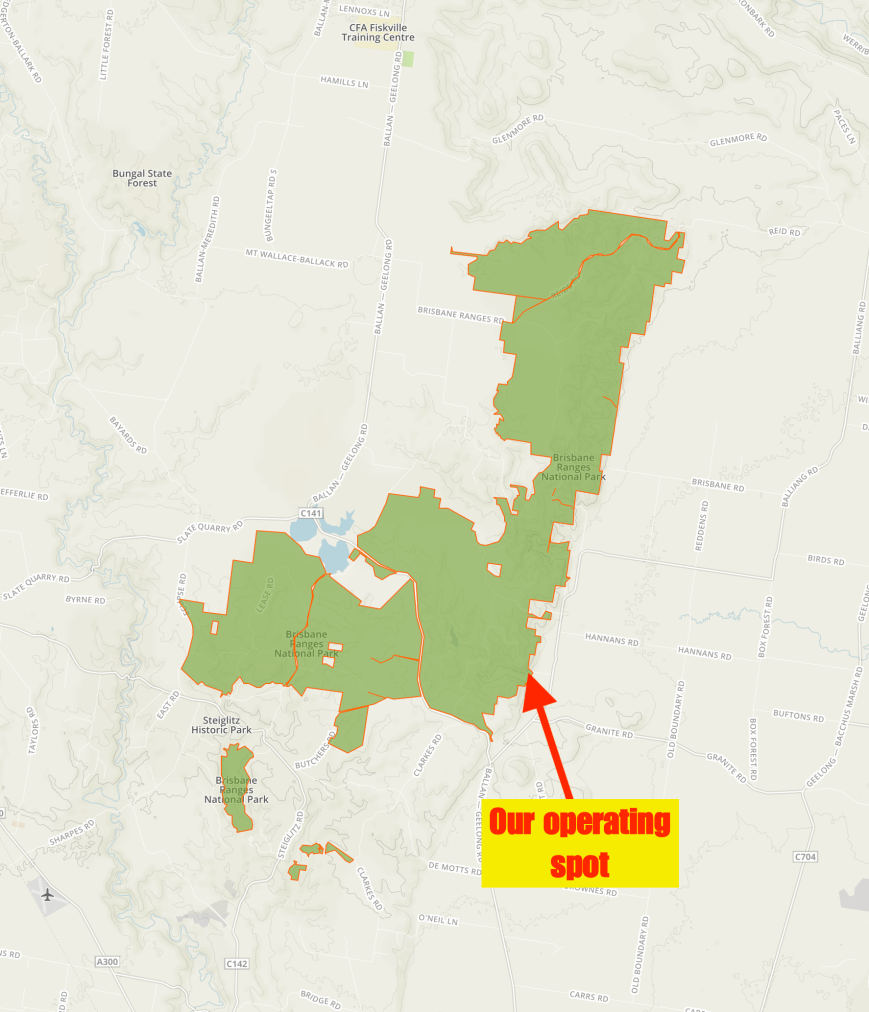
Above:- Map of the Brisbane Ranges National Park, showing our operating spot. Map courtesy of Protected Planet.
This was to be one of the most difficult activations undertaken by Marija and I. Nothing to do with access to the park, but rather, poor band conditions and a real struggle to get the 10 required contacts to qualify the park for VKFF. It was DIFFICULT!
I called CQ on 7.144 for around 5 minutes, competing with the very loud static crashes. Nev VK5WG was first in the log, followed by Peter VK3TKK mobile, and then Ivan VK5HS. But that was it. Callers completely dried up.
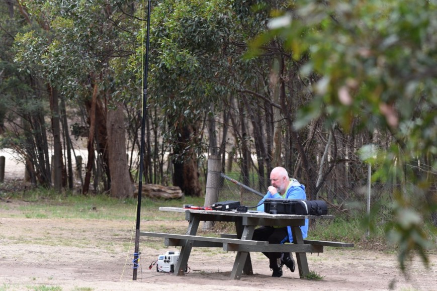
So it was time for Marija to call CQ, and hopefully her more pleasing voice might attract some callers. First in the log for Marija was Ivan VK5HS, followed by Ian VK5HS, and then John VK4TJ. Marija was doing a little better than me, and ended up logging a total of 10 stations on 40m, qualifying the park for VKFF.
I called CQ again on 7.144 and logged Keith VK2PKT and Ian VK5CZ. But that was it. I had hit a brick wall again, with just 5 contacts in the log. I moved down the band to the 10am Smoko Net where I logged Scott VK7NWT and Ron VK5MRE.
With just 7 contacts in the log, I headed down to 3.610 on the 80m band, hoping to get a few of the Victorian park die hards in the log. But I was to be disappointed, with just 3 contacts there. Thanks to Peter VK3PF, using his second call of VK3KAI, to get me to 10 contacts.
To conclude the activation I called CQ on 14.310 on the 20m band, and logged just the one contact there, Gerard VK2IO mobile.


So, feeling rather frustrated Marija and I packed up. We had fallen way short of the 44 QSOs required to qualify the park for the global WWFF program, but we had both qualified the park for VKFF and the KRMNPA.
Marija worked the following stations on 40m SSB:-
- VK5HS
- VK5IS
- VK4TJ
- VK4/AC8WN
- VK4/VE6XT
- VK7FJFD
- VK2HPN
- VK7FRJG
- VK2PKT
- VK2QA
I worked the following stations on 40m SSB:-
- VK5WG
- VK3TKK/m
- VK5HS
- VK2PKT
- VK5CZ
- VK7NWT
- VK5MRE
I worked the following stations on 80m SSB:-
- VK3PF
- VK2KYO
- VK3KAI
I worked the following station on 20m SSB:-
- VK2IO/m
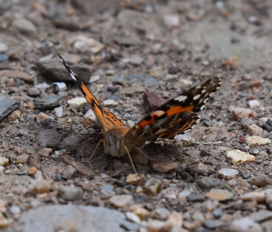
After packing up Marija and I took about a 20 minute walk along the Anakie Gorge walking track, which follows. The walk is 3 km (1 way). We were a bit pressed for time, and would like to come back here to do the full walk. It is quite spectacular in the gorge.
The gorge was absolutely alive with butterflies.
We then headed back towards Geelong, but on the way we stopped off at the Anakie General Store for lunch. I enjoyed a magnificent steak sandwich. The staff here were very friendly.
We then visited the National Wool Museum in Geelong. It is set in an 1872 bluestone woolstore and tells the Australian story of wool. Sheep farming commenced in Geelong in 1835 and the first of many woollen mills in Geelong opened in 1868. The museum was opened in 1988 and there are three floors to explore.
We then talk a walk along the waterfront, having a look at the Jan Lennard bollard sculptures which were commissioned by the City of Geelong in 1995.
")


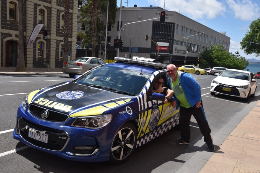
I then said g’day to some of my Victorian colleagues.
We then visited the old Geelong Gaol. Unfortunately it was not open, but we did get to walk around the outside of the gaol to view the historic buildings. The first prisoners were admitted here in 1853, with the prison closing in 1991.
Our next stop was the Little Creatures Brewery in Geelong. The brewery is located in the Old Mill complex.


Prior to going to Little Creatures, we popped in to the White Rabbit brewery which originally commenced its life in Healesville. One of the features of the brewery are the many barrels with are filled with aging ales. We had some tasting samples and walked away with a few ales.


We then went next door to the Little Creatures brewery where we sat down to enjoy a few cleansing ales.


We had planned to go out for tea that night with Rod VK3OB, and we still had a little bit of time on our hands, so we headed out to the Geelong Botanical Gardens and enjoyed some nice views of the city of Geelong.


We then drove out to Bannockburn and enjoyed a sensational night with Rod VK3OB and his wife Noeline, and Dallas VK3DJ.


We even checked in briefly to the 71130 DX Net to say hi to some of the regulars.


Below is our dessert. Calories were not a concern!
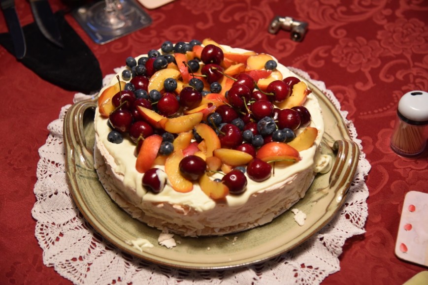
This was a most enjoyable night and we were really pleased to meet Rod, Noeline and Dallas.
References.
City of Greater Geelong, 2018, <https://www.geelongaustralia.com.au/nwm/default.aspx>, viewed 21st December 2018
The Old Geelong Gaol, 2018, <http://www.geelonggaol.org.au/>, viewed 21st December 2018
Maud/She Oaks/Steiglitz Communities, 2018, <https://www.maudedistrict.com/bunjils-lookout—maude.html>, viewed 21st December 2018
Maud/She Oaks/Steiglitz Communities, 2018, <https://www.maudedistrict.com/steiglitz.html>, viewed 21st December 2018
Parks Victoria, ‘Victoria’s Heritage, Brisbane Ranges National Park’
Parks Victoria, 1997, ‘Brisbane Ranges National Park Management Plan’.
White Rabbit Beer, 2018, <https://whiterabbitbeer.com.au/>, viewed 21st December 2018
Wikipedia, 2018, <https://en.wikipedia.org/wiki/Brisbane_Ranges_National_Park>, viewed 21st December 2018
Wikipedia, 2018, <https://en.wikipedia.org/wiki/Anakie,_Victoria>, viewed 21st December 2018
